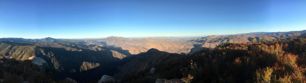
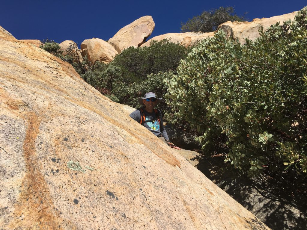
The second peak, Ant Benchmark, was just a short drive north from the Three Sisters trailhead. I pulled into the turnout just before the boundary of the Inaja Indian Reservation. I grabbed my gear and headed back down Boulder Creek Road.
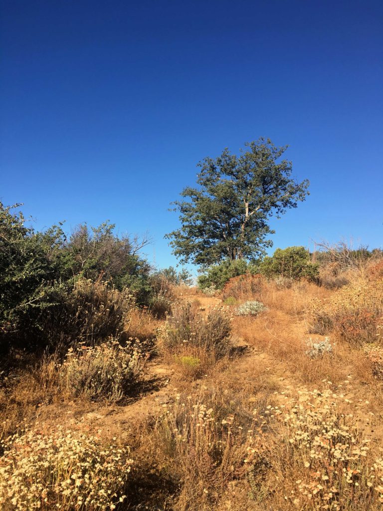
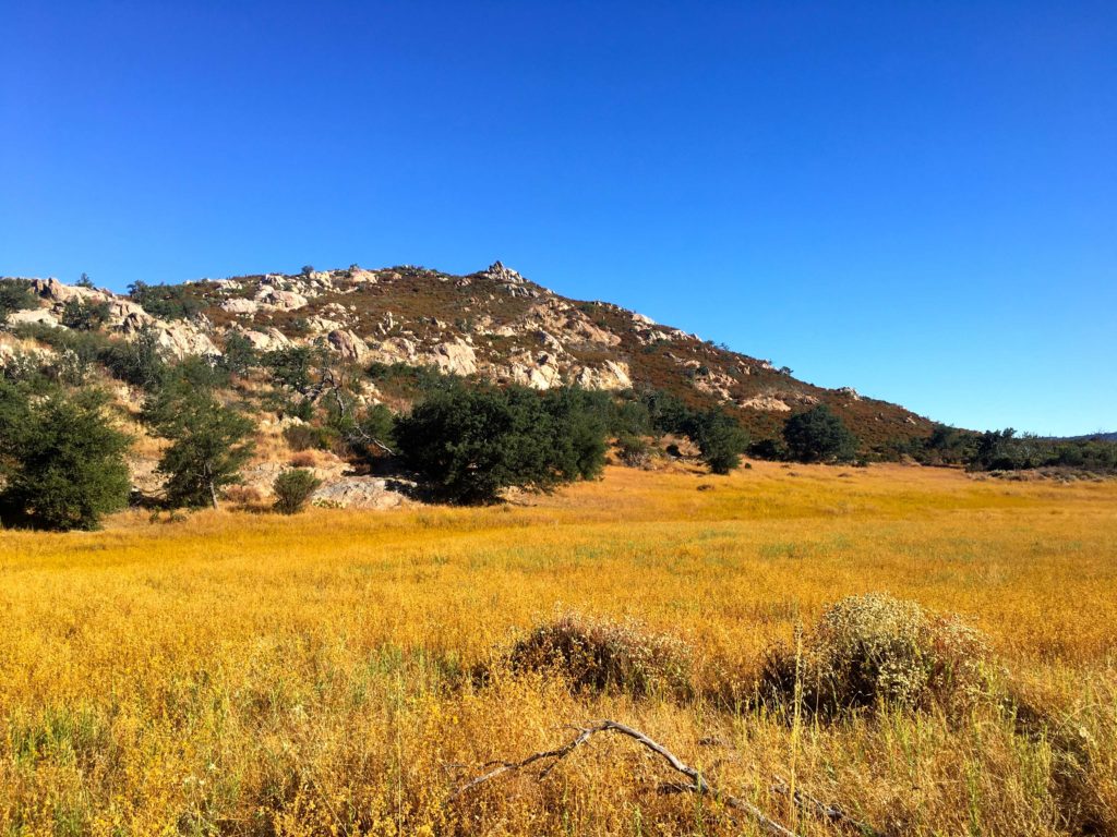
The trail was in the same shape as Sunshine Mountain, passable but with a lot of growth. After about .5 miles, the descent ends, and I head out across the golden meadow.
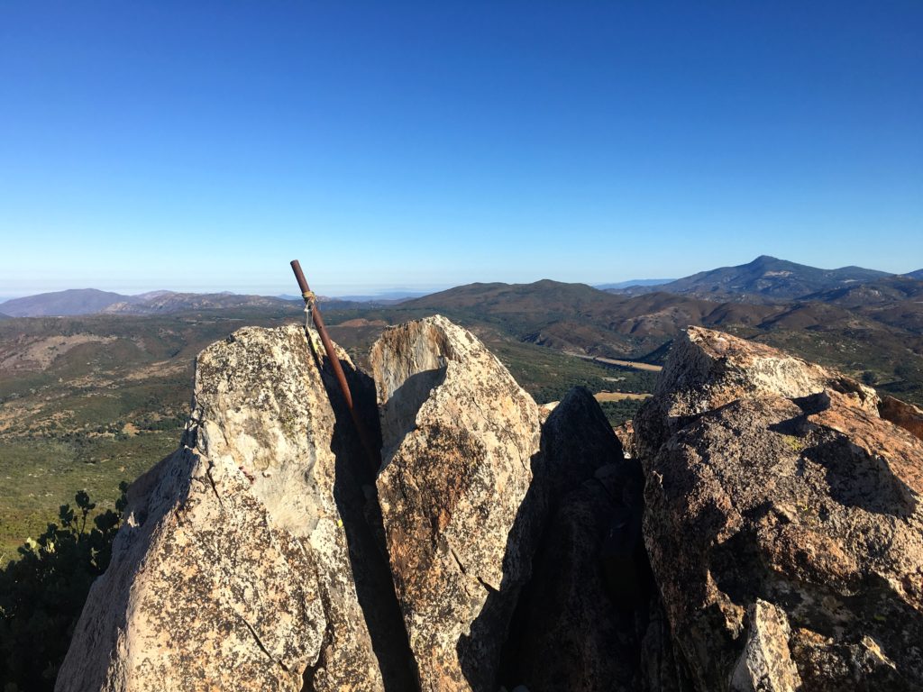
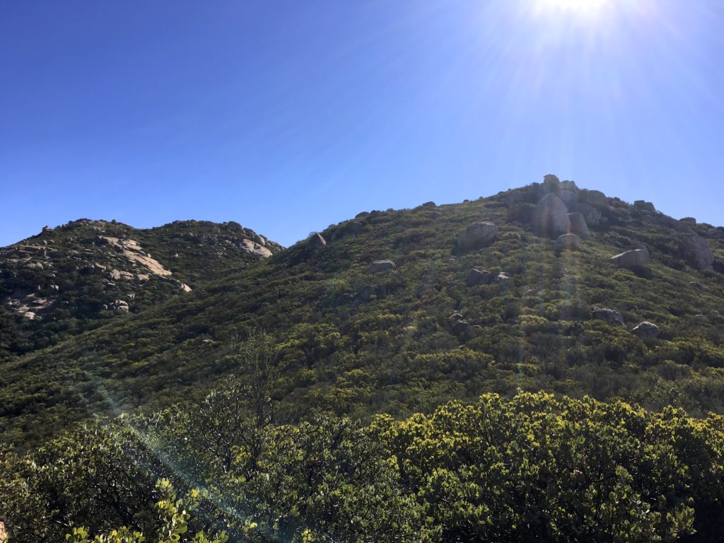
From there I began working my way up the summit. I remembered the actual summit was set back, so I knew I had more climbing than what I initially saw.
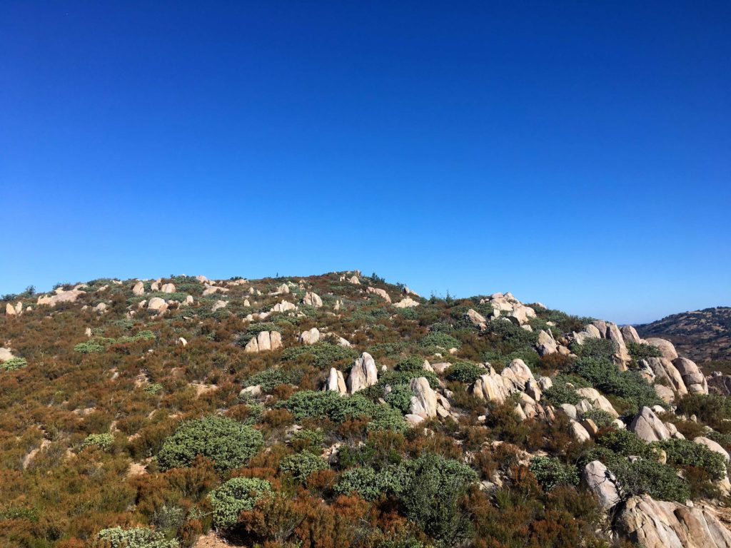
I never found a real path up. Mostly I tried to use the rocks and stay to the northeast side. Apart from the initial effort to bushwhack on to the slope, it went fairly well.
Once at the true summit, I sat and flipped through the register, recognizing many fellow peak baggers.
There were three marks on the summit as well. It was getting warm, so made my way back down the mountain.
So I was crossing back across the meadow and back up the old Jeep road. That was my 60th peak of my 100 Peak Challenge!
I am an avid peak bagger, sometimes backpacker, and former sea kayaker living in San Diego. In 2019, I became the third person to complete the San Diego 100 Peak Challenge. Not stopping with that accomplishment, I set my sights on the harder San Diego Sierra Club 100 Peak list, which I completed in 2021. In addition, I have conquered several Six-Pack of Peaks challenges (SoCal, San Diego, Central Coast, and Arizona-Winter). Beyond attempting the San Diego Sierra Club 100 Peak list a second time, I am looking forward to exploring new summits and new adventures across the southwest.
Kept waffling on what peak I wanted to do. Settled on attempting a three-fer, but with the temperatures, I might be pushing it. I pulled into the parking lot for Three Sisters/Eagle Peak a bit before sunrise. To my surprise, the road down to the trailhead for Sunshine Mountain was closed. That was going to put a wrench in my plans. But one peak at a time…
I headed off down the trail, the air was already warm, and the cooling effects of a marine layer were not there. I held a nice pace as I worked my way out to the peak. The trail was certainly more overgrown than last time. Toward the summit, it took a bit of poking around to find the trail.
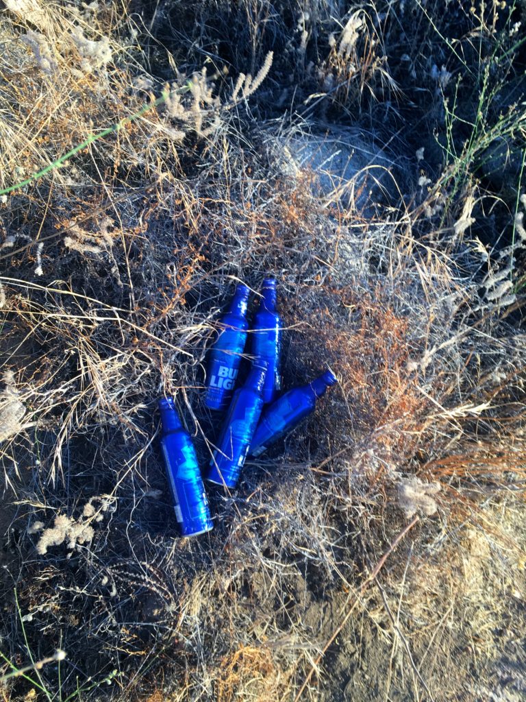
I was amazed at the graffiti along the trail, and the trash. Since this is an out-and-back hike, I tried to remember where the empty water bottles were to pick them up on the return. Sadly I left the five Bud Light bottles behind.
The summit was quiet. I found the benchmark and reference mark with no trouble. I did not find the register.
I headed back down the trail. The overgrowth again was an issue near the top. Since the road to the trailhead for Sunshine Mountain was closed, I was looking to see if there was a connecting trail. Caltopo showed one, but as I got near where it was supposed to be, I could find no evidence.
The parking lot had filled up, and I had to wonder if these hikers knew of the difficult and forecasted temperatures as they set off down to Three Sisters. None of them were headed to Eagle Peak…
I am an avid peak bagger, sometimes backpacker, and former sea kayaker living in San Diego. In 2019, I became the third person to complete the San Diego 100 Peak Challenge. Not stopping with that accomplishment, I set my sights on the harder San Diego Sierra Club 100 Peak list, which I completed in 2021. In addition, I have conquered several Six-Pack of Peaks challenges (SoCal, San Diego, Central Coast, and Arizona-Winter). Beyond attempting the San Diego Sierra Club 100 Peak list a second time, I am looking forward to exploring new summits and new adventures across the southwest.
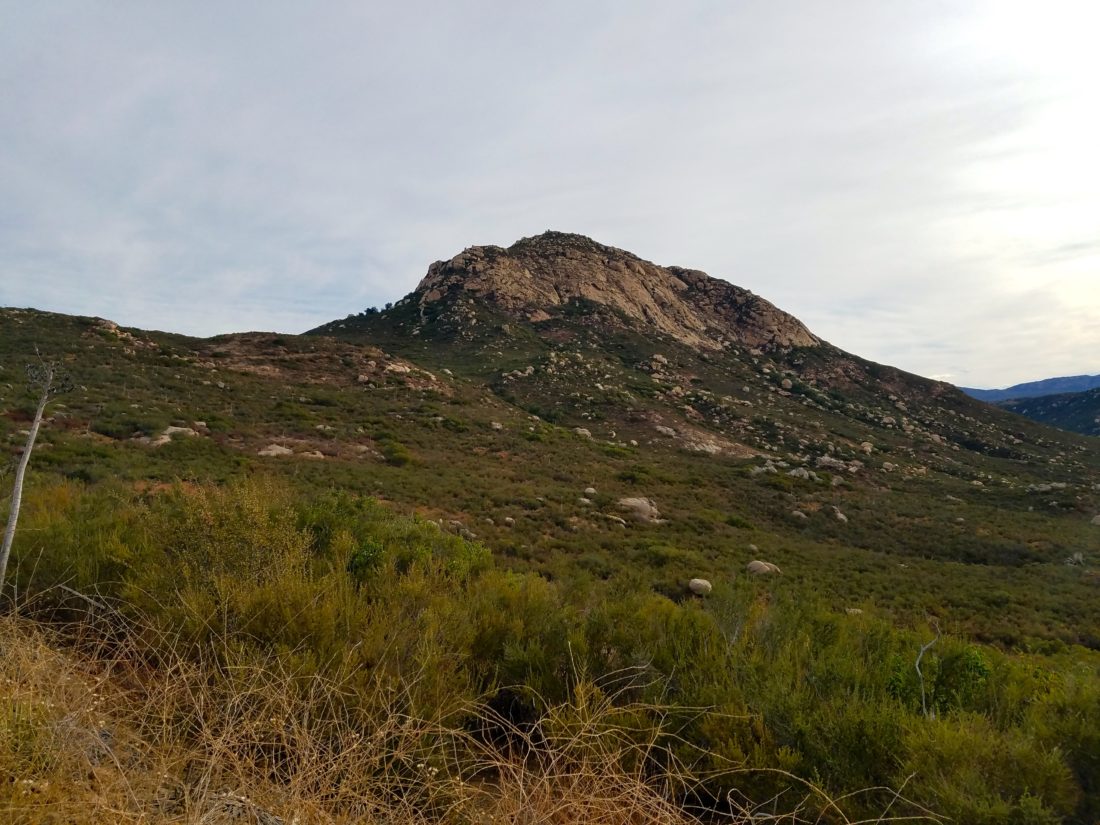
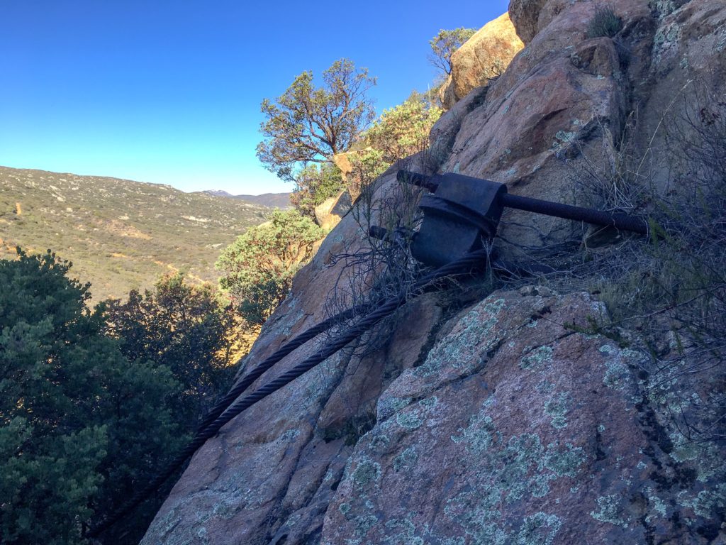
Today’s summit was Bell Bluff, just south of Alpine. I did this peak back in early January of 2018 with Ted. I wanted to beat the heat, so I set out early, just after sunrise. The rope down to the riverbed is still holding strong. The marine layer hid the summit as I crossed the dry Sweetwater River and onto the single track that led off to the southwest.
I made great time along the trail as it gently worked its way toward the peak. The sun finally broke through as the marine layer began to retreat.
I missed the double cairns which mark the turn-off to the peak, but the detour was just a few minutes. The trail had some overgrowth, but it was still passable. Now the hard work would begin, as the trail would get incredibly steep.
After about a half-mile, I reached the summit again. I signed the register and took my photos. I tended to a hot spot on my heel before heading down. I briefly lost the path a few times but found it after some review of my ascent route.
Looking at my descent
I cruised back down the trail to the car, the day was starting to warm up, so my choice for the early start was a wise one. That was my 57th peak of my 100 Peak Challenge!
I am an avid peak bagger, sometimes backpacker, and former sea kayaker living in San Diego. In 2019, I became the third person to complete the San Diego 100 Peak Challenge. Not stopping with that accomplishment, I set my sights on the harder San Diego Sierra Club 100 Peak list, which I completed in 2021. In addition, I have conquered several Six-Pack of Peaks challenges (SoCal, San Diego, Central Coast, and Arizona-Winter). Beyond attempting the San Diego Sierra Club 100 Peak list a second time, I am looking forward to exploring new summits and new adventures across the southwest.
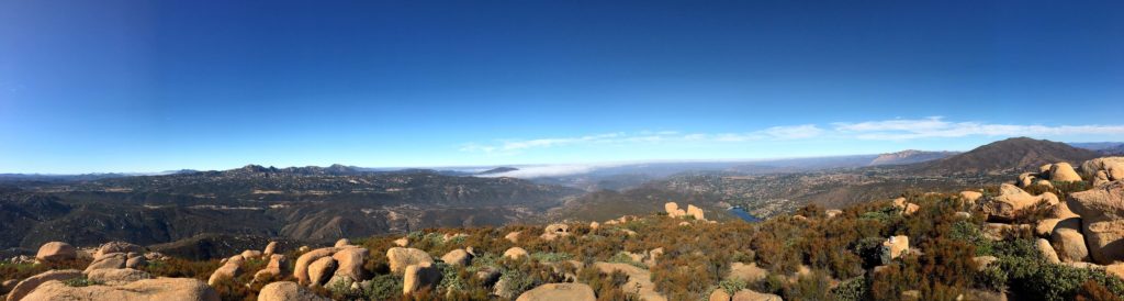
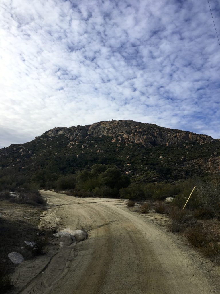
With an early morning scheduled for Monday (6:15 am flight to Seattle), I did not want to summit anything too long. I considered Viejas Mountain, or maybe Oakzinta, but end the I thought doing Big Black Mountain might be the best option.
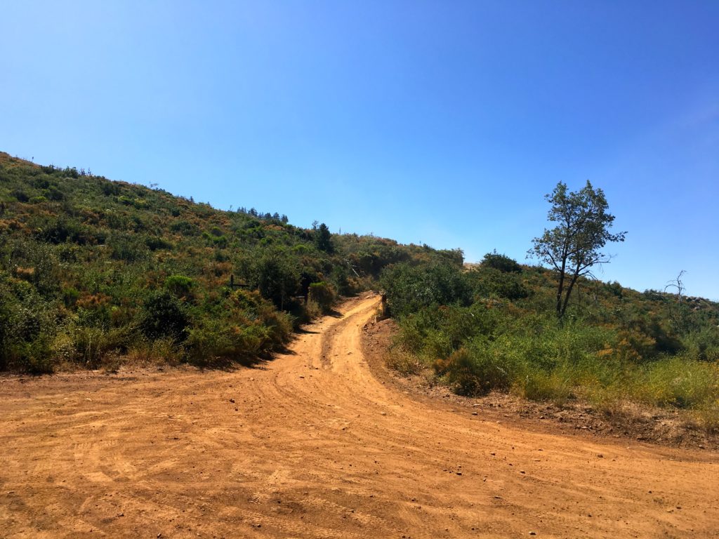
Like last time I planned to drive up partway. I really am not a fan of hiking on active roads. As I made my way up the road, I passed several Jeeps parked about to also make the drive up. At the turnout, I used last time, another truck was parked. I chatted for a bit, passing along what I remembered of the road. They headed up the road and I took a quick stroll to a nice overview. I got back into the Outback and began the drive to the next turnout. The road took some care while driving, but all those years driving on the forest roads near my folk’s cabin paid off.
Once at the turnout, I parked and got ready to begin the hike. The jeeps from earlier caught up with me. I chatted with the last one a bit. He drove off and I began hiking.
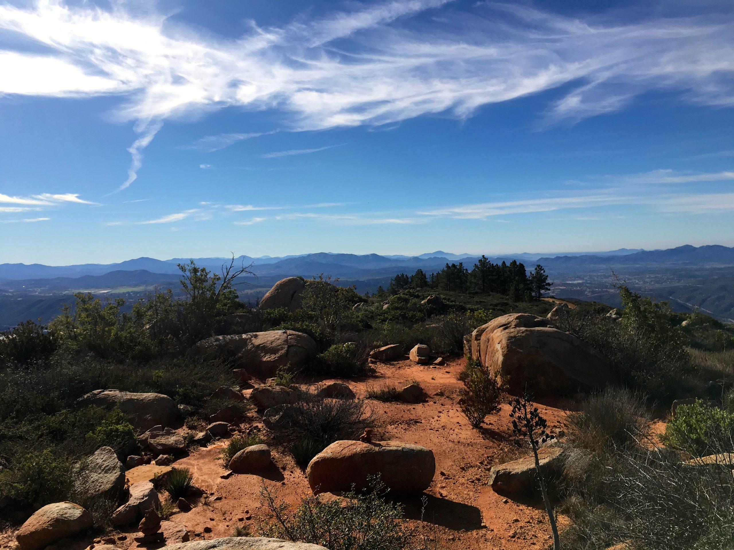
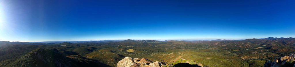
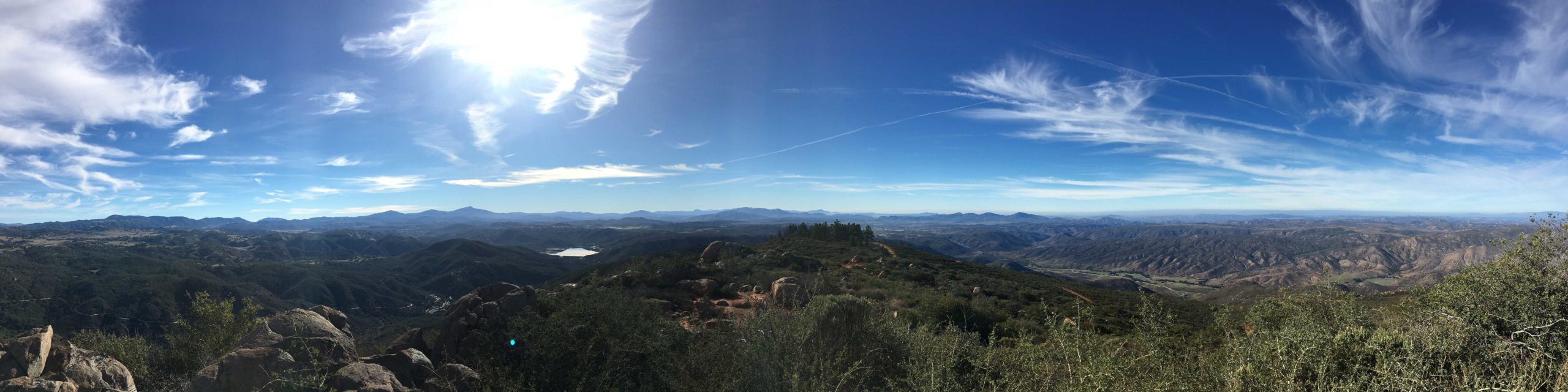
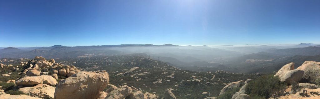
At the summit, it looked like a car lot. I could have driven the Subaru to the top but wanted to make a bit of hike out of it. I followed the use trail up to the actual summit. The views were outstanding.
I found the broken bits of the marker before heading down.
A father and son had joined me near the summit. I pointed out some of the peaks in the distance. It was kinda neat to look at them and know I had stood atop of them. I quickly made my way back to the car and began the careful drive down to the valley floor.
I am an avid peak bagger, sometimes backpacker, and former sea kayaker living in San Diego. In 2019, I became the third person to complete the San Diego 100 Peak Challenge. Not stopping with that accomplishment, I set my sights on the harder San Diego Sierra Club 100 Peak list, which I completed in 2021. In addition, I have conquered several Six-Pack of Peaks challenges (SoCal, San Diego, Central Coast, and Arizona-Winter). Beyond attempting the San Diego Sierra Club 100 Peak list a second time, I am looking forward to exploring new summits and new adventures across the southwest.
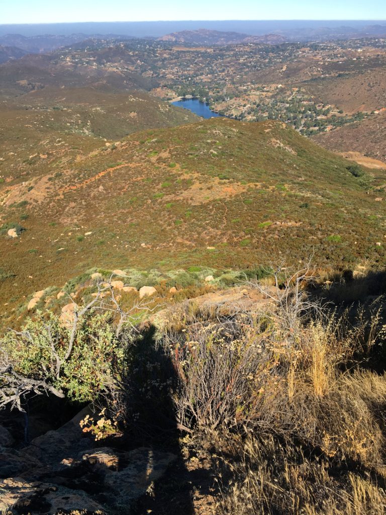
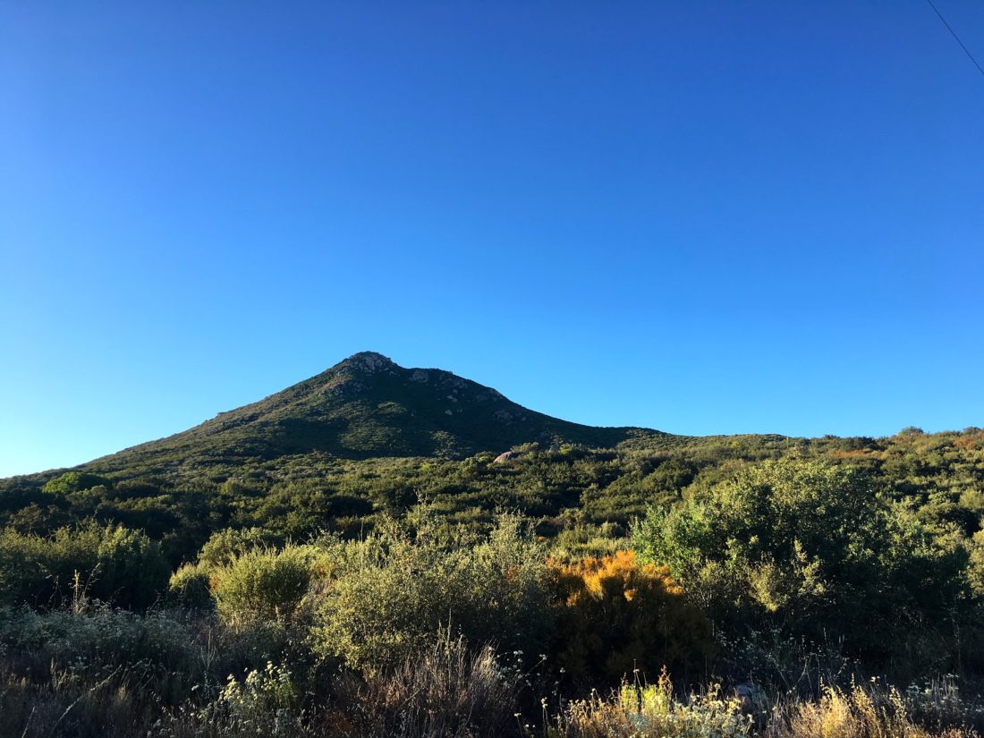
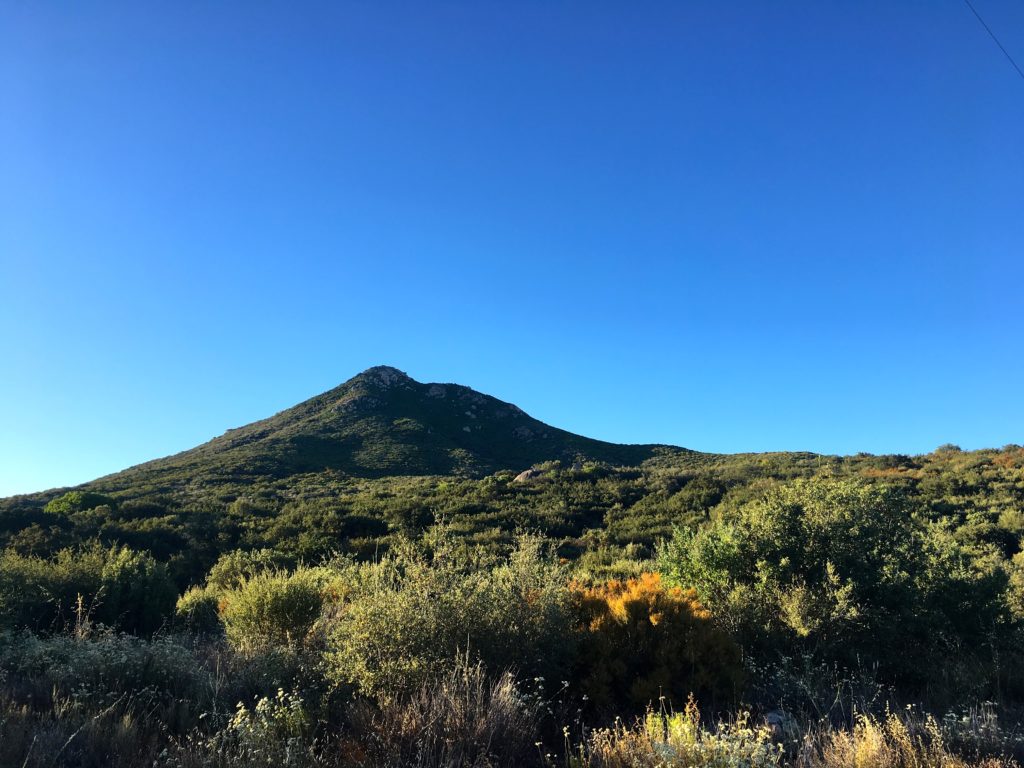
I wanted something a bit on the shorter side, so Long Valley Peak seemed like a perfect option. The trailhead is just off the 8 in Pine Valley. As I parked, the air was brisk, but I knew that was not going to last once the sun rose. A couple of dirt bikes were getting ready to head out on a nearby trail.
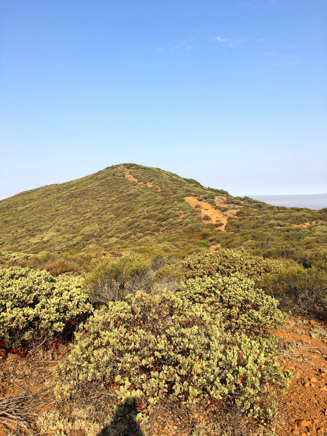
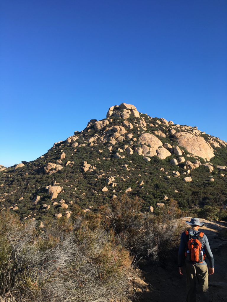
The trail follows the power lines for about a mile and a half. I remembered the rolling nature of this section. It was a good way to test my ankle. The sun poked over the Laguna mountains to the east, but the shade and slight breeze kept the temperatures pleasant. The peak loomed in the distance, standing alone.
When the road makes its right turn, I made my left turn onto the single track and the real climb began. The trail was fairly easy to follow, with just a few spots that took a quick moment to spot the continuation.
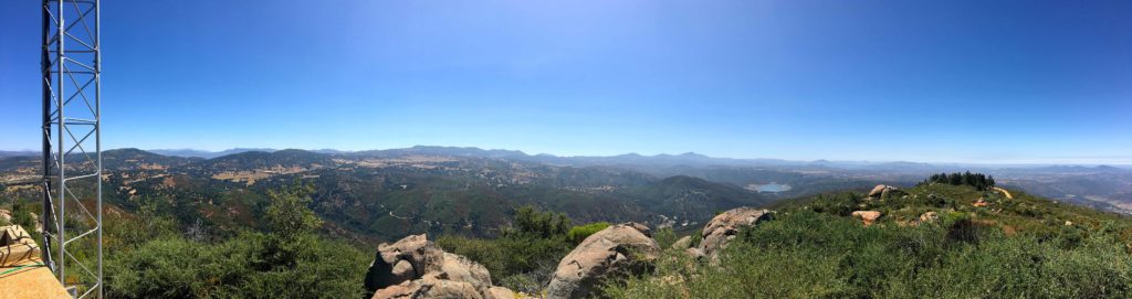
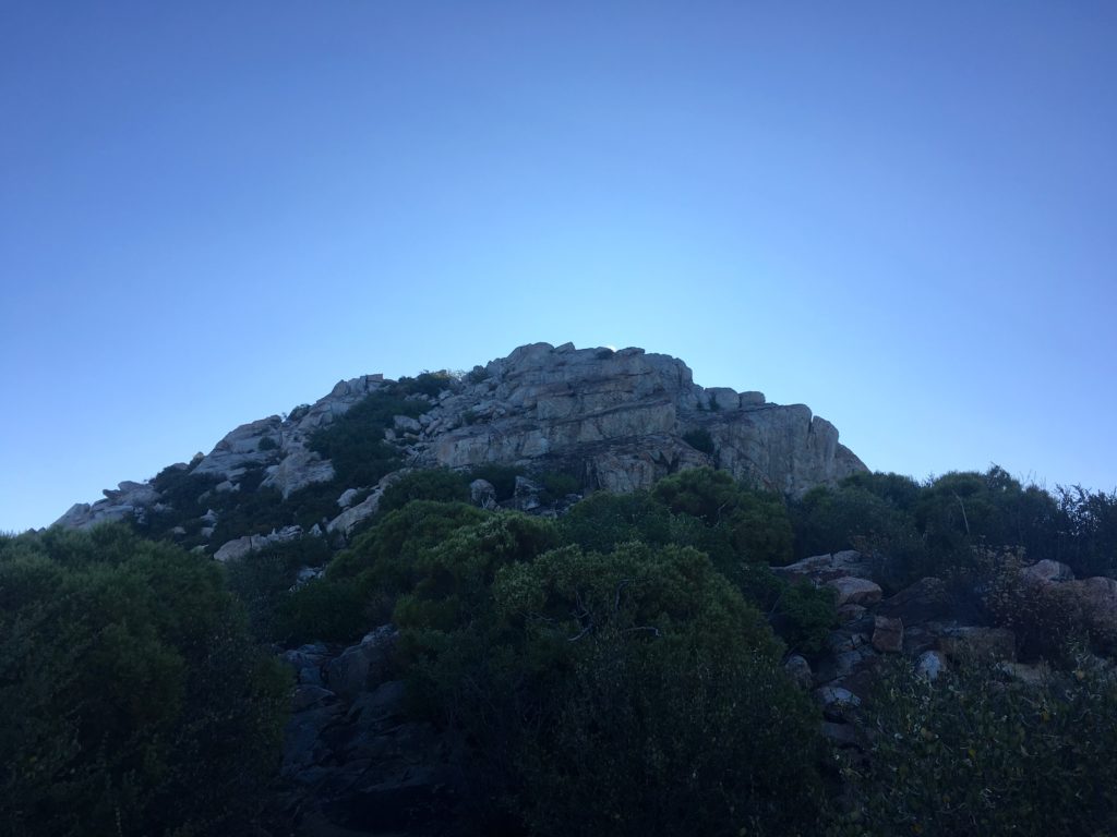
As I got closer to the summit, the trail became rocky and steeper. Making my way up, the view behind me was stunning. With one final push, the summit was reached. The vistas were as incredible as I remembered. Matt Hanan, another fellow peak bagger, mentioned the need for a new register, so I dropped a new one-off into the ammo box.
Familiar peaks surround me, as I took a break from the ascent. But I knew the day would keep getting warmer and the shade that I had would be fading away.
The descent went quickly back to the service road. Once back at the car I began wondering about this attempt’s pace vs. the first one. Both times I did this peak I was solo. To my surprise, I covered the 4.1 miles 30 minutes faster. I don’t think I was going that fast, I guess the first time I was just cruising.
This was peak #52 of my #100PeakChallenge.
I am an avid peak bagger, sometimes backpacker, and former sea kayaker living in San Diego. In 2019, I became the third person to complete the San Diego 100 Peak Challenge. Not stopping with that accomplishment, I set my sights on the harder San Diego Sierra Club 100 Peak list, which I completed in 2021. In addition, I have conquered several Six-Pack of Peaks challenges (SoCal, San Diego, Central Coast, and Arizona-Winter). Beyond attempting the San Diego Sierra Club 100 Peak list a second time, I am looking forward to exploring new summits and new adventures across the southwest.
With the first heatwave of the season arriving, it was a reminder that I needed to be selective with my peaks. For example, the county closes El Cajon Mountain and Mt. Gower during the month of August due to the heat.
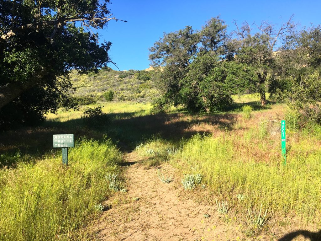
Morena Butte is certainly one of these peaks. This peak was a special one, as it was my first peak after my first bout of plantar fasciitis. For that summit, I opted to take the dam route. This time I decided to follow the more traditional route that follows part of the PCT before heading up the south side of the Butte. I paid 3 dollars and parked near the trailhead. As I worked my way along the service road, the screech of a Golden Eagle filled the air. Soon I reached the turnoff that would connect with the PCT.
The shade was welcomed, but the bugs were not. Wildflowers still doted the sides of the trail. The route is well marked and I was only pulling my phone out for photographs.
Given my timing, I did not expect to encounter any PCTers on the trail. Again, a nice sign indicated the turnoff to begin the proper ascent of Morena Butte.
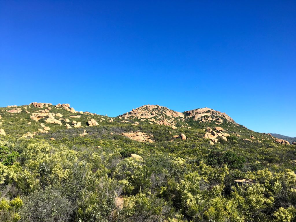
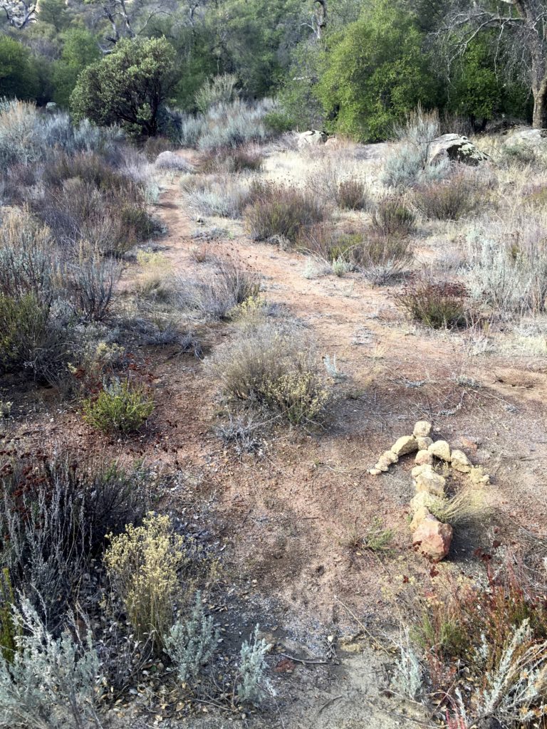
This trail begins working its way up from what had been a fairly flat hike so far. The rains this year have made the brush in some sections a tad thick. While there were a few steeper sections, the climb was fairly manageable. As the summit drew nearer, the trail began to fade away, but there were plenty of rock cairns to guide the way.
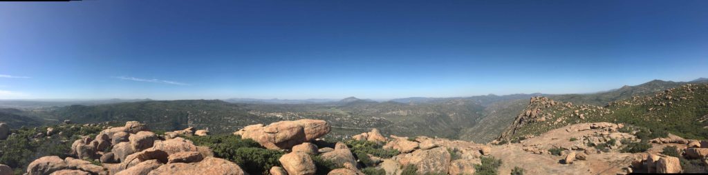
Once upon the Butte, it was a nice stroll to the high point of the south butte. The wind was gusting around 20-30 mph, so I knew I was not going to be hanging out too long. I scrambled up to where the register was. While looking at the views, my hat blew off into the brush below.
I signed the register and scrambled through the brush to retrieve my hat. I debated about venturing over to the other two high points but opted not to. Once I found the trail again, I made my way back down and onto the PCT. As I neared one of the junctions, I debated if I should return the same way or venture back on the other route. It was getting a tad warm, so I headed back along the same route. At the next junction, I remembered that this section had two parallel tracks, so I opted for the eastern track.
The upside of the wind, the bugs were being kept at bay. The old road eventually reconnected with the service road. I strolled back to the car, again thinking of how far I have come since my first time up to the top of this peak.
I am an avid peak bagger, sometimes backpacker, and former sea kayaker living in San Diego. In 2019, I became the third person to complete the San Diego 100 Peak Challenge. Not stopping with that accomplishment, I set my sights on the harder San Diego Sierra Club 100 Peak list, which I completed in 2021. In addition, I have conquered several Six-Pack of Peaks challenges (SoCal, San Diego, Central Coast, and Arizona-Winter). Beyond attempting the San Diego Sierra Club 100 Peak list a second time, I am looking forward to exploring new summits and new adventures across the southwest.
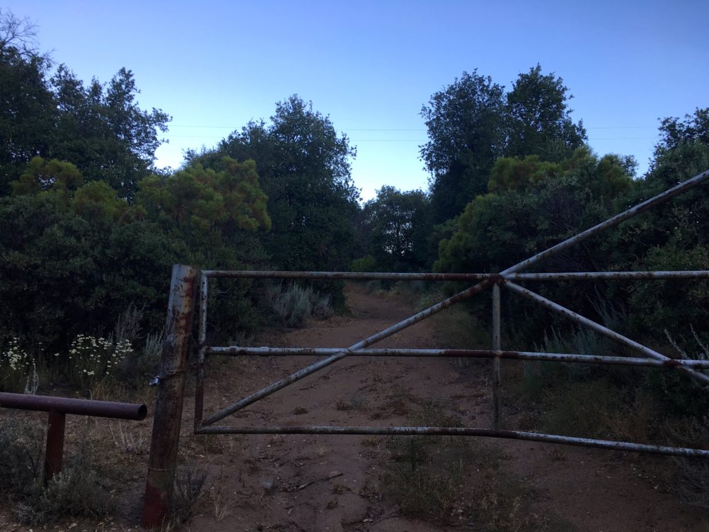
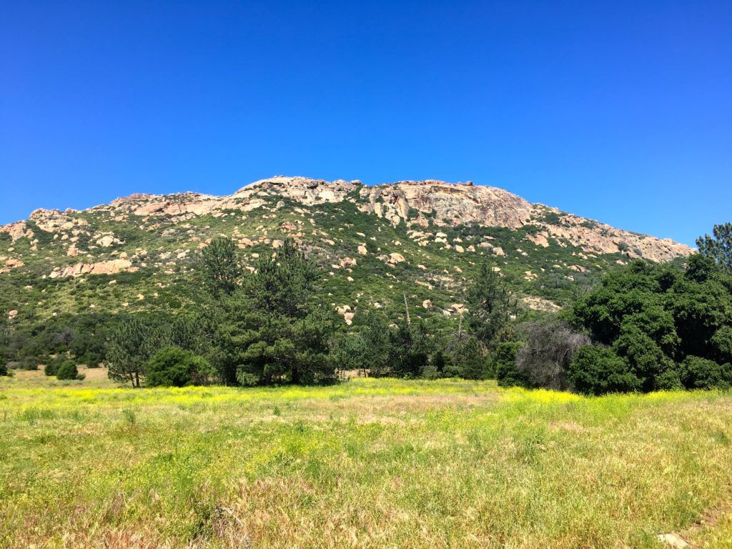
While the rainy Memorial Day weekend put a damper on any big hiking plans, Monday afternoon availed itself for some time on the trails. I mulled several options as a candidate, but in the end, I settled on Guatay Mountain out near Pine Valley. This peak was the first peak I did after my neck injury. It was going to be interesting to compare the two summits.
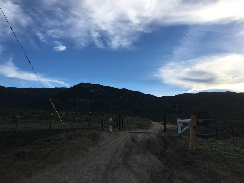
As I unlocked the gate to the trail, I could hear the stream flowing nearby. Like so many trails, it was slightly overgrown from all the rains we had this year. As expected, some of the steeper sections had become more rutted as well.
I followed the trail for about a mile before reaching the metal fence indicating the turnoff toward Guatay Mountain. This section also showed the effects of our winter, requiring some straddling of the trail to work my way up. The weather was perfect for hiking, a light breeze and perfect temperatures made the climb upward pleasant.
I remembered much of the trail as it passed under my boots. I was curious to discover the difference once I got to the steeper section of the hike. I remembered that it took some effort the first time.
This time I found myself working my way upward without any issues. Glancing northward toward Cuyamaca, its summit was still encased in clouds.
Soon the summit came into view. I took a short break and signed the register. I looked over at Long Valley and debated if I should consider doing it as well…
I headed back down the trail, reflecting on how different these two summits have been. The first time pushed me and gave me confidence that I could hike again. This time, it let me know that I had the strength to complete my 100 Peak Challenge Reboot.
Soon I found myself crossing that small stream again, knowing that this hike was nearing its end. Once back in the car, I decided not to tack on Long Valley, and just enjoy my summit of a Guatay.
I am an avid peak bagger, sometimes backpacker, and former sea kayaker living in San Diego. In 2019, I became the third person to complete the San Diego 100 Peak Challenge. Not stopping with that accomplishment, I set my sights on the harder San Diego Sierra Club 100 Peak list, which I completed in 2021. In addition, I have conquered several Six-Pack of Peaks challenges (SoCal, San Diego, Central Coast, and Arizona-Winter). Beyond attempting the San Diego Sierra Club 100 Peak list a second time, I am looking forward to exploring new summits and new adventures across the southwest.
Whenever I would talk about my remaining peaks, I would mention I needed to do summit Big Black Mountain. Almost everyone would ask, don’t you live almost next to it. I would then inform them that there are 3 Black Mountains in San Diego. The one I needed to summit was just a bit north of Ramona.
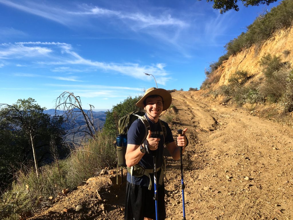
This hike fell into the category of the kind I don’t like, hiking on an active road most of the way. One option was to wait for the Forest Service to close the road due to weather, and then do the entire 14 miles without the fear of a motorcycle or 4×4 running you over. The other option was to simply drive most of it, then cap it off with a short hike. Given I am always cautious with my foot now, I choose the latter option. Jacob Posner was able to tag along, has needed some training miles for an ascent on Mt. Shasta later this year.
We drove out to the turn-off and began our off-road adventure up the mountain. The road was a standard dirt road as we climbed higher and higher. I had spotted a nice turn out that would give us about a 4-5 mile round trip hike. Basically, enough so we could enjoy Burger Bench afterward with no guilt.
Jacob loaded up his pack with his 25-lb bag of ice and up we went. I kept an ear out for vehicles, and also curious to see if the Subaru could have kept going.
Today was perfect, nice skies, the temperature was lovely. As we reached the end of the road, we both concurred that we could have driven, only one spot would have taken a touch of care to navigate. We did hear, then spot a lone motorcycle working its way up the road behind us. He parked and we chatted some. He was also a hiker and new to the area. I gave him pointers of my favorite hikes and the recommendation of some book 😉
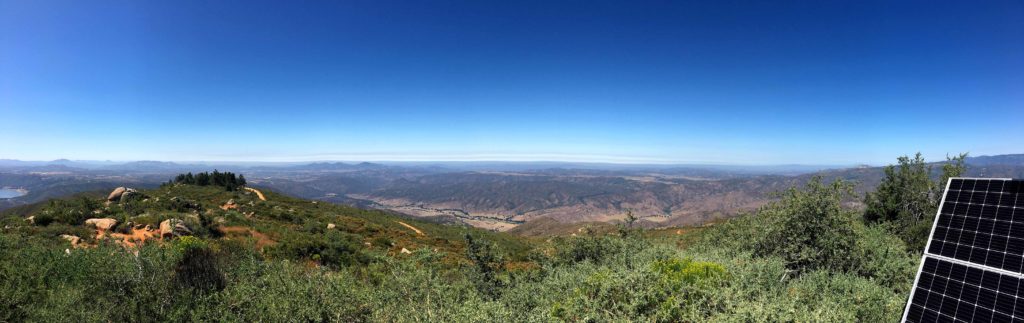
To reach the actual summit, which is home to a weather station, we followed the trail for about .2 miles. Once there we took a break, enjoyed the views and chatted. Jacob is finishing his last semester at Cal, then off to work at Boeing (having done an internship at SpaceX). If you know my other passions, you know we had plenty to talk about…
We headed back down the trail, then the road. Two more motorcycles passed us going up while we returned to the car. We kept an ear open for when they were headed back down. While driving down, we encountered two 4x4s heading up, so in part validating my choice. And of course, the burger and beer were tasty and cold.
I am an avid peak bagger, sometimes backpacker, and former sea kayaker living in San Diego. In 2019, I became the third person to complete the San Diego 100 Peak Challenge. Not stopping with that accomplishment, I set my sights on the harder San Diego Sierra Club 100 Peak list, which I completed in 2021. In addition, I have conquered several Six-Pack of Peaks challenges (SoCal, San Diego, Central Coast, and Arizona-Winter). Beyond attempting the San Diego Sierra Club 100 Peak list a second time, I am looking forward to exploring new summits and new adventures across the southwest.
After my successful failure of Half Dome, my foot’s plantar fasciitis reared up again. Something about favoring one foot over the other while hiking Half Dome 😉 I took a more aggressive approach and strapped on a walking boot for several weeks to let it heal. After some PT, it was finally time to test my foot out. Of my remaining peaks, Morena Butte seemed to fit the bill. I drove out to Lake Morena County Park, I opted to pay the 10 and park closer to the trailhead near the low-water launch site. You can park just outside the park for a longer hike.
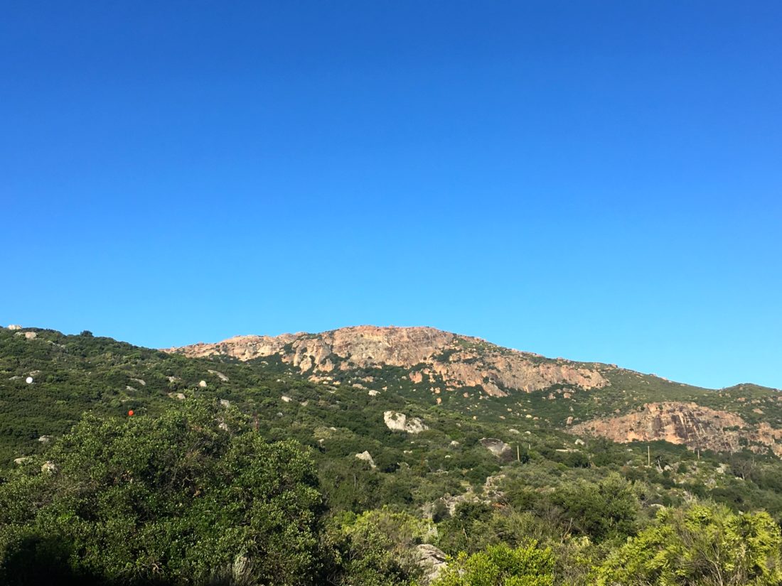
High above the lake looms Morena Butte, a three-peaked mountain topped with huge expanses of gorgeous granite slabs. The day was perfect, as first followed Ward’s Flat Trail. This a closed dirt service road that heads toward the south side of the dam. After about 1.5 miles, a nice rock arrow points the way on to the Hauser Overlook Trail.
Here is route becomes more trail-like as you being to climb through the chaparral. Once you reach the end of the trail, you will hopefully see the start of almost a goat-trail up the steep side of the mountain.
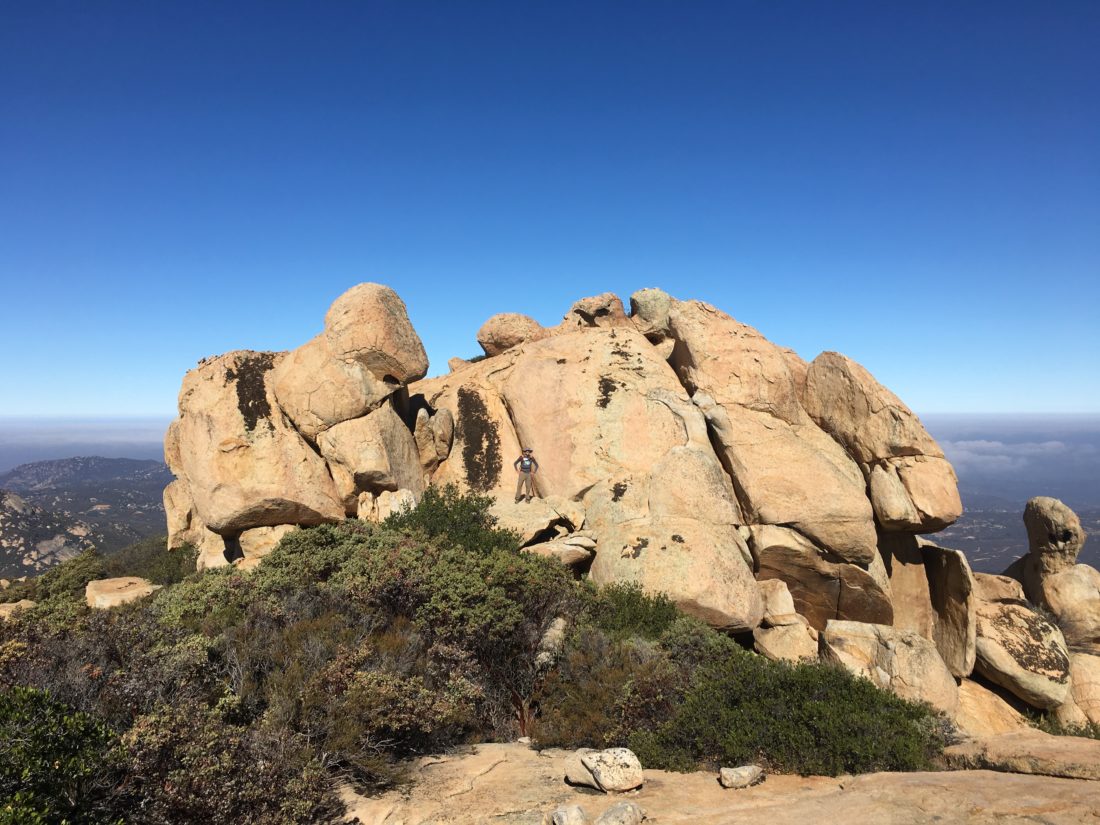
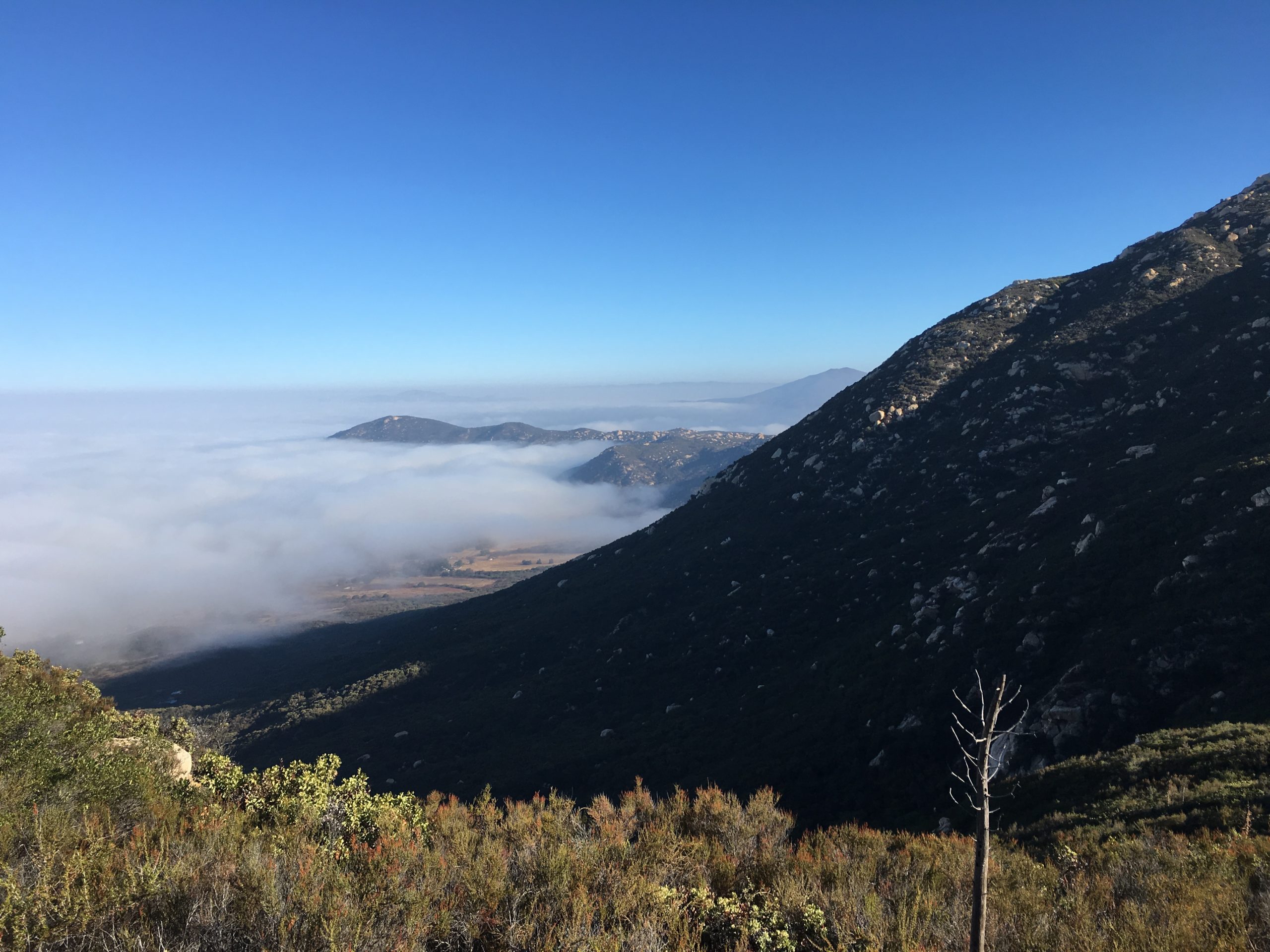
I carefully worked my way up, scampering up the rocks until the trail began to reform. According to my GPS, I gained almost 600 feet of elevation in just over .5 mile. Looking back I was rewarded with some nice views of the dam and the lake. After cresting a small summit, the triple peaks of Morena Butte came into clearing into view. The highest of the three is the southern one, so I made my way toward it.
Once on the top, the butte is a massive granite slab littered with pink boulders. A few puddles were scattered about from some recent rains. I found the register tuck away near the top of the south summit. While resting and enjoying the view, another hiker came along. We chatted a bit, she mentioned she was also chasing the 100 Peak Challenge. We had a pleasant chat before I headed off.
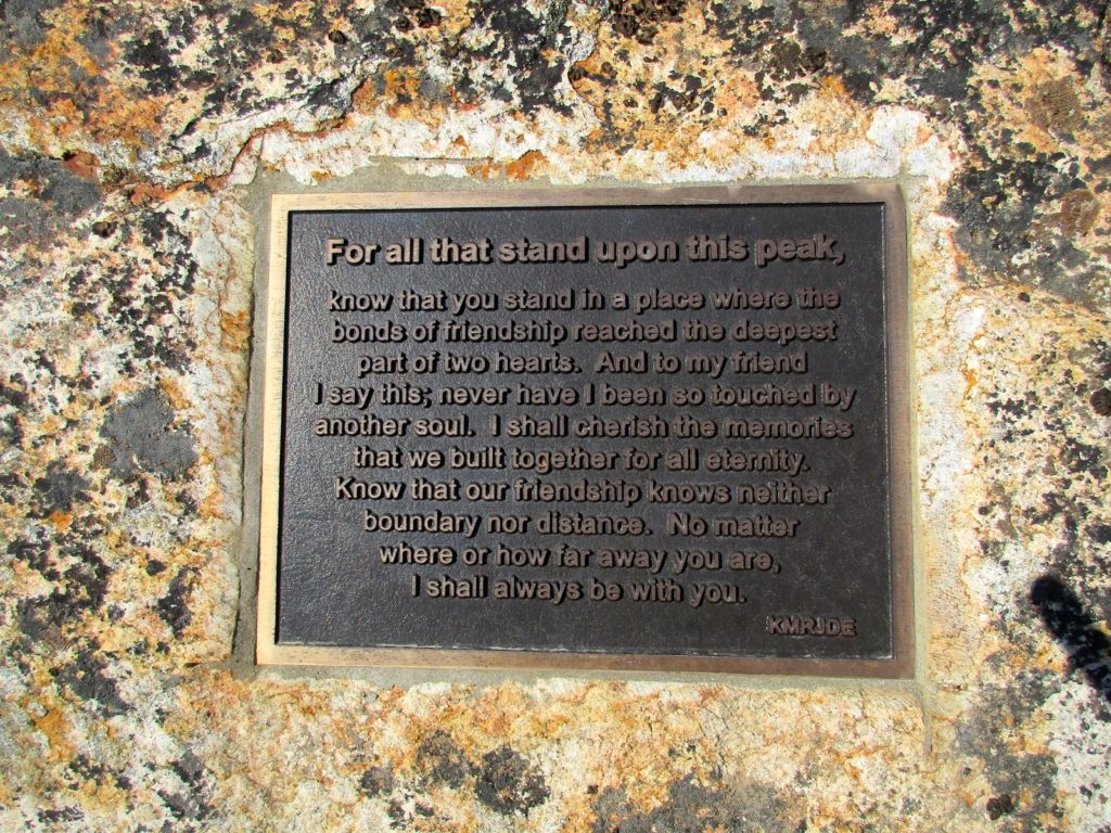
I first wandered over the eastern side of the butte to get a full view of the valley and the lake. Forgetting to turn my tracking on, I then made my way to the western edge. Towards the top of the peak if you go towards the left you will get a great big flat rock that has an awesome view of the valley below, and the base of the rock is a plaque that was put there a few years ago.
Having done enough exploring for one day, I started to retrace my route, although I must confess I did consider taking the longer route that connects with the Pacific Crest Trail instead of returning down that steep slope. In the end, I figured the devil you know versus the devil you don’t.
The return to the car was uneventful. My foot was feeling mostly ok, which was a good sign. I passed by an old foundation with a chimney that is still standing and makes you wonder what was originally there. Back at the car, I realized I forgot my cooler on the kitchen counter, but no worries as there is a country store just outside the park, so I stopped in and grabbed some cool drinks :).
I am an avid peak bagger, sometimes backpacker, and former sea kayaker living in San Diego. In 2019, I became the third person to complete the San Diego 100 Peak Challenge. Not stopping with that accomplishment, I set my sights on the harder San Diego Sierra Club 100 Peak list, which I completed in 2021. In addition, I have conquered several Six-Pack of Peaks challenges (SoCal, San Diego, Central Coast, and Arizona-Winter). Beyond attempting the San Diego Sierra Club 100 Peak list a second time, I am looking forward to exploring new summits and new adventures across the southwest.
Now that I am finding my trail legs again, it was time to go back and summit Gaskill. When Ted and I tackled Lawson Peak, we did not continue onto Gaskill, as I had a sick daughter to attend to.
We followed the same route as before, we looked at the trail leading up to Lawson and joked if either of us wanted to scramble up the chimney again…
The route follows the road for about a mile until the trail to Gaskill appeared. Along the way, a motorcycle passed us. We were not entirely sure why he needs a machete on his back.
The trail worked its way to up the steep slope to the peak. There we explored the first set of rocks. Ted went over to see if we could scramble atop the other set. Not finding a safe route, we opted not to attempt it.
We retraced our route, as the heat began to rise. Once back in the car, some well earned Mexican food and a fresh Alpine Brewery beer were in order.
I am an avid peak bagger, sometimes backpacker, and former sea kayaker living in San Diego. In 2019, I became the third person to complete the San Diego 100 Peak Challenge. Not stopping with that accomplishment, I set my sights on the harder San Diego Sierra Club 100 Peak list, which I completed in 2021. In addition, I have conquered several Six-Pack of Peaks challenges (SoCal, San Diego, Central Coast, and Arizona-Winter). Beyond attempting the San Diego Sierra Club 100 Peak list a second time, I am looking forward to exploring new summits and new adventures across the southwest.