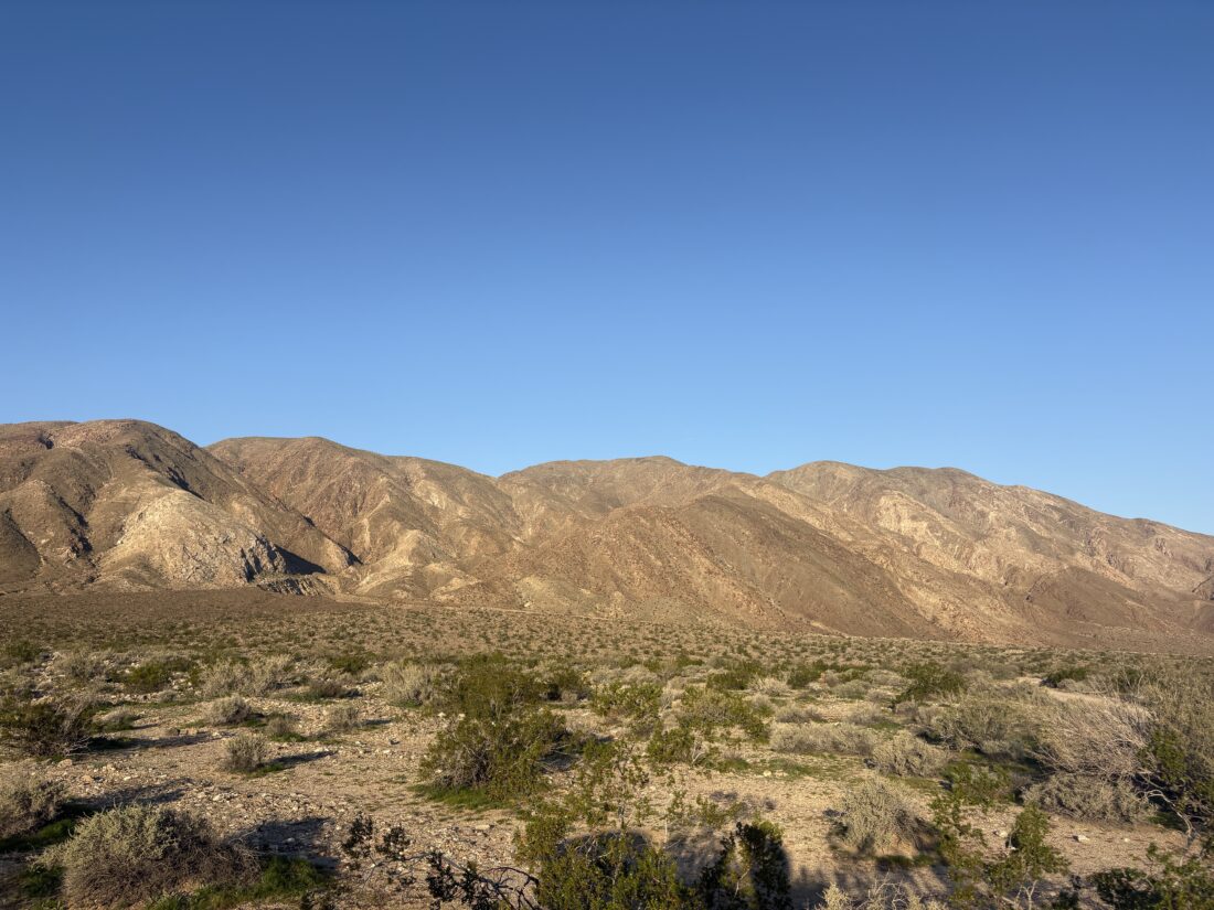
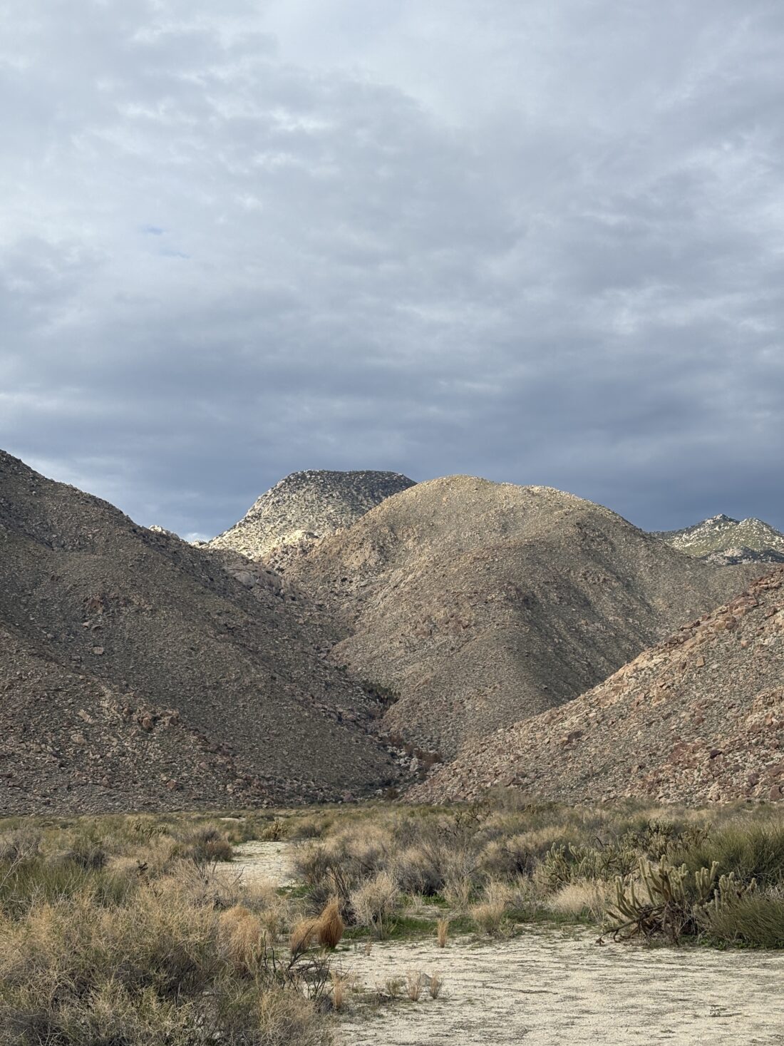
We opted to try to work on knocking out one of Ted’s remaining peaks. There was just one problem – it was going to be a bit windy for all of them. In the end, we settled on Oriflamme Mountain. As we drove out and passed Santa Ysabel, the various flags flying around were straight out. We pulled into the parking area and gathered our gear. I slipped on a fleece and made sure to put a wind shell in my pack. We crossed Sunrise Highway and headed down the old Jeep road.
Bring the Outdoors to Your Inbox
Sign up for our email and stay up to date on my adventures.
We cruised along, passing the rusted wreck of a truck. Maybe “Matt’s Off-Road Recovery” could remove it! I spotted the point where we would leave the road and begin the short climb to the summit. There isn’t a trail, but rather the need to use a best-guess method through the brush. For the most part, I got us to the top without any issues. It was quite breezy there, so we snapped a few photos, double checked for a register, and headed back down. We again weaved through the brush and actually exited at exactly the same point, back onto the road! We climbed back up to the car, (got to love those inverted hikes) and along the way, I outlined all my 2026 hiking goals. No surprise, I’ve got a ton!
I am an avid peak bagger, sometimes backpacker, and former sea kayaker living in San Diego. I am the co-author of Urban Trails: San Diego, coming in Spring 2026!
Several months ago, I arranged with Gina to be able to hike down to Palm Mesa High Point from Los Coyotes, figuring the end of February would be perfect to attempt it. Rick and Andrea were also going to join me to climb Cody & Pike Benchmarks. Well, Mother Nature had other ideas with an unseasonably hot spell. We wisely decided to cancel my attempt to summit Palm Mesa High Point, as it is an inverted hike and fully exposed. Instead, I would join Rick and Andrea on their efforts to bag Cody & Pike. We met at Gina’s lovely home, and piled into her car to drive into the deeper parts of the reservation. Wild turkeys and deer were spotted as we passed through the locked gates. We parked past the San Ignacio Cemetery, where some of her husband’s family is buried. We gathered our gear and set off down the road before dropping into the wash that would take us up to the ridge. Gina had left cairns for herself, as she does come wandering out here from time to time, we redubbed the cairns as “Ginas”.
Bring the Outdoors to Your Inbox
Sign up for our email and stay up to date on my adventures.
At the saddle, with Anza-Borrego spread out before us, Gina wasn’t feeling it. She sent us off, and she was going to chill and maybe stroll over to Dry Benchmark. The rest of us opted to skip climbing Phil and Norte Benchmarks and stay true to the primary benchmarks. I led the way through the brush, roughly following the track Gina and I took several years ago. Other than the brush being a bit thicker, it was a fairly straightforward ascent. Rick might disagree, as he did opt to wear shorts. At the summit, we took a break, signed the register, and took in the views before returning to the saddle and then onto Pike.
We followed the exit track that Gina and I used to avoid climbing up past Army Benchmark (which has been delisted in Peakbagger). I got a text from Gina that she was feeling better and had wandered over to Pike and would wait for us there. I found a deer trail and used that to cut across toward Pike. The day was warming, which reinforced my decision not to try for Palm Mesa High Point. We bypassed Pike Benchmark Summit and headed directly for Pike Benchmark. It is on the San Diego Sierra Club list, while the other is not. Gina was soaking in the views as we joined her.
We ate our lunches, again marvelling in the views, while a light breeze helped keep us cool. Rick and Andrea made the short climb over to Pike Benchmark Summit. I opted to skip it as I might be headed to Arizona for some hiking over the next four days. Gina and I side-hilled around it. When we reached a small saddle, Gina realized that she lost her phone. She had taken a call from her youngest, so we had an approximate area where it might be. She doubled back, and I waited a bit to begin calling it, so that it might be heard if it was not directly visible. Thankfully, she found it. When she went to return her phone to her shoulder case, she must have missed it. Crisis averted. We reached that initial saddle, and shortly thereafter, Rick and Andrea rejoined us. We took another short break and then headed back down to the car. While I did not get the peak I was after, it was still a great day out hiking with some great friends. The final stats were 5.7 miles in 6:00 with 1,130 feet of gain/
I am an avid peak bagger, sometimes backpacker, and former sea kayaker living in San Diego. I am the co-author of Urban Trails: San Diego, coming in Spring 2026!
Originally, I had planned to hike up to Rosa Point and Mile High on Sunday, but one set of friends had to back out, and another let me know that his legs were a bit worn from climbing Sawtooth (the one on the SD Peak Club list). So I suggested that Robert and I explore and see if we might be able to climb Knob Benchmark from Sheep Canyon. At worst, it would be another great hike out to Sheep Canyon, and we’d probably have some wildflowers to enjoy as well. We met around 7 at the parking lot next to Jilbertos and transferred into the Outback. Robert and I drove out to the gate at the third crossing. We parked, gathered our gear, and set off. There were quite a few more flowers than last time as we hiked along the stream.
Bring the Outdoors to Your Inbox
Sign up for our email and stay up to date on my adventures.
After the climb over Boulder Alley, we met a group of Boy Scouts returning from their overnight. Earlier, we had met a couple of bike-packers. As we got closer to Sheep Canyon, we could see where the recent rains had traveled across the desert sands. We walked over to the campground where another group of backpackers was milling around a picnic table. I assumed they might be WBC course participants, since a lecture was being held. Even with the closure, this is still a busy place. We found another table and had a quick snack break. Now onto the real adventure—could we find a route through Sheep Canyon, then onto Knob Benchmark? The route I had taken before is no longer available, so I was exploring alternatives.
As we headed into the canyon, the sounds of flowing water began to fill the air. A really good flow poured through the brush. That is a good sign for us if we can get in a backpacking trip to attempt SquareTop, as we will need to haul out very little with us. Maybe we could bring some firewood instead? We began slowly, picking our way through the brush and rocks, crossing the creek a few times. After almost an hour of pushing through the increasingly dense growth and only covering about 1/2 mile, we called it. We felt the canyon was going to get thicker and harder. Knob Benchmark is going to require a different route. We got back to the campground and had another snack before heading out. The day had warmed some, an indication of the warmer forecast for the coming week. We cruised back, stopping at the marker again. As we neared the gate, there were a lot more folks out enjoying the flowers. We drove back into town, grabbed a couple of sodas, and enjoyed our lunch at a picnic table under the shade of a cottonwood. While we never got close to the peak, it was still a fantastic day in the desert with some good company.
I am an avid peak bagger, sometimes backpacker, and former sea kayaker living in San Diego. I am the co-author of Urban Trails: San Diego, coming in Spring 2026!
The original plan was to summit Indianhead via Palm Canyon, but the forecast temperatures led us to postpone our attempt to a later date. Since we had planned for a pre-dawn start, I had booked a campsite at Borrego Palm Canyon Campground. I opted to keep the reservation, spend the night out there, and hike something else in the morning. After setting up my Luno mattress, I relaxed around the campsite a bit until the sun dipped below the mountains. I opted to bring a new backpacking meal, Chicken Tikka Masala from Bowl and Kettle, to try out. I also brought some naan from Trader Joe’s, which I warmed over the campfire. As the sunlight faded across the desert, I sat back and enjoyed my meal. My fire burned faster than expected, with a combination of dry wood and a slight breeze, so I turned in early and listened to some lectures.
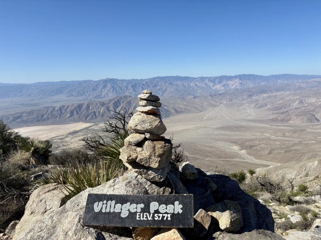
The alarm went off just after 5 am, and I made some oatmeal and coffee as I quietly broke camp. I decided to climb Villager Peak as my replacement for Indianhead. For those who are familiar with Villager, it is still a hard hike. It’s just under 14 miles round trip, but for the most part, a straightforward ridgeline to the summit. There are trees at the summit, so if I cared to take a nap in the shade, I could. The trailhead was empty when I pulled in. Driving over from the campground, I saw the temperature dip into the high 40s. Here it read in the low 50s, so I left my fleece in the car. Between the coming dawn and the quarter moon hanging in the western sky, I had plenty of light to set off across the desert floor to the Villager Ridge. I found the use trail shortly after leaving the trailhead, and cruised along. I crossed over the Rattlesnake Wash and up the steep slope to begin climbing.
Bring the Outdoors to Your Inbox
Sign up for our email and stay up to date on my adventures.
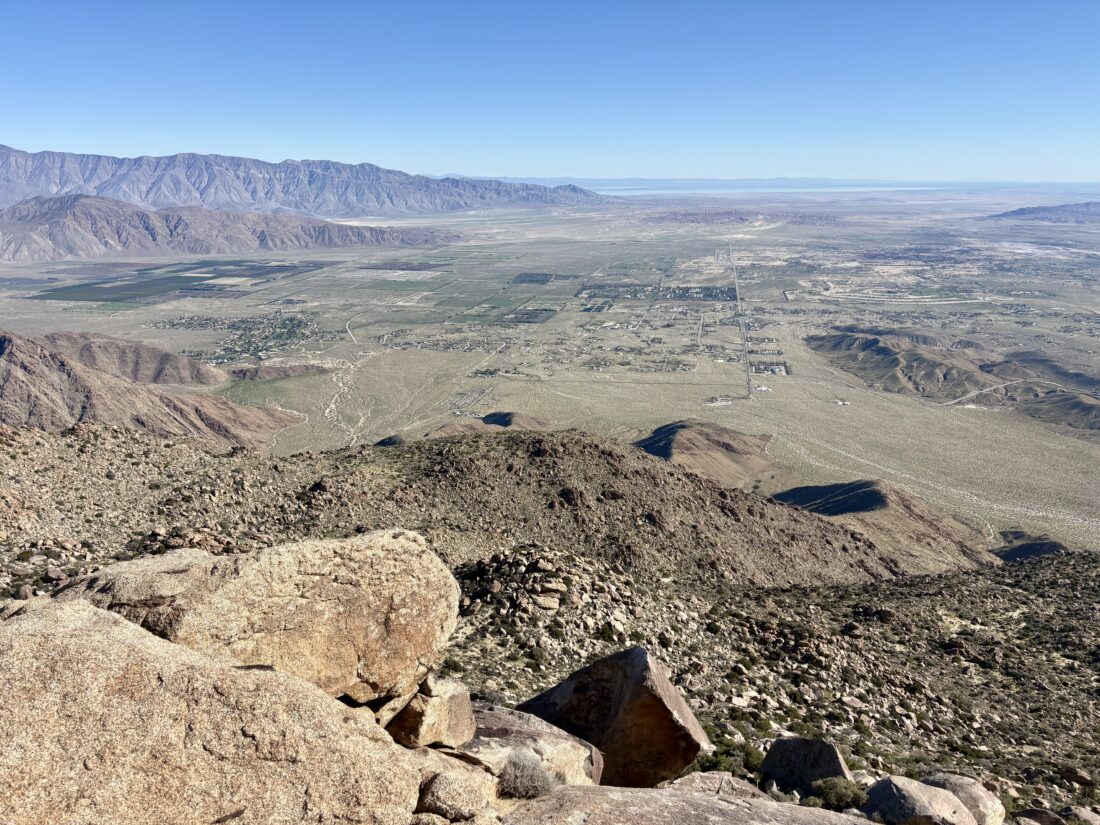
The sun finally rose above the mountains to the east, and a light breeze began to blow. Between the cairns and the use trail, there were no issues as I kept plodding along. From time to time, a steeper section would require some additional effort, but nothing too sustained, and a flatter section would follow to allow for some recovery. My left calf was feeling a bit off, and it gradually tightened as I hiked on, despite attempts to stretch it out. As I passed Mile High off to the east, the Salton Sea finally came into view. I looked across at that peak and gazed at what I had hiked down and up when I had summited it. While I still need to climb it again, I think I will take an alternate route down.
The Backpacker Radio Podcast kept me entertained as the summit drew near. I crested the small false summit and soon found myself staring at the rock cairn that denotes the summit. I took some photos, signed the register, and then enjoyed my lunch while gazing across the vista. While it was pleasant at the summit, I knew that it was going to get warmer as I made my way back down. Plus, I didn’t want my calf to tighten any further, so I got moving. If I had stayed about 15 minutes longer, I might have gotten great shots of some F-35s flying over.
The descent went smoothly with the calf causing very little discomfort. I was right about it getting warmer. I had brought a sun umbrella, but the breeze was just a bit too strong for me to use it. As I got lower, various flowers were now open to take in the sun’s rays. I would stop and photograph some, but otherwise kept a steady downward pace. I finally saw the glint from my car, and a few others parked next to it. I have to assume those adventurers were off toward some other destination, as I had not seen a soul.
Once back on the desert floor, I tucked my trekking poles away and broke out the sun umbrella for the final 1.25 miles back to that car. I am glad I had it, as I later learned that the temperature was in the upper 80s! I tracked the hike at 13.65 miles in 8:32, and an elevation gain of 4,854 feet. This was my 99th peak toward completing the 100 Peak Challenge a second time.
I am an avid peak bagger, sometimes backpacker, and former sea kayaker living in San Diego. I am the co-author of Urban Trails: San Diego, coming in Spring 2026!
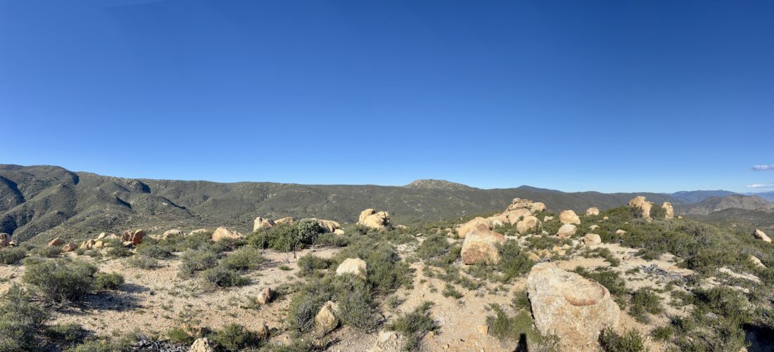
Decided to tackle one of Ted’s remaining peaks on his 100-peak list today. Given his time constraints, Coyote Mountain seemed to fit the bill perfectly. Our drive out had us under overcast skies, but as we dropped down to the desert floor, we left the clouds behind. Unfortunately, not the wind, as it was breezy as we got out of the car. We had the same issue the last time we tried to climb this mountain. The winds were not as strong, and we decided to at least get on the ridge and see how we felt. We crossed the rocky desert floor to the ridge that lay off to the west. As we drew near, we spied some cairns.
Once on the ridge, we could feel the wind, and it was strong enough to move our trekking poles, but nothing beyond that. We decided to continue; however, this was to be a silent climb, as we certainly were not going to be chatting over the wind. The route was almost overmarked with cairns, as well as the fairly well-defined use trail that followed the ridge. For the most part, we kept our heads down to avoid our hats being blown off, and pushed upward. The route goes mostly north, before turning westward to the summit, with a couple of short flat sections. The last time I climbed this peak, I needed to rest from time to time. For this climb, we kept hiking, except to snap a photo here and there.
Bring the Outdoors to Your Inbox
Sign up for our email and stay up to date on my adventures.
We reached the wide, broad summit, found the register and benchmark. I signed us in and opted not to enjoy the can of Coors that was in the ammo box. After a quick snack and various photos, we headed back down as the wind was still blowing and there was nothing on the summit to act as a windscreen.
After a few minutes descending, the winds ceased. Since we no longer had to keep our heads down, we could enjoy the expansive views to our east, and we could have a conversation. Along the way, we met two other hikers taking a short break on their ascent. We chatted for a bit before parting ways. Once at the base of the ridge, we followed more cairns that took us farther east than the route we took on the way in. We passed an old water tank, then finally back onto the road, and then our car. We tossed our gear in and changed into some dry shirts, then drove along the road to inspect a structure near the edge of the dry lake bed. This is a small shack labeled as “The Peace House”, and it was quite interesting. Since it is wildflower season out in the desert, here are the various flowers we spotted along our adventure:
After grabbing some Mexican food in town, we headed home. I logged 5.4 miles, while Ted had us at just under 6. Our total time was 3:43, about 45 minutes faster than my last time. The entire climb was 2,573 feet.
I am an avid peak bagger, sometimes backpacker, and former sea kayaker living in San Diego. I am the co-author of Urban Trails: San Diego, coming in Spring 2026!
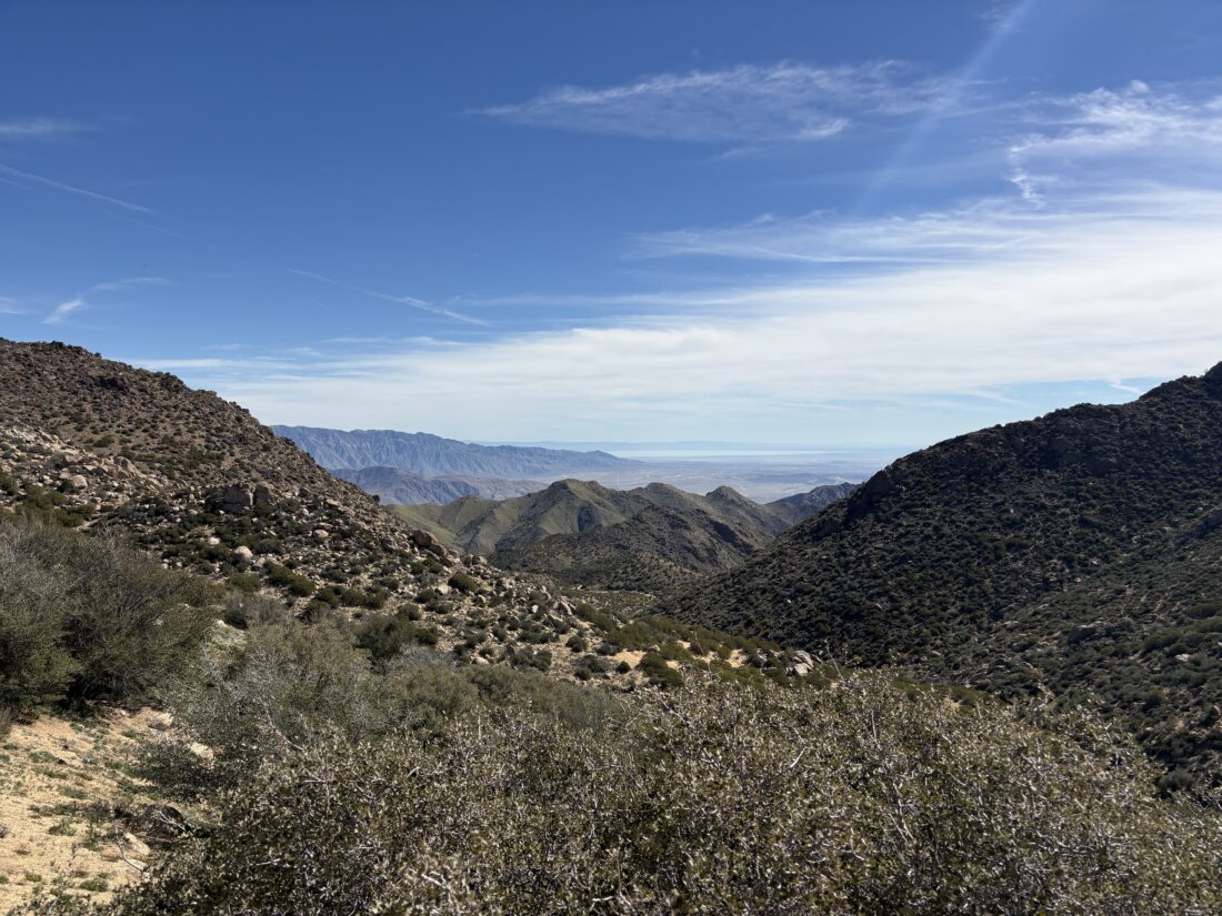
With Ted on call, and Rick and Andrea having climbed Sunset Mountain the day before, I set off alone to summit San Ysidro East Peak. Between the recent trek out to Goat Benchmark and my ascent of The Sirens, this area was quite familiar to me. I wanted to give myself as much time as possible to tackle this peak. I debated which route to take: come all the way up from the desert floor or come from Ranchita? I decided to gamble on the Ranchita route, in part because I knew it would be the route Rick & Andrea would probably take for their attempts at both The Sirens and San Ysidro East. Since I wanted to start as early as possible, I left the house around 4:30, planning to pick up breakfast in Ramona. Unfortunately, that McDonald’s does not open until 6, so Jack in the Box it was. I pulled off the side of Montezuma Valley Road just at the border of Anza-Borrego State Park as the pre-dawn glow was starting to fill the eastern sky. I slipped on my fleece, as it was in the upper 40s. I also put on my headlamp, finished my liter of water, and set off along the fence line. The basic plan was to follow the park boundary line until it was time to turn eastward.
This went well until around White Benchmark. Here, my route forced me to climb through a bouldery and brushy section that I did not want to spend the time or energy doing. I worked my way past it all, but I was now in a foul mood. In the sandy sections, I could see my former footprints in the soil, so I now had less effort to spend on navigation. The flowing water had since dried up in the gully. As I approached where we had veered off to ascend Goat Benchmark, I continued east. The gully turns a bit northward, and I remember from years ago that it becomes filled with dry falls and is no longer the easy route it had been. I stood atop a small hill and surveyed my route to the east. Checking my route against my collection of tracks, I saw I was slightly to the north of them, so I dropped down. This next section has gullies which merge and cross with minimal difficulty, but it does take some care. The first one, I remembered to stay to the north of their merger to avoid the dense brush and trees. I found the game trail across the brushy section and climbed back up the small ridge. Another small gully sits on the other side. The challenge here was the steeper sides, so you had to look for an entry and exit slope to traverse it. Then, one final short climb onto Hellhole Flats.
Bring the Outdoors to Your Inbox
Sign up for our email and stay up to date on my adventures.
With that behind me, I began rethinking my exit. Did I want to have to climb all that again? I have done it three times now and I wasn’t sure. I figured once I was coming back down from San Ysidro East, I would make the call. If I went down to Borrego Springs along the Kay ridge, I would contact Anita and have her come get me (she hates it when I hitchhike), or I would let her know that I am returning the way I came, but I still had time to make that call.
Hellhole Flats cruised by. I dodged and weaved around the plants, aiming to the north of Lookout Knob, then toward the saddle near the northeast corner of the flats. Once there, I found some shade and rested. The day wasn’t too warm, but there was no need to sit under the sun while having some snacks and fluids. Now, for the climb up to San Ysidro East. In just over 3/4 miles, I would gain close to 1,200 feet. I plotted my way up the steep slope, ignoring past tracks and using my best judgment to find my route. For the most part, there weren’t any issues, other than the steepness. The terrain varied from rocky sections to sandy portions to clumps of cacti needing to be avoided. Once near the San Ysidro ridge, I began turning westward toward the summit. The grade eased, but still climbed to the peak. After one last push upward, I was on the summit of San Ysidro East again.
The entire climb from my resting spot to the summit took just over an hour. I snapped some photos and began looking for a nice spot for a much-deserved rest. I actually found a pseudo-cave where I sat down. The coolness of the rock against my back felt great as I ate my lunch and other snacks. I did look around to see if there was a register tucked away, but did not find one. After about 30 minutes, and tending to an issue on my foot, it was time to set off. I soon had to decide on my exit route. Feeling better, both physically and mentally, I opted to retrace my route back to Ranchita. I will say staring across Hellhole Flats and seeing White Benchmark at almost the same elevation did make me question myself.
My route down led me to a small, open area, and I wandered over to the western edge to see if I might take it down, as it would be slightly more direct. In looking over, I had no real idea what lay below me, so I returned to my general path as before. One thing to note on this descent was returning through Hellhole Flats. I worked my way down toward the west, but if I had needed to climb The Sirens, I would have taken a more eastern line and stayed higher to avoid losing unnecessary elevation.
Back on Hellhole Flats, I put on my headphones and listened to an episode of Backpacker Radio about off-trail trips. Talk about timing! Once past the two gullies, I knew the next big effort was about to begin. I methodically plodded upward, often following my own footprints. I would take a few quick breaks to rest before pushing on. Once I could rejoin the gully, I knew the effort level would become easier, and I focused on that microgoal. Back in the gully, I then focused on the turn southward. This isn’t too hard to spot, as the gully does widen, and my footprints helped as well. Now to continue climbing and navigating past White Benchmark. I really did not want to repeat the effort I exerted on my outward route. Once I reached the boundary fence, I hugged it. When the fence ended due to terrain, I opted to take the easier route southward. Technically, I crossed onto private property, but I tried to stay as close as I could to the boundary and, when I could, take the eastern path. Once past the section to the west of White Benchmark, I crossed back on state land and continued southward. The sounds of cars zooming along Montezuma Valley Road started to fill the air as my podcast finished. Back at the car, I changed into a dry shirt, slipped off my gaiters, and let various people know I had made it. I stopped at Don’s Market in Santa Ysabel for some cold drinks. The entire hike was 13.2 miles and took me 9:30 to complete. I have included the elevation profile to help the reader better understand the challenges posed by these peaks. What is interesting is the elevation gain value(s).
App
Elevation Gain
Distance
GaiaGPS
3,616 feet
13.2 miles
Runkeeper
4,241 feet
13.42 miles
CalTopo
4,435 feet
13.44 miles
OnX Backcountry
4,738 feet
13.4 miles
Strava
4,518 feet
13.43 miles
Quite the mystery as to the differences in elevation gain. I might have to dig deeper into how each platform calculates its value.
Now for my opinion on the route options to climb San Ysidro East and The Sirens. I think I would rather make one solid climb from the desert floor. The section around White Benchmark is less than pleasant, and the section leaving Hellhole Flats on the return is also quite taxing. My times to about the same point (junction between the peaks) were both around 3:30 elapsed time, but I find the straightforward nature of just climbing the ridge “easier”. While it is a steep ascent and descent along the ridge, not having to deal with the terrain when leaving Hellhole Flats and returning to Ranchita is a plus.
I am an avid peak bagger, sometimes backpacker, and former sea kayaker living in San Diego. I am the co-author of Urban Trails: San Diego, coming in Spring 2026!
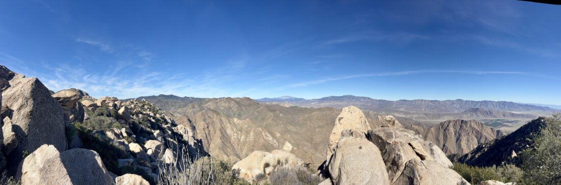
Rick and Andrea decided to hike up to Kay Benchmark, and I decided to tag along and continue toward The Sirens and/or San Ysidro East Peak. At least that was the original plan. I got to the Anza-Borrego Visitor Center and waited for the rangers to open the gate. While waiting, I got a text from Rick that they were running late and I should go ahead and start. The rangers finally arrived at 7:20 to unlock the gate. I quickly paid my day-use fee and parked, then grabbed my gear and set off for the ridgeline. I cruised up the ridge toward Ode Benchmark. Once there, I quickly signed the register and snapped a few photos. From there, I began the steep climb up to Kay Benchmark. From time to time, I would glance back to see if I could spy Rick and Andrea. I could see their car parked next to mine. I got through the bouldery section near Kay without any real issues. Once at Kay, I took a short break and scanned my next section. I was going to follow Greg’s descent route to reach the saddle between The Sirens and San Ysidro East.
The route-finding went fairly smoothly, and soon I was closing in on the saddle. While my route was a bit higher than Greg’s, it was still 1000x better than the route I took down back in 2020. Now at the saddle, I had to decide which peak to attempt first. I decided to go for The Sirens because it was “easier” and I was mindful of the time. With that in mind, I opted to head for The Sirens. I turned southward and roughly followed the contour line to its base. Once there, I recalled that the best way up its very steep and rocky slope was to approach it from the western side. I found the slab section I scaled that last time, and followed it up. At the summit, I got a message from Rick that they had just reached Kay, almost due east of me. In fact, we did shout at each other from our respective summits, but nothing intelligible. As I ate my PB&J and drank some electrolytes, I learned that part of the reason I did not see them on the ridge was that they ascended from the small saddle just west of Ode. While we were texting, they offered to pick me up in Ranchita if I wanted. I debated this for a bit and decided to go that way. I knew I wouldn’t have time to climb San Ysidro East, so this would at least give me some insight into my options for my return.
Bring the Outdoors to Your Inbox
Sign up for our email and stay up to date on my adventures.
After signing the register, I found an alternate path down from the peak and headed back to the saddle to drop down into Hellhole Flats. Once down, mostly following a small drainage path, I cruised along, aiming for the north of Lookout Knob. As I drew near the western edge of the flats, I again worked my way down through some rockier sections until I reached another drainage. I followed it to where it met with the drainage from the west, as that was the one we used when we recently climbed Goat Benchmark. But here, where they met, the brush was too dense, so I headed back north along that drainage for a short bit, then exited and continued westward.
Now, I began the climb out of Hellhole Flats. For the most part, I stayed hiking westward, skipping the detour to Goat Benchmark. I snacked a few times to keep my energy up, as this is still a modest climb. Soon, very familiar terrain came into view, including some recent footprints. The water was still flowing in that one section of the drainage, and there was even a thin sheet of ice next to it. Once I turned southward and was more exposed, I donned my wind shell, as a cool wind was blowing! One of the sections that I disliked last time was the section passing White Benchmark. This time, I decided to see if it was easier to just try to stay along the fence line as best as possible. While I might have drifted off the state park land, I never crossed the fence itself; this was the right choice for this section. I continued along the fence line until I reached the road, and Rick and Andrea were waiting for me. We had been texting back and forth, and they had only arrived about 15 minutes earlier. They then kindly shuttled me back to my car. Now for the big question: which route is better?
Since I need to return to climb San Ysidro East, I have to decide which route to take. Both routes have pros and cons. Honestly, I don’t know which way I will take. It probably depends on whether I am hiking it solo or with some friends, and whether they need a peak along the way. The upside is that I am now familiar with both options.
I am an avid peak bagger, sometimes backpacker, and former sea kayaker living in San Diego. I am the co-author of Urban Trails: San Diego, coming in Spring 2026!
The plan was to hike out to Goat Benchmark with Rick & Andrea, and if I was feeling up to it, I might push on to The Sirens and San Ysidro East. With the access closure from Lease Road, the only real option for us to hike to Goat Benchmark was to start from Montezuma Valley Road. I had hiked portions of this route, as far north as White Benchmark, but not between that point and the route I had taken before on my trips into Hellhole Flats. I arrived a bit early and saw the sunrise was really putting on a show, so I continued past our meeting point and drove farther along Montezuma Valley Road to a couple of turnouts to capture it. What a sight!
We were meeting at 7, so I turned around safely and met them at the fence line of Anza-Borrego State Park. The general plan was to head north, following the fence line (and the terrain), then link up with the gully descending toward Hellhole Flats. I was almost over a cold, so I wasn’t sure I had the energy to make the whole trek, but I carried enough to do so. At a minimum, I would have eyes on that new section that I would have to traverse at least once more with Ted to hike up to San Ysidro Peak. The recent rains made the ground a bit soft and damp. The brush was low, so our pants should remain dry. This new route adds about 1.5 miles to the junction of the routes and about 1,000 feet. We worked our way northward, following small use trails and trying to avoid unnecessary climbs. As we approached White, the route options became more complex, with more boulders and steep sections to contend with. We tried to follow the contour lines, but eventually opted to head up toward White Benchmark and a gap to its north. In hindsight, I think it would have been easier just to follow the slope south toward White, then cut across near the summit to that gap. That is what I did upon my return, and that is the better route.
After passing White, we tried to stay on the east side to avoid the property line. A small bump sits just to the north of White, and we found ourselves unable to continue. We debated heading straight east and down a steep slope, then up toward Goat from there, but we opted to try the west side and hug the property line. After a couple of downs and ups across some minor gullies, we turned onto one that would eventually link with the gully that I have used in the past. Once in it, we cruised along. At one point, we had a bit of flowing water that appeared briefly, then faded back underground. I kept a mindful eye for the turn off to Goat. I spotted a familiar landmark, just a small bump, and knew we were getting close. One thing I remember about Goat is that it is not the pile of rocks you think it is, nor the next one… Once there, we took a short break, and I pulled out my wind shell, as it was chilly and breezy. We had been adding and removing layers throughout the hike. We signed the register and snapped a photo of the benchmark. Rick and Andrea were hoping to continue and make it to Webo. I kept debating about my options. I had broken down the various sections for my attempts, and it seemed too much, as we had lost some time on the way out. Plus, the weather was supposed to worsen in the afternoon. I made the call that I was going to retrace our route. I then suggested, since they would be at Webo, why not just take the ridge down rather than slog back the way we came? I could drive down to the parking area and shuttle them back. So, that became the new plan. I gave them a few navigational pointers, and we parted ways.
I found some nice use trails to return me to the main gully, then to the side gully to begin my journey south. I was able to follow our route in with no issues. As I approached White, my right knee began to ache. Not sure if it was cold, or overused, but I was not happy. I wondered if the soft terrain had put some stress on it… Since I was so close to White, I opted to climb it formally. As I mentioned earlier, our route out almost took us to its summit. I climbed the rocks to the top, and then took a quick break for a PB&J. Both Rick and I had cell coverage, and they were atop Webo hunting for the benchmark and the register. They found the benchmark, but the register could not be located. The same was true for me. I could see a pile of rocks on top where one might have been, but no more. I did not look that hard to see if it had been relocated. I then headed southward, not following any particular track, letting the terrain guide me. Since my knee was hurting, I skipped climbing some of the other benchmarks scattered along the way. It had gotten colder and windier, so I was wearing all my layers. Ignoring my knee, I suspected I made the right call to not stay out longer.
Back at the car, I changed and drove on down to Borrego Springs. I grabbed a cold soda from the market and played on my phone a bit while I waited. I got a check-in message from Rick, and eventually made my way over to the parking lot for Hellhole Canyon. I relaxed for a bit until I spotted two tired but happy hikers emerging from along the trail. They tossed their gear in the back, and we made the drive back up to Ranchita. As we drew near where we started from, rain was falling! Boy, did we all make the right choice. It would have sucked hiking back in that! I tracked my hike at 8.3 miles over 6:15 with 2,087 feet of gain.
I am an avid peak bagger, sometimes backpacker, and former sea kayaker living in San Diego. I am the co-author of Urban Trails: San Diego, coming in Spring 2026!
In August 2023, Hurricane Hillary caused significant damage in portions of Southern California. In Anza-Borrego, one of the lasting impacts of that storm has been the closure of the road to Sheep Canyon. While the road would close seasonally during the summer to protect the Big Horn Sheep, since 2023, it has remained closed to all vehicles. The primary issue is that Coyote Creek was rerouted onto the road near the Third Crossing. This closure has made climbing five of the peaks on the San Diego Sierra Club list even more challenging, as if those five weren’t hard enough. With some weather in the forecast, and me getting over a slight cold, I decided to hike out to the Sheep Canyon Primitive Campsite and get a sense of what the hike out to the trailhead for three of these peaks would be like. As I drove through Ramona and Santa Ysabel, I could feel the wind blowing against my car, and I wondered if I might have issues down in the desert. Thankfully, as I made a quick stop at Christmas Circle in Borrego Springs, the winds were calm as the sun rose between the clouds. I then drove north until the pavement ended and continued on the very well-groomed dirt road. One challenge of reaching the closure point is that there are two crossings of Coyote Creek. The first crossing was minor, but the second one was a bit more intimidating; the Outback fjorded it without issue. I parked next to the closed gate and gathered my gear.
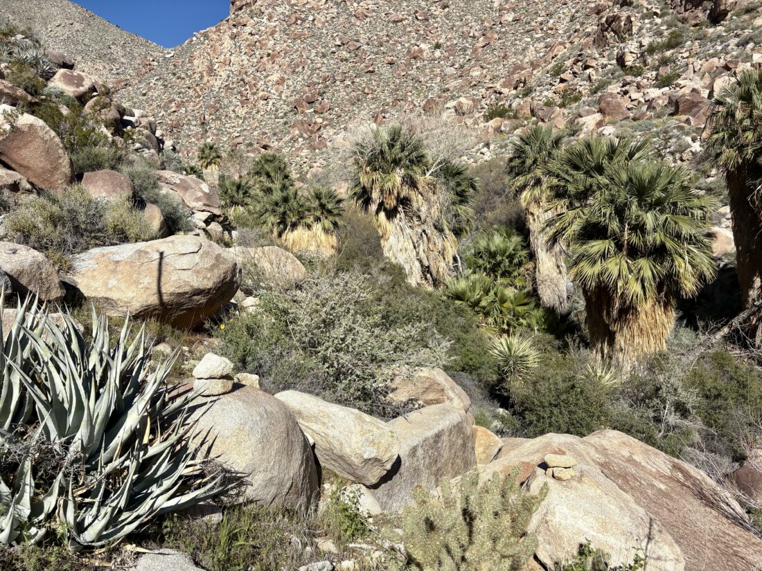
I enjoyed the sounds of the flowing water as I carefully worked my way along its banks toward dry ground. The water was flowing right down the road, its original channel, just to the west. I continued on, following a well-defined trail and collection of footprints. After navigating another couple of wet sections, I came to the infamous “Boulder Alley”. I remember climbing up this in Greg Gerlach’s truck, wondering if the Outback could safely handle it. I could see the storm damage, but nothing a little grading couldn’t repair. Once over this hill, Collins Valley lay before me, along with my first views of Square Top, Palm & Elder, and Collins Benchmarks. Knob lay hidden behind Palm & Elder. The road was in fine shape, and I made great time. I came to the junction of the Santa Catarina Marker and opted to visit it upon my return. After another 0.6 miles or so, I came to another intersection, this one for the Sheep Canyon Trail. I had seen this marked on my maps, so I opted to give it a go. The route was incredibly well blazed, makers clearly guiding you across the desert floor (the footprints also helped). Eventually, it rejoined the road and continued westward toward Sheep Canyon. The road turned southward and crossed a wide wash; there it split. The road continued southward toward Cougar & Indian Canyons, a place I have been meaning to explore, or westward to the Sheep Canyon Primitive Campground. I stuck to my primary objective. I wandered the various campsite, fire rings, picnic tables, and even a couple of pit toilets. I stared at the bouldery face that I climbed to reach Palm and Elder to my north, and the ridgeline I followed when I summited Square Top, while enjoying a well-earned snack.
As I headed back, I began thinking about how we might shuttle our water cache, and maybe some firewood? At the junction with the Sheep Canyon Trail and the road, I opted to take the road this time. Here, I hiked across softer sand than I had underfoot on the trail. When I reached the junction for the historical marker, I took the short detour to view it. It offers a nice view of the Lower Willows area. You can see the palms and other plant life growing along the creek. I hiked back down Boulder Alley, enjoying the podcast I had been listening to. Before too long, I was back along the flowing waters of Coyote Creek and then to my car. After again making the two water crossings in the Outback, I headed home.
The entire hike was 8.7 miles, in 3:10, with 689 feet of gain. The scouting trip was an overall success. I don’t see any issues, hiking out to Sheep Canyon, camping for the night, then tackling Square Top or Palm & Elder Benchmark. For Collins and Knob Benchmark, I would like to explore setting up our base camp in Salvador Canyon.
I am an avid peak bagger, sometimes backpacker, and former sea kayaker living in San Diego. I am the co-author of Urban Trails: San Diego, coming in Spring 2026!
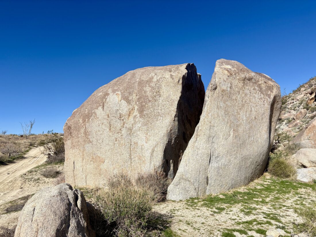
I drove to the end of Pinyon Wash and parked, finding one other car there when we arrived. Jeremy and I gathered our gear and set off. The plan was to hike down to Split Rock and try to find any of the pictographs. Our adventure began with a bit of scrambling over some rocks before exiting into a nice wash. Jeremy had never done any desert hiking, so this was a new experience for him. The wash worked its way through the canyon before opening into a vast open expanse. We continued southward, finally exiting the state wilderness and onto the road. We heard the sounds of a motorcycle, but never saw it. Whale Peak loomed over us to the southwest.
After our route turned eastward, we found some rocks to take a short snack break. A light breeze kept the day pleasant. Before too long, Split Rock came into view. We had passed one set of morteros along the way, but found many more here. A truck was parked nearby, but we never saw the owner. I scanned the rock for any pictographs and wandered the hillside as well. I came up empty. Our route was basically a lollipop, and this was the top of the lollipop, so we began our arc back toward the stem.
The wash we were now following was a bit narrower, so we had to navigate around some vegetation from time to time. After about a mile, we left the wash and began hiking across the open desert. More “firsts” for Jeremy. We would weave around the agave and other plants, following a generally northwesterly course for about 1.75 miles, until we met back at the point where we had exited from the canyon at the start of this journey.
When we reached the boulders at the beginning of the hike, I decided to take the east side to see if there might be an easier path down. While it initially seemed easier, we found a few drops that took a bit of care to descend. I managed to get Jeremy down safely. Once back at the car, we drove back to the highway and into Borrego Springs for some tacos. We did stop to view the latest sculptures, a rattlesnake and a roadrunner. Now properly fueled, we headed home, but did stop for a pint of cider at Calico Cidery.
I am an avid peak bagger, sometimes backpacker, and former sea kayaker living in San Diego. I am the co-author of Urban Trails: San Diego, coming in Spring 2026!