Originally, I had a permit to hike the Yosemite High Sierra Camp loop in July, but my summer plans changed, and I could no longer go due to classes. Thankfully, I was able to score one during my break between them. I drove up to Lee Vining, checked into my room, then made my way to the Whoa Nellie Deli for some fish tacos. Afterward, I watched the sun fade over Mono Lake. The next morning, I grabbed breakfast at Nicely’s, then checked out and grabbed a turkey sandwich for later. The drive up over Tioga Pass is always stunning. Bits of snow clung to the tops of some of the peaks. I pulled into the parking lot at the Wilderness permit station and quickly got my permit. The plan was to camp at each of the five High Sierra Camps; the ranger did caution me that the mosquitoes were bad at Sunrise and Vogelsang. I shouldered my pack and set off. Since I had hiked this section last year, I had less anxiety about what lay ahead.
As I reached the parking lot for Lambert Dome, some PCT hikers were looking for a hitch down the road. I inquired about how Glen Pass was, and they confirmed that it was not too bad, but you needed to tackle it early before it became slushy. I wished them well on their journey and continued on.
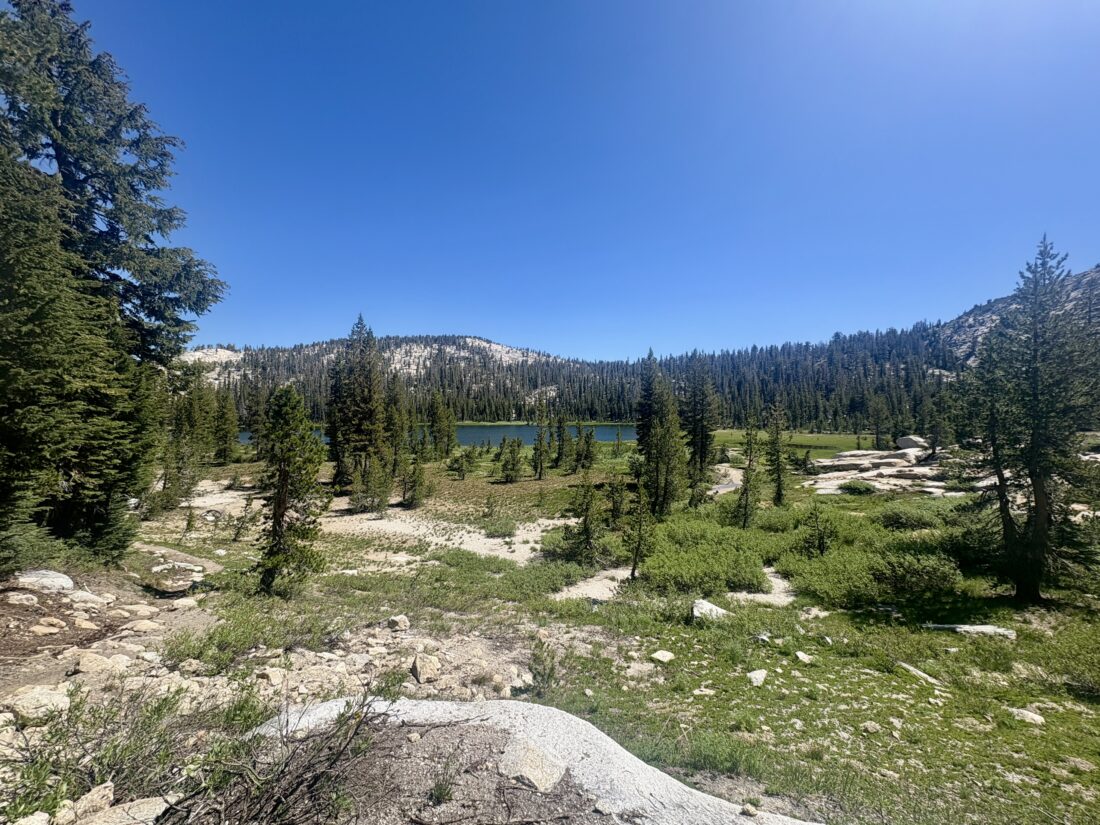
The hike down to Glen Aulin is pretty mellow, as it mostly follows the Tuolumne River. I stopped at Soda Springs, then at Parsons Lodge. Crews were doing some trail work nearby, and I thanked them for their efforts. From time to time, hikers passed me as they headed back to the meadow. After crossing the first bridge, I took a short snack break, watching the water flow by.
The trail worked its way past a few small waterfalls before finally reaching the bridge that would cross back across the Tuolumne and into Glen Aulin. I decided to see if the site I used last time was open, and it was. A couple from Florida was nearby, but I was respectfully far enough away. After setting up my tent, I ate that sandwich, then stored my pack in one of the lockers. For the afternoon, I relaxed and, after a short nap, wandered down to enjoy the views. A PCT thru-hiker joined me and a couple from Florida on the ledge and set up camp. He went by Casper and finally realized his dream of hiking the whole trail. Dinner was a Chili Mac meal, but I brought some homemade cornbread to have with it. With a full stomach, I turned in, knowing I had a modest climb tomorrow to the next camp.
I awoke around dawn and enjoyed breakfast before packing up. Crossing back over the Tuolumne, almost all of today’s hike would be a steady climb up to May Lake. Again, with less anxiety about the trail, I kept it at a more mellow pace. Some of the smaller streams were almost dry, but I still had a few stream crossings to make. I met another hiker making their way from May Lake. We chatted for a bit, and she confirmed that the bugs at Sunrise were awful, and some hikers actually left due to the mosquitoes. Great, not the news I wanted to hear. We wished each other well on our respective hikes.
I took a snack break at the same spot as last time, just being mindful not to lose my tripod this time. The trail becomes a bit more exposed, so that early start helped. I focused on my pace as the climb also became steeper. Before too long, I spied May Lake peeking through the trees. To my amazement, there were workers reassembling the actual camp! I wondered if they were going to reopen just this one or more? There were several large groups set up, so I scouted around for a spot that would give me a little space. Once set up, I enjoyed the area again. The bugs were minimal, so I could really just relax. The deeper question in my mind was the bugs at Sunrise (and the climb up to it). There actually is cell service here, so I let Anita know I might change plans and would keep her posted.
For dinner, I had Chicken Tikka Masala from Bowl and Kettle. They had sent me some of their meals to enjoy on this trek. I had this one before and could not wait to dive in. I also packed in some naan from Trader Joe’s to have with it. As I ate my meal, the sun slowly retreated behind Mt. Hoffman. After a hard day, I turned in and began debating my options for tomorrow.
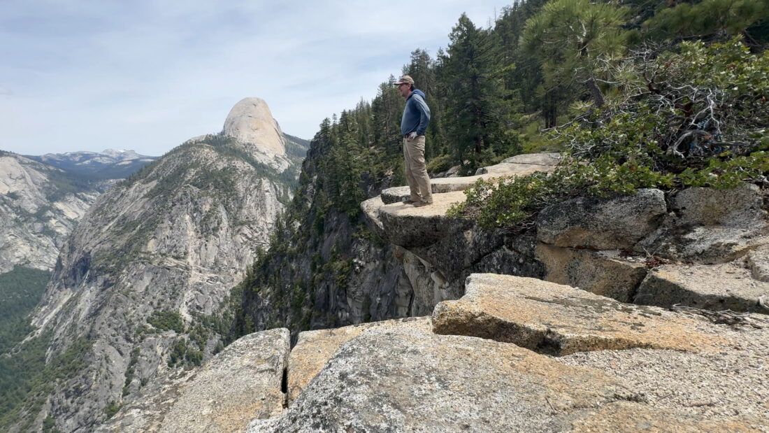
I awoke again before dawn and quickly packed up. I decided to skip breakfast and just have a bar and some electrolytes before heading down to Tenya Lake. The early morning sun shone on Half Dome to the west. Once I reached the May Lake Trailhead, I dumped some trash before continuing on.
Bring the Outdoors to Your Inbox
Sign up for our email and stay up to date on my adventures.
Once at Tenya Lake and the Sunrise Trailhead, I took a break and made breakfast. The parking lot was pretty full, as this trailhead is the one to Clouds Rest, a hike I have on my list. The trail stayed mellow for a while. Fresh bear scat was on the trail. I took a photo to denote the location for the rangers. Soon, the trail would begin its climb to Sunrise Lake. Even being very mindful of my pace, I actually caught some day hikers. At the trail junction for Clouds Rest, I took a snack break. Those day hikers caught back up, and some continued on to what I have heard is one of the most epic views in the park, while one pair headed on to the lake for some fishing.
I reached the first lake, and it was another stunning sight. After carefully crossing the outflow, I continued past the other two lakes before the last small climb. One tiny patch of snow remained on the trail just before I began my descent toward Sunrise HSC. I had chatted with some of the hikers passing in the other direction, and they validated the intensity of the bugs.
I crossed over a small stream to be rewarded with an incredible vista of the meadow and snow-capped mountains beyond. At a minimum, I knew this would be an outstanding lunch spot. As I ate, I debated whether to continue down to Merced HSC or hop on the John Muir Trail past Cathedral Lakes back to Tuolumne. Since the mosquitoes weren’t too bad at the moment, I found a nice site and made camp. It was just too beautiful not to try to stay. Plus, the lockers and pit toilet weren’t too far away. I slipped into my tent for a nap. When I awoke, there were certainly more mosquitoes buzzing around my tent. I ventured out to see the actual HSC and refill my water bottles.
I dove back into my tent, killing a few that snuck in. I slipped on my headphones and began catching up on some podcasts. Maybe I should have pushed on to Merced HSC? But it was a bit too late in the day to hike the 10 miles, plus I also heard it wasn’t exactly bug-free either. If I had had some company, it might have been easier to pass the time. For dinner, I had another meal from Bowl and Kettle, this time their Sweet Corn Grits. More mosquitoes were now buzzing about, so I ate in the tent. While I might have southern roots, grits were never my thing, but this dinner rocked!
I was glad I had downloaded some Netflix to watch as the sun slowly set. After another quick run to refresh my water and store my gear in the locker, I waited for the sun to dip behind the trees before turning in. A quarter moon was up and shining bright. I had to slip my beanie down to block the light. I still wasn’t sure about tomorrow’s adventure, so for now I just enjoyed the moment.
I awoke before dawn, in part to pack up before the mosquitoes came out. I took a moment to make breakfast and relish in the view. I finished packing, topped off my water, and set off. I had decided to exit. Spending the afternoon trapped in my tent was not my idea of fun at the next two sites.
Frost covered the meadow as I headed northward. While I had about 10 miles to get back to the car, it was mostly going to be downhill, except for a small climb over Cathedral Pass. The imposing Columbia Finger stood towering before me. Once over the pass, I soon passed Cathedral Lakes. The mosquitoes were back out, and other backpackers passed, some with bug nets on. I had mine ready just in case. Since the trail was mellow, I enjoyed my snack on the go to avoid being swarmed.
Once past the lake, I started passing more day hikers coming to enjoy it. As the miles slipped past, I reflected on the past four days and was pleased with the adventure. Once back at the meadow, I headed to the store and grabbed a soda. I sat on the bench out front, watching the various PCT hikers milling about. Some repacked their resupply boxes, while others were enjoying a breakfast burrito. I still had a long drive home, so I did not linger any longer.
Back at the car, I tossed my pack in the back and changed into some fresh clothes before setting off. I hit Copper Top BBQ in Big Pine for lunch and Erick Schat’s Bakkerÿ for some bread. All told, even with the mosquitoes, this was still a fantastic four days exploring Yosemite. Maybe I can grab another permit once the bugs are less of a problem and do a point-to-point hike from Tuolumne to Vogelsang, then to Merced, and finally to the Valley. Just need a shuttle bus running or another way to get back.
I am an avid peak bagger, sometimes backpacker, and former sea kayaker living in San Diego. I am the co-author of Urban Trails: San Diego, available now!
In 2019, I became the third person to complete the San Diego 100 Peak Challenge. Not stopping with that accomplishment, I set my sights on the harder San Diego Sierra Club 100 Peak list, which I completed in 2021. In addition, I have conquered several Six-Pack of Peaks challenges (SoCal, San Diego, Central Coast, and both the Arizona-Winter and Arizona-Summer).
I am looking forward to exploring new summits and new adventures across the southwest.