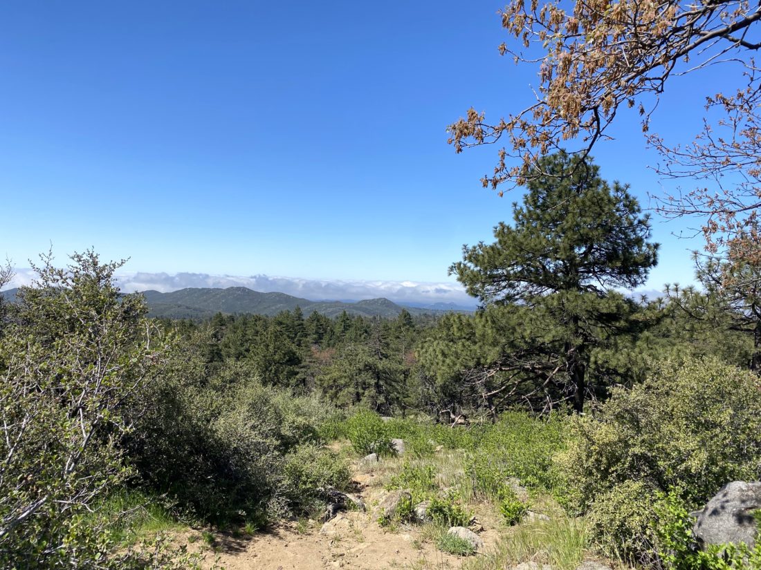
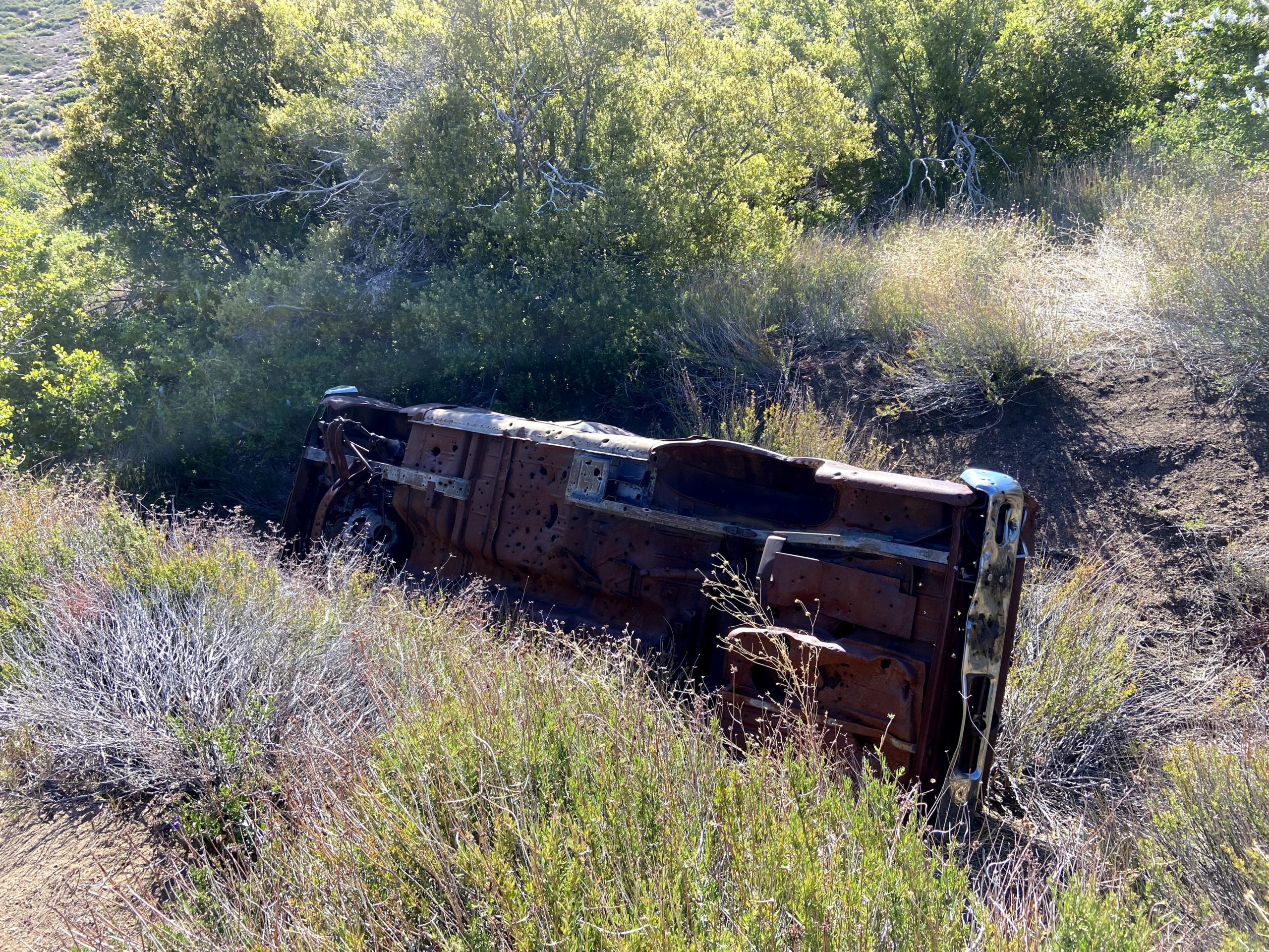
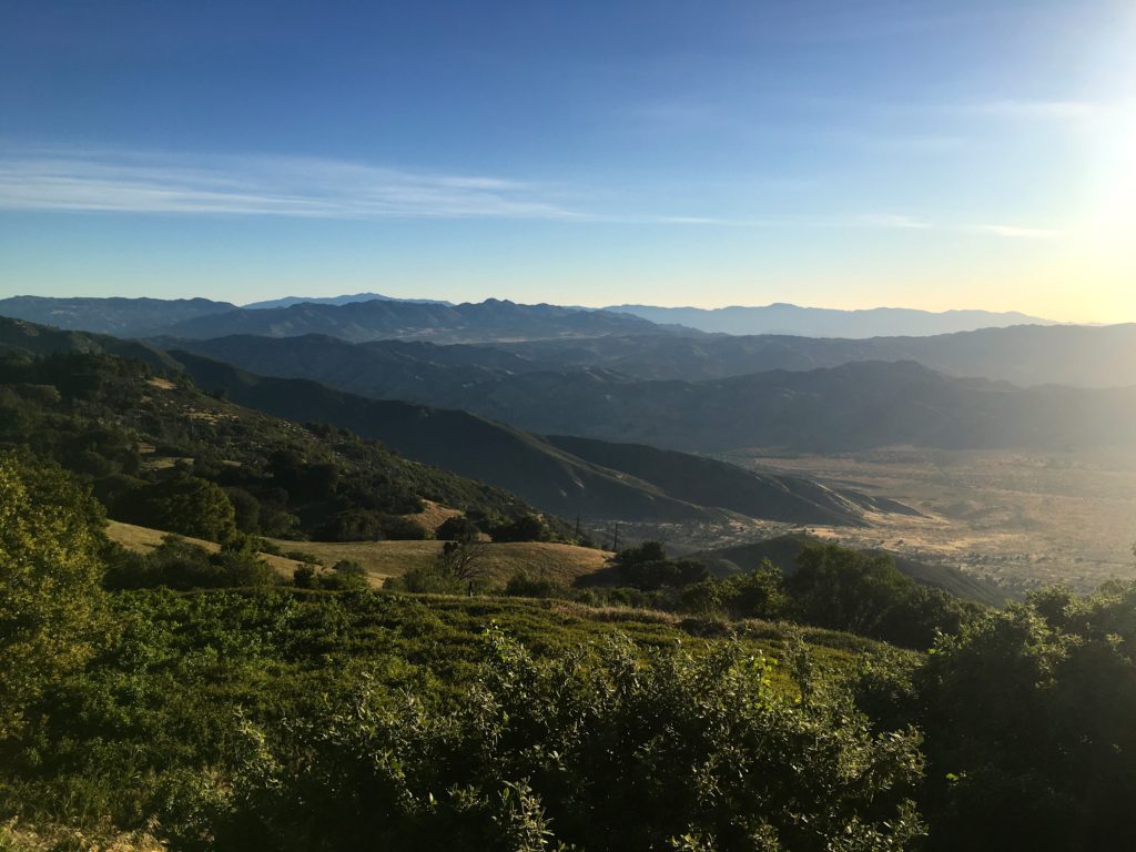
Since I was the hiking consultant for my synagogue’s Stepping Into Israel hiking challenge, I figured I should hike some of my recommendations. One of the hikes I recommended was the Wooded Hill Nature Trail. I have hiked this 1.5-mile loop twice before, but decided to do it once again. As I drove out to the trailhead, the marine layer was so thick that it was actually raining during my drive out. Just past Alpine, I broke through the clouds into a wonderfully sunny day. I pulled into the trailhead, grabbed my gear, and set off. Some remaining wildflowers still lined the edges of the trail.
It was nice to hike this trail on fresh legs. The previous times I had done this hike were after a full day of hiking. As I made my way up the hill, I heard the sounds of a woodpecker. After cresting the summit, I once again encountered mountain bikers on this trail. Wish they would enforce the rules sometimes. Once back at my car, I headed back into town for my second hike of the day.
I am an avid peak bagger, sometimes backpacker, and former sea kayaker living in San Diego. I am the co-author of Urban Trails: San Diego, coming in Spring 2026!
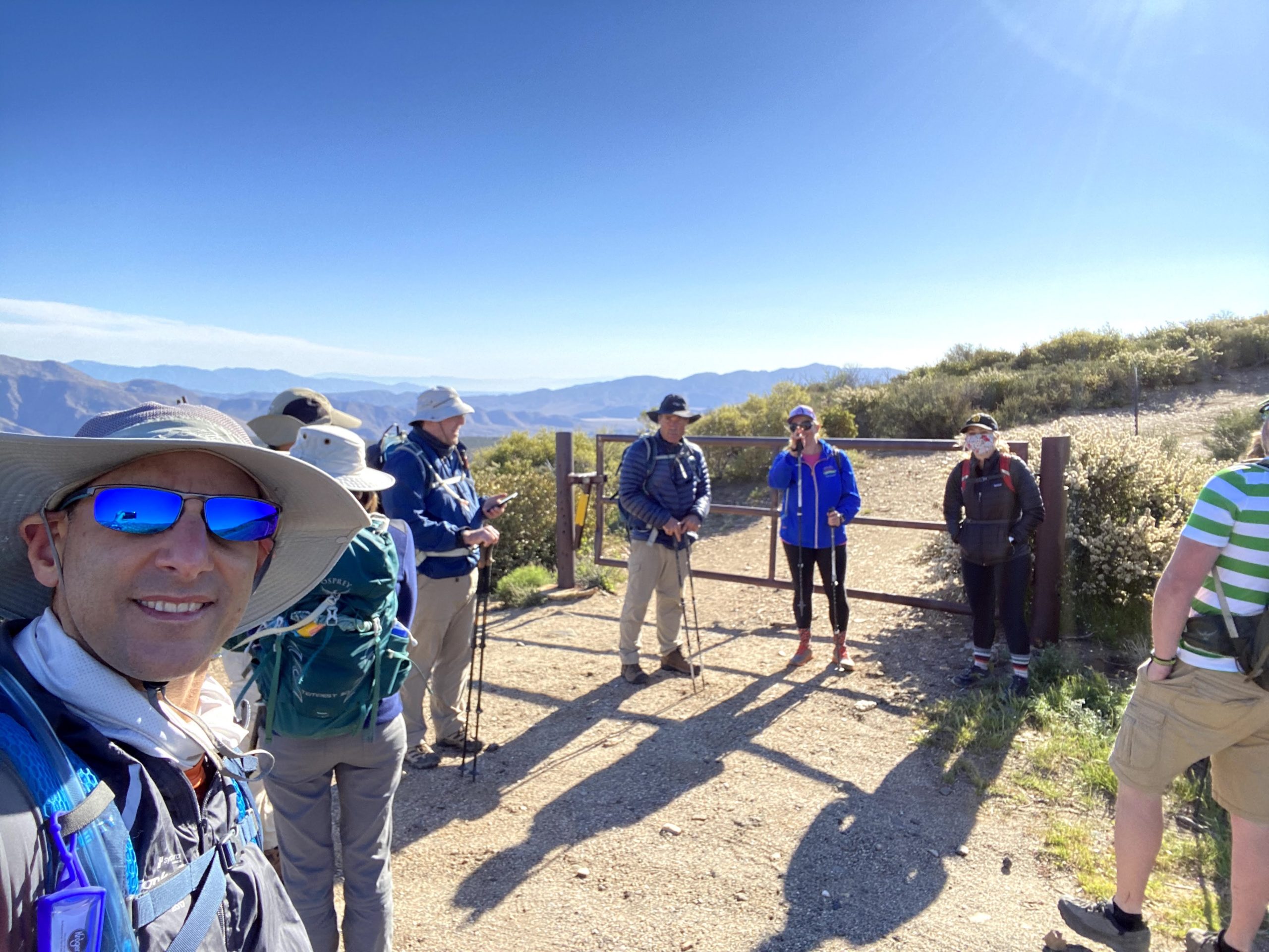
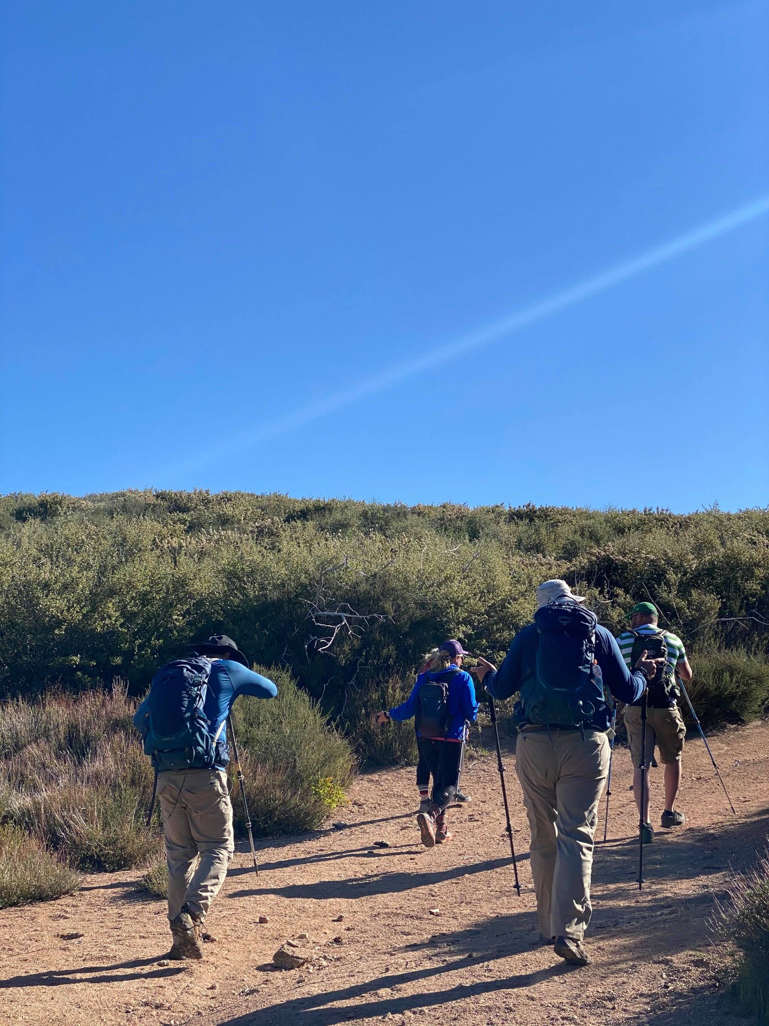
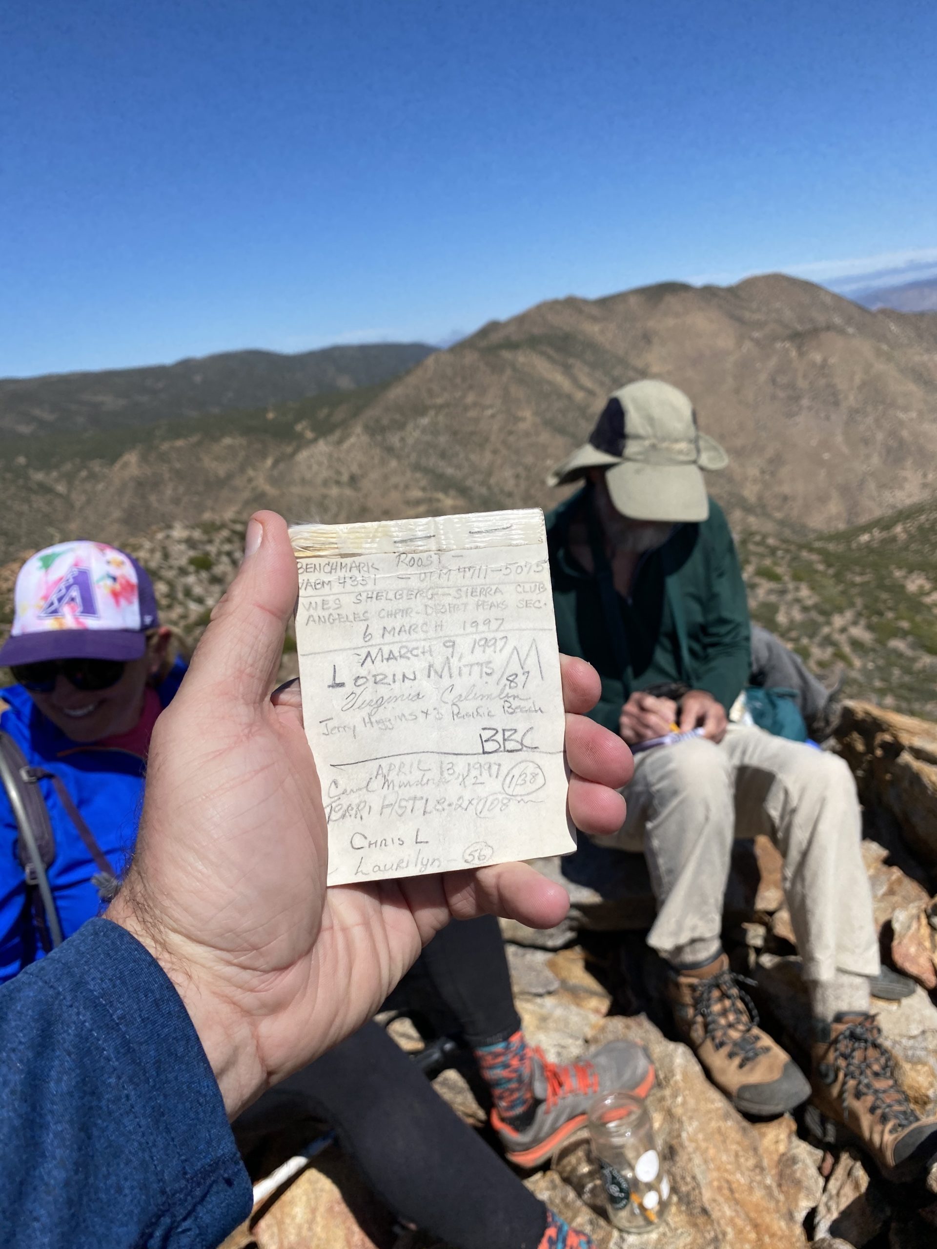
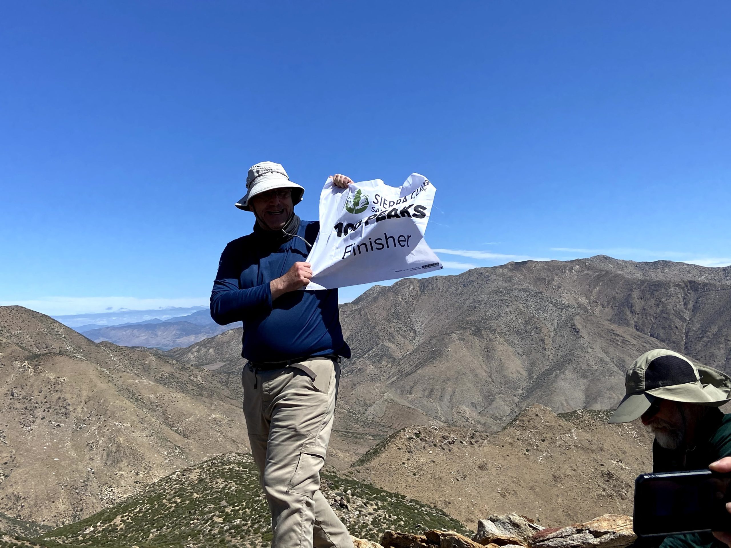
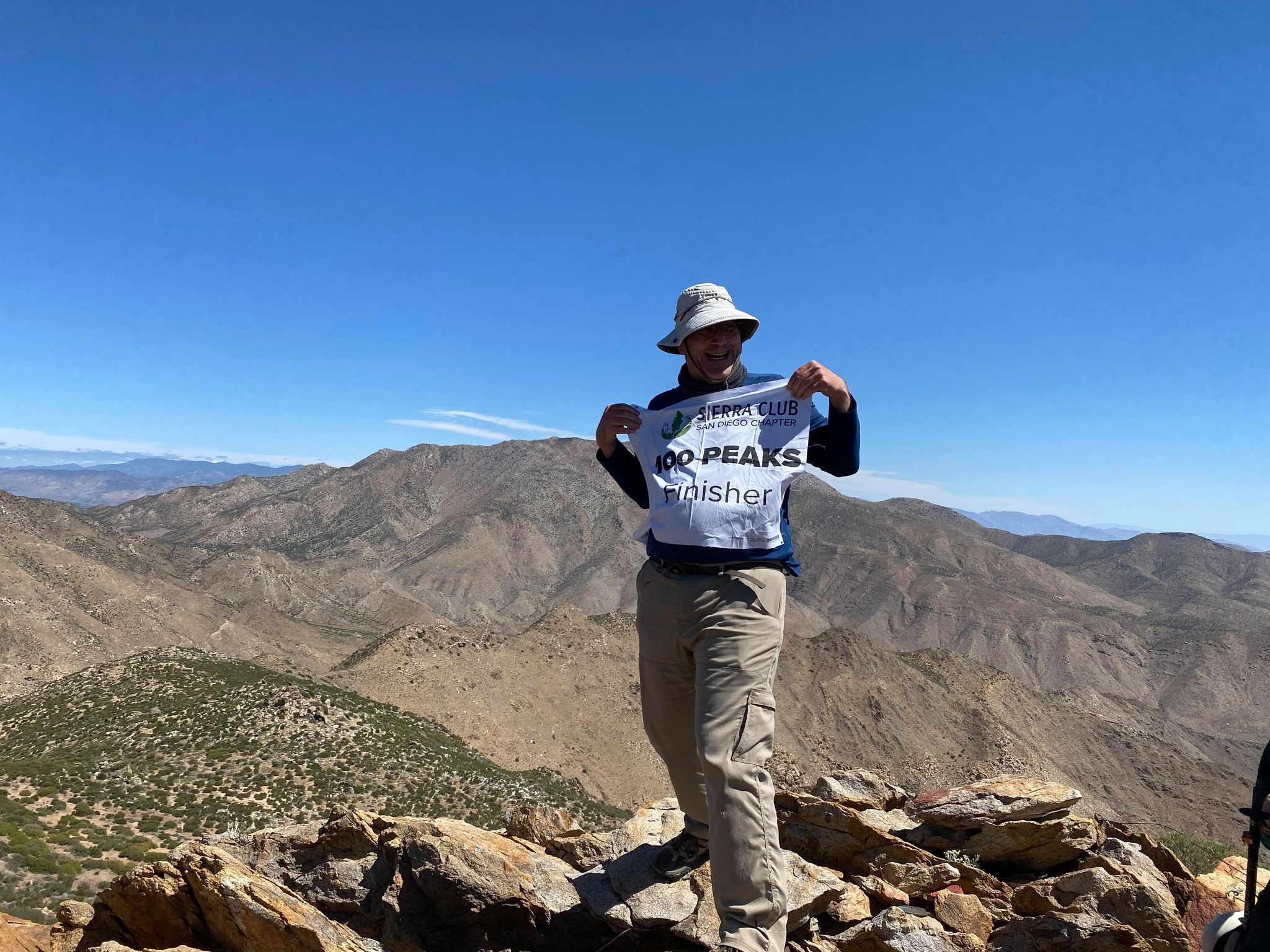
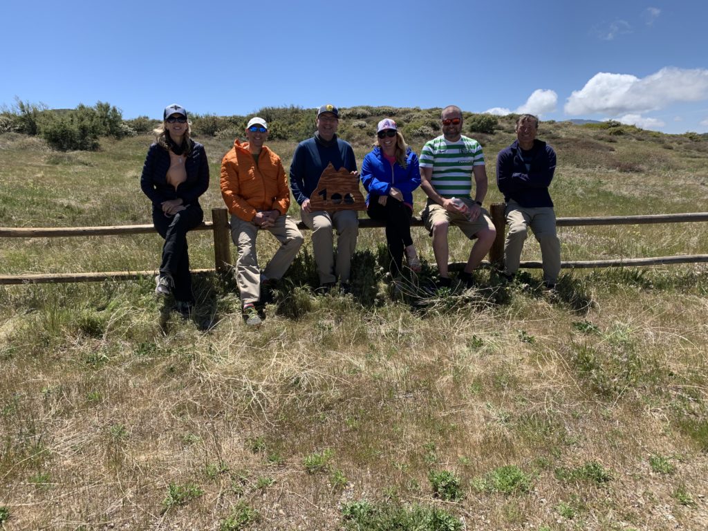
It is hard to comprehend that this summit would mark my completion of the San Diego Sierra Club 100 Peak List. For this milestone hike, I invited several of my hiking companions to accompany me. We met at the Pacific Crest Trail – Sunrise Trailhead at 8 am to condense down to fewer cars, as the actual parking area at the Lucky S Ranch is limited. After driving a couple of miles down the road, a group of mountain bikers had taken most of the available spots, but we were able to squeeze our cars into the area and still allow access to the ranch. We gathered in front of the gate to the old road that we would follow for a while. We discussed if we were going to add Oriflamme Mountain to the hike, and the consensus was to skip it. With that, Ted Markus, Greg Gerlach, Gina Norte, Matt Hanan, Larry Edmonds, Leslie Williams, Susie Kara, and Susie’s friend Jackie set off down the road.
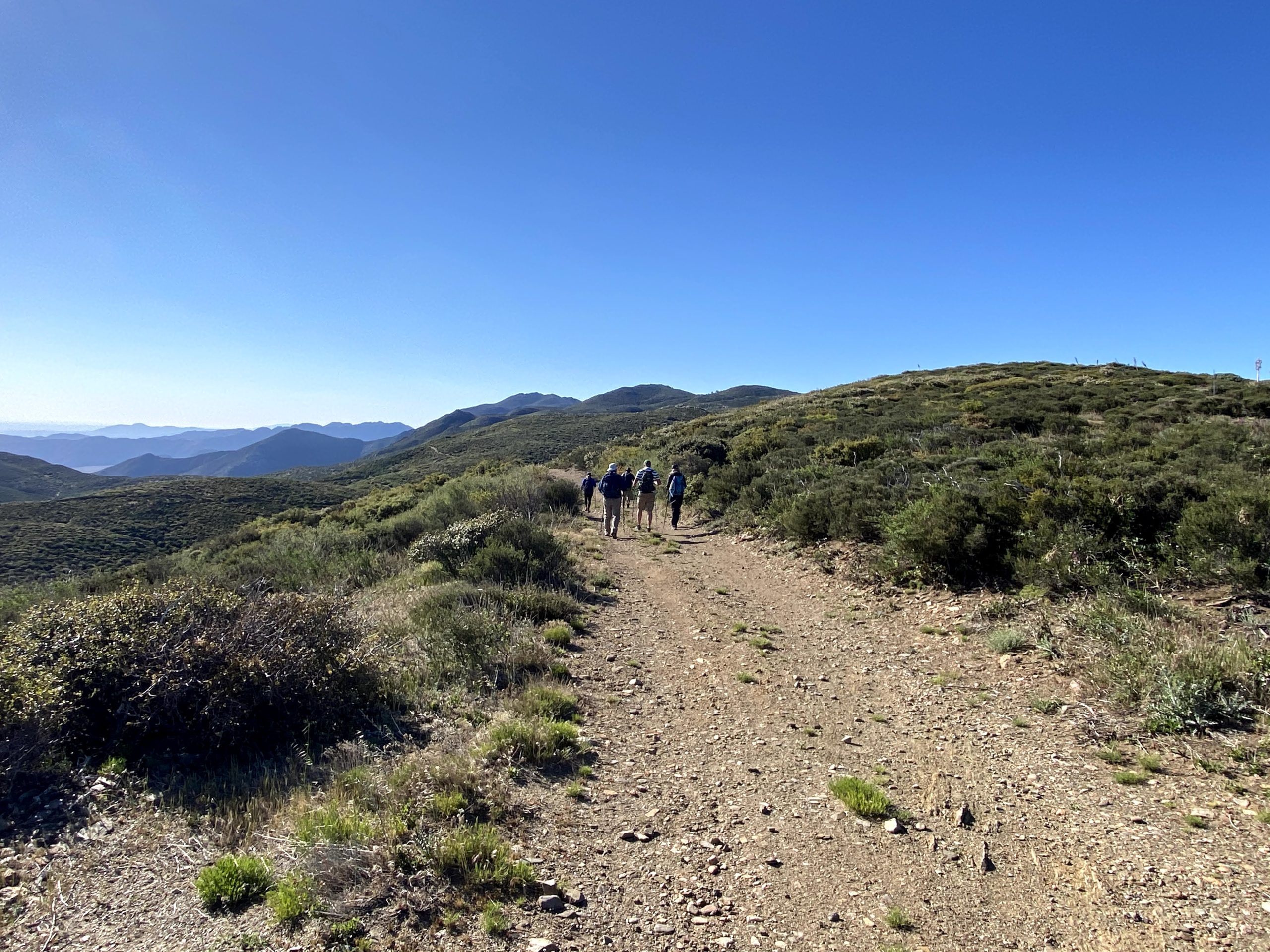
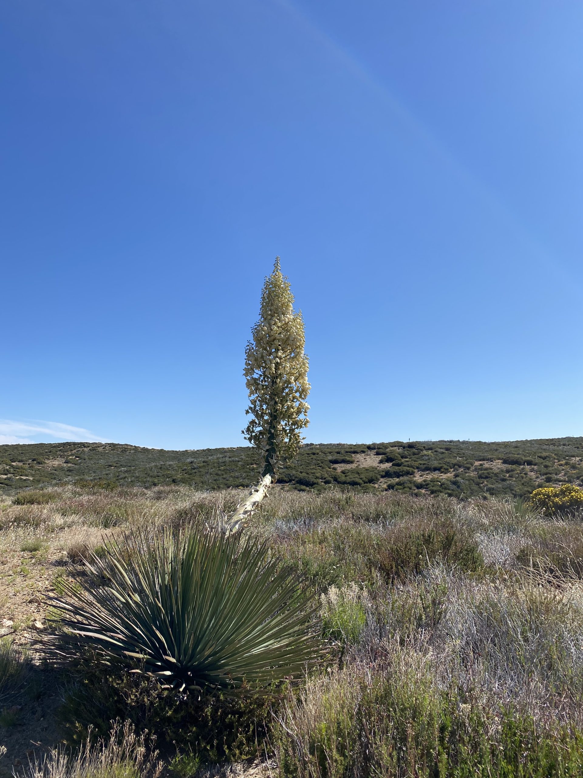
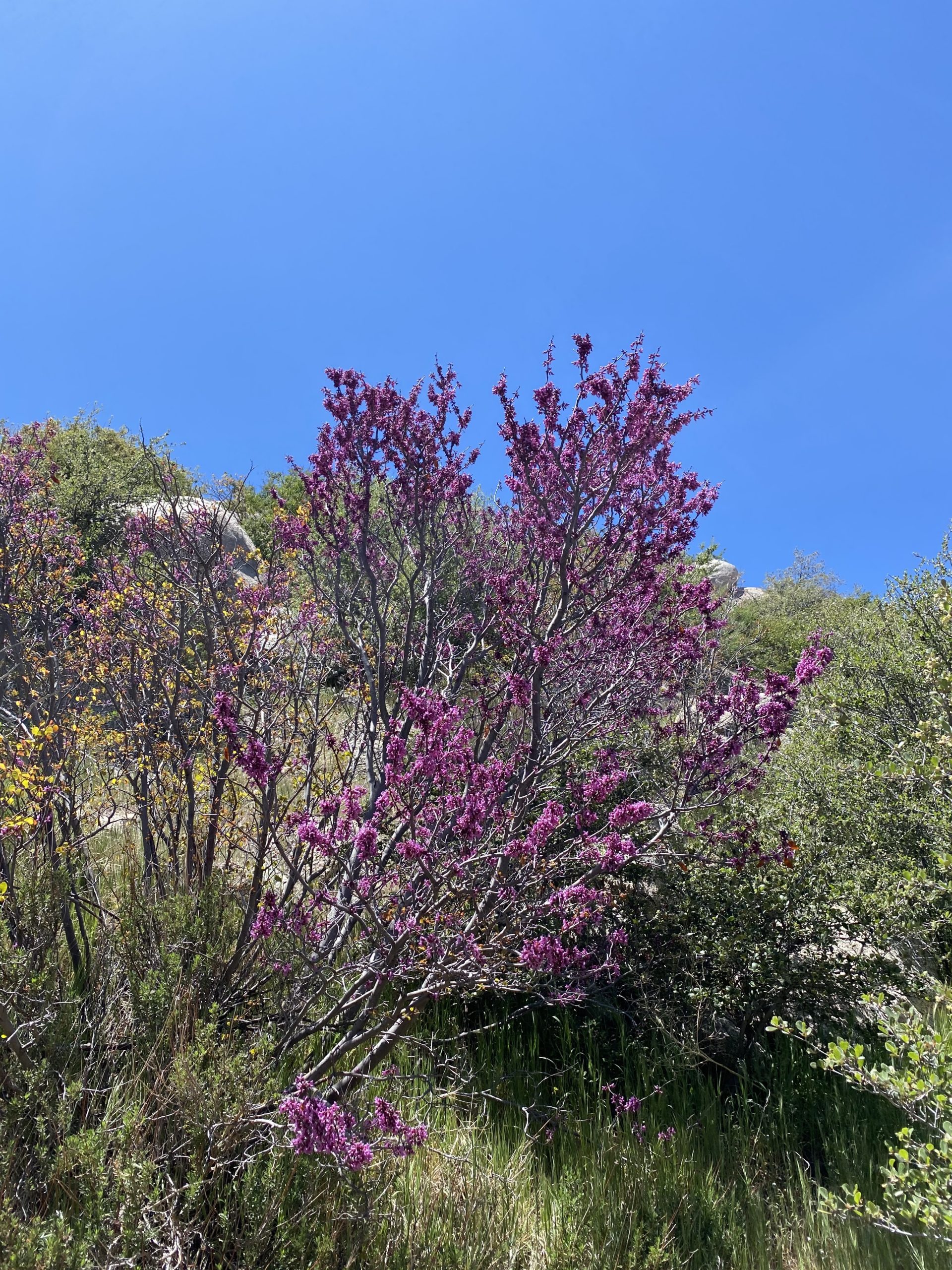
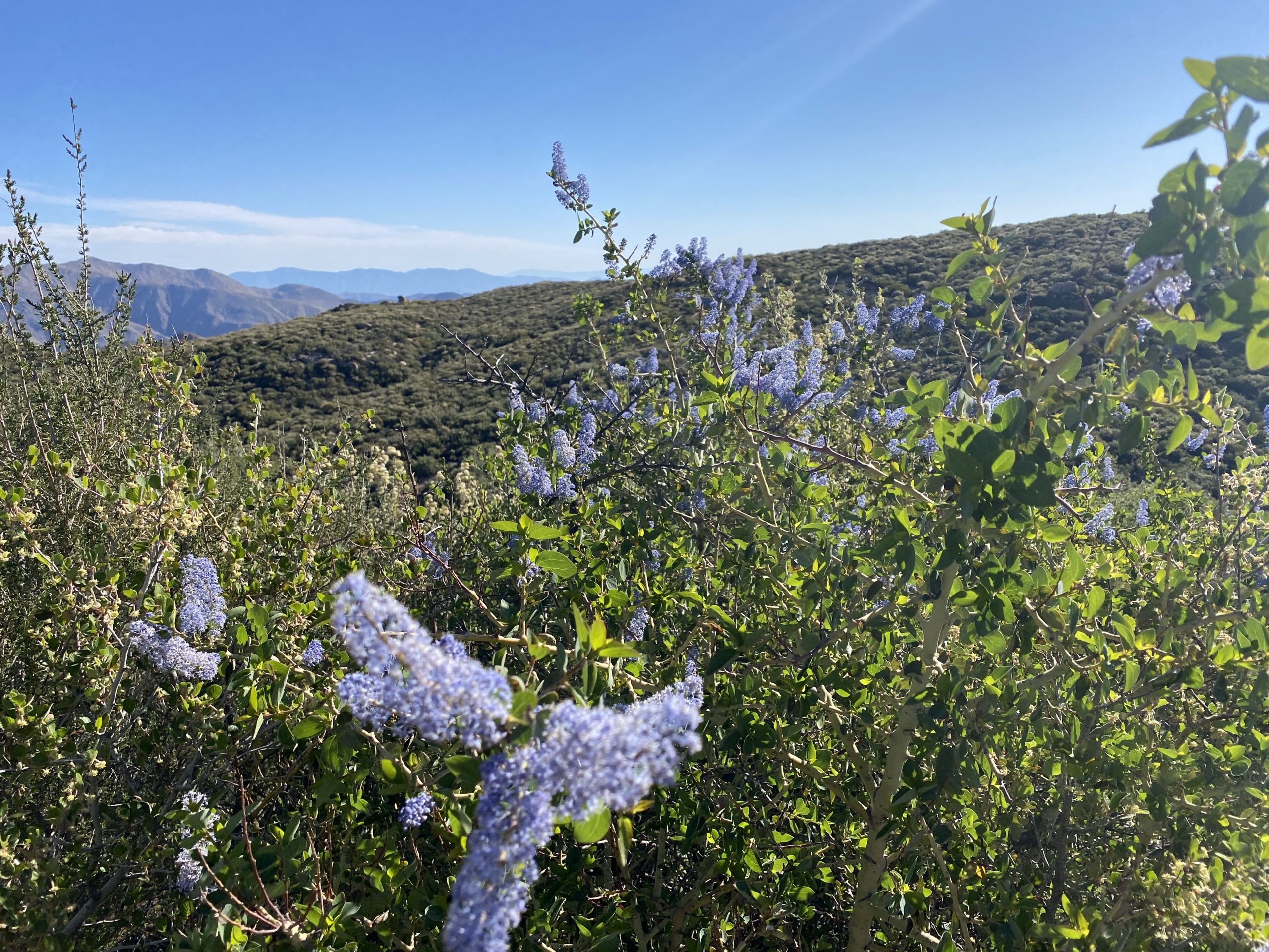
This was an inverted (aka canyon) hike, so we dropped down from our start just off Sunrise Highway. Some lovely wildflowers dotted the sides of the trail as we cruised along. We chatted about recent hikes, and I reflected on what was next on my hiking agenda. Soon we found ourselves at the end of the road and began the cross-country portion of the hike.
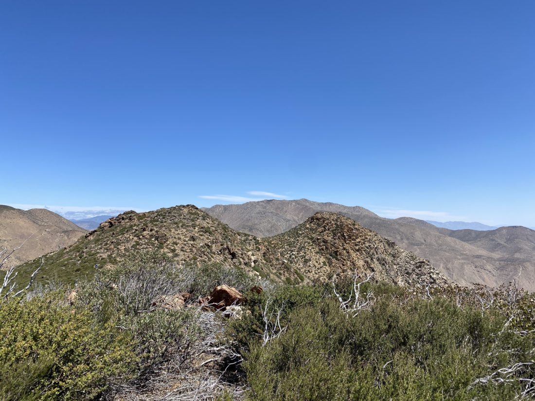
Roost Benchmark was the further of the two bumps. Since some of our group had hiked them before we followed their lead to loop around the first bump and then approach the summit from the north/northwest. We could see Larry and Leslie at the summit already. They had taken a different route that we had avoided in part to reports of it being overgrown and tick infested. As we crossed over the saddle, the winds picked up. Just as I was thinking I needed to tighten the strap on my hat, Greg’s hat went sailing. Thankfully it did not go far and he was able to retrieve it.
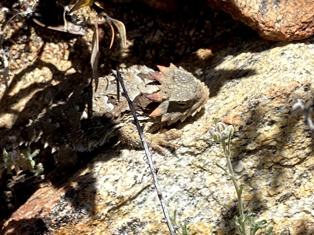
Soon we found ourselves atop the summit. I had done it! I plan to write a proper reflection on this journey, but a tremendous sense of accomplishment filled my heart. We sat around the summit enjoying some snacks, soaking in the views, and proudly signing the register. After a nice break, we began our descent. Along the way, we spotted a nice horn head lizard hanging out under some brush, and Ted got a great shot of it.
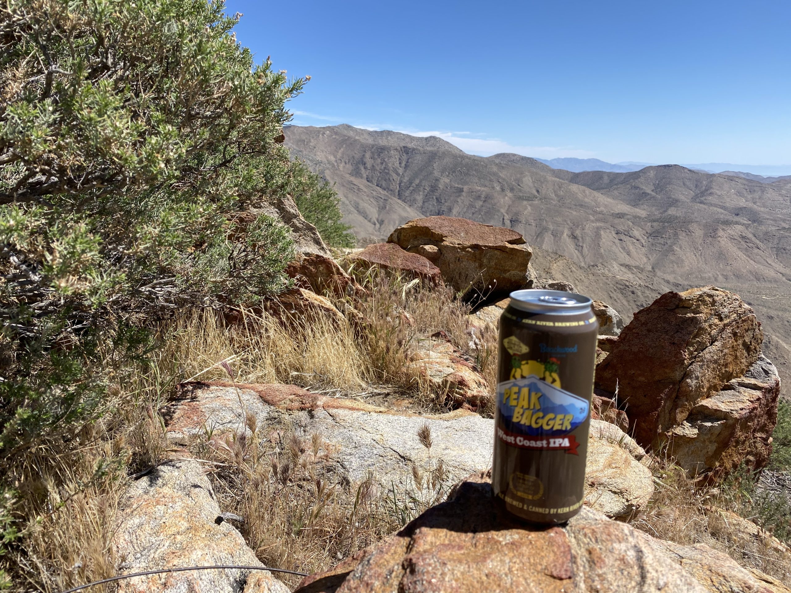
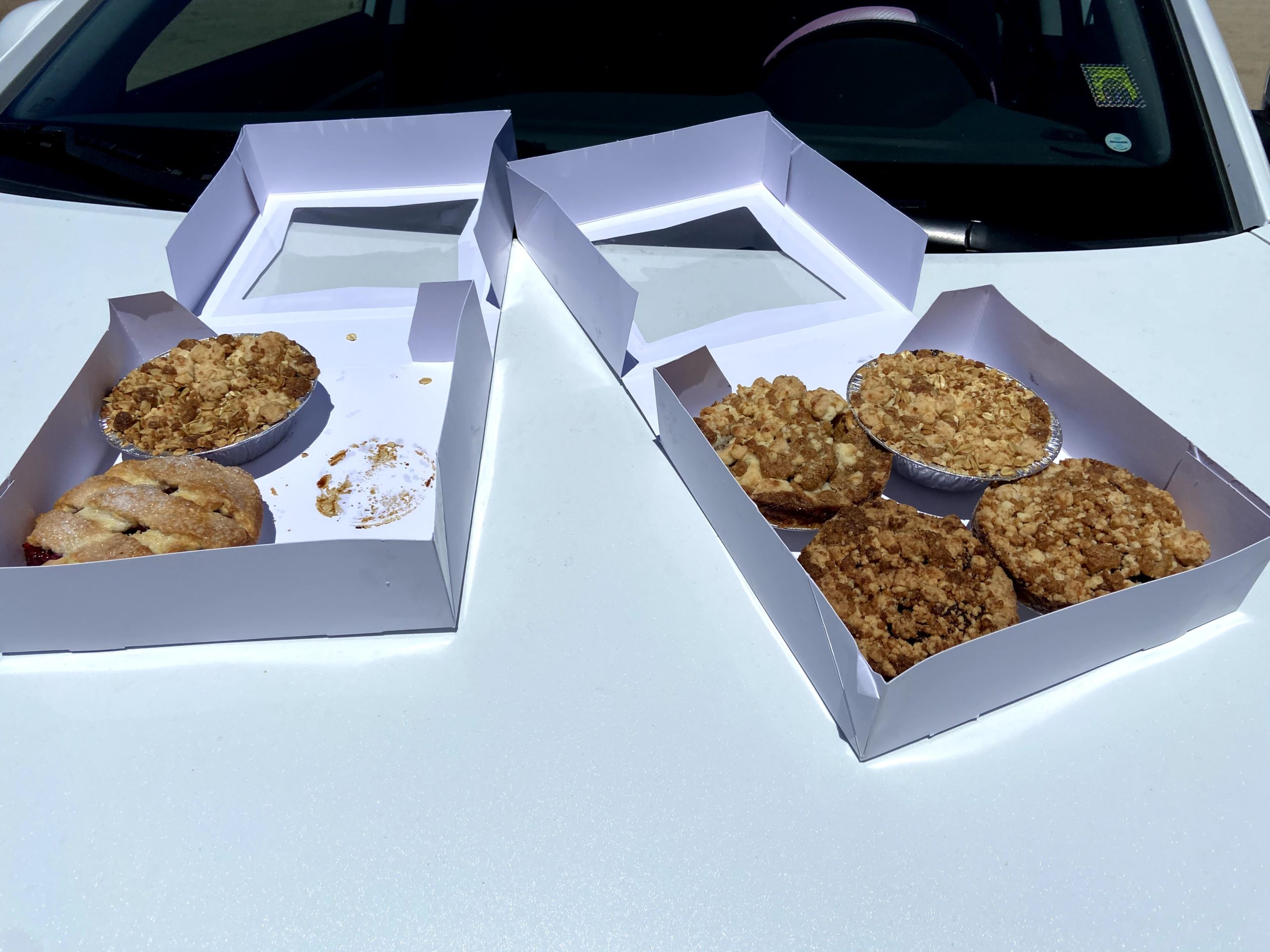
Since Larry said the overgrowth wasn’t too bad, we took the more direct route back up to the trailhead. Again, more wildflowers brightened our climb. While this road was a bit more overgrown, it was not too bad. We would stop to do a periodic tick check. Some of the group found some “hitchhikers” that were dealt with accordingly. As we waited next to where the PCT crosses the old jeep road, a thru-hiker passed by. Once we had regrouped, we climbed the last bit and back to the cars. Once back at the Sunrise Trailhead, my wife and daughter arrived with pies from Betty’s Pies in Encinitas to share. Susie had started this tradition with her completion of several summits, and I was happy to continue it. Since the summit did not lend itself to a group shot (plus the wind), we took a group shot there. After consuming our pies and enjoying a can of Peakbagger IPA from Kern River Brewery that I had been saving, we bid our farewells. Now on to the next adventure…
Gina, Ted, Me, Susie, Matt, Greg
The stats for the hike were 8.82 miles in 4:45 with a elevation gain of 1,764 feet.
I am an avid peak bagger, sometimes backpacker, and former sea kayaker living in San Diego. I am the co-author of Urban Trails: San Diego, coming in Spring 2026!
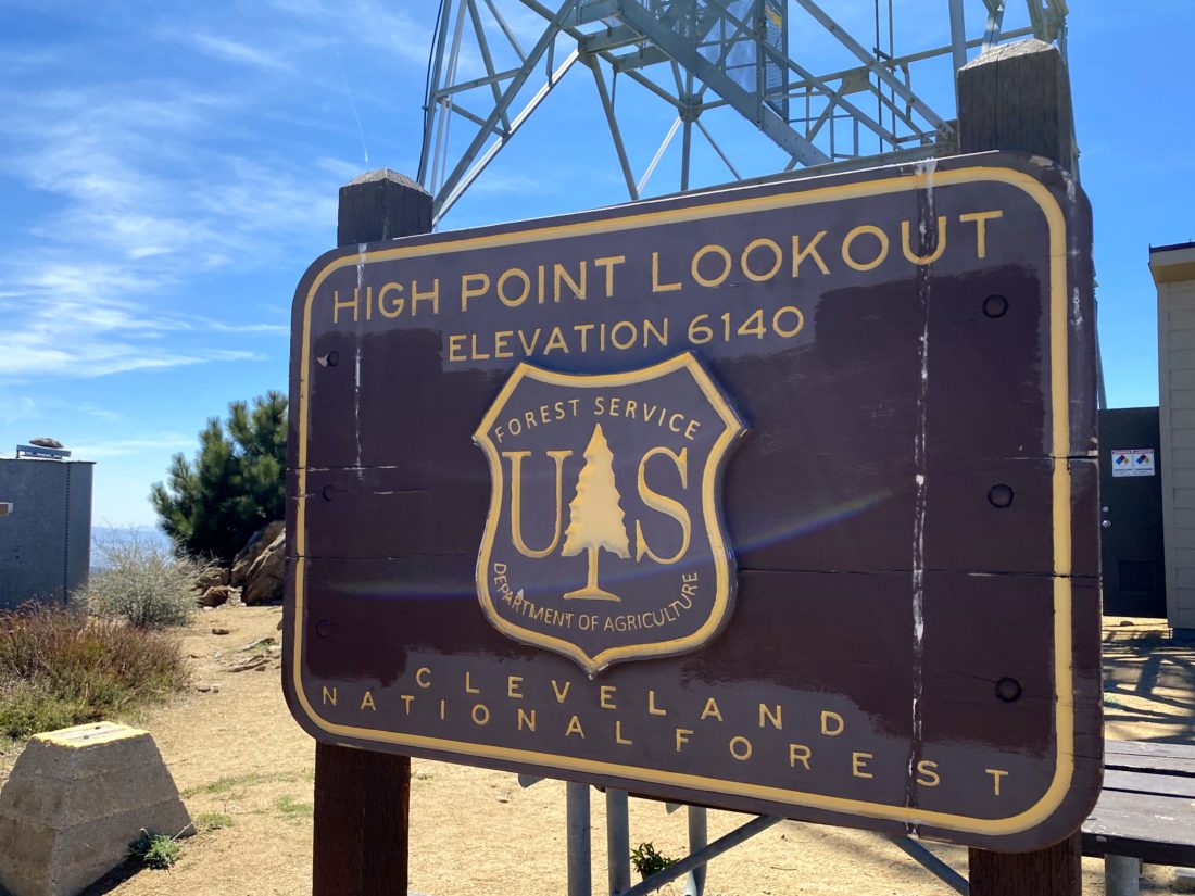
Having checked the Palomar Divide Road was listed as open, we decided to once again drive up toward Palomar High Point. Both Ted and I hiked this peak via Oak Grove last year and honestly did not feel the desire to do it again. So, as we had also done in the past, we drove to a much closer starting point.
The road was in ok shape, with a few potholes to watch out for, but nothing more. As we passed the Barker Valley Trailhead, there were four cars parked off to the side. We reached our usual stopping point, but neither of us felt like hiking from here, so we decided to drive on. We passed a few hikers making their way up, and one returning from the summit. Parking at the locked gate, we grabbed a bottle of water and walked up to the tower. A volunteer was working on replacing the toilet used by the tower staff. We chatted a bit, then set off to snap a few photos before heading back to the car and the hour drive back to the main road.
I am an avid peak bagger, sometimes backpacker, and former sea kayaker living in San Diego. I am the co-author of Urban Trails: San Diego, coming in Spring 2026!
Having just finished the Six-Pack of Peaks Arizona Winter Challenge figured I should pick up working on my hometown set of peaks. Since Ted Markus had never done Volcan Mountain, it seemed like the perfect choice. When we got to the trailhead, there was only one car and a CalFire engine.
Just after the entrance, the three CalFire firefighters were finishing their morning workout. After about a 1/2 mile, we hopped onto the 5 Oaks trail. While this adds a little extra distance to the hike, it was a nicer option.
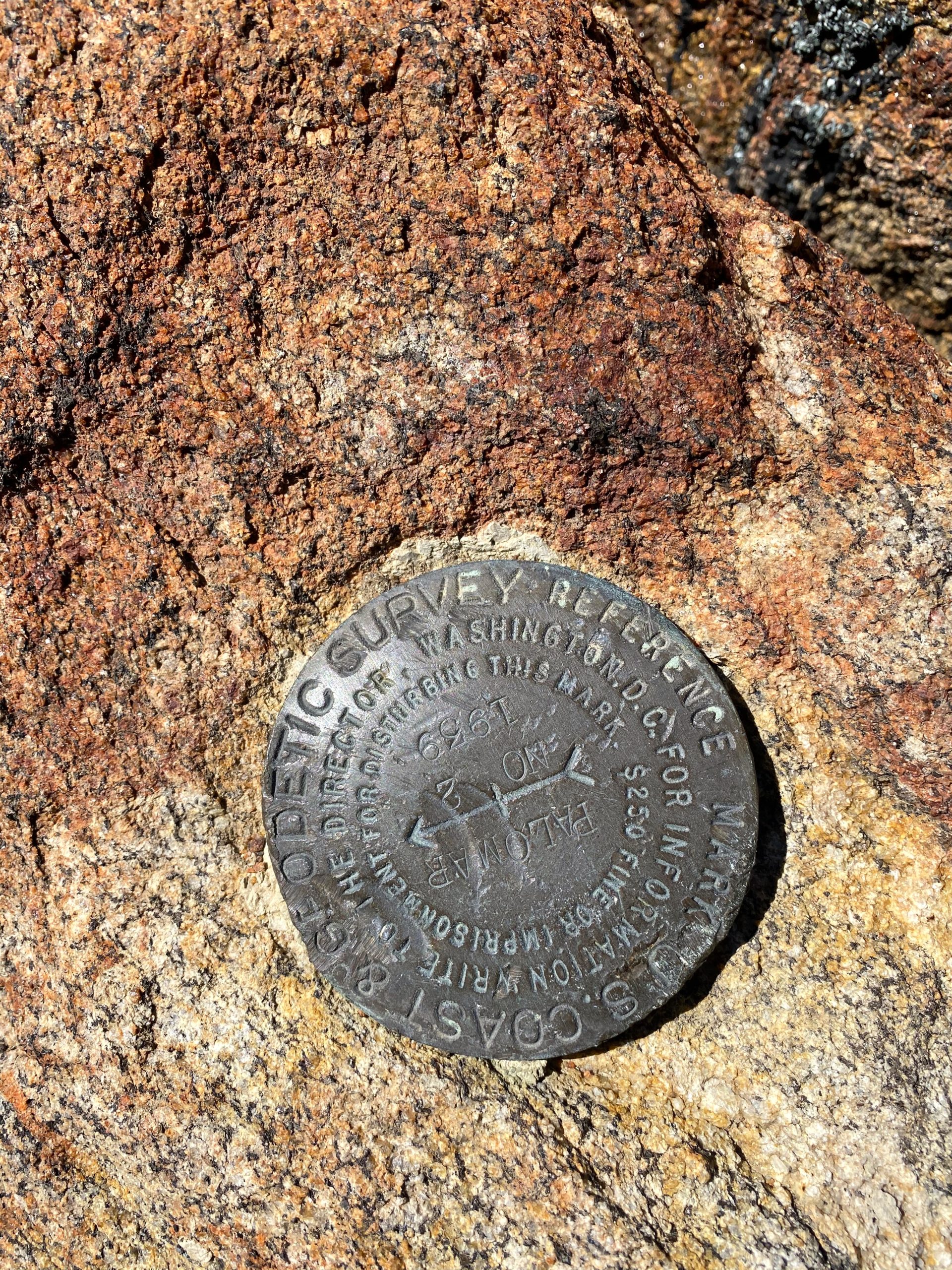
Once back on the main road, we cruised up toward the summit, stopping to look at the ruins of where an early exploration of placing an observatory here (Spoiler, it went to Palomar). Upon reaching the summit we spent a little time exploring, learning about the directional beacon, finding a couple of reference marks, and heading out to one of the benches. A few poppies were scattered along the ground, but they had not opened for the day yet.
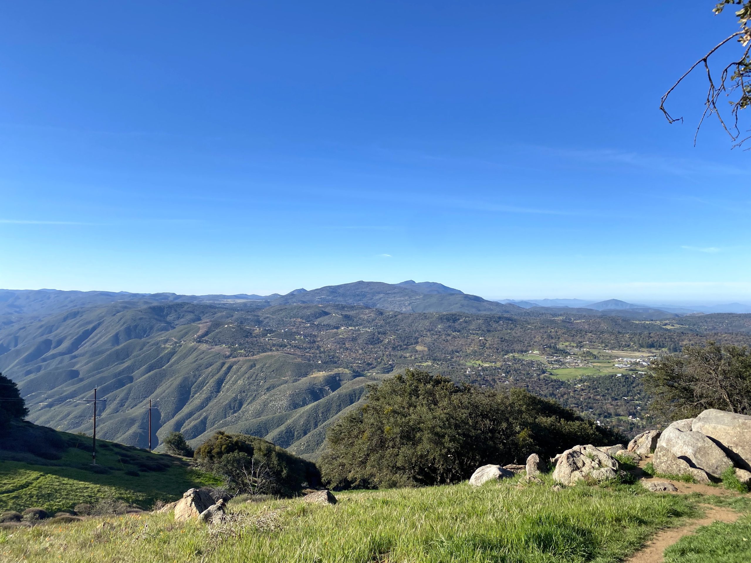
We took a nice view to the east, naming off so many peaks we have climbed. Up to this point, we have had the mountain to ourselves. But we were soon joined by other hikers out enjoying the trail. We headed back down along the main road, passing more folks, many with their dogs. This peak was a nice change of pace for both of us. Since it was still early we decided to drive up Palomar Divide Road and cross another peak off this year’s San Diego Challenge, Palomar High Point.
I am an avid peak bagger, sometimes backpacker, and former sea kayaker living in San Diego. I am the co-author of Urban Trails: San Diego, coming in Spring 2026!
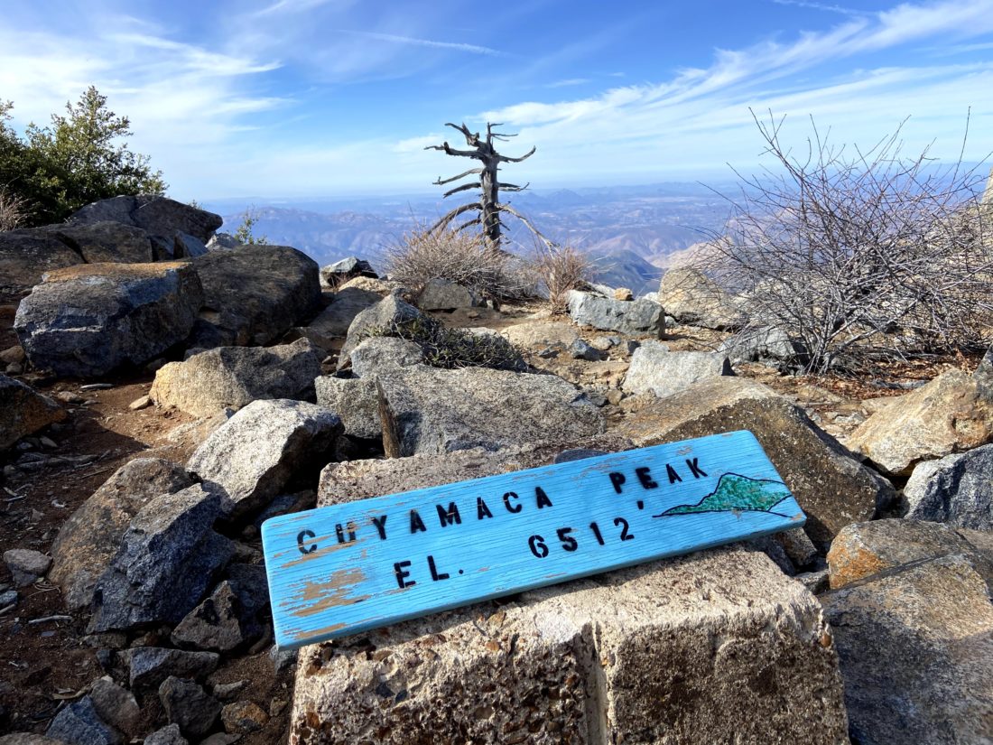
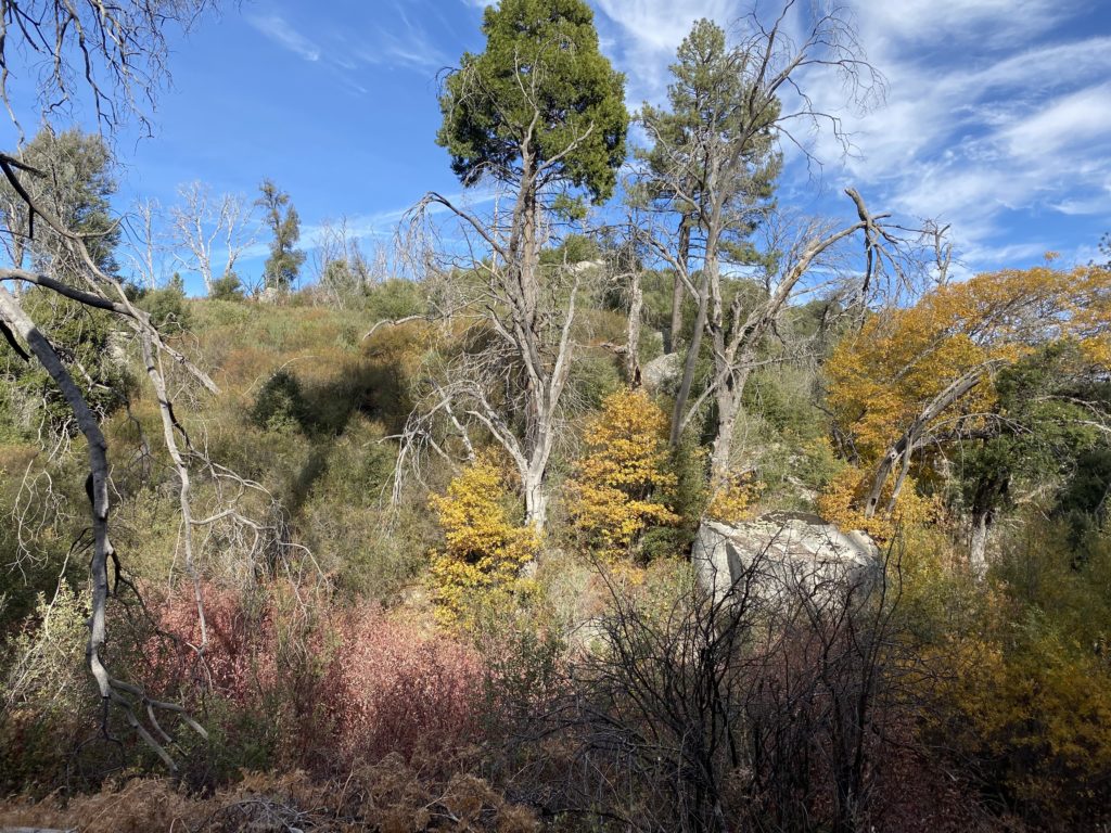
Since I could not tackle any of my remaining Sierra Club peaks this week, I opted to finish the Six-Pack of Peaks- San Diego collection. I had been saving Cuaymaca Peak for the fall, in part to enjoy some fall colors along the hike (I had also saved Mt. Wilson for the same reason, but the Bobcat Fire changed those plans). But also, to see if the SDGE construction closure order would finally be lifted. Ted Markus and I arrived at the Harvey Moore Trailhead just before 7 am. On the drive out we did catch a lovely sunrise. It was a brisk 44° as we set off. I was also testing out a new daypack, an Osprey Stratus 34. After last weekend, I realized I need a slightly bigger pack for longer hikes.
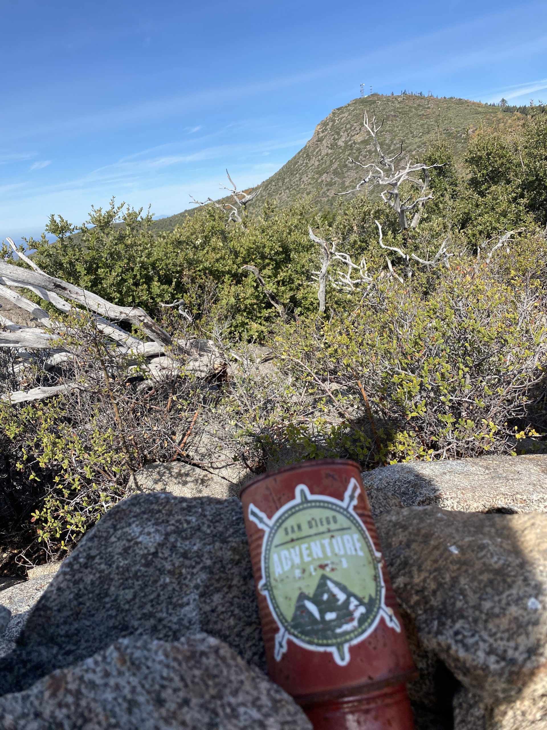
After carefully hiking across the bridge that spans Sweetwater Creek, we hopped onto the West Trail for a bit until it connected with the Monument Trail. The fleece I had on at the start was too warm, so it was time to test out the storage of the new pack. The pack has a small sleeping bag compartment, so I stuffed the fleece in there without an issue. We worked our way up the trail toward our first goal, Airplane Ridge. When I did this hike last year, I missed it and had to scramble back. This time I was a bit more attentive to the short cross-country scramble. Upon the small summit, we took a quick break. I opted to shed another layer before continuing on. There is no benchmark nor register, just a mystery can with a San Diego Adventure Club sticker. That will have to do.
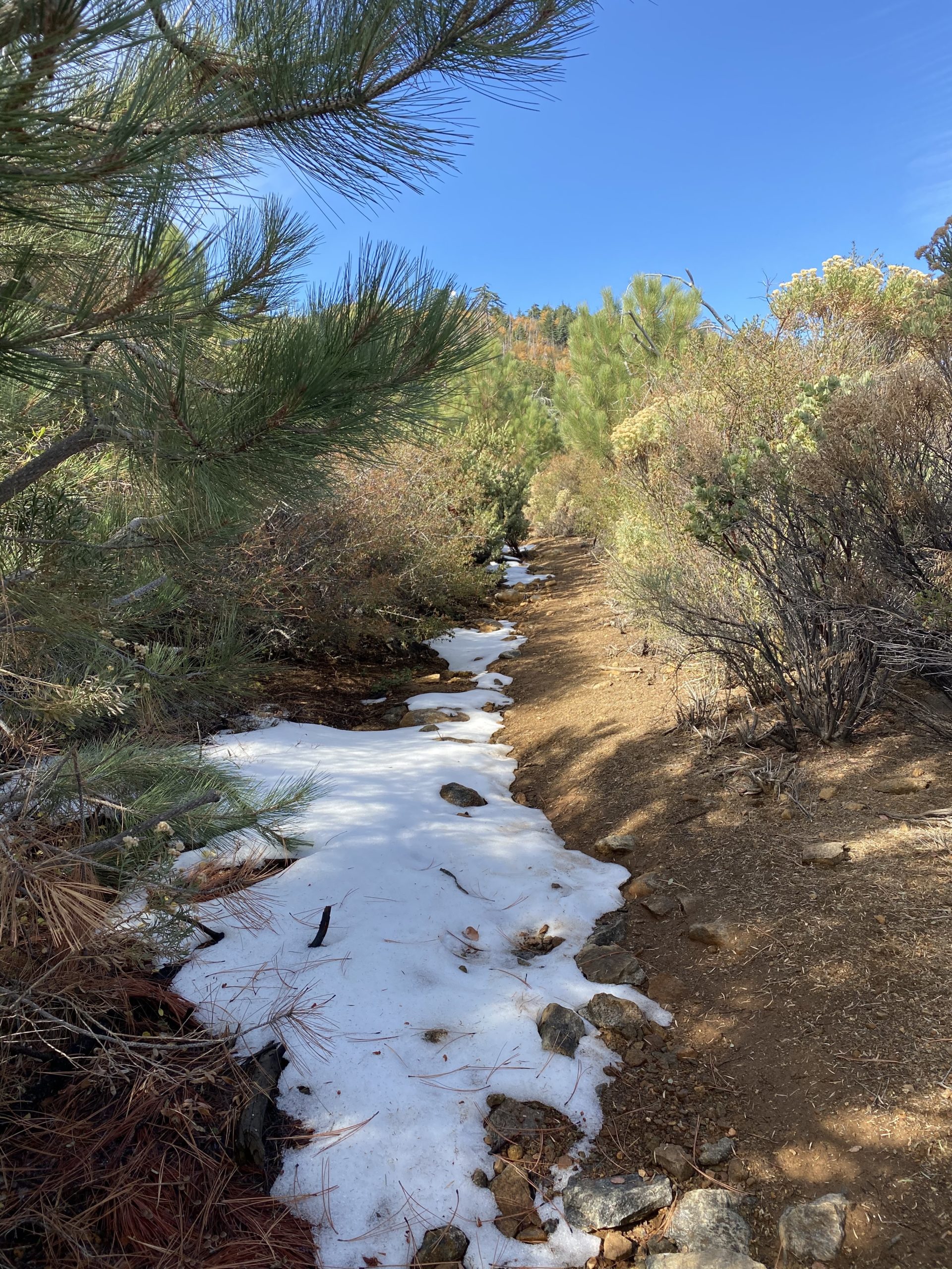
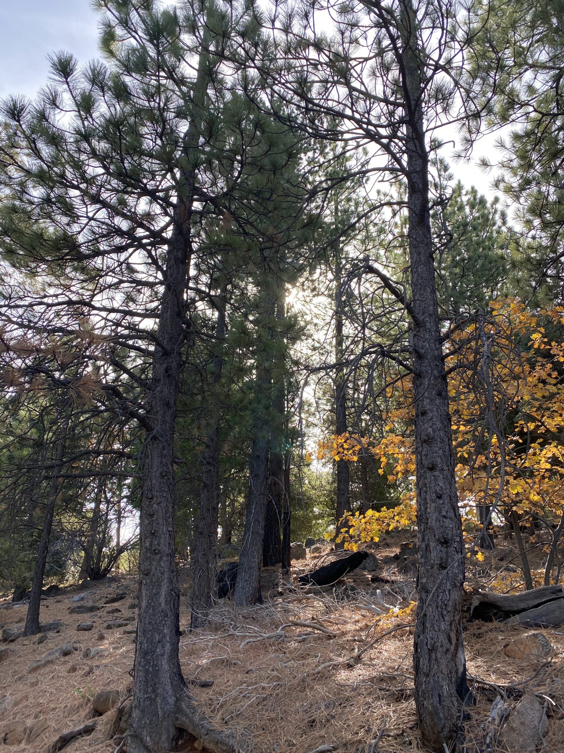
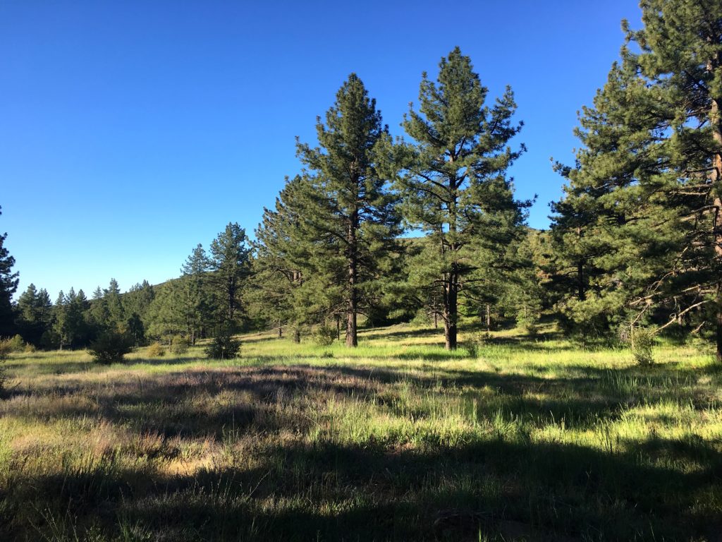
Ted and I continued to make good time, and soon we came to the junction with the West Mesa Trail. This is one of my favorite sections, as there is something about a meadow that I like. Once across the meadow, we turned on the Burnt Pine trail. After a quick snack, we would travel through some of the only remaining pine trees that survived the fire. Intermixed with the pines were some oaks, so we got some lovely fall color. As we drew higher, small stretches of snow still remained, tucked in the shady northern sides of the trail.
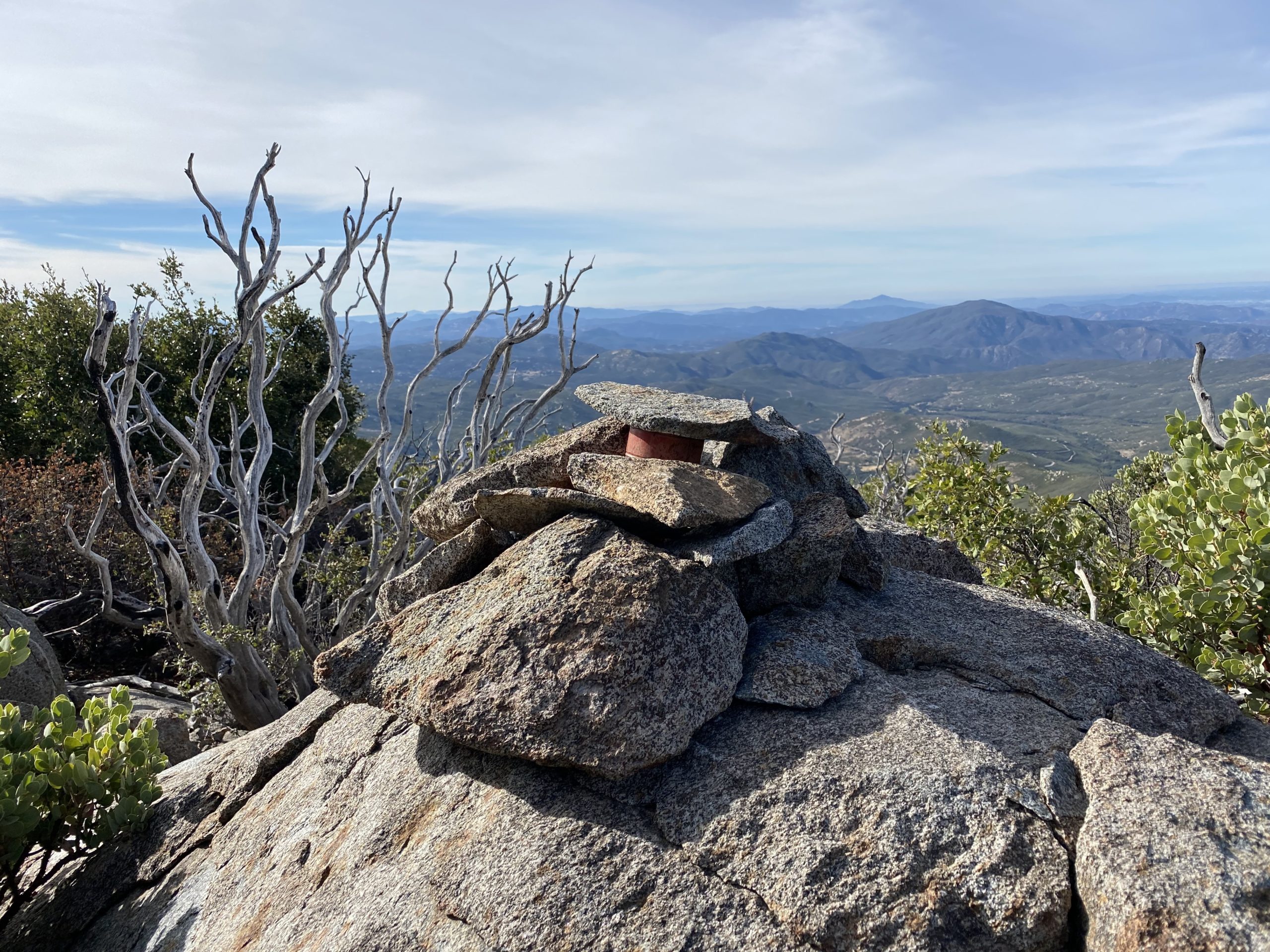
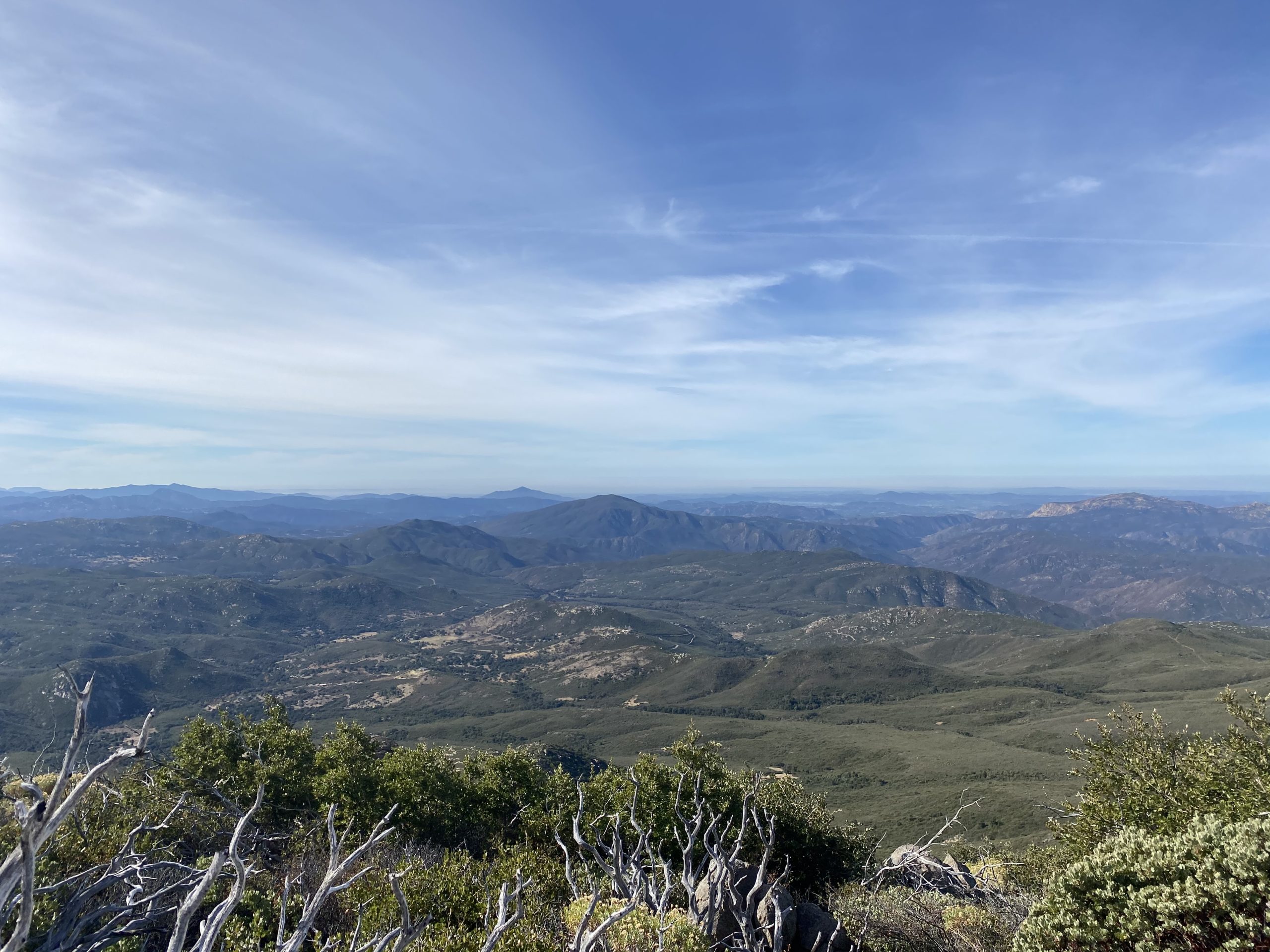
I had originally planned not to be hiking this weekend, as SpaceX was conducting a launch and land landing from Vandenberg AFB. But between the road closures forcing a fairly distant viewing spot and Covid, I opted to skip the 5-hour drive up to Lompoc. I was tracking the progress of the launch on my phone. As we reached the turnoff to Japacha, I pulled up YouTube to watch it. I missed the actual launch but followed the first stage’s return to the landing site. With that event done, we set off to summit Japacha peak. We weaved our way through the brush, following just a hint of the route. I had to double-check my previous track a couple of times to get us to the summit, where we took another short break. I signed the register seeing that the last person to sign in was almost a month ago, and the one before that about the same amount of time. Cuyamaca stood towering over us just to the north, so we once again headed off.
We then reached the fire road that would lead us to the summit, about .4 miles away. Technically, this is still closed, but all reports stated the SDGE closure was not being actively enforced as they are no longer working on that project. There is a reforestation effort closer to the campground, and when that is occurring the closure is in effect. The road was steep, but the new tarmac was nice, no more crumbling asphalt to worry about. As we drew close to the summit, a new fence now surrounded the towers, so we hiked to the end of the road and followed the trail to the summit.
Ted and I took our photos, then found some nice spots, socially distanced, and had our lunch. We found the NASA mark, two reference marks, a metal plug atop one of the high rocks, and some rock graffiti from long ago. We set off down the fire road, and we finally started to encounter some other hikers, whereas up to that point we had only seen one trail runner.
We debated on what route to take; retrace our ascent or head down the fire road and take one of the connecting trails. We opted for the latter option. While the new pavement is nice, it is still a steep road. As we made our way down, some heavy equipment was parked along the side of the road in support of the reforestation.
Once we reached the Fern Flat Fire Road, we left the pavement behind. The road also looked like some recent work had been done, and sure enough, we passed the parked grader that was smoothing out the ruts. This stretch was a pleasant stroll this time. Last time, I was hustling to make it back to the car to attend a birthday party for a friend. The only issue this time was I seemed to be developing some blisters on my pinky toes. At this point, I figured I was close enough to the car to not deal with them.
Soon we spotted the parking lot and our three-peak adventure was over. Ted got to cross off three more peaks on the 100 Peak Challenge, and I completed the Six-Pack of Peaks – San Diego collection! The entire hike was about 14.2 miles, 2,780 feet of gain in 6:53 of hiking time.
I am an avid peak bagger, sometimes backpacker, and former sea kayaker living in San Diego. I am the co-author of Urban Trails: San Diego, coming in Spring 2026!
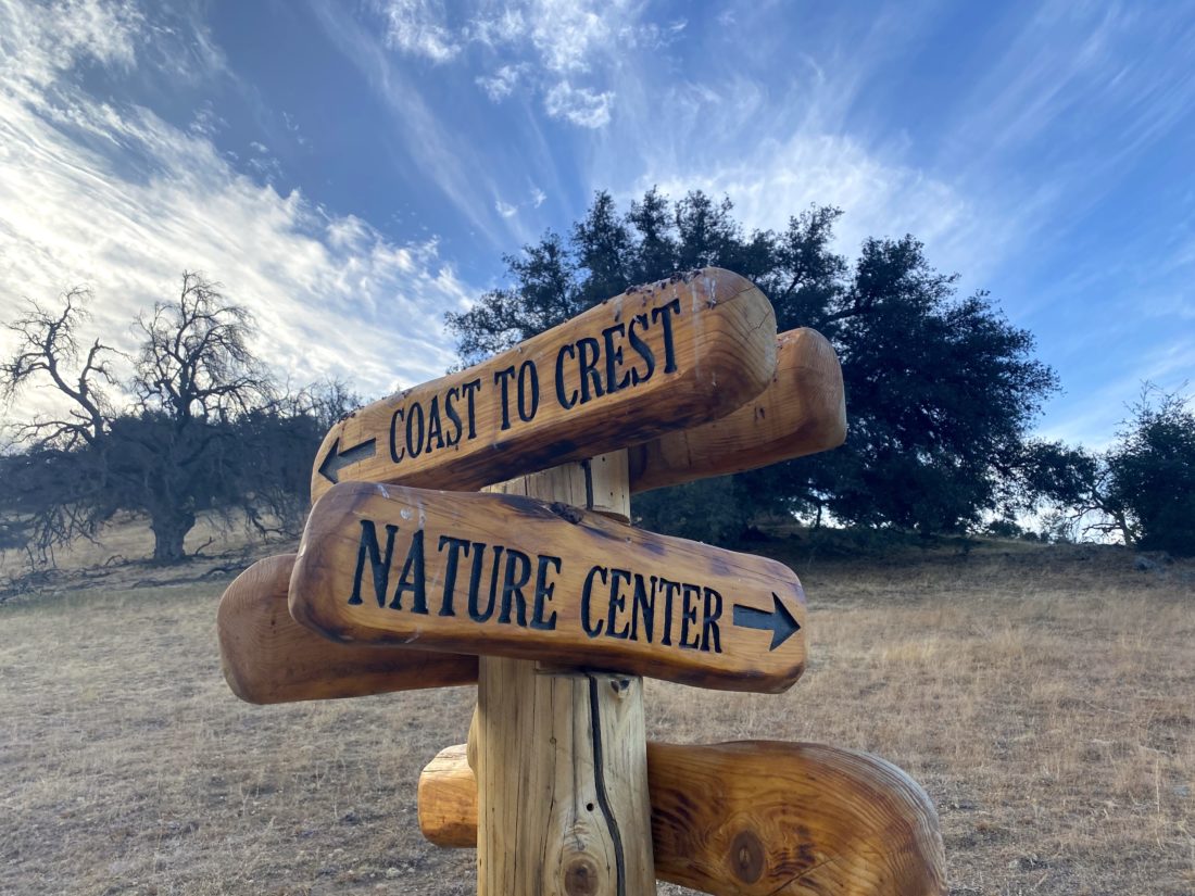
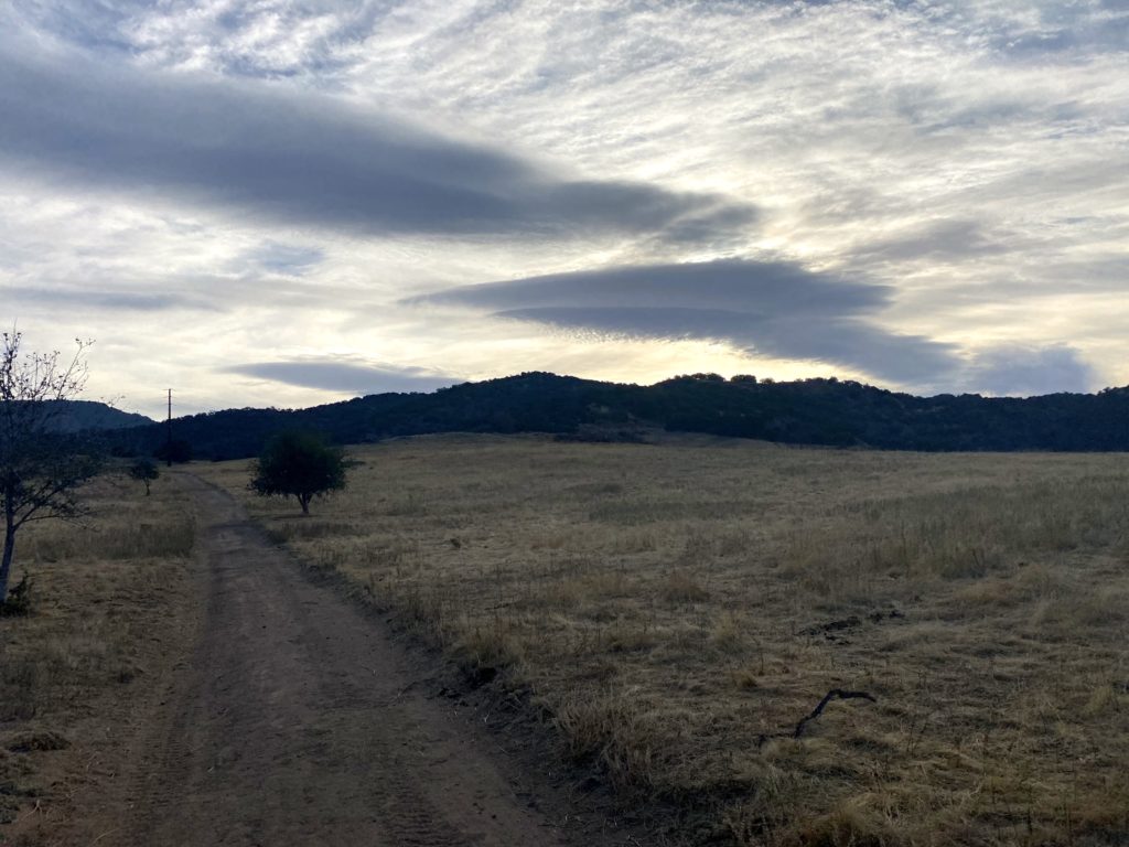
As America awaited the results of the election, I needed to take a break and get in a hike. With our first bit of winter weather due for the weekend, I opted to do one early Friday morning. I decided to hike one of my two remaining Coast to Crest Challenge hikes. I opted to hike the Santa Ysabel Loop on the Santa Ysabel East Preserve. This was going to be a 4.2-mile lollipop hike. As a bonus, I could pick up breakfast afterward at Farmhouse 78.
When I pulled up to the trailhead, two cars were already parked. While the skies had some clouds scattered about, the temperatures were perfect. I had hiked some of this preserve during the last Coast to Crest Challenge, and this section had some trails I would pass en route to other adventures.
The trail starts gently before making its way up the hill to the junction. Some beautiful signs pointed to the trail route. As I worked my way up, one of the other hikers passed me, and headed back down.
Later, I encountered a second set of hikers. We chatted a bit as they were also working on the Challenge. I gave them my readout of the three I had done. They then set off, planning to grab some sandwiches from Dudley’s Bakery for their breakfast.
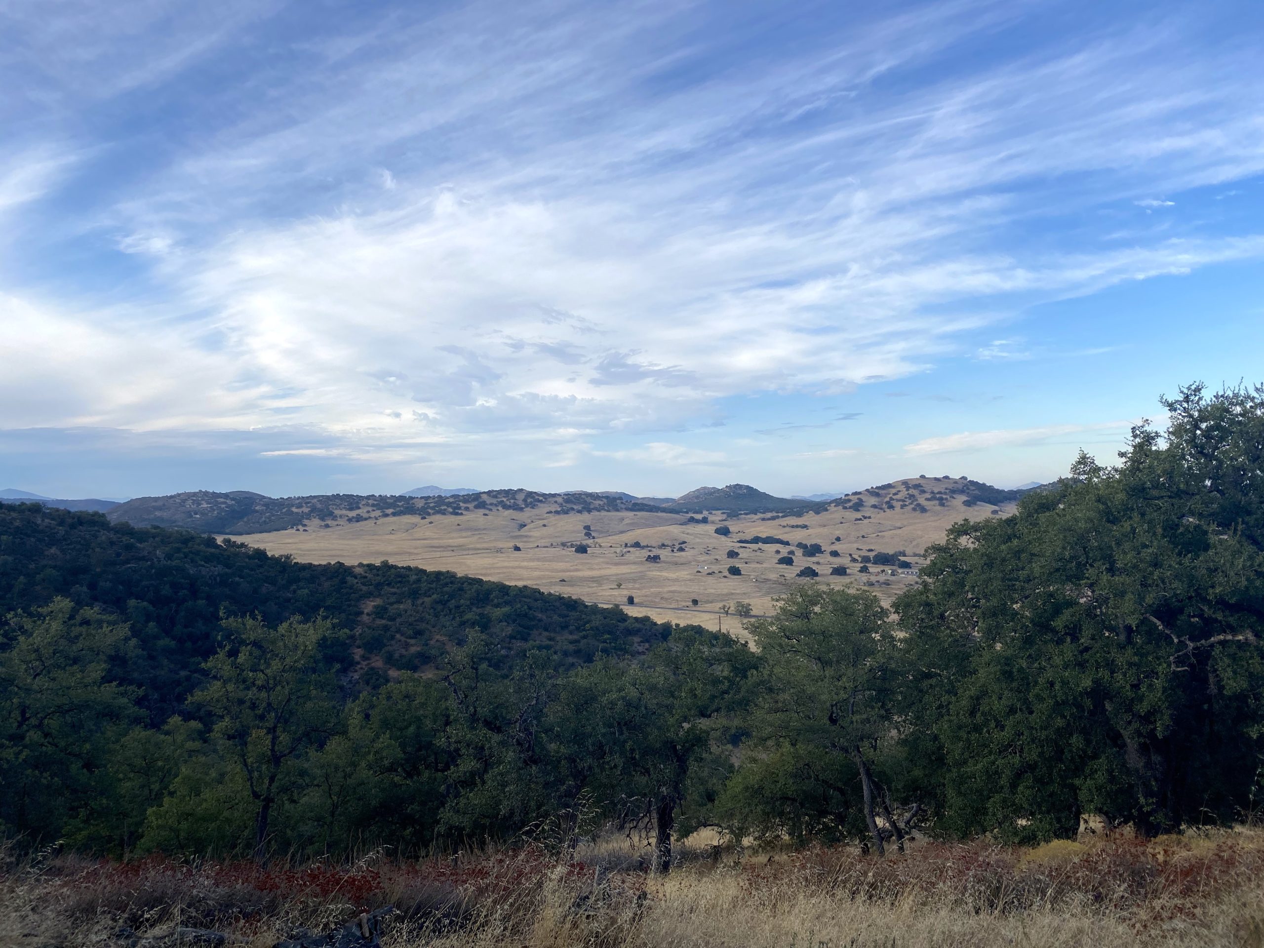
The trail was lovely, nice and wide, with some very beautiful scenery. I reached the selfie spot next to a nice set of picnic tables. I can see returning for a stroll with some friends to enjoy this hike.
With the photo taken, I cruised back down the trail, passing a couple more hikers along the way. Once back at the car, I tossed my gear in and made the short drive to the restaurant. I ordered some biscuits and gravy to go, as I needed to join in some work calls. With that, I only have to hike Boden Canyon to complete this year’s Coast to Crest Challenge.
I am an avid peak bagger, sometimes backpacker, and former sea kayaker living in San Diego. I am the co-author of Urban Trails: San Diego, coming in Spring 2026!
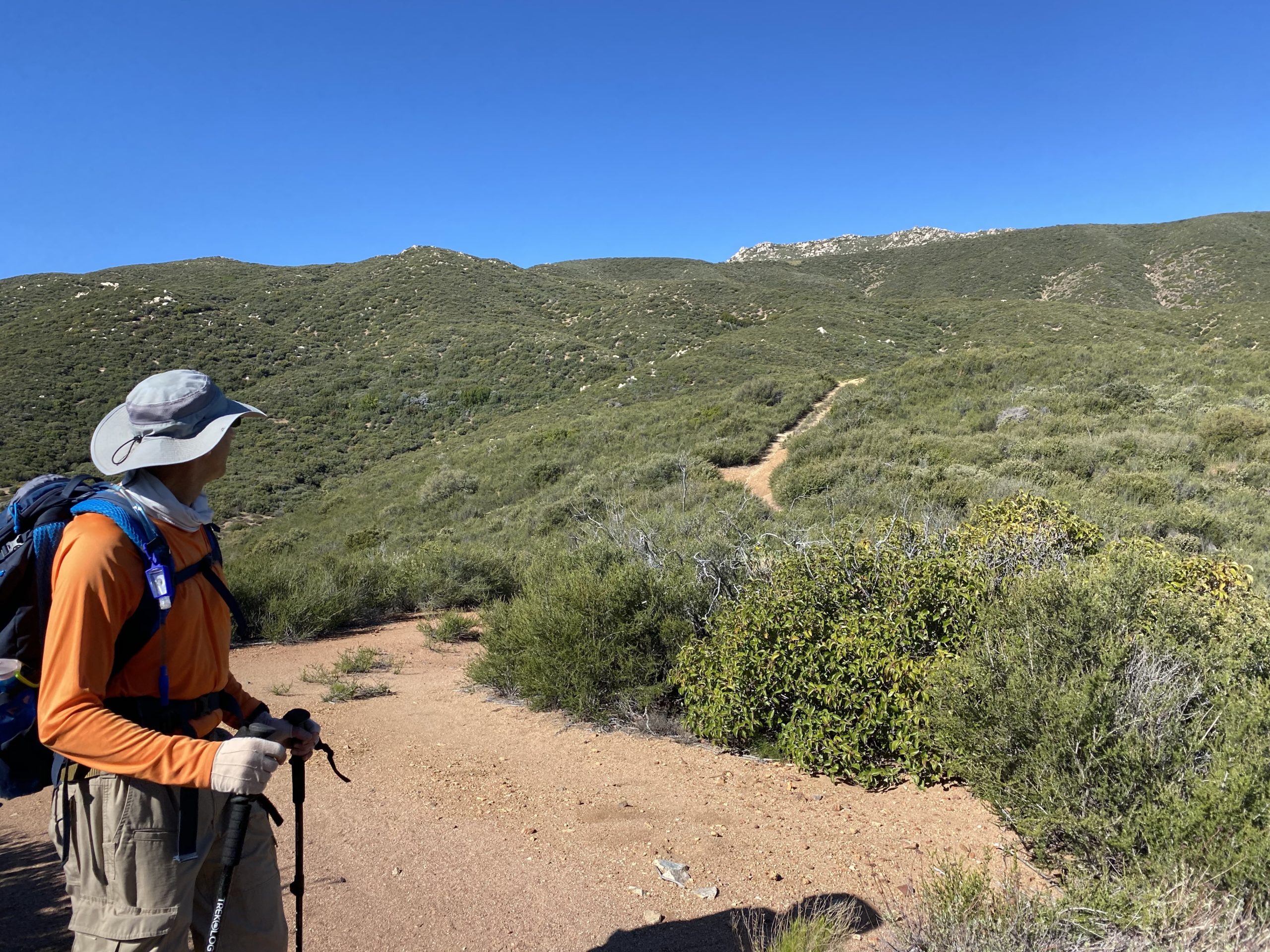
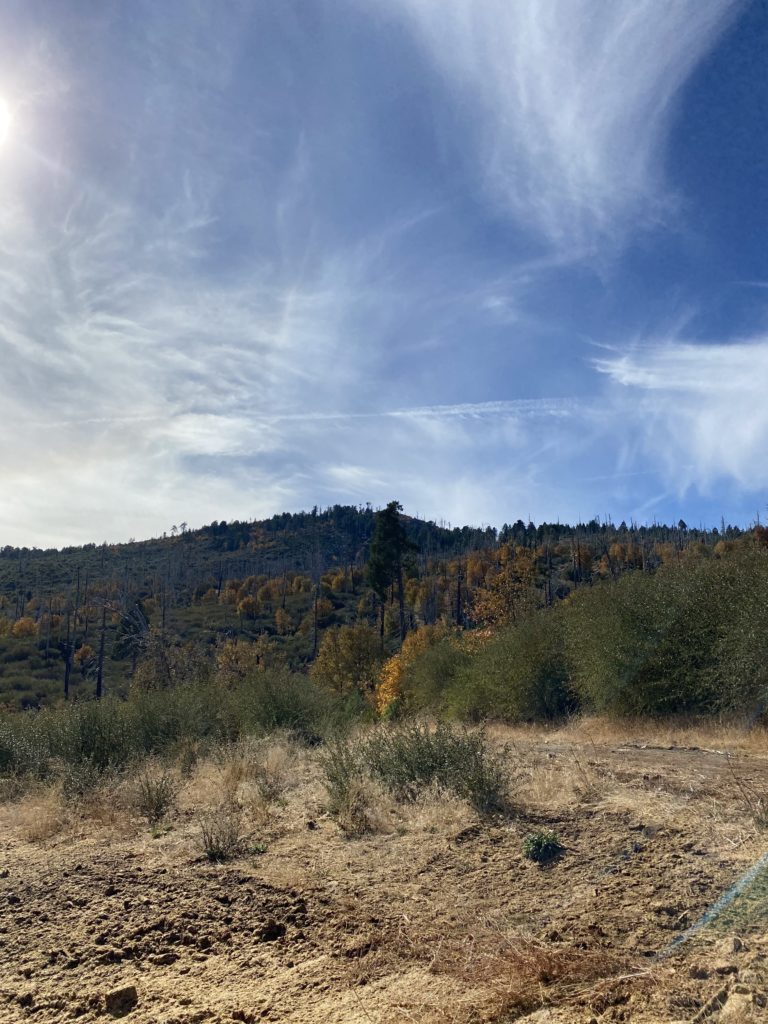
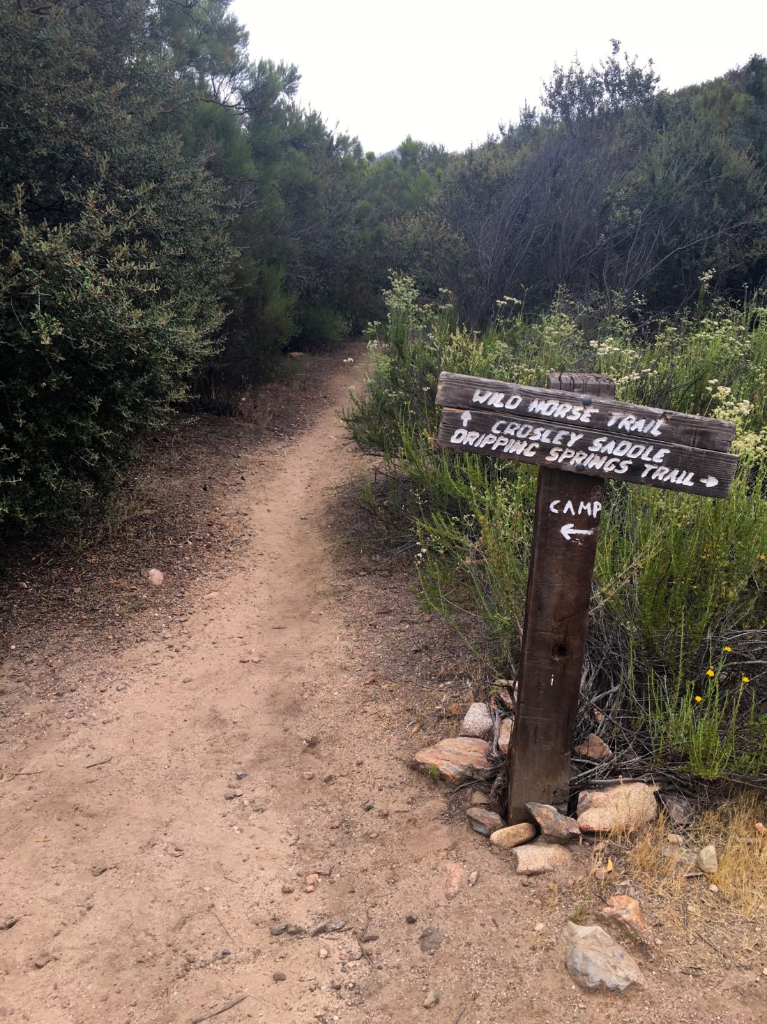
While I only have one more peak to summit to complete the Six-Pack of Peaks Challenge, fighting the crowds on the ones that are open was something I did not care to do. So, instead, I turned to summiting one of the mountains on the Sierra Club Lower Peaks Committee. This is a collection of peaks whose summit is below 5,000 feet. Some of these I have done while completing the 100 Peak Challenge. However, there was still one remaining to be climbed in San Diego, Wild Horse Peak in the Agua Tibia Wilderness.
I drove up to Dripping Springs Campground, with Ted following in his own car. The three free spots were already full at 7:30. I put up my Adventure Pass and Ted grabbed one of the Self Pay slips. The skies were still overcast, but we knew this should burn off as we rubbed on the sunscreen.
We passed through the campground, where breakfasts were being made over the campfires. The smell reminded me of so many mornings at my parents’ cabin. I signed the register and we set off. This is the same trailhead for Agua Tibia and for the very adventurous Eagle Crag. After crossing the dry creek bed, we turned onto the Wild Horse trail and began our climb.
The trail was a nice shape. Wildflowers still dotted the side of the trail. At times, some growth did extend onto the trail, but nothing bothersome. We did spy some poison oak at times, so know your plants! We kept on cruising up the trail, enjoying the views spread out before us. Off to the east, was one impressive orchard.
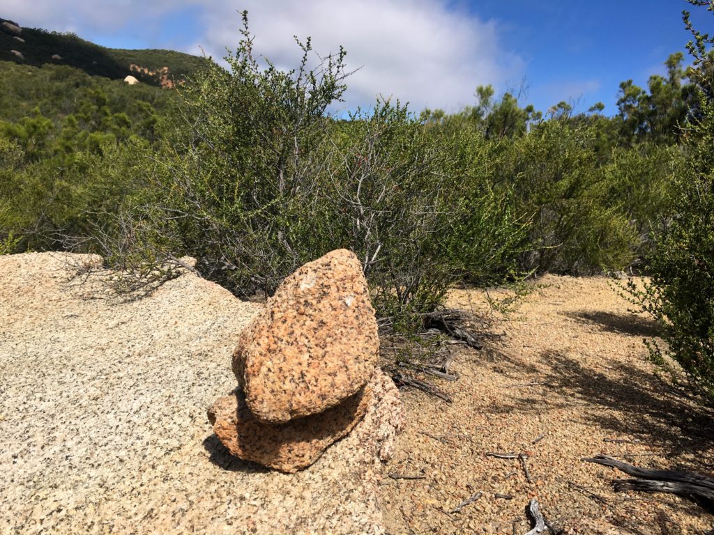
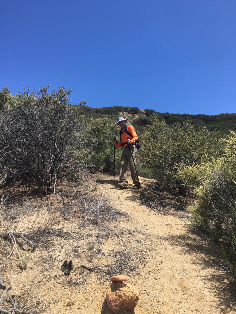
After a while, we spotted the cairn that denoted the use trail to the summit. The pleasant grade we had for the last 4.5 miles was to be replaced with a steep climb on loose decomposed granite. Descending this was not going to be fun. We made our way slowly up to the Ridgeline. The trail was fairly easy to follow, thanks in part to Kelly Laxamana who routinely hikes these trails and maintains them.
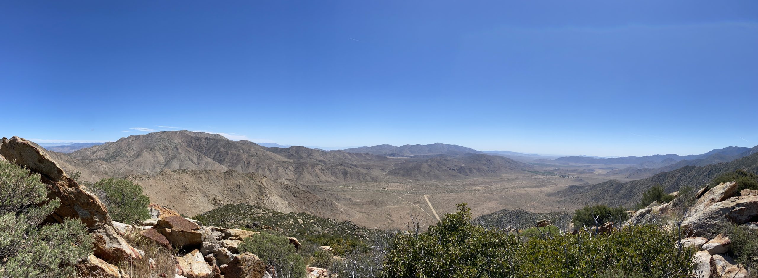
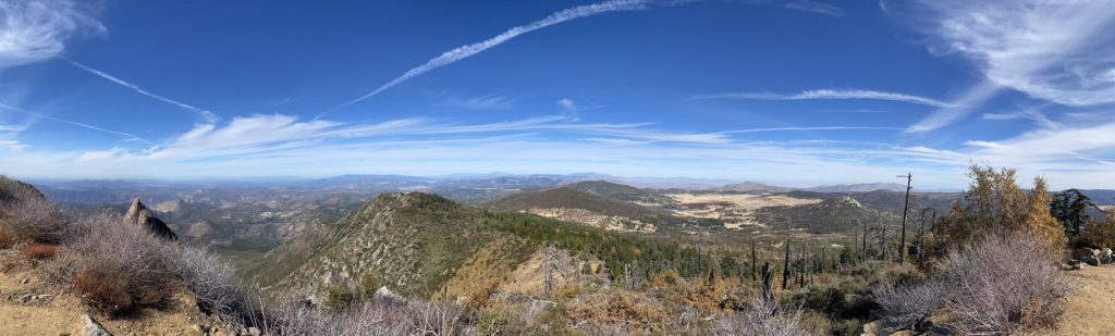
Now on the ridgeline, the grade eased and the summit was clearly in view. Before long, the familiar red register can stood nestled amongst a pile of rocks. We shed our packs and took in the sweeping views; Vail Lake to the north, with San Gorgonio far beyond that, to the northeast San Jacinto stood, calling for our return. Off to the south was Palomar High Point. To the Southwest, Agua Tibia.
I signed the register and saw that the last person to add their name was our good friend Susie Kara. There really isn’t a good place to sit down on this summit, so after a snack and some fluids, we headed back down the mountain.
Thankfully, the descent we worried about was not too bad. Slow and careful, as this was not a race. Once back on the main trail, we could return to a nice steady pace. The sun had broken through earlier, but we still had sections of shade and a light breeze to keep us comfortable.
Finally, with about two miles to go, we encountered our first set of hikers. I SO wanted to check the “Only Party On The Mountain” checkbox on peakbagger.com, but it was not to be. It was a large group, but they quickly passed as we turned our faces away. By the time we reached the end of the trail, we met four other groups working their way up the trail.
As we passed back through the campground, it had become mostly empty, although the day-use lot was completely full. With that, I completed my 8th Lower Peaks Committee mountain! I logged the hike at 10.1 miles in 5 hours with an elevation gain of 2,049 feet.
I am an avid peak bagger, sometimes backpacker, and former sea kayaker living in San Diego. I am the co-author of Urban Trails: San Diego, coming in Spring 2026!
Today’s plan included finally having a chance to hike with Gina Norte and cross Hot Springs Mountain off my Six-Pack of Peaks list. For those who don’t know Gina, she might be the “queen” of Hot Springs Mountain. She was the driving force in allowing for Hot Springs Mountain to be included on the challenge. We have been Facebook friends for some time, but have never been able to have our schedules sync up.
When I woke up, a mist/light rain was falling, I figured it was nothing more than some coastal drizzle, & I did not give it much attention. As I kept driving out toward Warner Springs, I began to fear that the forecast I looked at the night before was off. I really hadn’t planned for a wet hike… Luckily, as I neared the guard shack at the reservation to drop off my $10 entry fee, the skies became clear.
I parked in my usual spot, and Gina soon pulled up and parked under the shade of a nice oak tree. After some introductions in real life, we set off. If you have never hiked Hot Springs Mountain, the first two miles will get your blood pumping! We took a relaxed pace as we worked our way up the dirt road.
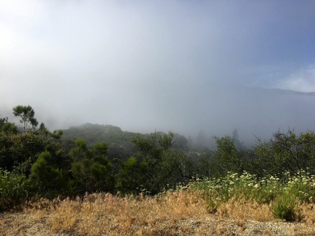
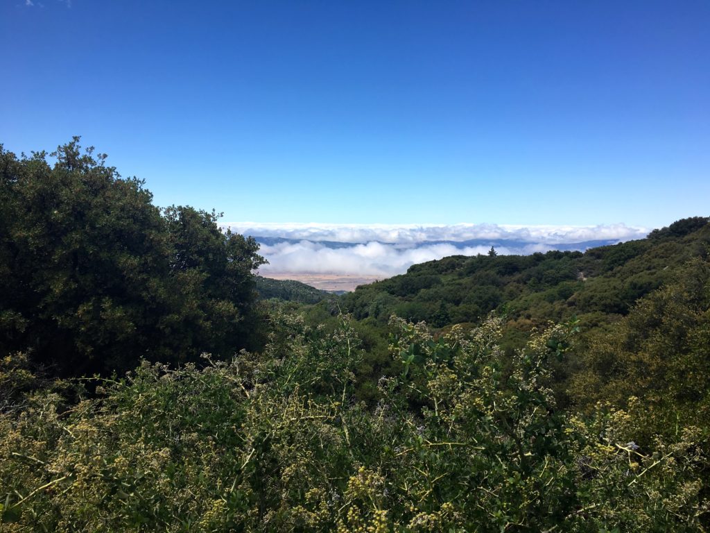
The clouds rolled in the valley below us, making for some dramatic views. Soon, it was time to slip on the bug nets as the flies began to swarm. Once past the steeper section, the grade eased. Gina was in full tour guide mode, filling me in on so much about the mountain and the tribe that lives there the Los Coyotes Tribe. I never knew that they did not have electricity until 2000!
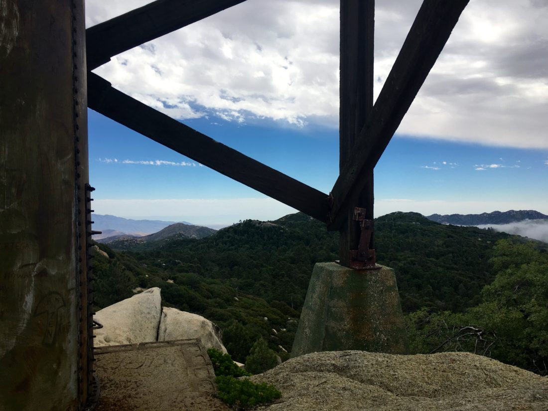
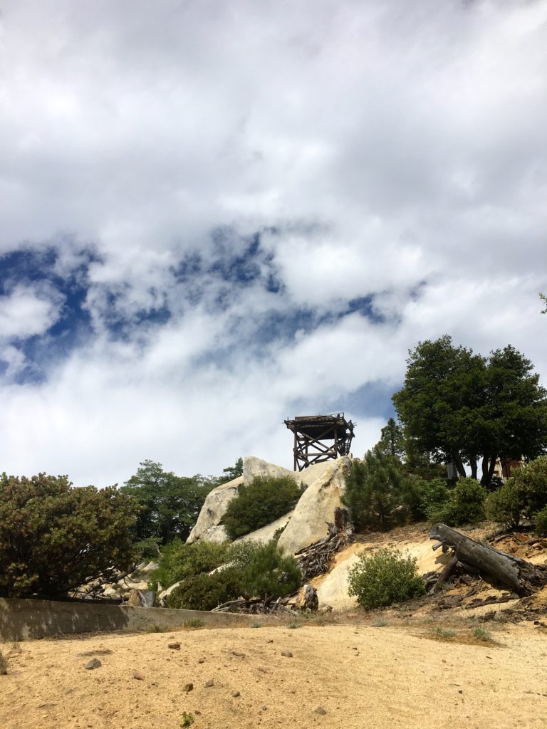
Before we knew it, the abandoned fire tower came into view. We decided to go climb the actual summit block first. Following the well-marked use trail, we reached the summit in short order. We scaled the summit following the same route as I took on my last visit.
As we sat there, the clouds still swirled below us to the west, while so many familiar peaks stood clearly to the east. After grabbing a snack and photos, we carefully made our way down. Just around the north side, a ladder has been set up for an alternate route. I scrambled up to photograph another reference mark.
We next wandered over to the old fire tower. This is the “Potato Chip” for this peak. Normally, Palomar would be visible to the west, but today the clouds hid it from us. Speaking of clouds, they started to move in, so we set off back down the mountain.
The breeze had picked up, so the bugs were being kept at bay as we made our way down. Gina told me about some possible new trails that might be opening on the mountain. This would be so exciting. For a long time all access to this peak was closed, so to have the possibility of seeing more of this beautiful reservation was wonderful news. We talked about how to inform hikers to be respectful of not only the trail but the rest of the land and its heritage.
Before we knew it, we were back at the cars. We chatted some more, but real life beckoned. We made some plans for some future adventures and said our goodbyes. Somewhere near Ramona, I realized I left my poles on the top of the car! I guess I will use my backup pair until I can pick my replacements from REI.
I am an avid peak bagger, sometimes backpacker, and former sea kayaker living in San Diego. I am the co-author of Urban Trails: San Diego, coming in Spring 2026!
Today’s adventure was to an obscure peak, Cuyapipe, deep in the Laguna Mountains. Finding places to safely and comfortably hike to is tough. We are definitely seeing more people out exploring some of the backcountry of San Diego. Since most of my remaining peaks for the San Diego Sierra Club list aren’t doable at the present time, I have been looking at other lists that are cataloged on Peakbagger. One of these is the San Diego Peak Club list. This list is actually the foundation for the Sierra Club list. There are some peaks listed here that definitely fit the obscure and rarely visited.
So, I headed up to the Lagunas to summit this one. I drove down Thing Valley Rd. to a nice turnout. I was shocked to see three different camps set up along the way. I am fairly certain dispersed camping is not allowed.
I grabbed my gear and set off down the road. Being under the trees and having cool air was certainly welcomed for my mental health. After a short bit, I reached the turn-off. From here, the old road became faint as it crossed the meadow. I knew to expect this from the few trip reports on this peak.
Soon, the old road revealed itself again, as it made a horseshoe toward the peak. Various wildflowers still dotted the landscape. The route began its climb toward the summit. The road was in poor shape, and given the steepness, I would need to take care coming back down.
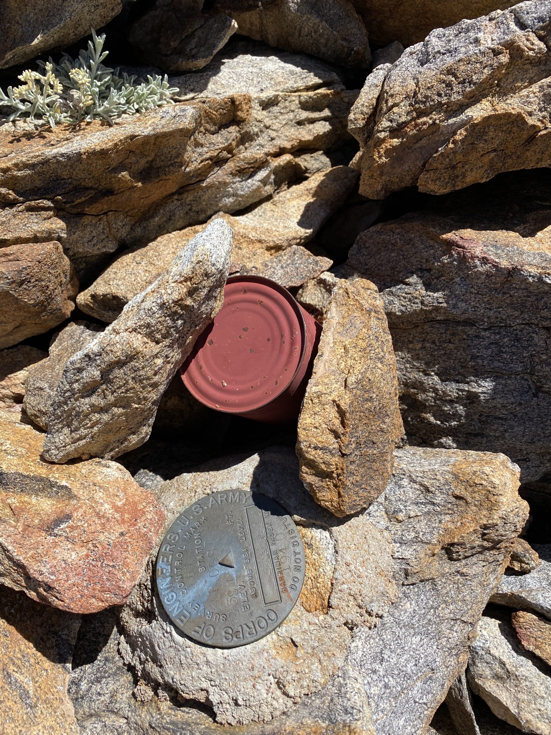
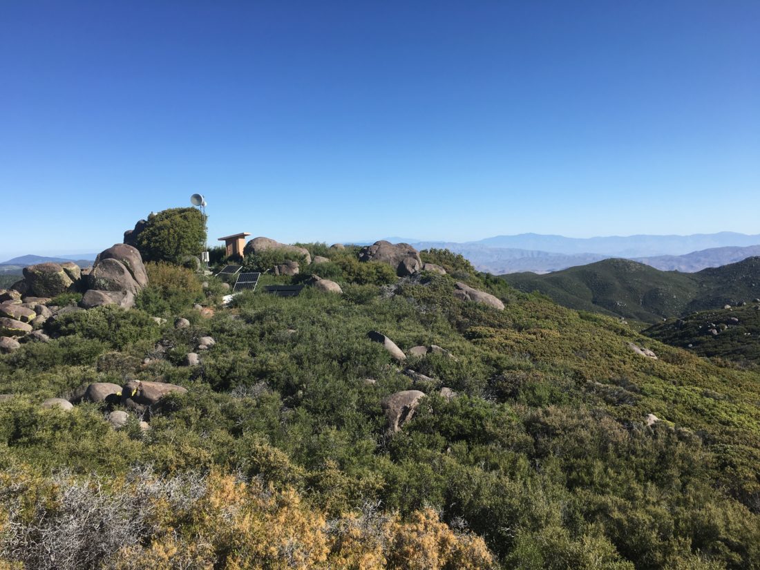
The summit is split into two parts. On the northern point is a communications tower, some solar panels, and a shed. I scrambled to the top of the rock and surveyed the incredible view.
I knew the Benchmark and the register marks were located on the southern peak, so I followed the trail over to it. Once atop its rocky summit, I found the main Benchmark and the two reference marks. A register was also located. It was not in the best shape. I might just return to fix that problem.
From this summit, I was rewarded with some fabulous views. After snapping some photos, I headed back down. Sure enough, I almost did slip on that one steep section but managed not to land on my rear.
Soon, I was back at the car having completed 3.5 miles in 2:06. For a change, I did not turn my tracking off, so that time includes all the exploration on the summits, so the moving time is probably about 15 minutes less. The biggest surprise was all the traffic I encountered driving back out. A total of four cars passed us driving down the road. Thankfully, I can a spot to pull over each time.
I am an avid peak bagger, sometimes backpacker, and former sea kayaker living in San Diego. I am the co-author of Urban Trails: San Diego, coming in Spring 2026!
I decided to go hike up Volcan Benchmark again now that some of the restrictions have eased. Figured an early morning hike would also reduce the number of people I might encounter on the hike. I pulled off the road next to the trailhead to the Volcan Wilderness Preserve. It was a bit brisk, so I had my warmer gear with me as I set off. Making my way up the familiar trail, my knee was feeling just a bit off. I have been having issues with it for a while. While I had hoped to be at or near the summit for sunrise, my pace wasn’t going to allow that.
As I climbed up the trail, the sound of birds chirping filled the air. Reaching the last section along the ridge, a pair of coyotes bounded ahead of me. Shortly thereafter, they began howling. I tried to record it but they stopped before I could capture it.
Once I reached the summit, I set out to find all three marks. I knew two were under the trees next to the Air Beacon. But where was the main one? The directions on the reference marks proved unhelpful. Peakbagger ‘s map did not seem to offer any more help.
I headed back onto the trail and decided to make the full loop. It was then I spotted the cement post. From an earlier photo I had seen, I knew there was a mark inside!
It certainly is not aligned with the two reference marks, but I will take it. I needed to be back in San Diego so my wife could use the car, so I began heading back down. Thankfully, the knee stayed about the same. Usually descents made it hurt more. As I came to the junction with the Five Oaks Trail, I decided to take it. I have never done it before. The first time I hiked Volcan, it was closed due to bees. The second time, I was more interested in comparing time with the first summit.
This trail is a single track that leads you through some beautiful scenery. It was here I encountered my first set of hikers. I stood off to the side with my buff raised, as they passed quickly. It was nice to see them don their masks. A bit later, I encountered my second group, three women, and their dogs. They stopped and I quickly passed by. Again, all three were wearing masks. The Five Oaks Trail reconnects about 3/4 of a mile from the trailhead. Here I had my third encounter, this time with a family of four making their way up. Again, all had masks. I gave them a heads up on the traffic I had seen.
As I was making my way down the last grade, three older hikers were just starting their hike. Sadly, the mask streak was broken. Two were walking across from one another, and as I stood off to the side, I began to wonder if the one nearer to me would move away. He didn’t. I was disappointed, as they looked like folks who hike regularly.
Upon reaching the ornate trailhead, a sheriff was beginning to hike up. I said a cheerful hello as I stepped away to allow him to pass.
Back at the car, I tossed my gear in, noting the request to park an extra distance away from each car was ignored. But, with that, my second peak of this year’s Six-Pack of Peaks was completed.
I am an avid peak bagger, sometimes backpacker, and former sea kayaker living in San Diego. I am the co-author of Urban Trails: San Diego, coming in Spring 2026!