Up on Tecuya Mountain

After spending the night at Mt. Pinos campground, I set off to hike up Tecuya Mountain (#110), which is on the Sierra Club Hundred Peak Section list. Yes, I am also slowly working on another peak list. There are a couple of routes to the summit, and I opted for the easiest. My legs were feeling the 14 miles from the day before. I turned onto Forest Road 9N21 and began driving the fairly well-groomed dirt road. I stopped briefly to move two modest-sized rocks out of the way, as they had tumbled from the hillside. Apart from a couple of minor ruts, the road was in fine form which I suspect is from the logging that is occurring toward the top. A fire occurred here not too long ago, and loggers were removing the dead trees for lumber. The firewood I used last night, I suspect, was from here, as some pieces had some char about them. I had a track from Keith Winston, and he marked the spot where he parked before setting off. The road seemed to be better than what he wrote, so I drove on to his second waypoint. Along the way, I spotted a small herd of deer, including several bucks. They stared at me for a bit before bounding off. I reached the second turnout and, looking at the very steep climb the road took, I knew that this was as far as my Outback was going to go.

I parked under some shade, grabbed my gear, and started up the road. Pictures don’t do it justice as to how steep that road became. Caltopo says it was 30+%, and my calves believed it. Thankfully, the grade eased, and I hiked through some nice forest, with views of the mountains peeking through. The road dipped down to a small saddle before making another steep climb. Once over it, I took the short spur to the actual summit where I had some nice views. Off to the southeast, I could see the I-5. I did not find any markers, so I began my return. I picked up a glass bottle that had been tossed aside and made another short side jaunt to another viewpoint. This one offered views northward and of the Central Valley. After carefully descending those steep sections, I was back at my car and ready for the long drive home. I spotted two more deer on the way out, but could not get a photo in time. Thankfully, the drive home was just about three hours, not bad for the day before a holiday weekend. The hike covered 1.39 miles and had a healthy 480 feet of gain, which I did in 38 minutes.


Buy Me a Coffee at ko-fi.com

I am an avid peak bagger, sometimes backpacker, and former sea kayaker living in San Diego. I am the co-author of Urban Trails: San Diego, available now!

In 2019, I became the third person to complete the San Diego 100 Peak Challenge. Not stopping with that accomplishment, I set my sights on the harder San Diego Sierra Club 100 Peak list, which I completed in 2021. In addition, I have conquered several Six-Pack of Peaks challenges (SoCal, San Diego, Central Coast, and both the Arizona-Winter and Arizona-Summer).

I am looking forward to exploring new summits and new adventures across the southwest. 

An afternoon saunter to Sawmill Mountain

After climbing Strawberry Peak in the morning, I drove over to hike the Mt. Pinos-Sawmill Mountain combo. I pulled into another nearly empty parking lot, broke out my camp chair, and enjoyed a tri-tip sandwich I bought at the local market (along with the firewood for later). Properly fueled up, I set off under the shade of the pines toward the first peak, Mt. Pinos. The section is a pleasant stroll up toward the high point of Ventura County. Soon, the familiar communications tower appeared. I grabbed a few photos from the summit and continued on. Just a short distance later is the Tumamait Trailhead and the Condor Viewing area. After briefly enjoying the panoramic view to the southwest, I continued on.

The trail now began descending, with some helpful switchbacks, down to a saddle and losing just under 500 feet of elevation. Here began the climb up to Sawmill Mountain. The temperatures were pleasant, and the light breeze felt great as I regained almost all the elevation I had just lost. The marker for the turnoff of the main trail was just as I remembered, and soon the tall rock cairn came into view. Unlike Mt. Pinos, which did not have any signs, Sawmill had two. I had a snack and some electrolytes before snapping more photos. Although I technically finished my SoCal Six Pack of Peaks Challenge with the summit of Strawberry Peak, I have a goal for myself to climb all 12 on the list this year. Just 5 more to go! The hike back to the car went quickly, even with the section down and up from that saddle. The entire hike took me 2:58, and covered 7.35 miles with a 1,427 feet of gain.  All told for the day, I hiked 14.19 miles in 6:19 with 3,222 feet of gain.

Thankfully, I wasn’t driving back to San Diego then. Instead, I was camping at the Mt. Pinos campground. I was able to get the same spot as last year. After unloading and setting up the Luno mattress, I got the fire going. The breeze had picked up, so it was a tad cool. I only brought a fleece, so I did feel it more than I would have liked to. After a nice steak dinner, I watched the fire for a while before dousing it and turning in for the night. I had accidentally left my tripod back at the trailhead, so no real astrophotography on this trip. I awoke at first light and quickly made breakfast and then broke camp. I drove back to the trailhead to see if the tripod might be there, but no luck. Next up was hiking up Tecuya Mountain before driving home.


Buy Me a Coffee at ko-fi.com

I am an avid peak bagger, sometimes backpacker, and former sea kayaker living in San Diego. I am the co-author of Urban Trails: San Diego, available now!

In 2019, I became the third person to complete the San Diego 100 Peak Challenge. Not stopping with that accomplishment, I set my sights on the harder San Diego Sierra Club 100 Peak list, which I completed in 2021. In addition, I have conquered several Six-Pack of Peaks challenges (SoCal, San Diego, Central Coast, and both the Arizona-Winter and Arizona-Summer).

I am looking forward to exploring new summits and new adventures across the southwest. 

Sweating on Strawberry Peak

I pulled into an almost empty parking lot at Red Box Gap to begin a multi-peak adventure. It was just a bit before 8:30, and I could feel the day warming up. Thankfully, I knew that Mt. Lawlor would be providing some shade during the first part of the hike. I cruised along the trail, filming bits and pieces of it. Once I reached the Lawlor Saddle, the real effort was about to start. The climb went well, as I was about 25 lbs. lighter than the last time I hiked this peak. I pushed past those annoying false summits until the true summit came into view.

Sadly, upon reaching it, I saw the registers open and their contents scattered about. Some graffiti also adorned the rocks. I looked around to find the summit signs, of which this peak always had several, were missing. I found some shade on the west side of the peak and had a snack and some much-needed electrolytes. I did not linger, as the entire descent back to the saddle would be in full sun. Once past the saddle, I still had stretches of shade to bring me some relief from the ever-warming day.

Back at the trailhead, two women were sitting under the shade of a tree with fully loaded backpacks beside them. I chatted with them a bit and learned they were hiking the entire Gabrielino Trail. I wished them well on their adventure and headed to my car. My Govee, a Bluetooth thermometer that I usually have on my pack, said the temperature was 88° F! I believed it. I drank some ice water, and then set off to my next stop, Sawmill Mountain. My ascent of Strawberry was done in 3:21, covered 6.84 miles, and had 1795 feet of gain.


Buy Me a Coffee at ko-fi.com

I am an avid peak bagger, sometimes backpacker, and former sea kayaker living in San Diego. I am the co-author of Urban Trails: San Diego, available now!

In 2019, I became the third person to complete the San Diego 100 Peak Challenge. Not stopping with that accomplishment, I set my sights on the harder San Diego Sierra Club 100 Peak list, which I completed in 2021. In addition, I have conquered several Six-Pack of Peaks challenges (SoCal, San Diego, Central Coast, and both the Arizona-Winter and Arizona-Summer).

I am looking forward to exploring new summits and new adventures across the southwest. 

Conquering San Bernardino Peak

One peak on the Six Pack of Peaks Challenge list that I have never been able to climb was San Bernardino Peak. Initially, the 2020 El Dorado Fire closed the surrounding area, and the 2024 Line Fire closed it again. Finally, the trail to the summit was open again, so I decided to finally climb it. There is a short section of driving on a forest road after passing the fire station in Angelus Oaks, which was not an issue for the Outback, but other cars might need to take care on this short section (one of the two cars at the trailhead was a Prius). Just after 6:30 am, I pulled into the dirt lot for the trailhead. As I gathered my gear, a nearby coyote was howling away. I had already gotten my free day hike permit from the San Gorgonio Wilderness Association, so I knew I was good to go.  After checking the information kiosk and remembering to hang my America the Beautiful pass from my mirror, I set off on my journey. The trail passes by a bench and a commemorative cairn that was built in 2017 as a reconstruction of the cairn that was erected for the San Bernardino Initial Point’s sesquicentennial anniversary (2002). The trail quickly leaves the trees and, for almost the rest of the hike, travels through the region burned by the El Dorado Fire. The trail has been repaired, but the scars of the fire remain. Probably, the biggest issue is the lack of shade along the trail, so an early start is highly recommended, along with sun protection and extra water. 

After about 3.5 miles and some helpful switchbacks, I reached Manzanita Flats. For about 1/2 mile, the trail was a bit more mellow, and I could cruise along for a bit. Here I met a gentleman also working his way up. We chatted a bit and discovered we both have Mt. Whitney permits and were using this hike as part of our training. I wished him luck on this ascent, as well as his attempt at Whitney.

The trail began climbing again and started to turn southward from what had been a mostly eastward direction. At about 5.8 miles, I reached Limber Pine campground and took a well-earned break. I had kicked around the idea of doing this peak as an overnight, but wanted to first do it as a day hike, so I would have a better sense of the level of effort required. But from what I have heard, the sunset views from here are outstanding! After a snack and some fluids, I set off, as I had about 2.2 miles left to go to reach the summit. About 1/3 of a mile later, I came to the Limber Pine Spring, which was still flowing nicely. I did not need water yet, but I had packed my Sawyer Filter and CNOC water bladder for later. Soon, I came across the Washington’s Monument Plaque. The protective covering made it hard to read the actual plaque, but this is what is on it:

Washington’s Monument

This plaque was set in commemoration of the sesquicentennial anniversary of the establishment of the San Bernardino Mountain Initial Point by Colonel Henry Washington, U.S. Deputy Surveyor, on November 8th, 1852.

A few hundred feet along the ridge to the south you will find the remains of Washington’s monument representing the first step in the land development of Southern California by the organized measurement and numentation of all public and private property in the region.

This plaque is dedicated in memory of Ira Alexander for his contributions to the surveying profession

Dedicated October 12, 2002

I decided to save going over to the actual Monument upon my descent. Shortly thereafter, I met the owner of the Prius on his descent. We chatted a bit, and he was proud as this was his first 10,000 summit. I congratulated him and we went our separate ways. I spotted the spur trail that would take me to the summit. Another nice thing was that I had left the fire-damaged region and had green trees around me. I made the short push to the summit!

A register box sat chained to a rock, and a simple summit sign lay nearby. I took in the views of San Jacinto Peak, San Gorgonio Mountain, and Mt Baldy, before finding a nice log to rest upon and enjoy my lunch. After a nice break, it was time for the 8 miles back down to the car. 

The trail overall was in good condition, and I expected to descend at a nice pace. I remembered to take the turnoff to view Washington’s Monument. After seeing it, I continued down the Limber Pine Spring. I filled my CNOC and filtered into my new M!go Water Bottles. With fresh, cool water, I set off once again. Few clouds had formed, so their shade was welcomed, but even so, the day was not too warm, and a light breeze also kept things pleasant. The miles ticked by, and with about 3 miles to go, I took another break for some snacks and electrolytes. Roof tops of buildings in Angelus Oaks started to become visible, but I still had about 1.5 miles left to hike. Finally, I caught the glint of sunlight off my car and knew I had finished my hike up San Bernardino! The entire hike was 16.02 miles, which I covered in 7:04 (not counting time at the summit). The total elevation gain was 4,715 feet, which I felt.


Buy Me a Coffee at ko-fi.com

I am an avid peak bagger, sometimes backpacker, and former sea kayaker living in San Diego. I am the co-author of Urban Trails: San Diego, available now!

In 2019, I became the third person to complete the San Diego 100 Peak Challenge. Not stopping with that accomplishment, I set my sights on the harder San Diego Sierra Club 100 Peak list, which I completed in 2021. In addition, I have conquered several Six-Pack of Peaks challenges (SoCal, San Diego, Central Coast, and both the Arizona-Winter and Arizona-Summer).

I am looking forward to exploring new summits and new adventures across the southwest. 

Atop Modjeska Peak

After my road walk up Santiago Peak, I decided to make the relatively short climb up Modjeska Peak. In the past, I could have taken the connector trail from the saddle over to partway up the peak. However, a small landslide had appeared to wipe out a section of that trail. So, instead, I returned to my parked car and took the other road to the summit. There is a fire break cut through here from an older fire. Unlike the road up Santiago, this road was quite rocky and certainly not one I cared to drive. When I passed the junction to the connector trail, I then had the choice to take the short, albeit steeper and direct fire break to the summit, or follow the road around the side of the mountain. I was feeling good, so I pushed up the steep fire break.

From the summit, I could take in the extent of the fire on Santiago Peak. I found the summit sign and took a few photos. It was starting to warm up, so I was ready to return to the car. Rather than deal with that steep rocky fire break, I took the road back. While not exactly rock-free, the grade was certainly less. Once back at the car, I pulled in behind 3 vehicles that were also heading down. Before too long, I was back in Silverado Canyon and headed home. The side trip up Modjeska Peak took 42 minutes to cover the 1.65 miles and 432 feet of gain.


Buy Me a Coffee at ko-fi.com

I am an avid peak bagger, sometimes backpacker, and former sea kayaker living in San Diego. I am the co-author of Urban Trails: San Diego, available now!

In 2019, I became the third person to complete the San Diego 100 Peak Challenge. Not stopping with that accomplishment, I set my sights on the harder San Diego Sierra Club 100 Peak list, which I completed in 2021. In addition, I have conquered several Six-Pack of Peaks challenges (SoCal, San Diego, Central Coast, and both the Arizona-Winter and Arizona-Summer).

I am looking forward to exploring new summits and new adventures across the southwest. 

Returning to Santiago Peak

Since the Maple Springs Road and portions of the North Main Divide Road were recently reopened after the Airport Fire, I knew that I should take this opportunity and knock out Santiago and Modjeska Peaks. The drive up from Silverado Canyon was uneventful with just a few folks walking along the paved section, getting their morning exercise in. The north side of the mountain was untouched by the fire, so it was still nice and green. As I neared the ridge, I could start to see the fire damage. When I was atop Sitton Peak a few days earlier, the extent of the fire was clear to see. I parked at my usual spot, at the junction with the road to Modjeska and the road that continues onto Santiago Peak. A water tanker was parked here. Since the road was in really good shape, I assumed it was here to help keep the dust down during the road work. I was surprised to find another car there this early, but it turns out they had driven up the night before and had camped there. After I gathered my gear, I chatted with them a bit. They said that they counted 30 cars driving up to the summit last night. I said my farewell and set off down the road. The landscape was devoid of the trees and brush that lined its slopes. While wildflowers were blooming and some green grasses were taking hold, it was a strange sight. I could easily see the trail I typically took to the summit of Santiago and the connector trail that I used for Modejska.

Once I reached the junction with the Joplin Trail, a warning sign told of its closure. With the Holy Jim Trail also closed, either a very long hike up an active road or starting partway up were the only options (sans just driving to the top) to summit this peak. A bit further down the road that had clearly been rebuilt, I passed the saddle between the two peaks. It is here that the trail breaks away from the road. I knew that no work had been done on it, so I was not too keen on using it. I did find that someone left a summit sign here, so I snapped a quick photo before continuing along the road. Looking back to the south, I could see the damage to Modjeska and also spied a landslide that had passed over the trail. I can recall that section of the trail before the fire as one that seemed a bit unstable. After a few turns, the summit came into view. Along the way, two SUVs passed me. They parked off next to one set of the towers, while I made my way to the summit. I snapped a few pictures before walking to the south end of the area to see the damage. I can recall watching the live video from the tower cameras as the fire raced over the summit.

Since today was a federal holiday, I wanted to get back down before more traffic headed up the mountain. I again thought about taking the trail down, but it was getting warmer and I wanted to summit Modjeska as well. I hustled back to the car, as taking that connector trail was not an option. Back at the car, the boys who had camped had packed up and left, and I stopped my tracker, as I wanted to have a Modjeska-only track recorded. I was up and down in 2 hours flat, covering 6.29 miles with 979 feet of gain.


Buy Me a Coffee at ko-fi.com

I am an avid peak bagger, sometimes backpacker, and former sea kayaker living in San Diego. I am the co-author of Urban Trails: San Diego, available now!

In 2019, I became the third person to complete the San Diego 100 Peak Challenge. Not stopping with that accomplishment, I set my sights on the harder San Diego Sierra Club 100 Peak list, which I completed in 2021. In addition, I have conquered several Six-Pack of Peaks challenges (SoCal, San Diego, Central Coast, and both the Arizona-Winter and Arizona-Summer).

I am looking forward to exploring new summits and new adventures across the southwest. 

Sweating up Sitton Peak

I pulled off Ortega Highway across from the now-closed Candy Store. I guess with the nearby campground closed due to the Airport Fire, there wasn’t enough business to keep it open. It was going to be a warm day, so I wasted no time in getting moving. This was going to be my 6th time up this peak, so I cruised along the very familiar trail. I snapped a few photos along the way, as there were still flowers blooming. When I reached 4 Corners, I noticed one of my sand baskets had come off my trekking poles. That happened on this trail once before. I kept hiking along, knowing I would be retracing my route rather than taking the Bear Ridge Trail that I had planned.

I powered up the last steep section to the summit and finally took a break. I did not stay too long, as it was getting even warmer. After grabbing some photos and mixing up some electrolytes, I set off. There actually was more shade than one would think for this hike, and I was thankful for that. As I cruised back to the car, I kept scanning the trail for my missing sand basket (and danger noodles), and as luck would have it, I found it! Soon, the highway came back into view, and my trek was drawing to a close. The car’s thermometer read just over 90°F, and I would believe it (it left my Govee at home, so I did not record the actual trail temps). Including the time at the summit, I clocked this hike in at 3:51 for the 9.4 miles. Not too bad!


Buy Me a Coffee at ko-fi.com

I am an avid peak bagger, sometimes backpacker, and former sea kayaker living in San Diego. I am the co-author of Urban Trails: San Diego, available now!

In 2019, I became the third person to complete the San Diego 100 Peak Challenge. Not stopping with that accomplishment, I set my sights on the harder San Diego Sierra Club 100 Peak list, which I completed in 2021. In addition, I have conquered several Six-Pack of Peaks challenges (SoCal, San Diego, Central Coast, and both the Arizona-Winter and Arizona-Summer).

I am looking forward to exploring new summits and new adventures across the southwest. 

Hiking the Tahquitz Peak Loop

As I left San Diego under drizzle, I hoped the forecast I read for Tahquitz Peak was correct. Luckily, as I crossed into Temecula, the clouds and rain faded away, and I had clear skies. After grabbing a biscuit and coffee from McDonald’s, I continued the drive up to Idyllwild. Since I was planning on hiking the Devil’s Slide trail, I knew I needed to get a permit from the Ranger Station in town. Since this was a weekday, I could obtain one of the self-issued permits for this hike. Otherwise, I would have had to either get one in advance or wait for the station to open. After filling out the permit and slipping the white copy into the slot, I made the short drive up to Humber Park. A few cars were here when I arrived. Again, the upside of doing this on a weekday. I hung my America the Beautiful pass from my mirror, as either that or an Adventure Pass is required. The air was cool, but once again, I knew once I started hiking, I would be shedding my layers in 5 minutes, so that fleece once again stayed in my pack. The plan was to hike up to the fire lookout tower atop Tahquitz Peak and then loop back through Tahquitz Valley.

The trail begins as a climb straight from the parking lot. Thankfully, the grade is not overwhelming. I suspect it is the altitude that gets hikers as they work their way up. Off to the left, you have a stunning view of Suicide Rock (another trail I need to do). I passed by two springs that were barely flowing. As I neared Saddle Junction, I met a PCT hiker from the Netherlands who was having to hike back down to Idyllwild to get a package. We chatted a bit, she did her first 20-mile day the day before, so she felt she was finally getting her “hiker legs”. I wished her well on her journey. At the junction, I took a right and joined the PCT myself, as I hiked southward toward Tahquitz Peak. The section was a lot more gentle than the 1,700 feet of gain I made coming up from Humber Park. After about 1.4 miles, I came to the spur trail that would take me to the lookout tower. The tower was another 0.4 miles further. Unfortunately, the tower will not be open in 2025 due to structural issues and budget concerns. I climbed the stairs up the tower and began taking in the sweeping views, while enjoying a well-earned snack. A fellow hiker and his dog joined me on the summit, and we chatted for some time before they set off back down. I lingered a bit more, doing some filming before I too set off.

Back at the junction with the PCT, I continued east along it for about 0.7 miles until I left it and started heading north toward Tahquitz Meadow. The creek had already dried up for the season, but the meadow was still beautiful. When I reached the Caramba Trail, I joined it to return me back to Saddle Junction. Once there, I mixed up some electrolytes and broke open a bag of trail mix to enjoy on my descent. I passed a few hikers making their way up the trail. Then I spotted the familiar colors of a ranger hiking up the trail. We stopped and chatted for some time, and she did indeed ask for my permit, which I had. She continued up, and I continued down. The call of some Mexican food in Idyllwild was getting strong. The entire loop was 9.8 miles with 2604 feet of gain in 4:13 (including the stops with the PCT hiker and the Ranger).


Buy Me a Coffee at ko-fi.com

I am an avid peak bagger, sometimes backpacker, and former sea kayaker living in San Diego. I am the co-author of Urban Trails: San Diego, available now!

In 2019, I became the third person to complete the San Diego 100 Peak Challenge. Not stopping with that accomplishment, I set my sights on the harder San Diego Sierra Club 100 Peak list, which I completed in 2021. In addition, I have conquered several Six-Pack of Peaks challenges (SoCal, San Diego, Central Coast, and both the Arizona-Winter and Arizona-Summer).

I am looking forward to exploring new summits and new adventures across the southwest. 

Tackling Cucamonga and Etiwanda Peaks

I pulled into the Ice House Canyon parking lot just around 6:30 am. Given this was a Monday, I did not have any trouble finding a spot, as there were only about 8 other cars here. It was nippy, but I knew that once I started up Ice House Canyon, I would be shedding that fleece layer in no time, so it stayed tucked in the pack. Next to the trailhead, work has begun on the new Heroes Project retreat. This is the organization that holds the Climb for Heroes event up Mt. Baldy, which I have done in the past. I had already gotten the free permit online needed to hike Cucamonga, so I skipped filling out the paper one and set off. The creek was flowing nicely as I passed by the cabins in the canyon. Just a few wildflowers remained along the side of the trail. About two miles in, the sun finally rose over the ridgeline. I stopped and got a photo for Ted, as he does enjoy a good sunrise. The trail continued its climb toward Icehouse Saddle. At the junction with the trail from Cedar Glen Campground, a trail runner was standing in front of the sign with a puzzled look on his face. I inquired about where he was trying to get to, and he replied, “Cucamonga”. I told him to stay on this trail and then look for the sign toward the east once you were at Icehouse Saddle. He thanked me and began jogging off. I shook my head at how unprepared he was. Before too long, I reached the saddle and took a well-earned break.

After enjoying the silence, I set off along the Cucamonga Trail toward the summit. From time to time, I had some great views of the high desert to the northeast. I stopped at the Bighorn Mine for a quick photo, but did not venture inside either tunnel. I reached the Bighorn Saddle and got ready for the 1,200 or so feet of gain that lay ahead of me. A few trail runners had passed me earlier in the climb, and they were now making their return as I climbed the switchbacks. I asked about that trail runner I helped earlier to find out if he got on the right trail. They said they did see him, so I didn’t have to worry about him heading the wrong way.

Partway up, I met two backpackers making their return from camping on the summit. I asked what their water load was for their trip, and they replied 6 liters. They had filled up at Columbine Spring, so they did have all that water weight from the beginning. We wished each other a safe hike and continued on. Soon, I spotted the wooden post indicating the side trail that you use to reach the summit, and I remembered the struggle up this section the last time I climbed Cucamonga. Thankfully, it was a bit easier this time around. As I reached the broad summit, I looked around for anyone else, but it was deserted! Slipping off my pack, I pulled out my tripod to be able to take the classic photo standing on the rock outcropping. I was glad I had the foresight to bring it, just in case. After snapping some more photos, I found a nice spot to enjoy an early lunch. A chipmunk chirped nearby as it tried to work its way over to grab some crumbs. As I was finishing my PB&J, two pairs of hikers joined me on the summit. We swapped cameras for some photos, and then I set off for my next destination, Etiwanda Peak.

Sitting just under a mile to the east of Cucamonga Peak is Etiwanda Peak, which is on the Sierra Club Hundred Peaks Section list. The trail mostly follows the ridgeline until a nice-sized cairn marks the junction with its side trail to the summit. After a short but steep climb, I stood atop the white quartz that sits at the top of the summit and soaked in the views. Unlike Cucamonga, I had a full 360° view of the area. After a quick snack, it was time to make my way back down.

One of the pair of hikers who joined me at the summit was also making their way to Etiwanda, and I let them know the cairn for the side trail was very visible. At Bighorn Saddle, I briefly thought about climbing the ridgeline and summiting it as well, but I plan on climbing Ontario again, so I opted to save it for that trip. 

Back at Icehouse Saddle, I paused for just a bit to rearrange some snacks for the hike down the canyon into one of my hip pockets. I cruised along, making good time on the descent. I passed a couple of backpackers making their way up to Kelly Camp for the night, and a few folks exploring Ice House Canyon. Before too long, I started passing the cabins again and knew the end of the trail was not far off. Once back at the car, I tossed in my gear and changed into a dry shirt. After a well-earned meal from In-N-Out, I hit the freeway home. The hike was 14.48 miles in 7:04 with 4770 feet of gain. 


Buy Me a Coffee at ko-fi.com

I am an avid peak bagger, sometimes backpacker, and former sea kayaker living in San Diego. I am the co-author of Urban Trails: San Diego, available now!

In 2019, I became the third person to complete the San Diego 100 Peak Challenge. Not stopping with that accomplishment, I set my sights on the harder San Diego Sierra Club 100 Peak list, which I completed in 2021. In addition, I have conquered several Six-Pack of Peaks challenges (SoCal, San Diego, Central Coast, and both the Arizona-Winter and Arizona-Summer).

I am looking forward to exploring new summits and new adventures across the southwest. 

Climbing Mt. Willson from Chantry Flats

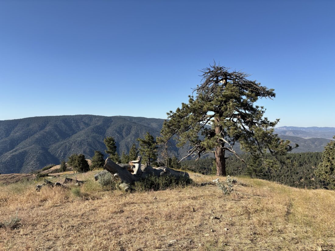
Finally had the chance to hike Mt. Wilson from Chantry Flats, as this route had been closed since the 2020 Bobcat Fire. So, with a very early morning start, I made the drive up. Pulling into the nearly empty parking lot just after 6, I gathered my gear and got ready to head off. From what I have read, this parking lot becomes packed on the weekends, much like Ice House Canyon’s parking area can be. For now, my Outback was one of only about 8 cars. I was planning on doing the hike as a loop, up the Gabrielino Trail, with a side hike to Sturtevant Falls, and returning to Chantry Flats via the Winter Creek Trail.

I followed the dirt road down into San Olene Canyon and made the first of many water crossings. To the left was the Lower Winter Creek Trail, and to the right, the Gabrielino Trail continued. Due to budgeting issues, the toilets at this junction were closed. I now entered the East Fork Santa Anita Canyon and began following the Big Santa Anita Creek. Here I passed by the Big Santa Anita Canyon Cabin Tract. These historic cabins were built by private citizens on Forest Service land under a Special Use Permit over 100 years ago. They are still owned by local families, many of whom are descendants of the original owners. As I continued past these cabins, sill dams lined the creek. The goal of these dams was to keep silt and other debris from impacting the main dam further downstream. After about 0.7 miles, I came to the junction with the side trail to Sturtevant Falls, and I hustled along it for about 0.3 miles. After a simple water crossing followed by a short scramble, the 50-foot falls stood before me. I enjoyed a bit of solitude, and I can only imagine what it is like on a hot weekend. I returned to the last junction and began my climb in earnest. I was thankful to have the “May grey” in effect. While I had my AirPods with me, the sounds of the flowing water were just too enchanting not to be my hike’s soundtrack for a while. The trail was in pretty good shape, with just one or two spots to watch my footing.

Soon, I came to Spruce Grove Trail Camp and saw that someone had made the trek here to spend the night. A small hot spot was forming on my right foot, so I stopped briefly to address it with some KT tape. I also took this as a good time for a snack before continuing. Shortly thereafter, I came to Sturtevant Camp. Apparently, you can rent cabins here on the weekend. Not sure if I can convince my wife to make the hike up to them. Just past here is the connector trail over Mt. Zion. Signs cautioned hikers that while the trail is open, it is still being rebuilt and to use extreme caution if they choose to hike it. I stayed on the Gabrielino Trail and continued my ascent toward Mt. Wilson. The overcast skies I had previously were gone, so I could feel the warmth of the sun.

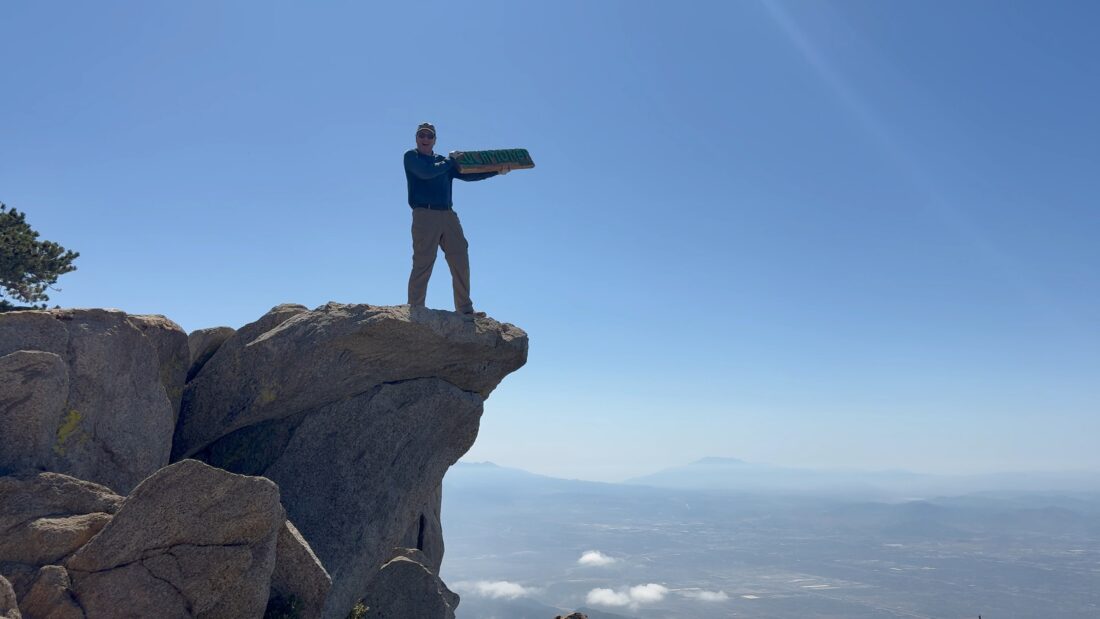
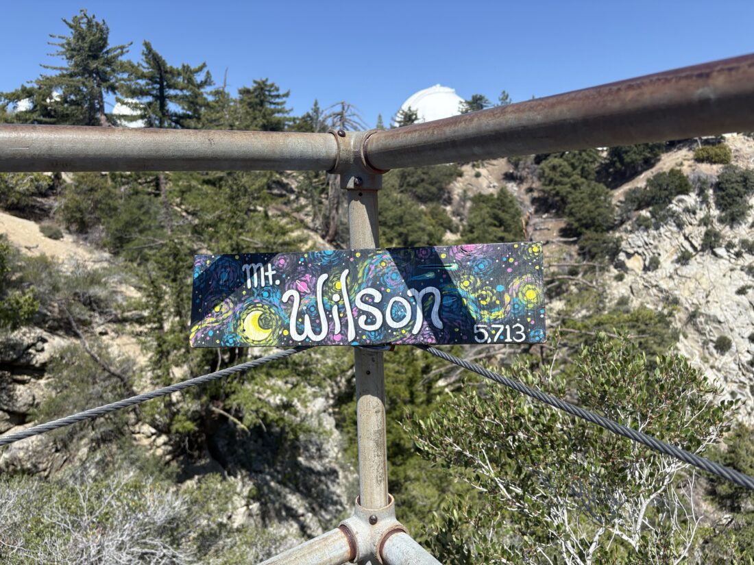
The trail had a good amount of shade, so it wasn’t too much of an issue. In fact, for the most part, I kept my sun hoodie down. Checking my map, I saw I was getting close to the summit, which was good, as I was in need of a break. Being so close, I pushed on for the last 1/4 mile. As I reached the top, I turned right to the viewpoint on Echo Rock to snap my summit selfies. I did not linger as I really wanted to sit in the shade at the Cosmic Café and eat my lunch. As I strolled along the road, past the various domes and other astronomical items, I ran into another hiker about to make his way down the Gabrielino. We swapped a few bits of trail beta and then went our separate ways. Once at the Café, I slipped off my pack, took off my shoes and socks to give my feet a rest, and broke out my lunch. Being a weekday, the café is not open. On the upside, there wasn’t another person there, so I ate my PB&J in blissful silence. I drank a liter of water and mixed up some electrolytes for the descent. I carried up 2.75 liters, but next time I will probably carry less and maybe pack my water filter if I am really concerned.

After walking over to the benchmark and the plaque honoring Wilson (who I am distantly related to), I stepped onto the Mt. Wilson Trail. This section of the trail was completely burned over by the Bobcat fire. After about 0.6 miles, this trail joins the Mt. Wilson Toll Road. I thought about taking the side road up to Mt. Harvard, but opted to skip it. While this used to be an actual road, large rocks have now fallen onto the roadway. With the sounds of flowing water long since gone, I slipped my AirPods on and enjoyed an episode of Backpacker radio. In 0.5 miles, the Mt. Wilson trail again leaves the Toll Road. Since the Toll Road is still closed from the fire (a large sign informs you of such), I made my left-hand turn back onto the trail. I hiked down the trail toward Manazanita Ridge. Here, a nice bench offers some respite for hikers needing a break from their climb. The Mt. Wilson Trail veers to the right, but it is also still closed due to the fire damage. Instead, I followed the Winter Creek Trail down. After about 1.2 miles, the sounds of Winter Creek began to fill the air, and I put my AirPods away. How often do you get to hike next to flowing water in Southern California?

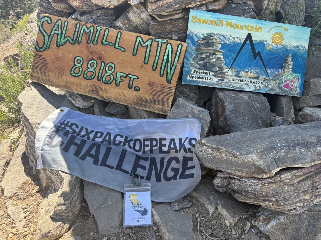
At Hoegee Trail Camp, where a few more private Cabins were, along with 13 primitive campsites, the trail splits. The Lower Winter Creek Trail follows the creek back and connects with the Gabrielino before Chantry Flats. While the Upper Winter Creek Trails return you to Chantry Flats proper. My routes that I had loaded onto my phone did not properly sync overnight, so I was hiking a bit in the blind. Since how often do I get to hike next to a flowing stream, I opted for the lAt Hoegee Trail Camp, where a few more private cabins are, along with 13 primitive campsites, the trail splits. The Lower Winter Creek Trail follows the creek back and connects with the Gabrielino before Chantry Flats. While the Upper Winter Creek Trails return you to Chantry Flats proper, my routes I had tried to load onto my phone did not properly sync overnight, so I was hiking a bit in the blind. Since I don’t often get to hike next to a flowing stream, I opted for the lower trail. The trail crisscrossed the stream 5 or 6 times. I passed the other end of the Zion Trail, along with the same warnings posted. After 1.5 miles, I came back to the junction with the Gabrielino Trail. There were now other folks on the trail, and a crew from the Forest Service doing some work. I made the 0.6-mile, 390-foot climb back up to the parking area, all the while questioning whether the stream was worth this climb. Once back at the trailhead, I walked over to the Pack Station and bought a cold Coke and a Snickers and enjoyed them on the patio. After tossing my gear into the car and putting on a dry shirt, I began the drive home, hoping the LA traffic wouldn’t be too bad. I logged my loop at 15.23 miles, in 6:39 (turning off the tracker at the Café) and 4,808 feet of gain. That was my first peak for the 2025 SoCal Six Pack of Peaks Challenge.


Buy Me a Coffee at ko-fi.com

I am an avid peak bagger, sometimes backpacker, and former sea kayaker living in San Diego. I am the co-author of Urban Trails: San Diego, available now!

In 2019, I became the third person to complete the San Diego 100 Peak Challenge. Not stopping with that accomplishment, I set my sights on the harder San Diego Sierra Club 100 Peak list, which I completed in 2021. In addition, I have conquered several Six-Pack of Peaks challenges (SoCal, San Diego, Central Coast, and both the Arizona-Winter and Arizona-Summer).

I am looking forward to exploring new summits and new adventures across the southwest.