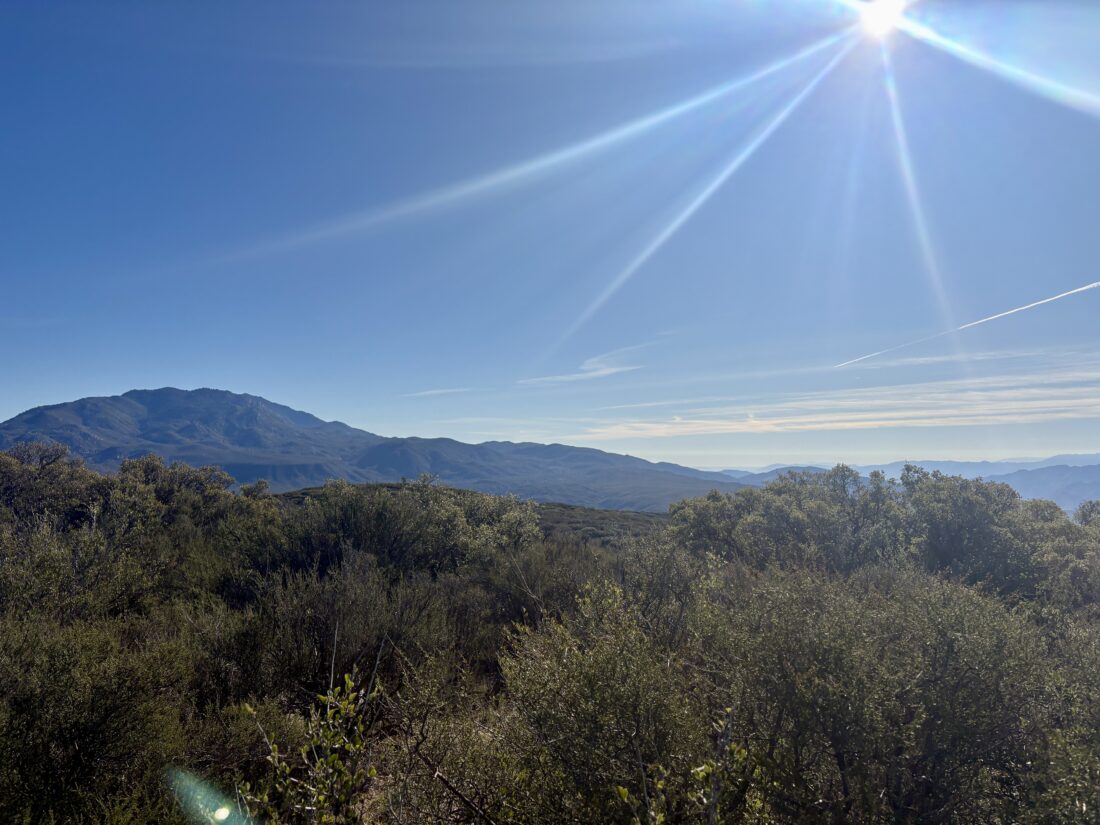
After wrapping up one of my courses the day before, I decided to summit Lookout Mountain. Just a mile past the Paradise Valley Cafe, I pulled into an empty dirt parking area for the Pacific Crest Trail. I grabbed my gear, carefully crossed the highway, and started hiking south along the PCT. I cruised along the well-worn trail, and as I crested a slight rise, the faint cries of some coyotes could be heard. I continued on, checking my route to make sure I did not miss the use trail to the summit. The use trail initially followed a small gully, then left it, and began the steep climb to the summit. The route was well ducked, so I had almost no issues staying on track. From time to time, I repaired a cairn or two and added a couple that might help fellow hikers.
Soon, the summit came into view. The familiar red register can sat tucked near the benchmark, and I added my name. The summit is relatively flat, and the brush is a bit high, so the views are not the best. After a quick snack, I began retracing my route down the mountain.
Once again on the PCT, I got a message that a friend who got a permit to hike the PCT had booked her flight to San Diego! I plan to join her for a few nights on the trail when she sets off. Back at the car, a few other cars had parked. I suspect they were headed north along the PCT. Initially, I planned to have lunch at PVC, but it was too early for me, so I just headed home. That summit was my #54th HPS peak! I logged the hike as 4.0 miles in 2:14, with 927 feet of gain.
I am an avid peak bagger, sometimes backpacker, and former sea kayaker living in San Diego. I am the co-author of Urban Trails: San Diego, available now!
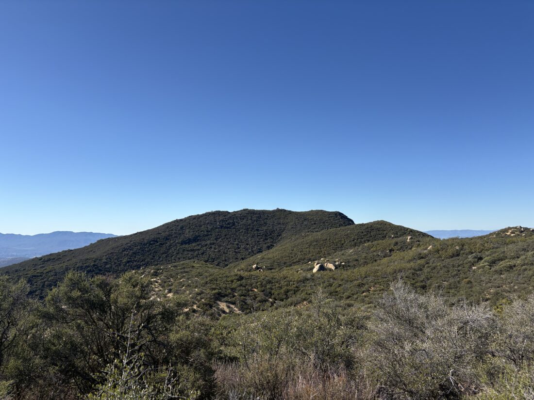
Little Cahuilla Mountain’s trailhead sits at a junction for several roads, so I made sure to park carefully. As I set off, I quickly discovered that this trail was quite different from the one I was just on. It was clearly less traveled, and I would have to take care with my navigation. The trail was a bit overgrown, but not to the point of true bushwhacking. Cairns dotted the trail from time to time, and I repaired a few along the way. My route would take me up and down several minor bumps, which gave me some lovely views as I scanned the brush for the trail to continue.
Soon, the steep final push to the summit started. I made it through the manzanita and red shanks and popped out to see the rocky summit before me. I scrambled over the rocks and sat under the shade of a lone tree. A register sat tucked in the rocks. I enjoyed a snack and the vistas. After the break, I began the slog back to the car. Once back at the car, I returned to the trail to collect a pair of jeans and an abandoned backpack. The hike up Little Cahuilla Mountain was 2.47 miles and took 2:01.
I am an avid peak bagger, sometimes backpacker, and former sea kayaker living in San Diego. I am the co-author of Urban Trails: San Diego, available now!
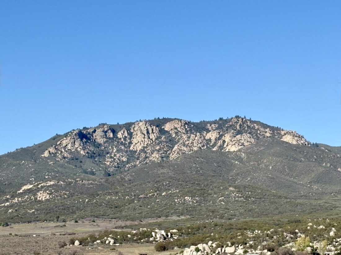
Today’s adventure was to summit a pair of peaks near Anza, Cahuilla Mountain, and Little Cahuilla Mountain. As I drove Forest Road 6S22 to the first trailhead, I was glad to be in my Outback; while not technical, the road was rougher than the one up to nearby Thomas Mountain a few days ago. I found the wide turnout and gathered my gear. These two hikes would be a perfect way to burn off some of the excellent Thanksgiving meal I had the day before. The trail was in great shape, and I found myself cruising along. As it wound its way up the mountain, I would have views of Thomas Mountain to my east and both San Gorgonio and San Jacinto to my north. After a while, the chaparral faded, and oaks and pines began to appear. The oaks had started to change color, so the contrast between their leaves and the pines made for a fantastic fall hike.
Before too long, I was at the summit. A wooden sign is affixed to two metal poles, and an ammo box serves as the register. I took a short phone break to help my wife find an old photo of my son sitting on my father’s lap aboard the train in Old Poway Park. With that task done, it was time to head back down. Views off to the west now appeared from time to time, as the crunch of leaves sounded under my boots.
The trail is in excellent condition, so I flew back down to the car. I tossed my gear in and set off to make the short drive to the trailhead for Little Cahuilla Mountain. The entire hike was 6.0 miles and took me 2:36.
I am an avid peak bagger, sometimes backpacker, and former sea kayaker living in San Diego. I am the co-author of Urban Trails: San Diego, available now!
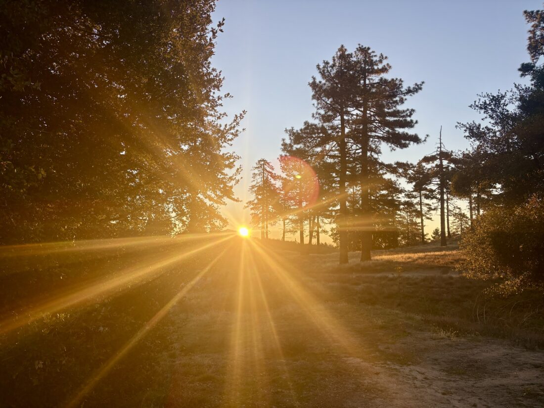
The drive up to Tool Box Springs Campground was uneventful, but I would not recommend opening a carbonated beverage for a bit upon arrival. There was one other camper here, and I found a relatively level spot to call camp for the night. There were still fire restrictions in place, so no campfire to pass the time. I brought up some BBQ from The Rib Shack in Fallbrook for dinner, which I ate under the fading light. I crawled into the car and watched one of my lectures for my Business of ORE course. Once it was truly dark, I spent some time photographing the night sky.
The night was not terribly cold; the low was just about 44°F. I awoke to the sun shining into my back window and then quickly made a cup of coffee and ate some oatmeal. The goal today was to climb Thomas Mountain and then on over to Little Thomas Mountain. The trailhead was directly next to the campground, so once I had broken down my sleeping kit, I set off. The trail used to be an old road that had long since been closed. I cruised along, rewarded with some great views from time to time. I would periodically check my progress, and before long, the summit came into view. A lone communications tower stands there, as well as the remains of a fire lookout tower.
This is also one of the yellow post campsites on Thomas Mountain, and I could have spent the night here instead. After a few photos, I headed north to another yellow post site, then down a use trail that followed the ridgeline. That trail connected with the main road, which I continued to follow northward toward Little Thomas Mountain. While this summit is not an official yellow post site, one certainly could also camp here. The day had warmed, so I shed my fleece and began my return.
Instead of completely retracing my route, I opted to take the road back to the campground. That would give me a chance to see some of the other yellow post sites. Snow-capped San Jacinto loomed to the north, and San Gorgonio would appear behind it from time to time. Sites 6-8 were empty, but each looked great for an overnight. The only advantage of staying at Tool Box Springs Campground is that there is a pit toilet. At site 8, a rope swing hung from a limb, and I had to stop and enjoy some time on it.
Before too long, the campground came back into view. A faint smell of a campfire filled the air. That other camper had a prohibited fire the night before and another in the morning as I left, and they had since departed the site. After stowing my pack, I walked over to the site to find a still glowing log in the fire ring. I returned with 2 gallons of water and drenched the embers out properly. The drive down the mountain and eventually home went quickly, even on the day before Thanksgiving. The loop covered 5.99 miles in 2:21 with 1,108 feet of gain. This also crossed another peak of the Hundred Peak Section list for me, with just 49 to go.
I am an avid peak bagger, sometimes backpacker, and former sea kayaker living in San Diego. I am the co-author of Urban Trails: San Diego, available now!
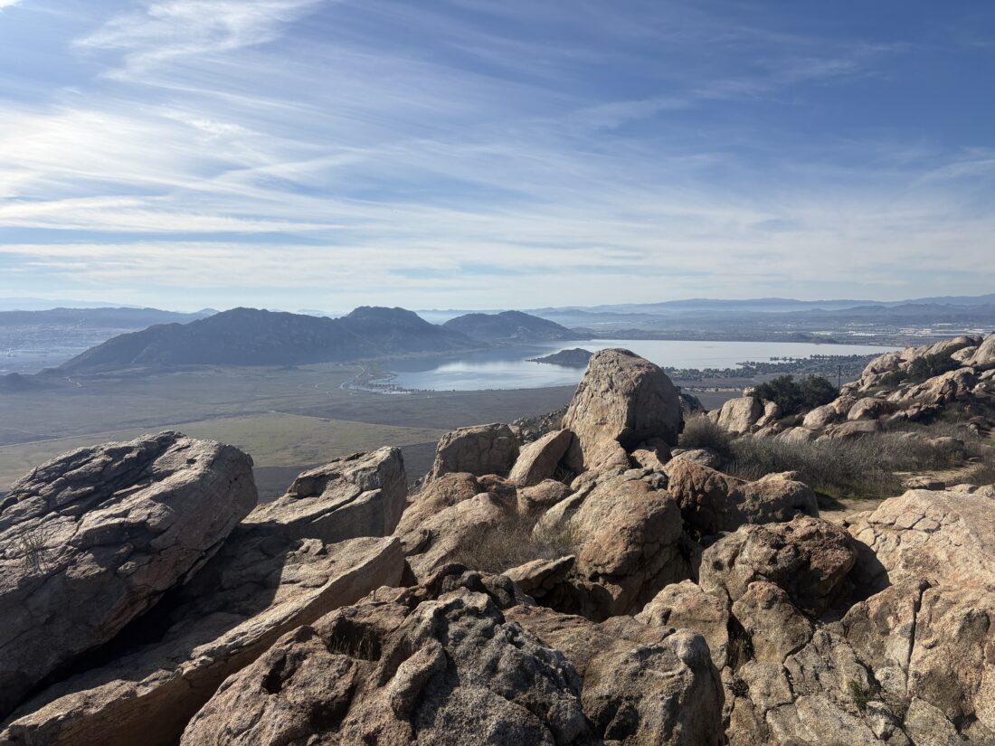
Since I owed Leslie Adams a scone from The Crafted Scone, we decided to meet up near Mount Russell in Riverside. This peak is on the Lower Peak Committee list, and it was the perfect opportunity to do a nice hike and catch up. We parked at a small turnout before the main entrance to the Lake Perris State Recreation Area. Leslie brought her dogs, Navi and Raven, along to enjoy the trail as well. Our route would have us work our way east to the base of the mountain, slightly gaining some elevation along the way. Navi and Raven would stop and enjoy the smells as we drew nearer. After a brief wrong turn, which I have edited out of the track below, the climb began.
The ascent was steep, and once it reached the ridgeline, Leslie opted to turn back. While it would ease up for a bit, there were still some steep sections ahead. She carefully headed back down the trail, and I hustled onward. The trail did ease somewhat, but now I had vistas to enjoy as I pushed on. The trail was easy to follow, and at two junctions, signs for a recent or upcoming trail race pointed the way. After dropping down from the false summit, I turned onto the trail to the true summit. Once at the top, I was rewarded with some clear views of the Inland Empire. The snow-capped mountains to the north and east were stunning.
After snapping a few photos, I started my descent, knowing Leslie would want the promised scone. I caught up with her about ½ mile from the trailhead. She had been collecting some trash along the trail, and the dogs were enjoying their time on the trail as well. Back at the car, I broke out some chairs, and under the shade of a willow, we enjoyed our well-earned scones and caught up even more. I logged the hike at 4.87 miles in 2:22 with 1,290 feet of gain.
I am an avid peak bagger, sometimes backpacker, and former sea kayaker living in San Diego. I am the co-author of Urban Trails: San Diego, available now!
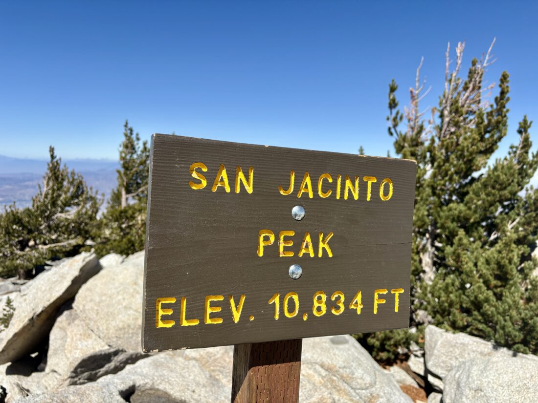
With the Palm Springs Aerial Tram closed for its annual maintenance, I had three options to ascend Mt. San Jacinto: via Marion Mountain Trail, Devil’s Slide Trail, or Deer Springs Trail. I had done the first two routes, so I decided to try taking the Deer Springs route to the summit. Initially, I had planned to do this as a backpacking trip staying at Little Round Valley, but the weather forecast called for a 40% chance of snow showers, so that was not going to happen. Instead, I opted to just do it as a long day hike instead. I pulled into the Ranger Station in Idyllwild and found that the only permits were for overnight trips. Given the government shutdown, it did not surprise me that the day-use permits had run out. So, figured I would hike without having one (they are free). From there, I made the short drive to the parking area for Deer Springs Trailhead. I shouldered my heavy pack and set off. I opted to carry 2.75 liters of water, as well as my Sawyer filter. According to SacJacJon.com, there should have been some water flowing at various spots along the trail, and the rains from the day before should ensure the flows were good. The temperatures were in the mid-50s, and the skies were partly cloudy as I set off up the trail. I knew I had a long, hard day ahead of me and tried just to keep a steady pace. I mentally broke the hike down into sections, from each trail junction to the next. My first milestone was the turn off to Suicide Rock about 2.1 miles in. Here, I made sure to have a quick snack while I continued my climb. The next up was Strawberry Junction, 1.6 miles later. There, I would now join the Pacific Crest Trail for a while.
When the PCT met with the Marion Mountain Trail, I decided to take a break and have another snack. A Sierra Club Los Angeles outing also arrived just as I did, and also took a short break. It was still cool, and I had worked up a sweat, so I slipped on my fleece to keep from getting a chill. I chatted with some of my fellow hikers. Their plan was to climb Marion Mountain and Drury Peak, two of the several Hundred Peak Section peaks scattered around San Jacinto. I stashed my fleece and set off up the trail toward the junction with Fuller Ridge. However, the breeze was a bit stronger on this side of the mountain, and I quickly stopped and put my fleece back on. Deer Springs was flowing quite nicely, so if I returned this way, I knew I had a solid water source to rely on. The Sierra Club hikers stopped at the Fuller Ridge junction, and I continued, leaving the PCT behind. After about 1.2 miles, I came to Little Round Valley. Some hikers were milling around the creek that was flowing just before the campground. If I had been able to camp here, I would have had a good water source. I looked over some of the campsites. While you can’t reserve them, you are supposed to camp at one of the designated locations. There is a simple outhouse here. Now, it was time for the final push to the summit. I had about 1.2 miles and over 800 feet of gain to reach the junction with the Peak Trail. I could start to feel the effects of the trail as I worked up the steep slope. I was over 10,000 feet up, and I could definitely tell.
I realized I should have had another snack in Little Round Valley, but opted to continue on. Initially, I had planned to stop at the junction for lunch, but the wind made things a tad chilly, so I decided to head for the Emergency Hut that sits just below the summit. I stepped inside, slipped off my pack, and stretched out on one of the bunks. I mixed up some electrolytes and ate my PB&J and oranges. I had a touch of cell service, so I checked in with my wife and let her know my status. Feeling much better, I shut the door to the hut and made the short scramble to the summit proper. The hikers I had passed in Little Round Valley were mingling around. I grabbed a few photos for myself and took a few for them. According to my Govee, it was 48°F and probably 10-15 mph winds, with some stronger gusts. I made the right call to enjoy my lunch in the hut.
With that summit, I completed all 12 peak options on the Six Pack of Peaks Challenge! Now for the long descent back to the car. I debated whether I should retrace my route or head back via Wellman Divide, then over to Strawberry Junction. Since I had never hiked the section from Annie’s Junction to Strawberry, why not? I still had enough water on me, plus I would be passing the Wellman Cienaga if I needed to refill. The descent went smoothly, partly because I brought my rubber tips for my trekking poles, which made them extra grippy through the rockier sections. I stopped at Wellman Divide for another snack and to drink some more electrolytes before continuing down. I also stashed my fleece, as the winds had almost died down completely. At the cienaga, I filled my CNOC bladder with about a liter of water. I did not need it then, but I could not fully remember if I had any remaining water crossings below Strawberry Junction (Narrator: There was one). At Annie’s Junction, I left the Mount San Jacinto State Wilderness and crossed back into the San Jacinto Wilderness. As an added bonus, I rejoined the PCT. The Strawberry Cienaga was dry, and I hiked past it. After getting slightly off the trail a bit due to my wandering over to enjoy a vista, I stopped at the Strawberry Campsite. The campers had their tents set up, ready to enjoy their overnight stay. There was another site off to the west that I might have to come back and enjoy next season.
Back at Strawberry Junction, I saw a trail runner I had seen at the summit. It turned out he missed the turn-off at Annie’s Junction and headed down toward Humbler Park via the Devil’s Slide. He opted to retrace his route rather than continue, but it had added another 6 miles to his already long day. I would have continued down and hitched a ride. I offered some water or food if he needed any. He declined both. We opted to hike the remaining 3.6 miles together, chatting about a myriad of things. Once back at his car, he thanked me for the conversation, saying it had helped distract him during the descent. I then checked my tracker and saw it had stopped a bit after Strawberry Junction. I took a screengrab to record what had been logged, along with an approximate timestamp. With a bit of work, I filled in the missing data. It was now just a touch after 6 pm, almost a full 12 hours on the trail. I let Anita know my status and when to expect me home. All told, I hiked 19.2 miles, with a moving time of 10:10 and an elevation gain of 5,240 feet!
I am an avid peak bagger, sometimes backpacker, and former sea kayaker living in San Diego. I am the co-author of Urban Trails: San Diego, available now!
After dropping my son off at the airport for his early morning flight to Chicago, I took advantage of being awake at that hour and drove up Icehouse Canyon to hike Ontario and Bighorn Peaks. The parking lot had some cars in it when I arrived a bit after 7 am. I grabbed my gear, filled out my day-use permit at the trailhead, and set off up the canyon. I have said this before, but it is such a treat to hike in Southern California and hear the sounds of flowing water. As I made my way steadily upward, I passed several folks hiking up with their goal of reaching Icehouse Saddle, and a father and son who were headed to Cedar Glen to camp for the evening. At the saddle, I took a break behind a tree, as a steady breeze was flowing. Given it was going to be another warm day, that breeze was welcomed. After mixing up my electrolytes and finishing my snack, I set off toward Ontario Peak.
Since I hoped to also climb Bighorn Peak afterwards, I kept a close eye on the terrain around where the side trail should be. I found enough visual landmarks at the junction that I felt confident I would find it upon my descent. After finding the turn off, I continued along the ridgeline, pushing past the bushes that bees were busy pollinating. Soon, the peak came into view, and the final push to the summit. As expected, I had the peak to myself. I sat down and enjoyed my PB&J and some of those electrolytes. I planned ahead and bought my tripod to take some better summit photos. When those “chores” were done, I packed up and headed back down.
At the junction, I left the main trail and started toward Bighorn Peak. I caught a glint from the peak, so someone was up there. The trail to the summit was not as used as the main trail and I had to cross over several downed trees. Partway up the mountain, I met the hiker who had been on the summit. We chatted for a bit before parting ways. At the summit, I had another snack and took in the 360° views of the peaks around me: Cucamonga, Ontario, Baldy, Timber, and Telegraph peaks. This was my 50th peak on the Sierra Club Hundred Peaks Section list!
I now took the trail heading east, toward Cucamonga, until I found the trail that would generally follow the ridgeline back toward Icehouse Saddle. It was steep and a bit loose at times, but soon rejoined the Ontario Peak trail, not far from Icehouse Saddle. I continued my descent, stopping for a while to chat with a hiker taking a break. She was training for an attempt to climb Mt. Whitney later this month. I shared what I knew and offered her as much encouragement as I could. While I had enough water for the rest of the descent, I stopped at Columbine Spring to filter some extra. That cold water felt great, as the day had become quite toasty. The rest of the descent went quickly, with just a few flies bothering me from time to time. I got back in the car, changed shirts, and headed home. When I went to look up the actual recorded stats for the hike, Runkeeper lost the track. OnX Backcountry routes out the hike at 11.7 miles with 4,185 feet of gain. Using timestamps on my photos, I did the route in about 7 hours, 20 minutes. Just one more peak, San Jacinto, to climb to finish all 12 of the SoCal Six Pack of Peaks!
I am an avid peak bagger, sometimes backpacker, and former sea kayaker living in San Diego. I am the co-author of Urban Trails: San Diego, available now!
With a cup of hot coffee, I set off for the 2-hour drive to Manker Flats. The goal of today’s hike was to first climb Mt. Baldy, then climb Mt. Harwood as well. While 4:00 am comes awfully early, I certainly enjoy the lighter traffic on the freeways going to my various trailheads. After grabbing McDonald’s along the way, I pulled into a parking space at Manker Flats. While I have climbed Mt. Baldy twice before, those ascents were always during the Climb for Heroes hikes, and they use the Devil’s Backbone route both up and back. Today, I wanted to climb to the summit via the Ski Hut route. I quickly grabbed my gear, made sure my America the Beautiful pass was hanging from my mirror, and set off. My route initially was on the paved road that provides access to some of the cabins along the creek. As the pavement ended, I could see San Antonio Falls streaming down before me. This was another landmark that was new to me. I opted to save hiking over to it upon my return, and continued my climb on the now dirt road. Soon, the sign marking the Baldy Bowl Trail came into view. At the trail register, I signed in, then continued on.
From time to time, I would pass other hikers as I kept climbing. Views of the Baldy Bowl would appear through the trees, as did views of the LA basin to the south. Thankfully, the area was saved from the recent fire. I caught a glimpse of the famous ski hut up ahead of me, and before too long, I reached the small spur trail leading to it. After walking around, I took advantage of the toilet behind it. This would make a lovely rest stop, but I was feeling good, so I pressed on. The nearby spring was flowing nicely. While I had my water filter with me, I did not need any additional water.
The trail turned west, then crossed the base of the Baldy Bowl. Once past that section, the trail turned northward and began the ascent along the west side of the bowl to the peak. The trail would split apart from time to time, but it would always come back together. It was more of a “choose-your-own-adventure” type of experience. Occasionally, signs would help guide me along the route.
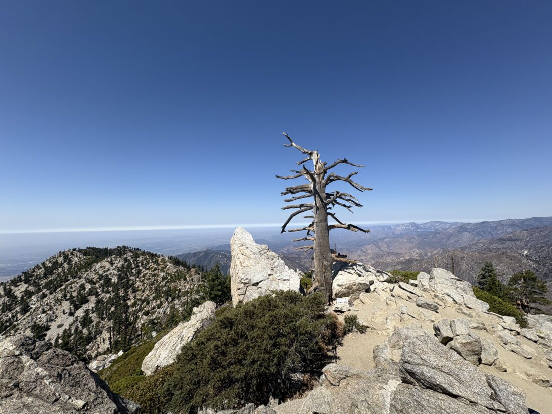
I could tell I was nearing the summit just by looking across to the east and seeing my position relative to the bowl. Soon, the rock shelters came into view, as did the metal plaque. I had reached the summit once again! There were a couple of others enjoying the views and the relativel quiet. This was quite the contrast to what the summit looks like during the Climb For Heroes (or probably most weekends).
I enjoyed some snacks and electrolytes under the cloudless skies. After taking a few photos, I began my descent via the Devil’s Backbone. My next goal was to climb Mt. Harwood, which sits just to the north of the main trail. This peak is on the Hundred Peaks Section list and was to be my 49th. Unlike during the Climb for Heroes, I was under no time pressures. A use trail took me up and over to the summit. There is no register or benchmark, just rewarding views.
After rejoining the main trail, I navigated the Devil’s Backbone without issue. I opted to take the straighter route down to the Notch, and my knees were not happy. Once at the Notch, I found a table in the shade and enjoyed my PB&J while staring back up at the peak I just climbed.
While the ski lift was running, which had some appeal, I grabbed my poles and set off down the service road. Soon, I reached the spur trail to the falls and made my way over to them. A few folks were there enjoying the cool water. I grabbed a few photos, dunked my hat under the falls, and headed back to the car. After my miscalculations about Mt. Whitney, doing this hike felt redemptive. I covered the 10.3 miles in 6:08 and recorded over 3,899 feet of gain. That leaves just two more peaks left to complete all 12 peaks on the Six Pack of Peaks Challenge-SoCal.
I am an avid peak bagger, sometimes backpacker, and former sea kayaker living in San Diego. I am the co-author of Urban Trails: San Diego, available now!
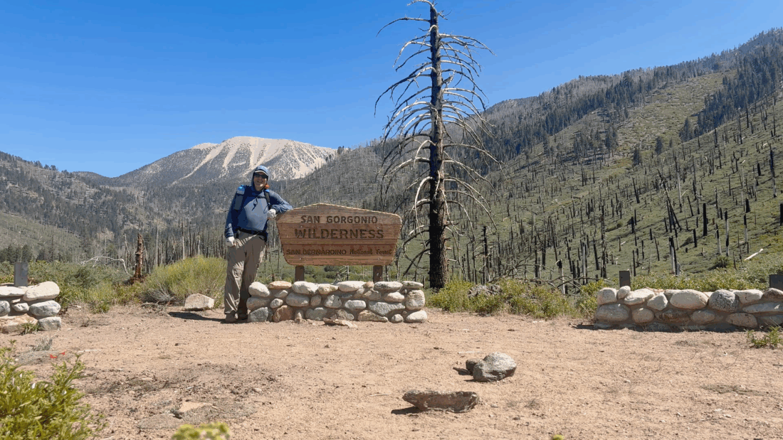
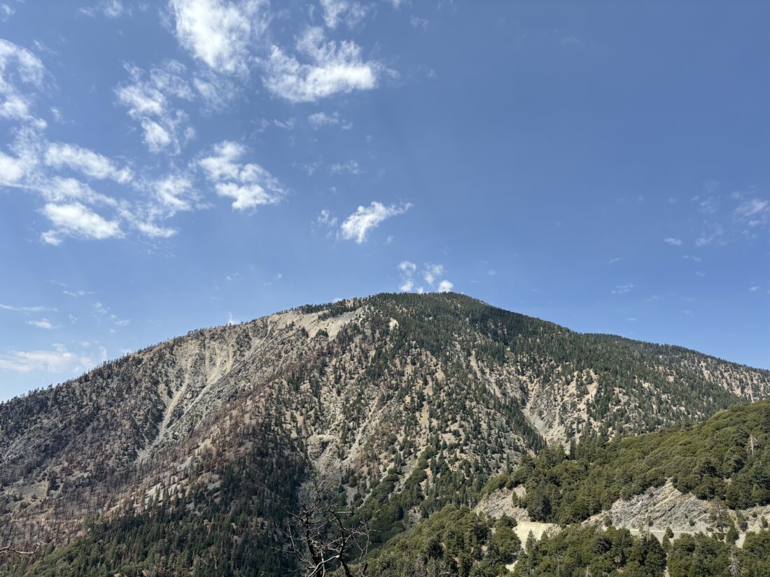
They say the third time is the charm, right? I wanted one last hard hike before Ted and I attempt to summit Mt. Whitney. I debated between hiking up Ontario and Bighorn or doing San Gorgonio as an overnight trip. With the water sources on San Gorgonio slowly drying up, I figured I should take that option. I pulled into the familiar parking lot and quickly gathered my gear. It was a bit warm, but there was enough of a breeze to offset it. I drank my liter of water and crossed over the road. I opted to only carry 1/2 liter of water and another 1/2 liter of electrolytes. My plan was to possibly filter at the crossing of the South Fork of the Santa Ana River if needed, and really load up on water at Lodgepole Spring. Instead of camping at Dry Lake, I decided to aim for camping further along at the Trail Flats campsite. The first part of the hike went quickly, and I, of course, made a stop at Poopout Hill for a photo. Soon, I reached the junction with Dry Lake Trail and Dollar Lake Trail. I crossed over the side streams and continued to the river. When Ted and I were here last August, it was flowing enough to make us cross cautiously. This time, I could simply rock hop across the water. I still had plenty of water and was feeling good for the next section. The next 1.6 miles would climb about 850 feet, and be a good workout. One difference from my last time here is that I weigh about 25 pounds less! I cruised through this section, and soon Dry Lake came into view. It certainly was smaller than last time. I took the trail along the north side over the spur trail to Lodgepole Spring. The spring was still flowing, but I had to go a bit further to find a good spot to fill up and filter. The plan was to fill both bottles, as well as my 3L CNOC bag, and haul all that up to Trail Flats. My light backpack just got heavier.
I continued looping around the edge of the lake until I rejoined the main trail and started the climb to camp. From here on out, the trail would be new to me. Over the next mile, I would climb over 500 feet. While the pack was about 10 lbs heavier, I felt good. I spotted the campsite sign attached high on a tree, and began to survey my options. I quickly found a nice flat spot and began setting up camp. I opted to bring my REI QuarterDome SL1 this time, since there would be no moon in the night sky, and I could lie in the tent and stare at the stars above.
I made dinner, watching the sun slowly dip behind the ridge. I hung my Adotec food bag and crawled under my quilt. The stars slowly began showing themselves as I continued to listen to The Two Towers. When it was dark enough, I was going to do some astrophotography, but my iPhone had offloaded AstroShader, so I could only use the built-in camera. Since I was hoping to reach the summit for sunrise, I set an alarm for 3 am. Some night hiking will also be good practice for Whitney.
The alarm went off, and I broke camp. I had debated leaving most of the gear here and hiking lighter to the summit. But in the end, I just packed up everything and set off. It was cold, and I was wearing my sun hoodie, my camp shirt, and my puffy, but quickly shed the puffy. The trail was easy to follow under the light of my headlamp. I ate a bar at Mine Shaft Saddle and pushed on under the starry skies.
The trail climbed at a nice grade along the east side of the mountain. The faint glow of the coming sunrise started to show off to the east. I passed the C-47 crash site without seeing it. It started to get colder as I kept gaining elevation, and I finally stopped and put the puffy back on. The lights of Palm Springs also came into view as I worked my way up a series of switchbacks, before the trail turned westward. The sun’s rays illuminated San Jacinto’s summit to my south, letting me know I had mistimed my attempt. Oh well, the night hiking was still good practice. The trail turned northward and reached the junction with the Vivian Creek Trail, just 0.4 miles from the summit. I remember how hard it was this last time I was here. Now I felt pretty good, with just a small headache.
I reached the summit and spotted a tent set up in one of the wind shelters. I took some photos with the summit signs before heading over to the tent. The occupant had come out and he gave me a wave. He had arrived at the summit around 9 last night via Vivian Creek and said it was cold and windy overnight. I fired up my stove, made a cup of coffee, and ate my oatmeal. We chatted for a bit while we each ate our breakfasts. The small headache faded away, and I assume it was either the need for some caffeine or a bit more fluids.
As much as I enjoyed our conversation, I knew I had quite a few miles left to hike to get back to the car. I debated whether I should return the same way I ascended, or loop around and come back via Dollar Lake. I opted to try the Dollar Lake route, as it was a bit shorter. I bid him farewell and set off back down the trail. I paused at the junction back to Dry Lake and mulled it over once again, but decided to stick to the plan. The trail split again, the left fork heading down to Vivian Creek, and the right fork heading toward Dollar Lake. I guess there are enough people not paying attention that a warning sign had to be added to keep people on the right track.
Another reason that I opted to take this route was that the trail passes by several Hundred Peak Section peaks, and I was considering adding them to the adventure. I didn’t do any advanced planning, so I only had whatever the topo maps showed me and what my eyes actually revealed about each summit. The sun had started to warm things up, and I stashed my puffy back into my pack. I was also right near Jepson Peak. I looked over the map, and it looked like it was a 0.2 mile jaunt off-trail to the summit, with almost 300 feet of gain. The legs were feeling good, so I went for it. I zig-zagged up the side of the peak until I reached its summit. There was no marker here, and I skipped signing the register. I did have a nice view of San Gorgonio off to my east as a reward. I then followed the ridgeline over to a small bump to the north, before working my way back down to the trail. Once back on the trail, I cruised along. Santiago and Modejska Peaks could be seen off to the southwest, rising above the marine layer. As I neared Dollar Lake Saddle, I decided that climbing Charleston and Little Charleston Peaks would have to wait. If I had brought an extra liter of water, I might have considered it. The rest of the hike would now be sunny and warm, so I wanted to conserve my fluids, as I still had almost 6 miles to go.
The trail did become both more exposed to the sun and rockier in nature as it worked its way downward. I put on my headphones and resumed my audiobook. I was at the part of the story when Merry and Pippin meet the Ents. Seemed perfect timing as I walked through the wilderness. After 2.3 miles, I again reached the junction to Dry Lake. I took a break under the shade of some lovely trees. I still had enough fluids to get me back to the car, so I did not wander over to the nearby creek to filter some additional water. The last 3.6 miles went quickly, passing backpackers making their way up to their campsites, and a day hiker or two. Soon, I passed the cabins at Horse Meadows and knew my adventure was drawing to a close. I am extremely happy to have climbed San Gorgonio again and to have done it as an overnight adventure. The entire hike was 22.41 miles, with 5,116 feet of gain. My hiking time was 3:59 from the trailhead to camp, 2:38 from camp to summit, and finally 4:45 from summit back to the car. Now to rest up and start packing for Mt. Whitney!
I am an avid peak bagger, sometimes backpacker, and former sea kayaker living in San Diego. I am the co-author of Urban Trails: San Diego, available now!
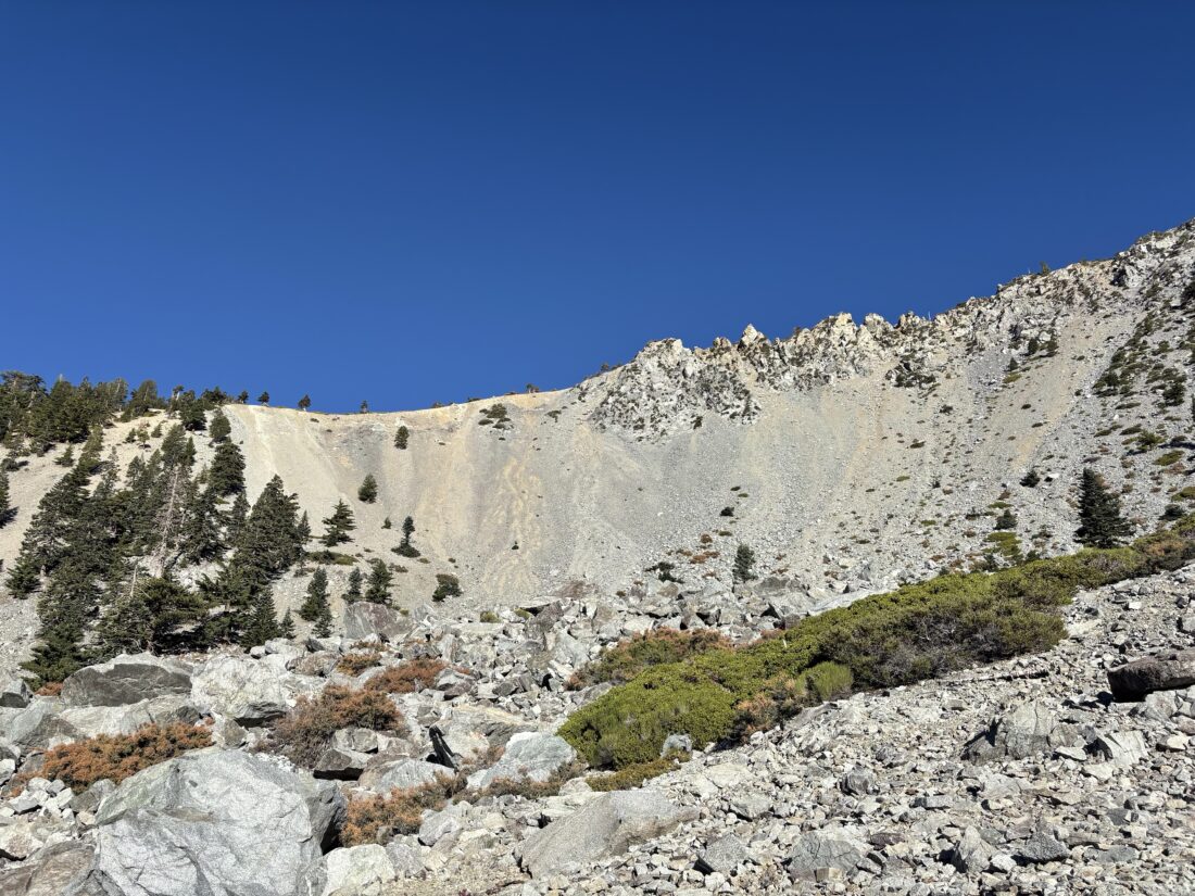
When the closure order for the Bridge Fire was lifted, this meant Mount Baden-Powell could once again be summited. However, the road to Vincent Gap was still closed, meaning either starting the hike with a 5-mile road walk or approaching it from Windy Gap. A few days ago, the road was opened past Wrightwood to Vincent Gap, so I decided to make the drive up and hike the 40+ switchbacks to the top. As I passed Wrightwood, I could see the damage caused by the Bridge Fire. Drawing nearer to the parking area, Mount Baden-Powell came into view. The south-east side clearly had been hit by the fire, while the north-east side still looked nice and green. Just before the fire occurred, a new parking fee was introduced for the main lot and a $5 pass is needed to park there. Previously, I would just hang my America the Beautiful pass and be fine. Now, even that pass will not work. If I park across the road, my pass is all I need. For more on this, watch this video. There were two cars in the “paid” lot and one car across the road. I grabbed my new backpack and set off. I was trying out the Osprey Hikelite 26 as an option for my upcoming attempt to climb Mt. Whitney.
It had been a few years since I took this route, but I certainly remembered that first steep “Welcome to Mount Baden-Powell” section. The trail eases up after 1/10th of a mile and starts working its way up the face of the mountain. It was slightly humid, but the shade of the trees helped. Switchback after switchback passed by, and I kept a good solid pace.
After two sets of hikers, I drew nearer to the summit as the distance between switchbacks reduced. Then the Wally Walden tree came into view. This tree is estimated to be over 1,500 years old. I made the rest of the push to the summit, where two hikers were hanging out. I found a spot to take a break and soak in the views for a bit. The other hikers said their goodbyes and began their descent. I did some filming of the monument to Lord Baden-Powell and the vistas from the summit before I also headed down. The descent went quickly, and I decided to go over and see Lamel Spring. The trail got a bit dicey just before the spring, but it was still flowing so it was worth it. I suppose if you were camping partway up, you could save a bit of water weight. I passed several other hikers making their way up. Soon, the parking lot came back into view. The new pack worked out nicely and might become my primary daypack. Originally, I had planned to grab lunch in Wrightwood, but it was too early, so I waited until I was closer to home and hit The Rib Shack in Fallbrook. I covered the 8.3-mile (including the side trip to the spring) in 3:393 with an elevation gain of 2,745 feet.
I am an avid peak bagger, sometimes backpacker, and former sea kayaker living in San Diego. I am the co-author of Urban Trails: San Diego, available now!