Backpacking the Yosemite High Sierra Camps

The adventure began with kissing my wife goodbye, patting our dog, and setting off toward Lee Vining. I had said goodbye to my son, who recently moved home to become the Youth Director at our synagogue, the night before.  The first stop was at a Starbucks, as a large coffee was needed for the long drive. I was meeting Rick to borrow a small tripod as both of the ones I ordered to replace the one I lost when hiking Sawmill were delayed in arriving. With Rick’s tripod now in hand, I began the drive north. Traffic was not too bad, and the podcasts passed the time.

My first stop was the Eastern Sierra Visitor Center in Lone Pine. I had a question about our upcoming permit to climb Mt. Whitney, and wanted to swap out a plastic Junior Ranger badge for a wooden one. Unfortunately, I arrived during their lunch break, and they were closed. I did, however, see some runners racing in the Badwater 135 and support cars were parked throughout the town.

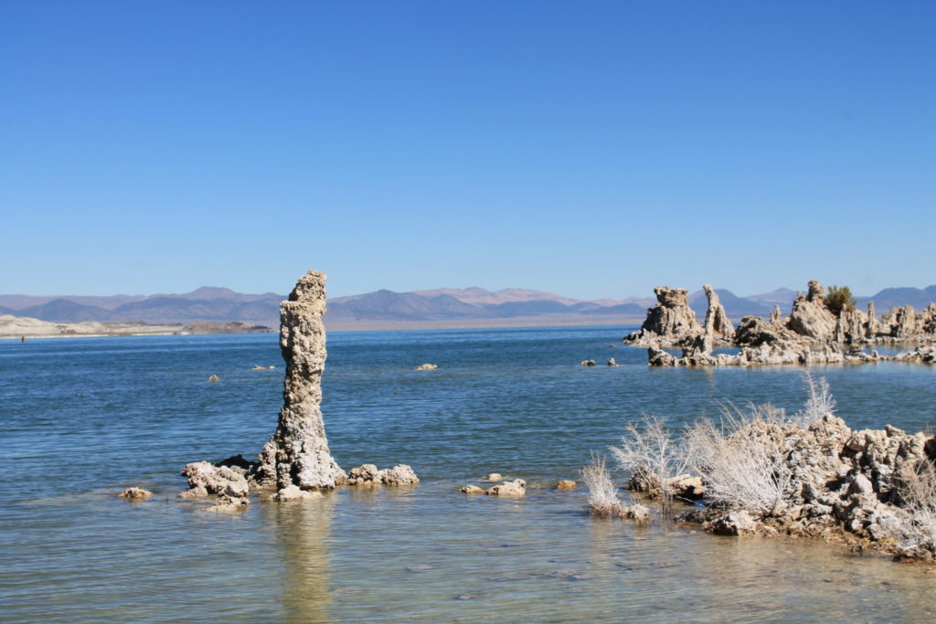
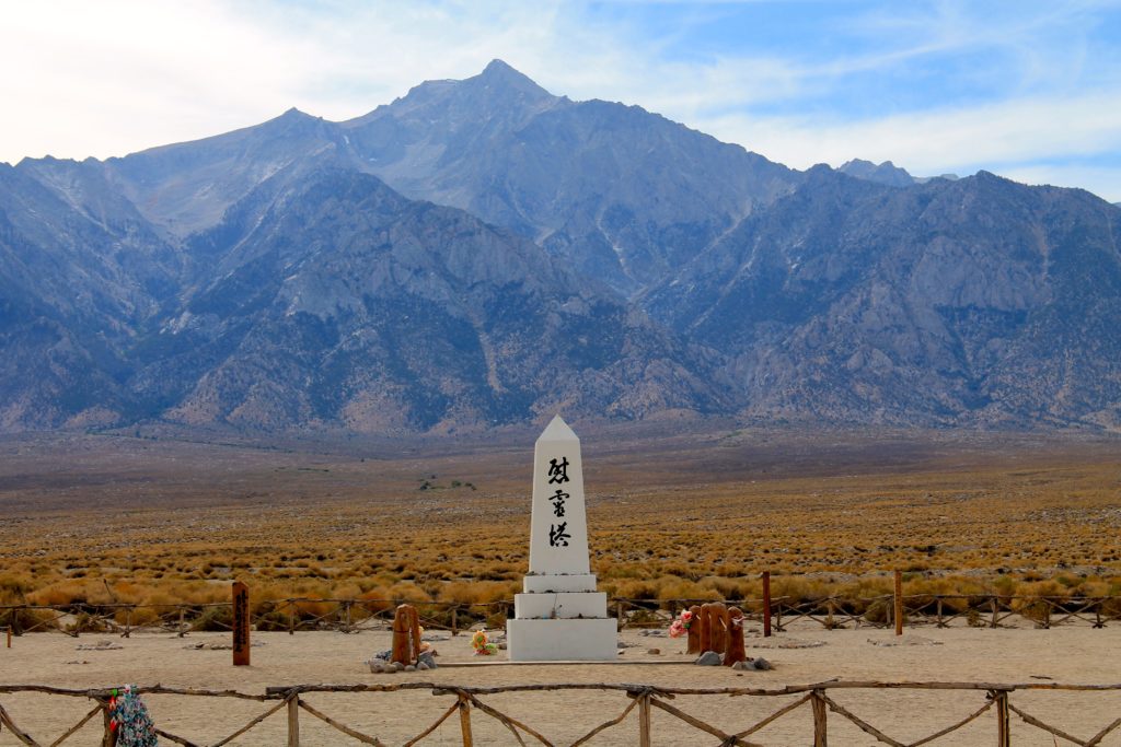
My next stop was Manzanar National Historic Site, again to obtain a Junior Ranger badge. Sadly, due to staffing issues, the Visitor Center is now closed from Tuesday through Thursday. Ted and I will have to return when we come back for our Whitney attempt. I already knew that the Copper Top BBQ was closed, and found Mountain Rambler Brewery as a replacement for my lunch stop. After a fine burger and a tasty flight, I made a quick stop for gas and continued northward. As I neared Mono Lake, I saw a sign saying there would be a Ranger-led walk at 6 pm. I certainly had time for this, but after checking into the motel and unloading my gear, I drove over to the Mono Basin Scenic Area Visitor Center to confirm that the walk was still scheduled. The kind volunteer said it was. I also inquired about any Junior Ranger badges, and they indeed had one for the Inyo National Forest! I made the 15-minute drive back to the south shore of Mono Lake and waited on a bench.

Our walk was led by a staffer from the Mono Lake Committee, Ana. She had recently started working there and was full of enthusiasm about the lake. About 15 of us walked the Loop Trail, stopping at various points to learn about a wide range of topics. I left toward the end, as I was getting hungry and wanted a good night’s sleep.

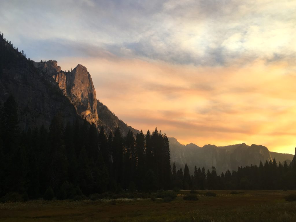
Dinner was the “world-famous” fish tacos at the Whoa Nellie Deli. The mango salsa one was outstanding, and the ginger coleslaw was good as well. I watched the sun set on the lake and headed back to the motel. Earlier in the day, I made the 30-minute drive into Yosemite National Park to pick up my Wilderness Permit, as well as a Junior Ranger booklet. I figured I could work on it that evening in the motel, which I did. With that task complete, it was time to turn in for the night. Tomorrow would begin 6 days of backpacking through Yosemite’s backcountry.

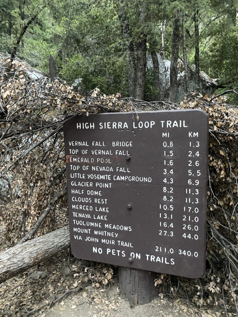
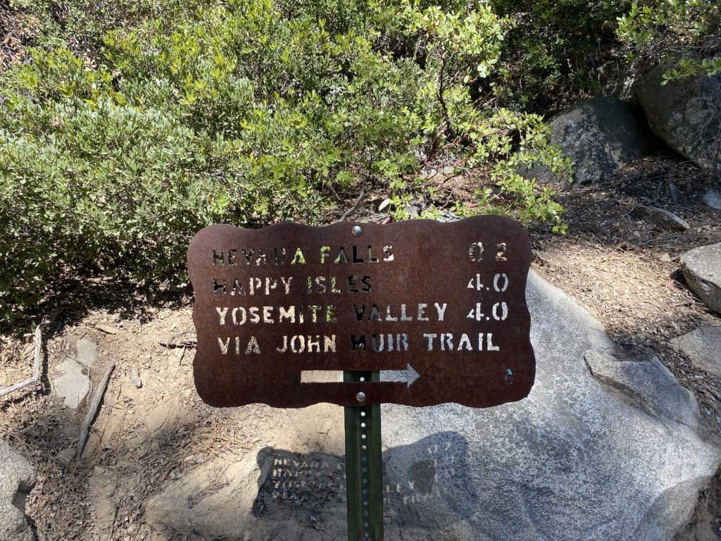
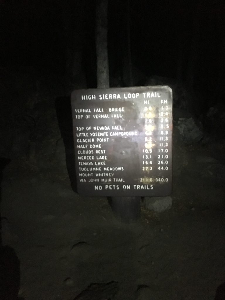
Day 1: Tuolumne Meadows to Glen Aulin

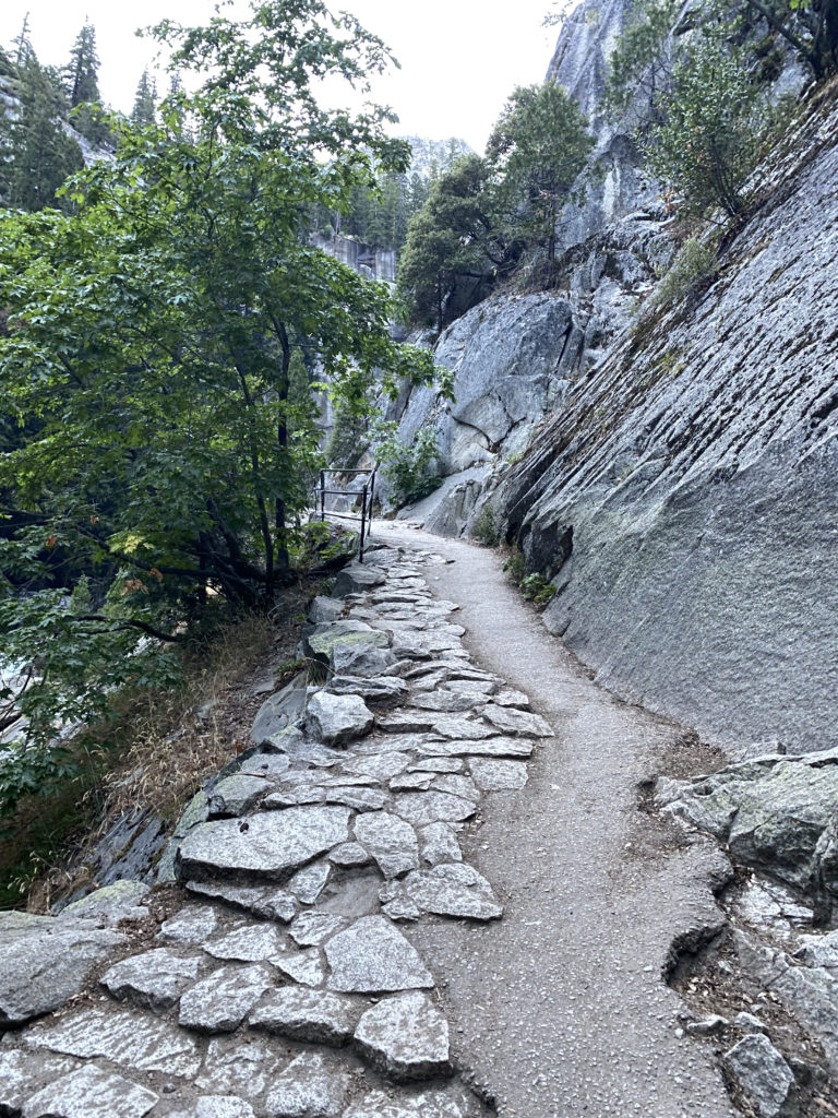
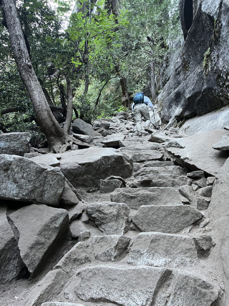
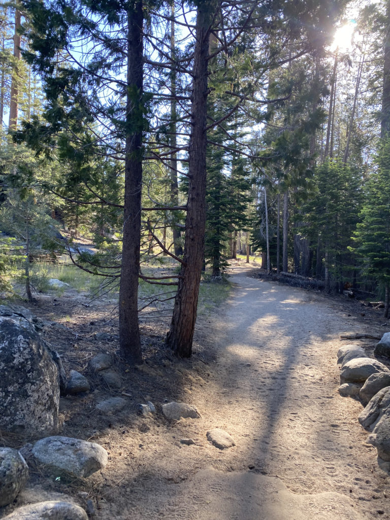
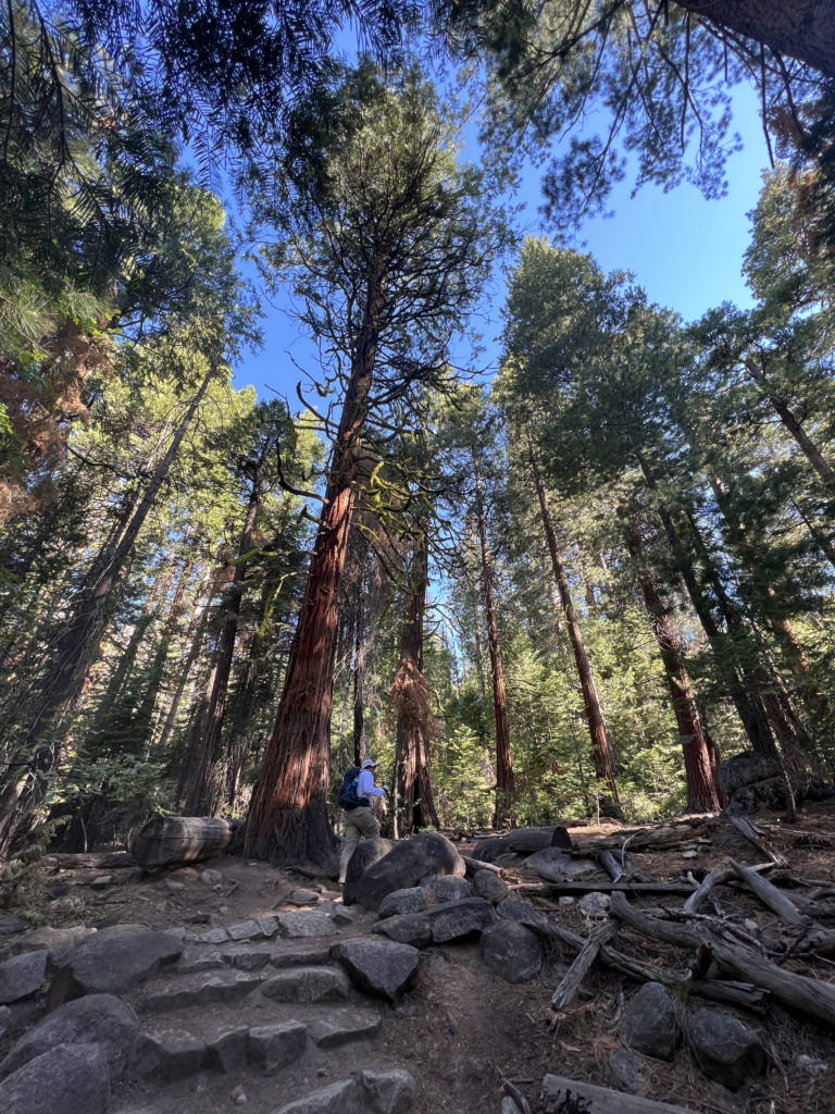
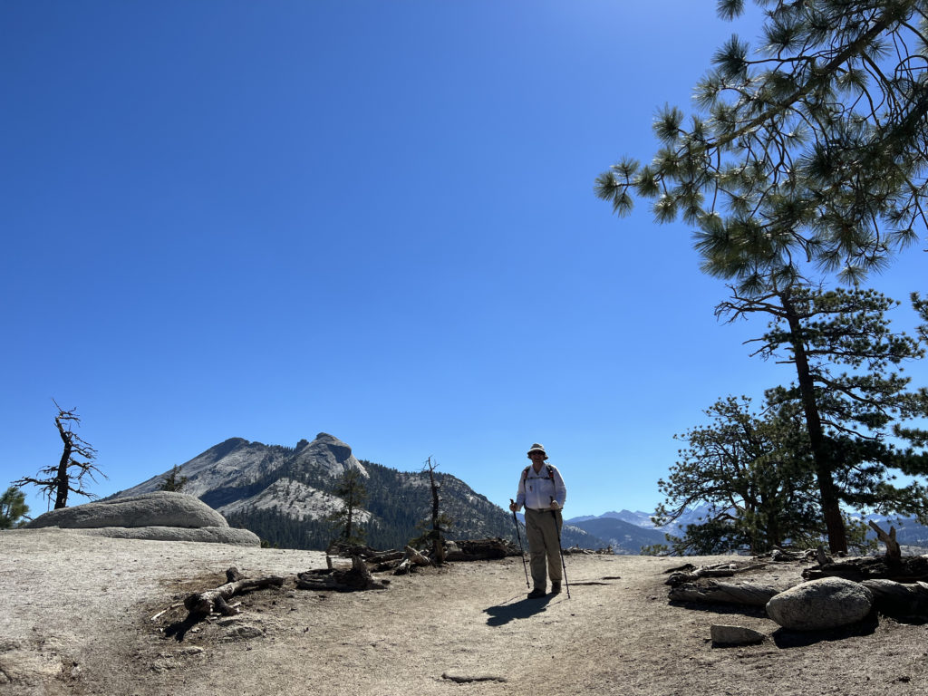
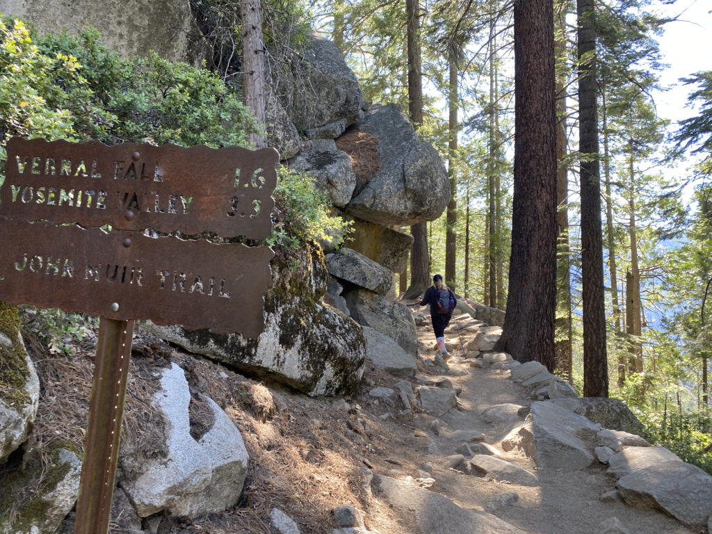
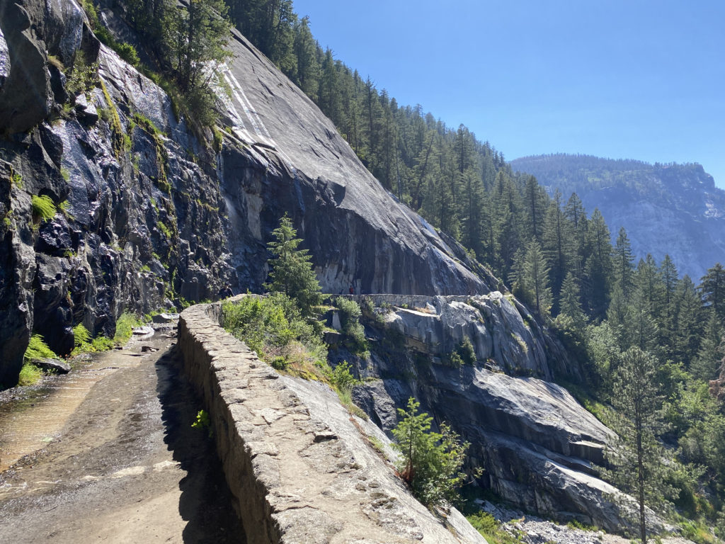
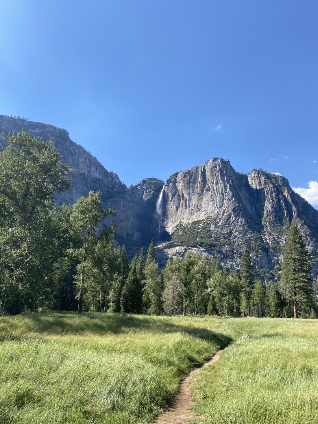
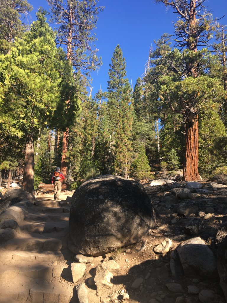
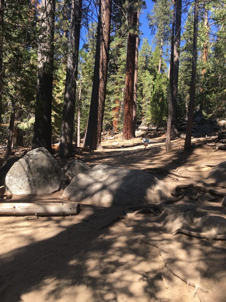
After a fairly good night’s rest in the motel, I took my last shower for almost a week. I walked down the highway to Nicely’s for a good breakfast to start off this adventure. Given that the Tuolumne Meadows Visitor Center did not open until 9 am, I was not in a rush. I swung by the Whoa Nellie Deli again to grab a ready-made sandwich for my lunch. The drive back to the park was uneventful, except for the dead deer on the side of the highway. I pulled into the parking lot for the Tuolumne Meadows Visitor Center and stored my backpack in a nearby bear locker. I went in and presented my completed Junior Ranger booklet. After a little chat with the Ranger, I was sworn in as a Junior Ranger for Yosemite. On her suggestion, I opted to park back at the Wilderness Permit Station. I checked back in with the rangers there in case something had changed. They reported all was good, just a few mosquitoes at spots. With that, it was time to hit the trail. I stepped onto the PCT and followed it westward. The trail paralleled Tioga Road for a bit before crossing it and following the road to the Glen Aulin Trailhead. Along the way, I was stopped by a woman assembling her backpacking gear, and she had a question about the parking for Glen Aulin. I told her where I had parked, but I was planning on doing the whole loop. She thanked me, and we parted ways.

The first point of interest was Soda Springs. This is a naturally carbonated spring that sits on the edge of the meadow. You can take a taste, which I did. It was slightly fizzy, with a bit of a metallic tinge.

The trail was mostly downhill for the first day, and with 6 days of food on my back, I was thankful. I took a short break and watched the waters of the Tuolumne River flow past. There I met a lady day-hiking to Glen Aulin, and we hiked down the trail together. We crossed the first bridge over the Tuolumne and saw some PCT hikers grabbing a few photos. We continued on down the trail, chatting about the state of our parks and public lands.

About 5 miles in, we met a Ranger on patrol. We chatted a bit, and I presented my permit. She commented on how small my pack seemed. I replied that I was leveraging the bear lockers at each site, so I left my heavy bear can in the car and was storing my food in my new Adotec bag. She said it was perfectly fine, given that each site does have lockers. If I were adventuring elsewhere, then an approved bear can would be needed.

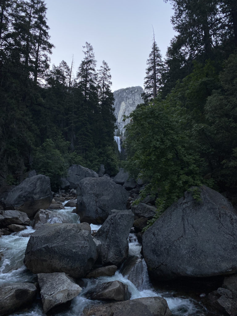
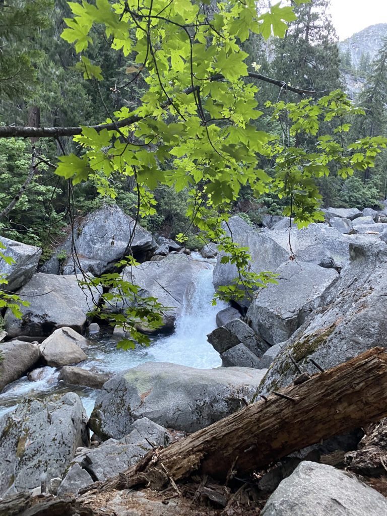
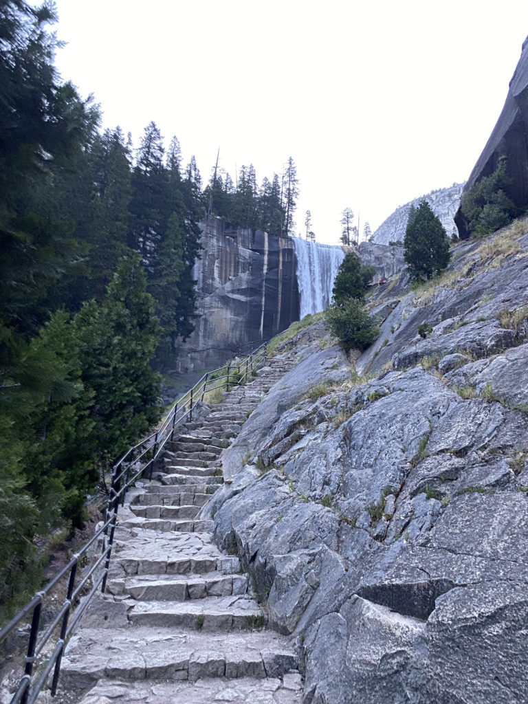
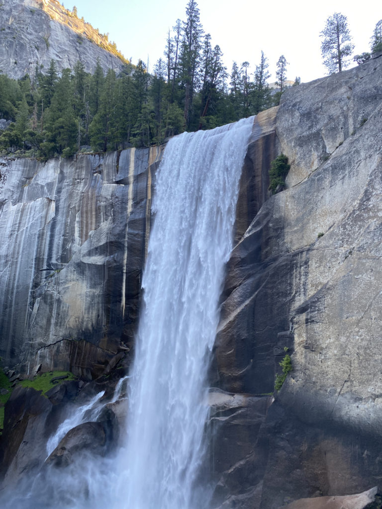
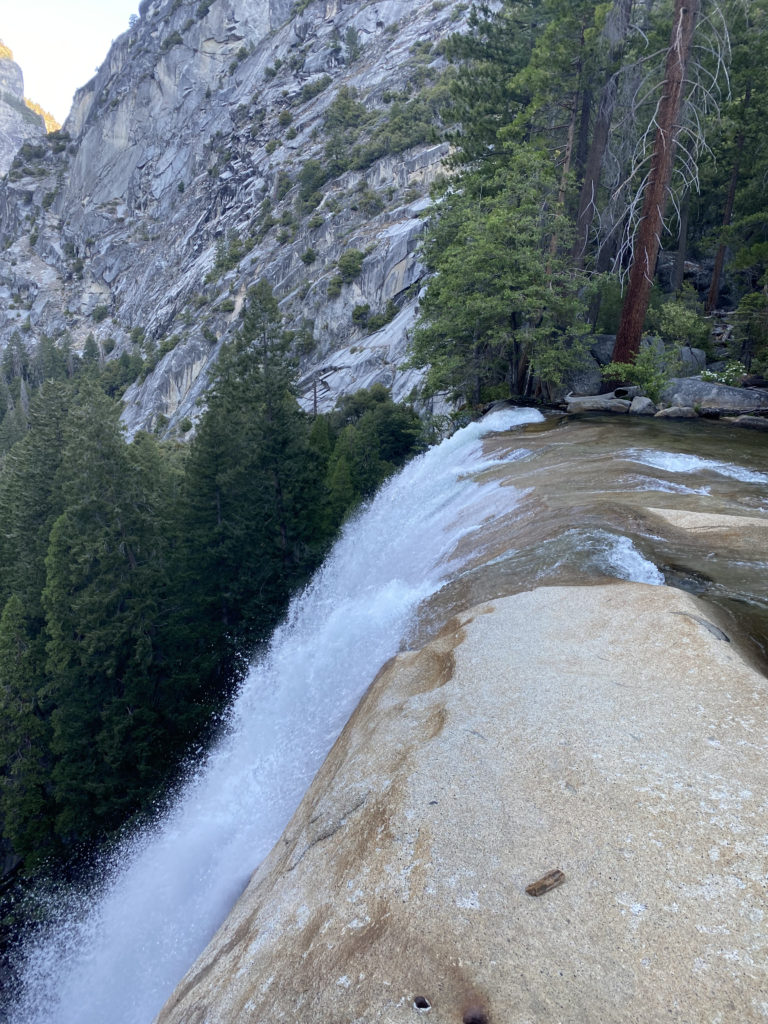
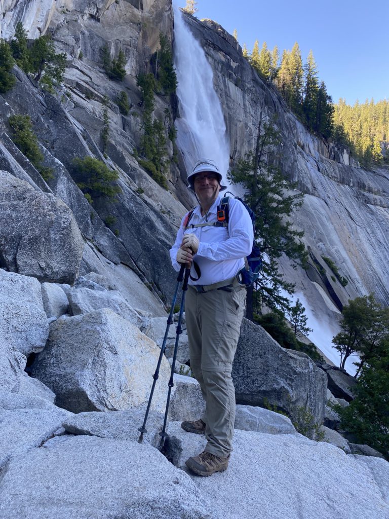
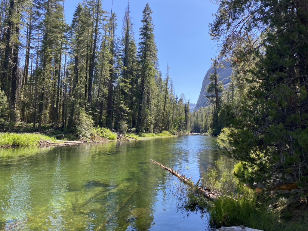
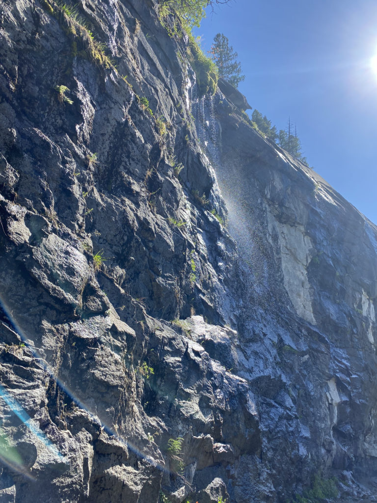
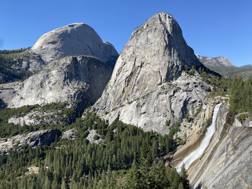
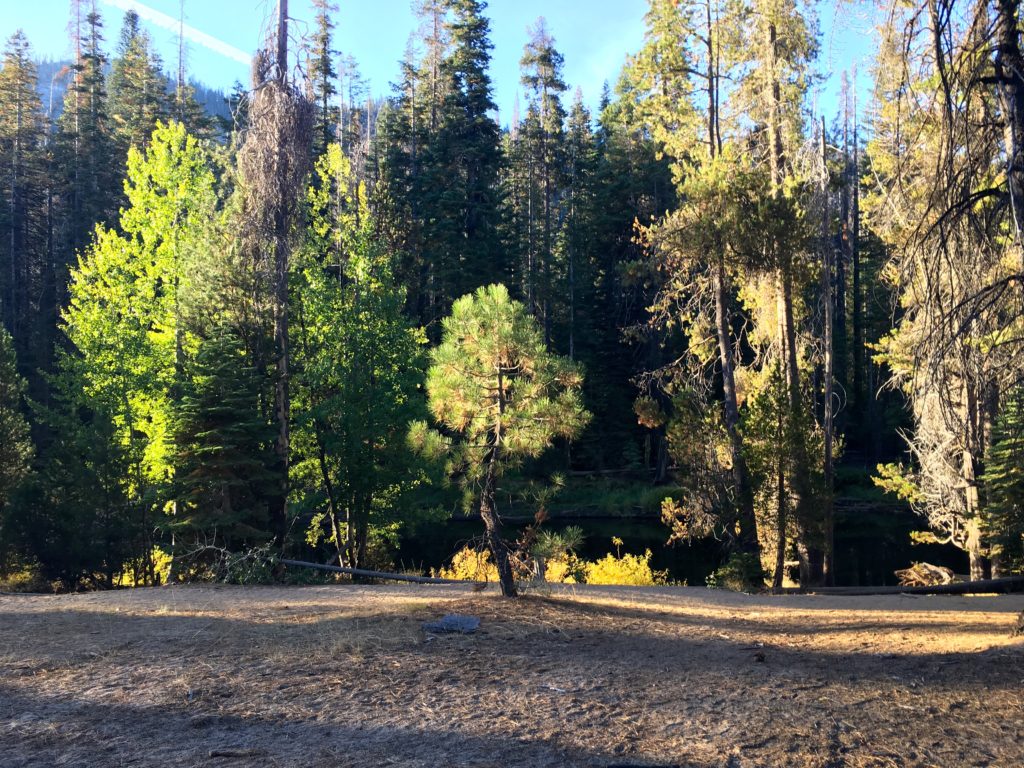
Soon, the sounds of a waterfall began to fill the air, and this meant we were drawing close to Glen Aulin. The bridge that crossed the Tuolumne River into Glen Aulin had been destroyed due to high snow a few years back, but thankfully had been rebuilt. Once across, we took a second bridge over Conness Creek into camp. She found a nice spot to have her lunch, and I did a quick tour of the backpacking site. The High Sierra Camps are built in two parts: the actual camp and its associated infrastructure, and a section for traditional backpackers. The camps were not open this year, so the various tents and other structures were not assembled. Continuing on to the backpacking area, I skipped the first collection of sites, as several spots were already taken, and continued on. I found a set of sites up on a granite ridge, all of which were unclaimed. I left my poles on a site that looked perfect, and returned down to also have my lunch with my hiking companion. When done, she headed back up the trail. I then tossed my food into the bear locker before making the short climb to my campsite. I decided to change which spot I picked upon closer inspection of the slope. Soon, I had my tent set up and was good for the evening. I wandered down to the river’s edge to fill my CNOC water bag, so I could filter some water later.

I found a nice shady spot and took a short nap. Once refreshed, I wandered around camp, including taking advantage of the composting toilet. I chatted with some of the other campers: a few PCTers, an Outward Bound group, and eventually the woman I met at the beginning of the hike. I sauntered down the trail that parallels the Tuolumne to explore some of the falls downstream for a bit. There I saw my first Marmot, but didn’t have time to snap a photo. I returned to camp to have dinner. I found a spot far enough away from my tent to make and eat my pasta. After cleaning up and storing the rest of the scented items, I turned in. I was tired from the day’s hike, and lying in my tent listening to my audiobook for a bit was just what I needed. A full moon would be rising soon, so that would put a damper on any stargazing or astrophotography. I turned my phone off to save some battery and drifted off to sleep. I forgot to mention, I did check in with Anita and let her know that I was safely at camp.

DAY 2: Glen Aulin to May Lake

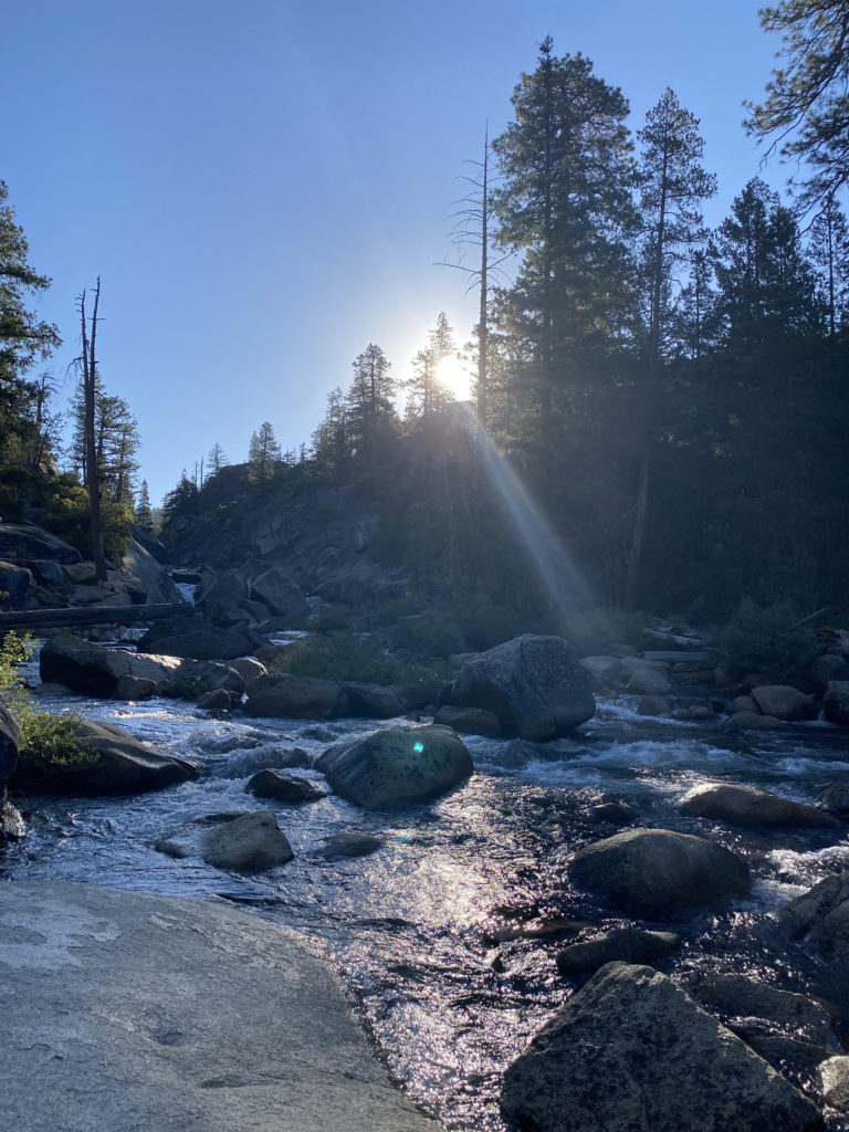
Sleep was about what I expected. I was actually a tad too warm, but this is one of the lower elevation sites, so I might still want my better quilt at the other camps. I awoke at first light, but fell back asleep for another 30 minutes. I packed up my gear, made a pit stop, then gathered my food and scented items from the locker. I went down to the river’s edge and had my breakfast of oatmeal and a cup of coffee. I properly re-packed my backpack and set off. Today’s journey would be hiking about 8 miles up to May Lake. According to one guide I read, I would be gaining about 1,400 feet of elevation. While this would almost be trivial back home, I had a fairly full backpack and was starting at 7,880 feet.

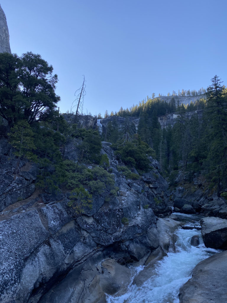
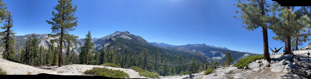
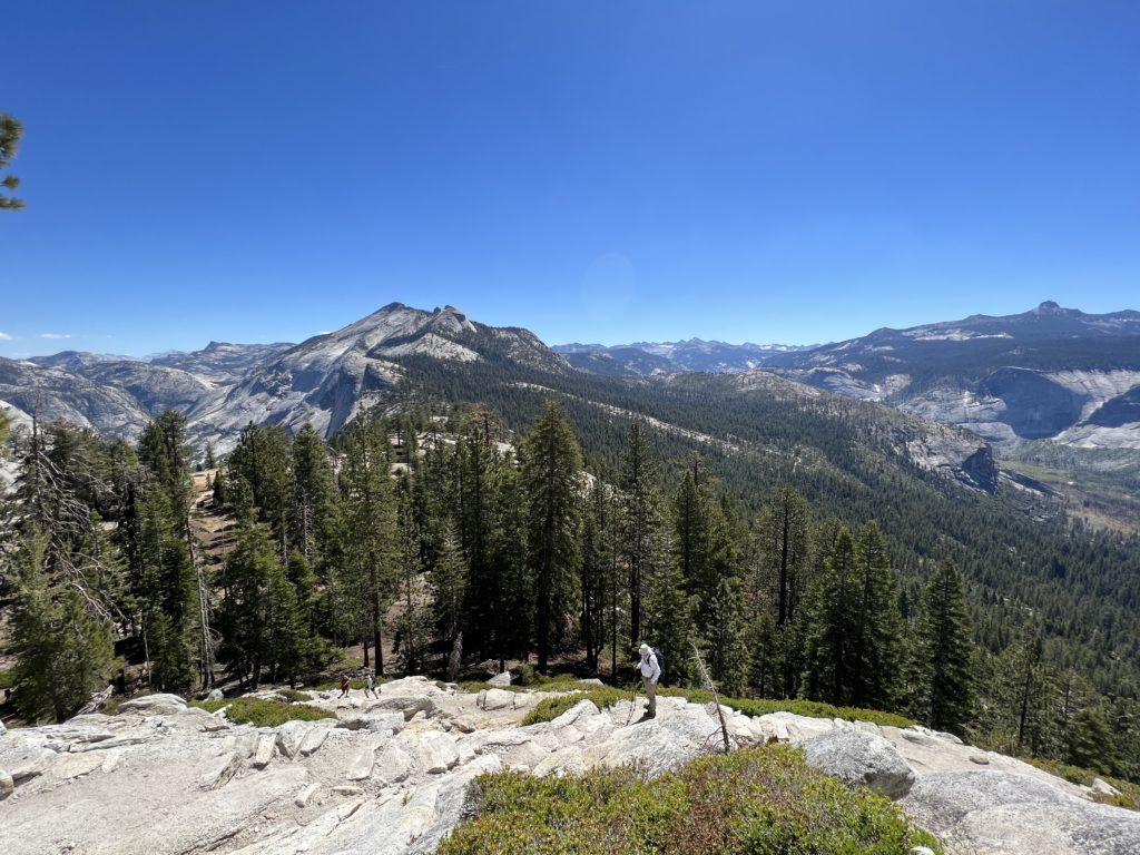
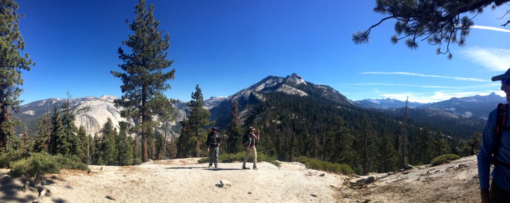
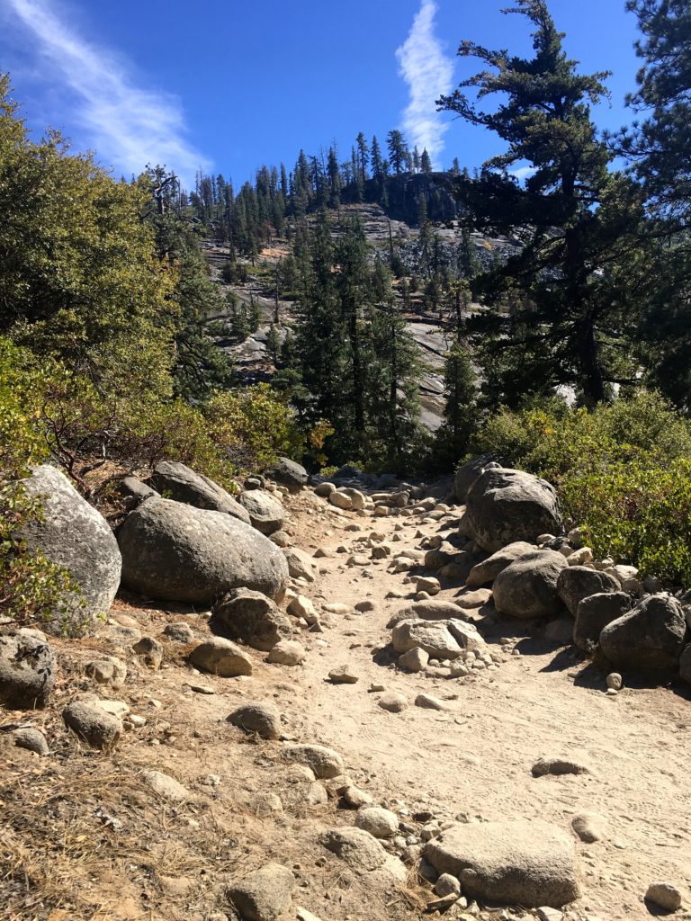
I crossed back over the Tuolumne River, the morning light shining through the mists from the waterfall, and made the steep climb to the junction with the trail to May Lake. This trail heads mostly southward, first toward McGee Lake. The mosquitoes were out in force, so the bug net quickly came out. The trail initially worked its way upward through the forest. The views were stunning, and occasionally I would dart off the trail to explore a possible viewpoint. About 3 miles in, I took a break and, since I had a clear view of the sky, sent a check-in message back home. I shouldered my pack again and set off. There was very little breeze, so it was a tad warm.

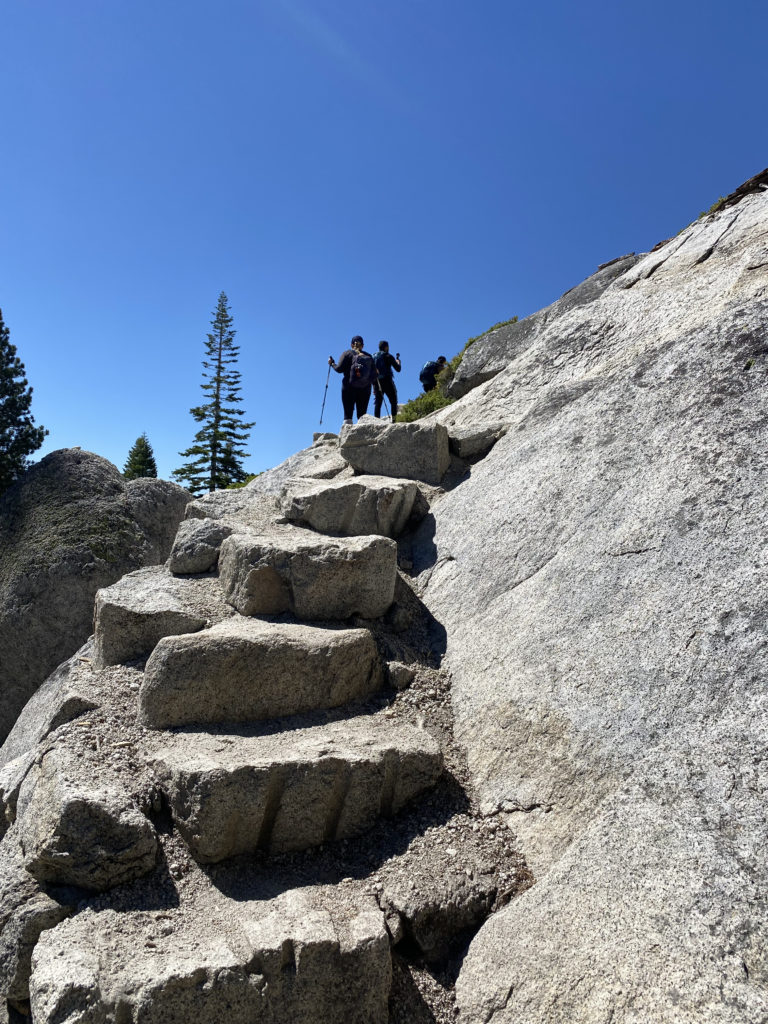
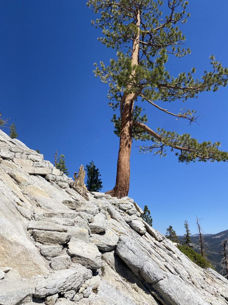
Just after one steeper section, I took another break under the shade and to soak in the views. I then began a series of switchbacks, and after about 10 minutes, I went to grab the tripod, and it was missing! It must have fallen off my pack where I took my break, so I turned and hiked back. At the rest stop, it was nowhere to be found. Ugh! I gave up looking there and started back up the trail, and just after the first switchback, I spotted it on the trail. I had walked right over it on the way down. Crisis averted. I tightened the strap I had been using to hold it on my pack and kept climbing. This section was very sun-exposed, so I was feeling the sun’s rays upon me. I took another break and adjusted my socks and shoes. Before leaving, I again checked that the tripod was still secure. Soon, I crested a small saddle and began the short and gentle descent to May Lake. Its waters were a welcoming sight. I had forgotten to “camel up” before leaving Glen Aulin, so I drank more than I planned for during my ascent. I passed through the closed camp’s foundations and buildings before finding a spot for the night. It was only about noon, so I had a lot of time to kill.

I again stashed my food in a locker, filtered some water, and under the shade of the trees, ate my lunch. I drank some electrolytes to replace those that I sweated away. I then found another shady spot and took a well-earned nap. My tracker recorded the climb as over 1,930 feet of gain. Quite a difference from what I had read eariler. That would explain the tightness in my calf. I certainly was hiking faster than I would have had I done a better job in understanding this section of the trip. I explored the area some more, stretching the calf, trying to get some relief. I went back down the water’s edge and soaked my feet in the cool waters. I opted for a second nap, because why not? I started considering my options. The next day’s hike was listed as “very strenuous” with about 1,600 feet of descent over 3 miles, followed by an ascent of almost the same amount but in just over a mile. The following day was a long descent, and then the day after that was the climb over Vogelsang Pass. If my calf worsened, I would be in for some long days. Knowing I had plans to attempt Mt. Whitney later in the month also weighed on my mind. I sat under the shade and considered my options. I took my phone out of Alpine mode and discovered that I had two bars of signal. I guess we had a line of sight into Yosemite Valley. I spoke with Anita, and I decided to let the descent tomorrow be the judge. If the calf felt ok, then I would continue my trek. If not, I would cross Tiagoa Road and should be able to get a hitch back to my car. With a plan in place, I cooked up my dinner and watched the sun dip behind the mountains. 

Day 3: May Lake to Sunrise Trailhead

I awoke just after 5:30 and quickly packed up. The calf did not cramp overnight, but I could still feel it as I broke camp. Instead of making breakfast, I tossed a few bars into my hip belt pocket and set off. I figured the sooner I got to the road, the better I might find a hiker driving in for a day hike. 

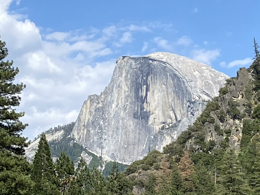
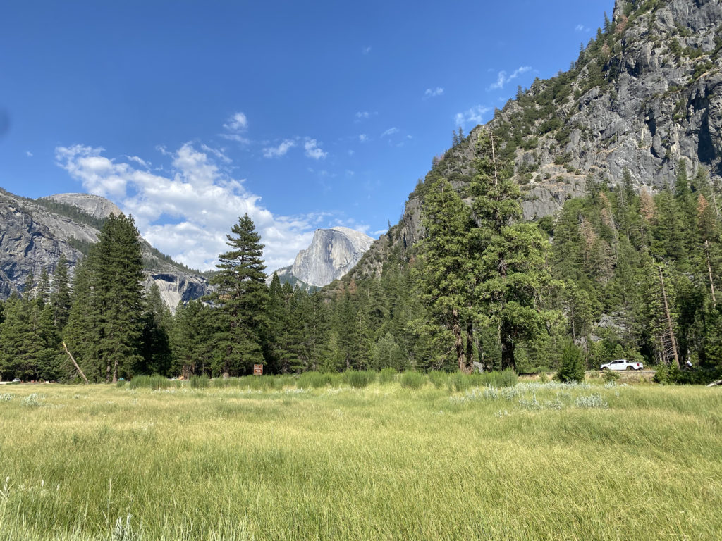
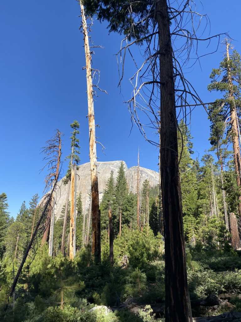
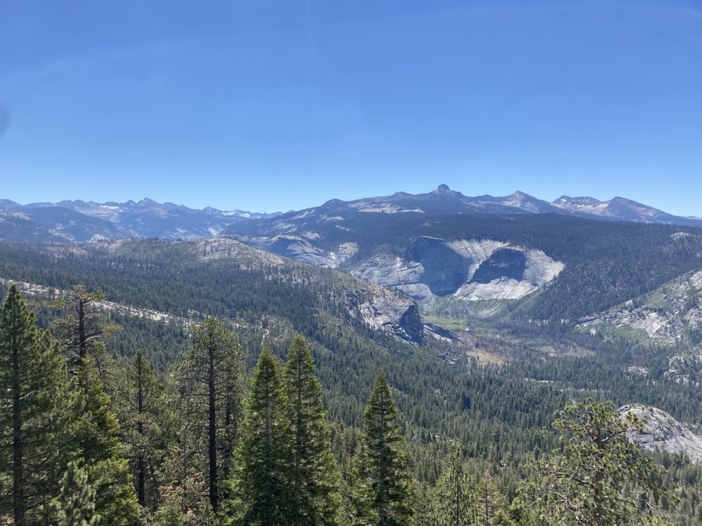
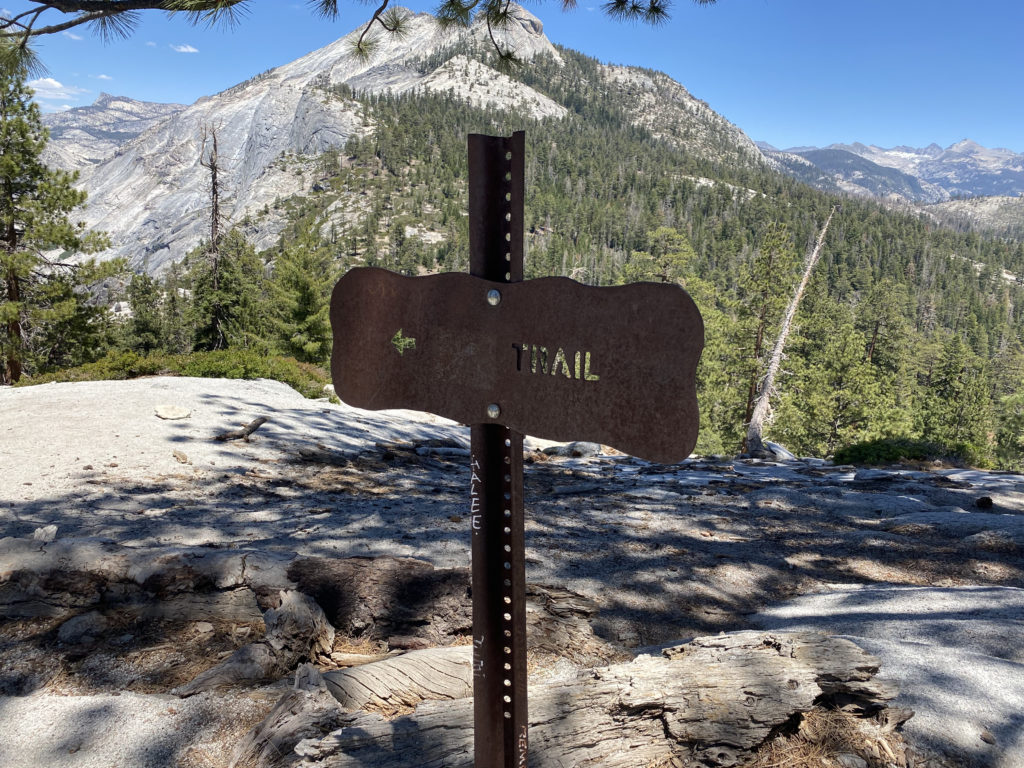
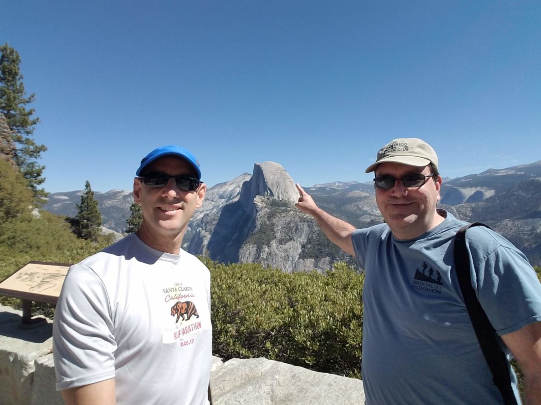
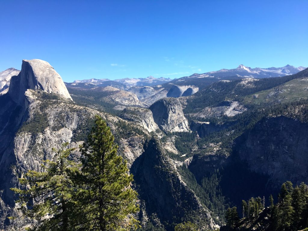
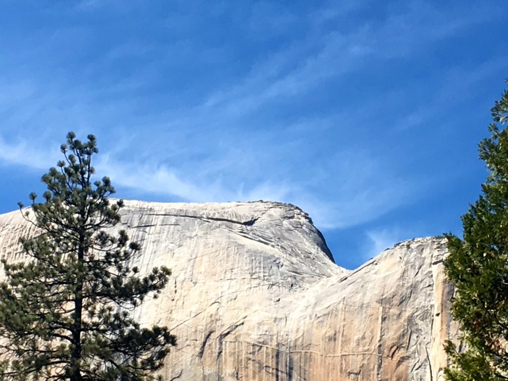
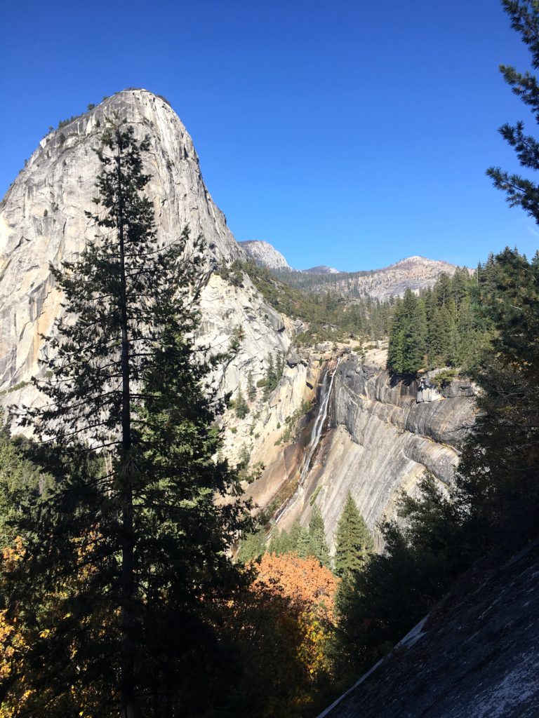
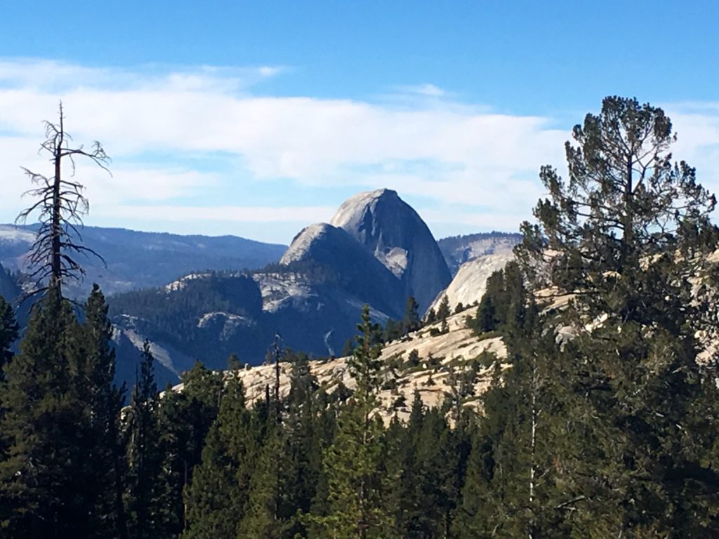
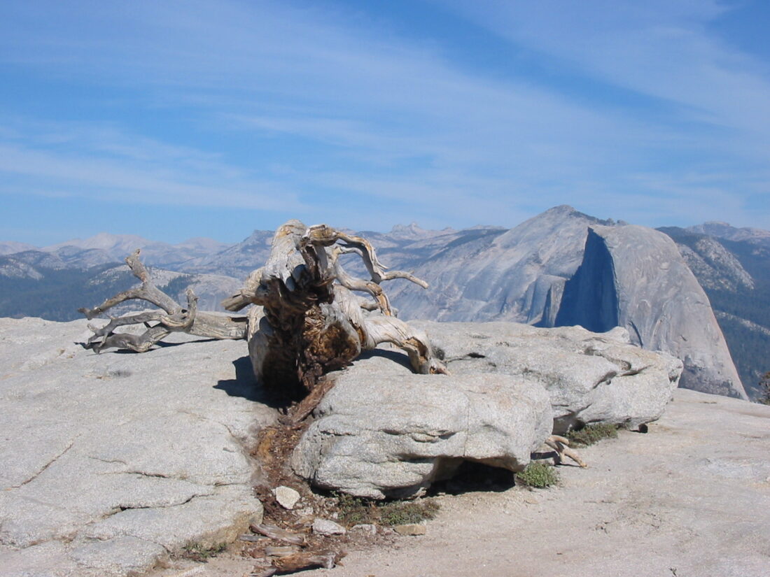
The descent went smoothly, and from time to time, I could see Half Dome in the distance. When the grade was steep enough, I could feel the tightness in my calf, validating my decision to end early. I reached the first May Lake Trailhead and tossed the trash I had been carrying. From there, I continued on the High Country Highway, according to the information sign. Bits of the asphalt were visible as I hiked along.

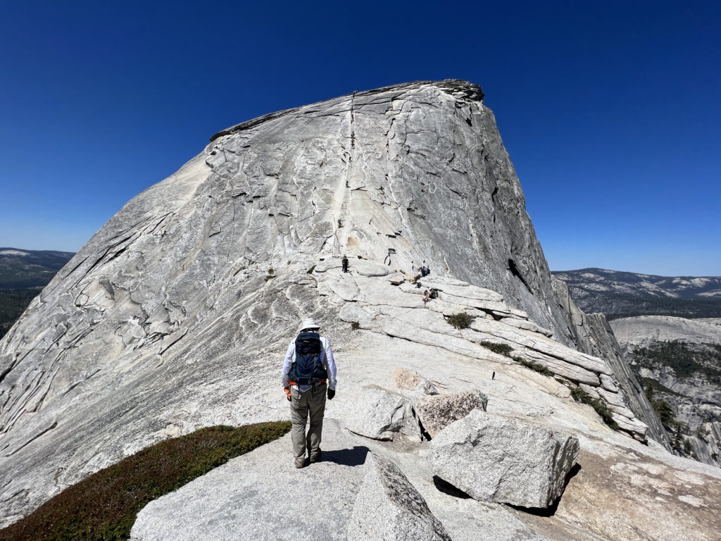
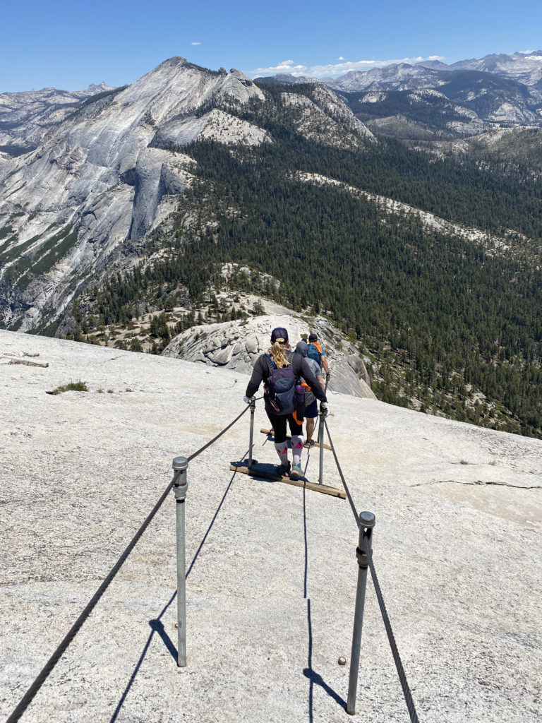
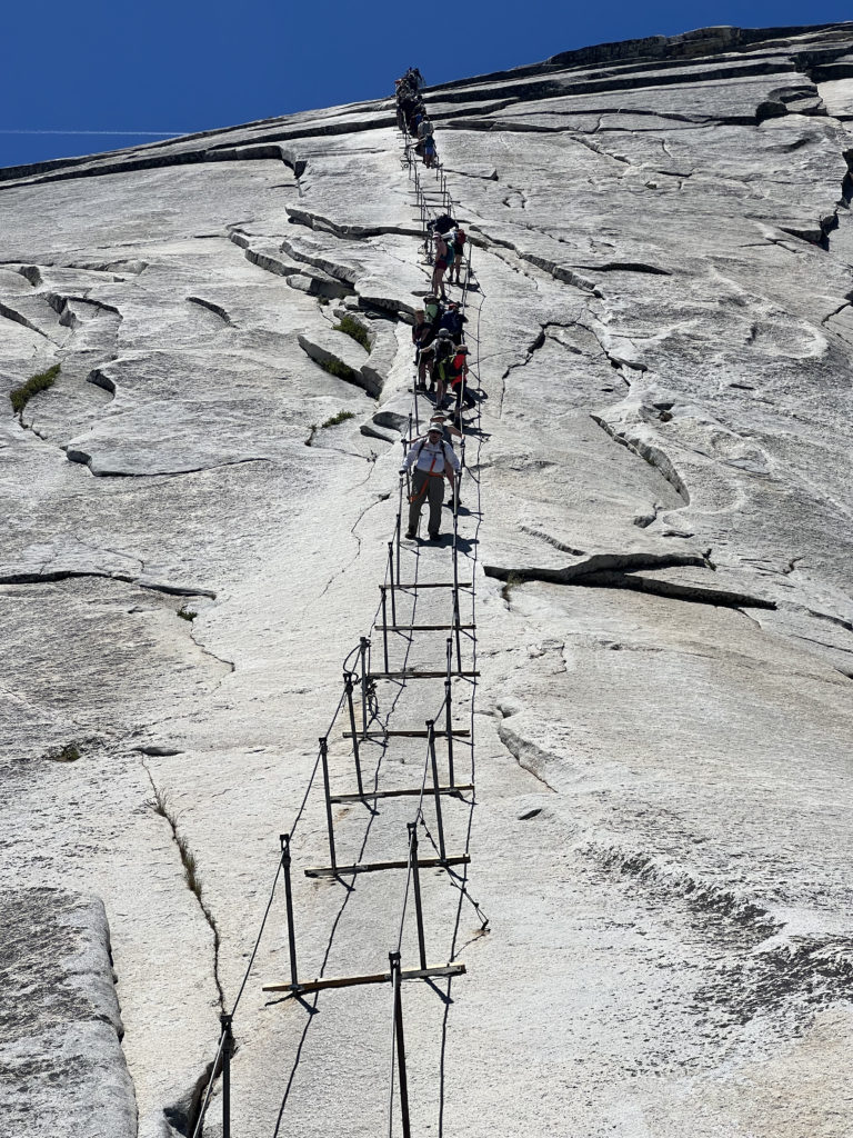
I did spy a bear print in the sand, just a reminder that there is a reason for all those warnings. Upon reaching the road, I crossed over and cruised on toward the Sunrise Trailhead. I figured I would have a better chance getting a hitch there than just on the side of the road with no place to pull over. This section was nice and flat, and my calf was thankful. I was bummed not to be continuing, as, except for that issue, everything else was going pretty well. The parking lot was filled with cars and hikers getting ready to head out. This is the primary trailhead for Cloud’s Rest, an epic hike that takes you to a view of Yosemite Valley from the east end. It is one that is on my list as well. I stood with my thumb out, and after a few cars drove past, two ladies in a Jeep pulled over and offered me a lift. Turns out they were backpacking down to Glen Aulin, so I filled them in with everything I just did. They dropped me off at the Lambert Dome parking area, and they headed down the side road to find parking. I cruised back to the car. Once back at the car, I tossed my backpack in and was going to stop off at the permit office, but the line was out the door.

I had tickets to see Alison Krauss and Union Station back in San Diego that night, so I was on a timetable. I purchased those tickets before I won the lottery for this trip. We had been trying to sell them, but had no luck. I stopped off at the small market and bought a cup of coffee to go with another bar I was eating. At the Tuolumne Meadows Visitor Center, I took advantage of the real restroom to change out of my hiking gear and into something comfortable to make the long drive home. Since I did not get my Yosemite patch when I was at the Visitor Center on Wednesday, I had to wait for them to open at 9. Once they did open, I grabbed my patch and a couple of other items, paid for them, and hit the road. I fueled the car back up in Bishop. Unfortunately, I would be passing through Big Pine too early to stop at Copper Top BBQ, so I would have to settle for something quick in Lone Pine. I did make another stop at Manzanar and got both my Junior Ranger badge and an Eastern Sierra Pear that was grown nearby. The rest of the drive was as exciting as you might imagine. I made it home in time to shower and make it to the concert, which I enjoyed, and my wife tolerated. Now to let that calf recover for a few days, then keep focusing on Mt. Whitney!


Buy Me a Coffee at ko-fi.com

I am an avid peak bagger, sometimes backpacker, and former sea kayaker living in San Diego. In 2019, I became the third person to complete the San Diego 100 Peak Challenge. Not stopping with that accomplishment, I set my sights on the harder San Diego Sierra Club 100 Peak list, which I completed in 2021. In addition, I have conquered several Six-Pack of Peaks challenges (SoCal, San Diego, Central Coast, and both the Arizona-Winter and Arizona-Summer). Beyond attempting the San Diego Sierra Club 100 Peak list a second time, I am looking forward to exploring new summits and new adventures across the southwest. 

Half Dome

One of my bucket list hikes has been to stand atop Half Dome in Yosemite. I got close in 2018, but having turned my ankle in the dark on the way up, I knew it would not be safe for me to continue past the Sub Dome. Ever since then I have been applying for a permit to attempt the hike again. This year I finally won the lottery and got my permit! Unfortunately, Ted would not be able to join me again as he and his family were at West Point to drop off their son. Susie, however, was free and happily agreed to join me.

My permit was for Monday, so we drove up to El Portal on Sunday. We left a bit on the early side, mostly to avoid LA traffic. After checking into the motel, we drove on toward the valley. Susie had just purchased new shoes and wanted to get a couple of miles in before the big day. Yosemite is now on a timed entry system, meaning you have to have a reservation between 6:00 am and 4:00 pm to enter the park. As we neared the entrance, we were 7 minutes early. I was hoping the ranger would let us enter, given I did have a permit for tomorrow, but they still made us turn back around. So, we drove back a bit until it was safe to make another U-turn. This time we arrived after 4:00, so I just showed my Annual Pass and drove on in.  It was just over 90° F on the valley floor, so we were not looking for anything too adventurous. We found a parking spot with almost no trouble. As we crossed over the valley toward Yosemite Falls, Half Dome stood majestically to our east. Its timeless shape stood lit in the afternoon sun. After taking a nice loop to see lower Yosemite Falls, we returned to the car. Susie said the shoes felt good and gave them the green light for tomorrow’s adventure. 

After making a stop at the store to see if there were any souvenirs we wanted, we drove up to Tunnel View to take in that classic vista of the valley. For dinner, we decided to try the new Basecamp restaurant. Unfortunately, both our sandwiches were barely edible. In fact, Susie just ate the fries and the biscuit that served as a bun for her chicken sandwich. 

Once back at the motel, we reviewed our strategy for the hike and set an alarm for 4 am. This time I wanted to start in daylight to hopefully avoid any missteps like last time. Another difference from the last attempt was we planned to filter water several times during the hike, which would keep our pack weight down. Given the predicted warm temperature, this probably meant having to carry around 5 liters. The day before, we had stopped in Oakhurst and grabbed some muffins, bananas, and orange juice for our breakfast. I certainly am not going to find my usual pre-hike breakfast of a sausage biscuit and hash browns. The parking lot was about 60% full when we pulled in. As we gathered our gear, I drank down a liter of water to start off nice and hydrated. Once we were ready to go, we set off down the path toward Happy Isles and the start of the Mist Trail/John Muir Trail (JMT). After hiking about 3/10 of a mile, we came to the Happy Isles bus stop and made a quick bio-break here. As we crossed over the stone bridge that spans the Merced River, the hike would now “formally” begin.

​​Section 1: Mist Trail

The first part of the Mist Trail is a paved, asphalt trail to the Vernal Fall footbridge. While this section is only about a mile long, you do gain about 500 feet, so we made sure to pace ourselves. While I was not thirsty, I had to take a sip at the water fountain, just because. For the rest of the hike, if you need water, you will have to filter it from the Merced or have it already. This is also the last chance for some flush toilets.

Now, the trail began climbing steeply toward Vernal Fall. After a short bit, the trail splits, with the JMT veering to the right and the Mist Trail to the left. The trail now turns into granite rocks and steps that would lead us up. While we had a glimpse of Vernal Fall from the footbridge, it was not until the trail made a slight turn did we get to see it fully. It is also here that you learn why this trail is called the Mist Trail. If there is a breeze, the mist from the waterfall is usually blown onto the trail. Thankfully, we only got a light mist during this section. During the winter, this section of the trail is closed due to it icing over and becoming unsafe. About 3/4 of the way to the top of Vernal Falls, the trail hugs a cliff wall, but thankfully, the metal railing provides some safety for this section.

The trail then pops out at the top of Vernal Fall on a nice wide plateau. I wandered over to the overlook for a bit before continuing on. The trail takes a mini-break from the elevation gain as it passes the Emerald Pool. Once we crossed the Silver Apron bridge, our climb would begin in earnest again toward the top of Nevada Fall. Steep stone switchbacks carried us up, as the river cascaded to our right. At the top of the waterfall, we came to the end of the Mist Trail and our first planned break. While most hikers hang out right at the junction with the JMT, near the bathroom, we hiked toward the falls to a spot that would give us access to the river. We sat on the smooth rocky banks and enjoyed a well-earned snack as we filtered water for the next section of the hike. I opted to have a liter of electrolytes, as well as about 2.5 liters in my water bladder. Our plan was to filter again once we returned from the summit. After about 20 minutes, we were ready for the next portion of the hike.

Section 2: Little Yosemite Valley

Now with our heavier packs, the flat but sandy section of the hike was welcomed. In just over 3 miles, we had already gained about 2,700 feet! Our first glimpses of the backside of Half Dome were coming into view as we cruised along. The trail splits after a bit, and if we continued straight we would enter the backpacking camp. There is a ranger station located at the camp, along with some pit toilets if you need one. Instead, we took the trail veering off to the left. Soon, this respite from the climbing would come to an end, as the trail makes a turn northward.

Section 3: The Climb

From Little Yosemite Valley, we were going to climb about 1,800 feet over the next 2.5 miles or so until we reached the Sub Dome. As we continued north along the JMT through some lovely forest, I felt myself beginning to feel a bit drained. I took a few short breathers that helped a bit. After 1.4 miles, we reached the junction with the Half Dome Trail. I found a nice spot for a break and then realized that I needed some real protein. I snacked on some jerky and soon began to feel better. Susie cruised on ahead and I once again found my groove. The trail finally turned west, and I knew that we would soon be at the Sub Dome.

Section 4: Sub Dome

It was here that I made the decision to turn back in 2018, so from here on out the hike would be filled with unknowns for me. I showed my permit and ID to the ranger who was stationed at the base of the Sub Dome. She gave us a quick safety briefing and we were good to go, but first, I had another snack and a brief rest. The steep stone steps would rise almost 600 feet in just 3/10 mile. I paused a few times as I made my way up, in part to save some energy for the cables, but also to take in the view. Once I crested the Sub Dome, the infamous cable section stood before me. The most challenging part of the hike was about to begin.

Section 5: The Cables and Summit

I have seen photos of the cables hundreds of times, but now they stood before me. We found a nice spot to take another quick break before continuing on. Both Susie and I brought a simple harness that would allow us to clip into the cables as we made our way up. Ted and I had these with us the last time. We stashed our trekking poles by some rocks and set off. Just a mere 400 feet of elevation gain in 1/10 mile up slick granite. Piece of cake, right? 

Across most of the poles that hold the cables up, is a wooden plank, but there are some sections where they are no longer there, and since Half Dome is protected, they will not be replaced. The cables start off mild, but quickly you find yourself pulling up using your arms from pole to pole. It is essentially a 45-degree angle in the beginning, which seems like a 60-degree angle in the middle, and then another 45-degree angle at the end. My gloves gave me a solid grip on the cable and I started to make my ascent. One of the other challenges with this section are the other climbers. We quickly found ourselves stuck behind one who was moving very slowly and we were in one of the more exposed sections of the cables. At that point, I decided that I needed to descend, so we turned back.

We sat once again at the base of the cables and stared up. Susie gave me a bit of pep talk, and we waited for the number of climbers on the cables to ease. The harness had been bothersome to use during our aborted attempt, so we both decided to forgo it this time. Once the crowd thinned, we again began making our way up. I focused on getting from one pole to another.  As I made my way up, if I needed to pause to allow a hiker to descend, I would clip in for a measure of safety. Overall, I knew that soon I would be standing atop the summit. 

As I stepped away from the cables, I felt a sense of accomplishment come over me. I walked over to a nice spot, slipped off my pack, and drank in the view. It was a touch warm, so I knew that we weren’t going to stay a long time on the summit. Plus, we did have the descent down the cables, which many say is harder, and the long hike back to the valley floor. I stood in the queue to have my photo taken on the “Visor”. Susie had already had her photos done while I was recovering from the effort. She hopped back into the queue and I took a new set for her. I also made sure to take a photo looking down from it, as I knew Ted had not ventured out and he might want to see what he missed.

While I wanted to have lunch up here, the heat was doing a number on our appetites, so we decided to head back down. Susie took the lead this time, as we carefully navigated the slick rock beneath our feet. I could feel my feet slip slightly from time to time, but I knew I had a good grip on the cable and focused on keeping myself in a safe place. We would pause and work out how to pass climbers heading up. I offered up words of encouragement to them, just as they had been given to me. Once past the section of the cables without planks, I knew that I had conquered Half Dome!

Section 6: The Descent

We stored our harnesses, retrieved our trekking poles, and started back down the granite stairs of the Sub Dome. My knee felt good, but I still took my time. We paused at the base of the Sub Dome for a bit and I had the last of the orange I had brought. I was also mindful of how much fluid I still had with me. There was still about 3.5 miles until we could filter water from the Merced. Thankfully, it was pretty much all downhill, so that would help.

After about 2.5 miles, I took a break and grabbed my small can of Coke, and drank it down. I knew the caffeine, sugar, and fluid would tide me over until we could refill our water. Finally, I reached Little Yosemite Valley and about ½ mile later, we sat next to the gently flowing Merced and began to filter our water. I had ¼ of a liter of water left when I arrived. We had some snacks while we refilled our bladders. I also filled my side bottle with more Gatorade as well. Once replenished, we set back down. Like most, we planned to descend using the JMT. This route is longer by an additional 1.5 miles, but without the knee-bashing steps along the Mist Trail. 

We could feel the heat as we traveled down. However, the views of Nevada Fall, Liberty Cap, and Half Dome did somewhat offset that. The next four miles were pretty much just more of the same. We both were ready to be done, and our feet were certainly in agreement. Finally, the trail rejoined the Mist Trail, and after a short break, we pushed on toward the end. Crossing back over the Vernal Fall footbridge, the end seemed so close, but that asphalt trail never seemed to end. Finally, the stone bridge came into view, and we just had the short, flat walk back to the car. Even at 6:30 pm, we could still feel the heat. I checked later and the high on the valley floor had been 100°F! We tossed our packs into the back of the Outback, changed shoes, and gave each other well-earned high-fives! 

The final stats for the hike were 17.02 miles in a total time of 13:12 hrs with an elevation gain of 5,485 feet. I did not stop my tracker during the entire hike. According to Susie’s tracker, our moving time was 9:53. We were a little slower than planned, but given the heat that we hiked under, we were quite pleased with our effort. 


Buy Me a Coffee at ko-fi.com

I am an avid peak bagger, sometimes backpacker, and former sea kayaker living in San Diego. In 2019, I became the third person to complete the San Diego 100 Peak Challenge. Not stopping with that accomplishment, I set my sights on the harder San Diego Sierra Club 100 Peak list, which I completed in 2021. In addition, I have conquered several Six-Pack of Peaks challenges (SoCal, San Diego, Central Coast, and both the Arizona-Winter and Arizona-Summer). Beyond attempting the San Diego Sierra Club 100 Peak list a second time, I am looking forward to exploring new summits and new adventures across the southwest. 

Yosemite Falls

It was just over 90° F on the valley floor, so we were not looking for anything too adventurous. We found a parking spot with almost no trouble. As we crossed over the valley toward Yosemite Falls, Half Dome stood majestically to our east. Its timeless shape stood lit in the afternoon sun. After taking a nice loop to see lower Yosemite Falls, we returned to the car. Susie said the new shoes felt good and gave them the green light for tomorrow’s adventure. 


Buy Me a Coffee at ko-fi.com

I am an avid peak bagger, sometimes backpacker, and former sea kayaker living in San Diego. In 2019, I became the third person to complete the San Diego 100 Peak Challenge. Not stopping with that accomplishment, I set my sights on the harder San Diego Sierra Club 100 Peak list, which I completed in 2021. In addition, I have conquered several Six-Pack of Peaks challenges (SoCal, San Diego, Central Coast, and both the Arizona-Winter and Arizona-Summer). Beyond attempting the San Diego Sierra Club 100 Peak list a second time, I am looking forward to exploring new summits and new adventures across the southwest. 

Half Dome (attempt)

One of the items on my bucket list was to summit Yosemite’s Half Dome. This year I got a permit for the cables in late September! I convinced Ted Markus to join me on the adventure. However, as most know, I herniated two discs in my neck in early April. Slowly, I began my recovery from the injury. I kept focusing on getting strong enough to attempt the Dome. As the time got closer, I felt that I might be able to do it. My foot was doing well through the training hikes, and my neck was better. So, on Friday (Sept 21st), we loaded up the car and headed to Yosemite. Since it is a drive and sadly, we are not in our 20s, we decided to break the drive up into two parts. Since we were passing through Bakersfield, I had to introduce Ted to the only two good things in that town; Basque food (Benji’s) and Dewars!

After a fine meal and some ice cream, and some chews to bring home, we headed on to Visalia for the night. As we drove into the Yosemite the next morning, the effects of the Ferguson fire were all around us; trees still smoldering, “Thank You” signs hung on fences, and repair crews still working to restore services…

We drove our way up to Glacier Point to gaze at the Dome, as well as much of the route we would take the next morning from the valley floor: first past Vernal Falls, then Nevada Falls, along the Little Yosemite Valley, then back around to the sub-dome, then the cables to the top.

We had talked about a short hike to Sentinel Dome, but it took us 20 minutes to park at Glacier Point, and the parking at the Trailhead was full. In fact, some poor driver got his car seriously stuck as we were leaving.

We returned back to the valley floor to see some sights, find our trailhead, and double-check our permits with the Rangers. We took a short hike out to Mirror Lake (long since dry for the season) and gazed up at the sheer face of Half Dome.

As the sun began to set, we headed out of the valley for an early dinner and last-minute prep for the following day. On the way out, we were greeted with some magical light against the valley walls.

Unfortunately, the room we had reserved in El Portal had a pipe burst, so we had to stay another 10 minutes further from the entrance. We quickly settled in and had a forgettable dinner and hit the pillows. The alarm was set for 3:00 am, but we were both up before then. The air was crisp but not cool as we drove back into the park. The parking lot was slowly filling up with other hikers. We donned our gear and headed off. After a quarter-mile, we realized we made the wrong turn, so backtracking, we found the road to the Happy Isles bridge and began in earnest.

Through the darkness, lit only by our lamps, we trekked along the asphalt path toward the Vernal Falls bridge. A critter moved along the side of the trail, and the white stripe along its back made us pause and retreat. Thankfully, the only stink that we would be carrying would be our own.

The splashing of the unseen Merced River could be heard as we climbed ever upward. Once we left the paved trail, the real hike began. About a mile later, I took a misstep and rolled my right ankle. I could not believe it! It hurt some, but I could put weight on it. Hoping it was just a light sprain, I soldiered on in the darkness, taking a tad more care as I climbed the stone steps upward.

Dawn’s light slowly began to fill the canyon, revealing the beauty that had been hidden. Atop the falls, we took a break before climbing to entering Little Yosemite Falls. We missed a turn and followed the wrong path for a bit. Our ‘Spidey-Sense’ told us to backtrack. Ted’s GPS was bouncing all over the place in the narrow canyon. So we entered the relative flat of Little Yosemite and enjoyed the respite as the Merced River flowed past…

The ankle was gently reminding me of the episode hours earlier as we walked through some river sand. I could also feel the elevation in my lungs as we climbed ever higher.

Soon, we began to catch glimpses of the backside of Half Dome and the sub-dome. They still were towering above us, although we had been hiking since 4:30 and it was close to 9:00 am. When we reached the turnoff for the last two miles up to Half Dome, we unloaded my two side water bottles, and Ted’s Gatorade, behind a tree. No sense in carrying the weight up to the summit.

I could feel my energy begin to drain, along with the unsteadiness of my ankle. I told myself that at the sub-dome I would be honest and decide if I should abandon the attempt. Over 7,000 feet up, the lungs were feeling it. We had started the day at about 4,000 feet.

Closer and closer, we neared the sub-dome, which many had said was equally as hard as the cable ascent.

As I reached the base of the sub-dome, I knew that I did not have it in me to safely attempt the summit. Between the ankle and my energy, I knew that I should not try. I was truly saddened as I wished Ted good luck on his summit attempt. I placed my safety belt on a rock, where I hoped someone would be able to use it. Ted said he passed his along as well once he was done with it.

We agreed to rendezvous back where we left the water. As I descended, my ankle gently reminded me that I was making the correct choice. I found solace under the pines as I worked my way back down. Once at the junction, I let my feet rest, ate some of my lunch, and sipped some water. I chatted with hikers as they passed, wishing them good luck on their attempts. Then I began to worry about my pace and the distance I needed to cover to return to the trailhead.

I packed up my water and left Ted’s empty Gatorade as a signal that I had started back down (along with an arrow made of sticks). As I made my way back down the switchbacks, each step reinforced my decision. I knew that Ted would catch me at some point, and if not, I planned to wait at the bridge at Nevada Falls, where we would take the John Muir Trail (JMT) down, bypassing the steep, stone steps from earlier.

Just before entering Little Yosemite Valley, the Ranger was checking permits on her iPad. I gave her my name and asked her to pass along a message to Ted that I was ok and headed down. I was also able to find some ankle tape, which greatly helped. I was so lucky that it was just lying there…

Ted caught me just before we left the valley again. Crossing over the Merced River, we were treated to some tremendous views of the falls as we worked our way down the JMT.

We still had about 4+ more miles to go back down to the valley floor, along with about 2,000 feet of elevation. Although this route is longer, by about 2 miles, our knees and my ankle were thankful.

We did have a brief unscheduled stop because a bear and her two cubs were reported ahead, so we let them pass. We did not see them.

But our adventure was not over! We decided to take the long way home down the 395 the next day. If you have never explored this road, you must. It is truly a hidden gem of California. After one last farewell to Half Dome, we continued along the 120, and over the pass at 10,000+ feet.

We quickly began our descent toward Lee Vinning, but not before more awesome vistas filled our car window. Our first quick stop along the 395 was at Mono Lake and the Tufas. (It was too early to hit the Whoa Nellie Deli).

As we drove down the 395, the eastern Sierras rose sharply along the highway. Patches of snow still clinging to a few spots. As lunchtime approached, we were nearing the town of Bishop, which could only mean one thing…

Grabbing some sandwiches to go, and a bag of bread for the family, we continued back toward San Diego. As we neared Lone Pine, we stopped at the Manzanar National Historic Site.

In 1942, the United States government ordered more than 110,000 men, women, and children to leave their homes and detained them in remote, military-style camps. Manzanar War Relocation Center was one of ten camps where Japanese American citizens and resident Japanese aliens were incarcerated during World War II. Sobering…

After a brief look at the Visitor Center and the driving tour of the site, we headed the short way to Lone Pine on Whitney Portal Road. There we headed out to the Alabama Hills and the Mobius Arch.

I was too sore to attempt the hike to the arch. I had seen it a few years before, so Ted scampered down the trail. I did stare up at Mt. Whitney in the distance…

We made our way through the high desert, occasionally slowed by traffic. It looks like the 395 is being widened from Kramer Junction to the 15 (eventually), and the 58 will be bypassing Kramer Junction sometime soon as well. We both reflected on the journey and we were thankful for it and the support of our family to undertake it.

Soon, the sun was setting over the desert, and Chris and Ted’s adventure came to a close. Thanks for reading. Happy Trails…


Buy Me a Coffee at ko-fi.com

I am an avid peak bagger, sometimes backpacker, and former sea kayaker living in San Diego. In 2019, I became the third person to complete the San Diego 100 Peak Challenge. Not stopping with that accomplishment, I set my sights on the harder San Diego Sierra Club 100 Peak list, which I completed in 2021. In addition, I have conquered several Six-Pack of Peaks challenges (SoCal, San Diego, Central Coast, and both the Arizona-Winter and Arizona-Summer). Beyond attempting the San Diego Sierra Club 100 Peak list a second time, I am looking forward to exploring new summits and new adventures across the southwest. 

Sentinel Dome

While the twins took a nap with their mom in the car, I got out and made the short hike to the top of Sentinel Dome. The dead tree that was made famous in a photograph by Ansel Adams, had finally fallen, the views from the summit were breathtaking.


Buy Me a Coffee at ko-fi.com

I am an avid peak bagger, sometimes backpacker, and former sea kayaker living in San Diego. In 2019, I became the third person to complete the San Diego 100 Peak Challenge. Not stopping with that accomplishment, I set my sights on the harder San Diego Sierra Club 100 Peak list, which I completed in 2021. In addition, I have conquered several Six-Pack of Peaks challenges (SoCal, San Diego, Central Coast, and both the Arizona-Winter and Arizona-Summer). Beyond attempting the San Diego Sierra Club 100 Peak list a second time, I am looking forward to exploring new summits and new adventures across the southwest.