Hiking the Methuselah Trail

High up in the mountains above Owens Valley, a 45-minute drive from Big Pine, California, sits the Ancient Bristlecone Pine Forest. Ted and I drove up the winding White Mountain Road, about 10 miles from CA 168. Our plan was to stop at Schulman Grove and hike the Methuselah Trail in order to acclimatize a bit before attempting to hike up White Mountain the next day. Along the way, we made a brief stop at Sierra View Vista and walked the short trail to take in the expansive views of the Sierra. I continued driving up the paved road, climbing just over 10,000 feet in elevation. We stopped at the Ancient Bristlecone Pine Forest Visitor Center and showed our pass to the staff before hitting the trail. I had been here before and hiked the Cabin Loop Trail, but did not do the Methuselah Trail.

We left the beautiful visitor center and headed down the trail. After about 300 yards, we came to a junction. From time to time, a bench would be set beside the trail to give out-of-breath hikers a place to rest and soak up the views. Off to the east, we could see down into Deep Springs Valley, then onto the Last Chance Range, and beyond that, Nevada.

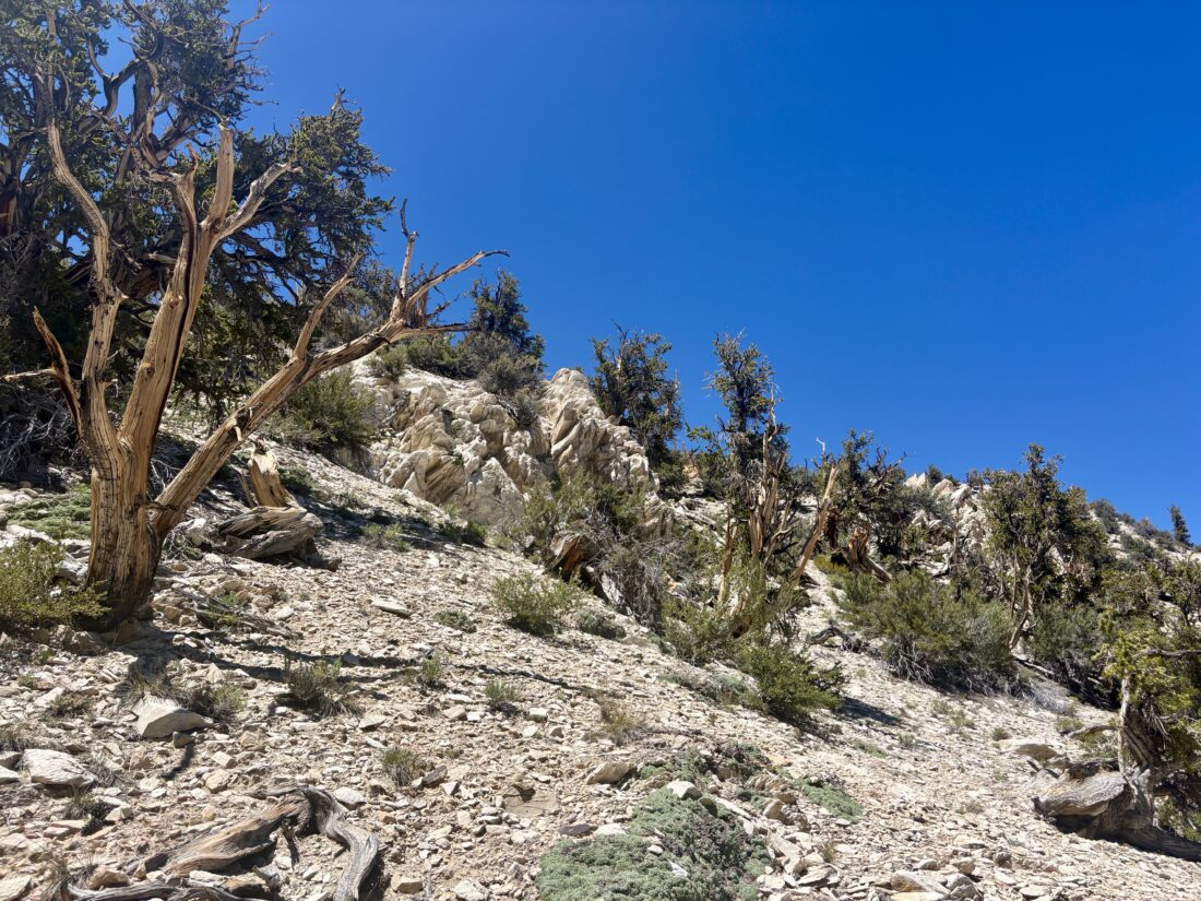
On the north-facing slopes, we would find the bristlecone pines. Since the north slopes retain snow longer, they can absorb additional moisture. In addition, there is no underbrush to compete with for the limited resources for their growth. These factors are key components to their longevity.

After descending for about 1.7 miles, we came to the Methuselah Grove. Here, the bristlecone pines cluster in large numbers, growing seemingly right out of the chalky sandstone. Somewhere in this grove is the oldest living tree, at over 5,000 years old. Some of the dead trees have been dated to over 10,000 years old. Once we left the grove, we began the climb back toward the visitor center. Neither of us wanted to take the longer route, which would have taken us along the Cabin Loop Trail, as we still had another hour of driving to our intended campsite. The entire loop was 4.1 miles in 1:58, with 643 feet of elevation gain.


Buy Me a Coffee at ko-fi.com

I am an avid peak bagger, sometimes backpacker, and former sea kayaker living in San Diego. I am the co-author of Urban Trails: San Diego, available now!

In 2019, I became the third person to complete the San Diego 100 Peak Challenge. Not stopping with that accomplishment, I set my sights on the harder San Diego Sierra Club 100 Peak list, which I completed in 2021. In addition, I have conquered several Six-Pack of Peaks challenges (SoCal, San Diego, Central Coast, and both the Arizona-Winter and Arizona-Summer).

I am looking forward to exploring new summits and new adventures across the southwest. 
Returning to Sawmill Mountain

My son wanted to get away for the weekend, so I suggested that we head up toward Los Padres and camp at McGill Campground. After a small mix-up with the campground reservation, we got an even better site. After setting up, we relaxed a bit before cooking dinner, then continued relaxing by the campfire. The next morning, I made the short drive to Nordic Base to hike out to Sawmill Mountain.

I had considered Antimony Peak, but I was still nursing some calf tightness, and thought I should stick to a trail I knew well. I kept my pace a bit more on the mellow side; there was no need to set a PR. Before too long, the communication tower atop Mt. Pinos came into view. I swung by Ventura County’s high point, snapped a few photos, and motored on.

Quite a few Snow Plants dotted the sides of the trail. Usually, I might see one or two, but this time there were a lot more. A nice breeze kept the hike refreshing as I made my way down the saddle, then up toward Sawmill. Just as I was approaching the massive cairn, I met two hikers. We chatted a bit; they were off to hike Grouse Mountain for the 3-2-1 challenge. At the summit, I snapped a few photos and grabbed a snack. Leaving the summit, I met a trail runner who was hoping to make it all the way to Cerro Norteste. I wished him well on his run and continued back to the trailhead. I met a few other hikers along the way. When I got back to my car, I discovered that something went wrong with my recording. Drat! I was curious to see how long I had been moving, and I only had my total time (I stopped a few times for longer conversations with some of those hikers).

Once back at the campground, we packed up the car and headed off for the next adventure. We grabbed some tri-tip sandwiches from the market, then drove to the top of Frazier Mountain. The road was manageable. There were some rocky sections, but nothing too bothersome with good off-road tires. At the summit, we broke out the chairs and enjoyed both the view and the sandwiches. Afterward, we explored the abandoned fire lookout tower before heading back down the mountain and finally home.


Buy Me a Coffee at ko-fi.com

I am an avid peak bagger, sometimes backpacker, and former sea kayaker living in San Diego. I am the co-author of Urban Trails: San Diego, available now!

In 2019, I became the third person to complete the San Diego 100 Peak Challenge. Not stopping with that accomplishment, I set my sights on the harder San Diego Sierra Club 100 Peak list, which I completed in 2021. In addition, I have conquered several Six-Pack of Peaks challenges (SoCal, San Diego, Central Coast, and both the Arizona-Winter and Arizona-Summer).

I am looking forward to exploring new summits and new adventures across the southwest. 

Ascending Spitler Peak

When I was backpacking along the Desert Divide section of the PCT, I was able to “side quest” and climb a few of the HPS peaks that lay near the trail. However, there were a couple that I skipped for various reasons. So, today I decided to head back and cross one of them off the list. I settled on Spitler Peak as the day’s goal. I turned off Highway 74 and on Fobes Ranch Road. The road had recently been graded, but I still had to be a bit mindful, and avoid a few rocks from time to time. I came to a locked gate after about 3.5 miles of driving. Just before the gate was a wide spot to park. According to the map, this is where the road used to go, but it is now blocked by large rocks.

I gathered my gear, remembered to put up my sunshade, and set off along the abandoned road. After about 1/2 mile, the road ended, and the actual trail took over. My route would now climb toward Fobes Saddle, where I would rejoin the PCT. The trail was in pretty good condition. There were a couple of turns that were slightly confusing, so I built some cairns to help guide others.

Once at the saddle, I turned northward to continue the climb toward Spitler Peak. As I made my way along the trail, it was certainly easier without my full backpack, having already hiked about 16 miles. The peak came into view, and I began looking for cairns that might indicate a route up its steep slope. I didn’t remember seeing any when I passed by it last time, and that still held true this time. So, I looked for a clear, straightforward path to get started on the ascent. When I say steep, I mean like 30-50% slope! I kept pushing on, knowing the summit wasn’t actually that far off the trail. I checked my position and adjusted my ascent route slightly to reach the proper summit. Once at the summit, I slipped off my pack and took in the views. During the ascent, my left calf began to ache, so I mixed up some electrolytes to see if that might help. After a snack, some more photos, I signed the register and headed back down.

Back on the PCT, I retraced my route back to Fobes Saddle. Along the way, I enjoyed the wildflowers that still dotted the sides of the trail. At the saddle, there was a box marked “trail magic”; it was actually filled with trash from thru-hikers. I gathered some up and stuffed them into my pack to haul out.  My calf continued to ache, but I managed to keep hiking down the trail. When I was back on the abandoned road, I spotted a gopher snake in the shade, but upon looking closer, I saw that a smaller rattlesnake had attacked it and was latched onto it. As I gave it a wide berth, I wondered how that tiny rattler was going to handle much larger prey?

The day had warmed up, and the breeze usually kept it pleasant, but as the car came back into view, I was glad to be done. My calf was certainly going to need some attention once I got home, but first, I had to hit Paradise Valley Café for a well-earned lunch. The final stats for the hike were 7.5 miles in 4:22 with 2,294 feet of gain.


Buy Me a Coffee at ko-fi.com

I am an avid peak bagger, sometimes backpacker, and former sea kayaker living in San Diego. I am the co-author of Urban Trails: San Diego, available now!

In 2019, I became the third person to complete the San Diego 100 Peak Challenge. Not stopping with that accomplishment, I set my sights on the harder San Diego Sierra Club 100 Peak list, which I completed in 2021. In addition, I have conquered several Six-Pack of Peaks challenges (SoCal, San Diego, Central Coast, and both the Arizona-Winter and Arizona-Summer).

I am looking forward to exploring new summits and new adventures across the southwest. 

Hiking a loop through Shenandoah National Park

I awoke to my ears still ringing from last night’s Bruce Springsteen concert (or maybe just my regular tinnitus) and quickly packed up and checked out. Today’s plan was to drive out to Shenandoah National Park. Once past the DC traffic, I cruised through the Virginia countryside. Once on Skyland Drive, I headed south toward Big Meadows and the visitor center there. Along the way, I would pull over at one of the many overlooks to marvel at the views.  At the visitor center, I stamped my passport book and picked up my Junior Ranger booklet. The plan for the morning was to make a nice loop from there down to Dark Hollow Falls, then up past Rose River Falls. From there, I planned to work my way over to the Big Meadows lodge for lunch, then down to Lewis Spring Falls before finally returning to the visitor center.

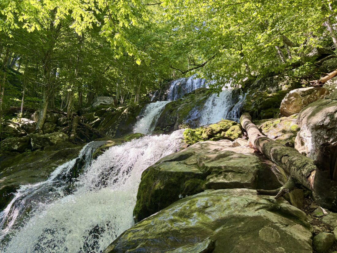
The creek flowed next to the trail as I made my way down toward the falls. It had been raining for the past week, so everything was still damp. The falls were lovely, and a few folks were milling about, taking in their beauty. I continued on down the trail, still marveling at everything. From time to time, I had to deal with water running along the trail. A few spots took some care, as I was without my trekking poles. The trail then turned upward toward the next major falls, Rose River. Once there, I took another break and enjoyed them.

Unfortunately, my left calf began to tighten. I drank some electrolytes and hoped that might address the issue. Once I reached the Rose River Trailhead, my route was now on the Appalachian Trail! As I worked my way toward the lodge at Big Meadows, I crossed paths with 4 different thru-hikers. I chatted with them briefly, and all were happy to have a break from the rain. The calf was getting better, but I knew I was going to be skipping the Lewis Springs Falls part of my hike.

After lunch and working on my Junior Ranger booklet, I made a quick trip up BlackRock Overlook. Once back at the visitor center and my Junior Ranger badge secured, I stopped at the general store next door and grabbed some bananas and another Gatorade. This adventure covered 7.5 miles in 3:47 and 1,464 feet of gain.


Buy Me a Coffee at ko-fi.com

I am an avid peak bagger, sometimes backpacker, and former sea kayaker living in San Diego. I am the co-author of Urban Trails: San Diego, available now!

In 2019, I became the third person to complete the San Diego 100 Peak Challenge. Not stopping with that accomplishment, I set my sights on the harder San Diego Sierra Club 100 Peak list, which I completed in 2021. In addition, I have conquered several Six-Pack of Peaks challenges (SoCal, San Diego, Central Coast, and both the Arizona-Winter and Arizona-Summer).

I am looking forward to exploring new summits and new adventures across the southwest. 

Hiking the Sandstone Peak Loop

After spending the night at my wife’s uncle’s house in Encino, I awoke early and drove to the Mishe Mokwa Trailhead in the Santa Monica Mountains. The goal today was to complete a 7+ mile loop that included 6 summits on the Lower Peak Committee list. I pulled into an empty parking lot and gathered my gear. Crossing the road, I set off along the trail, hoping that not bringing a jacket wasn’t a mistake, as the clouds were all around me. I came to the first signed junction and headed off toward Sandstone Peak. The trail was in great shape, and I was making good time. A couple of hikers passed me, returning from what I assume might have been an attempt to watch sunrise from the summit. I found the turn off to the peak and worked my way up. A plaque honoring Mr. W. Herbert Allen, who donated many acres of land to the Boy Scouts, was mounted on a nearby rock. There was an attempt to rename this peak in his honor in the 1960s, but the petition was denied because of a Department of the Interior policy against naming geographic landmarks after people who were still alive. The clouds prevented any sort of views, and I knew that was going to be the case for the rest of the day. 

I made my way back down to the Backbone trail and continued my clockwise route. The track I was using as a guide featured a short side-hike to the summit of Pico Raquelita. While not on the list, I figured, why not bag another peak? After a little bushwhack, I reached the summit and quickly returned to the main trail. I found the use trail leading to the top of Boney Peak not long after rejoining it. I was surprised by the lack of cairns to guide hikers, especially given that this area is fairly popular. I found the primary summit block and called it “bagged”. There was no need to climb it for the view, as there was none. I opted for a more direct route back to the main trail, guessing my way down.

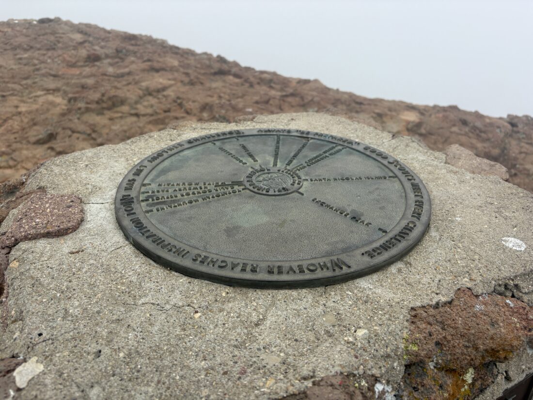
Next up was Inspiration Point, just a short walk to the memorial for William Plants, an Eagle Scout who died on the trail in Kings Canyon National Park at the age of 16. Two hikers were just leaving as I arrived. Atop the memorial is a sighting disc to help pinpoint the various landmarks that could have been seen, but not today.

The trail came to a junction, and I turned to the south to hike to Exchange Peak. I passed some old water tanks, then onto a use trail toward the summit. While the route was mostly findable, I again wondered about the lack of cairns and how they might be useful.

After a snack, I headed northward toward Tri-Peaks. My route would become less defined as I left the Backbone Trail for a while. There was signage to help guide me, so I never felt lost. I reached the summit and understood the reasoning behind the name. I milled around the base of the Tri-Peaks before continuing northward toward the final peak of this loop, Big Dome. 

My route turned eastward, and just after Pop Top Peak, which I technically skipped, the trail veered off toward the summit. I missed the first trail up, and had to back-track to it from the east side. Again, just more views of the gray clouds.

I rejoined the Mishe Mowka Trail and continued eastward. I passed by Split Rock, stopping at the picnic table to adjust my shoes before continuing on. I opted not to take the unmaintained trail to view Balance Rock because visibility was so poor. I slipped in my headphones and enjoyed a podcast as I motored home.

A couple of signposts asked visitors to position their camera, take a photo, and email it to the researchers. This citizen scientist’s effort to catalog the recovery from the 2018 Woolsey Fire is really impressive. I snapped my photos to send later. Before too long, I reached the junction near the start of the trail. There, a gentleman was plucking up the red flags I had spotted from time to time along the trail. I initially assumed they were there for a trail race on Saturday. They actually were guides for hikers from a nearby retreat. We chatted a bit as we made our way back to the trailhead. He went over to his clients, and I to my car. I changed for the long drive home and set off. This was a great day of peak bagging, knocking 6 more off the LPC list. I might need to return on a clear winter’s day to enjoy the views, but it was still a good day on the trails. The final stats were 7.5 miles in 4:25 with 1,443 feet of gain


Buy Me a Coffee at ko-fi.com

I am an avid peak bagger, sometimes backpacker, and former sea kayaker living in San Diego. I am the co-author of Urban Trails: San Diego, available now!

In 2019, I became the third person to complete the San Diego 100 Peak Challenge. Not stopping with that accomplishment, I set my sights on the harder San Diego Sierra Club 100 Peak list, which I completed in 2021. In addition, I have conquered several Six-Pack of Peaks challenges (SoCal, San Diego, Central Coast, and both the Arizona-Winter and Arizona-Summer).

I am looking forward to exploring new summits and new adventures across the southwest. 

Up to the Hollywood Sign

The start of my Los Angeles Lower Peak adventure was to finally climb Cahuenga Peak and see the backside of the Hollywood sign. I left early to try to avoid as much of the traffic as possible. Parking on Lake Hollywood Boulevard, I gathered my gear and set off. I turned onto Wonderview Drive, passing some lovely homes. I slipped around the gate (which I later learned only looks locked), but I retrieved a lost water bottle from the hillside, so I figured I had done a good deed to go off-trail slightly. Once past the water tank, I spied the actual trail to my first destination, the Wisdom Tree atop Burbank Peak. A plaque gave some history about this portion of Griffith Park. The trail climbed quickly to the summit. The Wisdom Tree was the sole surviving tree from the Burnham Fire and has garnered celebrity status. I took in the views, under the May Grey, and continued along the ridge trail toward Cahuenga Peak, my actual goal, as it is the one on the Lower Peaks Committee list. The trail had some ups and downs; I am sure a bit more challenging for non-hikers, but I kept hiking along.

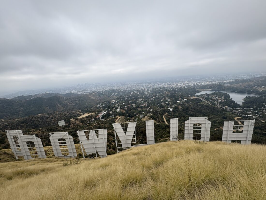
Atop Cahuenga Peak, I enjoyed the view of Lake Hollywood below me and Mt. Lee to the east. 

The trail connected to the Mt. Lee service road and, in a short distance, the backside of the Hollywood sign. I walked up the small hill to see the entire sign. After snapping a few photos, I headed back. While the overcast skies kept the day cool, I certainly wasn’t going to have an iconic photo of the LA skyline today.

I retraced my route and was soon back at the car. Next up was Temescal Peak, out near Encino. My stats for this hike were x.x miles, in x:xx with xx feet of gain.


Buy Me a Coffee at ko-fi.com

I am an avid peak bagger, sometimes backpacker, and former sea kayaker living in San Diego. I am the co-author of Urban Trails: San Diego, available now!

In 2019, I became the third person to complete the San Diego 100 Peak Challenge. Not stopping with that accomplishment, I set my sights on the harder San Diego Sierra Club 100 Peak list, which I completed in 2021. In addition, I have conquered several Six-Pack of Peaks challenges (SoCal, San Diego, Central Coast, and both the Arizona-Winter and Arizona-Summer).

I am looking forward to exploring new summits and new adventures across the southwest. 

A loop around Cush-Pii

My friend Becca was supposed to be heading out on a two-day, one-night backpacking trip. Unfortunately, that adventure was canceled, but since her pack was mostly ready to go, she asked if I might take her on a training hike. I thought, why not do a loop around and up Cush-Pii (aka Stonewall Peak)? It is a nice mix of some flatter sections and a bit of gain to test out the legs and the lungs. We drove out to the Paso Picacho campground and parked in the day-use area. After paying the $10 day-use fee and using the facilities, we crossed the highway to the trailhead. Becca also wanted to practice her navigation skills. I recommended that we do the loop clockwise and had her point us in the right direction. We hiked along, chatting about various things from family to hiking. At the next junction, I had her figure out once again where we were and where we needed to go. Since we were now on the California Riding and Hiking Trail, I gave her a brief history of it. That in turn led to talking about backpacking it through Joshua Tree.

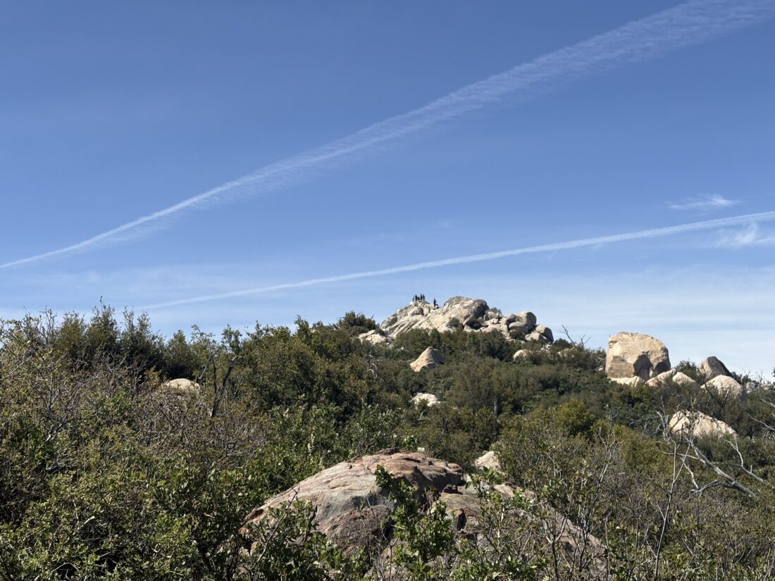
At our next junction, we took a short break as the climb was about to begin. Becca pushed herself upward with her heavy pack on her shoulders. Thankfully, I got her to leave 2 liters of water in the car.  She is preparing to overnight on San Jacinto, so I was explaining where the water sources are and about how much she might need. Soon, the summit came into view, and we climbed over the granite and up the stairs to the summit. A couple of people were also at the top, taking in the 360° views. We took a short break before working our way back down from the summit.

Our route now would be the direct route from the campground. While we had seen only two people before reaching the summit, that was about to change. Several large groups passed us, making their way up. Apparently, a father-son group was staying at the campground, and the 30+ were headed to the top. Not sure how they were going to handle that, since they wouldn’t all fit up there at the same time. I pointed out the parking area I use when I climb Cuyamaca, and I noted there were a lot of cars there. It turns out there was a 100-mile race, so it was probably a good thing we opted for the day-use lot. Once back down, we chatted with a park volunteer staffing the entrance kiosk. We had hoped to try The Pub at Lake Cuyamaca, but the parking lot was full from the race (and others), so we opted for Dudley’s instead. Our loop covered 5.0 miles with 1.108 feet of gain.


Buy Me a Coffee at ko-fi.com

I am an avid peak bagger, sometimes backpacker, and former sea kayaker living in San Diego. I am the co-author of Urban Trails: San Diego, available now!

In 2019, I became the third person to complete the San Diego 100 Peak Challenge. Not stopping with that accomplishment, I set my sights on the harder San Diego Sierra Club 100 Peak list, which I completed in 2021. In addition, I have conquered several Six-Pack of Peaks challenges (SoCal, San Diego, Central Coast, and both the Arizona-Winter and Arizona-Summer).

I am looking forward to exploring new summits and new adventures across the southwest. 

Adventures in Mining Country…

Since I could not easily link up with Sara to hike more of the PCT with her, I decided to go peak bagging instead. I decided to try to knock out some summits on the Hundred Peak Section list just north of Paradise Valley Café.  I parked the car at the side of the road, slipped on my fleece as it was a bit cold, grabbed my gear, and headed off. The route took me past a few lovely homes before heading into the wilderness. The trail was easy to follow as it worked its way eastward. The peak of the day was to be Gold Hill. While not on the list, I decided to climb it anyway. At the junction, there was a very detailed sign telling “a brief history of mining ‘round these parts”. As I made my way up, I found some of the old foundations of various buildings. Once at the summit, I soaked in the view, especially of Thomas Mountain to my west. I returned to the junction and continued following an old 4×4 road up the mountain toward Butterfly Peak.

Along the way, I passed a gated mine shaft and another informational sign, this time about bats! My route now began climbing in earnest, but the views were lovely. Soon, I came to another mine shaft. This one was a vertical shaft that had been filled with mining items. After surveying it a bit, I continued up toward the saddle. Once there, I turned northward toward Butterfly Peak. I actually turned too soon, but did find another mine shaft, and this one was completely exposed. I pushed on up, picking my route through the brush and rocks. The peak came into view, and the final effort to the summit. Once there, I slipped off my pack and soaked in the views. I found the register and signed in under two of my friends who were here last year. I turned my gaze to the east and Ken Point, my next possible summit. First, I had to bushwhack my way down to the old road. Once there, I started toward it, but the cross-country adventure to the summit and the descent left me less than motivated to push on, so I turned back.

I crossed back over the saddle and down the trail. When I reached the information sign for Gold Hill, I headed southward toward Rock Point. I spied the cairn for the trail to its summit. In addition to the cairns, colored ribbons also help mark the route. Once at this summit, I found some shade and enjoyed my lunch. Off to the north, I could see San Jacinto, and from my vantage point, it was completely devoid of snow. I am sure Sara will appreciate this when she hikes over it.

Once back on the main trail, I began following those ribbons, as they matched the route I had been using. Unfortunately, I found myself at a gate reading “private property”. Oops! I had followed a trail leading me to the edge of Paradise Ranch. A counselor was nearby, and I asked if I might pass through and she kindly let me. Turns out those ribbons were theirs and not from a trail race. This facility is a wilderness camp for kids in Riverside County. This is why I am not including the actual track, as I don’t want anyone to accidentally make the same error. Once back at the car, I changed into a dry shirt and made the short drive to Paradise Valley Café for a second lunch.  My adventure covered 9.26 miles in 6:56, with a total gain of 2,465 feet.


Buy Me a Coffee at ko-fi.com

I am an avid peak bagger, sometimes backpacker, and former sea kayaker living in San Diego. I am the co-author of Urban Trails: San Diego, available now!

In 2019, I became the third person to complete the San Diego 100 Peak Challenge. Not stopping with that accomplishment, I set my sights on the harder San Diego Sierra Club 100 Peak list, which I completed in 2021. In addition, I have conquered several Six-Pack of Peaks challenges (SoCal, San Diego, Central Coast, and both the Arizona-Winter and Arizona-Summer).

I am looking forward to exploring new summits and new adventures across the southwest. 

PCT – Mount Laguna & Foster Point

The planned hike today was to start at the Storm Cloud Viewpoint and hike south to Mt. Laguna, where Sara planned to enjoy a warm breakfast at the Pine House Café. This section was pretty flat. I had hiked a portion of it recently when I took Becca up Monument Peak.

I neared Mt. Laguna, stopped at the Desert View picnic area, and had a snack. I tried texting Sara, but had no signal, which was odd. I cruised on down to the general store and found that the AT&T tower was down. I did not want to walk all the way down to the café, but as luck would have it, she was across the street at the visitor center, topping off her water.

Sara filled me in on the rest of Day 1 and Day 2 as we cruised along the trail. I pointed out more local sites as the miles slipped past. We came to the junction with Foster Point, an actual blue line on FarOut. I made the short hike out to the vista, which I had never done. I then reconnected with the red line and Sara and kept moving north. Once back at my car, I broke out a couple of chairs and some cold sodas. Sara snacked, as she was still a bit full from breakfast, and I had a tuna kit. The views of Anza-Borrego were stunning. Soon it was time for Sara to push on, and for me to head home. Hopefully, I will rejoin her near Paradise Valley Cafe in a few days and actually spend a night on the PCT. Today’s adventure was 10.5 miles in 5:07 with just 1,026 feet of gain.


Buy Me a Coffee at ko-fi.com

I am an avid peak bagger, sometimes backpacker, and former sea kayaker living in San Diego. I am the co-author of Urban Trails: San Diego, available now!

In 2019, I became the third person to complete the San Diego 100 Peak Challenge. Not stopping with that accomplishment, I set my sights on the harder San Diego Sierra Club 100 Peak list, which I completed in 2021. In addition, I have conquered several Six-Pack of Peaks challenges (SoCal, San Diego, Central Coast, and both the Arizona-Winter and Arizona-Summer).

I am looking forward to exploring new summits and new adventures across the southwest. 

PCT – Southern Terminus

The windshield wipers danced rhythmically as we drove out to Campo and the southern terminus of the Pacific Crest Trail. Hopefully, this rain was the last bit of the storm that blew through during the evening. My friend Sara was here to fill in a few gaps from her 2018 thru-hike. We parked at CLEEF and grabbed our gear. I was just day hiking with her, as I was unable to secure an overnight permit in the Cleveland National Forest. Hikers milled about, some enjoying their pancakes, others scrolling on their phones, each about to start along a journey that would transform them in ways unknown. We hiked down to the monument, took a few photos, and began walking northward. A new fence kept us from the actual border wall, which was also now topped with razor wire.

The skies were still dark, so our rain gear stayed on as we began our journey northward.  I had been to the terminus before, but never hiked this section of the PCT. Soon we passed the 1-mile marker, just over 2,649 more miles to go until the Canadian border. We cruised along, chatting about all sorts of things, her various other thru-hikes, all things Star Trek, and more. The next milestone was at the 3-mile mark, crossing the railroad tracks. At 4.4 miles, we stopped, and Sara filtered some water from the small stream. The day had warmed enough to shed a few layers before we began climbing.

Since I could not camp unless we made it the full 20 miles to Lake Morena, I had to decide when I was going to turn back. I certainly wasn’t going to descend into Hauser Canyon, only to climb back out. Around the 7-mile mark, we found a nice spot for a snack, and I made the call to head back. Sara pushed north, and I headed south. Along the way, I meet some other folks beginning their PCT experience. Once back at CLEEF, I sat around for a bit, loaning a tool for one hiker to repair their tent, listening to two more try to lighten the load of one of their packs. Soon it was time to head home. Sara texted me later that day that she had reached Lake Morena and enjoyed some trail magic before turning in. Maybe next year I might actually backpack this section…. All told, I hiked 13.5 miles in 6:56 with 1,296 feet of gain.


Buy Me a Coffee at ko-fi.com

I am an avid peak bagger, sometimes backpacker, and former sea kayaker living in San Diego. I am the co-author of Urban Trails: San Diego, available now!

In 2019, I became the third person to complete the San Diego 100 Peak Challenge. Not stopping with that accomplishment, I set my sights on the harder San Diego Sierra Club 100 Peak list, which I completed in 2021. In addition, I have conquered several Six-Pack of Peaks challenges (SoCal, San Diego, Central Coast, and both the Arizona-Winter and Arizona-Summer).

I am looking forward to exploring new summits and new adventures across the southwest.