Trip Reports

Diablo Benchmark

The first peak of an entire weekend out in Anza-Borrego was to be Diablo Benchmark. Susie Kara and Matt Bennett convinced me to come out Friday afternoon to summit this peak. They had planned to primitive camp overnight nearby. I opted for a little more comfort and grabbed a campsite at Agua Caliente. I loaded up the Outback and headed out. Since I had already booked a hotel for Saturday night, I really did not need too much in terms of food or gear. I got to the campsite a bit behind schedule but was able to quickly set up the tent and toss in my gear.

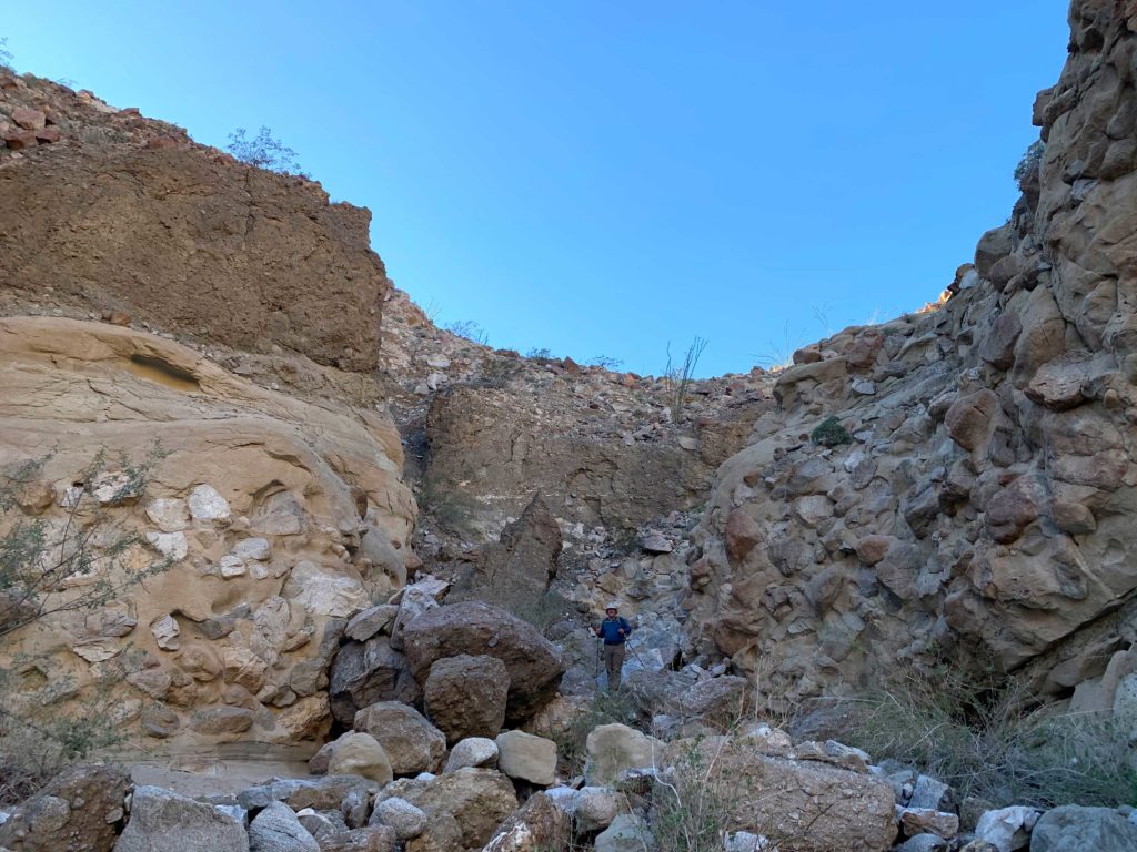
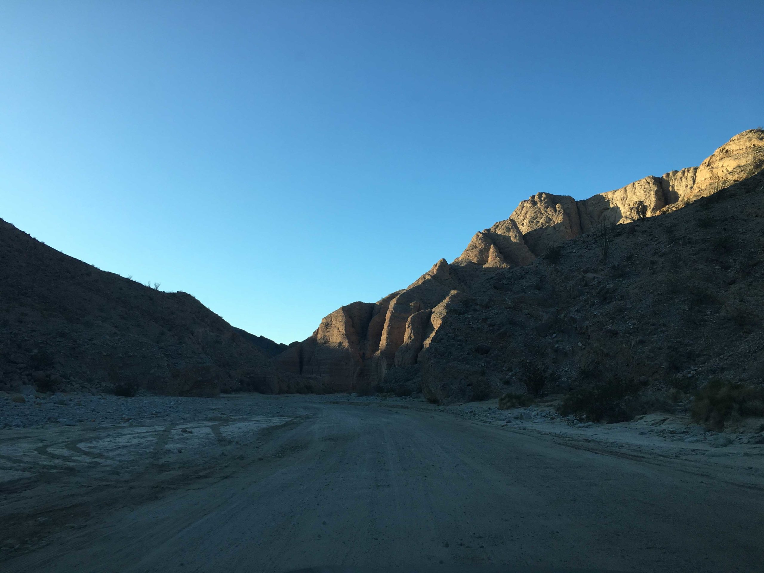
I met Susie and Matt at the turnoff for June Wash, and they quickly piled into the car and off we went. Our plan was to drive up the wash road as far as we could, then hike up the rest of the way. I had no trouble driving the route. Once we neared the start of Greg Gerlach’s recent track, we found a nice spot to park the car and set off.

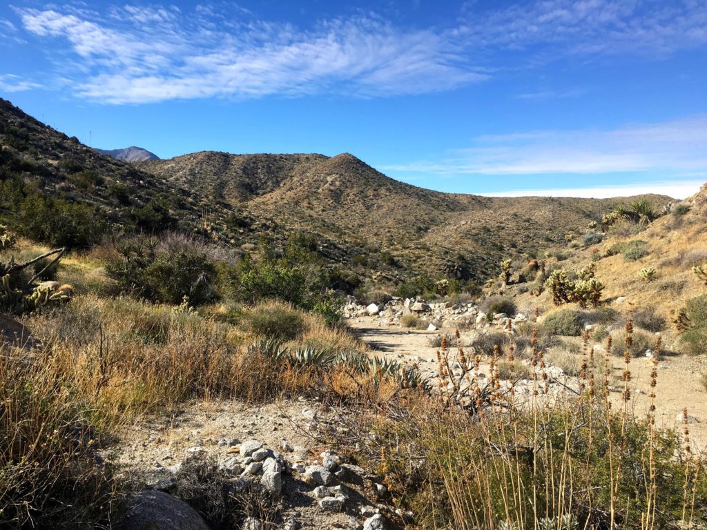
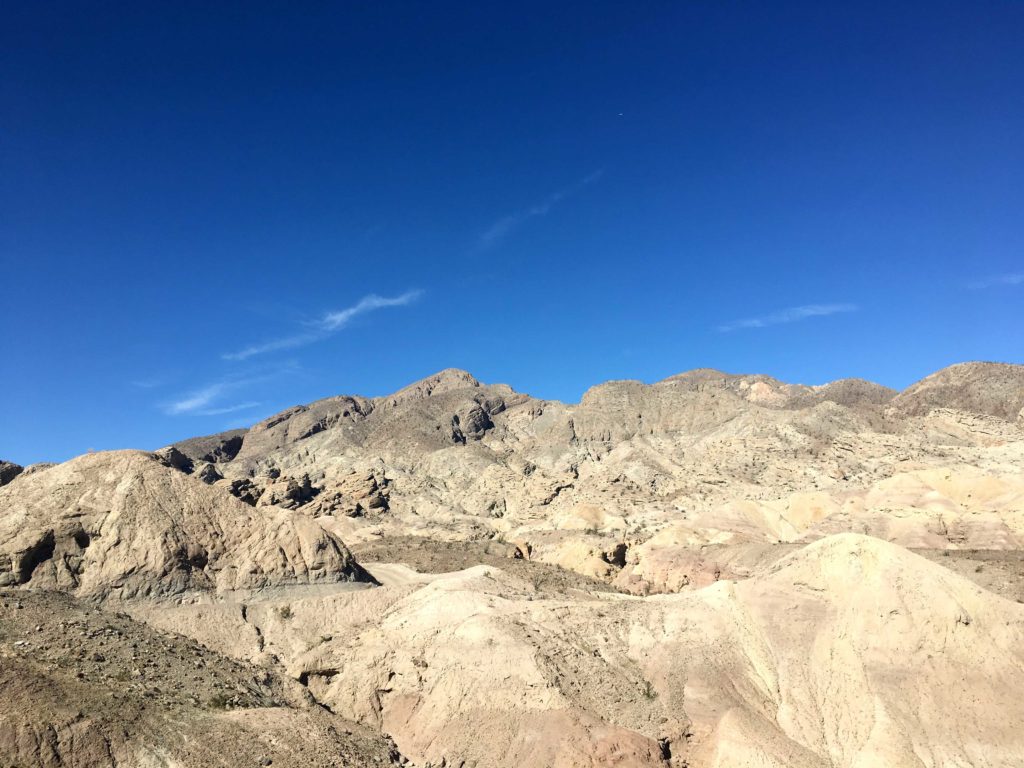
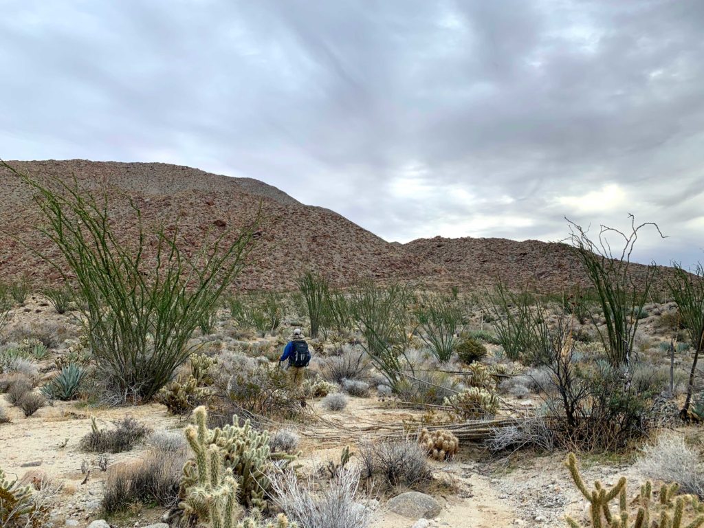
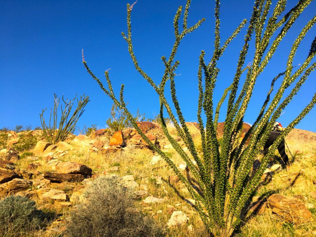
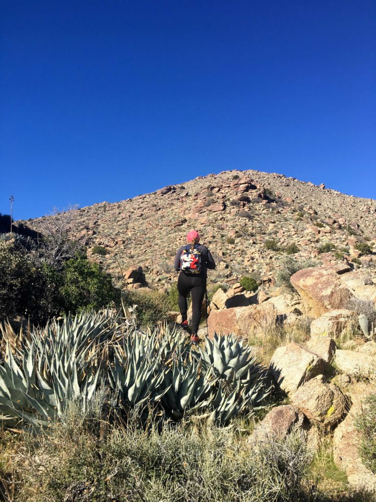
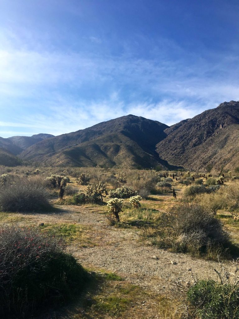
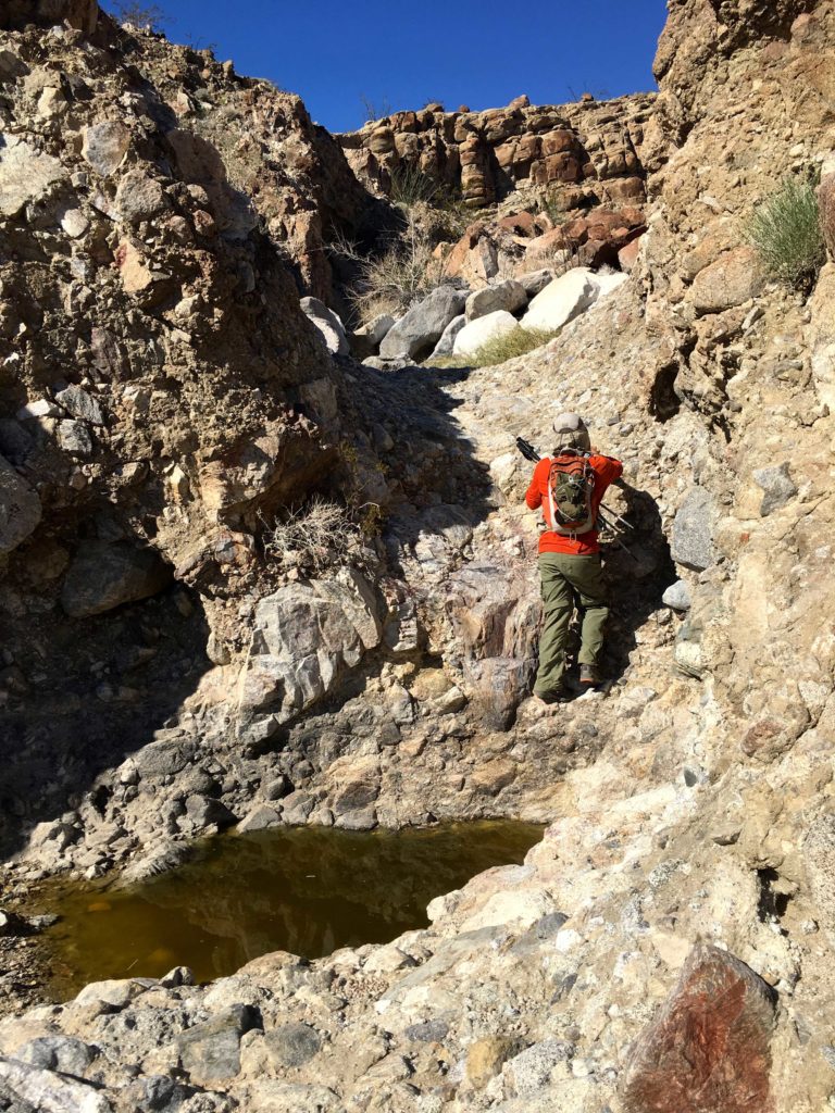
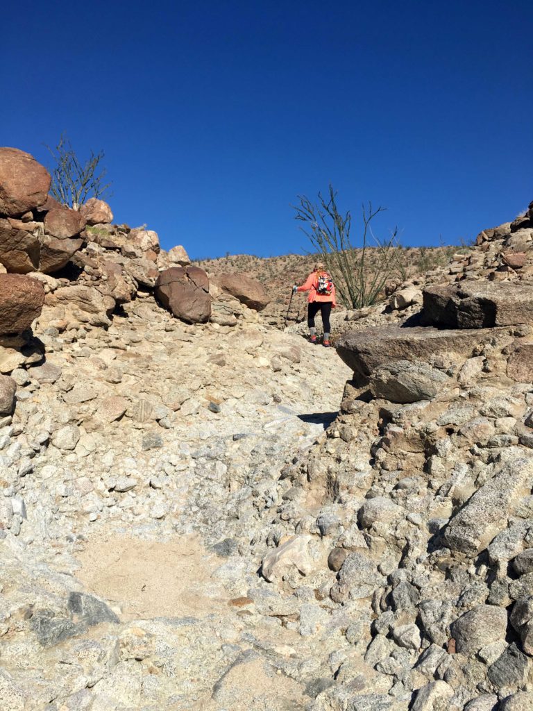
We continued to follow the wash for a while, avoiding the chollas that dotted the entire route. Soon it was time to leave the wash and ascend to the ridgeline. We initially started up the wrong one, but I recognized the proper hillside from some Google Earth research I had done and we dropped over to it.

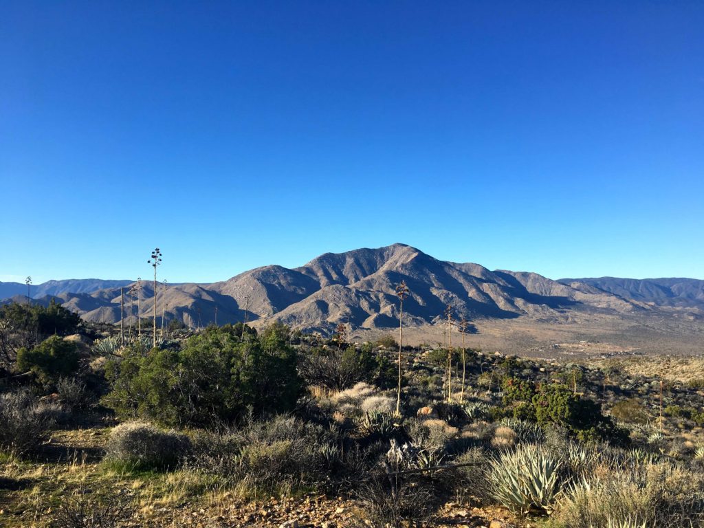
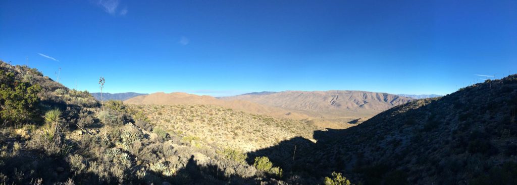
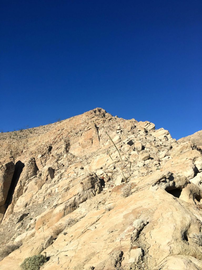
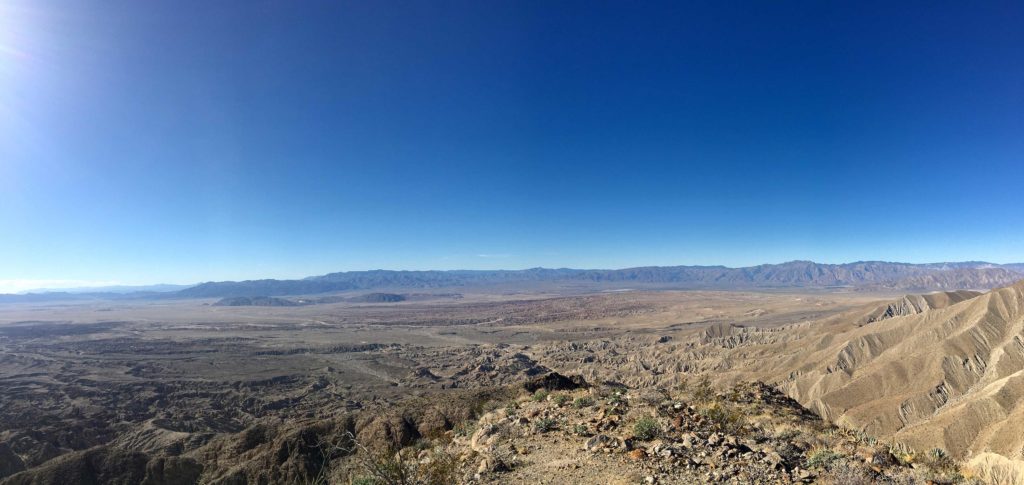
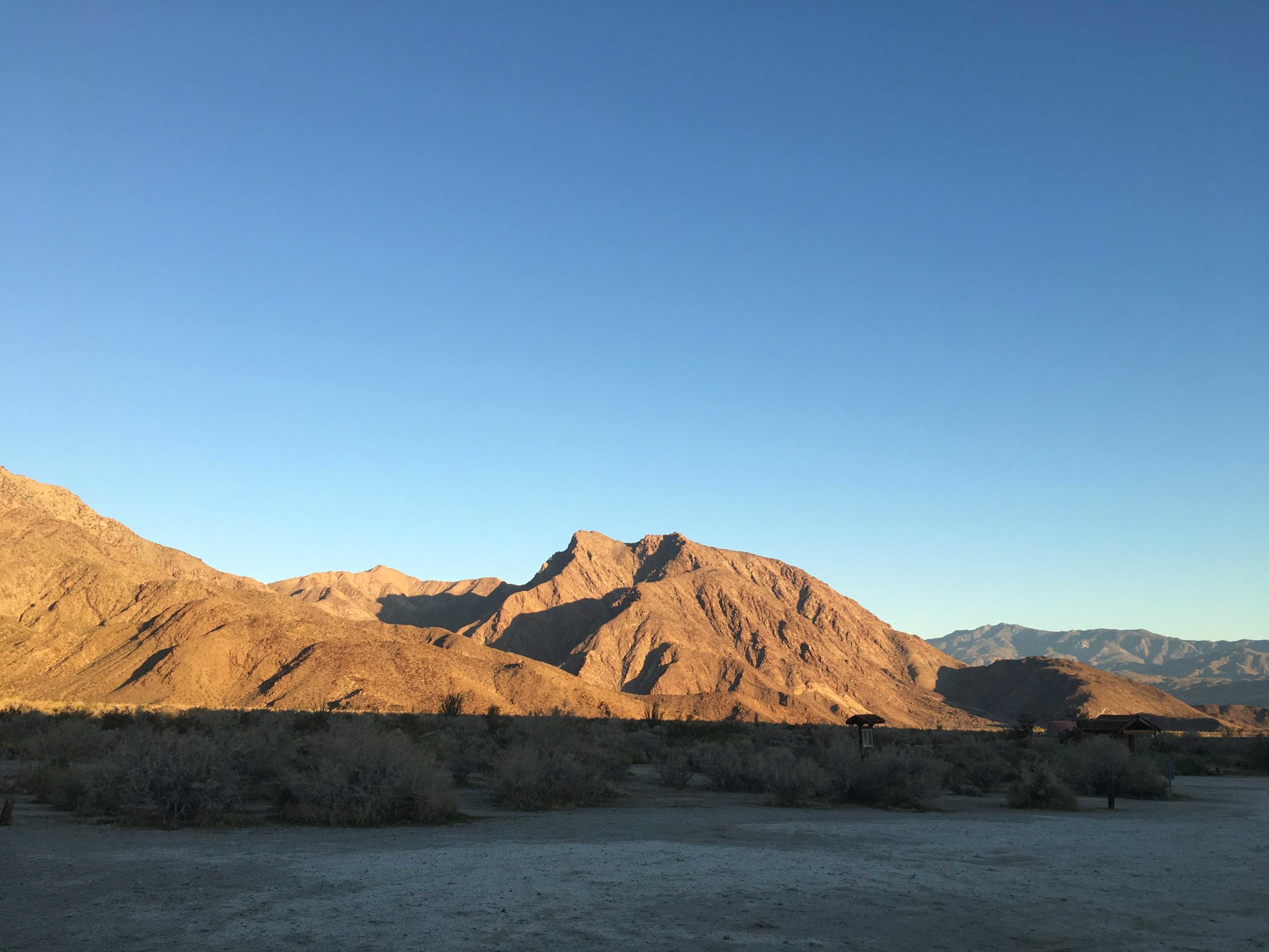
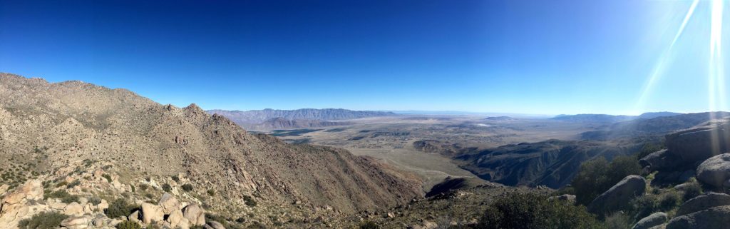
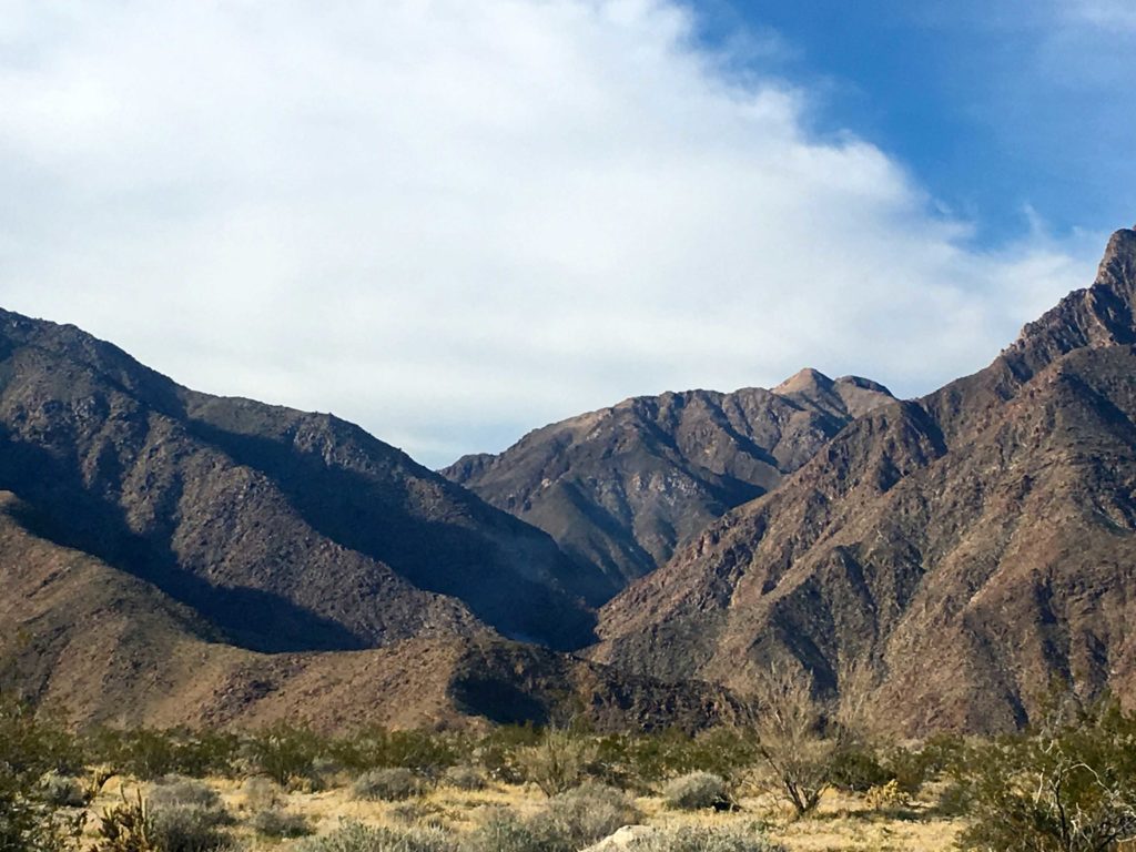
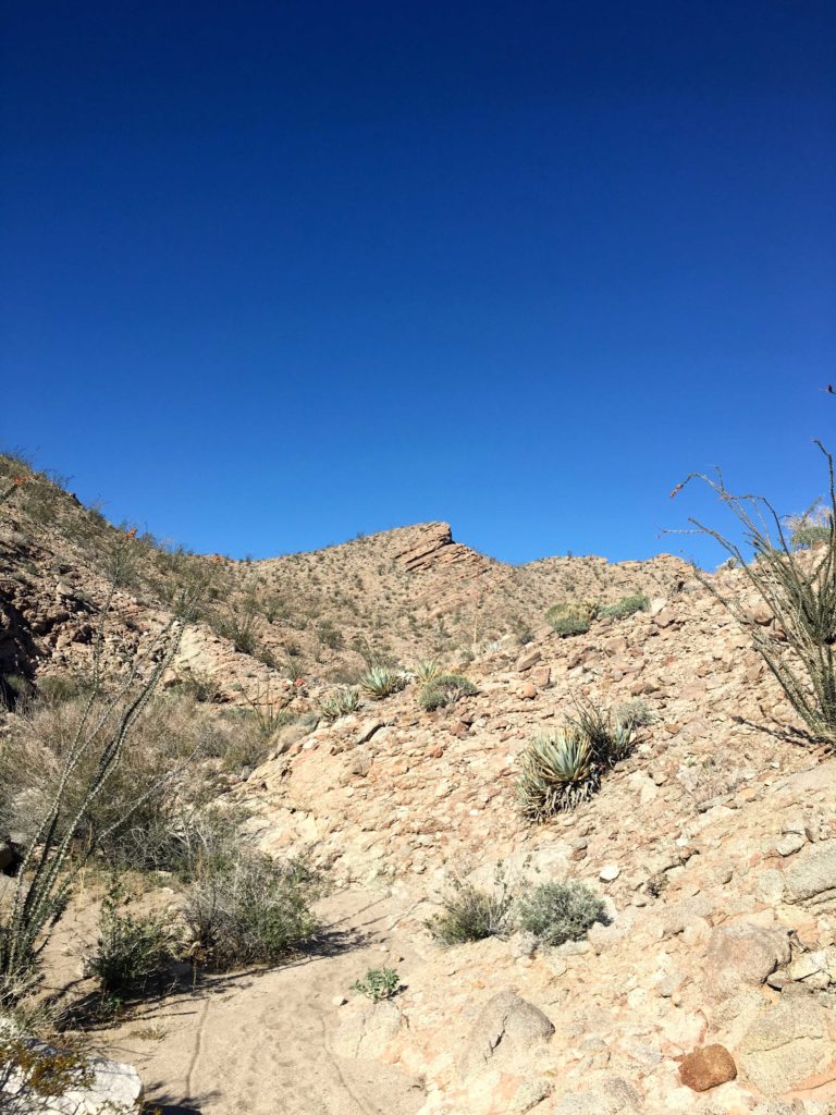
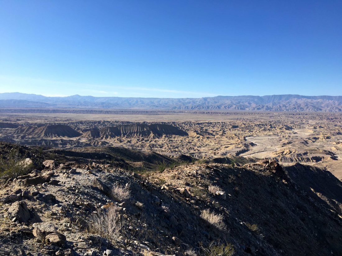
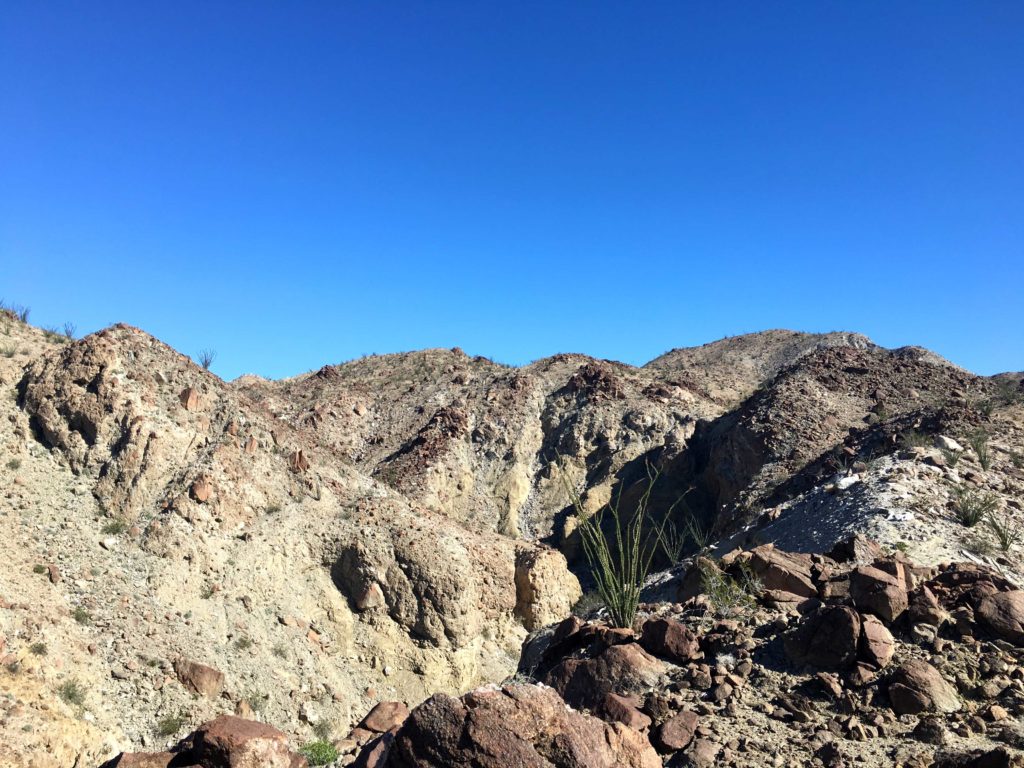
Once on the proper ridgeline, the views to the east were spectacular. The twisted canyons were spread out before us. The climb up the ridgeline was mild, and soon the summit came into view. The direct path looked a bit rocky, but a fairly clear route bent to the west and then arched back to the east.

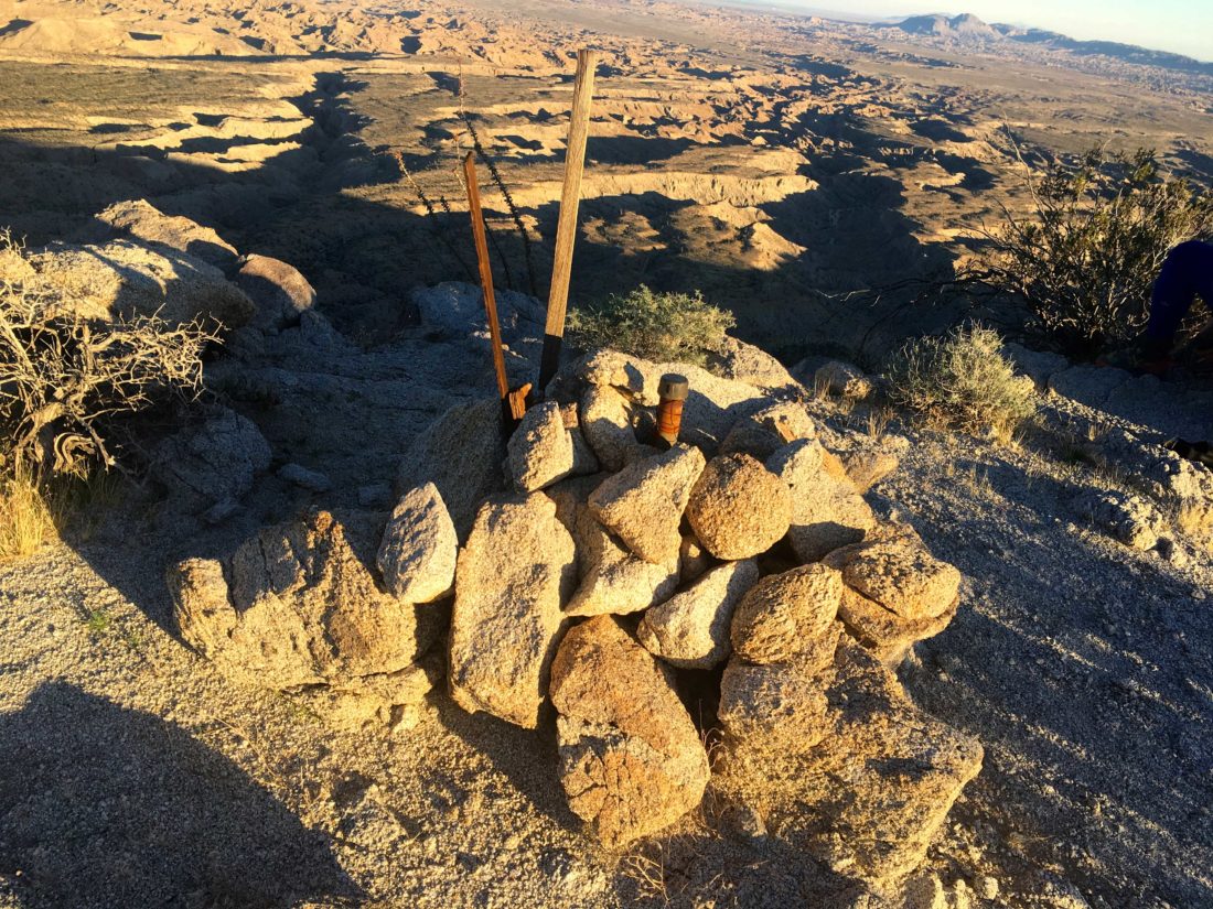
Upon reaching the summit, we began looking for the benchmark and register. I scoured along the ridge to the north, and Susie and Matt headed south. They won. We signed the register and snapped our photos.

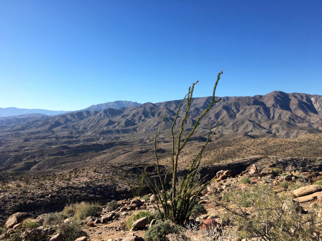
The sun was slowly setting over the Lagunas to the west. So we began our descent, keeping an eye on the setting sun, mostly for photo opportunities.

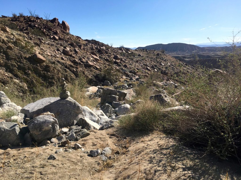
We made it back to the car without any real issue, sans a few chollas that attacked us. I dropped Susie and Matt off at their car and drove the 5 minutes back to my campsite. I bundled up and lit a nice campfire, enjoyed my dinner, and turned in for the night. #79 of #SD100 was in the books.


Buy Me a Coffee at ko-fi.com

I am an avid peak bagger, sometimes backpacker, and former sea kayaker living in San Diego. I am the co-author of Urban Trails:San Diego, coming in Spring 2026!

In 2019, I became the third person to complete the San Diego 100 Peak Challenge. Not stopping with that accomplishment, I set my sights on the harder San Diego Sierra Club 100 Peak list, which I completed in 2021. In addition, I have conquered several Six-Pack of Peaks challenges (SoCal, San Diego, Central Coast, and both the Arizona-Winter and Arizona-Summer). I am looking forward to exploring new summits and new adventures across the southwest. 

North Pinyon Mountain (Peak 3640)

Decided to go hike another peak that Susie had already done, this time North Pinyon Mountain (Peak 3640). This peak’s trailhead is along the eastern spur of Plum Canyon. As I was driving in, I was surprised to see someone driving out, especially this early in the morning. Turns out he was camping at the road’s end. I let him know my plans and we parted ways. I parked a polite distance from his camp and began gearing up. It was a touch chilly, and given the first part of the hike was up a wash, I knew I would be in the shade for a while. Tossing on a thin fleece, I set off.

The route would follow this wash until its end. Along the way, a few dry waterfalls would need to be traversed. Only one required me to bypass it, and the rest were fun diversions. The elevation gain was nice, but noticeable when I would stop and look back. I was getting a tad warm, so I stowed my fleece.

I was now ready to leave the wash and climb up to Peak 3300. From here I was rewarded with a beautiful view of Granite Mountain to the west. Since I had cell coverage again, I shared the photo with my wife.

My route now turned easterly. Crossing the summit, I now had to mind the agave, cholla, cat’s claw, and other hazards. From here I drifted to the south toward the saddle that would allow me to begin my ascent of North Pinyon.

About 100 feet of elevation loss later, I was ready to start the climb. The slope was not too steep, nothing like yesterday’s peak. I knew from the previous trip reports the true summit was hidden behind a false summit. 

As I crested it, I could see it was would be an easy stroll over. There was a bit of breeze, so I was glad to have the fleece for my break.

There is no benchmark here, but a nice register can was filled with familiar names. I soaked in the views; Granite, Grapevine, Whale, Sunset and so many more.

I signed in and had a quick snack before heading back down. Along the way, I picked up someone’s lost wool cap. I wonder if it might be Matt’s. The rest of the return was uneventful, except for a blister on my right pinky toe. Oh, the joy of new shoes. With that #78 of the #SD100 down! 4.26 miles in 3:00 hours, and gaining 1,546 feet.


Buy Me a Coffee at ko-fi.com

I am an avid peak bagger, sometimes backpacker, and former sea kayaker living in San Diego. I am the co-author of Urban Trails:San Diego, coming in Spring 2026!

In 2019, I became the third person to complete the San Diego 100 Peak Challenge. Not stopping with that accomplishment, I set my sights on the harder San Diego Sierra Club 100 Peak list, which I completed in 2021. In addition, I have conquered several Six-Pack of Peaks challenges (SoCal, San Diego, Central Coast, and both the Arizona-Winter and Arizona-Summer). I am looking forward to exploring new summits and new adventures across the southwest. 

Travelers Peak

With Susie off visiting a good friend out of state, I decided to knock out a peak that she had already done on the San Diego 100. She suggested Travelers Peak might be a good one to summit, so out to the far side of Anza-Borrego I went. The route up Travelers Peak initially follows the jeep trail to the Calcite Mine, then a well-defined user trail to the summit. 

I had initially had done the Calcite Mine portion when I did the Anza-Borrego 5 for 50 hikes back in 2017. That time we parked just off the highway and hike the road up to the mine. As pulled off the Borrego-Salton Sea Expressway, I decided to try driving the road up toward the Calcite Mine instead. The road was in really good shape, & I suspect it had been graded recently. At the turn-off into the nearby slot canyon was a nice spot to park. I debated if I should keep driving up the road or just settle for this. I opted to park.

Grabbing my gear, I set off up the road. The road conditions continued to be good. I stopped after about a quarter-mile, and for a moment thought about heading back to the car and trying to drive it all the way to the mine. I did recall the road being a bit rougher further ahead, but in the end, I opted for the exercise. After a mile, I reached the mine area. Overall, the road would have been drivable in my Subaru with a few spots that would take some care. 

Now it was time to leave the Jeep trail and head onto the use trail. I knew from other tracks that I had a steep ascent ahead of me. I also knew that there were going to be some challenging sections as well. The use trail basically follows a ridgeline, meaning some sections tended to be a touch narrow. Nothing problematic, but still you needed to be mindful. Between the steep grade and the temperature, I was certainly working up a sweat.

So, I came to the first of the challenging sections. I focused on my footing and carefully worked my way through it. One thing about solo desert hiking is you need to slow it down and be certain about your routes, foot, and handholds when you are navigating more complex sections. The route would switch between easier sections and these complex ones. 

Soon, the summit was truly in sight. I was never sure if I was seeing it earlier. As I reached the top, a simple rock pile held the register next to the benchmark, which for some reason is labeled as Palm.

I found the two reference marks as well. I had hoped to locate the azimuthal marker, which was back down the trail and off to the west, but I passed it during my descent and opted not to go back and find it.

The register was a time capsule of fellow peak baggers. I enjoyed skimming its pages.

But there is not any great place to sit up here except for one small rock, so I decided to head back down. The route was easy to follow, just to be taken with care. I again took my time descending the complex sections, at times simply scooting on my backside.

I could see the road off in the distance for much of the hike, and as I neared the mine, two jeeps pulled in. I debated if I should bum a ride back down… I also spotted another group of hikers making their way to the mine, and briefly chatted with them. As I began my hike down the road, I met up with Joel & the group from the SD Adventure Club, on one of their outings. They had hiked in from the road, so they were looking forward to their rest at the mine area. I let them continue, and I kept motoring down. I thought about returning through the slot canyon, but I was craving a burrito back in town.

As I neared my car, three motorcycles passed on their way up, a gentle reminder of why I dislike active road hikes. With that, #77 of the #SD100 was complete! 4.62 miles in 3 hours and 48 minutes of active hiking, with a mere 2,036 feet of gain.


Buy Me a Coffee at ko-fi.com

I am an avid peak bagger, sometimes backpacker, and former sea kayaker living in San Diego. I am the co-author of Urban Trails:San Diego, coming in Spring 2026!

In 2019, I became the third person to complete the San Diego 100 Peak Challenge. Not stopping with that accomplishment, I set my sights on the harder San Diego Sierra Club 100 Peak list, which I completed in 2021. In addition, I have conquered several Six-Pack of Peaks challenges (SoCal, San Diego, Central Coast, and both the Arizona-Winter and Arizona-Summer). I am looking forward to exploring new summits and new adventures across the southwest. 

Sunset Mountain

Another fantastic day out in Anza-Borrego. The planned summit was Sunset Mountain, a couple of miles down Pinyon Wash. Susie Kara and I planned to rendezvous with Matt Bennett at the turnoff from the 78 onto the dirt wash. Along the way, we caught a wonderful sunrise at Santa Ysabel.

The road to the starting point for the hike could be driven by a standard car with a little care. The skies were overcast as we set off across the desert floor, weaving through the Ocotillos. Soon we found ourselves at the base of the mountain and stared up at its steep rocky slopes. There was no trail for this peak, it was one of those “avoid the pointy plants of pain and the rocks”. 

We picked our way upward. Matt and Susie led the way, while I followed behind, keeping a slow but steady pace. They would stop from time to time to regroup. I would have a quick sip and be ready to continue plodding upward.

Along the way, we stumbled across the remains of what we think was a Big Horn Sheep. Given that it was next to a large set of boulders, we also don’t think it died of natural causes…

Soon the summit was almost within reach and a welcomed break from the climbing. With the overcast skies, some of the sweeping vistas were diminished. We signed the register and the benchmark and two reference marks were found. The benchmark is stamped Yak, but most maps refer to it as Sunset Mountain.

Since Susie did have two yoga classes to teach later in the afternoon, we did need to be mindful of the time. Given the terrain, we knew that our descent was going to be one of care and caution.

As we approached the base of the summit, we debated as to our path down. Matt and Susie took a steeper route down to the wash, while I followed a route closer to our ascent. They said their way seemed the better choice, as they watched my descent, although it wasn’t that bad.

We worked our way down the wash, encountering a really fun dry waterfall that was a perfect slide. We got separated, but given we now had a straight-forward walk across the desert floor, I was not worried. I reached the car before them, which I expected since they were probably waiting for me at some spot. Once I reached it I honked the horn and a few minutes later they arrived.

This was #76 of the San Diego 100 for me, and #81 for Susie. Dropping Matt back at his car, we motored home.


Buy Me a Coffee at ko-fi.com

I am an avid peak bagger, sometimes backpacker, and former sea kayaker living in San Diego. I am the co-author of Urban Trails:San Diego, coming in Spring 2026!

In 2019, I became the third person to complete the San Diego 100 Peak Challenge. Not stopping with that accomplishment, I set my sights on the harder San Diego Sierra Club 100 Peak list, which I completed in 2021. In addition, I have conquered several Six-Pack of Peaks challenges (SoCal, San Diego, Central Coast, and both the Arizona-Winter and Arizona-Summer). I am looking forward to exploring new summits and new adventures across the southwest. 

Ted & Webo Benchmarks

The original plan was to make the long off-road drive to summit Vallecito Mountain High Point, but I needed to be reachable by phone. So, instead, we opted to summit Webo Benchmark, figuring since it was in the line of sight of Borrego Springs we would have cell coverage. 

Susie Kara and I pulled into the Hellhole Canyon parking lot a bit after 7 am. Indianhead was stunning in the morning light to the north of us as we set off across the flat desert floor. Webo loomed before us to the west. There was no disguising this hike, it was going to be a steep hard ridgeline assault to the summit. 

After about a mile, the ridgeline was now just off to our right. There was no trail to follow, not even a faint use trail. We would weave our way around the various cacti and rocks while pushing ourselves ever upward. I was able to take the call that I needed to, so our choice of peaks was correct.

Soon we found ourselves at Ted Benchmark. I had summited this far last year with Ted Markus when Granite had a crust of snow on it. We took a break and signed the register. We had gone about 2.2 miles and climbed 1,450 feet. Now to continue our push to Webo, our real destination.

It was here that Susie had her first encounter with a cactus, and we broke out the tools to remove the spines from her foot. A bit later, she got hit again. We still managed to keep up a good pace up the steep slope, occasionally taking a short breather. It was on one of these we saw the bloodstain on my right leg — an agave had gotten me. We were certainly earning our desert merit badges.

Finally, the summit was almost within reach! From reviewing previous trip reports, we knew the benchmark and register were a touch north of the highest boulders. We scrambled up the rock and basked in the view! We carefully surveyed the north and west, as several peaks on our list are out there and we hope to bag them very soon. We took a nice break, ate some food, signed the register, snapped our photos, then began our descent.

While we were picking our way down the slope, a Sheriff’s helicopter came flying past. We hoped it was not needed for a rescue. Only later did we learn that the first palm grove on Borrego Palm Canyon had gone up in flames. This was just a bit to the north of us. 

We completely missed Ted Benchmark on our way down, and I got hit by two chollas. Susie had to break out the gloves to remove them. With those nasty buggers removed, we soon found ourselves back on the desert floor and then cruised back to the car. We were in shock about the palm grove. We drove into Borrego Springs for lunch, and while we drove toward the canyon,  we could see the smoke plume rising in the distance.

With that aside, it was a great day for peak bagging in Anza-Borrego. That was #75 of the #SD100, and Susie’s #79 & #80!


Buy Me a Coffee at ko-fi.com

I am an avid peak bagger, sometimes backpacker, and former sea kayaker living in San Diego. I am the co-author of Urban Trails:San Diego, coming in Spring 2026!

In 2019, I became the third person to complete the San Diego 100 Peak Challenge. Not stopping with that accomplishment, I set my sights on the harder San Diego Sierra Club 100 Peak list, which I completed in 2021. In addition, I have conquered several Six-Pack of Peaks challenges (SoCal, San Diego, Central Coast, and both the Arizona-Winter and Arizona-Summer). I am looking forward to exploring new summits and new adventures across the southwest. 

Split Mountain West

One of the uncertainties around Split Mountain West was the road to the start of the hike at Oyster Shell Wash. At worst, we could hike in from where we parked for Split Mountain East, but that would add another mile or so of distance. I had seen a Jeep come out of the route we needed to take, so that was a good sign. With our lunch break over, we set off. Fairly soon, we encountered some imposing rocks, but with some care, we traversed them without an issue. As we neared our destination, one more section took a bit of attention.

We actually missed the entrance to the wash that most tracks tend to start with. We found another entrance to a wash, along with a nice parking spot, so we decided to stop here and scout out our options. Keith Winston has just hiked this, and this was the track Susie was using as her reference. I had Greg Gerlach’s track on my device. After some discussion and reviewing our topo map, we opted to follow Keith’s route. We headed up this wash for a bit, then knew we needed to hop over the ridge to get into the Oyster Shell Wash. Part of the decision was this route also appeared to save about another mile off the full journey. After summiting Split Mountain East earlier in the day, there was no argument from our legs.

The climb took a little care between the grade and its rocky nature. Once on the ridge, we cruised along before finally committing to dropping down into the wash. We left a cairn for ourselves to denote our exit point upon our return.

We began working our way up the wash. It is in this first section that we would encounter the dry waterfalls mentioned by others. Several had pools of water at their base. I opted not to attempt a couple of them and went up and around them. I was feeling a bit beat after getting through this initial section, but a few minutes in the shade relaxing was just what I needed. Never underestimate what even a short break can do.

Soon, the wash would open up some, and the journey became easier. I scanned the sediment walls trying to spot any fossils, but no luck. Regardless, the scenery was so relaxing. With the summit drawing near, we began to look for the best route toward the finish.

Much like the climb near the start of this hike, we had another one up out of the wash. We were not looking forward to the descents down these slopes. But soon our efforts paid off and the summit was in sight. Like Split Mountain East, it just held a register can. The views were not as pleasant as our earlier peak, but we all agreed the adventure up the wash more than offset it. After snapping some photos and a nice snack we headed back down. We did look over at a peak denoted as Split Mountain West-Southeast Peak, which some had erroneously summited. While it reportedly holds a register, none of us liked the route over.

We had made good time to the summit, so I knew we should not have any issues with our descent or the drive out. Matt and Susie again cruised ahead, checking in on pokey me from time to time. You certainly were not going to get lost on this hike. It is also nice to have an understood relationship with your hiking companions. They are both much faster hikers than me, but are aware and know when to pause to sync up with me. In some ways, I get the best of both worlds, semi-solo hiking with the safety of hiking partners.

Upon our return, I opted to only bypass one of the dry waterfalls that I bypassed earlier. I did not trust myself to attempt the route on one of them. Before too long, we reached our exit marker. We did discuss if we want to continue down the wash and then backtrack to the car, or hop over the ridge. The shorter route won. We each picked a different route down to the other wash, in part as not to worry about kicking a rock loose and injuring the hiker below.

Our total for Split Mountain West was 3.87 miles, some 1,087 feet of gain in 2:59 hrs of active hiking. As we drove back out, we spotted the actual start of Oyster Shell Wash. The drive out was uneventful. We dropped Matt off at his car and since there was still some daylight left, he decided to summit Borrego Mountain East Butte rather than grab dinner back in Borrego Springs. While waiting for our food at Red Ocotillo, Matt texted he was back from his summit and was headed home. I forgot to mention, we found three Mylar balloons during both hikes. Ugh.


Buy Me a Coffee at ko-fi.com

I am an avid peak bagger, sometimes backpacker, and former sea kayaker living in San Diego. I am the co-author of Urban Trails:San Diego, coming in Spring 2026!

In 2019, I became the third person to complete the San Diego 100 Peak Challenge. Not stopping with that accomplishment, I set my sights on the harder San Diego Sierra Club 100 Peak list, which I completed in 2021. In addition, I have conquered several Six-Pack of Peaks challenges (SoCal, San Diego, Central Coast, and both the Arizona-Winter and Arizona-Summer). I am looking forward to exploring new summits and new adventures across the southwest. 

Split Mountain East

Now that I have completed the 100 Peak Challenge, it was time to begin working on the remaining peaks on the Sierra Club-San Diego list. Thankfully, these two lists share a lot of the same peaks, so I only have 28 more peaks to climb. Fellow 100 Peak Challenge finisher Susie Kara is also working toward the same goal. So, we are teaming up to tackle them. Unlike the 100 Peak Challenge, the SD100 does not have a time limit. However, all of our remaining peaks are in Anza-Borrego, so we are racing against the heat.

We decided to tackle Split Mountain East and West. Located south of Ocotillo Wells, these two peaks would be two separate hikes. I pulled into the empty parking lot for Iron Mountain and waited for Susie to arrive. Soon thereafter, a few cars pulled in and hikers began their journey up to greet the sunrise from the summit. Susie pulled up and we set out on the all too familiar route to the desert.

The predawn glow began to fill the desert as we got closer to the turn-off from the 78. The full moon still hung over the western sky. We pulled over to the side of the road and took some photos of the beauty around us. After a pit stop at the bathrooms at the Ocotillo Wells Ranger Station, we began trying to connect with Matt Bennet who wanted to join us on our adventure. After some back-and-forth texting, we found where he was waiting and picked him up. We set off down Split Mountain road for about 6 miles to the Fish Creek Wash turnoff.

Campers were scattered along the route, which was a good sign in case the Subaru ran into trouble. The trailhead to Split Mountain East is the same as to the famous Wind Caves. We parked next to the sign for them. The trail quickly began climbing, so make sure you stretch first before heading out. While the sign says the caves are 1.0 miles away, they are actually about 1/2 miles away. We stopped and explored them briefly, but our goal lay a bit further and higher away.

As the other trip reports indicated, the use trail would fade in and out. For the most part, it was a matter of following the ridge ever upward.

As we neared the point where we knew we had to descend and cross the wash, we continued up the wrong ridge for a bit. Cross-checking our bearings, we backtracked a bit and found the correct route again.

Once we had finished dropping down the wash, we found a pool of water tucked beneath a dry waterfall. After a short break and discussion on our final push to the summit, we set off. Matt and Susie followed a gully up, while I trailed behind and found the use trail along the west side. We rejoined at the saddle and began the final bit to the summit.

We sat atop the peak taking in the views of the eastern Anza-Borrego. While there is no benchmark, we did find and sign the register. After finishing our snack, we headed back down. Like it usually happens, the trail was easier to spot for the descent.

As we made our way down, we would point out various peaks to our west to Matt. He recently moved out here, so we were showcasing some of Anza-Borrego’s finest for his future enjoyment.

We debated exploring the wind caves more, but the second peak was calling… Once back at the car, we took a nice lunch break before driving to the trailhead for Split Mountain West. We covered 4.3 miles with some 1,590 feet of elevation gain over 3:13 hours of active hiking time.


Buy Me a Coffee at ko-fi.com

I am an avid peak bagger, sometimes backpacker, and former sea kayaker living in San Diego. I am the co-author of Urban Trails:San Diego, coming in Spring 2026!

In 2019, I became the third person to complete the San Diego 100 Peak Challenge. Not stopping with that accomplishment, I set my sights on the harder San Diego Sierra Club 100 Peak list, which I completed in 2021. In addition, I have conquered several Six-Pack of Peaks challenges (SoCal, San Diego, Central Coast, and both the Arizona-Winter and Arizona-Summer). I am looking forward to exploring new summits and new adventures across the southwest. 

Pamo Valley Trail

I decided to hike the Pamo Valley section of the Coast to Crest Trail which is just north of Ramona. I pulled into the empty Orosco Ridge Trailhead at about 7 am. It was brisk and the sun had not risen above the hills yet. I had seen this trail before, as it follows the road that is used to access Big Black Mountain. Slipping on a second layer, I headed north.

The well-marked trail works its way along the valley, occasionally crossing the road from time to time. Since this is an active cattle grazing area, sections are managed via gates. I would also cross a few bridges along the way.

Like all the hikes on the Coast to Crest Challenge, there is a designated selfie spot. For Pamo Valley it is near the end of the trail. It wasn’t until near this spot did I finally hear some cows mooing in the distance. 

I decided to keep going until I reached the Forest Road for Big Black Mountain before turning back. I thought about my dear friend Mark Kerbel as the miles ticked off, for today was his birthday. He would have enjoyed this one.

As I returned to the parking lot, a few more cars had arrived. I tossed my gear in and headed home. Just two more hikes and my third Coast to Crest Challenge will be complete.


Buy Me a Coffee at ko-fi.com

I am an avid peak bagger, sometimes backpacker, and former sea kayaker living in San Diego. I am the co-author of Urban Trails:San Diego, coming in Spring 2026!

In 2019, I became the third person to complete the San Diego 100 Peak Challenge. Not stopping with that accomplishment, I set my sights on the harder San Diego Sierra Club 100 Peak list, which I completed in 2021. In addition, I have conquered several Six-Pack of Peaks challenges (SoCal, San Diego, Central Coast, and both the Arizona-Winter and Arizona-Summer). I am looking forward to exploring new summits and new adventures across the southwest. 

North Shore Lake Hodges

I decided to take advantage of the lovely weather and go complete another one of the hikes on the Coast to Crest Challenge, this time the hike along the north shore of Lake Hodges. This hike was a fast solo hike as the wife was feeling the effects of being woken up by a call at 4 am from Israel regarding my son’s birthday present.

The trail was filled with a few families enjoying their time off, along with the occasional group of mountain bikers whizzing by. Unlike the Highland Valley Trail, this one is nice and wide.

It felt odd not to make the right hand turn to begin the trail up to the summit of Bernardo Mountain, but the designated selfie spot was straight along the main trail. 

Grabbing the required photo, I headed back to the car, passing more hikers and bikers along the way. All in all, a fun 3.7 miles, and my second hike completed for this challenge. 


Buy Me a Coffee at ko-fi.com

I am an avid peak bagger, sometimes backpacker, and former sea kayaker living in San Diego. I am the co-author of Urban Trails:San Diego, coming in Spring 2026!

In 2019, I became the third person to complete the San Diego 100 Peak Challenge. Not stopping with that accomplishment, I set my sights on the harder San Diego Sierra Club 100 Peak list, which I completed in 2021. In addition, I have conquered several Six-Pack of Peaks challenges (SoCal, San Diego, Central Coast, and both the Arizona-Winter and Arizona-Summer). I am looking forward to exploring new summits and new adventures across the southwest. 

Highland Valley Trail

With the 100 Peak Challenge complete (still wrapping my head around that), a simpler hike seemed to be in order. My wife is embarking on a 52 5K Challenge, so I thought the Highland Valley Trail would be a nice workout to kick off the New Year.  This trail is one of the five hikes that make up the current San Dieguito River Foundation’s Coast to Crest Challenge. We set off along the trail. The weather was almost postcard-perfect as we paralleled Highland Valley Road. 

A few mountain bikers passed us as we continued on. The trail would gently rise and fall as it made it way eastward. Once it reached Sycamore Creek, the trail turned southward. Soon we reached the trail’s end and we took a well-earned rest on the picnic bench.

Once Anita was ready we began our return. A few more mountain bikers passed us along the way, but soon we spotted the I-15 and shortly thereafter the trailhead. I am really proud of my wife, she did great for her first time really hiking. Here is to many more together…


Buy Me a Coffee at ko-fi.com

I am an avid peak bagger, sometimes backpacker, and former sea kayaker living in San Diego. I am the co-author of Urban Trails:San Diego, coming in Spring 2026!

In 2019, I became the third person to complete the San Diego 100 Peak Challenge. Not stopping with that accomplishment, I set my sights on the harder San Diego Sierra Club 100 Peak list, which I completed in 2021. In addition, I have conquered several Six-Pack of Peaks challenges (SoCal, San Diego, Central Coast, and both the Arizona-Winter and Arizona-Summer). I am looking forward to exploring new summits and new adventures across the southwest.