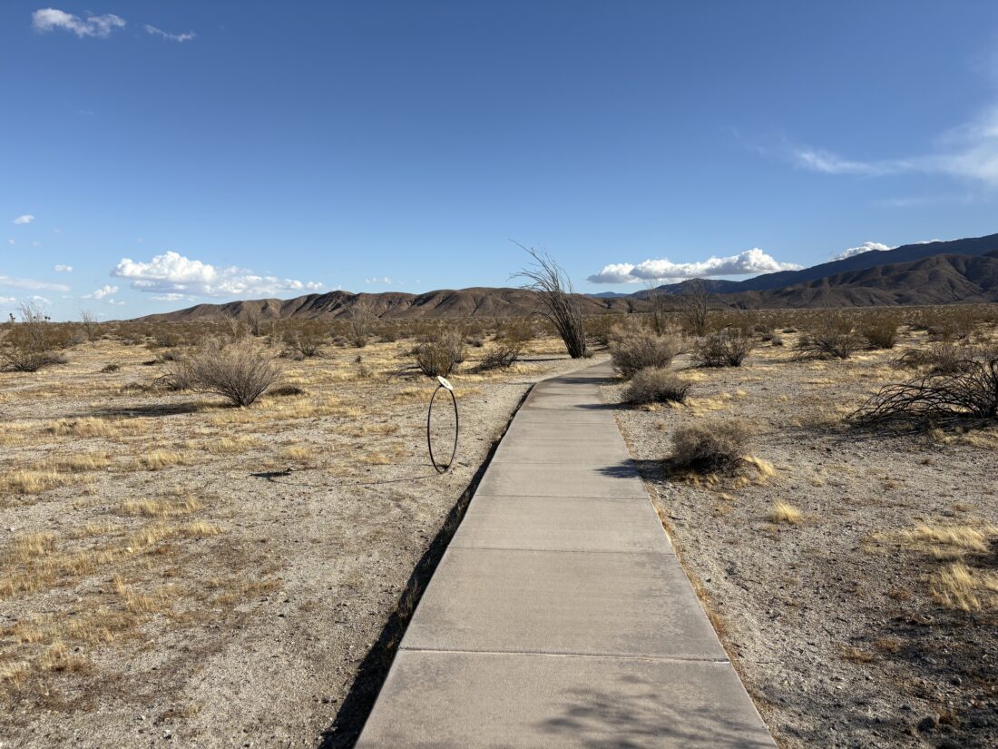
Once back at the shared trailhead for the Panorama Overlook Trail and the Visitor Center Trail, I set off down the concrete pathway. Interpretive signs lined the pathway. They were a collection of panels of the plants and wildlife, as well as markers denoting (in scale), the distance of each planet from the ‘sun’ that is located at the Visitor Center. Borrego Springs is a recognized “Dark Sky” community, so it is nice to have some additional astronomical mentions.
At the visitor center I inquired about backpacking into Sheep Canyon, and the ranger said to park my car facing back down the road and to have a good time! Hum, maybe I will try for a peak back there, or at least a quick overnight?
I cruised back to the campground and began setting up for the night, which was mostly inflating the Luno Mattress. I considered just heading into town and eating there, but decided to try my original plan. I got a fire going in the wind and managed to cook my steak. I retreated to the car to eat my dinner, as the winds were still blowing about 20 mph. They were predicted to die down around midnight so it should not be an issue during our climb. I guessed it was an early bedtime for me, as I used all the wood to cook the steak and it was getting cold. Tomorrow I was meeting Rick to attempt to summit Indianhead, so turning in early wasn’t too much of a burden.
I am an avid peak bagger, sometimes backpacker, and former sea kayaker living in San Diego. I am the co-author of Urban Trails: San Diego, coming in Spring 2026!
In 2019, I became the third person to complete the San Diego 100 Peak Challenge. Not stopping with that accomplishment, I set my sights on the harder San Diego Sierra Club 100 Peak list, which I completed in 2021. In addition, I have conquered several Six-Pack of Peaks challenges (SoCal, San Diego, Central Coast, and both the Arizona-Winter and Arizona-Summer). I am looking forward to exploring new summits and new adventures across the southwest.
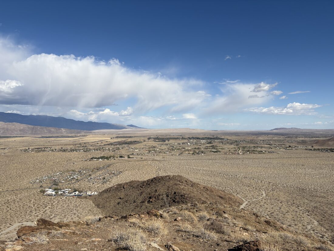
After checking in at the campground, I switched into my hiking clothes and set off for a little afternoon adventure. First up, I planned to hike the Panorama Overlook Trail. I would see this one on the maps when reviewing routes of various nearby peaks, but never found the time to hike it. The shared trailhead to the Overlook and the Visitor Center is located at the edge of the campground, a very short walk from my site. The trail to the Panorama Overlook headed off to the right toward the base of a ridge. Soon I was at the base of the ridge and began working my way up to a nice overlook. The clouds over the distant mountains made for some nice photos.
While this is the “official” end of the trail, a use trail continues to the west and further up the ridge. I had time, so why not? The use trail was usually visible, but from time to time I did have to pause and do a quick scan to pick it up again. I reached another bump and decided to turn back here, as I also wanted to walk over to the visitor center. Looking over to the south at the ridge up to Kay Benchmark (which I need to summit again), I could see why Greg Gerlach hopped off when he did, as it makes perfect sense. Once back on the desert floor, I returned to the start of the trail just to have a complete track recorded for this trail. Next up, walking the concrete path over to the Visitor Center.
I am an avid peak bagger, sometimes backpacker, and former sea kayaker living in San Diego. I am the co-author of Urban Trails: San Diego, coming in Spring 2026!
In 2019, I became the third person to complete the San Diego 100 Peak Challenge. Not stopping with that accomplishment, I set my sights on the harder San Diego Sierra Club 100 Peak list, which I completed in 2021. In addition, I have conquered several Six-Pack of Peaks challenges (SoCal, San Diego, Central Coast, and both the Arizona-Winter and Arizona-Summer). I am looking forward to exploring new summits and new adventures across the southwest.
Since I had time before heading out to camp in Anza-Borrego, I decided to stop and hike the Inaja Memorial Trail. We just had a winter storm blow through, and I was hoping for a little snow on the ground. The parking lot was empty as I put on my hiking boots for this short .5 mile loop. Grabbing my trekking poles, I headed over to the memorial for a moment before setting off. Unfortunately, the snow that had been here had mostly melted away, and only a patch or two remained in the shade. I cruised along the trail until I reached the viewpoint. It was a nice day with the clouds in the sky, and the snow on the mountains to the east. Back at the car, I tossed in my poles, and headed down the road to Santa Ysabel, then on to Borrego Springs.
I am an avid peak bagger, sometimes backpacker, and former sea kayaker living in San Diego. I am the co-author of Urban Trails: San Diego, coming in Spring 2026!
In 2019, I became the third person to complete the San Diego 100 Peak Challenge. Not stopping with that accomplishment, I set my sights on the harder San Diego Sierra Club 100 Peak list, which I completed in 2021. In addition, I have conquered several Six-Pack of Peaks challenges (SoCal, San Diego, Central Coast, and both the Arizona-Winter and Arizona-Summer). I am looking forward to exploring new summits and new adventures across the southwest.
After the scouting trip to the trailhead on Saturday, I decided to take advantage of the break between the storms to go climb Granite Mountain again. The other time I summited this peak was via the Cool Canyon route, and this time I really wanted to use the Rodriguez Canyon trailhead. After filling up the gas tank and grabbing my breakfast and coffee, I headed out to the desert. As I drove through Julian, I spied a PCT hiker thumbing a ride back down to the trail. I pulled over and offered a lift. We had a lovely chat as we drove down the Banner Grade. I dropped him off at the Scissors Crossing parking lot and wished him well on his journey. I then cruised down to the trailhead, making a quick stop at the pit toilets in Blair Valley. I was glad I had my “poop kit” with me, as both toilets had no toilet paper. I turned off the highway, and began driving the road that Ted and I drove on Saturday. The heavy construction equipment that was parked beside the road had been busy, as one section of the road had been smoothed over. I still had to carefully pick my way up out of Vallecito Wash, but the Outback handled it like a champ. I drove up Rodriguez Canyon a short distance and found a nice spot to pull off. Grabbing my gear I headed north across the open desert floor until I linked up with an old jeep road that led to a couple of abandoned mines. The road was overgrown and would fade from time to time.
At some point I lost the road and began working my way up a ridge. When I checked my position again, using Keith Winston’s route, I found myself on the wrong side of a ravine. I decided to keep on my route, follow the contour to get closer to Keith’s route and go from there. I knew after the mines that I missed, the route follows the ridgeline up. I began weaving and dodging cacti as I kept climbing. The temperature was perfect, cool with a slight breeze. I had a fleece and a wind shell in my pack, but never needed them. I would stop to snap a photo from time to time, but just kept motoring on.
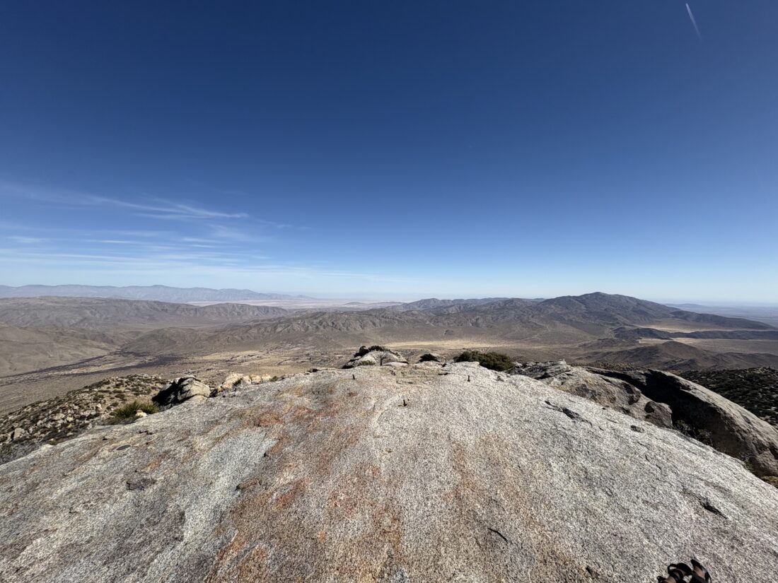
From time to time, cairns would appear. Around 5000 feet in elevation, small patches of snow started to appear in the shade. I could see snow over on the Laguna Mountains to my southwest and on Volcan Mountain to my northwest. As I neared the end of this ridgeline, there was one small bouldery section to climb, but nothing like the mess I recall from the Cool Canyon Route. At the end of this ridgeline, I followed another ridgeline to the northeast. Once over a small false summit, the peak and its massive granite boulders stood before me. This was certainly an easy route, although the section in Cool Canyon itself is a highlight.
I scouted around the boulders looking for a route up, and eventually found one. As I made my final move onto the summit, my two full water bottles on the side of my pack fell out. One went bouncing one way and the other a different way. Crud! I hoped I would be able to find them in the rocks below, otherwise I would be collecting some of that snow to turn into drinking water.
On the summit, I enjoyed some snacks and the last of the water from the bottle that I keep in my shoulder pouch. The views were as stunning as I remembered. If there was a register, it is tucked somewhere below, and I did not bother to go scouting for it, I figured I would have enough scouting to find my water. After a nice break atop the summit, it was time to head back. I surveyed where one bottle bounced, and declared it lost. I worked my way down from the summit block and hoped that the second bottle could be located, and thankfully it was. Since I was heading down and had water in the car, I felt I should be ok. I slipped the recovered bottle into the side pouch and tightened the strap to be sure.
My goal for the descent was to stick to Keith’s track more closely, as I really wanted to see one or two of the abandoned mines. The descent went fine, and there was a faint use trail that I picked up from time to time, just like on the ascent. For the most part, though, it was again weaving past the cacti as I hiked down the ridge. I reached Keith’s turn off spot and generally stayed on course.
I spotted the first mine and peered in, but really did not have any interest in clamoring inside. I walked over to where the second mine was, but it appears that it is no longer open. I could see the outline of the jeep road across the ravine and worked my way carefully down to it. Once on it, I continued to follow it down the mountain. I could see my car off in the distance, always a good sign. Once back at the car, I drank 1/2 liter of water, as I had finished my remaining water about a mile back.
As I drove out, a lone backpacker was hiking along the road. I stopped and chatted with him. He had hiked down Oriflame Canyon and was headed over to the campground at Stagecoach Trails. I offered him a ride, as I was stopping there for a cold soda and snack, but he wanted to hike the whole route. I wished him well and drove away to get that aforementioned soda and begin my drive home. All told, I hiked 7.4 miles with just over 3,000 feet of elevation gain in 6:01.
I am an avid peak bagger, sometimes backpacker, and former sea kayaker living in San Diego. I am the co-author of Urban Trails: San Diego, coming in Spring 2026!
In 2019, I became the third person to complete the San Diego 100 Peak Challenge. Not stopping with that accomplishment, I set my sights on the harder San Diego Sierra Club 100 Peak list, which I completed in 2021. In addition, I have conquered several Six-Pack of Peaks challenges (SoCal, San Diego, Central Coast, and both the Arizona-Winter and Arizona-Summer). I am looking forward to exploring new summits and new adventures across the southwest.
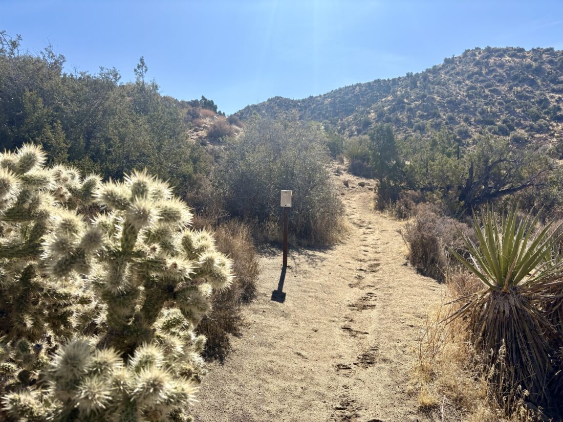
With a bit of weather rolling in, Ted and I headed out to the desert to find something hike-able. We settled on Whale Peak, one that Ted still needed to climb, and maybe we would add on Pinyon Mountain after. The clouds covered the mountains as we drove through Julian and down toward the desert. The Subaru handled the off-road section to the trailhead without incident.
We parked at the trailhead, and felt the cold wind as we stepped out. Ted stayed in his puffy and I slipped on my fleece and made sure my wind shell was in my pack before setting off. The trail immediately starts climbing, so if you need to warm up first, I suggest a short hike down the road. We followed the drainage up to the first saddle. I drifted out of the drainage area toward the end, but in hindsight should have just stayed in it. Once at the saddle, a clear trail could be spotted, plus an extensive collection of cairns would line our route. We cruised along, chatting about recent college visits or other upcoming trips. This would be my third time doing this peak, so much of the route was familiar.
The route would climb over several small ridges before making the final climb to the summit. We had some dramatic views of the surrounding mountains and the swirling clouds. Along the way, we found an iPhone lying on the trail. It didn’t power up as the cold probably drained its battery. I slipped it into my pack to hopefully be able to return it to its owner. Note: We were able to locate the owner and return the phone to him.
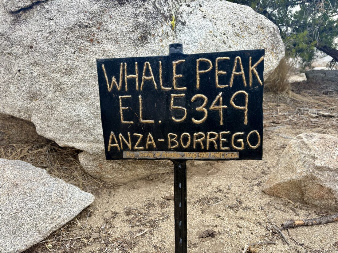
Soon, we were on the summit plateau and we strolled over to the proper summit. We took in the views, found the benchmark and a reference mark, and of course the metal sign. We ducked behind a rock wall to hide from the wind and have a snack. That wind shell came in handy, despite the sun starting to poke out.
After our break, we began our descent. This time, I made sure to head in the right direction. As we worked our way down the steep section, I noted that we were a little off track, so we made a course correction and were soon back on track. We cruised along, and after about half a mile, we shed our layers and continued. As we cruised along one of the small flat areas, we encountered a trail runner making his way up the summit.
Our route down the drainage went smoothly and we were back at the car. Beyond the mystery of the found iPhone, Ted’s recorded mileage and my recorded mileage varied by 3/10 of a mile. Quite a difference! I asked Ted if he wanted to try for Pinyon Mountain next. The issue was this hike would be along a ridgeline and subject to the cold winds. We decided to pass and return another day. As we drove back to the highway, our adventure was not over. Since we had time, we drove down to explore the trailhead for the southern route for Granite Mountain. This road certainly was tougher than the one we drove to the trailhead for Whale, but not as tricky as the road to Jacumba. We stopped short of exiting the wash, as we had a nice spot to turn around. We did walk the next section of the route and I felt it was drivable. This was a good sign as I want to climb Granite via the southern route. We drove back to Julian and had some food and beers at Julian Beer Company before continuing on home. Our ascent of Whale took us 3:03 and on my tracker, 4.3 miles.
I am an avid peak bagger, sometimes backpacker, and former sea kayaker living in San Diego. I am the co-author of Urban Trails: San Diego, coming in Spring 2026!
In 2019, I became the third person to complete the San Diego 100 Peak Challenge. Not stopping with that accomplishment, I set my sights on the harder San Diego Sierra Club 100 Peak list, which I completed in 2021. In addition, I have conquered several Six-Pack of Peaks challenges (SoCal, San Diego, Central Coast, and both the Arizona-Winter and Arizona-Summer). I am looking forward to exploring new summits and new adventures across the southwest.
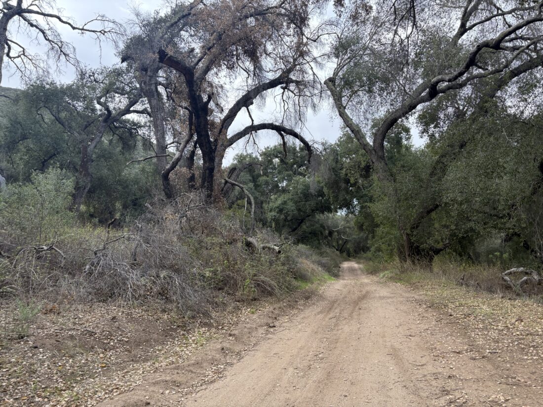
Decided to knock out one of my two remaining Coast to Crest Challenge hikes this morning. The partially cloudy skies made it a perfect day to head out to hike some of the Upper Santa Ysabel Trail. Given that this trail is shared with off-road traffic, doing it on a regular weekday is ideal, plus having the shade from the partially cloudy skies is an added bonus. I drove out to Pauma Valley and turned on the dirt road that I have previously taken up to the top of Big Black Mountain. The road was in fair condition—don’t know if I would take a Prius on it, but any 2WD SUV-like car would do just fine. When I got to the wide junction with the Upper Santa Ysabel Trail, I pulled off and parked. I originally had planned to hike a longer portion of the trail, but needed to be back in cell coverage by 9ish. I figured I could still hike enough to make it count for the challenge. I grabbed my smaller daypack, trekking poles, and my hat, and set off.
The road, on which I could have kept driving, descended toward a small wash, before climbing back up a bit. There are lovely oaks along this section of the trail. I cruised along, enjoying the views of the dry creek below and the vistas back to the west. I reached a turnaround spot for vehicles, and in looking at my watch I realized that I needed to turn back. I reached my car and drove back down the mountain, getting back into Ramona and therefore cell coverage. This was a nice stroll, and I think I might try hiking the rest from the other side to “complete” the trail sometime soon.
I am an avid peak bagger, sometimes backpacker, and former sea kayaker living in San Diego. I am the co-author of Urban Trails: San Diego, coming in Spring 2026!
In 2019, I became the third person to complete the San Diego 100 Peak Challenge. Not stopping with that accomplishment, I set my sights on the harder San Diego Sierra Club 100 Peak list, which I completed in 2021. In addition, I have conquered several Six-Pack of Peaks challenges (SoCal, San Diego, Central Coast, and both the Arizona-Winter and Arizona-Summer). I am looking forward to exploring new summits and new adventures across the southwest.
One of the hikes that always seems to be on those “Top 5 Hikes of San Diego” lists is out to the Los Peñasquitos waterfall. For me, it is just down the road and one I do when I don’t feel like climbing Black Mountain. Starting from the dirt parking lot at the west end of the baseball fields, I head west down the North Side Trail. If I am doing this hike in the morning, there is usually the smell of bacon in the air from the nearby houses. This side of the canyon has less shade than the south side, so I am mindful of that as I hike along. Single-track trails break away from the main, wide trail from time to time. Those side trails are meant for hikers and horses only (although, I have encountered a mountain biker or two on them). These are nice during busier times, to get away from the crowds. Just be aware that they tend to be a bit more overgrown and doing a tick check is highly recommended. On the flip side, you will be closer to the creek, so you will probably find some nice spots to watch the water flow past.
As I make my way along whichever route I am following that day, I pass by Carson’s Crossing, one of 5 formal crossings of Peñasquitos Creek. This is almost the halfway point to the waterfall. Soon, I should start to see the small rocky hill that stands to the north of the waterfall, and my destination. At the junction just before the waterfall, a trail leads off to the north. This would take me up to the Duck Pond and Del Mar Mesa (see this trip report). The North Side Trail continues westward, and as the sign will point out, the water is just to the south.
You can climb down the rocks to the water, but I personally would avoid contact with it, as most of the water is urban runoff. On the other side of the creek, you should see some stone steps leading down. You can rock hop over the creek if the water level is low enough, but just watch out for poison oak that lines much of the shore. The Park Rangers have placed signs warning of this for a reason. On the weekend, this area can be quite crowded. You might spy a bench to the west from the main waterfall area. This spot will offer not only a better view of the falls, but usually a more peaceful experience. I leave the main waterfall area behind and walk back to the North Side Trail, continue west for a very short bit, then take the side trail leading south to that bench.
I like to return to the car using the South Side Trail, since it has a bit more shade, so once I reach Carson’s Crossing, I take it to cross over. If I want a longer hike, I could keep going west to the Sycamore Crossing and use it. Once on the south side of the canyon, the trail system is very similar. The main, wide trail and the narrow hiker and rider only trails that dart off to the side. The South Side Trail is also more likely to have some horse encounters, as there is a private stable to the east of Black Mountain Road. As you near the Peñasquitos Creek crossing, which I use to return back to my car, you will pass Eichar’s Grave. Although not the actual grave, this is a small memorial for John J. Eichar, who was believed to be a cook for the occupants of the Los Peñasquitos Ranch House in the late 1800s. An interesting bit of hidden San Diego history. There are some nearby benches on which to rest, but the trailhead isn’t too far ahead. Once across the creek, the trail splits. If you care to visit the Ranch House (check for when it is open), you can follow the trail to the left and it will take you to it. Or stay straight and you will find yourself at the parking lot. Typically, this entire loop covers about 7.7 miles, but if you meander along the side trails, or explore the falls, you might have a slightly different mileage recorded on your tracker.
I am an avid peak bagger, sometimes backpacker, and former sea kayaker living in San Diego. I am the co-author of Urban Trails: San Diego, coming in Spring 2026!
In 2019, I became the third person to complete the San Diego 100 Peak Challenge. Not stopping with that accomplishment, I set my sights on the harder San Diego Sierra Club 100 Peak list, which I completed in 2021. In addition, I have conquered several Six-Pack of Peaks challenges (SoCal, San Diego, Central Coast, and both the Arizona-Winter and Arizona-Summer). I am looking forward to exploring new summits and new adventures across the southwest.
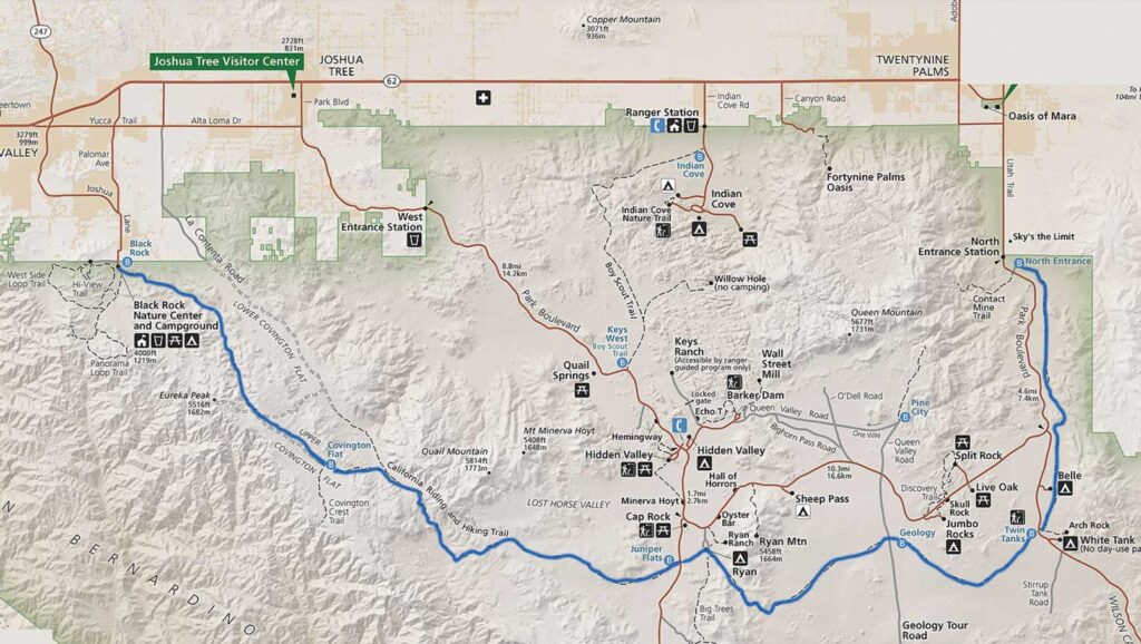
My good friend Ted H. said he would love to join me, along with one of his long-time hiking buddies. The basic plan was for me to drive to various spots along the trail and cache the water we would need along our trek. After that, I would spend the night car camping at Blackrock Campground, which is conveniently located next to the western end of the trail. With my gear packed into the Subaru, I left for Joshua Tree in the morning, hoping to have a relaxing day. I pre-ordered a sandwich from Jersey Mike’s along the way. Not 15 minutes into the drive, Anita calls me to let me know I forgot to pack my eggs in the cooler. Thankfully, she was headed in my general direction, so at least I did not have to drive all the way home. With that crisis averted, I again headed northward, just a little behind schedule. Around Menifee, something clicked in my head, “Did I pack my hiking boots?!” Normally, I wear them out the door when I go hiking, but I was in my regular shoes for some comfort. I found a place to pull over and check, and sure enough, I had forgotten them! Anita was working in East County, so she could not help me this time. Back to San Diego I went. I called Jersey Mike’s to put my sandwich away, as I would be delayed in picking it up. With my hiking shoes acquired, I got back on the road. Given the delay I did swap the order of the water caches, just in case I had further unexpected delays.
Stop one was now the end of Upper Covington Flats Road. Since this was about a ten-mile drive along a dirt road, it made sense to do this while I had daylight. The rest of the caches would be near easily accessible roads. The road was in good shape, and a few pools of water from the recent rains did offer a little fun to the drive (and the need for a car wash later). A lone Prius sat at the trailhead as I tucked 3 gallons of water under some brush. Each cache would have a gallon for each of us. Next, I headed to what would be our last cache, near the parking area for Arch Rock. I wanted to place these jugs a little further from the trailhead, as this spot is heavily trafficked, and did not want someone to accidentally use our water. From there, I drove westward to Geology Road for what was planned for our water for the end of day 2. The final cache was to be placed at the trailhead to Juniper Flats. With our water safely tucked away, I drove back toward Blackrock, making a stop at Stater Bros. to grab a steak to grill, some firewood, and an orange juice for the morning.
The sun had set, so it took a little bit to find my campsite. I quickly unloaded, set up the Luno, and started a fire. The winds made it chilly, so I was glad to have a fire to warm up. I grilled my steak, this time just right. I enjoyed it, along with a nice salad and fine beer from The Bruery. Tomorrow was going to be the start of a big adventure, so I turned in just as the moon was rising over the hills to the east.
It was chilly when I woke up, and I quickly cooked my eggs. I packed up my car camping gear and drove over to the backcountry parking area. The plan was for Mark to drive over to the eastern terminus of the trail and get picked up by Ted and Andrea. The original plan was to start at around 8. Unfortunately, Mark got a late start leaving his campsite. Adding to the mix, the cell network was completely down, so we had no method of communication with each other. Finally, just before 10, they returned from the car shuttle setup, and we could hit the trail.
I carried 3.75 liters of water as we set off on the trail. I did consider having Andrea drive us down to Covington Flats Trailhead and just start from there so we would have time to easily make the planned campsite. The others felt that we should be ok, so we stuck to the original plan. The recent rains compacted the sandy section, making the hiking a bit nicer. This first section was a steady climb, the wind was making the day chilly. Both San Jacinto and San Gorgonio’s snow-capped summits peaked into view from time to time.
After about 6 miles, we found a spot out of the wind and had a snack break. I had hoped to film a lot more on the trip, but that 2-hour delay scuttled that plan. Once we reached Upper Covington Flats, we each strapped our gallon of water to our packs and continued on (after another snack). The sun was setting, and it was pretty clear that we were not going to make the planned campsite. There was another possible site that was only 2.8 miles further, so that became our new destination.
The water jug made a rhythmic sound as I hiked down the trail. When I came to the location of the campsite, it was clearly not going to work. The site sat on the crest above a valley, and the winds were howling. I was actually being pushed from time to time. Setting up camp here was not an option. So, we dropped down and found a spot that was a bit more sheltered. We each found a spot to pitch our respective tents. I did not repeat what happened on San Gorgonio, so I made sure all my tent stakes were highly secured. I set up my camp chair I opted to bring and cooked up dinner. The winds made it too chilly to sit around and chat, so after I ate, I retreated to my tent and listened to an audiobook. The tent would feel the wind, but it held firm. I drifted off to a little sleep, as the winds would wake me briefly. Around midnight, the winds calmed down, and I drifted into a nice slumber. I woke up just before sunrise to answer nature’s call and caught a nice morning sky. I crawled back under my quilt for a little more rest before really starting the day.
I emerged from my tent around 7, and I cooked up some oatmeal and a nice hot cup of coffee. As I was packing up, I could not locate my tent stake bag. My guess was that I left it out and the winds blew it away. I did scout the surrounding brush, but no luck (I later found them tucked in my jacket). I was ready to hit the trail at about 8, however, we did not hit the trail until 9. Thankfully, without the wind, it was quite pleasant. From time to time, we would see trail runners race past along the trail above us.
The trail continued descending for a while before we would have two steep climbs that would have us enter Juniper Flats proper. I reached the crest and found a nice rock to wait for Ted and Mark to rejoin me. I soaked in the view and the silence. Once back together, Ted and I set off together, with Mark keeping his own pace. The plan was to rejoin at the Juniper Flats trailhead and top off our water from the cache I had left on Friday. As I was descending, I felt a couple of hot spots forming. At the trailhead, I put some KT blister tape on where I thought they were.
After a nice lunch, I went solo, as Mark was just pulling in as I was set to head out. I again was concerned about our timing to reach the next planned site and the water as well. I tossed my empty water jug into the recycling at Ryan Campground and motored on. I could feel my feet, but I hoped the blister tape would do its job. I had a slight climb leaving Ryan Campground, but then the trail leveled out.
My feet started to hurt more, so I stopped under the shade of a Juniper tree and took a look at them. A quarter-sized blister had formed on the balls of each foot. This was not good. I applied more KT tape, but I suspected that I might have to call it. My best guess is I actually was hiking too fast to make up for our delayed starts and created the friction to cause them to form. I began thinking of options. I could camp early and then hike to Geology Road in the morning. I could attempt to make it to the planned site and either backtrack to Geology Road and get picked up or if the feet were up to it, limp to Arch Rock and bail there. Hiking to the end was no longer an option. As I drew nearer to Geology Road, I began messaging Anita about her driving out to pick me up. I actually hoped to hitch a ride from someone who could take me back to my car, but first I needed to tell Ted and Mark of my plan to bail here. So I set up my chair and waited. I actually had a cell signal, so I called Anita and gave her the details for plan B if I could not hitch a ride.
After about 30 minutes, they reached the trailhead. I told Ted where the water was at Arch Rock and began looking for someone returning from driving Geology Road. Sure enough, the first car stopped and had room for me and my gear and was headed in the right direction. I said my farewells to Ted and Mark. My rescuers kindly drove me back to my car. Once back out of the park, I texted Anita that she could return home, as she had preemptively started out to meet me. I tossed my gear into my car and bid farewell to my rescuers.
My adventure was not quite over. I opted to fuel up at the Morongo gas station and grab dinner at In-n-Out. As I entered the traffic circle, a Mercedes Benz SUV cut in front of me, causing me to slam on my brakes, and unfortunately, my burger and fries flew off the seat onto the floor. I lost about half my fries, but the burger was still intact. Thankfully, that was the last of the misadventures.
I did hear from Ted that they completed the hike, but he, too, had blisters that slowed him down.
I am an avid peak bagger, sometimes backpacker, and former sea kayaker living in San Diego. I am the co-author of Urban Trails: San Diego, coming in Spring 2026!
In 2019, I became the third person to complete the San Diego 100 Peak Challenge. Not stopping with that accomplishment, I set my sights on the harder San Diego Sierra Club 100 Peak list, which I completed in 2021. In addition, I have conquered several Six-Pack of Peaks challenges (SoCal, San Diego, Central Coast, and both the Arizona-Winter and Arizona-Summer). I am looking forward to exploring new summits and new adventures across the southwest.
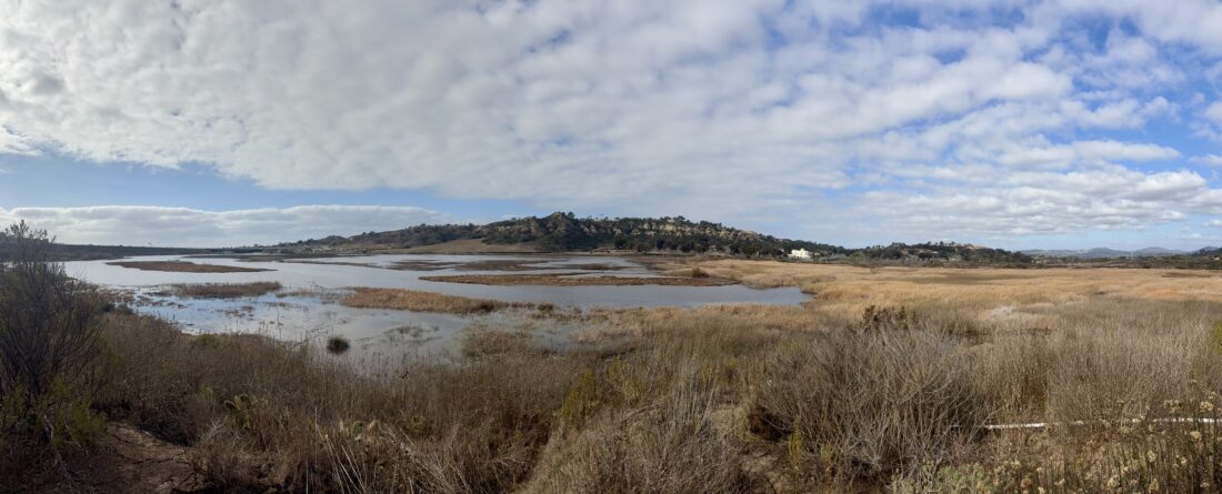
When I hiked Annie’s Canyon from the San Elijo Lagoon Nature Center a few years ago, just after crossing the bridge over the lagoon, I noticed that the trail split. We followed the route that led over to Annie’s Canyon, but I wondered where the other trail went. I decided to take a look online and find out the answer. It turns out that it turns southward along the freeway for a short distance before linking up with the La Orilla Trail. Being focused on climbing peaks, I often miss little hidden gems that might be close by. This trail follows La Orilla Creek as it flows into the San Elijo Lagoon and has a trailhead on El Camino Real, just north of San Dieguito County Park. I made the 15-minute drive over to the small parking area and set off down the trail. Right at the trailhead, near the informational kiosk, is an ADA-accessible picnic area. I learned later from the Park Ranger I spoke with upon my return, that this was just recently added, in part due to the requests of some users.
The start of the trail passes through a section where most of the views are blocked either by trees or other plant life. Along the way, benches would line the side of the trail, each dedicated to someone. At about .4 of a mile, the La Orilla trail intersects with the Santa Helena Trail which runs a short distance to the south, and ends at the Santa Helena Trailhead, while the Stonebridge Trail heads to the north. Continuing westward, I passed several pinyon pines, and their smell hung pleasantly in the air as I passed.
The trail soon made a small climb up, and then split. I took the right fork which led off to Tern Point. From this vantage point, you can see the eastern end of San Elijo Lagoon. Two benches provide a nice resting spot. After snapping a few photos, I continued westward, making my way down the hill and back to follow the lagoon’s edge. Here the trail became quite sandy for a section, and a couple of times quite swampy. The trail came to a T junction, with the trail to the right taking you out to another viewpoint, while the other trail became the Santa Inez spur trail. After enjoying the viewpoint, and seeing some of the waterfowl a bit closer, I followed the Santa Inez Trail. This took me past the native plant nursery that is located near the Santa Inez Trailhead, and the trail that follows the freeway and links up the trails that take you onto Annie’s Canyon or to the Nature Center. I opted to turn back at this point, as I still had some work to do. As I neared Tern Point again, I took the other trail I had bypassed earlier and passed by two massive eucalyptus trees, before rejoining the main trail. This trail certainly fits the bill as a “hidden gem”. I logged the entire trail at 3.4 miles.
I am an avid peak bagger, sometimes backpacker, and former sea kayaker living in San Diego. I am the co-author of Urban Trails: San Diego, coming in Spring 2026!
In 2019, I became the third person to complete the San Diego 100 Peak Challenge. Not stopping with that accomplishment, I set my sights on the harder San Diego Sierra Club 100 Peak list, which I completed in 2021. In addition, I have conquered several Six-Pack of Peaks challenges (SoCal, San Diego, Central Coast, and both the Arizona-Winter and Arizona-Summer). I am looking forward to exploring new summits and new adventures across the southwest.
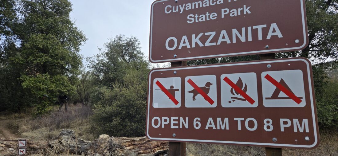
My good friend Becca is going to be hiking the Trans-Catalina Trail in May and wanted to start upping her hiking miles. I offered some options for her and she decided that doing the Oakzanita Loop sounded just right. Ted Markus joined us as well for this adventure. It was a brisk 44 degrees when we arrived at the parking area. Once geared up, and a group selfie taken in front of the trailhead sign, we set off along the Lower Descanso Creek Trail. The trail was still a little damp from the showers we received on Friday, but thankfully not muddy. The creek was still dry, making the stream crossings trivial.
Once we reached the East Mesa Fire Road, we took it around the bend to then join the Upper Descanso Creek Trail. Now the trail would begin to noticeably gain elevation. Partway up, we stopped to shed our respective layers. We had yet to see or hear another soul, despite there being a few cars at the trailhead. I wondered if they were backpacking out at Granite Springs? The trail reached the Oakzanita Peak Trail which would take us up to the summit.
Soon, I passed the two hitching rails and then found myself on the summit. As I waited for Becca and Ted to arrive, I got my camera ready to capture their arrival. We had a quick snack and soaked in the views. As I pointed out various peaks in the distance, another hiker briefly joined us but hustled off to make it to the all-you-can-eat pancake fundraiser at the Descanso town hall.
We finished our snacks and cruised back to the junction with the Upper Descanso Creek Trail and the Oakzanita Peak Trail. Everyone was feeling good, so we opted to continue along the Oakzanita Peak Trail until it connected with East Mesa Fire Road. This portion of the trail is pretty mellow, and we all chatted away, sharing updates about our various children.
Back on the fire road, we motored back until the junction with the Lower Descanso Creek trail. We kept a good pace and soon we began to see evidence that the trailhead was close. Back at the car, we stopped our various tracking devices and noted the slight difference in recorded mileage (I logged 7.5 miles, while Becca logged 7.6 miles and Ted logged 7.7 miles). It was a good training hike for Becca, her longest to date. We opted to skip the traditional post-hike food and drink, as we would probably be overeating while watching the “big game”.
I am an avid peak bagger, sometimes backpacker, and former sea kayaker living in San Diego. I am the co-author of Urban Trails: San Diego, coming in Spring 2026!
In 2019, I became the third person to complete the San Diego 100 Peak Challenge. Not stopping with that accomplishment, I set my sights on the harder San Diego Sierra Club 100 Peak list, which I completed in 2021. In addition, I have conquered several Six-Pack of Peaks challenges (SoCal, San Diego, Central Coast, and both the Arizona-Winter and Arizona-Summer). I am looking forward to exploring new summits and new adventures across the southwest.