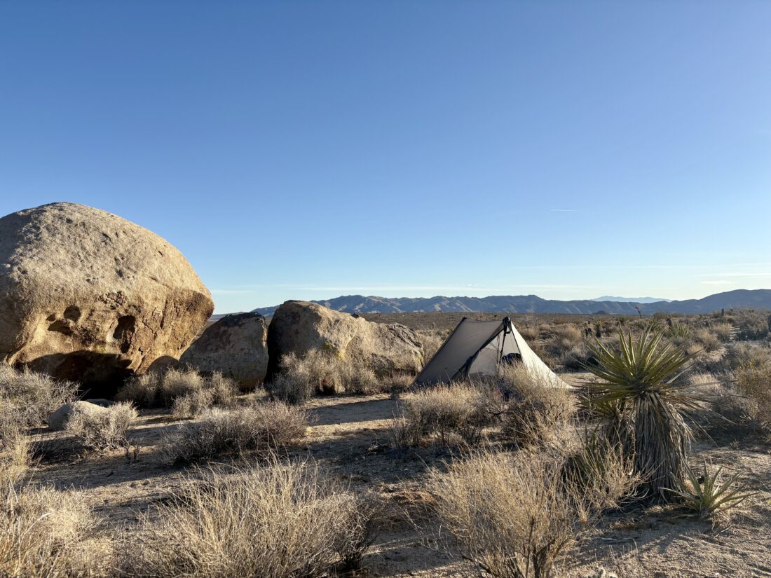
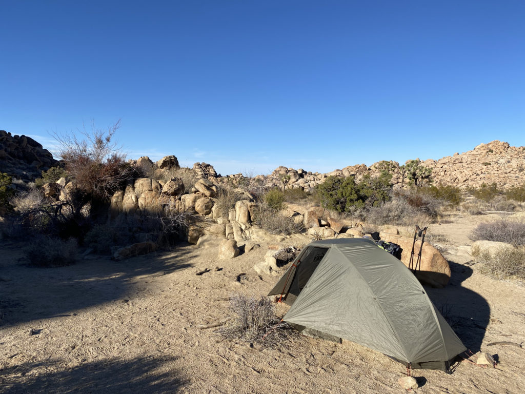
With this winter heat dome over the area, my hiking options were very limited. None of my remaining desert peaks were remotely possible, so I turned to some of the other peak lists that I am working on. Out in Joshua Tree National Park, there was one small peak on the Lower Peak Committee list that I needed to climb, Malapai Hill. I had skipped it after climbing Bernard and Little Berdoo. As luck would have it, there was a campsite at Jumbo Rocks Campground for Sunday night, so I grabbed it. As I pulled into the site in the late afternoon, a light breeze was blowing and the air was warm. After quickly setting up camp, I relaxed in my chair, reading. This was my spring break after all. As the sun set, I lit a campfire and started dinner. I watched the flames dance in the fire pit. Today was also the one-year anniversary of the passing of my sister. My thoughts turned to the cherished memories I have with her. Soon, the fire grew low, and I was ready to turn in.
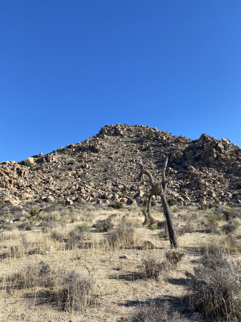
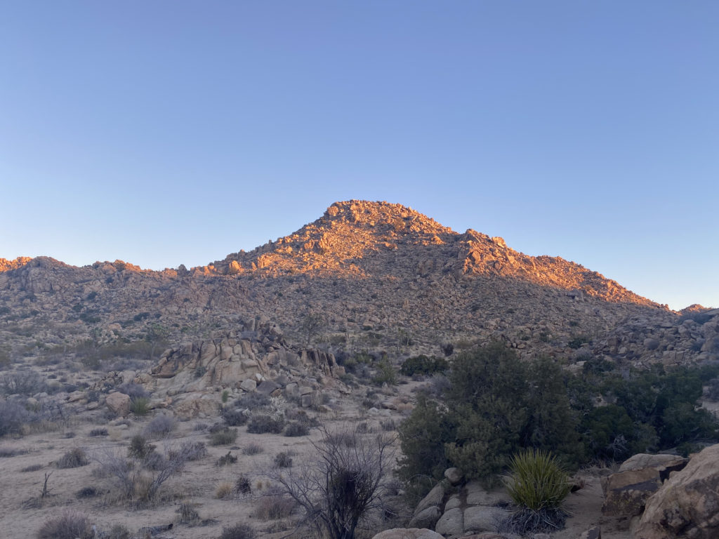
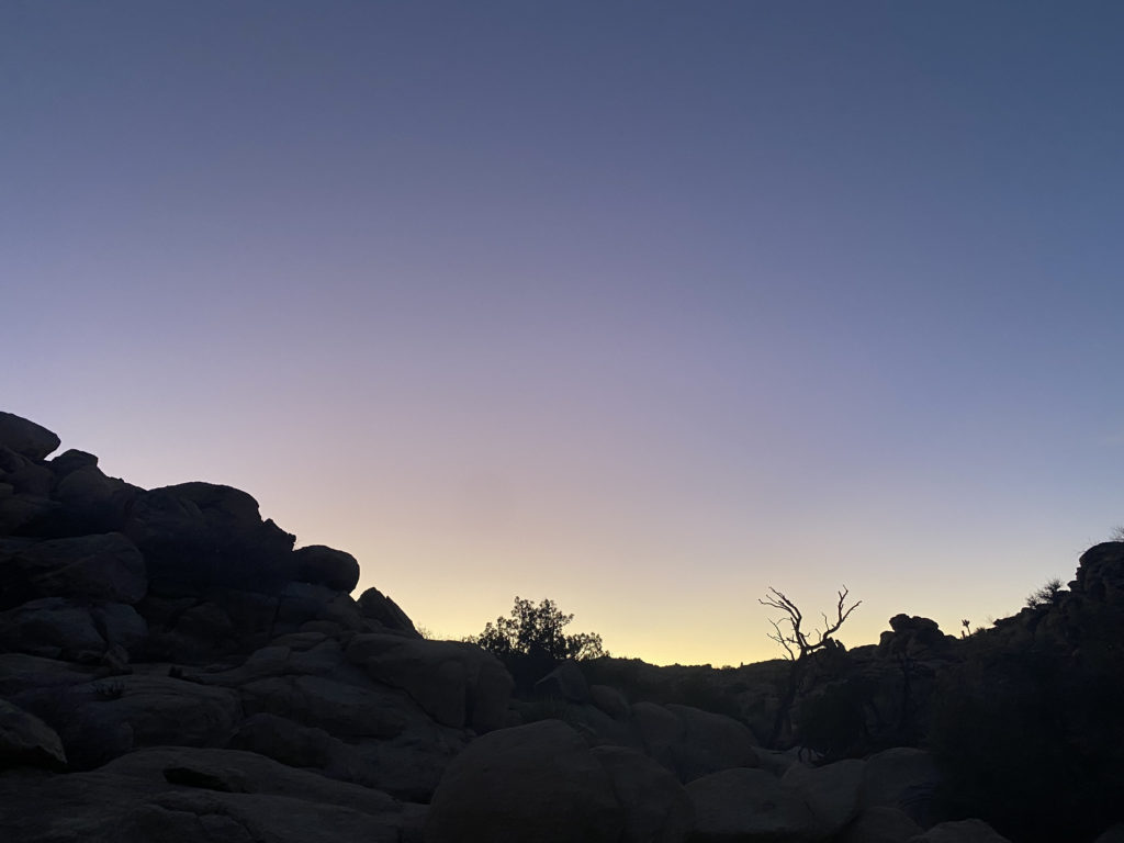
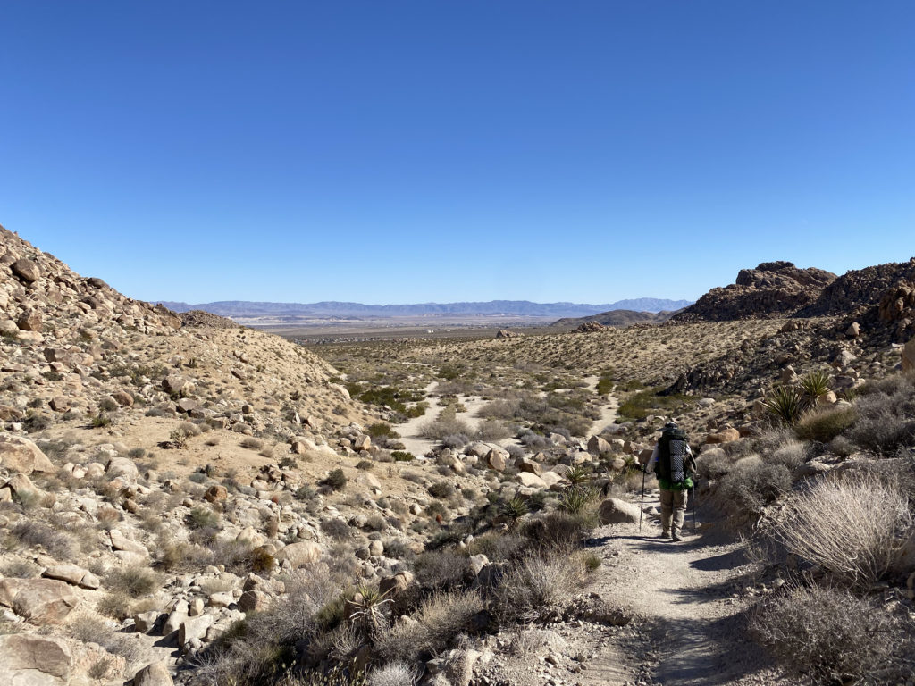
I woke around 6 and quickly broke camp. The plan was to climb Malapai Hill, then possibly drive down to hike the Lost Palm Oasis Trail. Turning onto Geology Road, I stopped and marveled at the sunrise, with a sliver of moon hanging above the desert. I hoped the photo turned out well. After about 7 miles on the road, I pulled into a small parking area and finished gearing up. Malapai stood off to my west, its red, rocky talus slope challenging me.
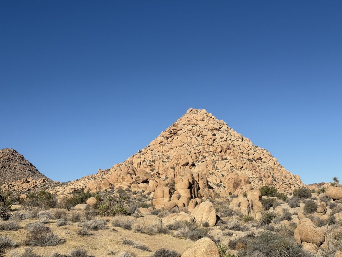
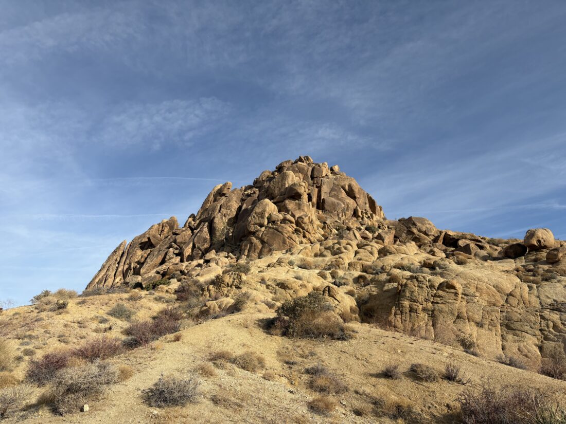
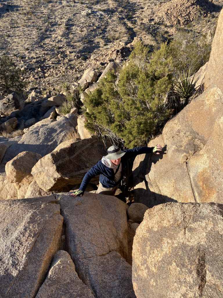
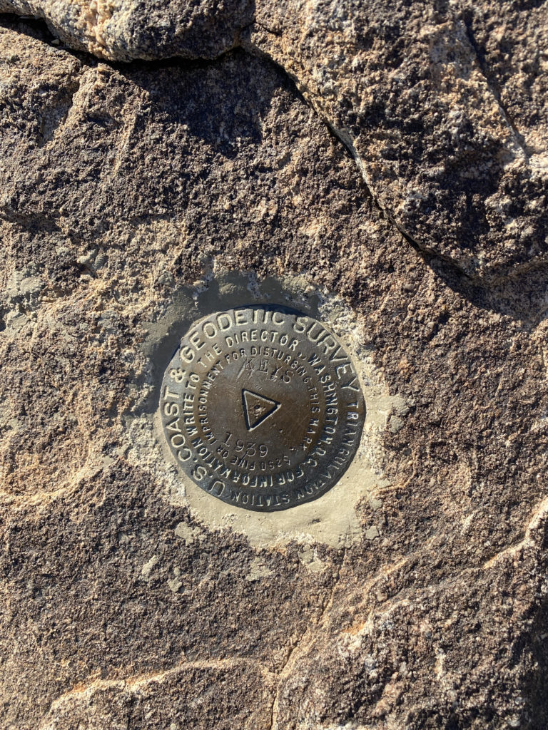
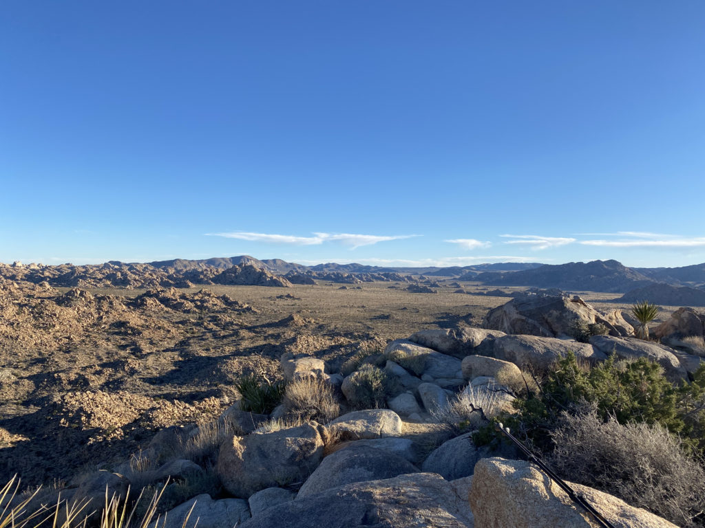
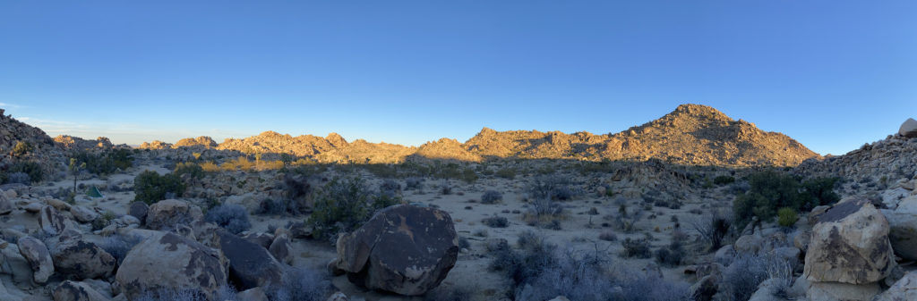
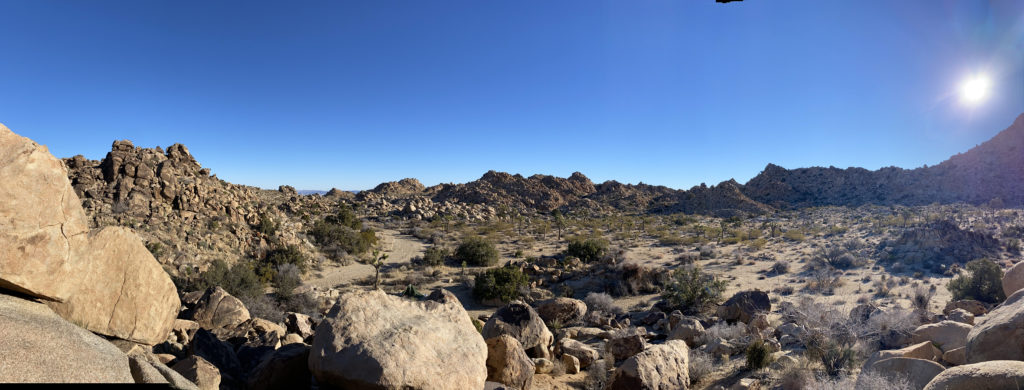
The morning glow began to fill the valley to my south with its gentle light. It was already 64°F, so I got moving. The desert floor was covered with a wide range of flowers, and their scent filled the air. As I drew near to the base of the climb, I opted to stay to the south (left) of the main talus field to make my ascent to the saddle between the summit of Malapai Hill (the north bump) and Malapai Benchmark (south bump). The climb went very quickly, and I was soon at the saddle. The final climb to the top of Malapai Hill did involve more rocky sections, reminding me of Red Hill in Anza-Borrego. The summit does not appear to have a register or anything beyond some incredible views. I then worked my way back down to the saddle and up to Malapai Benchmark. Again, nothing was found, just better views toward the south.
I returned to the saddle, then back down to the desert floor, snapping photos of some of the flowers along the way.
Once back at the car, I opted to skip Lost Palm Oasis. It was another hour’s drive, and a 7+ mile hike at a lower elevation, all of which meant a toasty one. The climb up Malapai Hill was 1.7 miles in 1:08 with 399 feet of gain. That was also my 25th LPC summit.
I am an avid peak bagger, sometimes backpacker, and former sea kayaker living in San Diego. I am the co-author of Urban Trails: San Diego, available now!
I awoke just before sunrise. After a nice warm breakfast, I drove down Geology Tour Road to the start of the hike. The road was in pretty good condition, except for two rutted spots that were muddy and had been “enjoyed” by others. At marker 14, I turned off the road and parked. I left a note in the window, grabbed my gear, and set off.
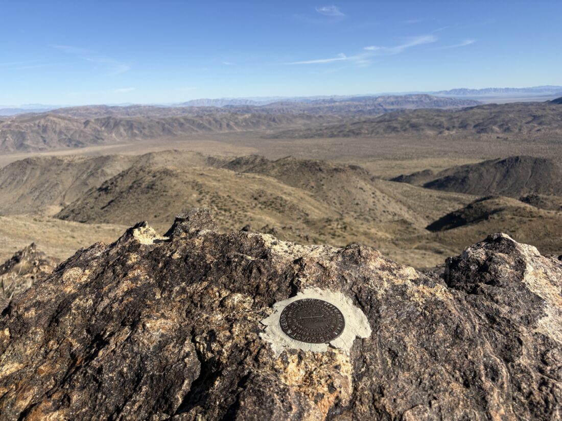
I worked my way eastward toward the wash, which I would follow southward for about 1.5 miles, when it split into two forks. Here, a large cairn marked the exit from the wash, and the climb would begin in earnest. My route took me up a gully and toward a small saddle. A lone boulder just to the east of it helped give me a target to aim for. Once along the ridge, it was now a “simple” process to follow it in a generally southward direction, ever climbing. The route would alternate from mild to steep. After a very convincing false summit, the true summit of Bernard Peak came into view. I scrambled to the summit. A light breeze helped temper the day’s warmth. I found the benchmark and a reference mark. I signed the register before setting off for the next peak (Little Berdoo) after addressing a hot spot on my foot.
I dropped down to another saddle, sad to lose some elevation, but I did pick up an excellent use trail for a while. My route arched over to the summit. Here I found the benchmark, reference mark, and the register. The Coachella Valley was spread out before me as I enjoyed a snack and some electrolytes before heading back.
My route back went well with a few drifts off track, but I quickly corrected my navigation. I enjoyed a Walking Tamale, a new trail food for me, during one of the mellower sections to keep my energy levels up. Way off to the north, I could see the volcanic rocks of Malapai Hill and Geology Tour Road, as I kept descending. Soon, I passed that lone boulder again and down to the wash. Initially, I planned to follow the wash back to the road, then to my car, to avoid the open desert portion again. With a quick check against the saved GPX track I had been using, I saw that I was drifting to the east, so I was going to have some last open desert hiking before reaching the road.
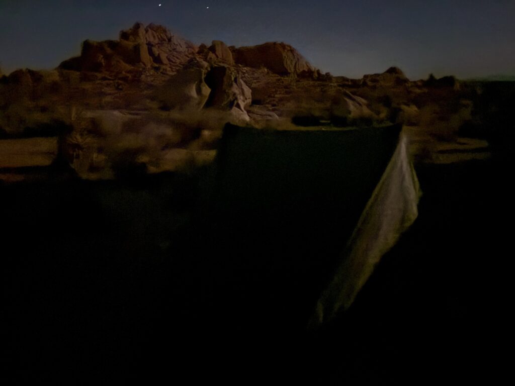
Once back at the car, I enjoyed some cold water, as the day was now in the mid-70s. The thought of hiking up volcanic rocks to the summit of Malapai Hill on a warm day with some tired legs was not something that appealed to me. Tonight’s campsite was down at Cottonwood Springs, so I had a bit of a drive to recover from the day’s efforts. I stopped at the visitor center to ask about the road to the Monument Peak trailhead. The rangers said that up to that point, an AWD car would have no issues. Past that, well, you’d better have a real 4×4 with recovery gear. I got the same campsite as I had last year. The light pollution is a bit worse here, so astrophotography wouldn’t be as good. I quickly set up camp and started cooking while I started a campfire. Unlike last night, there was no breeze, so it was an enjoyable night to enjoy a nice beer and watch the fire.
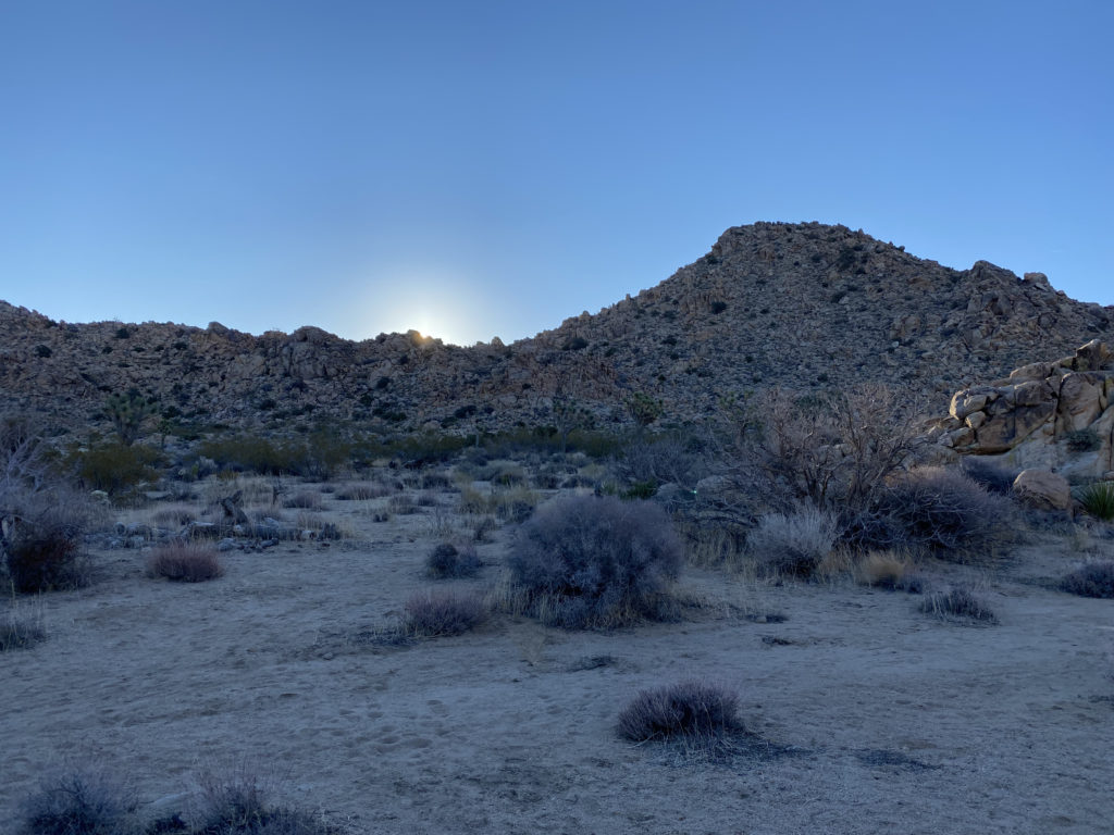
I awoke slightly before dawn and captured a short time-lapse of the sunrise.
After some oatmeal, OJ, and hot coffee, I decided not to attempt Monument Peak. My legs were still spent from the past two days, and as I still needed to climb Malapai Hill, I knew I had a return trip to Joshua Tree in my future. With that decision, I headed home very satisfied with the hikes and camping. The entire multiple peak hike covered 8.7 miles in 5:44. The total elevation gain was 2,221 feet.
I am an avid peak bagger, sometimes backpacker, and former sea kayaker living in San Diego. I am the co-author of Urban Trails: San Diego, available now!
After climbing Mount Mel, my next hike would take me to the Queens: Queen Mountain and Queen Benchmark. I turned on Big Horn Pass Road, then continued northward onto O’Dell Road. The parking lot was empty, as expected on a Monday. I gathered my gear and 3 liters of water before setting off. The hike actually begins along an old jeep road, so I cruised along toward the base of the mountains. The road eventually faded into a well-worn trail and started its climb. Cairns dotted the way as well. From time to time, I would add or repair them. The steep climb came to a small plateau, then over to a gully for the final push to the saddle between the two peaks.
I opted to make the short climb to Queen Mountain first. A nice, wide slab led to the actual summit. After locating the reference mark and soaking in the views on this HPS peak, I returned to the saddle and then arched around the north side of Queen Benchmark. Once at the summit, I signed the register and found the benchmark. I didn’t stay too long, as I still needed to get back to the car and set up camp at Jumbo Rocks Campground.
The descent went reasonably smoothly, and I was soon back at the car. The campground was a short drive away, and before too long, I had camp set up. After a nice dinner next to a warm campfire, I enjoyed some astrophotography before turning in. Tomorrow was going to be a big day, hiking two more HPS peaks, Bernard and Little Berdoo Peaks, and if the legs have any gas left in them, Malapai Hill. The hike was 3.97 miles long and had a healthy gain of 1,204 feet, which I did in 3:00.
I am an avid peak bagger, sometimes backpacker, and former sea kayaker living in San Diego. I am the co-author of Urban Trails: San Diego, available now!
With my first semester of graduate courses behind me, I set off to Joshua Tree National Park for some camping and peak bagging. First up was Mount Mel, near Indian Cove Campground. I previously considered climbing this peak while backpacking the Boy Scout Trail, but opted to skip it. I parked at the Nature Trail trailhead and set off to the west. The trail took me past a wash that would follow almost to a saddle to the south of Mount Mel.
Once at the saddle, I scanned the boulders that make up this peak to find a route up. I set off, working my way carefully up through the rocks. Soon, I was nearing the top and began exploring how I might reach the actual summit block. I found the register and then scrambled to the proper summit. From there, I snapped a few photos and began picking my way back down. Once back at the car, I set off to the day’s second hike, up to Queen Mountain and Queen Benchmark. But first, lunch in 29 Palms and some more firewood for camp later. The hike was 2.2 miles, in 1:24, and 400 feet of gain.
I am an avid peak bagger, sometimes backpacker, and former sea kayaker living in San Diego. I am the co-author of Urban Trails: San Diego, available now!
When blisters forced me to end my thru-hike of the California Riding and Hiking Trail in Joshua Tree, I began thinking of options to complete the last 11 miles. Initially, in mid-March, I had planned to hike the Eagle Rock Loop in Arkansas in conjunction with my grand-niece’s 3rd birthday. Unfortunately, my sister’s condition worsened, and she was placed on hospice. So, I decided to reschedule that backpacking trek until the fall. That also meant that I would have the time to spend the two days I needed to finish off the CRHT. We flew back to Little Rock for the birthday, but my sister took an unexpected turn and passed away late Saturday evening. My wife and I arrived home in San Diego very late on Monday. When it was just a visit, just the party and time with family, I penciled in doing the CRHT on the Wednesday and Thursday after we returned. I talked it over with Anita, and she said I should still go. Some time alone out in the wilderness will be good for you, plus Mindy always loved my adventures. It let her “get out” when she no longer could. So, on Tuesday, I assembled my gear and was ready to set out for some healing time on the trail.
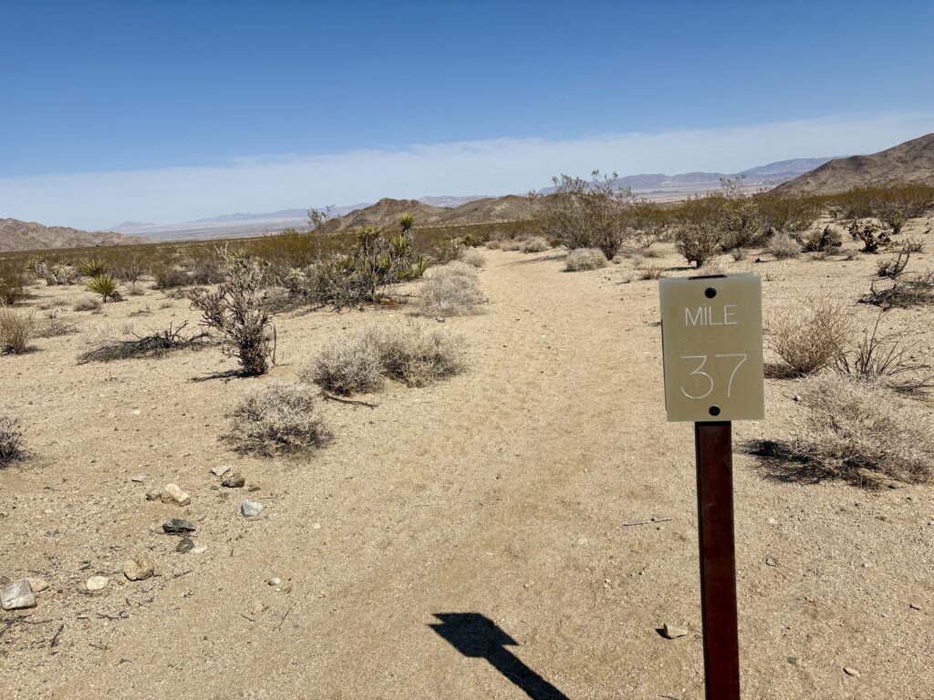
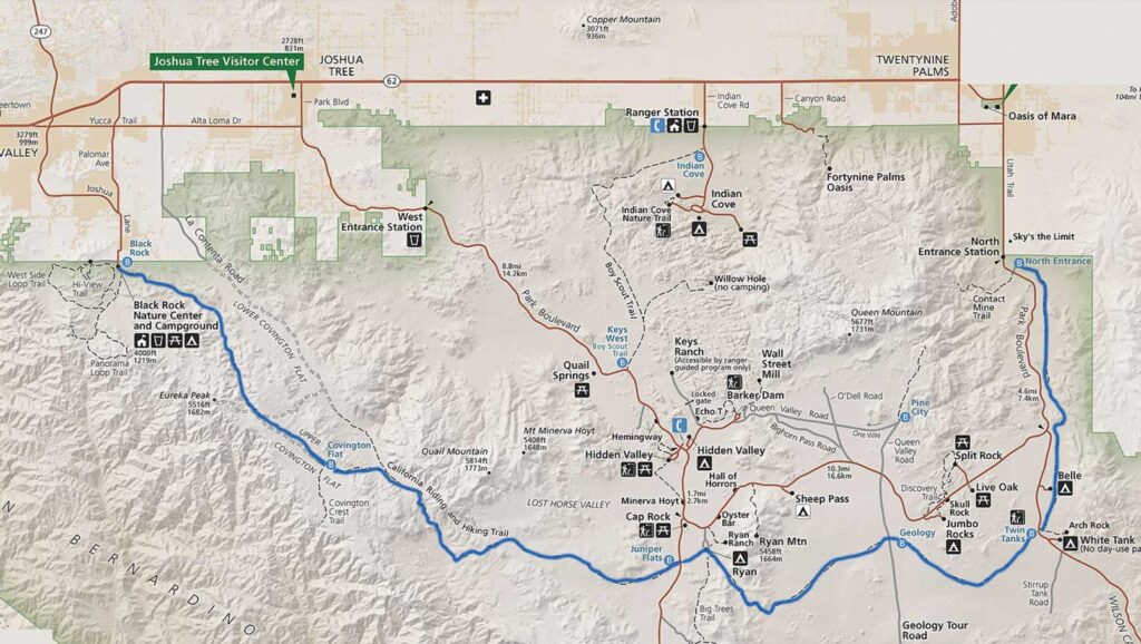
My plan was straightforward: Start from the North Entrance Trailhead, hike to the Geology Road Trailhead, then make a U-turn and hike back to the car. The drive out was pretty uneventful. This time, I made sure I had my hiking shoes. Actually, two pairs of hiking shoes. After the blisters for the first attempt and an issue during my hike in Borrego Palm Canyon, I decided to switch to Altra Lone Peak 9’s. This hike would be their maiden voyage on my feet. I did bring my Merrell Moab 2’s just in case I found that I did not like the new shoes, I might be able to return to the car and switch my footwear. I planned two water caches; the first was two 1-liter bottles at the Arch Rock Trailhead (1 liter for the hike out and the other for the hike back), and the second cache was at the Geology Road Trailhead, where I left one 1-liter bottle. Like before, I carried two 1-liter bottles on the sides of my pack and a .75-liter bottle in my shoulder pouch.
I parked at the trailhead and gathered my gear. The weather was perfect, with just a light breeze. I brought my tripod again, this time hoping for more filming along the way. The trail heads mostly southward and gently gains in elevation. After just 6 miles, I spotted Belle Campground and made a slight detour. I used the pit toilet and found an empty picnic table to sit at and enjoy my lunch. After some tuna, oranges, and a Kit-Kat bar, I set off toward the Arch Rock Trailhead. There, I picked up one of the water bottles and slipped it into my pack.
The trail now turned eastward. As my shoes crunched on the desert floor, my thoughts turned to my sister. My mom had given her up for adoption before I was even born (11 years to be exact), and I did not learn of her existence until 2000 (by accident). Finally, in 2018, we discovered one another and had seven wonderful years together. Soon, I spotted the recommended campsite and found a perfect spot to pitch my tent. After setting up camp, I looked at the time and was feeling good, so I changed my plans. Initially, I had planned to hike out to Geology Road to pick up the water cache in the morning and hike the 11+ miles back to the car. Instead, I decided to go ahead and hike over, get the liter, and hike back, making it closer to the original plan in February. I left the trekking poles behind as they were holding up my tent and headed out. It was so weird to hike without them, I didn’t know what to do with my hands… Soon, I saw the glint of sunlight on a windshield and knew the trailhead was close. I reached it in no time and gathered my water. I reflected on the difference—the last time I was here hiking, my feet had blisters, and I was completely defeated. This time, while my heart was filled with sadness from the loss of my sister, the rest of me felt great, including the feet in the new shoes.
Once back at camp, I relaxed in the chair I brought and watched the sun sink lower over the horizon. I made dinner and soon crawled into my tent to drift off to sleep. Initially, there was to be a SpaceX launch out of Vandenberg around 11, but I had a cell signal and learned that the launch had been delayed, so I deleted that alarm from my phone. During the night, I did wake up and try for some photographs of the incredibly starry night I was sleeping under. I really need to find some good tutorials of how to adjust the settings to get better night photography.
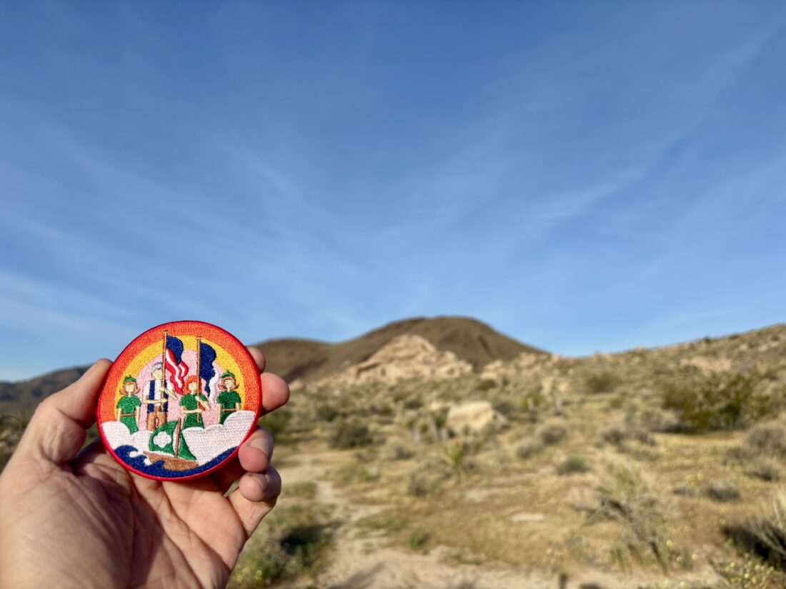
I woke around 6, before the sunrise. As I packed up, I kept an eye out toward the east to capture the first rays of the rising sun. After a quick breakfast of oatmeal and a cup of coffee, I was ready to head out. While yesterday was fairly easy, today was even easier as it was almost all downhill. I spent more time reflecting on my sister, letting this journey be a part of my grieving and healing process. Some formal events were planned, but I needed time for myself. I picked up my remaining bottle and kept on cruising. I again made a bio-break at Belle Campground and dumped my trash. I passed a few folks starting their journey as I drew nearer to the end of mine. Once back at the camp, I was happy to have hiked the entire trail, and while not all in one go, it was still a continuous footpath. After a stop at the Visitor Center for some stickers and a patch, I enjoyed a good burger and a well-earned beer in Joshua Tree. As for the shoes, they worked pretty well, although I did develop one blister. I suspect it might be my pace again. For both legs of the hike, I held just over 21-minute miles, which is really fast. I think if I just went slower, my feet would be fine. The final stats were 23.3 miles in 9:27 and 1,700 feet of gain.
I am an avid peak bagger, sometimes backpacker, and former sea kayaker living in San Diego. I am the co-author of Urban Trails: San Diego, available now!
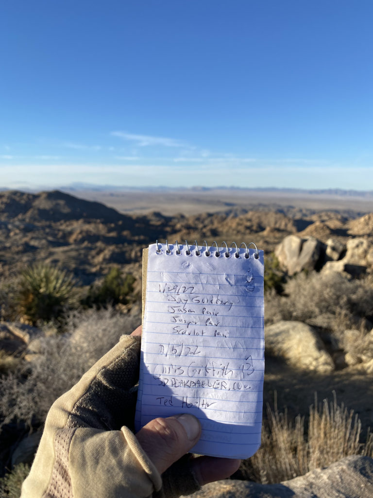
My good friend Ted H. said he would love to join me, along with one of his long-time hiking buddies. The basic plan was for me to drive to various spots along the trail and cache the water we would need along our trek. After that, I would spend the night car camping at Blackrock Campground, which is conveniently located next to the western end of the trail. With my gear packed into the Subaru, I left for Joshua Tree in the morning, hoping to have a relaxing day. I pre-ordered a sandwich from Jersey Mike’s along the way. Not 15 minutes into the drive, Anita calls me to let me know I forgot to pack my eggs in the cooler. Thankfully, she was headed in my general direction, so at least I did not have to drive all the way home. With that crisis averted, I again headed northward, just a little behind schedule. Around Menifee, something clicked in my head, “Did I pack my hiking boots?!” Normally, I wear them out the door when I go hiking, but I was in my regular shoes for some comfort. I found a place to pull over and check, and sure enough, I had forgotten them! Anita was working in East County, so she could not help me this time. Back to San Diego I went. I called Jersey Mike’s to put my sandwich away, as I would be delayed in picking it up. With my hiking shoes acquired, I got back on the road. Given the delay I did swap the order of the water caches, just in case I had further unexpected delays.
Stop one was now the end of Upper Covington Flats Road. Since this was about a ten-mile drive along a dirt road, it made sense to do this while I had daylight. The rest of the caches would be near easily accessible roads. The road was in good shape, and a few pools of water from the recent rains did offer a little fun to the drive (and the need for a car wash later). A lone Prius sat at the trailhead as I tucked 3 gallons of water under some brush. Each cache would have a gallon for each of us. Next, I headed to what would be our last cache, near the parking area for Arch Rock. I wanted to place these jugs a little further from the trailhead, as this spot is heavily trafficked, and did not want someone to accidentally use our water. From there, I drove westward to Geology Road for what was planned for our water for the end of day 2. The final cache was to be placed at the trailhead to Juniper Flats. With our water safely tucked away, I drove back toward Blackrock, making a stop at Stater Bros. to grab a steak to grill, some firewood, and an orange juice for the morning.
The sun had set, so it took a little bit to find my campsite. I quickly unloaded, set up the Luno, and started a fire. The winds made it chilly, so I was glad to have a fire to warm up. I grilled my steak, this time just right. I enjoyed it, along with a nice salad and fine beer from The Bruery. Tomorrow was going to be the start of a big adventure, so I turned in just as the moon was rising over the hills to the east.
It was chilly when I woke up, and I quickly cooked my eggs. I packed up my car camping gear and drove over to the backcountry parking area. The plan was for Mark to drive over to the eastern terminus of the trail and get picked up by Ted and Andrea. The original plan was to start at around 8. Unfortunately, Mark got a late start leaving his campsite. Adding to the mix, the cell network was completely down, so we had no method of communication with each other. Finally, just before 10, they returned from the car shuttle setup, and we could hit the trail.
I carried 3.75 liters of water as we set off on the trail. I did consider having Andrea drive us down to Covington Flats Trailhead and just start from there so we would have time to easily make the planned campsite. The others felt that we should be ok, so we stuck to the original plan. The recent rains compacted the sandy section, making the hiking a bit nicer. This first section was a steady climb, the wind was making the day chilly. Both San Jacinto and San Gorgonio’s snow-capped summits peaked into view from time to time.
After about 6 miles, we found a spot out of the wind and had a snack break. I had hoped to film a lot more on the trip, but that 2-hour delay scuttled that plan. Once we reached Upper Covington Flats, we each strapped our gallon of water to our packs and continued on (after another snack). The sun was setting, and it was pretty clear that we were not going to make the planned campsite. There was another possible site that was only 2.8 miles further, so that became our new destination.
The water jug made a rhythmic sound as I hiked down the trail. When I came to the location of the campsite, it was clearly not going to work. The site sat on the crest above a valley, and the winds were howling. I was actually being pushed from time to time. Setting up camp here was not an option. So, we dropped down and found a spot that was a bit more sheltered. We each found a spot to pitch our respective tents. I did not repeat what happened on San Gorgonio, so I made sure all my tent stakes were highly secured. I set up my camp chair I opted to bring and cooked up dinner. The winds made it too chilly to sit around and chat, so after I ate, I retreated to my tent and listened to an audiobook. The tent would feel the wind, but it held firm. I drifted off to a little sleep, as the winds would wake me briefly. Around midnight, the winds calmed down, and I drifted into a nice slumber. I woke up just before sunrise to answer nature’s call and caught a nice morning sky. I crawled back under my quilt for a little more rest before really starting the day.
I emerged from my tent around 7, and I cooked up some oatmeal and a nice hot cup of coffee. As I was packing up, I could not locate my tent stake bag. My guess was that I left it out and the winds blew it away. I did scout the surrounding brush, but no luck (I later found them tucked in my jacket). I was ready to hit the trail at about 8, however, we did not hit the trail until 9. Thankfully, without the wind, it was quite pleasant. From time to time, we would see trail runners race past along the trail above us.
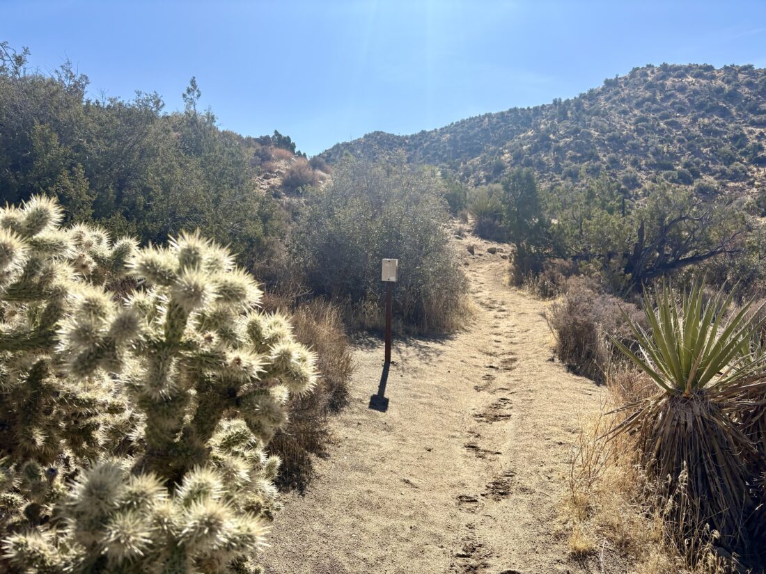
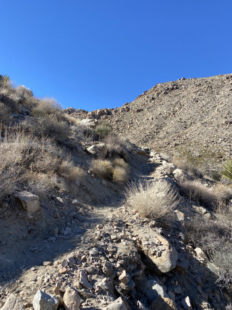
The trail continued descending for a while before we would have two steep climbs that would have us enter Juniper Flats proper. I reached the crest and found a nice rock to wait for Ted and Mark to rejoin me. I soaked in the view and the silence. Once back together, Ted and I set off together, with Mark keeping his own pace. The plan was to rejoin at the Juniper Flats trailhead and top off our water from the cache I had left on Friday. As I was descending, I felt a couple of hot spots forming. At the trailhead, I put some KT blister tape on where I thought they were.
After a nice lunch, I went solo, as Mark was just pulling in as I was set to head out. I again was concerned about our timing to reach the next planned site and the water as well. I tossed my empty water jug into the recycling at Ryan Campground and motored on. I could feel my feet, but I hoped the blister tape would do its job. I had a slight climb leaving Ryan Campground, but then the trail leveled out.
My feet started to hurt more, so I stopped under the shade of a Juniper tree and took a look at them. A quarter-sized blister had formed on the balls of each foot. This was not good. I applied more KT tape, but I suspected that I might have to call it. My best guess is I actually was hiking too fast to make up for our delayed starts and created the friction to cause them to form. I began thinking of options. I could camp early and then hike to Geology Road in the morning. I could attempt to make it to the planned site and either backtrack to Geology Road and get picked up or if the feet were up to it, limp to Arch Rock and bail there. Hiking to the end was no longer an option. As I drew nearer to Geology Road, I began messaging Anita about her driving out to pick me up. I actually hoped to hitch a ride from someone who could take me back to my car, but first I needed to tell Ted and Mark of my plan to bail here. So I set up my chair and waited. I actually had a cell signal, so I called Anita and gave her the details for plan B if I could not hitch a ride.
After about 30 minutes, they reached the trailhead. I told Ted where the water was at Arch Rock and began looking for someone returning from driving Geology Road. Sure enough, the first car stopped and had room for me and my gear and was headed in the right direction. I said my farewells to Ted and Mark. My rescuers kindly drove me back to my car. Once back out of the park, I texted Anita that she could return home, as she had preemptively started out to meet me. I tossed my gear into my car and bid farewell to my rescuers.
My adventure was not quite over. I opted to fuel up at the Morongo gas station and grab dinner at In-n-Out. As I entered the traffic circle, a Mercedes Benz SUV cut in front of me, causing me to slam on my brakes, and unfortunately, my burger and fries flew off the seat onto the floor. I lost about half my fries, but the burger was still intact. Thankfully, that was the last of the misadventures.
I did hear from Ted that they completed the hike, but he, too, had blisters that slowed him down.
I am an avid peak bagger, sometimes backpacker, and former sea kayaker living in San Diego. I am the co-author of Urban Trails: San Diego, available now!
After packing up our campsite, we headed out for a short hike to Mastodon Peak. I had done this loop hike before, but this time I opted to hike it in the opposite direction. So, once we reached the junction, we turned left toward the peak. Informational signs dotted the trail from time to time, highlighting plants and animals that might be spotted.
We cruised along some washes, making our way up toward the peak and the abandoned mine that sits just below the summit. As we gained some elevation, the views became expansive. Off to the southwest, the northern end of the Salton Sea became visible. After inspecting the mine, we looped around the peak and followed the use trail to the summit. We soaked in views for bit before scrambling back down to rejoin the main trail.
We spied a couple of hikers heading out to the Lost Palms Oasis, a trail I haven’t explored yet. Our loop took us down to the Cottonwood Spring, before turning northward and back toward the campground.
I am an avid peak bagger, sometimes backpacker, and former sea kayaker living in San Diego. I am the co-author of Urban Trails: San Diego, available now!
Rather than attempt to find parking at the trailhead in the White Tank campground, my son and I parked at the Twin Tanks parking lot and started our hike from there. The trail headed briefly south before crossing Pinto Basin Road. The California Riding and Hiking Trail also crosses at this junction (with luck I will be on it this February).
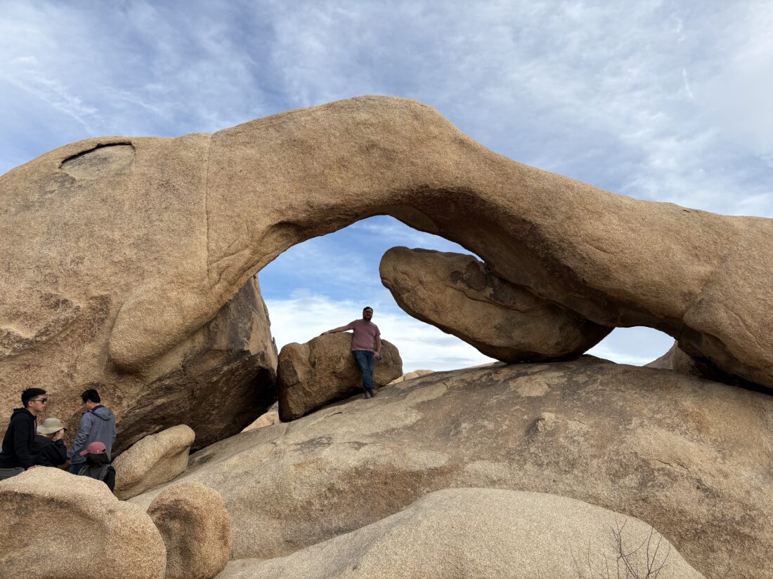
The flat and wide trail heads off to the east for about 0.4 miles to the junction to the spur trail to Heart Rock. After another 0.2 miles, we waited in a brief queue before snapping our photos in front of the clearly heart-shaped stone. Returning to the junction, we then made our way over to Arch Rock. Ben scrambled up, while I made my way to the other side to snap the photo. After we were done, we retraced our route back to the car and then headed down to set camp at Cottonwood Campground for the night.
I am an avid peak bagger, sometimes backpacker, and former sea kayaker living in San Diego. I am the co-author of Urban Trails: San Diego, available now!
While backpacking the Boy Scout Trail in Joshua Tree with my good friend Ted Hoelter, I hoped to summit Keys Peak which is on the Lower Peaks Committee list. After hiking about 4 miles along the trail, we found a nice spot to set up camp for the night. Keys Peak was just a short walk to our east. Once camp was set up, we headed over to the base of the peak.
I looked at the western face and felt that we could tackle it straight on until near the summit where the rocks looked larger and we would stay to the right for the last bit. While I spotted one cairn near the start, I did not see the next one. No matter, the terrain did not provide any issues. About halfway up, something shiny caught my eye, and I found a mylar balloon caught in a bush, so I headed over to collect it. Once the trash was packed away, I headed back toward my original route. As I expected, toward the top, there were a few Class 2 sections to scramble through, but soon we were on the summit.
I found the benchmark and register. We snapped our photos and took advantage of cell service to check in with our spouses. The sun was setting and there was a light breeze, so I was eager to climb back down and start thinking about dinner. Coming down, I quickly found the string of cairns that guided us back to the desert floor. This little excursion was .5 miles with just over 325 feet of gain. Back at camp, we enjoyed our dinner under the evening skies before turning in.
I am an avid peak bagger, sometimes backpacker, and former sea kayaker living in San Diego. I am the co-author of Urban Trails: San Diego, available now!
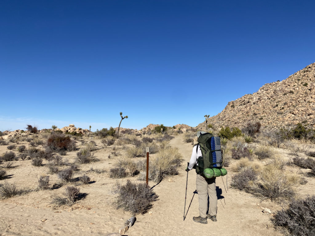
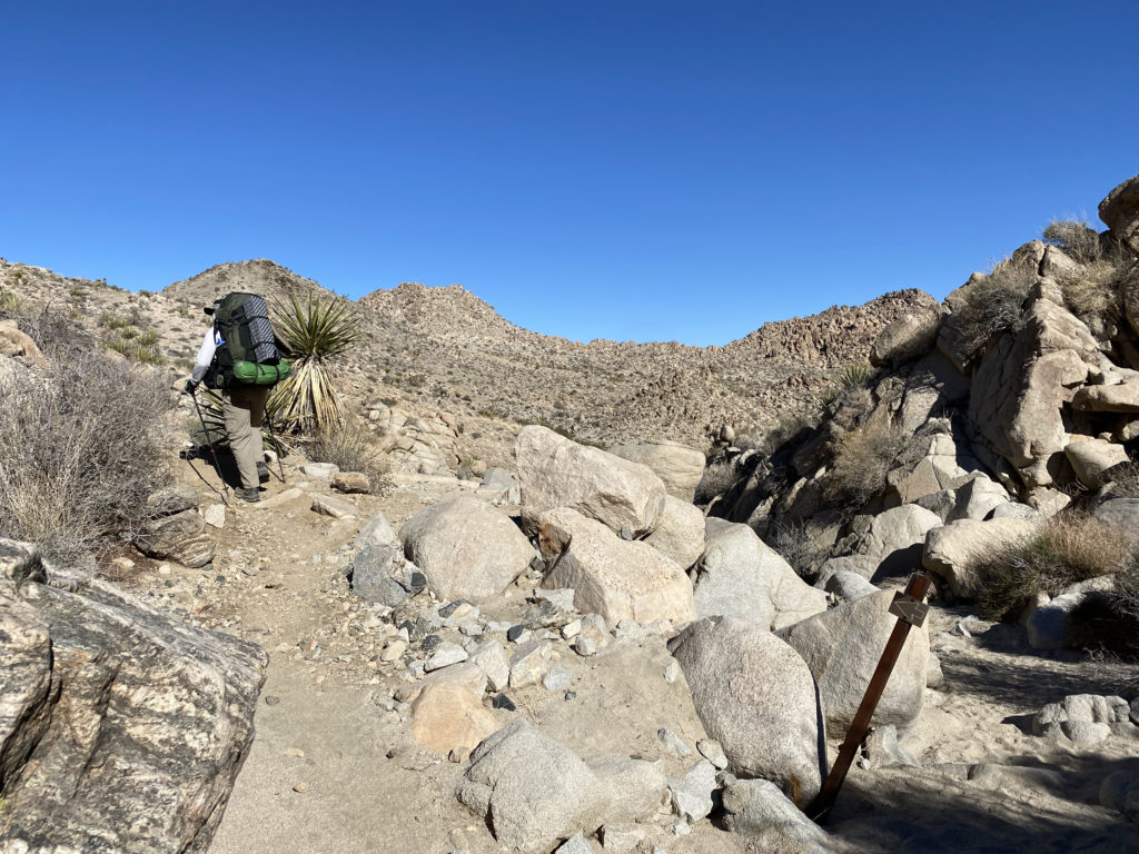
With my usual hiking partners busy, I decided to take a backpacking trip in Joshua Tree National Park. My friend Ted from Santa Barbara, who had joined me when I hiked Santa Cruz Island, was able to join me. We opted to hike the Boy Scout Trail, which would be a nice 8-mile hike, allowing us to explore both the upper Mojave desert with its Joshua Trees and then the lower Mojave desert, with cacti and yuccas. In addition, I hoped to summit two peaks on the Lower Peaks Committee list that are near the trail–Keys Peak and Mount Mel. We were doing this trip as a point-to-point hike, starting at the Keys West Trailhead and working our way down to the Indian Cove Trailhead. I arrived first at the Indian Cove Backcountry parking area and waited for Ted to arrive. Another hiker was getting ready to head off and planned on following the same route, but as a day hike. Since there is cell coverage at this trailhead, he had called for a cab to drive him to the other trailhead. This also could be an option for those who can’t or don’t want to set up a car shuttle. Ted eventually arrived, after getting a late start, and having to get a pass from the ranger station ($30). I took a short nap in the car while I waited. Once Ted arrived, I transferred my hiking gear into his car and he tossed his backpack into mine. With that, we headed back into town to grab lunch before setting off.
After enjoying a nice burger and soda at JT’s Country Kitchen, we drove back into the park via the West Entrance. This is the main entrance to the park from the north, so be prepared to wait a bit to pass by the ranger station. Since I have a National Parks Annual Pass, I was able to bypass some of the waiting. We drove south toward the Keys West parking lot. This is a large lot but can fill up. Sure enough, upon arriving, there was not a spot to be found. The Boy Scout Trail is also a popular day hiking site, so we decided to wait for some returning hikers and then take their spot. After about 10 or 15 minutes, a couple did return and I was able to take their spot. Two other cars were waiting behind me. I had grabbed two backcountry permits (free) while waiting at the other trailhead and had them filled out.
NOTE: Permits are no longer free for backpacking in Joshua Tree. You need to obtain them from Recreation.gov or from the Park Headquarters in Twentynine Palms.
We had left one at our destination and had the other ready to deposit at the backcountry board in this location. We took advantage of the primitive pit toilet before setting off. Another thing to note, there is no water at this trailhead.
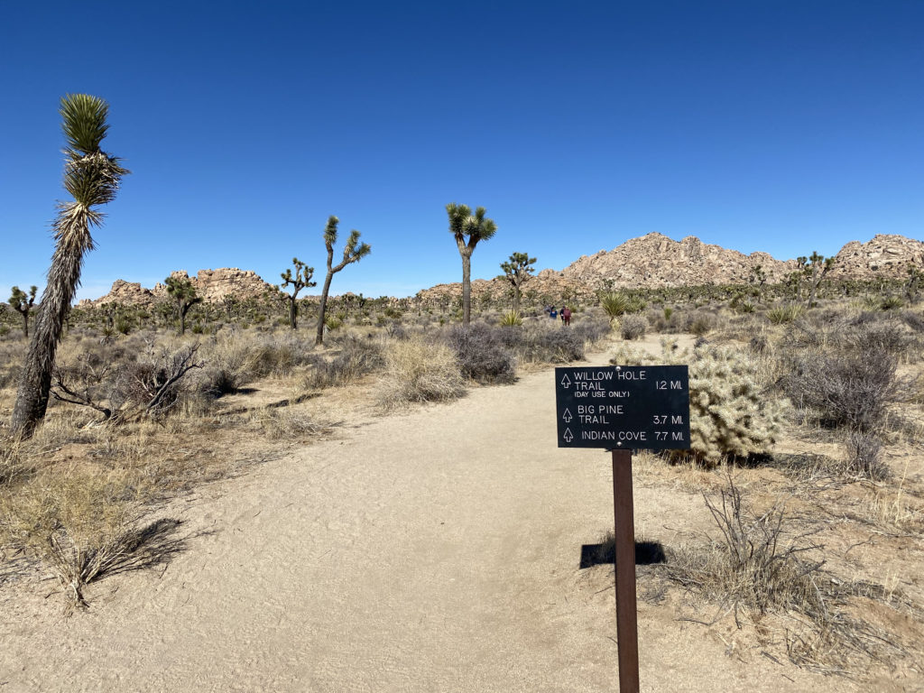
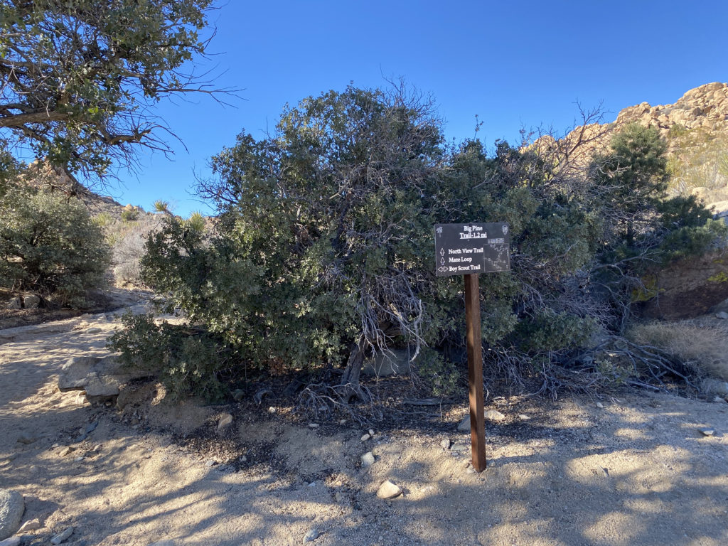
The trail sets off to the north. Soon you will see a mileage sign to the three main destinations from this trailhead; Willow Hole Trail (1.2 miles), the Big Pine Trail (3.7 miles), and Indian Cove (7.7 miles). What is interesting is the mileage sign next to the parking lot lists the Indian Cove at 7.5 miles. Since I had created markers for the turn-offs to each of the side peaks, I wanted to make sure my tracking app was working. For some reason, it was not recording the distance. After relaunching the app a few times, then finally rebooting my phone, it started working. I could have enabled tracking on my Garmin InReach Mini, but I like to only use that for communication with my wife or in a real emergency.
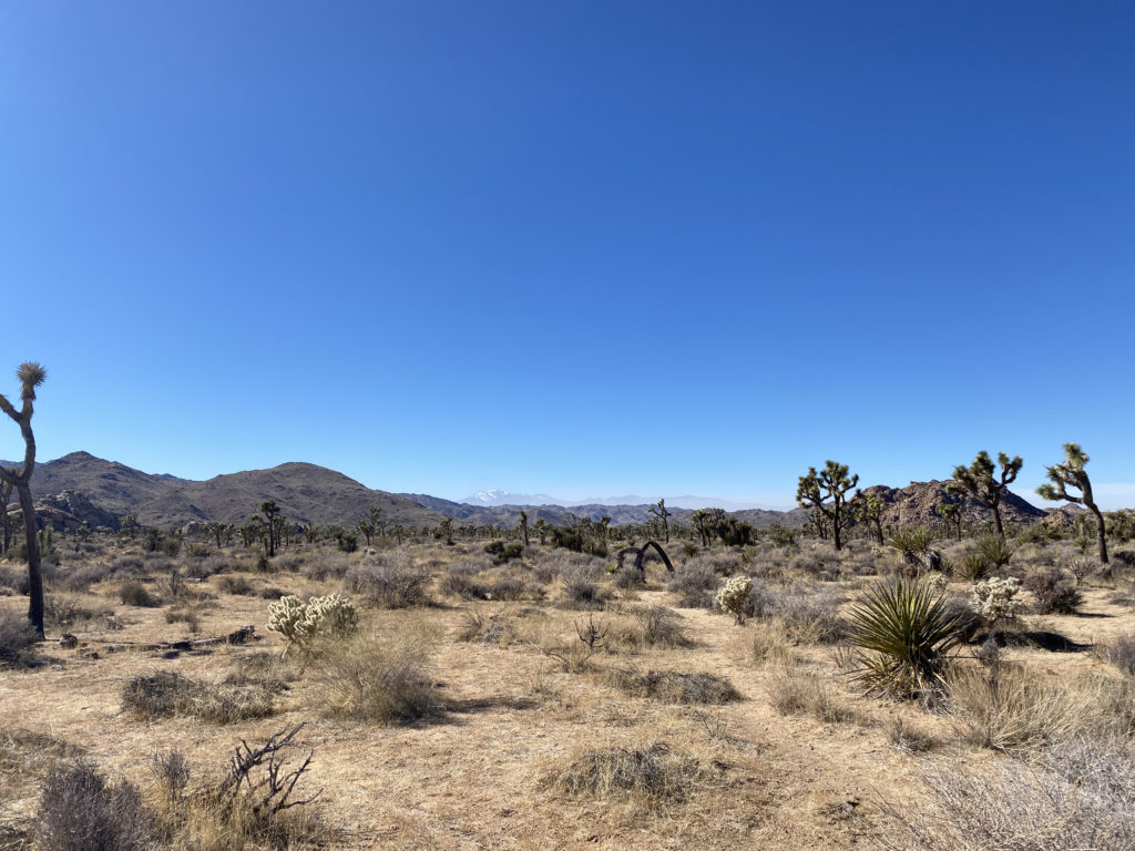
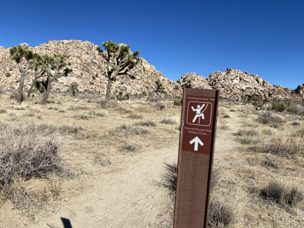
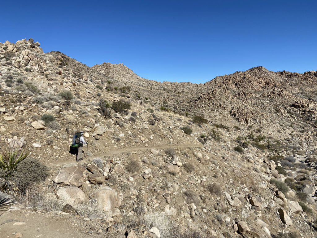
Off to the west, we could see the snow-capped summit of San Gorgonio, Southern California’s highest peak. The trail is nice and flat for almost the first 3.5 miles, so we were able to cruise along. This area is also a popular climbing area, and we would pass signs indicating various climbing access trails to spots like “Brownie Girl Dome” and “Hidden Dome”. The first real junction that you need to look for is the Willow Hole Trail. Stay to the left to keep on the Boy Scout Trail. As you cruise along the trail, enjoy the Joshua Trees that will dot the landscape.
I knew at a certain point the trail would begin to pass into rockier terrain and we would no longer find a suitable campsite. In addition, there are some rules that we needed to observe. Besides the “stand 1 mile from a road and 500 feet from the trail”, we were also not allowed to camp on the east side of the trail. (NPS rules). We could see the terrain becoming less sandy, and the plant life began to change as well.
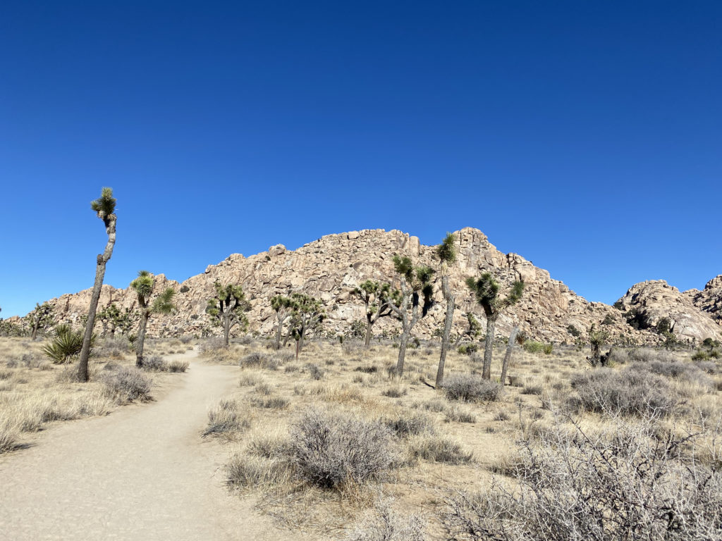
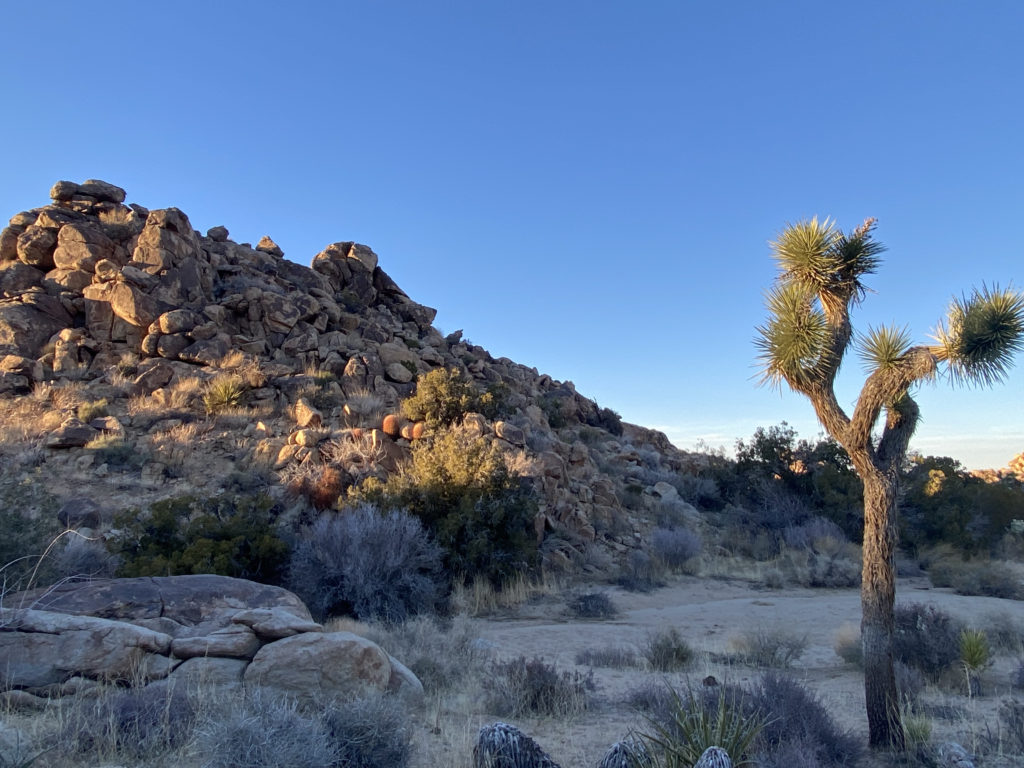
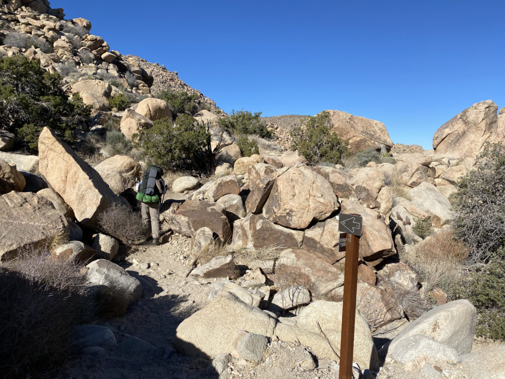
Off to my right, I could see Key Peak in the afternoon sun. We had been seeing several possible camping sites but decided to keep heading north just a bit. Not really finding anything else suitable, we retraced our route about .1 mile to a nice area near Keys Peak. We picked spots about 20 yards apart, so our snoring did not bother each other. Once camp was set up, we headed over to the base of the peak.
I looked at the western face and felt that we could tackle it straight on until near the summit where the rocks looked larger and we would stay to the right for the last bit. While I spotted one cairn near the start, I did not see the next one. No matter, the terrain did not provide any issues. About halfway up, something shiny caught my eye, and I found a mylar balloon caught in a bush, so I headed over to collect it. Once the trash was packed away, I headed back toward my original route. As I expected, toward the top, there were a few Class 2 sections to scramble through, but soon we were on the summit. I found the benchmark and register. We snapped our photos and took advantage of cell service to check in with our spouses. The sun was setting and there was a light breeze, so I was eager to climb back down and start thinking about dinner. Coming down, I quickly found the string of cairns that guided us back to the desert floor. This little excursion was .5 miles with just over 325 feet of gain.
As the sun’s light began to fade, I sat back and enjoyed the changing light upon the rocks around us. We each had our dinners and some beers we had packed in as well. It was getting colder, so we each retreated to our tents for the night. Ted had brought a tripod and DSLR in hopes of getting some nice star shots later once the sliver of moon had set. I did not have the best night’s sleep, as I needed just a bit more warmth. I woke before the sun crested the hills to the east, and Ted was up soon thereafter. Ted took a bit longer to get ready, so I scrambled up the mound of boulders to our west for a look around. Once we were done with breakfast, we finished packing and headed back onto the trail.
We came to the intersection with the Big Pine Trail that could take us to the west and eventually to the main road, but we continued working our way northward. The trail was getting rockier and rockier. There were a few boulders to work our way down, but nothing serious. It was more about having a backpack on versus a standard daypack. Along the way, we passed an old water basin from a nearby mine.
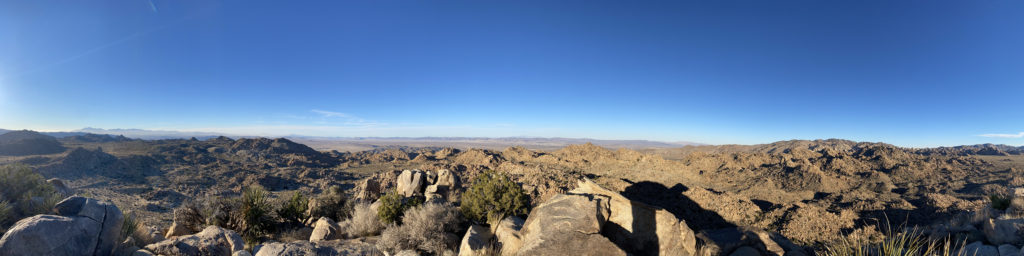
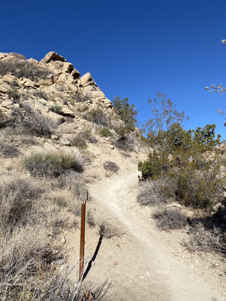
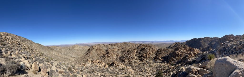
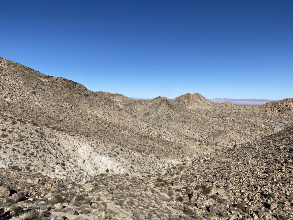
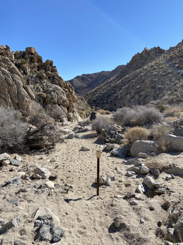
The trail markers kept us on the trail, although the route was very easy to follow. We had begun the descent toward the canyon that we would eventually follow out. Ted commented that we certainly picked the right direction, as climbing this with a full pack would take some effort. The next point of interest was the Boy Scout Viewpoint. This spot gave us an epic view toward the east. After capturing the panoramic view, we would descend through a series of switchbacks until we reached another wash. Here the trail made a hard right turn and began heading eastward.
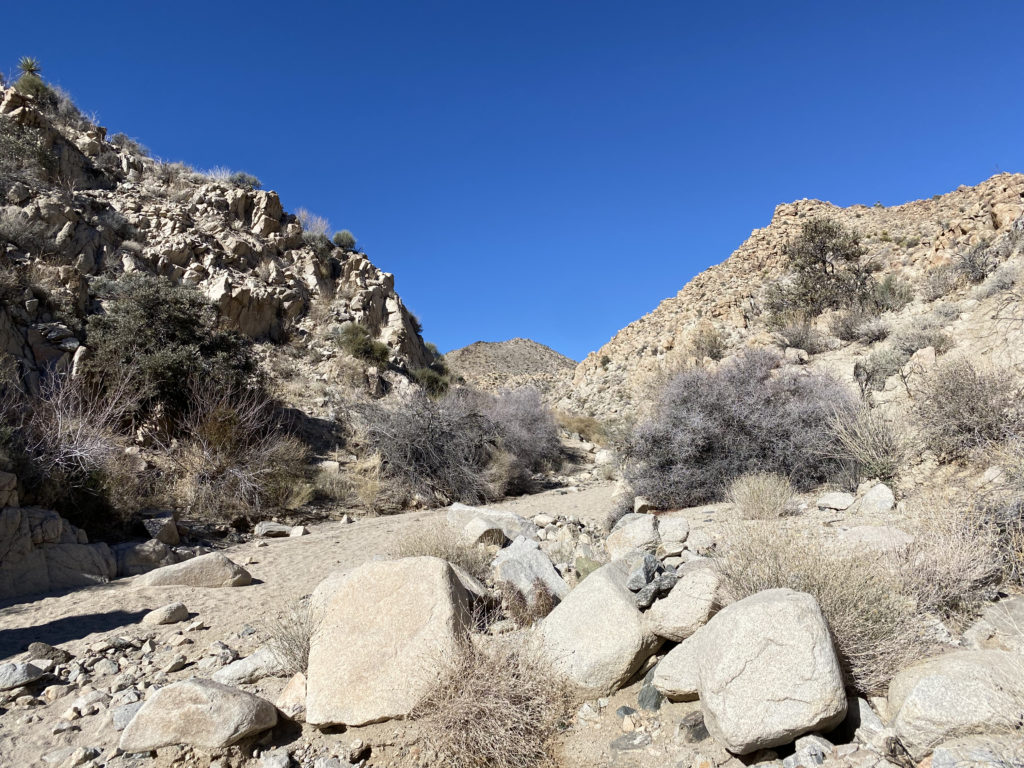
While trail markers would still guide us through the wash, there really is only one route to take. Various cacti would dot the sides of the wash and canyon walls, including some very beautiful and colorful barrel cacti. We still had some shade, so the temperatures were pleasant as we worked through the wash and the narrow slots. I kept an eye on our track for the turn-off to climb Mount Mel. I wasn’t certain if I was going to do it as the poor sleep had not left me overly eager to scramble up the rocky slopes to this summit. Once at the turn-off, I looked at it and decided to skip it. It is close enough to the other trailhead that returning another time was not going to be an issue.
Finally, the trail left the wash, then hugged the side of the hill before exiting into the wide flat desert. From here we had a long gradual downhill hike back to the car. This trailhead only holds about 6-7 cars, and there were a few open spots. There are no facilities, but both the ranger station and Indian Cove campground do. We changed our shirts and shoes and headed back to go get my car. Along the way, we grabbed lunch at the Crossroad Cafe. They had a one-hour wait, but that gave us time to go into the park, get my car and be back in time. After lunch, Ted and I said our goodbyes until our next adventure.
Day 1: 3.93 miles, 1:35 with maybe 200 or so feet of gain.
Day 2: 4.45 miles, 2:09 with 1,280 of loss.
I am an avid peak bagger, sometimes backpacker, and former sea kayaker living in San Diego. I am the co-author of Urban Trails: San Diego, available now!