Return to Bear Mountain

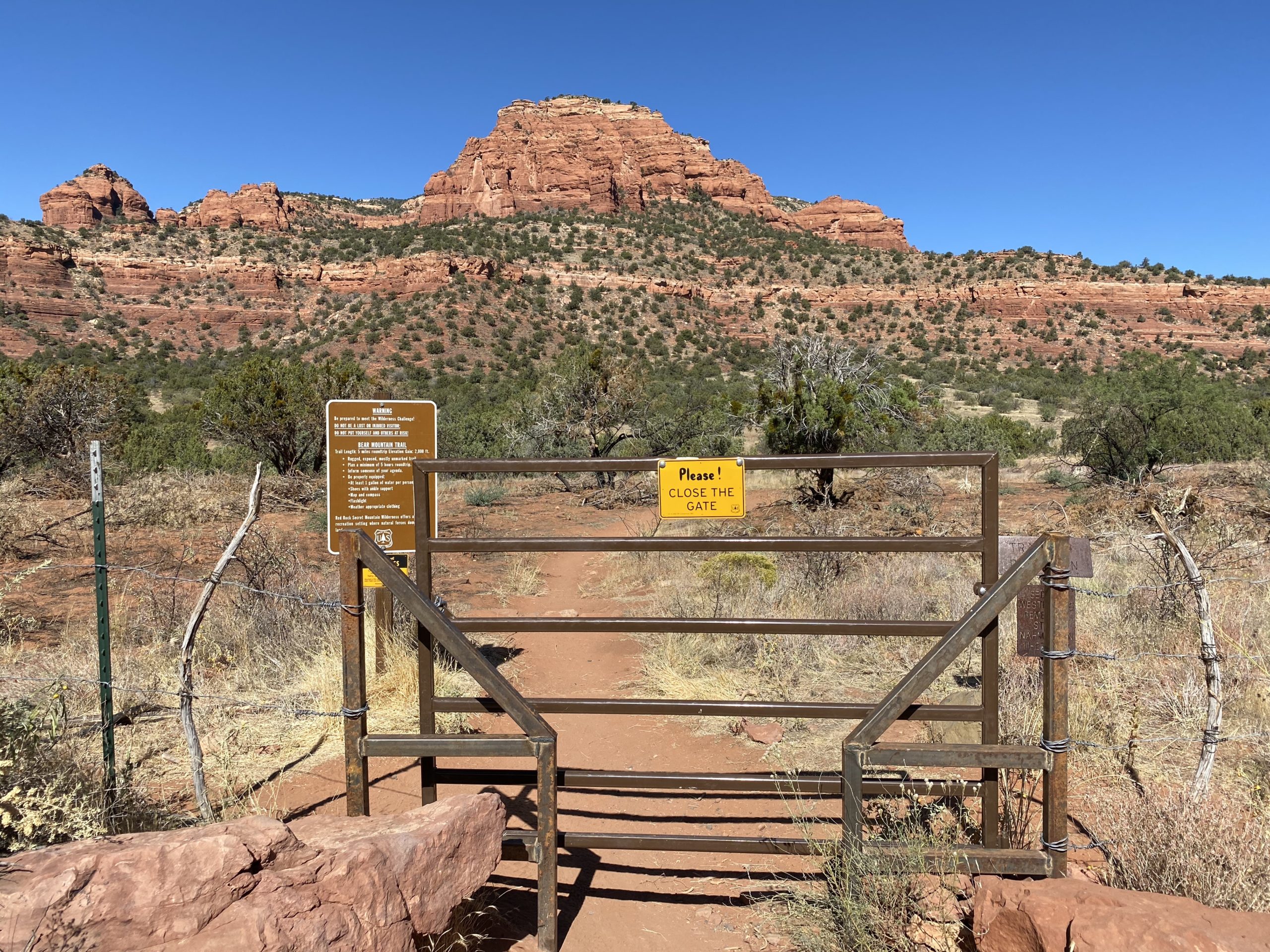
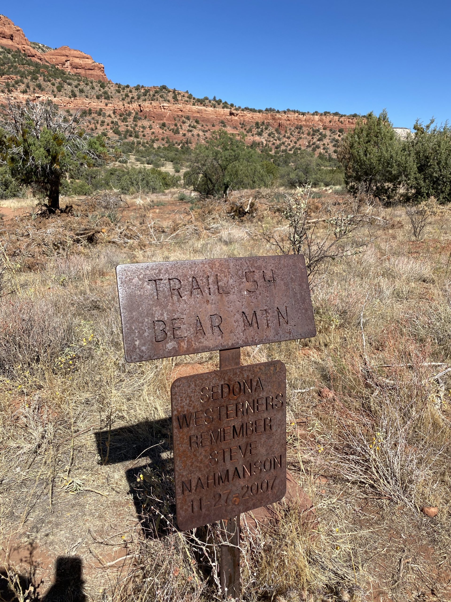
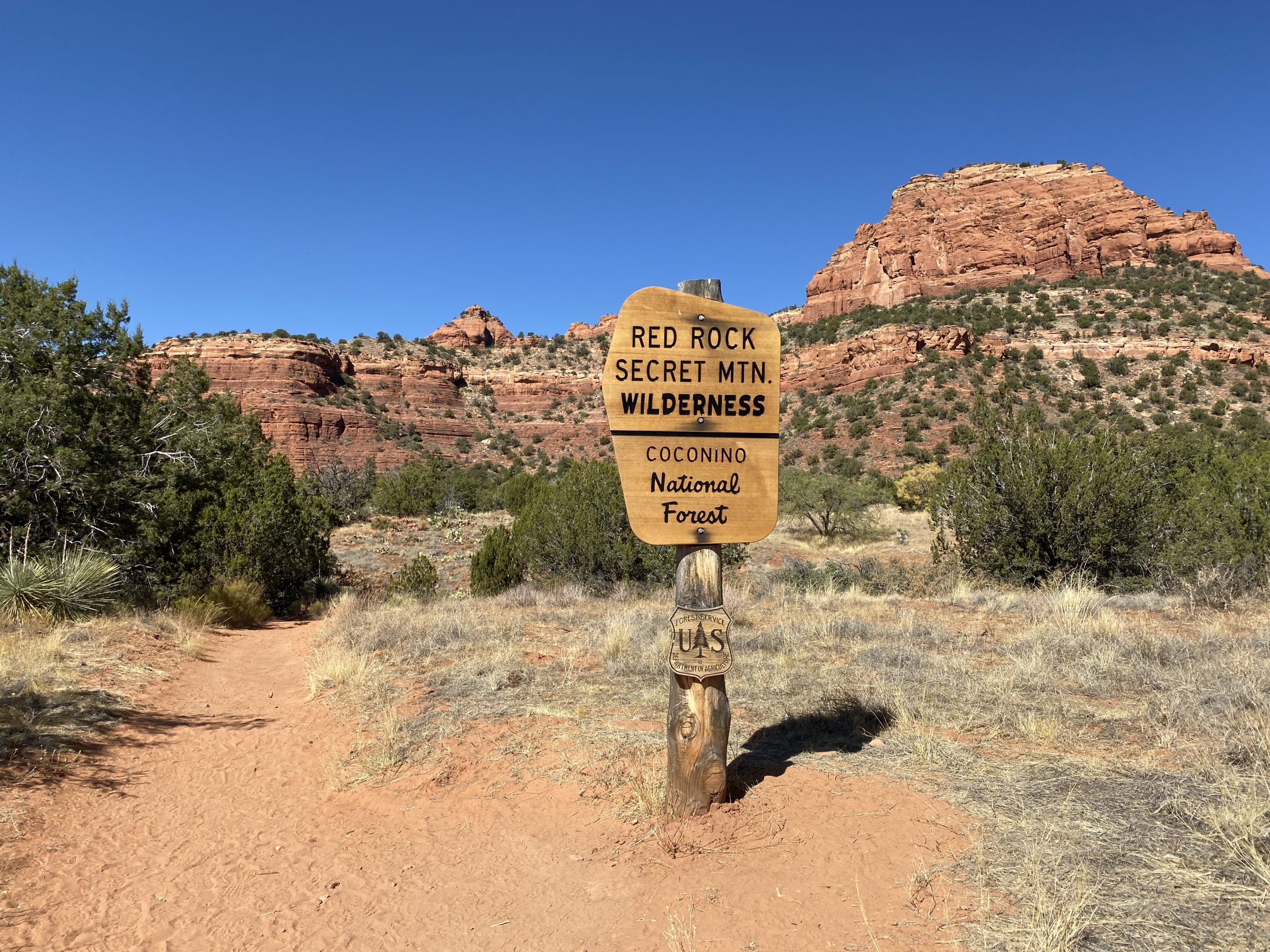
I wanted to try to complete the Arizona Summer Six Pack of Peaks Challenge before I started grad school and in case the Coconino Forest became closed (which has happened in the past). Unfortunately, I could not stay with my friends in Flagstaff, so I had to work out how I was going to string together the three remaining peaks. The plan was for me to drive to North Phoenix and stay in a hotel, then wake up very, very early to get to the trailhead for Bear Mountain in Sedona. It was still quite toasty there, so an almost sunrise start was called for. The drive over was uneventful, and I had a good night’s sleep in the hotel; however, 4 am still came way too early. I grabbed a shower, then breakfast from the nearby Waffle House, and hit the road. I had hiked this mountain about 4 years ago, so I was familiar enough with the effort and basic route. I had wanted to hike Wilson Mountain, but the length of it and the temperature did not seem to make a good pair. I pulled into the parking lot and a few cars were already there. This is a shared parking area with Doe Mountain, so I wasn’t sure who might also be attempting Bear Mountain. I grabbed my pack and headed off. The early morning sun really showcased the red rocks around me.

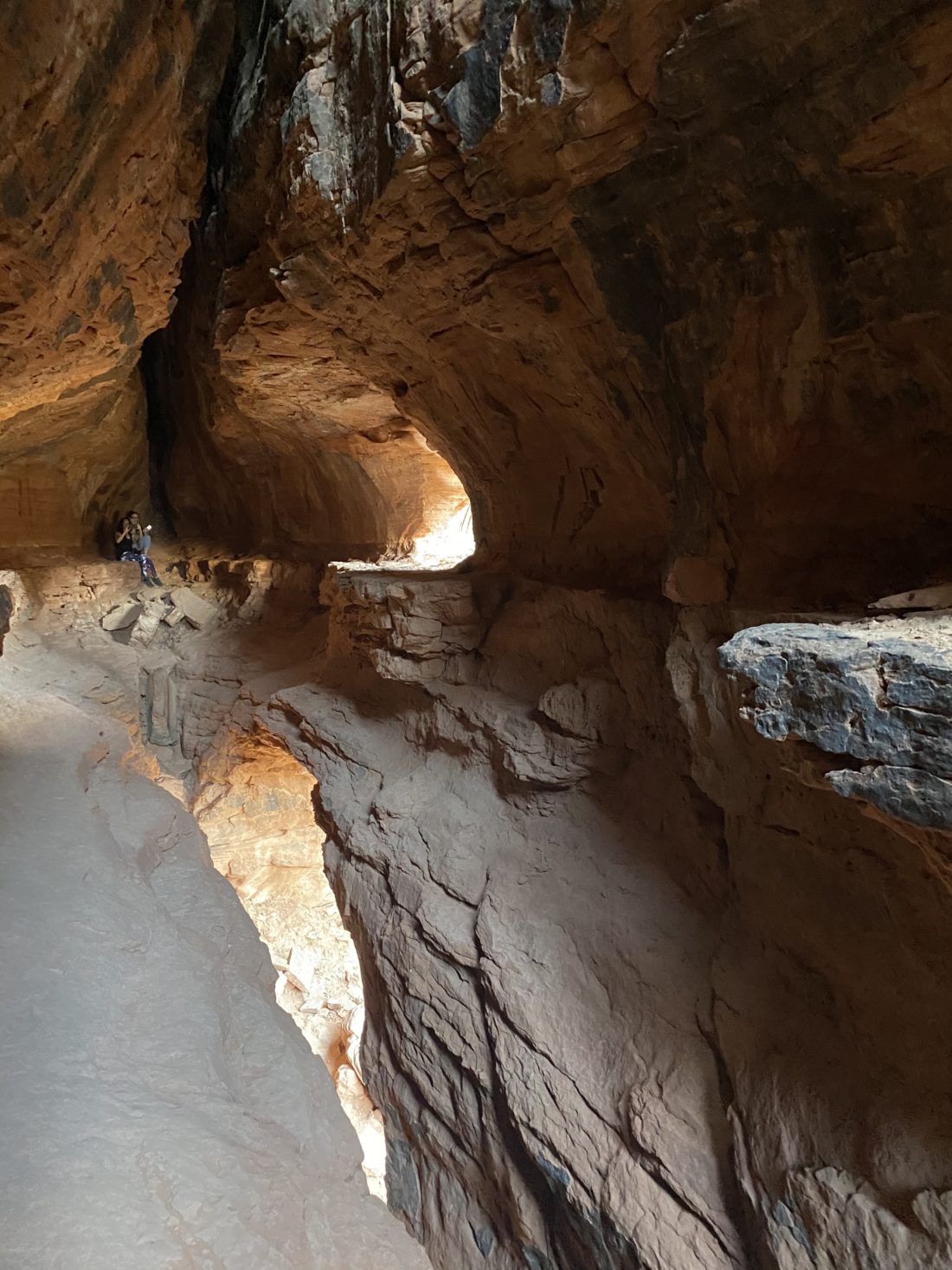
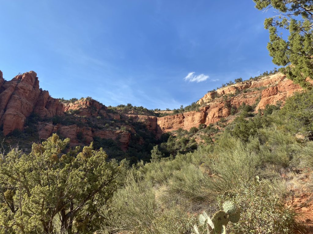
After crossing three small drainages, the trail began its first ascent. I remembered the duality of this hike, gentle sections and sections of steep, cliff-face hiking. The first of those cliff-face sections soon appeared, and I could feel the difference between the years. While sweat still dripped from my head, I felt so much stronger. White blazes guided me along the trail, as much of it is on rock, so you are rarely going to see footprints in the dirt to help guide you. I remembered the rocky nature of this trail and thoughtfully brought the rubber tips for my poles. Those certainly helped throughout the hike.

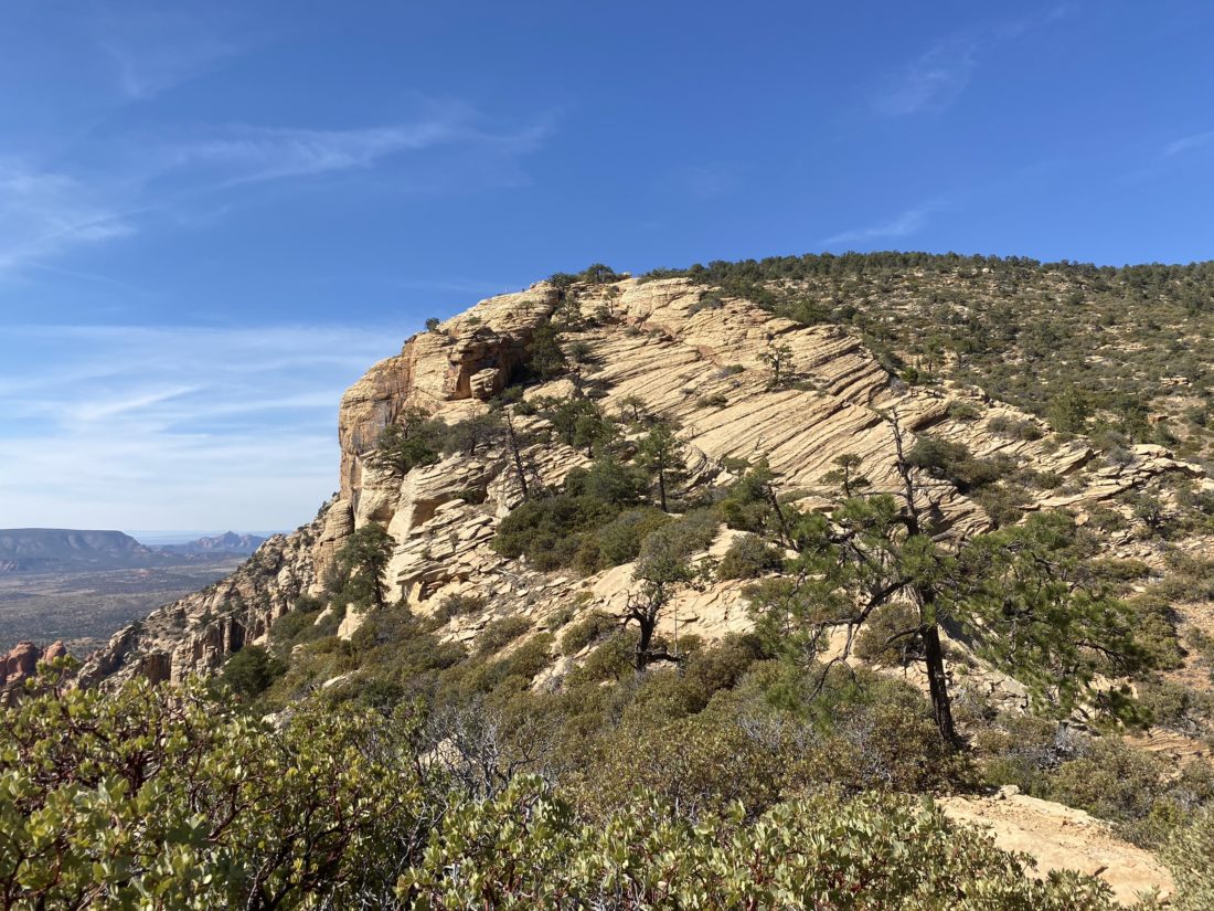
The trail eased after the first cliff face, then up the next one. Bear Mountain was finally in view, as it is hidden from the parking lot. The trail worked its way around and continued the climb. Fay Canyon to the north came into view.

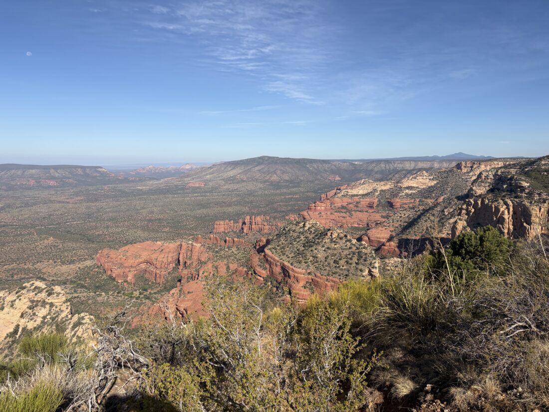
I pushed up the last section, and soon the End of Trail marker came into view. I found some shade under a nearby tree and took a break. I didn’t want to stay too long, as the day was getting hot and there was little shade on this hike. I snapped a few photos around the cairn and some panoramic shots of the views, then headed down.

It went quickly, although I did drift off the trail once or twice, but only for a couple of minutes. I had a sense I might have missed a blaze, and I was right. This is where all those trail miles pay off. Soon, I was starting to see the parking area, and I knew my hike would soon be complete. I logged the hike at 4.69 miles with 2,057 feet of gain in 3:06. On the way out of town, I grabbed a cold soda from McDonald’s and headed off to my next Arizona Adventure.


Buy Me a Coffee at ko-fi.com

I am an avid peak bagger, sometimes backpacker, and former sea kayaker living in San Diego. In 2019, I became the third person to complete the San Diego 100 Peak Challenge. Not stopping with that accomplishment, I set my sights on the harder San Diego Sierra Club 100 Peak list, which I completed in 2021. In addition, I have conquered several Six-Pack of Peaks challenges (SoCal, San Diego, Central Coast, and both the Arizona-Winter and Arizona-Summer). Beyond attempting the San Diego Sierra Club 100 Peak list a second time, I am looking forward to exploring new summits and new adventures across the southwest. 

Soldier Pass

I opted to skip hiking to Devil’s Bridge and went instead up Soldier Pass. Since the lot doesn’t open until 8, I parked about a mile away at the Sedona Dog Park and road walked it in. The air was cooler today, and some clouds dotted the sky. I quickly started making my way up the trail. The views were some of the best of the trip. The light on the rocks made for some great photos, and I felt like I was grabbing my camera every 20 yards.

The first point of interest was Devil’s Kitchen. This is a 150-foot wide sinkhole, and it was quite impressive. A bit after that, I reached the Seven Sacred Pools. A few had some stagnant water in them, and I’m guessing it must the something to see them flowing. But the star attraction was the cave just off the main trail near Brins Mesa. 

Just as I reached the turn-off for the climb up to it, I encountered my first set of hikers, also headed to the same spot. They had parked just outside the gate. Having almost two miles of solitude was lovely. As we drew closer, I could hear voices echoing from within the cave. Once at the cave, three other ladies were there. They had come via the Jordan Trail. With a bit of effort, we made it into the cave. I marveled at the size of this wonder and its importance to the Native Americans.

I scrambled back down, as I did have an 11am check-out time and wanted to grab a shower before hitting the road back to Tempe. The trail was now filling up with people making their way up. I offered guidance to several folks on where to make the turn. A good sized crowd milled around the Seven Sacred Pools, as it is a stop on some of the Jeep tours. That early morning start was so worth it.

As I walked passed the now full lot, my curiosity had me glance over at the car those two ladies had parked. Yup, a citation was tucked under their wiper blade. That was going to be one expensive hike. I began walking back to my car, watching an almost steady stream of cars head to the trailhead, only to be disappointed. A local drove by and asked if I wanted a quick lift back to the dog park. I pulled up my mask and hopped in. He said he often shuttles folks between the park and the trailhead since there is almost no shoulder. He pointed out that the Sunrise Trail helps some, and I mentioned I used it coming up. I thanked him for the assistance. I knew my tracking was going to be funky with that last mile, only to discover I forgot to turn it back on when I left the cave. Oh well.


Buy Me a Coffee at ko-fi.com

I am an avid peak bagger, sometimes backpacker, and former sea kayaker living in San Diego. In 2019, I became the third person to complete the San Diego 100 Peak Challenge. Not stopping with that accomplishment, I set my sights on the harder San Diego Sierra Club 100 Peak list, which I completed in 2021. In addition, I have conquered several Six-Pack of Peaks challenges (SoCal, San Diego, Central Coast, and both the Arizona-Winter and Arizona-Summer). Beyond attempting the San Diego Sierra Club 100 Peak list a second time, I am looking forward to exploring new summits and new adventures across the southwest. 

Bear Mountain

After dropping my son off to spend his one-year dating anniversary with his girlfriend in Tempe, I opted to head up to Sedona for some hiking over the weekend. I had planned to try to hike out to Devil’s Bridge and then maybe try Doe Mountain afterward. But as I drove up to the trailhead, the parking situation looked worse than Mt. Woodson on the weekend. So, I decided to pivot to one of my alternate hikes. Boynton Canyon trailhead was nearby, so I decided to see if I could find reasonable parking there. Sadly, the lot was full and the roadside parking was also packed.

Instead, I opted to hike Bear Mountain, one of the peaks on the Arizona Summer Six Pack of Peaks Challenge. Figuring since this was a harder hike than the other two, it would be less crowded. As I pulled up to the trailhead, I saw that the small lot was full, and about 8 or so cars lined the roadside. Since this is also the same parking spot for Doe Mountain, I figured I would probably be ok with the amount of trail traffic.

I grabbed my gear and crossed the road to the trailhead. The trail starts off crossing a short, flat section before beginning its first climb. I knew from the research I had done, that I was in for a short but steep hike. The trail was fairly easy to follow and whenever there was some uncertainty, painted white markers pointed the direction.

After a steeper section, I found myself on a plateau. It was here I finally got to see the actual summit. Looking back, I was rewarded with some sweeping views.

The trail continued climbing, but at a much gentler grade for a bit. In fact, there were a couple of small descents just to keep me on my toes. Off to my right, was Fay Canyon. I had hiked this several years ago with my twins during a Thanksgiving vacation. I am pretty sure I could spot the rock arch in the cliff.  I took a short rest on a log at the saddle before the final steep push to the summit. Thus far, I think I saw about 10-15 hikers on the entire trail. With my break over, I began making my way up to the summit.

After about a quarter mile of climbing, I reached the end of the trail. I enjoyed another break, as well as the views. A rock pile served as the summit marker. I could see Bear Mountain – Middle Peak off to the northwest, but I did not feel the need to add another two miles to this hike. 

Looking back up

The hike back down was mostly uneventful. One bonus was that the vistas were easier to see hiking in this direction. Even though it was now mid-afternoon, I did encounter some folks heading up. I gave them some information about what lay ahead, suggesting possible turnaround points. Soon I found myself back off the mountain and making my way across to my car. The parking lot and roadside had thinned out. If I did not have plans to meet a college friend for dinner, I might have done Doe Mountain as well. All told this hike was 4.5 miles roundtrip with about 2,000 feet of elevation gain. 


Buy Me a Coffee at ko-fi.com

I am an avid peak bagger, sometimes backpacker, and former sea kayaker living in San Diego. In 2019, I became the third person to complete the San Diego 100 Peak Challenge. Not stopping with that accomplishment, I set my sights on the harder San Diego Sierra Club 100 Peak list, which I completed in 2021. In addition, I have conquered several Six-Pack of Peaks challenges (SoCal, San Diego, Central Coast, and both the Arizona-Winter and Arizona-Summer). Beyond attempting the San Diego Sierra Club 100 Peak list a second time, I am looking forward to exploring new summits and new adventures across the southwest. 

Boynton Canyon

I had hoped to get to the trailhead for Devil’s Bridge before the crowds were too bad, but even with my early arrival, I could not find a parking spot. Plus, given this was still during the pandemic (and before the vaccine) I did not want to deal with it. Instead I headed further down the road to another great hike, Boynton Canyon. I found a parking spot at the the trailhead and grabbed my gear. If the lot was full, there are some overflow spots down the road.

The trail first passes by the Enchantment Resort before leaving civilization behind. You will also see a trail off to your right. This is the Boynton Vista Trail and after a short climb will offer some nice views. It is also said that this is the location of one of the energy vortexes in the region. 

Once you are past the resort, the trail will continue northward and into the canyon proper. As you enter the canyon, the canyon wall will become closer and the trees more numerous. While I was here in October, I am sure this shade would be very welcomed during the hotter months. The trail will then turn westward. About 2 miles in is the turn-off to the Subway Cave. I did not do this side trip, in part I was not planning to do it so I did not have any information on the side route.

Staying on the Boynton Canyon Trail, I passed through the beautiful forest filled with ponderosa pine trees, and then oaks and maple trees. The trail does start to get a bit rockier and steeper as it nears the end of the trail. There is a nice wide plateau to relax and enjoy a snack, and of course soak in the view. Then simply retrace your route back to the trailhead.


Buy Me a Coffee at ko-fi.com

I am an avid peak bagger, sometimes backpacker, and former sea kayaker living in San Diego. In 2019, I became the third person to complete the San Diego 100 Peak Challenge. Not stopping with that accomplishment, I set my sights on the harder San Diego Sierra Club 100 Peak list, which I completed in 2021. In addition, I have conquered several Six-Pack of Peaks challenges (SoCal, San Diego, Central Coast, and both the Arizona-Winter and Arizona-Summer). Beyond attempting the San Diego Sierra Club 100 Peak list a second time, I am looking forward to exploring new summits and new adventures across the southwest. 

Fay Canyon

Looking for a milder hike in the Sedona region since my daughter had her arm in the cast, and Fay Canyon seemed like a great option. It is very similar to the Boynton Canyon hike, but shorter. We found a parking spot along Boynton Pass Road. Crossing the road, we entered the Red Rock Secret Mountain Wilderness and began our hike.

The trail passes into the canyon, and the cottonwood trees provide some shade, but it was a pleasant autumn day so it was not needed. After about 0.6 miles, we found the spur trail that would take us up to the arch and ruins. From the canyon floor it is very hard to see it. The trail was a bit steep, but armed with trekking poles we made the climb with no issues.

After exploring the area, we made our careful descent back to the main trail. We headed further into the canyon for a bit before retracing our route to the car.