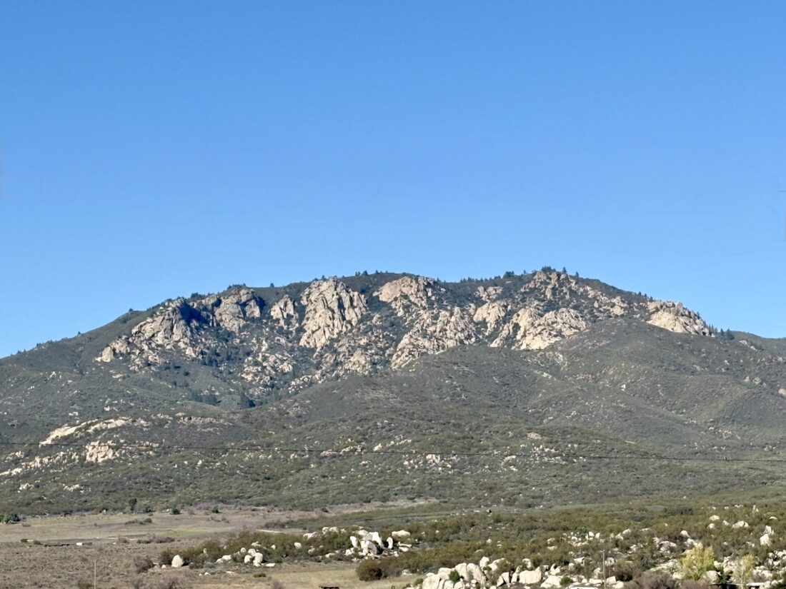
Located on the retreat’s property stands Mount R. During a break, I walked up the steep paved road to the small saddle between the south peak and the main peak. I first followed the road to explore the south peak, knowing it would offer the best views. From there, I returned to the saddle and climbed toward the main peak. Thankfully, the discharge pond at the saddle did not smell. I passed a couple of water tanks before reaching the true summit of Mount R. A sign with a tent-like icon, along with a directional arrow on it, was at the saddle and here as well. Once I was done exploring the summit a bit, I followed it up to the north peak, wondering if I might find a small campsite.
At the north peak, more towers stood, but there were no additional signs for a campsite. I wandered north a bit more to see if I could spot something, but nothing looked like a campsite. I pulled up a trip report from Mike Sullivan, who mentioned both a plaque and a reference mark. In reading the report a bit closer, he said they were back at the south peak, so I made my way back over. I did find a cement marker for R. Menachem Hecht Trail, and since I did not see any reference mark on the boulders I scrambled upon earlier, I decided to follow the trail that led southward off the mountain toward some other boulders. Atop one of them was a reference mark pointing off to the southwest. It was marked just as Mount R.M. 2. Might have to dig a bit deeper on this. I returned back down to the lodge, to discover two friends were just about to hike up there themselves, so I happily guided them back up to the peaks, showing the plaque, the various mountains off in the distance, and a little plant knowledge along the way.
After checking in again upon returning from Keller Peak and being told that the setup was almost done, I set off for my final summit, Slide Mountain. I left the car parked where it was. This mountain is the top of Snow Valley Ski Resort; the chair lifts were silent due to the lack of snow. I followed the firebreak over a small hill, then joined a sandy service road toward the summit. This certainly did not feel like a hike in the mountains at the end of January.
Bring the Outdoors to Your Inbox
Sign up for our email and stay up to date on my adventures.
I passed under the chair lifts and onto the actual summit, with some granite boulders just to the south. Since the views were similar to Keller Peak’s, I did not stay long. I didn’t even bother looking for a register. I retraced my route, although I skipped the service road and took another fire break down off the mountain. This jaunt was 1.4 miles, took me 37 minutes, and had 264 feet of gain. It was nice to be able to cross three more peaks off the Hundred Peak Section list. I am now 2/3 of the way there!
I am an avid peak bagger, sometimes backpacker, and former sea kayaker living in San Diego. I am the co-author of Urban Trails: San Diego, coming in Spring 2026!
Originally, I wanted to hike Keller Peak and Slide Mountain before the retreat started, but according to the Forest Service website, the road was closed for the season. I decided to continue driving up Keller Peak Road after hiking Mill Peak to see what the real status was. It turned out the gate was open, so I drove up the well-paved road toward Keller Peak. Along the way, I passed some Yellow Post sites, and a few were occupied. As I neared the summit, I reached a closed gate and found a place nearby to park off the road. A service truck was actually just exiting as I started my road walk to the summit. I had to be mindful of the time, as I needed to be back at the retreat center by 4 pm.
Bring the Outdoors to Your Inbox
Sign up for our email and stay up to date on my adventures.
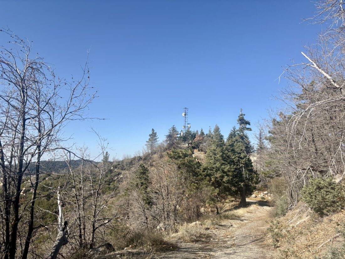
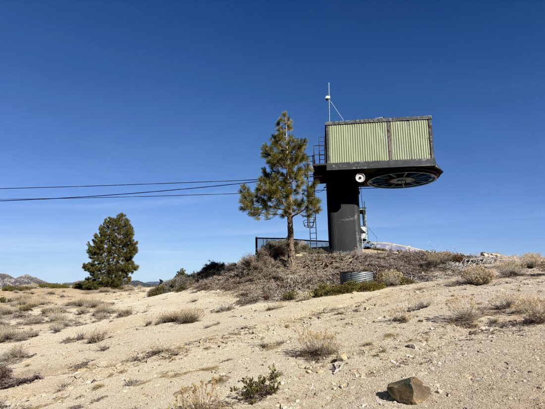
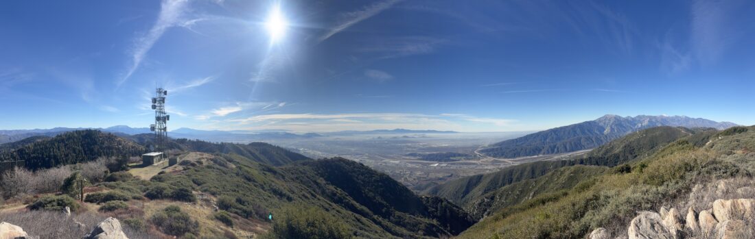
The road was uneventful; signs of the Line Fire were all around. That fire had overrun the summit, burning the fire lookout tower. Its metal frame still stands, as do the nearby communication towers. The road loops around the summit before actually reaching it. I walked around it, enjoying the view. I could see the retreat center and Mill Peak to the west, and Slide Mountain to my east. There was a posted notice about actually going to the base of the tower, which I respected. I checked my watch and hustled back down to the car. I covered the 2.4 miles in 44 minutes and had 273 feet of gain. I hope the tower is rebuilt, but with current budgets, I find it unlikely.
I am an avid peak bagger, sometimes backpacker, and former sea kayaker living in San Diego. I am the co-author of Urban Trails: San Diego, coming in Spring 2026!
With my wife needing to be at the location early for the retreat we were attending, I had the chance to spend some time hiking. Just to the east of the camp where the retreat was being held was Mill Peak. There weren’t any direct trails from the camp, so I drove over to the trailhead along Keller Peak road. I grabbed my gear and set off along the Exploration Trail. If I had time, I could follow this trail all the way to Keller Peak.
I cruised along the trail, crossing over a not-so-dry Dry Creek. The day felt like a perfect autumn day, rather than the end of January. I eventually left the Exploration Trail and began the final push to the summit. OnX showed two trails from this junction that later rejoined. I chose the one that followed the ravine. Now near the summit, I could see San Bernardino snow-capped off to the southeast, and Keller Peak almost directly due east.
Bring the Outdoors to Your Inbox
Sign up for our email and stay up to date on my adventures.
Some trip reports said the summit was overgrown with buckthorn, but it appears that trail crews had come through and cleared a perfect path to the granite summit. I scrambled to the top and enjoyed the views. The inland empire was spread out to the southwest. I signed the register before having my lunch.
After scrambling down from the summit, I headed back down. Instead of using the trail that followed the ravine, I opted for the other route. This route had a pretty steep section and required a little care to descend. Back at the car, I checked in with my wife to see if I was needed, and was told that everything was under control. The hike was 3.4 miles long, and I spent 1:33 on the trail, including lunch. The hike had a nice 702 feet of gain, but with the summit at 6,657 feet, you will feel it some.
I am an avid peak bagger, sometimes backpacker, and former sea kayaker living in San Diego. I am the co-author of Urban Trails: San Diego, coming in Spring 2026!
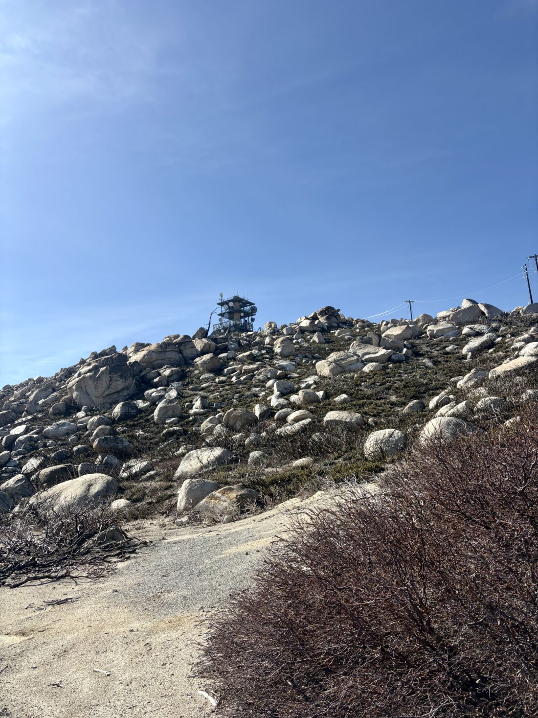
Today’s adventure was going to be a collection of HPS peaks near Silverwood Lake. I set off pre-dawn toward the 138 near the Cajon Pass. I had never gone east on this highway; my usual route is west toward the Baden-Powell trailhead. I soon turned off the highway and onto the forest road that would snake around the mountains and 4 of the HPS peaks. Initially, I was behind two trucks making their way up the dirt road ahead of me. One was pulling a trailer, so it was slow going, but before too long, they turned onto a private road, and I continued on the forest road. The first peak of the day was Cajon Mountain. I parked at the junction with the closed gate, grabbed my gear, and set off. Most of this hike would be on the closed road, with just a touch of off-trail fun at the actual summit. I had views of Mt. Baldy and Cucamonga from time to time. Their snow-capped summits shone in the morning sun. At the junction with the use trail to the summit, I opted to go to Cajon Lookout first, just a very short distance further. Here I had more views of the pass, and from time to time, the distant sound of a train whistle. Since I had a long day ahead of me, I returned to the junction and began working my way to the summit. There was both a register and a benchmark here. After signing in, I snapped a few photos and retraced my route. One peak down, four to go.
Cajon Mountain & Lookout
Sugarpine Mountain
Back at the car, I set off to my next summit, Sugerpine Mountain. I knew this was going to be a simple walk-up. I parked off the road, gathered my gear, and hiked up to this summit. Here, I only found the register tucked next to some rocks. While this was another road walk, the road was something beyond what my Outback could handle. Back at the car, it was time to drive to Bailey Peak, a short distance away.
Bailey Peak & Benchmark
The road became a bit rougher, but the Outback still had no problem. I again parked off to the side at a junction and set off for Bailey Benchmark first. There were two communications facilities, and the benchmark was atop a rock between them. A large wall structure was also there, of which I have no clue about its purpose. On the way back, I took a use trail to the summit of Bailey Peak. Sadly, I did not locate anything on the actual summit. Returning to the car, it was off to the last peak along this road, Monument Peak.
Monument Peak
This road did have one tricky section that I had to deal with, a sizable rut to straddle. I conquered it with relative ease. I walked up the road and found an actual monument erected here. It said,
THE MOHAVE INDIAN TRAIL: TRAVELED BY FR. FRANCISCO GARCES
MARCH, 1776 AND JEDEDIAH S. SMITH NOVEMBER, 1826.
I snapped a few photos and had a choice to make: which route back to the 138? I could completely retrace my route, or gamble by taking another forest road that would drop me into the community of Cedarpines Park. I figured I’d keep exploring. The road down was fine and dropped me at the western edge of the community. I weaved my way past all the cabins and eventually back onto the 138.
Cleghorn Mountain
I drove back north, parked at the Lake Vista parking area, and had my lunch. Properly fueled, I headed for my last peak of the day, Cleghorn Mountain. The road I was going to take is part of the Silverwood OHV area, so I expected to encounter some traffic. Not 5 minutes in, a group of off-roaders was parked. A Cybertruck had tried the technical shortcut and gotten stuck. I just missed the recovery. This route has a mainline road, which is not an issue; in fact, it was recently graded. But scattered along the way are side routes that are much more technical. I met a few others enjoying the road as I made my way toward Cleghorn Peak. I found a parking spot near the summit and parked. It looks like you used to be able to drive almost to the summit, but this road is fenced off, and debris is scattered across the former road. I walked up to the top and enjoyed one last summit vista.
I drove further westward until I reached a junction; one road continued west toward the 15, just before the 138. The other option went northward to the Summit OHV Staging Area, then on to the 138. I opted for the latter; in part, I wanted a cold Coke from McDonald’s. The drive was uneventful, and the staging area did have pit toilets (which I did not need, but good to know). Once at McDonald’s, the drive-thru line was pretty long, so I opted to grab a soda from the gas station next door. A small fire erupted just off the 215 but was quickly contained. The final stats for all these hikes were:
Peak
Distance
Time
Elevation
Cajon Mountain
3.25 miles
1:16
575 feet
Sugarpine Mountain
0.3 miles
12 minutes
119 feet
Bailey Benchmark
0.5 miles
16 minutes
95 feet
Bailey Peak
0.3 miles
20 minutes
144 feet
Monument Peak
0.1 miles
5 minutes
26 feet
Cleghorn Mountain
0.25 miles
11 minutes
76 feet
Offroad Driving
22 miles
–
–
I am an avid peak bagger, sometimes backpacker, and former sea kayaker living in San Diego. I am the co-author of Urban Trails: San Diego, coming in Spring 2026!
Today’s hike would be up to Suicide Rock near Idyllwild. I arrived just after the ranger station opened to pick up my permit (free), before making the short drive to the Deer Springs Trailhead. This is the same trail I used during my last ascent of San Jacinto back in October. The parking area was empty as I gathered my gear. I tucked my warmer gloves, a beanie, and my puffy into my pack, as it was a bit chilly. I was also wearing a base layer under my regular hiking pants. For my upper layers, I had my Ridge Merino sun hoodie and my fleece. I locked the car and set off up the trail. The skies were clear, and the sun felt good. After a bit, I decided to shed the fleece as I didn’t want to overheat with it on. I have found that my base layer actually does a good job of keeping me warm.
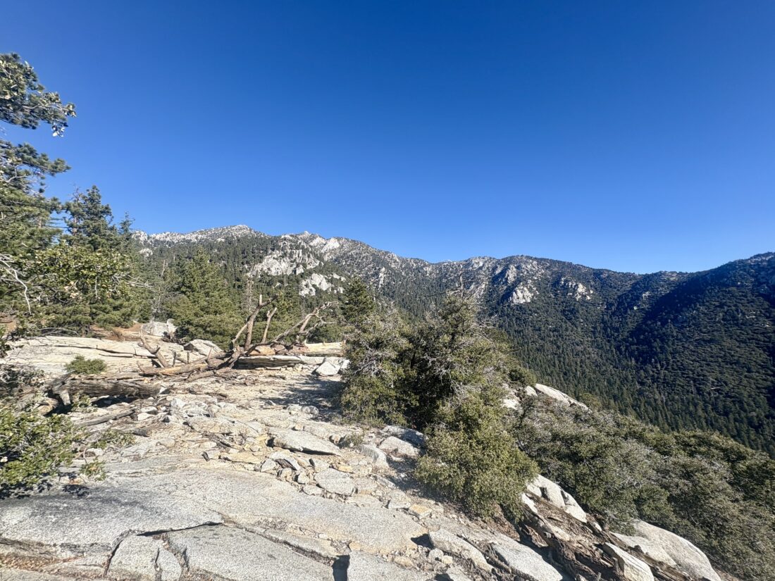
I cruised up the trail, enjoying the crunch of leaves and acorns under my boots. After about 2.5 miles in, I reached the turn-off to Suicide Rock. The trail passed by a nicely flowing Marion Creek before continuing its climb toward the “summit”. As I drew near, a few small patches of snow lay scattered about. Then I came to one of three small icy snow crossings I would make—nothing dangerous, other than maybe falling on your butt, though I still took care in traversing them. Then the granite dome came into view…Along with some dude fully naked sunbathing! What the heck! He never reacted to me passing by as I looked for a spot well away from him. I soaked in the views I came to see while avoiding the view I did not. After a snack, I set off back down the trail. He never moved the whole time.
After again crossing those icy patches, I motored down the trail, weighing my lunch options once I was down. Along the way back, I met a few other hikers working their way up. I gave them some beta on the trail and a warning about the person getting his vitamin E fix. Before too long, I was back at the car and ready for lunch. Paradise Valley Cafe won the battle for my stomach. I stopped by the ranger station to inform them of the person sunbathing and a general trail update, but they had closed for lunch. I would call them from home later. That was my #55 HPS peak, and with a little luck, I hope to get a few more in during my winter break. I logged the hike at 7.1 miles round trip in 3:14 with 1,751 feet of gain.
I am an avid peak bagger, sometimes backpacker, and former sea kayaker living in San Diego. I am the co-author of Urban Trails: San Diego, coming in Spring 2026!
After wrapping up one of my courses the day before, I decided to summit Lookout Mountain. Just a mile past the Paradise Valley Cafe, I pulled into an empty dirt parking area for the Pacific Crest Trail. I grabbed my gear, carefully crossed the highway, and started hiking south along the PCT. I cruised along the well-worn trail, and as I crested a slight rise, the faint cries of some coyotes could be heard. I continued on, checking my route to make sure I did not miss the use trail to the summit. The use trail initially followed a small gully, then left it, and began the steep climb to the summit. The route was well ducked, so I had almost no issues staying on track. From time to time, I repaired a cairn or two and added a couple that might help fellow hikers.
Soon, the summit came into view. The familiar red register can sat tucked near the benchmark, and I added my name. The summit is relatively flat, and the brush is a bit high, so the views are not the best. After a quick snack, I began retracing my route down the mountain.
Once again on the PCT, I got a message that a friend who got a permit to hike the PCT had booked her flight to San Diego! I plan to join her for a few nights on the trail when she sets off. Back at the car, a few other cars had parked. I suspect they were headed north along the PCT. Initially, I planned to have lunch at PVC, but it was too early for me, so I just headed home. That summit was my #54th HPS peak! I logged the hike as 4.0 miles in 2:14, with 927 feet of gain.
I am an avid peak bagger, sometimes backpacker, and former sea kayaker living in San Diego. I am the co-author of Urban Trails: San Diego, coming in Spring 2026!
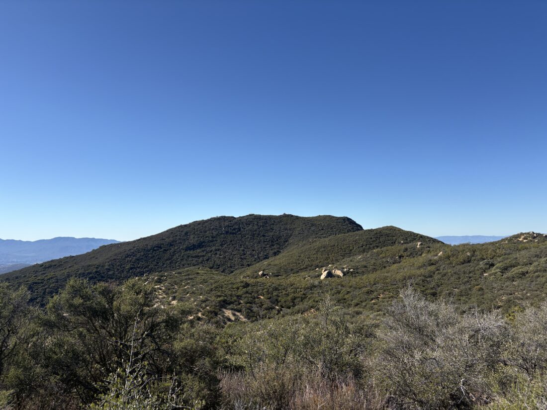
Little Cahuilla Mountain’s trailhead sits at a junction for several roads, so I made sure to park carefully. As I set off, I quickly discovered that this trail was quite different from the one I was just on. It was clearly less traveled, and I would have to take care with my navigation. The trail was a bit overgrown, but not to the point of true bushwhacking. Cairns dotted the trail from time to time, and I repaired a few along the way. My route would take me up and down several minor bumps, which gave me some lovely views as I scanned the brush for the trail to continue.
Soon, the steep final push to the summit started. I made it through the manzanita and red shanks and popped out to see the rocky summit before me. I scrambled over the rocks and sat under the shade of a lone tree. A register sat tucked in the rocks. I enjoyed a snack and the vistas. After the break, I began the slog back to the car. Once back at the car, I returned to the trail to collect a pair of jeans and an abandoned backpack. The hike up Little Cahuilla Mountain was 2.47 miles and took 2:01.
I am an avid peak bagger, sometimes backpacker, and former sea kayaker living in San Diego. I am the co-author of Urban Trails: San Diego, coming in Spring 2026!
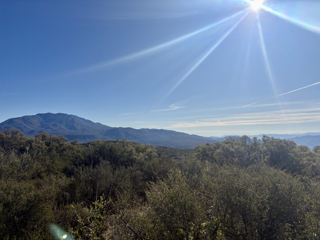
Today’s adventure was to summit a pair of peaks near Anza, Cahuilla Mountain, and Little Cahuilla Mountain. As I drove Forest Road 6S22 to the first trailhead, I was glad to be in my Outback; while not technical, the road was rougher than the one up to nearby Thomas Mountain a few days ago. I found the wide turnout and gathered my gear. These two hikes would be a perfect way to burn off some of the excellent Thanksgiving meal I had the day before. The trail was in great shape, and I found myself cruising along. As it wound its way up the mountain, I would have views of Thomas Mountain to my east and both San Gorgonio and San Jacinto to my north. After a while, the chaparral faded, and oaks and pines began to appear. The oaks had started to change color, so the contrast between their leaves and the pines made for a fantastic fall hike.
Before too long, I was at the summit. A wooden sign is affixed to two metal poles, and an ammo box serves as the register. I took a short phone break to help my wife find an old photo of my son sitting on my father’s lap aboard the train in Old Poway Park. With that task done, it was time to head back down. Views off to the west now appeared from time to time, as the crunch of leaves sounded under my boots.
The trail is in excellent condition, so I flew back down to the car. I tossed my gear in and set off to make the short drive to the trailhead for Little Cahuilla Mountain. The entire hike was 6.0 miles and took me 2:36.
I am an avid peak bagger, sometimes backpacker, and former sea kayaker living in San Diego. I am the co-author of Urban Trails: San Diego, coming in Spring 2026!
The drive up to Tool Box Springs Campground was uneventful, but I would not recommend opening a carbonated beverage for a bit upon arrival. There was one other camper here, and I found a relatively level spot to call camp for the night. There were still fire restrictions in place, so no campfire to pass the time. I brought up some BBQ from The Rib Shack in Fallbrook for dinner, which I ate under the fading light. I crawled into the car and watched one of my lectures for my Business of ORE course. Once it was truly dark, I spent some time photographing the night sky.
The night was not terribly cold; the low was just about 44°F. I awoke to the sun shining into my back window and then quickly made a cup of coffee and ate some oatmeal. The goal today was to climb Thomas Mountain and then on over to Little Thomas Mountain. The trailhead was directly next to the campground, so once I had broken down my sleeping kit, I set off. The trail used to be an old road that had long since been closed. I cruised along, rewarded with some great views from time to time. I would periodically check my progress, and before long, the summit came into view. A lone communications tower stands there, as well as the remains of a fire lookout tower.
This is also one of the yellow post campsites on Thomas Mountain, and I could have spent the night here instead. After a few photos, I headed north to another yellow post site, then down a use trail that followed the ridgeline. That trail connected with the main road, which I continued to follow northward toward Little Thomas Mountain. While this summit is not an official yellow post site, one certainly could also camp here. The day had warmed, so I shed my fleece and began my return.
Instead of completely retracing my route, I opted to take the road back to the campground. That would give me a chance to see some of the other yellow post sites. Snow-capped San Jacinto loomed to the north, and San Gorgonio would appear behind it from time to time. Sites 6-8 were empty, but each looked great for an overnight. The only advantage of staying at Tool Box Springs Campground is that there is a pit toilet. At site 8, a rope swing hung from a limb, and I had to stop and enjoy some time on it.
Before too long, the campground came back into view. A faint smell of a campfire filled the air. That other camper had a prohibited fire the night before and another in the morning as I left, and they had since departed the site. After stowing my pack, I walked over to the site to find a still glowing log in the fire ring. I returned with 2 gallons of water and drenched the embers out properly. The drive down the mountain and eventually home went quickly, even on the day before Thanksgiving. The loop covered 5.99 miles in 2:21 with 1,108 feet of gain. This also crossed another peak of the Hundred Peak Section list for me, with just 49 to go.
I am an avid peak bagger, sometimes backpacker, and former sea kayaker living in San Diego. I am the co-author of Urban Trails: San Diego, coming in Spring 2026!