Miscaluation in the Agua Tibia Wilderness…

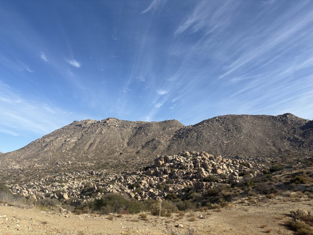
With a nice weather forecast, I decided to tackle both Agua Tibia and Eagle Crag. I have hiked them before, Agua Tibia from Dripping Springs Campground and Eagle Crag from Cutca Valley Trail. I pulled into the hiker parking area at Dripping Springs just before 5:30. I put on my Osprey Talon for its inaugural hike. While I liked the Osprey Hikelite, I really missed having hip pockets. It was worth a bit more pack weight for the convenience. I finished my pre-hike water and set off. It was cool under the cloudless, starry sky. My headlamp guided me through the 4/10 mile walk through the campground. I went to sign the hike log, but none was to be had. The plan was to hike up to Agua Tibia, then continue on to Crosby Saddle. Depending on how I was feeling, I would push on to Eagle Crag. This was going to be a marathon hike.

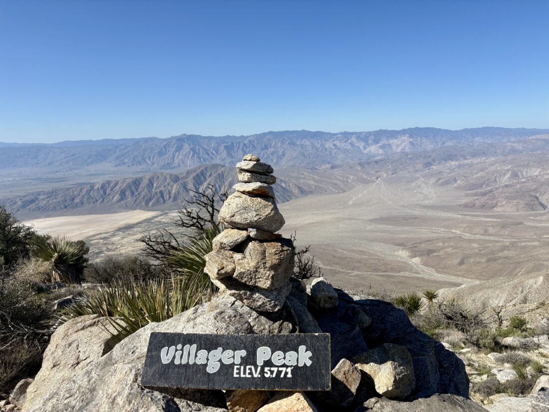
The trail was in great shape, and even with just my headlamp to guide me, I cruised along. Slowly, the predawn light began to fill the eastern sky, and the outline of San Jacinto began to take form. I pushed on, heading ever upward. I reached the log that Ted and I took our breaks on the last time I hiked this trail. I paused for a quick snack, but kept on going, as I was feeling good. I reached the junction with the Palomar-McGee trail and continued onto it. Before too long, I began looking for the cairn that marked the turn off to the summit of Agua Tibia. From there I weaved my way along the use trail until I reached the summit. Here I took a nice break in the shade and enjoyed some well-earned snacks. I found the register, the benchmark, and two reference marks. For fun, I scrambled to the top of the summit block.

With that peak now checked off, it was time to hike into the unknown. From the trip reports I had read, the quality of the trail degrades past the Agua Tibia turnoff. The question was how bad? It was 2 miles down to Crosby Saddle, so off I went. Earlier, a trail runner had passed, and since I did not see him again, I had to assume that the trail was passable in some form.

The trail was certainly being overgrown, and I had to push the overgrowth away from time to time. None of it would be at the level of bushwhacking, yet. There were quite a few downed trees across the trail as well. Many I could step up and over, a few had me crawling under, and one required a bit of climbing to pass. From time to time, I could see Eagle Crag off to my south. I reached Crosby Saddle around when I expected to. However, I was not certain I would return through those last two miles on my return. I might gamble and take the Wild Horse Peak Trail back. But now it was time to push on toward my second peak, Eagle Crag.

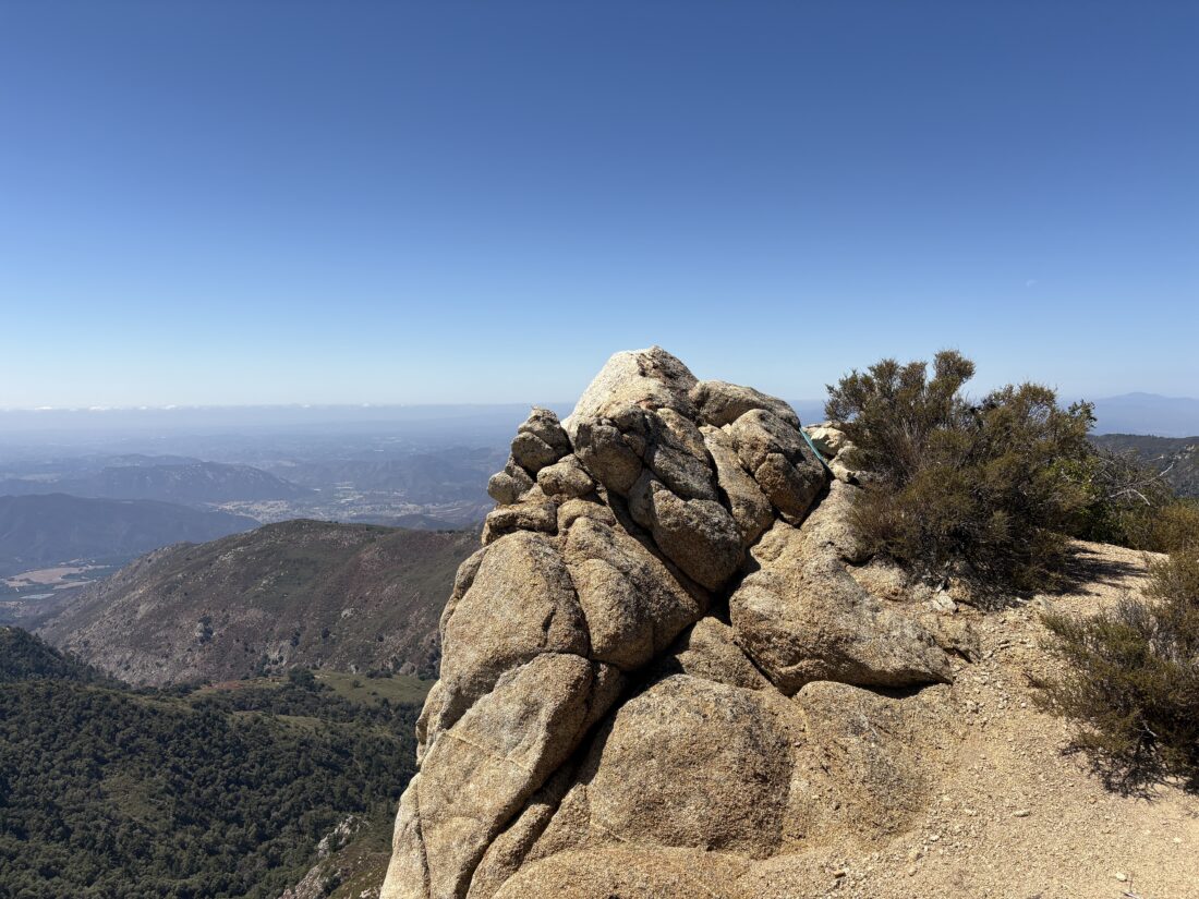
The trail was a bit more overgrown at first and also had some downed trees. A few times, I just trusted my trail guts and pushed through the manzanita. When the brush wasn’t a problem, the trail was nice and wide, which let me cruise along nicely. However, flies became enough of a nuisance that I broke out the bug net. The day had warmed up some, but it was still pleasant, and I did have a modest amount of shade as well. Soon, I was standing in front of the cairn that marks the turn for the ascent to Eagle Crag. This is an incredibly steep scramble and one I was not looking forward to making again. I carefully worked my way up, each step was carefully placed as I slowly picked my route. There were a few more cairns, but I lost them. I tried to follow my best judgment through the terrain. A branch tore my sleeve, and my wrist was also bleeding as I bushwhacked through. Finally, I made it into more navigable terrain and worked my way closer. I found the cairns again and could see the crag! I zigzagged through the low manzanita bushes until I reached it. I slipped off my pack and found some shade to rest. I ate my lunch, drank some electrolytes, and ate some more. While I had bagged my second peak, I still had to hike out. I snapped some photos. I brought my tripod to photograph myself on the crag. I didn’t frame it right, and I cut off my head. Don’t ask why I didn’t check it before leaving.

As happens so often, the trail becomes easier to see on the descent, and I avoided all that nasty brush working my way down. The trail did vanish, so I worked my way into the gully and followed back to the trail. For those using this trip report as a guide, try to use my down route for your ascent. I had 1.5 liters of water left and about 12 miles of hiking. I was a bit worried about that fact.

Once back at the saddle, I had to decide which route to take. The return via Agua Tibia was shorter, but it had that less-than-pleasant section to deal with. Going past Wild Horse Peak was longer, but it seemed to look easier on the map. I opted for Wild Horse. Why not do a full survey of all the trails?

The trail was a tad overgrown, and my bug net would get caught from time to time, but nothing too bad. My low water supply worried me, however. I called my wife and asked if my son could meet me on the trail with some water. I had about 6 miles to go and a 1/2 liter left. The trail was mostly downhill, although I did have one climb that forced me to drink a bit more. I ate a few Mike & Ike’s from time to time to keep my energy up. I finished my dried apricots and jerky as well. I miscalculated my water, but no need to bonk by not keeping fueled.

With just under two miles to the junction, I began to keep an eye out for Ben. Judging my pace, what I estimated his driving time, then his hiking time, I should be seeing him soon. I spotted him at the top of a small climb and told him to wait. He was a welcome sight. I drink about a liter and a Gatorade. The sun was getting low, so we set off. We made our way back down the trail. Ben pointed out where he had to gamble to With just under two miles to the junction, I began to keep an eye out for Ben. Judging my pace, what I estimated his driving time, then his hiking time, I should be seeing him soon. I spotted him at the top of a small climb and told him to wait. He was a welcome sight. I drink about a liter of water and a Gatorade. The sun was getting low, so we set off. We made our way back down the trail. Ben pointed out where he had to gamble to reach me. I told him to take the Dripping Springs trail toward Crosby Saddle. I forgot that the junction sign points differently. Glad he chose the right one. We reached the end of the trail and made the walk through the campground. When we reached our cars, he made sure I was truly ok.

He then headed home, as he had a big event he was overseeing the next morning. I changed my shirt and shoes and drank the cold water I had in the car. I grabbed a burger on the way home and drank a large Coke. Other than my water error, I actually felt pretty good. Tired and a bit sore, but almost 24 miles (plus 0.8 miles in the campground) with 4,700+ feet of elevation gain might do that. The next day, I measured exactly what I had left, a whopping 4 oz. For the last two miles. Did I need to call for help? Maybe, maybe not. I would have been very miserable for those last couple of miles for sure. It was wise to put my ego aside and ask for it. I am certainly going to be adding a bit more water for any future harder hikes. The final stats for this near-marathon were 23.8 miles, in 13:11 with a healthy 4,708 feet of gain.


Buy Me a Coffee at ko-fi.com

I am an avid peak bagger, sometimes backpacker, and former sea kayaker living in San Diego. I am the co-author of Urban Trails:San Diego, coming in Spring 2026!

In 2019, I became the third person to complete the San Diego 100 Peak Challenge. Not stopping with that accomplishment, I set my sights on the harder San Diego Sierra Club 100 Peak list, which I completed in 2021. In addition, I have conquered several Six-Pack of Peaks challenges (SoCal, San Diego, Central Coast, and both the Arizona-Winter and Arizona-Summer). I am looking forward to exploring new summits and new adventures across the southwest. 

Conquering San Bernardino Peak

One peak on the Six Pack of Peaks Challenge list that I have never been able to climb was San Bernardino Peak. Initially, the 2020 El Dorado Fire closed the surrounding area, and the 2024 Line Fire closed it again. Finally, the trail to the summit was open again, so I decided to finally climb it. There is a short section of driving on a forest road after passing the fire station in Angelus Oaks, which was not an issue for the Outback, but other cars might need to take care on this short section (one of the two cars at the trailhead was a Prius). Just after 6:30 am, I pulled into the dirt lot for the trailhead. As I gathered my gear, a nearby coyote was howling away. I had already gotten my free day hike permit from the San Gorgonio Wilderness Association, so I knew I was good to go.  After checking the information kiosk and remembering to hang my America the Beautiful pass from my mirror, I set off on my journey. The trail passes by a bench and a commemorative cairn that was built in 2017 as a reconstruction of the cairn that was erected for the San Bernardino Initial Point’s sesquicentennial anniversary (2002). The trail quickly leaves the trees and, for almost the rest of the hike, travels through the region burned by the El Dorado Fire. The trail has been repaired, but the scars of the fire remain. Probably, the biggest issue is the lack of shade along the trail, so an early start is highly recommended, along with sun protection and extra water. 

After about 3.5 miles and some helpful switchbacks, I reached Manzanita Flats. For about 1/2 mile, the trail was a bit more mellow, and I could cruise along for a bit. Here I met a gentleman also working his way up. We chatted a bit and discovered we both have Mt. Whitney permits and were using this hike as part of our training. I wished him luck on this ascent, as well as his attempt at Whitney.

The trail began climbing again and started to turn southward from what had been a mostly eastward direction. At about 5.8 miles, I reached Limber Pine campground and took a well-earned break. I had kicked around the idea of doing this peak as an overnight, but wanted to first do it as a day hike, so I would have a better sense of the level of effort required. But from what I have heard, the sunset views from here are outstanding! After a snack and some fluids, I set off, as I had about 2.2 miles left to go to reach the summit. About 1/3 of a mile later, I came to the Limber Pine Spring, which was still flowing nicely. I did not need water yet, but I had packed my Sawyer Filter and CNOC water bladder for later. Soon, I came across the Washington’s Monument Plaque. The protective covering made it hard to read the actual plaque, but this is what is on it:

Washington’s Monument

This plaque was set in commemoration of the sesquicentennial anniversary of the establishment of the San Bernardino Mountain Initial Point by Colonel Henry Washington, U.S. Deputy Surveyor, on November 8th, 1852.

A few hundred feet along the ridge to the south you will find the remains of Washington’s monument representing the first step in the land development of Southern California by the organized measurement and numentation of all public and private property in the region.

This plaque is dedicated in memory of Ira Alexander for his contributions to the surveying profession

Dedicated October 12, 2002

I decided to save going over to the actual Monument upon my descent. Shortly thereafter, I met the owner of the Prius on his descent. We chatted a bit, and he was proud as this was his first 10,000 summit. I congratulated him and we went our separate ways. I spotted the spur trail that would take me to the summit. Another nice thing was that I had left the fire-damaged region and had green trees around me. I made the short push to the summit!

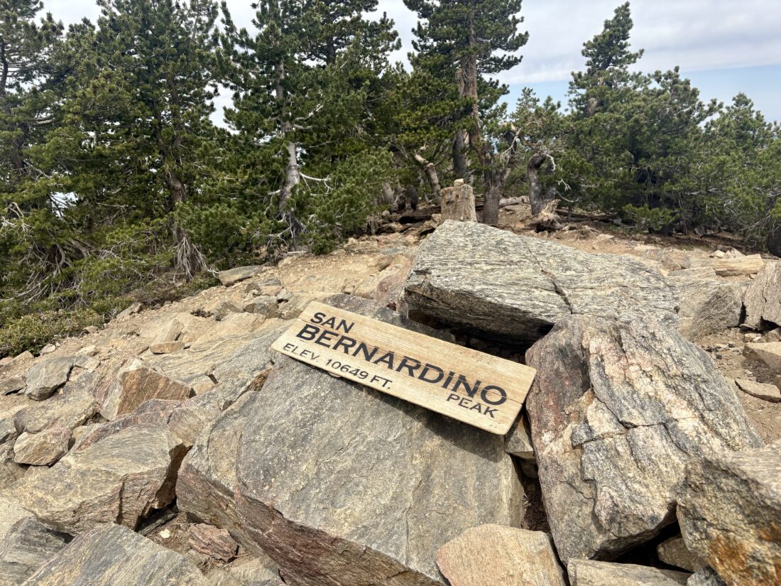
A register box sat chained to a rock, and a simple summit sign lay nearby. I took in the views of San Jacinto Peak, San Gorgonio Mountain, and Mt Baldy, before finding a nice log to rest upon and enjoy my lunch. After a nice break, it was time for the 8 miles back down to the car. 

The trail overall was in good condition, and I expected to descend at a nice pace. I remembered to take the turnoff to view Washington’s Monument. After seeing it, I continued down the Limber Pine Spring. I filled my CNOC and filtered into my new M!go Water Bottles. With fresh, cool water, I set off once again. Few clouds had formed, so their shade was welcomed, but even so, the day was not too warm, and a light breeze also kept things pleasant. The miles ticked by, and with about 3 miles to go, I took another break for some snacks and electrolytes. Roof tops of buildings in Angelus Oaks started to become visible, but I still had about 1.5 miles left to hike. Finally, I caught the glint of sunlight off my car and knew I had finished my hike up San Bernardino! The entire hike was 16.02 miles, which I covered in 7:04 (not counting time at the summit). The total elevation gain was 4,715 feet, which I felt.


Buy Me a Coffee at ko-fi.com

I am an avid peak bagger, sometimes backpacker, and former sea kayaker living in San Diego. I am the co-author of Urban Trails:San Diego, coming in Spring 2026!

In 2019, I became the third person to complete the San Diego 100 Peak Challenge. Not stopping with that accomplishment, I set my sights on the harder San Diego Sierra Club 100 Peak list, which I completed in 2021. In addition, I have conquered several Six-Pack of Peaks challenges (SoCal, San Diego, Central Coast, and both the Arizona-Winter and Arizona-Summer). I am looking forward to exploring new summits and new adventures across the southwest. 

Conquering Humphreys Peak

With Bill Williams Mountain (9,256 ft.) and Kendrick Peak (10,418 ft.) climbed earlier in the week, it was time to attempt to summit the state’s highest point, Humphreys Peak (12,633 ft.). Having taken a rest day with a quick trip to the Grand Canyon, I was ready to finally set a new altitude record for myself. Afternoon rainstorms were not predicted, so I would not have to worry about any weather issues. I pulled into Lot 1 at the Arizona Snowbowl and gathered my gear. A few cars were there when I arrived. Unlike the faster paces I held on the other peaks, I planned to keep myself to a more measured pace.

The trail cut across the ski slope before entering the trees and beginning the climb toward the summit. I made my way along the western slope of Humphreys under the shade of the trees. Unlike Kendrick, the trail had more tree roots to be mindful of. Off to the south, some snow still remained, and the now dormant chairlift was visible. The trail made a steady climb toward the Humphreys-Agassiz saddle, my first real milestone for this hike. After 4.1 miles, I reached it! I stopped for a bit and took in the vista. Humphreys used to be about 4,000-5,000 feet taller, before it explosively blew its top long ago. To my east was the bowl that was created after that eruption. A few patches of snow were scattered about, but from recent trip reports, nothing was still on the trail.

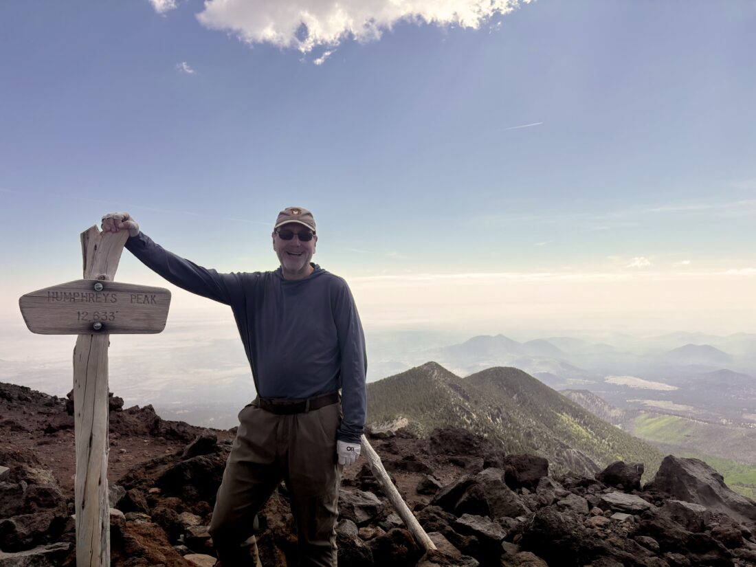
The saddle is almost at the tree line, so for the last mile to the summit, I would be hiking under the Arizona sun. The trail also changed, as I was now hiking across mostly exposed rock. Wooden branches helped serve as trail markers to the summit, which lay to the north of the saddle. As I carefully made my way along the trail, the conditions reminded me of many of my hikes in Anza-Borrego, just not at 11,000+ feet. I passed two small snow fields as I continued my journey upward. Soon, I spotted the summit sign and knew I had made it. There was another hiker there when I arrived. He was getting ready to descend, but before he did, I asked him to snap a few photos of me at the summit. I wished him well on his descent, and he said to enjoy the almost calm summit. I found a nice spot to relax and enjoy some snacks. I marveled at the views from 12,633 feet. I could make out the North Rim of the Grand Canyon (although a nearby fire did make it a bit hazy) and the red rocks around Sedona to the south. Both Bill Williams and Kendrick were easily spotted to my west.

After a bit, another hiker reached the summit. Since I was almost ready to descend, I hurried up to allow him to also enjoy the solitude. The route down to the saddle went fairly well. As I neared the saddle, I started to encounter a few more folks making the push to the summit. 

I saw that the two state high-pointers I passed during my ascent were still pushing along. I gave them a quick trail report before parting ways. The rest of the descent was uneventful, and I soon found myself crossing back across the ski slope and to my car. I know spending time in Flagstaff and doing those two other peaks helped me prepare for this ascent, but I was really happy at how well the entire hike went. After tossing my gear into the car and putting on a dry shirt, I drove back to Flagstaff and headed to Lumberyard Brewery for some well-earned food and drink. I tracked this hike at 10.2 miles in 6:07 (excluding time at the summit) and 3,369 feet of gain. 


Buy Me a Coffee at ko-fi.com

I am an avid peak bagger, sometimes backpacker, and former sea kayaker living in San Diego. I am the co-author of Urban Trails:San Diego, coming in Spring 2026!

In 2019, I became the third person to complete the San Diego 100 Peak Challenge. Not stopping with that accomplishment, I set my sights on the harder San Diego Sierra Club 100 Peak list, which I completed in 2021. In addition, I have conquered several Six-Pack of Peaks challenges (SoCal, San Diego, Central Coast, and both the Arizona-Winter and Arizona-Summer). I am looking forward to exploring new summits and new adventures across the southwest. 

Up to Vallecito Mountains High Point

With the successful summit of Kay Benchmark behind me, I headed into Borrego Springs for a burrito. After that, I drove over to Center Market and got a sandwich for dinner and then headed out for McCain Springs. This was the planned camping spot, before hiking to Vallecito Mountains High Point. I had ridden out here a few months back in my friend Dave’s Rubicon, scouting if the trail conditions could be handled by my Subaru. Overall, we felt it looked doable. So, I left the paved road and headed down Fish Creek Wash. This section gave me no worries, as I had driven it multiple times, but as I passed the spot where my son and I had car camped, the uncertainty rose. I continued on, recalling a few of the slightly touchy spots. One obstacle did take two attempts to get over, but the rest was smooth sailing. Soon, I reached the junction to McCain Spring and drove to the end. I had feared that the site might already be taken, but I had it to myself. I set up camp, in no rush as I had plenty of daylight. Enjoyed my sandwich and beer, and as I looked across the desert, it was peaceful as the sun set behind the hills. I set out to make a fire for the evening, but in chopping the wood, the axe nicked my finger. Thankfully, I had taken the “Stop the Bleed” course from Kit Fox Outfitters and handled the minor wound. With that issue addressed, I finished preparing the fire and sat back and enjoyed the flames. As the fire burned itself out, I crawled into the Subaru for some well-earned rest.

I awoke around 6:30 and enjoyed a hot cup of coffee, some oatmeal, and a cold bottle of OJ. Once I had repacked the car, I gathered my gear to set off toward the peak. As I climbed over the small saddle, I soon found the ridge that I would follow for a bit, again dodging and weaving around the cacti towards another saddle. Following the route our group used last time, I ascended a boulder-filled slope. I actually spotted a few cairns at the beginning but quickly lost them, so it was a typical “choose your own adventure” type of ascent. Once up and over, I worked my way down toward the wide flat before me and onto the drainage path.

Now the hike moved into cruise mode for a while, as I headed north toward the next section of the climb. As the drainage came to an end, I stared at the rock-filled slope, trying to scout a route up. Vallecito Mountains High Point is hidden behind a false summit, so even as I drew near to the top of this peak, I knew I was not done with my climb. I worked my way down toward the saddle, then began the real climb to the summit. Soon, I was standing atop Vallecito Mountains High Point. I signed the register and enjoyed a well-earned rest. I snapped a few photos and geared up for my descent.

Carefully, I worked down the face of the peak, occasionally having to back-track if the route became unclimbable. Slow and cautious was the order of the day. Soon, I was back on the drainage and once again cruised along. Now, I had a choice to make: follow the same route Carefully, I worked down the face of the peak, occasionally having to back-track if the route became unclimbable. Slow and cautious was the order of the day. Soon, I was back on the drainage and once again cruised along. Now, I had a choice to make: follow the same route back, which included another “fun” climb, or explore following the drainage all the way out. There were no reports of anyone trying this route on Peakbagger, but the satellite imagery made it appear doable, with just one section in the middle that might be an issue. At the spot where I would have made my U-turn to follow my ascending route, I continued on the drainage. I spotted some footprints in the sand, so someone tried this route not too long ago.

Initially, the route stayed the same as it turned westward. After a bit, I reached that rocky section that I spied from the satellite imagery. I worked my way through the rocks, usually staying along the main drainage route. Occasionally, I took a short slide down the smooth, water-worn rocks. I was glad to be descending through this section, as it was nice to have gravity on my side. After a while, the drainage opened back up, and I was once again cruising on the sand. When the drainage turned south again, I made a short climb over a small rise, then crossed the flat desert back to the road. Soon, I saw the sun glinting off my car, telling me that I was almost done. The entire loop covered 6.2 miles in 4:45 with 1,185 feet of elevation gain. As to whether the route through the drainage was better, I am not sure, but I do know that I would not use the drainage for the ascent portion.


Buy Me a Coffee at ko-fi.com

I am an avid peak bagger, sometimes backpacker, and former sea kayaker living in San Diego. I am the co-author of Urban Trails:San Diego, coming in Spring 2026!

In 2019, I became the third person to complete the San Diego 100 Peak Challenge. Not stopping with that accomplishment, I set my sights on the harder San Diego Sierra Club 100 Peak list, which I completed in 2021. In addition, I have conquered several Six-Pack of Peaks challenges (SoCal, San Diego, Central Coast, and both the Arizona-Winter and Arizona-Summer). I am looking forward to exploring new summits and new adventures across the southwest. 

Into Borrego Palm Canyon…

After a couple of hikes around the campground, I decided to set up camp for the night, which is really just inflating my Luno mattress. The winds were still blowing, making it chilly to be outside. I debated heading into town for dinner instead of attempting to cook my steak over the fire. I figured I would give it a try, and if it failed, then drive into town. It took the entire bundle of wood, but I was able to cook it! I did retreat into the car to actually eat it. Tomorrow’s hike was going to be a tough one, so crashing out early wasn’t too much of a problem.

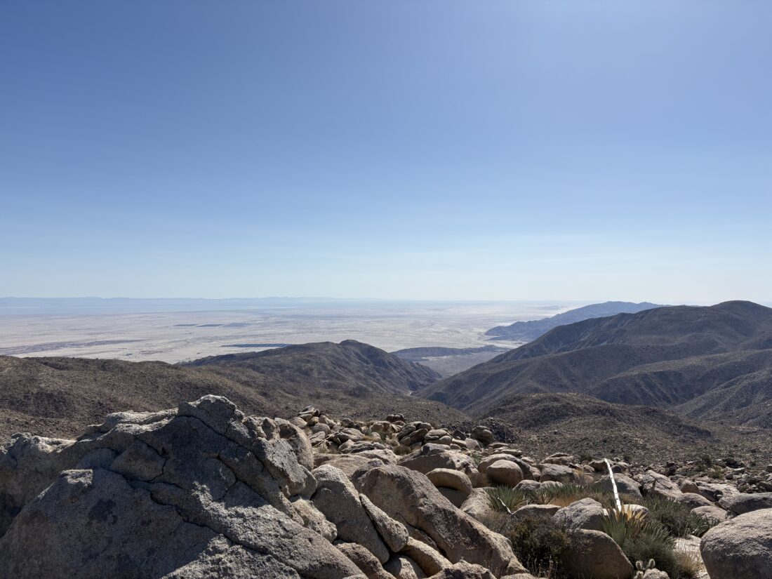
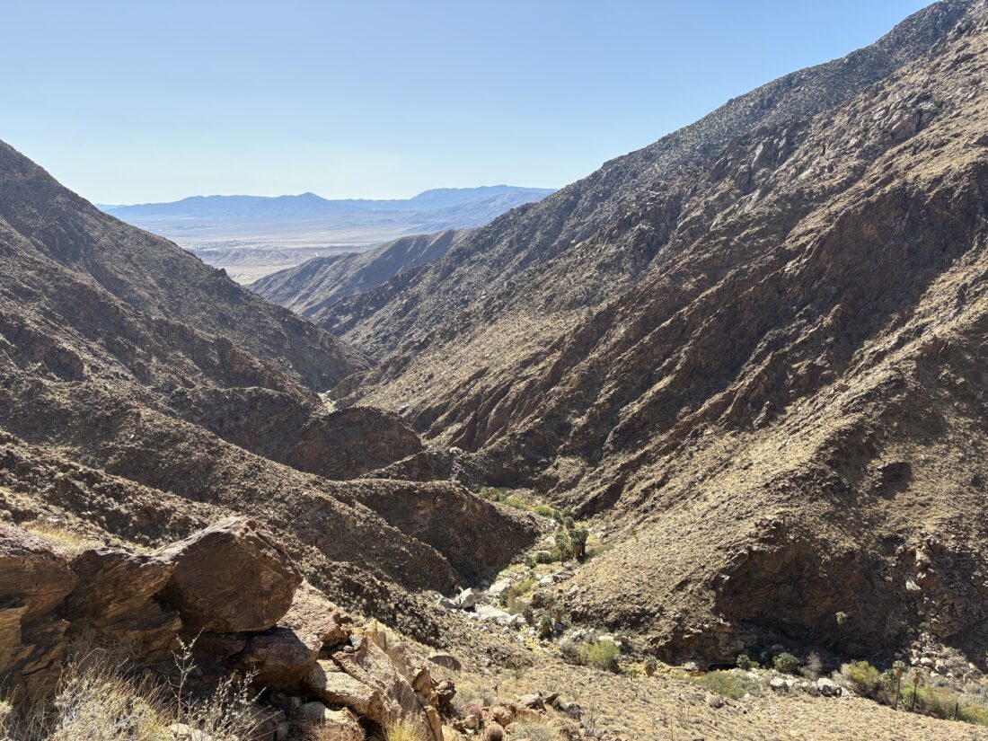
I rose just before sunrise and caught some nice photos of the sunrise and the morning glow upon the peak we aimed to climb. I packed up and drove over to the trailhead parking lot to meet Rick. We were going to follow the same route I used when I summited back in 2019: head into the canyon, exit at the third oasis, then follow the steep ridge to the summit. I had an event back in San Diego at 8 pm, so I did have a hard turn-back time. Just after 7 am, we set off. The first part of the trail led us up to the first Palm Oasis. The palms were recovering nicely from an arson fire a few years back. We found the new route around the oasis and left the maintained trail behind.

Now it would be a mix of use trails and “seat of our pants” route finding. The water was flowing nice and strong and made for a lovely hike. We crossed the stream numerous times as we pushed on. Various spots along the way were familiar from the two times I had hiked here before. 

We reached the third Palm Oasis and took a well-earned break under the shade of some large boulders. I looked at the time and had a bad feeling. I knew what still lay ahead of us. While I was feeling great, I doubted I could summit, exit, and make it back to town in time. We should have started at 6. That was my error, as I picked the start time based on my last summit. There were a couple of spots in the canyon that slowed us down just enough. We decided to climb up out of the canyon and check our time again. So up we went on the very steep slope. I felt pretty good working my way up, so that was a positive sign for me. Once on the ridge, we began picking our way up. This was going to be slow. We had about 1.2 miles to cover and a lot of elevation gain to be had. I just did not think I could make it in time and decided to turn back. Rick opted to continue, as this summit would complete the 100 Peak Challenge for him. I felt bad not being there for this. I had the pin and the flag in my pack. 

I carefully picked my way down the steep slope back to the third Palm Oasis. Had a few more snacks and mixed up some Gatorade. We had spotted an empty beer bottle there earlier, so I tossed it into my pack to carry out. Soon, I began hearing voices as I spotted a group of five hikers making their way up the canyon. We chatted briefly and were sure of their destination. I told them to keep an eye out for Rick just in case. Then, I continued down the canyon.

Somewhere past the second Palm Oasis, I tripped over my own two feet and bruised and scraped my knee. It was tender, but I could still hike without too much issue. I suspected it would be sore tomorrow (narrator: yes, it was). I did not have any navigation issues until just before the first Palm Oasis, where I got off track. After some backtracking, I found the right path and reached the “end of the trail” sign. Day hikers were scattered about, enjoying the shade and the water. I motored past them, ready to be done. Once back at the car, I left Rick a note as to when I exited. I got a text from him that afternoon; he had reached the summit, and to his amazement, there were a groups of hikers there! I wondered if they used the Henderson Canyon route. I think that is the one I might use for my next attempt. I’m glad Rick got the summit, and around 5:45 pm, I got another message that he was back at his car. That did validate my decision to turn back. Although I did not make the summit, the hike through the canyon was beautiful.


Buy Me a Coffee at ko-fi.com

I am an avid peak bagger, sometimes backpacker, and former sea kayaker living in San Diego. I am the co-author of Urban Trails:San Diego, coming in Spring 2026!

In 2019, I became the third person to complete the San Diego 100 Peak Challenge. Not stopping with that accomplishment, I set my sights on the harder San Diego Sierra Club 100 Peak list, which I completed in 2021. In addition, I have conquered several Six-Pack of Peaks challenges (SoCal, San Diego, Central Coast, and both the Arizona-Winter and Arizona-Summer). I am looking forward to exploring new summits and new adventures across the southwest. 

Returning to Jacumba Mountain

After a 45-minute drive up a collection of BLM roads that tested both the Subaru and my off-road driving skills, we reached the starting point for our climb up Jacumba Mountain. This would be my third time on the summit, but Rick and Andrea’s first. This would also be their 99th peak of the 100 Peak Challenge. After grabbing our gear, we headed off. We were going to follow the same route that I used on my last summit. Soon we found ourselves staring at the start of the steep climb up to the ridge. I remembered some of the landmarks scattered along the slope and used those to act as waypoints to guide us.

I took the lead and began leading us up.  I was feeling good and quickly found myself almost near the top. I paused here, waiting for Rick and Andrea to join me. As I sat on the rock, I soaked iI took the lead and began leading us up. I was feeling good and quickly found myself almost near the top. I paused there, waiting for Rick and Andrea to join me. As I sat on the rock, I soaked in the view to the west. When Rick and Andrea crested the lip, I directed them along an easier route to join me. Once back together, we had just a short bit left to the actual ridge, which is actually almost plateau-like.

We continued northward for a quarter mile, actually stumbling onto a use trail that guided us straight to the summit. With a short scramble, the three of us were standing on the summit. We soaked in the views, had a snack, and leafed through the register. I had forgotten that Hann finished her 100 Peak Challenge on this summit.

After our break, it was time to return. Once at the drop-off, we gave each other some safety space as we descended the steep slope. About halfway down we spied cairns and used them for the rest of the descent. If you are planning to use this track for your summit attempt, isolate our descent portion for your ascent as well. I again found myself ahead of Rick and Andrea, and at the sandy area that was our descent target, I again found a rock to rest on. While drinking my electrolytes, I spied them picking their way down the slope. Once back together, we cruised back to the car. An arrow in the sand that Andrea drew keyed us into where to climb over the small boulder hill.

Back at the car, we changed shirts and began the final portion of this adventure—the drive out. We had one section that took a couple of attempts to overcome, but otherwise, we navigated the “fun” sections of the road and found ourselves on the pavement again. We stopped in Alpine for some food and drink.

Sample of the “easy” off-road portion

The entire hike covered 3.0 miles and took us 3:15. According to CalTopo, the steep section of the hike was only between a 30-40% gradient!


Buy Me a Coffee at ko-fi.com

I am an avid peak bagger, sometimes backpacker, and former sea kayaker living in San Diego. I am the co-author of Urban Trails:San Diego, coming in Spring 2026!

In 2019, I became the third person to complete the San Diego 100 Peak Challenge. Not stopping with that accomplishment, I set my sights on the harder San Diego Sierra Club 100 Peak list, which I completed in 2021. In addition, I have conquered several Six-Pack of Peaks challenges (SoCal, San Diego, Central Coast, and both the Arizona-Winter and Arizona-Summer). I am looking forward to exploring new summits and new adventures across the southwest.