Knott Grove Trail

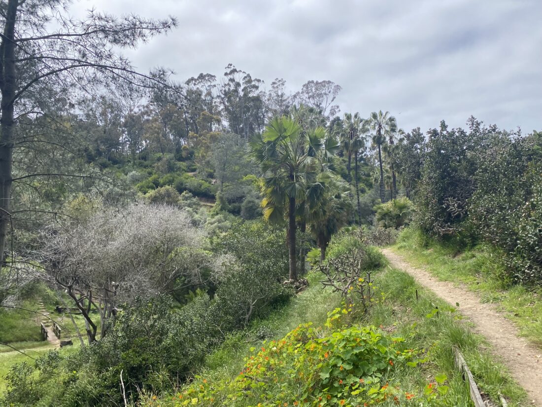
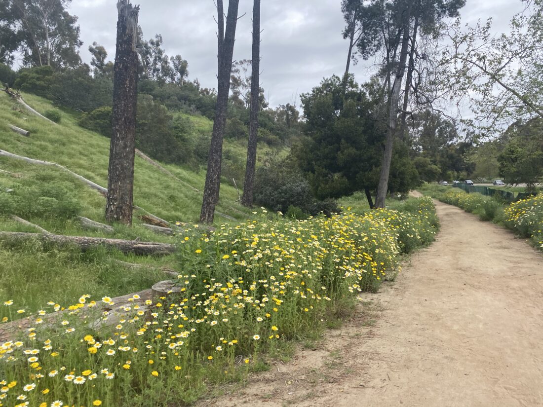
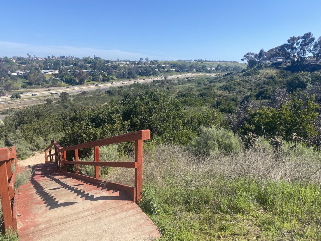
I parked at the Canyonside Community Park near the first ball field, grabbed my gear, and set off. Crossing over Black Mountain Road, I passed over Penasquitos Creek, flowing nicely after a recent rainstorm. I turned into the driveway to the Canyonside Equestrian Center to connect with the trail. It was undergoing some maintenance, so I followed the road to the Ranger Station to access the trail there. The trail follows the north side of Mercy Road until the road bends away. Even though I was close to the road, I hardly heard any traffic noise. After crossing a northbound service road, the trail narrowed and the surrounding brush grew thicker. A marker also indicated that this section was known as the Bill Witzell Trail.

Bill Witzell was a founding member of the Los Peñasquitos Canyon Preserve Volunteer Patrol. Using his extensive knowledge as an engineer to design and install most of the bridges that cross Peñasquitos Creek. In addition, he was involved in the layout, design and construction of the Trans-County Trail east of Black Mountain Road.

Gina Washington, Senior Park Ranger – Los Peñasquitos Canyon Preserve

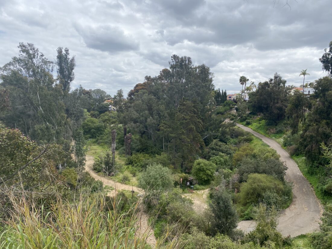
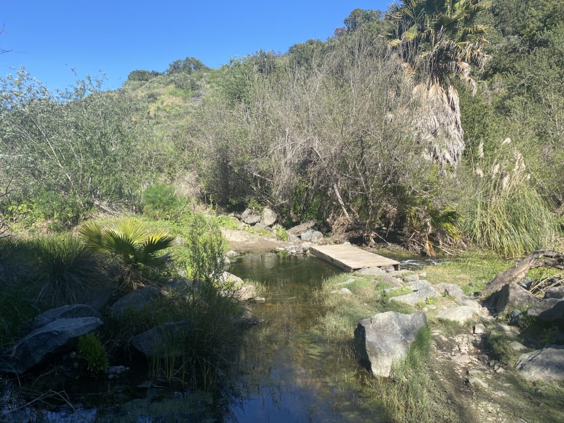
Several bridges crossed the creek as I continued eastward. Soon, the noise from I-15 started to fill the air. The trail passed under the freeway, and then under a smaller abandoned bridge, ending at Cara Way. Just down that road to the north is the Crime Victim’s Memorial Oak Garden (known initially as the Cara Knott Memorial Oak Garden, in memory of the 1986 murder of twenty-year-old Cara Knott). I decided not to visit the garden this time, so I retraced my route. Along the way, a ranger was working to remove some of the invasive mustard along the trail. We chatted briefly before I thanked her for the effort she was putting into pulling those plants out. This was a nice little hike that was a delightful surprise.


Buy Me a Coffee at ko-fi.com

I am an avid peak bagger, sometimes backpacker, and former sea kayaker living in San Diego. I am the co-author of Urban Trails: San Diego, coming in Spring 2026!

In 2019, I became the third person to complete the San Diego 100 Peak Challenge. Not stopping with that accomplishment, I set my sights on the harder San Diego Sierra Club 100 Peak list, which I completed in 2021. In addition, I have conquered several Six-Pack of Peaks challenges (SoCal, San Diego, Central Coast, and both the Arizona-Winter and Arizona-Summer).

I am looking forward to exploring new summits and new adventures across the southwest. 

Presidio Park Loop

I felt like exploring Presidio Park a bit more, so I convinced the wife and daughter to tag along (the dog needed no convincing to go on a walk). Being a Sunday, we knew parking might be an issue, so we used the lot at the CalTrans building. We wandered through the newly opened Iipay Tipai Kumeyaay Mut Niihepok (Land of the First People) area, before heading toward the Junípero Serra Museum. We used the trailhead at Mason and Jackson to formally start the loop. Once at the Junípero Serra Museum, we followed a trail that went around the north side of it. We looped around the building and headed south for a bit. While we could see the park, we made a hairpin turn and worked our way down a ravine toward Taylor Street. There we climbed back up the other side through Palm Canyon. From there we looped around to the west and emerged at the park. We walked over to the southern entrance to the park, and before taking the trail back down toward Old Town, I strolled over to look at the Mormon Battalion statue. Once back in Old Town, we found an ice cream shop and enjoyed another wonderful outing.


Buy Me a Coffee at ko-fi.com

I am an avid peak bagger, sometimes backpacker, and former sea kayaker living in San Diego. I am the co-author of Urban Trails: San Diego, coming in Spring 2026!

In 2019, I became the third person to complete the San Diego 100 Peak Challenge. Not stopping with that accomplishment, I set my sights on the harder San Diego Sierra Club 100 Peak list, which I completed in 2021. In addition, I have conquered several Six-Pack of Peaks challenges (SoCal, San Diego, Central Coast, and both the Arizona-Winter and Arizona-Summer).

I am looking forward to exploring new summits and new adventures across the southwest. 

Juniper Canyon

When I reached my car after hiking Switzer Canyon, it was about 11:30, and Grand Ole BBQ didn’t open until noon. I decided to explore Juniper Canyon which was just a few minutes away. The trail headed south, past some lovely wildflowers and along the dry creek bed. Signs pointed out the distance to the various other trailheads. I opted to continue onto the furthest trailhead. Once I reached it, followed another fork of the canyon back to the northeast. The trail was mostly river rock and eventually came to an end at a fence. I retraced my route back to the car, then made the short drive for some well-earned BBQ.


Buy Me a Coffee at ko-fi.com

I am an avid peak bagger, sometimes backpacker, and former sea kayaker living in San Diego. I am the co-author of Urban Trails: San Diego, coming in Spring 2026!

In 2019, I became the third person to complete the San Diego 100 Peak Challenge. Not stopping with that accomplishment, I set my sights on the harder San Diego Sierra Club 100 Peak list, which I completed in 2021. In addition, I have conquered several Six-Pack of Peaks challenges (SoCal, San Diego, Central Coast, and both the Arizona-Winter and Arizona-Summer).

I am looking forward to exploring new summits and new adventures across the southwest. 

Switzer Canyon

Since the rains were holding off, I decided to squeeze in another hike after the Bridle Loop Trail. I drove through Balboa Park to the eastern side and parked near the trailhead for Switzer Canyon. I dropped down into the canyon and headed east. The trail was a mix of dirt and river rock. After a short while the trail came to an end at a drainage tunnel. While some might stoop to walk through it, I am only a couple of weeks out from cervical fusion, so I passed. Instead, I took a use trail up to 30th Street and used surface streets to one of the trailheads for western Switzer Canyon. 

I dropped down to the canyon floor, passing a couple enjoying their coffee while walking their dog. I passed the tunnel before continuing further up the canyon. At the junction, I took the right fork which eventually led me onto Redwood Street, right near a good friend’s house, so I stopped my tracker and popped in for a short visit. After saying goodbye to him and his wife, I turned the tracker back on and continued heading west. I turned south on 31st and found another entrance to the canyon. The trail followed the creek bed for a bit, right along some homes, before reconnecting at the earlier junction. I left the canyon via the Burlingame trailhead and began my street hike back to the car.


Buy Me a Coffee at ko-fi.com

I am an avid peak bagger, sometimes backpacker, and former sea kayaker living in San Diego. I am the co-author of Urban Trails: San Diego, coming in Spring 2026!

In 2019, I became the third person to complete the San Diego 100 Peak Challenge. Not stopping with that accomplishment, I set my sights on the harder San Diego Sierra Club 100 Peak list, which I completed in 2021. In addition, I have conquered several Six-Pack of Peaks challenges (SoCal, San Diego, Central Coast, and both the Arizona-Winter and Arizona-Summer).

I am looking forward to exploring new summits and new adventures across the southwest. 

Bridle Loop Trail

If you have ever driven south on Hwy. 163 through Balboa Park, you’ve probably noticed some trails on the west side of the highway. Well, it turns out that trail is part of the Bridle Loop Trail, so I decided to make this my next hike. Starting from the southwest corner of Balboa Park, I headed north along the sidewalk until I reached the Juniper Stairs (thanks to the California Conservation Corps), which took me down to the trail that runs along Hwy. 163. The trail finally stopped paralleling the freeway and climbed back up near the Marston House. I cruised along the sidewalk, past the playground, and the bocce ball courts, and soon I was back at the car. Apart from the noise near Hwy. 163, this was a nice loop.


Buy Me a Coffee at ko-fi.com

I am an avid peak bagger, sometimes backpacker, and former sea kayaker living in San Diego. I am the co-author of Urban Trails: San Diego, coming in Spring 2026!

In 2019, I became the third person to complete the San Diego 100 Peak Challenge. Not stopping with that accomplishment, I set my sights on the harder San Diego Sierra Club 100 Peak list, which I completed in 2021. In addition, I have conquered several Six-Pack of Peaks challenges (SoCal, San Diego, Central Coast, and both the Arizona-Winter and Arizona-Summer).

I am looking forward to exploring new summits and new adventures across the southwest. 

Chollas Radio System Open Space

A couple blocks away from where I parked for Emerald Hills East, was the Chollas Radio System Open Space, so I decided to make the short drive over and explore it. This trailhead is located at the end of Zircon Street, and I found a spot in front of one of the homes. The trail headed west and down the slope, with no wooden stairs this time. Portions of this open space are fenced off to protect the habitat, and there are clear trail signs for to follow. I passed three ladies who were also out enjoying the trail. Soon, I came to the creek that runs along nearby Hwy. 94. Since we had some late-season rain, it had some water flowing. I crossed it without incident and reached the formal end of the trail. I again retraced my route and called it a day.


Buy Me a Coffee at ko-fi.com

I am an avid peak bagger, sometimes backpacker, and former sea kayaker living in San Diego. I am the co-author of Urban Trails: San Diego, coming in Spring 2026!

In 2019, I became the third person to complete the San Diego 100 Peak Challenge. Not stopping with that accomplishment, I set my sights on the harder San Diego Sierra Club 100 Peak list, which I completed in 2021. In addition, I have conquered several Six-Pack of Peaks challenges (SoCal, San Diego, Central Coast, and both the Arizona-Winter and Arizona-Summer).

I am looking forward to exploring new summits and new adventures across the southwest. 

Emerald Hills

After exploring Chollas Lake, I decided to explore nearby Emerald Hill Canyon. The parking lot at the Emerald Hills Neighborhood Park was almost empty and red wooden stairs led the way down the hillside. From there, the trail was actually paved, although it could use some plant maintenance, as the brush was starting to become overgrown. Once the trail reached the canyon floor, the pavement ended, and it then turned east to parallel Hwy. 94. Unlike other canyon hikes I have recently done, this one never left the noise of the city behind. The trail quickly ended at Federal Blvd., so I retraced my route back to the car.


Buy Me a Coffee at ko-fi.com

I am an avid peak bagger, sometimes backpacker, and former sea kayaker living in San Diego. I am the co-author of Urban Trails: San Diego, coming in Spring 2026!

In 2019, I became the third person to complete the San Diego 100 Peak Challenge. Not stopping with that accomplishment, I set my sights on the harder San Diego Sierra Club 100 Peak list, which I completed in 2021. In addition, I have conquered several Six-Pack of Peaks challenges (SoCal, San Diego, Central Coast, and both the Arizona-Winter and Arizona-Summer).

I am looking forward to exploring new summits and new adventures across the southwest. 

Chollas Lake

Decided to explore Chollas Lake in the morning. The parking lot was surprisingly full as I pulled into one of the last open spots. I grabbed my gear and headed down to the edge of the lake. I followed the lakeshore for a bit until a side trail called my name. The trail was nicely shaded under the eucalyptus trees as it worked its way up and then back down toward the dam.

From there, I left the lake behind and entered a wide urban canyon. I came to a signpost highlighting various destinations both near and far. While the trail continued along the canyon floor, another trail made the short climb to the top of the mesa. From the mesa, I had a sweeping view of the canyon, as well as a nice view of downtown San Diego. The wide trail looped around the baseball field, where a team was having a practice session.

Once back on the canyon floor, I crossed the parking lot to link back up with the trail. I took the single-track option to make the gentle climb to Gloria’s Mesa, rather than the direct trail along the canyon floor. Once at Gloria’s Mesa, I explored the amphitheater and the lovely wildflowers in bloom. I headed down a flight of stairs past a wooden gazebo near the southwest corner of the lake. Turning east, I followed the wide path back toward the start. I was amazed at the number of picnic tables and pavilions that were located along the lake. This area certainly had plenty of spots to come to enjoy the scenery. When I got back to the parking lot, there were cars actively waiting to park. If this is an issue when you visit, drive down to Gloria’s Mesa, and you will probably not have any issues parking there.


Buy Me a Coffee at ko-fi.com

I am an avid peak bagger, sometimes backpacker, and former sea kayaker living in San Diego. I am the co-author of Urban Trails: San Diego, coming in Spring 2026!

In 2019, I became the third person to complete the San Diego 100 Peak Challenge. Not stopping with that accomplishment, I set my sights on the harder San Diego Sierra Club 100 Peak list, which I completed in 2021. In addition, I have conquered several Six-Pack of Peaks challenges (SoCal, San Diego, Central Coast, and both the Arizona-Winter and Arizona-Summer).

I am looking forward to exploring new summits and new adventures across the southwest. 

Seven Bridges

When I had my neck issue five years ago, one of the first outings after I recovered was a portion of the Seven Bridges hike. Now, after my cervical fusion, it seemed fitting to do this hike again, and hopefully, this time, I could complete all seven bridges! We found parking near the Spanish Arts Village, and after a fellow dog owner lent us a couple of poop bags (as we forgot ours at home), we crossed our first bridge over Park Boulevard. We then continued north along Park Boulevard, until we made the short turn onto University and over its small bridge. Then we headed northwest along Lincoln Avenue until we turned south on Vermont, and across our third bridge.

Back along University Avenue, we made a pit stop at Starbucks for a beverage, then continued west to First Avenue. Next up was the Spruce Street Suspension Bridge. Neither Anita nor Rocky enjoyed this one. Once we made it across, we continued onto the Quince Street Bridge. The construction down below in Maple Canyon was quite evident. Next up was the First Avenue Bridge, which also spans Maple Canyon. We continued along First Avenue until we reached Laurel Street and turned eastward back toward Balboa Park.

Workers were finishing cleaning up from the Race for Autism that occurred earlier in the day. We crossed the famous Cabrillo Bridge that spans the 163 and into the park. With that, we soon found ourselves back at the car. Overall, the neck felt pretty good…


Buy Me a Coffee at ko-fi.com

I am an avid peak bagger, sometimes backpacker, and former sea kayaker living in San Diego. I am the co-author of Urban Trails: San Diego, coming in Spring 2026!

In 2019, I became the third person to complete the San Diego 100 Peak Challenge. Not stopping with that accomplishment, I set my sights on the harder San Diego Sierra Club 100 Peak list, which I completed in 2021. In addition, I have conquered several Six-Pack of Peaks challenges (SoCal, San Diego, Central Coast, and both the Arizona-Winter and Arizona-Summer).

I am looking forward to exploring new summits and new adventures across the southwest. 

Walker Preserve Trail

I wanted to get something in before the rains came later in the day. So I decided to go explore the Walker Preserve Trail out in Santee/Lakeside. I convinced Jeremy to join me on this adventure. The gates to the parking lot were closed, so we found parking along a nearby street, as all the parking along Magnolia Avenue was taken. I later learned that this parking lot is used for staging for the restoration and clean-up efforts. After passing under a nice trailhead sign, a nice gazebo stood off to the side, along with some picnic benches. Just beyond that, a water fountain for humans and another one for your dog are available. The only bathroom appears to be a port-a-potty. We passed a large group of hikers that were milling about and set off down the nice wide and well-groomed dirt path.

Houses lined the left side of the trail, but the San Diego River would appear from time to time behind the brush. The sound of various birds would fill the air as we cruised eastward. There were several informational panels posted along the way, explaining some of the history of the area, most notably the sand mining that used to occur here. There was a short spur that led to a nice bench and a lovely view of the river. It is possible to access the river at certain points, where you might find some trying their luck fishing.

The trail splits at one point and makes a tiny climb to reveal two more picnic tables under some trees. The trail rejoins again and continues onto toward the Lakeside Baseball Park. There is water here, and when the field is in use, the bathrooms are available. We continued eastward, technically leaving the Walker Preserve Trail and joining the Lakeside River Trail. The houses to the north were now replaced with warehouses. We went under Riverford Road and then passed by a pocket park. The trail made a short dog leg and then passed by the Willowbrook Golf Course. We also came across a nice wooden view deck that has a nice view of the river. There was an unhoused person sleeping there, so we let him be and continued on. When reached Channel Road, we took a short break and worked our way back to the start. On the way back, we saw someone sitting in that pocket park with their binoculars scanning the field to the west for birds. We got back to the car, having beat the rain. The entire hike was 5.9 miles, with a whopping elevation gain of 34 feet (the short climb on the side trail was really something), and we did it in just under 2 hours of moving time.


Buy Me a Coffee at ko-fi.com

I am an avid peak bagger, sometimes backpacker, and former sea kayaker living in San Diego. I am the co-author of Urban Trails: San Diego, coming in Spring 2026!

In 2019, I became the third person to complete the San Diego 100 Peak Challenge. Not stopping with that accomplishment, I set my sights on the harder San Diego Sierra Club 100 Peak list, which I completed in 2021. In addition, I have conquered several Six-Pack of Peaks challenges (SoCal, San Diego, Central Coast, and both the Arizona-Winter and Arizona-Summer).

I am looking forward to exploring new summits and new adventures across the southwest.