Shepard Canyon Loop

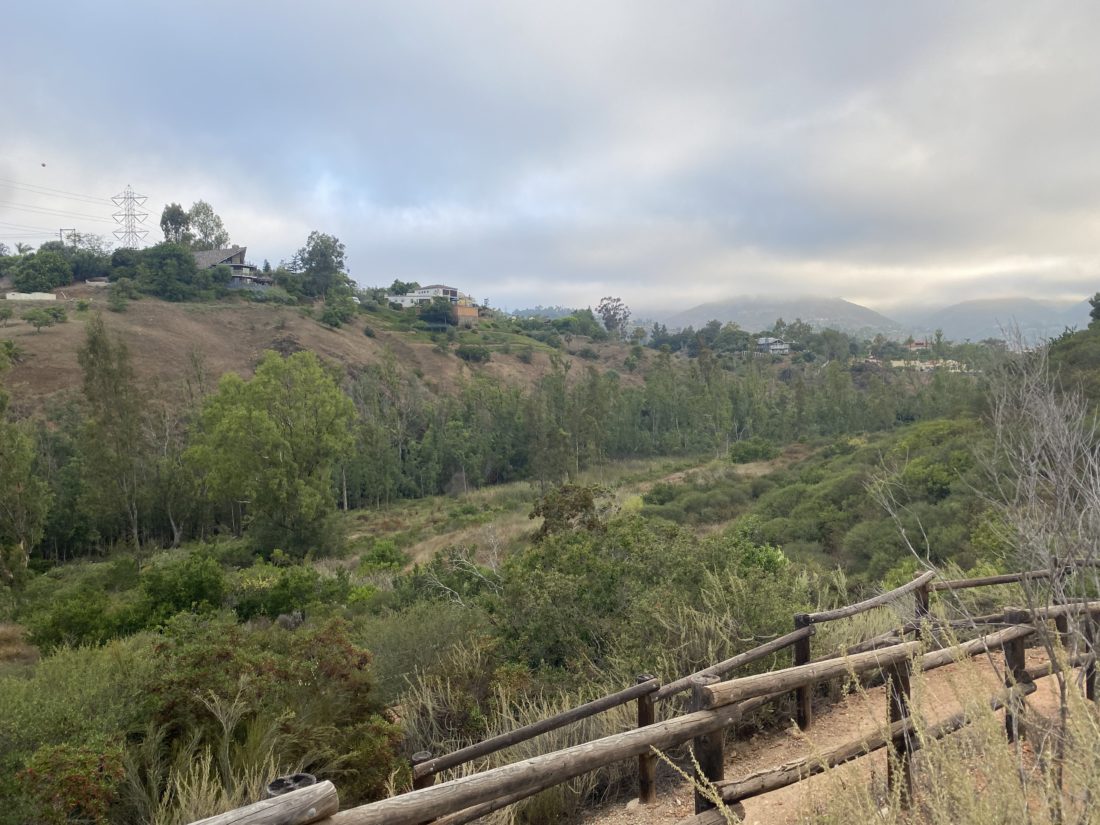
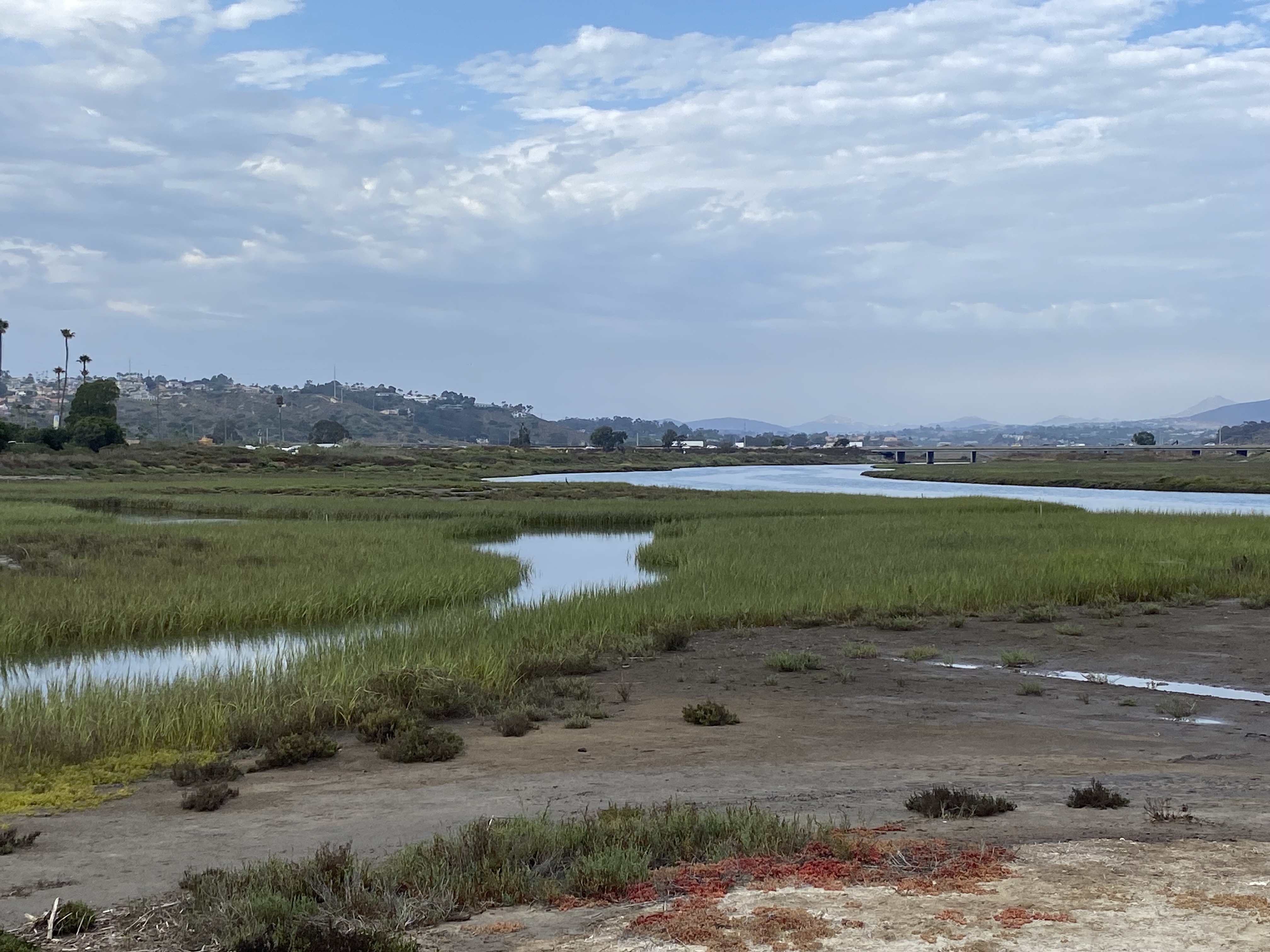
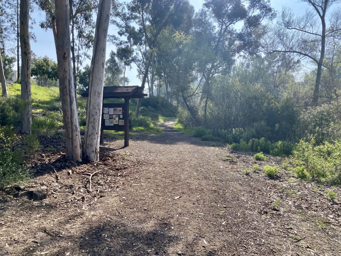
I wanted to explore another urban trail, so I returned to my old neighborhood and decided to hike Shepherd Canyon. I opted to link up North Shepherd Canyon to East Shepherd Canyon, then onto a trail that would skirt Mission Trails Regional Park and back to the start. I parked on Portobelo Street, right near Sheperd Canyon Mini Park. The trail dropped down into the canyon and headed southwest. It always amazes me how quickly the sounds of the neighborhood disappear and the sounds of nature emerge. The trail reached Villarrica Way after a short bit, and I crossed over to continue on the North Shepherd section. I continued along the trail until it reached Antiqua Boulevard. This was the southern terminus for this portion. But at the corner of Santo Road and Antiqua Boulevard, was the entrance to the East Shepherd Canyon trail. I crossed the street at the stoplight. A bit further south along Santo Road was the entrance to West Sheperd Canyon, but I would explore that another day.

I entered the canyon and learned that this part of the trail is also a nature plant trail. Along the first portion of the trail are about 22 signs that will help you identify the plant life. These information panels were installed about a decade ago by a local Girl Scout Troop. Originally, they were black with silver lettering, but exposure to the weather has stripped the black away. To learn more about this project visit shootingforsilverstars.wordpress.com.

Some of the local residents were out enjoying this wonderful trail. The stream was flowing just a bit, and it meant a few easy water crossings. I came to the turnoff to see Dishwasher Pond. A couple of benches were here to sit and enjoy the canyon view.

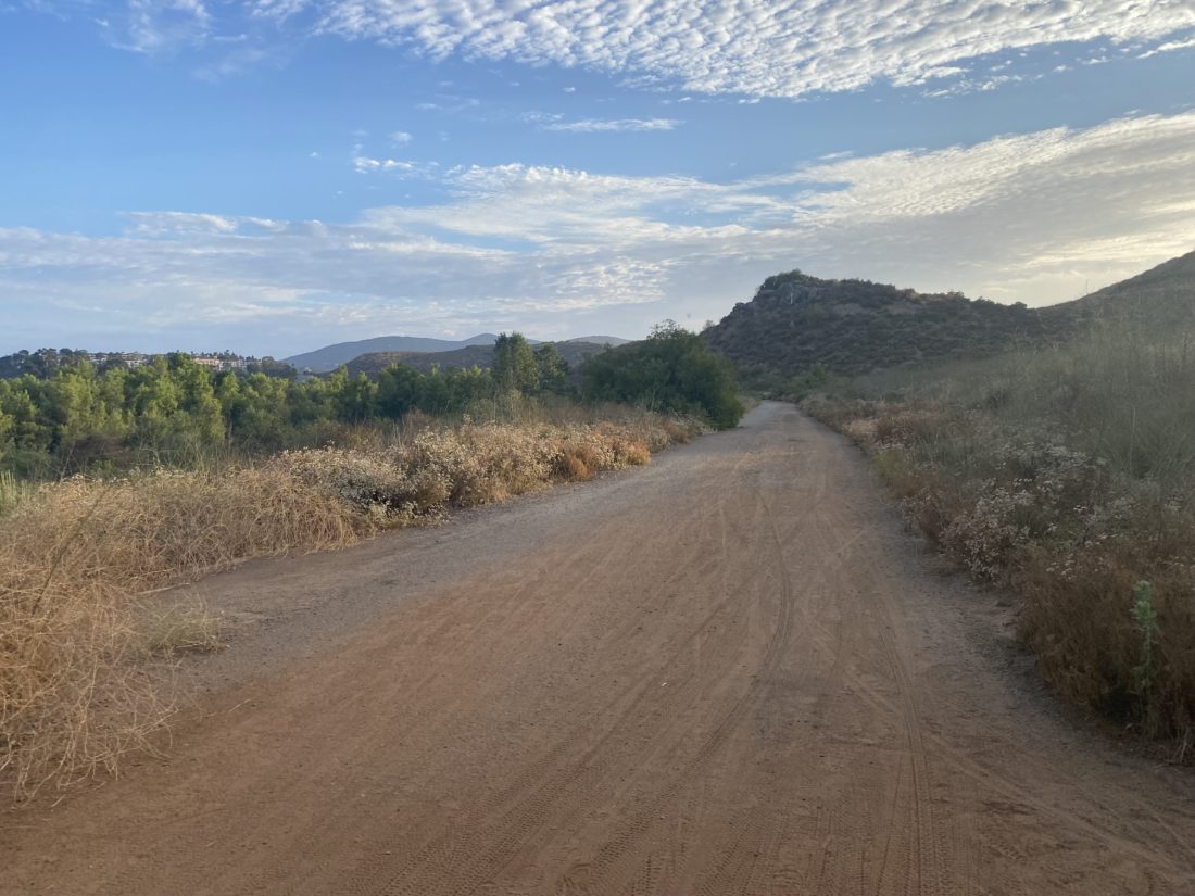
I continued on until I climbed out of the canyon and back onto Portobelo. While I could have followed the street back to the car, I was not done exploring. Just past the church, I crossed the street and picked up a trail heading east. Side trails would link to the houses nearby. 

Soon the surrounding houses ended as I crossed over into MTRP. A few trails led off into the park, but I headed north until the trail turned west alongside some condos. From there I cruised along until I exited back to where I had parked. This was a lovely loop that should be in a book. 


Buy Me a Coffee at ko-fi.com

I am an avid peak bagger, sometimes backpacker, and former sea kayaker living in San Diego. I am the co-author of Urban Trails: San Diego, coming in Spring 2026!

In 2019, I became the third person to complete the San Diego 100 Peak Challenge. Not stopping with that accomplishment, I set my sights on the harder San Diego Sierra Club 100 Peak list, which I completed in 2021. In addition, I have conquered several Six-Pack of Peaks challenges (SoCal, San Diego, Central Coast, and both the Arizona-Winter and Arizona-Summer).

I am looking forward to exploring new summits and new adventures across the southwest. 

Navajo Canyon Trail

Continuing my exploration of some of our urban trails, I decided to hike the Navajo Canyon Trail. This short hike is tucked away in one of many little canyons near SDSU.  I found some parking near the trailhead, grabbed my gear, and headed over to the signboard. Since the weather is starting to warm up, a warning about hiking with your dog was posted. The trail was fairly wide at this point, and the drainage was flowing with some run-off from the recent rains. As I left the trailhead, the sounds of cars faded away. Instead, the occasional chirps from the various birds filled the air.

I soon started to have some simple water crossings, and at one point had to shift to hiking along a narrow path above the stream bed to avoid the water flowing along the rocky main section. There were a couple of side trails, but they were marked as access paths to the utility poles.

As the trail neared its end, there was a small climb to the trail’s end at a church’s preschool. From here, you are provided with a nice view of the canyon you just hiked through. There is another portion of the trail (an additional 0.2 miles) that you can continue hiking on, or simply turn around at this point. I opted to continue, so I walked past the preschool and then past their parking lot, to where the trail picked up again. The trail dipped down and across the drainage, then ended at Carthage Street. With the full trail done, I then retraced my route back to the trailhead. As I drew near the start, a family and their dogs were just heading out. I logged this hike at 2.5 miles, with a nice gain of 250 feet.


Buy Me a Coffee at ko-fi.com

I am an avid peak bagger, sometimes backpacker, and former sea kayaker living in San Diego. I am the co-author of Urban Trails: San Diego, coming in Spring 2026!

In 2019, I became the third person to complete the San Diego 100 Peak Challenge. Not stopping with that accomplishment, I set my sights on the harder San Diego Sierra Club 100 Peak list, which I completed in 2021. In addition, I have conquered several Six-Pack of Peaks challenges (SoCal, San Diego, Central Coast, and both the Arizona-Winter and Arizona-Summer).

I am looking forward to exploring new summits and new adventures across the southwest. 

Florida Canyon

With my wife and daughter away in Arkansas, I took advantage of that and decided to hike Florida Canyon in Balboa Park. This is all part of my effort to explore more of our urban hikes in San Diego. Somehow, I found parking near the Spanish Village on a Sunday. I grabbed my gear and headed to the pedestrian bridge near the fountain. I took a quick look around the Inez Grant Parker Memorial Rose Garden before heading through the Desert Garden and into the trail. The paved trail works its way down Florida Canyon and the road. I crossed over Florida Road and re-joined the trail.

I headed east until I reached a junction that took me up a draw toward the top of the mesa. The trail was moderately busy, walkers, runners, and mountain bikers were all out enjoying the nice spring day. Once on the mesa, I looped around until I reached the trail that would take me back down another draw to rejoin the trail that parallels the road. I then crossed Florida Drive and began hiking back up the switchbacks toward the start. Partway up, I spotted two hikers heading down with packs larger than one would need for this simple trail. I asked if they were training for something, and they replied they were off to Spain shortly to hike the Camino de Santiago. We chatted a bit about their upcoming adventure before parting ways. I reached the cactus garden and crossed back over Park Boulevard. Now, cars were circling for a parking spot. I tossed my gear in and headed home. There is another section of the canyon I plan to come back to and explore at a later date.


Buy Me a Coffee at ko-fi.com

I am an avid peak bagger, sometimes backpacker, and former sea kayaker living in San Diego. I am the co-author of Urban Trails: San Diego, coming in Spring 2026!

In 2019, I became the third person to complete the San Diego 100 Peak Challenge. Not stopping with that accomplishment, I set my sights on the harder San Diego Sierra Club 100 Peak list, which I completed in 2021. In addition, I have conquered several Six-Pack of Peaks challenges (SoCal, San Diego, Central Coast, and both the Arizona-Winter and Arizona-Summer).

I am looking forward to exploring new summits and new adventures across the southwest. 

Monument Hill

Today’s adventure was a hike to summit Monument Hill, which is a peak listed on the Sierra Club Lower Peaks Committee list. The peak is located in the Santa Rosa Plateau Ecological Reserve, which for a time was closed due to the Tenaja fire back in 2017. The Reserve is now open again, so I thought this was a perfect opportunity to go explore it. After a one hour drive, I found myself pulling into the gravel parking lot next to the Visitor Center. I knew there was a use fee for the Reserve, but did not see anywhere to deposit the $4. The Visitor Center was closed, so I figured I would try to figure this out when I returned from the hike. I headed south along Waterline Road until I reached the Tenaja Truck Trail. I followed it for a short time until I reached the Vista Grande Trail. Now I switched from the wide trails I had been on to a more traditional single track. This trail climbed up at an easy grade, offering some nice vistas of the plateau. It was here that I spied my first tarantula along the trail. 

When I reached Monument Hill Road, I could finally see the summit about ½ mile away. I was back cruising on a wide road again toward it. I came to the cut-off that would take me up the small hill to the top. Once there, and after another tarantula sighting, two benches greeted me. I poked around the area and found the benchmark and two reference marks. It offered more great views of the area. I’m going to have to return some time during the spring, as I can only imagine how lovely it must be.

Once I descended, I opted to continue along Monument Hill Road until it reached the Lomas Trail. If I had more time I might have continued on to the historic Adobes, but I decided to save that for another time. The Lomas Trail was a little steeper than the Vista Trail, so I was glad to have done the loop in the direction I did. The trail ends back at the Tenaja Truck Trail, so I followed it back toward Waterline Road. It was here that I passed some of the first other people out enjoying the Reserve. Once back at the trailhead, the Visitor Center was still closed, so I began walking around the parking lot looking for a place to pay my use fee. I found it in the center of the parking lot, partly behind some shrubbery. I slipped my $4 into the metal box, and headed back to the car. The day had warmed up a bit, so I was glad to be done. The entire hike was 4.9 miles, with a gain of 287 feet and four tarantula sightings!


Buy Me a Coffee at ko-fi.com

I am an avid peak bagger, sometimes backpacker, and former sea kayaker living in San Diego. I am the co-author of Urban Trails: San Diego, coming in Spring 2026!

In 2019, I became the third person to complete the San Diego 100 Peak Challenge. Not stopping with that accomplishment, I set my sights on the harder San Diego Sierra Club 100 Peak list, which I completed in 2021. In addition, I have conquered several Six-Pack of Peaks challenges (SoCal, San Diego, Central Coast, and both the Arizona-Winter and Arizona-Summer).

I am looking forward to exploring new summits and new adventures across the southwest. 

Pamo Valley

I knew when I hiked this trail with the family that it was a gamble, as it might be included in the 2023-2024 Coast to Crest Challenge. Well, I lost that bet, and this trail is one of the five hikes. I really didn’t mind hiking it again, as it is a very pleasant stroll along the valley. Given how easy the trail is, I had hoped one of my friends could join us, but he had prior commitments, so it was just Ted and I. We pulled into the parking lot, and there were about 5 or 6 cars parked. The skies were overcast again, thankfully not due to an incoming tropical storm, but just some “standard” monsoonal stuff. We grabbed our gear and headed out northward along the trail.

When I did this hike about a month or so ago, portions of the trail were overgrown, but now the grasses near the trail had all been cut. We cruised along the trail at a nice pace. I spent part of the time outlining my upcoming camping and hiking trip to the central coast. Along the way, a trail runner passed us, with a dog following behind. The dog stopped to say hello to us, and we learned that the dog did not belong to the runner and that apparently lived at one of the ranches in the valley. The dog trotted back toward the runner and we continued on. The trail ends at the intersection with the road that goes up “Big” Black Mountain. We had a quick snack, and I took my trip photo at the nearby sign.

We began retracing our route, passing a hiker who was headed up Big Black Mountain for some training for the Grand Canyon. We wished him well and to be careful on the road. A bit later, we spotted the dog again. He had trotted back to us, and for the next couple of miles, mostly hung out with us. He did run ahead and play in the water for a bit at one point. Turns out, he is a fixture on the trail. Larry Edmonds sent me a photo of the dog from a few years ago. He has no collar, so we can’t tell you his name. Soon we reached the parking lot and my final Coast to Crest Challenge was complete. I am thinking of stringing all five together in a point-to-point fashion and doing them in one day, but that is for another time. One other thing to note is I swapped out my pack. I picked up an Osprey Talon 6 for these lighter hikes. My regular day pack just seemed like overkill. The pack worked well, although I will need to adapt to using bottles instead of a bladder. The hike was a pleasant 6.3 miles that we covered in 2:15, with just about 470 feet of gain.


Buy Me a Coffee at ko-fi.com

I am an avid peak bagger, sometimes backpacker, and former sea kayaker living in San Diego. I am the co-author of Urban Trails: San Diego, coming in Spring 2026!

In 2019, I became the third person to complete the San Diego 100 Peak Challenge. Not stopping with that accomplishment, I set my sights on the harder San Diego Sierra Club 100 Peak list, which I completed in 2021. In addition, I have conquered several Six-Pack of Peaks challenges (SoCal, San Diego, Central Coast, and both the Arizona-Winter and Arizona-Summer).

I am looking forward to exploring new summits and new adventures across the southwest. 

Santa Fe Valley Trail

The past two times I had hiked this trail were after work. Since I was working from home this morning, I decided to do it bright and early. I pulled into the empty parking lot just after 6:30 a.m., grabbed my gear, and headed toward the trail. The skies were overcast as I cruised along the trail with the groundskeepers working the nearby golf course. 

The trail crosses quite a few small bridges as it follows the San Dieguito River. Then the trail reaches the other element known for the switchbacks that carry you up from next to the river and toward a hill above it. You certainly are rewarded with some nice views after making the short climb. I snapped my challenge photo and retraced my route. Just one more hike and the 2023-2024 Coast to Crest Challenge will be complete.


Buy Me a Coffee at ko-fi.com

I am an avid peak bagger, sometimes backpacker, and former sea kayaker living in San Diego. I am the co-author of Urban Trails: San Diego, coming in Spring 2026!

In 2019, I became the third person to complete the San Diego 100 Peak Challenge. Not stopping with that accomplishment, I set my sights on the harder San Diego Sierra Club 100 Peak list, which I completed in 2021. In addition, I have conquered several Six-Pack of Peaks challenges (SoCal, San Diego, Central Coast, and both the Arizona-Winter and Arizona-Summer).

I am looking forward to exploring new summits and new adventures across the southwest. 

Cerro Noroeste

Since Campo Alto was just up the road from the trailhead, we made the short drive to see it. This was where we initially had planned to camp this weekend, but some campsites were closed due to tree hazards, and ours was one of them.

Dave parked near the summit and I took a short walk— first to the radio tower then over to the actual summit of Cerritos Noroeste. I looked to see if there might be a register, but given its proximity to the campground, I doubted it. I grabbed a few photos and went back to the Jeep and some more adventures…


Buy Me a Coffee at ko-fi.com

I am an avid peak bagger, sometimes backpacker, and former sea kayaker living in San Diego. I am the co-author of Urban Trails: San Diego, coming in Spring 2026!

In 2019, I became the third person to complete the San Diego 100 Peak Challenge. Not stopping with that accomplishment, I set my sights on the harder San Diego Sierra Club 100 Peak list, which I completed in 2021. In addition, I have conquered several Six-Pack of Peaks challenges (SoCal, San Diego, Central Coast, and both the Arizona-Winter and Arizona-Summer).

I am looking forward to exploring new summits and new adventures across the southwest. 

Lake Hodges (via Sikes Adobe)

My second hike for this year’s Coast to Challenge was to hike from the Sikes Adobe Historic Farmstead to the Bernardo Mountain turn-off. I actually had this as one of my rehab hikes, as I had never done the section from the Adobe to where the trail connects with the bridge. I parked in the small lot across from the Adobe and set off on the paved trail. This section parallels the I-15, so be prepared to listen to the rush of the traffic. The trail ducks under the freeway. As I looked at the dry lake bed, I recalled sitting in my kayak at this same spot while calling my mom to wish her a happy birthday…

The trail now leaves the I-15 behind and links up to the pedestrian bridge. This is a trail I have hiked many times, so I just cruised along. A few runners passed by, along with a mountain biker or two. The trail is closed after sunset, as it is a designated wildlife corridor. I crossed the wooden bridge, which appears to have suffered some damage. At the junction with the trail that would lead to the summit of Bernardo Mountain, I took my required photos and retraced my route. I thought the hike was going to clock in about 4 miles, but my tracker logged it at 3.6 miles. 


Buy Me a Coffee at ko-fi.com

I am an avid peak bagger, sometimes backpacker, and former sea kayaker living in San Diego. I am the co-author of Urban Trails: San Diego, coming in Spring 2026!

In 2019, I became the third person to complete the San Diego 100 Peak Challenge. Not stopping with that accomplishment, I set my sights on the harder San Diego Sierra Club 100 Peak list, which I completed in 2021. In addition, I have conquered several Six-Pack of Peaks challenges (SoCal, San Diego, Central Coast, and both the Arizona-Winter and Arizona-Summer).

I am looking forward to exploring new summits and new adventures across the southwest. 

San Dieguito Lagoon Trail

Every summer the San Dieguito River Conservancy publishes their Coast to Crest Challenge. Each challenge is a series of five different hikes along the various trails that make up the entire system. While some new sections have been recently acquired, they are not ready for hikers yet, so we get to revisit trails that have been used in previous challenges. With the current heat wave, starting with the San Dieguito Lagoon Trail seemed like a smarter choice. I had recently hiked it with some friends as a “warm-up” before brunch at Viewpoint Brewery. Since this was a Monday, they were not open for a mid-hike refreshment. My wife and our dog decided to join me for this early evening stroll. We parked next to the ranger station, just to have a better recorded track.

We cruised along the wide and well-groomed trail, stopping from time to time for a water break for our dog. Instead of going all the way to the overlook, the turn-around point this time was the end of the boardwalk, just north of Viewpoint. I tried to get a selfie of all three of us but gave up as Rocky was just not interested. We cruised back to the car, passing just a few folks along the way. 


Buy Me a Coffee at ko-fi.com

I am an avid peak bagger, sometimes backpacker, and former sea kayaker living in San Diego. I am the co-author of Urban Trails: San Diego, coming in Spring 2026!

In 2019, I became the third person to complete the San Diego 100 Peak Challenge. Not stopping with that accomplishment, I set my sights on the harder San Diego Sierra Club 100 Peak list, which I completed in 2021. In addition, I have conquered several Six-Pack of Peaks challenges (SoCal, San Diego, Central Coast, and both the Arizona-Winter and Arizona-Summer).

I am looking forward to exploring new summits and new adventures across the southwest. 

Ramona Grasslands

After summiting Volcan Mountain yesterday, I knew I should keep my trail time to something more on the mild side, and Ramona Grasslands seemed to fit the bill nicely. I decided to try this hike with the dog.

The marine layer had already burned off, but a good breeze kept the temperatures nice and comfortable. Rocky was not on his best behavior, so a lot of corrections were needed as we strolled down the wide trail. We passed a few others out enjoying the area but had a lot of the preserve to ourselves.

I opted to do the longer loop, stopping at the picnic benches for a quick break in the shade and some water for Rocky. A few flowers still dotted the sides of the trail.

Once back at the trailhead, a ranger had set up a display about various wildlife. Turned out he was the same ranger from Barnett Ranch and he remembered me. We chatted some before I bid farewell. A nice Sunday stroll of about 2.75 miles in 1:02.


Buy Me a Coffee at ko-fi.com

I am an avid peak bagger, sometimes backpacker, and former sea kayaker living in San Diego. I am the co-author of Urban Trails: San Diego, coming in Spring 2026!

In 2019, I became the third person to complete the San Diego 100 Peak Challenge. Not stopping with that accomplishment, I set my sights on the harder San Diego Sierra Club 100 Peak list, which I completed in 2021. In addition, I have conquered several Six-Pack of Peaks challenges (SoCal, San Diego, Central Coast, and both the Arizona-Winter and Arizona-Summer).

I am looking forward to exploring new summits and new adventures across the southwest.