Baden-Powell (via Dawson’s Saddle)

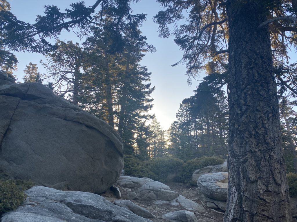
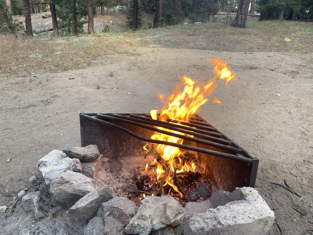
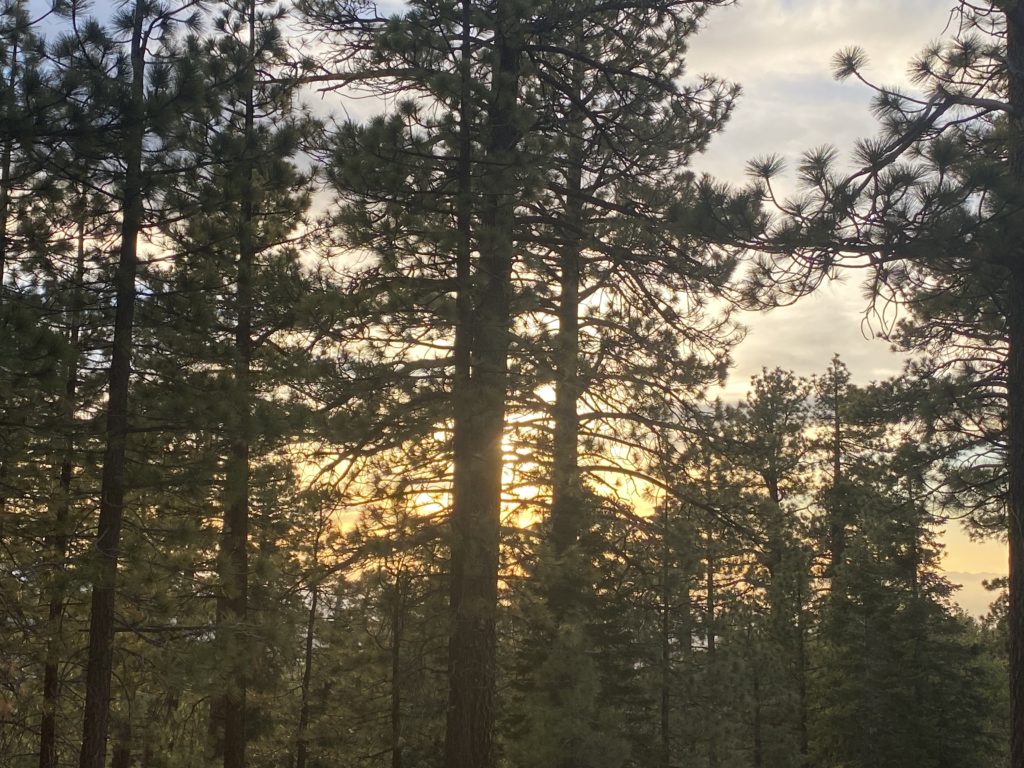
The drive from Palm Springs to Wrightwood was uneventful. I decided to grab lunch along the way in Cazabon and refuel the Outback. After the mid-70s atop San Jacinto, the 100+ temps on the desert floor felt awful. The next peak on my adventure was Baden-Powell. Originally when I planned the adventure, I had hoped to hike out to the Big Horn Mine in the afternoon, but this heat wave we were having scuttled that idea. That hike is south-facing and without a lot of shade. I checked into my campsite at Table Mountain and then drove the 10 minutes back into Wrightwood to hit the market. I grabbed some soda, a couple of beers, and a bag of ice. Back at the campsite, I unpacked the backpack and the slack-pack and then reassembled my daypack. Soon I could feel my stomach being to grumble and headed again back into Wrightwood for dinner. After a nice Carne Asada burrito plate, I drove back to finish setting up for the night. Last year, I bought a custom air mattress for the Outback from Luno. In about 5 minutes, I had all the parts inflated and ready. The camp host stopped by and we chatted a bit. He said tonight the campground was mostly empty, but tomorrow it would be packed. I gathered some of the downed wood and enjoyed a small campfire as night fell. I crawled into the back of the Outback and listened to an audiobook for a while before drifting off to sleep. 

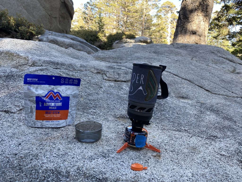
I woke again before dawn. I can see why they sell window covers, but I had a long day of hiking ahead of me and it was going to be warm, so I did not mind. I made my breakfast, this time some biscuits and gravy from Mountain House. If the temperatures had been milder, I might have considered breakfast in town. I deflated the mattress, relocated my other items, and set off toward Dawson’s Saddle. I had climbed Baden-Powell twice before, each time via the Vincent Gap trailhead and the infamous switchbacks. But this time, I decided to approach it from the other route. I passed the parking lot at Vincent Gap and there were about 5 cars parked there. 

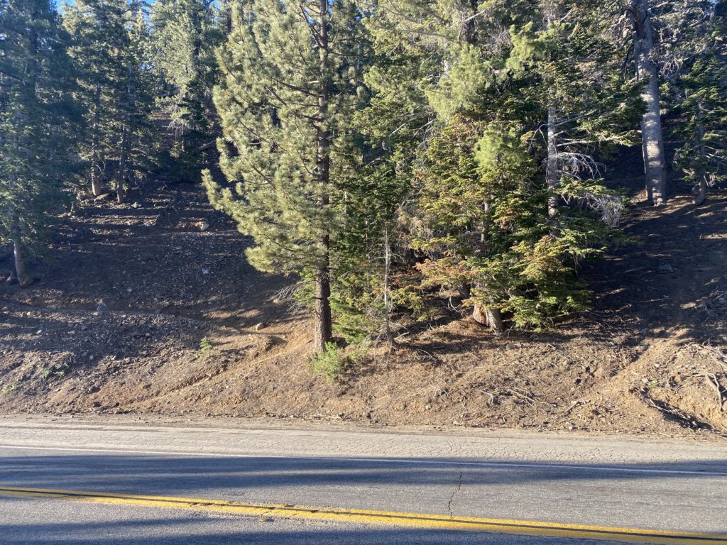
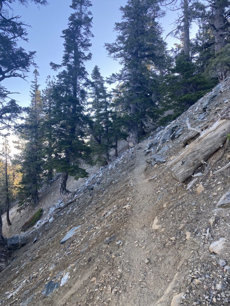
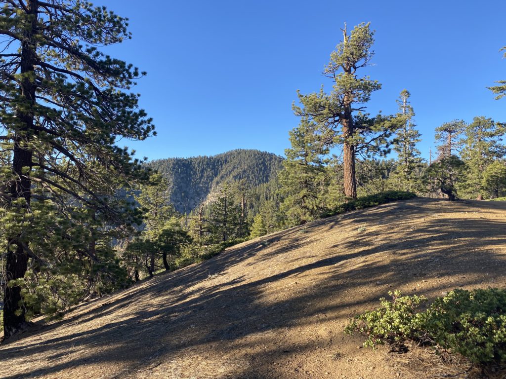
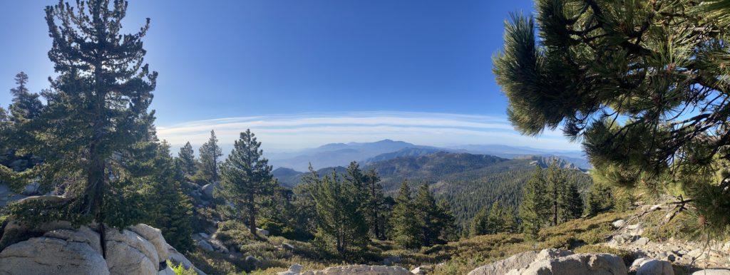
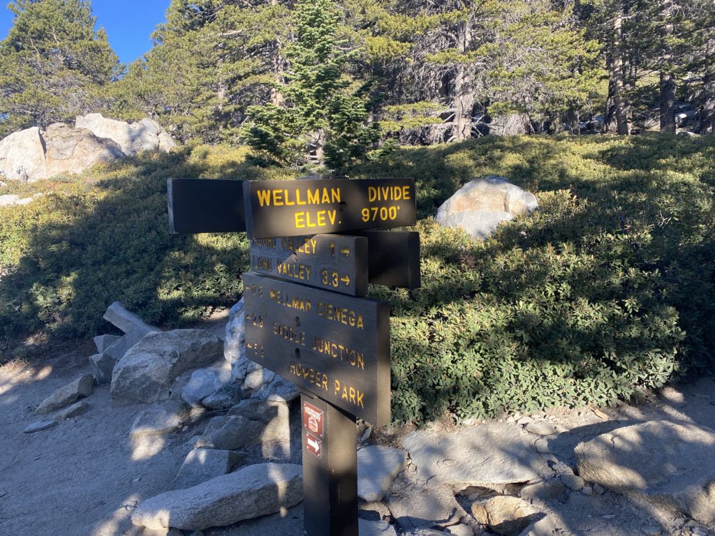
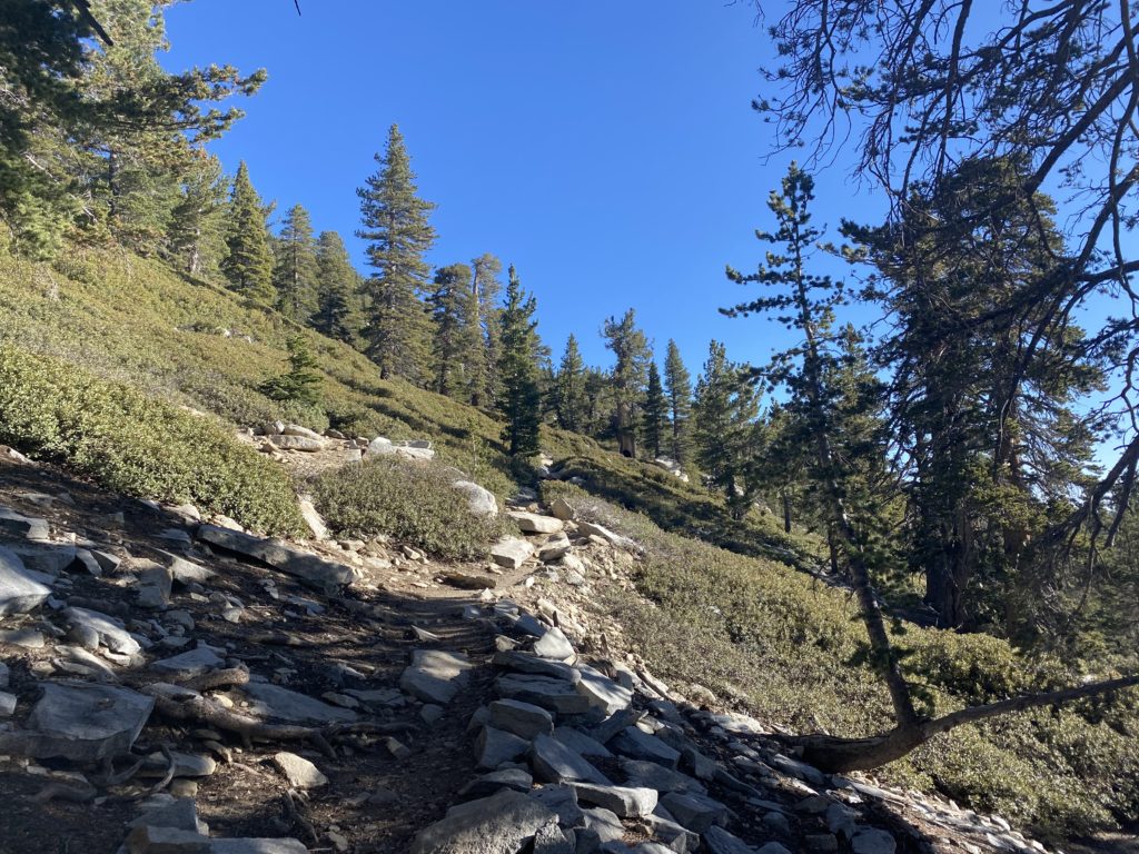
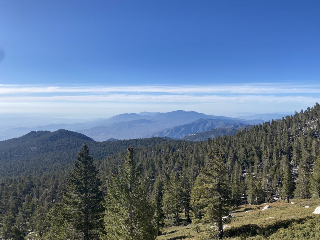
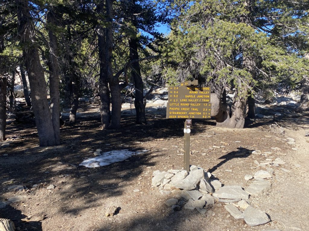
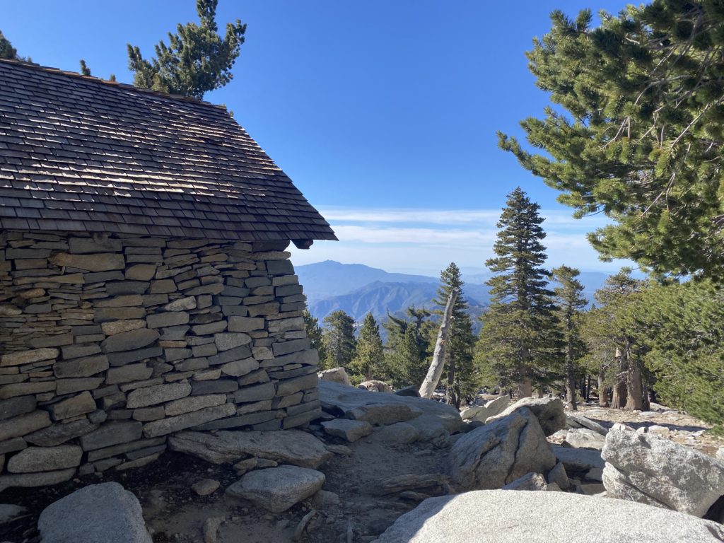
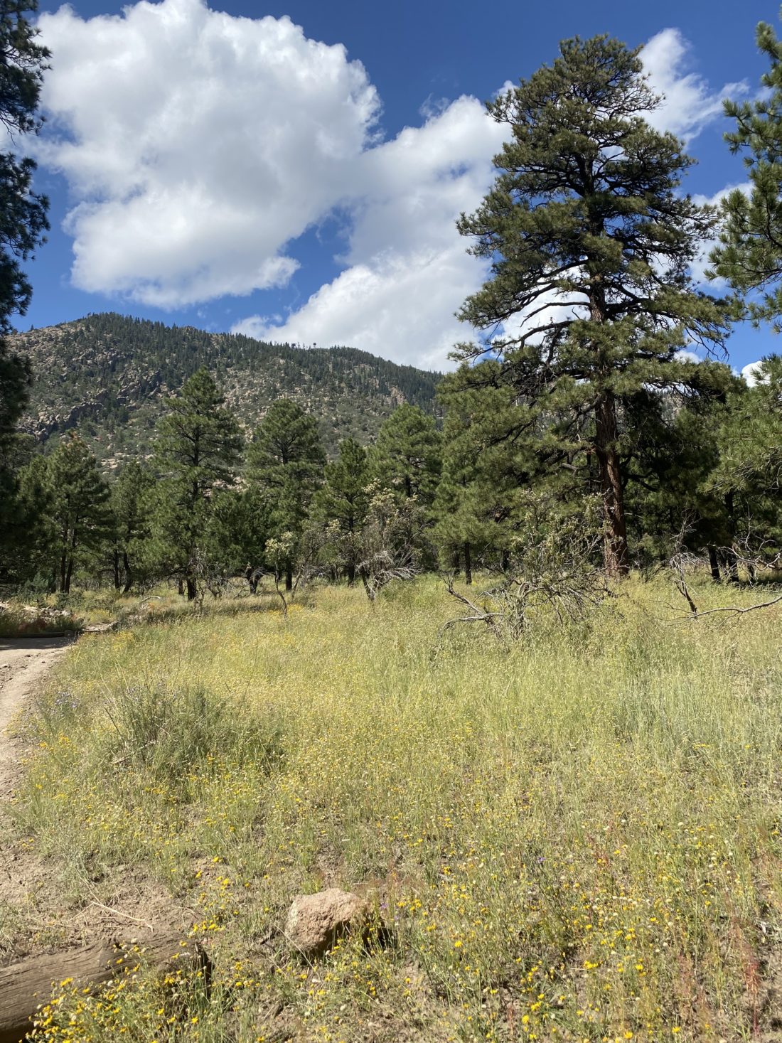
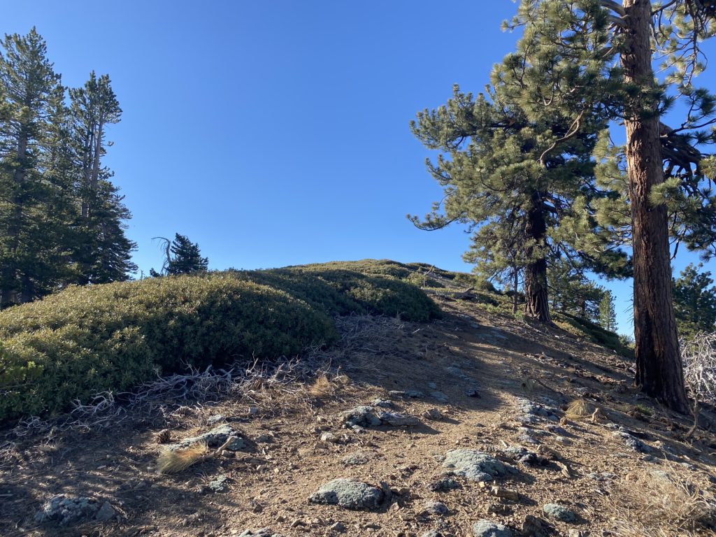
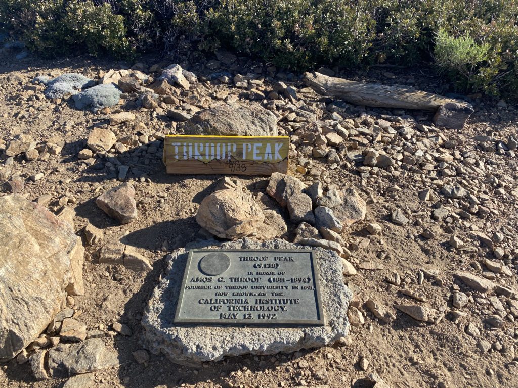
Finding the parking area for Dawson’s Saddle was fairly easy, I just had to look for the CalTrans shed and park to the side. The full plan for the day was to hike from the saddle to Throop Peak, then continue along the ridge east to Mount Burnham and then Baden-Powell. I grabbed my gear and crossed over the Angeles Crest Highway to the trail. This first section of the trail was steep, and I honestly began to reconsider just doing the switchbacks. I knew though, that after a short portion of this, the trail would mellow out. As I gained the ridge that I would follow toward Throop, I was rewarded with some great views to the west, as well as some nice views to the south, including Throop Peak. The trail certainly became much more reasonable as I continued to climb. After about 1.5 miles, the trail splits. To the left is a connector trail that joins the Pacific Crest Trail or you can stay heading south to climb up to the summit of Throop Peak. I missed the junction, but since the trail made a turn to the east, I stopped and checked my route. I was just a bit off, so I did a quick U-turn, followed by some short cross-country hiking, and found the trail. I had about 4/10 mile to gain about 450 feet. I paced myself as I worked up toward the summit. I had a long day ahead of me and had a respectable day of hiking the day before. Soon the summit came into view and I spotted the metal plaque and ever-present summit signs. I snapped my photos and soaked in yet another summit vista. Off to the east stood my next two peaks, Mount Burnham and the primary goal, Baden-Powell. Once I was ready, I set off down from the summit to connect with the PCT. 

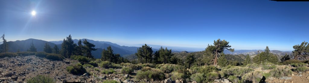
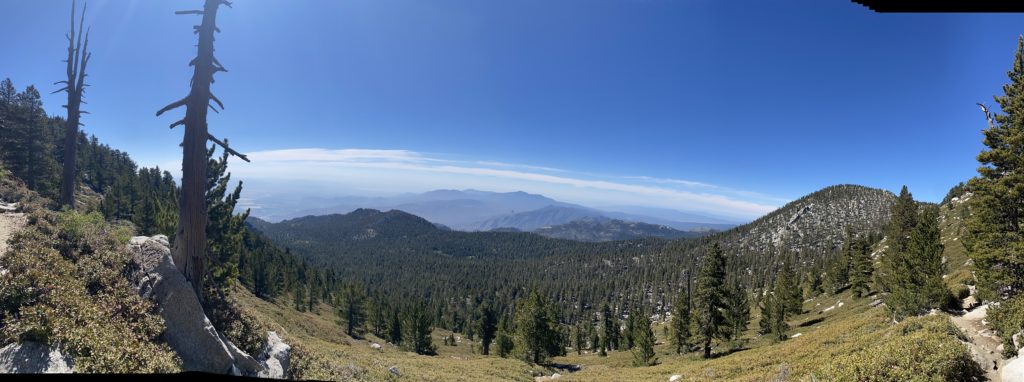
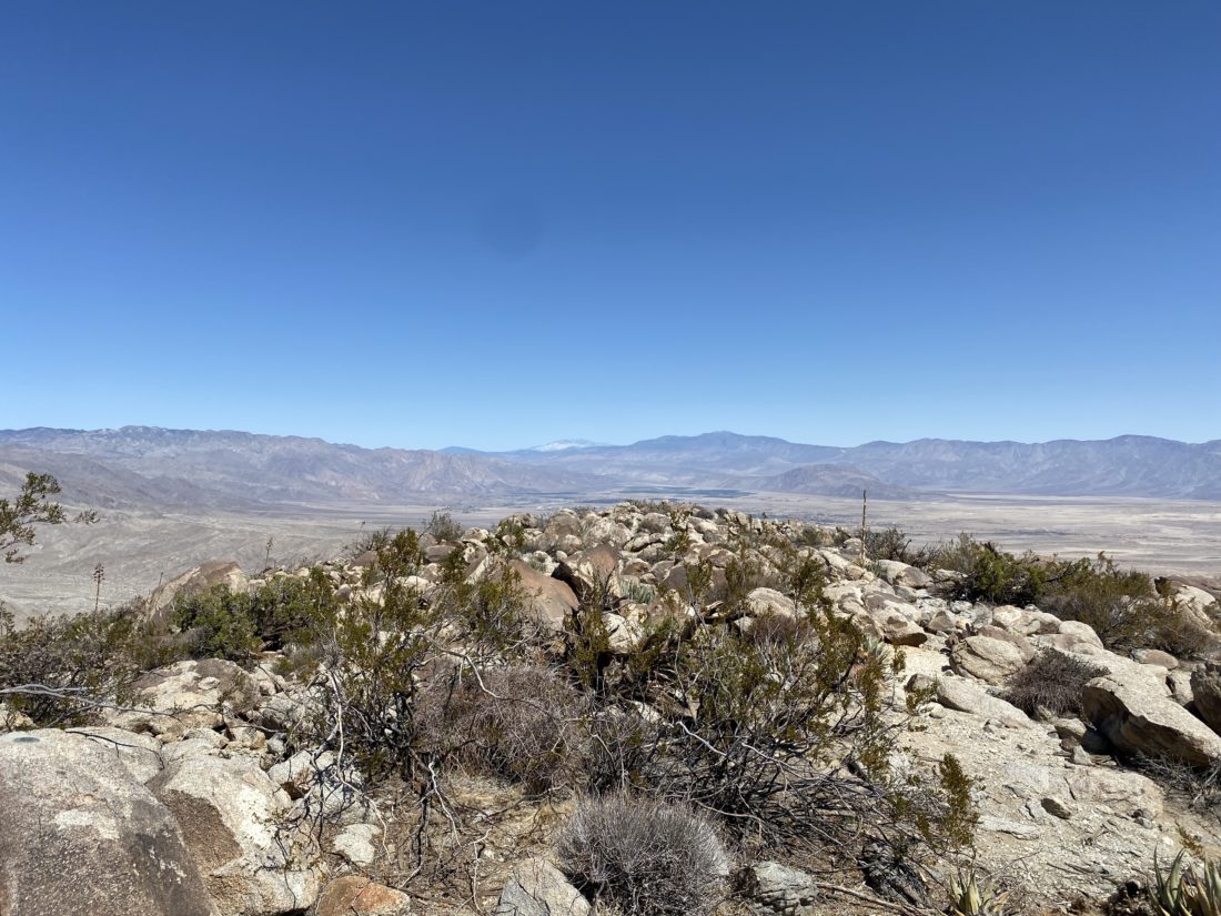
Once on the PCT, I had about a mile to go before the junction to summit Mount Burnham. From previous trip reports, I knew this approach was also a bit steep. I made the decision to bypass it and continue on to my primary goal of Baden-Powell and summit Burnham on my return. As I continued eastward on the PCT, I would be passed from time to time by actual PCT thru-hikers. We would stop for a bit and chat before each heading our separate ways. The views along the trail were delightful. At times, I could see the high desert to the north, and at other times off toward the Los Angeles basin.

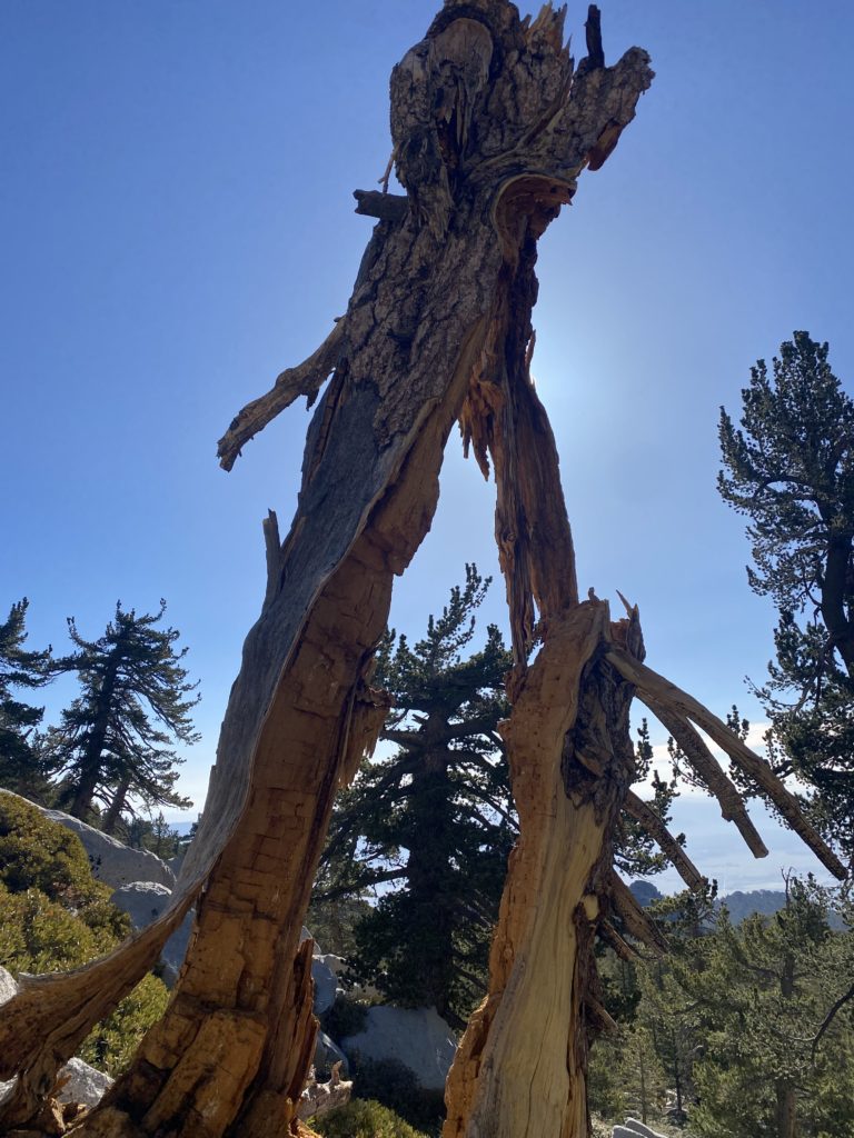
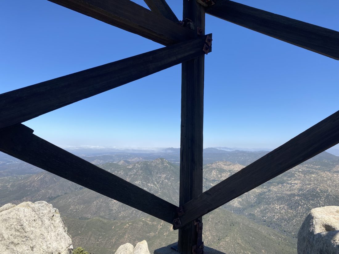
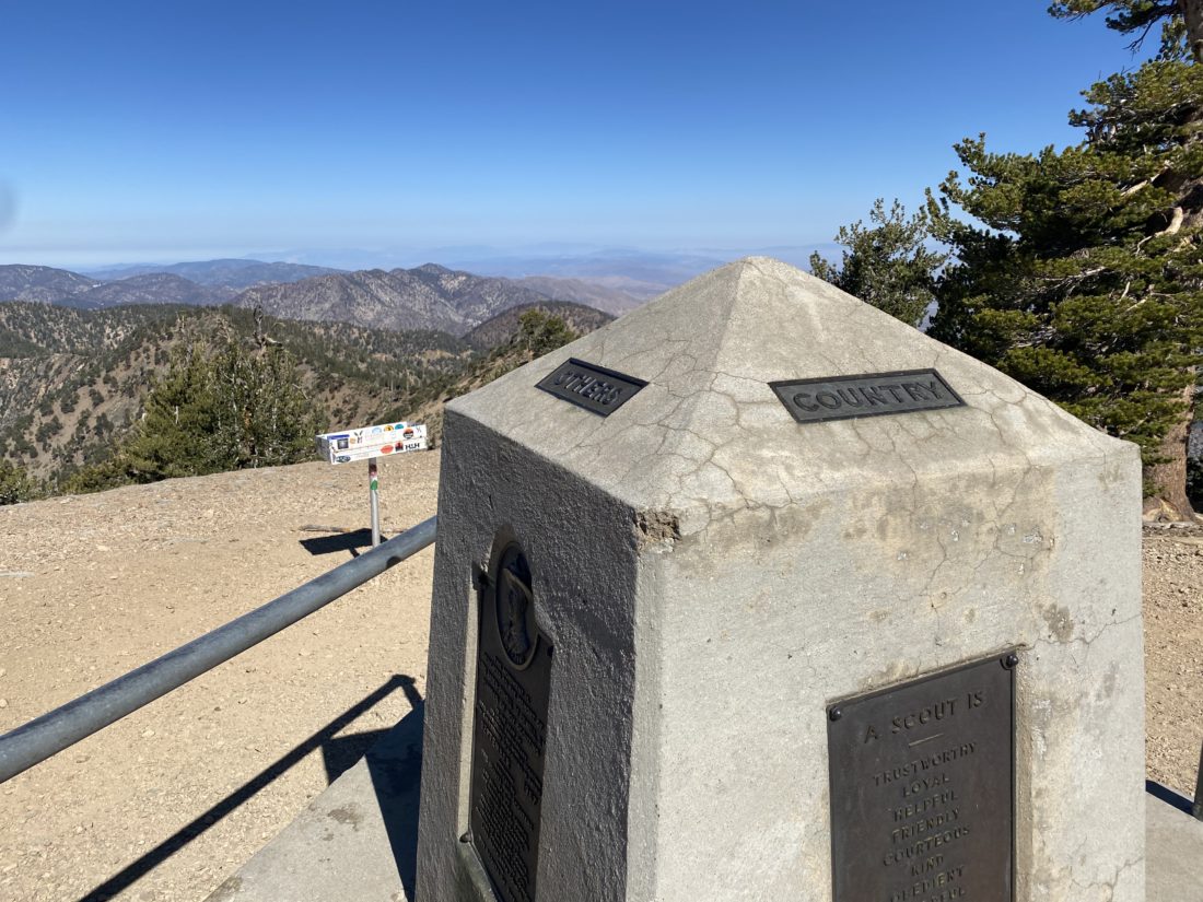
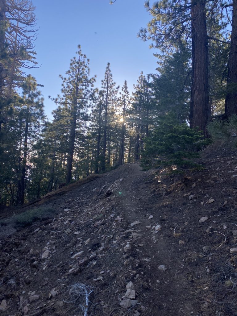
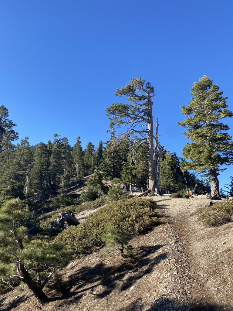
Finally, I came to the junction that would take me up to the summit of Baden-Powell. Again, this is a short but steep climb. I kept my eyes focused on the trail in front of me and plodded upward. Soon, the familiar concrete monument was in front of me. I dropped my pack next to it and wandered over to the summit flag. I snapped a few photos, but I have found that I tend to take less at the summits when I revisit them. This time was no exception. I sat next to the monument to Lord Baden-Powell and enjoyed a well-earned snack. Off to my west, I could see my return route. From this side, the ascent of Mount Burnham looked much more hospitable. Once I was refreshed, I set off back the way I came. Looking back, I should have gone the other way, just to see the Wally Waldron tree before rejoining the PCT. Oh well…

I cruised along the PCT knowing for the most part, I would be descending, but with a few short climbs from time to time just to keep things interesting. I reached the junction to leave the PCT and make the climb up to Mount Burnham. I made my way up the trail, stopping briefly once to photograph Baden-Powell. I really only had to go about 500 feet with just about 100 feet of gain. A bit nicer than 3/10 mile and over 300 feet of gain. At the summit, a small rock cairn had been constructed, and the summit sign was placed next to it. I found a register and signed it. After a few photos, I set off down the other side. As I made my way down back toward the PCT, I was validated by my choice to do this peak upon my return. 

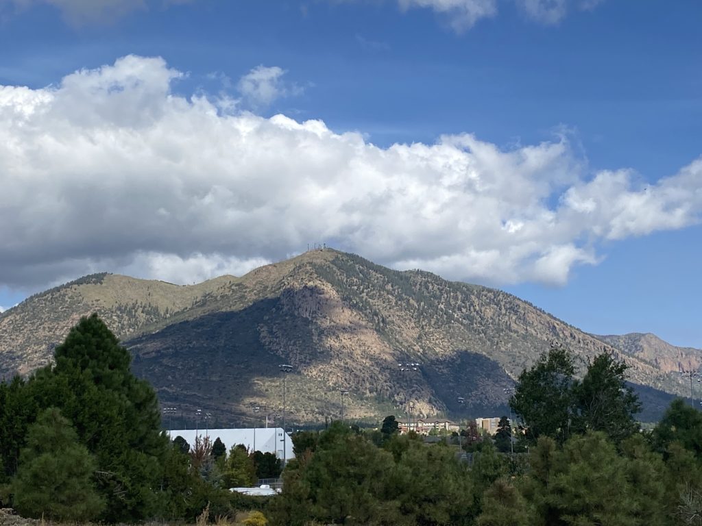
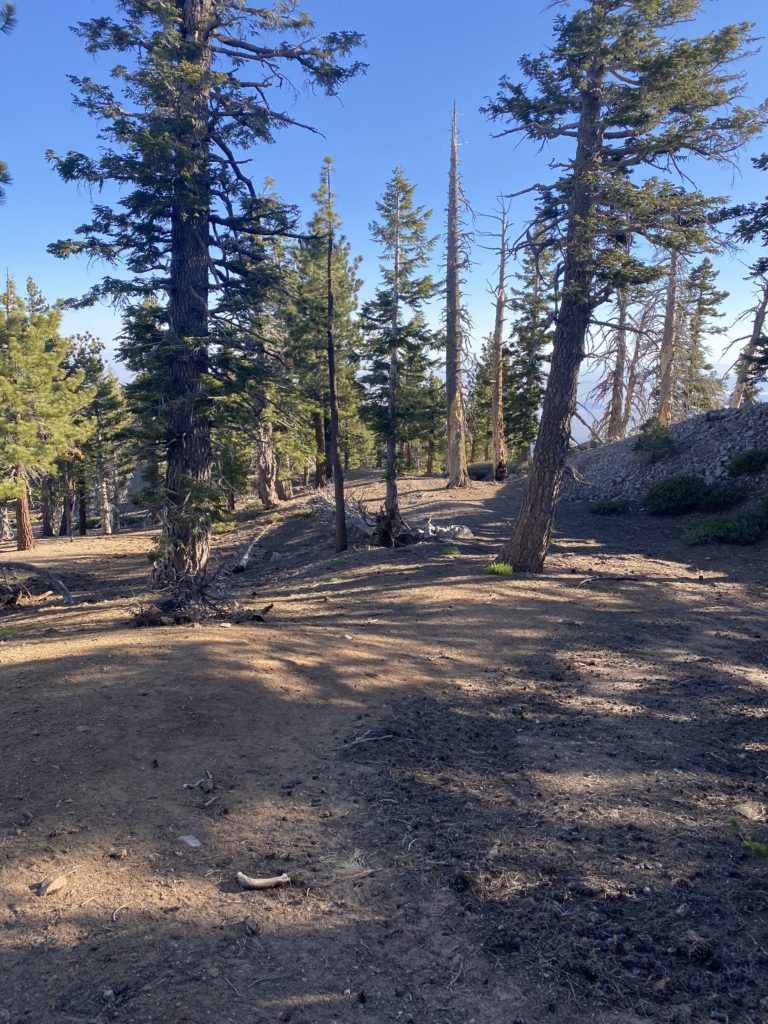
The trail would continue on, treating me to more views along the way. Soon I reached the junction with the side trail that avoided climbing back up Throop Peak. This was that same trail I was briefly on earlier in the day. I had about 2.3 miles mostly descending back toward Dawson’s Saddle. From time to time, I would see the burned slopes of Mount Lewis just to the north of where I was parked. That area burned during the Bobcat fire back in 2020. Along the way, I passed a group of four hikers heading out for Baden-Powell, I wished them well and continued on. Once safely down that short steep section, I again crossed the highway to my car. I really enjoyed the climb to Baden-Powell this way. While it had some moments, it felt less of a challenge and more of a hike. I would like to come back and explore some of the other peaks in the area. After changing out of the hiking clothes and a quick rinse, I headed down to the high desert and over toward Frazier Park and what was to be my next set of peaks; Mt. Pinos and Sawmill Mountain. The final stats for this hike were 8.5 miles, in 4:46 with 2,640 feet of gain.


Buy Me a Coffee at ko-fi.com

I am an avid peak bagger, sometimes backpacker, and former sea kayaker living in San Diego. I am the co-author of Urban Trails: San Diego, available now!

In 2019, I became the third person to complete the San Diego 100 Peak Challenge. Not stopping with that accomplishment, I set my sights on the harder San Diego Sierra Club 100 Peak list, which I completed in 2021. In addition, I have conquered several Six-Pack of Peaks challenges (SoCal, San Diego, Central Coast, and both the Arizona-Winter and Arizona-Summer).

I am looking forward to exploring new summits and new adventures across the southwest. 

Backpacking San Jacinto

Earlier this year, Jeff Hester, the founder of the Six-Pack of Peaks Challenges, asked if I would be interested in joining a group to scout out a new set of peaks for a New Mexico-based Challenge. I immediately said yes! However, New Mexico had to close all its National Forests, as several wildfires were raging across the state. That meant we would have to postpone the trip, possibly to Fall. Since I had the time off, I decided to turn my focus to either working on the SoCal Six-Pack or the Arizona Summer Six-Pack. In the end, the SoCal trip won. One of the biggest pains of the SoCal is all the driving to and from San Diego, but turning it into more of a camping road trip would take some of the sting out of the effort. Plus, this would let me have an adventure! The first peak on the list was San Jacinto, but instead of hiking up via Devil’s Slide or the Marion Mountain route, I would do this peak as an overnight trip. I sent away for my overnight permit (yes, you still have to apply for the permit via the mail). Once I received my permit, I secured campgrounds near the other two peaks I wanted to climb, Baden-Powell and Sawmill. This trip was going to be a blend of backpacking and car camping, so I had an interesting collection of gear in the back of my trusty Outback. With everything loaded, I set off for Palm Springs and the Aerial Tram.

Day 1: Mountain Station to Round Valley

The first day was actually going to be pretty mild. I parked my car in the overnight lot at the tram station and grabbed my gear. While I had a reserved ticket for 2 pm, I was there a bit early. There was room on the tram, so I headed up away from the heat of the desert. After my 12-minute ride, I headed to the ranger station to check in. The ranger went over the basic rules and showed me how the campsite actually worked. I must admit, in planning this portion of the trip I did not really understand the layout of the Round Valley campground. Along the trail, there are posts, each marked with an R and a number. These serve as junction markers to trails that lead back to the various campgrounds, which are all named. He told me to avoid R1-R4 as they are just off the main trail to the peak. Since there were some winds forecasted for the evening, he also suggested not staying at Upper Chinquapin. Now that I understood the campground, and carrying a much better map that came with my permit, I set off. 

The temperatures were in the mid-70s, but the light breeze and the shade made for a pleasant time. Since I was early, I debated heading to the campsite, dropping my gear, and heading up to the summit, but I knew I had several more days of hiking ahead of me and did not need to rush. Once at Round Valley, I began to explore some of the options to set up camp. In the end, I picked Buckthorn, as there was a spot sheltered by some boulders that could offer some additional protection from the wind. I walked back down to the Seasonal Ranger station and marked on the map that I had taken Buckthorn for the evening, then went over to the faucet to filter water. 

As evening came, I made my dinner and enjoyed a nice beer I carried up. Since I only had to cover just over 2 miles with an elevation gain of about 800 feet, I was willing to have the extra weight for a nice Victory at Sea from Ballast Point. A quarter moon hung in the sky as I crawled into my tent and drifted to sleep.

Day 2: Round Valley to Summit

I woke just before dawn, and the forecasted winds never seemed to come. I had my oatmeal and a couple of cups of coffee while I broke down camp. My plan was to stash my backpack, while I slack-packed up to the summit. I found a nice nook near the ranger station and set off up the trail toward Wellman Divide. Since the first tram up wasn’t until 10 am, I doubted I would see anyone for quite a while. I felt great as I made the climb up from Round Valley. I suspect that spending the night at 9,100 feet helped my body get a bit more used to the altitude. I reached Wellman Divide still feeling great. I stopped for a bit to grab some photos before continuing upward.

The trail was familiar, as this was the third time I had covered this portion of the route. Unlike last time, where I had been feeling the climb, this time I just kept cruising along. I reached the turn near Miller Peak and kept trucking along, knowing I was almost there. I came to the junction with the trail that connects up from Little Round Valley. If I was going to see anyone this early, it would be anyone who might have camped there. Although I suspect, if they had camped there, they might have tried for a sunrise summit. There was a tiny patch of snow nearby, and I wondered how much longer it would last?  

I set off for the final 3/10 mile to the summit. I briefly stopped at the Rescue Hut but was starting to run low on energy. Since I had a short scramble to the top, I pushed on. Someone had spray-painted blue arrows to help guide you up the rocks. I could not recall seeing this the last time. 

Once at the summit, I stood alone. I snapped my photos, enjoying not having to wait for others. I then found a nice spot to take my well-earned break. With a little bit of food in me, I was feeling great again. I took in the views some more, then headed back down the trail. As I neared the turn near Miller Peak, I decided to hike over and check it out. I got close to the true summit, but it would have been a bit of a scramble to the top and I just did not feel like doing it. After rejoining the main trail, I cruised back down. I would look at my watch and wonder when I might encounter my first day hikers. My best guess was just around Round Valley. The return to Round Valley went smoothly, stopping only for photos. 

Once back at Round Valley, I switched back to my backpack, securing my slack-pack to the outside. I thought about transferring my water bladder back into my backpack but figured I had just about 2 miles of downhill ahead of me and I would be fine. Just past the first campsites, I met my first day-hikers. My guess had been correct as to the timing. We chatted a bit, then each went our separate ways. About every 15 minutes or so, I would pass another set of hikers making their way toward the summit. Some seemed a bit more prepared than others. Finally, I reached the ranger station. I checked in with the ranger to let him know I safely returned. As I enjoyed a nice cool drink of water, I listened to him caution a group of hikers about the warm day. Feeling a bit refreshed, I set off on the hardest part of the entire hike, the climb to the actual tram station. I plodded my way up the 120 feet of steep concrete switchbacks. Once there, I bought a cold soda and waited for the next tram down. With one peak down, it was off to drive over to Table Mountain Campground and tackle Baden-Powell via Dawson’s Saddle tomorrow.

Final Stats

Day 1: Ranger Station to Round Valley: 2.25 miles, 1:17, and 795 feet of gain.

Day 2: Round Valley – Summit: 5.9 miles, 3:39 (excluding time at the summit), and 1,735 feet of gain 

Round Valley to Ranger Station: 1.9 miles, 1:03, and 795 feet of loss. 


Buy Me a Coffee at ko-fi.com

I am an avid peak bagger, sometimes backpacker, and former sea kayaker living in San Diego. I am the co-author of Urban Trails: San Diego, available now!

In 2019, I became the third person to complete the San Diego 100 Peak Challenge. Not stopping with that accomplishment, I set my sights on the harder San Diego Sierra Club 100 Peak list, which I completed in 2021. In addition, I have conquered several Six-Pack of Peaks challenges (SoCal, San Diego, Central Coast, and both the Arizona-Winter and Arizona-Summer).

I am looking forward to exploring new summits and new adventures across the southwest. 

Mirror Lake

Matt’s alarm went off at midnight, and shortly thereafter it wished him a “happy birthday”. Once it was done singing to him, I did the same. Matt was getting ready to attempt to summit Mt. Whitney, while I was planning to hike as far as Trail Camp. This opportunity for me was fairly last minute, so I had not had the chance to do any training for a hike of the magnitude of the summit. I let Matt focus on getting ready, as I was not scheduled to sync up with David until around 1:30 am. Matt finished up and set off for Whitney Portal. David arrived on schedule and we tossed our gear and began our drive up.

Driving in, we could see headlamps dancing along the trail. When we parked at the portal, the car’s thermometer read 43°F. We grabbed our gear and clicked on our headlamps and set off. There was some comfort having hiked this about 12 hours earlier as we climbed in the darkness. My legs, and more importantly lungs, were feeling good as the trail climbed ever upward. I knew not to compare my pace, as night hiking is always slower. As we made our way up, David was having trouble following my pace. He said to go on and he would meet me at the Lone Pine Lake junction. I continued hiking at a nice pace, being mindful of bears that might be out. All was going well until the long log crossing near the junction. While it had not been an issue in the daylight, this night crossing was nerve-wracking. It was more of a shuffle than actually walking. I reached the junction and waited for David. I found a spot to sit and turned off my headlamp to save my batteries. The stars were majestic as there was no moon to hide their brilliance. In addition, a meteor shower was just concluding, and I spotted one very bright one streaking across the sky. As I waited, several more vaporized into our atmosphere. It had been some time sitting here and I was starting to shiver. I got up and paced a bit to warm back up. I am fairly sure it was below freezing here. Several hikers passed by, but no David. I decided to continue on, knowing David would either turn back and relax back at the portal, or I would meet up with him on my descent.

Just past the Lone Pine Lake junction is the entrance to the Whitney Zone. I stopped for a photo and continued on. To the east, the predawn glow was starting to appear. I kept climbing toward Outpost Camp, the next milestone for me on this hike. The mountains were slowly being bathed in light. The trail eases some as it makes its way through Bighorn Park, the creek flowing next to the trail. As I neared Outpost Camp, I could see the tents scattered about and continued on, trying to be quiet for anyone who might still be asleep.

From there I would have another set of switchbacks to climb until I reached Mirror Lake. My plan was to reach it by sunrise, then enjoy a second breakfast and coffee before pushing on. Waiting for David put me behind schedule, so I watched the sunrise while I was on the switchbacks. 

As I reached the junction for Mirror Lake, I could start to feel the altitude and was glad to be taking a break. I found a nice flat patch of granite near the south shore and pulled out my water filter, but for some reason, I could not get it to work. It might have been clogged from the last time I used it or for some other reason. I had enough clean fluids to get down, so that was not an issue, but I did not have enough to continue on nor make my breakfast. I snapped some photos of the peaks reflecting down onto the water. Several groups of hikers passed by as they made their way forward. While I was bummed about not reaching my goal, this hike had been a spectacular one. I hung out here for about 30 minutes, soaking it all in.

As I made my way back, I would mention to ascending hikers to be on the lookout for a fellow in a green and white Celtic jersey and to make sure to wish him a happy birthday! One set of hikers asked if I was Chris and relayed a message from David that he would meet me at Outpost Camp. 

There, as promised, was David. He said it just wasn’t his day on the mountains, and with that, we began heading down toward the trailhead. Along the way, we spotted some deer and some pikas. More hikers continued on, some with full backpacks ready to make camp, probably at Trail Camp. In fact, one of those folks turned out to be a friend of a friend who recognized me. We made it back down to Whitney Portal just before 9 am. I hiked a total of 8.6 miles in 6:26. My final altitude was 10,655 feet, meaning I climbed 2,386 feet. After driving back down to Lone Pine, David hopped into his car to race back to his hotel in Ridgecrest to grab a shower. I gathered my gear from the hotel and set off. As I drove away, I looked off to the west, hoping that Matt would be successful and one day I might stand atop that summit. Later that evening, I got a message from Matt that he made it and 15+ people wished him a happy birthday!


Buy Me a Coffee at ko-fi.com

I am an avid peak bagger, sometimes backpacker, and former sea kayaker living in San Diego. I am the co-author of Urban Trails: San Diego, available now!

In 2019, I became the third person to complete the San Diego 100 Peak Challenge. Not stopping with that accomplishment, I set my sights on the harder San Diego Sierra Club 100 Peak list, which I completed in 2021. In addition, I have conquered several Six-Pack of Peaks challenges (SoCal, San Diego, Central Coast, and both the Arizona-Winter and Arizona-Summer).

I am looking forward to exploring new summits and new adventures across the southwest. 

Hot Springs & Corral Benchmark

Since I am halfway done with the San Diego Six-Pack of Peaks, I figured I would cross another one off the list, Hot Springs Mountain. If I was going to do this peak, I had to sync up with Gina Norte and do it with her again. I met her at her house and then drove up toward the summit. The upside of being the trail manager for Los Coyotes is you have some additional access. We parked the car, grabbed our stuff, and headed toward the summit. The bugs were out and I had a few extra bits of protein along the way. I almost broke out the bug net but opted not to.

The summit was empty and we spent just a little bit of time here before heading over to the abandoned lookout tower for a bit. We surveyed possible routes for an attempt to summit Obie Benchmark, but that was for another day. As we cruised back down from the summit, the first wave of hikers began to make their way up. We chatted with some before parting ways.

Our next goal was to visit Corral Benchmark. This peak sits off the main trail. Since I was with Gina, we could climb it. The route up was pretty straightforward and we soon found ourselves at the summit. A register sat off to the side, and a tribal benchmark was affixed to a nearby rock. We had a snack and took in the views. May Grey socked in the coast. In fact, I had a little rain on my way here. Off to the west stood SquareTop, Collins, and Knob. To our southeast, Cody, and Pike. These were some stunning vistas. I was honored to be able to view them.

We grabbed our packs and rejoined the main trail. Soon we were back at Gina’s car and making the drive back down. I bid farewell and began driving back home, with a stop at Dudley’s for a well-earned sandwich.


Buy Me a Coffee at ko-fi.com

I am an avid peak bagger, sometimes backpacker, and former sea kayaker living in San Diego. I am the co-author of Urban Trails: San Diego, available now!

In 2019, I became the third person to complete the San Diego 100 Peak Challenge. Not stopping with that accomplishment, I set my sights on the harder San Diego Sierra Club 100 Peak list, which I completed in 2021. In addition, I have conquered several Six-Pack of Peaks challenges (SoCal, San Diego, Central Coast, and both the Arizona-Winter and Arizona-Summer).

I am looking forward to exploring new summits and new adventures across the southwest. 

Sunset Mountain

I had pretty much written off doing any more peaks on the San Diego Sierra Club 100 list this desert season but much to our surprise we had some nice weather here at the end of April, so Susie Kara and I decided to knock Sunset off our to-do list. We had done this hike with Matt Bennett back in January 2020. While the actual distance from the trailhead to the summit isn’t that far, this hike is one of the more challenging ones on the list. We drove out to Anza Borrego turning onto Pinyon Wash and drove down the rather nice dirt road back to a good spot to pull over and park the Subaru. Off to the east loomed Sunset Mountain. We gathered our stuff and set across the flat desert floor to the start of the grueling climb. We had a few cactus flowers scattered along the way offering a little bit of joy to offset our climb. The route up is basically a straightforward assault on the mountain. Both Susie and I remembered how much we disliked climbing a mountain due to a large amount of poor footing. We carefully worked our way up the very steep slopes to the first minor, and I stress, MINOR plateau and had a short breather. We had gained almost 700 feet in just over .2 miles. Neither one of us was looking forward to descending this section.

We checked our location against our previous route, and we were basically right on track. Since there is no defined trail, it is up to you to plot your route up the mountain, hoping to follow the easiest path you can see. I led us up the steep slopes ever closer to the summit. So far, my route finding had been going well. I would like to think all this time in the desert has helped improve them. 

Soon we reached the last bit of the climb and pushed on. Susie had the lead, as I did pick a slightly slower section that I had Susie skip. After hopping over the rocky summit, there stood the wooden post denoting the summit. The register can was tucked next to it. The benchmark, stamped as Yak, was also right there. Off to the east and west were two reference marks as well. We took a short break and did all the usual summit activities before heading back down.

I had parked near a couple of smoke trees that grew next to the main road. This gave us a great landmark to keep aiming toward as we slowly and carefully worked our way back down. Last time when we climbed this peak, our descent time was longer than our ascent. 

As we neared the bad section, we made the call to take the gully that was to our south instead. While we still had a steep and difficult descent to reach it, we felt once in it, our stress levels would ease. Susie and Matt took that route last time while I stayed on the same route I used going up. I did have one large rock break out from under me, we made it safely to the gully. While it was rocky, there was nothing that posed any challenges. In fact, we had a couple of sections that we just slid down. Who doesn’t like a nice slide!?

The gully opened back onto the desert floor, and we began weaving through the various pointy plants scattered across the landscape. Once back at the car we were glad to be done with this peak. The entire hike was just 3.6 miles, but we gained over 1,970 feet. And to further add to that, the first 1/2 mile was mostly on the flat desert. Our complete time was 5:09, including our breaks. It was a touch slower than last time, but we were without the awesome route-finding skills of Matt. Just 21 more to go!


Buy Me a Coffee at ko-fi.com

I am an avid peak bagger, sometimes backpacker, and former sea kayaker living in San Diego. I am the co-author of Urban Trails: San Diego, available now!

In 2019, I became the third person to complete the San Diego 100 Peak Challenge. Not stopping with that accomplishment, I set my sights on the harder San Diego Sierra Club 100 Peak list, which I completed in 2021. In addition, I have conquered several Six-Pack of Peaks challenges (SoCal, San Diego, Central Coast, and both the Arizona-Winter and Arizona-Summer).

I am looking forward to exploring new summits and new adventures across the southwest. 

Coyote Mountain

As we pulled onto the side road along Rockhouse Canyon Road, another car was parked with a solo hiker getting ready to make their ascent of Coyote Mountain. Unlike last weekend, when the winds were a bit too high for our comfort, today’s forecast looked pleasant, although just a touch on the warmer side. Susie, Alberto, and I gathered our gear and began hiking across the desert floor to the ridge that we would follow up to the summit. The other hiker had already left and appeared to be making good time.

Soon we found ourselves at the base of the steep ridge and started our ascent. I was hoping that I might find the folded rock again and see it in a better light. As luck would have it, we passed right by it. Score! 

Susie guided us up the ridge. The route is very well marked with cairns, and after a bit, the use trail began to reveal itself. While not really needed, as this is a standard ridgeline hike without any real obstacles, it is nice to walk on a more cleared route. 

Unfortunately, I am not as fit as Susie, so we took a short break to let me recover a bit. I then took over the pace-setting. We would take a few more quick breathers just before a steeper section along the ascent, We were still holding a solid pace. 

As we neared the final steep section, that earlier hiker was making his way back down. We chatted a bit before continuing on. Soon, we crested the summit, and the wooden pole that marks it stood before us. We took a nice break, snapping some photos, signing the register, and refueling. I found the two reference marks, as well as the benchmark itself. Since both Susie and I had early evening plans, we were mindful of the time and headed back down.

The descent went pretty quickly. I found a nice rhythm that did not bother my knees. When I did this hike back in 2019, I had some serious knee pain on the descent. This time, no real discomfort. Susie and Alberto would stop occasionally for a brief moment to regroup. One thing I have learned with my knees is to hike at the pace my body can handle. Once I would catch up with them, I usually kept right on going.

As we neared the base of the ridge, we almost headed down the wrong spur, but a quick check of our ascent track got us back on track. Off in the distance, we spotted a truck that had pulled up. We were curious who might be looking at starting this hike around noon. The temperatures were in the mid-70s and there is no shade on the entire hike. It turns out it was another hiker and his wife we knew, who had just started tackling some harder hikes across San Diego. We chatted some before parting ways. The stats for the hike were 5.2 miles in 4:29. Our time up to the summit was 2:15, and we spent about 20 minutes relaxing before heading down. The elevation gain was a mere 2,623 feet. 


Buy Me a Coffee at ko-fi.com

I am an avid peak bagger, sometimes backpacker, and former sea kayaker living in San Diego. I am the co-author of Urban Trails: San Diego, available now!

In 2019, I became the third person to complete the San Diego 100 Peak Challenge. Not stopping with that accomplishment, I set my sights on the harder San Diego Sierra Club 100 Peak list, which I completed in 2021. In addition, I have conquered several Six-Pack of Peaks challenges (SoCal, San Diego, Central Coast, and both the Arizona-Winter and Arizona-Summer).

I am looking forward to exploring new summits and new adventures across the southwest. 

Mount Elden

The previous day’s ascent of Bill Williams took a bit out of me. That, coupled with a slightly worse weather forecast, meant the planned hike up Kendrick Peak was not going to happen. Instead, I opted to summit Mt. Elden, which is all of 10 minutes from my friend’s house.

Mt. Elden

I grabbed a biscuit from McDonald’s and ate it while I finished getting ready. If you have ever driven through Flagstaff and seen the tall mountain right in town, that is Mt. Elden. The parking lot was almost full when we got there at 7:30. 

The trail starts off fairly gently before the steep ascent to the summit. My friend’s husband decided to join me. He had hiked it years ago and wanted to try again. But about a mile in, he looks down to discover the soles of his hiking boots have separated. I dug out my duct tape to hold them together enough for him to return to the trailhead and call his wife. One of the benefits of an in-town hike with cell service! I then set off.

I was extra mindful that I was at altitude and kept a measured pace. This trail was much rockier than Bill Williams. A friend described this hike as like doing Viejas Mountain but 3x harder. I can attest that is about right. 

The trail would work its way up the steep slope, switching back and forth. Hikers would pass me returning from the summit and a couple would pass me on their ascent. I would stop from time to time to catch my breath and to take in the view.

Soon, the lookout tower and all the other towers came into view. I found a shady spot and just sat there for a while. Once I had recovered, I wandered around the summit. The views were spectacular. I could see Kendrick to the northwest and Humphrey to the north. Clouds were starting to build, so I was glad to have changed up my plans. I found both reference marks and the benchmark. 

I had made the summit in 2:30, and after about 30 minutes at the top, I knew it was time to head down. Given the steep, rocky nature of the trail, I did not expect to gain much time like I had on Bill Williams. I stopped a few times to chat with folks making their way up. Finally, the 1/2 mile to go sign appeared, and the end was in sight. It had gotten a tad warm, but a strong breeze offset that. All told, I recorded this hike at 5.4 miles. It took me 5:02 to climb the 2,397 feet to the summit.


Buy Me a Coffee at ko-fi.com

I am an avid peak bagger, sometimes backpacker, and former sea kayaker living in San Diego. I am the co-author of Urban Trails: San Diego, available now!

In 2019, I became the third person to complete the San Diego 100 Peak Challenge. Not stopping with that accomplishment, I set my sights on the harder San Diego Sierra Club 100 Peak list, which I completed in 2021. In addition, I have conquered several Six-Pack of Peaks challenges (SoCal, San Diego, Central Coast, and both the Arizona-Winter and Arizona-Summer).

I am looking forward to exploring new summits and new adventures across the southwest.