Trip Reports

A Challenge on El Cajon Mountain

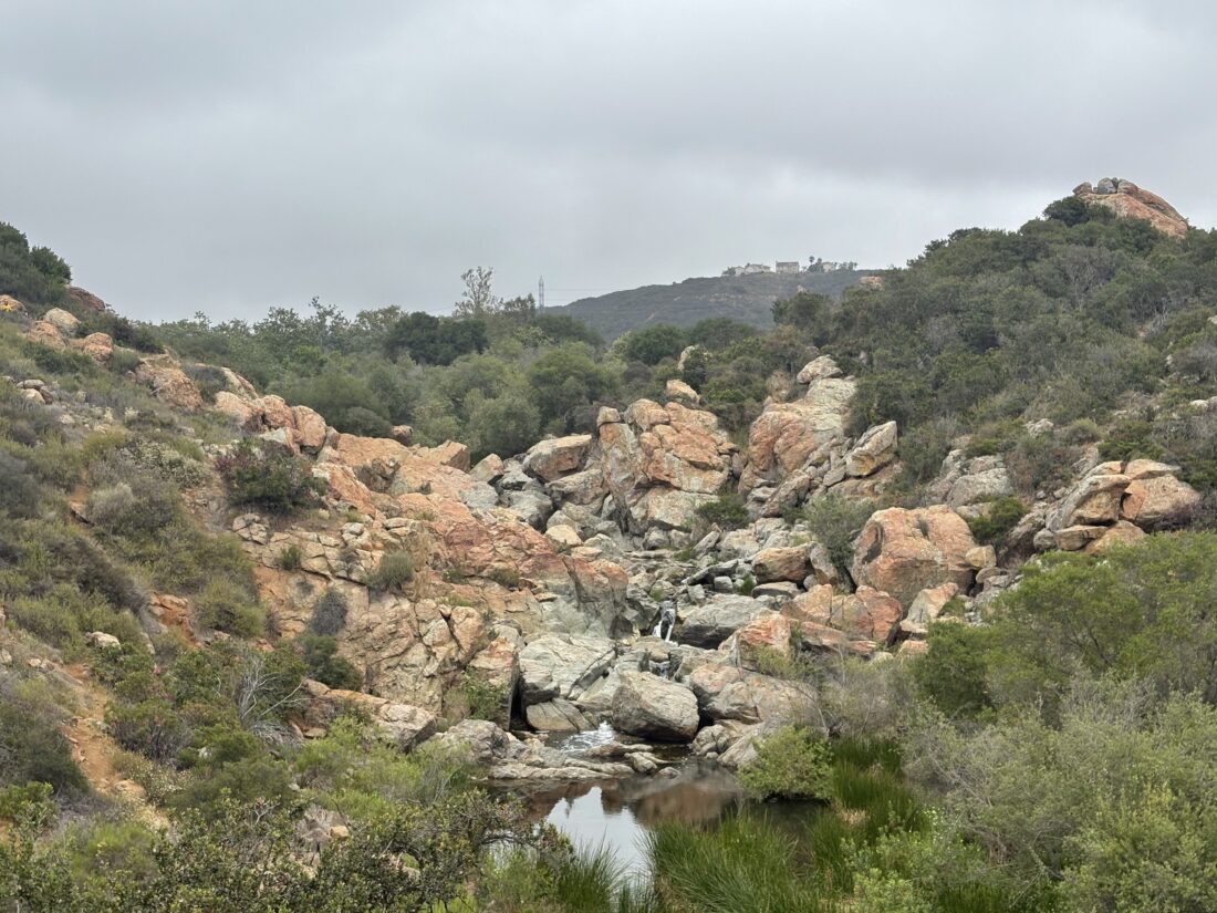
As we approached the parking lot for the trailhead, cars lined both sides of Wildcat Canyon. I decided to gamble and see if there might be a spot still in the lot, and there was! Ted and I gathered our gear and walked over to the sign-in tent. Today was the Warrior Hike Challenge up El Cajon Mountain in honor of Memorial Day. We attached our commemorative carabiners to our packs and small American flags as well and set off. The overcast skies were welcomed as we made the first climb of the day. The 1-mile Celebration Station was still setting up as we passed by. Wildflowers dotted the edges of the trail from time to time. We were making good time as we continued pushing onward. The trail splits around the 2.5-mile mark, and we opted to take the trail to the left. This section is one of the steeper portions of the climb, but I felt good pushing upward. When the trail came back together, we saw the 3-mile Celebration Station about 100 yards down the other trail. We decided to stop at it upon our return. I was curious about what our time to the summit might be, as I was feeling good.

From time to time, hikers who had gotten an even earlier start were making their way back from the summit.  A small stream was still flowing across the trail, just before the final climb. We passed the abandoned truck, and soon the junction with the trail to El Cajon Mountain and El Capitan. Now we followed the single-track trail up the last bit to the summit. As expected, the summit was crowded, but we found a spot to take a break and refuel. I pulled up my tracker and saw that we had reached the summit in 2:27!

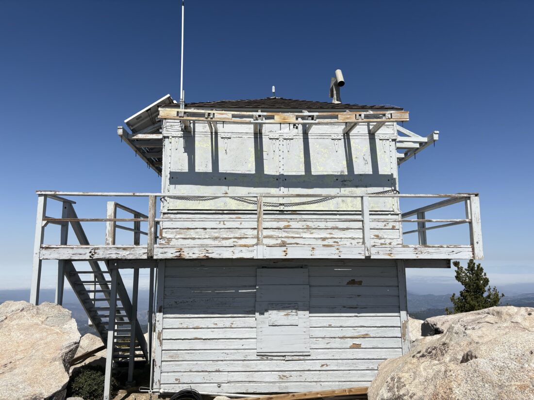
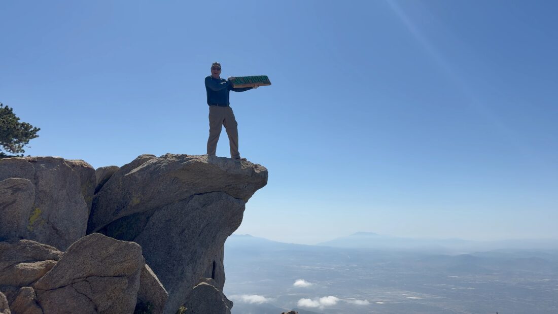
After snapping some photos, including with the summit sign, we set off back down the mountain. We would pause from time to time to allow the uphill hikers the right of way. Once at the junction with El Capitan, we decided to make the 0.2-mile trek to visit that summit. In all my times up El Cajon, I never hiked over. As we approached the summit, the ruins of the building came into view. I joked this was practice for seeing the hut atop Mt. Whitney. After snapping some more photos, we returned to the junction and went back down. One of the challenges of this hike is that you have two modest climbs to make upon your return, so we were mindful of that.

At the junction with the spur trail to the old mines, we opted to make the 0.1-mile trek to see them. We took a few photos in the entrance to one of the mines, but opted not to go exploring further. Once back on the main trail, we soon came to the 3-mile Celebration Station. We grabbed some free snacks and one of the cords we needed to earn our commemorative patch and challenge coin.

As we continued down the trail, my knees were feeling the steep descent, and Ted’s foot was also feeling it. The miles ticked by, and off in the distance was the blue tent of the 1-mile Celebration Station. One final climb brought us to it, and we got our second cord and another round of snacks. As we headed to the trailhead, the thought of burritos filled our heads. Back at the trailhead, we got our last cords, earning the patch and coin. If we repeat this hike for Veterans Day, we can earn two more coins. After tossing our gear back into the car, Ted and I compared our recorded stats, which did vary quite a bit. Ted’s Garmin recorded 12.02 and Strava on his phone recorded 11.89! My tracker logged the hike at 11.5 miles in 5:51 and 3,152 feet of gain. With that summit, my San Diego Six Pack of Peaks was completed. Now to start on the SoCal Six Pack.


Buy Me a Coffee at ko-fi.com

I am an avid peak bagger, sometimes backpacker, and former sea kayaker living in San Diego. I am the co-author of Urban Trails:San Diego, coming in Spring 2026!

In 2019, I became the third person to complete the San Diego 100 Peak Challenge. Not stopping with that accomplishment, I set my sights on the harder San Diego Sierra Club 100 Peak list, which I completed in 2021. In addition, I have conquered several Six-Pack of Peaks challenges (SoCal, San Diego, Central Coast, and both the Arizona-Winter and Arizona-Summer). I am looking forward to exploring new summits and new adventures across the southwest. 

Backpacking Barker Valley

After the closure of the Palomar Divide Truck Trail a couple of weeks ago, which forced me to pivot to backpacking Noble Canyon instead, I secured a new overnight permit for Barker Valley. The road had reopened, so that hurdle was no longer in front of me. However, we had some unseasonably warm weather forecast for the start of my trip. Since I was not planning on starting until mid-afternoon and most of the 3 or so mile hike would be descending from the trailhead to Barker Valley, I was overly worried. I made the very familiar drive through Ramona and then Santa Ysabel. After a quick stop for gas at the tribal gas station, I passed on through Warner Springs until I reached the turn-off onto the Palomar Divide Truck Trail. After 8 miles of driving, I reached the trailhead and pulled into a spot off to the side of the road. It was warm, but a nice breeze helped it feel less oppressive. I read over the trailhead kiosk, which I had seen numerous times on my drives up to Palomar High Point, before setting off down the trail.

The trail gently worked its way down, following the contours of the mountain. Sweeping views of Lake Henshaw to the south, and both the Observatories and the Lookout Tower to the north. The trail was slightly overgrown in spots, but nothing too bad. I might return with some clippers to do some trail maintenance, if I felt like making the drive up again. Wildflowers still lined the trail from time to time. Footprints could be seen in the sandy sections of the trail, so it does see some traffic occasionally. About a mile in, a rock arrow pointed the way. This area had a couple of nice campsites on either side of the trail.

After about 1.8 miles, another large rock arrow pointed the way for the trail, which now made a sharp left turn, leaving the ridgeline it had been following. On several maps, a trail is shown continuing along the ridge line, but it appears that it is becoming overgrown. The trail was also starting to become a bit more rocky, so a little more care was needed with my footing as I worked my way down toward the valley. The overgrowth also increased a bit, but nothing a quick push of a trekking pole could not handle. Soon, I found myself in the valley and near the West Fork of the San Luis Rey River. Now I needed to find a campsite and access to water. I carried enough to get me to the campsite and back if things did not work out, but not enough for dinner and breakfast. I passed one campsite, which might have worked, but continued along the trail that paralleled the stream, looking for other camping options as well as water. I came upon a nice campsite near a very large downed oak tree. I had a choice between under the shade of an oak tree or on the open dirt. I brought my REI QuarterDome, so I could lie inside the mesh walls and enjoy the night sky, so the choice of where to pitch my tent was obvious.

I dropped my pack, grabbed my CNOC water bag, and set off to find water to filter. At first, I found a large pool of water with bits of algae floating on top of it. No worse than what I have seen used by those on the Arizona Trail, but I decided to keep exploring before settling on this as my water source. Soon, I heard the sounds of flowing water and made my way back to the edge of the stream. I placed my bag into the gently flowing stream and had 3 liters in a matter of moments. I trekked the 0.3 miles back to the campsite and began to set up camp. As the sun was beginning to set, the mosquitoes were starting to come out in force. I had my bug net, but I forgot to bring any repellent, so I retreated to my tent (killing the few that had snuck inside). I relaxed, staring at the trees around me and the dance of the bugs on the tent’s mesh. I figured this was good practice for my Yosemite backpacking trip. After the sun had set, I ventured out of the tent and made my dinner.

I listened to my audiobook while I enjoyed a freeze-dried lasagna and waited for the stars to come out. Once it was dark enough, I again worked on some astro-photography before turning in. It actually became quite chilly, and I was glad to have my warmer quilt with me. I woke up around 5:30 and made a cup of hot coffee. It was a bit nippy, so I checked my Govee thermo-hygrometer, and it said it was 31°F! Being in a valley meant the cold air had settled here overnight, hence the temperature difference between the summit forecast and my location. I boiled some more water for my oatmeal and began packing up. Around 6:30, I was ready to head back up the trail.

The climb back to the trailhead went fairly smoothly, I only stopped to remove my fleece and adjust my socks. After about 1:30, I again reached the metal gate, and my backpacking adventure in Barker Valley was over. I tossed my gear into the Outback, changed into a clean shirt, and decided to drive on up the High Point. The road became a bit rougher, and I drove the last 5 miles to the summit. The road to the trailhead is doable in most cars (just drive slow and keep your eyes open), but after the trailhead, I would only recommend something a bit more off-road-friendly (like my Outback). Near the summit, I could see the results of the controlled burn that had been performed recently. The tower was staffed, so I was able to drive all the way to the top. I wandered around the summit, snapping a few photos. It was too windy to have a discussion with the two rangers staffing the tower, so I set off back down the road and home.

The final stats for this adventure were 6.9 miles with 1055 feet of gain (most of it on the way back). My descent time was 1:30 (with some filming time included), and 1:27 for the ascent (less time filming). The video of the trip will be on my YouTube channel soon, so go there and like and subscribe!


Buy Me a Coffee at ko-fi.com

I am an avid peak bagger, sometimes backpacker, and former sea kayaker living in San Diego. I am the co-author of Urban Trails:San Diego, coming in Spring 2026!

In 2019, I became the third person to complete the San Diego 100 Peak Challenge. Not stopping with that accomplishment, I set my sights on the harder San Diego Sierra Club 100 Peak list, which I completed in 2021. In addition, I have conquered several Six-Pack of Peaks challenges (SoCal, San Diego, Central Coast, and both the Arizona-Winter and Arizona-Summer). I am looking forward to exploring new summits and new adventures across the southwest. 

Along the Ouachita Trail

After having breakfast with my brother’s two children, Ben and I set off to take a stroll along a trail at Pinnacle Mountain State Park. I really wanted to see the eastern terminus of the Ouachita Trail, and figured it might be a nice trail to saunter on for a bit. FYI: The Ouachita National Recreation Trail (OT) is a 223-mile hiking trail that stretches from Talimena State Park in Oklahoma to Pinnacle Mountain State Park in Arkansas. I am thinking I might want to attempt it one day, as it does not have permitting issues that the John Muir Trail has.

We drove out to the parking lot and set off. The area had some rain the night before, so the ground was wet and we had to be mindful of our footing from time to time. We did not go that far along the Ouachita Trail before the trail had some flowing water on it. We took that as a sign to turn back, plus my sister’s daughter and her husband were now up and ready for us to come over. We retraced our route, following those helpful blazes back to the car. While I did pick up an Ouachita Trail patch the day before, we did not walk enough for it to count. 😉


Buy Me a Coffee at ko-fi.com

I am an avid peak bagger, sometimes backpacker, and former sea kayaker living in San Diego. I am the co-author of Urban Trails:San Diego, coming in Spring 2026!

In 2019, I became the third person to complete the San Diego 100 Peak Challenge. Not stopping with that accomplishment, I set my sights on the harder San Diego Sierra Club 100 Peak list, which I completed in 2021. In addition, I have conquered several Six-Pack of Peaks challenges (SoCal, San Diego, Central Coast, and both the Arizona-Winter and Arizona-Summer). I am looking forward to exploring new summits and new adventures across the southwest. 

Climbing Pinnacle Mountain

We were back in Arkansas for my sister’s celebration of life, and originally hoped to drive over to Hot Springs to get in a hike on Saturday morning. However, the chaos around getting my daughter to Little Rock from DC had me staying closer to Little Rock. Instead, I opted to hike Pinnacle Mountain, which was just 20 minutes from the hotel. I had climbed this peak in 2018 on my first visit to Little Rock with my son and nephew-in-law. This time, I opted to ascend the peak from the East Summit trail instead. There were a few cars in the parking lot when I pulled in. A nice trailhead sign guided me into the woods and onto the trail. I followed the blazes through the forest, being mindful of the roots and rocks. These trails are quite different from those back in San Diego. Soon, I came to the base of the mountain, and it was time to gain 510 feet in just about 0.2 miles. Not only was this approach steeper, but the entire ascent is Class 2. The blazes guided me up the rocks toward the summit. While it was early, it was warm and muggy. I soon heard voices and knew the summit was close.

I stood atop the summit and once again took in the view. My daughter was finally on her last leg of her journey, and I was no longer worried about having to help her navigate options to get to Little Rock in time. After enjoying the views, I descended via the West Summit Trail. While initially, the trail was rocky, it eased up and became more trail-like. Benches were placed along the route to provide respite for those not physically capable of the climb or who just needed a rest.

Once at the base of the trail, I took the Base Trail around the south side of the mountain. Here, I would spy some mushrooms from time to time as I cruised along the mostly flat trail back to the car.

On the drive back, I stopped at the Pinnacle Mountain Visitor Center. This is a beautiful building and I explored the exhibits some before grabbing some stickers and a better hiking map. I hoped that I might return the next day for some more trail time. My stats for this hike were: 2.58 miles, with  784 feet of gain in 1:34. 


Buy Me a Coffee at ko-fi.com

I am an avid peak bagger, sometimes backpacker, and former sea kayaker living in San Diego. I am the co-author of Urban Trails:San Diego, coming in Spring 2026!

In 2019, I became the third person to complete the San Diego 100 Peak Challenge. Not stopping with that accomplishment, I set my sights on the harder San Diego Sierra Club 100 Peak list, which I completed in 2021. In addition, I have conquered several Six-Pack of Peaks challenges (SoCal, San Diego, Central Coast, and both the Arizona-Winter and Arizona-Summer). I am looking forward to exploring new summits and new adventures across the southwest. 

Bushwhacking the Oriflamme Mountains

After not being able to backpack Sitton Peak the day before due to the parking issue at San Juan Trailhead, I opted to hike the Oriflammes in the Laguna Mountains instead. I made the all-too-familiar drive through Ramona and Julian and parked at the small turnout next to the Lucky 5 Ranch. This would be my third time on some portion of this trail, twice before when I climbed Roost Benchmark, and the previous summit of Oriflamme Mountain. The truck trail appeared to have been recently graded, and I wondered what the rest of the route would be like. I did recall a few good-sized ruts, so not something I would take my Subaru down.

Soon, I passed the junction with the PCT. We are near the end of the NOBO season, but it was still early in the morning, and I doubted I would encounter any thru-hikers yet. I continued working my way down. The car thermometer read 41° F when I left, but I knew it would be warming up, and I would have almost no shade. The ruts were still there, but a Jeep would be fine. In fact, I think some of the tire tracks I saw were from one.  

Some wildflowers dotted the sides of the trail. Soon, I reached the point where I would leave the truck trail and climb through the chaparral to the summit. A cairn marked the exit, which had not been there when I first climbed this peak. I weaved my way through the brush without too much difficulty. Soon, I found myself on the summit. It was a nice, clear day, so I had some sweeping views of the desert to my east. If there is a register located here, I did not find it. I knew that there was no benchmark, so after a few photos, I set off to climb Oriflamme Mountain North Peak. I did not attempt it the last time I was here due to time constraints, but now I had the time. North Peak is one of the peaks on the original San Diego Peak Club list, which is the “mother” list for both the San Diego Sierra Club list and the 100 Peak challenge list. While I could have followed the brush-covered ridgeline down to the North Peak, I opted to descend back to the road, follow it to a spot, and climb it from there. Once I reached a point close to a straight line to the summit, I scanned for an entry point into the chaparral. I found one and began weaving my way through the scrub. Initially, it was a bit bothersome, but I quickly found a fairly clear route and was atop the summit with less trouble than the primary Oriflamme. Here, I did find a register and added my name to the list of those who had stood atop this peak. I could see Roost Benchmark off to the north, but I did not bring enough water to continue on.

I made my way back down to the truck trail with no major issues. Now the “fun” would begin, as this is an inverted hike, meaning I now had to make the climb up to the trailhead. I slipped on my AirPods, listened to the season finale of “It’s Story Time with Wil Wheaton,” and started back up. Along the way, about 30 members of the Laguna Mountain Hot Shots were making their way down to do some fire prevention work. I thanked them for their efforts. Soon, the climb came to an end, and I tossed my gear into the car. I took the 8 home, since by the time I got back into town, it would be lunchtime and I could swing by Mi Ranchito and grab a well-earned burrito. With that second ascent of Oriflamme, I need just four more peaks to finish the 100 Peak Challenge a second time. The final stats were 6.0 miles, with 1,156 feet of gain in 2:54.


Buy Me a Coffee at ko-fi.com

I am an avid peak bagger, sometimes backpacker, and former sea kayaker living in San Diego. I am the co-author of Urban Trails:San Diego, coming in Spring 2026!

In 2019, I became the third person to complete the San Diego 100 Peak Challenge. Not stopping with that accomplishment, I set my sights on the harder San Diego Sierra Club 100 Peak list, which I completed in 2021. In addition, I have conquered several Six-Pack of Peaks challenges (SoCal, San Diego, Central Coast, and both the Arizona-Winter and Arizona-Summer). I am looking forward to exploring new summits and new adventures across the southwest. 

Taking a Wilderness First Aid Course

After all those miles of hiking and backpacking, I felt it was finally time to improve my first aid skills. I did have the Sierra Club Wilderness Basics book loaded on the Kindle App on my phone as a reference, but some practical knowledge is always the best. I can’t always hike with a doctor… So, I signed up for a 16-hour wilderness first aid course through my friends at Kit Fox Outfitters. The course was being held out at the Broken Oak Ranch, near Warner Springs, over Mother’s Day weekend. Class began at 8 with the usual filling out of forms before Colin began teaching. The class was a mix of Boy Scout troop leaders who would be guiding their packs along various trips, a filmmaker setting off on his motorcycle down to Patagonia, and a mishmash of other outdoor adventurers.

Unfortunately, an early-season heat wave had descended upon us, so we all sought out shade under the oaks while we listened to a fire hose of information being given by Colin. From time to time, we would leave our camp chairs and work through some real-life scenarios along the sandy washes, trails, and hilltops of the ranch. After a solid 8 hours of class, the first day came to a close. 

Originally, I had planned to car camp out at the Broken Oak, but the thought of dealing with the heat was not appealing. So, I drove on home to a hot meal, a soft bed, and air-conditioning.  The next morning, I made the oh-so-familiar drive back to Warner Springs for the second day of class. We were joined by David, another instructor, to continue diving into how to manage first aid in wilderness situations. On the first day, we had done our CPR training, and today we had our EpiPen training (like I needed that, given my son has one). We had a few more hands-on scenarios making splints, make-shift litters, and dealing with a multi-person incident. After our final “test”, our course was complete and we had all passed. We said our goodbyes, ready to venture into the wilderness with a bit more confidence.


Buy Me a Coffee at ko-fi.com

I am an avid peak bagger, sometimes backpacker, and former sea kayaker living in San Diego. I am the co-author of Urban Trails:San Diego, coming in Spring 2026!

In 2019, I became the third person to complete the San Diego 100 Peak Challenge. Not stopping with that accomplishment, I set my sights on the harder San Diego Sierra Club 100 Peak list, which I completed in 2021. In addition, I have conquered several Six-Pack of Peaks challenges (SoCal, San Diego, Central Coast, and both the Arizona-Winter and Arizona-Summer). I am looking forward to exploring new summits and new adventures across the southwest. 

Overnight in Noble Canyon

My original plan was to backpack Barker Valley near Palomar; however, about an hour before I was set to drive out, I decided to check the status of the road to the actual trailhead, and it was closed! According to the Forest Service website, the Palomar Divide Trail was closed, meaning I could not get to the trailhead. Not to let a fully packed backpack go to waste, I considered some alternatives; Sitton Peak, Arroyo Seco, and Noble Canyon were options that quickly came to mind. I did not have the ability to quickly get an overnight permit for Sitton, so it was out of the running. Arroyo Seco was possible, but Noble Canyon was closer to the overnight I had planned for Barker Valley. After stopping at the ranger station in Alpine to pick up my permit, I drove on up to the Penny Pines trailhead. I gathered my gear, hung my Adventure Pass (not sure I needed to, but better safe than sorry), and walked through the gate onto the trail. Around the picnic table, 6 PCT thru-hikers were chilling in the shade. We chatted a bit and I learned two were from New Zealand, two from the Netherlands, and two were Americans. I shared some local trail knowledge before wishing them all luck on their journey and set off down my trail to the west. I cruised along, glad to be doing this hike on a weekday and not being worried about getting run over by mountain bikers. Some clouds hung in the air, offering some shade from time to time. Off to the north, I could spy Garnet Peak and Pine Mountain as I worked my way toward Noble Canyon proper.

At about 3.5 miles in, I passed a nice campsite under a large oak tree. I didn’t have any planned camping spot, so I was playing it all by ear. I kept working my way down the canyon, and soon, flowing water could be heard. I came to another campsite, this one larger, but the ground was not nearly as flat as the first one, so I passed on it. After about 5 miles, I threw in the towel and turned back; that first campsite (32.885492° -116.499558°) was going to be my home for the evening.

I set up camp quickly as the sun was starting to dip behind the hill to the west. After dinner, I retreated into my tent to listen to my audiobook before turning in around “hiker midnight“. The nearly full moon shone through the benches and made an interesting pattern on my tent.

I remembered to bring the new pillow this time, and it worked well. I still need to add a bit more loft, but that was to be expected. Around 5:30, I woke up and crawled out of my tent. According to my thermometer, it was about 40°F. I made a cup of coffee and began to break camp. I decided not to have breakfast here, but to head back to Mt. Laguna to hopefully enjoy some tales from PCTers and have a hot meal at the Pine House Café. I made good time back to the car, even doing some filming along the way. At the trailhead, I chatted with some local day hikers getting ready to make a loop up to Garnet Peak. Once their friends pulled in, I said farewell and set off for breakfast. The Kind bar was enough for those 3 miles, but I now needed a real meal. The Café was closed when I arrived, and a few PCTers were milling about, waiting for it to open. Normally, they are closed on Thursday, but the owner decided to open anyway. I shared a table with a gentleman who has hiked the PCT multiple times. We had a fantastic chat over coffee and our meal. The common thread was “taking advantage of the time you have”. With our stomachs full, we bid goodbye, he continued walking northward and I drove back home. I am going to need to find the time to hike Noble Canyon from the other trailhead and see if there are campsites in that section.


Buy Me a Coffee at ko-fi.com

I am an avid peak bagger, sometimes backpacker, and former sea kayaker living in San Diego. I am the co-author of Urban Trails:San Diego, coming in Spring 2026!

In 2019, I became the third person to complete the San Diego 100 Peak Challenge. Not stopping with that accomplishment, I set my sights on the harder San Diego Sierra Club 100 Peak list, which I completed in 2021. In addition, I have conquered several Six-Pack of Peaks challenges (SoCal, San Diego, Central Coast, and both the Arizona-Winter and Arizona-Summer). I am looking forward to exploring new summits and new adventures across the southwest. 

Exploring the Santa Rosa Plateau

I decided to explore a bit more of the Santa Rosa Plateau and hike out to see the vernal pool and the Rancho Santa Rosa Historic Area. There was only one car in the parking lot when I pulled in. I paid my $6 use fee and set off along the trail. The grasses were still green, and clumps of poppies could be seen scattered about. The flowers were still closed, awaiting the morning light to open them up. Hopefully, on my return, I can get a good photo or two.

The large vernal pool was about 0.6 miles due east of the trailhead. A boardwalk allows you to walk closer to the actual vernal pool. In the distance, I spotted two herons. I left the vernal pool and headed down to the Moreno and Machado Adobes, the two oldest standing structures in Riverside County.  The trails are very well maintained, with each junction well-signed, and from time to time, benches were placed so you could sit and enjoy the view.

Once there, I strolled around the grounds and looked at the outside of the buildings for a bit. I had an 11 am meeting I needed to attend back in San Diego, so I headed back to the car. Instead of taking the Vernal Pool Trail back, I opted to take the Transpreserve Trail back to the car. Along the way, I spotted a balloon off in the grass, so I carefully left the trail and picked it up.

Soon, I could see the trailhead, and as I had hoped, the poppies had started to open up. I snapped a few photos and headed home. The entire hike was 3.65 miles and had 339 feet of elevation. There are some more trails around the preserve that I’ll try to explore soon.


Buy Me a Coffee at ko-fi.com

I am an avid peak bagger, sometimes backpacker, and former sea kayaker living in San Diego. I am the co-author of Urban Trails:San Diego, coming in Spring 2026!

In 2019, I became the third person to complete the San Diego 100 Peak Challenge. Not stopping with that accomplishment, I set my sights on the harder San Diego Sierra Club 100 Peak list, which I completed in 2021. In addition, I have conquered several Six-Pack of Peaks challenges (SoCal, San Diego, Central Coast, and both the Arizona-Winter and Arizona-Summer). I am looking forward to exploring new summits and new adventures across the southwest. 

Strolling through the Saguaros

After spending the evening looking up at the night sky atop Kitt Peak, I still got up early enough to get in a morning hike out in Saguaro National Park. I drove out to the Broadway Gate Trailhead and saw that this was a popular one, as cars lined both sides of the road. After finding a spot, I grabbed my gear and headed to the trailhead. Three different trails share this trailhead, so the popularity makes sense. A volunteer was standing at the junction, so I checked in with him about my route, and he wished me happy hiking. My plan was to link together a collection of trails to total about 5 miles. I headed southward along the Cactus Forest trail, passing the occasional fellow hiker. The trail junctions are well marked, so I was only pulling out my phone to take a photo.

I then turned eastward onto the Cholla Trail, which would take me to the Squeeze Pen Trail. Along the way, I spotted a good-sized road runner. Unfortunately, my hands were full and I could not get a photo before it ran away.  At the junction with the Squeeze Pen Trail, I began hiking northward. Here, some of the saguaro were flowering, so that was a delightful sight to see.

Once I reached the Pink Hill Trail, I joined it and started heading west. I followed the small spur to the top of the hill. After taking in the view of the wide, flat desert, I rejoined the Pink Hill Trail. It crossed a few washes, but soon it connected with the Shantz Trail, which brought me back to the starting point. I let the volunteer know about the flowering saguaro along the Squeeze Pen Trail, then headed back to the car. My loop covered 5.24 miles with 180 feet of gain in 1:41. I headed over to the visitor center to pick up my Junior Ranger badge and another “I Hiked for Health” pin!


Buy Me a Coffee at ko-fi.com

I am an avid peak bagger, sometimes backpacker, and former sea kayaker living in San Diego. I am the co-author of Urban Trails:San Diego, coming in Spring 2026!

In 2019, I became the third person to complete the San Diego 100 Peak Challenge. Not stopping with that accomplishment, I set my sights on the harder San Diego Sierra Club 100 Peak list, which I completed in 2021. In addition, I have conquered several Six-Pack of Peaks challenges (SoCal, San Diego, Central Coast, and both the Arizona-Winter and Arizona-Summer). I am looking forward to exploring new summits and new adventures across the southwest. 
Early morning in Alamo Canyon

After finishing up my hikes that afternoon, it was time to head over to my campsite. I had secured one of the four sites at the Alamo Canyon Primitive Campground. Finding the site was not easy, as I drove right by the turn-off and had to double back to make the 3-mile drive down the dirt road. I pulled into my spot and quickly got to setting up my Luno Mattress. I could not find the nozzle for the compressor, so I had to hold it carefully to each valve to inflate them. I found the nozzle the next morning when packing up, under the folded back seat. How it got there is a mystery. I opted to bring a sandwich for dinner and skip a dehydrated meal or the hassle of any real cooking. I sat and watched an incredible sunset, and actually ran around looking for some nice saguaro to frame in the fading light. Organ Pipe Cactus National Monument does not allow campfires, so when the darkness comes, it comes. Soon, Orion came into view, low in the western skies. I spent some time working on my astrophotography. I am slowly understanding AstroShader, the app I use for these experiments. Shortly, the effort of the two hikes and the drive told me it was time to crawl into my car and get some sleep.

Around 4 am, I woke up and decided to crawl out and grab a few more photos, as the Milky Way was now visible in the night sky. I slept for a couple more hours before the morning light crept through the window. I made a simple breakfast of oatmeal before heading out to hike the Alamo Canyon Trail. I was technically 0.12 miles shy of the required 5 miles to earn that “I hiked the green desert” pin. This 1.8 round trip trail is fairly flat, so those miles wouldn’t be an issue, and there is an old house and corral to be seen along the trail as well.

The trail worked its way along the north side of the wash, passing a variety of cacti, including some Organ Pipe Cactus. The morning light offered some great photos. I came to the old house first and poked around it some, but I was on a bit of a timetable. I crossed through the wash and quickly reached the corral. I snapped a few photos and began to retrace my route. There in the wash was the rusted remains of the engine that must have been the pump to pull the water from the wash to the storage troughs. Soon, I spied the end of the trail and the end of my adventures in Organ Pipe Cactus National Monument. I changed out of my hiking gear and drove back to the visitor center to obtain my pin. Now for the 2 1/2 hour drive to Tucson for the rest of my Arizona adventure.


Buy Me a Coffee at ko-fi.com

I am an avid peak bagger, sometimes backpacker, and former sea kayaker living in San Diego. I am the co-author of Urban Trails:San Diego, coming in Spring 2026!

In 2019, I became the third person to complete the San Diego 100 Peak Challenge. Not stopping with that accomplishment, I set my sights on the harder San Diego Sierra Club 100 Peak list, which I completed in 2021. In addition, I have conquered several Six-Pack of Peaks challenges (SoCal, San Diego, Central Coast, and both the Arizona-Winter and Arizona-Summer). I am looking forward to exploring new summits and new adventures across the southwest.