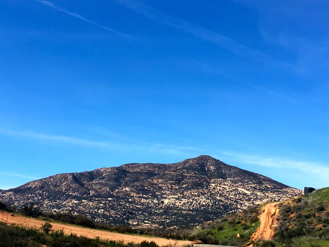
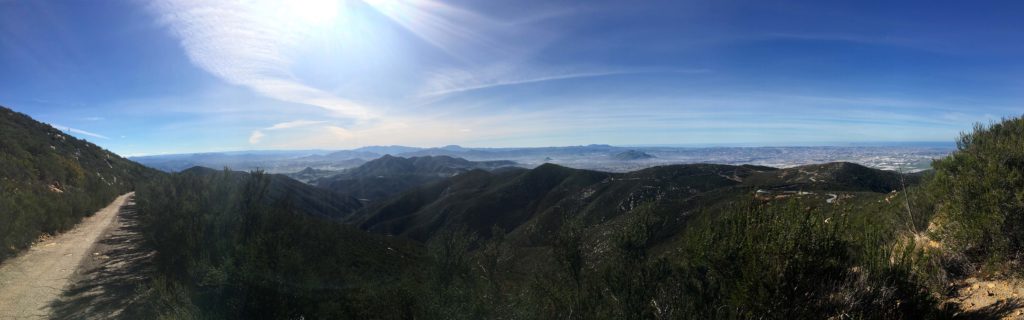
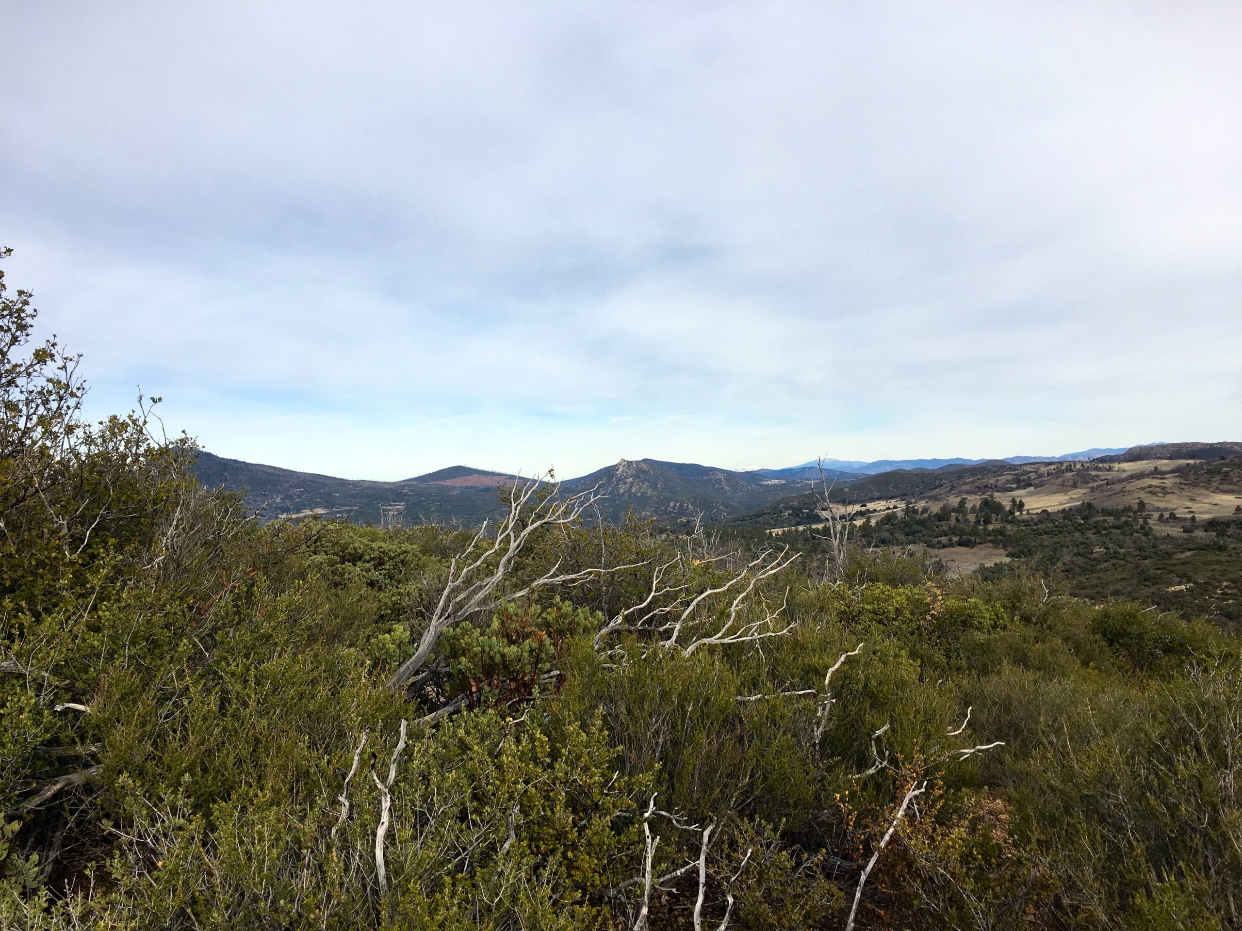
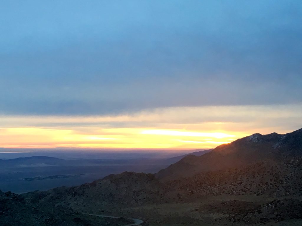
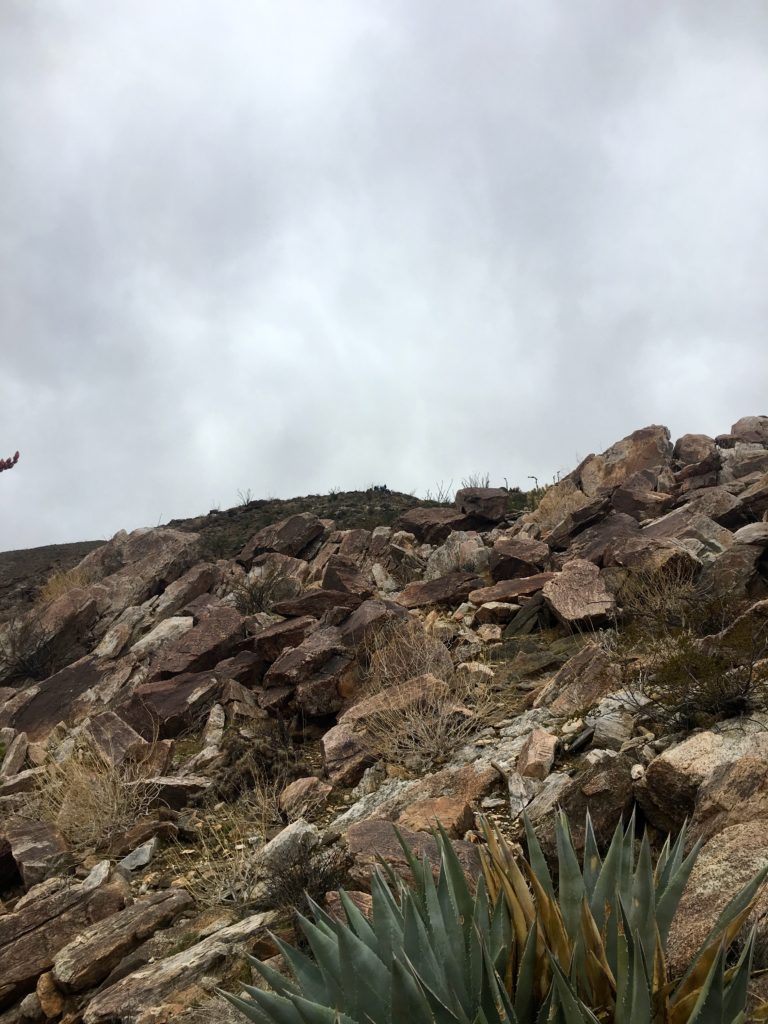
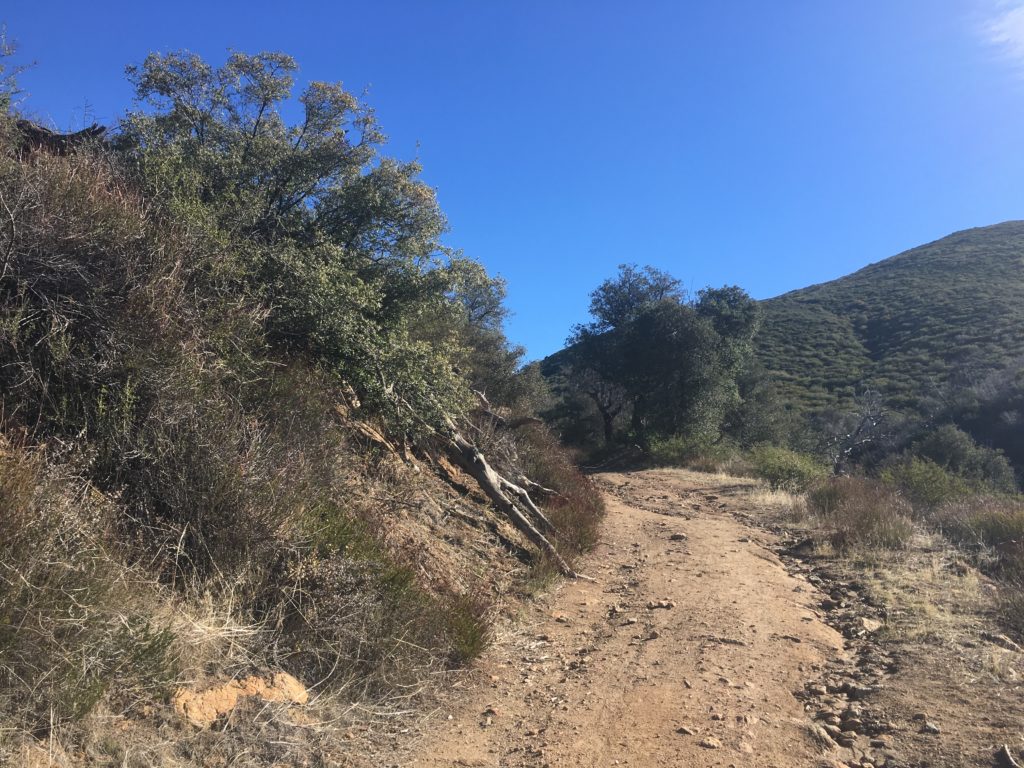
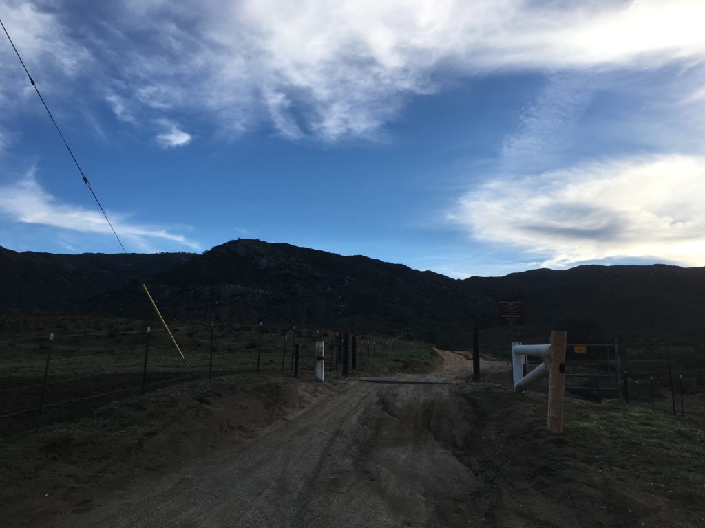
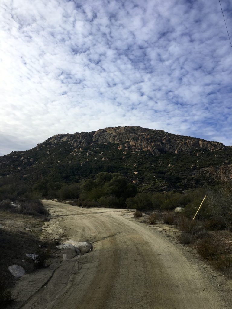
The road to Tecate Peak starts a mere 1500 feet from the border. The road follows the wall for a bit before beginning its steep ascent to the summit.
The road was tougher than the road up to Otay Mountain, so I was glad I spent so much of my youth riding motorcycles along the dirt roads of the Sierras. Along the way, I passed two groups of hikers descending.
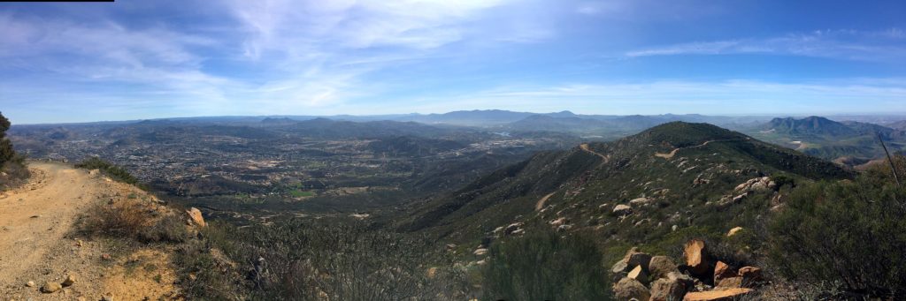
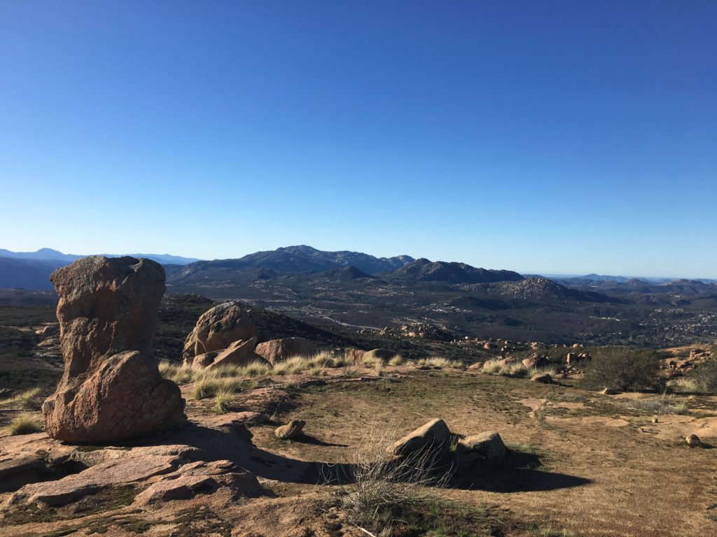
As I neared the summit, I found a nice spot to park and get some dirt under my feet. The view was equally spectacular. Far to the north, I could spy San Gorgonio’s snow-capped summit. So many other peaks I have summited also filled my view.
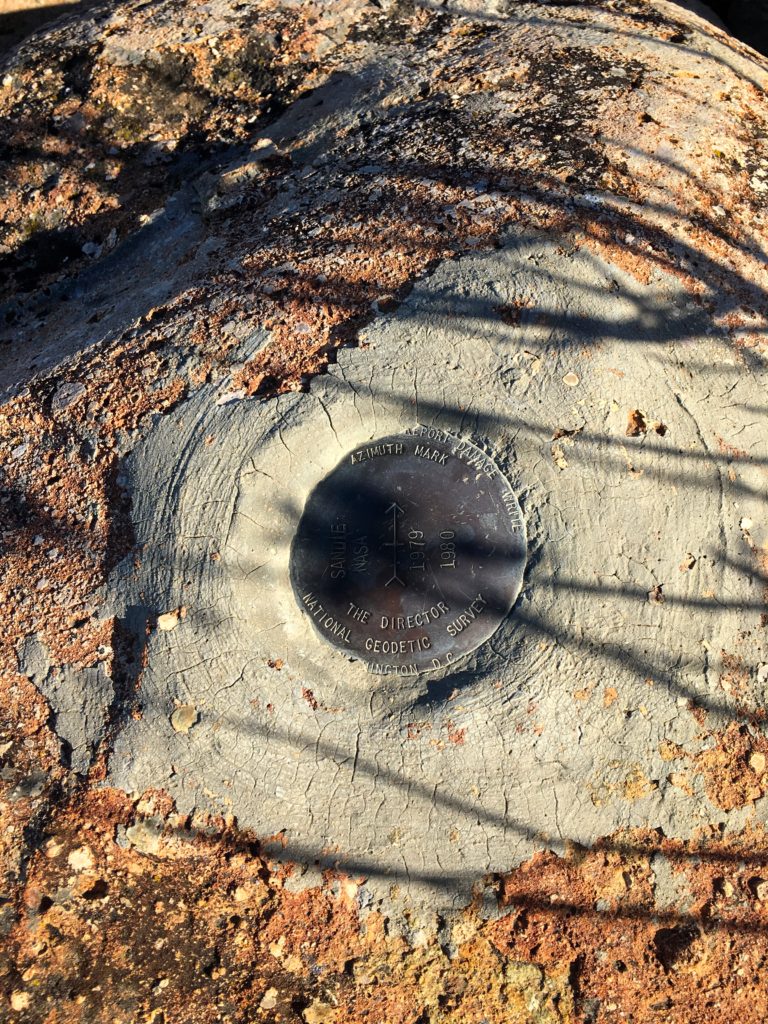
There isn’t a marker here that I could spot, but there is a metal post in concrete. I headed back down the road, never spotting another car. Looking forward to attempting the Sombreros later this week. If you choose to hike this peak, the round-trip distance is about 10 miles, and completely exposed.
I am an avid peak bagger, sometimes backpacker, and former sea kayaker living in San Diego. I am the co-author of Urban Trails:San Diego, coming in Spring 2026!
In 2019, I became the third person to complete the San Diego 100 Peak Challenge. Not stopping with that accomplishment, I set my sights on the harder San Diego Sierra Club 100 Peak list, which I completed in 2021. In addition, I have conquered several Six-Pack of Peaks challenges (SoCal, San Diego, Central Coast, and both the Arizona-Winter and Arizona-Summer). I am looking forward to exploring new summits and new adventures across the southwest.
As the peak count dwindles, I still had Otay Mountain and Tecate Peak to summit. They are not technically challenging, just follow the road to the summits. Now, mind you these are long roads.
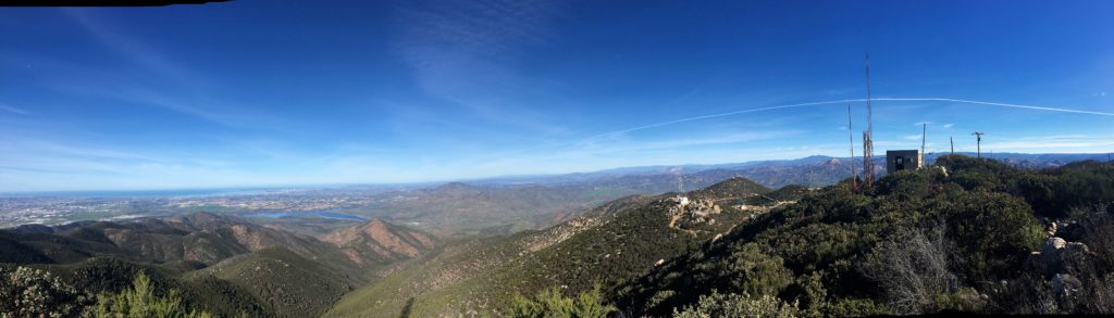
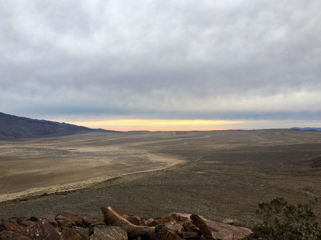
So, I figured to shave off some miles by driving partway up. First up was Otay Mountain, I turned onto Otay Truck Trail from the trailer park and began my climb. The Subaru handled the road with no issues. Along the way, I passed only one hiker working their way up. I parked at Doghouse Junction and chatted with the Border Patrol agent who was also parked there. From there I headed up to the summit along the road. The views were spectacular. I picked a great day to go.
I did find one marker but knew that would be it.
On the way down had a chance to chat with another agent who was scanning the terrain…
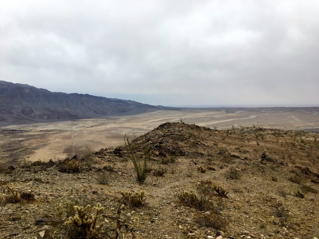
I opted to take the truck trail down toward the gun club, as it was in the direction of Tecate Peak. Working my way down the mountain, I chatted with three motorcycle riders taking a break. Further down, I passed two other cars beginning their ascent. If you choose to hike this summit I would recommend the route from Modern Hiker, it has a round trip distance of 15 miles.
I am an avid peak bagger, sometimes backpacker, and former sea kayaker living in San Diego. I am the co-author of Urban Trails:San Diego, coming in Spring 2026!
In 2019, I became the third person to complete the San Diego 100 Peak Challenge. Not stopping with that accomplishment, I set my sights on the harder San Diego Sierra Club 100 Peak list, which I completed in 2021. In addition, I have conquered several Six-Pack of Peaks challenges (SoCal, San Diego, Central Coast, and both the Arizona-Winter and Arizona-Summer). I am looking forward to exploring new summits and new adventures across the southwest.
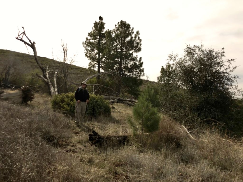
Headed out in the morning to attempt Sugg Peak again. This time I had Susie Kara to show me the route. We got to the trailhead and one car was already there and the sun was just about to rise above Oakzanita Peak.
We made our way along the East Mesa Fire Road, we passed a gentleman heading down, I assume it was his car. Near the junction of the Oakzanita trail, we headed across the meadow toward West Sugg.
There was no trail, just two hikers following their guts. We picked our way through the brush until a slight trail was revealed. Susie kept her eye open for the boundary fences, as these were reference points.
We came to the old Jeep trail that leads back to Oakzanita, but it was severely overgrown. Given the shape of the stuff we were traversing, it might get tougher soon to summit Sugg Peak.
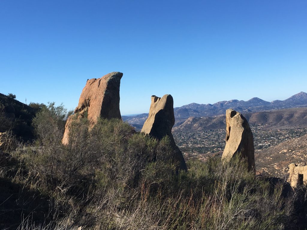
We found Susie’s magic rock and scrambled up. At this point, we were closing in on the summit. We picked our way through the brush until the summit revealed its rocky top.
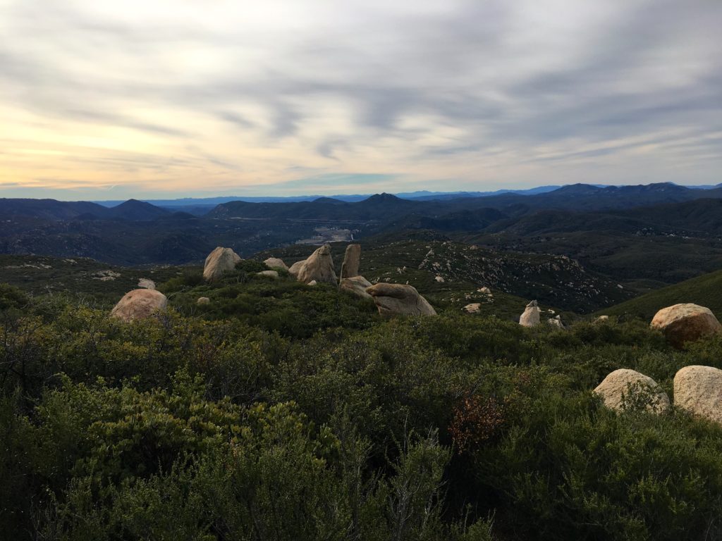
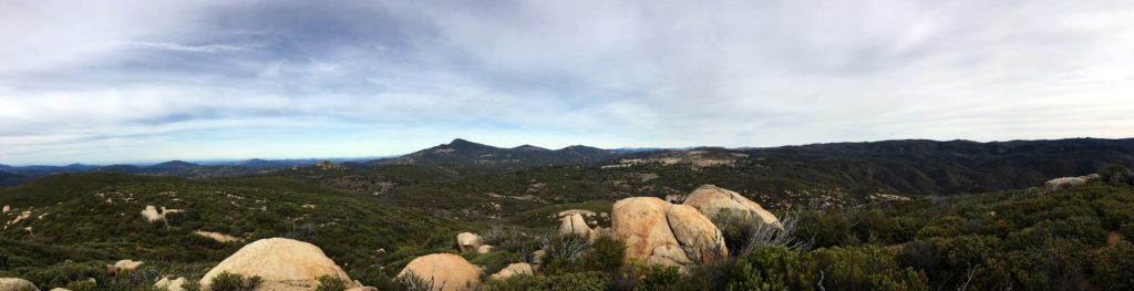
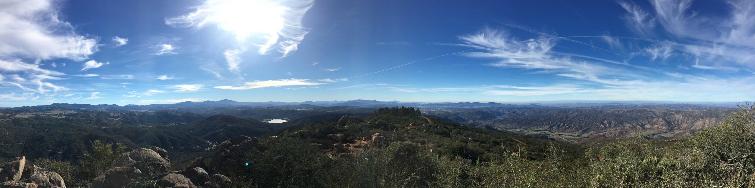
We signed the register; we were the first in 2019! The views of the Cuyamacas and the Lagunas were refreshing. The wind made it a tad chilly, so we did not linger too long.
From the summit, I could see the route Mark and I tried. This route was 10x easier. We picked our way down, occasionally correcting our route.
Soon we were back at the East Mesa Fire Road and began trekking back to the car. Did pass two other hikers and several mountain bikers. Oh, I forgot to add that Susie did Baden-Powell yesterday. This was much earlier than my previous attempt.
This was my 85th summit and the final push is now underway!
I am an avid peak bagger, sometimes backpacker, and former sea kayaker living in San Diego. I am the co-author of Urban Trails:San Diego, coming in Spring 2026!
In 2019, I became the third person to complete the San Diego 100 Peak Challenge. Not stopping with that accomplishment, I set my sights on the harder San Diego Sierra Club 100 Peak list, which I completed in 2021. In addition, I have conquered several Six-Pack of Peaks challenges (SoCal, San Diego, Central Coast, and both the Arizona-Winter and Arizona-Summer). I am looking forward to exploring new summits and new adventures across the southwest.
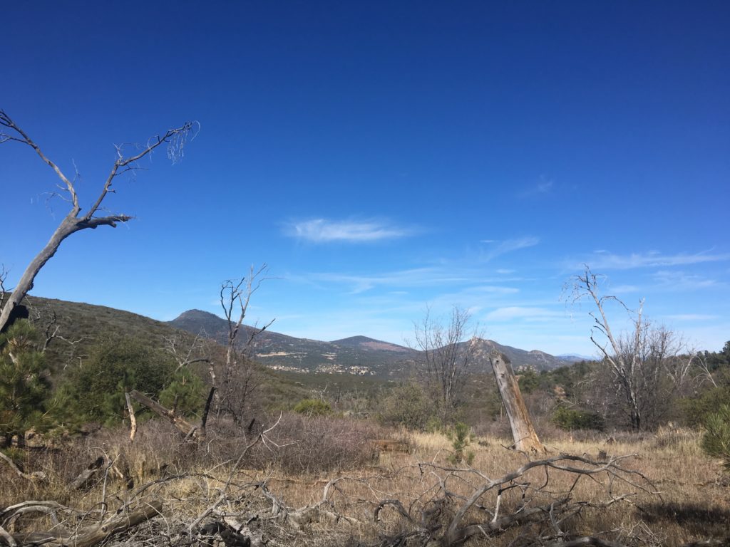
I had planned to try to summit Sugg Peak with the expert guidance of Susie Kara, but alas she was under the weather. Since I was already up and ready to go, I had to quickly pivot to an alternate plan. The challenge I am starting to face with my remaining peaks is that many are long and difficult, and not suited for a solo attempt. Luckily, Peak 3339 was still on my list of peaks left to summit.
I drove out toward Boulevard as the sun rose over the mountains. Frost lined the side of the road from the recent rains. As I drove north along McCain Valley road, I passed the turnoff to the trailhead to Mt. Tule. Soon I came to the Lark Canyon OHV Staging Area, which has several pit toilets.
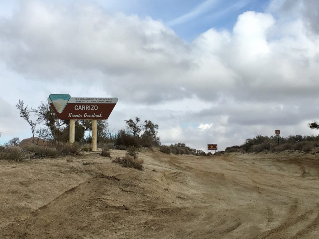
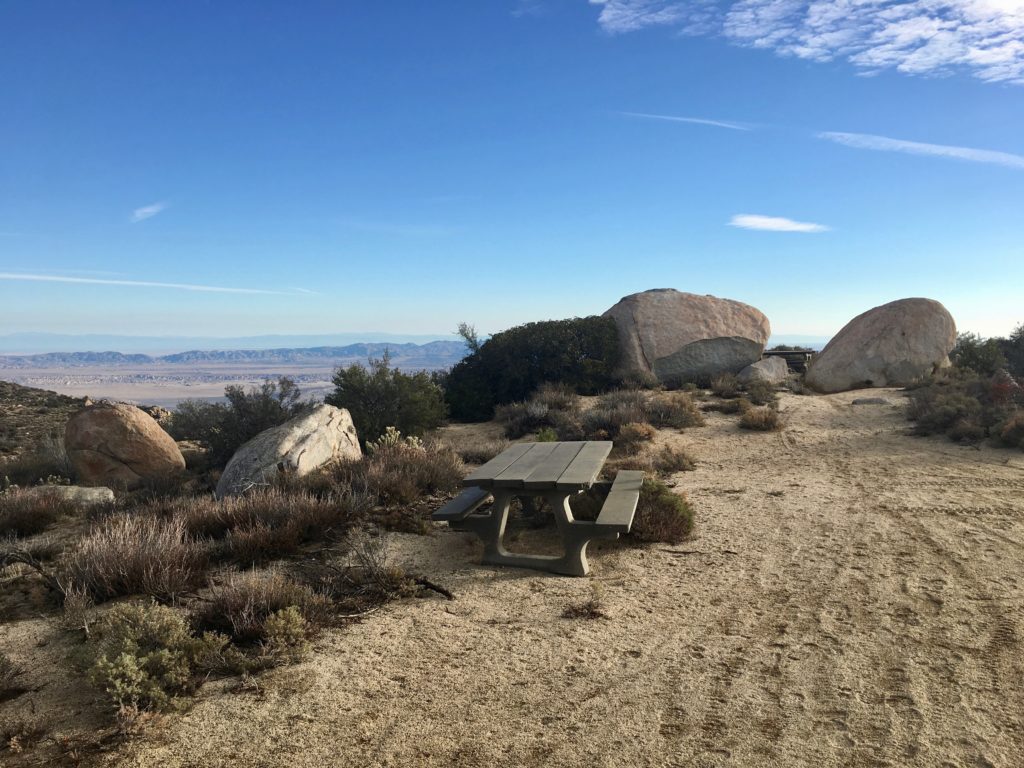
Continuing north along a well-graded dirt road I reached the Carrizo Scenic Overlook. I turned off here and parked at a nice turnout. The trailhead is to the east beyond a fence. I passed a few picnic tables and a metal grill before descending steeply down.
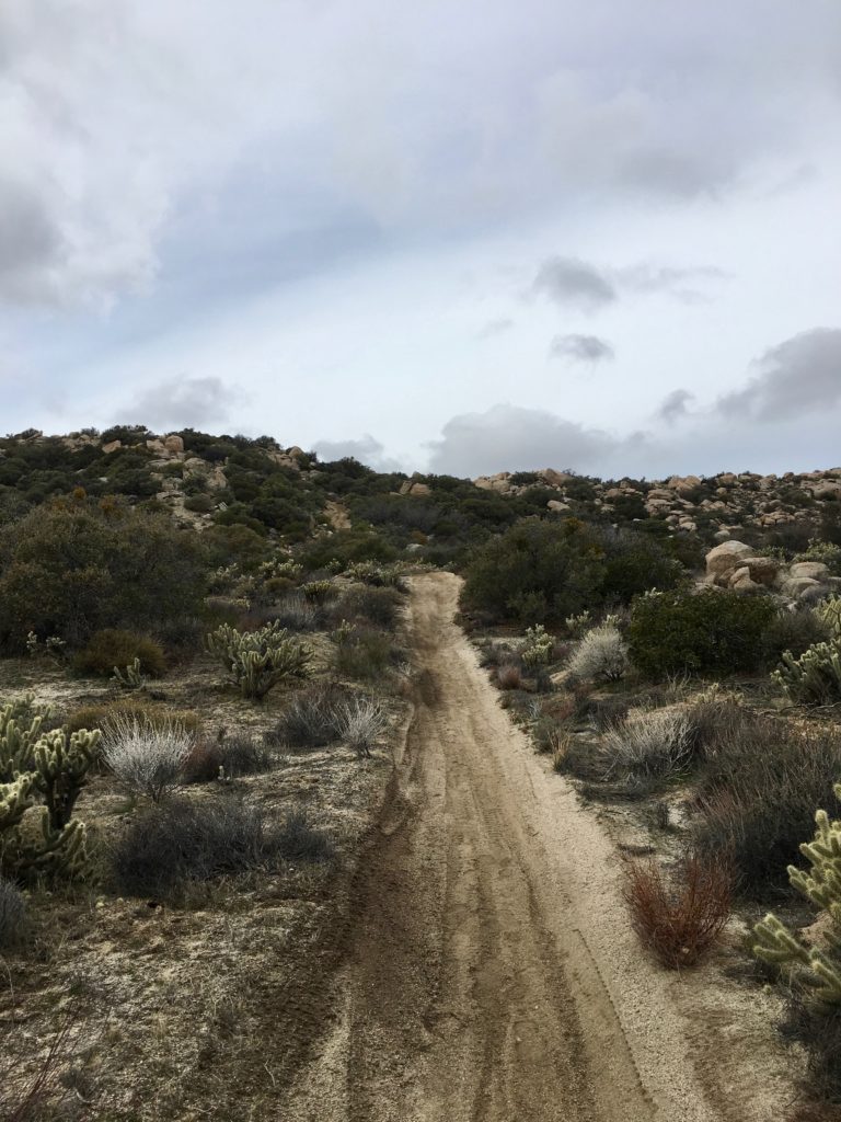
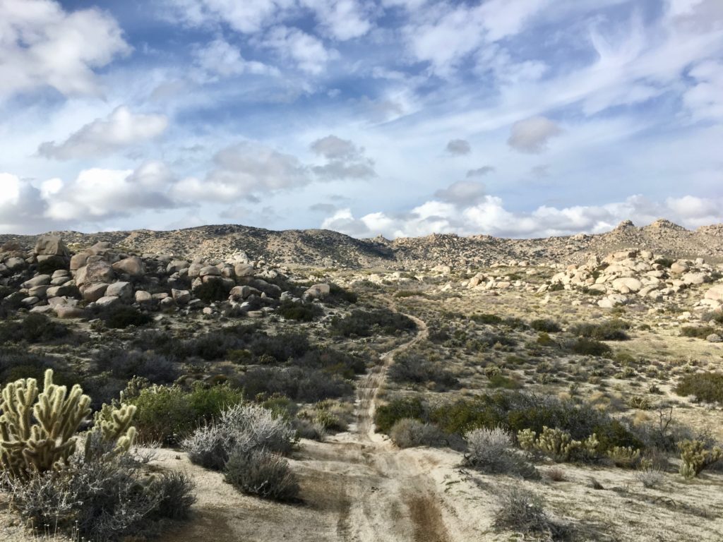
The route to Peak 3339 follows a motorcycle trail most of the time, so navigation is not difficult. Unfortunately, this is an inverted summit, meaning that you start higher than the actual summit.
I worked my way down the trail, reminiscing of my former dirt bike days, and secretly hoping I might catch a ride back up…
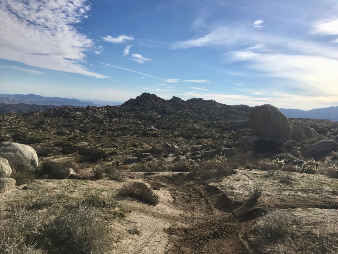
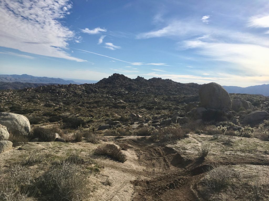
The peak was one of the bumps basically straight ahead of me in the distance, however, the trail turns northward for a while before returning to its eastward route. The advice I read recommended staying on the trail as long as possible before heading cross-country to the peak.
As the peak drew near, I eventually decided it was time to leave the trail and begin the actual climb to the summit. I unfortunately worked my way a tad too far south along the peak cluster. Navigating back to Peak 3339 from the south, I did not find any easy routes up. So, I worked my way back to the west side of the peak. There I found a nice route that took me basically to the top.
There I scrambled to the top of a nice block and enjoyed the view. I did not find a register. It might have been on the other block, but I was not comfortable scrambling solo to check it out.
After a snack, I headed down from the summit and began crossing the open desert to rejoin the trail. The windmills stood out along the ridge to the west, reminding me of the climb still to come to get back to the car.
Oddly, I never heard the sounds of any motorcycles, although I saw many being unloaded earlier. No complaints, as the quiet of the desert is always welcome. As I made my way back up the steep incline, I met a fellow hiker. With a copy of Afoot and Afield In San Diego in hand, he was out exploring as well. Turns out he is a fellow Gaucho. He graduated a few years before me with a degree in geology. We chatted for some time before we went our separate ways.
As I neared the end of the trail, I picked up two beer cans that were tossed to the side of the trail. Ugh. Although I had hoped to summit Al Holden as well, I did not want to venture out to it solo. But this was such a fun hike, I figured I would return with some friends to explore the area more another time.
I am an avid peak bagger, sometimes backpacker, and former sea kayaker living in San Diego. I am the co-author of Urban Trails:San Diego, coming in Spring 2026!
In 2019, I became the third person to complete the San Diego 100 Peak Challenge. Not stopping with that accomplishment, I set my sights on the harder San Diego Sierra Club 100 Peak list, which I completed in 2021. In addition, I have conquered several Six-Pack of Peaks challenges (SoCal, San Diego, Central Coast, and both the Arizona-Winter and Arizona-Summer). I am looking forward to exploring new summits and new adventures across the southwest.
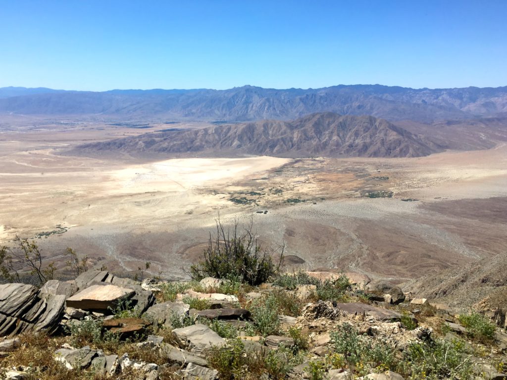
As my remaining peak list dwindles, solo hikes are in short supply. Coyote Mountain was one of the few peaks left. I drove out to Anza-Borrego in the early morning and was greeted with a gorgeous sunrise as I left Ranchita and began my descent into Borrego Springs.
The trailhead is off Rockhouse Canyon Road; I loved that Apple Maps told me I had to park and walk to it. Ha! Although it is a dirt road, a standard car would have no trouble.
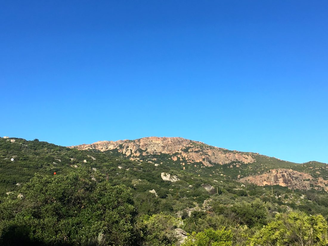
Looking at Coyote Mountain from the Villager ridge (from a previous hike)
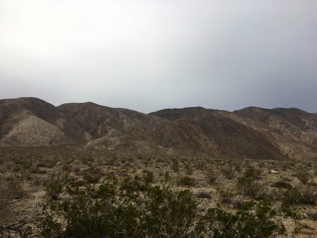
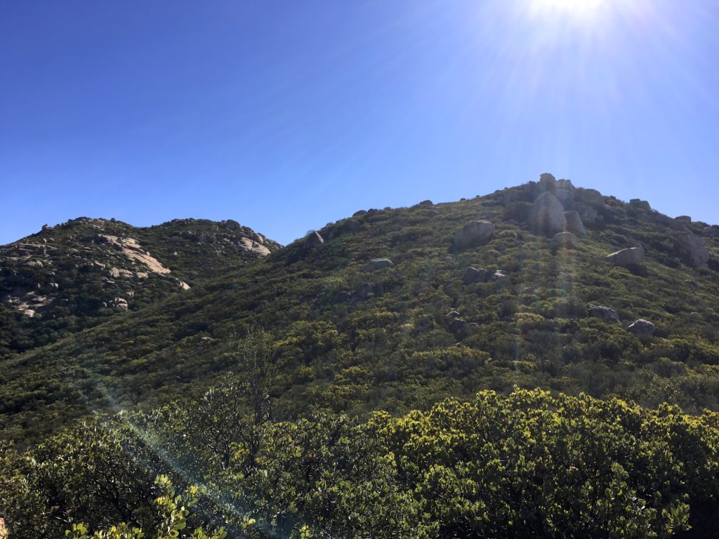
The skies were partly overcast, as a storm was due in the afternoon. I parked, and Coyote Mountain loomed before me. The route follows the ridgeline to the summit, so the only minor challenge is crossing the desert floor to it.
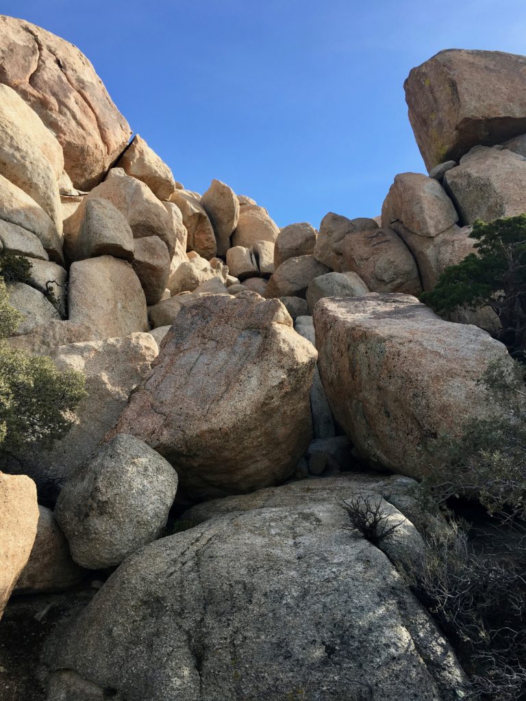
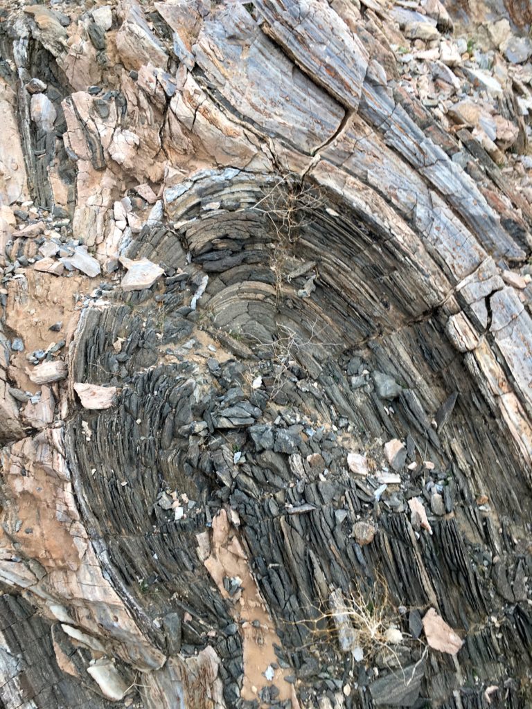
As I began working my way up the start of the ridge, I spotted this geological wonder.
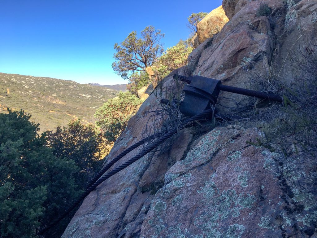
I navigated my way up, and at times a clear use trail guided me through the rocks and sharp pointy plants. At other times, the trail would fade away, or I was working my way up a steep and rocky section.
The route would alternate between sections that burned your quads and easier sections that would allow you to catch your breath. As the summit looms over you, the route bends westward, letting you know that the end is close at hand.
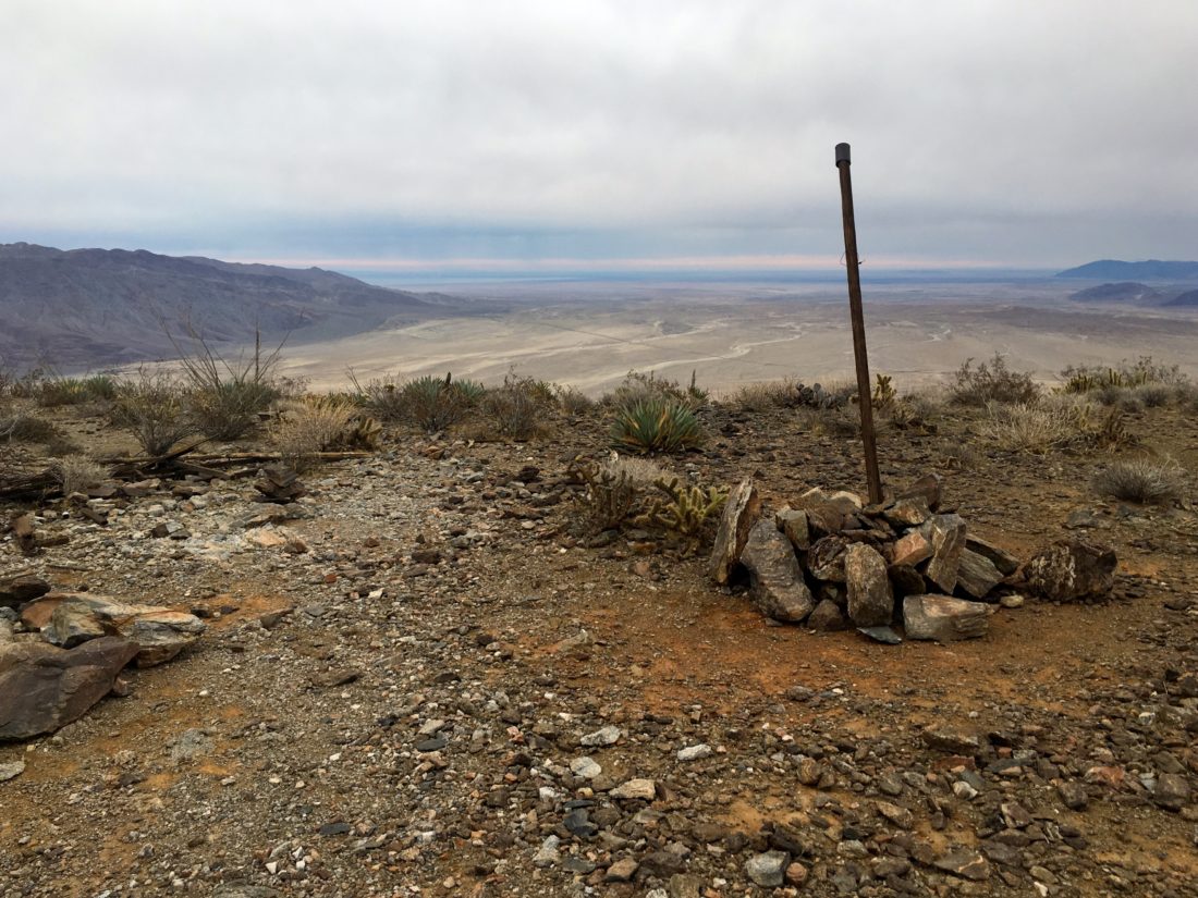
At the summit, you are almost immediately greeted with a pole denoting the register and the benchmark is nearby.
I took in the views of Clark Dry Lake bed to the east, near where I started. To the west and south bits of Borrego Springs. I had a snack, then wandered over to a nearby bump to the west. Another register was tucked in a pile of rocks as well.
Then it was time to work my way back down because I certainly did not want to do this in the rain. About halfway down, about 14 hikers were making their way up. This turned out to be a guided hike led by the Anza Borrego Foundation. A bit behind them were two other hikers, and we chatted some. I mentioned what I was doing, and it turns out I was chatting with Greg Gerlach and Kelly Laxamana, two peakbaggers I trust on peakbagger.com. How I wish I could have picked their brain more about my remaining summits.
With about a mile to go, my knees started to really hurt. The steepness of this summit was getting to me. As I slowed my pace, I began looking for the best option to depart from the ridgeline and get back to flatter ground. I made it back to the car and was glad to be done and heading back into Borrego Springs for a cold beverage and some Mexican food. As I drove back home and crested into Ranchita, the rain started to fall. 83 summits are done, and looking forward to finishing them!
I am an avid peak bagger, sometimes backpacker, and former sea kayaker living in San Diego. I am the co-author of Urban Trails:San Diego, coming in Spring 2026!
In 2019, I became the third person to complete the San Diego 100 Peak Challenge. Not stopping with that accomplishment, I set my sights on the harder San Diego Sierra Club 100 Peak list, which I completed in 2021. In addition, I have conquered several Six-Pack of Peaks challenges (SoCal, San Diego, Central Coast, and both the Arizona-Winter and Arizona-Summer). I am looking forward to exploring new summits and new adventures across the southwest.
Since my wife and daughter were driving up to LAX to pick up my son from his trip to Florida in the Subaru, I was somewhat limited to my peak options. Thankfully, Mt. Gower near Ramona fit the bill.
I opted to start the hike by using the water tank short cut. Parking at the culdesac, I tried to be respectful of the homeowners, as I readied myself. I headed up the access road to the water tank, then pass around the fencing to join the trail. For those wanting a longer hike, there is another trailhead near the end of Gunn Stage road.
The trail will basically follow a ridgeline eastward, rising and following, but generally working its way up. After passing a small meadow, you will begin the push up the peak. Along the way, you will pass Mt Gower’s famous teeth.
A short time afterward you will reach a wide flat granite slab. This is where the defined trail will end. I took a moment to enjoy the view. A pair of hikers were working their way back to the trailhead, we briefly chatted and continued on our way.
Following Scott Turners’ advice, I checked my GPX route and began working my way up the slope. It was a mix of digital routing matching and experience to reach the top.
Mt. Gower is an interesting peak. There are actually three peaklets here. False Gower is the first peaklet that you will encounter, and for most this is good enough, even for the 100 Peak Challenge.
There was a bit of breeze at the summit, as a storm was due in later that night, so I did not linger.
I decided to work my way through the brush southward to the true summit. My phone weighed out, so no route data, and no photos. It took a bit to make it there. Like the reports on peakbagger.com, no benchmark or register was located.
Checking with the family, to hear my son landed safely after being delayed from the previous day, I began heading back down. As I drew closer to my starting point, I encountered a few more hikers beginning their ascent of Mt Gower. Back at the car, I loaded up and headed home.
I am an avid peak bagger, sometimes backpacker, and former sea kayaker living in San Diego. I am the co-author of Urban Trails:San Diego, coming in Spring 2026!
In 2019, I became the third person to complete the San Diego 100 Peak Challenge. Not stopping with that accomplishment, I set my sights on the harder San Diego Sierra Club 100 Peak list, which I completed in 2021. In addition, I have conquered several Six-Pack of Peaks challenges (SoCal, San Diego, Central Coast, and both the Arizona-Winter and Arizona-Summer). I am looking forward to exploring new summits and new adventures across the southwest.
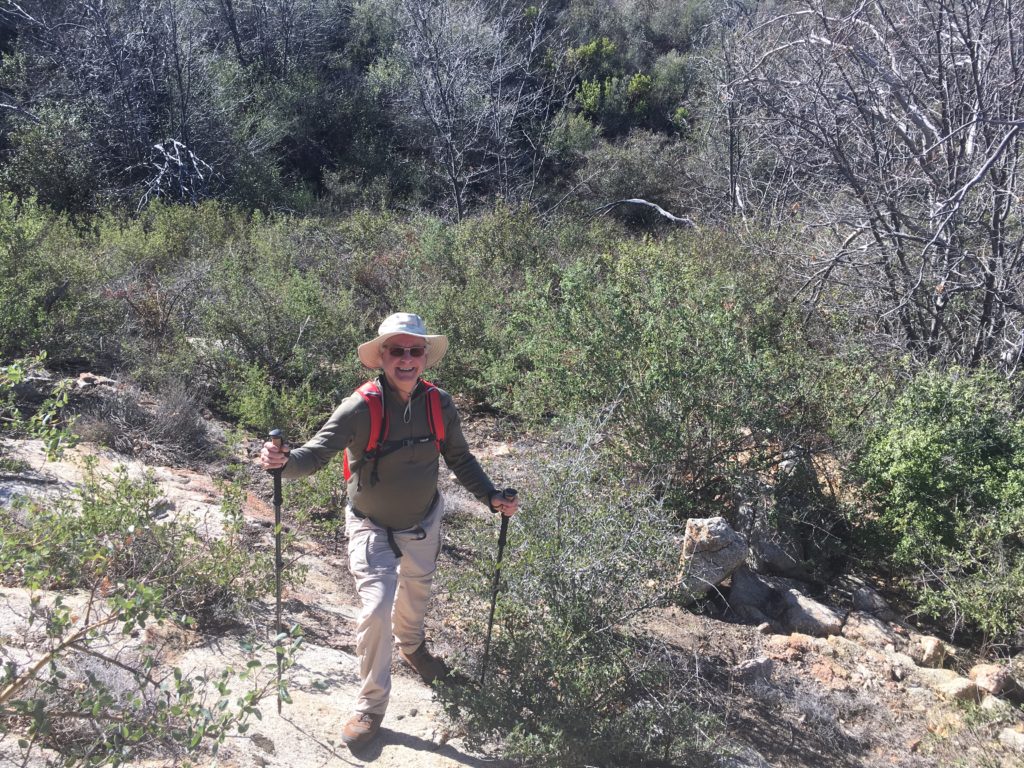
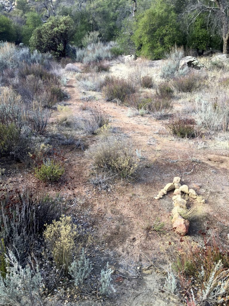
I decided to attempt to summit Sugg Peak today. I was able to convince my friend Mark Better to tag along. Sugg Peak sits in the heart of Cuyamaca Rancho State Park, In researching how to get to this summit, I learned that this was going to be a mix of simple fire roads and pure cross-country hiking. Our quest began on the East Mesa Fire Road. We cruised along for a couple of miles or so until we reached where I thought we should leave the road and begin the true adventure.
From reading Derek’s trip report, he spoke of passing through a meadow and of an abandoned cabin before bushwhacking their way to the summit. Like Derek, I had spent some time on Google Earth to identify landmarks and possible routes. As Mark and I pushed past the brush onto the meadow, we had high hopes.
Crossing over the barbed wire fence that denotes the boundary with Cleveland National Forest, we continued on. Sitting on the edge of the meadow was the abandoned cabin! We spent some time exploring it. The stone walls still stood, but the roof was long since gone. But now it was time to find our way to the summit.
We surveyed the landscape before us, wondering if one route might be better than another. Derek’s description does not give us many clues, nor was there a GPS track to assist us. So we headed off to pick our way through the brush. Faint use trails would appear and disappear as we worked through the scrub. It was slow going. After a good hour of this, we had made little progress. Finally, we decided to turn back.
This is actually a valuable skill to possess as a hiker, know your true limits and when to toss in the towel. This attempt was one of those times. We knew how we felt, and what it would take to get back to the trailhead. The peak will have to wait for another day.
We hacked our way back down to the meadow and onto the fire road. While we did not summit Sugg Peak, the discovery of the cabin and time spent with a good friend certainly offset that.
I am an avid peak bagger, sometimes backpacker, and former sea kayaker living in San Diego. I am the co-author of Urban Trails:San Diego, coming in Spring 2026!
In 2019, I became the third person to complete the San Diego 100 Peak Challenge. Not stopping with that accomplishment, I set my sights on the harder San Diego Sierra Club 100 Peak list, which I completed in 2021. In addition, I have conquered several Six-Pack of Peaks challenges (SoCal, San Diego, Central Coast, and both the Arizona-Winter and Arizona-Summer). I am looking forward to exploring new summits and new adventures across the southwest.
Whenever I would talk about my remaining peaks, I would mention I needed to do summit Big Black Mountain. Almost everyone would ask, don’t you live almost next to it. I would then inform them that there are 3 Black Mountains in San Diego. The one I needed to summit was just a bit north of Ramona.
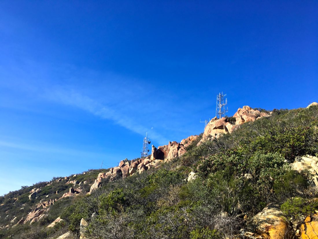
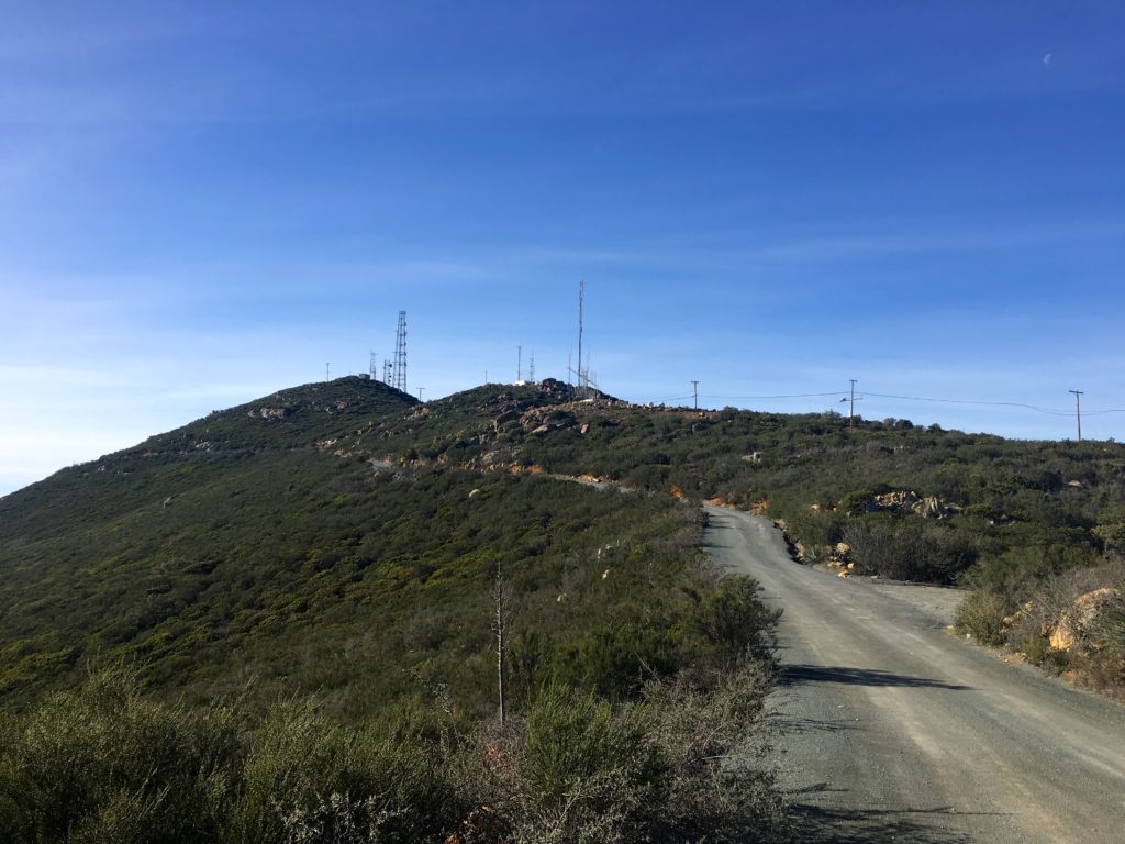
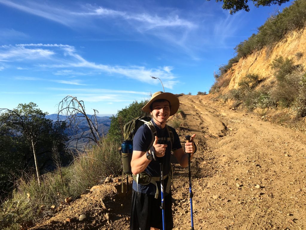
This hike fell into the category of the kind I don’t like, hiking on an active road most of the way. One option was to wait for the Forest Service to close the road due to weather, and then do the entire 14 miles without the fear of a motorcycle or 4×4 running you over. The other option was to simply drive most of it, then cap it off with a short hike. Given I am always cautious with my foot now, I choose the latter option. Jacob Posner was able to tag along, has needed some training miles for an ascent on Mt. Shasta later this year.
We drove out to the turn-off and began our off-road adventure up the mountain. The road was a standard dirt road as we climbed higher and higher. I had spotted a nice turn out that would give us about a 4-5 mile round trip hike. Basically, enough so we could enjoy Burger Bench afterward with no guilt.
Jacob loaded up his pack with his 25-lb bag of ice and up we went. I kept an ear out for vehicles, and also curious to see if the Subaru could have kept going.
Today was perfect, nice skies, the temperature was lovely. As we reached the end of the road, we both concurred that we could have driven, only one spot would have taken a touch of care to navigate. We did hear, then spot a lone motorcycle working its way up the road behind us. He parked and we chatted some. He was also a hiker and new to the area. I gave him pointers of my favorite hikes and the recommendation of some book 😉
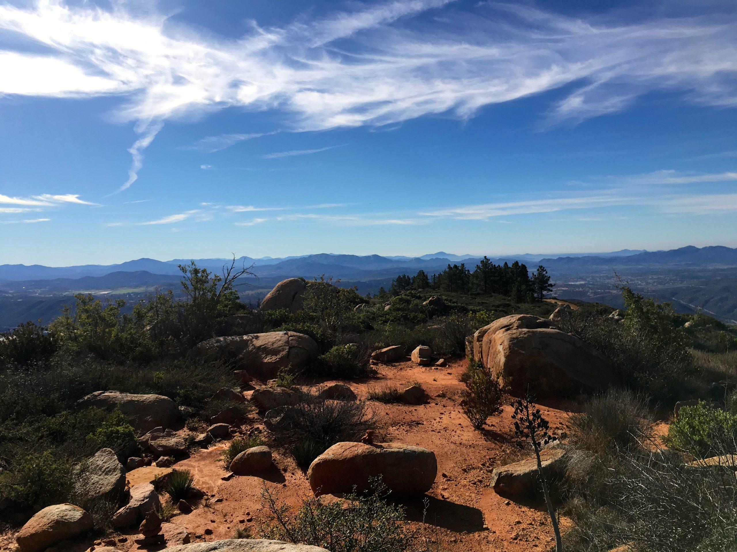
To reach the actual summit, which is home to a weather station, we followed the trail for about .2 miles. Once there we took a break, enjoyed the views and chatted. Jacob is finishing his last semester at Cal, then off to work at Boeing (having done an internship at SpaceX). If you know my other passions, you know we had plenty to talk about…
We headed back down the trail, then the road. Two more motorcycles passed us going up while we returned to the car. We kept an ear open for when they were headed back down. While driving down, we encountered two 4x4s heading up, so in part validating my choice. And of course, the burger and beer were tasty and cold.
I am an avid peak bagger, sometimes backpacker, and former sea kayaker living in San Diego. I am the co-author of Urban Trails:San Diego, coming in Spring 2026!
In 2019, I became the third person to complete the San Diego 100 Peak Challenge. Not stopping with that accomplishment, I set my sights on the harder San Diego Sierra Club 100 Peak list, which I completed in 2021. In addition, I have conquered several Six-Pack of Peaks challenges (SoCal, San Diego, Central Coast, and both the Arizona-Winter and Arizona-Summer). I am looking forward to exploring new summits and new adventures across the southwest.
After my successful failure of Half Dome, my foot’s plantar fasciitis reared up again. Something about favoring one foot over the other while hiking Half Dome 😉 I took a more aggressive approach and strapped on a walking boot for several weeks to let it heal. After some PT, it was finally time to test my foot out. Of my remaining peaks, Morena Butte seemed to fit the bill. I drove out to Lake Morena County Park, I opted to pay the 10 and park closer to the trailhead near the low-water launch site. You can park just outside the park for a longer hike.
High above the lake looms Morena Butte, a three-peaked mountain topped with huge expanses of gorgeous granite slabs. The day was perfect, as first followed Ward’s Flat Trail. This a closed dirt service road that heads toward the south side of the dam. After about 1.5 miles, a nice rock arrow points the way on to the Hauser Overlook Trail.
Here is route becomes more trail-like as you being to climb through the chaparral. Once you reach the end of the trail, you will hopefully see the start of almost a goat-trail up the steep side of the mountain.
I carefully worked my way up, scampering up the rocks until the trail began to reform. According to my GPS, I gained almost 600 feet of elevation in just over .5 mile. Looking back I was rewarded with some nice views of the dam and the lake. After cresting a small summit, the triple peaks of Morena Butte came into clearing into view. The highest of the three is the southern one, so I made my way toward it.
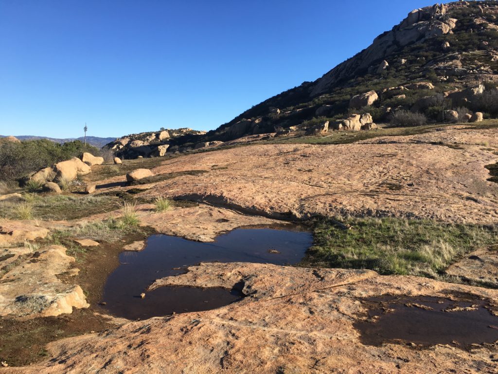
Once on the top, the butte is a massive granite slab littered with pink boulders. A few puddles were scattered about from some recent rains. I found the register tuck away near the top of the south summit. While resting and enjoying the view, another hiker came along. We chatted a bit, she mentioned she was also chasing the 100 Peak Challenge. We had a pleasant chat before I headed off.
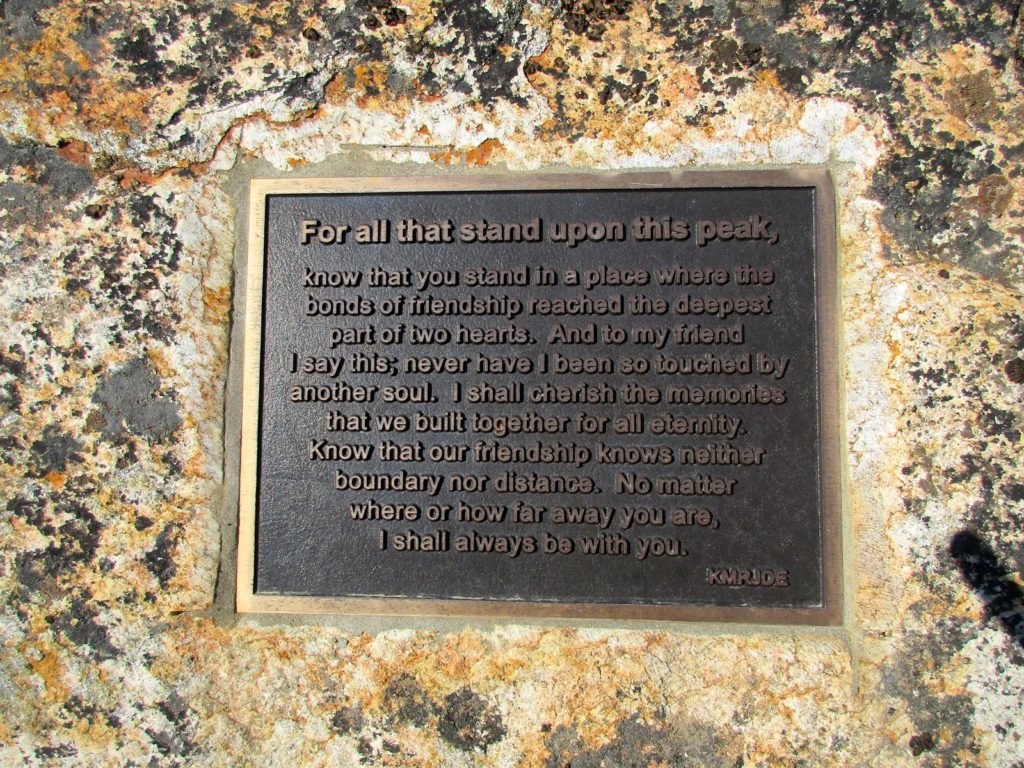
I first wandered over the eastern side of the butte to get a full view of the valley and the lake. Forgetting to turn my tracking on, I then made my way to the western edge. Towards the top of the peak if you go towards the left you will get a great big flat rock that has an awesome view of the valley below, and the base of the rock is a plaque that was put there a few years ago.
Having done enough exploring for one day, I started to retrace my route, although I must confess I did consider taking the longer route that connects with the Pacific Crest Trail instead of returning down that steep slope. In the end, I figured the devil you know versus the devil you don’t.
The return to the car was uneventful. My foot was feeling mostly ok, which was a good sign. I passed by an old foundation with a chimney that is still standing and makes you wonder what was originally there. Back at the car, I realized I forgot my cooler on the kitchen counter, but no worries as there is a country store just outside the park, so I stopped in and grabbed some cool drinks :).
I am an avid peak bagger, sometimes backpacker, and former sea kayaker living in San Diego. I am the co-author of Urban Trails:San Diego, coming in Spring 2026!
In 2019, I became the third person to complete the San Diego 100 Peak Challenge. Not stopping with that accomplishment, I set my sights on the harder San Diego Sierra Club 100 Peak list, which I completed in 2021. In addition, I have conquered several Six-Pack of Peaks challenges (SoCal, San Diego, Central Coast, and both the Arizona-Winter and Arizona-Summer). I am looking forward to exploring new summits and new adventures across the southwest.
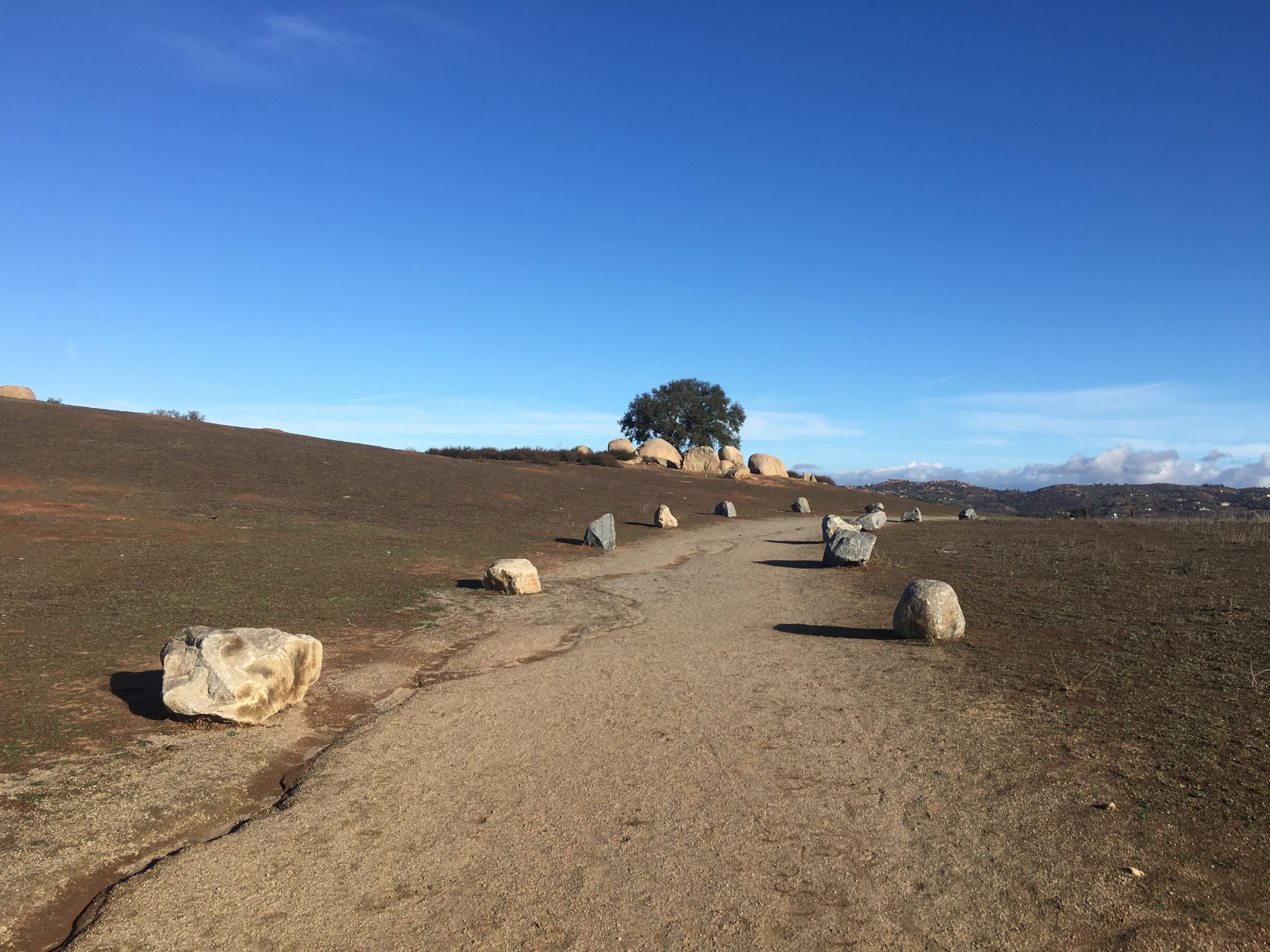
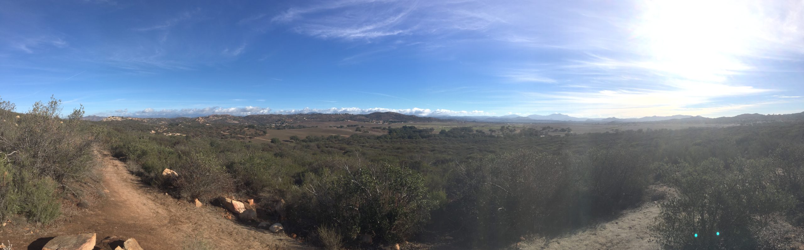
One of the hikes on this year’s Coast to Crest Challenge was out at the Ramona Grasslands. This was going to be a nice sauntering kind of hike, perfect since I was recovering from plantar fasciitis. I pulled into the parking area and headed off. The trail is nice and wide, as it worked its way through the grasslands. The Ramona airfield sits off to the northeast. Like all the Coast to Crest Challenge hikes, there was a designated selfie spot, in this case out toward the north end of the trail.
I passed a few folks out enjoying the trail. One couple was walking their horse back to their trailer. He was rehabbing from an injury and needed the exercise.
I was enjoying myself as I reached the spot. This would be a lovely hike to bring a picnic on and enjoy the views.
Soon I found myself back at the car. As I drove past all those cars with folks working their way up to the Potato Chip, I felt sorry that just down the road is a lovely gem of a hike.
I am an avid peak bagger, sometimes backpacker, and former sea kayaker living in San Diego. I am the co-author of Urban Trails:San Diego, coming in Spring 2026!
In 2019, I became the third person to complete the San Diego 100 Peak Challenge. Not stopping with that accomplishment, I set my sights on the harder San Diego Sierra Club 100 Peak list, which I completed in 2021. In addition, I have conquered several Six-Pack of Peaks challenges (SoCal, San Diego, Central Coast, and both the Arizona-Winter and Arizona-Summer). I am looking forward to exploring new summits and new adventures across the southwest.