Ted Markus and I pulled off to the trailhead for El Cajon Mountain and were a bit early, so we were debating where to park when we spotted the ranger leaving Oakoasis Preserve and coming to unlock the gates to the parking lot. While we waited for Derek Loranger and Larry Edmonds to arrive, I was trying to comprehend what I was about to complete. This was to be my final peak of the 100 Peak Challenge. Over the course of this year, I had already summited 99 peaks throughout San Diego County. In about 6 miles and some 3,200 feet of elevation gain, I should be standing atop El Cajon Mountain. There have only been two other finishers of the challenge since I began in 2017. I would be the third.
Larry pulled in first. I have only interacted with him over email, but he is an accomplished peak bagger and wanted to get some training before tackling Alice Benchmark out near Villager. It is always nice to meet fellow peak-baggers in real life. Derek arrived shortly thereafter. Besides being the owner of Burger Bench in Escondido, he is the creator of the 100 Peak Challenge. It was quite an honor to have him join me for this hike.
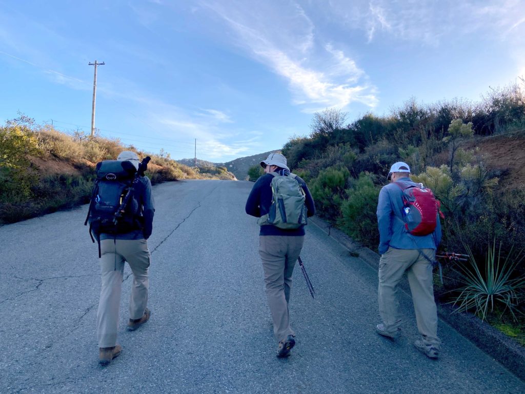
It was a chilly 39 when we set out. El Cajon Mountain, for many their pinnacle summit, is just under 12 miles round trip. There is some serious elevation gain, both going out and coming back. We knew that we were going to have our work cut out for us.


With this hike being so popular, every mile is denoted with a signpost that also shows the elevation profile as well. For some, this might be torturous to know what still lies ahead. We were quickly warming up, so we stopped and shed a layer. The trail can get quite steep at times, so having hiking poles can help. Larry recounted doing El Cajon in the rain and the ‘joy’ of coming down on the slick trail.


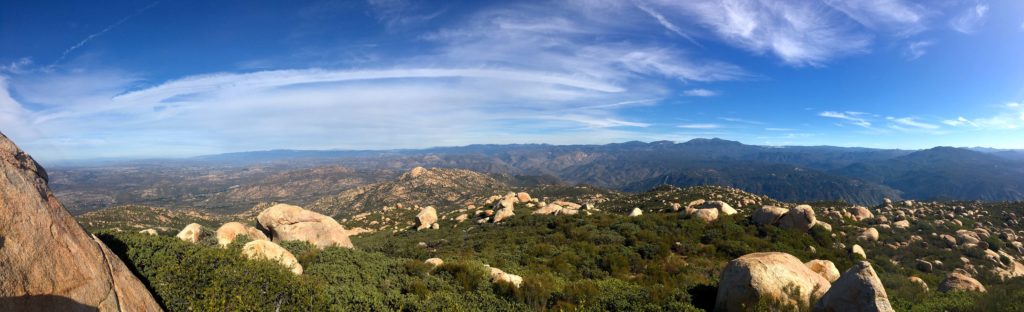
The trail was a little muddy in sections, and in some places either had a small stream flowing on the trail or across it. Off in the distance, we could see the snow-capped mountains around us, Mt. Baldy and San Jacinto way off to the north, Palomar, Cuyamaca, and Lagunas to our east.


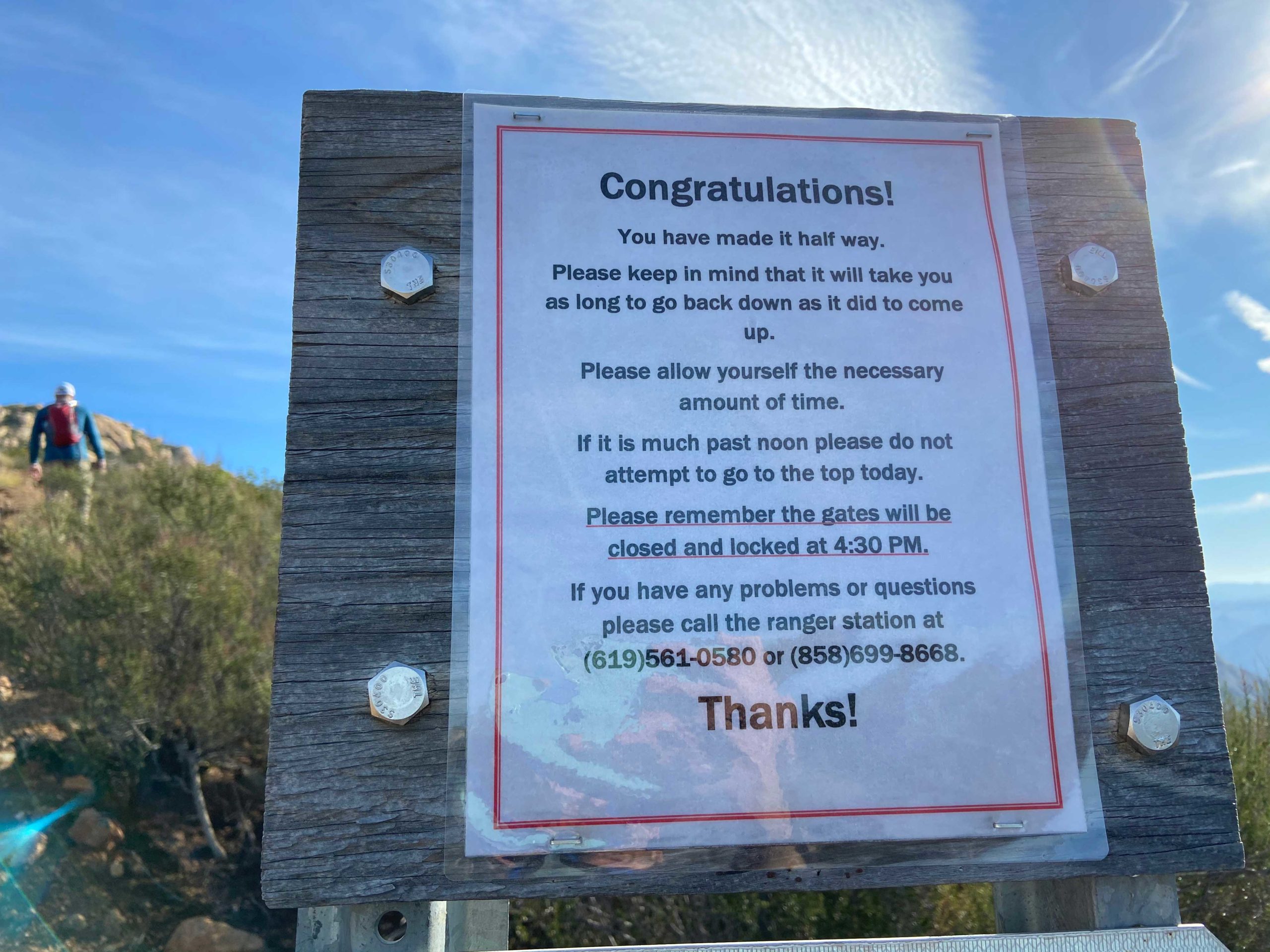
Another “fun” part of this hike is you have several ups and down to traverse before you reach the final push to the peak. My left knee had been bothering me since Indianhead, so I had it secured in a brace. For the most part, it felt ok, but some of the steeper descents gave me a little discomfort.
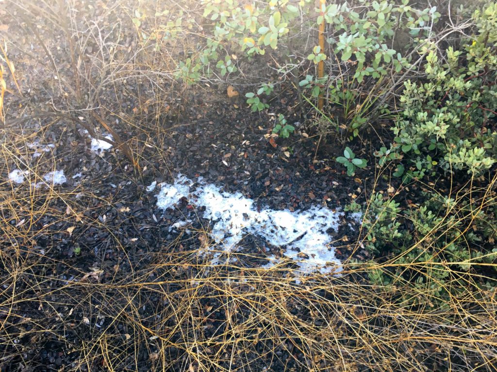
As the trail passed along the north side, a few very tiny patches of snow hid in the shade. Ted could not resist making a tiny snowball and beaning me 🙂 We began encountering hikers and runners making their way down.
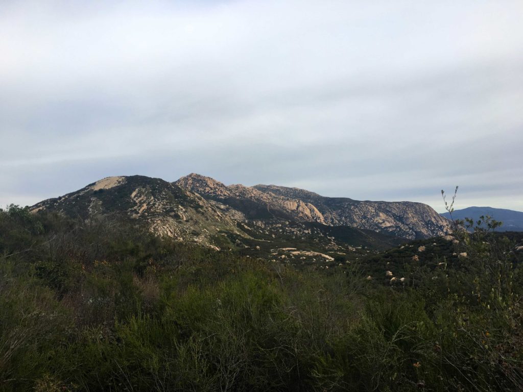
We stopped for a few short breaks but kept plugging upward. The views were something; Barona Casino was behind us, the 8 to the south, and many familiar peaks beyond it. The peaks to the east were hidden behind El Cajon for the time being.
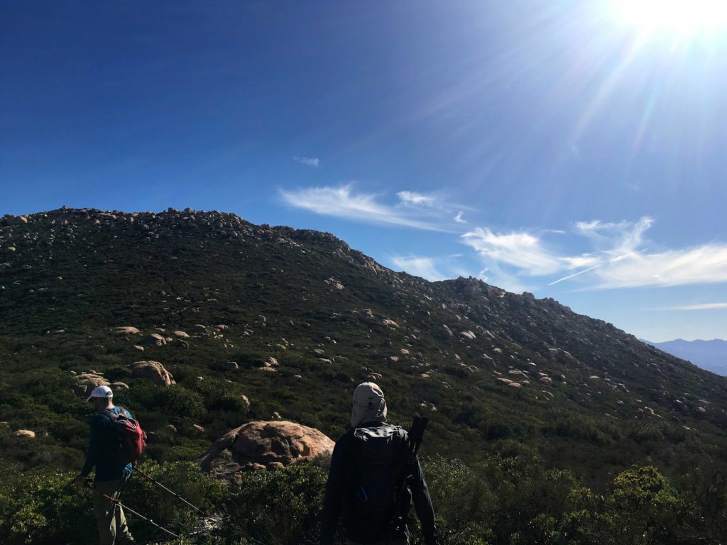
The wide trail finally comes to an end around mile 5 and continues as single-track to the summit. It was strange to think in less than a mile, I would be there. I wasn’t sure how I would react once I saw the metal summit sign. As we neared the end, fiberglass signposts guided you through the brush. Quite a contrast from the open navigation on all those desert peaks.
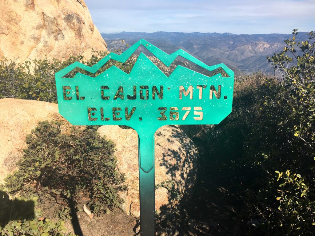


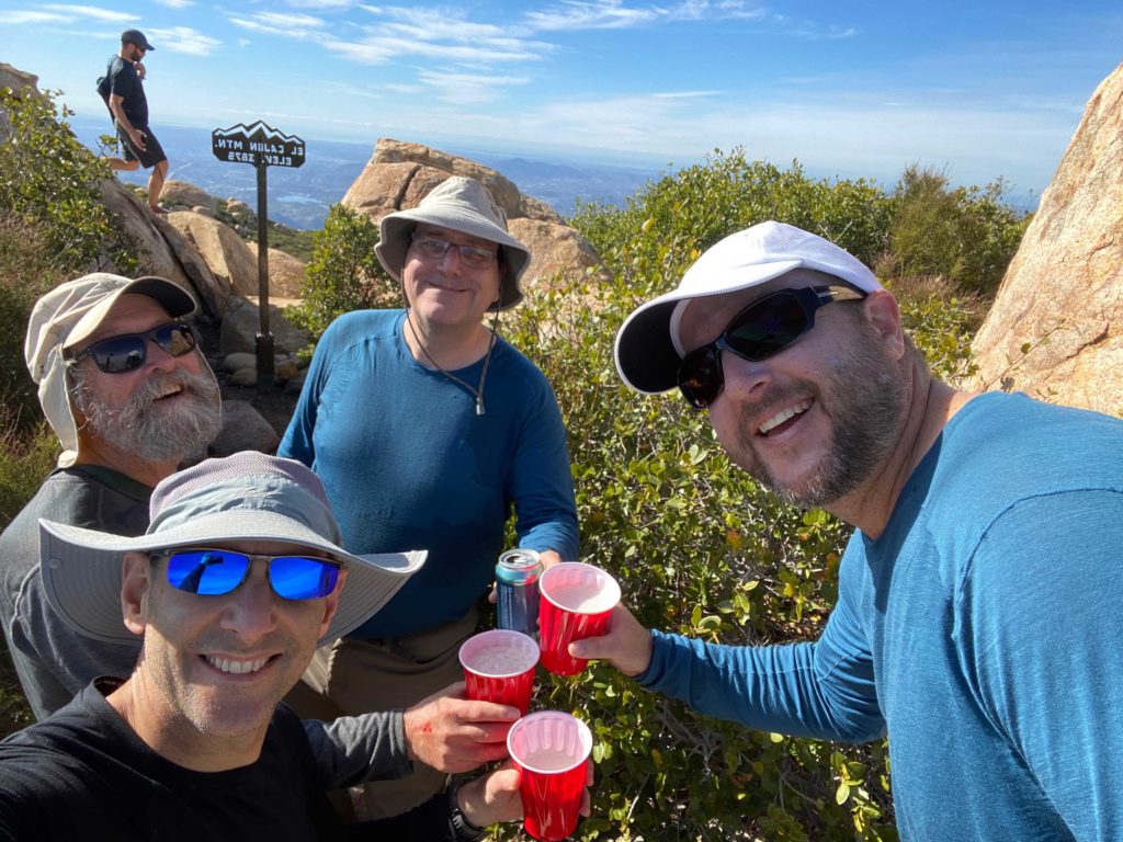
And there it was, the bright green summit sign: El Cajon 3,975 feet. I had done it!! We found a spot near one of the reference marks and shed our packs. We snapped some photos of the views, then I grabbed the 100 Peak Finisher flag I had made and took a few more. I had packed my last can of Three Sisters IPA from Mother Earth. I had been saving this can from my first attempt at this challenge. On Friday, I got a growler of Vanguard Grapefruit IPA from Wavelength Brewery to share with my companions. Ted graciously carried it for us, along with a can of HFS from Alpine Brewery. We toasted my accomplishment with these fine brews and munched on our snacks.
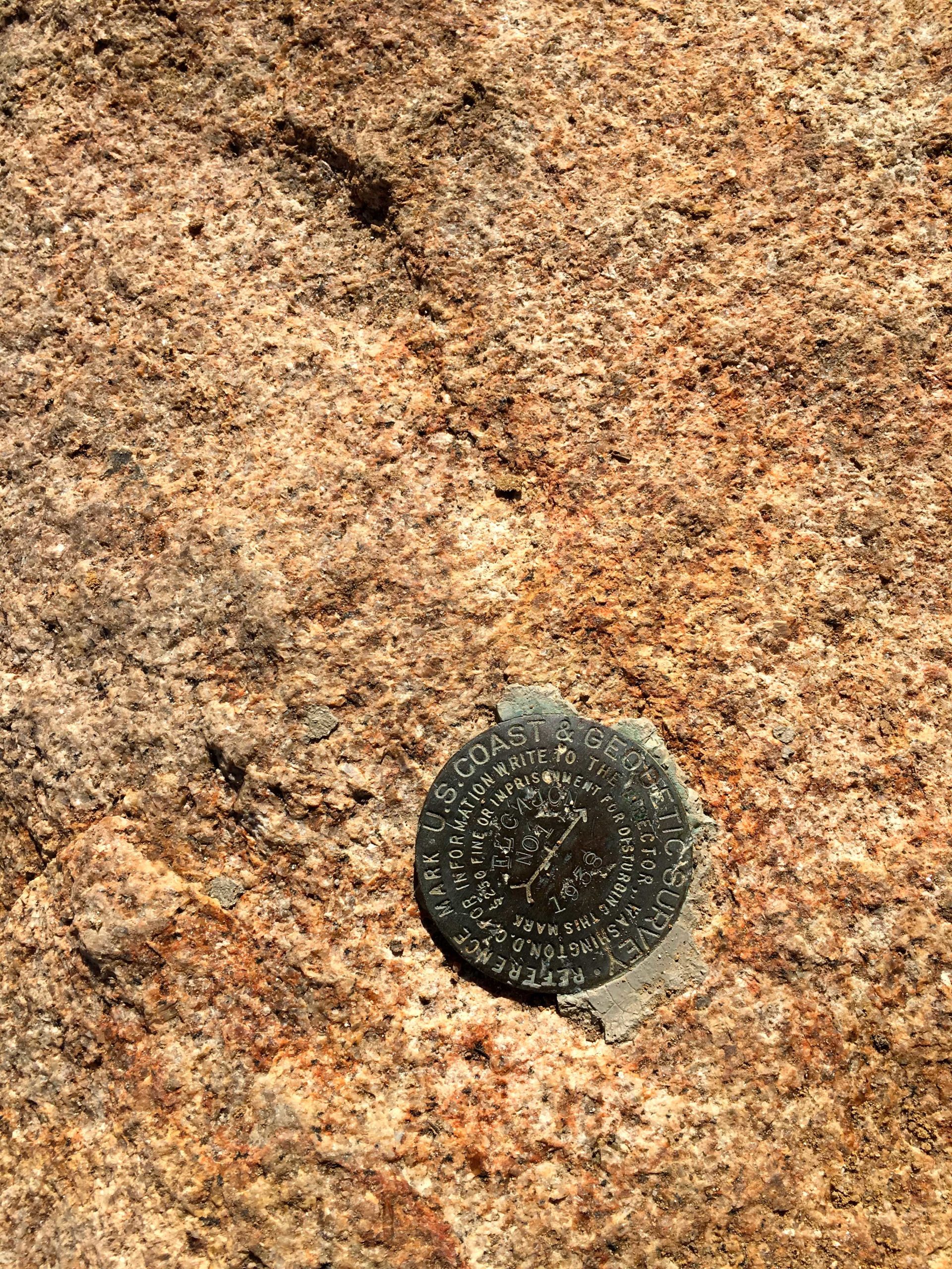
I went scrambling around to locate the main Benchmark and the other reference mark.


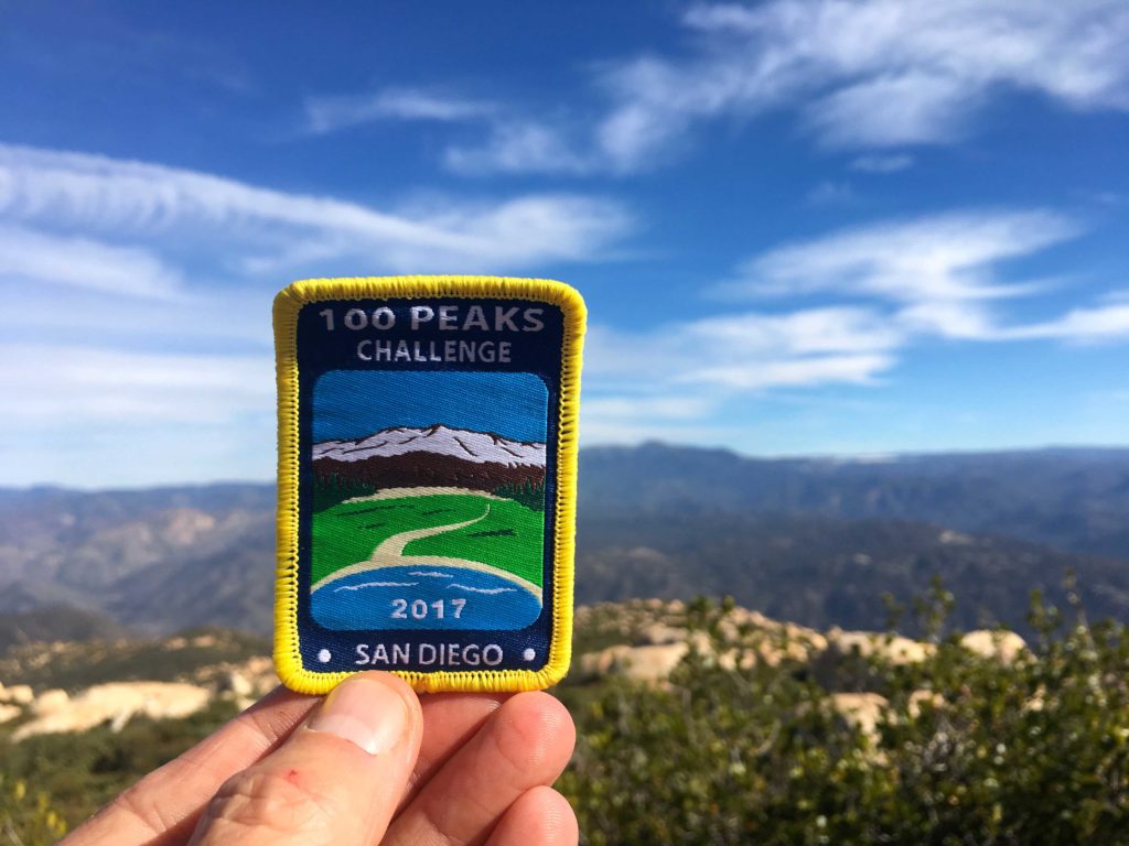
Derek formally presented me with the 100 Peak Finishers patch. This was real.
I was still trying to process what all this meant. It is going to take some time to fully understand what I had just done. I wonder if through-hikers have the same mix of emotions as I was having: joy, fulfillment, sadness, and a touch of relief.
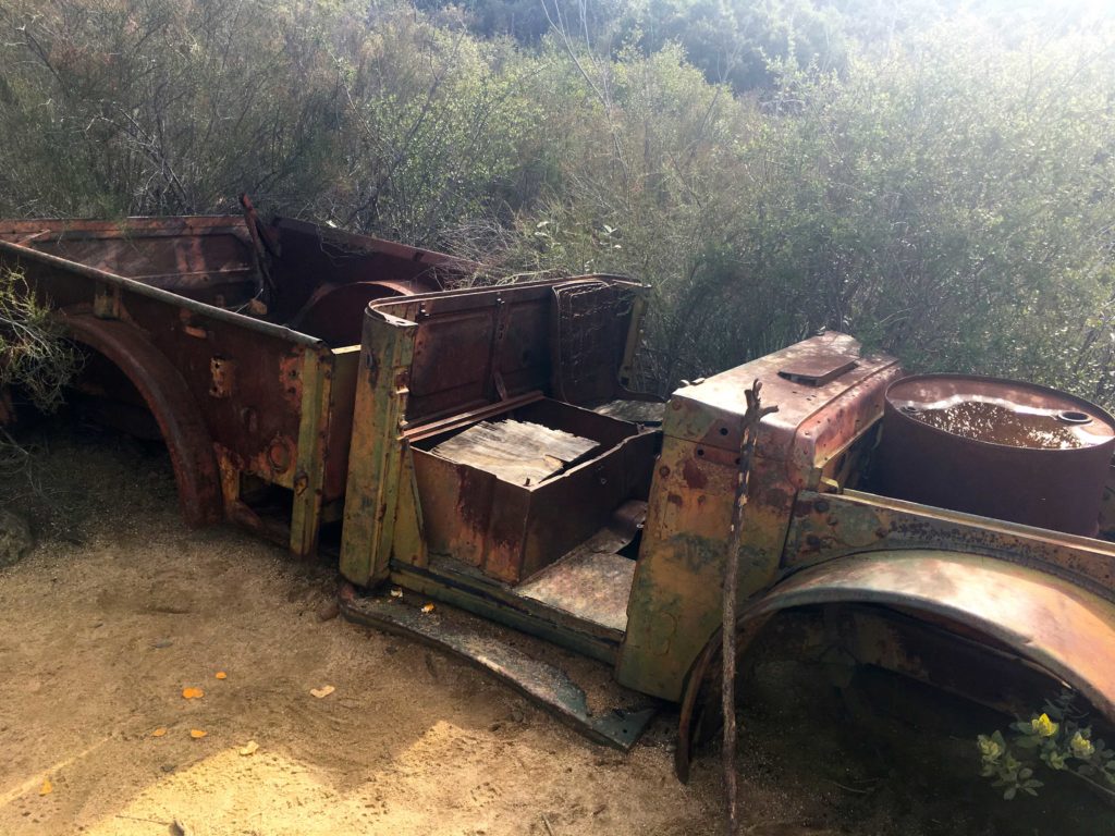
We loaded up our packs and began our descent. The skies had started to fill with some high clouds and a slight breeze picked up, as a storm was due to arrive the next day. My knee was feeling ok as we came back down the steep grade. This time we stopped at the rusted car for a few photos.
As we made our way down, a paraglider was soaring to the southwest of us. Quite the sight to see. The miles ticked by, but those uphills certainly were felt in my legs. El Cajon is often referred to as the mountain where you go uphill both ways. Finally, we crested the last bump and the trailhead came back into view. The end of this journey was almost done.
We crossed back into the parking lot and turned off our trackers. Mine recorded our hike as covering 11.05 miles in 5 hours and 53 minutes of active hiking. The elevation gain was 3,716 feet. El Cajon was now complete. For the answer to what’s next, you can read that here.


I am an avid peak bagger, sometimes backpacker, and former sea kayaker living in San Diego. I am the co-author of Urban Trails: San Diego, available now!
In 2019, I became the third person to complete the San Diego 100 Peak Challenge. Not stopping with that accomplishment, I set my sights on the harder San Diego Sierra Club 100 Peak list, which I completed in 2021. In addition, I have conquered several Six-Pack of Peaks challenges (SoCal, San Diego, Central Coast, and both the Arizona-Winter and Arizona-Summer).
I am looking forward to exploring new summits and new adventures across the southwest.
I was honored to be a part of your accomplishment. Here’s to the next peaks on the horizon. Cheers!