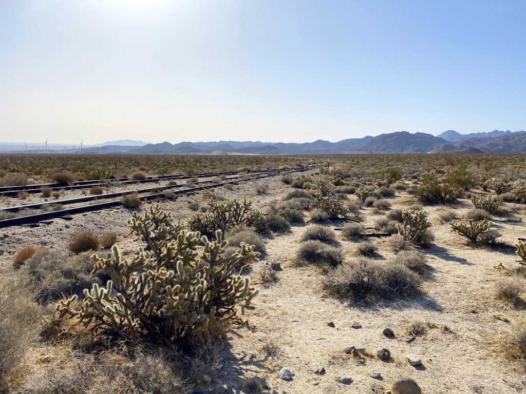
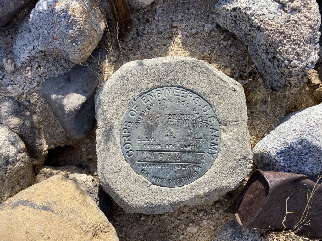
Wanted to do something low-key, as I hope to get several Arizona peaks in later this week, and Windy Benchmark came to mind. This benchmark sits atop a small bump above one of the tunnels on the San Diego and Arizona Eastern Railway. The hike out to it is pretty mild, so it was a perfect adventure to invite a non-peakbagger along on. While I had done some peaks with Mark back in 2019, a knee injury meant he needed to stay mostly flat, so this hike would be perfect. We made the long drive out toward Dos Cabezas, but it went quickly as we had not seen each other for some time. After making our way past the windmills, we drove toward our starting point along the east side of the tracks. Just before the old water tower sits Cabez Benchmark. I pulled off and hopped out of the car, scouring the desert floor to see if I could locate it. Sure enough, there it was, affixed to the ground. It is not on any list, but it was still fun to find.


We parked at the usual spot for those hiking out to Indian Hill or taking the northern approach to the Goat Canyon Trestle. In addition to wanting to summit Windy Benchmark, I had hoped to locate the Blue Sun Cave. This is an incredible pictograph site, but its location is carefully guarded to preserve it. I was able to deduce its approximate location, so off we went. I knew it was around Indian Hill, so it was not going to be too far out of our way. We cruised across the open desert until we came to where it should be located. I scanned the rocky hillside, looking for a possible cave entrance. Spotting what appeared to be something, I went ahead to survey it. Another clue to its location is a rock covered in morteros, so I knew I was probably on the right track. I scrambled up and over some boulders, and there it was! Mark followed me up and we stood before some incredible images. I took a moment to reflect on the legacy of these drawings, wondering what they truly meant to the people that drew them.
Leaving with our photos and memories, we set off back toward Windy Benchmark. I spotted the rocky draw that I had erroneously attempted to climb thinking that was the route to Indian Hill. Once back on the old jeep road, we soon found ourselves at the ruins of one of the work camps. We poked around a bit before starting down the tracks. Now technically, walking on the tracks is trespassing, but I was not worried about it. After about 1/2 mile we came to the base of Windy Benchmark.


Mark decided he would try to climb it with me. We left the tracks and started up a sandy slope. After a short while, Mark turned back, as it was too much on his knee. He was going to explore the tunnel and the views on the other side. So I continued on alone. The sand gave way to more rocky terrain. I spotted what appeared to be the old bypass road, and followed it up to the ridge. I saw four hikers making their way along the track, heading down to the trestle. I continued up the gentle ridge, dodging the various cacti. Once on the summit, I found the benchmark and the register can. I marveled at the original register, before adding my name to the newer one. I took in the views from the peak for a bit before retracing my route.


Once down, I headed into the tunnel and found Mark walking back through. He had chatted with those hikers, and some mountain bikers as well. He loved the vistas on the other side. We returned to the junction with the old jeep road but first decided to explore the other tunnel for a bit. This tunnel had an actual gate inside, but it was half-open. We met two more hikers who were just out exploring the area. We chatted some before heading our separate ways. We stayed on the old road all the way back to the car. Sitting under the tracks, three more hikers were getting ready to head off. I gave the standard “Technically, it is trespassing” warning, then gave them some guidance on their route.
We drove back to the water tower and had our lunch. We explored the area for a bit afterward. Our next stop was Piedras Grande. While I had summited this peak twice before, I never explored the trail leading up to the turn-off. The closed road has a variety of signage explaining the significance of the area. I was able to locate a Yoni, or female fertility symbol, and showed it to Mark. Our real hope was to locate the “Horse and Rider” pictograph. I knew it had a small sign in front of the cave, so I kept my eyes open for it. Usually, I am focused on the peak and not fully looking for other things. About 3/4 mile from the trailhead, I spotted what I thought might be it and sure enough, there was a small sign. Unfortunately, this pictograph has suffered some damage. This “Horse and Rider” pictograph would have been made after the first European contact with the local Kumeyaay Indians. Spanish explorer Juan Bautista de Anza led an expedition through the area in 1774.
We returned back down the road and headed home. It was nice to squeeze in a peak, but seeing these pictographs was clearly the highlight of the adventure.
I am an avid peak bagger, sometimes backpacker, and former sea kayaker living in San Diego. In 2019, I became the third person to complete the San Diego 100 Peak Challenge. Not stopping with that accomplishment, I set my sights on the harder San Diego Sierra Club 100 Peak list, which I completed in 2021. In addition, I have conquered several Six-Pack of Peaks challenges (SoCal, San Diego, Central Coast, and Arizona-Winter). Beyond attempting the San Diego Sierra Club 100 Peak list a second time, I am looking forward to exploring new summits and new adventures across the southwest.


