With the Sierra Club 100 behind me, as well as my backpacking trip on Santa Cruz Island, it was time to turn my attention back to completing the various Six-Pack of Peak Challenges. Since I am hoping to do several of them as overnighters, I had a handful to pick from. Since I knew my friend Gina Norte usually hikes Hot Springs Mountain on Saturdays, I reached out to see what her plans were. She replied that she was taking another San Diego Hiking Society admin, Conni Barth Nardo, and a friend up Hot Springs Mountain, but via the Nelson Camp route. I remember reading about this route in my earlier editions of Afoot and Afield in San Diego. Instead of starting at the campground, this route follows an older jeep road from much further back on the reservation. Access to this part of the reservation has been closed for a number of years, so given the opportunity to explore a new trail, I was so excited to be able to tag along.
We met as usual at the guard shack and followed Gina to the campground. The tribe had recently changed their hiking hours to allow starting at 6 am, and there were about 8 or so cars already parked. We tossed our gear into Gina’s car and set off, driving along the dirt road for a bit. Instead of heading to the right, like we did when we hiked to Palm Mesa High Point, we veered left. We passed through our second locked gate, then past the shooting range. Finally, we pulled over near what Gina referred to as “Four Corners”. From here we would follow an old jeep road until it intersected with Hot Springs Mountain Road.


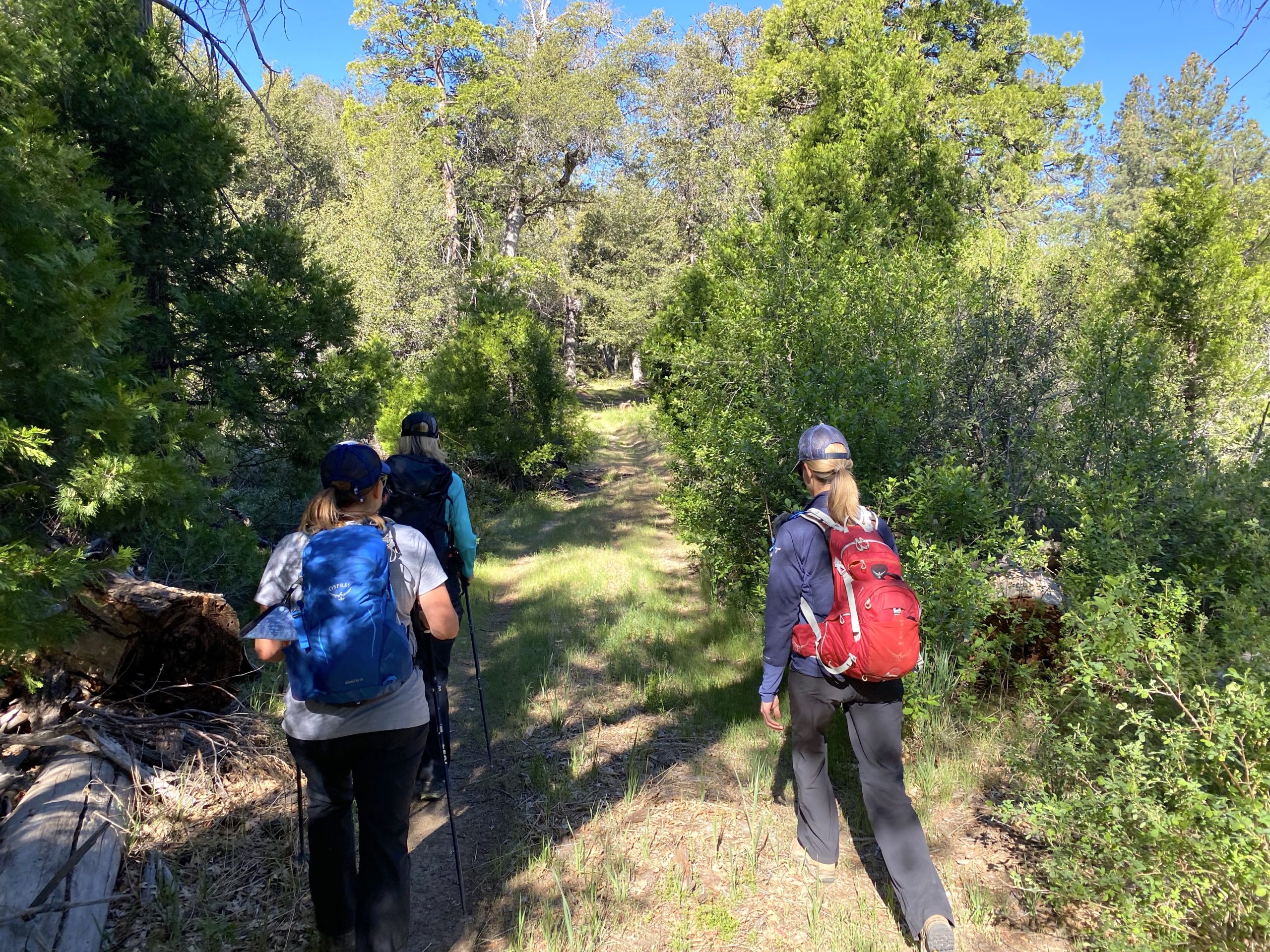
The four of us began working our way up the mountain, Gina leading the way and telling us about the history of the land and its people. After a bit, we stopped and she led us off-trail to an impressive collection of morteros. These were some of the deepest I have ever seen. Then she led us over to the cooking area. She pointed out some of the shards of pottery that remain. Also, she told us how to distinguish it from the surrounding ground.


Once back on the trail, the “road” became rockier in nature. One of Gina’s roles for the tribe is also to monitor some of the wildlife on the mountain. Along this route, she has a trail camera set up to capture the other ‘visitors’ to Hot Springs Mountain. Near its position, Gina spotted a mound of mountain lion scat. She estimated that it was 1-2 days old. Since we were traveling in a close group, there was very little risk. Plus, we all knew what to do if we did have an encounter.


After about 1.2 miles we met up with the main road and continued on up to the summit. Neither Gina nor I missed bypassing those first couple miles on the normal route. Once at the top, we opted to head over to the summit block first, then return to explore the area around the abandoned lookout tower. As we made our way to the true summit, four ladies were getting ready to take a Happy Birthday photo. Gina asked if they had made it to the top, and they said they did not. Gina being Gina said “come along” and she would guide them up. Arriving at the summit block, there were some other hikers making their way up. Gina offered some tips to them as well. Connie, her friend Meredith, and I just hung around while everyone else made their way up.


The four of us finally scrambled up the rock and soaked in the views. I pointed out the various key mountains that surrounded us. We carefully scrambled down, and even more folks were waiting their turn. HSM was quite popular today. Gina helped another set of hikers make it up before we headed over to the tower.


We poked around there a bit and had a snack. I even ran into a former Qualcomm colleague. After catching up a bit, we headed off. Plus it was getting crowded up there. I was glad I was vaccinated. Upon our return, we decided to take another off-trail excursion, with Gina’s permission to summit Peak 6440. This peak is just about 0.2 miles off the main route. We scrambled up its rocky dome to some incredible views. We could look back and see the summit and tower to our west, and some even better desert views to our east. We wandered the summit a bit before heading back down.


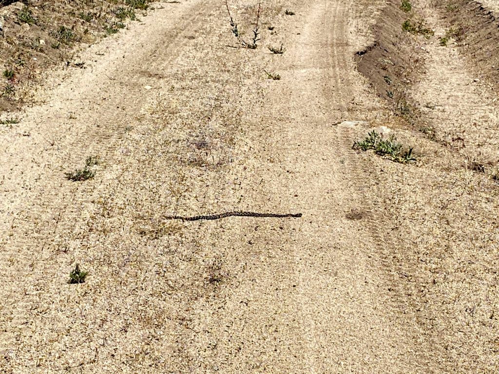
We continued sharing stories and adventures as we made our way back down to the car. The day had warmed up a tad, but it was still pleasant. There was one section of the route that had changed. On the way up there was a portion of the road that was muddy from a spring. Upon our descent, bees had arrived to drink, so we had to carefully pass through it. Once back at the car we returned to the campground, but not before spotting a rattlesnake sunning itself in the road. I snapped a few photos from the safety of the car, then guided Gina around it, as it had no interest in moving. We bid farewell at the campground and headed back home. Since I only had a snack at the tower, I was a bit hungry. I debated just getting some snacks from Don’s Market or a sandwich from Dudleys. Dudley’s won.
I am so grateful that I was able to come along on this hike and see more of this incredible area. We are already planning a laundry list of other hikes to come… The final stats for this route were 6.9 miles in 5:14 with 1,459 of gain.


I am an avid peak bagger, sometimes backpacker, and former sea kayaker living in San Diego. In 2019, I became the third person to complete the San Diego 100 Peak Challenge. Not stopping with that accomplishment, I set my sights on the harder San Diego Sierra Club 100 Peak list, which I completed in 2021. In addition, I have conquered several Six-Pack of Peaks challenges (SoCal, San Diego, Central Coast, and Arizona-Winter). Beyond attempting the San Diego Sierra Club 100 Peak list a second time, I am looking forward to exploring new summits and new adventures across the southwest.