Jacumba Mountain

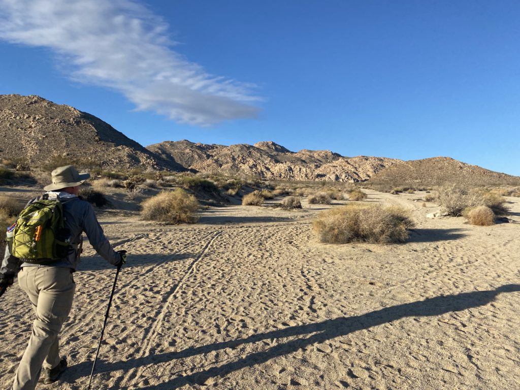
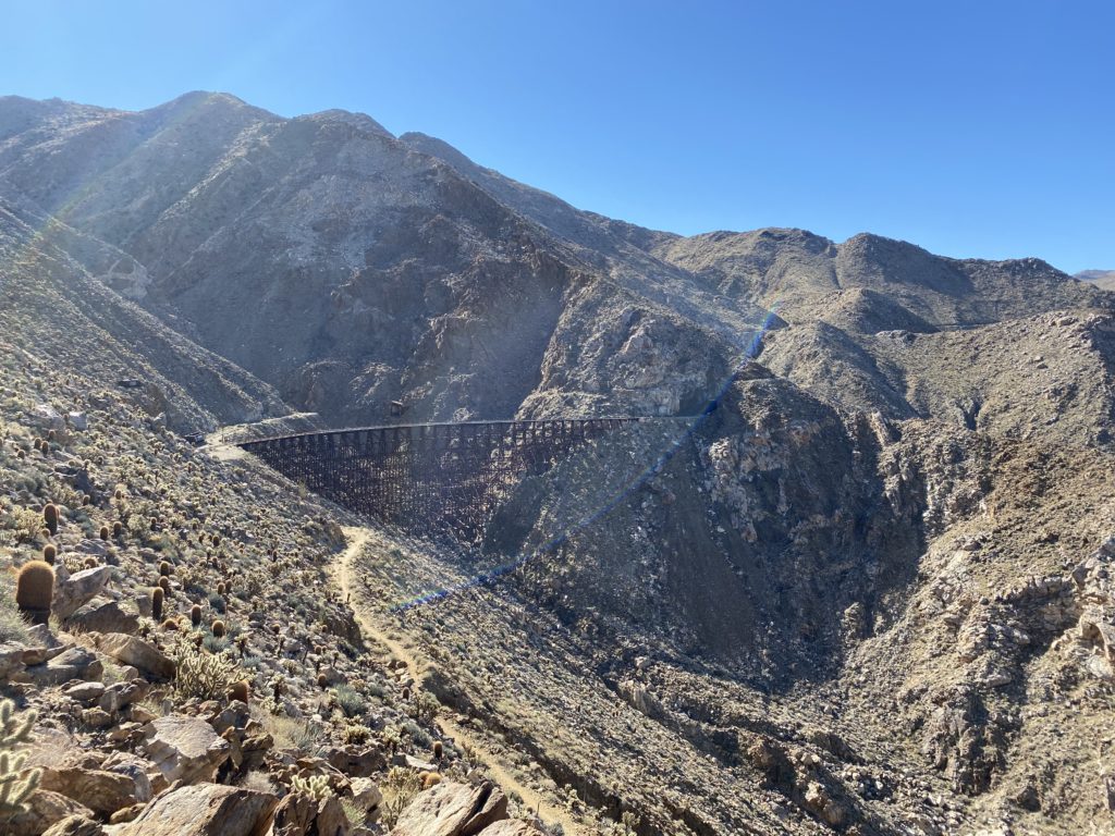
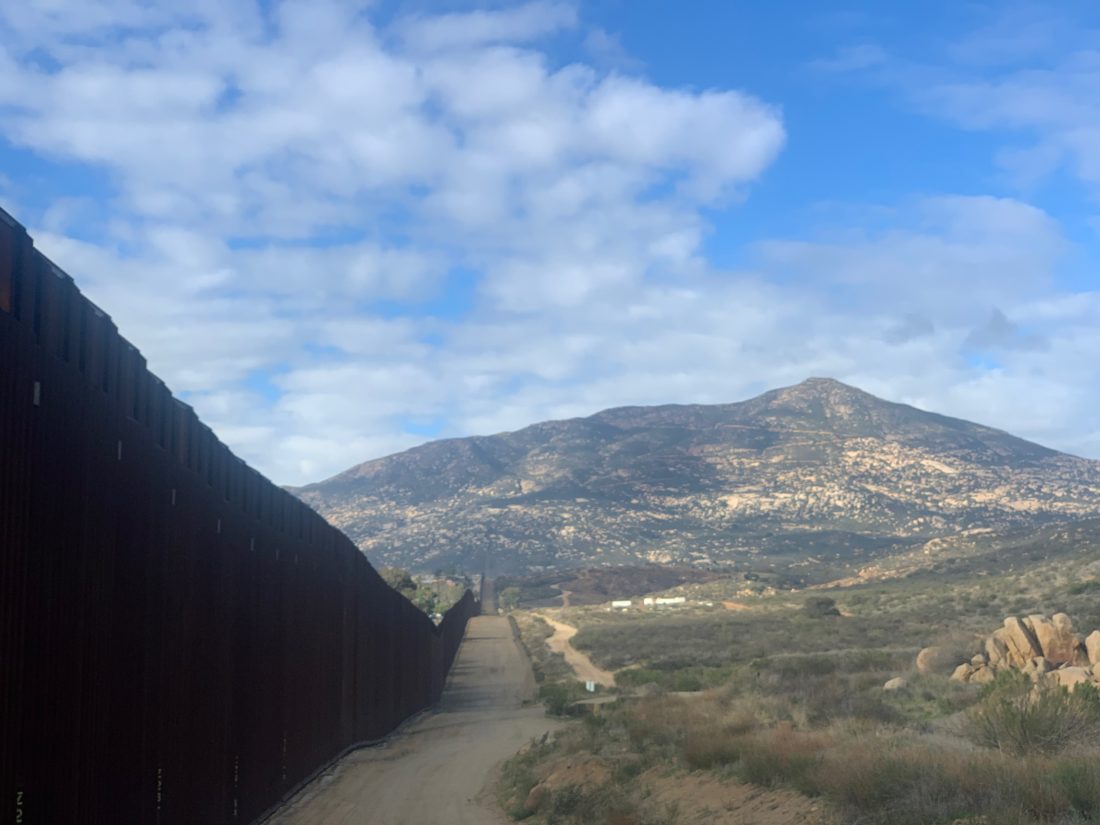
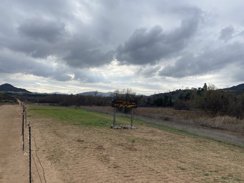
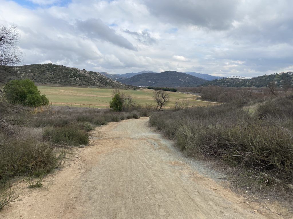
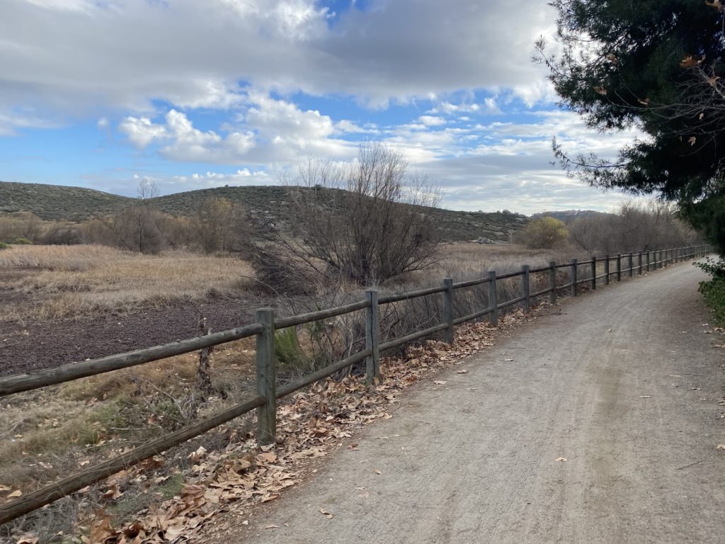
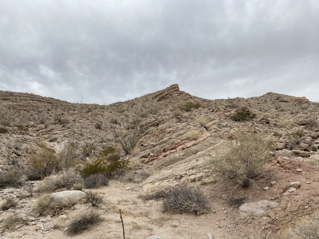
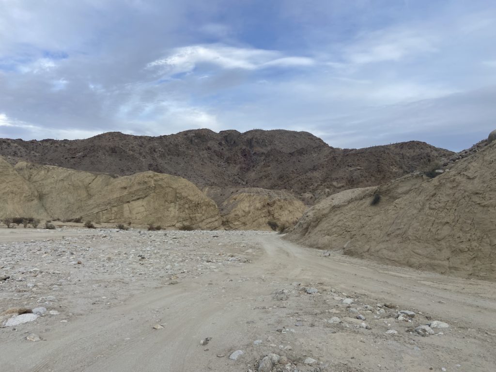
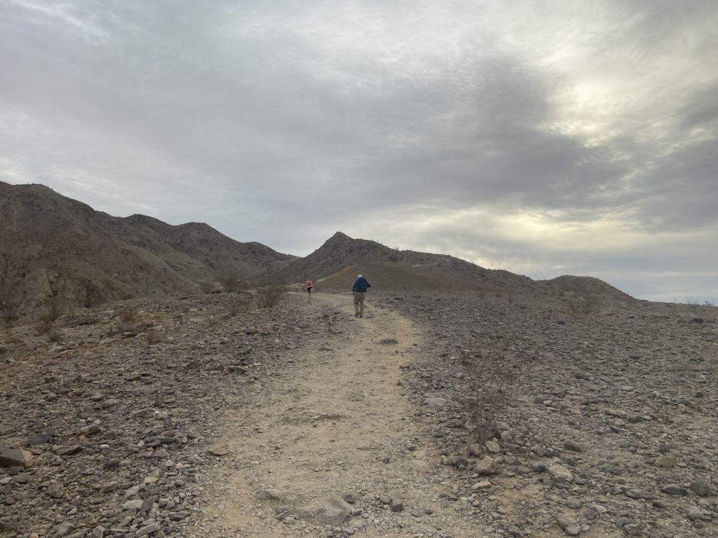
Decided to tackle Jacumba Mountain today. This was a peak Susie, Ted, and Matt Hanan all needed. I initially was going to take the Subaru out to the trailhead. It made it to a different trailhead back in 2019, so I had some confidence that it was up to the task, but Matt offered up his actual 4×4 again, so I was happy to turn the driving over to him. We pulled off the 8 at In-Ko-Pah and backtracked to the dirt road that would take us back into the Jacumba Wilderness. The road was rough and took some care as we navigated around the rocks and ruts. We made it to the trailhead and parked. Off to the north stood the summit Jacumba. The route appeared fairly straightforward and without any major concerns other than it looked steep.

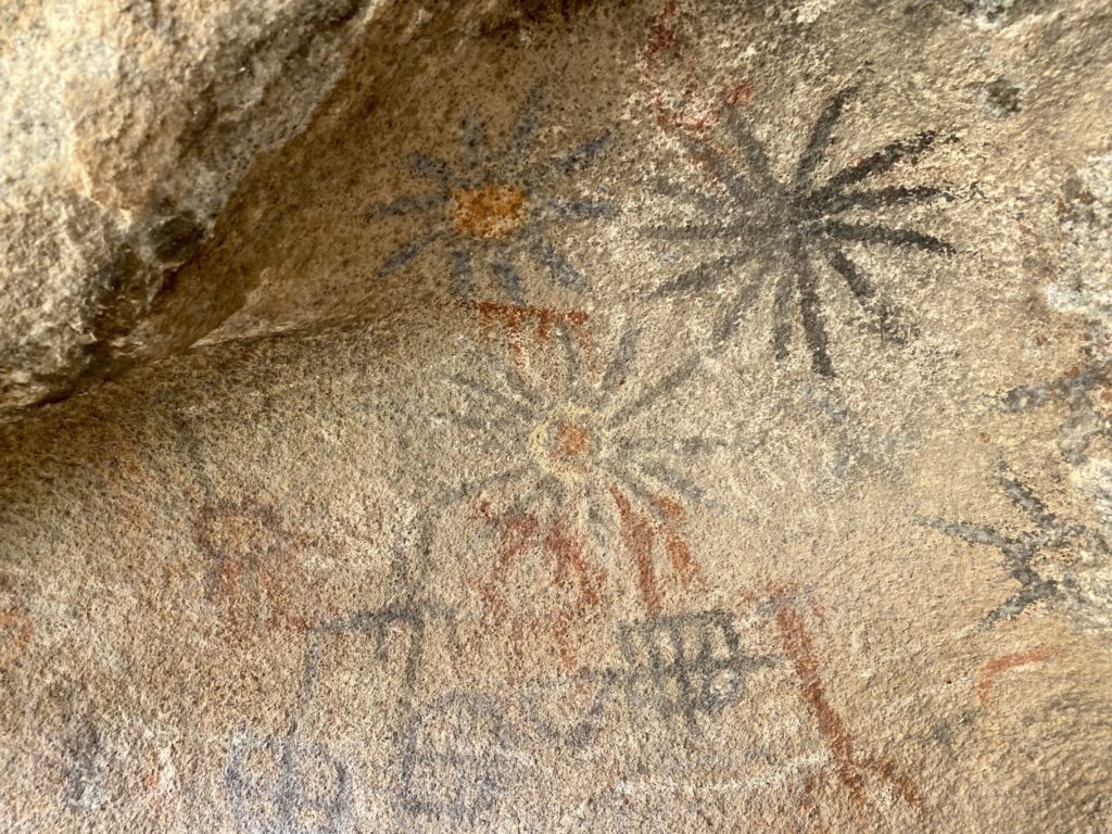
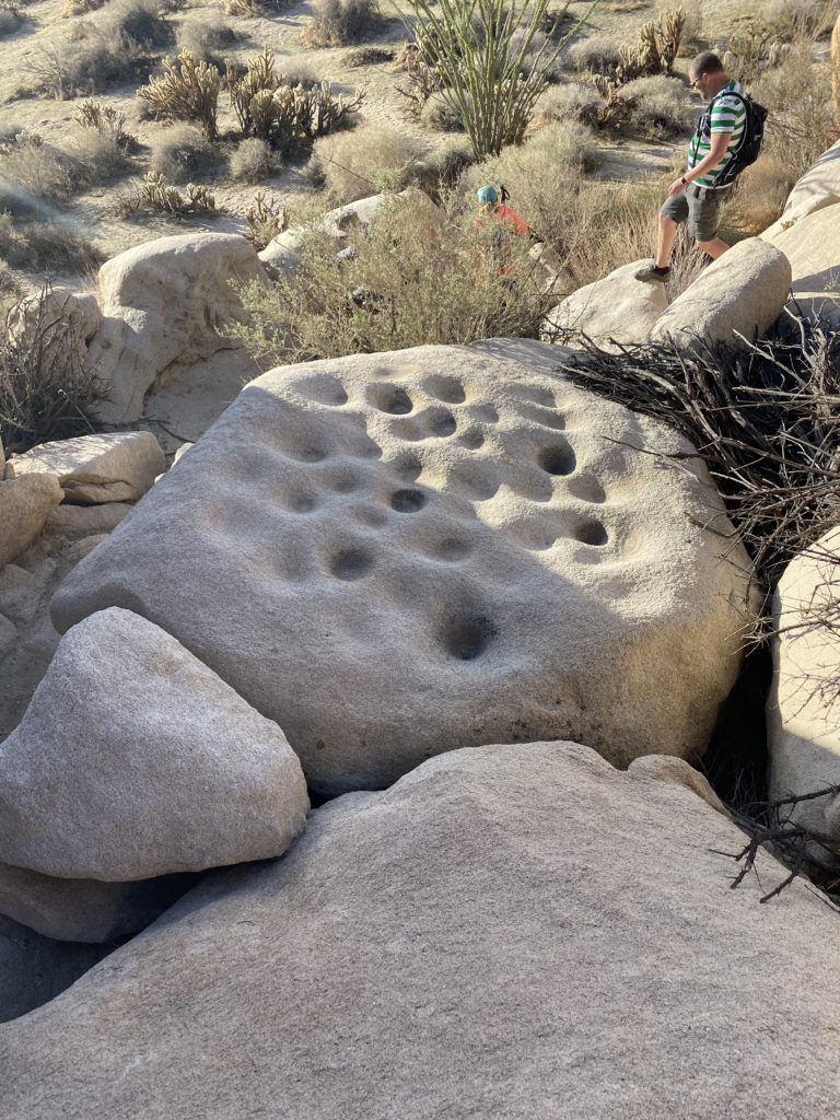
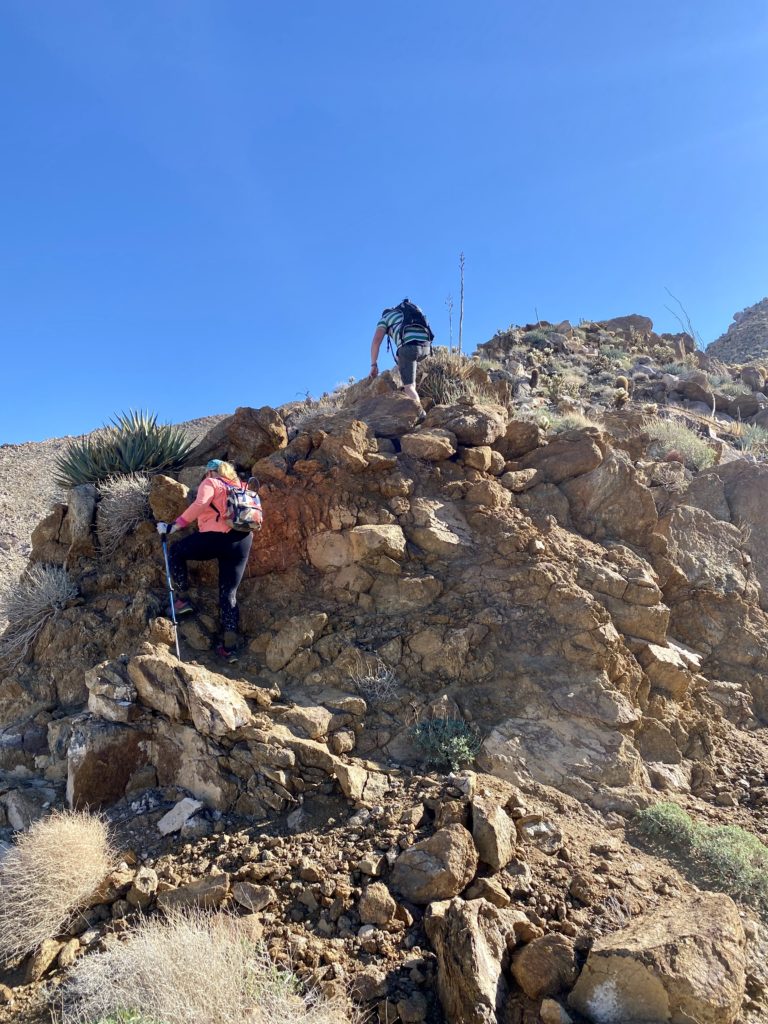
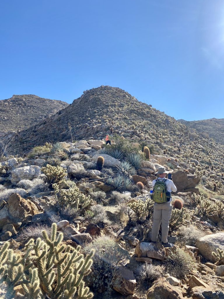
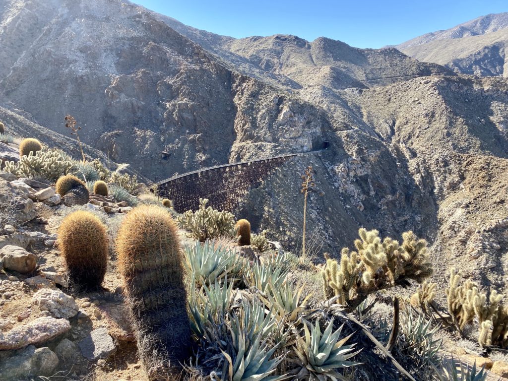
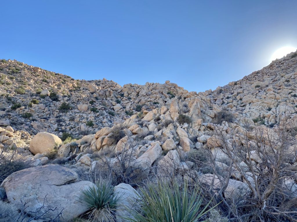
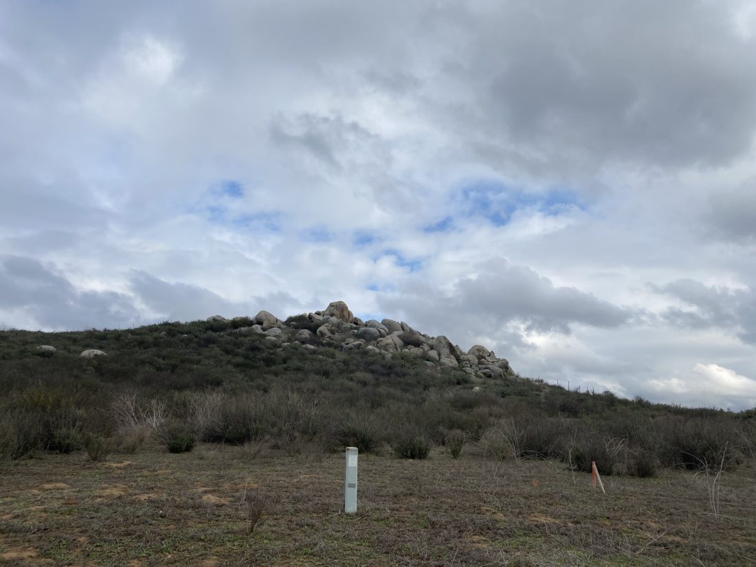
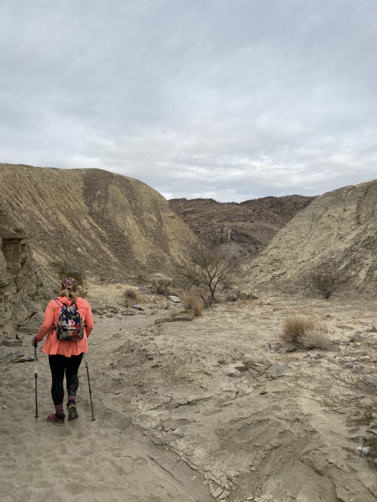
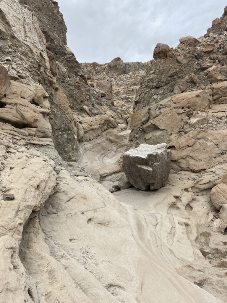
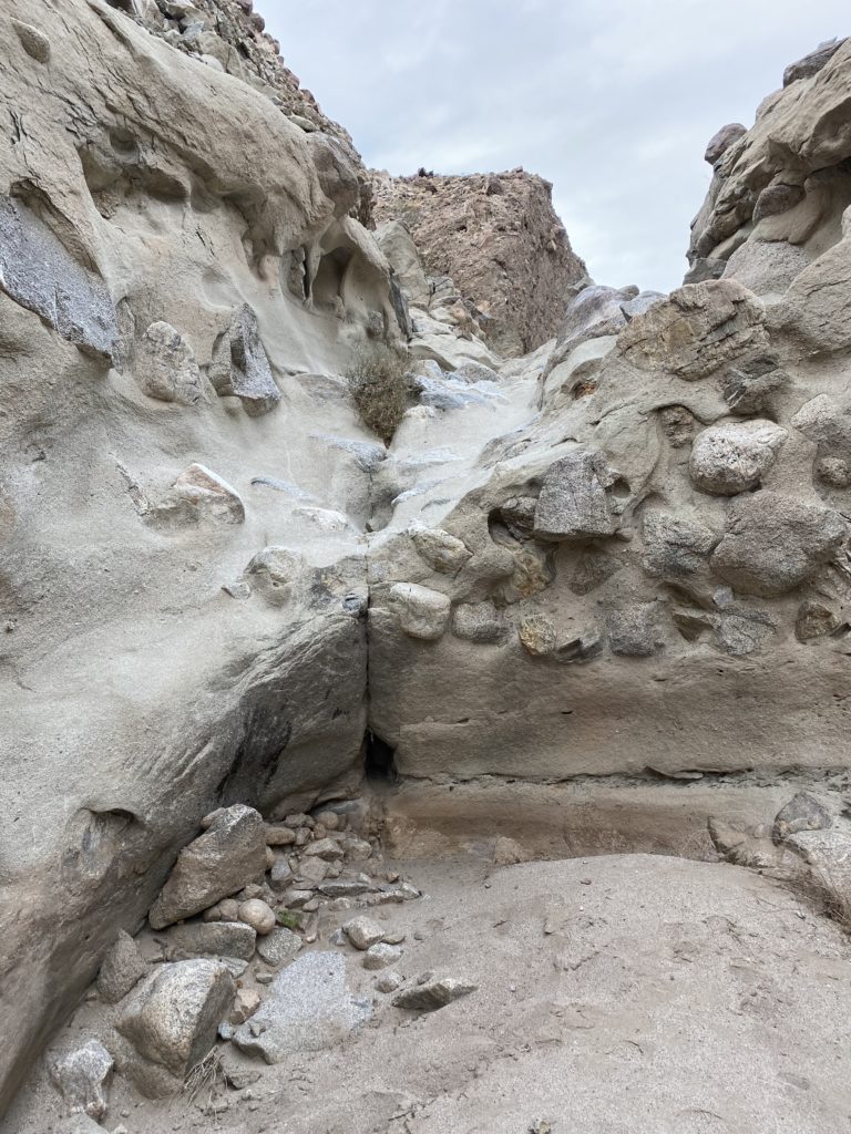
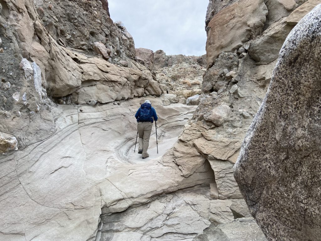
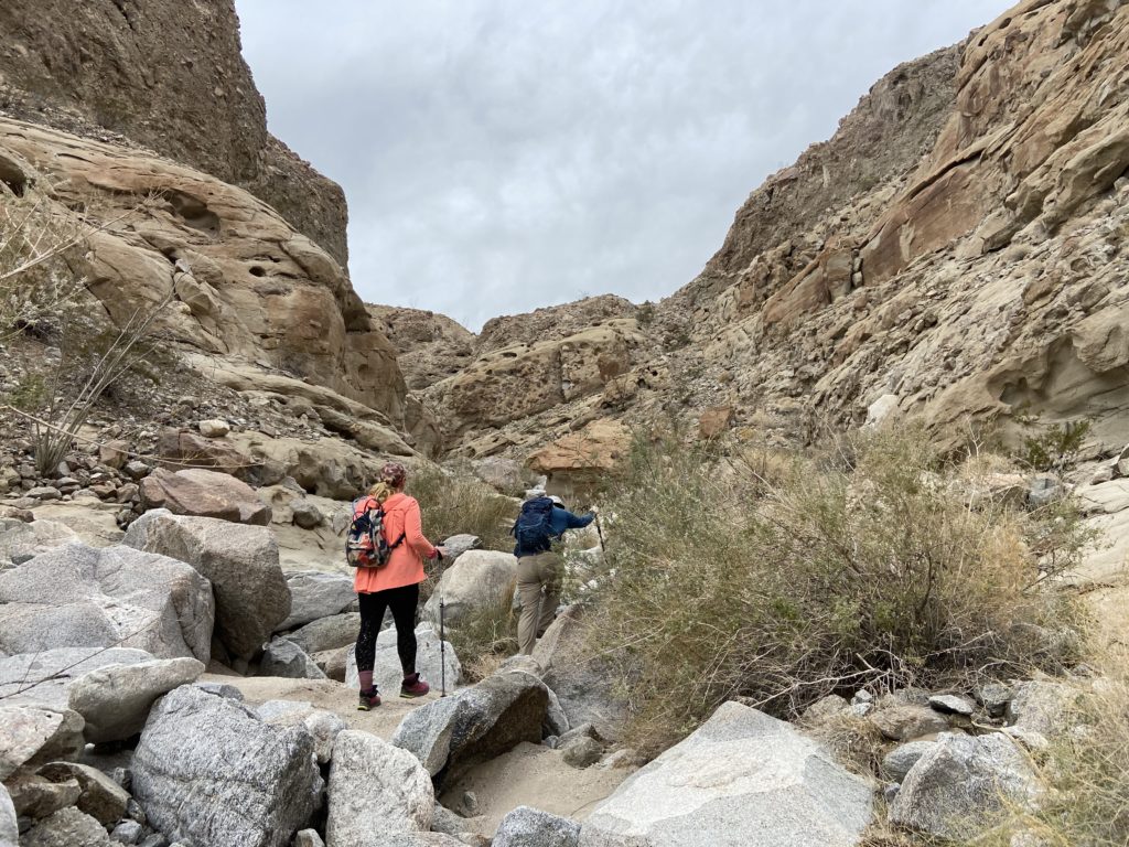
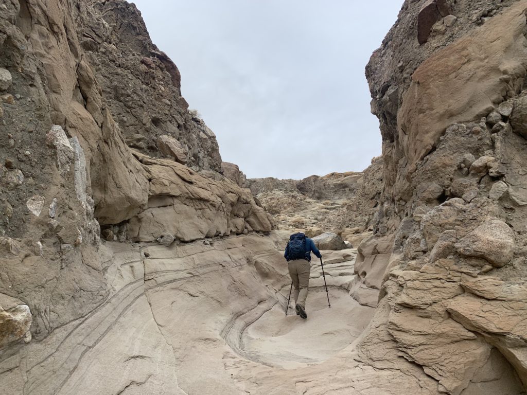
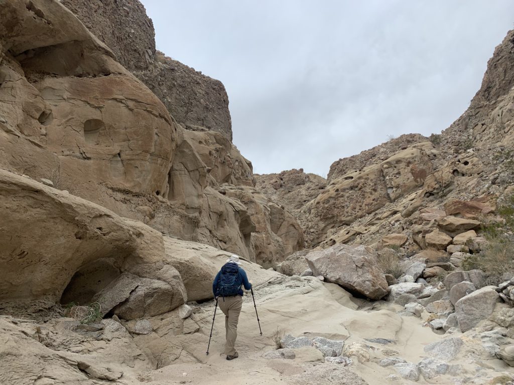
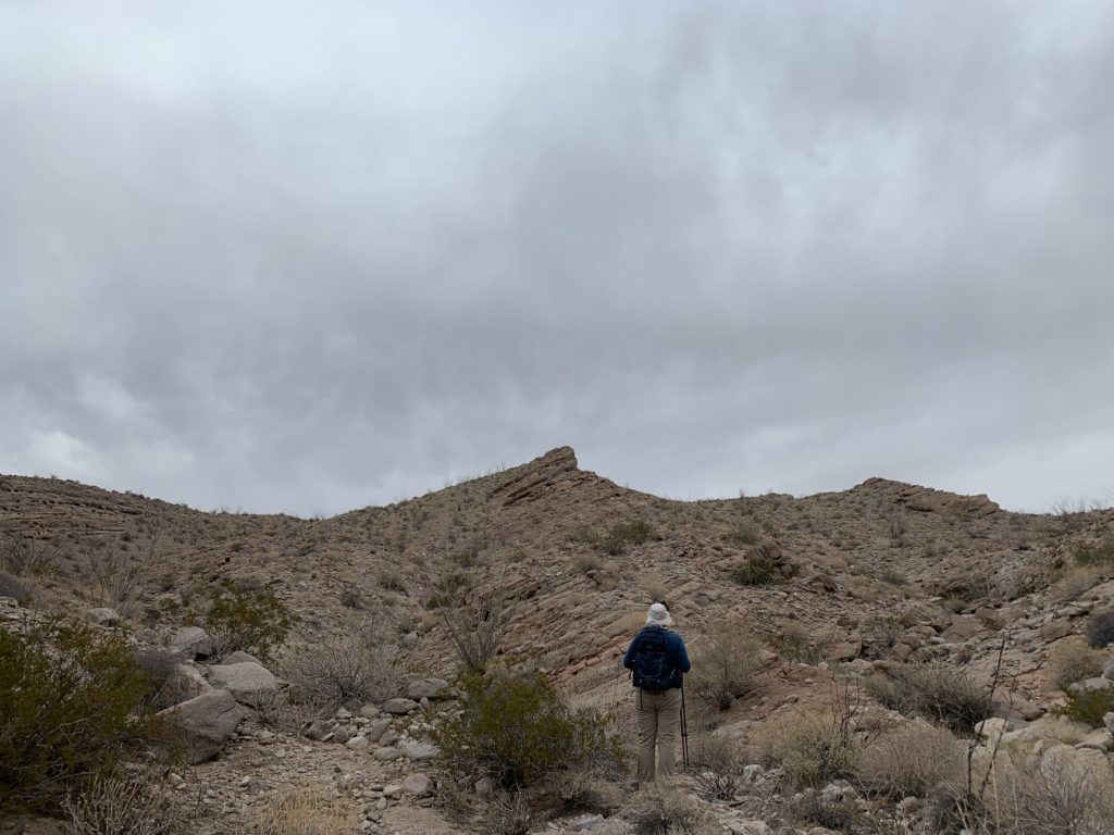
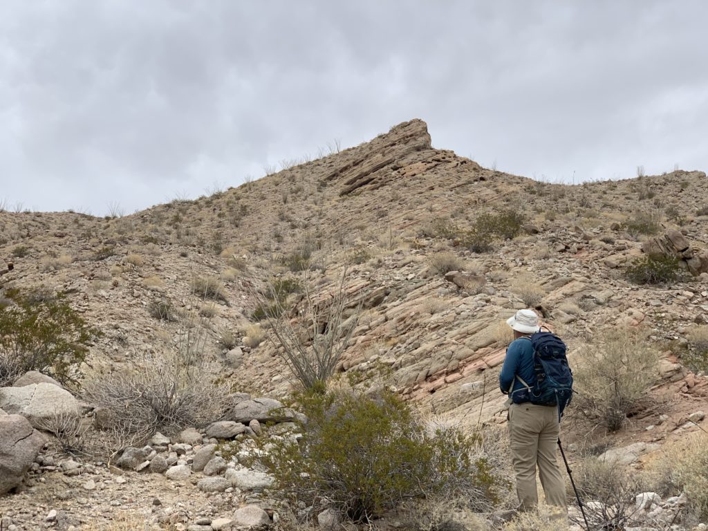
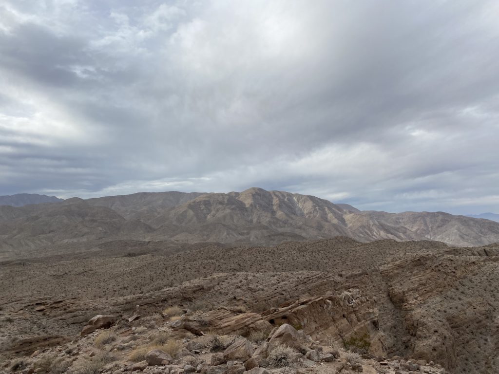
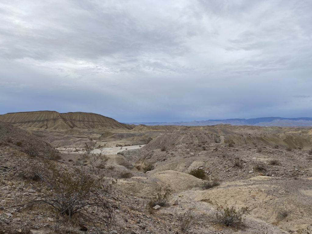
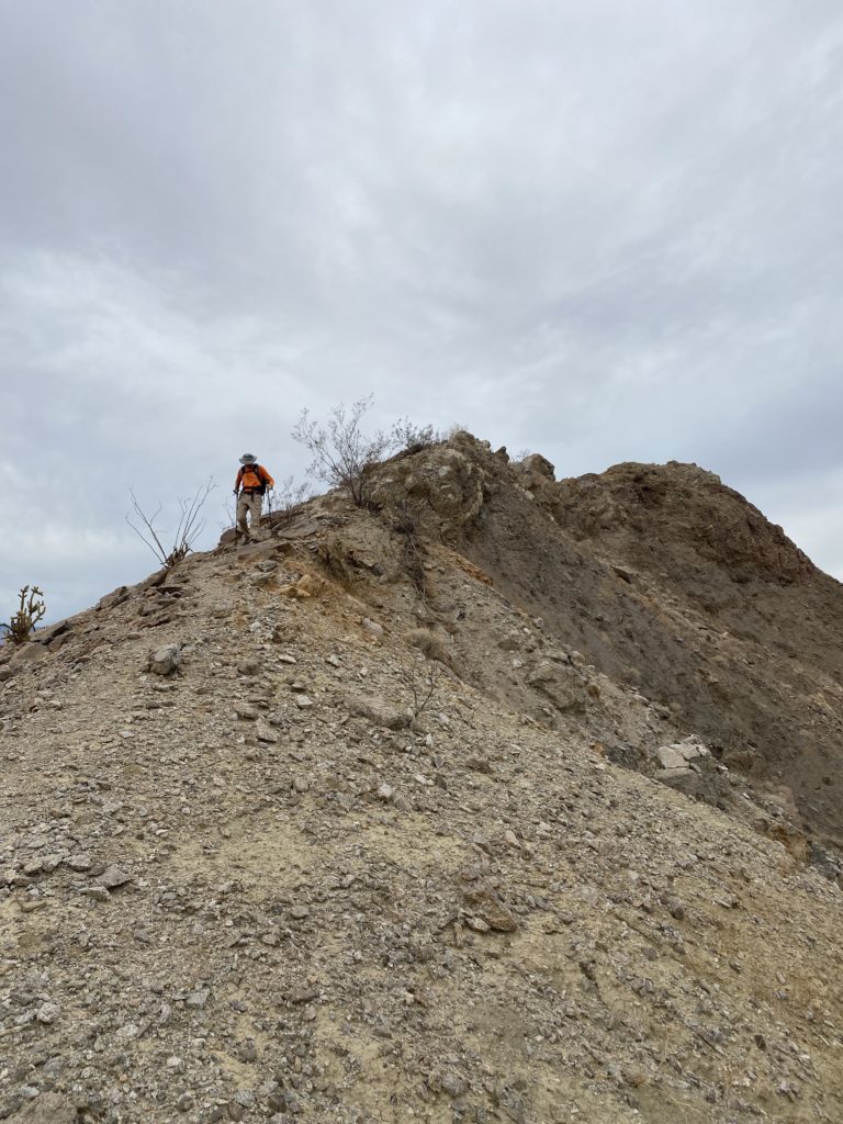
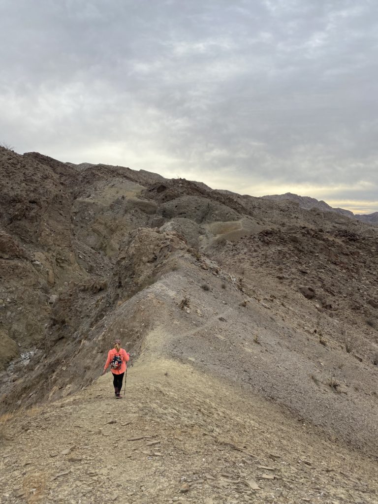
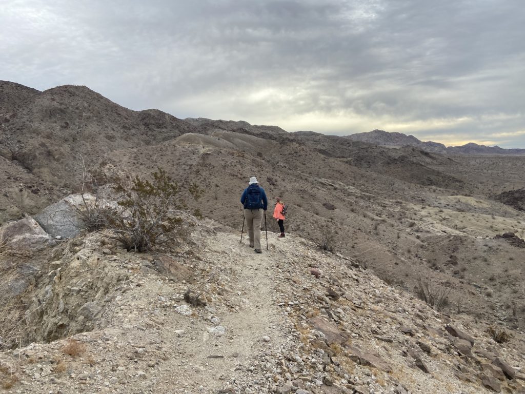
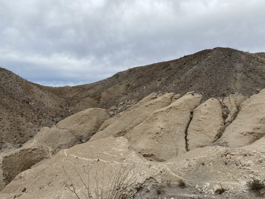
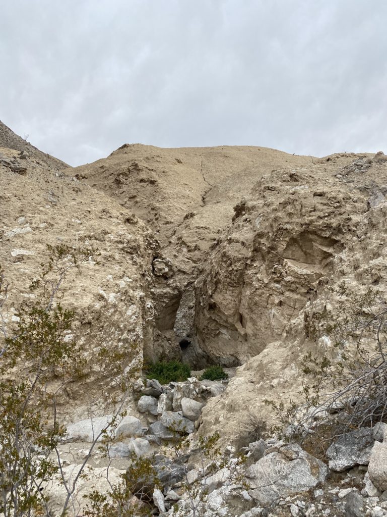
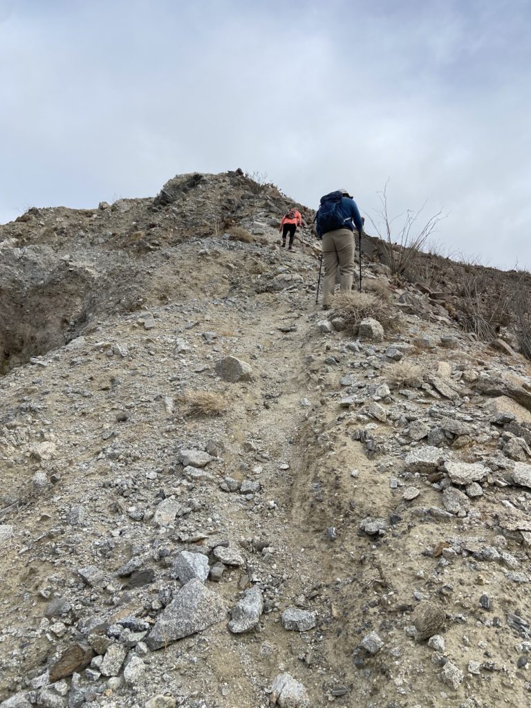
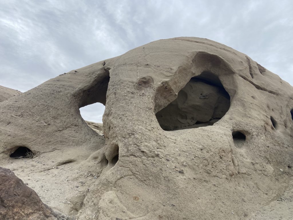
After climbing over some initial boulders, we dropped into a nice wash that took us toward the base of the mountain. Spying some cairns, or homemade markers, we began climbing the western side of Jacumba. We took a couple of short breaks to catch our breath, but also to take in the views.

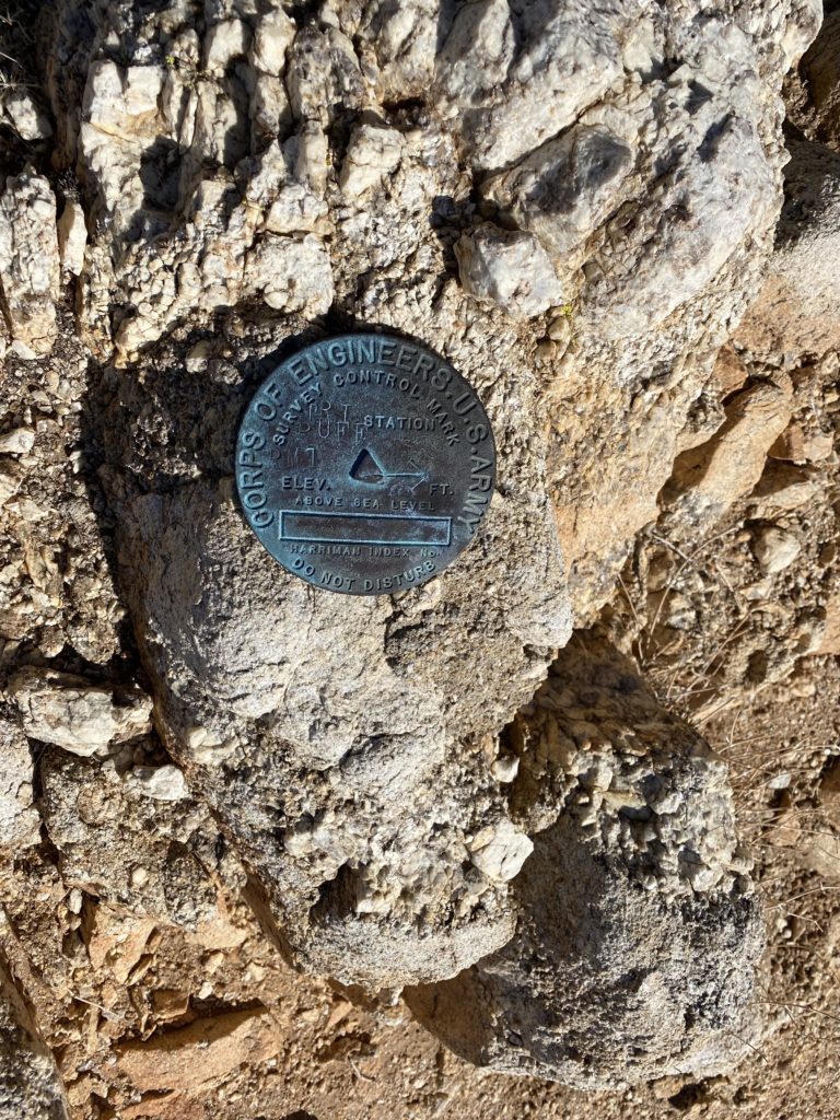
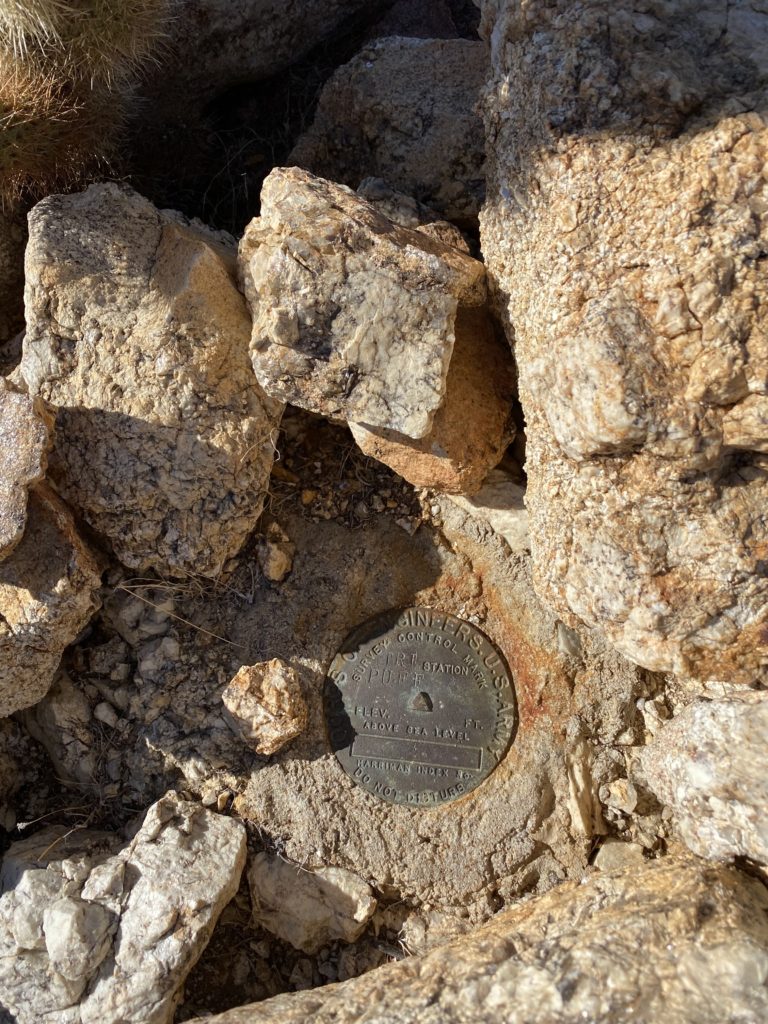
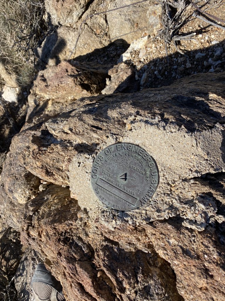
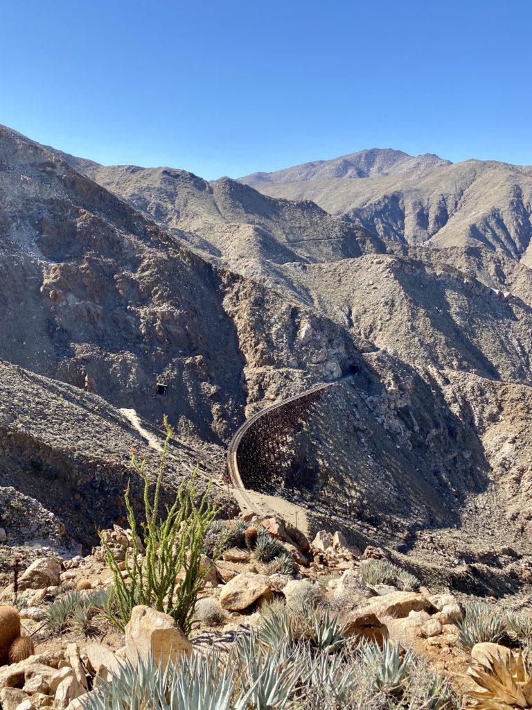
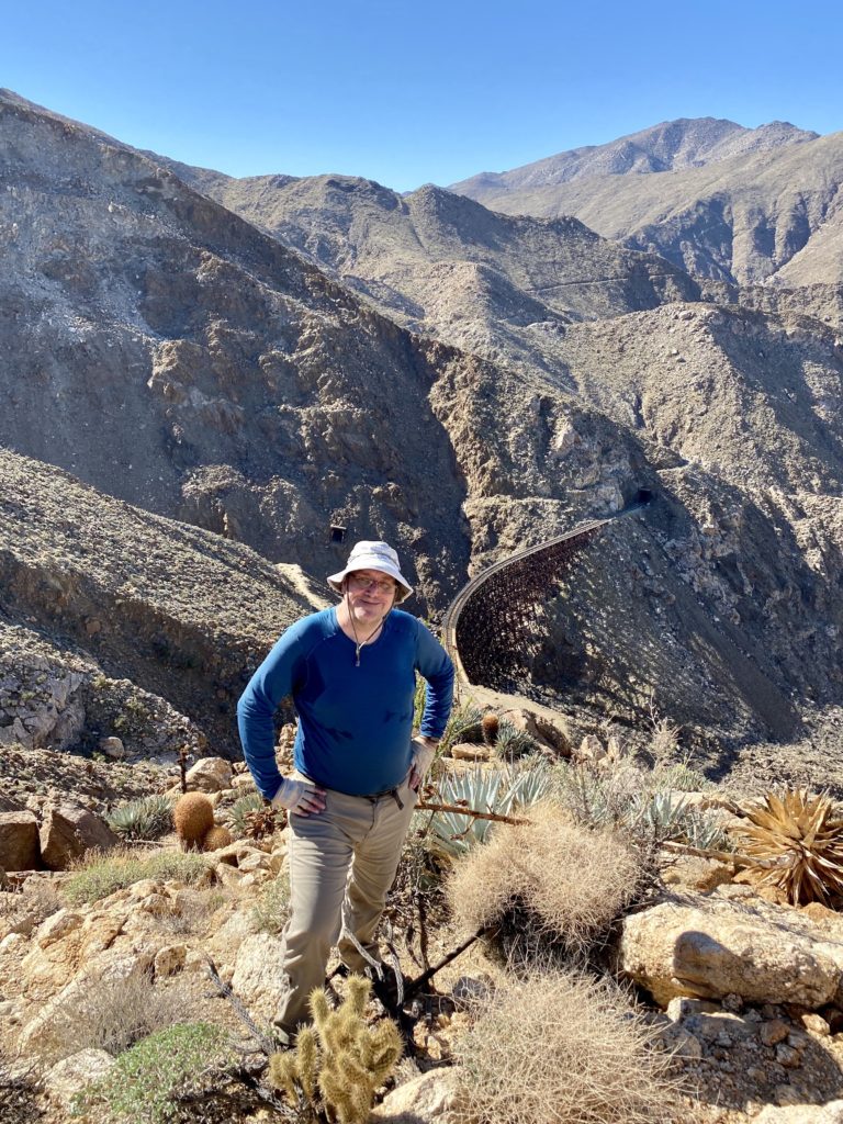
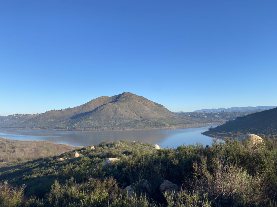
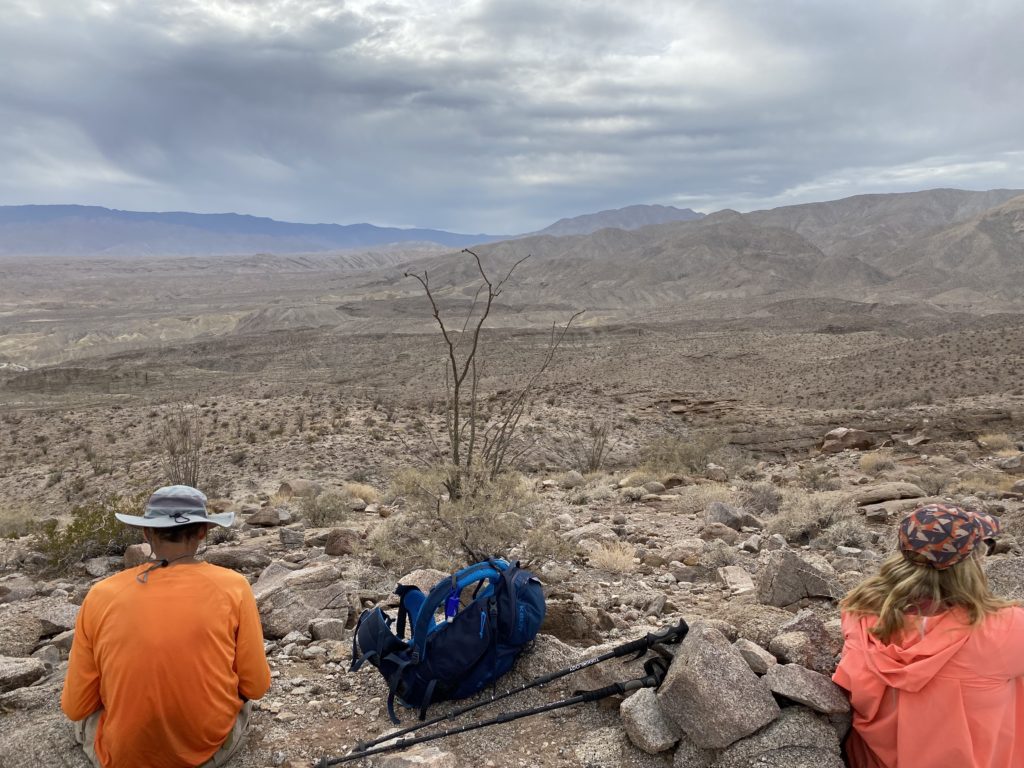
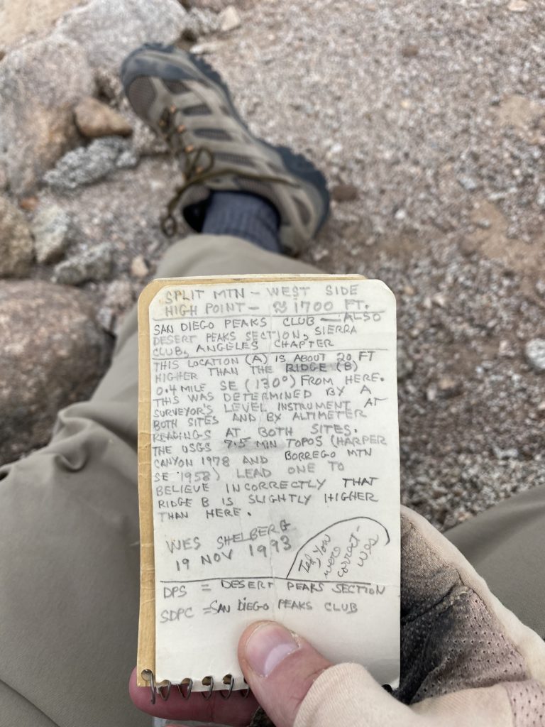
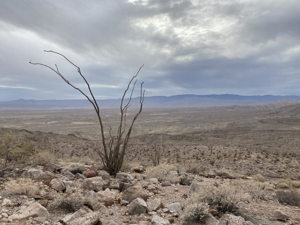
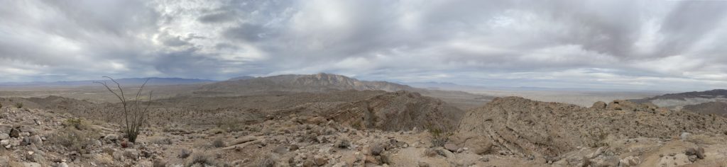
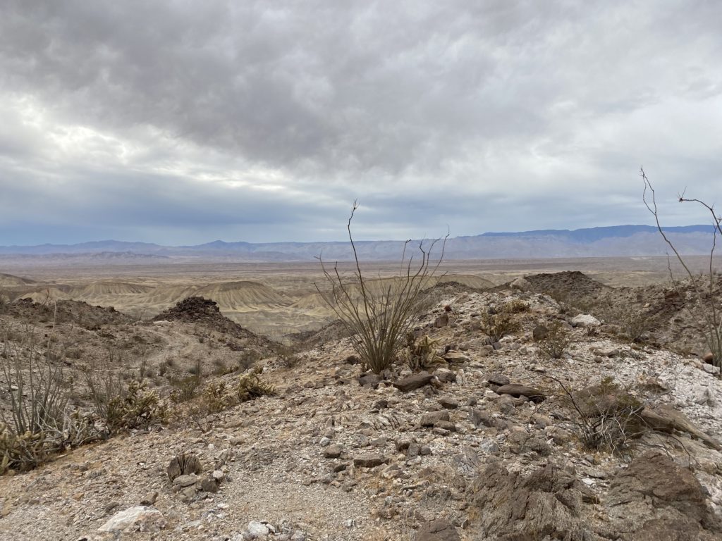
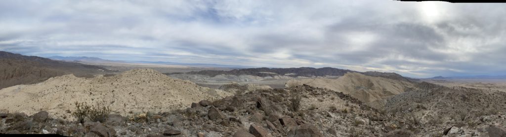
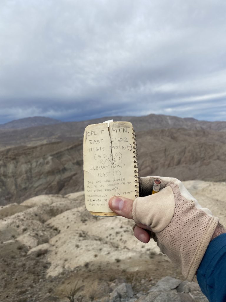
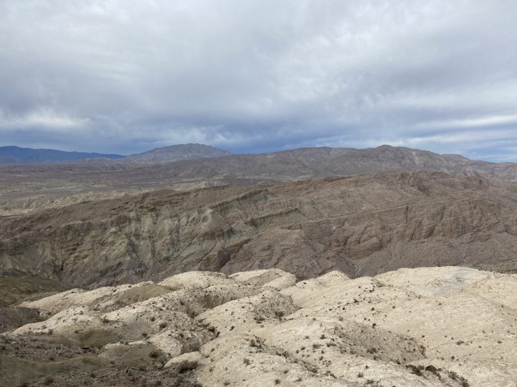
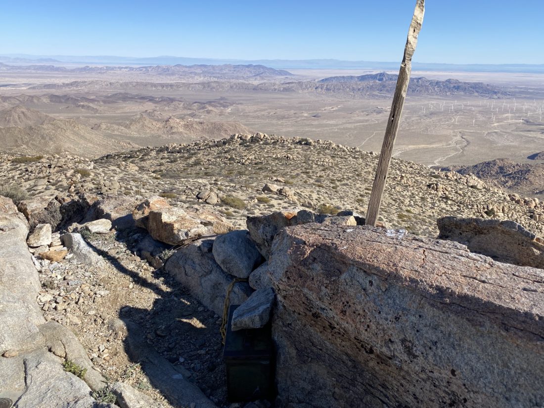
Once we crested, the windmills of Ocotillo were spread out to our east. This is where this route connected with my previous route. Now it was a simple stroll over to the summit. We climbed up the summit block and took in the sweeping views. It was a fairly clear day, so we could see the Salton Sea off to the east. 

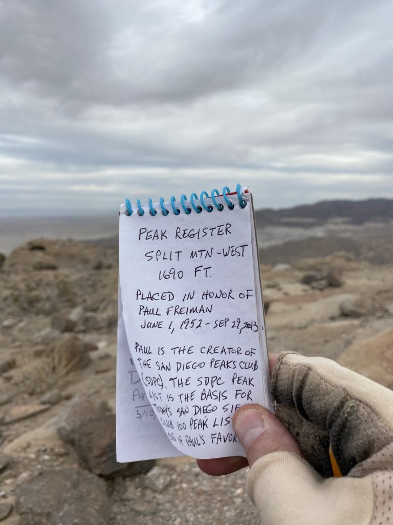
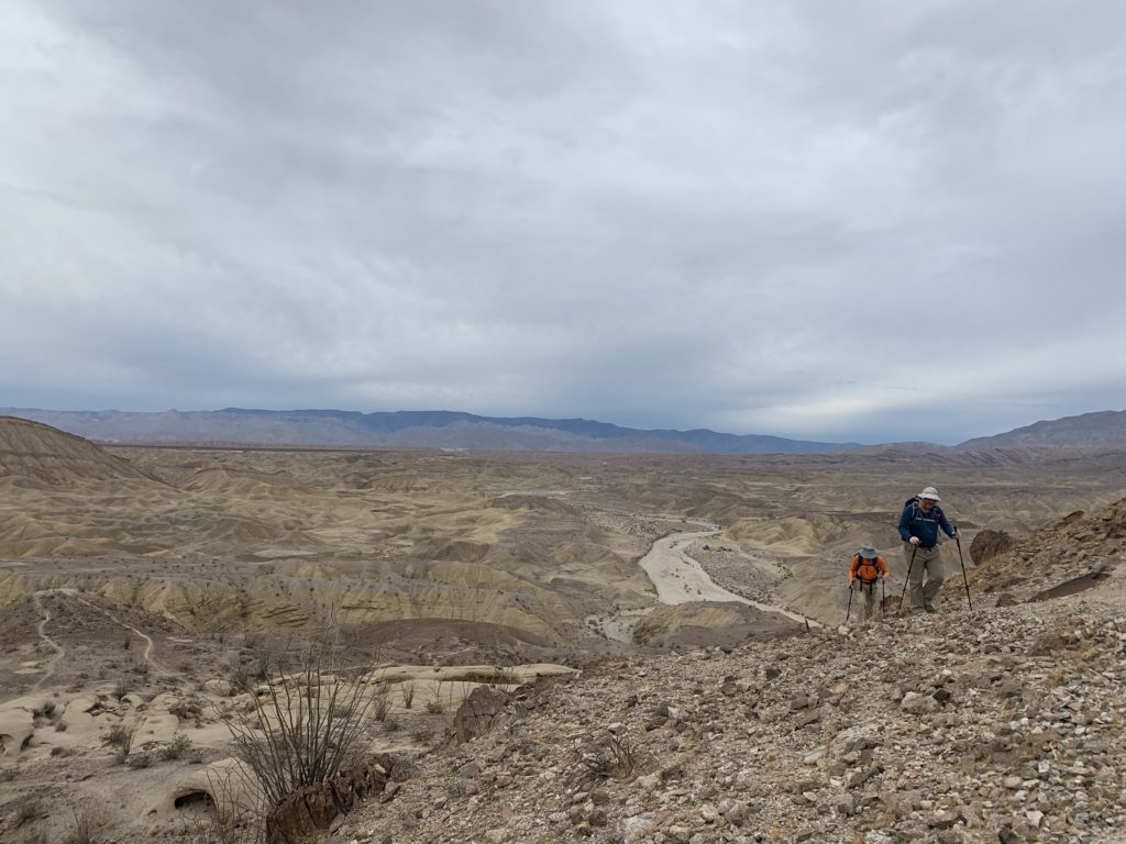
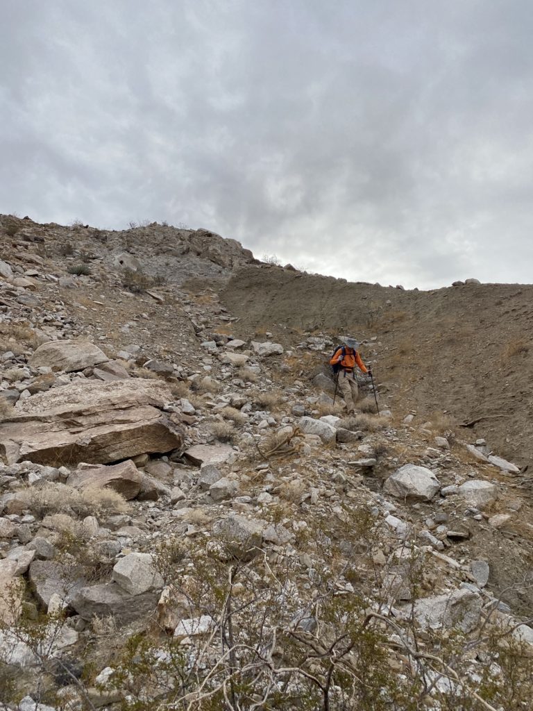
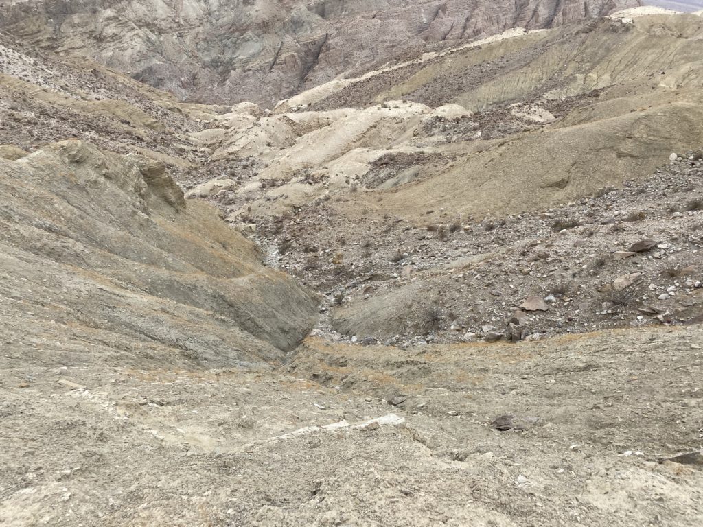
After a nice break and signing the register, we retraced our route. The descent went fairly smooth, until almost the end. We left the wash too soon and spent a bit of time scrambling over the rocks. Oh well. Once back in the car, another off-roader was nearby and inquired a bit about our adventure. We made our way back down the dirt road, which seemed a bit easier in this direction. Back on the 8, we made a bee-line to Alpine Brewery’s Outpost for some food and drink. The hike was just over 3.1 miles in 2:56 total time and an elevation gain of 1,280 feet. Nice to cross this one off the list!


Buy Me a Coffee at ko-fi.com

I am an avid peak bagger, sometimes backpacker, and former sea kayaker living in San Diego. In 2019, I became the third person to complete the San Diego 100 Peak Challenge. Not stopping with that accomplishment, I set my sights on the harder San Diego Sierra Club 100 Peak list, which I completed in 2021. In addition, I have conquered several Six-Pack of Peaks challenges (SoCal, San Diego, Central Coast, and both the Arizona-Winter and Arizona-Summer). Beyond attempting the San Diego Sierra Club 100 Peak list a second time, I am looking forward to exploring new summits and new adventures across the southwest. 

Puff & Moan Benchmarks

Since Ted was on call, Susie and I looked over our remaining peaks for ones that Ted had previously done, and Puff and Moan Benchmarks looked like a good candidate. I knew Matt Hanan needed Puff Benchmark, so I asked if he wanted to tag along. He also offered to drive! While planning an upcoming backpacking trip in Joshua tree with the “other” Ted, I mentioned my weekend plans and he was very interested given all the planned points of interest along the way. Since we were hiking on Sunday, he drove down from Santa Barbara on Saturday evening. We caught up a bit—he was one of my groomsmen after all, before turning in. We picked up Susie en route to Matt’s house for our 6:00 am departure. As we drove east on the 8, we caught a wonderful sunrise.

We opted to take the road via the windmills as opposed to via Mortero Canyon. While a bit longer, overall the road is without any issues. As we made our way to the parking spot, I spotted a lenticular cloud to our north. I don’t think I have ever seen one before in real life. Once at the parking spot, we grabbed our gear and set off along the desert floor to our first goal, the Blue Sun Cave. I visited it last year when I was hiking out to Windy Benchmark. My memory was spot on and we found the cave without issue. We all spent some time looking over these reminders of people long since gone. But we had a lot of miles to cover, so we looped around Indian Hill to take the old road toward the tracks. Just before the tracks, there are some remains of one of the railroad camps.

Our route paralleled the abandoned train tracks. Full disclosure, the tracks are considered private property, and walking on them is considered trespassing. Our route gave us some great views of the Carrizo Gorge, various small trestles and even two derailed train cars. Soon we found ourselves at the base of the ridge that would take us up to Puff Benchmark. Avoiding the cactus was the biggest challenge we had as we made our way up the ridge. Off to our right, the famous Goat Canyon Trestle stood majestically.

Once at the summit, we took a well-earned break. We snapped our photos and grabbed a snack, as the easy part of the hike was almost over. We saw some folks down near the trestle, and later we learned it was Tara, Kali, and their friend David. They spotted Susie’s bright pink jacket and my blue shirt up on the summit. Small world! Once off the ridge, we retraced our route to pick up an old road that would take us part way toward Moan Benchmark. While we debated going over to the Trestle, Susie and I were here for the peaks.

The road could barely be seen. The years and weather have not been kind to it. Along the way, we passed another set of ruins from the track’s construction. Unlike last time, we had a pretty good route up to Moan. We soaked in the views to our east. The sun was even reflecting off of Matt’s car in the distance. After signing the register and another snack, we set off for the hardest part of the hike—the descent back to the desert floor. Neither Susie nor I were looking forward to it. It was going to be a steep and tough down climb. We debated just heading almost straight down just a bit south of the benchmark or following the route from last time. Ted opted to try the direct route, while we headed out along the previous track. Our route started off quite nicely. Off to the northwest, I could see Windy Benchmark. I wondered if that route might be an option, but we did not want to go exploring. Unfortunately we continued north a bit too far, but since the terrain was still easy, we continued until it was time to really begin our downclimb. The mess of boulders seemed much like the last time. We did eventually reach a spot from where we could not descend. We surveyed our options and worked our way south toward another possible route. We really did not want to up-climb and connect with our original track. We carefully pushed on downward. 

Along the way, we did find a nice shard of pottery. Leaving it where we found it, we continued working our way down. Finally, we reached the desert floor. I took a photo of some of the stuff we climbed down. I dubbed this section “Bruno”, because “we don’t talk about Bruno”. Back on the same road we took out to the tracks, we cruised back to our starting point. We would scan the desert to our south to see if we could spot Ted. As we approached the car, he was sitting happily on the bridge waiting for us to arrive. He beat us by about 25 minutes. This was a milestone hike for me, as I now have just 25 more peaks to climb to complete the San Diego Sierra Club list a second time. The hike covered 10.9 miles in 7:27, with 1,814 feet of gain. 


Buy Me a Coffee at ko-fi.com

I am an avid peak bagger, sometimes backpacker, and former sea kayaker living in San Diego. In 2019, I became the third person to complete the San Diego 100 Peak Challenge. Not stopping with that accomplishment, I set my sights on the harder San Diego Sierra Club 100 Peak list, which I completed in 2021. In addition, I have conquered several Six-Pack of Peaks challenges (SoCal, San Diego, Central Coast, and both the Arizona-Winter and Arizona-Summer). Beyond attempting the San Diego Sierra Club 100 Peak list a second time, I am looking forward to exploring new summits and new adventures across the southwest. 

Piedras Pintadas Trail

Since I was working from home, I decided to knock off another trail on the WBC challenge, Piedras Pintadas. I pulled into the parking lot, pulled on my fleece and set off down the trail. A light fog hung over Lake Hodges as I made my way along the trail.

I made the small climb to the summit, then took the required selfie. As I made my way back, I took my daily stand-up call. This short hike was a nice way to start the day.


Buy Me a Coffee at ko-fi.com

I am an avid peak bagger, sometimes backpacker, and former sea kayaker living in San Diego. In 2019, I became the third person to complete the San Diego 100 Peak Challenge. Not stopping with that accomplishment, I set my sights on the harder San Diego Sierra Club 100 Peak list, which I completed in 2021. In addition, I have conquered several Six-Pack of Peaks challenges (SoCal, San Diego, Central Coast, and both the Arizona-Winter and Arizona-Summer). Beyond attempting the San Diego Sierra Club 100 Peak list a second time, I am looking forward to exploring new summits and new adventures across the southwest. 

Otay Mountain

Two of the peaks that Susie needed to summit in her quest to complete the San Diego Sierra Club 100 Peak list are Otay Mountain and Tecate Peak. Both of these peaks are hiked by following an active dirt road to their respective summits, something neither of us enjoy hiking. So instead I offered to drive us up both peaks. I had done this not too long ago with Ted Markus, but Susie was out of town at that time. We began with Otay Mountain. Starting from the RV park, I drove up the long dirt road to the summit. Partway up, I pulled over to let a Border Patrol truck pass. I parked about 1/4 mile before the summit. The skies were very cloudy and we were not going to enjoy anything more than simply crossing this peak off our list. We walked up the road to the cluster of towers, then poked around a bit. We found a reference mark, and I pointed out the new rescue box that had been installed since the last time Susie was here. Once done with the summit, we hopped back in the car and headed down the east side of the mountain.

Partway down, two road signs informed us that the road was closed. What? Thay would have been much more useful to know back at Doghouse Junction. I could see a staging site for the work, as well as a good place to possibly turn around. There was a worker sitting in a truck, so we asked if it was possible to still use the road. She said that while she did not have a radio to talk to the crew, where they were working should allow us to pass by. We thanked her and continued on. Not too much further, we saw the skip loader working. We spoke with another worker who let us squeeze by. I will say, the road is in great shape. Continuing on down, we spotted more Border Patrol just as they were escorting migrants up to the road. A bit past that bit of excitement, a cluster of campers were scattered about. The biggest shock was yet to come. While two of the vehicles that were involved with the migrants passed us, we soon came upon a new Mercedes sedan driving very slowly down the road. Now the road isn’t horrible, but I don’t think I would want to take a sedan on it. Susie and I looked at each other with so many questions…


Buy Me a Coffee at ko-fi.com

I am an avid peak bagger, sometimes backpacker, and former sea kayaker living in San Diego. In 2019, I became the third person to complete the San Diego 100 Peak Challenge. Not stopping with that accomplishment, I set my sights on the harder San Diego Sierra Club 100 Peak list, which I completed in 2021. In addition, I have conquered several Six-Pack of Peaks challenges (SoCal, San Diego, Central Coast, and both the Arizona-Winter and Arizona-Summer). Beyond attempting the San Diego Sierra Club 100 Peak list a second time, I am looking forward to exploring new summits and new adventures across the southwest. 

Tecate Peak

Once back on the 94 after successfully driving up Otay Mountain, we headed for our second peak of the day, Tecate. I pulled onto the Tecate Mission Road and began working my way toward the base of the peak. I actually missed the primary road, so instead I just followed the border fence until I reached a point where I could rejoin the correct route. From there it was a long slow climb to the summit, and this road was not in great shape. There were a few spots where we needed to take some care, but the Subaru did just fine.

Once at the summit, a Mobile Vehicle Surveillance System was stationed there. It was stationed by a young Army soldier, who we chatted with for some time. Since she was new to San Diego, Susie and I gave her the 411 on the peaks that she could see from her post. After chatting a bit, and grabbing a few photos, we said goodbye and headed back down the road. We had talked about trying to squeeze in Buckman Benchmark, but the timing was too tight. I dropped Susie back off at her place, then grabbed lunch to share with my daughter before she returned to college later in the day.


Buy Me a Coffee at ko-fi.com

I am an avid peak bagger, sometimes backpacker, and former sea kayaker living in San Diego. In 2019, I became the third person to complete the San Diego 100 Peak Challenge. Not stopping with that accomplishment, I set my sights on the harder San Diego Sierra Club 100 Peak list, which I completed in 2021. In addition, I have conquered several Six-Pack of Peaks challenges (SoCal, San Diego, Central Coast, and both the Arizona-Winter and Arizona-Summer). Beyond attempting the San Diego Sierra Club 100 Peak list a second time, I am looking forward to exploring new summits and new adventures across the southwest. 

Mule Hill

We tentatively hoped to squeeze in Buckman Benchmark after crossing Otay Mountain and Tecate Peak off Susie Kara’s San Diego Sierra Club 100 x2 attempt. But we did not feel that we had the time given Susie needed to get back in town to teach yoga in the late afternoon. After dropping her off back at her place and grabbing lunch, I was itching to get some actual hiking in. The San Diego Sierra Club-North County group had kicked off a Wilderness Basics Challenge, so I decided to explore one of the hikes on that list. One that caught my eye was the Mule Hill Trail. This relatively flat-out and back hike was just about 15 minutes from my house. I parked in the large lot near the Sikes Adobe, grabbed my gear, and set off. 

After passing by the restored farmhouse, the trail arches around the shoreline of Lake Hodges before heading mostly east. This trail passes by the site of one of the bloodiest battles in the Mexican War. A number of interpretive signs along the trail tell the story of a group of US soldiers surrounded by enemies after the Battle of San Pasqual. This is where US troops (including Kit Carson) retreated after the Battle of San Pasqual a few miles away. The US troops held the hill for four days awaiting reinforcements, while surrounded by enemies. They had to resort to eating their mules, and thus the small promontory earned its name. The US troops had just about given up all hope of rescue and were about to try and fight their way out when a group of Marines came to their aid.

After cresting a small rise, the fields of the San Pasqual Agricultural Preserve spread out before me. The trail continued straight along the edge of the fields for over a mile. Around 3.2 miles I came to a “Y” junction. To the right was a connector trail leading to the Old Coach Trail on the opposite side of Highland Valley Road. The Coast to Crest Trail continued to the left, heading to Raptor Ridge. I took my required photo for the challenge and retraced my route. There were a few folks out enjoying the trail, but for most of the hike, I was able to enjoy the solitude. I am guessing that this trail will be on next year’s Coast to Crest Challenge.


Buy Me a Coffee at ko-fi.com

I am an avid peak bagger, sometimes backpacker, and former sea kayaker living in San Diego. In 2019, I became the third person to complete the San Diego 100 Peak Challenge. Not stopping with that accomplishment, I set my sights on the harder San Diego Sierra Club 100 Peak list, which I completed in 2021. In addition, I have conquered several Six-Pack of Peaks challenges (SoCal, San Diego, Central Coast, and both the Arizona-Winter and Arizona-Summer). Beyond attempting the San Diego Sierra Club 100 Peak list a second time, I am looking forward to exploring new summits and new adventures across the southwest. 

Split Mountain West

After climbing Split Mountain East in the morning, Susie, Ted and I set our sights on Split Mountain West. The trailhead is about ½ mile from where we had parked. These two hikes are  contrasts of one another, Split Mountain East is mostly a ridgeline hike, while Split Mountain West will mostly be within a wash. The road out to the trailhead was also a bit more difficult, but the mighty Outback got us to a nice pull out to begin our hike. Unlike when we did this hike in 2020, we didn’t start the day as early, so we were needing to be mindful of the time, as I certainly did not want to be driving the off-road section in the dark. 

Once again, we planned to use our track from 2020 as the basis for our route. We followed a small wash for a bit, before climbing a steep, loose, rocky slope. Unlike our forgetfulness earlier in the day, both Susie and I recalled this section. After reaching the crest of the ridge, we followed it a bit before dropping down the other side into Oyster Shell Wash. This portion of the wash is a bit rocky, and we remembered that while we could follow it out back to the road, it would not be easy going. 

We left a marker to tell us when we should exit the wash and back over the ridge. I took the lead as we began working our way up the wash. This initial portion of the hike had several dry falls to navigate. Sometimes we could climb them directly, but there were a couple that required us to bypass them. After about ½ mile in the wash, it opened up some and became more sandy. We cruised along, weaving our way mostly northward toward the summit. Eventually, the wash began to end and finally the summit came into view. There is another peak directly off to the east from the wash, and on some older version of the San Diego Peak Club list, it is listed. Susie and I talked about making a detour for it. But, being mindful of the time, we decided not to. 

We took the left fork of the fading wash for a bit before just tackling the summit straight on. After the steep climb, we reached the summit.

We took a short break, grabbing a snack, signing the register and snapping our photos. Once we were ready, I led the group back down from the summit. This time I headed due east to intersect the gully we exited earlier. It really did not make that much of a difference. We cruised back down the wash, keeping an eye out for the couple of dry falls that would need to be bypassed. One of the falls, I did elect to downclimb, but Ted and Susie opted to bypass it. 

We missed our exit marker just a little bit, but still found a nice route out of the wash. Susie had brought her partially broken pole, so we would need to share one of my poles on this descent. We slowly and extremely carefully made our way down the slope. I remembered how much we all hated it the first time, and I still hate it. Susie and I commented that if we ever return, we might spend some more time exploring other options for this section. There is another peak near the one we submitted that used to be on the San Diego Peak Club list that we might climb one day. Plus, the wash is filled with tons of interesting geology, and it would be nice to explore without a time constraint. Although I have yet to spot any Oyster Shells embedded in the walls!

Once back at the car, I drove us out as the light was fading, making it back onto the pavement just at sunset. Another great day in the desert. I logged the hike at 3.7 miles in 3:36 with 1,040 feet of gain. Susie and Ted tracked a longer distance, a good reminder of the differences in tracking devices.


Buy Me a Coffee at ko-fi.com

I am an avid peak bagger, sometimes backpacker, and former sea kayaker living in San Diego. In 2019, I became the third person to complete the San Diego 100 Peak Challenge. Not stopping with that accomplishment, I set my sights on the harder San Diego Sierra Club 100 Peak list, which I completed in 2021. In addition, I have conquered several Six-Pack of Peaks challenges (SoCal, San Diego, Central Coast, and both the Arizona-Winter and Arizona-Summer). Beyond attempting the San Diego Sierra Club 100 Peak list a second time, I am looking forward to exploring new summits and new adventures across the southwest. 

Split Mountain East

The first of two peaks planned for the day was Split Mountain East, and if you guessed the other was Split Mountain West, you would be right! We left from our standard rendezvous point and headed out toward the desert. Along the way we caught a lovely sunrise just before Ramona.

We stopped at the Ocotillo ranger station to use the facilities before heading down toward Fish Creek Wash/Split Mountain. This was the first time Ted had been here, so he was fascinated by the Canyon. The Subaru once again handled the terrain like a champ. The canyon opened up and we parked just a bit past the trail sign to Wind Caves. 

While the skies were overcast, the temperature was pleasant. We gathered our gear and set up. One of the reasons for picking the hike was both Susie and I recalled it being fairly straight forward and one that should not put too much stress on my knee. The trail starts off with a short climb to a plateau. I could feel my knee a bit as I worked my way toward the Wind Caves. Once we reached the caves, we took a bit of time exploring the amazing wonders. But, the peak was calling us, so we continued on following the trail. This trail followed a ridge for a while. To our left, there was a decent drop down to a wash. To our right, the Carrizo Badlands and the Elephant’s Knees. The route took us around and over several small bumps, some which we followed on the use trail around to the side, and some we had to go up and over. FInally we reached the point where we would leave this ridge and pick up an old mining road for a short bit. We finally got our first glimpse of the summit. 

After a short stint on the road, we had a careful descent down a steep and rocky slope to cross over the wash that we had been following for some time. From there, we began climbing back up toward the summit. When we did this hike back in 2020, Susie and Matt stayed in the center of the gully, while I stayed to the left and found a use trail. Remembering this, we followed my previous route to the final ridge to the summit. 

Throughout the hike, both Susie and I commented that this hike seemed harder than we remembered, and the next section was going to be a reminder of our forgetfulness. Our route took us straight up a steep slope toward the summit, however off to our left was a very large cliff face. Coupled with this drop-off, the ground did not provide the best footing. The only saving grace was the lack of cacti. We pushed upward, being ever mindful of our steps. Finally, the true summit came into view. What we had spotted from below was not the actual summit. Thankfully, it was fairly benign to reach. We sat at the summit for a bit, enjoying a snack and the views. The cloudy skies subdued the landscape. There was just enough breeze to make it slightly cool, and we wanted to try for Split Mountain West, plus I was still keeping a close eye on my knee.

We carefully began our descent along that ridge. Susie had left a broken trekking pole back at the car, so she was having trouble working her way down the slope. I took the lead and would proceed about 10-15 feet ahead of her, then toss her one of my poles so she could safely come to me. Once off this section, we all breathed a sigh of relief. Ted turned to me and commented that I said this was an easy hike. I resisted the urge to reply “Did you die?!” 😉

The rest of our descent went without issues and my knee held up just fine. Upon reaching the Wind Caves again, Ted and Susie opted to explore them a bit more, while I felt like cruising back to the car. Once back at the car, we had some lunch and I took the opportunity to ice my knee. I was up for trying for the second peak, so we packed up and drove to the other trailhead. I logged this hike at 4.3 miles in 3:50 total time, and with an elevation gain of 1,630 feet.


Buy Me a Coffee at ko-fi.com

I am an avid peak bagger, sometimes backpacker, and former sea kayaker living in San Diego. In 2019, I became the third person to complete the San Diego 100 Peak Challenge. Not stopping with that accomplishment, I set my sights on the harder San Diego Sierra Club 100 Peak list, which I completed in 2021. In addition, I have conquered several Six-Pack of Peaks challenges (SoCal, San Diego, Central Coast, and both the Arizona-Winter and Arizona-Summer). Beyond attempting the San Diego Sierra Club 100 Peak list a second time, I am looking forward to exploring new summits and new adventures across the southwest. 

Kwaay Paay

Another peak I needed some more photos for my trail guide on SoCal Hiker was Kwaay Paay. Kwaay Paay, meaning “chief” in the language of the Kumeyaay people who called the area home for thousands of years, stands alone on the southeast side of Mission Gorge. This is a short 2.8-mile hike, so I decided to do it over a long lunch break. Ted Markus was off, so he joined me in doing this peak.

We cruised up the trail to the peak, encountering a few hikers here and there. Ted did comment that he wishes he brought his poles (hum, might have mentioned that in the trail guide…).

The summit was nice, I had not been here since the new summit marker was installed. This was one of the reasons I needed to do this peak again. We hustled back down, grabbed lunch at Mi Ranchito in PQ, and enjoyed their fine Mexican food in my backyard.


Buy Me a Coffee at ko-fi.com

I am an avid peak bagger, sometimes backpacker, and former sea kayaker living in San Diego. In 2019, I became the third person to complete the San Diego 100 Peak Challenge. Not stopping with that accomplishment, I set my sights on the harder San Diego Sierra Club 100 Peak list, which I completed in 2021. In addition, I have conquered several Six-Pack of Peaks challenges (SoCal, San Diego, Central Coast, and both the Arizona-Winter and Arizona-Summer). Beyond attempting the San Diego Sierra Club 100 Peak list a second time, I am looking forward to exploring new summits and new adventures across the southwest. 

Monserate Mountain

I needed to return to Monserate Mountain to take some updated photographs for a trail guide I am writing from SoCal Hiker. Since I had the day from work, I thought would make the short drive up and snap a few photos that I needed.

After taking a few versions of the new sign, I started up the trail. Since a portion of the trail is closed until December 2022, I was hoping to photograph the closure signage at the junction for inclusion in the guide. Plus, I need some ‘trail’ shots to reflect what the trail looks like. My two previous times up this peak were a bit light on photos.

At the first junction, there was no signage, but I was really enjoying the hike, so I kept going. Finally, at the final junction, there was a closure warning. I continued onto the summit and snapped more photos. San Gorgonio and San Jacinto’s snowcapped summits stood off to the north.

I certainly had a much better set of photos for the guide, so I headed back down to the car. All in all, a nice hike of 3.1 miles in 1:34 with an elevation gain of 1,148 feet.


Buy Me a Coffee at ko-fi.com

I am an avid peak bagger, sometimes backpacker, and former sea kayaker living in San Diego. In 2019, I became the third person to complete the San Diego 100 Peak Challenge. Not stopping with that accomplishment, I set my sights on the harder San Diego Sierra Club 100 Peak list, which I completed in 2021. In addition, I have conquered several Six-Pack of Peaks challenges (SoCal, San Diego, Central Coast, and both the Arizona-Winter and Arizona-Summer). Beyond attempting the San Diego Sierra Club 100 Peak list a second time, I am looking forward to exploring new summits and new adventures across the southwest.