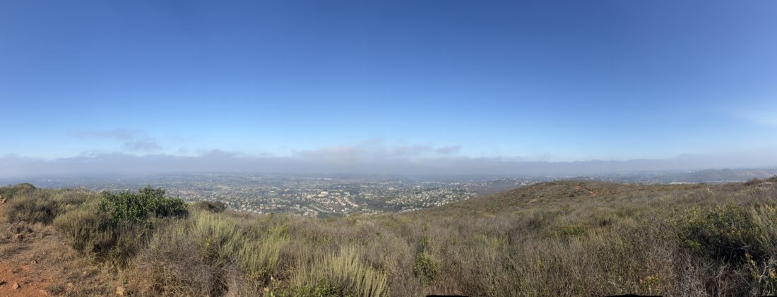
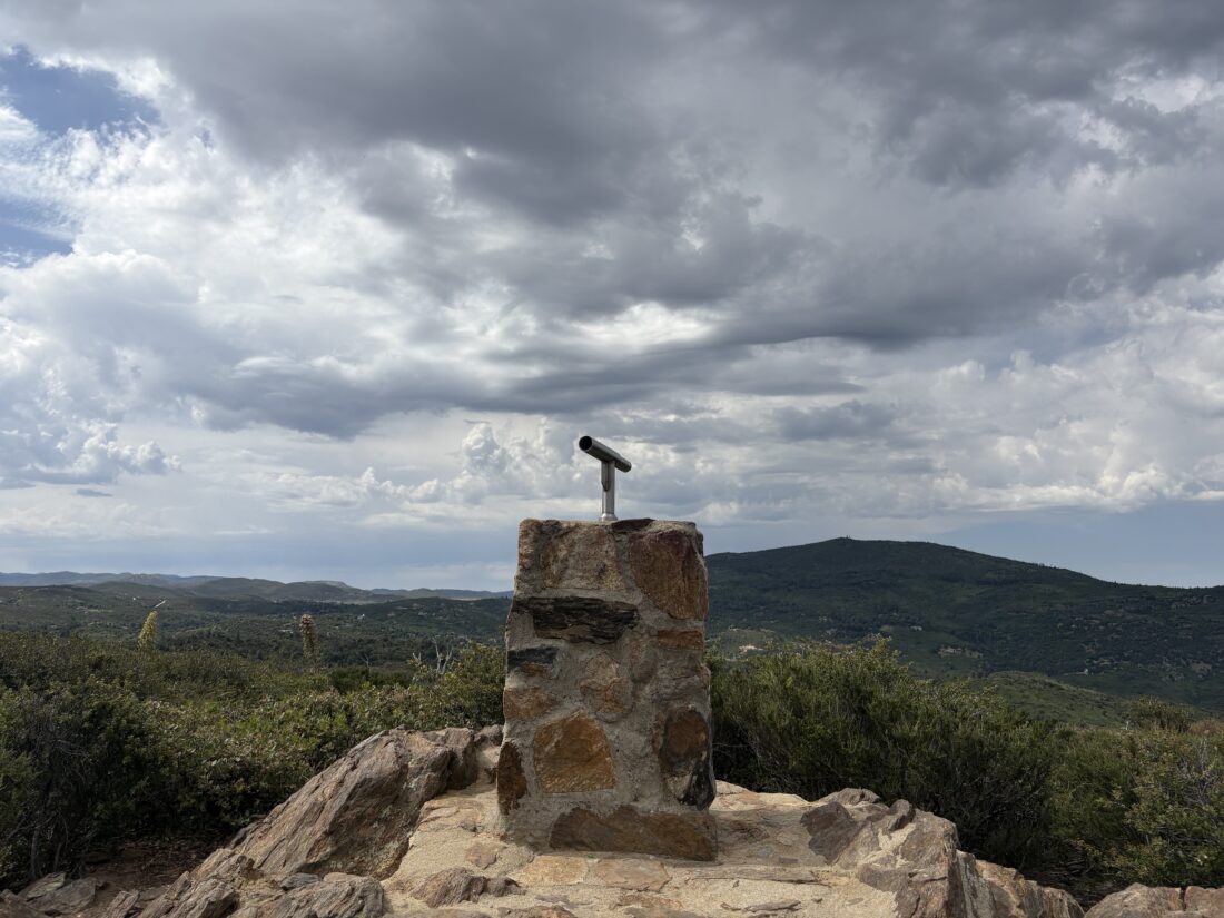
Battle Mountain is a quick but steep little hike, and since Ted needed it and we needed to kill a bit of time before lunch, it was a perfect choice. I grabbed only my poles, and Ted grabbed his and a small bottle of water and set off.
The trail climbed up and around the slope of the hill until it reached the top. It was warm under the bright June sun, and I was glad we were not tackling anything bigger this late in the morning. At the summit, two Canadians visiting for a wedding were also enjoying the view. We snapped their photo and took a few of the scenery before heading back down. We picked up some trash along the way, as well. Back that car, we changed into dry shirts, stashed our gear, and headed to Mi Ranchito for lunch. The hike up Battle Mountain was all of 0.5 miles with a healthy 267 feet of gain.
I am an avid peak bagger, sometimes backpacker, and former sea kayaker living in San Diego. I am the co-author of Urban Trails: San Diego, coming in Spring 2026!
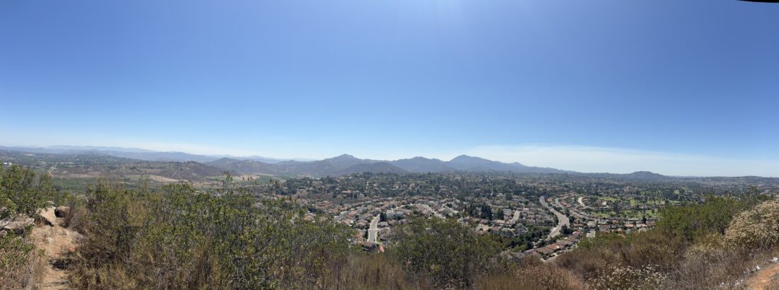
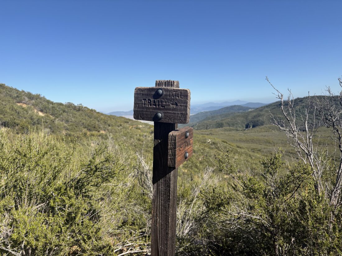
After climbing Denk Mountain, Ted and I made the short drive to hike up Double Peak. We opted for the shorter route from the Ridgeline trailhead instead of from Discovery Lake. When we arrived, the lot was completely full. Thankfully, two hikers had just finished, and we were able to grab their spot. The day was warming up, as the June Gloom was starting to burn off. We set off down the well-groomed trail toward the peak. Soon we came to the junction with the steep use trail to the summit and began powering our way up. I remembered this section from the last time I hiked it and could tell the difference in my fitness, as I drew close to the top.
At the top, we passed by the amphitheater and headed to the main viewing section. Some other hikers were milling about, as were some who simply drove up. After quickly taking in the views, Ted asked if there was an alternative route down, and I said yes, but it is a bit longer. We took the trail west down a steep, but much shorter section to the sidewalk. From there, we left the sidewalk and joined the trail we had been on earlier. We cruised along it until we returned back to our starting point. Skipping that descent was fine by me. This lollipop hike was 2.91 miles in 1:06 with 623 feet of gain. Better still, it gets Ted another peak closer to his 100! Since it was still early, we decided to make the short climb up Battle Mountain before lunch.
I am an avid peak bagger, sometimes backpacker, and former sea kayaker living in San Diego. I am the co-author of Urban Trails: San Diego, coming in Spring 2026!
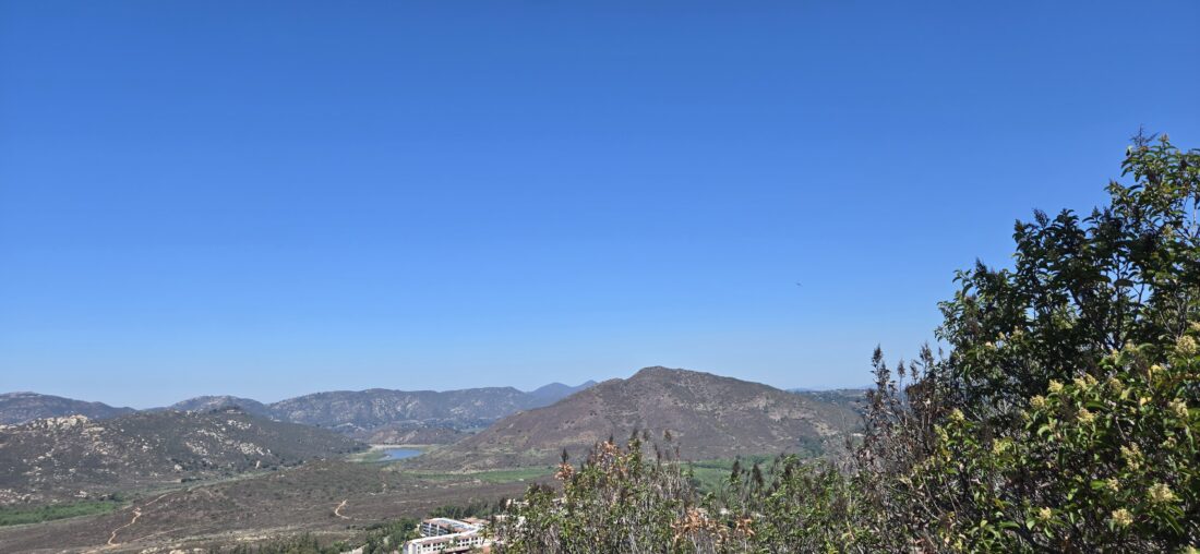
I have climbed Denk Mountain twice before, but from the western side. After watching Rick’s video of hiking from the Copper Creek trailhead, I decided to go that way next time. Since Ted was restricted on how long he could go hiking, I suggested we stay in town and work on some of those peaks he needed on the 100 Peak Challenge list. Since Denk Mountain was still on his unclimbed list, this would be a perfect opportunity to explore the eastern and southern sides. We found parking near the entrance to a large building and set off along the trail. The June Gloom was strong, and thus the air was humid. We hiked past the buildings, and then came to a locked gate and a nearby kiosk. The trail followed Copper Creek toward the southwest, crossing over it several times. A small weir had been built in a narrow part of the canyon; however, access to it was restricted.
Soon, we came to the Whiptail Loop Trail and saw the edges of the fire that had burned here about a month or so ago. We decided to continue on to the Horned Lizard Trail and use it to begin the actual climb to the summit. Our route mostly skirted the burn area, as the trail had been part of the fire break. There were still some bulldozed fire breaks on the slopes, which had notices posted to keep out. The trail worked its way upward through a series of switchbacks. While this area is popular with mountain bikers, so far we had only seen 3 trail runners. The wooden shade structure came into view, and soon we were atop the broad, flat summit.
After a quick snack and some water, we headed down the trail on the northeast side. We stuck to the main trail and, after passing a few other hikers, were soon back at the car. I enjoyed this route over the route I have used before. All told, we covered 4.3 miles in 1:37 with 680 feet of gain. Now on to the second peak of the day, Double Peak.
I am an avid peak bagger, sometimes backpacker, and former sea kayaker living in San Diego. I am the co-author of Urban Trails: San Diego, coming in Spring 2026!
With Van Dam Peak crossed off Ted Markus’s list of peaks left to climb for the 100 Peak Challenge, we made the short drive to Silverset Park to climb Twin Peaks. We cruised up the trail toward the saddle between the two peaks.
Once at the saddle, we made the short hike over to the lower peak, then quickly retraced our route and ascended the main peak. After a few photos, we headed down the trail, making the full loop back to the car. With that, two more peaks were now crossed off his list. We hiked 1.79 miles in 52 minutes with an elevation gain of 643 feet.
I am an avid peak bagger, sometimes backpacker, and former sea kayaker living in San Diego. I am the co-author of Urban Trails: San Diego, coming in Spring 2026!
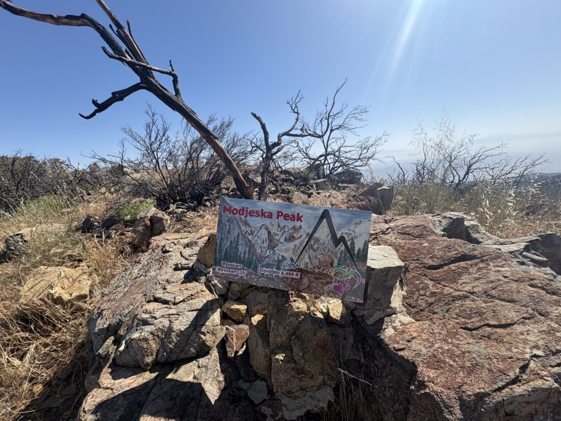
After my road walk up Santiago Peak, I decided to make the relatively short climb up Modjeska Peak. In the past, I could have taken the connector trail from the saddle over to partway up the peak. However, a small landslide had appeared to wipe out a section of that trail. So, instead, I returned to my parked car and took the other road to the summit. There is a fire break cut through here from an older fire. Unlike the road up Santiago, this road was quite rocky and certainly not one I cared to drive. When I passed the junction to the connector trail, I then had the choice to take the short, albeit steeper and direct fire break to the summit, or follow the road around the side of the mountain. I was feeling good, so I pushed up the steep fire break.
From the summit, I could take in the extent of the fire on Santiago Peak. I found the summit sign and took a few photos. It was starting to warm up, so I was ready to return to the car. Rather than deal with that steep rocky fire break, I took the road back. While not exactly rock-free, the grade was certainly less. Once back at the car, I pulled in behind 3 vehicles that were also heading down. Before too long, I was back in Silverado Canyon and headed home. The side trip up Modjeska Peak took 42 minutes to cover the 1.65 miles and 432 feet of gain.
I am an avid peak bagger, sometimes backpacker, and former sea kayaker living in San Diego. I am the co-author of Urban Trails: San Diego, coming in Spring 2026!
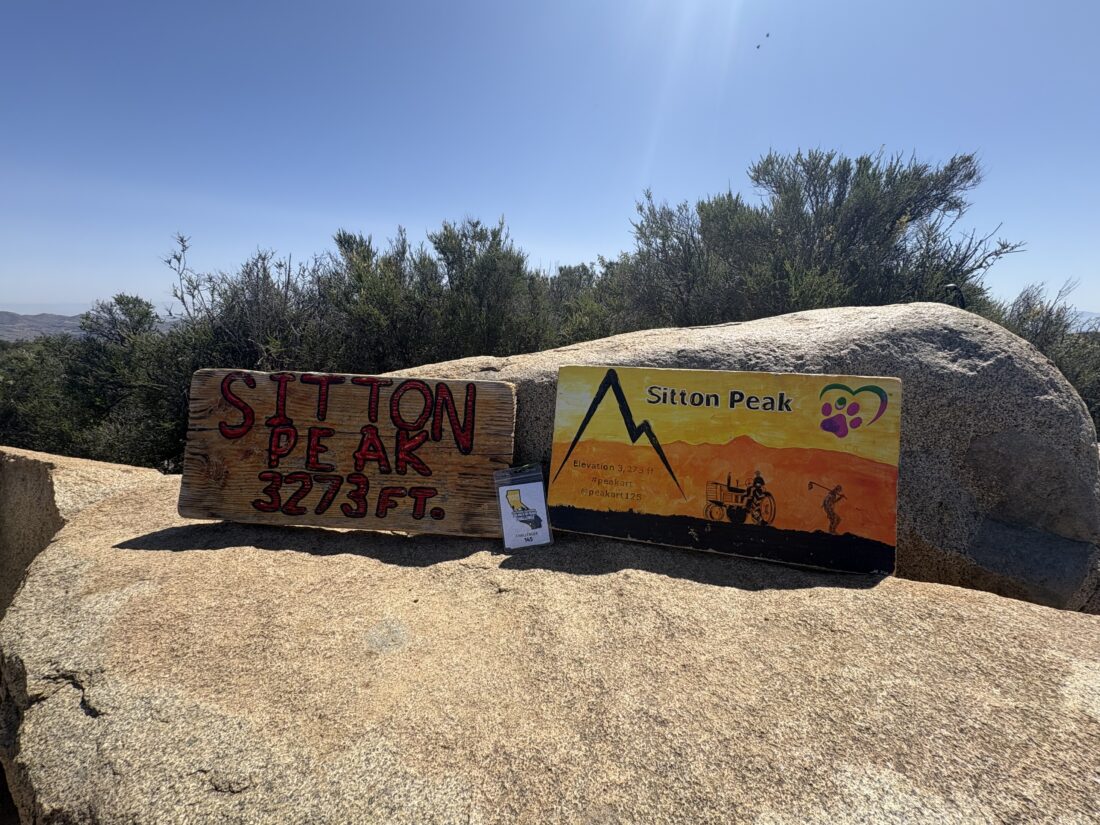
Since the Maple Springs Road and portions of the North Main Divide Road were recently reopened after the Airport Fire, I knew that I should take this opportunity and knock out Santiago and Modjeska Peaks. The drive up from Silverado Canyon was uneventful with just a few folks walking along the paved section, getting their morning exercise in. The north side of the mountain was untouched by the fire, so it was still nice and green. As I neared the ridge, I could start to see the fire damage. When I was atop Sitton Peak a few days earlier, the extent of the fire was clear to see. I parked at my usual spot, at the junction with the road to Modjeska and the road that continues onto Santiago Peak. A water tanker was parked here. Since the road was in really good shape, I assumed it was here to help keep the dust down during the road work. I was surprised to find another car there this early, but it turns out they had driven up the night before and had camped there. After I gathered my gear, I chatted with them a bit. They said that they counted 30 cars driving up to the summit last night. I said my farewell and set off down the road. The landscape was devoid of the trees and brush that lined its slopes. While wildflowers were blooming and some green grasses were taking hold, it was a strange sight. I could easily see the trail I typically took to the summit of Santiago and the connector trail that I used for Modejska.
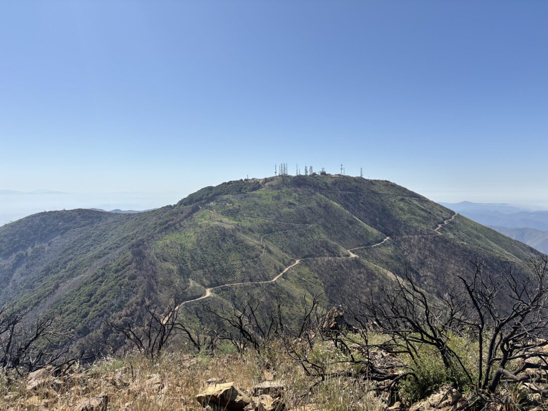
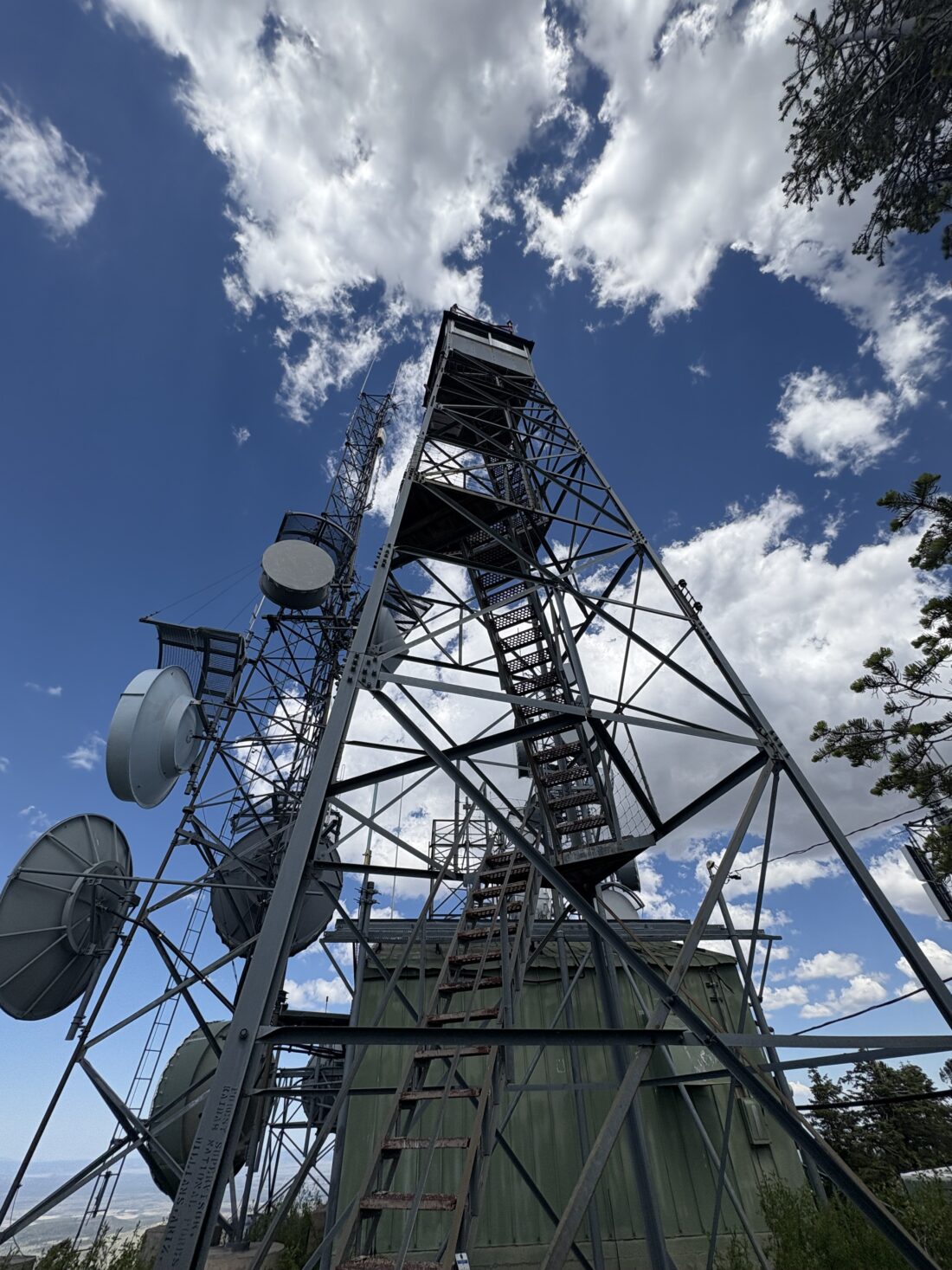
Once I reached the junction with the Joplin Trail, a warning sign told of its closure. With the Holy Jim Trail also closed, either a very long hike up an active road or starting partway up were the only options (sans just driving to the top) to summit this peak. A bit further down the road that had clearly been rebuilt, I passed the saddle between the two peaks. It is here that the trail breaks away from the road. I knew that no work had been done on it, so I was not too keen on using it. I did find that someone left a summit sign here, so I snapped a quick photo before continuing along the road. Looking back to the south, I could see the damage to Modjeska and also spied a landslide that had passed over the trail. I can recall that section of the trail before the fire as one that seemed a bit unstable. After a few turns, the summit came into view. Along the way, two SUVs passed me. They parked off next to one set of the towers, while I made my way to the summit. I snapped a few pictures before walking to the south end of the area to see the damage. I can recall watching the live video from the tower cameras as the fire raced over the summit.
Since today was a federal holiday, I wanted to get back down before more traffic headed up the mountain. I again thought about taking the trail down, but it was getting warmer and I wanted to summit Modjeska as well. I hustled back to the car, as taking that connector trail was not an option. Back at the car, the boys who had camped had packed up and left, and I stopped my tracker, as I wanted to have a Modjeska-only track recorded. I was up and down in 2 hours flat, covering 6.29 miles with 979 feet of gain.
I am an avid peak bagger, sometimes backpacker, and former sea kayaker living in San Diego. I am the co-author of Urban Trails: San Diego, coming in Spring 2026!
I pulled off Ortega Highway across from the now-closed Candy Store. I guess with the nearby campground closed due to the Airport Fire, there wasn’t enough business to keep it open. It was going to be a warm day, so I wasted no time in getting moving. This was going to be my 6th time up this peak, so I cruised along the very familiar trail. I snapped a few photos along the way, as there were still flowers blooming. When I reached 4 Corners, I noticed one of my sand baskets had come off my trekking poles. That happened on this trail once before. I kept hiking along, knowing I would be retracing my route rather than taking the Bear Ridge Trail that I had planned.
I powered up the last steep section to the summit and finally took a break. I did not stay too long, as it was getting even warmer. After grabbing some photos and mixing up some electrolytes, I set off. There actually was more shade than one would think for this hike, and I was thankful for that. As I cruised back to the car, I kept scanning the trail for my missing sand basket (and danger noodles), and as luck would have it, I found it! Soon, the highway came back into view, and my trek was drawing to a close. The car’s thermometer read just over 90°F, and I would believe it (it left my Govee at home, so I did not record the actual trail temps). Including the time at the summit, I clocked this hike in at 3:51 for the 9.4 miles. Not too bad!
I am an avid peak bagger, sometimes backpacker, and former sea kayaker living in San Diego. I am the co-author of Urban Trails: San Diego, coming in Spring 2026!
After an uneventful night in Kingman, I made the drive eastward toward Williams, Arizona. The first peak on my itinerary was to hike up Bill Williams Mountain again. I had done this one back in 2021 and enjoyed it. The parking area had about 5 cars in it as I gathered my gear to set off on the straightforward hike up to the summit. The trail worked its way past the Ponderosa Pines and oaks that dominate the start of the hike. The trail mostly heads along the nouth side of the mountain. The stream that was flowing the last time I hiked here was now dry.
I reached the junction with the Bixler Trail and knew that the summit was drawing near. The trees also changed, and while the Ponderosa Pines became bigger, Douglas Fir, Spruce, and Quaking Aspen now also lined the slopes of the mountain. Soon, the trail reached the service road, and I remembered to use the trail to avoid some of the road walking I did the first time I summited.
The various communication towers stood above me as I headed to the closed fire lookout tower. A mom, her son, and their dog were just leaving as I climbed the ladder to soak in the views. The actual tower is closed, so stopping at one of the landings would be the best I could do. I found a couple of the reference marks, but the benchmark is long gone. After a snack and some filming, I set off back down the mountain.
The descent went smoothly, and I greeted a few other hikers along the way. As I drew near the trailhead, my thoughts turned to lunch in town. My friends who I would be staying with recommended the Grand Canyon Brewery, and I certainly wasn’t going to say no to a post-hike beer! Just as I got back to the car, a few drops of rain began to fall. It is the start of that weather pattern, so early starts were going to be the rule for this trip. I recorded this hike as 7.9 miles, with 2392 feet of gain. Excluding the time at the summit, the total time was 3:45, which was dramatically faster than the time before. I will take that as a good sign, as I have two hard peaks planned.
I am an avid peak bagger, sometimes backpacker, and former sea kayaker living in San Diego. I am the co-author of Urban Trails: San Diego, coming in Spring 2026!
My friend Becca needed a short hike to help break in some new shoes, and since she has got the peak-bagging bug, I suggested a couple of options. We settled on hiking up to Glen’s View in William Heise County Park. Ted also tagged along, as he also needed this peak in his effort to complete the 100 Peak Challenge. A good friend had a 60th birthday party the night before, so we left at a more reasonable hour than usual. We pulled into the parking lot for the trailhead, passing all sorts of campers enjoying their time outside. Grabbing our gear under slightly overcast skies, we set off along the Nature Trail.
We cruised along, making our way to the first junction, where we took a right turn and continued our climb. Before too long, we reached the short spur trail to Glen’s View. A family was enjoying the view when we arrived, but they soon headed back down, so we had the summit to ourselves. We played “Can Chris name the summits?” Yes, he can.
Our discussions now turned to an important matter: lunch. As we made our way down, we enjoyed the wildflowers that still lined the sides of the trail. When we reached the junction with the Canyon Oak trail, Becca’s shoes were still feeling good, so we opted to add on a bit more trail time. A few other campers and their dogs passed us along the way. I showed Ted and Becca the “Observatory”, two sloped benches that allow you to lean back and enjoy the night sky. Shortly thereafter, we returned to the campground and back to our starting point. Tossing our gear back into the car, we began our drive home. Dudley’s won out for our lunch spot. Unfortunately, as we approached Mt. Woodson, the highway was closed due to a fatality, so we had to take an alternate route home. All told, we hiked 3.3 miles, with 633 feet of gain.
I am an avid peak bagger, sometimes backpacker, and former sea kayaker living in San Diego. I am the co-author of Urban Trails: San Diego, coming in Spring 2026!
After the closure of the Palomar Divide Truck Trail a couple of weeks ago, which forced me to pivot to backpacking Noble Canyon instead, I secured a new overnight permit for Barker Valley. The road had reopened, so that hurdle was no longer in front of me. However, we had some unseasonably warm weather forecast for the start of my trip. Since I was not planning on starting until mid-afternoon and most of the 3 or so mile hike would be descending from the trailhead to Barker Valley, I was overly worried. I made the very familiar drive through Ramona and then Santa Ysabel. After a quick stop for gas at the tribal gas station, I passed on through Warner Springs until I reached the turn-off onto the Palomar Divide Truck Trail. After 8 miles of driving, I reached the trailhead and pulled into a spot off to the side of the road. It was warm, but a nice breeze helped it feel less oppressive. I read over the trailhead kiosk, which I had seen numerous times on my drives up to Palomar High Point, before setting off down the trail.
The trail gently worked its way down, following the contours of the mountain. Sweeping views of Lake Henshaw to the south, and both the Observatories and the Lookout Tower to the north. The trail was slightly overgrown in spots, but nothing too bad. I might return with some clippers to do some trail maintenance, if I felt like making the drive up again. Wildflowers still lined the trail from time to time. Footprints could be seen in the sandy sections of the trail, so it does see some traffic occasionally. About a mile in, a rock arrow pointed the way. This area had a couple of nice campsites on either side of the trail.
After about 1.8 miles, another large rock arrow pointed the way for the trail, which now made a sharp left turn, leaving the ridgeline it had been following. On several maps, a trail is shown continuing along the ridge line, but it appears that it is becoming overgrown. The trail was also starting to become a bit more rocky, so a little more care was needed with my footing as I worked my way down toward the valley. The overgrowth also increased a bit, but nothing a quick push of a trekking pole could not handle. Soon, I found myself in the valley and near the West Fork of the San Luis Rey River. Now I needed to find a campsite and access to water. I carried enough to get me to the campsite and back if things did not work out, but not enough for dinner and breakfast. I passed one campsite, which might have worked, but continued along the trail that paralleled the stream, looking for other camping options as well as water. I came upon a nice campsite near a very large downed oak tree. I had a choice between under the shade of an oak tree or on the open dirt. I brought my REI QuarterDome, so I could lie inside the mesh walls and enjoy the night sky, so the choice of where to pitch my tent was obvious.
I dropped my pack, grabbed my CNOC water bag, and set off to find water to filter. At first, I found a large pool of water with bits of algae floating on top of it. No worse than what I have seen used by those on the Arizona Trail, but I decided to keep exploring before settling on this as my water source. Soon, I heard the sounds of flowing water and made my way back to the edge of the stream. I placed my bag into the gently flowing stream and had 3 liters in a matter of moments. I trekked the 0.3 miles back to the campsite and began to set up camp. As the sun was beginning to set, the mosquitoes were starting to come out in force. I had my bug net, but I forgot to bring any repellent, so I retreated to my tent (killing the few that had snuck inside). I relaxed, staring at the trees around me and the dance of the bugs on the tent’s mesh. I figured this was good practice for my Yosemite backpacking trip. After the sun had set, I ventured out of the tent and made my dinner.
I listened to my audiobook while I enjoyed a freeze-dried lasagna and waited for the stars to come out. Once it was dark enough, I again worked on some astro-photography before turning in. It actually became quite chilly, and I was glad to have my warmer quilt with me. I woke up around 5:30 and made a cup of hot coffee. It was a bit nippy, so I checked my Govee thermo-hygrometer, and it said it was 31°F! Being in a valley meant the cold air had settled here overnight, hence the temperature difference between the summit forecast and my location. I boiled some more water for my oatmeal and began packing up. Around 6:30, I was ready to head back up the trail.
The climb back to the trailhead went fairly smoothly, I only stopped to remove my fleece and adjust my socks. After about 1:30, I again reached the metal gate, and my backpacking adventure in Barker Valley was over. I tossed my gear into the Outback, changed into a clean shirt, and decided to drive on up the High Point. The road became a bit rougher, and I drove the last 5 miles to the summit. The road to the trailhead is doable in most cars (just drive slow and keep your eyes open), but after the trailhead, I would only recommend something a bit more off-road-friendly (like my Outback). Near the summit, I could see the results of the controlled burn that had been performed recently. The tower was staffed, so I was able to drive all the way to the top. I wandered around the summit, snapping a few photos. It was too windy to have a discussion with the two rangers staffing the tower, so I set off back down the road and home.
The final stats for this adventure were 6.9 miles with 1055 feet of gain (most of it on the way back). My descent time was 1:30 (with some filming time included), and 1:27 for the ascent (less time filming). The video of the trip will be on my YouTube channel soon, so go there and like and subscribe!
I am an avid peak bagger, sometimes backpacker, and former sea kayaker living in San Diego. I am the co-author of Urban Trails: San Diego, coming in Spring 2026!