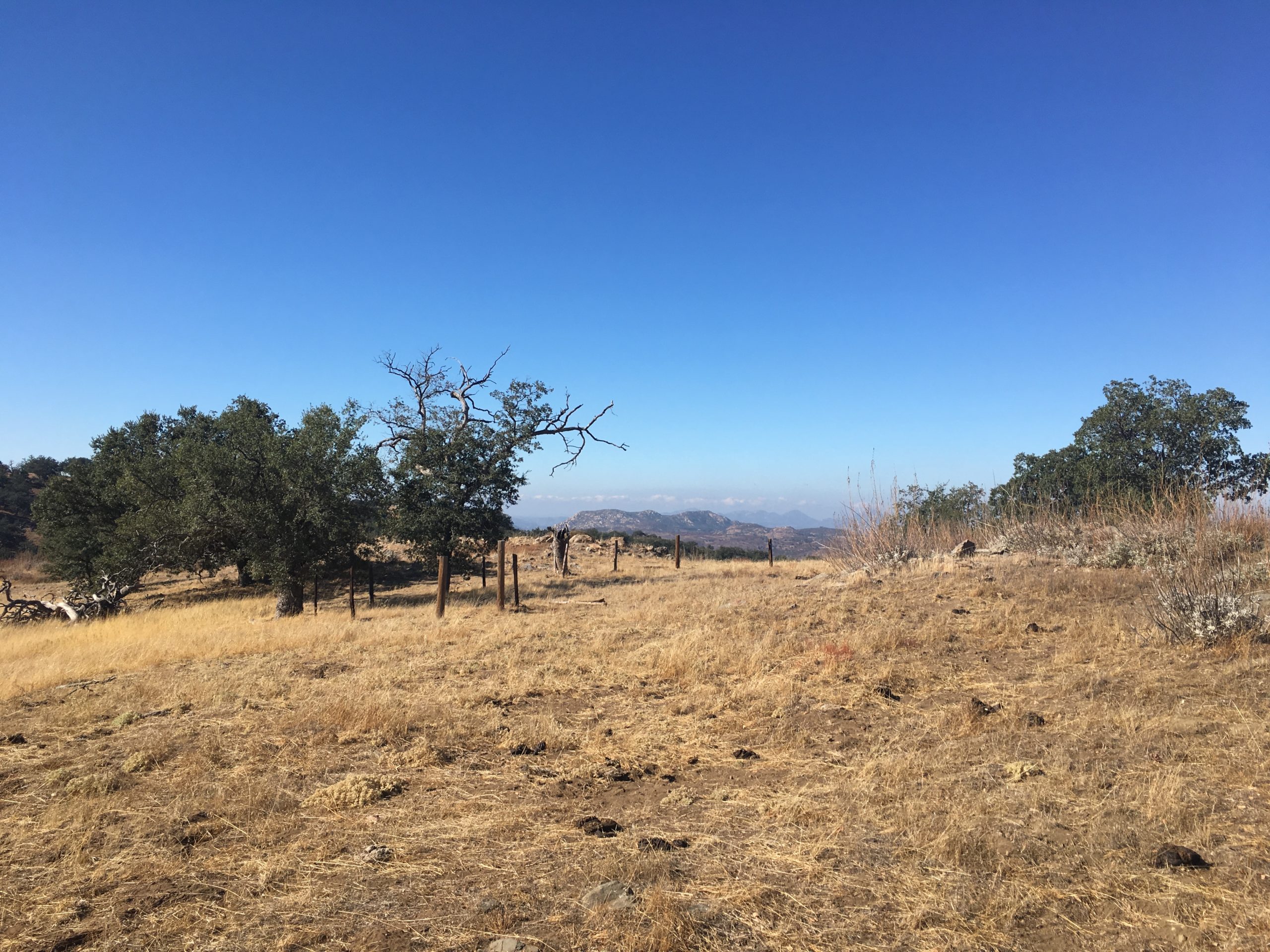
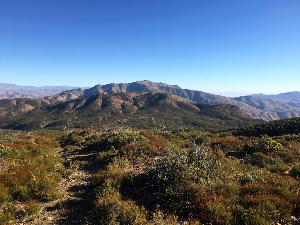
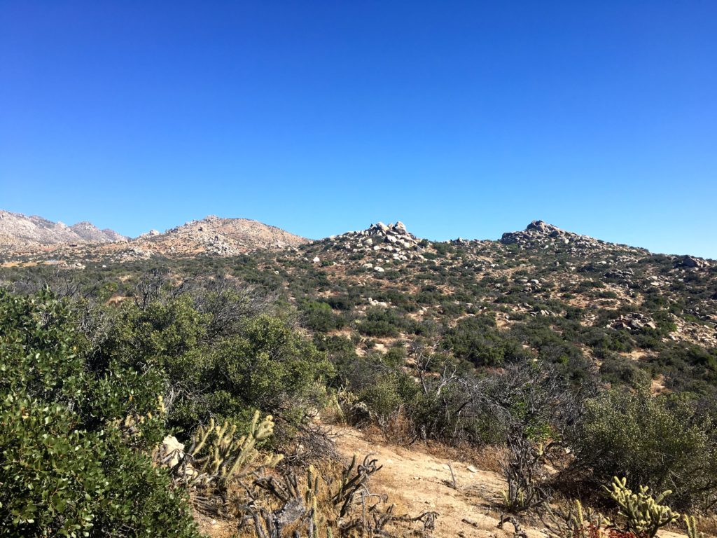
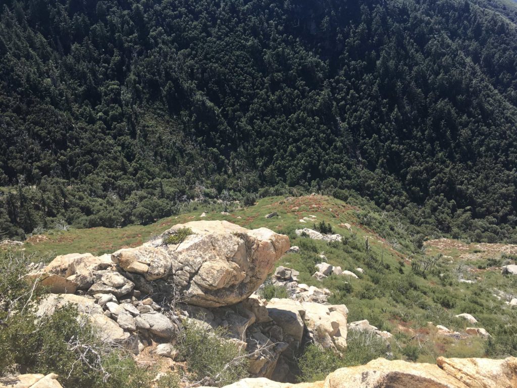
After summiting P1546, I drove back up Eagle Peak Road to the shared trailhead for Cemetery Hill and Oak Benchmark. Along the way, I passed a modest amount of hunters parked along the side of the road. I knew I would need to be alert for the next two hikes. I swapped my normal hat for my red ball cap. Cemetery Hill is another inverted peak, like P1546, so down another old road, I went.
Once at the base of the descent, I had about 1.5 miles to cover over some easy rolling terrain. As I neared the peak, I would have to go cross-country to the summit.
I soon found myself passing the wooden posts that mark the cemetery. There are no other markers to be found. At the true summit, I had a nice rest under the shade of oak before heading back.
That was peak #82 of my #100PeakChallenge.
I am an avid peak bagger, sometimes backpacker, and former sea kayaker living in San Diego. I am the co-author of Urban Trails:San Diego, coming in Spring 2026!
In 2019, I became the third person to complete the San Diego 100 Peak Challenge. Not stopping with that accomplishment, I set my sights on the harder San Diego Sierra Club 100 Peak list, which I completed in 2021. In addition, I have conquered several Six-Pack of Peaks challenges (SoCal, San Diego, Central Coast, and both the Arizona-Winter and Arizona-Summer). I am looking forward to exploring new summits and new adventures across the southwest.
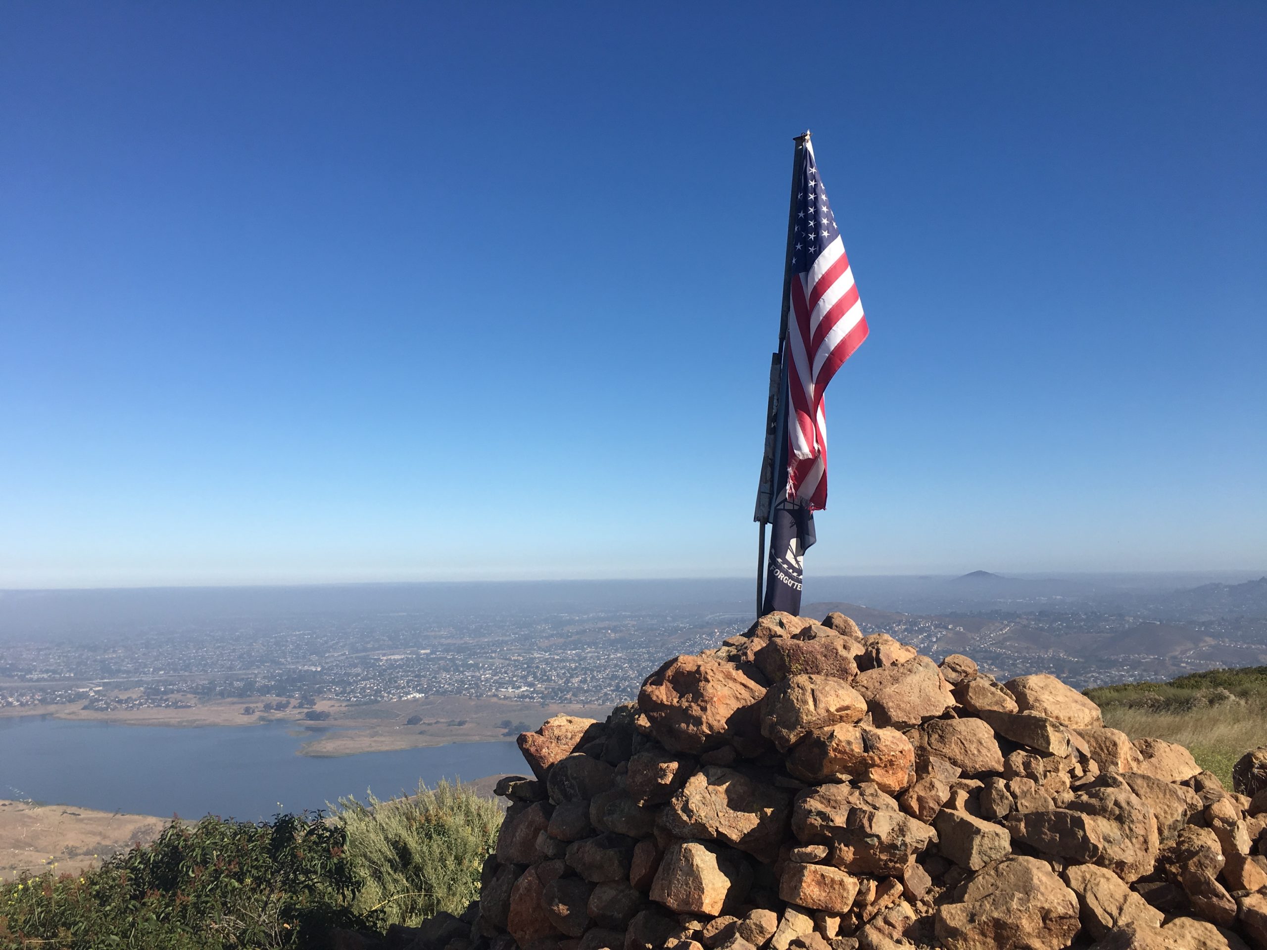
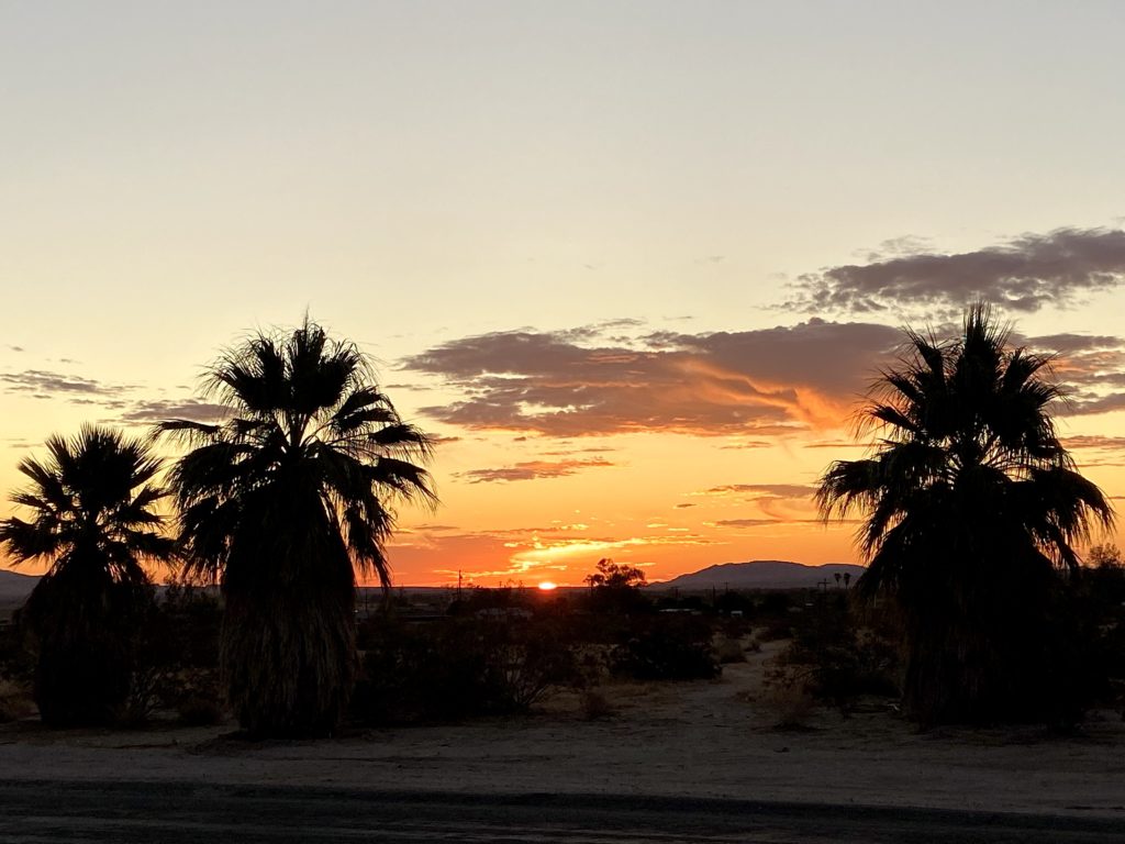
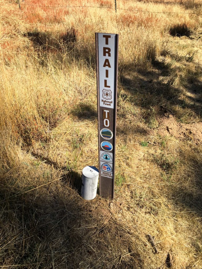
Since I had some personal commitments in the morning, a full day of hiking was not in the cards. But I still had a couple of hikes that I had classified as “in-town”. Ted Markus was free and we thought a sunset from atop Mother Miguel would be a perfect choice. We first stopped by A16 to collect our completion rewards for doing the 3-Peak Challenge. Continuing down to Chula Vista, we found parking right next to the trailhead. It was unseasonably warm, so we were both in shorts and short-sleeves as we headed onto the trail.
Recently the trail underwent some realignment and I was curious to see the changes. The trail now follows a switchback route rather than the brutal old direct route. The barbed wire serves as a barrier against using the old trail. The trail is in great shape. So much nicer than Cowles.
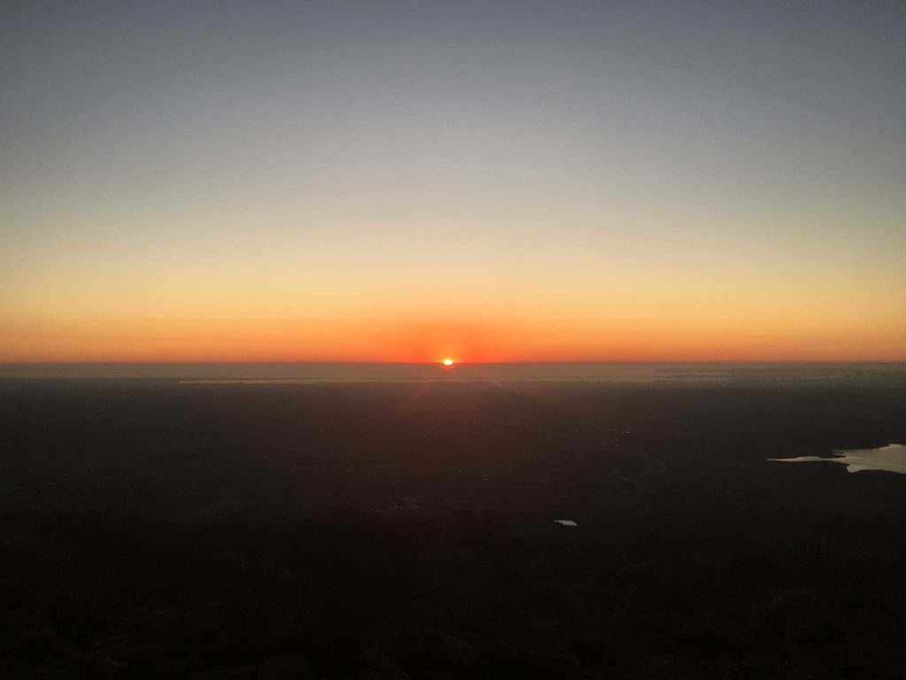
We reached the summit with about 30 minutes to kill before the actual sunset. The nearly full moon had risen to the east, and a stream of planes made their approach to the airport passed overhead.
Soon, the sun’s final glow was fading and it was time to begin our descent. Ted was enjoying using the camera on his iPhone 11 to capture the fading glow. Soon we found ourselves back at the car, and peak #80 was now in the bag!
I am an avid peak bagger, sometimes backpacker, and former sea kayaker living in San Diego. I am the co-author of Urban Trails:San Diego, coming in Spring 2026!
In 2019, I became the third person to complete the San Diego 100 Peak Challenge. Not stopping with that accomplishment, I set my sights on the harder San Diego Sierra Club 100 Peak list, which I completed in 2021. In addition, I have conquered several Six-Pack of Peaks challenges (SoCal, San Diego, Central Coast, and both the Arizona-Winter and Arizona-Summer). I am looking forward to exploring new summits and new adventures across the southwest.
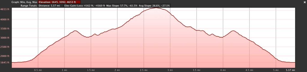
I knew the attempt to summit Square Top was going to be hard, but this turned out to be the hardest hike I have ever done to date.
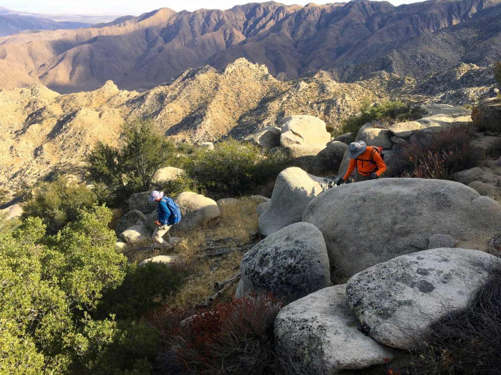
Ted Markus and I pulled into the parking lot in Borrego Springs just before sunrise to meet with Greg Gerlach who was accompanying us on this hike and providing the needed 4×4 to the trailhead. Greg is working on his third pass through the San Diego 100, which is slightly different from the 100 Peak Challenge, so teaming up made perfect sense. Greg’s hiking resume is inspiring and it was a great thrill to spend some time in the mountains with him.
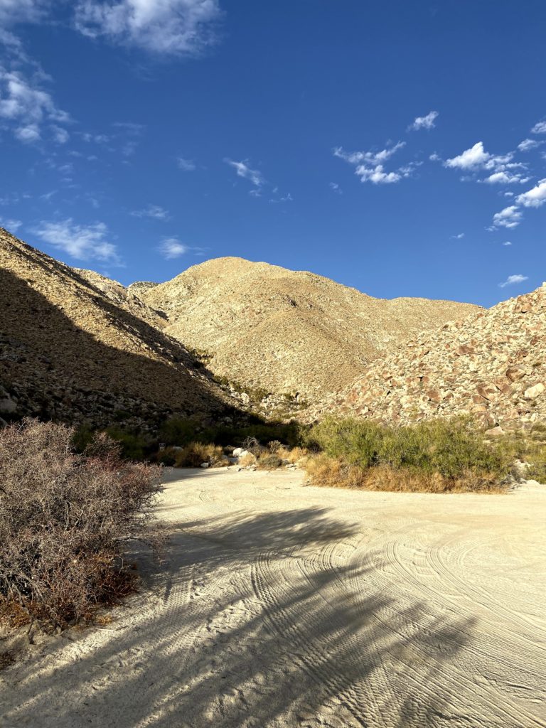
Heading north from Borrego Springs, we began our off-road adventure. After a couple of water crossings, the road turns rocky for a bit. This is why we took Greg’s truck and not my Subaru Outback. After about an hour of driving, we reached the Sheephead Canyon Primitive Campground, just past it was the trailhead. We quickly geared up and set off.
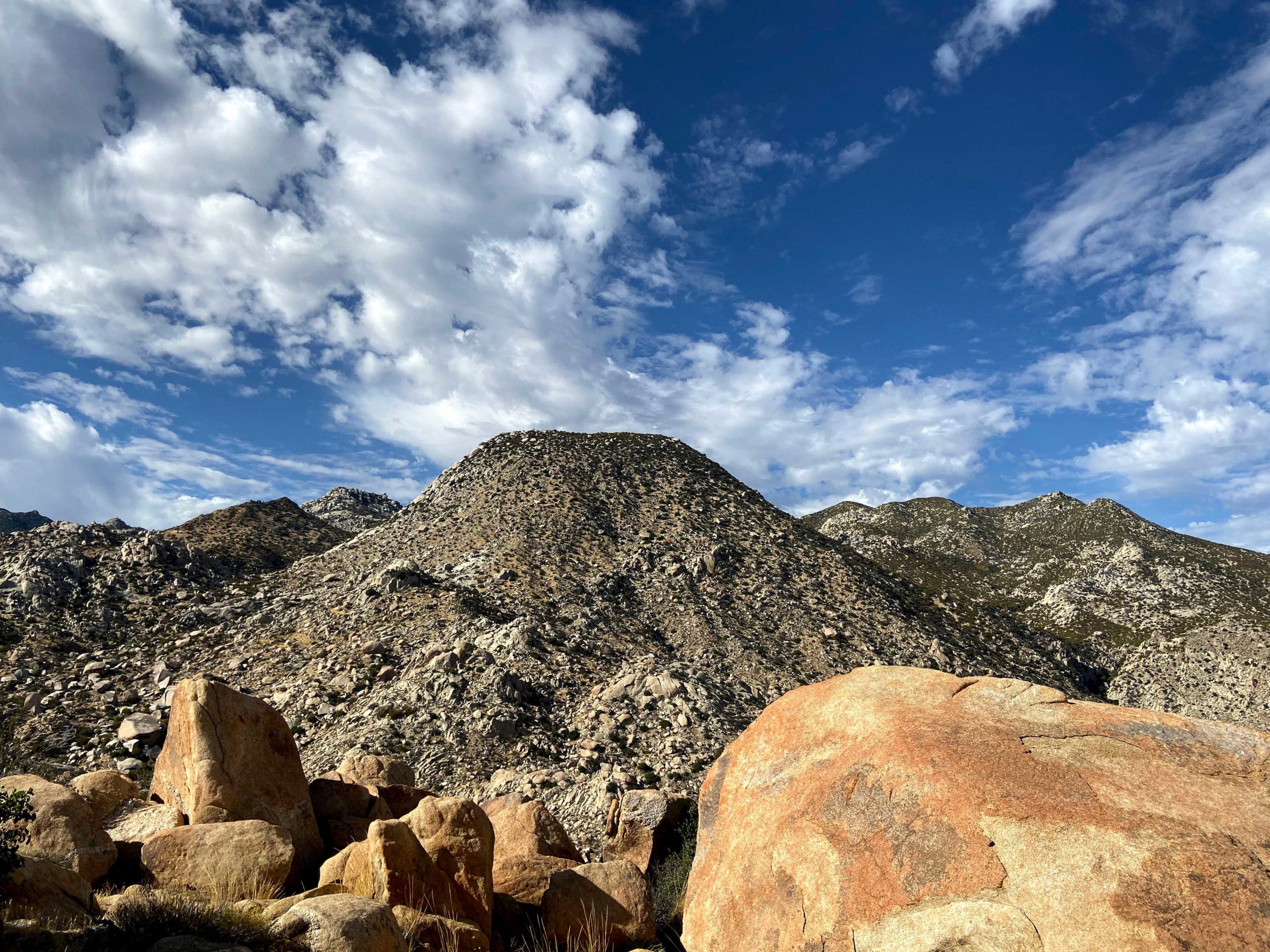
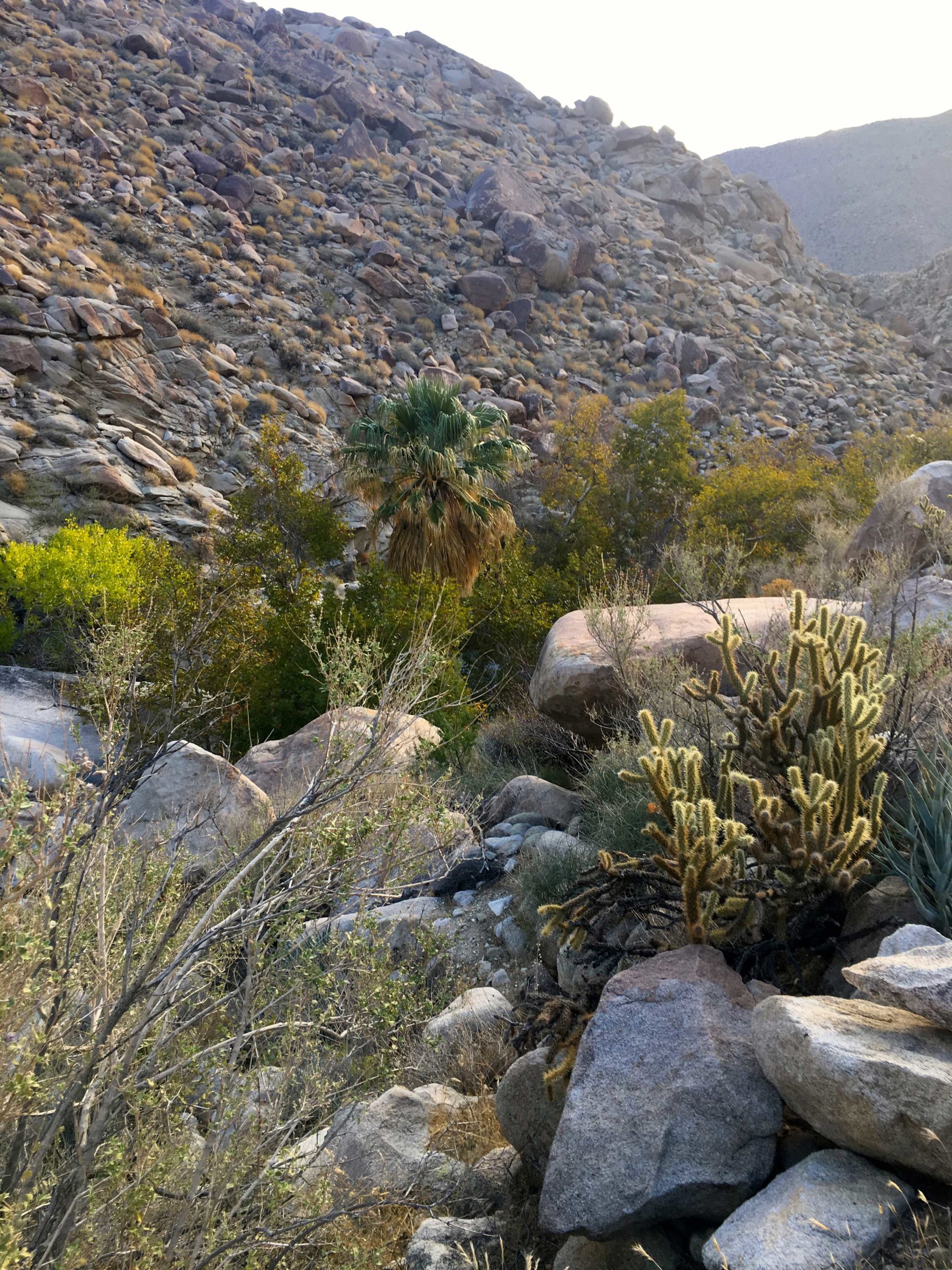
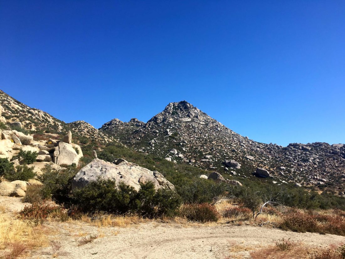
Square Top used to be done from a route from the Los Coyotes Indian Reservation, but it appears the road to that trailhead is permanently closed to non-reservation residents. So we need to summit this peak from the east. The trail followed the dry stream bed for a short distance. This would be the only flat section of the entire day. We had a route loaded on our devices, plus a paper map, and left the stream bed and began scrambling up and over the boulders along the ridgeline. In addition to the boulders, the steepness of the ridgeline can not be understated. It would range between 30-50% grade throughout most of the hike.
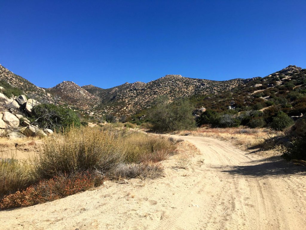
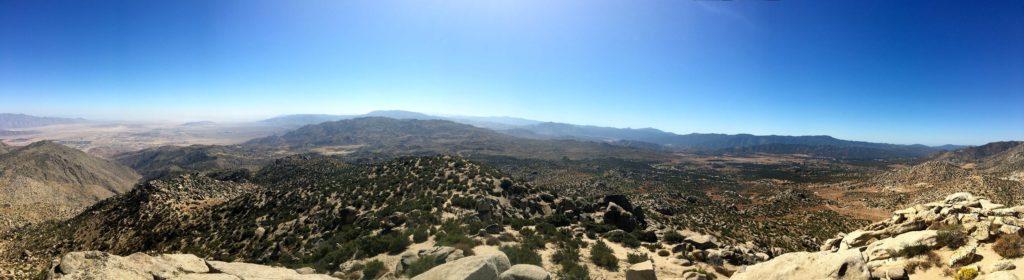
While we could see Square Top off in the distance when we started the hike, it was now fully hidden behind P3360. After about two hours of hiking, we finally reached this intermediate summit and a well-earned break. There was a register tucked away, so we added our names. Square Top now loomed before us. We scanned its rocky and steep slopes for a possible route up. We agreed on a basic plan of attack, but first, we had to drop down some 300 feet of elevation. Climbing back up that on our return was going to suck.
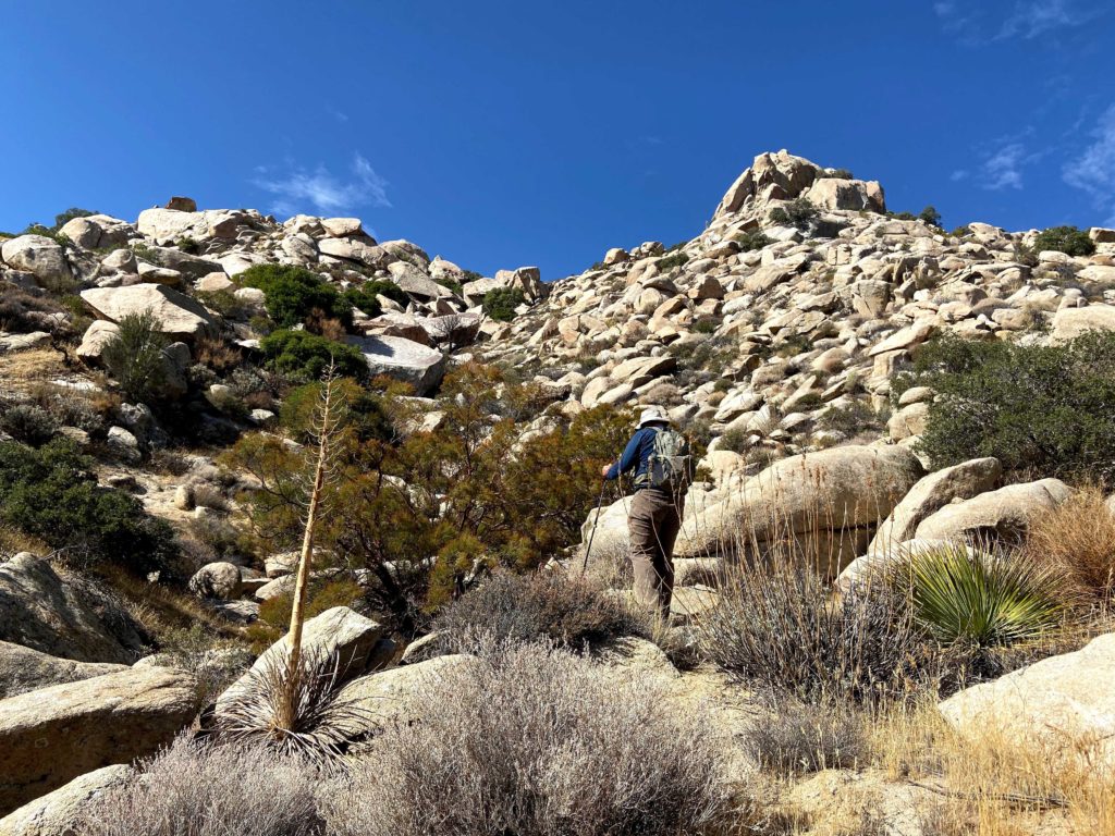
We found a manageable route down to the saddle and then began to push up. The steepness remained about the same, but toward the base, the boulder field was pretty intense to work through. Some very large rocks served as our intermediate landmarks to aim for as we work our way upward.
At this point, I started to have some real trouble. The effort was really getting me and I had to take a lot of breaks as we slogged forward. Both Ted and Greg were very supportive and accommodating as I sat and caught my breath. I really considered turning back several times; this was harder than any summit I had previously done. But I knew if I did turn back I would probably never have another chance, and my 100 Peak Challenge would be over. I dug deep and found the will and energy to push on.
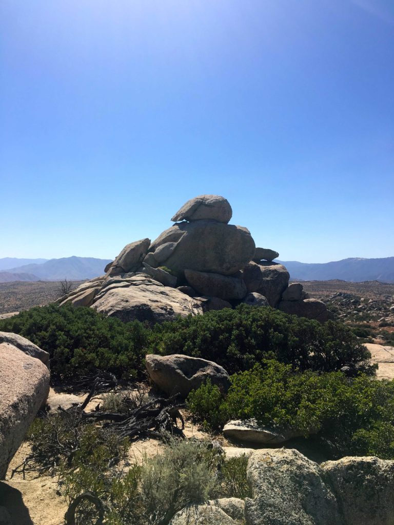
Soon we started to encounter the denser brush that surrounded the summit. I knew the summit was close, we had agreed that if our descent was in the dark, it was ok with all of us. Greg really knew what this summit meant to me. Slipping past the brush, the summit plateau was reached, and we soon found ourselves at the summit block. We had done it!
We signed the registers and took a short break. Without climbing gear, the actual summit block is unreachable. All this work and we don’t actually get to stand on the actual top… We did not stay too long, as we all knew the effort that still lay ahead of us to get back to the trailhead.
We began our careful and slow descent, doubling checking our tracks so as not to get off course. As we approached the boulders near the base of the summit, working through this section again sapped my energy. Greg and Ted continued to lead the way, and I plodded slowly along behind. I dug deep once again and began the ascent up P3360. But I knew once I crossed the summit, it would be all ‘downhill’ from there.
The sun was setting, casting a rosy light on the Santa Rosa Mountains to the east, meaning our last mile was going to be in the dark. Obviously, this was going to slow our pace even further, but we had prepared for this in case this happened. As we carefully picked our way back down, the steepness was a constant issue. I could not believe that we had gone up this! I missed seeing deer go prancing by, but Ted and Greg saw them. I was too focused on the descent and not injuring myself and missed them.
Finally, we reached the stream bed and began heading back to Greg’s truck. I ran out of my water with about a quarter-mile to go, so I was looking forward to the cool drinks in my cooler.
All told, this hike was a mere 5.3 miles on my device. Ted and Greg had different mileage from their devices. Our elevation gain was 3,617 feet and I had us on the trail for 11 hours, 10 of it actually hiking. We all agreed that this was one beast of a summit. While we were proud of making it but were certain we would never do it again.
I am an avid peak bagger, sometimes backpacker, and former sea kayaker living in San Diego. I am the co-author of Urban Trails:San Diego, coming in Spring 2026!
In 2019, I became the third person to complete the San Diego 100 Peak Challenge. Not stopping with that accomplishment, I set my sights on the harder San Diego Sierra Club 100 Peak list, which I completed in 2021. In addition, I have conquered several Six-Pack of Peaks challenges (SoCal, San Diego, Central Coast, and both the Arizona-Winter and Arizona-Summer). I am looking forward to exploring new summits and new adventures across the southwest.
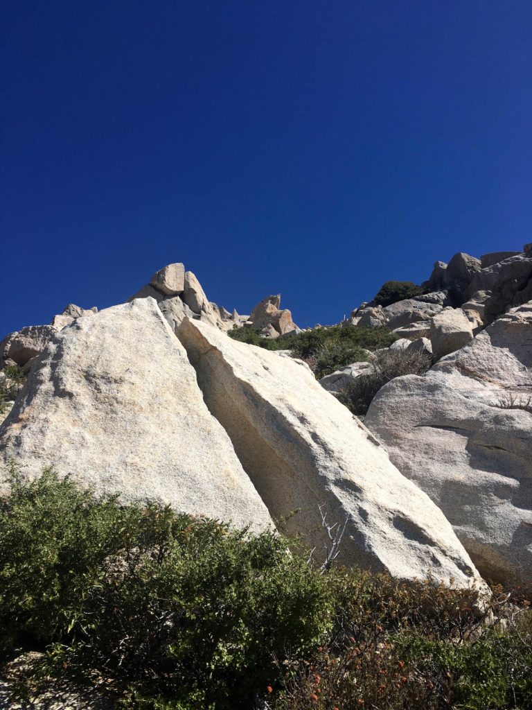
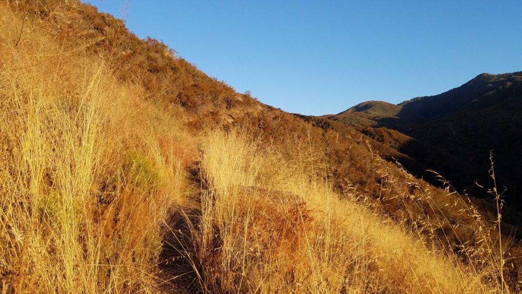
After two failed attempts at summiting The Thimble (see here for those trip reports), I headed back out to try again. Originally, fellow 100 Peaker, Gail Welch was going to guide me up, but she took a tumble on the ice and was out of commission. Matt Hanan, an SD100 Peaker, had to do solo Dad duty, so I headed out to Ranchita alone.
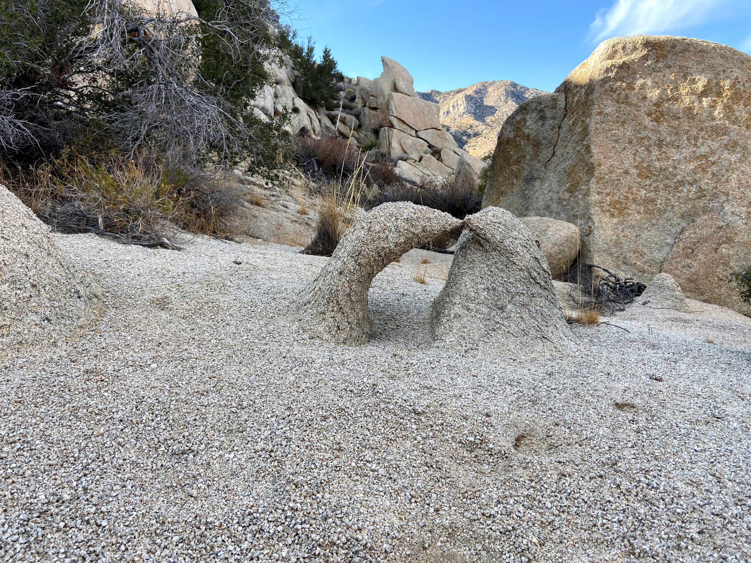
Pulling into my now familiar turn out, I headed out along the road toward my challenge. A nice breeze kept the temperatures pleasant as I work my way up the road. Just past the crest in the road, my first view of The Thimble came into view. I studied it imposing face and attempted to scout out my route up it. I had a GPS track from Hann Asoy’s successful summit, so I had that to fall back on, but I wanted to try this on my own.
I worked my way up through the brush looking for the end of the barbed wire fence. The route gets close to some of the private property, so I was trying to be mindful. The slope quickly grew steep, somewhere between 30-50%. My route weaved around the granite boulders and past the brush. Once in and while I did need to push through some to continue my climb.
Looking up at The Thimble
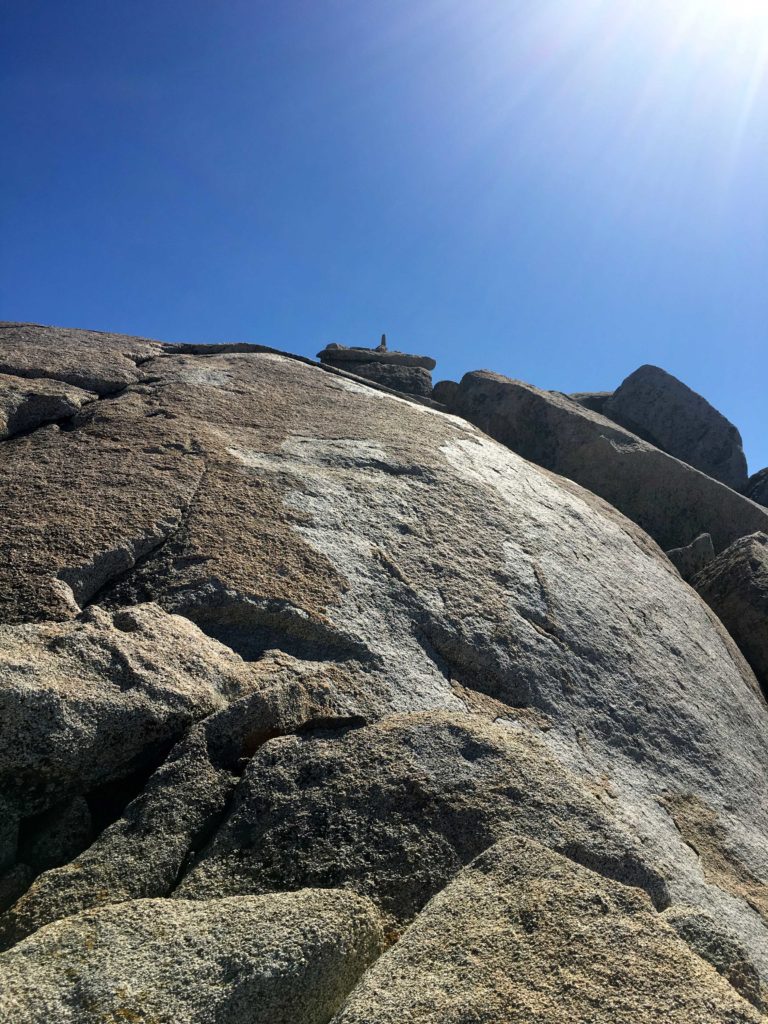
As I drew near the summit, a thicket of brush stood before me. I tried seeing if there was a route to the left side, but it was too thick. Nothing appeared in the middle. I was thinking I might need to descend and look for an alternate route. I texted my wife and let her know my status, I figured I still had another 30 minutes of climbing ahead of me.
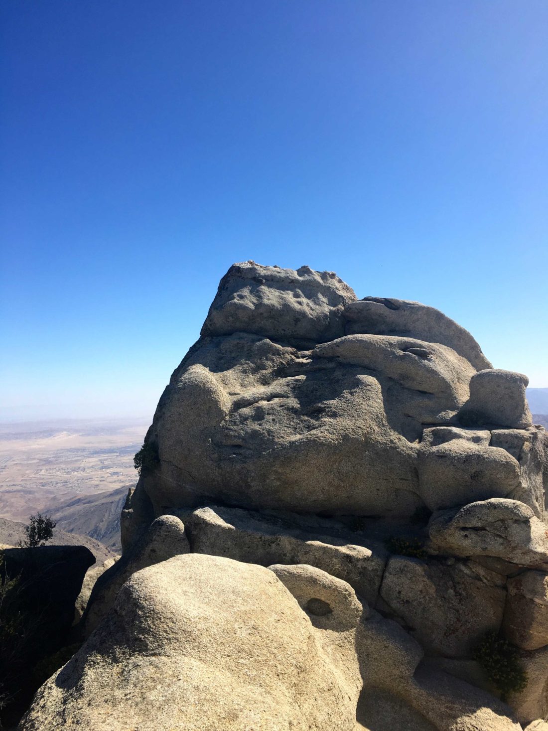
I decided to see if there might be a path near a large granite boulder to the right, and there was! I squeezed past the brush and the summit lay before me. So much for another 30 minutes of climbing!
Nearing the summit
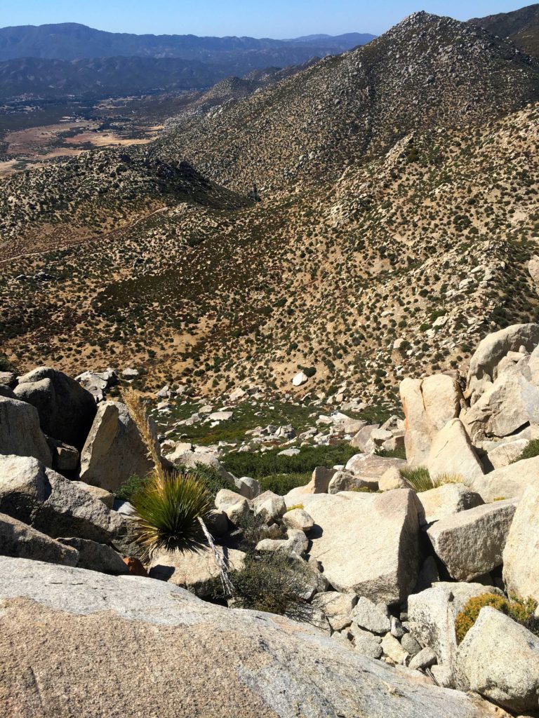
Sadly the register seems to be missing, but the views were incredible! I might have let out a shout upon reaching the top… The Thimble had been conquered! San Ysidro stood to the north, Bonny, and White to the south. The Salton Sea was visible in the distance.
After a brief break, I began a careful descent. It is almost easier to find a nicer path when going down. Once off the peak, I cruised back down to the car, stopping at the Ranchita General Store for some cold drinks before the drive home.
Looking at my down route
With that my #78 peak of #100PeakChallenge was done!
I am an avid peak bagger, sometimes backpacker, and former sea kayaker living in San Diego. I am the co-author of Urban Trails:San Diego, coming in Spring 2026!
In 2019, I became the third person to complete the San Diego 100 Peak Challenge. Not stopping with that accomplishment, I set my sights on the harder San Diego Sierra Club 100 Peak list, which I completed in 2021. In addition, I have conquered several Six-Pack of Peaks challenges (SoCal, San Diego, Central Coast, and both the Arizona-Winter and Arizona-Summer). I am looking forward to exploring new summits and new adventures across the southwest.
Unlike the last time I tried to hike this peak about a month ago, the temperatures were pleasant and the winds light (think 44°F and 20-25 mph winds). I parked next to the Pedro Fagas monument and gathered my gear. The route to Chariot starts by following the California Riding and Hiking Trail. You can stay on it for a while, then take the Mason Valley Truck Trail down for a 9-mile hike. Instead, I decided to follow some faint use trails across the meadow that would take me to the Pacific Crest Trail for about a 5.5-mile hike instead.
The meadow grasses were pretty high, so I took extra care as I made my way across it. After about .8 of a mile, I came to the PCT, from here I quickly began looking for some metal fence posts to the east, these would indicate the steep trail down the ridgeline. The first time I did this hike I missed them and did an extra quarter mile on the PCT.
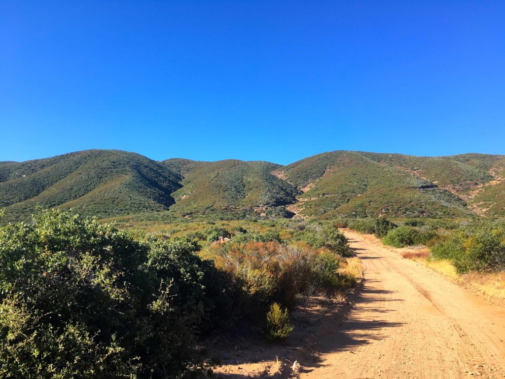
With the use trail found, I began my descent. Chariot Mountain is an inverted peak, meaning you start higher than the summit. The trail was not too bad, I certainly have bushwhacked through worse recently. It was as steep as I remembered from last time, but the uncertainty that hung over me was no longer there. Making it feel a bit easier. However, I still was not looking forward to ascending it on my return. Chariot Mountain was clearly visible across the valley, and Granite Mountain standing behind it.
The trail came to end on Mason Valley Truck Trail. A wooden post on the side of the road would serve as a marker to locate it on the way back. The road appeared to have been graded not too long ago, as machinery treads were visible on the roadbed.
At the T, I turned right and Chariot drew closer. There is an old fire break that serves as the trail to the summit. In fact, the turnoff is marked by a bramble of deadwood blocking it from vehicle access. The climb up was steady, with one steeper section to deal with, but soon I reached the summit plateau and made my way to the true summit.
There is no Benchmark here, but tucked in some rocks was the register. As I enjoyed the views, I flipped through it, seeing many familiar names. After adding mine as a 2x’er, I headed back down, and then back up. Can you tell I wasn’t looking forward to that part…
The ascent up from the road went slow, my snack on the summit didn’t give me the boost I had hoped for. But I slogged on and finally reached the top. From there it was a pleasant stroll back across the meadow, again staying mostly on established use trails.
Chariot Mountain was #77 of #100PeakChallange.
I am an avid peak bagger, sometimes backpacker, and former sea kayaker living in San Diego. I am the co-author of Urban Trails:San Diego, coming in Spring 2026!
In 2019, I became the third person to complete the San Diego 100 Peak Challenge. Not stopping with that accomplishment, I set my sights on the harder San Diego Sierra Club 100 Peak list, which I completed in 2021. In addition, I have conquered several Six-Pack of Peaks challenges (SoCal, San Diego, Central Coast, and both the Arizona-Winter and Arizona-Summer). I am looking forward to exploring new summits and new adventures across the southwest.
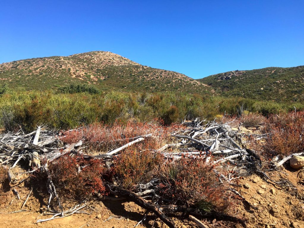
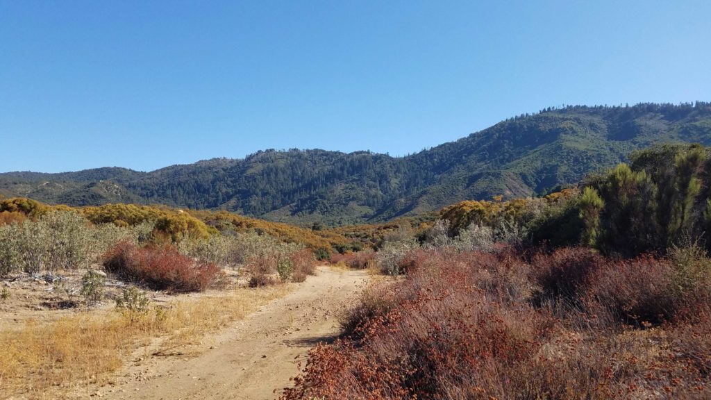
With the weather starting to turn, it was time to start thinking about my remaining peaks in the desert. While the true desert was still a tad warm still, the weather for the peaks near Ranchita was nice enough for them to be attempted. My feet were still a tad sore from the summiting of Sheephead Mountain and Manza Benchmark yesterday, so I did not feel like hiking out to Wilson Benchmark. Instead, I opted to do White Benchmark and Bonny Benchmark.
After making breakfast at home, I pulled into the familiar turnout for this hike just past the Anza-Borrego State Park sign. Grabbing my gear and applying a good application of sunscreen, I set off across the desert floor. The first peak I wanted to summit was White Benchmark about 2 miles away and some 1,000 or so feet of elevation to be gained. Although I passed by Bonny, I wanted to summit it on the return route.
I followed the faint use trails, dodging the pointy pain planets along the way, toward the summit of White Benchmark. The breeze kept any bugs away and made the temperature perfect. Soon the summit lay before me. I scrambled up the summit block and was again rewarded with a tremendous view of Anza-Borrego to the east. I don’t think there is a register here, just the benchmark.
After a brief break, I began my descent, however, two other peaks were on the agenda; Bonny and Clyde. Following the ridgeline down from White, I began working my way to Bonny, but first up was Clyde. While not on any list, I felt I had to do the pair. Actually, it is basically on the route down from White, so it is not a problem. I scrambled a good way up the summit but did not climb the final portion since I was out here solo.
From there I made my way toward Bonny. Once I reached the peak, I worked my way along the south side until I reached the ledge on the west face. I carefully worked way along with it until I reached the summit again. There are two marks here, along with a register.
After a quick break, I carefully headed back down from the summit. Unlike my last two times to the peak, I opted not to go visit Hut Benchmark. Instead, I angled across along the desert floor following more faint use trails until I returned to the car. With that, peaks #75 and #76 were done!
I am an avid peak bagger, sometimes backpacker, and former sea kayaker living in San Diego. I am the co-author of Urban Trails:San Diego, coming in Spring 2026!
In 2019, I became the third person to complete the San Diego 100 Peak Challenge. Not stopping with that accomplishment, I set my sights on the harder San Diego Sierra Club 100 Peak list, which I completed in 2021. In addition, I have conquered several Six-Pack of Peaks challenges (SoCal, San Diego, Central Coast, and both the Arizona-Winter and Arizona-Summer). I am looking forward to exploring new summits and new adventures across the southwest.
After summiting Sheephead Mountain, I drove a short way back down Sunrise Highway to the trailhead. I actually grabbed a spot right next to it. Both the Sunset and Big Laguna trails start from here, so it is a popular spot. I grabbed my gear and set out again. The Sunset Trail is a hiking-only trail so I did not worry about being run over by a mountain bike since the Big Laguna Loop is a very popular trail for them.
As I cruised along the trail, I spotted patches of poison oak to either side. I had a feeling that this was going to be an issue on this summit attempt. Soon I reached the meadow that I needed to cross to join up with the use trail that would take me down the ravine and then back up to Manza Benchmark. As I set off across it, poison oak was scattered about. This was going to be a challenge.
I never found the use trail in the actual meadow, but on the other side, I spotted it and began my descent. The trail through this section was fairly easy to follow and only slightly overgrown, but tons of poison oak to attempt to avoid. After losing about 300 feet of elevation, it was time to make the steep climb out of the ravine. The bugs had started to come out, so on went the bug net.
The trail became fairly well marked with cairns as it quickly rose to the ridgeline. Poison oak continued to grow everywhere, I only hoped my contact would not become an issue later.
So I reached the crest of the mountain and turned northward. Here I would meander through the manzanita and over boulders toward the summit. The trail here was a bit more overgrown and I had a few spots that took a moment to resolve which way to go.
Finally, from atop the false summit, the Manza Benchmark stood before me. As I scrambled over the rocks, the same incredible view was presented to me. I sat on a rock and enjoyed a snack. I took my photos and again signed the register and began the trek down.
The return back to the Sunset Trail went by quickly, again hoping that the poison oak not going to leave a ‘gift’ for later. Soon, I was back at my car and my 74th peak of my 100 Peak Challenge was completed.
I am an avid peak bagger, sometimes backpacker, and former sea kayaker living in San Diego. I am the co-author of Urban Trails:San Diego, coming in Spring 2026!
In 2019, I became the third person to complete the San Diego 100 Peak Challenge. Not stopping with that accomplishment, I set my sights on the harder San Diego Sierra Club 100 Peak list, which I completed in 2021. In addition, I have conquered several Six-Pack of Peaks challenges (SoCal, San Diego, Central Coast, and both the Arizona-Winter and Arizona-Summer). I am looking forward to exploring new summits and new adventures across the southwest.
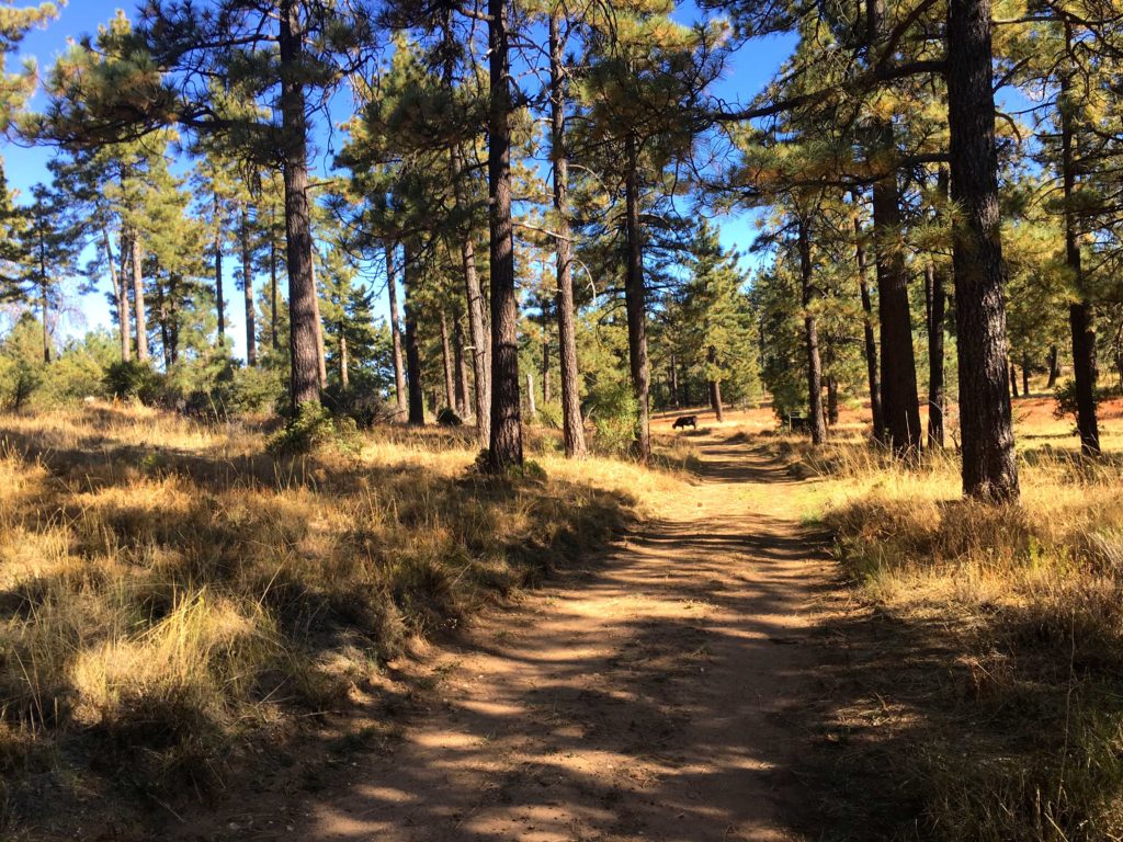
The plan for today was to summit two nearby peaks, Sheephead Mountain and Manza Benchmark both in the Lagunas. The first peak of this two-fer was going to be Sheephead. With the weather beginning to become fall-like, I did not need to be at the trailhead at sunrise. I drove down the semi-paved Kitchen Creek Road off of Sunrise Highway.
The trail seemed very familiar as the pine needles crunched under my boots. When I reached the other Kitchen Creek road, I made sure to leave a mark to find the use trail back up the ravine. I missed it the first time I summited.
As I cruised down the road, a few cows were hanging around and scampered off as I approached. Ignoring the locked gate and its warning, I continued down the road. Double-checking my original GPS route, I spotted a faint use trail and headed hopefully toward the summit.
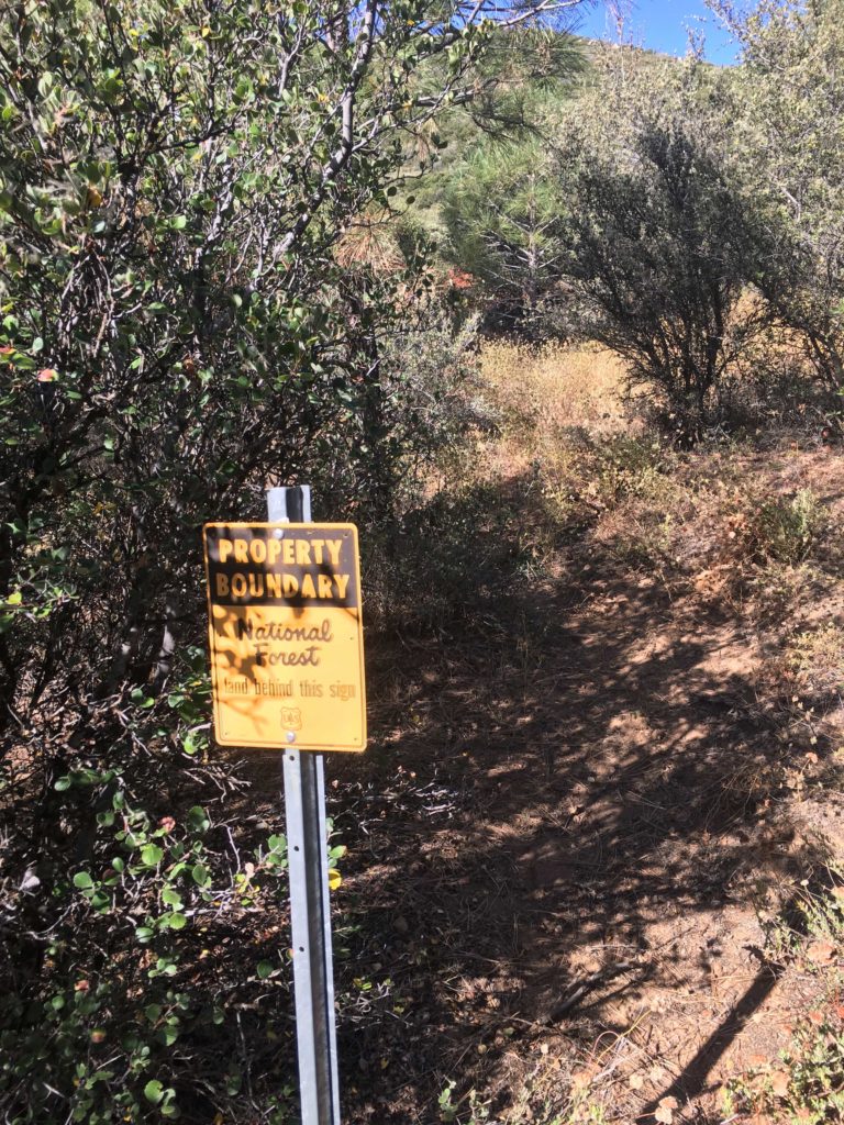
I spotted the boundary sign and knew the entrance to the use trail. Now the real effort would begin, the trail would climb some 600 feet in about .3 miles. The trail was overgrown, in fact, I lost a bandanna somewhere in that mess. Maybe after the challenge is over I might return and do some maintenance.
Finally, the summit revealed itself before me. Conditions were much nicer this time, so I enjoyed the views without feeling I was going to be blown away…
I signed the register and took my photos before heading back down. I kept an eye out for my missing red bandanna, figuring it would be easy to spot, but alas I never found it. But I did find a pair of sunglasses. Too bad I need prescription ones.
The trail deposited me back on the road and I headed back up the road. The cows were still hanging around as I neared the turnoff to the trail to make my way up the ravine. I was pleased about getting another peak out of the way. That was peak #73 of my #100PeakChallenge. Now for the short drive to the trailhead for Manza Benchmark.
I am an avid peak bagger, sometimes backpacker, and former sea kayaker living in San Diego. I am the co-author of Urban Trails:San Diego, coming in Spring 2026!
In 2019, I became the third person to complete the San Diego 100 Peak Challenge. Not stopping with that accomplishment, I set my sights on the harder San Diego Sierra Club 100 Peak list, which I completed in 2021. In addition, I have conquered several Six-Pack of Peaks challenges (SoCal, San Diego, Central Coast, and both the Arizona-Winter and Arizona-Summer). I am looking forward to exploring new summits and new adventures across the southwest.
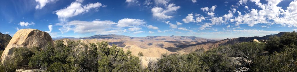
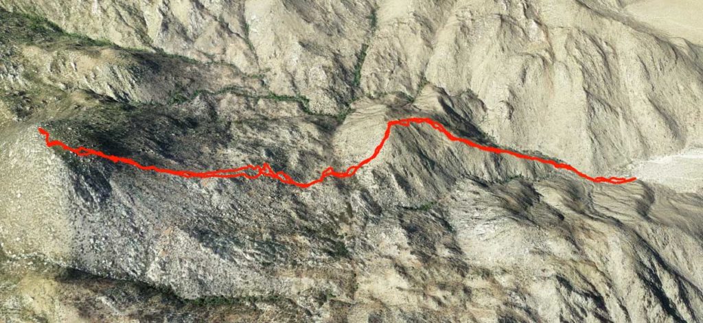
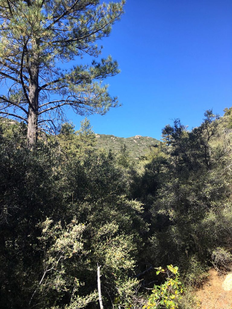
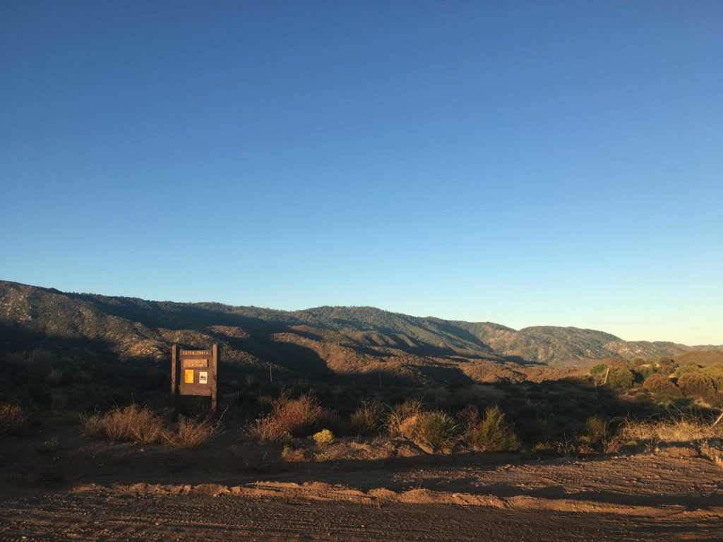
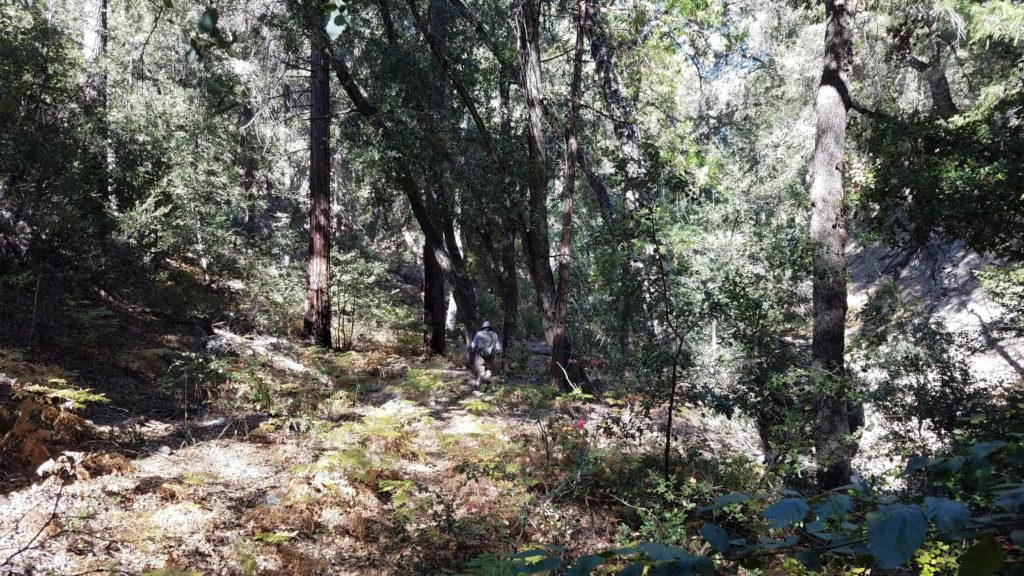
The sun was just rising as we parked the Subaru at the start of the Cutca Valley Trail for our hike out to Eagle Crag. This peak was a special one for me. My first attempt at the 100 Peak Challenge ended with 5 peaks left to summit, and Eagle Crag was one of those ‘Final Five’. When I began my ‘reboot’, I knew that this peak would be one of the challenges left to overcome. First, we checked the condition of the road to the actual trailhead. Thankfully, the High Point Truck Trail was in really good shape as it wound its way up from the Rancho California RV Resort just off the 79.
We knew the day was going to be a long one, some 18 or so miles of hiking with some decent elevation gains both there and back, not to mention the very steep ascent to the summit. The weather was going to be sunny and in the mid-70s, so having enough fluids with us was critical.
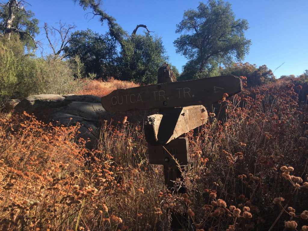
Once we passed the trail sign for the Cutca Valley Trail, we quickly plunged some 500 feet into Cottonwood Canyon. This ascent at the end of the day was not going to be fun. We followed the dry creek bed for a bit, taking care to avoid the poison oak that encroached onto the trail. The trail then began its climb up through a steep and narrow ravine before reaching Cutca Valley. There was some nice shade along this section, which we would appreciate upon our return. Every so often a blue and white ribbon would line the trail, not that they were truly needed for this section of the hike, but they gave us something to look for. The trail then came upon a wide clearing, and I thought this would be the perfect spot to stash one of the extra bottles of water I had brought. My idea was to have this reserve available to us to rehydrate if needed before we made our climb back out of Cottonwood Canyon. Also about this point, the small flies were becoming bothersome, so we donned our bug nets (the best $9 I ever spent) and continued on.
The trail then transformed into the remains of an old road and it would work its way up and down along the contours of the landscape for several miles. Nothing dramatic, but it would be something to deal with upon the trek back. While we had been hiking on the Cutca Valley Trail, we now segued onto the Cutca Trail.
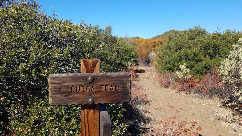
Around the 4 mile point we took a break under the shade of a coastal oak before continuing on. The views to the south of the Palomar Mountains were impressive as we munched on some snacks. Eventually, we came to the turnoff for the Cutca Trail. We would be leaving the old road that we had been on and return back to a traditional trail. Next to this trail sign, Ted and I both stashed a water bottle, no sense in hauling the weight up to the summit.
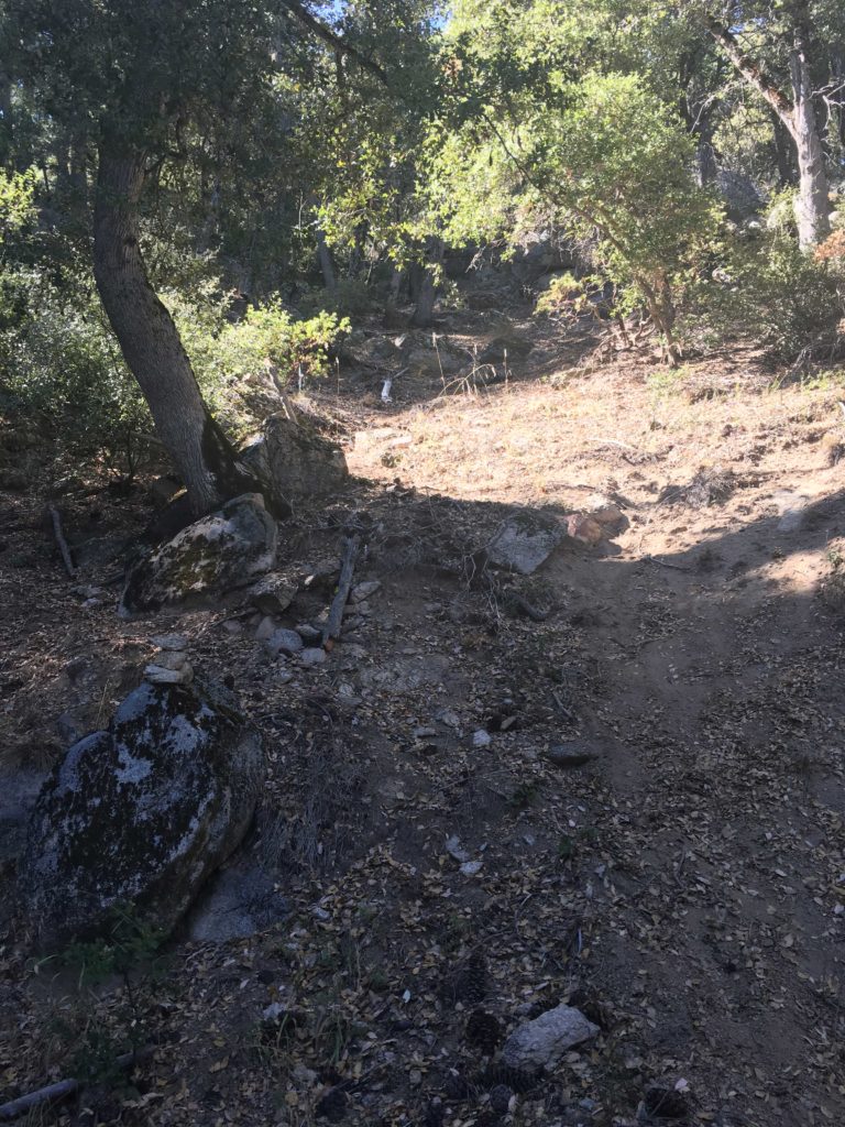
The trail now began gaining some real elevation, and along with it some of the first real challenges with navigation. As we were now under the canopy of mostly alders, with some Douglas fir and Coutler pine tossed in for good measure, the trail would become harder to find. First, all those trees would provide leaves that would mask the trail at times. Second, the trail would cross back and forth across the currently dry creek bed. We could carefully work our way through the rocks, looking for where the trail would pick back up along its banks. The poison oak would be making its return along the trail, adding another level of caution as we pushed on.
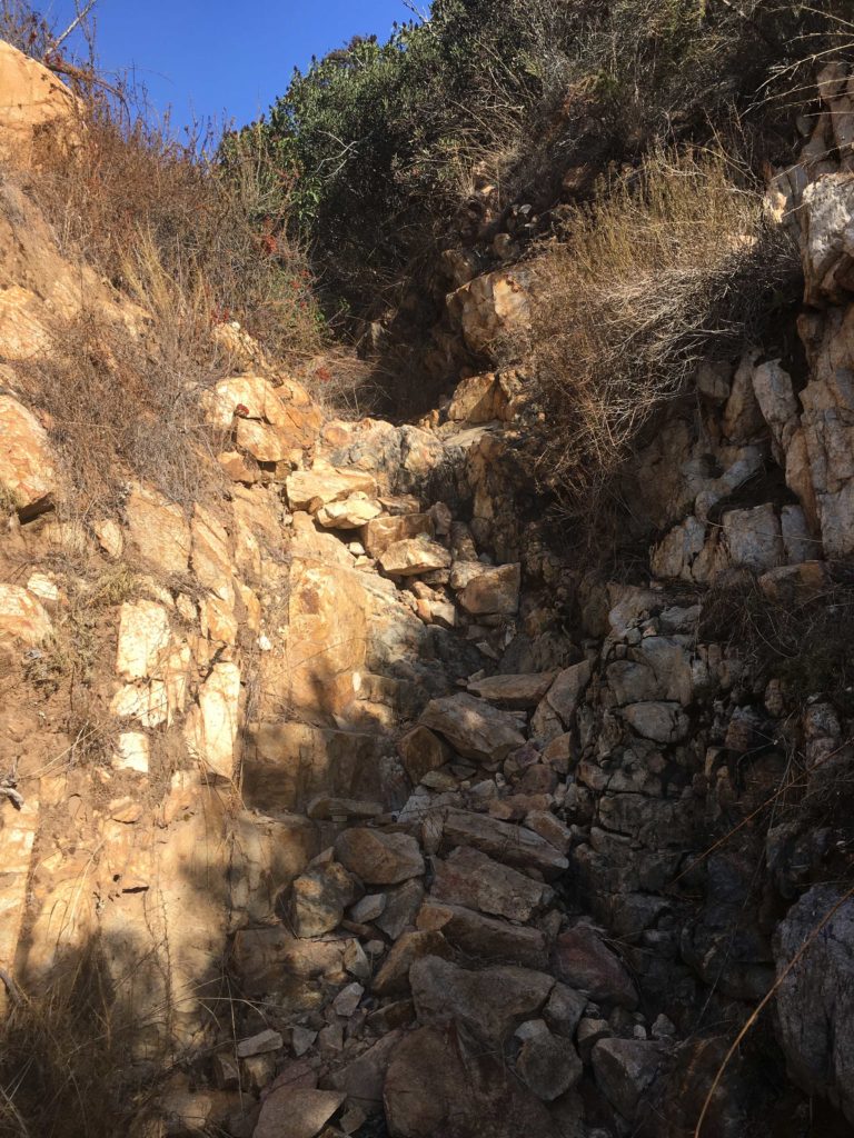
The trail eventually leaves this section behind and starts a series of switchbacks for more elevation gain. The upside was the trail was again easy to follow, and as an added bonus, some great views of the mountains to the north again. Eventually, the trail reaches the junction with the abandoned Palomar Divide Road. Continuing westward, we began looking for the rock cairn that would mark the bottom of the steep ravine that would lead us to the summit.
This portion of the hike was brutal. To call this steep is an understatement, and pictures do not do it justice. Foot by foot we would work our way up the ravine. I had a recent GPX track loaded, as I did not spy any ribbons or other markings to guide us. This gave me an approximate sense of where we needed to go. Although we did have to punch through some brush and dead trees at times, we found ourselves on the plateau staring at the summit. Weaving our way through the manzanita, we made it to Eagle Crag!
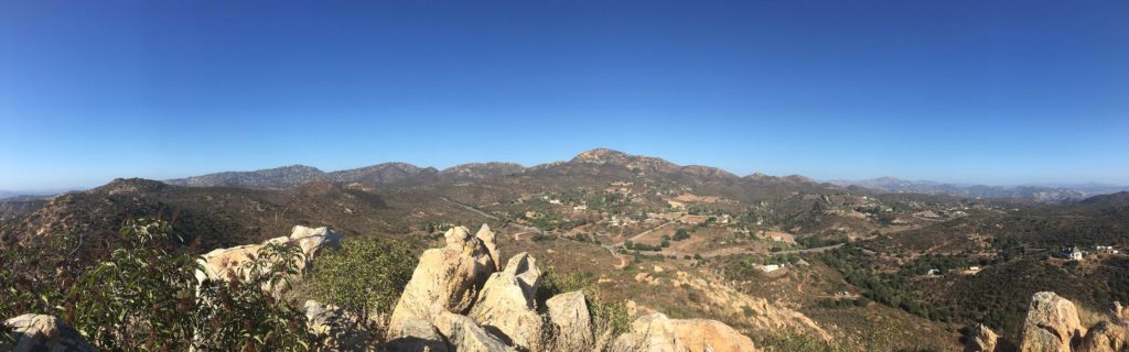
This was a tremendous sense of accomplishment for me! One of the ‘Final 5’ was summited! (yes, I knew I still had 9 miles back to the car). There was also something that made it stand out personally for me. As I sat upon the crag and soaked in the view, I flipped through the register, spotting many familiar names. It was touching to see many thanking Jerry Schad, the original author of Afoot and Afield in San Diego. I also saw two groups had summited it the day before. I would be remiss as not to point out that this perch is not for those afraid of heights, as the drop-off is almost 1,000 feet down.
After a tasty and well-earned PB&J, some oranges, and some Gatorade, we finished up taking our photos and wandered to the north end of the summit to snap some more photos of our recently conquered Three Saints. It was a bit before 1 pm, so we decided to begin the 9 miles back to the car. We safely navigated our way back down the steep ravine, at times almost sliding. It reminded me of the descent of False Sombrero, just without the rocks.
While the summit was behind us, we knew that in addition to the miles we needed to cover, we still had some climbing ahead of us before we reached the car. Soon the switchbacks were behind us, and we again worked our way through the canyon, enjoying the shade (but not the bugs or the poison oak). As we reached the sign that marked the turn-off, we gathered our water cache. The day had become warmer, and this section of the hike was certainly more exposed as we retraced our route. I could feel both the temperature and the effort of this hike as we trekked on. We did hear the telltale sound of a rattle, and Ted spotted the tail before quickly moving on.
Finally, we came to where I had placed that first bottle. Ted was still feeling good, so I quickly drank it down, along with the last few slices of orange I had kept for the end of the hike. As we descended into Cottonwood Canyon, I broke out my final trick, a small can of Coke. I figured a nice burst of sugar and caffeine would help power me up that 500′ of elevation.
The sun was starting to set and cast its golden glow over the hillside as we plodded upward. We soon reached the car and our journey was complete. 18.4 miles and over a cumulative 3,600 feet of elevation gain. Carefully, we shed our hiking gear and wiped down to hopefully keep any poison oak from triggering a rash. With the sun now set, I carefully drove back down the dirt road and to a hearty dinner at a Mexican restaurant back in Temecula. With that my #72 peak of my #100PeakChallenge was in the books and the ‘Final Five’ is now the ‘Fantastic Four’!
I am an avid peak bagger, sometimes backpacker, and former sea kayaker living in San Diego. I am the co-author of Urban Trails:San Diego, coming in Spring 2026!
In 2019, I became the third person to complete the San Diego 100 Peak Challenge. Not stopping with that accomplishment, I set my sights on the harder San Diego Sierra Club 100 Peak list, which I completed in 2021. In addition, I have conquered several Six-Pack of Peaks challenges (SoCal, San Diego, Central Coast, and both the Arizona-Winter and Arizona-Summer). I am looking forward to exploring new summits and new adventures across the southwest.
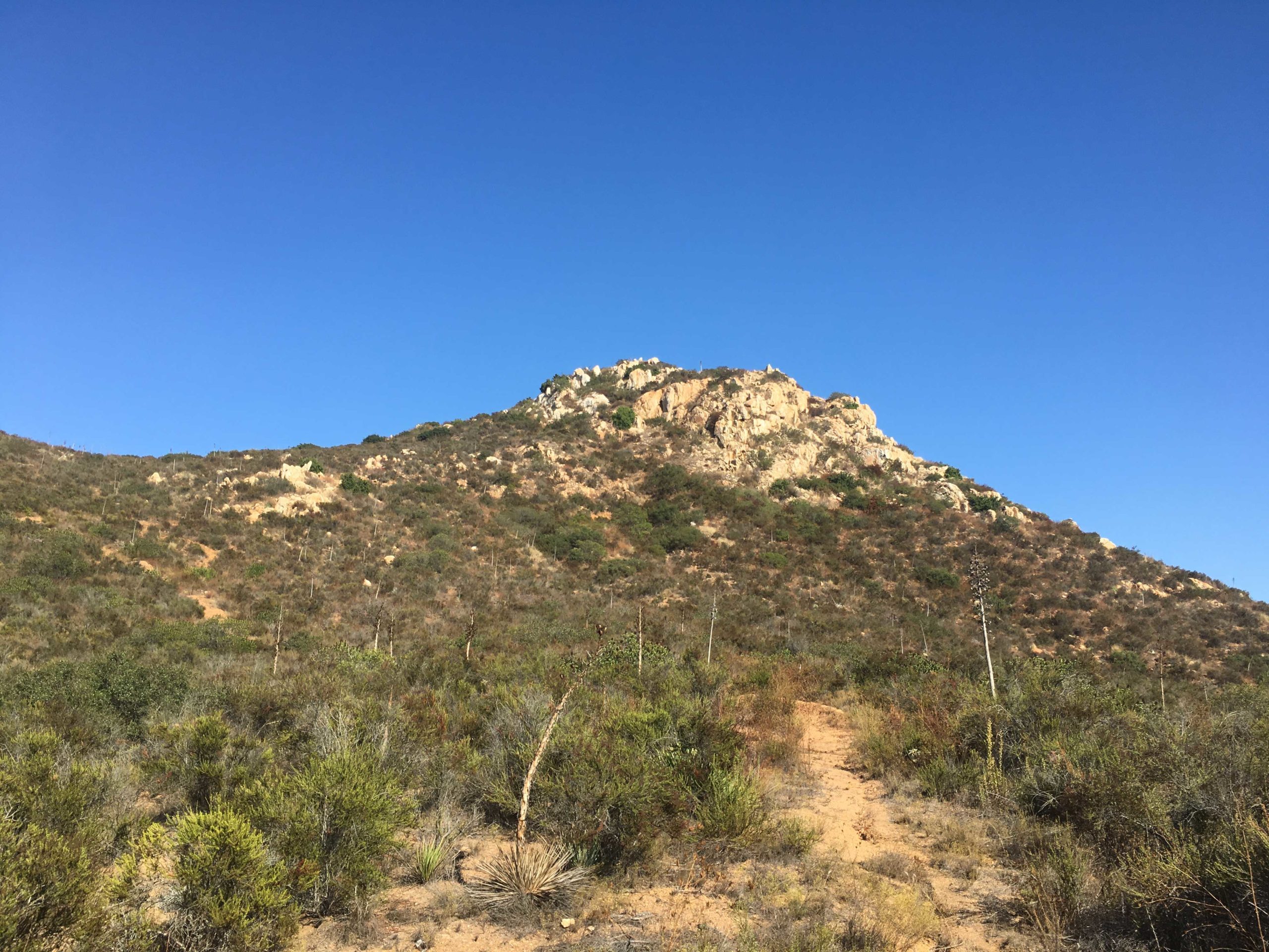
With the trail closed for Rock Mountain, Derek needed to find a replacement peak. After some discussion, Goat Peak in Poway was added to the Challenge. I had some unexpected free time this afternoon, so I decided to go hike it. I had limited research on this peak. I knew where the trailhead was, and a route, but not a lot more than that. The trail begins at the end of Quiet Valley Lane and follows Poway Creek for about 0.7 miles. I crossed the dry creek bed 5 times before leaving the canyon.
Now the trail changed its character from a gentle stroll to a real workout. Over the next ¼ of a mile, I gained over 400 feet of elevation. The path here is quite eroded and slippery and at times sports ruts down the middle, making footing a bit awkward. Finally, I reached a plateau and found a nice rock to sit on and grab a short breather. It offered a great view back down the canyon. Looking to the east, the actual peak finally came into view.
Soon the trail began working its way up a dry creek where I encountered a few dry waterfalls, some requiring mild scrambling to climb up. So much for doing this hike after some rains… Finally, I left the other creek and the last push to the summit. Throughout the hike, there were portions of the trail built up for mountain bikes, but it was clear they had not been used for some time.
To reach the summit, a little bit of scrambling was required. As I sat and let the breeze cool me off, Mt Woodson stood to the north, and Iron Mountain to the east. I found the register with no problem and added my name.
After soaking in the vistas, I carefully worked my way back down the rocks to the main trail. I knew descending was going to be slow, given the trail conditions, but I was in no hurry. While the trail was easy to follow, you are going to need long pants to avoid some of the overgrowth. Soon I had made it back down the dry creek and the other steep section. It was nice to get another peak crossed off the list, #71!
I am an avid peak bagger, sometimes backpacker, and former sea kayaker living in San Diego. I am the co-author of Urban Trails:San Diego, coming in Spring 2026!
In 2019, I became the third person to complete the San Diego 100 Peak Challenge. Not stopping with that accomplishment, I set my sights on the harder San Diego Sierra Club 100 Peak list, which I completed in 2021. In addition, I have conquered several Six-Pack of Peaks challenges (SoCal, San Diego, Central Coast, and both the Arizona-Winter and Arizona-Summer). I am looking forward to exploring new summits and new adventures across the southwest.