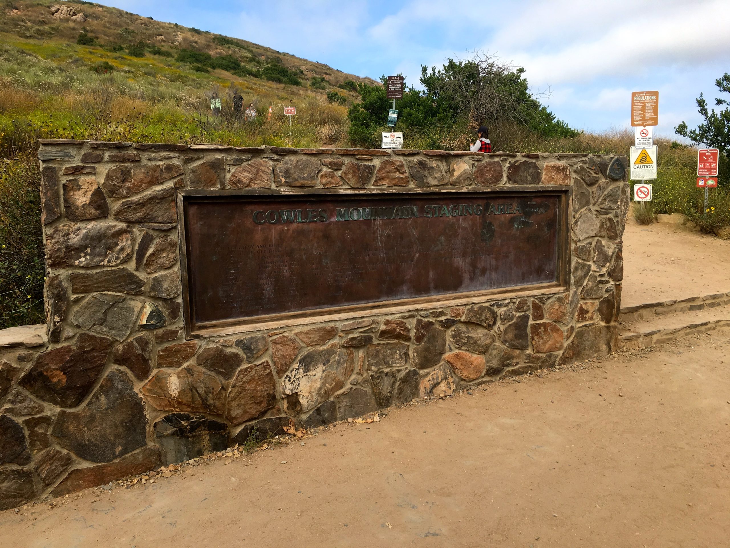
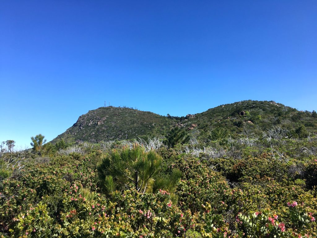
The San Diego Adventure Club was hosting an evening hike up Cowles Mountain and onto Pyles Peak. Since Cowles is so popular, any chance to do it when there is less crowded I will take it. June Gloom was in full force as we set off from the Staging Area near Golfcrest.
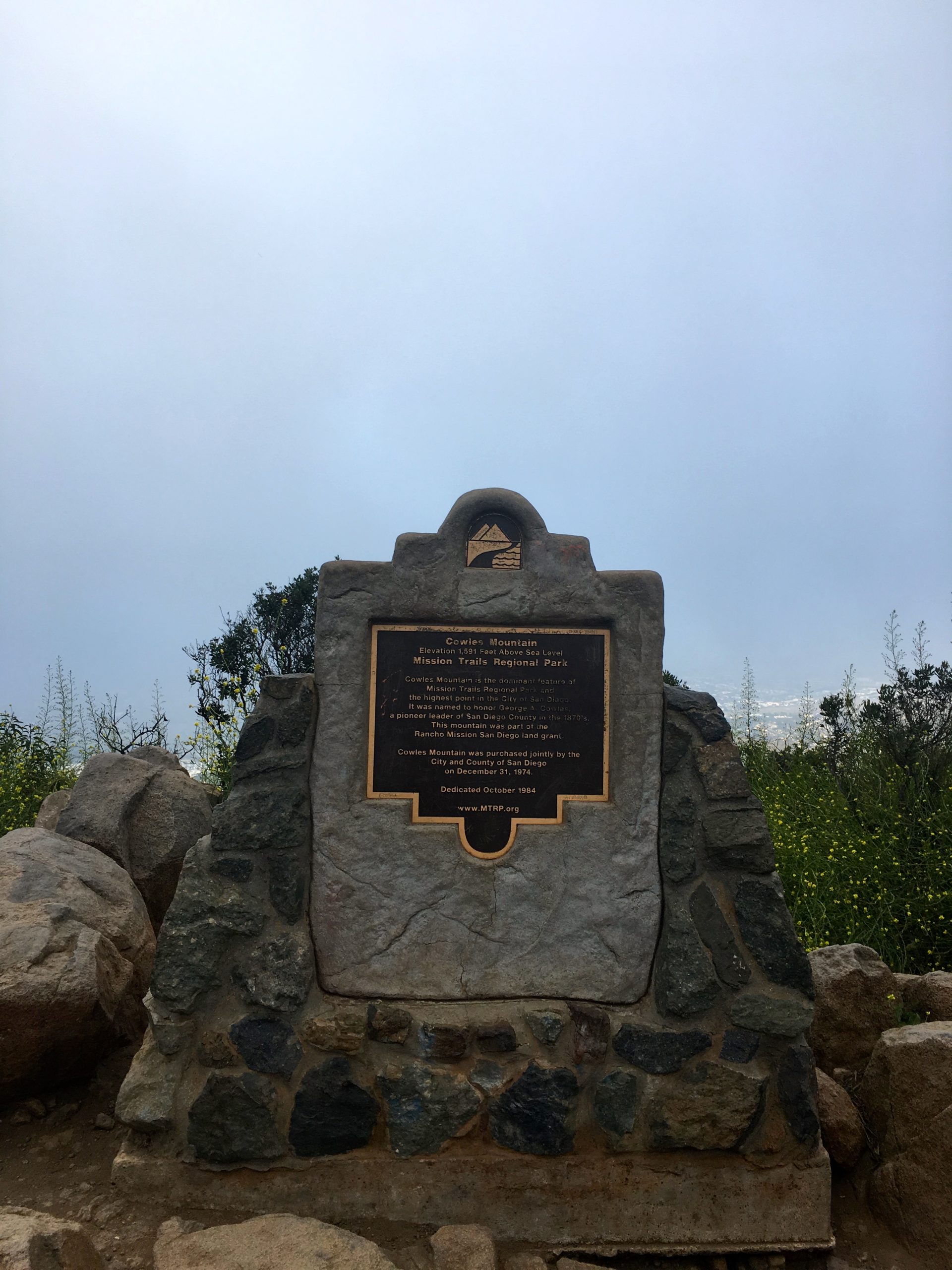
We quickly found ourselves at the summit of Cowles, amongst a small crowd of folks. There was a slight breeze, so we did not linger, a couple of quick photos before we headed off toward Pyles.
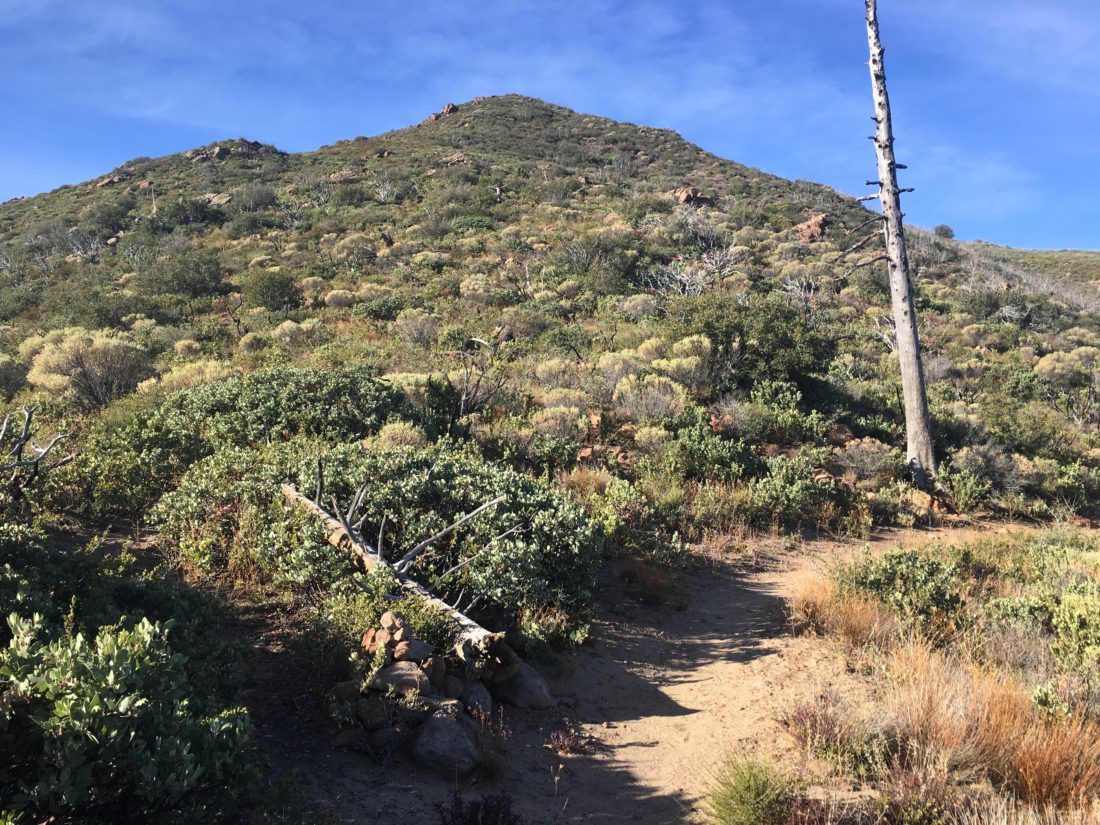
One of the hikers in the group was excited, as once she summited Pyles, she will have completed the Mission Trails 5 Peak Challenge. We descended down from Cowles and across the saddle.
Some opted to take the side trail to the top of P1380, but with the low clouds, I opted to skip it this time. We made our way up to the summit and again took our photos. It was getting later and a tad chilly. We began making our way back down. The group opted to descend via a use trail near an overlook. I opted not to follow and return the same way.
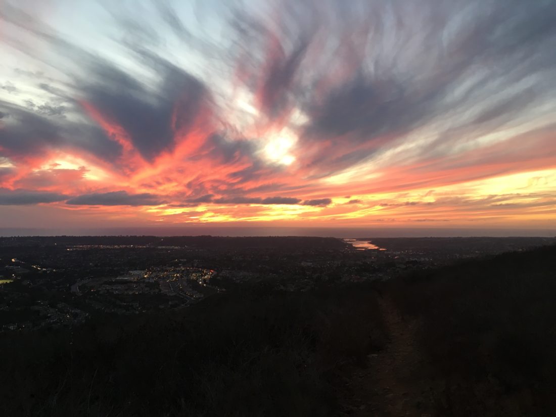
Once I reached the summit of Cowles, I broke out my headlamp and began the careful trek down. The last thing I wanted to do was to turn an ankle with a simple misstep. There were some city lights to provide some visual treats. I was surprised at the number of people still climbing up with maybe an iPhone to light their way.
I am an avid peak bagger, sometimes backpacker, and former sea kayaker living in San Diego. I am the co-author of Urban Trails:San Diego, coming in Spring 2026!
In 2019, I became the third person to complete the San Diego 100 Peak Challenge. Not stopping with that accomplishment, I set my sights on the harder San Diego Sierra Club 100 Peak list, which I completed in 2021. In addition, I have conquered several Six-Pack of Peaks challenges (SoCal, San Diego, Central Coast, and both the Arizona-Winter and Arizona-Summer). I am looking forward to exploring new summits and new adventures across the southwest.
I did this peak after work again. Thankfully, I remembered all my gear this time. I opted to take the entire Switchback Trail to the summit.
While the skies were overcast, as June Gloom was in full force, flowers did line the sides of the trail.
Encountered a couple of mountain bikers working their way up, and a few other trail users during the entire trip.
I returned from the summit the same way as my first time at the peak.
I am an avid peak bagger, sometimes backpacker, and former sea kayaker living in San Diego. I am the co-author of Urban Trails:San Diego, coming in Spring 2026!
In 2019, I became the third person to complete the San Diego 100 Peak Challenge. Not stopping with that accomplishment, I set my sights on the harder San Diego Sierra Club 100 Peak list, which I completed in 2021. In addition, I have conquered several Six-Pack of Peaks challenges (SoCal, San Diego, Central Coast, and both the Arizona-Winter and Arizona-Summer). I am looking forward to exploring new summits and new adventures across the southwest.
I had hiked the Fortunas a number of times when I lived in Tierrasanta. When summiting them again for the 100 Peak Challenge Reboot, I decided that they should have their own post and not be a part of my Mission Trails 5 Peak Challenge post.
Rather than follow my standard route of up the South Fortuna stairs then over to North Fortuna and back to the Clairemont Mesa trailhead, I opted to approach these peaks via the Oak Canyon route. Since we just had some more rain, I knew that I would have a flowing stream for part of the trail to enhance the scenery.
I parked along the road near the Old Mission Dam and quickly crossed the bridge and onto the trail leading up to Oak Canyon. The rains had certainly created a lot of growth along the trail. The trail to the Fortuna Saddle provided a good hard warm-up.
Once at the saddle, I opted to summit North Fortuna first. I worked my way up toward the peak, which is initially hidden from the saddle. Since it was a late Friday afternoon, the traffic on the trails was light. I did encounter two hikers asking about routes since I carry a paper map, I showed them where we were and the best route back to the visitor center. I let them keep it.
Atop the summit, I could see the clouds starting to form to the east, as a storm was forecast for the weekend. I opted not to sign the register, and then back retracing my route down to the saddle. The new peak marker had not been installed here yet.
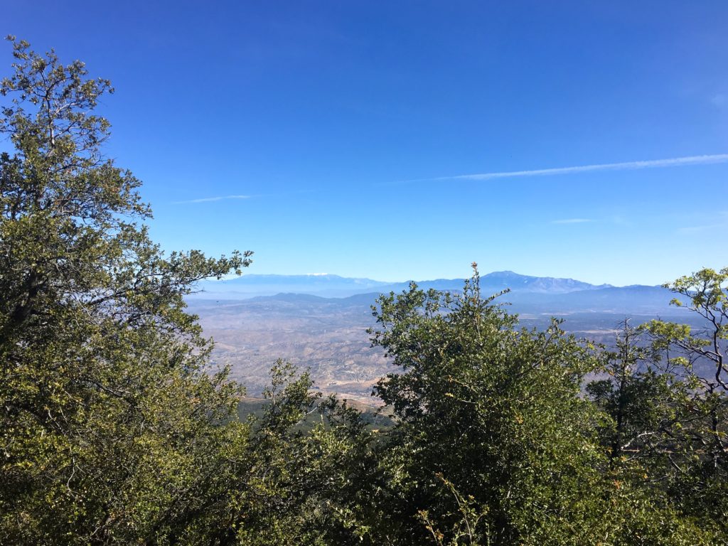
The trail up to South Fortuna was a bit easier and much easier than up the stairs. The marker for South Fortuna has been replaced with one that is a bit more impressive. Across the canyon, I could see Kwaay Paay standing tall, and Cowles and Pyles a bit beyond that.
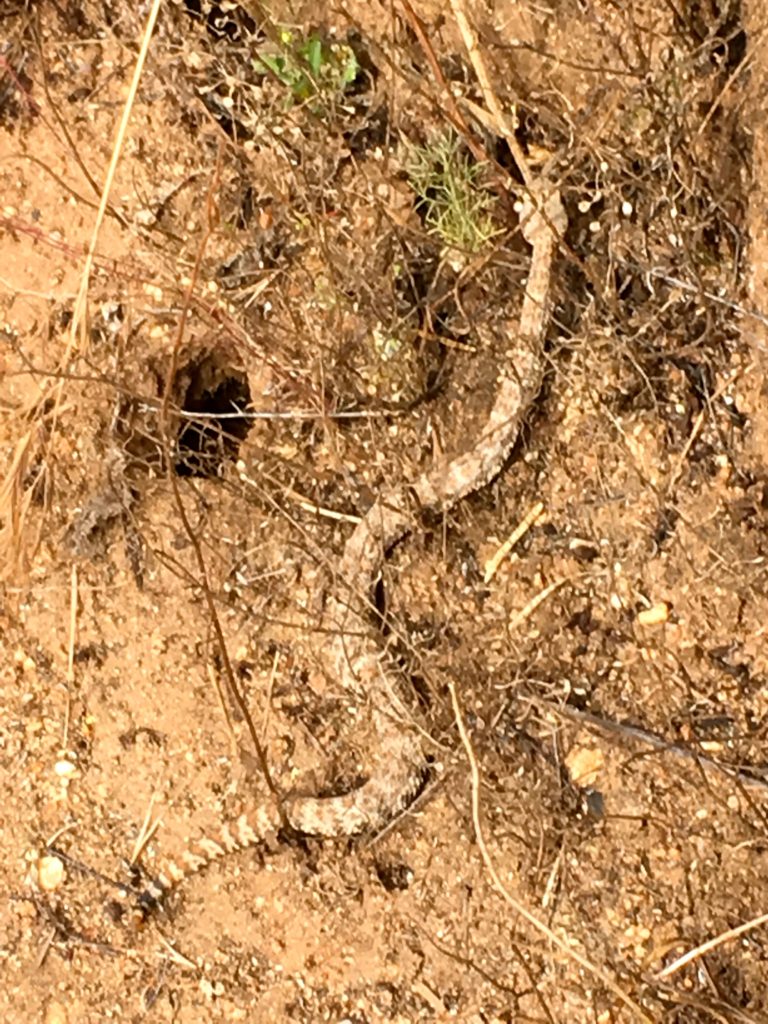
While descending toward the saddle from South Fortuna, a rattlesnake was making its way across the trail in front of me. I let it pass, but it still stopped and hissed at me as I gave it a wide berth.
Retracing my route down Oak Canyon, I pass the Oak tree with a very bent branch. One of my favorite family photos was taken here. I had to reflect that in a few weeks, my twins would be graduating high school and moving on with their lives.
I am an avid peak bagger, sometimes backpacker, and former sea kayaker living in San Diego. I am the co-author of Urban Trails:San Diego, coming in Spring 2026!
In 2019, I became the third person to complete the San Diego 100 Peak Challenge. Not stopping with that accomplishment, I set my sights on the harder San Diego Sierra Club 100 Peak list, which I completed in 2021. In addition, I have conquered several Six-Pack of Peaks challenges (SoCal, San Diego, Central Coast, and both the Arizona-Winter and Arizona-Summer). I am looking forward to exploring new summits and new adventures across the southwest.
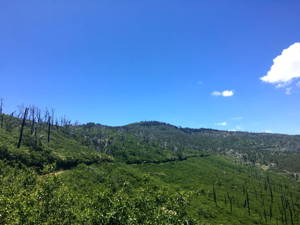
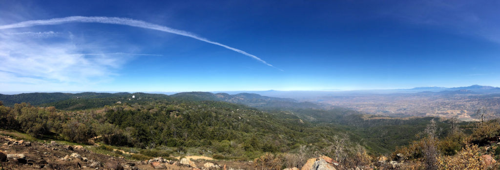
I wanted to do something with some miles in preparation for the rescheduled Climb For Heroes, looking at my list of remaining hikes for the 100 Peak Challenge Reboot, and thought about connecting several of the peaks in the Cuyamacas. The recent rains had extended the wildflowers, so it seemed like a perfect plan. The goal was to summit Airplane Ridge, then up to Japacha Peak, then Cuyamaca, and hit Arrowmaker Ridge on the return. All told about 14 miles of hiking were planned for the day.
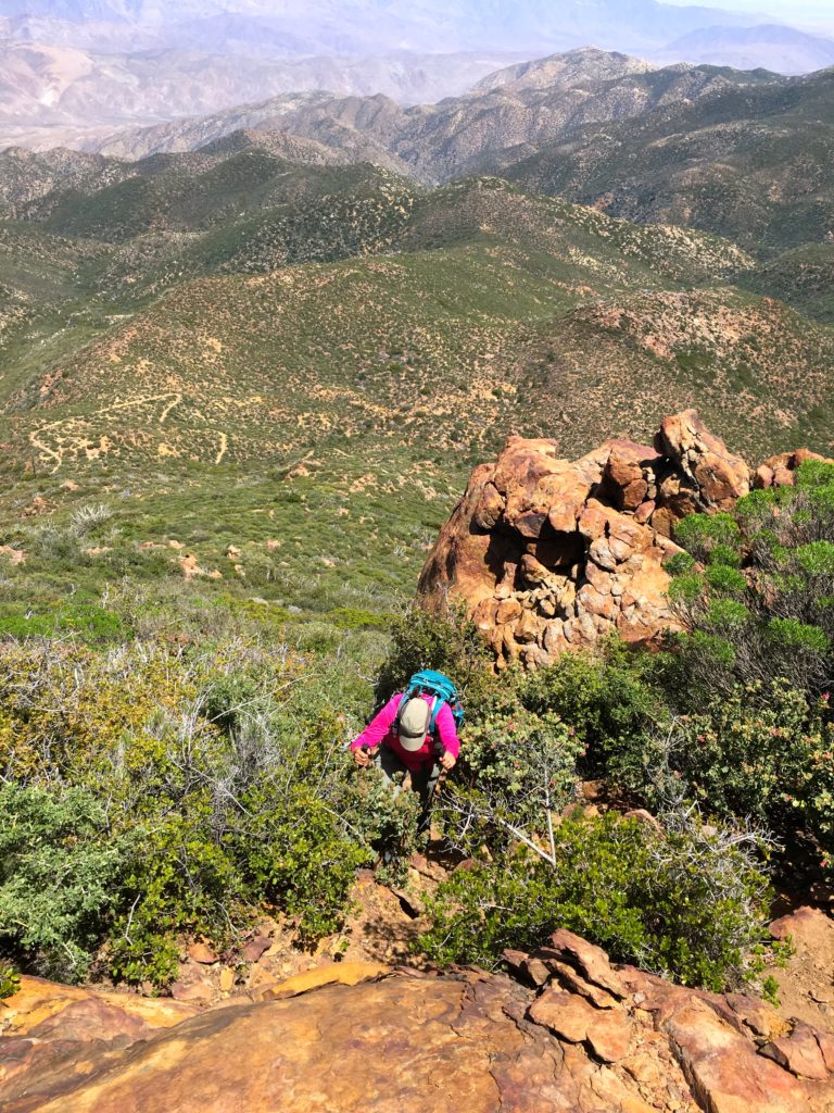
I wanted to start this attempt from the Green Valley Campground, but it is currently closed. Instead, I started at the Sweetwater Parking area. Crossing over the flowing water, I began working my way along the Monument Trail toward the first peak of the day, Airplane Ridge. The grade of the trail made the ascent very pleasant. The big peaks loomed ahead of me. So much so, that I missed hopping off the trail to summit Airplane Ridge. Doh! So I backtracked and tried approaching it from the north. I got close, but not directly at the high point. The bush was too thick. If had done some recon with some satellite imagery, I should have continued backtracking further and would have had a clear path, like a remembered from the first ascent from the south. Looking back at my pictures, I even took a photo of where I should have gone.
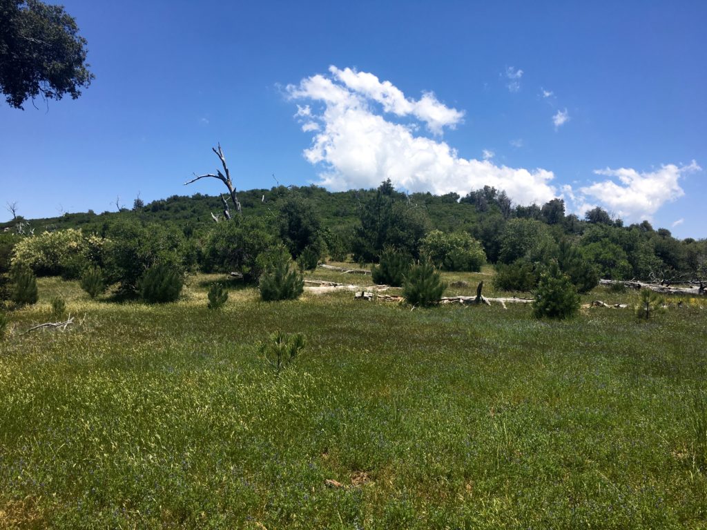
After hopping back on the trail, I began climbing my way up toward Japacha peak. The flowers along the meadow were stunning. Soon I found myself weaving my way through the remaining pine trees on the mountain. The crunch of the needles under my boots was music to my ears.
When I ‘summited’ Japacha Peak the first time I only got partially there, as my hiking partner was in shorts and had to turn back. Not a problem this time, as I scouted a sort of path through the brush to the peak. While there is no benchmark, there is a register. The June Gloom was in full force, but it made for a dramatic scene to the west.
After signing in, and a short rest, I picked my way back through the brush and back on the trail. Cuyamaca towered over me as a continued climbing. The Burnt Pine trail ends at the main road to the summit of Cuyamaca. This was going to be my least favorite portion of this loop, as it is mostly steep and paved.
I finally encountered my first other hikers of the day along the road. At the summit, I rested and gazed out across the cloud tops covering much of my view. I had the summit all to myself.
I began to work my way down the road to the Fern Fire Road. I began to encounter more hikers making their way to the summit, along with their dogs in tow. I had forgotten how steep the road was, and as such, my pace slowed some. It might also have been the fact I already hiked 8 miles. I began to become concerned about the time, as I needed to be back in town to celebrate a good friend’s 50th birthday. I wondered if I should just head to the road and hitchhike back to the car. In the end, I figured I could make it back to the car without too much delay.
The road gently worked its way down, crossing various springs along the way. Soon I found myself at the base of Arrowmaker Ridge. I was uncertain if I should attempt it. I was going to be cutting it close in time. Although the peak is not that high, it does require some bushwhacking. Since I was fighting the clock, I had not been resting nearly as much as I normally do. I crossed over the meadow to see if an easy route. Alas, nothing appeared, and I was running out of gas and still had a couple of miles still to go. Since both Middle Peak and Stonewall Peak are nearby, I knew I would have an easy opportunity to try again.
My route took me along Japacha Creek. The flowing water was soothing, I wish I had time to dip my feet into the cool waters and rest.
I finally found myself back at my car with plenty of time to make it to the party. All told this hike covered 14.4 miles in 7 hours. The total elevation gain was 2,775 feet. All in all a fantastic day on the trails. That makes 33 summits of the 100 this year.
I am an avid peak bagger, sometimes backpacker, and former sea kayaker living in San Diego. I am the co-author of Urban Trails:San Diego, coming in Spring 2026!
In 2019, I became the third person to complete the San Diego 100 Peak Challenge. Not stopping with that accomplishment, I set my sights on the harder San Diego Sierra Club 100 Peak list, which I completed in 2021. In addition, I have conquered several Six-Pack of Peaks challenges (SoCal, San Diego, Central Coast, and both the Arizona-Winter and Arizona-Summer). I am looking forward to exploring new summits and new adventures across the southwest.
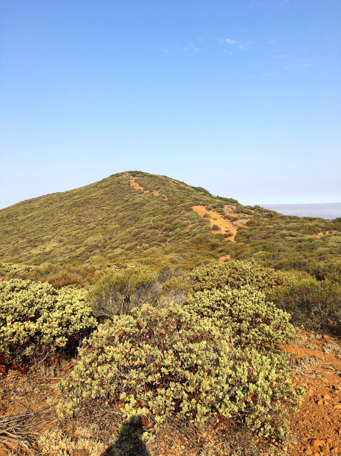
While the rainy Memorial Day weekend put a damper on any big hiking plans, Monday afternoon availed itself for some time on the trails. I mulled several options as a candidate, but in the end, I settled on Guatay Mountain out near Pine Valley. This peak was the first peak I did after my neck injury. It was going to be interesting to compare the two summits.
As I unlocked the gate to the trail, I could hear the stream flowing nearby. Like so many trails, it was slightly overgrown from all the rains we had this year. As expected, some of the steeper sections had become more rutted as well.
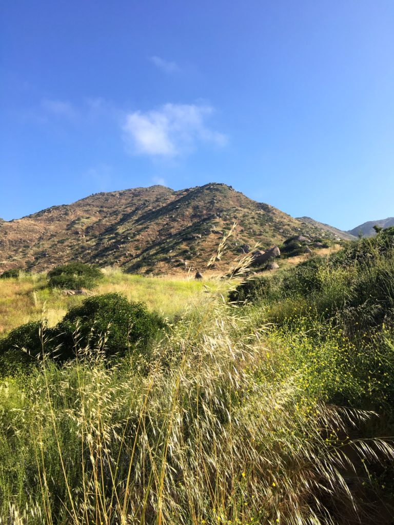
I followed the trail for about a mile before reaching the metal fence indicating the turnoff toward Guatay Mountain. This section also showed the effects of our winter, requiring some straddling of the trail to work my way up. The weather was perfect for hiking, a light breeze and perfect temperatures made the climb upward pleasant.
I remembered much of the trail as it passed under my boots. I was curious to discover the difference once I got to the steeper section of the hike. I remembered that it took some effort the first time.
This time I found myself working my way upward without any issues. Glancing northward toward Cuyamaca, its summit was still encased in clouds.
Soon the summit came into view. I took a short break and signed the register. I looked over at Long Valley and debated if I should consider doing it as well…
I headed back down the trail, reflecting on how different these two summits have been. The first time pushed me and gave me confidence that I could hike again. This time, it let me know that I had the strength to complete my 100 Peak Challenge Reboot.
Soon I found myself crossing that small stream again, knowing that this hike was nearing its end. Once back in the car, I decided not to tack on Long Valley, and just enjoy my summit of a Guatay.
I am an avid peak bagger, sometimes backpacker, and former sea kayaker living in San Diego. I am the co-author of Urban Trails:San Diego, coming in Spring 2026!
In 2019, I became the third person to complete the San Diego 100 Peak Challenge. Not stopping with that accomplishment, I set my sights on the harder San Diego Sierra Club 100 Peak list, which I completed in 2021. In addition, I have conquered several Six-Pack of Peaks challenges (SoCal, San Diego, Central Coast, and both the Arizona-Winter and Arizona-Summer). I am looking forward to exploring new summits and new adventures across the southwest.
Since I had to drop my daughter and friend off at 5:15 am to catch a train to a youth group event in Simi Valley, I decided to see if I might be able to sneak a short hike in before the predicted rains came. While Kwaay Paay seemed to fit the bill, short and in-town.I drove out to Mission Trails and parked in the lot just outside the locked gate. The skies were gloomy as I made my way down the road to the trailhead. While Kwaay Paay is a short hike, it does offer a nice elevation gain to offset that.
Working my way up, I encountered a few early-morning folks trying to squeeze in a workout before the rains came. The trail has seen some damage from the winter’s rains, so there were a few rutted sections to be aware of.
The cloudy skies did dampen the views at the summit, which was still sporting the old summit sign. The Fortunas were visible from across the canyon.
On the way down I opted to take the east side trail just for something different. This trail follows the eastern edge of the park next to the apartments.
I made it back to the car, and about 3 minutes later the rain came. This was peak #28 of the #100PeakChallenge Reboot.
I am an avid peak bagger, sometimes backpacker, and former sea kayaker living in San Diego. I am the co-author of Urban Trails:San Diego, coming in Spring 2026!
In 2019, I became the third person to complete the San Diego 100 Peak Challenge. Not stopping with that accomplishment, I set my sights on the harder San Diego Sierra Club 100 Peak list, which I completed in 2021. In addition, I have conquered several Six-Pack of Peaks challenges (SoCal, San Diego, Central Coast, and both the Arizona-Winter and Arizona-Summer). I am looking forward to exploring new summits and new adventures across the southwest.
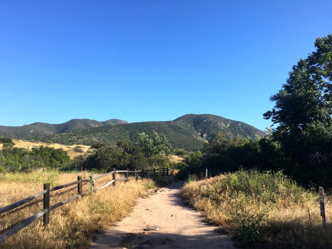
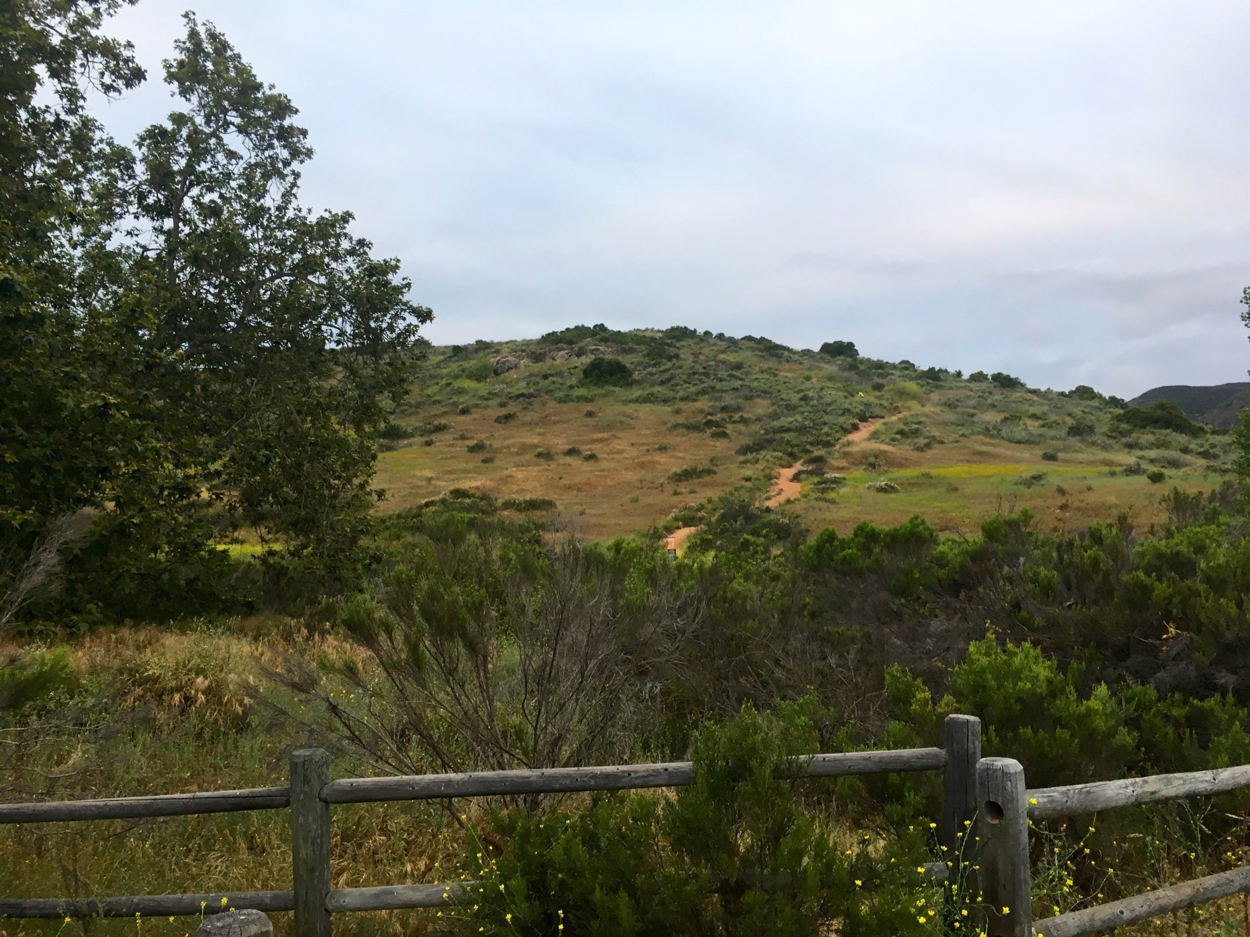
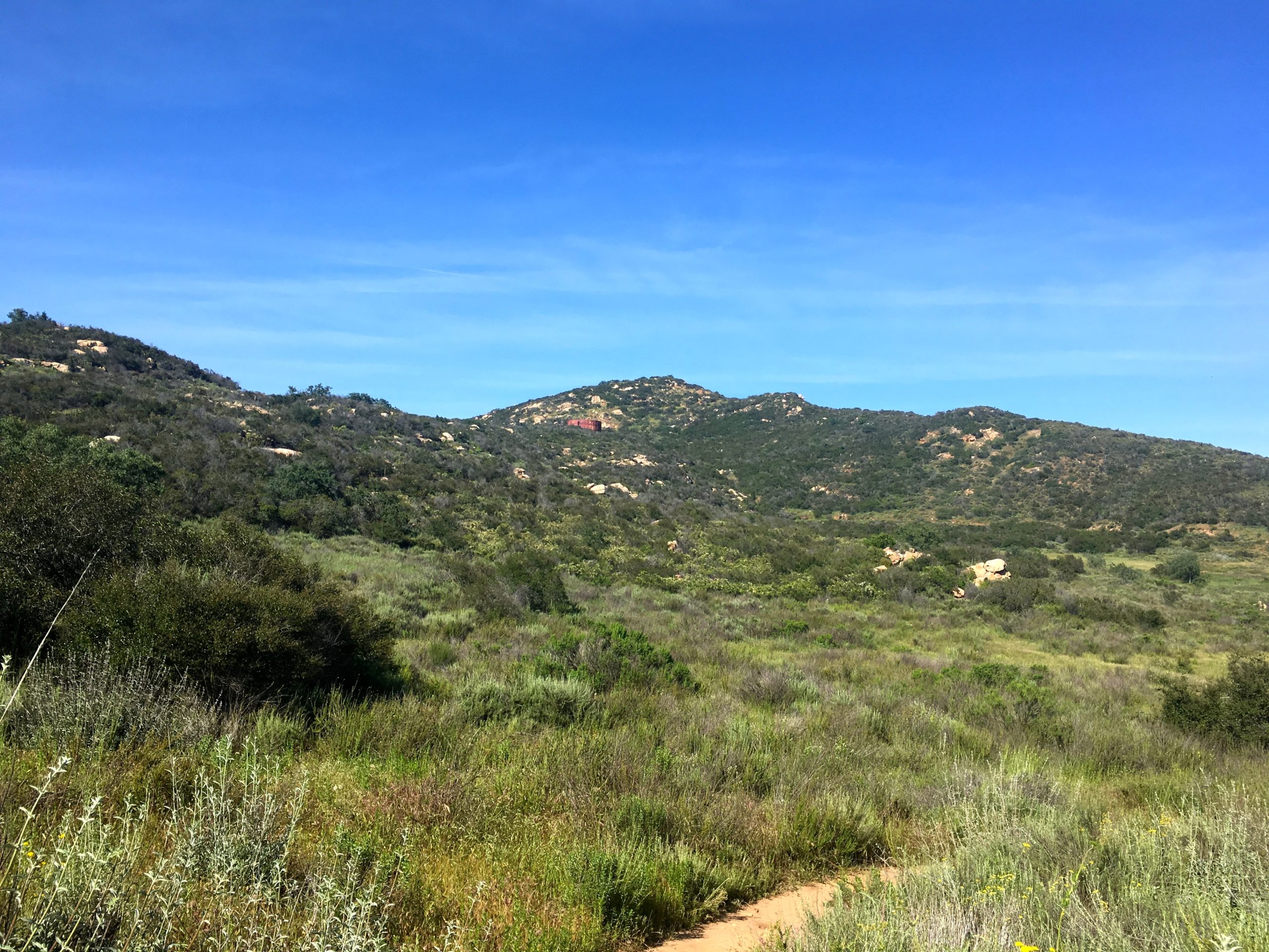
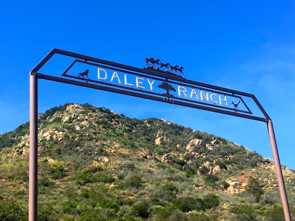
My late afternoon meeting was canceled, so I decided to head out to Daley Ranch and hike up to Stanley Peak. I opted for the approach from the main entrance this time instead of taking the Caballo Trail.
The area still was carpeted in green grasses and a few flowers. A small stream still flowed across the trail. As I worked my way toward the peak, the seasonal ponds were filled with water.
The summit was quiet, just the sound of the road below. I opted to make the route a loop, in part to enjoy the green meadows.
As began my return to the car, I began seeing a lot more people out enjoying the trails.
This peak was the 25th peak of my 100 Peak Challenge reboot.
I am an avid peak bagger, sometimes backpacker, and former sea kayaker living in San Diego. I am the co-author of Urban Trails:San Diego, coming in Spring 2026!
In 2019, I became the third person to complete the San Diego 100 Peak Challenge. Not stopping with that accomplishment, I set my sights on the harder San Diego Sierra Club 100 Peak list, which I completed in 2021. In addition, I have conquered several Six-Pack of Peaks challenges (SoCal, San Diego, Central Coast, and both the Arizona-Winter and Arizona-Summer). I am looking forward to exploring new summits and new adventures across the southwest.
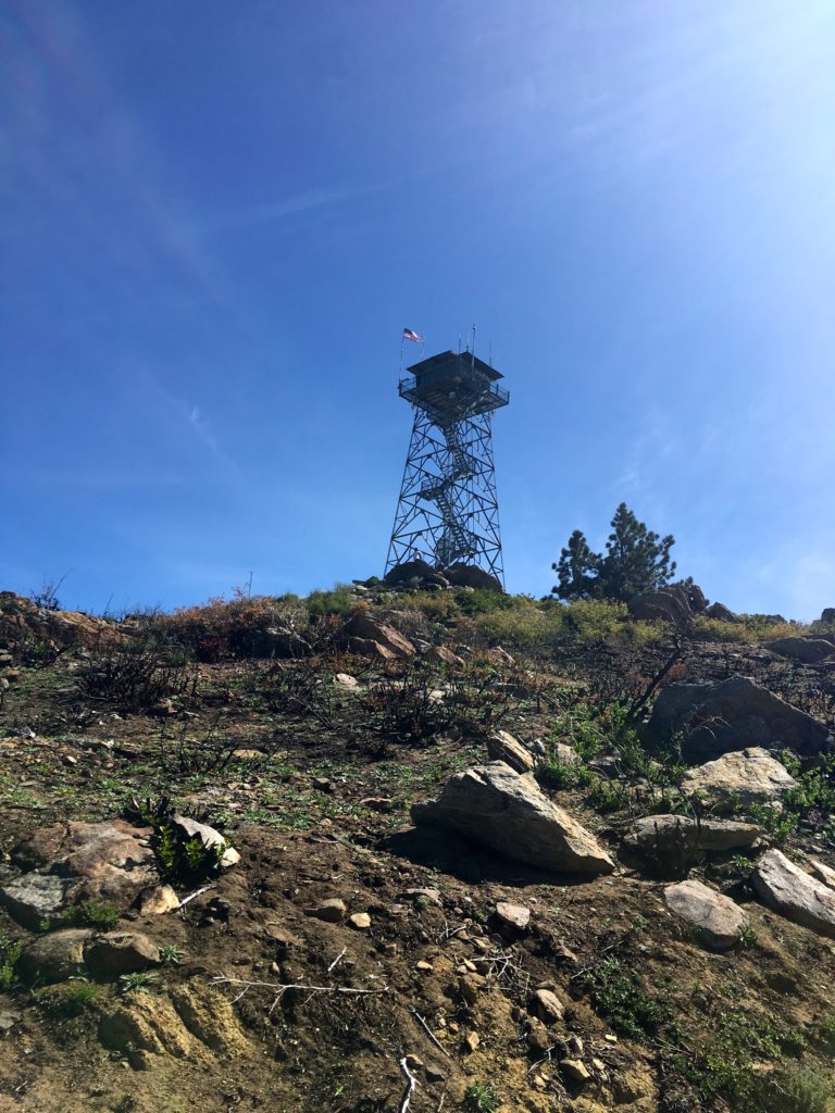
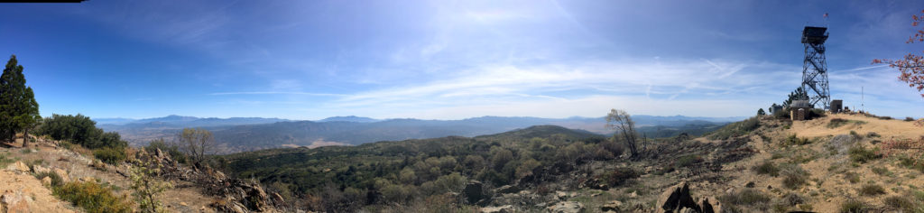
We had planned to attempt to summit Square Top via the Los Coyotes Indian Reservation. Unfortunately, they are no longer allowing access to the trailhead. So, Gail needed to complete her summit of Palomar High Point, so since we had a capable car, along the Palomar Divide Trail we went. We parked at the same spot as before and worked our way to the lookout tower. This time the mountains to the north still gleamed with snow.
The area directly around the tower had been burned, most likely due to a controlled fire.
We took a few photos, then headed back down to the car and off to the next hike. There was an hour of driving down from the summit before we had to make our decision. We debated between Combs Peak, which was to the northwest of us, or out to Eagle Rock.
Once we reached the main road, we decided to go summit Combs Peak again, so off went!
I am an avid peak bagger, sometimes backpacker, and former sea kayaker living in San Diego. I am the co-author of Urban Trails:San Diego, coming in Spring 2026!
In 2019, I became the third person to complete the San Diego 100 Peak Challenge. Not stopping with that accomplishment, I set my sights on the harder San Diego Sierra Club 100 Peak list, which I completed in 2021. In addition, I have conquered several Six-Pack of Peaks challenges (SoCal, San Diego, Central Coast, and both the Arizona-Winter and Arizona-Summer). I am looking forward to exploring new summits and new adventures across the southwest.
After being unable to attempt Square Top, we decided to summit two other peaks nearby. Since Gail needed to finish Palomar High Point, we drove partway up the Palomar Divide Trail and hiked to the top. The second peak, since we all had the entire day free, was hiking Combs Peak. We made our way out Chinuahua Valley Road then onto Long Valley Road. Once we reached the trailhead, after encountering someone also driving east, who decided to stop in the middle of the road and take a piss. Thankfully, he did not also pull into the trailhead. The road was marked with new mile markers that also had the Boy Scout oath upon them. At the trailhead itself, a new PCT trail magic shelter had been built since I had been here last. Since it was the start of the northbound season, we expected to see a lot of folks working their way northward.
The four of us cruised up the PCT to the turn-off and started the steep ascent. In just about .5 miles, we would gain some 600′ of elevation.
We meet two other hikers just getting ready to descend as we reached the top. The views are still one of the best in the county. Atop the summit, we could see snow-capped San Gorgonio and San Jacinto to the north. To the east, we spied the Salton Sea. The benchmark and register were both found.
Again, carefully working our way down, the expected stream of PCTers appeared. We would stop and wish them well on their journey. I wondered what each was seeking on the trail…
I am an avid peak bagger, sometimes backpacker, and former sea kayaker living in San Diego. I am the co-author of Urban Trails:San Diego, coming in Spring 2026!
In 2019, I became the third person to complete the San Diego 100 Peak Challenge. Not stopping with that accomplishment, I set my sights on the harder San Diego Sierra Club 100 Peak list, which I completed in 2021. In addition, I have conquered several Six-Pack of Peaks challenges (SoCal, San Diego, Central Coast, and both the Arizona-Winter and Arizona-Summer). I am looking forward to exploring new summits and new adventures across the southwest.
As part of my 100 Peak Challenge Reboot, I hiked this peak again. I decided to hike Clevenger Canyon North today as I wanted to see San Pasqual Creek actually flowing, as well as get it summited again before the heat of summer hit. So down the trail, I went.
The graffiti on the rocks near the trailhead has been cleaned up, but I quickly got a taste of how overgrown the trail has become. The wild mustard has exploded all over the hillside making the trail hard to see at times.
The creek was still flowing nicely and was able to cross it with a small hop. The rocks here are unfortunately covered in graffiti. Now the climb up began. The trail is in need of some serious attention. The overgrowth slowed me down as I would push past it. About halfway up I did spot a small rattlesnake along the trail. I encouraged him to move along, once it was far enough away, I continued on.
The breeze kept the temperatures nice, along with the “May Gray”. I reached the viewpoint and snapped a few photos. I then decided to continue northward on the trail to investigate if there was a route to Peak 1820.
This trail wasn’t too bad compared to the mess on the way up. I eventually reached an unreadable sign and turn back. Along the way, I saw enough of a route to weave my way to the actual top of 1820. The views were nice, and since it was Star Wars Day, I needed to check on the availability of the special Lego set. I worked my back down the trail without incident. Although another car had parked at the trailhead, I never saw them.
I am an avid peak bagger, sometimes backpacker, and former sea kayaker living in San Diego. I am the co-author of Urban Trails:San Diego, coming in Spring 2026!
In 2019, I became the third person to complete the San Diego 100 Peak Challenge. Not stopping with that accomplishment, I set my sights on the harder San Diego Sierra Club 100 Peak list, which I completed in 2021. In addition, I have conquered several Six-Pack of Peaks challenges (SoCal, San Diego, Central Coast, and both the Arizona-Winter and Arizona-Summer). I am looking forward to exploring new summits and new adventures across the southwest.