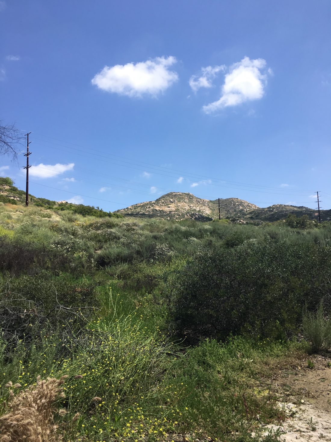
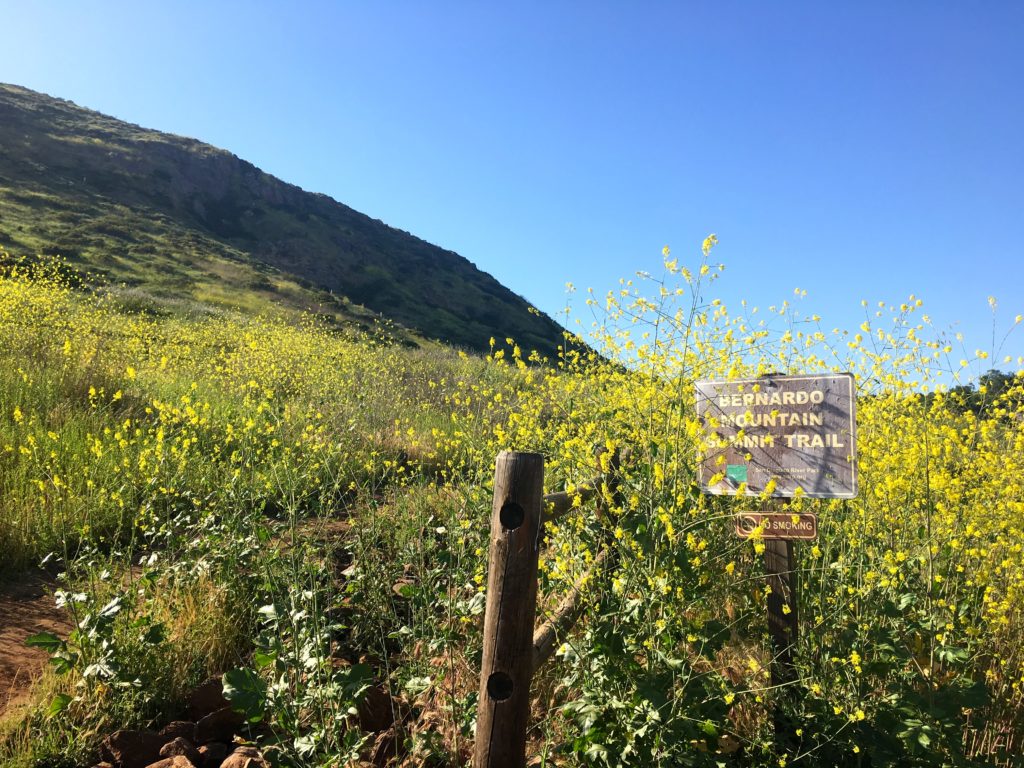
This is a great hike to save for the summer for a quick after-work summit. That is what I did. I had done this peak a few years previously after finding it in Afoot and Afield but decided to formally do it again. This peak is just south and east of the Target in Poway, so it was immediately recognizable to me. The trailhead is next to Silverset Park.
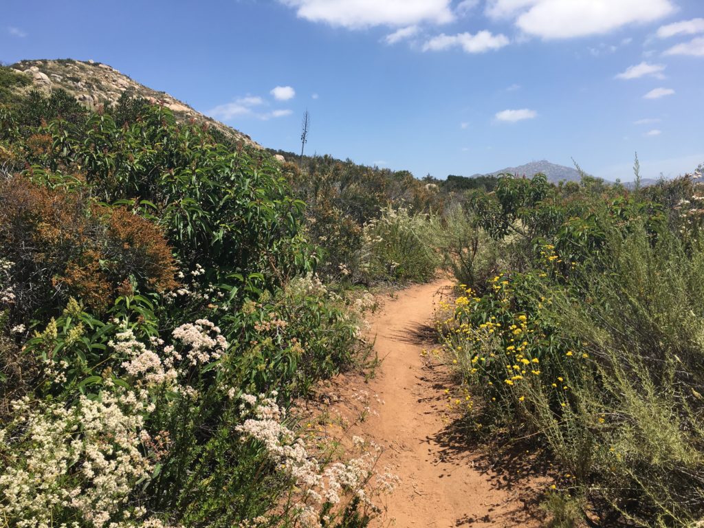
The trail works its way up to the summit with no real issues. It is a nice reminder of all the ‘hidden’ hikes and peaks that are tucked away in town.
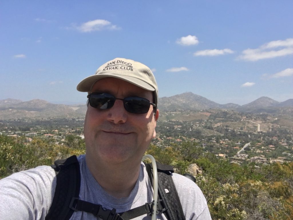
From the summit, you have some nice views of Poway and beyond. I opted to continue the loop, and head down the backside of the mountain. This route is a touch steeper and I am glad I had my hiking poles.
I am an avid peak bagger, sometimes backpacker, and former sea kayaker living in San Diego. I am the co-author of Urban Trails:San Diego, coming in Spring 2026!
In 2019, I became the third person to complete the San Diego 100 Peak Challenge. Not stopping with that accomplishment, I set my sights on the harder San Diego Sierra Club 100 Peak list, which I completed in 2021. In addition, I have conquered several Six-Pack of Peaks challenges (SoCal, San Diego, Central Coast, and both the Arizona-Winter and Arizona-Summer). I am looking forward to exploring new summits and new adventures across the southwest.
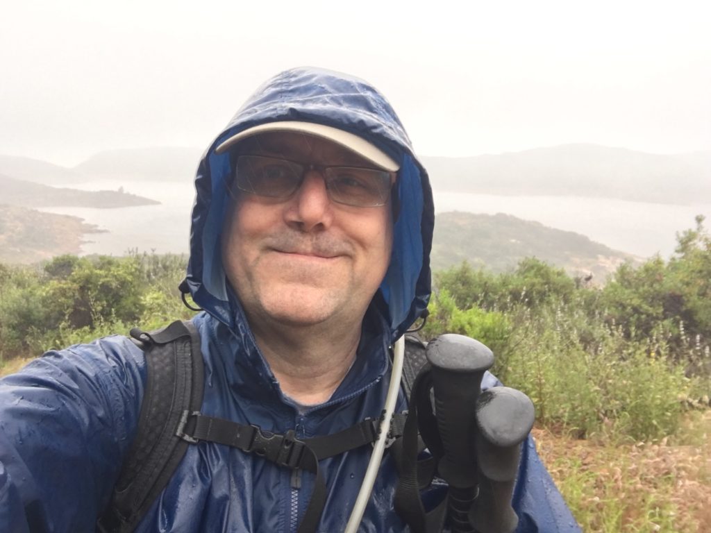
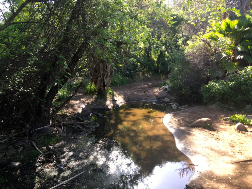
On a semi-rainy afternoon, I, along with a few friends decided to head out to Elfin Forest and hike up to Mount Israel. Parking in the main lot for the reserve, we crossed over the stream and began climbing up the Way Up Trail.
Once we reach the overlook to the Olivenhain reservoir, we continued on west to the summit. The rains held off, but the cloudy mists still made for a damp, but refreshing hike.
We headed back down the trail to the car, dried off, and headed home. Only later did I learn I missed the turn to the actual summit.
I am an avid peak bagger, sometimes backpacker, and former sea kayaker living in San Diego. I am the co-author of Urban Trails:San Diego, coming in Spring 2026!
In 2019, I became the third person to complete the San Diego 100 Peak Challenge. Not stopping with that accomplishment, I set my sights on the harder San Diego Sierra Club 100 Peak list, which I completed in 2021. In addition, I have conquered several Six-Pack of Peaks challenges (SoCal, San Diego, Central Coast, and both the Arizona-Winter and Arizona-Summer). I am looking forward to exploring new summits and new adventures across the southwest.
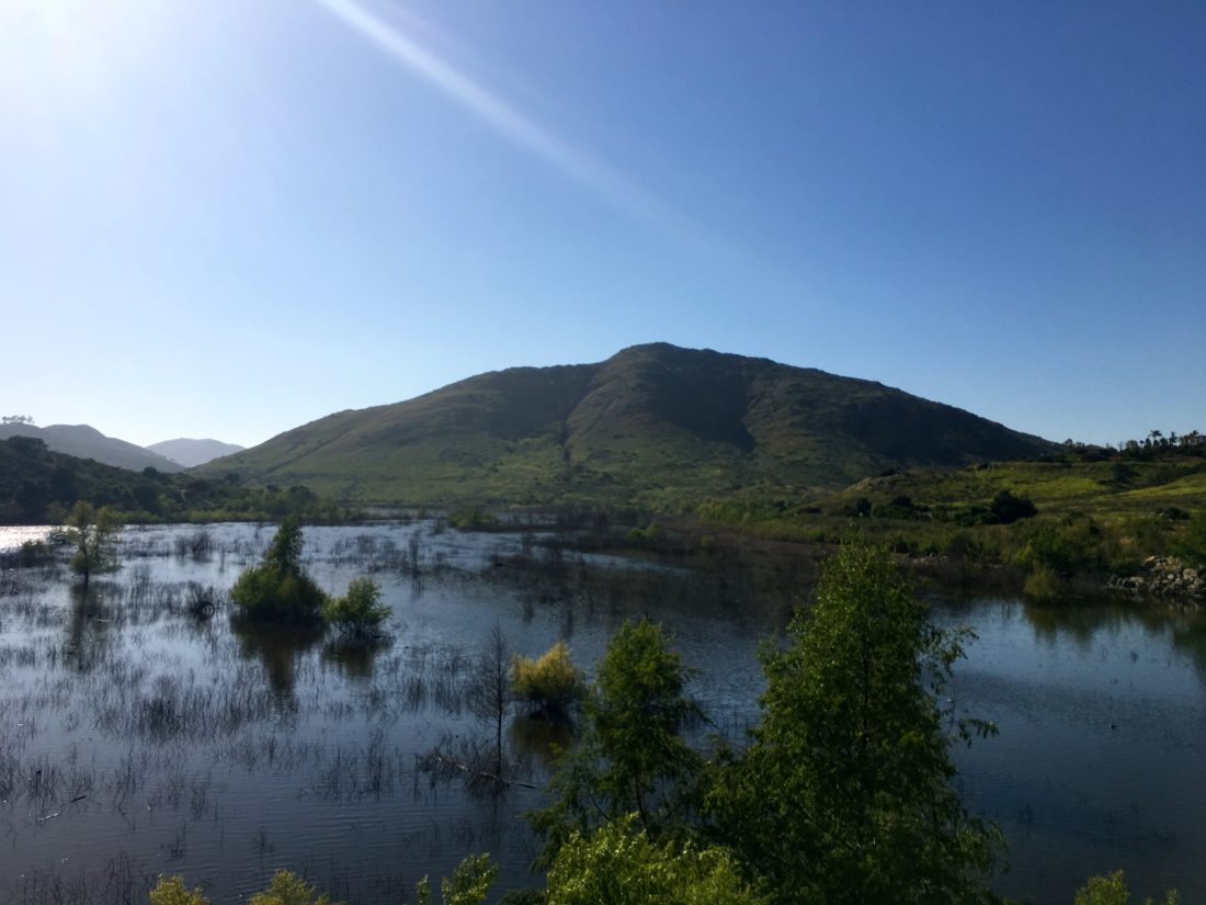
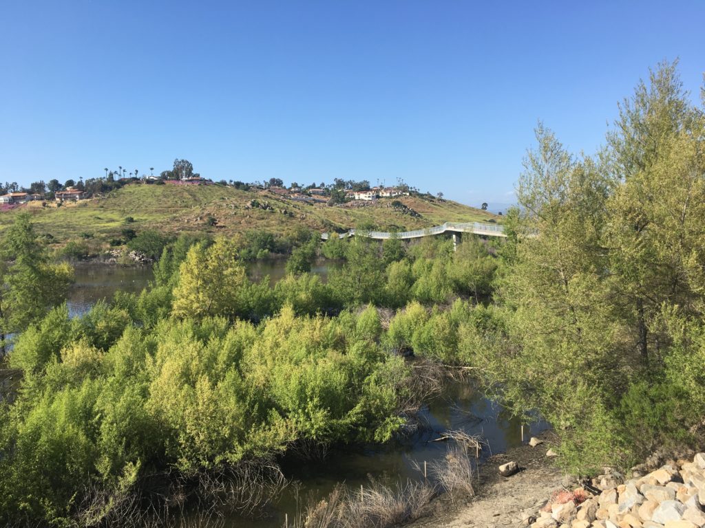
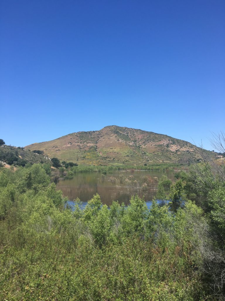
Standing over Lake Hodges is Bernardo Mountain. This became another of my new trails once I moved to Rancho Penasquitos. This is a great hike without the crowds that swarm to Iron Mountain or Mt. Woodson. Starting from the parking lot on West Bernardo Drive, you soon cross the beautiful bridge over the lake.
With any luck, there will be water at this end of the lake. Many years ago, I was kayaking on Mother’s Day (with the wife’s OK) and stopped under the I-15 to call my mother, just because.
The trail wraps around toward the west, crossing a small stream along the way.
On this portion of the trail, you will encounter mountain bikers and other folks using the trail. But once the trail to summit breaks off from the main path and turns north again and away from the lake, the number of folks you will encounter will drop off.
The trail begins its climb up the mountain from the northside. After a few steeper sections, you reach the summit.
As a bonus, this summit is one of the five portions of the San Dieguito River Valley Conservancy’s 2017 Coast to Crest Trail Challenge.
I am an avid peak bagger, sometimes backpacker, and former sea kayaker living in San Diego. I am the co-author of Urban Trails:San Diego, coming in Spring 2026!
In 2019, I became the third person to complete the San Diego 100 Peak Challenge. Not stopping with that accomplishment, I set my sights on the harder San Diego Sierra Club 100 Peak list, which I completed in 2021. In addition, I have conquered several Six-Pack of Peaks challenges (SoCal, San Diego, Central Coast, and both the Arizona-Winter and Arizona-Summer). I am looking forward to exploring new summits and new adventures across the southwest.
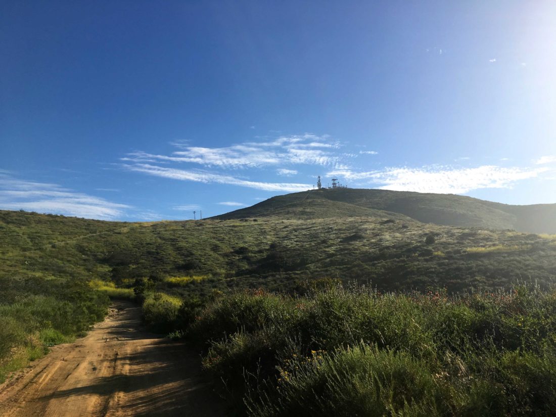
I can see this peak from my house. I have lost count of the number of times I have trekked to the top of this peak.
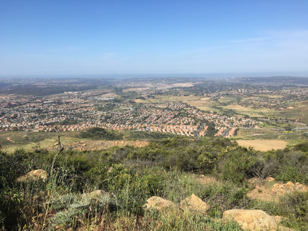
My two standard routes are either via the Nighthawk trail or via Miner’s Ridge. Either route is nice, both eventually intersect the access road to the summit. Miner’s Ridge is along the northeast side of the mountain so you can get some shade if you are hiking in the afternoon. The summit is home to a variety of communication towers, so the view is slightly obstructed. Regardless, it still offers a nice view of Carmel Valley and Del Mar to the west.
I am an avid peak bagger, sometimes backpacker, and former sea kayaker living in San Diego. I am the co-author of Urban Trails:San Diego, coming in Spring 2026!
In 2019, I became the third person to complete the San Diego 100 Peak Challenge. Not stopping with that accomplishment, I set my sights on the harder San Diego Sierra Club 100 Peak list, which I completed in 2021. In addition, I have conquered several Six-Pack of Peaks challenges (SoCal, San Diego, Central Coast, and both the Arizona-Winter and Arizona-Summer). I am looking forward to exploring new summits and new adventures across the southwest.
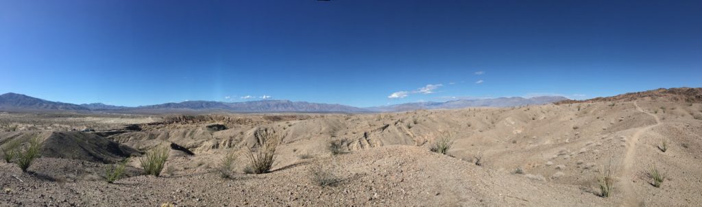
I had gotten the first 4 of the 5 hikes of the Anza-Borrego 5 for 50 Challenge done pretty quickly, but life kept getting in the way of finishing it. I was watching the temperatures start to rise out in the desert, plus it was desert flower season, meaning the park would be more crowded. My final hike was out to the Calcite Mine. I was able to drag Dave Myron along for this adventure. This was in another part of the park I had never explored, out east along the S-22. We pulled into a small turnout, as I did not want to attempt driving on Calcite Road.
We hiked along the road for about 2 miles, even with the early start, I could feel the heat. I had to take a short break in the shade to cool off. We explored the mine area. Just after the bombing of Pearl Harbor, this mine was established to extract optical-grade calcite for gun sights, the only mine of its kind in the US. The mine was short-lived, but the deep cuts in the earth are clear evidence of the operation. Bits of calcite can be found scattered around.
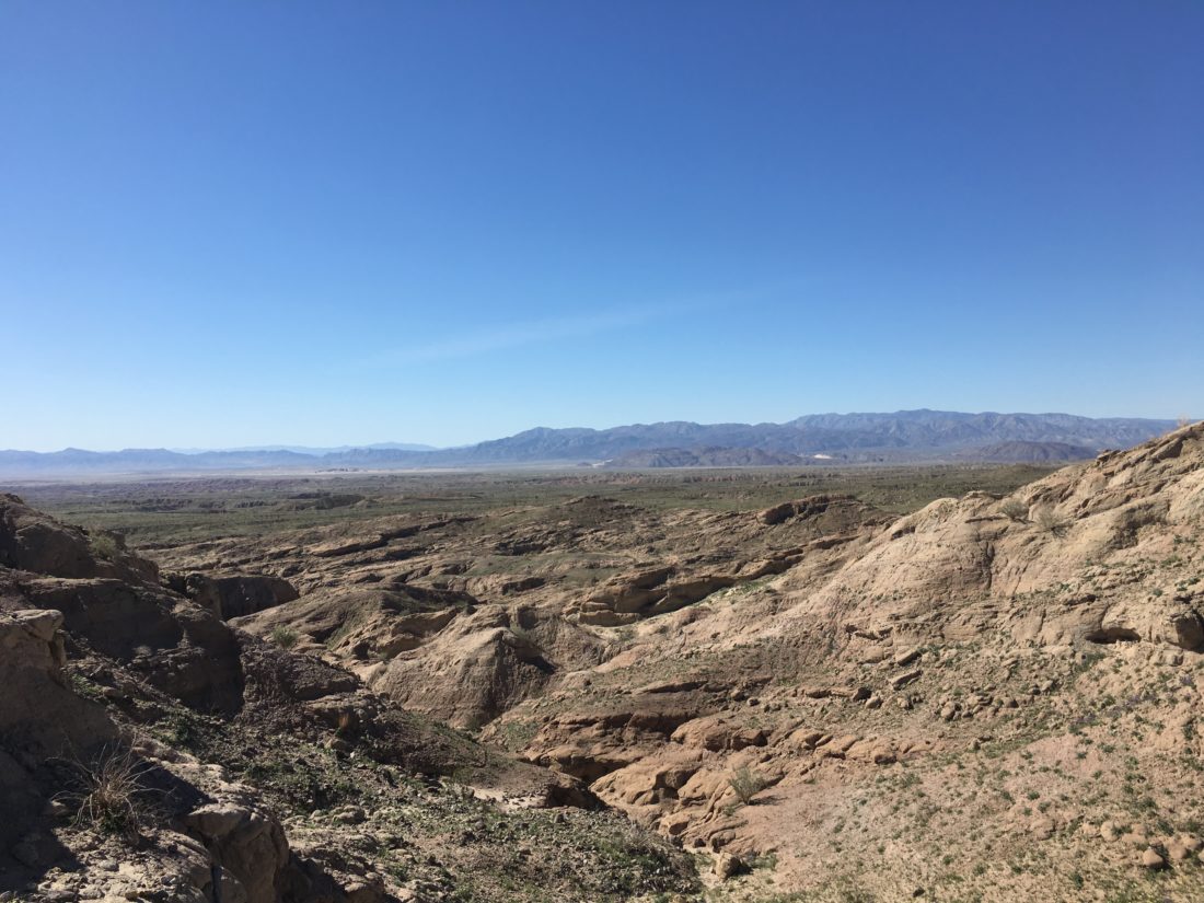
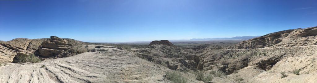
We headed back down, we opted to take the slot canyon that parallels the jeep road. I had seen the junction for it when we were heading up to the mine and assumed we would be able to spot it along the way back. Well, we missed it. We continued following the wash that the slot canyon had opened up into. Instead of heading south, the route was now veering eastward. Dave and I debated our options. We could go full cross-country toward the cell tower, which we could see and was near the car, continue in the wash, hoping it would turn to the south and road (which we knew ran east-west), or retrace our route.
This section of the wash is drivable, and when we had exited the canyon, a truck had pulled up and three hikers set off to explore it from the bottom. While Dave and I mulled our options, they were heading back out. I flagged them down and ask if they knew how much further down the road. They offered to give us a lift, so we hopped into the truck bed and motored out. It turns out, that this wash heads east for quite a while. Off-roaders will know it as Truckhaven Wash. Glad we opted for the lift. They took us back to that car and with that, the challenge was over. I certainly was humbled by this hike, and would learn to improve my research and navigation skills for any future trips (oh, little did I know…). These challenges had been fun, I wonder what other hiking challenges might exist…say what is this “100 Peaks Challenge“?
I am an avid peak bagger, sometimes backpacker, and former sea kayaker living in San Diego. I am the co-author of Urban Trails:San Diego, coming in Spring 2026!
In 2019, I became the third person to complete the San Diego 100 Peak Challenge. Not stopping with that accomplishment, I set my sights on the harder San Diego Sierra Club 100 Peak list, which I completed in 2021. In addition, I have conquered several Six-Pack of Peaks challenges (SoCal, San Diego, Central Coast, and both the Arizona-Winter and Arizona-Summer). I am looking forward to exploring new summits and new adventures across the southwest.
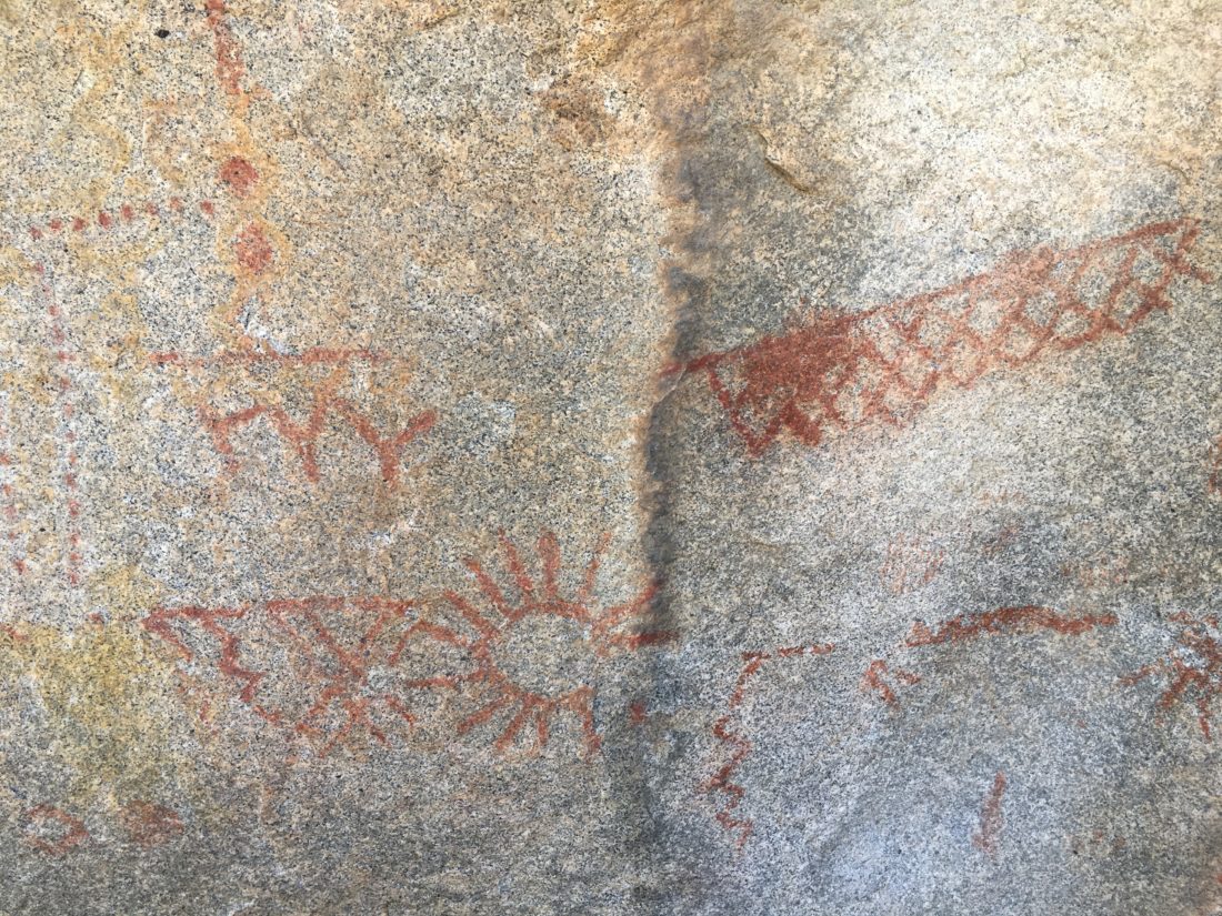
I had been out to the pictographs a few years earlier with my twins, so I was familiar with this hike. I drove along the dirt road to the trailhead. It was nicer to do this road in my Subaru rather than my Saturn. I parked at the trailhead and set off. The first half mile gains about 300 feet of elevation, so you get a bit of workout. Once you crest the rise, the trail begins sloping gently down. About .8 miles in, I came to the large boulder with several pictographs on it. These were made by the Kumeyaay, one of two main Native American groups that made their homes in Anza-Borrego and the surrounding regions.
I decided since I did not have to worry about my twins this time, I would continue to the Smuggler Canyon overlook. From here I was rewarded with a fantastic view of the Vallecito Valley. I retraced my route and was back at the car, ready to call it a day. One more hike to do and this challenge was complete!
I am an avid peak bagger, sometimes backpacker, and former sea kayaker living in San Diego. I am the co-author of Urban Trails:San Diego, coming in Spring 2026!
In 2019, I became the third person to complete the San Diego 100 Peak Challenge. Not stopping with that accomplishment, I set my sights on the harder San Diego Sierra Club 100 Peak list, which I completed in 2021. In addition, I have conquered several Six-Pack of Peaks challenges (SoCal, San Diego, Central Coast, and both the Arizona-Winter and Arizona-Summer). I am looking forward to exploring new summits and new adventures across the southwest.
I had been getting bored with sea kayaking of late. As much as I love the smell of the ocean, and the lap of water against my boat, paddling in the same waters, again and again, was becoming monotonous. So, I decided to spend a bit more time on the trails. In the early part of 2017, I stumbled on the Anza-Borrego 5 for 50 Challenge. The Anza-Borrego Foundation was celebrating its 50th anniversary by inviting folks to complete 5 hikes throughout the park. So I laced up my boots and headed out. I was able to convince a few friends to tag along for some of them.
I then began looking through my worn copy of Afoot and Afield in San Diego for new places to explore. It was then I learned about Derek’s 100 Peak Challenge. So now armed with a completely insane opportunity, I set out to see what I could accomplish. Now, the ‘official’ challenge is supposed to be in a calendar year, but I am opting to see what I can complete within 365 days (give or take). Plus, some 30+ hikes are all located in Anza-Borrego, so when I started this adventure, the heat made this highly prohibitive. My initial goal was to hit 50 by year’s end (Spoiler: I did ). I am going to use this blog, to serve as my hiking register for this challenge. So, lace up the boots, grab your poles and let’s summit a peak!
Having finished the Mission Trails 5 Peak Challenge, I discovered that the Anza-Borrego Foundation was conducting their own hiking challenge in celebration of their 50th Anniversary. Just like the MTRP Challenge, it is a series of 5 unique hikes, each requiring a selfie at a particular spot along each hike. So off to Anza-Borrego I go (oh, if I only knew what truly lay ahead for me…)
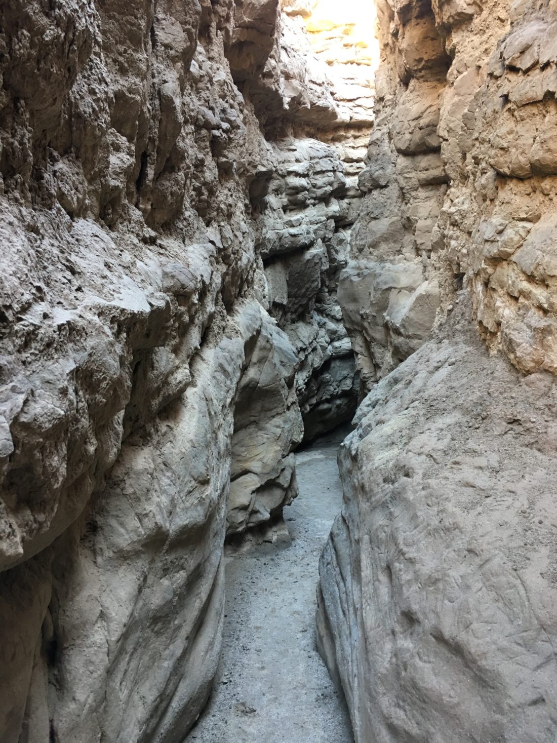
For the first hike of this challenge, I opted to go do The Slot at Borrego Mountain. I convinced Mark Better to tag along for this adventure. We found the turnoff from the highway and on to the dirt road. The car seemed a bit loose in the dirt. As we pulled into the trailhead, I discovered why, a flat rear tire. I had a spare and being such a popular trail, I was not worried about being stranded. Since it was early, why not go do the easy 1.5 or so miles through the Slot. We can deal with the tire when we get back.
With Borrego Mountain West Butte rising off to the east, we started along the trail, rising up from the parking area. Soon, the trail dips down into the canyon. Quickly we found ourselves working our way through the narrow canyon. Passing under the fallen rock, we enjoyed twisting and turning along the route. After about 3/4 mile, the canyon opened up, we hiked a bit before turning around and retracing our route.
Once back at the car, we addressed the issue of the flat tire. With a bit of digging and proper leverage, we were able to take care of changing the tire. We headed into Borrego Springs for lunch, and then the second of the planned hikes, the Borrego Palm Canyon Nature Trail.
I am an avid peak bagger, sometimes backpacker, and former sea kayaker living in San Diego. I am the co-author of Urban Trails:San Diego, coming in Spring 2026!
In 2019, I became the third person to complete the San Diego 100 Peak Challenge. Not stopping with that accomplishment, I set my sights on the harder San Diego Sierra Club 100 Peak list, which I completed in 2021. In addition, I have conquered several Six-Pack of Peaks challenges (SoCal, San Diego, Central Coast, and both the Arizona-Winter and Arizona-Summer). I am looking forward to exploring new summits and new adventures across the southwest.
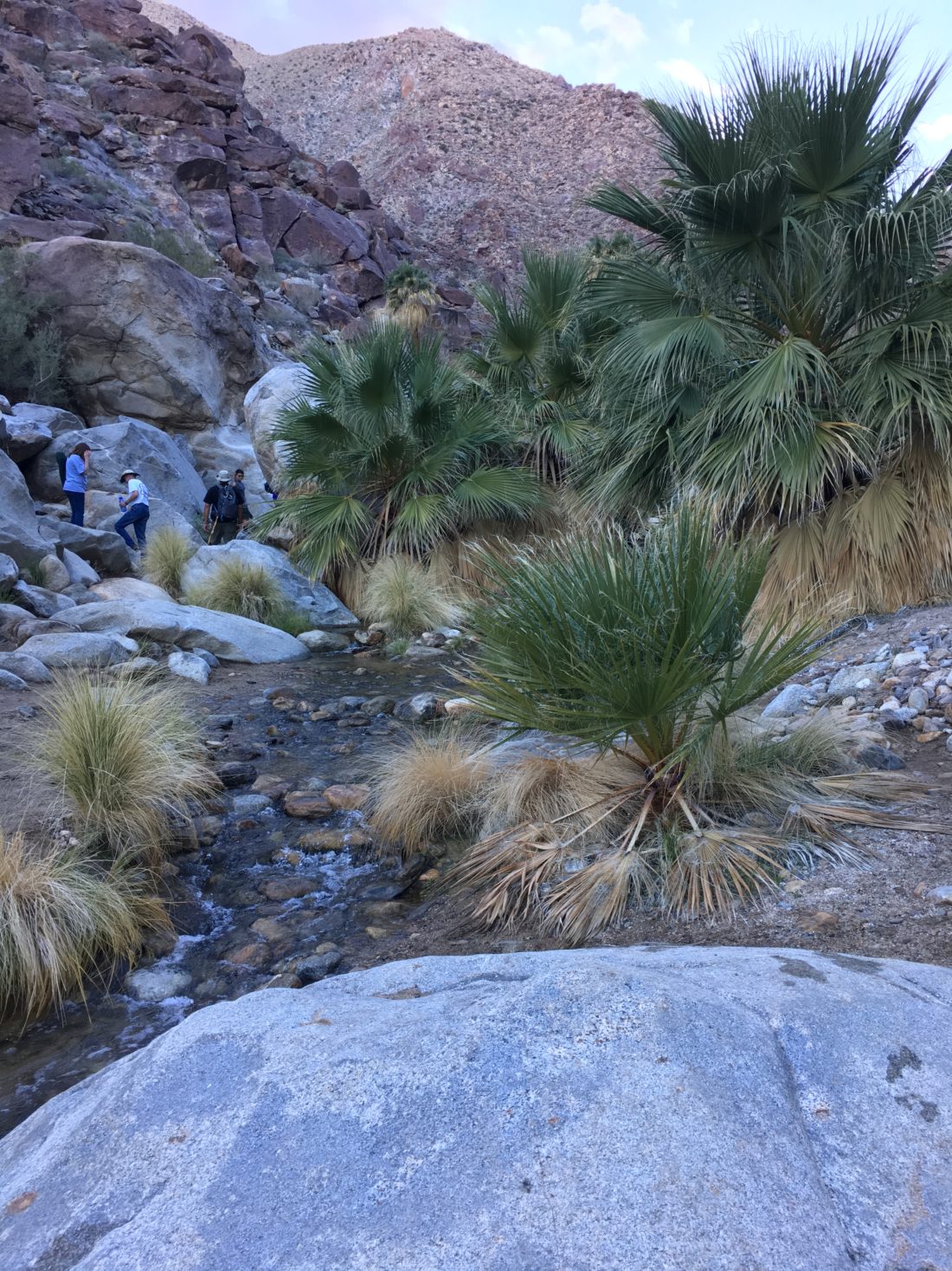
After grabbing a burrito in Borrego Springs, we headed to the Borrego Palm Canyon Nature Trail. We paid our $ 10-day use fee and pulled into the parking lot for the trail. Mark had never visited the Palm grove at the end of the trail, so I knew this was going to be another treat.
This is one of the most popular hikes in all of Anza-Borrego, so it follows a well-worn and marked trail. You can grab a pamphlet that will describe the various markers along the way. Since it was January, water was still flowing from out of the canyon, quite a treat to have to cross a running stream in the desert.
After about 1.5 miles, we reached the grove. Mark did have to be back in town, so we did not spend too long exploring. After the fire in 2020, it was nice to have seen them in their full glory. On the way back from the grove, we opted to take the alternate trail back, in part for fewer hikers and to see more of the park. Once back at the trailhead we headed home. Two of the five were completed!
I am an avid peak bagger, sometimes backpacker, and former sea kayaker living in San Diego. I am the co-author of Urban Trails:San Diego, coming in Spring 2026!
In 2019, I became the third person to complete the San Diego 100 Peak Challenge. Not stopping with that accomplishment, I set my sights on the harder San Diego Sierra Club 100 Peak list, which I completed in 2021. In addition, I have conquered several Six-Pack of Peaks challenges (SoCal, San Diego, Central Coast, and both the Arizona-Winter and Arizona-Summer). I am looking forward to exploring new summits and new adventures across the southwest.