With so many trails overrun with hikers, I have been combing various peak lists for off-the-beaten-track adventures. One of these lists is the San Diego Peak Club List. This list serves as the foundation for the San Diego Sierra Club. Thankfully, there were a couple of peaks that weren’t out in Anza-Borrego that looked interesting; Margarita Lookout and Margarita Peak.
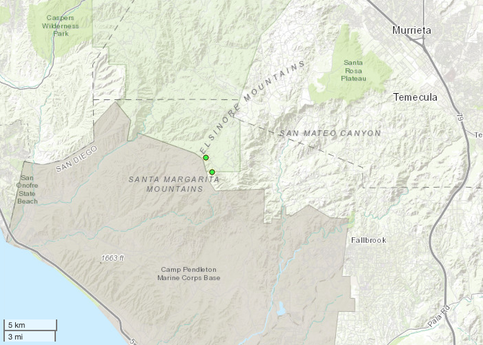
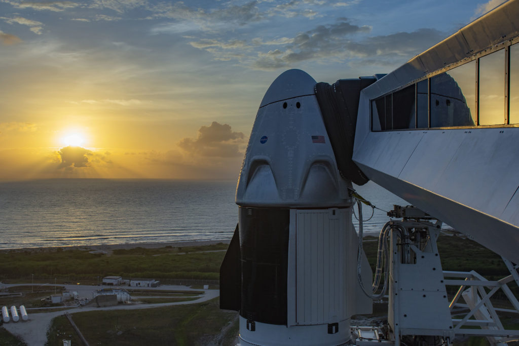
These two are located north of Fallbrook, right on the border with Camp Pendleton. I pulled into the trailhead for Sylvan Meadows to watch the actual docking of the Crew Dragon “Endeavour” with the ISS. Once they had successfully docked, I headed out to the trailhead.
Now, I had already saved the location in Google Maps, as the route can get a bit confusing according to the trip reports on Peakbagger. But something went sideways. As I drove down the roads, I soon found myself passing Rock Mountain and the Santa Margarita river! What??? For some reason, Google Maps wanted to take me to Fallbrook. I finally convinced it to take me to the proper location. Thankfully, I only lost an hour and the hikes weren’t going to be too long. Finally, the paved road ended and the dirt road began. For the most part, this road is fully drivable by a standard car, like a Mini Cooper. But you might need a car wash afterward. After about 30 minutes on the dirt, I reached the shared trailhead for Margarita Lookout and Margarita Peak. There is a nice wide turnout, so no worries about parking.
From the reports, Margarita Lookout was going to be just under 5 miles round trip, but the elevation profile was easier. The hike to the summit of Margarita Peak was only about 1.6 miles, but a steep climb. Since I had done El Cajon on Friday, I opted for the easier one first. For much of the hike, you continue to follow the same forest road. In fact, I could have kept driving on it almost to the summit, but where is the sport in that?


Some wildflowers dotted the sides of the road. The road eventually reached a turn out for the final push to the summit. Here the trail got a bit rocky. Soon the flag at the summit was fully in view.


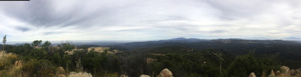
There isn’t a real benchmark, but a block of concrete was stamped with “1964” on it. A few remnants of the tower remained. I could spy so many familiar peaks; San Gorgonio, San Jacinto, Palomar, and even Cuyamaca off in the distance. I signed the register and headed back down.
I heard the din of a motorcycle, and when I reached the road again, two riders were just turning around from riding up. I let their dust settle before cruising back to the car.
From my good friend Gina Norte, got some information on the history of this place: The original Fire Lookout Tower was built in 1935 by the Civilian Conservation Corps and was replaced in 1965 and a cabin was added. In 1986 a wildfire burned both structures and in 1988 the tower remains were destroyed in a collision with a Marine Corps CH-46E helicopter. The site of the old tower lies one mile north of Margarita Peak and 100 yards from Camp Pendleton.


I am an avid peak bagger, sometimes backpacker, and former sea kayaker living in San Diego. In 2019, I became the third person to complete the San Diego 100 Peak Challenge. Not stopping with that accomplishment, I set my sights on the harder San Diego Sierra Club 100 Peak list, which I completed in 2021. In addition, I have conquered several Six-Pack of Peaks challenges (SoCal, San Diego, Central Coast, and Arizona-Winter). Beyond attempting the San Diego Sierra Club 100 Peak list a second time, I am looking forward to exploring new summits and new adventures across the southwest.
My wife was a fire lookout there in 1980 . She roads here horse to work there from the sky ranch where we lived. I worked at the Tenaja forest service fire station and it is torn down I think there is a sign there. Good times the valley lived off grid and a CB radio was our communication with the world.