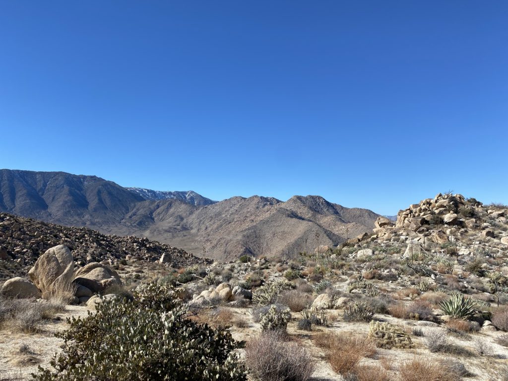
Whenever you talk to someone about the San Diego Sierra Club 100 Peak list, two peaks are always referenced as the hardest on the list – Red Top and Sawtooth Mountains High Point. In fact, my hiking buddy Matt Hannan referred to them as “Fun and Funner”. As I scoured over trip reports, reading of failed attempts to summit the pair, I knew that I truly had a mountain to climb. One of the challenges for these peaks is their remoteness compared to the rest of the peaks. While some might require some serious 4×4 driving to reach the trailhead, these peaks sit tucked within an area of Anza-Borrego known as the Inner Pasture. There are no accessible roads that can take you to the base of the mountain, so you are first going to have to hike in. There are three routes others have used in the past. One route begins in McCain Valley and descends down Pepperwood Canyon before reaching the Inner Pasture and the south face of the mountain. While the length of this route is not too bad, it does mean you have to climb back up the canyon after the summits. Another route climbers have used is to drive down Indian Gorge road, hike over a rocky pass, then onto the Inner Pasture. While this route does not have the big climb like the Pepperwood route, the crossing of the rocky pass twice (usually in the dark) is not fun either. The ascent up the peaks is usually the same south face as Pepperwood’s. The third option is to approach it from the north. This is an even longer route, but the hike to the base of the mountain is an easy one, through a nice canyon for about 3 miles, then across the flat Inner Pasture for another 3+ miles. Susie Kara and Matt Bennett had used this route last year with success. Now, a lot of climbers attempt these peaks as a long day hike, but some have started to treat them as an overnight trip. This was what Matt and Susie did, and I decided to follow their example for my attempt.
In addition to choosing a route, there is a very limited window in which you can try to summit these peaks. You need enough daylight to safely climb them, and also since they are relatively low, the desert heat becomes a factor as well. Mid to late February is usually the best choice. So, we began targeting the weekend of the 19th through the 21st for our attempt. My usual hiking companion Ted Markus was up for the challenge, as well as Susie and Matt. In addition, Greg Gerlach was up for trying this route as well. He had done these peaks three times before, once via Pepperwood and twice via Indian Gorge. He was curious to see if it was ‘easier’ with the third route. He also agreed to spend a second night and camp with us. We had a rock star team assembled, and I could not have asked for a better group of climbers to go with.
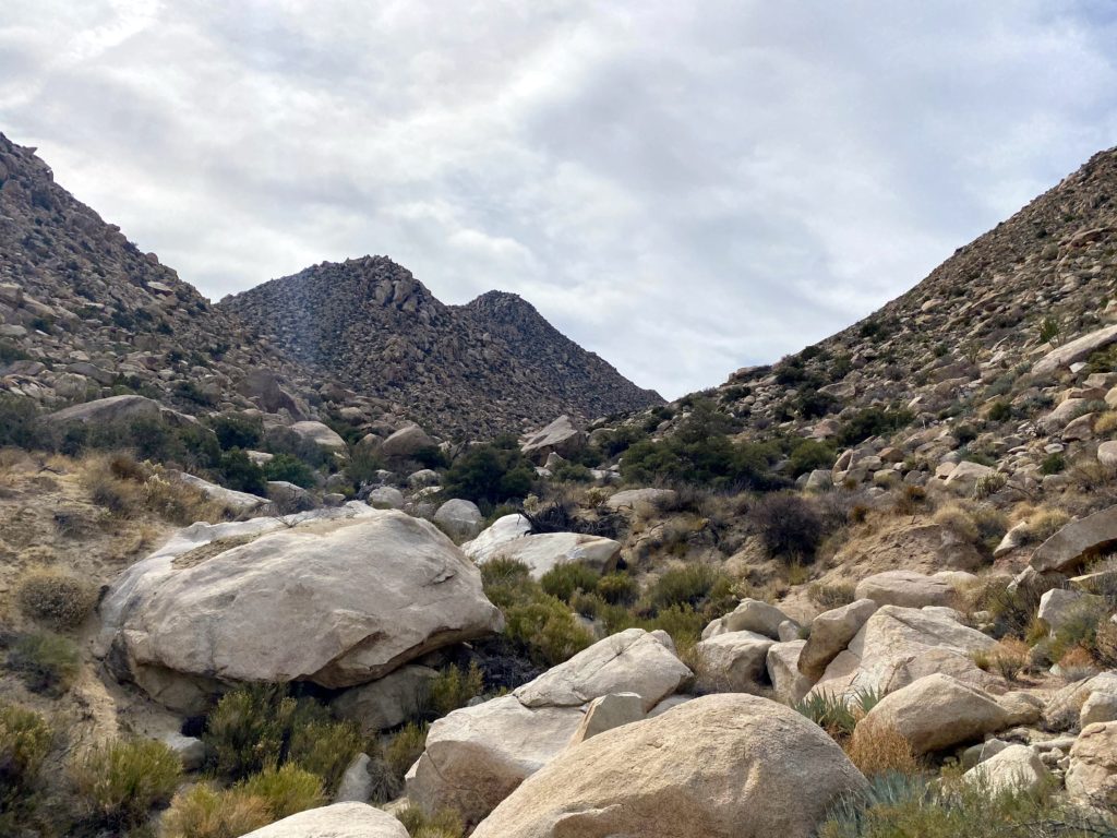
Since Ted and I were camping for two nights, we needed a bit more water than the 7 liters Susie and Matt used for the first trip. Rather than carry all that weight out at once, the previous weekend Ted and I made the 14-mile round trip hike to our planned campsite and cached about 10 liters between us. This also gave us an opportunity to see the start of the climb up close, as well as the crossing of the Inner Pasture. I was familiar with the canyon section, as it is the same route one uses to climb Stage Benchmark.
We met Greg at the small turnout that we would use near the entrance to the unnamed canyon. We hoisted our packs onto our backs and set off. Ted certainly won the award for the biggest pack load. Although I had 4 liters cached, I still carried out almost 5 more liters. Matt and Susie were planning to join us later in the day. We wanted to take the hike out nice and slow – no need to race to the campsite. Since I am not an experienced backpacker, I did want to give myself enough time to set up camp in daylight.


The miles ticked off fairly quickly, with Ted & I stopping twice for a quick break. We wound up heading basically straight for the entrance to the drainage where we would camp. Not really a problem, but we had hoped to use the wash that we followed out the previous weekend. Oh well. Regardless, we still made the nearly 7 miles in 3:15 with fully loaded packs.
Once at the campsite, we dropped our packs and went off to recover our caches. There was a little bit of me hoping they were gone and I would not have to climb these monsters. But the bottles of water were safely recovered. No excuses now…


We set up our tents, keeping ourselves safely apart. Plus, no one needs to hear me snore. Matt and Susie came just as the sun was dipping below the ridgeline. We all chatted for a while, made our dinners, and agreed on waking up around 5:30 to set off by 6:30. As I lay in my tent, I went over the route in my head, recalling the satellite imagery to help as landmarks. While I knew Matt would be our guide for this hike, I still needed to take responsibility for my own safety if I needed to navigate for whatever reason.


A quarter moon lit up the night sky as I lay in my tent trying to fall asleep. My mind kept going over the challenge of tomorrow’s hike. Sleep did come, although fitfully. I woke to the predawn glow and quickly boiled some water for a hot cup of coffee. I had packed my slackpack the night before, so I was basically ready to go. We all were soon up and getting ready for a long day. We could see the sunlight begin to illuminate the summit of Red Top. To the north, the sun’s rays cast a golden glow across the Inner Pasture as I ate my breakfast.


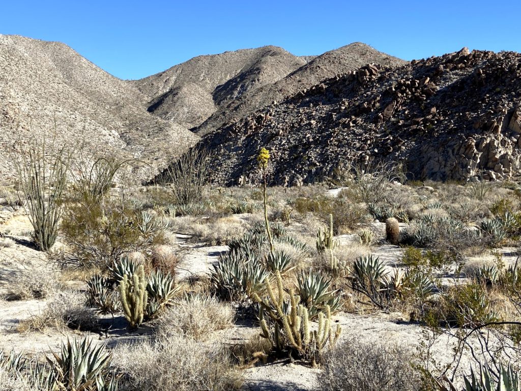
The plan was to ascend up the drainage to the saddle between Red Top and Sawtooth, climb Red Top, which is usually considered the harder of the two, return back to the saddle and climb up Sawtooth, then return back down to the saddle and follow the drainage back to camp. I put all my remaining gear in the tent for safety and to give it some extra weight as the forecast had some winds predicted. The temperature was forecast to be in the low 60s, so I dressed fairly light. I had on one extra top layer, as we would be in the shade of the drainage for a while and it was in the mid-40s when we set off. That is another reason this route has some appeal – the fact you will be in the shade for some time while hiking.


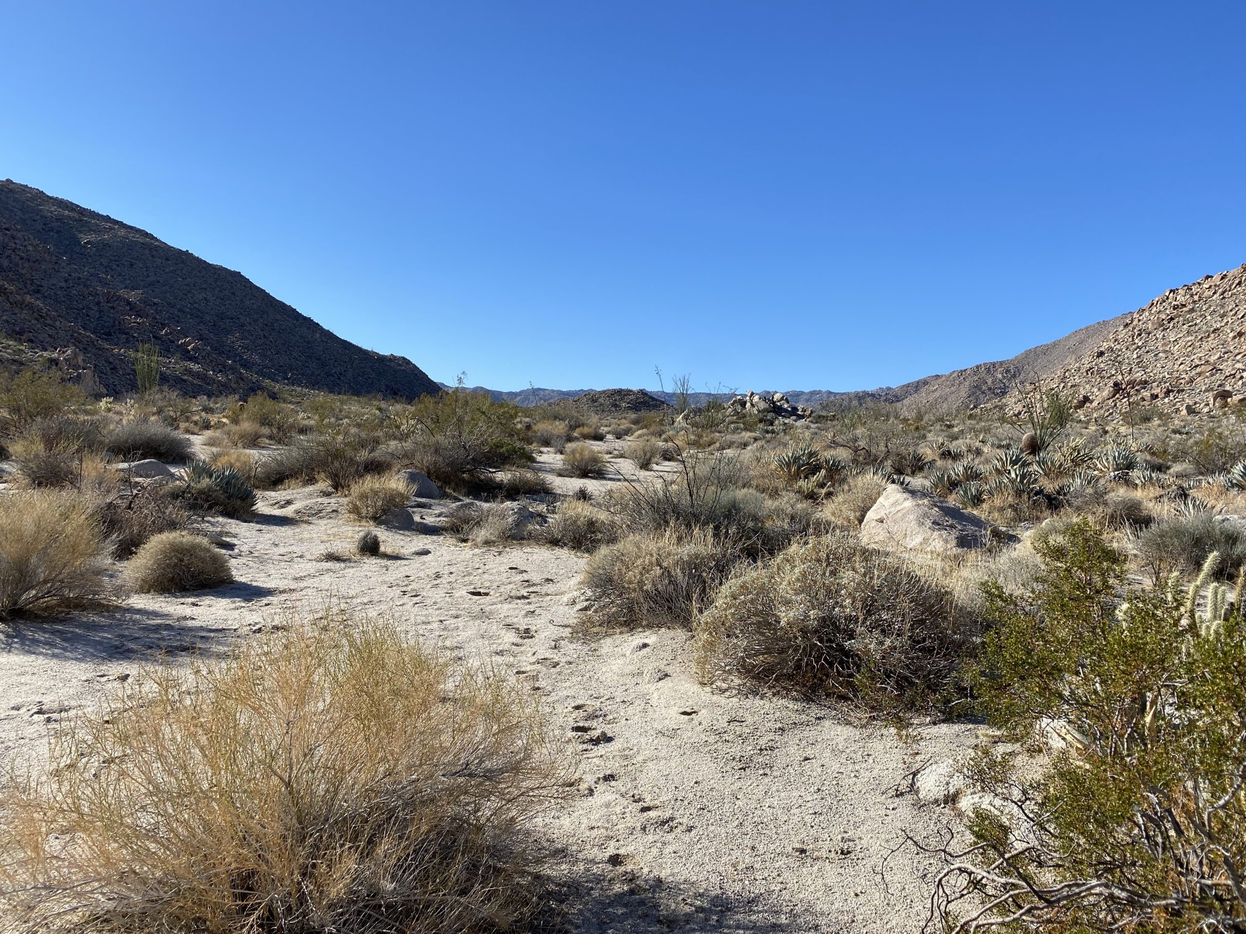
With Matt in the lead, we set off up the drainage toward the saddle. Our route was a mixture of sand, rocks, brush, and cacti, and it took some effort and looking ahead at the route to find the easiest path. After about an hour, we took a short break and shed a layer.


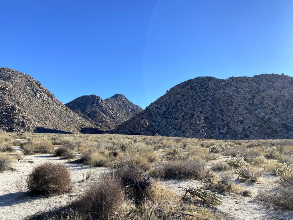
Soon, the summit of Sawtooth also came into view to the south as we drew nearer to the saddle. It was clear to see why these peaks are so difficult – their slopes are nothing but a jumble of boulders and brush. There is no easy ridge line to follow, just a combination of your route-finding skill and a dash of luck.


Once at the saddle, we took an extended break. It had taken us just slightly over 2 hours to cover the 1.8 miles with about 1,200 feet of gain. We cached some water for later under the shade of a large boulder, as there was no sense in hauling it up and down Red Top.


We could see the summit from the saddle and I put my trust in Matt to find a way through what seemed an impossible climb. About halfway up, we reached a small plateau, which let us have a short breather, as the next section increased in difficulty. We stored our trekking poles, as the climb now required the use of our hands. As we worked our way up, the views to the southeast were spectacular. Finally, after an hour and a half to cover the ¾ of a mile with over 800 feet of gain, we were at the summit of Red Top.


We mostly hung out in the cave at the summit, enjoying some snacks, signing the register, etc. This was Greg’s fourth time on Red Top, he commented that was the easiest route he had ever had up from the saddle. We still had a long day ahead of us, however. At the summit, I discovered that I had lost one of my trekking poles during the ascent. They had gotten snagged on some brush at one point and it must have pulled the pole out of my pack. Crud! Hopefully, we would be able to retrace our route and find it, otherwise, I would have issues. I had also noticed the possible formation of a blister on the tip of one of my toes. Yup, a blister had formed. I took care of it, hoping it would not impede me. From the summit, we could see our next peak. There is just over a mile between the two summits, but it would take us almost three hours to cover it (including another break back at the saddle). That should give you an idea of the difficulty of these peaks.
We set back down toward the saddle, and sure enough, Matt spotted my missing pole. That tree must be related to Charlie Brown’s Kite Eating Tree! I was glad to have it back. My usual hiking pack has straps for my trekking poles so they would have been secured, but alas this pack does not. Something to address the next time I use that pack.


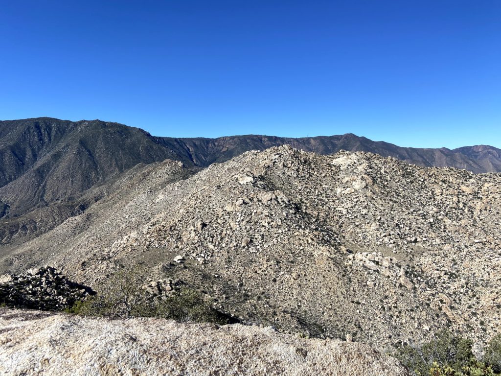
The breeze had started to pick up, which was fine, as we would no longer have any shade for a while. We gathered our cached fluids, had a nice snack, and reviewed the basic route that we were going to take up toward Sawtooth. Unlike Red Top, which is basically a direct approach, Sawtooth requires bypassing a peaklet. On the ascent, we stayed on the south side of it. This certainly took some care to navigate through the boulders. In addition, portions of this climb are sandy, but not like you would know by looking. If you have ever climbed up a steep sandy slope you will know that it is hard and draining. I started to feel my energy dropping as I made my way slowly up. Matt scampered back down to me and offered to carry some of my pack items to lighten the load. It wasn’t much, but enough to help me along.


I would look at the map on my phone, and see that we were closing in on the summit. I could almost taste it. When I arranged this attempt, I let the group know that if I ran into issues or was too slow, I would abandon trying for Sawtooth. Now, though, the summit was just a few hundred feet away. We came up the south side, and just as we did the winds began to roar. Those 40 mph gusts that were predicted came true. Carefully crossing an exposed section, Ted and I sat atop the south side of Sawtooth. I was in a bit of a daze. I had done it! The reality didn’t hit me until the next day, and in part, I knew that right now, I still needed to get down from the peak. We had a snack and I proudly signed the register. Since we had cell service, I texted my family the good news. Once we had recovered a bit, we clambered over some more exposed boulders to the northern side of the summit. Susie had kindly signed us in on the register located there, as neither of us wanted to scramble up.


Matt took us down a slightly different route from the summit, in part to see if we could avoid the troubles we had on the south side of the peaklet. So, we worked our way around the northside, and overall it was a better choice. Again, a HUGE thank you to Matt and his talents. Once back at the saddle, we took another break under the shade of a large boulder. Since Susie and Matt had hoped to hike out that evening, they bid adieu and they set off down the drainage. Greg, Ted, and I began our descent. Our route finding was pretty good, we would stop and readjust our track from what we recorded on our ascent, but nothing critical. Our only real issue was Ted hit his head on a boulder and had a small scrape that he had to attend to.


The sun dipped below the ridgeline as we drew nearer to camp, but we knew that we were almost done so we had no worries. When we arrived, we discovered that the wind had blown over my tent and moved Ted’s as well. There was no damage to either (except Ted did lose a tent stake). Once we had restored our tents, I quickly ate my dinner and called it a night, as did Greg and Ted. I was spent from the day. That was the hardest hike I have ever done to date. Palm and Elder were a close second, but these two peaks beat them. The stats for the day were 6.6 miles in 10:50 hours with 2738 feet of gain. If I ever revisit these peaks, I will do them as single peaks. In part, I would like to enjoy the summits more and not worry about the other summit.


We woke around 6 the next morning and started to break camp. While enjoying my morning coffee, I started to feel prouder about my summits. I knew it was still going to take a few days to fully process it. We enjoyed how much lighter our packs were without all the water and food we carried in. We set off just after 7 back toward the cars, and this time we did find the wash we used last week, making some great time crossing the Inner Pasture. We reflected on yesterday’s hike, and Greg commented that he felt the south approach is still slightly better. The primary reason is the easier exit off of Sawtooth.


On the way out, we encountered two hikers headed out to attempt Red Top. They were going to use the south approach, so they had quite a hike across the Inner Pasture. We asked about what their water load was, and they replied 4 gallons. Yikes! That is a lot of weight. They also planned to camp and attempt it the next day. We wished them luck and parted ways.
Once back at the car, we changed out of our hiking clothes into some clean clothes. Greg said goodbye and to keep him in the loop for my final hikes. Ted and I then drove a few minutes to the Agua Caliente Store and bought some well-earned ice cream sandwiches for a second breakfast. Over the three days, we hiked nearly 20 miles.
Now onto the final three!


I am an avid peak bagger, sometimes backpacker, and former sea kayaker living in San Diego. In 2019, I became the third person to complete the San Diego 100 Peak Challenge. Not stopping with that accomplishment, I set my sights on the harder San Diego Sierra Club 100 Peak list, which I completed in 2021. In addition, I have conquered several Six-Pack of Peaks challenges (SoCal, San Diego, Central Coast, and Arizona-Winter). Beyond attempting the San Diego Sierra Club 100 Peak list a second time, I am looking forward to exploring new summits and new adventures across the southwest.