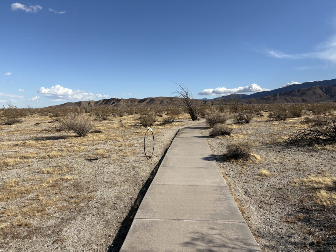
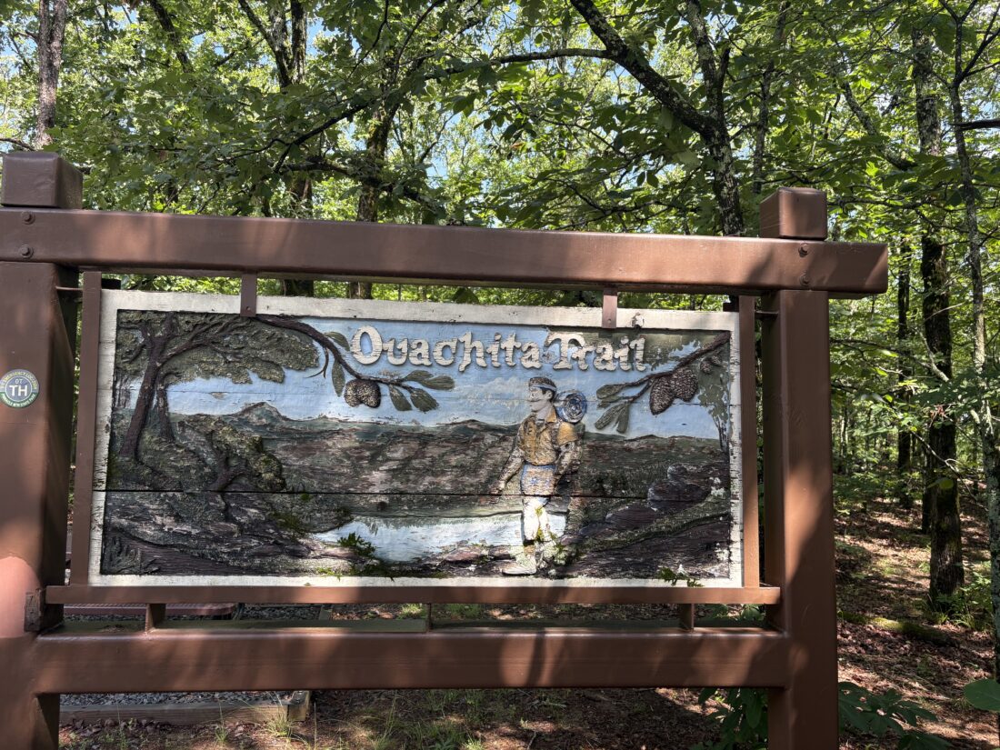
Early morning in Alamo Canyon

After finishing up my hikes that afternoon, it was time to head over to my campsite. I had secured one of the four sites at the Alamo Canyon Primitive Campground. Finding the site was not easy, as I drove right by the turn-off and had to double back to make the 3-mile drive down the dirt road. I pulled into my spot and quickly got to setting up my Luno Mattress. I could not find the nozzle for the compressor, so I had to hold it carefully to each valve to inflate them. I found the nozzle the next morning when packing up, under the folded back seat. How it got there is a mystery. I opted to bring a sandwich for dinner and skip a dehydrated meal or the hassle of any real cooking. I sat and watched an incredible sunset, and actually ran around looking for some nice saguaro to frame in the fading light. Organ Pipe Cactus National Monument does not allow campfires, so when the darkness comes, it comes. Soon, Orion came into view, low in the western skies. I spent some time working on my astrophotography. I am slowly understanding AstroShader, the app I use for these experiments. Shortly, the effort of the two hikes and the drive told me it was time to crawl into my car and get some sleep.

Around 4 am, I woke up and decided to crawl out and grab a few more photos, as the Milky Way was now visible in the night sky. I slept for a couple more hours before the morning light crept through the window. I made a simple breakfast of oatmeal before heading out to hike the Alamo Canyon Trail. I was technically 0.12 miles shy of the required 5 miles to earn that “I hiked the green desert” pin. This 1.8 round trip trail is fairly flat, so those miles wouldn’t be an issue, and there is an old house and corral to be seen along the trail as well.

The trail worked its way along the north side of the wash, passing a variety of cacti, including some Organ Pipe Cactus. The morning light offered some great photos. I came to the old house first and poked around it some, but I was on a bit of a timetable. I crossed through the wash and quickly reached the corral. I snapped a few photos and began to retrace my route. There in the wash was the rusted remains of the engine that must have been the pump to pull the water from the wash to the storage troughs. Soon, I spied the end of the trail and the end of my adventures in Organ Pipe Cactus National Monument. I changed out of my hiking gear and drove back to the visitor center to obtain my pin. Now for the 2 1/2 hour drive to Tucson for the rest of my Arizona adventure.


Buy Me a Coffee at ko-fi.com

I am an avid peak bagger, sometimes backpacker, and former sea kayaker living in San Diego. I am the co-author of Urban Trails: San Diego, coming in Spring 2026!

In 2019, I became the third person to complete the San Diego 100 Peak Challenge. Not stopping with that accomplishment, I set my sights on the harder San Diego Sierra Club 100 Peak list, which I completed in 2021. In addition, I have conquered several Six-Pack of Peaks challenges (SoCal, San Diego, Central Coast, and both the Arizona-Winter and Arizona-Summer).

I am looking forward to exploring new summits and new adventures across the southwest. 

Hiking the Canyon Oak Trail

My wife and I drove up to William Heise County Park to attend a hosted star gazing event later that evening. After paying the $5 day-use fee, we parked near the meadow. Anita and our dog, Rocky, hung out there while I set off for a short hike. I originally was going to hike the Desert View Trail, but I was feeling the double whammy of my hike earlier in the day and the drive back up to Julian. So, instead, I opted to do the Canyon Oak Loop instead.

The 1.6-mile trail works its way up the nearby slopes to the northeast part of the park. I had some lovely views along the loop. Some high clouds were rolling in, and I hoped they cleared before the skies turned dark. Along the way, a couple of benches had been installed for those who might want a breather or to soak in the views. I made my way back down, taking the alternate trail to the campground.

Back at the meadow, Anita and I enjoyed a nice picnic dinner before wandering up to where the telescopes had been set up. We chatted with their owners, and as the skies darkened, those high clouds had faded away. Through the viewfinders, we saw Jupiter and the Galilean moons, Saturn, and the double star in the Big Dipper. It was a nice event, and all three of us enjoyed ourselves. The hike was a 1.65-mile loop from the trailhead and had 320 feet of gain.


Buy Me a Coffee at ko-fi.com

I am an avid peak bagger, sometimes backpacker, and former sea kayaker living in San Diego. I am the co-author of Urban Trails: San Diego, coming in Spring 2026!

In 2019, I became the third person to complete the San Diego 100 Peak Challenge. Not stopping with that accomplishment, I set my sights on the harder San Diego Sierra Club 100 Peak list, which I completed in 2021. In addition, I have conquered several Six-Pack of Peaks challenges (SoCal, San Diego, Central Coast, and both the Arizona-Winter and Arizona-Summer).

I am looking forward to exploring new summits and new adventures across the southwest. 

Exploring Gonzales Canyon

Continuing my theme of hiking new places, I decided to explore Gonzales Canyon. While I had hiked the Torrey Pine Loop Trail some years ago, this time, I wanted to hike the entire Lagoon Trail. I found street parking near Solana Ranch Park. That park is attached to an elementary school, so parking there is not allowed during school hours. I followed the trail back under the road to the west.

After about a mile along the service road, I came to the junction with the Lagoon Trail and the Sword Trail. I took the right fork onto the Lagoon Trail. This trail stayed on the northern side of the canyon as it continued westward. Signs warned of the encroaching poison oak that would line the trail in the shadier sections. The trail turned northward and made a few small climbs until I neared a collection of horse properties. At the access point for some power lines, I decided to begin my return.

For my return, I opted to follow the Sword Trail, which runs along the south side of Gonzales Canyon. I passed by the connector to the Torrey Pine Loop Trail and continued eastward. I learned that this canyon is named after Levi Gonzales, a Portuguese farmer who owned the land in the 1800s. It is thought that his homestead was likely near one of the groves of eucalyptus trees. I continued cruising along the wide, flat trail, occasionally passing others enjoying a morning hike. I soon passed another trail junction, this time with the Cathedral Trail. This trail heads southward through a canyon toward Cathedral Catholic High School, of which I will need to come back and explore at a later date. Soon, the bridge came back into view, and my hike was over. I logged this hike at 5.3 miles and covered it in 1:46.


Buy Me a Coffee at ko-fi.com

I am an avid peak bagger, sometimes backpacker, and former sea kayaker living in San Diego. I am the co-author of Urban Trails: San Diego, coming in Spring 2026!

In 2019, I became the third person to complete the San Diego 100 Peak Challenge. Not stopping with that accomplishment, I set my sights on the harder San Diego Sierra Club 100 Peak list, which I completed in 2021. In addition, I have conquered several Six-Pack of Peaks challenges (SoCal, San Diego, Central Coast, and both the Arizona-Winter and Arizona-Summer).

I am looking forward to exploring new summits and new adventures across the southwest. 

Exploring Annie’s Canyon

Some good friends from Arizona were in town to take a repositioning cruise from San Diego to Vancouver and wanted to enjoy a little bit of coastal San Diego. We settled on the short hike to see Annie’s Canyon. From the Rios Avenue Trailhead, we strolled along the south side of the San Elijo Lagoon. A few birds could be seen along the water’s edge. The trail soon found its way to the junction with Annie’s Canyon.

We started up the slope to the entrance to the canyon. Soon, we began working our way through the narrow sandstone walls. Then we climbed the ‘famous’ ladders until we reached the top and the viewing area. The views of the lagoon were nice, even under cloudy skies. We took the trail that followed the shoreline for our return, passing by benches that had been dedicated to loved ones. Back at the car, we drove through Del Mar and then on to Mi Ranchito for some excellent Mexican food.


Buy Me a Coffee at ko-fi.com

I am an avid peak bagger, sometimes backpacker, and former sea kayaker living in San Diego. I am the co-author of Urban Trails: San Diego, coming in Spring 2026!

In 2019, I became the third person to complete the San Diego 100 Peak Challenge. Not stopping with that accomplishment, I set my sights on the harder San Diego Sierra Club 100 Peak list, which I completed in 2021. In addition, I have conquered several Six-Pack of Peaks challenges (SoCal, San Diego, Central Coast, and both the Arizona-Winter and Arizona-Summer).

I am looking forward to exploring new summits and new adventures across the southwest. 

Strolling to the Visitor Center

Once back at the shared trailhead for the Panorama Overlook Trail and the Visitor Center Trail, I set off down the concrete pathway. Interpretive signs lined the pathway. They were a collection of panels of the plants and wildlife, as well as markers denoting (in scale), the distance of each planet from the ‘sun’ that is located at the Visitor Center. Borrego Springs is a recognized “Dark Sky” community, so it is nice to have some additional astronomical mentions.

At the visitor center I inquired about backpacking into Sheep Canyon, and the ranger said to park my car facing back down the road and to have a good time! Hum, maybe I will try for a peak back there, or at least a quick overnight?

I cruised back to the campground and began setting up for the night, which was mostly inflating the Luno Mattress. I considered just heading into town and eating there, but decided to try my original plan.  I got a fire going in the wind and managed to cook my steak. I retreated to the car to eat my dinner, as the winds were still blowing about 20 mph. They were predicted to die down around midnight so it should not be an issue during our climb. I guessed it was an early bedtime for me, as I used all the wood to cook the steak and it was getting cold. Tomorrow I was meeting Rick to attempt to summit Indianhead, so turning in early wasn’t too much of a burden.


Buy Me a Coffee at ko-fi.com

I am an avid peak bagger, sometimes backpacker, and former sea kayaker living in San Diego. I am the co-author of Urban Trails: San Diego, coming in Spring 2026!

In 2019, I became the third person to complete the San Diego 100 Peak Challenge. Not stopping with that accomplishment, I set my sights on the harder San Diego Sierra Club 100 Peak list, which I completed in 2021. In addition, I have conquered several Six-Pack of Peaks challenges (SoCal, San Diego, Central Coast, and both the Arizona-Winter and Arizona-Summer).

I am looking forward to exploring new summits and new adventures across the southwest. 

Up the Panorama Overlook Trail

After checking in at the campground, I switched into my hiking clothes and set off for a little afternoon adventure. First up, I planned to hike the Panorama Overlook Trail. I would see this one on the maps when reviewing routes of various nearby peaks, but never found the time to hike it. The shared trailhead to the Overlook and the Visitor Center is located at the edge of the campground, a very short walk from my site. The trail to the Panorama Overlook headed off to the right toward the base of a ridge. Soon I was at the base of the ridge and began working my way up to a nice overlook. The clouds over the distant mountains made for some nice photos.

While this is the “official” end of the trail, a use trail continues to the west and further up the ridge. I had time, so why not? The use trail was usually visible, but from time to time I did have to pause and do a quick scan to pick it up again. I reached another bump and decided to turn back here, as I also wanted to walk over to the visitor center. Looking over to the south at the ridge up to Kay Benchmark (which I need to summit again), I could see why Greg Gerlach hopped off when he did, as it makes perfect sense. Once back on the desert floor, I returned to the start of the trail just to have a complete track recorded for this trail. Next up, walking the concrete path over to the Visitor Center.


Buy Me a Coffee at ko-fi.com

I am an avid peak bagger, sometimes backpacker, and former sea kayaker living in San Diego. I am the co-author of Urban Trails: San Diego, coming in Spring 2026!

In 2019, I became the third person to complete the San Diego 100 Peak Challenge. Not stopping with that accomplishment, I set my sights on the harder San Diego Sierra Club 100 Peak list, which I completed in 2021. In addition, I have conquered several Six-Pack of Peaks challenges (SoCal, San Diego, Central Coast, and both the Arizona-Winter and Arizona-Summer).

I am looking forward to exploring new summits and new adventures across the southwest. 

A loop around the Inaja Trail

Since I had time before heading out to camp in Anza-Borrego, I decided to stop and hike the Inaja Memorial Trail. We just had a winter storm blow through, and I was hoping for a little snow on the ground. The parking lot was empty as I put on my hiking boots for this short .5 mile loop. Grabbing my trekking poles, I headed over to the memorial for a moment before setting off. Unfortunately, the snow that had been here had mostly melted away, and only a patch or two remained in the shade. I cruised along the trail until I reached the viewpoint. It was a nice day with the clouds in the sky, and the snow on the mountains to the east. Back at the car, I tossed in my poles, and headed down the road to Santa Ysabel, then on to Borrego Springs.


Buy Me a Coffee at ko-fi.com

I am an avid peak bagger, sometimes backpacker, and former sea kayaker living in San Diego. I am the co-author of Urban Trails: San Diego, coming in Spring 2026!

In 2019, I became the third person to complete the San Diego 100 Peak Challenge. Not stopping with that accomplishment, I set my sights on the harder San Diego Sierra Club 100 Peak list, which I completed in 2021. In addition, I have conquered several Six-Pack of Peaks challenges (SoCal, San Diego, Central Coast, and both the Arizona-Winter and Arizona-Summer).

I am looking forward to exploring new summits and new adventures across the southwest. 

Along the Upper Santa Ysabel Trail

Decided to knock out one of my two remaining Coast to Crest Challenge hikes this morning. The partially cloudy skies made it a perfect day to head out to hike some of the Upper Santa Ysabel Trail. Given that this trail is shared with off-road traffic, doing it on a regular weekday is ideal, plus having the shade from the partially cloudy skies is an added bonus. I drove out to Pauma Valley and turned on the dirt road that I have previously taken up to the top of Big Black Mountain. The road was in fair condition—don’t know if I would take a Prius on it, but any 2WD SUV-like car would do just fine. When I got to the wide junction with the Upper Santa Ysabel Trail, I pulled off and parked. I originally had planned to hike a longer portion of the trail, but needed to be back in cell coverage by 9ish. I figured I could still hike enough to make it count for the challenge.  I grabbed my smaller daypack, trekking poles, and my hat, and set off.

The road, on which I could have kept driving, descended toward a small wash, before climbing back up a bit. There are lovely oaks along this section of the trail. I cruised along, enjoying the views of the dry creek below and the vistas back to the west. I reached a turnaround spot for vehicles, and in looking at my watch I realized that I needed to turn back. I reached my car and drove back down the mountain, getting back into Ramona and therefore cell coverage. This was a nice stroll, and I think I might try hiking the rest from the other side to “complete” the trail sometime soon.


Buy Me a Coffee at ko-fi.com

I am an avid peak bagger, sometimes backpacker, and former sea kayaker living in San Diego. I am the co-author of Urban Trails: San Diego, coming in Spring 2026!

In 2019, I became the third person to complete the San Diego 100 Peak Challenge. Not stopping with that accomplishment, I set my sights on the harder San Diego Sierra Club 100 Peak list, which I completed in 2021. In addition, I have conquered several Six-Pack of Peaks challenges (SoCal, San Diego, Central Coast, and both the Arizona-Winter and Arizona-Summer).

I am looking forward to exploring new summits and new adventures across the southwest. 

Hiking the Peñasquitos Waterfall

One of the hikes that always seems to be on those “Top 5 Hikes of San Diego” lists is out to the Los Peñasquitos waterfall. For me, it is just down the road and one I do when I don’t feel like climbing Black Mountain. Starting from the dirt parking lot at the west end of the baseball fields, I head west down the North Side Trail. If I am doing this hike in the morning, there is usually the smell of bacon in the air from the nearby houses. This side of the canyon has less shade than the south side, so I am mindful of that as I hike along. Single-track trails break away from the main, wide trail from time to time. Those side trails are meant for hikers and horses only (although, I have encountered a mountain biker or two on them). These are nice during busier times, to get away from the crowds. Just be aware that they tend to be a bit more overgrown and doing a tick check is highly recommended. On the flip side, you will be closer to the creek, so you will probably find some nice spots to watch the water flow past.

As I make my way along whichever route I am following that day, I pass by Carson’s Crossing, one of 5 formal crossings of Peñasquitos Creek. This is almost the halfway point to the waterfall. Soon, I should start to see the small rocky hill that stands to the north of the waterfall, and my destination. At the junction just before the waterfall, a trail leads off to the north. This would take me up to the Duck Pond and Del Mar Mesa (see this trip report). The North Side Trail continues westward, and as the sign will point out, the water is just to the south.

You can climb down the rocks to the water, but I personally would avoid contact with it, as most of the water is urban runoff. On the other side of the creek, you should see some stone steps leading down. You can rock hop over the creek if the water level is low enough, but just watch out for poison oak that lines much of the shore. The Park Rangers have placed signs warning of this for a reason. On the weekend, this area can be quite crowded. You might spy a bench to the west from the main waterfall area. This spot will offer not only a better view of the falls, but usually a more peaceful experience. I leave the main waterfall area behind and walk back to the North Side Trail, continue west for a very short bit, then take the side trail leading south to that bench.

I like to return to the car using the South Side Trail, since it has a bit more shade, so once I reach Carson’s Crossing, I take it to cross over. If I want a longer hike, I could keep going west to the Sycamore Crossing and use it. Once on the south side of the canyon, the trail system is very similar. The main, wide trail and the narrow hiker and rider only trails that dart off to the side. The South Side Trail is also more likely to have some horse encounters, as there is a private stable to the east of Black Mountain Road. As you near the Peñasquitos Creek crossing, which I use to return back to my car, you will pass Eichar’s Grave. Although not the actual grave, this is a small memorial for John J. Eichar, who was believed to be a cook for the occupants of the Los Peñasquitos Ranch House in the late 1800s. An interesting bit of hidden San Diego history. There are some nearby benches on which to rest, but the trailhead isn’t too far ahead. Once across the creek, the trail splits. If you care to visit the Ranch House (check for when it is open), you can follow the trail to the left and it will take you to it. Or stay straight and you will find yourself at the parking lot. Typically, this entire loop covers about 7.7 miles, but if you meander along the side trails, or explore the falls, you might have a slightly different mileage recorded on your tracker.


Buy Me a Coffee at ko-fi.com

I am an avid peak bagger, sometimes backpacker, and former sea kayaker living in San Diego. I am the co-author of Urban Trails: San Diego, coming in Spring 2026!

In 2019, I became the third person to complete the San Diego 100 Peak Challenge. Not stopping with that accomplishment, I set my sights on the harder San Diego Sierra Club 100 Peak list, which I completed in 2021. In addition, I have conquered several Six-Pack of Peaks challenges (SoCal, San Diego, Central Coast, and both the Arizona-Winter and Arizona-Summer).

I am looking forward to exploring new summits and new adventures across the southwest. 

Strolling the La Orilla Trail

When I hiked Annie’s Canyon from the San Elijo Lagoon Nature Center a few years ago, just after crossing the bridge over the lagoon, I noticed that the trail split. We followed the route that led over to Annie’s Canyon, but I wondered where the other trail went. I decided to take a look online and find out the answer. It turns out that it turns southward along the freeway for a short distance before linking up with the La Orilla Trail. Being focused on climbing peaks, I often miss little hidden gems that might be close by. This trail follows La Orilla Creek as it flows into the San Elijo Lagoon and has a trailhead on El Camino Real, just north of San Dieguito County Park. I made the 15-minute drive over to the small parking area and set off down the trail. Right at the trailhead, near the informational kiosk, is an ADA-accessible picnic area. I learned later from the Park Ranger I spoke with upon my return, that this was just recently added, in part due to the requests of some users.

The start of the trail passes through a section where most of the views are blocked either by trees or other plant life. Along the way, benches would line the side of the trail, each dedicated to someone. At about .4 of a mile, the La Orilla trail intersects with the Santa Helena Trail which runs a short distance to the south, and ends at the Santa Helena Trailhead, while the Stonebridge Trail heads to the north. Continuing westward, I passed several pinyon pines, and their smell hung pleasantly in the air as I passed.

The trail soon made a small climb up, and then split. I took the right fork which led off to Tern Point. From this vantage point, you can see the eastern end of San Elijo Lagoon. Two benches provide a nice resting spot. After snapping a few photos, I continued westward, making my way down the hill and back to follow the lagoon’s edge. Here the trail became quite sandy for a section, and a couple of times quite swampy. The trail came to a T junction, with the trail to the right taking you out to another viewpoint, while the other trail became the Santa Inez spur trail. After enjoying the viewpoint, and seeing some of the waterfowl a bit closer, I followed the Santa Inez Trail. This took me past the native plant nursery that is located near the Santa Inez Trailhead, and the trail that follows the freeway and links up the trails that take you onto Annie’s Canyon or to the Nature Center. I opted to turn back at this point, as I still had some work to do. As I neared Tern Point again, I took the other trail I had bypassed earlier and passed by two massive eucalyptus trees, before rejoining the main trail. This trail certainly fits the bill as a “hidden gem”. I logged the entire trail at 3.4 miles.


Buy Me a Coffee at ko-fi.com

I am an avid peak bagger, sometimes backpacker, and former sea kayaker living in San Diego. I am the co-author of Urban Trails: San Diego, coming in Spring 2026!

In 2019, I became the third person to complete the San Diego 100 Peak Challenge. Not stopping with that accomplishment, I set my sights on the harder San Diego Sierra Club 100 Peak list, which I completed in 2021. In addition, I have conquered several Six-Pack of Peaks challenges (SoCal, San Diego, Central Coast, and both the Arizona-Winter and Arizona-Summer).

I am looking forward to exploring new summits and new adventures across the southwest.