Trip Reports

Sawmill Mountain & Mt. Pinos

I spent the night at Mt. Pinos campground enjoying some clear skies and good company with a good friend from college.

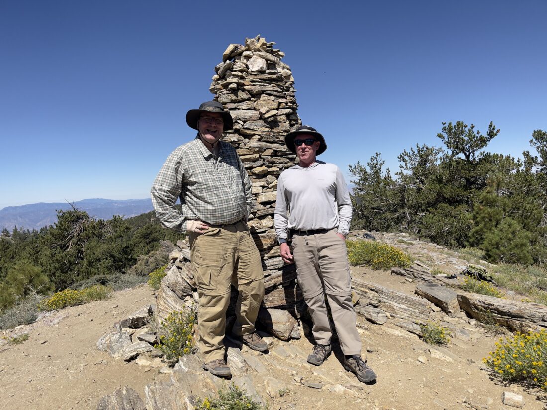
After breakfast, we made the short drive to the trailhead for our planned hike to Sawmill. Unfortunately, my breakfast wasn’t sitting well, so I kept a more relaxed pace to see if things might settle themselves. The hike up to Mt. Pinos is pretty mellow, so I knew I had some time to see if my stomach calmed down. We reached the summit without any other incidents and snapped some photos. The summit sign was MIA, but no biggie. 

We continued on to the Mount Pinos Condor Observation Site and I sat for a bit. An incident radio station had been set up to assist the firefighters battling the Apache fire to our west. Neither Ted nor I saw any smoke from it. I was feeling better and we began our descent to the saddle between Mt. Pinos and Sawmill. Having done this peak several times, I was comfortable with continuing.

We worked our way up to the summit of Sawmill and had a nice long rest. The smoke from the Borel fire, east of Bakersfield, was clearly visible (later in the day, it may have triggered a pyrocumulus). After chatting with another 6 Pack of Peaks challenger, we set back. While I was better, I was not at 100%, so we took a few breaks along the return. The trail had become more active as the day wore on.

Back at the car, we calculated making the 7.3 miles with a moving time of 3:12. We drove back down the mountain to grab some deli sandwiches for lunch and some more firewood for my campfire later that night. Ted had commitments Sunday morning, so he packed up his tent and headed home. I spent the afternoon relaxing under the pine trees, researching new adventures. I woke again to the first light of the sun, packed up and cruised on home.


Buy Me a Coffee at ko-fi.com

I am an avid peak bagger, sometimes backpacker, and former sea kayaker living in San Diego. I am the co-author of Urban Trails:San Diego, coming in Spring 2026!

In 2019, I became the third person to complete the San Diego 100 Peak Challenge. Not stopping with that accomplishment, I set my sights on the harder San Diego Sierra Club 100 Peak list, which I completed in 2021. In addition, I have conquered several Six-Pack of Peaks challenges (SoCal, San Diego, Central Coast, and both the Arizona-Winter and Arizona-Summer). I am looking forward to exploring new summits and new adventures across the southwest. 

Cuyamaca Peak (via Conejos Trail)

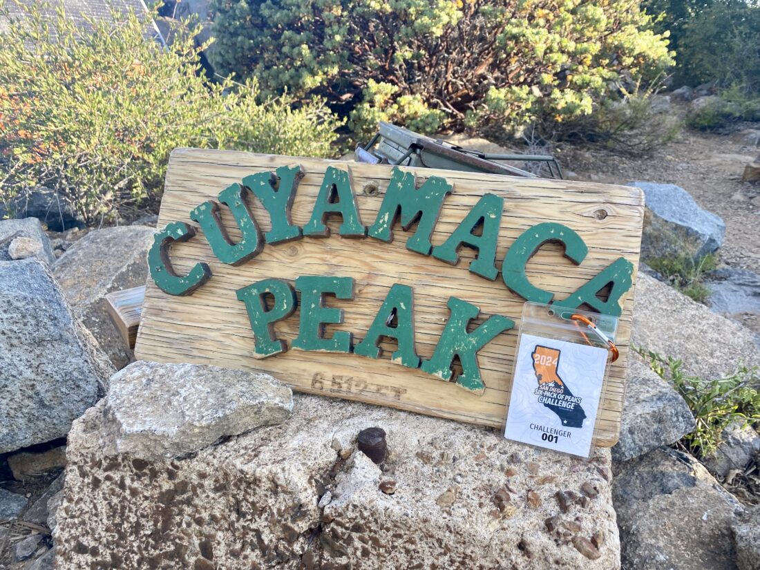
With the region under a heat advisory, I knew that any serious hiking would require a very early start. I arrived at the Los Vaqueros Trailhead just after 5:15 am, and the parking area was already quite full. It appears that I would once again be hiking Cuyamaca Peak during a trail run. After gathering my gear, I crossed the road. Off near the horse staging area, several large white tents were set up, and quite a few cars were parked along that road as well. This might have been more than just a training run. (Narrator: He was right, it was an actual race). I cruised along Milk Ranch Road, and orange flags denoted the route the runners would be taking. Their route had them using the Middle Peak Fire Road, so it seemed I would have this first mile or so to myself. I stopped a few times to photograph the sunrise. 

I hopped on to Azalea Springs Fire Road to connect with the Conejos Trail. The runners would be following the same route to the summit as I was taking, but so far I hadn’t encountered a single one. There were some bugs so I slipped on my bug net. I figured it would be good practice to get comfortable wearing it before some of my upcoming backpacking trips. The miles slipped by, and as I neared the junction with the service road, a pair of race photographers were camped out, ready to capture the runners as they came past. At the junction, I chatted briefly with a race volunteer, who gave me the 411 on the race. There were three races; a 50K, a marathon, and a 1/2 marathon. As I plodded up the service road, runners finally started to appear. Some racers lightly jogged up the 15-20% grade toward the summit, while others fast-walked it. As I neared the summit, I could hear the sounds of cowbells clanging and music thumping. The end of the service road was set up as a check-in point, complete with an aid station for the runners. I gave the volunteers a wave and followed the use trail to the summit proper. 

I sat at the summit enjoying my snacks and the view for a bit, but the constant noise from the race did not lend itself to allowing a restful time on the peak. I headed back down along the fire road. Once past the junction with Conejos Trail and the Burnt Pine Connector Trail, I left the race behind for a while. Along the way, I did meet two hikers working their way up the road. We chatted a bit before heading our separate ways. I hopped back on the Azalea Springs Fire Road, glad to be off the warm asphalt of the service road. Once back on Milk Ranch Road, I strolled along, feeling the warmth of the day increase. A runner raced past, which was odd, as the route had them taking the side trail up to Middle Peak, then down its service road. She was too far gone before I had a chance to tell her she missed a turn. I guess when her tracker is short by 2 miles, she might figure out her mistake. Back at the car, I changed and enjoyed some well-earned cold water. As I drove away, I checked the temperature and it was already 84°F! As much as waking up at 4 AM, sucked, beating the heat and knocking out another peak was worth it. Did the 8.6 miles in 3:45, so I was pretty happy with the day’s hike. This is probably my last peak on the San Diego Six Pack of Peaks list until the weather cools in the fall. 


Buy Me a Coffee at ko-fi.com

I am an avid peak bagger, sometimes backpacker, and former sea kayaker living in San Diego. I am the co-author of Urban Trails:San Diego, coming in Spring 2026!

In 2019, I became the third person to complete the San Diego 100 Peak Challenge. Not stopping with that accomplishment, I set my sights on the harder San Diego Sierra Club 100 Peak list, which I completed in 2021. In addition, I have conquered several Six-Pack of Peaks challenges (SoCal, San Diego, Central Coast, and both the Arizona-Winter and Arizona-Summer). I am looking forward to exploring new summits and new adventures across the southwest. 

Volcan Mountain (via 5 Oaks Trail)

Since I needed to hike Volcan Mountain for this year’s Six Pack of Peaks Challenge, I invited Becca Barr and her son, Daniel along for the hike. Both are fairly new to hiking, so this was a perfect hike to test their hiking legs out. They needed to be back in town around noon-ish, so we had an early start to the day. I drove out to the trailhead, and there were just a couple of cars parked along Farmers Road. We gathered our gear and set off. After a quick pit-stop at the port-a-potty, we began our hike in earnest. I spied a new sign that had been posted about the Coast to Crest trail, which was very welcomed. I followed my standard route of taking the 5 Oaks trail up, and service road back. We took a few short breaks along the way, just to make sure everyone was feeling good. We stop at the ruins of the cabin, and the nearby overlooks, before reaching the summit. 

After a quick snack, we took our photos at the benchmark. Gazing out across Anza-Borrego, I pointed out the various peaks and other sights. But since we had to be mindful of the time, we began our descent. We passed quite a few folks working their way up to the summit. Once back in the car, we motored home so they could clean up and make the show. It was nice to serve as a hiking guide for some new hikers. Hopefully, I can show them some more great trails around San Diego soon.


Buy Me a Coffee at ko-fi.com

I am an avid peak bagger, sometimes backpacker, and former sea kayaker living in San Diego. I am the co-author of Urban Trails:San Diego, coming in Spring 2026!

In 2019, I became the third person to complete the San Diego 100 Peak Challenge. Not stopping with that accomplishment, I set my sights on the harder San Diego Sierra Club 100 Peak list, which I completed in 2021. In addition, I have conquered several Six-Pack of Peaks challenges (SoCal, San Diego, Central Coast, and both the Arizona-Winter and Arizona-Summer). I am looking forward to exploring new summits and new adventures across the southwest. 

Lopez Canyon

The parking lot was half-filled, mostly with mountain bikers, judging by the bike mounts on the cars. We took the trailhead out from the east end of the parking lot, passing by some nice riparian growth. The trail quickly came to a T junction with one fork heading toward PQ Canyon and the waterfall, and the other into Lopez Canyon. We took the Lopez Canyon trail. The trail crossed over the dry Lopez Creek and then hugged the steep side of the canyon. We followed the old road for a while until we reached another junction. The right fork led out of the canyon, while the other stayed in the canyon. There were signs of habitat restoration underway as we stayed in the canyon

We crossed the dry creek a few more times until we reached the point where the trail faded into the stream bed. Anita and Rocky stopped here, and I pushed on for the last 1/4 mile or so to the bridge. I did spot a few ticks on my legs, which I quickly removed. The trail thankfully left the stream bed and I took a single-track trail toward the bridge. Once I was close enough, I retraced my route and rejoined Anita and Rocky. Our return was uneventful, passing two other hikers enjoying the trail. Once home, we plucked several more ticks off all of us. Ugh!


Buy Me a Coffee at ko-fi.com

I am an avid peak bagger, sometimes backpacker, and former sea kayaker living in San Diego. I am the co-author of Urban Trails:San Diego, coming in Spring 2026!

In 2019, I became the third person to complete the San Diego 100 Peak Challenge. Not stopping with that accomplishment, I set my sights on the harder San Diego Sierra Club 100 Peak list, which I completed in 2021. In addition, I have conquered several Six-Pack of Peaks challenges (SoCal, San Diego, Central Coast, and both the Arizona-Winter and Arizona-Summer). I am looking forward to exploring new summits and new adventures across the southwest. 

Grasslands Loop

Decided to do an early morning hike along the Grasslands Loop Trail in Mission Trails. However, this time I opted to start from the East Fortuna Staging Area which has plenty of parking for both cars and horse trailers. This staging area has several horse pens and a dedicated larger horse corral, as the Grassland Loop Trail is horse-friendly.

I started from the trailhead on the northwest side of the parking area. This flat dirt trail meanders past a vernal pool before linking with the North Fortuna Perimeter Trail (the other option from the parking area). After a short distance, I turned south toward the Grassland Crossing Trail to join the Grassland Loop North Trail. The now golden grasslands spread out before me. Kwaay Paay stood proudly to my south, and the Fortunas rose to the west. Others were also out enjoying the trails as well. The trail now turned south, and paralleled Oak Canyon, which was to the west. While a short connector trail would take me over to it, I remained on the Grasslands Trail. Soon I came to the Old Mission Dam Overlook. While the bench was inviting, I had chores to do back home.

From there I headed northeast, passing a collection of morteros, before rejoining the Grasslands Connector trail. I considered taking this short spur over the San Diego River but opted not to. I found myself back at the North Fortuna Perimeter Trail heading back toward the parking area. A nice easy 2.5-mile loop to stretch out my legs.


Buy Me a Coffee at ko-fi.com

I am an avid peak bagger, sometimes backpacker, and former sea kayaker living in San Diego. I am the co-author of Urban Trails:San Diego, coming in Spring 2026!

In 2019, I became the third person to complete the San Diego 100 Peak Challenge. Not stopping with that accomplishment, I set my sights on the harder San Diego Sierra Club 100 Peak list, which I completed in 2021. In addition, I have conquered several Six-Pack of Peaks challenges (SoCal, San Diego, Central Coast, and both the Arizona-Winter and Arizona-Summer). I am looking forward to exploring new summits and new adventures across the southwest. 

Sitton Peak Overnight

As I finished my water and put on my hiking boots, I looked at the thermometer on the car. It read 84°F. It was going to be a warm one hiking to the campsite this afternoon. Rather than hiking Sitton Peak as a day hike again, I had the idea of doing it as a short backpacking trip. The last time I had hiked the peak, I was specifically keeping an eye out for a possible campsite. Turns out, about 0.9 miles before the summit, there is a clear and wide area to set up camp. I had gotten my Wilderness Permit from the Ranger station a few days before, so I was able to legally spend the night in the San Mateo Wilderness. With 3.5 liters of water in my pack, I carefully and quickly crossed the highway. In some ways, this is the scariest part of the entire hike. I snapped a photo at the trailhead and then signed the trail register. With the warm temperatures, I focused on keeping a reasonable pace. I had a lot more weight on my back than when I usually do this hike. 

As I came to the boundary with the San Mateo Wilderness, a small stream was still gently flowing. I was also enjoying all the wildflowers that were still blooming along the trail’s edge. That made the climb a bit more enjoyable. Once I reached the junction with Bear Ridge Trail and the Bear Canyon Trail, I knew I had earned a break. I had covered about 2.1 miles in just about 1:15. I sat under the shade of a nice oak tree and drank some water. I still had another 1.9 miles to cover, so I put my pack back on and set off. The trail was a touch overgrown, so I was glad I was wearing long pants. Once I reached the Four Corners, I looked for another spot for a short break. After a few minutes along the trail toward the summit, I found an acceptable spot for another break. The campsite wasn’t too much further, but I now needed to make a decision about setting up. One option was to simply unload my gear, and set up camp after I returned from the summit, or the other option was to properly set up camp first. I decided to do the latter. As I approached the saddle, I knew the site was just off to my left. I followed the use trail back just a few yards behind some bushes to the location I had scouted before and quickly set up camp. I am currently using the Gossamer Gear The One as my tent. For those who don’t know, this tent uses your trekking poles as part of the support structure. I was certainly going to need those trekking poles for my climb to the summit. I carefully removed them, letting the tent collapse. The test would be reinserting them after I got back. With a much lighter pack, I set off toward the summit.

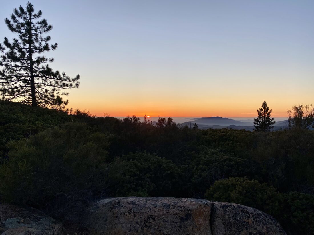
Water was still seeping out at a few spots, even this late in the season. This was probably part of the reason I was wearing my bug net, and overgrowth at times was pretty significant. Nothing that truly blocked my path, but I certainly needed to take some care with my footing. At the turn-off, I began the steep climb to the top of the peak. The hike had taken a touch more out of me than I had hoped, so I just took my time. Once I reached the top, the soft evening sun lit up one of the summit signs that was perched on the register can. I dropped my pack and soaked in the view. The sun sat over the west, sinking slowly. I snapped a few photos before enjoying a summit beer and some snacks. While I had my headlamp in my pack, I had no desire to descend that steep 0.4 miles back to the main trail in the dark, so I left before the sun dipped beyond the horizon. A quarter moon was up, offering a touch of light, as the sun’s light faded. I reached my campsite just before I needed to switch on my headlamp. I changed out of my very damp hiking shirt and began making dinner. The bugs were still out, so I retreated to my tent to enjoy my dinner. After dinner, I finished getting ready for bed. I settled in, enjoying listening to Sir Patrick Stewart’s autobiography for a bit, before going to sleep.

I woke a bit before dawn when nature began calling. Since the forecast was going to be another warm one, I opted to pack up and hike the 3.9 miles back to the car. I really didn’t feel like making any coffee, so I just nibbled on my Nutri-Grain bar while I packed up. My tent had some condensation, so I was going to need to dry it out before I truly put it away. I caught the sunrise coming over the hills to the east and made sure I snapped a few photos for Ted as I cruised back along the trail. At Four Corners, I debated taking the Bear Ridge Trail back instead of the Bear Canyon Trail, but I left my wallet in the car and was a touch nervous about that. The cooler air that had settled along the Bear Canyon Trail was welcome, as I could feel the day warming up. I finally started to pass folks making an early morning attempt at the summit. Finally, the end of the trail came into view, and after carefully crossing Ortega Highway, I walked to my car, hoping that my wallet was still inside. Thankfully, it was! I changed out of my gear into something a bit drier and cleaner and began the drive home. All in all, this was a great overnight trip, and one I would do again, just when it is a bit cooler. One piece of gear I might bring next time is a chair. My only option at the campsite was my small seating pad, and that was it. 


Buy Me a Coffee at ko-fi.com

I am an avid peak bagger, sometimes backpacker, and former sea kayaker living in San Diego. I am the co-author of Urban Trails:San Diego, coming in Spring 2026!

In 2019, I became the third person to complete the San Diego 100 Peak Challenge. Not stopping with that accomplishment, I set my sights on the harder San Diego Sierra Club 100 Peak list, which I completed in 2021. In addition, I have conquered several Six-Pack of Peaks challenges (SoCal, San Diego, Central Coast, and both the Arizona-Winter and Arizona-Summer). I am looking forward to exploring new summits and new adventures across the southwest. 

Corte Madera Overnight

Six weeks ago I had two vertebrae in my neck fused, and now I was about to set off for my first backpacking trip. In addition to the new hardware I was internally sporting, I was also testing out several new pieces of gear. I decided to switch to a Gossamer Gear The One tent, a NEMO Tensor sleeping pad, and replace my JetBoil with an MSR Pocket Rocket 2. All told I shaved about 2 pounds off my base weight. In addition, since this trip was so short, I opted to use my Osprey Stratos 34 pack instead of my bigger Osprey Atmos 65. That pack change took almost another 1.5 pounds off my base weight. 

I pulled into the small pullout for Corte Madera in the mid-afternoon. One other car sat there under the warm sun. As I finished getting ready to set off, I drank the last of my pre-hike water. There are no water sources on this hike, so I was being mindful of my hydration needs. I closed the hatch of the Subaru and set off! The first part of the hike is along the road that leads off to several properties to the north. The shade from the oaks was certainly welcomed, as well as a light breeze. Once I reached the turn-off to the Espinoza Trail, I knew I was about to start gaining some elevation. Wildflowers would occasionally dot the side of the trail, making for a pleasant trek up toward the saddle. Once I at the saddle, I turned toward the hard part of the trail—the steep climb up and around Coulter Peak. Having done this peak before, I knew what lay ahead. At the split rock, I took a well-earned rest under the shade of some Coulter pines.

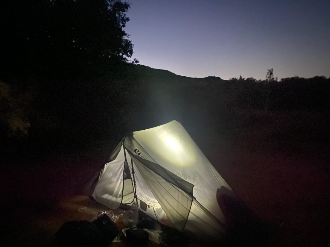
Soon, I found myself nearing my planned campsite. Unlike my REI QuarterDome SL1, which uses a traditional frame for the tent, The One is supported by using your trekking poles and tie-downs. What I was fearful of was that the dirt at the campsite would not allow me to properly stake down the tent. Well, it turns out I was right. The dirt was not deep enough. So I instead had to use heavy rocks to keep the anchor lines in place. With the tent, and the rest of my camp set up, I hiked the 1/3 mile over to the summit to take my summit photo. It felt so odd not to be using my trekking poles even for such a short distance. I did not hang out long on the summit, as I wanted to be back at camp well before sunset.

Once back at camp, I relaxed a bit before making dinner. I did bring a can of “Nature Calls” from Burgeon Brewery to enjoy along with my Mountain House Beef Stroganoff. As the sun sank below the marine layer, I put on my new puffy jacket I plan to use on my Alaskan cruise. Since there was a quarter moon, I knew I wasn’t going to have any great star gazing until the very early morning. So, I turned in for the evening, wondering how my new sleeping pad was going to do. At around 2 in the morning, I awoke wondering why my hip was against the hard ground. It turns out my brand-new sleeping pad had a slow leak. I fumbled around for the sack used to inflate it and got it back to an acceptable level. I was not pleased. 

Around 5 am, I awoke again, as the pad had deflated enough again to cause me some discomfort. I knew the sun would be up soon, so I decided to get moving. I brewed a cup of coffee as the sun slowly rose. One of the ways I opted to keep my water load a bit lighter was not to have breakfast at camp, but instead just some coffee and a breakfast bar. I would enjoy a proper meal at Janet’s Montana Cafe in Alpine. One of the camp treats I like to enjoy is a small apple pie for dessert. I was too full yesterday evening to eat it, so I still had it in my food bag. I figured it now counted as a pastry instead of a dessert, so I had it with my coffee instead of the Nutri-Grain bar. I broke camp, but before I headed back to the car, I grabbed just my trekking poles and returned to the summit. I watched the morning light spread out across the landscape.

Once back at my campsite, I put on my pack and set off. Just past Coulter Peak, I heard voices from some early morning hikers. I stepped aside as they continued their climb toward the summit. They mentioned they wondered who was already parked at the trailhead this early. I told them I had camped near the summit. Internally, I knew my car was still there. The rest of the return was uneventful and I had about 1/4 liter of water left when I reached the car. In retrospect, I could have taken a bit more to reduce my water anxiety, but I never felt thirsty. I do need to figure out my electrolyte system if I am going to continue to use bottles and not a reservoir, but that is a problem for another day. With a clean shirt and some of the dirt and sweat wiped off, I drove on down to Alpine and enjoyed some delicious biscuits and gravy and a couple of eggs. Except for the sleeping pad issue, the trip went really well. My legs are a little sore, and in looking over my moving time, I think I actually was hiking too fast with my gear. In the end, it was great to be backpacking again. Now to swap out that pesky sleeping pad…

Update

I tested my sleeping pad again to verify the leak. I inflated it at 8am, and at 4pm the pad was still fully inflated. So, what happened while I was out camping? What I think happened is when I was inflating the pad, I overfilled it, so the valve on the pad popped off. Maybe I did not put the value back one correctly. When I testing, I made sure that value was properly seated, and I did not over-inflate, so maybe that was the source of the slow leak.


Buy Me a Coffee at ko-fi.com

I am an avid peak bagger, sometimes backpacker, and former sea kayaker living in San Diego. I am the co-author of Urban Trails:San Diego, coming in Spring 2026!

In 2019, I became the third person to complete the San Diego 100 Peak Challenge. Not stopping with that accomplishment, I set my sights on the harder San Diego Sierra Club 100 Peak list, which I completed in 2021. In addition, I have conquered several Six-Pack of Peaks challenges (SoCal, San Diego, Central Coast, and both the Arizona-Winter and Arizona-Summer). I am looking forward to exploring new summits and new adventures across the southwest. 

Wave Cave

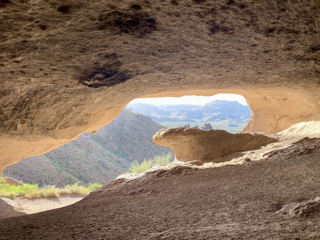
Since my son would be at work all day Monday, I decided to bring my hiking gear with me to Arizona and try to get in some early morning hiking. I wanted something relatively short, but interesting, so I decided to hike up to the Wave Cave. I drove to the Peralta trailhead parking lot. This was the same road I used when I hiked the Hieroglyphic Trail a couple of years ago. A couple of hikers were starting out when I pulled into the dirt lot. It was a chilly 47°F as I grabbed my gear, but I knew that cold feeling would soon fade into memory. The trail headed across the flat desert floor, but off in the distance I could spot the cave up on the hillside. After about 0.6 miles, the trail reaches the boundary of the Superstition Wilderness. While a trail does run along the fence, I continued north through an opening. In another 0.2 miles, the trail to Carney Springs forked to the right, but I stayed on the more used trail to the left. At this point, I would start climbing toward the cave.

The trail now passed into a ravine and began to climb in earnest. The trail crosses over the ravine and makes the final push up to the cave itself. As I got to the cave, the couple who were ahead of me were just about to leave. I asked if they wouldn’t mind taking a few photos of me on the “wave” before they left. Once they left, I had the cave to myself (since this is a popular hike, it was a rarity, which is one advantage of starting at dawn). After exploring the cave and having some water, I headed back down the trail.

The views out across the desert were lovely, and as I made my way back toward the car, I passed several more hikers heading up. Unfortunately, I made a misstep with about 0.5 miles to go and rolled my ankle. Thankfully, I was able to keep going with just a little discomfort and got back to the car without any further issues. Back at the hotel, I wrapped my ankle and kept it elevated and iced for the rest of the day. This was a fun little hike (despite the rolled ankle). 


Buy Me a Coffee at ko-fi.com

I am an avid peak bagger, sometimes backpacker, and former sea kayaker living in San Diego. I am the co-author of Urban Trails:San Diego, coming in Spring 2026!

In 2019, I became the third person to complete the San Diego 100 Peak Challenge. Not stopping with that accomplishment, I set my sights on the harder San Diego Sierra Club 100 Peak list, which I completed in 2021. In addition, I have conquered several Six-Pack of Peaks challenges (SoCal, San Diego, Central Coast, and both the Arizona-Winter and Arizona-Summer). I am looking forward to exploring new summits and new adventures across the southwest. 

Papago Park Loop

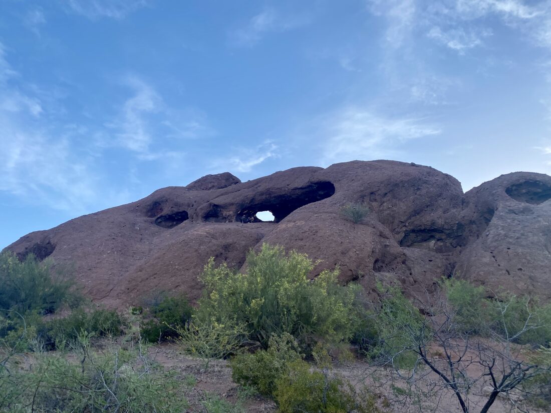
Near the hotel where we were staying for my son’s graduation (go ASU! Forks Up!) is Papago Park. Since I had brought my hiking gear, I decided to wake up early and explore it before it became too warm. I parked near the Hole-In-The-Rock and set off. The Hohokam Tribe used this hole in the rock as a calendar to mark the summer and winter solstice. The hole is directly visible from the parking lot, and a few folks were already exploring it. I did not see a path from this side and followed the trail to the backside. On reaching the backside, I also did not find a route to the hole. I must admit, I did not do my usual research for this hike, as I should have found a trail on the backside. Next time when I visit my son in Tempe, I will do the trail correctly. I wasn’t too disappointed, as I was more interested in seeing the park. I headed to the northwest to loop around the Papago Buttes, then down to Little Butte. The trails were nicely defined and several folks were out for their early morning run or walk. I hiked part way up Little Butte to take in the views of Phoenix. I was starting to get hungry, so I headed back to the car. 


Buy Me a Coffee at ko-fi.com

I am an avid peak bagger, sometimes backpacker, and former sea kayaker living in San Diego. I am the co-author of Urban Trails:San Diego, coming in Spring 2026!

In 2019, I became the third person to complete the San Diego 100 Peak Challenge. Not stopping with that accomplishment, I set my sights on the harder San Diego Sierra Club 100 Peak list, which I completed in 2021. In addition, I have conquered several Six-Pack of Peaks challenges (SoCal, San Diego, Central Coast, and both the Arizona-Winter and Arizona-Summer). I am looking forward to exploring new summits and new adventures across the southwest. 

Cedar Creek Falls

** WARNING **

This is not an appropriate hike for hot weather!!

Temperatures in the San Diego River Gorge frequently reach well over 100 degrees. While hiking out to the local swimming hole for a refreshing dip may seem like a good idea on a hot summer day, each year dozens of hikers regularly succumb to heat exhaustion while trying to hike back out to the trailhead. Several heat-related fatalities have occurred on this trail. In the summer, the waterfall does not flow, and the little water that is in the pool is usually stagnant and green with algae, so it’s really not worth risking your life for.


Don’t judge me, but in all my years hiking in San Diego, I had never hiked out to see Cedar Creek Falls. I was close when I summitted Peak 1546, but never continued on to the falls themselves. Since I wanted to continue to test out my recovery by wearing my daypack, I thought the trek out to the falls would fit the bill nicely. I paid the $6 to obtain my permit and headed out to the trailhead in Ramona. A marine layer would keep the temperatures down on what is typically a very warm hike. I pulled into the parking area and one car sat alone in the lot. I had picked up breakfast on the way out but wasn’t hungry yet, so I tossed the biscuit sandwich into my pack and set off. The kiosk was filled with warnings about the difficulty and the dangers of the heat. The lure of a waterfall and swimming hole is incredibly strong, which is why a permit is needed to help defray the impact on this destination. The trail began working its way down towards the San Diego River Gorge. As I cruised along, mileage markers dotted the side of the trail indicating the distance to the waterfall and back to the trailhead. Given this is mostly an inverted hike, the real effort is in the return to the trailhead. Wildflowers lined the side of the trail and bird songs filled the air. Every so often, shade shelters would be found. Each had rescue information attached for those who might need it.
Soon I reached the end of my descent and would start the next part of the adventure–the water crossings. To reach the falls, I would need to first traverse the San Diego River, then Cedar Creek twice. This was a perfect time to test out the new waterproof hiking boots I bought for my upcoming trip to Alaska. The first crossing took a little care, as the creek was still flowing nicely, and not all the rocks were above the waterline. My foot did get a tad wet on one rock but otherwise had no issues, and mainly because these were low-rise shoes and not high-topped. The second and third crossings were handled without incident.

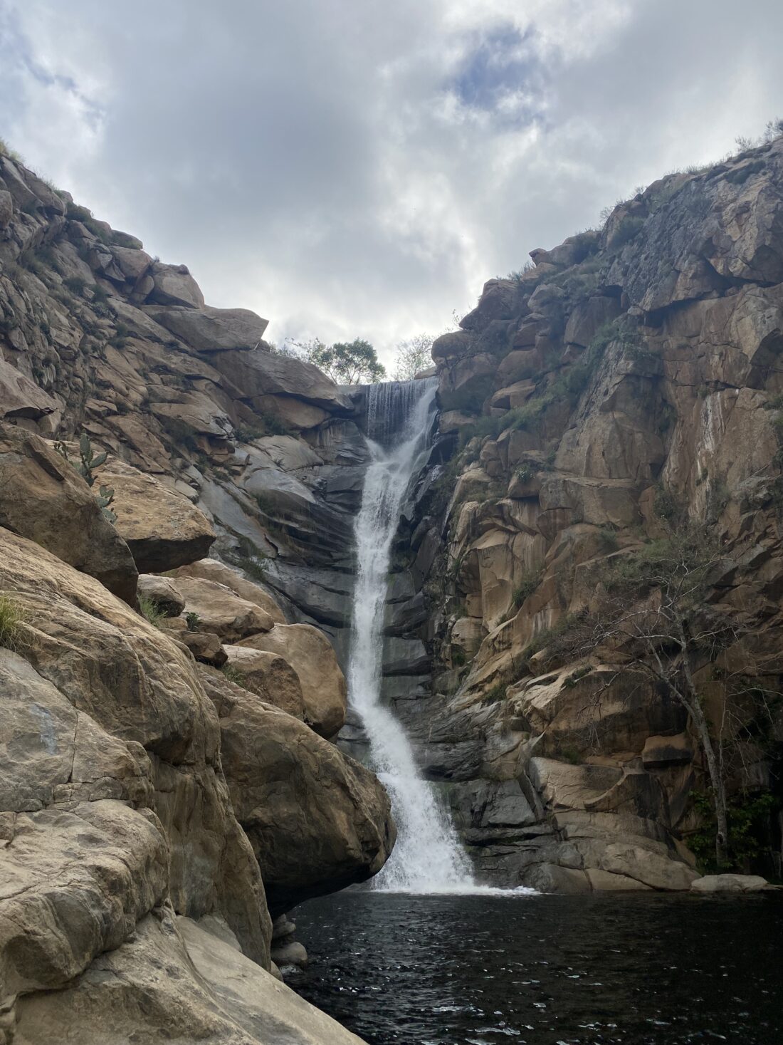
he flowing falls came into view, and they were a sight to see. I scrambled over the smooth rocks to take a few photos. Three young women were enjoying their morning snacks nearby. I broke out my biscuit and ate some of it while enjoying the falls. Since I still needed to work today, I said farewell to the others and began my trek back.

Safely staying mostly dry across the crossings, I started my ascent. I now started to encounter more folks making their way out. The only unexpected sight along the way was a wild turkey running down the trail, but otherwise, the climb back to the trailhead was a nice steady one. Back at the car, I changed into a dry shirt and drove home. Since Kit Fox Outfitters was not open, I would have to stop by another time to get my sticker for the Ramona Trails Challenge.


Buy Me a Coffee at ko-fi.com

I am an avid peak bagger, sometimes backpacker, and former sea kayaker living in San Diego. I am the co-author of Urban Trails:San Diego, coming in Spring 2026!

In 2019, I became the third person to complete the San Diego 100 Peak Challenge. Not stopping with that accomplishment, I set my sights on the harder San Diego Sierra Club 100 Peak list, which I completed in 2021. In addition, I have conquered several Six-Pack of Peaks challenges (SoCal, San Diego, Central Coast, and both the Arizona-Winter and Arizona-Summer). I am looking forward to exploring new summits and new adventures across the southwest.