Trip Reports

Torrey Pines – Broken Hill Overlook

Decided to try to test my recovering foot with a bit more distance, but more importantly, some actual elevation gain. So, with that in mind, I decided to tackle Torrey Pines this morning. Found parking along the coast, grabbed my gear, and set off. The skies were still overcast, but that was fine by me. I began my climb up the road with a bit of apprehension, but as I made my way up, the foot felt pretty good.  An occasional biker or runner would pass by, but for the most part, I had the route to myself. As I neared the top, I climbed the stairs to the official high point for the state park, moved off the dirt covering the benchmark, and happily took my photo. 

I continued cruising south toward Broken Hill Overlook. I realized in all my years living in San Diego, I don’t think I’ve ever explored this part of Torrey Pines. Shameful, I know. I turned off the road and onto a very well-groomed dirt trail. 

Several bridges crossed now dry vernal pools as I headed westward toward the overlook. After a couple of junctions, I soon came upon the overlook.

The view was stunning. The sandstone formations, the Pacific Ocean, and some wildflowers are still in bloom. Since it was a work day, I did not linger too long and retraced my steps. The next test for my foot was coming up—the descent. 

The park had begun to come alive with many more people enjoying the trails. I made my way back down to the coast, and the foot was feeling pretty good. However, the real test will be later in the day, and how my foot feels then. But for now, I was really happy with what I just did. All told I hiked 4.1 miles with 460 feet of gain. While I was not purposely looking at my time, it wasn’t too bad either. 


Buy Me a Coffee at ko-fi.com

I am an avid peak bagger, sometimes backpacker, and former sea kayaker living in San Diego. I am the co-author of Urban Trails:San Diego, coming in Spring 2026!

In 2019, I became the third person to complete the San Diego 100 Peak Challenge. Not stopping with that accomplishment, I set my sights on the harder San Diego Sierra Club 100 Peak list, which I completed in 2021. In addition, I have conquered several Six-Pack of Peaks challenges (SoCal, San Diego, Central Coast, and both the Arizona-Winter and Arizona-Summer). I am looking forward to exploring new summits and new adventures across the southwest. 

South Lake

I wanted to get in a quick late morning hike to continue my rehab from my foot surgery. When I was looking at options for new places to explore, my friend Connie suggested that I might like doing the loop around South Lake in San Marcos. This trail just recently opened, so it was certainly one I wanted to explore.

Connie and I met in the parking lot and quickly set off. One thing to note, there are no bathrooms at this trailhead, so plan accordingly. The access to the trail is from sunrise to sunset. After passing through the gate, we opted to hike the loop clockwise. The trail almost immediately splits into an upper path and a lower path. We took the high road… 

We cruised around the well-groomed trail, catching up with each other, and stopping to take a quick photo or two. After about a mile, we were back at our starting point. The foot was feeling good, so we decided to do another loop, and this time we took the lower trail. This took us past the various folks trying their luck fishing in the lake. The trail rejoined the upper trail after about 1/4 mile. 

After our second loop, we decided to call it as we each had stuff to attend to and said goodbye. This was a nice little local trail.


Buy Me a Coffee at ko-fi.com

I am an avid peak bagger, sometimes backpacker, and former sea kayaker living in San Diego. I am the co-author of Urban Trails:San Diego, coming in Spring 2026!

In 2019, I became the third person to complete the San Diego 100 Peak Challenge. Not stopping with that accomplishment, I set my sights on the harder San Diego Sierra Club 100 Peak list, which I completed in 2021. In addition, I have conquered several Six-Pack of Peaks challenges (SoCal, San Diego, Central Coast, and both the Arizona-Winter and Arizona-Summer). I am looking forward to exploring new summits and new adventures across the southwest. 

Bernardo Bay

Today’s adventure was a short loop along the shores of Lake Hodges. About 8 cars were in the parking lot at the Piedras Pintadas trailhead. I grabbed my gear and headed west along the wide trail. Along this initial portion, interpretive panels tell the story of native peoples that lived here.

The trail forks as it reaches the now-dry lakeshore (the lake’s water levels had been lowered for repairs to the dam), and I stayed to the right. The trail would now follow the shoreline for most of the rest of the way.

Various birds could be seen along the empty lake bed. Bernardo Mountain stood high above it to the north. My foot certainly was not ready to climb to its summit.

There were a few others out enjoying the trail, but for the most part, I had the trail to myself. As the trail turned eastwards, I could spot the pedestrian bridge off in the distance. Soon the trail ended at the bike path that runs along the road, and after a short climb up, I returned to my car. A nice 2.1-mile loop was perfect to keep working my foot.


Buy Me a Coffee at ko-fi.com

I am an avid peak bagger, sometimes backpacker, and former sea kayaker living in San Diego. I am the co-author of Urban Trails:San Diego, coming in Spring 2026!

In 2019, I became the third person to complete the San Diego 100 Peak Challenge. Not stopping with that accomplishment, I set my sights on the harder San Diego Sierra Club 100 Peak list, which I completed in 2021. In addition, I have conquered several Six-Pack of Peaks challenges (SoCal, San Diego, Central Coast, and both the Arizona-Winter and Arizona-Summer). I am looking forward to exploring new summits and new adventures across the southwest. 

Laguna Meadow

High wind warnings on Father’s Day kept us from driving up to Laguna Meadow for a hike. Thankfully, this past Sunday the weather looked almost perfect. The three of us drove up to the Laguna Campground and found some parking near the trailhead. After applying a good covering of sunscreen, we set off along the trail. We did not have an exact goal in mind, more letting my foot tell me what it could handle. I was hoping that I might break the 3-mile mark. 

I opted to take the trail to the right, as it would pass closer to Little Laguna Lake. It still held water, along with a few ducks as well. We continued walking along the trail, stopping at times to let mountain bikers pass by. Just before we reached Big Laguna Lake, we climbed a small knoll to stop under the shade of some pines. This gave everyone a nice breather. Once everyone was rested and hydrated we set off to cross the small dam that forms the southern end of the lake. A herd of cows was milling around. I took the lead and had my wife hold our dog close. I slowly began crossing, giving the cows plenty of room and time to “moo-ve” along. The trail here was narrow and as you might expect a bit overgrown. Carefully looking down in the grasses to the side of the trail, tiny frogs could be spotted hopping around. I tried to grab a photo but had no luck in capturing anything. 

About halfway across the dam three mountain bikers, who had stopped at the end of the dam, decided they needed to cross while we were on it. So they forced us to stop off trail, while they rode past. I guess they never bothered to read those “who yields to whom” signs… I debated mentioning something but had a feeling it would fall on deaf ears.

Once across, we continued southwest toward the Water of the Woods and the Los Rasalies Ravine. At the junction with the Sunset Trail, we found some rocks to sit on under the shade of the trees. The meadow, the pond, the smell of the forest—this was what I have been missing for almost a year. While I wanted to keep going and turn this into a large loop, I felt it would be wiser for my foot to just return back the way we came.

A few more bikers, along with some fellow hikers, passed us as we made our way back to the car. Instead of taking the exact same route back, I opted to have us cross over the meadow to the eastern side and use the Laguna Campground Spur Trail instead. This trail had a bit more shade, and since the day was warming up, it was welcomed by everyone. Soon, we spotted the glint of sunlight bouncing off the windshields of the cars at the campground. We stepped through the gate, and our hike was done. All told, we hiked 3.4 miles. With all the stops to allow folks to pass, the time was a tad on the slow side. But more importantly, the foot felt pretty good. A couple more hikes about this length and then it will be time to start adding some elevation gain into the adventures again!


Buy Me a Coffee at ko-fi.com

I am an avid peak bagger, sometimes backpacker, and former sea kayaker living in San Diego. I am the co-author of Urban Trails:San Diego, coming in Spring 2026!

In 2019, I became the third person to complete the San Diego 100 Peak Challenge. Not stopping with that accomplishment, I set my sights on the harder San Diego Sierra Club 100 Peak list, which I completed in 2021. In addition, I have conquered several Six-Pack of Peaks challenges (SoCal, San Diego, Central Coast, and both the Arizona-Winter and Arizona-Summer). I am looking forward to exploring new summits and new adventures across the southwest. 

Barnett Ranch Open Space Preserve

Decided to continue my foot rehab with another mild hike. This time I opted to explore the Barnett Ranch Open Space Preserve out near Ramona. I had driven past it several times en route to Mt. Gower or some other peak. After driving past the hoards of cars parked at the trailhead for Iron Mountain and Woodson, I pulled into the parking lot. A park ranger had just pulled in, I chatted with him for a bit before setting off.

The sun was shining, something that hasn’t happened too much recently. Thankfully a light breeze kept things pleasant. The trail is mostly a loop around the edge of the preserve.

Wildflowers were still in bloom throughout. The trail is initially a paved road that continues on to some properties off to the north and then continues on a proper dirt trail. I soon found myself taking a quick break next to a small pond before continuing on the trail, and arriving at a small water crossing. I began a short climb toward the southern end of the preserve which gave me some sweeping views of the area.

The trail would follow the small ups and downs along the hills. There are two connector trails that would return me back to the trailhead and I opted for the closest, mostly since it also is the trail to the overlooks to the south. I did not want to push my foot since I still needed to drive home so that portion of the preserve would have to wait for another trip.

Since I was out near Ramona, I decided to stop in and visit Kit Fox Outfitters. Colin was teaching a class, so I chatted with Stephanie a bit. Once I am ready to start backpacking again, going to have to take a closer look at their store. 🙂


Buy Me a Coffee at ko-fi.com

I am an avid peak bagger, sometimes backpacker, and former sea kayaker living in San Diego. I am the co-author of Urban Trails:San Diego, coming in Spring 2026!

In 2019, I became the third person to complete the San Diego 100 Peak Challenge. Not stopping with that accomplishment, I set my sights on the harder San Diego Sierra Club 100 Peak list, which I completed in 2021. In addition, I have conquered several Six-Pack of Peaks challenges (SoCal, San Diego, Central Coast, and both the Arizona-Winter and Arizona-Summer). I am looking forward to exploring new summits and new adventures across the southwest. 

Blue Sky Ecological Reserve

It has been seven weeks since the surgery on my foot and I finally felt ready to try something more than a walk around the neighborhood. Also, my custom orthotics arrived, so I could trim them and insert them into my hiking boots. While I was recovering, I mapped out a list of hikes that would be relatively flat, somewhat interesting, and between 2-6 miles in length. I opted to do a portion of the trail in the Blue Sky Ecological Preserve. I certainly wasn’t going to make the climb up to Lake Ramona, but the out-and-back to the start of the climb seemed just what I needed to attempt.

Joining me on this sojourn was my lovely wife and our dog. We pulled into a mostly empty parking lot under the grey morning sky and set off down the wide trail.

I have hiked this trail before but always turn onto the connector trail that climbs up to Lake Poway. Today’s plan was to keep going eastward until the trail makes its turn to the north.

A few other hikers passed us as we made our way past a few remaining flowers that dotted each side. We passed the fork to the Creekside trail, but that trail doesn’t allow dogs, so we stayed on the main trail. Signs are placed along the route, letting visitors know what various trees and plants are.

Soon we reached the turnaround point, just past three picnic benches. I considered bringing my breakfast along but opted not to.

We made our way back to the car, again passing a few more folks out for their morning workout. Just before we reached our starting point, I convinced my wife to let me take the Overlook trail instead. This trail has a short climb, but my foot handled it without issue. Soon we were back at the parking lot. Our hike clocked in at 2.4 miles in just under 1 hour. The best part was the foot was feeling good. 


Buy Me a Coffee at ko-fi.com

I am an avid peak bagger, sometimes backpacker, and former sea kayaker living in San Diego. I am the co-author of Urban Trails:San Diego, coming in Spring 2026!

In 2019, I became the third person to complete the San Diego 100 Peak Challenge. Not stopping with that accomplishment, I set my sights on the harder San Diego Sierra Club 100 Peak list, which I completed in 2021. In addition, I have conquered several Six-Pack of Peaks challenges (SoCal, San Diego, Central Coast, and both the Arizona-Winter and Arizona-Summer). I am looking forward to exploring new summits and new adventures across the southwest. 

Big Trees Trail

With the road closures due to the snow, we were a bit limited in where we could explore Sequoia National Park. In addition, my foot issue further compounded what we could do. Thankfully, the trail that follows Round Meadow was both accessible and something that I should be able to do. After visiting the Giant Forest Museum and exploring its exhibits, my wife and I crossed back over Generals Highway and turned right onto the paved path toward Round Meadow. 

We passed the junction to the Sunset Rock trail to our left and continued alongside the road. Soon, the trail departed from the road, passing a small meadow. After crossing Little Deer Creek, the path reached the accessible parking area. Since this trail is mostly flat and is paved, making it perfect for hikers looking for a nice stroll. In addition, there are some pit toilets are also located here.

Since this trail loops around the meadow, you are free to follow it either clockwise or counterclockwise. We opted to follow the trail counterclockwise. Interpretive signs dot the side of the trail, which gave us insight into the ecology and history of the area. Thankfully, the paved trail was mostly free of snow, but the boardwalk sections did still have a layer of snow on them. 

Once we had completed the loop, we started to head back toward our car. Instead of completely retracing our route, we opted to take the spur trail toward the Sunset Rock Trail. In doing so, we passed the Clara Barton Tree, one of only a few trees in the grove named after a woman. We crossed back over Little Deer Creek and continued south to the highway. All told this hike covered 1.4 miles with an elevation gain of 143 feet.


Buy Me a Coffee at ko-fi.com

I am an avid peak bagger, sometimes backpacker, and former sea kayaker living in San Diego. I am the co-author of Urban Trails:San Diego, coming in Spring 2026!

In 2019, I became the third person to complete the San Diego 100 Peak Challenge. Not stopping with that accomplishment, I set my sights on the harder San Diego Sierra Club 100 Peak list, which I completed in 2021. In addition, I have conquered several Six-Pack of Peaks challenges (SoCal, San Diego, Central Coast, and both the Arizona-Winter and Arizona-Summer). I am looking forward to exploring new summits and new adventures across the southwest. 

Santee Lakes

As I continue to take it easy as I rehab my foot, I went looking for a short, but flat hike. I realized I had never explored Santee Lakes, and a stroll around them would fit my requirements perfectly. We found street parking and took the stairs down into the park. If you want to drive into the park formally, the city of Santee does charge a small fee. As soon as we reached the lake shore, a few geese were milling about.

We decided to follow the shoreline in a counter-clockwise manner. Along the grassy shoreline, we passed quite a few folks trying their luck at catching the catfish that swim in these waters. And judging by a few anglers, they seem to have some good success.

Picnic areas also dot the shoreline, and we passed folks celebrating a child’s first birthday, a corporate party, and a baby shower. The east side of the shore has quite a few trees along it, providing some nice shade. As we neared the camping area of Santee Lakes, we opted to take the path to the west side of the lakes and head back toward our car.

We followed the sidewalk as it worked its way along the western shores. Soon we reached the path that divided Lake 1 and Lake 2 and back to our starting point. I can see why this is a popular spot for folks to get their walking time in. Our stroll covered just over 2 miles in about 46 minutes, just the right distance for the foot.

Bernardo Mountain

It has been a couple of months since my foot began hurting after hiking Volcan Mountain, so I thought would see if it could handle some time on the trail. I needed Bernardo Mountain to complete this year’s Coast to Crest Challenge, so I decided why not? Ted and his oldest son joined me for the climb to the top. Unfortunately, the forecast was for an extremely hot day, so this meant an early start. We set off from the Piedras Pintadas Trailhead and crossed over the dry lake bed. Repairs to the Lake Hodges Dam meant much of the lake had been drained, making for some interesting scenery.

We made our way toward the mountain, the warmth of the day was already being felt. We kept a measured pace, in part to the heat, but also for my foot. The trail wrapped around the mountain, making its ascent toward the summit. Soon, we found ourselves there, sharing it with one other fellow adventurer. I took my required “selfie” at the summit and we began our descent.

The empty lake bed was quite interesting to see. Thankfully no unpleasant surprises have been discovered like in the receding Lake Mead… We returned to our cars feeling the full effects of the blazing heat. It was just past 9:30 in the morning and the thermometer was reading over 90°F! We said farewell and retreated into the air-conditioning of our cars. My foot did feel some pain, so I knew I needed more rest before my next adventure.


Buy Me a Coffee at ko-fi.com

I am an avid peak bagger, sometimes backpacker, and former sea kayaker living in San Diego. I am the co-author of Urban Trails:San Diego, coming in Spring 2026!

In 2019, I became the third person to complete the San Diego 100 Peak Challenge. Not stopping with that accomplishment, I set my sights on the harder San Diego Sierra Club 100 Peak list, which I completed in 2021. In addition, I have conquered several Six-Pack of Peaks challenges (SoCal, San Diego, Central Coast, and both the Arizona-Winter and Arizona-Summer). I am looking forward to exploring new summits and new adventures across the southwest. 

Little Lakes Valley

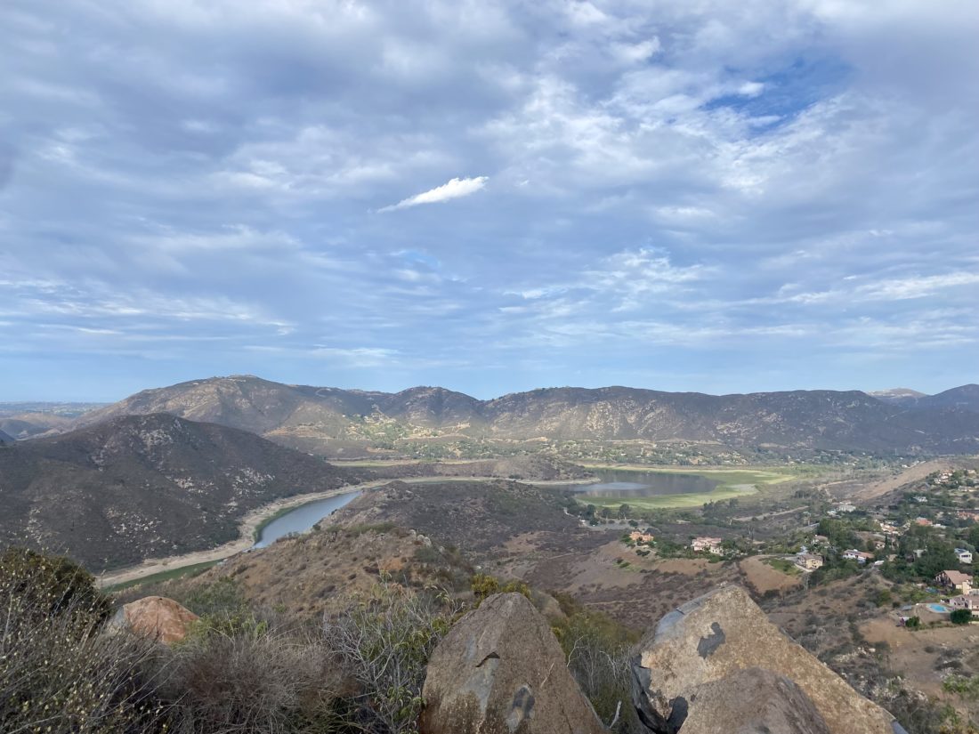
After spending the night at the Grandview Campground, I made my way toward Mosquito Flat Trailhead to begin my backpacking trip in Little Lakes Valley. While I could have made breakfast at the campground, I had a recommendation to stop at the Rock Creek Lakes Resort and have breakfast there instead. After enjoying some eggs, toast, and coffee out on their deck, I hopped back in the car and continued driving toward the trailhead. While it was just after 9:30, I got the last available parking spot. There were some available in the overflow section about ¼ mile back down the road. As a point of trivia, this parking lot is the highest paved trailhead in the US at 10,200 feet!

My basic plan was to saunter along the trail, soaking in the views until I reached Chickenfoot Lake, and then find a campsite. Once I had my camp set up, I would then continue exploring the valley up toward its end at Gem Lakes. After taking advantage of the pit toilets at the trailhead, I set off down the trail. The sounds of Rock Creek flowing past me filled my ears. The trail would take me past several lakes, each with its unique beauty. 

Since I was in no hurry, I made sure to keep my pace relaxed. This was in part to manage my foot, but also to remember the fact I am hiking at over 10,000 feet. The trail would gradually climb for a bit, then rise up a bit as it neared a lake, then it would mostly level out again as it passed by it, then repeat the cycle again.

After formally entering the John Muir Wilderness, the next milestone was the junction with the trail that could take you up to Ruby Lake and over Mono Pass. But that was for another adventure. Soon, my first lake, Mack Lake, would come into view. This lake sits down a bit from the trail, so I did not go exploring it. I could see some folks trying their luck in fishing. Over the two days out in Little Lakes Valley, I saw quite a few folks with fishing rods along the trail.

Continuing on, I soon came to my second lake, Marsh Lake. I left the main trail and followed a small spur trail to get an even better view of the lake. I had barely begun this hike and was already blown away by the beauty of the area. Once back on the main trail, and after a short climb, the next lake would open up before me. The trail now hugged the shoreline of Heart Lake. Here a string of Boy Scouts passed me, returning from their overnight adventures. 

Side streams would flow into the lakes. Some of them had real bridges, while others were just rock-hopping across. My next lake along the trail was Box Lake. Much like Mack Lake, this one sits slightly below the trail. Checking my tracker, I had covered about half of the planned 3-mile hike to the campsite.

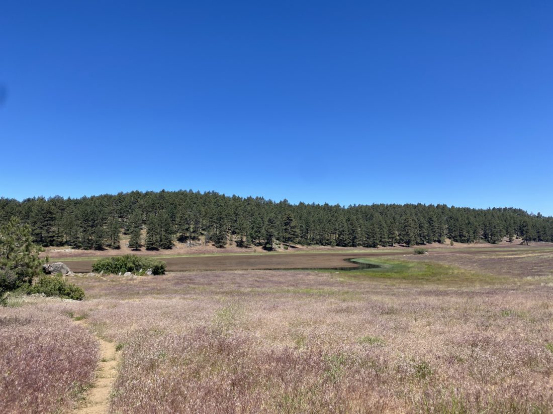
So far, everything was feeling good as I made my way up toward Long Lake. The trail passes on the left side of the lake, along a rocky shoreline. I could start to see the landscape changing, transitioning from the forest into the alpine. I knew after Long Lake, I would reach the junction with the trail that would take me over to Chickenfoot Lake. 

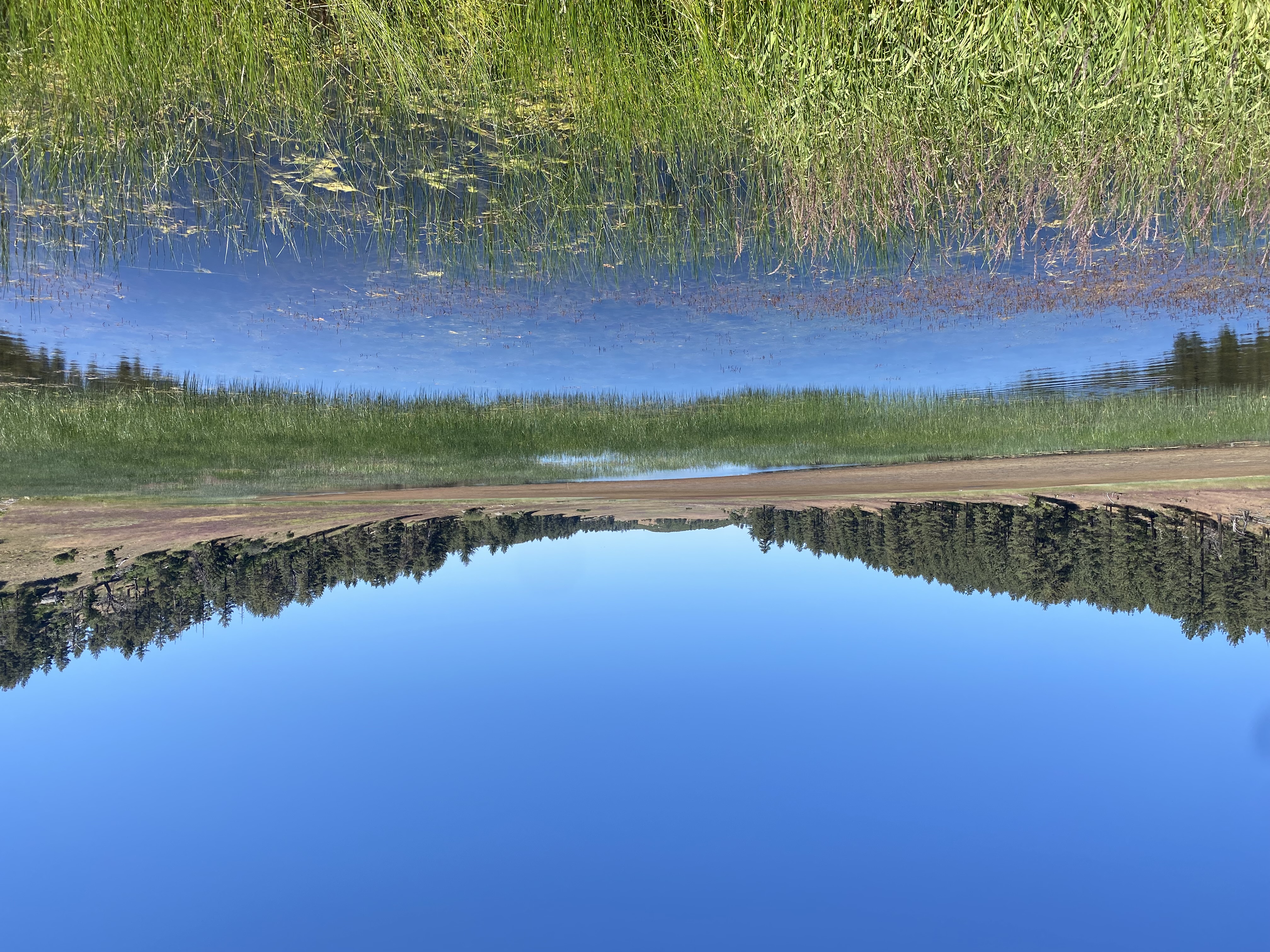
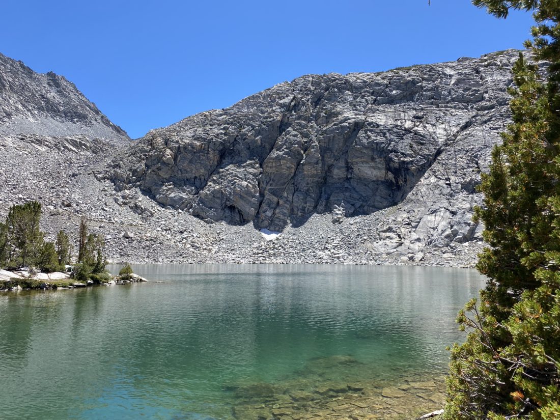
One of the reasons for picking this lake to set up camp is that it sits off the main trail and is a bit more secluded from the main trail traffic. I worked my way up and over to the lake. While the gain is not much, being at altitude certainly has an effect on the effort needed. I passed several sites but wanted to survey my options before picking one. I found a nice one with a good view of one of the “toes” of Chickenfoot Lake and began to set things up. As I headed down to the lake to filter some water, a couple of hikers were nearby enjoying their lunch in the shade. It turns out one of them was the volunteer at the Bristlecone Forest Visitor Center and the one who swore me in as a “Junior Ranger”. Small world… I quickly filtered some water, as I was hungry as well. I tried a new method of filling my ‘dirty’ Sawyer bags by using a Ziploc bag to scoop the water from the lake, then transfer it into the Sawyer bags. This worked like a charm. No more struggling to fill them via their small openings. 

After stashing my bear canister, I tossed some items into my slack pack and set off to explore the rest of the valley. I rejoined the main trail and headed toward the Gem Lakes. Rising to my left was Morgan Pass. Apparently, there was an effort to have a road cross it and come into the valley from that direction. In fact, the frame of one of those cars sits rusting by the side of the trail. I gave serious thought to climbing up to the pass, but the desire to see the lakes won out.

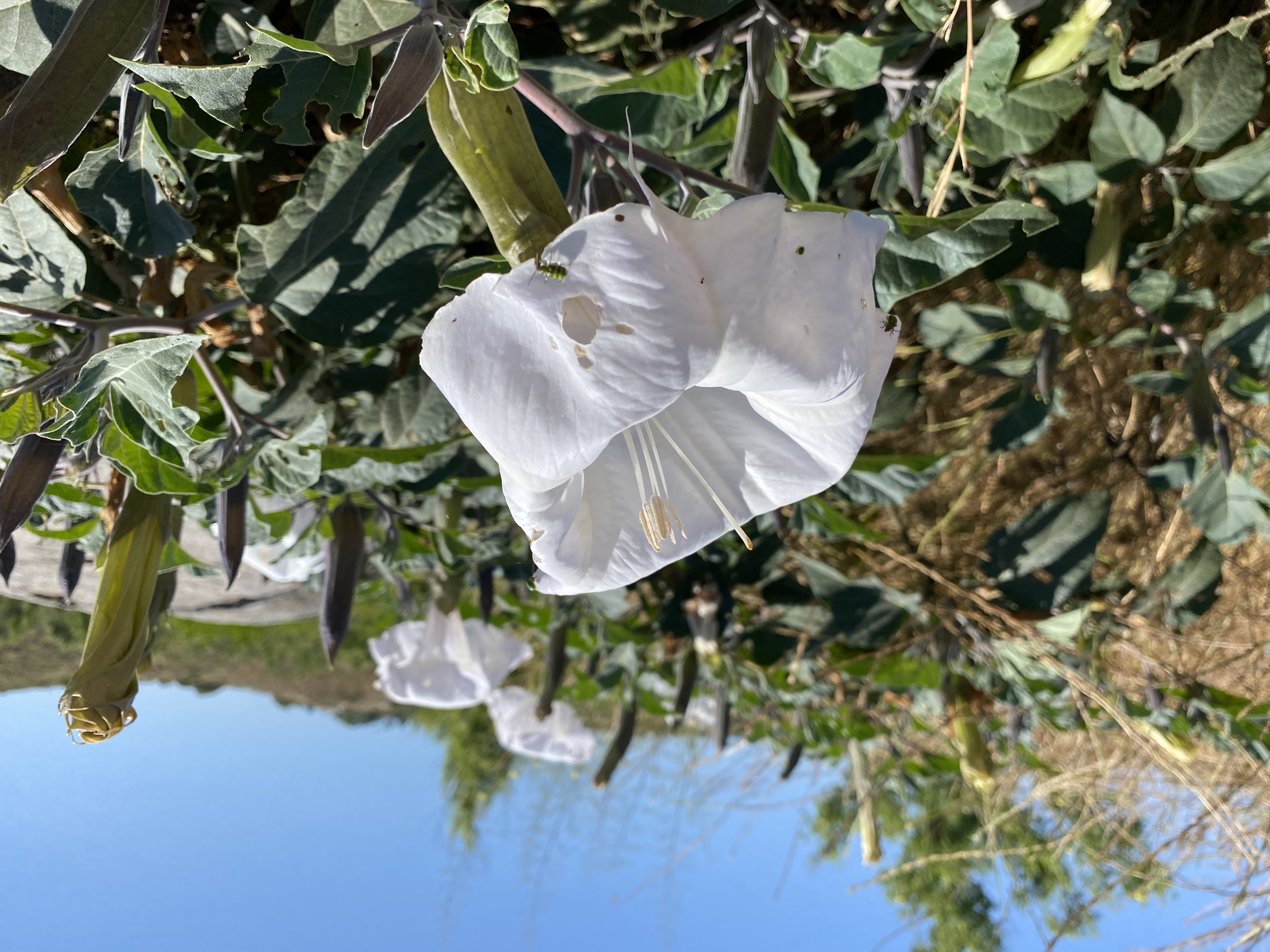
Gem Lakes is a small collection of about 5 or so lakes at the end of the valley. The two main lakes sit almost next to one another at the actual end. A few wildflowers dotted the trail as I hiked toward it. The steep walls of the valley gave me a clear idea of how much further I had to go. I came up over the small rise, and the main lake spread out before me. Some snow still remained tucked against the rocky talus of the northside of the slope. Some folks had pitched their tents at some of the available spots along the shoreline. I followed the trail along it until I reached the western shore, then found a comfortable spot and just relaxed. 

I decided to head back to my camp. I kept eyeing the climb up Morgan Pass and gave it one last consideration at the junction, but I knew I needed to stay conservative as I still did need to hike out tomorrow. Once back at the camp, I gave my feet a nice soak in the cold lake. I figured they had earned that reward. I found some shade, kicked back, and listened to an audiobook for a while. 

As the sun began to set behind the mountains, I left the shore and began making dinner. I sat against some rocks, gazing at the water while eating my meal. The bugs started to come out, so I opted to retreat to my tent and continue my audiobook for a while. Soon, I could feel sleep coming on and I drifted off. Since it was one day after the full moon, I knew I was not going to have a dark sky to enjoy. Around midnight I woke up and poked my head out of the tent to be rewarded with a magical sight. The glow of the moon was lighting up the mountains and I hoped my phone’s camera captured it. Thankfully, it did.

I woke a bit before sunrise, which was fine as I had hoped to also capture some of the early morning aspenglow. I tried to have some breakfast, but I just wasn’t feeling it. I guess the altitude was getting to me a bit. As I was packing, I got the moon setting behind the pointed peaks to the west, and a few minutes later, I got my aspenglow.

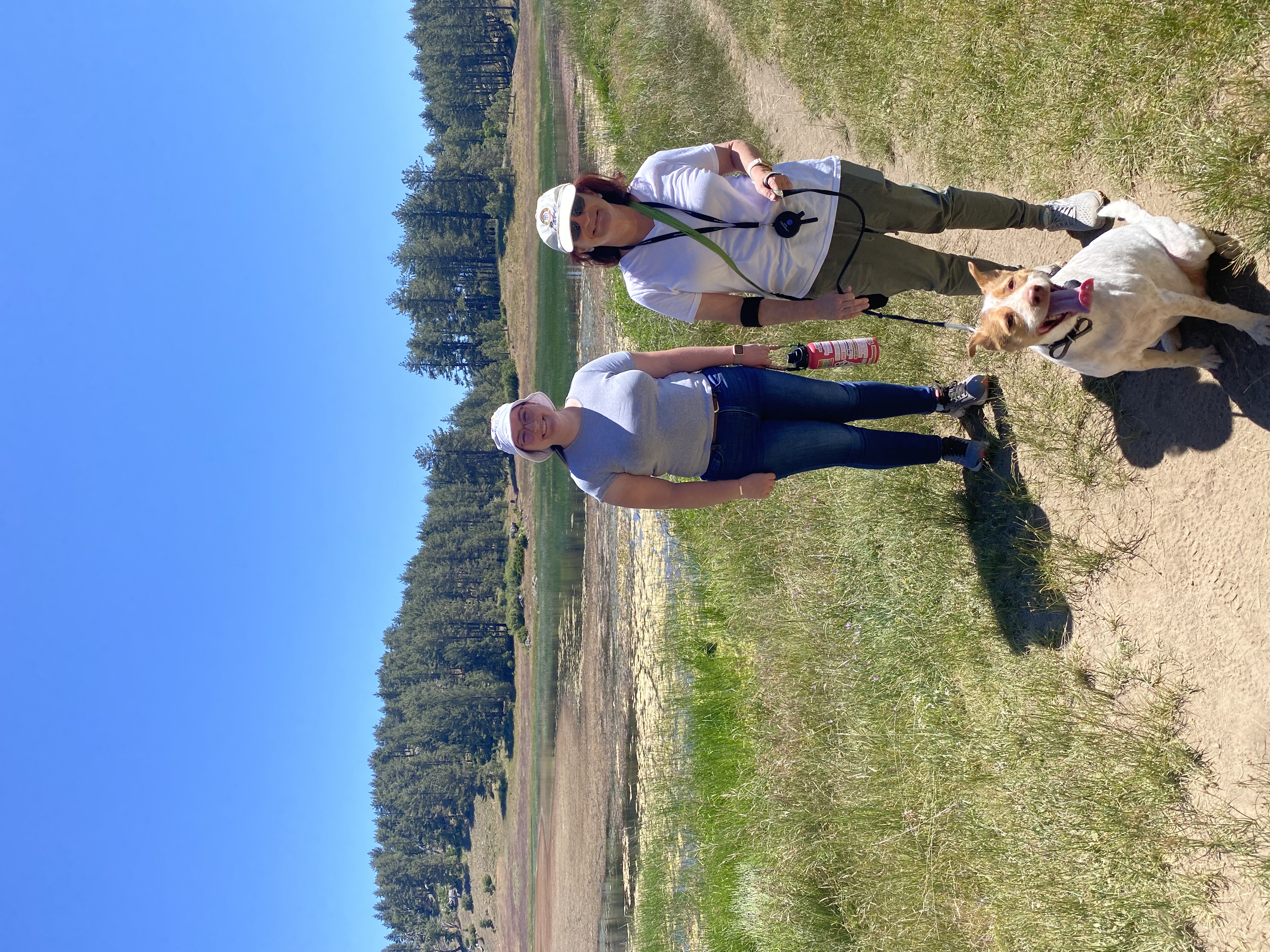
Those pancakes back at the Rock Creek Lake Resort were sounding really good, so I set off. The air was calm as I neared Box Lake, and its smooth surface was a wonderful mirror of the majestic mountains behind it. While the hike out was going to be mostly downhill, I did have a few small bumps to cross over. Several of the other lakes also provide similar shots as I drew nearer to the trailhead. About halfway back, I started to encounter some other hikers, and quite a few dogs as well. I stopped and chatted with some, as they inquired about where I had camped, much like I had done the day before.

The sun finally rose above the high valley walls just before I reached the trailhead. With that my adventure in Little Lakes Valley was drawing to a close. As I made my way to the parking lot, a couple in a truck asked if I was leaving. I told them “yes, in a bit”. They swung around and politely waited for me to switch out of the hiking gear and clean up a bit before heading out. The parking lot was once again full. As I drove away, I saw several folks walking up from the overflow lot to begin their hike. I once again sat on the deck, enjoying a warm breakfast, scrolling through the hundreds of photos I took across the three days, being ever thankful for the opportunities to find peace and joy in this world.

The drive home was uneventful, just long. I made a quick stop at Erick Schat’s Bakery for some bread to bring home and picked up my other Junior Ranger badge at the Eastern Sierra Visitor Center. Once home, I unloaded the car and gave it a good airing out as we needed it to pick up my daughter later that night from the airport. Another great trip was now in the books. And as an added bonus, my foot did ok. 


Buy Me a Coffee at ko-fi.com

I am an avid peak bagger, sometimes backpacker, and former sea kayaker living in San Diego. I am the co-author of Urban Trails:San Diego, coming in Spring 2026!

In 2019, I became the third person to complete the San Diego 100 Peak Challenge. Not stopping with that accomplishment, I set my sights on the harder San Diego Sierra Club 100 Peak list, which I completed in 2021. In addition, I have conquered several Six-Pack of Peaks challenges (SoCal, San Diego, Central Coast, and both the Arizona-Winter and Arizona-Summer). I am looking forward to exploring new summits and new adventures across the southwest.