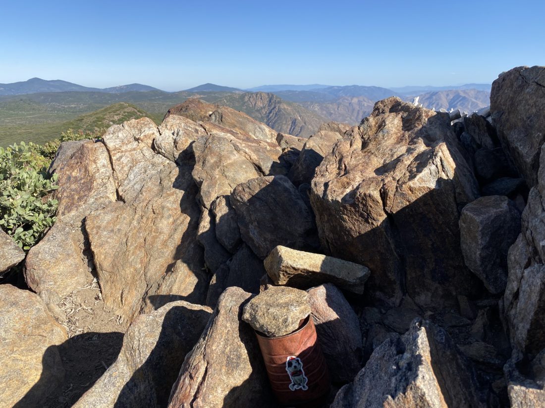
For the second hike on the Coast to Crest Challenge, I decided why not do the one that is almost in my backyard, Black Mountain. The recommended route was to take the Miner’s Ridge trail to the summit to snap your selfie. From the parking lot, the trail heads east for a bit before making its turn and starts climbing toward the summit.
I took a more direct route so I could also summit the ‘secondary’ summit as well. Plus, I was planning on getting in a second hike in after.
Once I reached the summit, there were numerous mountain bikers, some other hikers. I stayed long enough to take the photo and retreated from the crowds. I made my way back to the car, tossed in my gear, and headed off to the Scorpion Ridge-Santa Fe Valley Connector trail.
I am an avid peak bagger, sometimes backpacker, and former sea kayaker living in San Diego. I am the co-author of Urban Trails:San Diego, coming in Spring 2026!
In 2019, I became the third person to complete the San Diego 100 Peak Challenge. Not stopping with that accomplishment, I set my sights on the harder San Diego Sierra Club 100 Peak list, which I completed in 2021. In addition, I have conquered several Six-Pack of Peaks challenges (SoCal, San Diego, Central Coast, and both the Arizona-Winter and Arizona-Summer). I am looking forward to exploring new summits and new adventures across the southwest.
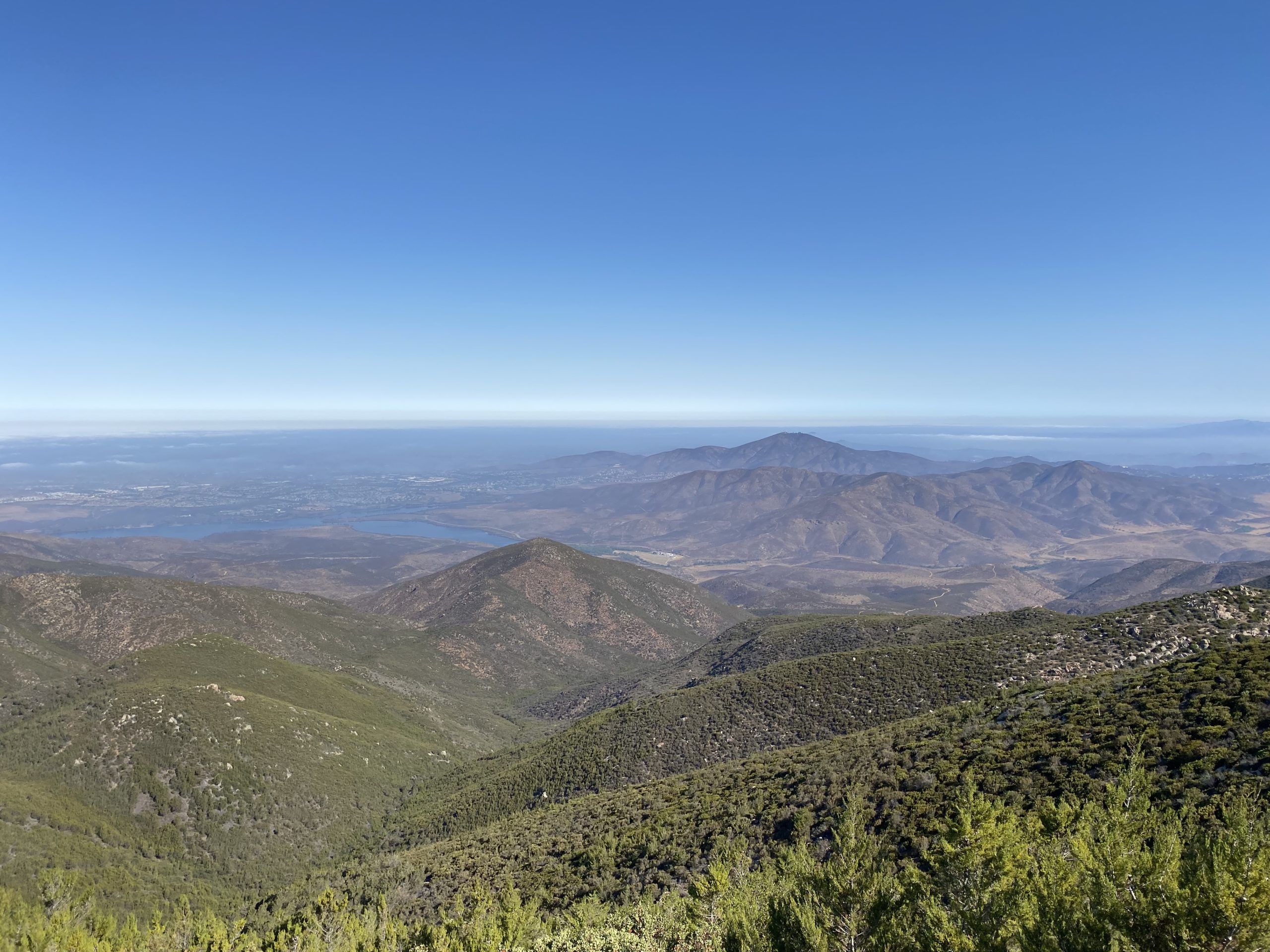
Rather than fight the traffic trying to summit one of remaining peaks on the Six Pack of Peaks list, decided to stay in town and knock off two peaks that are drivable: Otay Mountain and Tecate Peak. Saw one car, and it was not a mini-van on the way up Otay. Parked near the summit and strolled up the last 1/2 mile.
From there we drove down the east side, passing a single motorcycle. The road was in fantastic shape! Once back on the 94, we made the short drive to Tecate and the drive up to its summit.
I am an avid peak bagger, sometimes backpacker, and former sea kayaker living in San Diego. I am the co-author of Urban Trails:San Diego, coming in Spring 2026!
In 2019, I became the third person to complete the San Diego 100 Peak Challenge. Not stopping with that accomplishment, I set my sights on the harder San Diego Sierra Club 100 Peak list, which I completed in 2021. In addition, I have conquered several Six-Pack of Peaks challenges (SoCal, San Diego, Central Coast, and both the Arizona-Winter and Arizona-Summer). I am looking forward to exploring new summits and new adventures across the southwest.
From the summit of Otay Mountain, we drove down the east road back to the 94. A lone motorcycle passed us during our descent, so far we have had the mountain all to ourselves. Once at the border, we drove along the border wall. Here we passed a border patrol truck. I rolled down the window and let the agent know what are plans were. He wished us well and we continued on.
Tecate Peak
The road was certainly rougher than the Otay Mountain Truck Trail, but nothing that the Subaru could not handle. We worked our way up to the summit. It was in the mid-80s, so I drove all the way to the top.
We took in the views, spotting the various peaks we have climbed and a few that Ted still needs… Once we were done, we carefully drove back down. There was a border patrol lookout along the way, but it appeared not to be staffed. We also passed another parked truck while we made our descent, but was not sure if it was also border patrol or not. It was getting close to lunchtime, so we headed home and grab some Mexican food from Mi Ranchito and enjoyed it in the shade of my backyard. It was nice to cross these two off the list again without any issues.
I am an avid peak bagger, sometimes backpacker, and former sea kayaker living in San Diego. I am the co-author of Urban Trails:San Diego, coming in Spring 2026!
In 2019, I became the third person to complete the San Diego 100 Peak Challenge. Not stopping with that accomplishment, I set my sights on the harder San Diego Sierra Club 100 Peak list, which I completed in 2021. In addition, I have conquered several Six-Pack of Peaks challenges (SoCal, San Diego, Central Coast, and both the Arizona-Winter and Arizona-Summer). I am looking forward to exploring new summits and new adventures across the southwest.
With the 4th of July weekend upon us, the thought of fighting holiday traffic and crowds on any of the Six-Pack of Peaks I still needed to do did not seem appealing. Since I was still on vacation, I opted to go ahead and summit Otay Mountain and Tecate Peak. These are drivable summits, and I really don’t have any desire to hike them. Ted Markus was also free, so he hopped into the passenger seat and we set off.
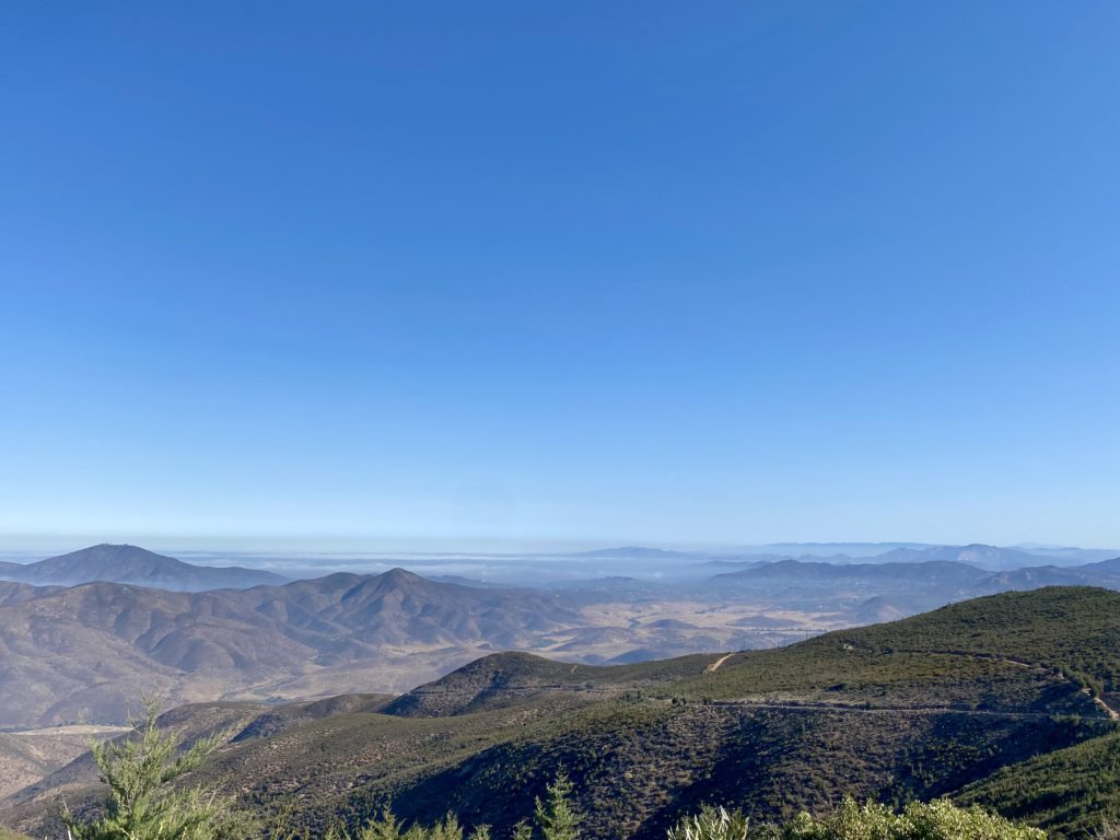
Looking back at Otay Mountain Truck Trail
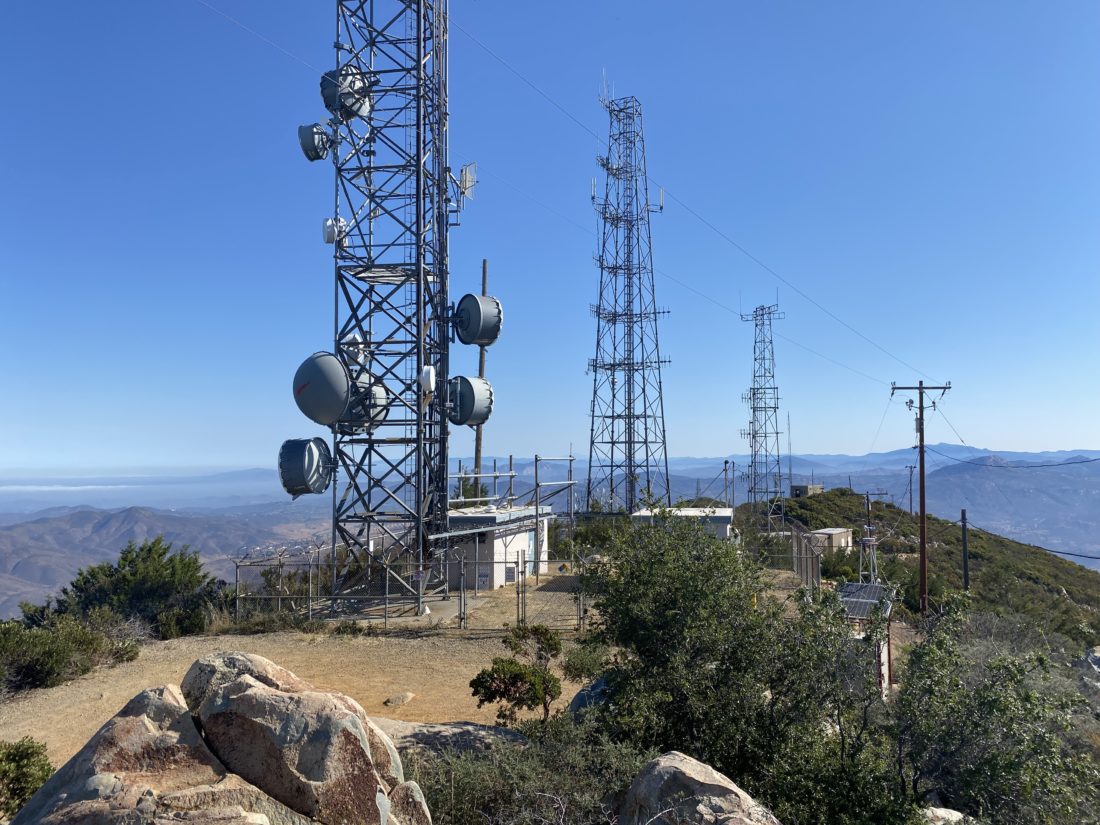
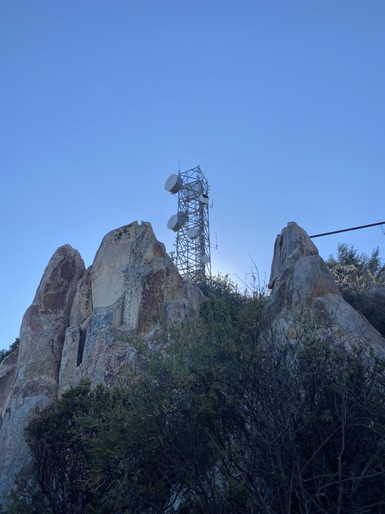
The road was in really good shape. I was hoping being early and on a Friday we would not encounter anyone on the road, as it can it narrow at times. It was not almost until Doghouse Junction that we pass our first car. Thankfully we were at a nice wide spot so there were no issues. Since it was warm, rather than parking at Doghouse Junction, we drove to the turn off to the summit and parked there.
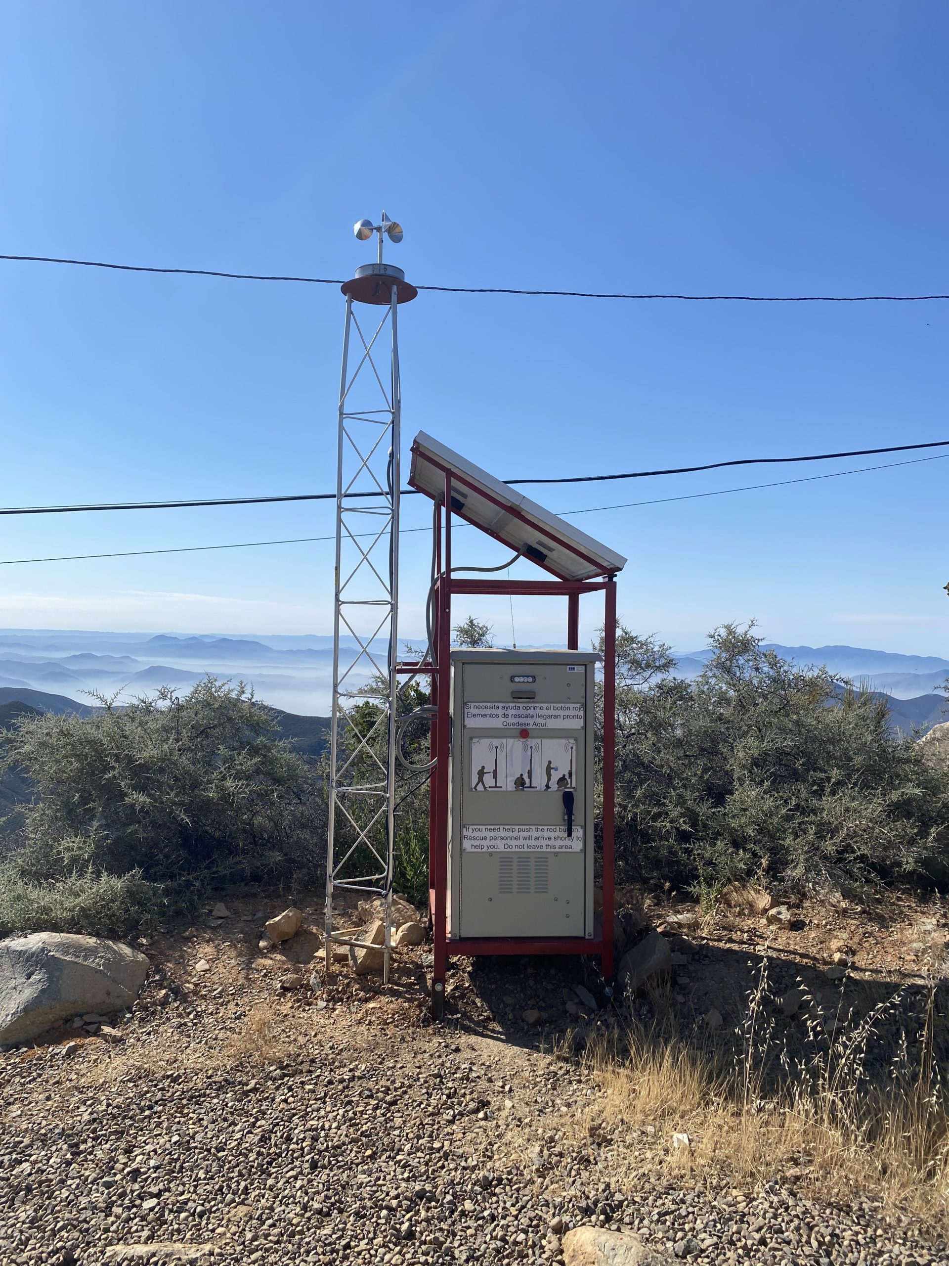
We hiked the 1/2 mile to the summit and took in the views. A new rescue station was in place for any migrant that finds themselves here and in trouble.
We poked around the summit for a bit then headed back to the car to continue on to the second peak of the day, Tecate!
I am an avid peak bagger, sometimes backpacker, and former sea kayaker living in San Diego. I am the co-author of Urban Trails:San Diego, coming in Spring 2026!
In 2019, I became the third person to complete the San Diego 100 Peak Challenge. Not stopping with that accomplishment, I set my sights on the harder San Diego Sierra Club 100 Peak list, which I completed in 2021. In addition, I have conquered several Six-Pack of Peaks challenges (SoCal, San Diego, Central Coast, and both the Arizona-Winter and Arizona-Summer). I am looking forward to exploring new summits and new adventures across the southwest.
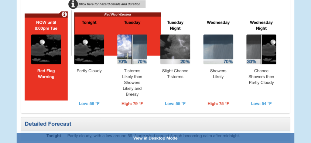
As my permit dates for Rae Lakes began approaching, I started watching the weather forecasts with more interest. Initially, this was to figure out what I might need to pack. But as the days became closer and closer, I became more concerned about the conditions I might find myself in. This was going to be my first multi-day solo trip, so I was trending toward being extra cautious about the journey. Initially, the forecast called for a warm start, followed by a 20% chance of thunderstorms for the rest of the trip. That is manageable, as thunderstorms are common in the latter part of the day. But each day, the forecast kept trending in the wrong direction. That 20-30% chance became 30-40%, then 40-50%. In addition, the weather service also issued a Fire Weather Warning (which was later changed to a Red Flag Warning) for late Monday afternoon through Tuesday evening. They warned of dry lightning triggering fires and the high winds creating the possibility of it becoming fast-moving. Not really the conditions that I looked forward to hiking into. As I sat in my hotel in Visalia, I reached out to some of my more experienced backpacking buddies (David & Leslie/Mike) to get their take. They all agreed that it did not look like it was going to be a fun trip. The general consensus was to go ahead, get up early as planned and drive the 2 hours to Road’s End and consult with the ranger. If I liked what I heard, continue on to the first campsite and spend the night. Then I could make the call and decide if I want to continue or simply turn back. With that, I set my alarm for 4 am, and hit the pillow.
When I woke up. I checked the latest weather report and saw that it was looking more like 50-60% of thunderstorms and showers as well were now in the forecast. Given I had not camped in the rain, doing it for multiple days seemed like a poor option. I got to the permit station just a touch after 7 am. I spoke with Ranger Mary about the forecast and what her thoughts were. She basically asked, “How much do you like being wet?” That settled it, no loop for me this time, but I was still game for one night in the wilderness! So, I parked in the long-term lot, finished getting ready, and hit the trailhead just before 8 am. The forecast for Upper Paradise was to be in the low 80s, with a light breeze. I had hoped that my early start would let me stay ahead of the heat. I had not paid attention to the forecasted high, so I had no idea exactly what I might be racing against.
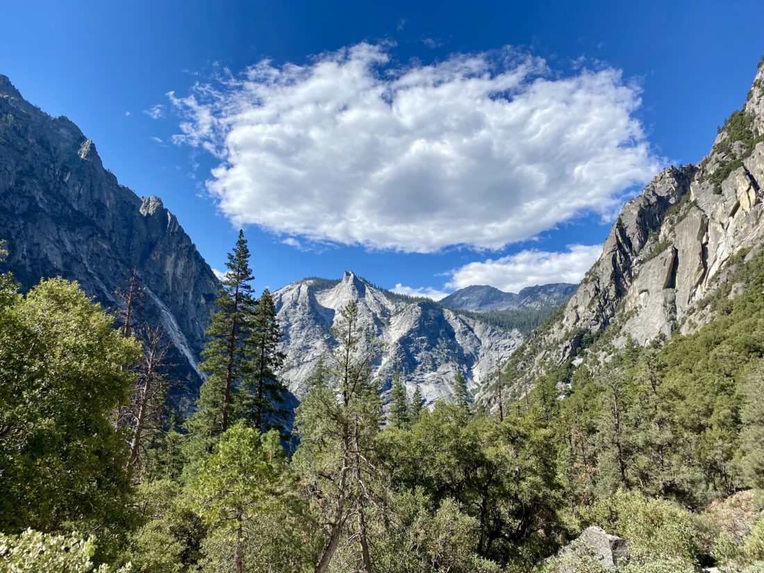
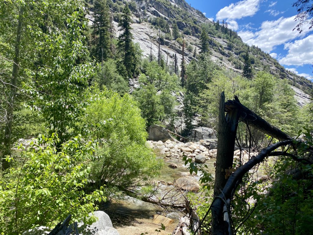
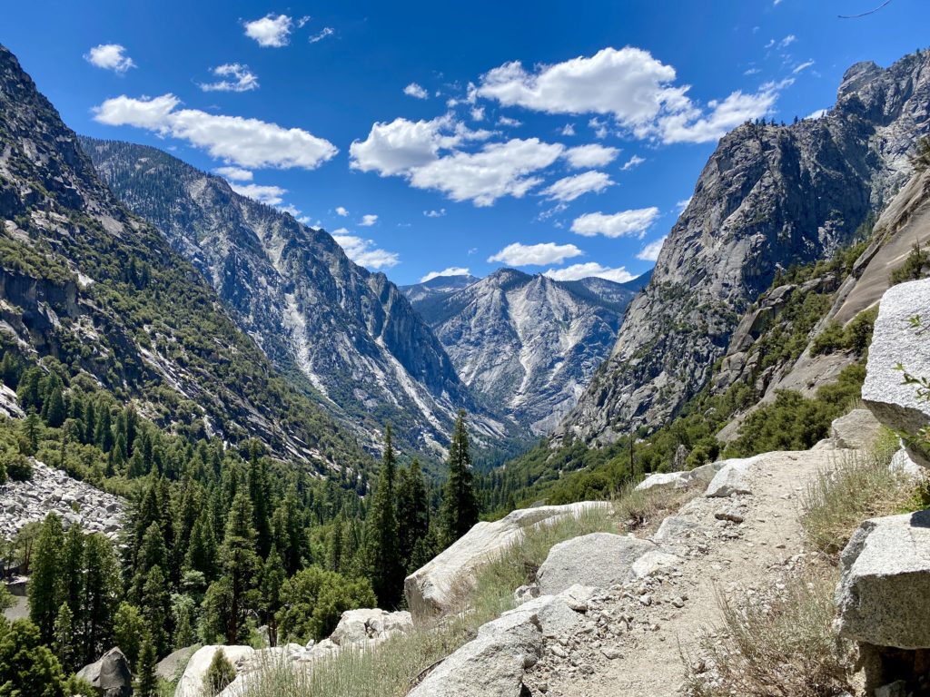
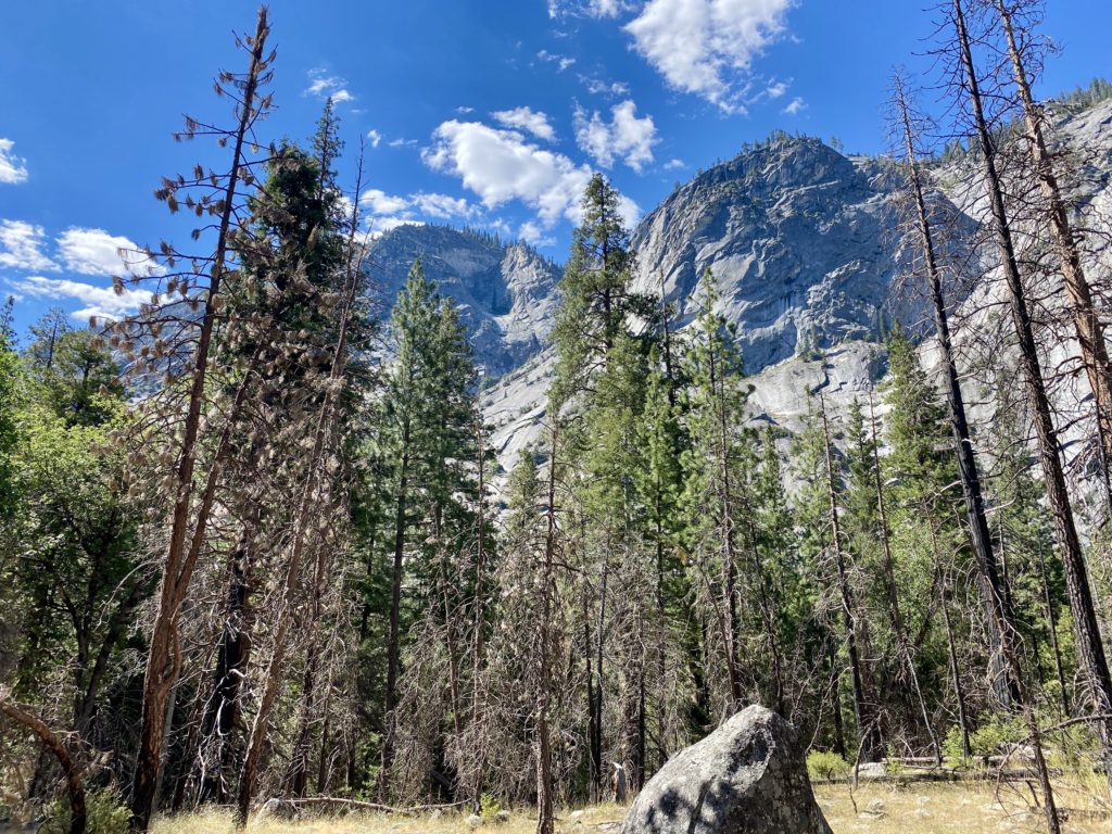
The trail is fairly flat for the first 1.9 miles until it reaches the junction of the Kings River and Bubbs Creek. Here I would take the left fork and begin ascending toward Paradise Valley. The sounds of the river were so refreshing. The views were as incredible as I had imagined. It was getting warmer as I pushed on. I had a liter of water in my interior water bladder, a liter in a side bottle, and 1 liter of Gatorade. I could feel my pace slow. At first, I thought I might be the added weight of 5 days of food, the extra clothing, and other items making it tougher. But, as I felt the sweat begin to soak my shirt, I knew that day was warmer than I had hoped for.
At Mist Falls I took an extended break. Ate some of the oranges I brought for the first day and drank some more fluids. I decided to spend a bit of time in the shade and recharge before pressing on. Most everyone here were day-hikers. Oh, how I coveted their small light packs… I pressed on, being mindful of the temperatures. I dug out my cooling towel and wrapped it around my neck.
I kept finding myself looking for a place to sit under some shade for a bit. I checked my position and the topography ahead of me. I gave serious consideration to throwing in the towel and bailing. I found another rest stop and refilled my side bottle with some cool water from the river (properly filtered of course). I finished my oranges but still could not think about having my proper lunch. I knew that this was not a good sign, so I tore open one of my goos and forced it down.
As I made my way across the exposed switchbacks, I estimated the temperatures were either in the upper 80s or low 90s. This was going to take some serious effort if I was actually going to make camp. My spirits were getting crushed. I would move from shady section to shady section, pausing for a bit almost every time. Once I reached the southern end of the valley, I took another break and was able to eat my lunch. I again went to the river to filter more water, as my bladder had been completely emptied by this point. Rechecking the map, I was not too far from Middle Paradise campsite, so I pressed on.
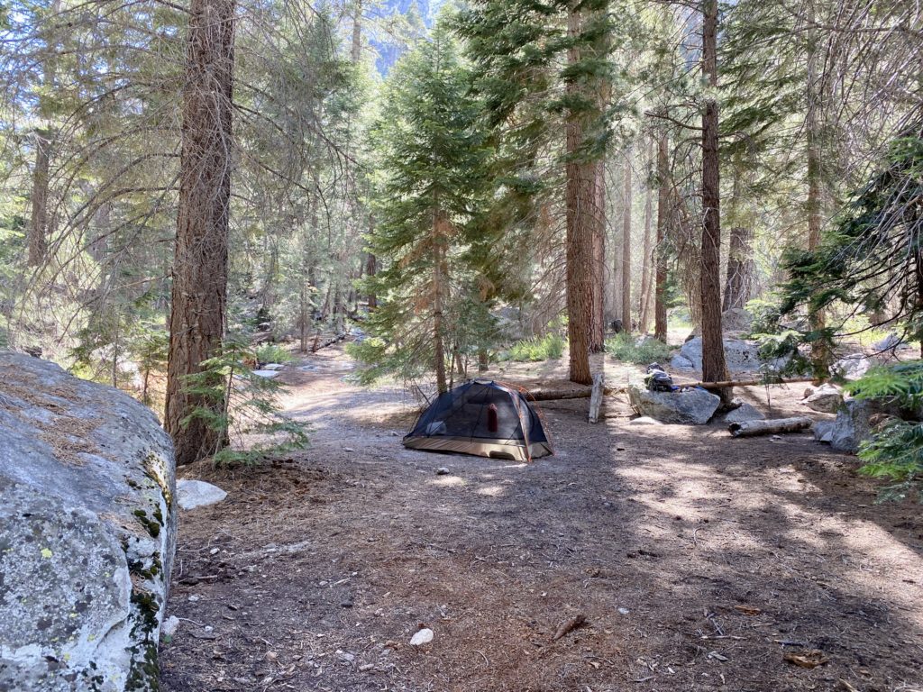
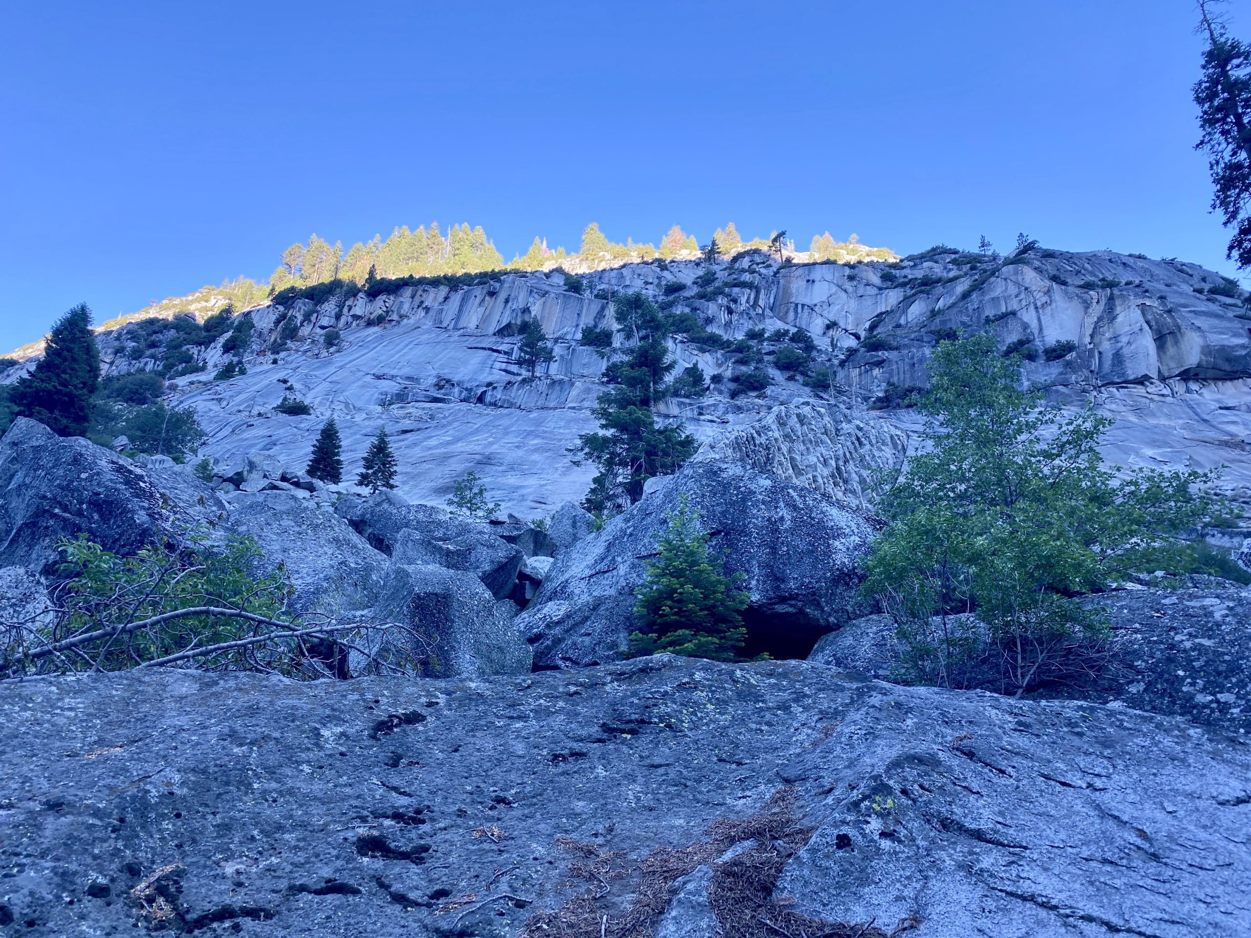
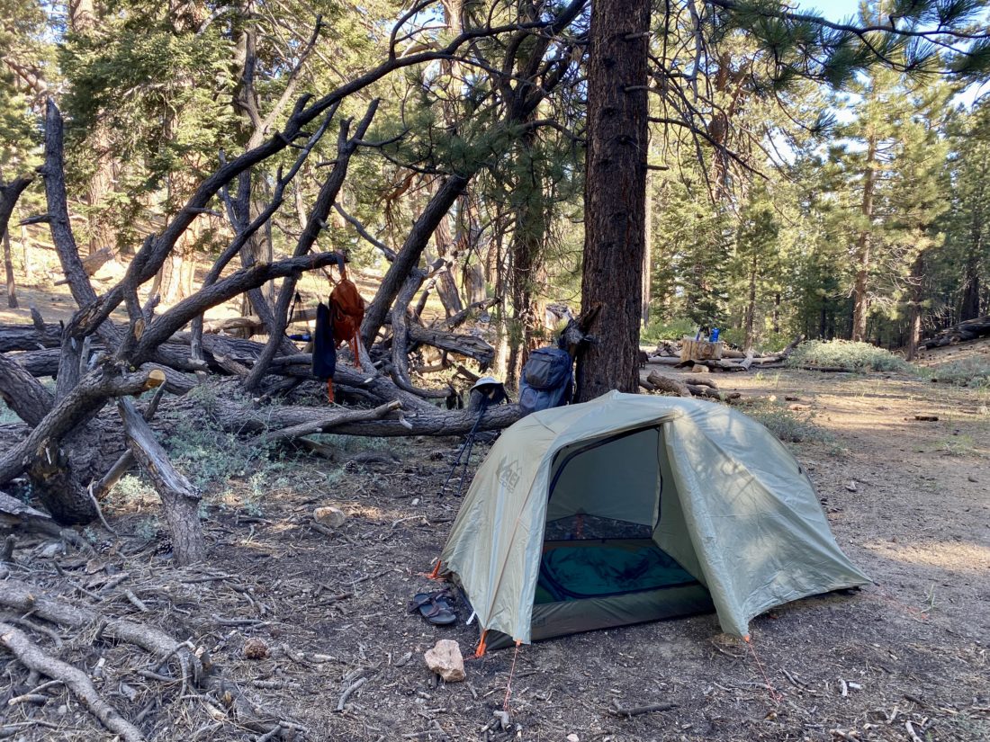
Passing through Lower Paradise, I could see the numerous dead trees and why this campsite is currently closed. I then spied the bear locker at Middle Paradise and said this was as far as I was going to go. I was the only one here, so picked a nice spot a bit back from the water, hoping the bugs would not be an issue. Thankfully, for most of the hike, they were not too bad.
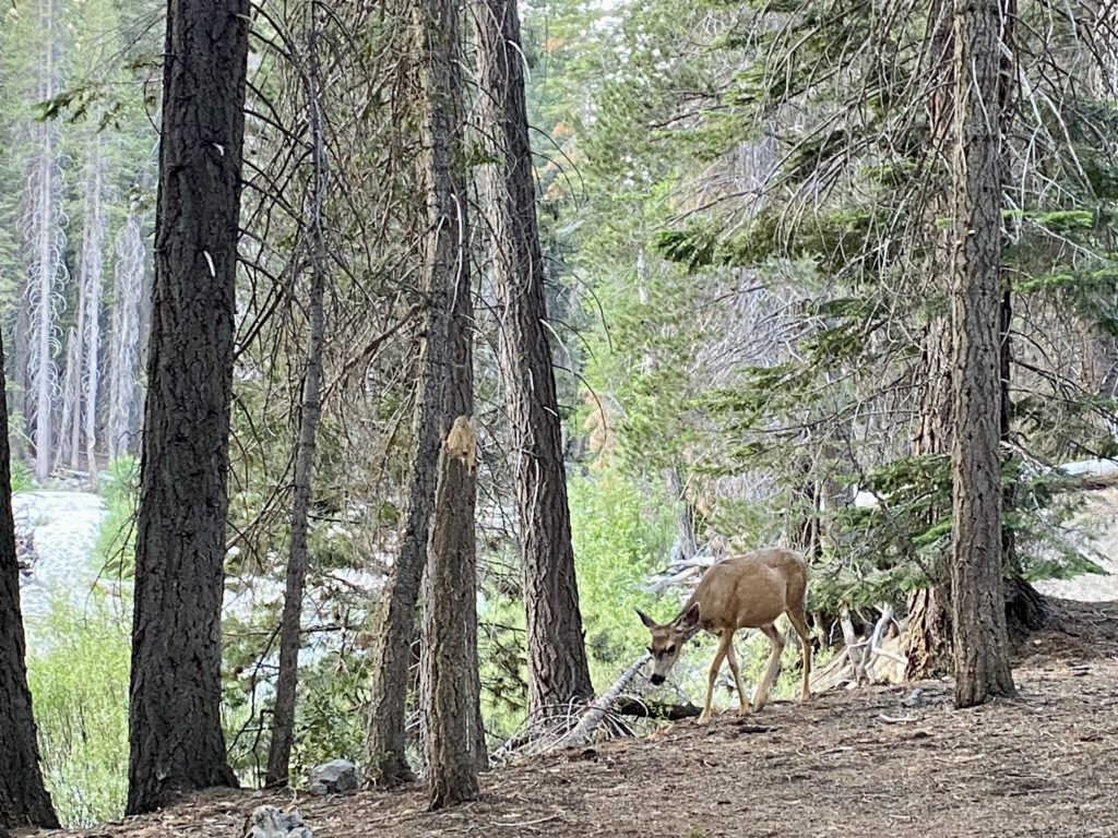
I got some more water and then began to set up camp for the night. It was only 3:30 or so, but I just did not have the energy to hike another 2 or so miles to Upper Paradise. Eventually, 3 other hikers joined me at the site. And not soon after that, a doe strolled past us with not a care in the world. While soaking my feet in the cool water, I used my InReach to report in with my wife and give her my status.
My site had a fire ring, so I had planned for a small fire to pass the time later. I gathered some starter material and placed the pine needles in the pit. I then set off to find some downed wood that I could use. I started to smell the familiar smell of a campfire. I figured it must be from further down the trail. According to GaiaGPS, the Middle Paradise campsite was further north. I then looked over to the fire pit, and the started material had begun to smolder on its own! It seems the last users of this firepit had not properly put it out. Thankfully, I took care of it, but I was pissed.
About 4 to 6 other hikers passed on through, pushing on toward Upper Paradise. I would say now that I had an extended break here, I probably could have pushed on. But, I was fine spending the night here. Later in the early evening, two more hikers also decided to find a spot to pitch their tents. It was one of them who spotted the bear as it passed around us. We watched it as it took a look at us. It looked to be about 2-3 years old and did not seem to have any tags or collar. Eventually, it wandered away. I certainly was going to be a bit more cautious for the evening. Since I was not needing 5 days of food I treated myself to a double dinner, being a bit more mindful of any unwanted company.
With plenty of water to manage my fire, I sat and enjoyed the flames. I reflected on what I had overcome. I let the fire die down until only the embers remained, I doused it with my water pouches and made sure it was out. I had really wanted to gaze up at the night sky from Rae Lakes, but this view would have to do. The night was pleasant, I slept without the cover on my tent and just my camp shirt on. Once the moon rose, it did wake me once, but even that was a welcomed sight. As the pre-dawn broke, I found myself rested and ready to head back out. The other folks were going to continue on to Woods Creek and then see what the weather held. I did briefly consider it, but in the end, felt it best to stick to the one night.
I repacked my bag, trying to be mindful of the other campers. I knew I was hiking down into the heat, so I wanted an earlier start. Not ten minutes on the trail, I spotted that same bear dashing in front of me and then stopping a safe distance away. I kept my face toward him as I continued carefully down the trail. Two hikers passed me before I reach Lower Paradise, and I gave them each a heads up about my earlier bear sighting. Upon reaching Lower Paradise there were two folks who had ignored the closure notice and camped there. I let them know as well.
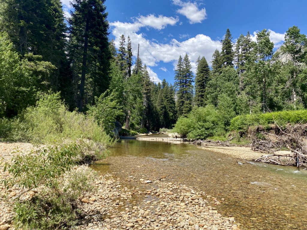
The miles slipped by much easier, the pack a little lighter, the temperatures pleasant and mostly going downhill. I stopped at Mist Falls, and this time the entire area was empty. I sat a listened to the roar of the river tumbling down. When I went to put my pack back on, the sternum strap snapped. Crud! Maybe this was a sign that turning back was a good idea. Also, I did discover a hole in one of my pairs of Darn Tough Socks…. About ¾ of a mile past Mist Falls, I meet my first day-hikers. A family was taking a break and politely asked if I had bug spray. The bugs had been worse today. In fact, at Mist Falls, I broke out the bug net. I turned around and told the father which pocket to find it in. They were so happy. We chatted some before we each headed our separate ways.
As I made my way along the trail, a mule train was making its way up, I assume to resupply the ranger station at Rae Lakes. I stepped aside and let them pass. Now I would watch out for fresh droppings on the trail. A bit further down, I met two more day-hikers, they told me they just encountered a rattlesnake slithering off the trail. Sure, enough it was just off to the side, minding its own business. I safely snapped a photo or two and continued on.
I started to encounter a mix of day-hikers and those still heading out to attempt the loop. I let the backpackers know about my bear sighting at Middle Paradise and wished them well. Soon, I found myself back at the junction of Bubbs Creek and the Kings River. I hoped to cross that bridge upon my return from the loop. But this time just a quick stroll on it would have to do.
The day was getting much warmer, and I could feel the need to drink more and more as I covered the last couple of miles. I found myself drifting from shady section to shady section again. I was guessing it was in the mid to upper 80s. I would know soon enough once I got to the car. It was about 10:30, and I met someone just heading out. We chatted a bit, he had just landed a walk-up permit. He had hoped to have the ability to send a message to his wife, but couldn’t. So I offered to pass along his itinerary for him once I was able to.
Finally, the permit station came into view. I spoke with the ranger and gave him my bear sighting information, as well as the camping at Lower Paradise and the fire issue. The area is now at Stage 3 fire restrictions, so the small fire I had is no longer allowed. Once at the car, I cleaned up some, then threw on some shorts and a t-shirt. Unfortunately, I also developed a nice blister on my toe. I had felt something earlier, but when I checked my foot, I did not see it. I guess it was another sign that I made the right call. I picked out some snacks for the ride home, but the trail mix was not going to be one of the options, as it had melted into a mass of goo. Yeah, it had been warm on this hike. As I pulled away, heading toward Cedar Grove for some cold soda and a snack, I waited for the car’s thermometer to settle down. It read 95°F at 11 am. Yikes! That would explain why I had so much trouble, it was even hotter than I planned.
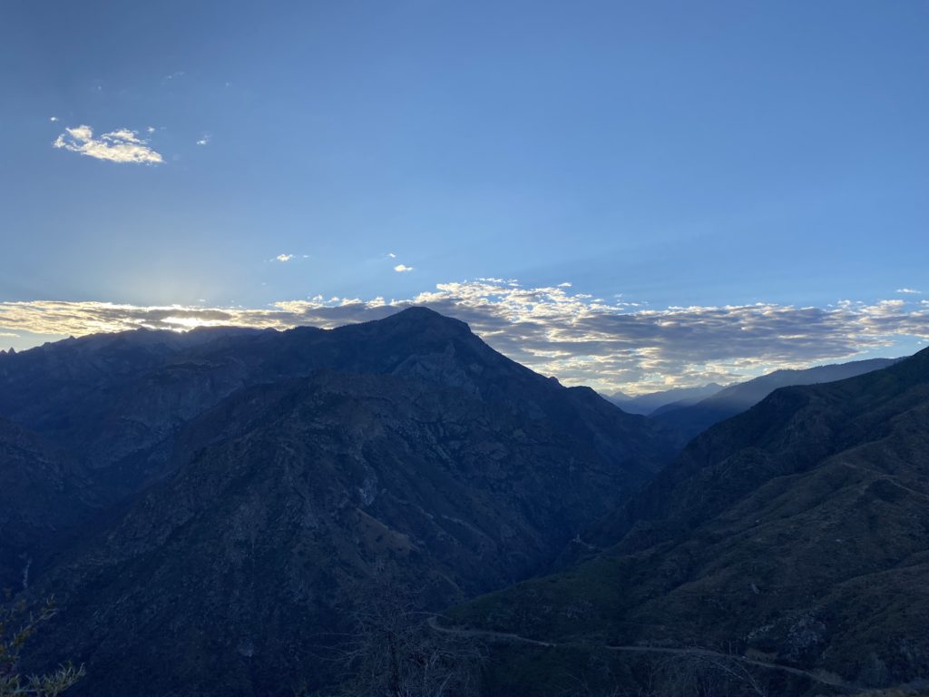
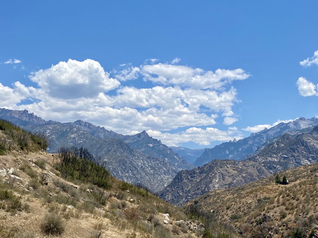
As I drove up out of Kings Canyon, I pulled over at a nice vista and could see the start of the clouds forming in the distance. I decided to take the long way home and drive through Sequoia National Park. I did not plan to stop, I just wanted to enjoy the trees and views. Once back off the mountain, I headed back through Bakersfield, this time stopping at Dewar’s to pick up some chews for the family. All in all, it was an adventure to build on. Except for the one-two punch of the heat and the predicted rain, the trip went mostly well. Maybe in the early fall, I might find an opportunity to try again…
The forecast on Monday.
I am an avid peak bagger, sometimes backpacker, and former sea kayaker living in San Diego. I am the co-author of Urban Trails:San Diego, coming in Spring 2026!
In 2019, I became the third person to complete the San Diego 100 Peak Challenge. Not stopping with that accomplishment, I set my sights on the harder San Diego Sierra Club 100 Peak list, which I completed in 2021. In addition, I have conquered several Six-Pack of Peaks challenges (SoCal, San Diego, Central Coast, and both the Arizona-Winter and Arizona-Summer). I am looking forward to exploring new summits and new adventures across the southwest.
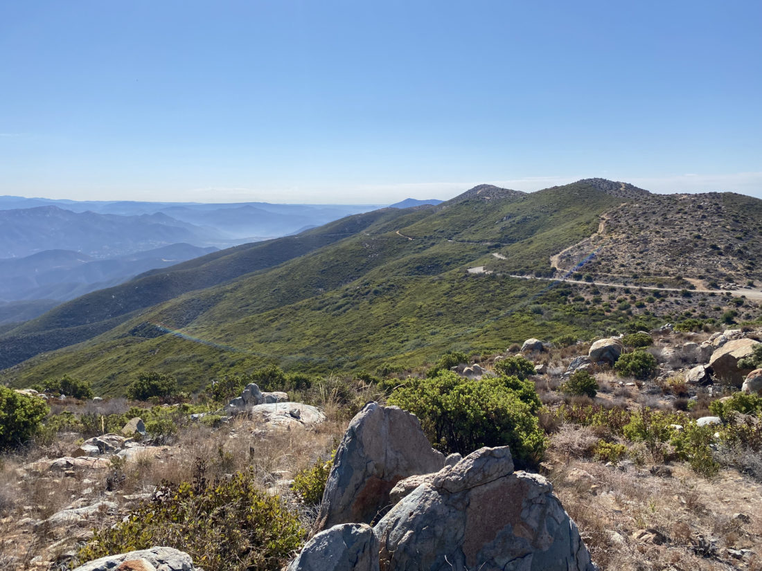
For those who have done the 3-2-1 Challenge in Los Padres National Forest, you know that one of the real challenges is just the long drive to the trailhead. Last year when Ted Markus and I did these peaks, we did it as a day hike. During the long drive back to San Diego, we both commented that while the hike itself was great, sitting in LA traffic, not so much. Since we had both acquired backpacks and related overnight gear, we decided to do this trip as an overnight adventure.
Last year I logged that the entire hike was just under 11 miles, including a side trip to Sawmill Mountain West, so we knew this trip would be quite manageable. In fact it is about 4.5 miles to the campsite, and we’d pass the first two peaks on the challenge; Mt. Pinos and Sawmill. I figured once we made camp, we could go to the summit of Grouse, about a mile away. Another goal of this trip was to test out a few new items before I embark on the Rae Lakes Loop in a few weeks. Primarily the bear canister and the water filter.
Ted and I left San Diego just after 8 am and began our drive up to the trailhead. Our first stop was the Subway in Castaic. While there is a spring at the campsite, we were cautious about the flow. One site labeled the flow as ‘a trickle’. Rather than risk needing to use our water for food, we planned our hike to avoid needing to do so. Also, instead of hauling out lunch to eat on the trail, we stopped at Mike’s Pizza Co in Frazier Park and split a nice medium-sized veggie pizza. Ted had also packed a couple of beers for later that evening, so I ran next door to the market and grabbed some as well.
About 30 minutes later, we were pulling the parking lot at the Chula Vista Trailhead (aka Nordic Base), and we quickly gathered our gear. I hung my Adventure Pass from the mirror and we were off. The temperatures were pleasant and the scent of the pines was a welcomed treat. I carried our dinner in the bear canister, along with 2 liters of water and one Gatorade. This fluid load is about what I am planning for Rae Lakes. While the actual pack will be heavier with more food and clothes for the trip, it should give me some insight to what I have in store.
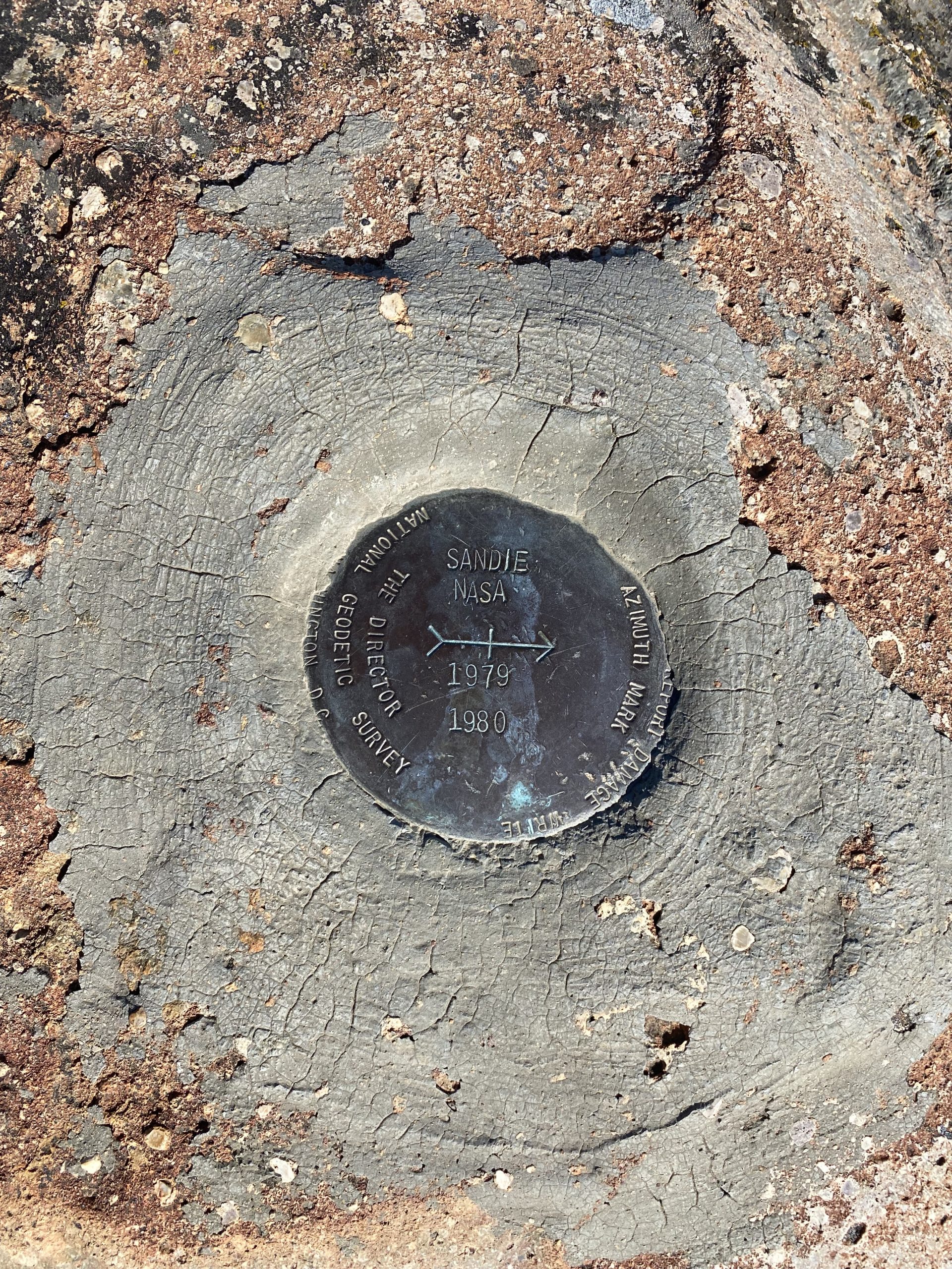
The trail, actually a closed dirt road, led us to the top of Mt. Pinos. In just over 1.5 miles, we gained about 500 feet. Once at the summit, we snapped a few photos of the survey marks and the southern San Joaquin Valley. Neither one of us felt the need for a real break yet, so we continued on. The nice road ended at the Mt. Pinos Condor Observation Site. There are some nice benches here but we still felt fine, so instead of stopping we headed down the Tumamelt Trail. This hike is a bit of a roller coaster, up to one summit, down to a saddle, then up to the next, and once again for good measure. I remember needing to stop last time when I was ascending this section. I was interested to see how I would do on this section the next day. For now, we just worked our way down the switchbacks.
Once at the saddle, we began to regain those 500 feet we just lost. I took a couple of short breathers under some refreshing shade, but overall everything was still feeling good. The summit of Sawmill sits off to the side of the main trail, about .2 miles away. We soon found ourselves before the massively stacked cairn and the curiously misspelled sign. I have seen incorrect elevations before, but not a misspelling on a simple word like Sawmill.
We dropped our packs and took a short rest. I had some Gatorade and some trail mix. After about 10 minutes, we put our packs back on for the descent down to Sheep Camp. At about 4.6 miles, we came to the junction of Tumamelt and the North Fork Trail. The campsite is about ½ mile down the North Fork Trail. As we neared it, we could hear the voices of other campers. Since this was a first-come, first-served site, I was hoping that we would find a spot. Thankfully, site #2 was open and we would not be looking to find an alternate site for the evening. I dropped my pack and walked the 50 yards or so to inspect the state of the spring. It had a nice steady trickle. I could see if you needed water for a group of Boy Scouts, you could wait a while. But for what we needed, this would be fine.
Sheep Camp Spring
With our tents set up, we grabbed our slack packs and set off to finish the 3-2-1 Challenge by climbing up Grouse Mountain. Ted brought a simple waist pack, while I was testing yet another new item, the REI Flash 22 pack. We made our way back up to the junction and then continued on about .3 miles until the junction that would take us up to the summit. In keeping with the spirit of the day, we had another roller-coaster profile before we would reach ‘False’ Grouse. The well-defined trail ends at what appears to be the summit. There is even a small rock cairn. But in reality, the true summit is back along the crestline. There is where you will find the wooden structure that you probably have seen before. We snapped our photos and headed back to camp. Ted was hoping we might have a nice view to capture a sunset, but this wasn’t going to happen on this peak.
Back at camp, I went to the spring to filter some water for the evening and to have on hand since we were planning to enjoy a small campfire. As the sun slowly sank behind the hill, we broke out our sandwiches and beers. Soon evening fell and we began to enjoy the night sky. It was a new moon, so the stars were out in force. Ted was able to capture some pretty good shots.
I awoke just before sunrise, having an average night of sleep. Since we were just about 4.5 miles from the trailhead, we decided to wait on a real breakfast until we were back in town. I fired up the Jetboil for my coffee and Ted’s tea. As we sipped our beverages, we each munched on a bar, before packing up. We quietly left the campsite and began hiking out. I had a small blister on my pinky toe, but the KT tape seemed to be doing its job.
The final test for me was going to be that final climb up to the Condor Viewing area. Unlike last time, where I needed to take a few breaks, this time I was able to motor up with no real issues. It was here we finally started to encounter some hikers starting their day. I was wondering when we would. I had figured once we reached Mt. Pinos is where we would spot our first-day hikers.
Ted and I just continued on, thinking of some fresh eggs and toast… Soon we were back at the car, covering the 4.25 miles in just over 2 hours. We threw our packs in the car and changed into some clean shirts and drove back down the hill. Unfortunately, the restaurant I picked had some of the slowest service I had ever had. Not a lot of options in the area, so we just sucked it up and waited for our meals. But overall, the trip was great! Doing this trip as an overnight is the best way to do these peaks. Now to devote all my focus on getting ready for my big Rae Lakes trip!
I am an avid peak bagger, sometimes backpacker, and former sea kayaker living in San Diego. I am the co-author of Urban Trails:San Diego, coming in Spring 2026!
In 2019, I became the third person to complete the San Diego 100 Peak Challenge. Not stopping with that accomplishment, I set my sights on the harder San Diego Sierra Club 100 Peak list, which I completed in 2021. In addition, I have conquered several Six-Pack of Peaks challenges (SoCal, San Diego, Central Coast, and both the Arizona-Winter and Arizona-Summer). I am looking forward to exploring new summits and new adventures across the southwest.
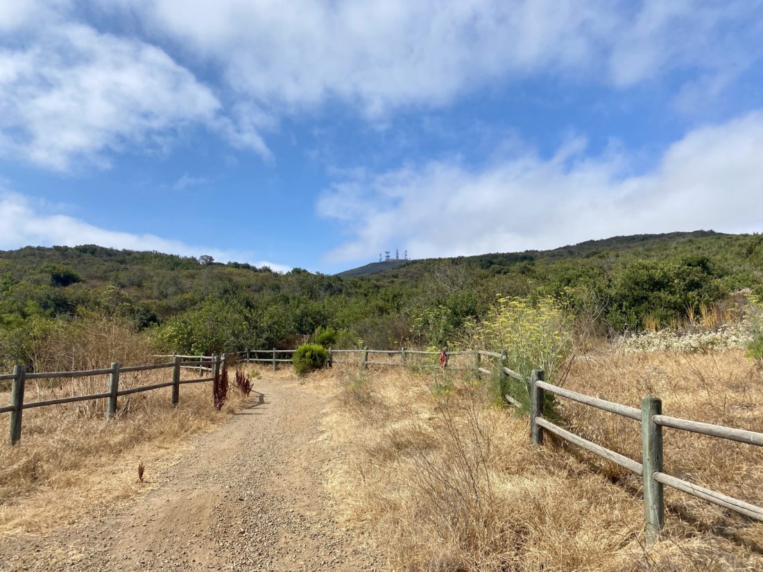
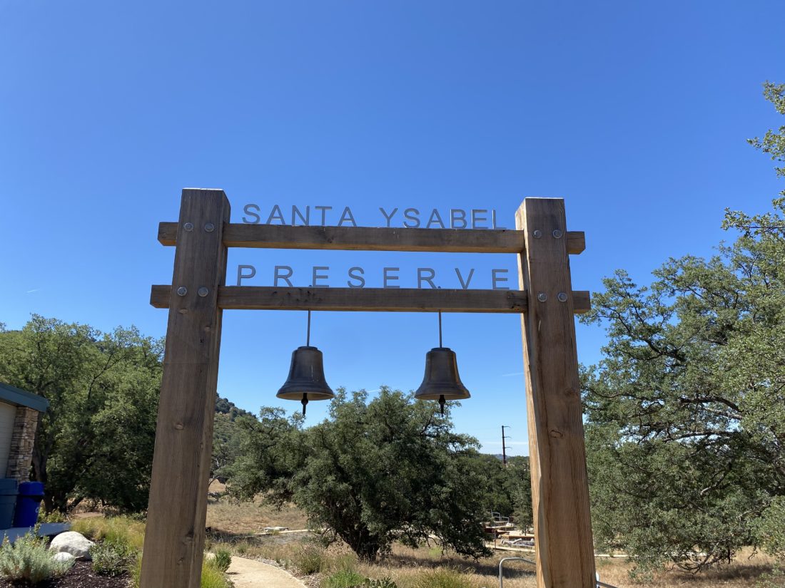
While I had previously hiked a good portion of Santa Ysabel East Preserve, I had not done the Nature Center Loop yet. Since it was on the San Diego County Parks Tour Our Trails Challenge, I convinced my wife to come along for the adventure. We brought our dog along for the adventure as well. We started from their new Visitor Center and began our climb up the hill. We took it slow.
Once up the hill, we cruised to the north before dropping back down and returning to the start. Since we were still dealing with COVID-19, we did not go into Julian or Wynola, but I could see doing that next time.
I am an avid peak bagger, sometimes backpacker, and former sea kayaker living in San Diego. I am the co-author of Urban Trails:San Diego, coming in Spring 2026!
In 2019, I became the third person to complete the San Diego 100 Peak Challenge. Not stopping with that accomplishment, I set my sights on the harder San Diego Sierra Club 100 Peak list, which I completed in 2021. In addition, I have conquered several Six-Pack of Peaks challenges (SoCal, San Diego, Central Coast, and both the Arizona-Winter and Arizona-Summer). I am looking forward to exploring new summits and new adventures across the southwest.
After summiting Monument Peak earlier in the morning, our second peak of the day was going to be Garnet Peak. While the trailhead at Penny Pines was filled with cars, there was no one at the Garnet Peak trailhead. I spied a couple of hikers making their way up the peak, and later a few more along the PCT. We passed through the meadow quickly and found ourselves ready to start up the rockier portion of the hike.
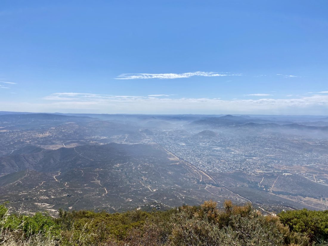
We made good time up the trail, and two hikers passed us returning from the summit. Once there, the three hikers I spotted on the PCT were enjoying the peak. The ‘infamous’ wind that usually is found on this peak was nowhere to be felt. We took a short snack break and snapped our photos. I tried to survey the extent of the fire that had burned recently near Oriflamme Canyon. It appeared not to have reached Roost Benchmark. I would later learn that it actually came within just a few feet of the summit.
As we made it our way back down, there were more hikers making their way up. Once back at the car, we looked at the time and decided that we would skip trying to squeeze in Wooded Hill and headed back into town.
I am an avid peak bagger, sometimes backpacker, and former sea kayaker living in San Diego. I am the co-author of Urban Trails:San Diego, coming in Spring 2026!
In 2019, I became the third person to complete the San Diego 100 Peak Challenge. Not stopping with that accomplishment, I set my sights on the harder San Diego Sierra Club 100 Peak list, which I completed in 2021. In addition, I have conquered several Six-Pack of Peaks challenges (SoCal, San Diego, Central Coast, and both the Arizona-Winter and Arizona-Summer). I am looking forward to exploring new summits and new adventures across the southwest.
Initially, I had hoped to sneak in one more peak on the Sierra Club list, but some commitments in the early afternoon made it too tight to attempt San Ysidro. Instead, I opted to do some of the shorter peaks in the Lagunas that Ted needed to summit. First up was Monument Peak, a nice 2.8-mile hike. We pulled into the parking area and grabbed our gear and headed off along the trail.
The temperatures were pleasant as we made our way to the summit. Flowers still dotted the sides of the trail, making for an even more visually enjoyable hike. After a short stint on the PCT, we turned on the trail that would take us to the peak. This section of the trail was a bit more overgrown and could use some light pruning.
We reached the summit and were greeted by the fantastic desert views. Unlike previous visits, there was almost no wind to speak of. We snapped our photos and signed the register before heading back down. Once back at the car (and not missing the turn as I did on my first time hiking this peak), we headed off to our second peak of the day, Garnet Peak, just a few minutes down the road.
I am an avid peak bagger, sometimes backpacker, and former sea kayaker living in San Diego. I am the co-author of Urban Trails:San Diego, coming in Spring 2026!
In 2019, I became the third person to complete the San Diego 100 Peak Challenge. Not stopping with that accomplishment, I set my sights on the harder San Diego Sierra Club 100 Peak list, which I completed in 2021. In addition, I have conquered several Six-Pack of Peaks challenges (SoCal, San Diego, Central Coast, and both the Arizona-Winter and Arizona-Summer). I am looking forward to exploring new summits and new adventures across the southwest.
Being Memorial Day weekend, I did not want to drive up and tackle any of the Six-Pack of Peaks, so I turned to one of my non-desert peaks on the Sierra Club list that I needed to summit again. Since Ted Markus was back from his Grand Canyon adventure, I roped him into tagging along. Since he needed to summit Oakzanita, we opted to hit it along the way. We followed the Lower Descanso trail up until it reached the East Mesa Fire Road. After a very short stretch, we hopped onto the Upper Descanso trail. As we made our way up, wildflowers dotted the sides of the trail.
Soon we found ourselves at the junction to the peak, and the trail then began the final push to the top. Once there we enjoyed the views, Cuyamaca and Cush-Pi (Stonewall) to our north, Long Valley to our south, & the Lagunas to the east. We did not linger too long, as we heard voices from some other hikers making their way up. We chatted a bit and let them enjoy their time on the peak.
As we neared the junction, we passed two more hikers en route to the summit. These would be the last people we would see until we returned to the trailhead. Our route was to head south on the trail until it looped northward again, near the meadow we would cross to begin our cross-country trek up to Sugg Peak.
I had my track from 2019 when Susie Kara had graciously guided me to the summit. Now it was my turn to guide Ted. I remembered the landmarks that Susie had used when we did this peak, and I planned to use them as checkpoints. First up were the flat rocks just past the meadow’s edge. From here we were next on the lookout for the boundary fence between Cuyamaca State Park and Cleveland National Forest. After passing through the fence, we were now keeping our eyes out for the route that we would follow south for a bit. I spotted the faint path at the end of a small clearing; it had certainly become overgrown since I used it almost 2.5 years ago. The next landmark for us was the old jeep road sign. Ted did not believe there was once a road off to our right.
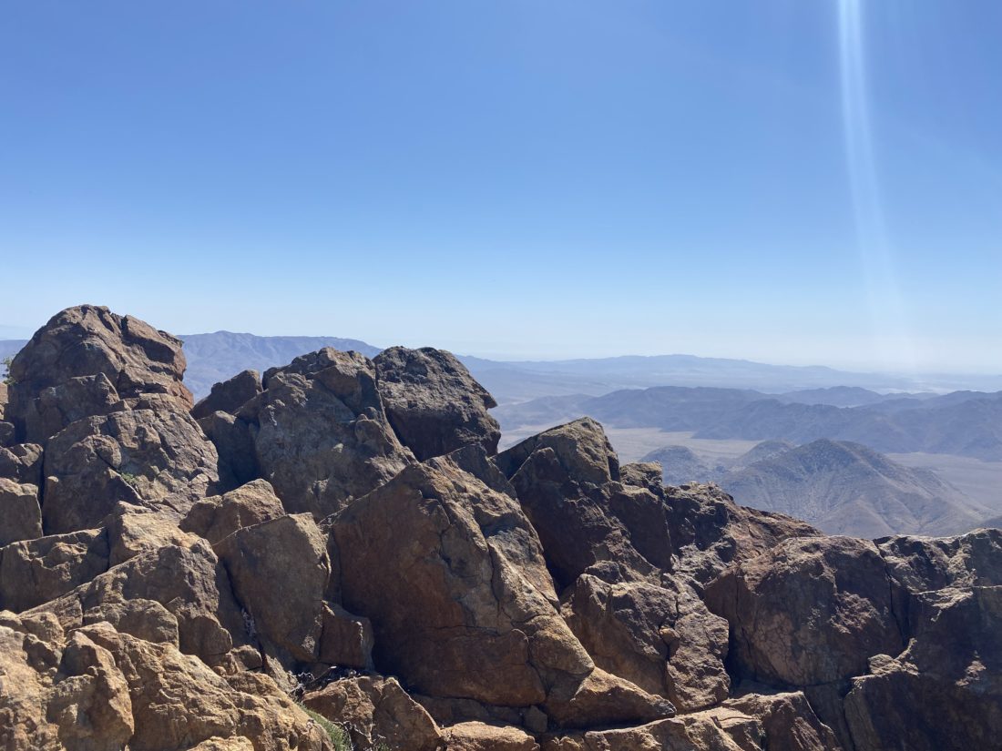
Now for the last bit, the real bushwhacking would begin and the final push to the summit. From here we would leave the ‘trail’ and head east up the saddle toward Sugg. I would mostly just use my guts and some general suggestions from the track to weave through the thick brush that covered its slope. We reached the large rock slab that I tore my pants on the last time when descending. This was the only real landmark for this section of the hike, so reaching it was a good sign. I kept working us upward, checking my decisions with Ted from time to time. Soon we crested the false summit and Sugg Peak stood before us. We made our way over to the true summit. I signed the register, having to move the loose survey mark out of the way. We enjoyed the views while munching on our snacks.
We headed back down, hoping to retrace our steps, but I knew that following our exact route was a pipe dream. We hit a couple of dead-ends, but I worked around them and soon we were spot on with our track where we had left the ‘trail’! Maybe I have learned something after 100s of miles and 100+ peaks 😉
Once I got us back to the edge of the meadow, we had a decision to make. We had considered tacking on East Mesa High Point for Ted, but it was a touch warm and pizza and beer sounded really good (vaccinated bonus!). So, we cruised back down the trail toward the car. All told we covered 8.9 miles in 5:11 hours with 1,787 feet of gain.
I am an avid peak bagger, sometimes backpacker, and former sea kayaker living in San Diego. I am the co-author of Urban Trails:San Diego, coming in Spring 2026!
In 2019, I became the third person to complete the San Diego 100 Peak Challenge. Not stopping with that accomplishment, I set my sights on the harder San Diego Sierra Club 100 Peak list, which I completed in 2021. In addition, I have conquered several Six-Pack of Peaks challenges (SoCal, San Diego, Central Coast, and both the Arizona-Winter and Arizona-Summer). I am looking forward to exploring new summits and new adventures across the southwest.