Trip Reports

Roost Benchmark

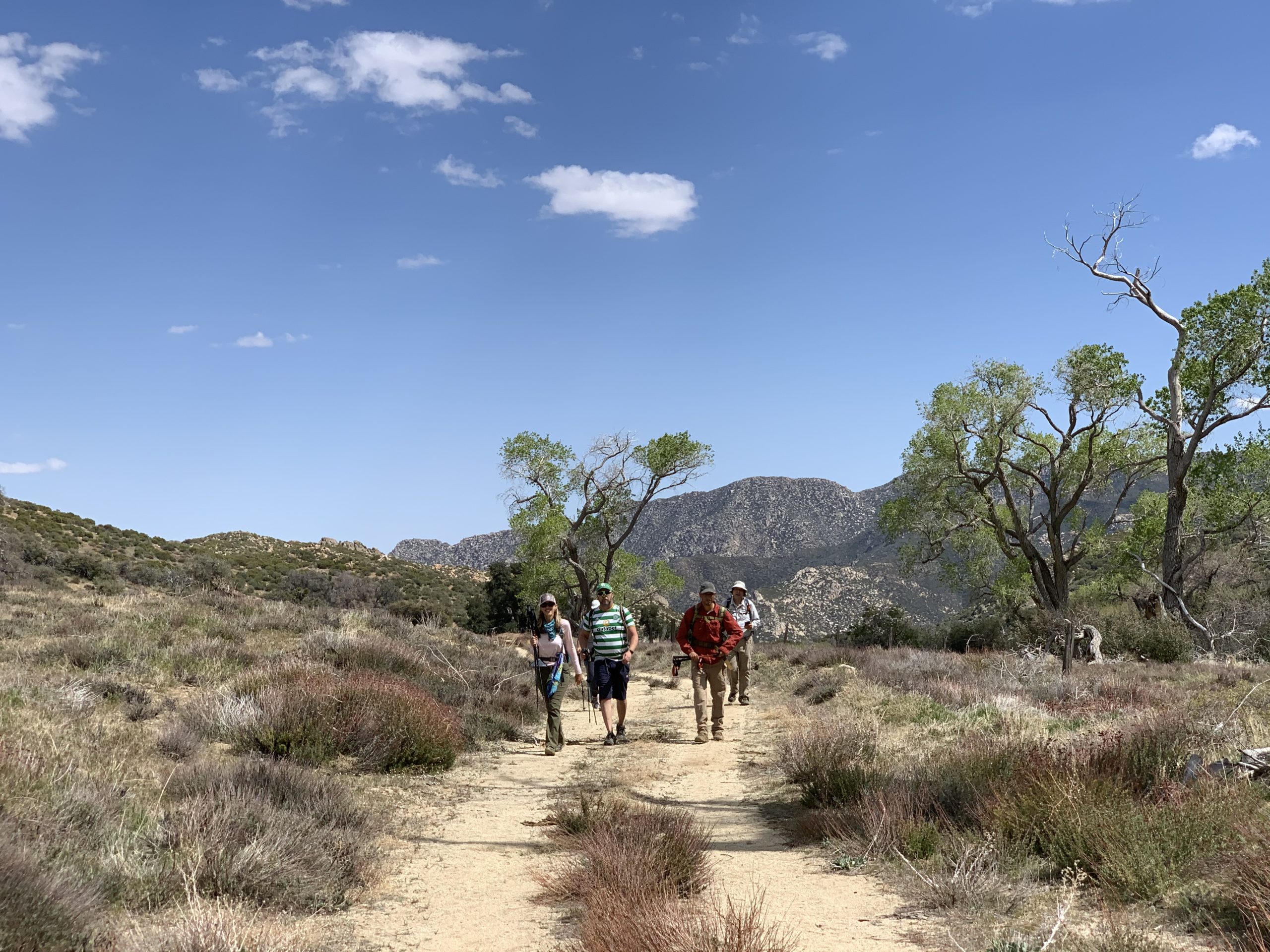
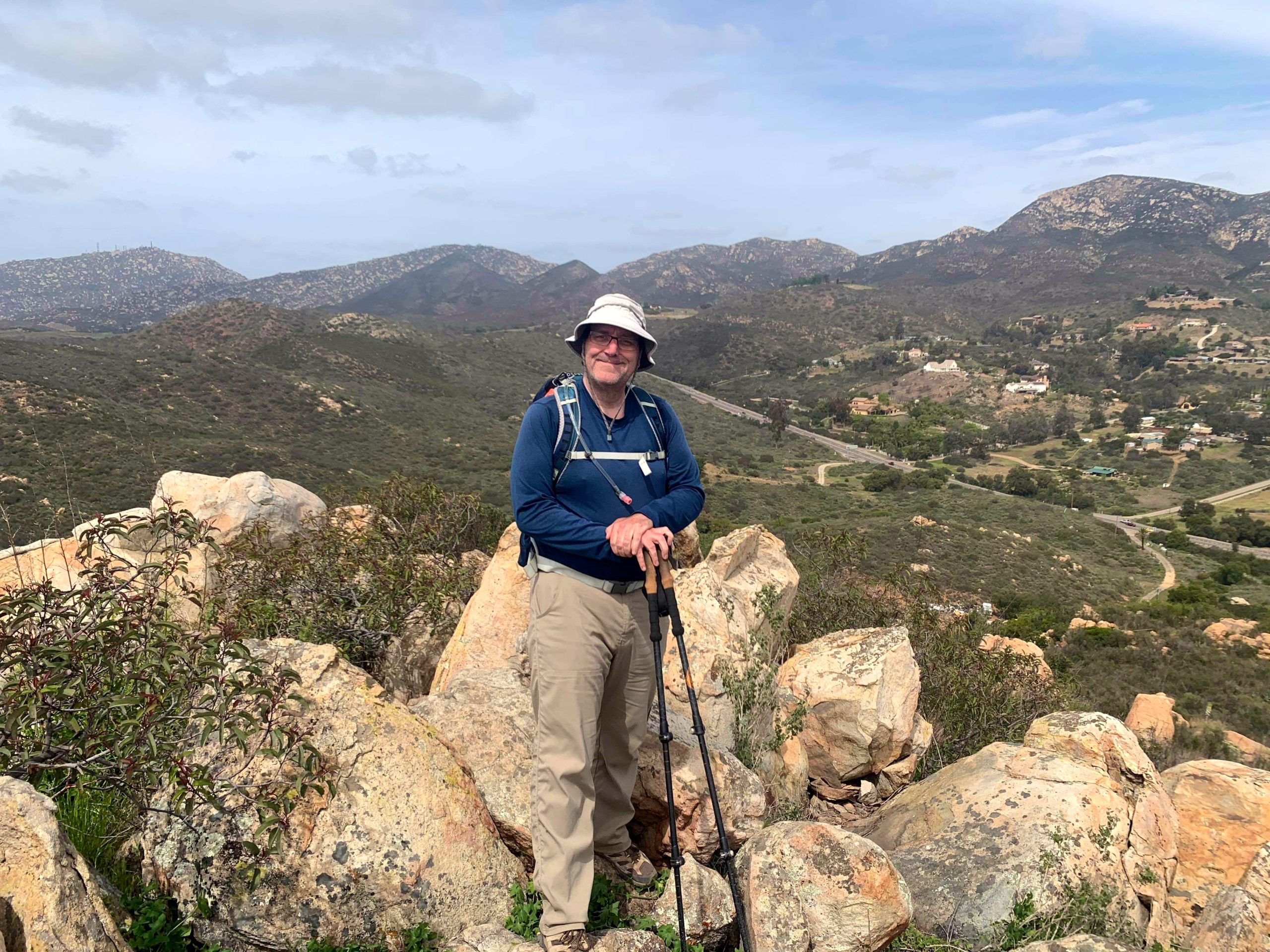
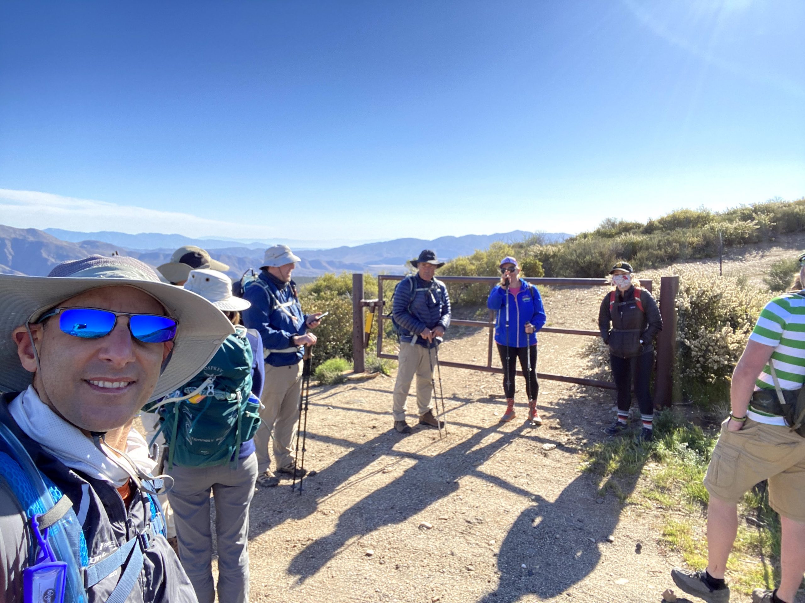
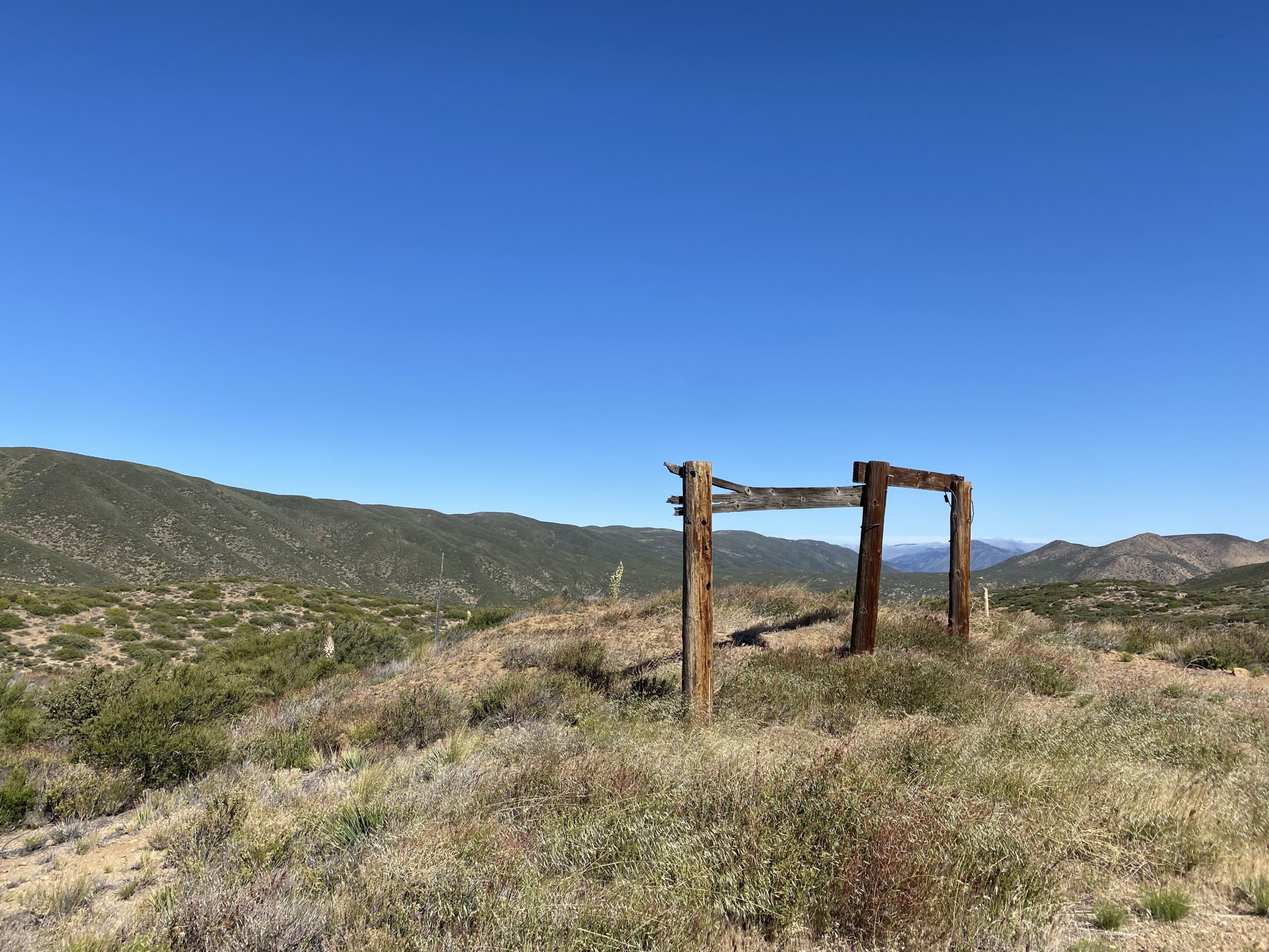
It is hard to comprehend that this summit would mark my completion of the San Diego Sierra Club 100 Peak List. For this milestone hike, I invited several of my hiking companions to accompany me. We met at the Pacific Crest Trail – Sunrise Trailhead at 8 am to condense down to fewer cars, as the actual parking area at the Lucky S Ranch is limited. After driving a couple of miles down the road, a group of mountain bikers had taken most of the available spots, but we were able to squeeze our cars into the area and still allow access to the ranch. We gathered in front of the gate to the old road that we would follow for a while. We discussed if we were going to add Oriflamme Mountain to the hike, and the consensus was to skip it. With that, Ted Markus, Greg Gerlach, Gina Norte, Matt Hanan, Larry Edmonds, Leslie Williams, Susie Kara, and Susie’s friend Jackie set off down the road.

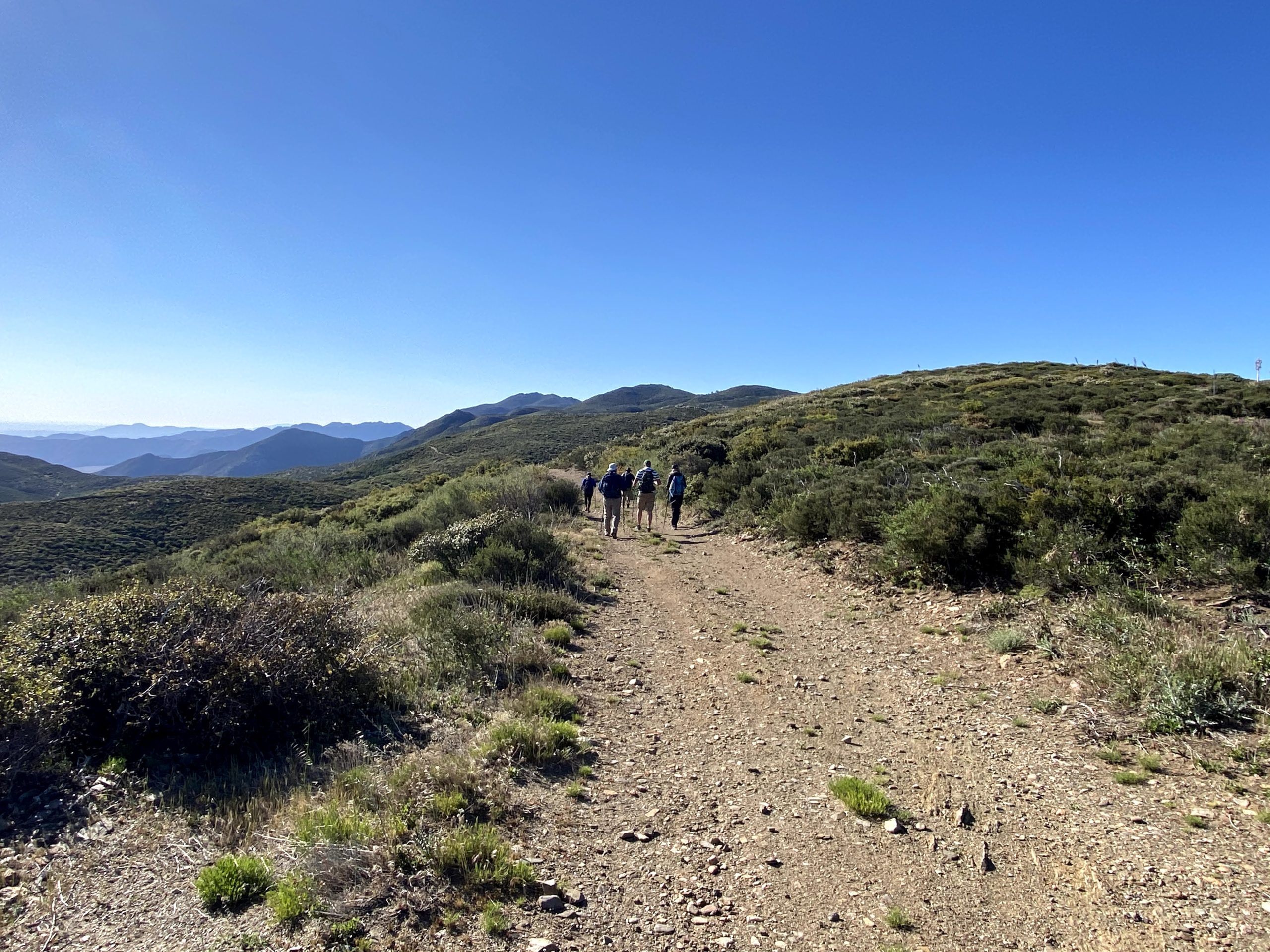
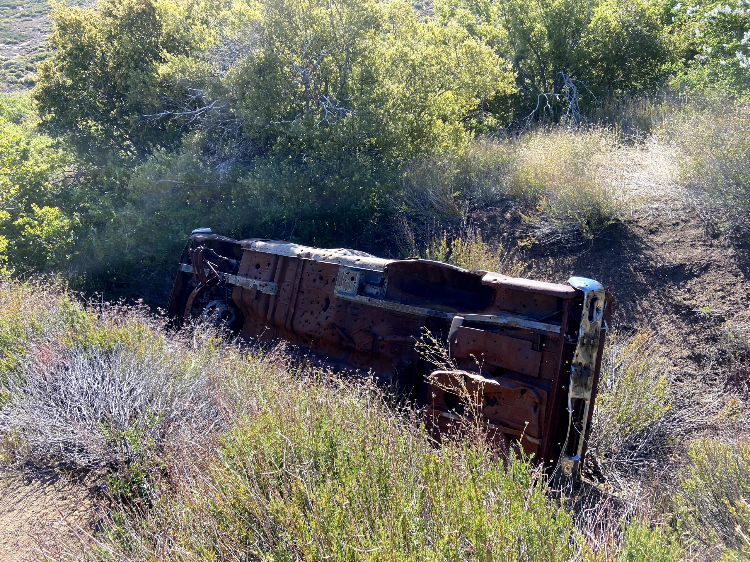
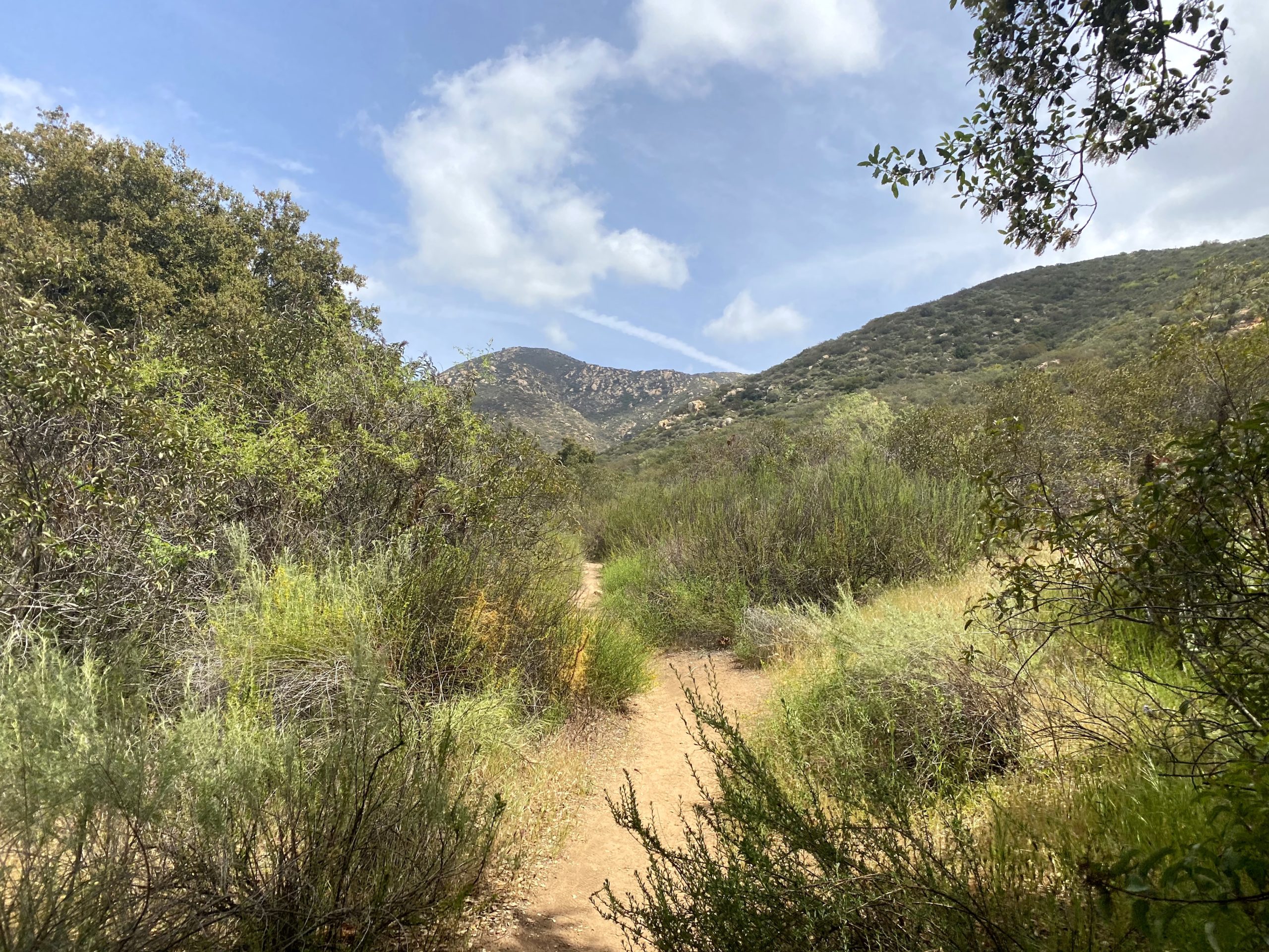
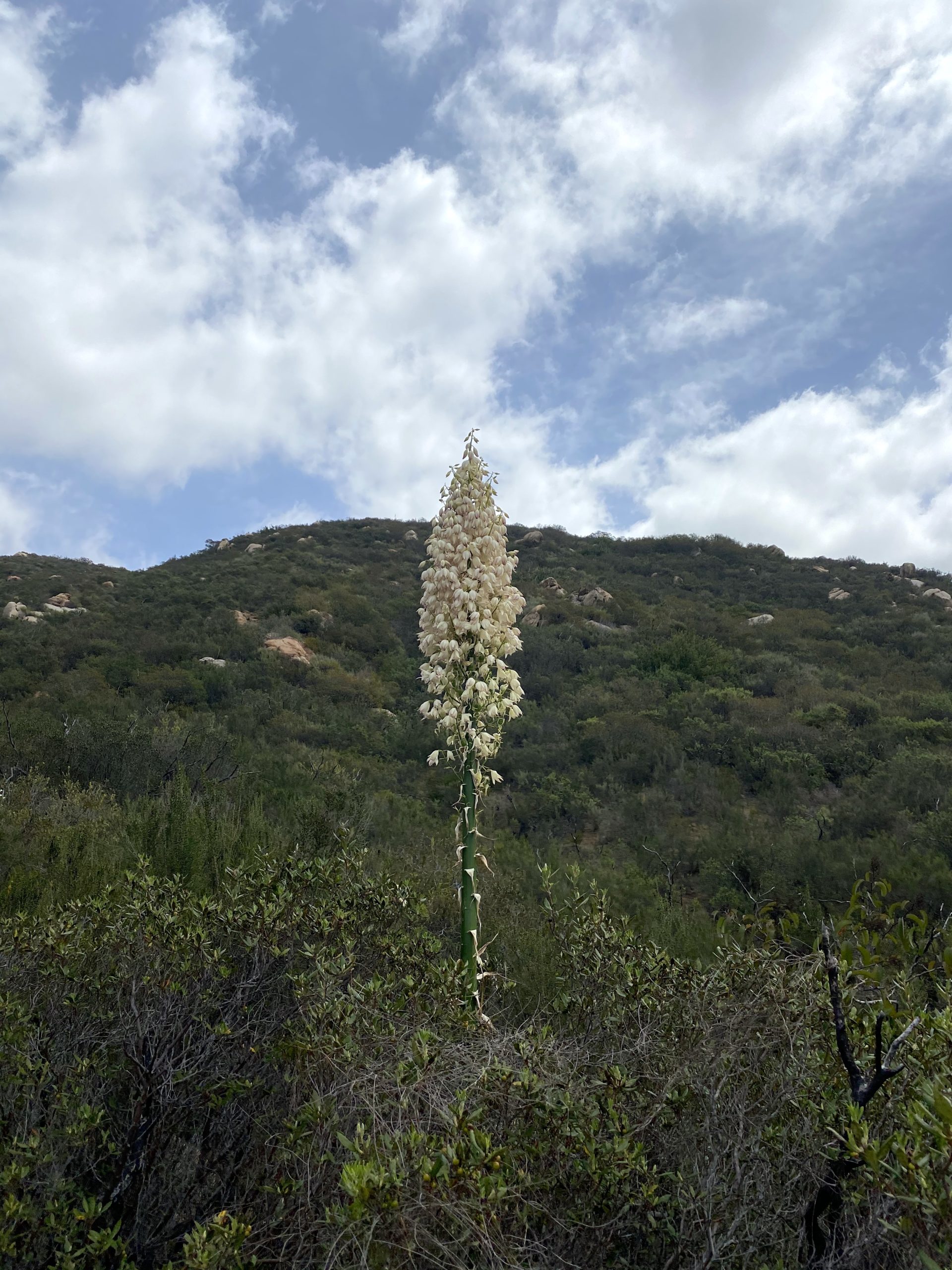
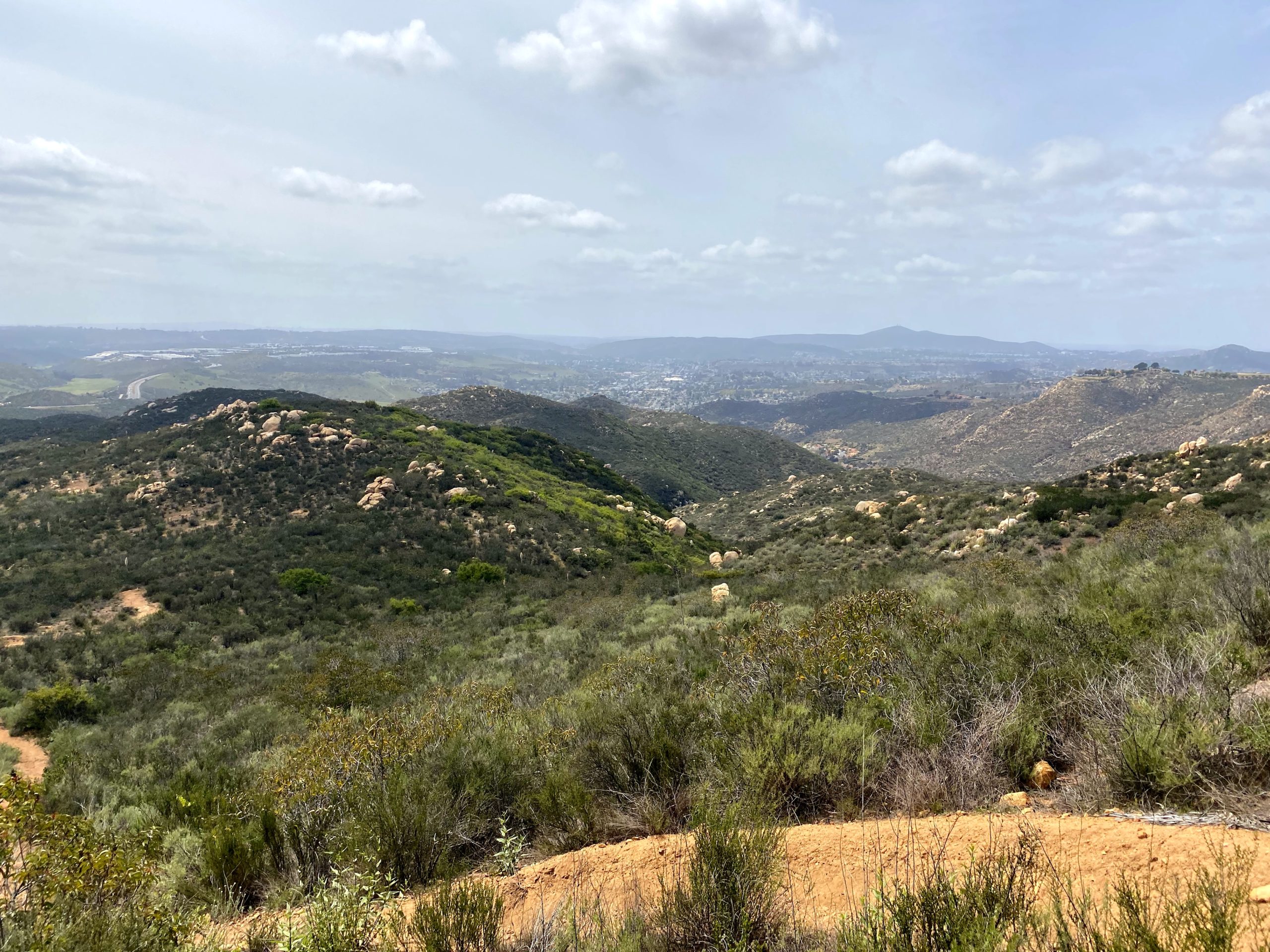
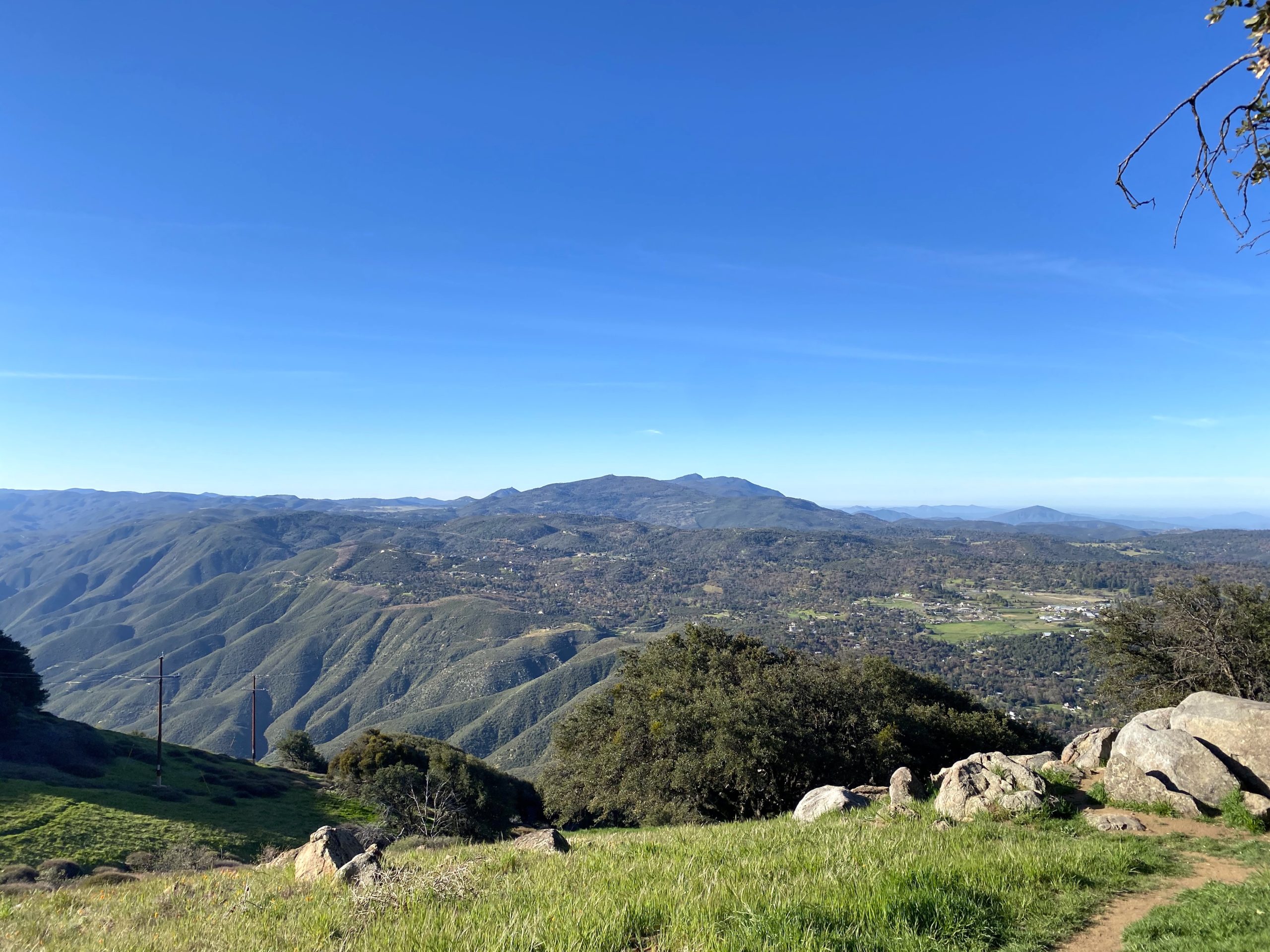
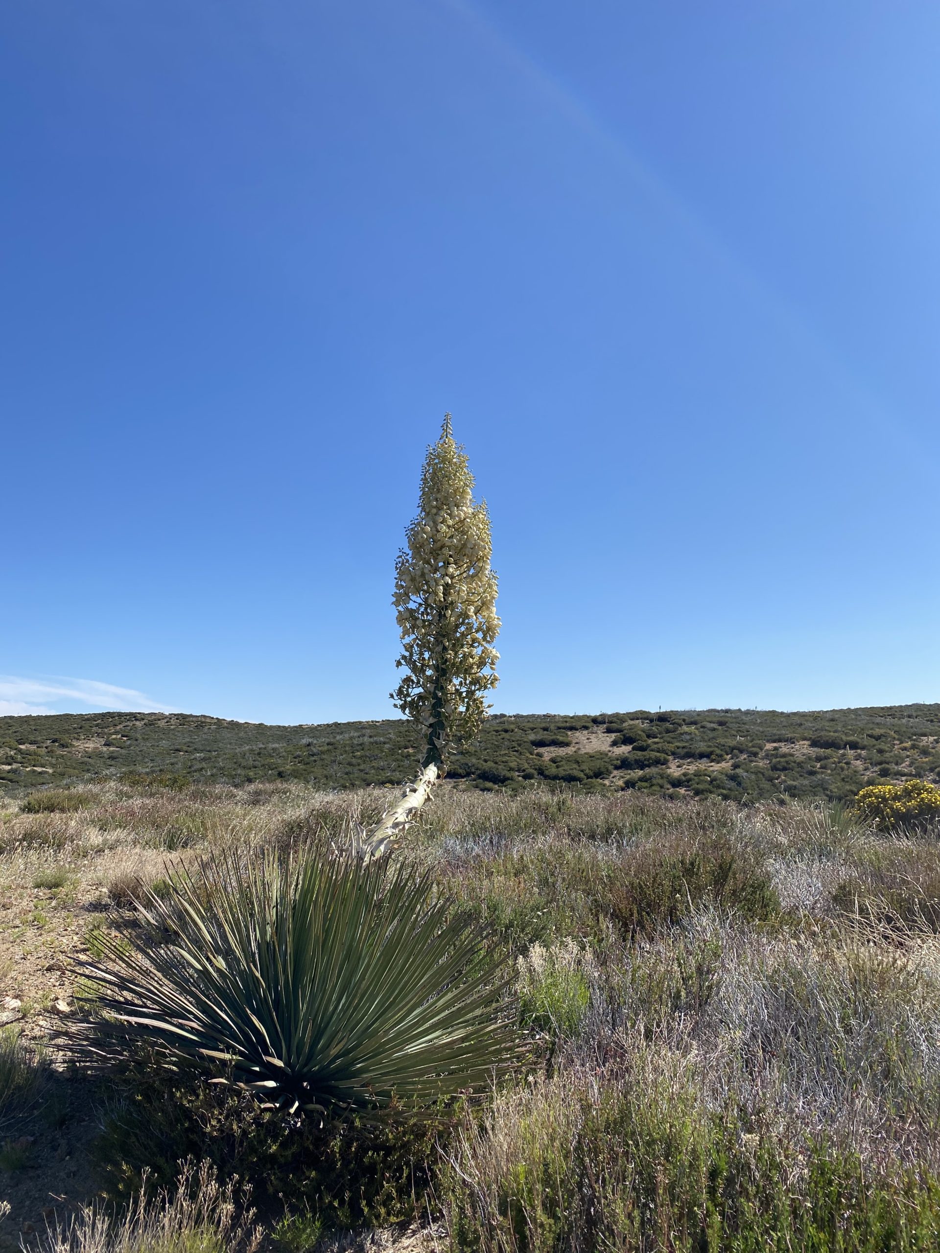
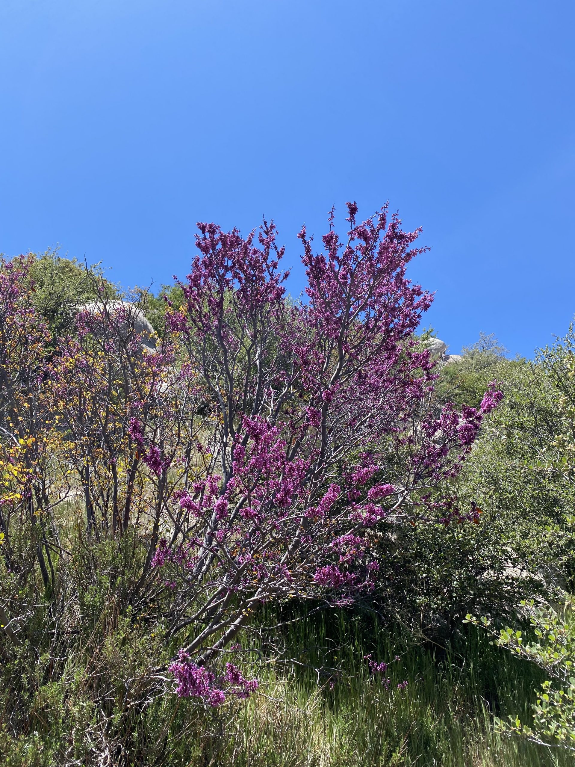
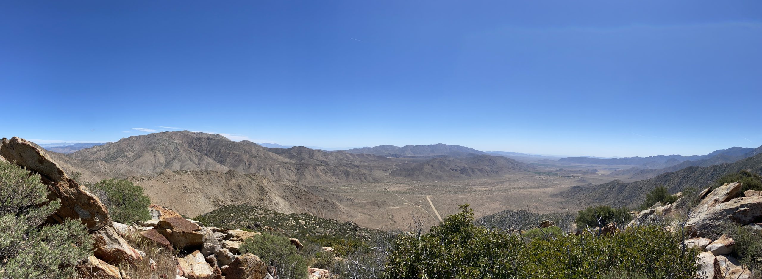
This was an inverted (aka canyon) hike, so we dropped down from our start just off Sunrise Highway. Some lovely wildflowers dotted the sides of the trail as we cruised along. We chatted about recent hikes, and I reflected on what was next on my hiking agenda. Soon we found ourselves at the end of the road and began the cross-country portion of the hike. 

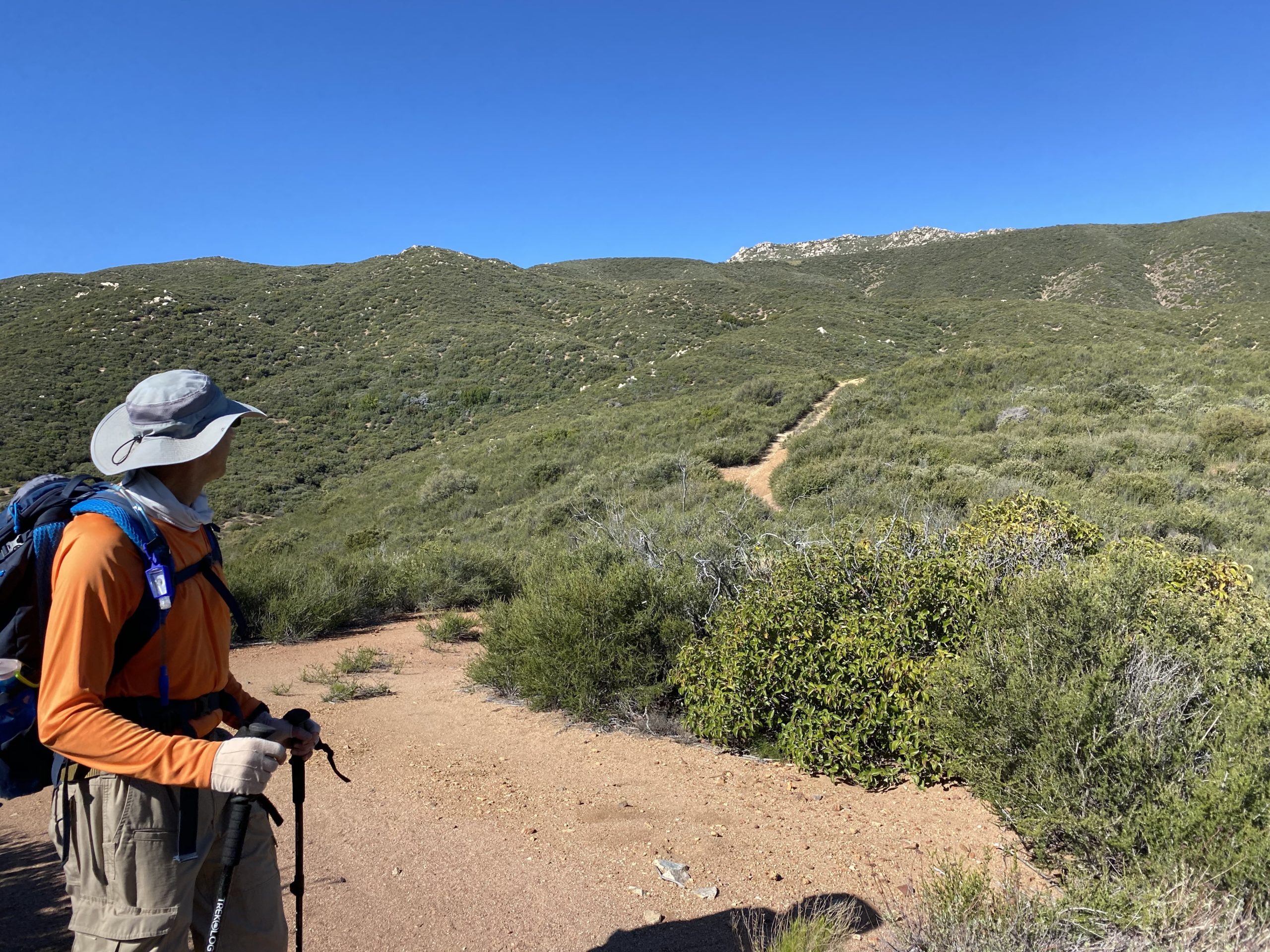
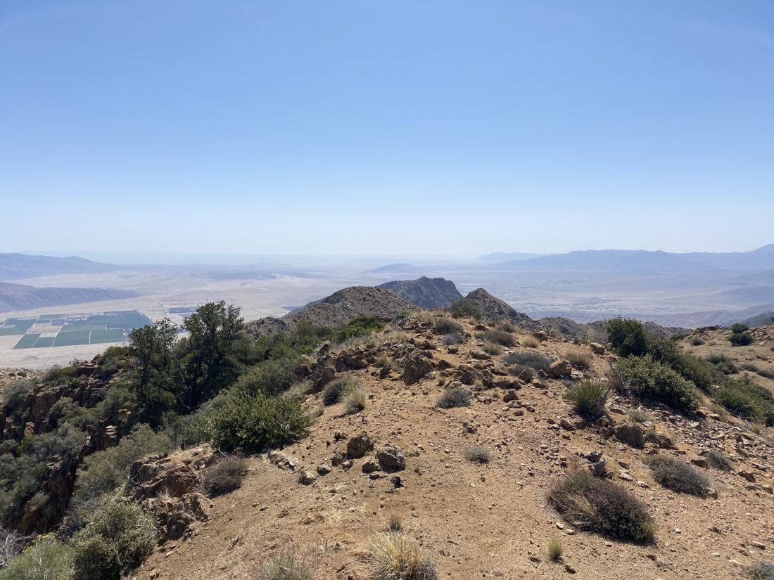
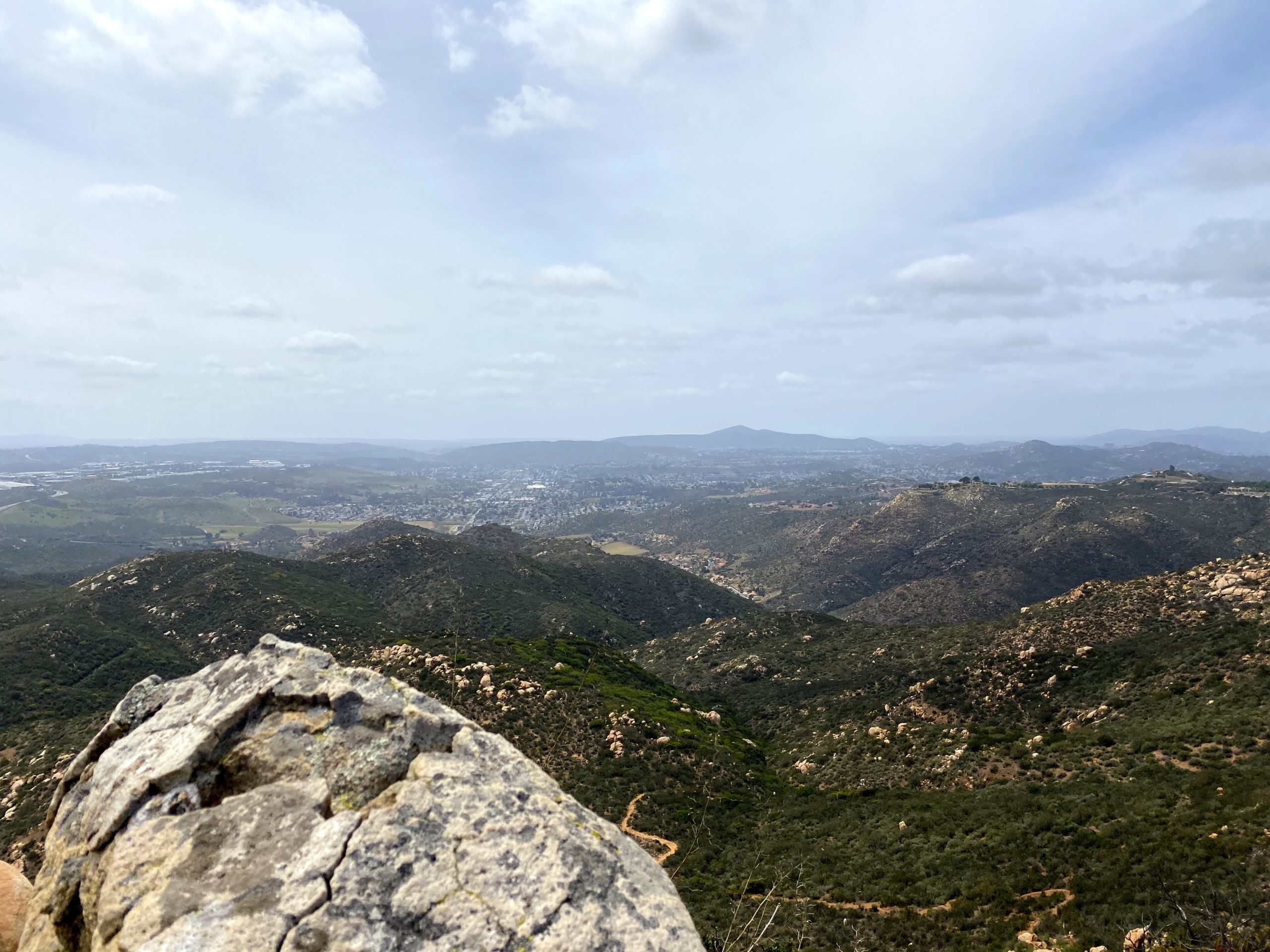
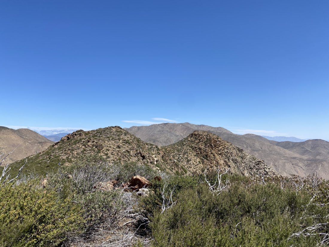
Roost Benchmark was the further of the two bumps. Since some of our group had hiked them before we followed their lead to loop around the first bump and then approach the summit from the north/northwest. We could see Larry and Leslie at the summit already. They had taken a different route that we had avoided in part to reports of it being overgrown and tick infested. As we crossed over the saddle, the winds picked up. Just as I was thinking I needed to tighten the strap on my hat, Greg’s hat went sailing. Thankfully it did not go far and he was able to retrieve it.

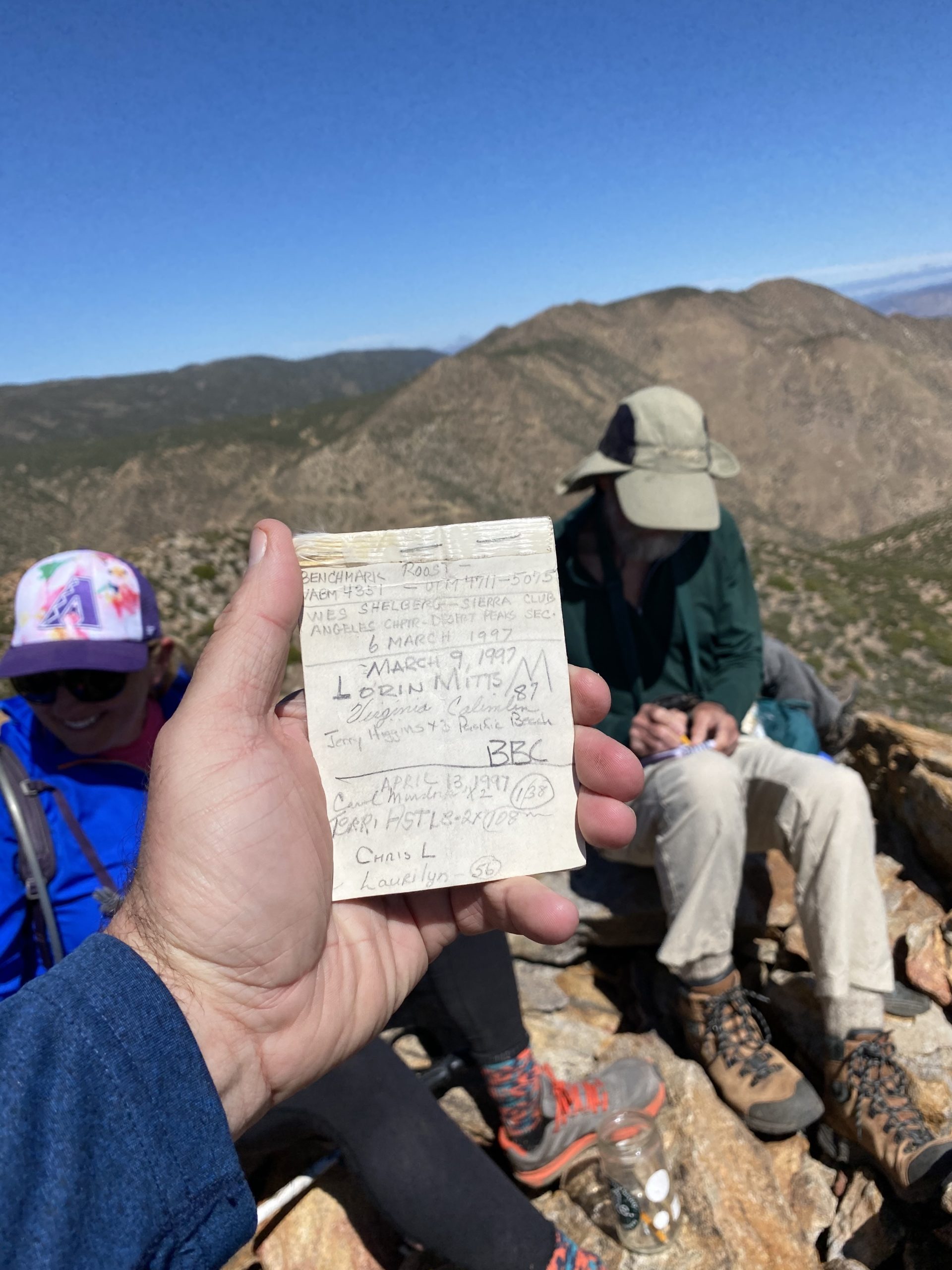
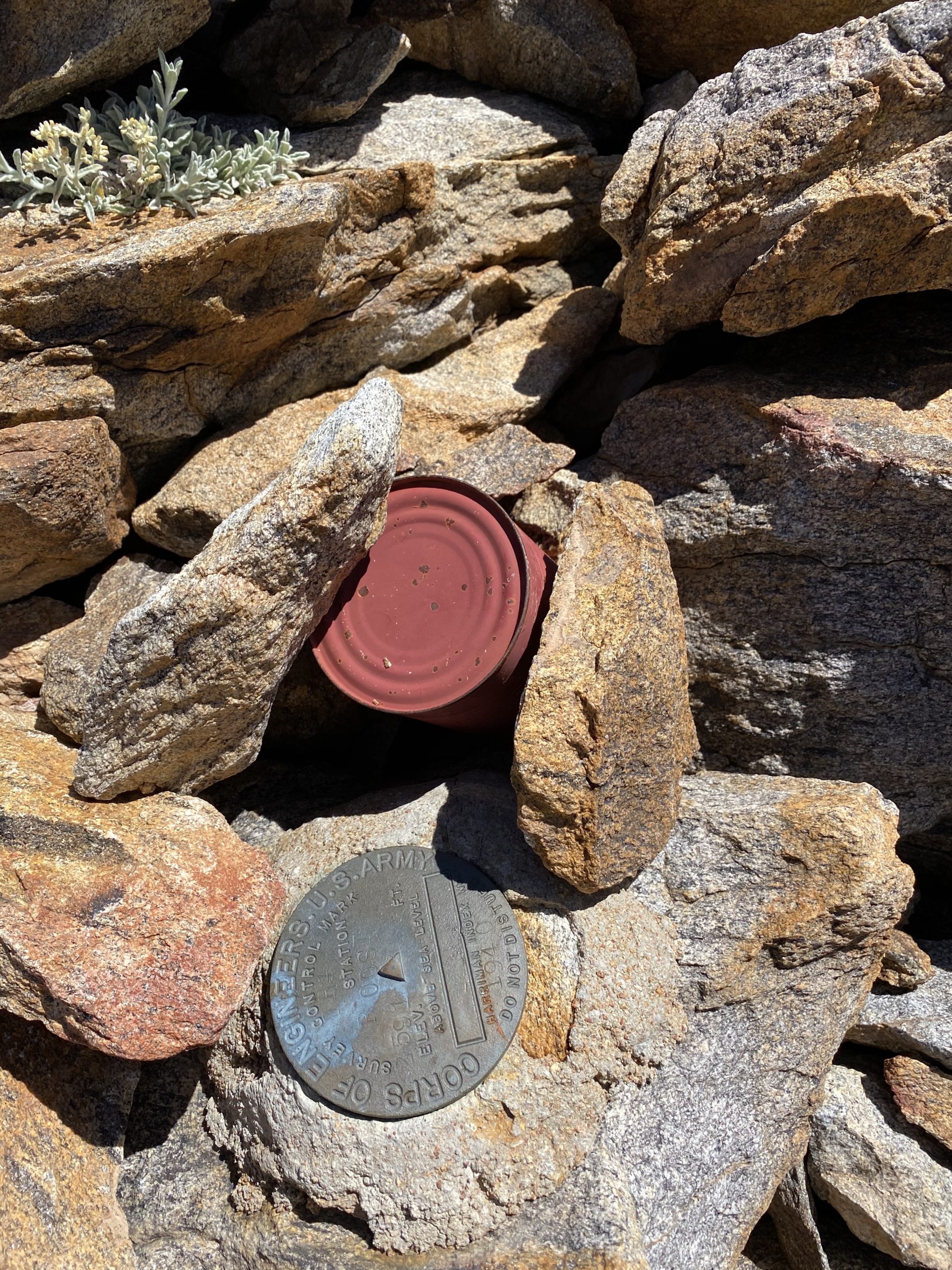
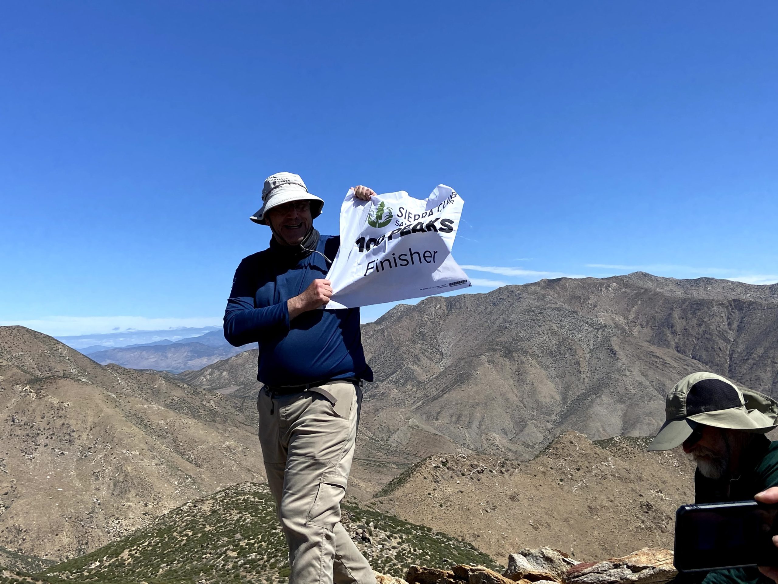
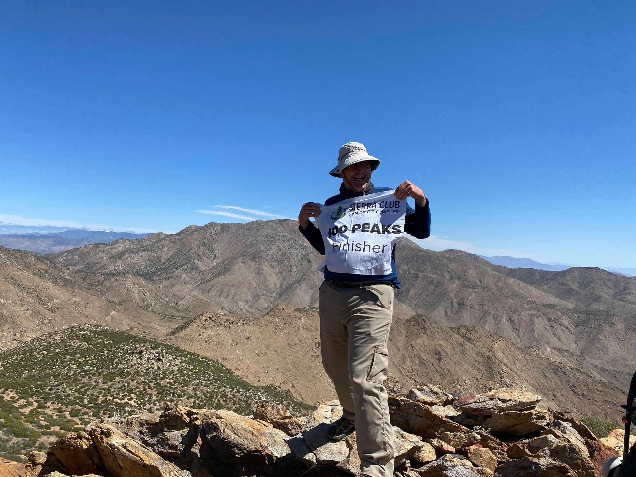
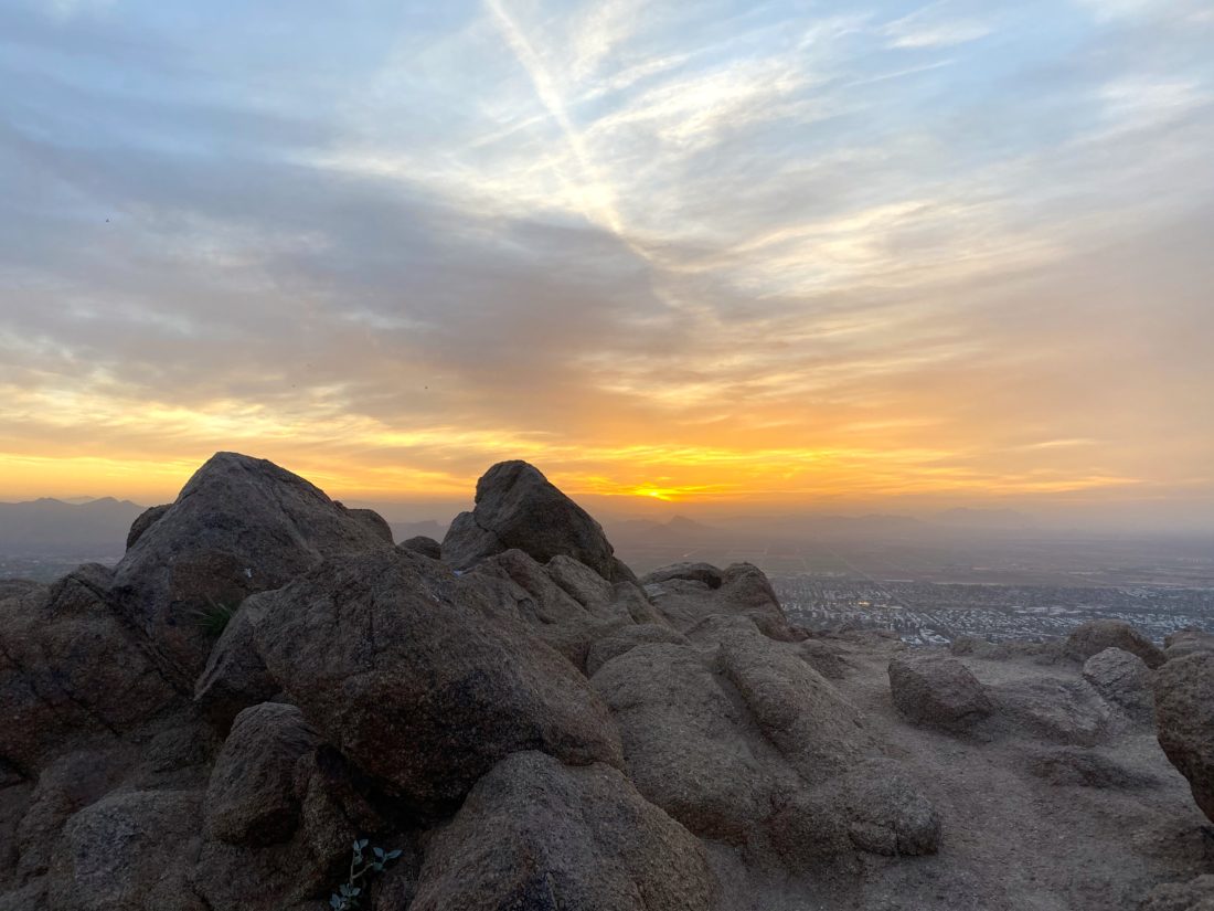
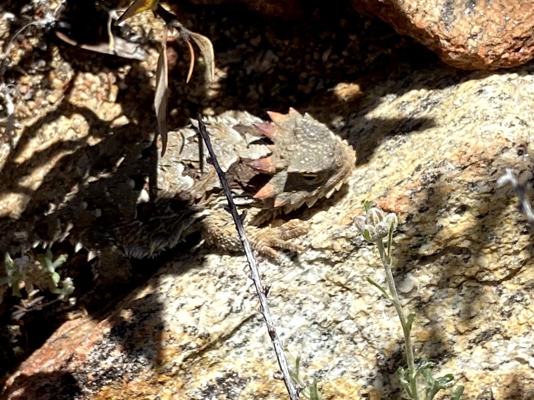
Soon we found ourselves atop the summit. I had done it! I plan to write a proper reflection on this journey, but a tremendous sense of accomplishment filled my heart. We sat around the summit enjoying some snacks, soaking in the views, and proudly signing the register. After a nice break, we began our descent. Along the way, we spotted a nice horn head lizard hanging out under some brush, and Ted got a great shot of it.

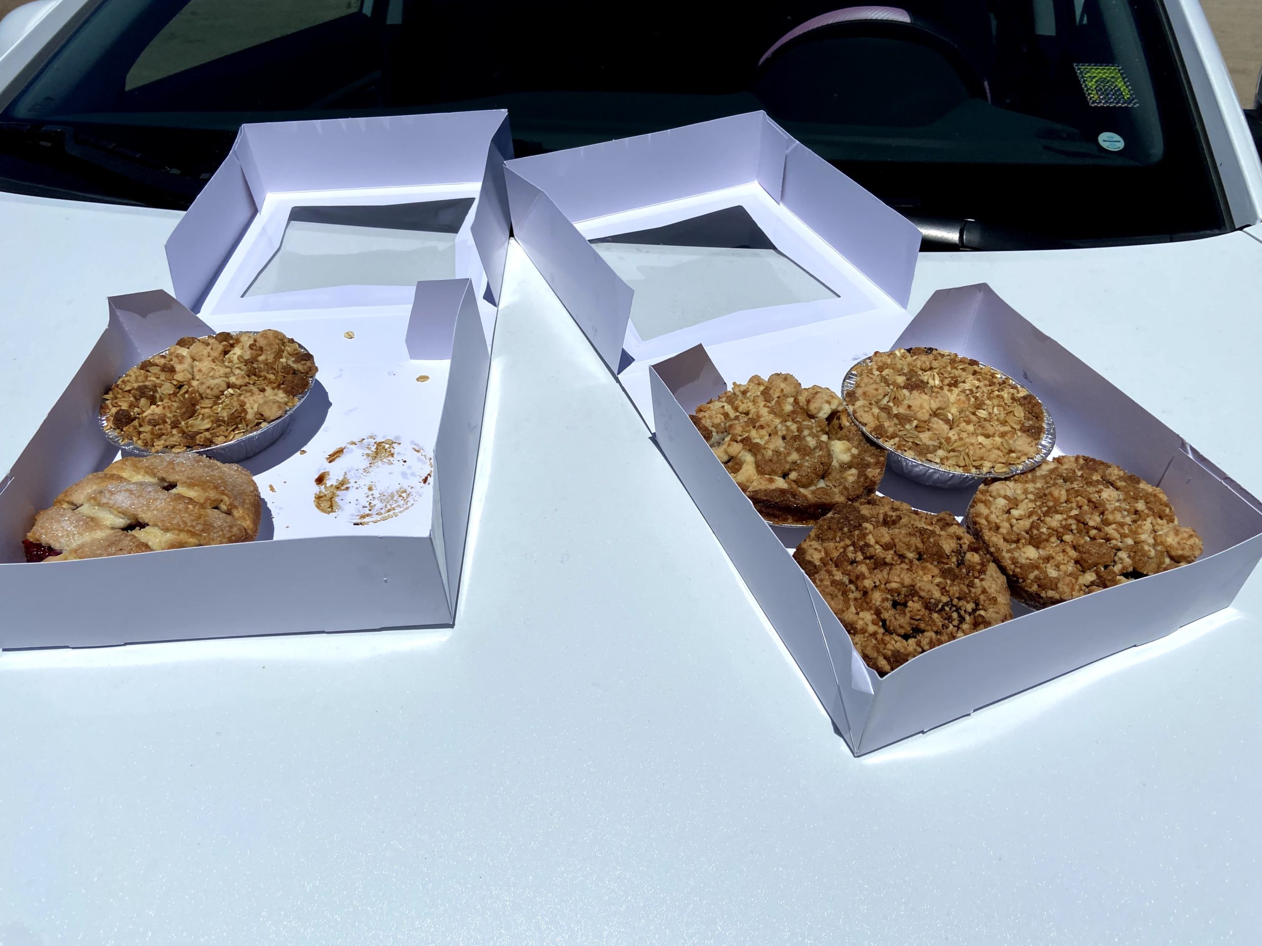
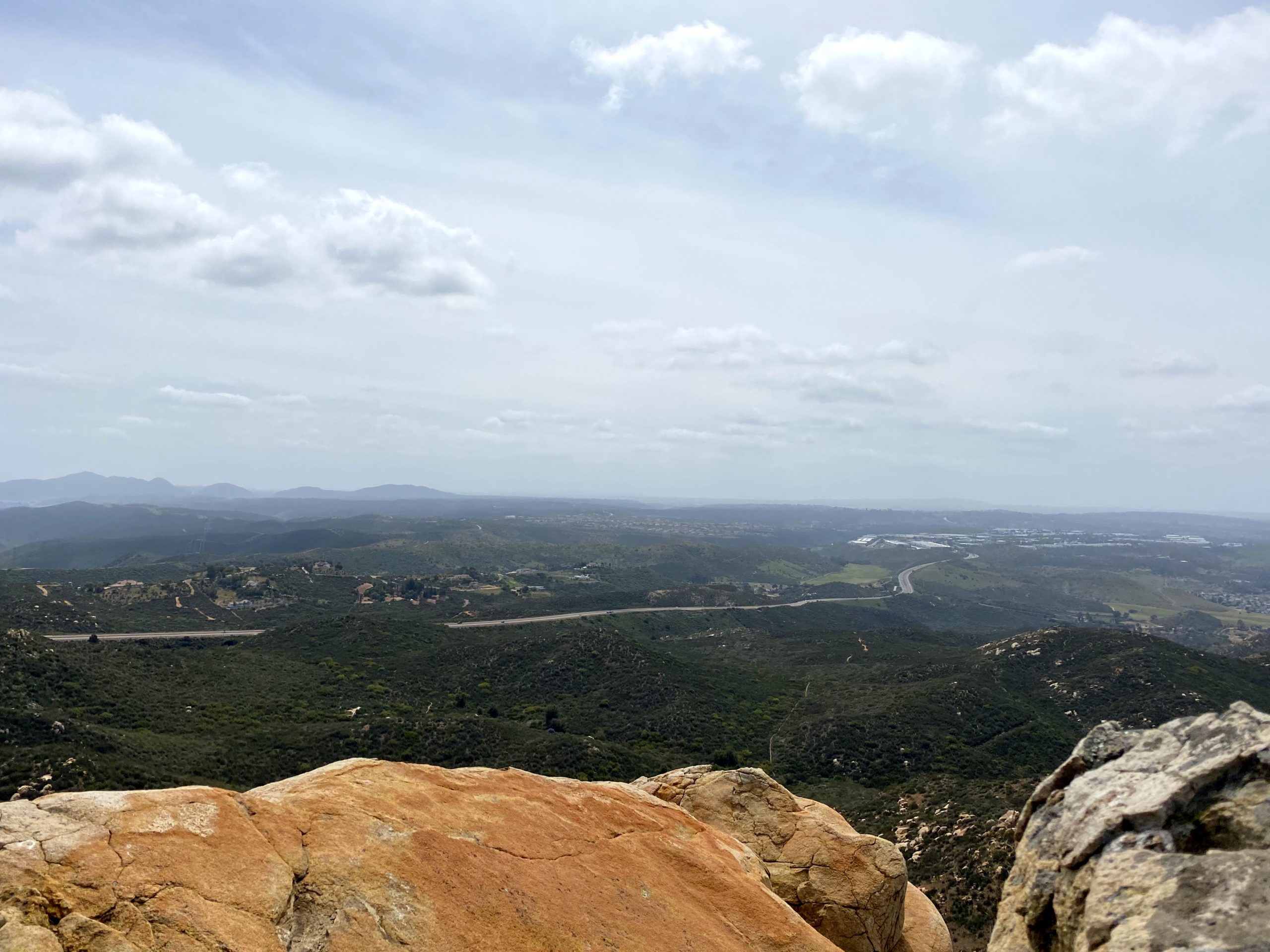
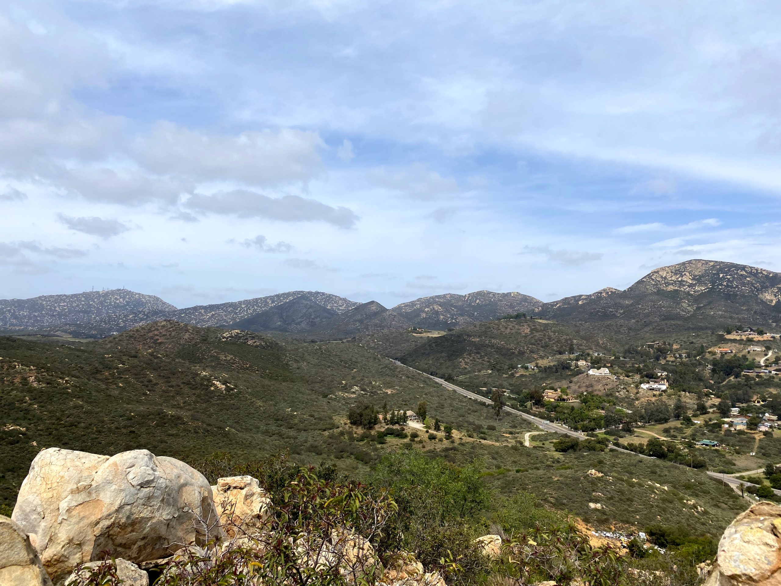
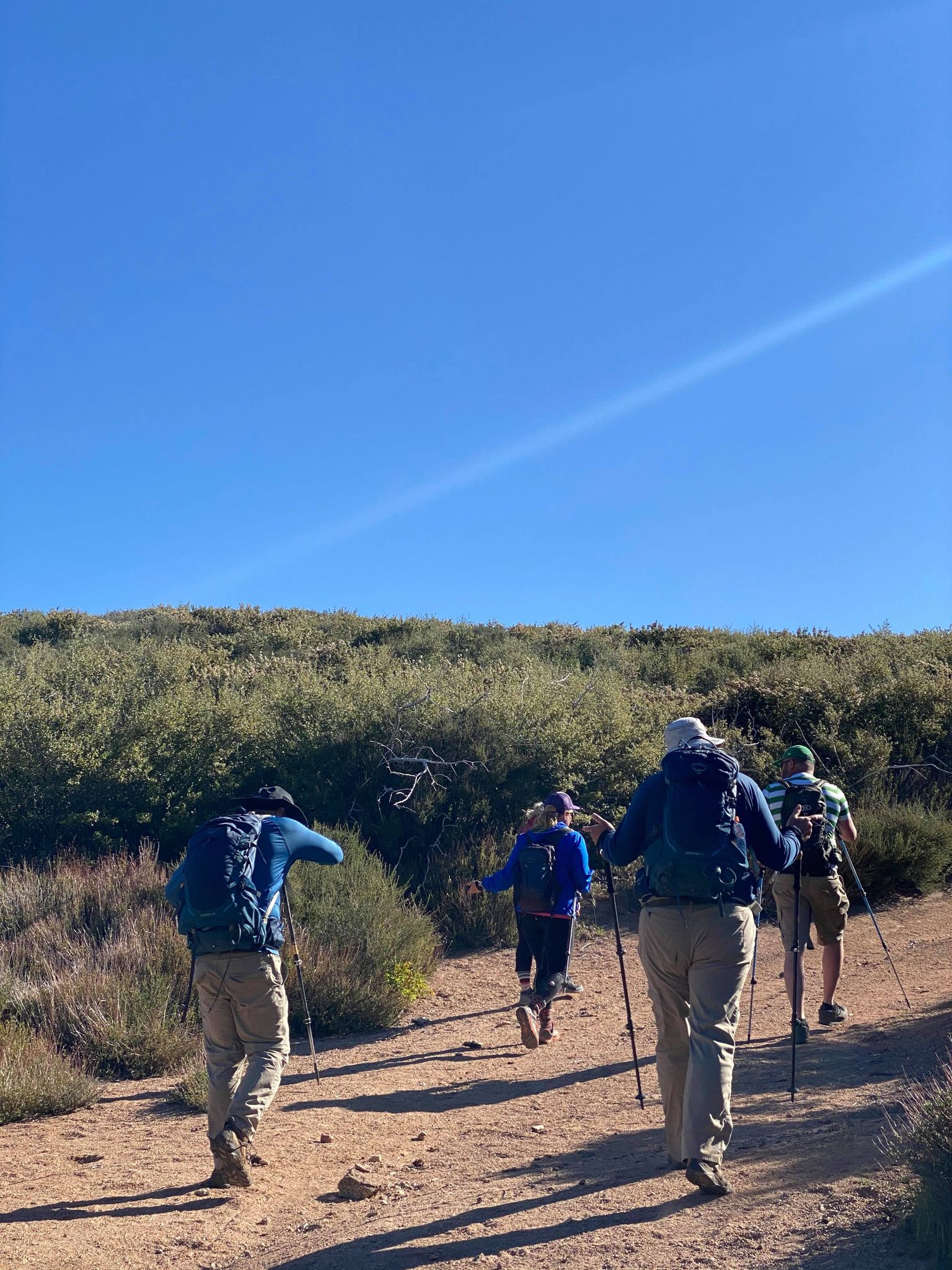
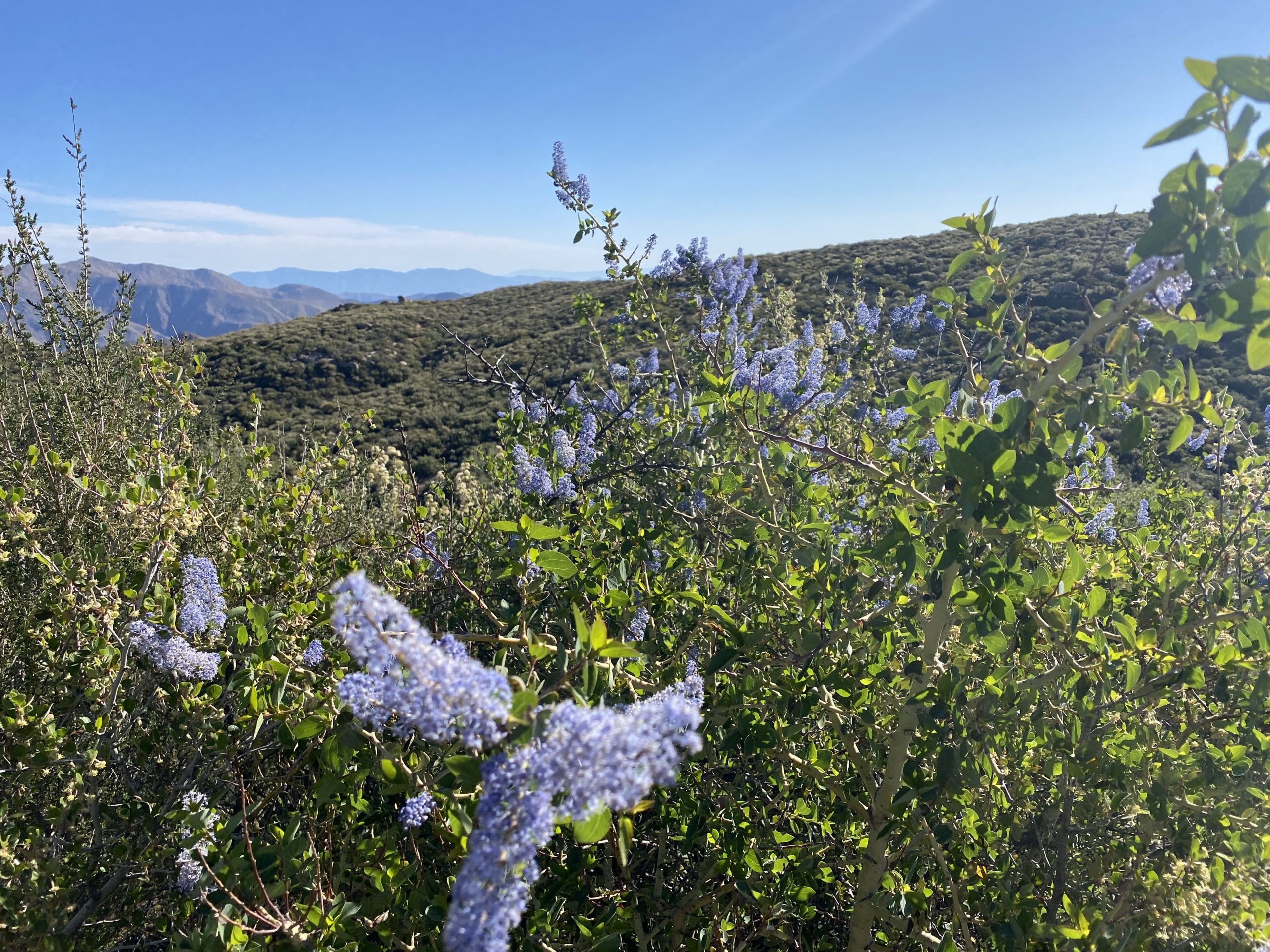
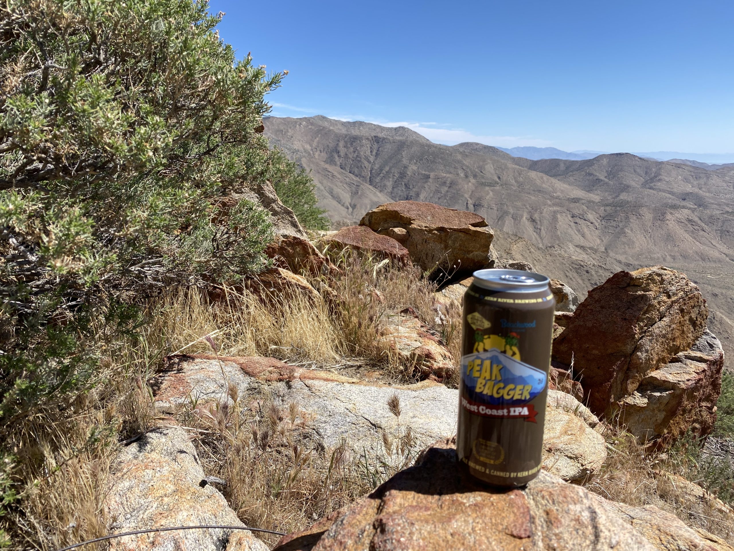
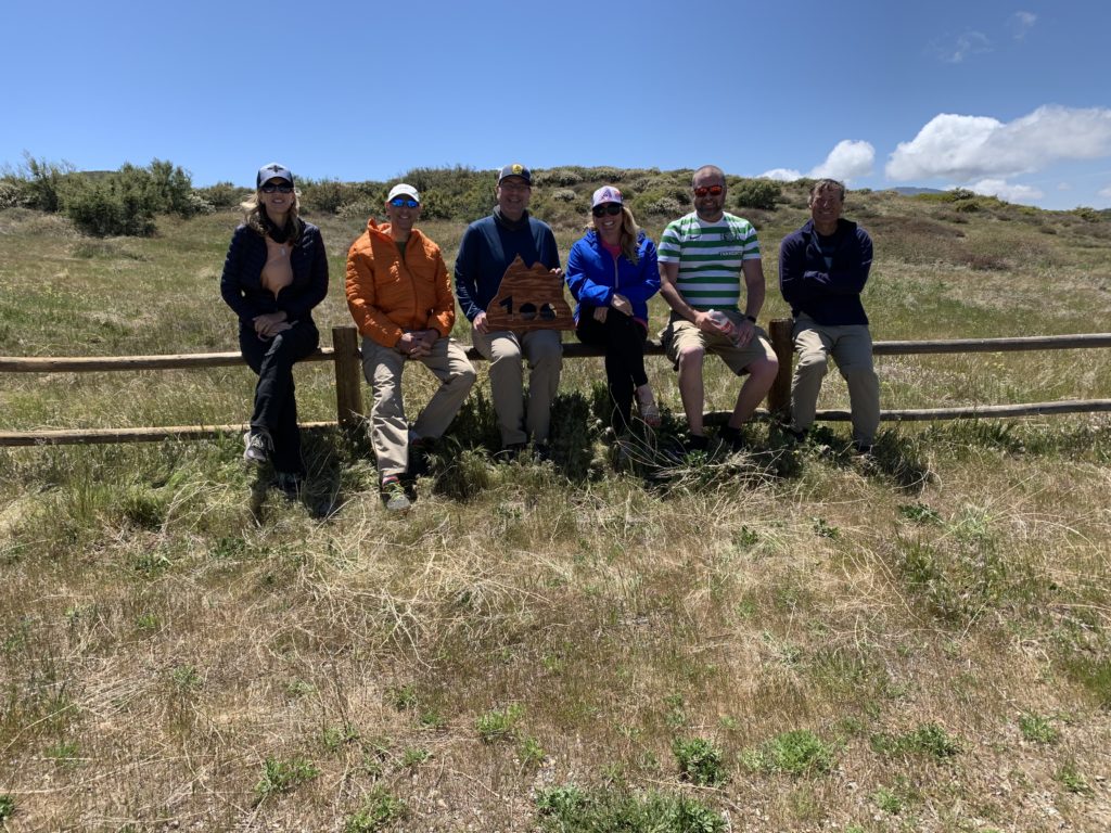
Since Larry said the overgrowth wasn’t too bad, we took the more direct route back up to the trailhead. Again, more wildflowers brightened our climb. While this road was a bit more overgrown, it was not too bad. We would stop to do a periodic tick check. Some of the group found some “hitchhikers” that were dealt with accordingly. As we waited next to where the PCT crosses the old jeep road, a thru-hiker passed by. Once we had regrouped, we climbed the last bit and back to the cars. Once back at the Sunrise Trailhead, my wife and daughter arrived with pies from Betty’s Pies in Encinitas to share. Susie had started this tradition with her completion of several summits, and I was happy to continue it. Since the summit did not lend itself to a group shot (plus the wind), we took a group shot there. After consuming our pies and enjoying a can of Peakbagger IPA from Kern River Brewery that I had been saving, we bid our farewells. Now on to the next adventure…

Some of the hikers who came with me
Gina, Ted, Me, Susie, Matt, Greg

The stats for the hike were 8.82 miles in 4:45 with a elevation gain of 1,764 feet.


Buy Me a Coffee at ko-fi.com

I am an avid peak bagger, sometimes backpacker, and former sea kayaker living in San Diego. I am the co-author of Urban Trails:San Diego, coming in Spring 2026!

In 2019, I became the third person to complete the San Diego 100 Peak Challenge. Not stopping with that accomplishment, I set my sights on the harder San Diego Sierra Club 100 Peak list, which I completed in 2021. In addition, I have conquered several Six-Pack of Peaks challenges (SoCal, San Diego, Central Coast, and both the Arizona-Winter and Arizona-Summer). I am looking forward to exploring new summits and new adventures across the southwest. 

Palm Mesa High Point

It is hard to imagine that this journey to complete all 100 peaks on the San Diego Sierra Club list is almost done. I have two more peaks to summit; Palm Mesa High Point and Roost Benchmark. I knew my window to climb them was coming to an end, as the desert was warming up, so I needed to try to get them in as soon as possible. The more challenging of the two was going to be Palm Mesa High Point. This peak can be summited in a number of ways; you can climb up from Sheep Canyon, approach it from Henderson Canyon, or use the Borrego Palm Canyon North Fork route. The first two options are difficult routes, while the last one is easier but has access issues. Thankfully, Gina Norte was able to grant a small group of us permission to start from within the Los Coyotes Indian Reservation. 

Our group met at 6 am at the guard shack at Los Coyotes and waited for Gina to arrive and then escort us in. Once we were all there, we followed Gina up the road to the campground. Once there, we parked and got into two cars before continuing further back into the reservation. We parked near the cemetery and began our adventure. The hike is not extreme, but it is a canyon hike, so we have most of our elevation gain on our return from the summit. The seven of us (Susie Kara, Matt Bennett, Matt Hanan, Alberto Martinez, Laura Neuman, Gina, and myself) continued down the road toward the wash that would take us up over the ridge. 

Passing under the tall oaks, we dropped down into a wide sandy wash and began working our way up toward a small saddle. Susie and I had hiked this portion last summer when we climbed Cody & Pike, so we knew the route (Gina also was very familiar with the region as well). The small fork that Susie and I missed last time got us again, but this time it was for just a brief moment. Once at the saddle, our group split up. There are three Sierra Club peaks that can be accessed via this route; Cody, Pike, and Palm Mesa High Point. Since I had climbed Cody & Pike already, I was only focused on Palm Mesa High Point. But Matt H. and Alberto were more interested in Cody & Pike since it was much easier to get them via this route. Depending on their speed, they might try to catch us and also summit Palm Mesa High Point. Matt B. offered to go with them, so we said our goodbyes and down the North Fork, we went. We knew from Greg Gerlach’s trip report that we should not have any major issues, sans a few dry waterfalls that we would need to bypass.

I realized that when we transferred cars, I forgot to grab my Gatorade and oranges from my cooler. Crud. I even told myself “Don’t forget to grab the stuff from the cooler”. I would just need to be a little cautious. I had 3 liters, plus my other food, so I should be ok. 

We passed Pike to our north and Cody to the south. There were some wildflowers scattered along the side of the wash, giving us some nice visuals. Finally, we started to encounter the first of our dry waterfalls. Susie had done some of this section when she, Matt B, and Greg Gerlach had done this hike back in 2019 as a backpacking trip. Some we were able to scale down, and a couple we bypassed. We took a short break and discovered we had several hitchhikers who had decided to attach themselves to our clothes. We picked off the ticks and checked each other, and would do so several more times during the hike.

Finally, after about 4 miles, we reached the base of Palm Mesa High Point. Thankfully, the route up to the summit did not have any terrain challenges, other than gaining about 900 feet of elevation in about 0.6 miles. I took the climb at a steady and measured pace, taking a couple of mini-breaks along the way. Soon I had reached the summit! The four of us sat around soaking in the views. Familiar peaks surrounded us. To our north, we could see Collin, Palms, and Elder. To our south was the San Ysidro ridge. Off to the east, Anza-Borrego was spread out before us. We tried not looking to the west and our climb back up. I happily signed the register and took my photos. I enjoyed my PB&J and the Mandarin that Susie gave me. After a nice break, we set off back down. As we almost reached the base of the ridge, Matt B. was making his way up. He filled us in on the status of the rest of the group before heading up toward this summit. The four of us then began our climb back up toward the saddle. 

Over the next 2.5 miles, we would gain about 1,400 feet before reaching that small saddle. I continued my steady and measured pace, being careful with my water intake. We would stop for a short break here and there (also for some quick tick checks). Matt B. did catch us, as expected and we continued on up to the saddle where Matt H. and Alberto should be waiting.

As the saddle came into view, we could spot Matt H. in his traditional Celtic Football jersey, waving down to us. Once we reached the saddle, we took a short break while we waited for Alberto to return from his quick jaunt up Phil Benchmark. Upon his return, we cruised the 1.75 miles back to our cars and then drove back to the campground. With that, my 99th peak was in the books. All told, this hike covered 9.7 miles in 7:53 with 2,974 feet of total gain. Next up, Roost Benchmark!


Buy Me a Coffee at ko-fi.com

I am an avid peak bagger, sometimes backpacker, and former sea kayaker living in San Diego. I am the co-author of Urban Trails:San Diego, coming in Spring 2026!

In 2019, I became the third person to complete the San Diego 100 Peak Challenge. Not stopping with that accomplishment, I set my sights on the harder San Diego Sierra Club 100 Peak list, which I completed in 2021. In addition, I have conquered several Six-Pack of Peaks challenges (SoCal, San Diego, Central Coast, and both the Arizona-Winter and Arizona-Summer). I am looking forward to exploring new summits and new adventures across the southwest. 

Goat Peak

One of my fellow admins on the San Diego Hiking Society was looking for a hike to keep training for an upcoming Cactus to Clouds attempt. I suggested Goat Peak might be a good choice, about 1,000 feet of gain over a mile and a quarter, and probably free of hikers (Plus he had some time constraints). We met at the trailhead and set off. This was our first time hiking, so we spent a lot of time chatting as we made our way up toward the summit.

The trail was exactly as I remembered it and after about an hour we found ourselves on the rocky summit. We spent a good 30 minutes soaking in the views before heading back down. Some of the steeper sections took some care, as David did not bring his poles. This peak is one of a handful of summits from the 100 Peak Challenge that I have not done twice, so it was nice to cross it off the list. 


Buy Me a Coffee at ko-fi.com

I am an avid peak bagger, sometimes backpacker, and former sea kayaker living in San Diego. I am the co-author of Urban Trails:San Diego, coming in Spring 2026!

In 2019, I became the third person to complete the San Diego 100 Peak Challenge. Not stopping with that accomplishment, I set my sights on the harder San Diego Sierra Club 100 Peak list, which I completed in 2021. In addition, I have conquered several Six-Pack of Peaks challenges (SoCal, San Diego, Central Coast, and both the Arizona-Winter and Arizona-Summer). I am looking forward to exploring new summits and new adventures across the southwest. 

Palomar High Point

Having checked the Palomar Divide Road was listed as open, we decided to once again drive up toward Palomar High Point. Both Ted and I hiked this peak via Oak Grove last year and honestly did not feel the desire to do it again. So, as we had also done in the past, we drove to a much closer starting point.

The road was in ok shape, with a few potholes to watch out for, but nothing more. As we passed the Barker Valley Trailhead, there were four cars parked off to the side. We reached our usual stopping point, but neither of us felt like hiking from here, so we decided to drive on. We passed a few hikers making their way up, and one returning from the summit. Parking at the locked gate, we grabbed a bottle of water and walked up to the tower. A volunteer was working on replacing the toilet used by the tower staff. We chatted a bit, then set off to snap a few photos before heading back to the car and the hour drive back to the main road. 


Buy Me a Coffee at ko-fi.com

I am an avid peak bagger, sometimes backpacker, and former sea kayaker living in San Diego. I am the co-author of Urban Trails:San Diego, coming in Spring 2026!

In 2019, I became the third person to complete the San Diego 100 Peak Challenge. Not stopping with that accomplishment, I set my sights on the harder San Diego Sierra Club 100 Peak list, which I completed in 2021. In addition, I have conquered several Six-Pack of Peaks challenges (SoCal, San Diego, Central Coast, and both the Arizona-Winter and Arizona-Summer). I am looking forward to exploring new summits and new adventures across the southwest. 

Volcan Mountain (via 5 Oaks Trail)

Having just finished the Six-Pack of Peaks Arizona Winter Challenge figured I should pick up working on my hometown set of peaks. Since Ted Markus had never done Volcan Mountain, it seemed like the perfect choice. When we got to the trailhead, there was only one car and a CalFire engine. 

Just after the entrance, the three CalFire firefighters were finishing their morning workout. After about a 1/2 mile, we hopped onto the 5 Oaks trail. While this adds a little extra distance to the hike, it was a nicer option.

Once back on the main road, we cruised up toward the summit, stopping to look at the ruins of where an early exploration of placing an observatory here (Spoiler, it went to Palomar). Upon reaching the summit we spent a little time exploring, learning about the directional beacon, finding a couple of reference marks, and heading out to one of the benches. A few poppies were scattered along the ground, but they had not opened for the day yet.

We took a nice view to the east, naming off so many peaks we have climbed. Up to this point, we have had the mountain to ourselves. But we were soon joined by other hikers out enjoying the trail. We headed back down along the main road, passing more folks, many with their dogs. This peak was a nice change of pace for both of us. Since it was still early we decided to drive up Palomar Divide Road and cross another peak off this year’s San Diego Challenge, Palomar High Point.


Buy Me a Coffee at ko-fi.com

I am an avid peak bagger, sometimes backpacker, and former sea kayaker living in San Diego. I am the co-author of Urban Trails:San Diego, coming in Spring 2026!

In 2019, I became the third person to complete the San Diego 100 Peak Challenge. Not stopping with that accomplishment, I set my sights on the harder San Diego Sierra Club 100 Peak list, which I completed in 2021. In addition, I have conquered several Six-Pack of Peaks challenges (SoCal, San Diego, Central Coast, and both the Arizona-Winter and Arizona-Summer). I am looking forward to exploring new summits and new adventures across the southwest. 

Camelback Mountain

My greatest worry about hiking Camelback was not the hike itself, but how I would feel after hiking The Flatiron the day before. If Piestewa is Phoenix’s Cowles Mountain, Camelback is their Iron Mountain. In addition to the heat, the other challenge for this hike is the parking at the trailhead. It is currently compounded by the fact that the other route to the summit is closed for maintenance, so everyone has to take the Echo Canyon trail. I had joined the Arizona Hiking Society’s Facebook group and inquired about how early one could start, as technically the trail is open from dawn to dusk. My son was getting his first vaccine shot in the mid-morning, so I had a hard time limit (and the reason why I had to stay longer in Phoenix). I was told the lot is open, and usually fills up quickly, so a pre-dawn start was recommended. I pulled into the lot, a bit before 5:00 am and there were a few cars already parked. I put on my headlamp, grabbed my poles, and set off.

The trail began as a wide dirt path that quickly brought me to a small saddle. The city lights from this spot were lovely. There is a sign informing you to stay on the trail, as a hiker recently fell to his death. This hike has a lot of rescues, and in fact, has a helipad to assist when necessary.  

After the saddle, a series of wooden stairs aided my ascent. Soon after that came one of Camelback’s signature features — the metal fence and railing section. The route became so steep that these were installed to assist hikers and to provide some safety from the drop as well. There were some notches in the rock, so I was able to get through this section without any trouble.

The route would transition mostly from a trail to a “choose your own adventure” up the steep boulders. I was thankful for my poles and my gloves as I picked my way up. Occasionally, trail signs would guide me along. Other markers were used to indicate reference spots on the mountain for search and rescue. The boulder section was nothing technical, but I am sure for someone who does not do a lot of desert hiking it can be quite the challenge.

Soon I found myself reaching the summit, just as the sun was breaking through the clouds to the east. What a sight. I had a 360-degree view of the Phoenix area, and not a lot of company on the summit. I chatted with a couple of fellow hikers for a bit before heading back down. My legs certainly were feeling the effort from yesterday’s climb up The Flatiron.

As I climbed back down, more and more hikers were making their way up. I was again glad that I started early. Around the halfway point, a gentleman in a knee brace asked me about my poles and if they helped. I told him that for me, yes. We then probably spent 10 minutes chatting about various hikes in the area, after all, I have 3 more years of my son attending ASU! 

At the top of that railing section, I had to wait several minutes to descend due to the increase in traffic. Like the day before, I snapped photos that I could not take on the way up. I thought about heading over to the cave but decided I should get down to make sure I got my son to his appointment. Once back at the parking lot, it had completely filled up and there were cars waiting. I tossed my gear in quickly and freed up a spot. With that my Six-Pack of Peaks Arizona Winter Challenge was complete! My stats for Camelback were a relaxing 2:30 to cover the 2.4 miles and its 1,264 feet of gain.


Buy Me a Coffee at ko-fi.com

I am an avid peak bagger, sometimes backpacker, and former sea kayaker living in San Diego. I am the co-author of Urban Trails:San Diego, coming in Spring 2026!

In 2019, I became the third person to complete the San Diego 100 Peak Challenge. Not stopping with that accomplishment, I set my sights on the harder San Diego Sierra Club 100 Peak list, which I completed in 2021. In addition, I have conquered several Six-Pack of Peaks challenges (SoCal, San Diego, Central Coast, and both the Arizona-Winter and Arizona-Summer). I am looking forward to exploring new summits and new adventures across the southwest. 

The Flatiron

Since I needed to stay in Arizona for a few days after bringing my son back to ASU from his visit home for Passover, I set out to climb the last two peaks on the Six-Pack of Peaks Challenge-Arizona Winter list; The Flatiron and Camelback. Unfortunately, an early heatwave had descended on the region, pushing the highs in Tempe into the upper 90s. This certainly threw a wrench into my planning. In doing my research on The Flatiron, I also learned that the day-use area where the trailhead is located is only open from 6 am to 8 pm. I had hoped for a pre-dawn start to avoid some of the heat. I called the ranger at the Lost Dutchman State Park to inquire about what my options might be. She informed me that there was a self-registration kiosk and I can park in the day-use overflow lot. Problem solved! So, Monday morning another very early alarm went off in my hotel. I gathered my gear and made the 40-minute drive to the park. I filled out the registration form, slipped in my $7, and proceeded to the parking lot. I followed a short connector trail to the primary parking lot and then on to the Siphon Draw Trail. A quarter moon shone through the thin clouds above the Superstition Mountains.

The first 1.25 miles or so are on a well-maintained trail that will take you to the mouth of the canyon. With my headlamp guiding me, I made my way along in the dark, gaining about 700 feet of elevation along the way. At the base of the canyon, the trail followed the left side and began to gain elevation a little more earnestly. Another hiker caught up with me, and we hiked along until we reached The Basin, a natural depression where millennia of wind and erosion has worn the red volcanic tuff into a Martian landscape. The sun had risen, so I stowed my headlamp. We stopped for a brief bit for me to take a few photos before continuing on. Many day hikers reach this point and turn back, as the next half of the hike is where the real challenge begins. 

Climbing up and out of The Basin gave me a good look at the remaining climb. Over the next mile, I would gain about 1,500 feet of elevation. My temporary hiking buddy went on ahead, as I was keeping a measured but slower pace. I dropped down into Siphon Draw and began the steep climb. At this point, the trail had ended, and I was looking either for the white or blue blazes spray-painted on the rocks, or following my own route-finding skills. From all the trip reports, and also from the hiking buddy I had met, the key is to stay to the left side of the canyon. I kept climbing, stopping for a quick breather from time to time, turning back to enjoy the view, then turning back around to see The Flatiron slowly getting closer and closer. Finally, I came to probably the biggest challenge of the entire hike — “The Wall”. This is an 8-foot nearly vertical rock face that you need to scale. I opted to take the left side and use a sturdy tree as a handhold to help me scale it. My heart was racing as I pulled myself up and over. Once past this obstacle, it was just a short bit until I reached the plateau and the trail out to The Flatiron. 

As I sat alone on top of the Flatiron, I soaked in the incredible vistas. A chipmunk tried to become friends to see if I would share my orange. I declined. After about 15 minutes, another hiker joined me. We chatted a bit and exchanged cameras for some photos. I was ready to begin my descent and let him enjoy the summit by himself. At the top of the draw, I looked down and truly understood the sheer steepness of what I had climbed. Once back at “The Wall”, I examined the other side and decided that it seemed like a safer route to descend. I had no trouble working my way down. With that challenge completed, it was now just the careful steep descent ahead of me.

Making my way down, I started to encounter hikers making their way up. As I drew nearer to The Basin, I would encounter more and more hikers. Dropping back into The Basin, I took a short break to enjoy this natural wonder. Off to one side, there was a small pool of water, and I could only imagine what this must look like during a rainstorm. The day was starting to warm up and the sun was above the mountain, so I continued on down the trail.

I would stop to take photos that I normally would have taken on the way up but mostly kept on trucking. I could see the state park off in the distance as I plodded along, knowing I had a cool drink in the car and A/C. This was clearly the hardest of the six peaks, but I had hiked the 5.8 miles and gained 2,831 feet in 6:15. Not too shabby! The thermometer on the car read 92°, so I had certainly made the right choice with that 4:30 AM start.


Buy Me a Coffee at ko-fi.com

I am an avid peak bagger, sometimes backpacker, and former sea kayaker living in San Diego. I am the co-author of Urban Trails:San Diego, coming in Spring 2026!

In 2019, I became the third person to complete the San Diego 100 Peak Challenge. Not stopping with that accomplishment, I set my sights on the harder San Diego Sierra Club 100 Peak list, which I completed in 2021. In addition, I have conquered several Six-Pack of Peaks challenges (SoCal, San Diego, Central Coast, and both the Arizona-Winter and Arizona-Summer). I am looking forward to exploring new summits and new adventures across the southwest. 

Santiago & Modjeska Peaks

Since I had the day off, I decided to put it to good use and go hiking. I figured, why not get one of my least favorite hikes on the Six-Pack of Peaks Challenge out of the way? This would be Santiago Peak. I decided to follow the same basic plan as I did last year, to drive up from Silverado Canyon to just before the trailhead to Modjeska Peak, park, and hike on to Santiago. The road up the canyon was in good shape, with a few crossings still had water flowing slightly over them. At the junction with the Main Divide Road, I took a short break. I remembered this next section of the road was a bit rocky, but as I drove up it, I found that it was much nicer than expected. It was still rocky, but not nearly as worrisome as it was last time. I parked in the same spot, grabbed my gear, and set off down the road.

Once I reached the small saddle between Modjeska and Santiago, I looked for a side trail that would take a more direct route toward the summit, rather than the winding road. While it looks like it might have been an old road at one point, this was a nicely maintained trail. The biggest surprise was the old truck off to the side. While the trail was comfortably wide, I had trouble seeing a truck drive it. The trail eventually reconnects with the Main Divide Road, which I then followed on up to the summit. Along the way, I spotted one last patch of snow.

There was no one at the summit, just the hum of the towers and a slight breeze. The sign was gone, but that is not why I climb. I wandered around the summit a bit, taking in the sights. Peakbagger was misbehaving, so I did not have a reference map to locate any secondary marks. Oh well. The last time I climbed Santiago, my knee was in no shape to try to summit Modjeska.

Today it was feeling just fine, so once I had reached that small saddle again, I took another side trail that would climb partway to the summit. This trail was a bit overgrown but still very passable — it connects with a road that works its way to the summit of Modjeska. I reached a fork and could either take the .6 mile road or the shorter but steeper direct route up what I assume was a fire break created during the Holy Jim Fire. I opted to take the short-but-steep route up and the long way back. As I neared the summit, I heard my first car of the day.

Two trucks were making their way up to the summit. I snapped a few photos and waited for the first truck to climb up the last bit. I chatted with the spotter a bit while she guided the truck over some rocks. I waved at the second truck and made my way back down. When they passed me again, we chatted about a side trail that I was near. Unfortunately, I knew nothing about it and when I checked GaiaGPS, it had nothing, I wished them safe driving and they drove off. Soon after I was back in my car and ready to head back down the mountain. I kept my windows down and the radio off to listen for any oncoming traffic. I encountered several more cars, a couple of motorcycles, and some bikes all working their way up. All told I logged 5.4 miles with just over 1,300 feet of gain in 2:30. This was my first peak on the 2021 Six-Pack of Peaks Challenge.


Buy Me a Coffee at ko-fi.com

I am an avid peak bagger, sometimes backpacker, and former sea kayaker living in San Diego. I am the co-author of Urban Trails:San Diego, coming in Spring 2026!

In 2019, I became the third person to complete the San Diego 100 Peak Challenge. Not stopping with that accomplishment, I set my sights on the harder San Diego Sierra Club 100 Peak list, which I completed in 2021. In addition, I have conquered several Six-Pack of Peaks challenges (SoCal, San Diego, Central Coast, and both the Arizona-Winter and Arizona-Summer). I am looking forward to exploring new summits and new adventures across the southwest. 

Piestewa Peak

I knew I had time for either Piestewa Peak or Camelback before it was time to head back to San Diego. I flipped a coin and Piestewa Peak won. Previously known as Squaw Peak, this mountain was renamed in 2003 to honor Lori Ann Piestewa, the first known Native American woman to die in combat in the U.S. military. I knew this would be a crowded ‘Cowles’-like peak, but since I was trying to complete the Six-Pack of Peaks – Arizona Winter Challenge, I needed to climb it. As I neared the trailhead, I was prepared to circle for a parking spot, but as luck would have it, I snagged one! It had warmed up a touch, so I changed into one of my cooler shirts and set off.

The beginning of the trail is wide and has constructed steps and cement curbs. There a sign warning hikers about the dangers of heat, and to use headphones. This peak really is the Cowles of Phoenix. I wonder if Camelback is the same? I followed the stream of people along Trail 300-Summit Trail to a saddle around the .5-mile mark. Here, there is a junction with Trail 302. Staying on Trail 300, the climb began to get a bit steeper. Hikers and tourists would pass me coming down from the peak. The rocky trail would have a few sections of railing, but after climbing Picacho Peak, this seemed overkill, but given the level of traffic on this trail, necessary. After the final push I was on the summit. Given how crowded it was I did not stay long. In fact I did not bother to photograph the benchmark (I knew it was heavily scarred).

I took my photos and set off back down. Having to keep my face covering on due to crowds did mean I drank less than usual, and I could tell the difference. Soon I was back at my car and could properly rehydrate. All told, I did the 1.97 miles in 1:46 and climbed 1,125 feet. Now for a shower and the 6-hour drive home.


Buy Me a Coffee at ko-fi.com

I am an avid peak bagger, sometimes backpacker, and former sea kayaker living in San Diego. I am the co-author of Urban Trails:San Diego, coming in Spring 2026!

In 2019, I became the third person to complete the San Diego 100 Peak Challenge. Not stopping with that accomplishment, I set my sights on the harder San Diego Sierra Club 100 Peak list, which I completed in 2021. In addition, I have conquered several Six-Pack of Peaks challenges (SoCal, San Diego, Central Coast, and both the Arizona-Winter and Arizona-Summer). I am looking forward to exploring new summits and new adventures across the southwest. 

Fremont Saddle

Since we could not head back to San Diego until my son’s class was over in the mid-afternoon, I planned to squeeze in two more peaks on this trip. I had debated attempting Flatiron, but opted to hike Fremont Saddle instead. Once again, I left my hotel in the predawn darkness and drove the 50 minutes to Peralta Canyon.

After driving down a nicely groomed dirt road for about 6 or 7 miles, I came to a large parking lot. There were a few cars here, but still plenty of parking. I used the pit toilet to recycle some coffee before heading out. I signed the register and headed off. 

The trail would work its way up the canyon toward the saddle. The skies were a bit overcast, so the light was a bit flat for the photos, but still the scenery was lovely. I found the trail fairly easy to follow, as portions of the trail were marked with horse cairns (aka horse poop). I was keeping a good pace as I neared the saddle.

As I crested the saddle, the 1,000 foot Weaver’s Needle stood before me. Better yet, the skies had opened a bit, and I had some nice light to take my photos. As I stood there taking in this incredible sight, the wind was blowing a bit, so I put on my windbreaker. I explored the saddle some, but I still had another peak to climb. 

The return to the car went quickly, just like yesterday, I started to encounter fellow hikers making their way up. I chatted with one gentleman for a bit and he recommended I join the Arizona Hikers Facebook group. I figured my son has three more years at ASU, and they could be a good hiking resource for me. Back at the car, the lot had almost filled up. I tossed in my gear and headed back into town to climb Piestewa Peak. The final stats were 4.5 miles in 2:45 with 1,327 feet of gain.


Buy Me a Coffee at ko-fi.com

I am an avid peak bagger, sometimes backpacker, and former sea kayaker living in San Diego. I am the co-author of Urban Trails:San Diego, coming in Spring 2026!

In 2019, I became the third person to complete the San Diego 100 Peak Challenge. Not stopping with that accomplishment, I set my sights on the harder San Diego Sierra Club 100 Peak list, which I completed in 2021. In addition, I have conquered several Six-Pack of Peaks challenges (SoCal, San Diego, Central Coast, and both the Arizona-Winter and Arizona-Summer). I am looking forward to exploring new summits and new adventures across the southwest.