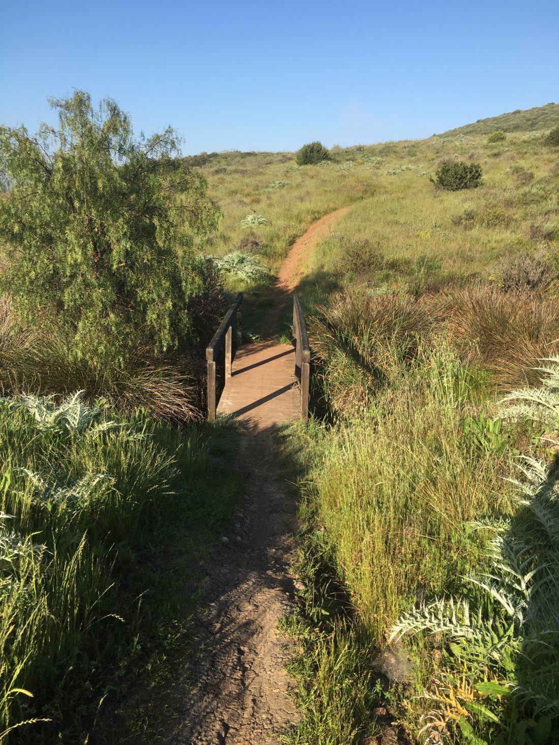
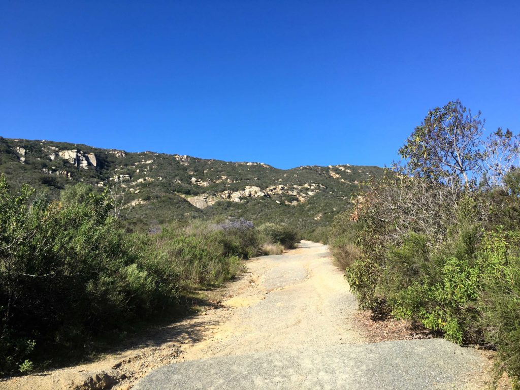
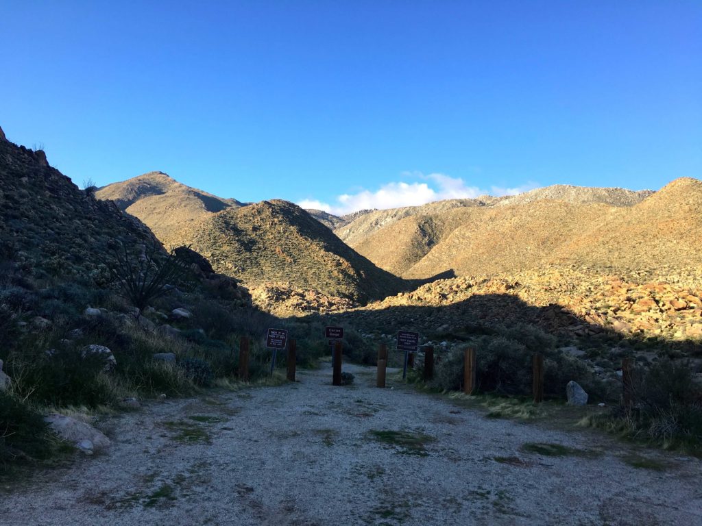
With the stay local restrictions still in place, I decided to explore some of the local peaks listed in the Near By tab of Peakbagger: Santa Monica Ridge, Low South Benchmark, Peak 557, and Sol Benchmark. Since my knee was still not at 100%, these should be perfect to test it out. First up was Santa Monica Ridge, which is located in the Del Mar Mesa Preserve. Odds are I probably have been here, as this is one of my favorite ways to enter Los Peñasquitos Canyon. But for the sake of certainty, I decided to hike out to it.
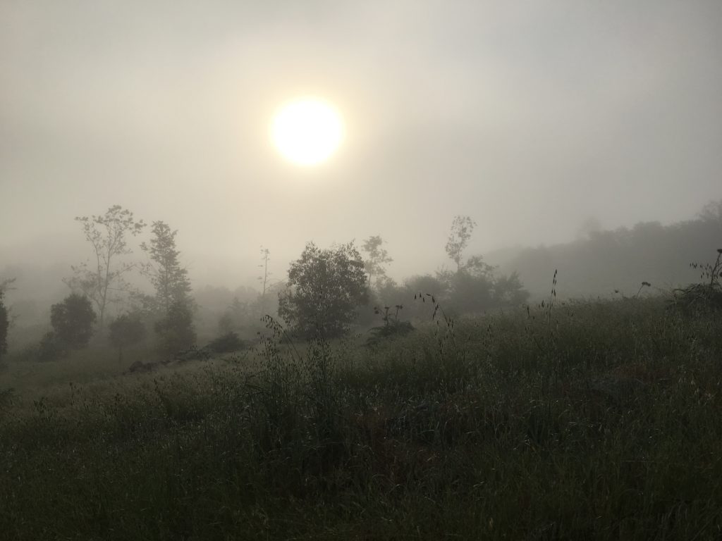
The morning fog still hung over me as I quickly worked my way to the top of the bump. There is no cairn or other mark to denote it, so I took a screenshot of my location atop the mark and returned to my car. An older couple was just entering the trail, so I let them pass before passing through the gate.
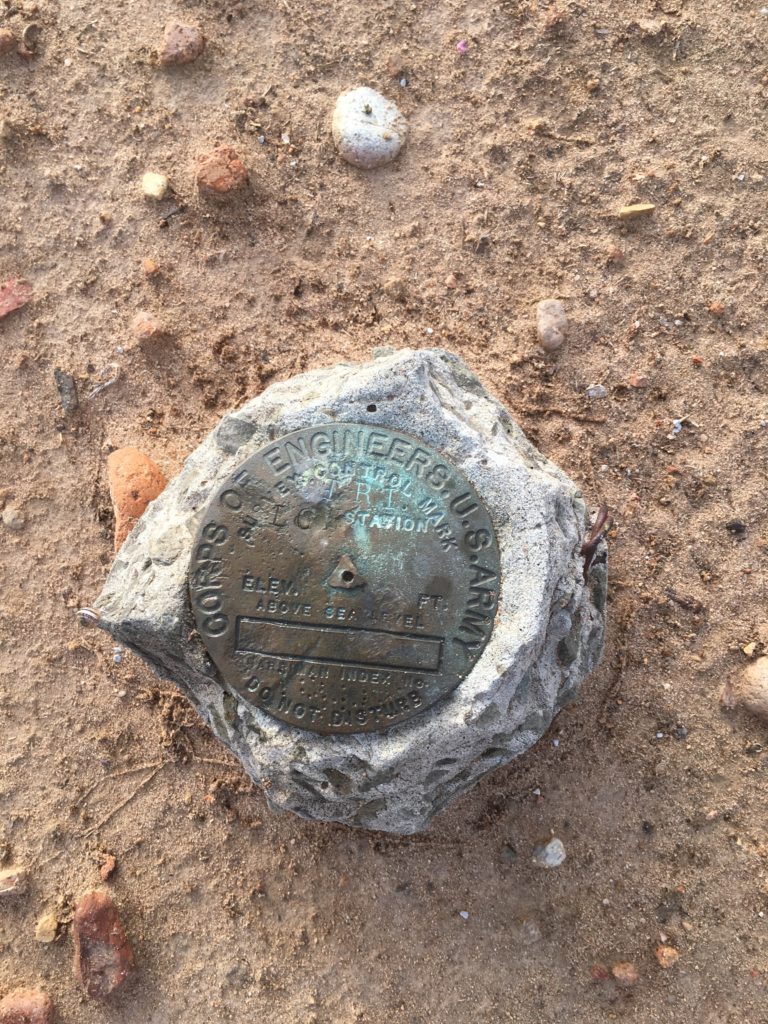
Next on the list was Low South Benchmark, near Fairbanks Ranch. I drove by this every day coming home from work. I found a parking spot and headed up the trail. After a short stroll up the hill, I reached where the benchmark should be. And there, under the power line tower, it was.
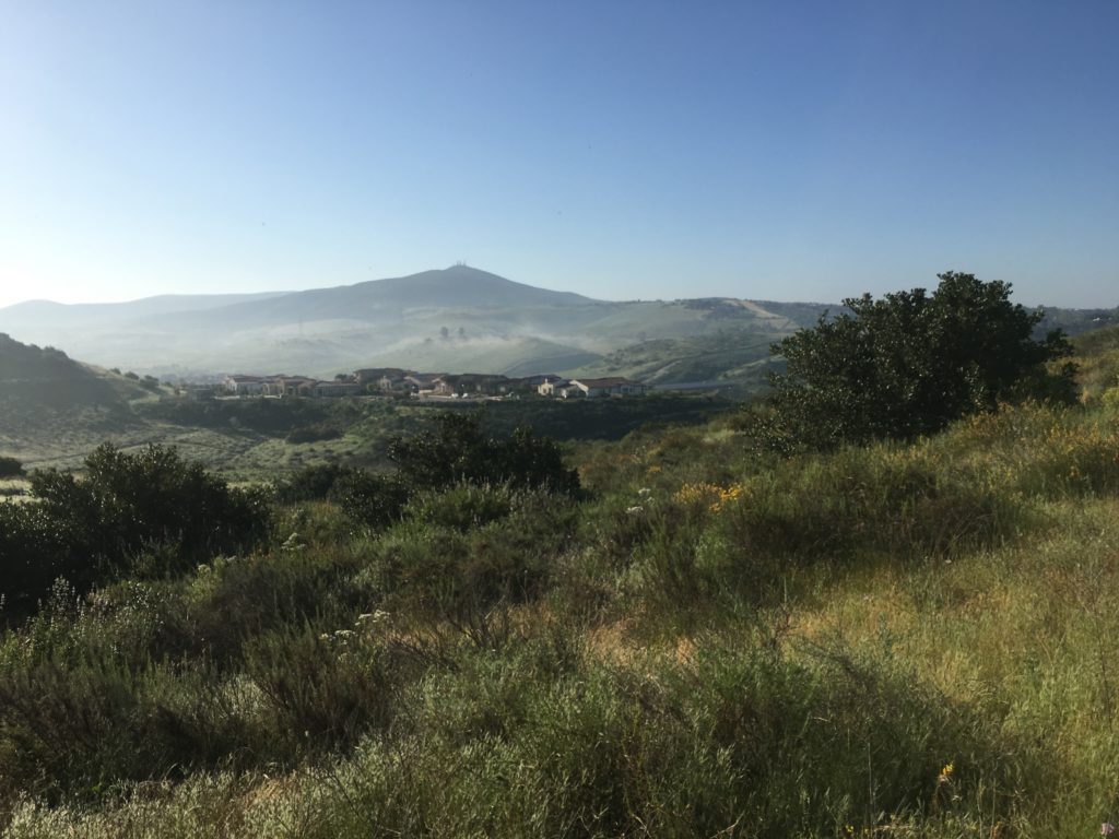
Snapping the photo and headed back down, the sun was starting to burn off the fog as I headed for my third destination, Peak 557.
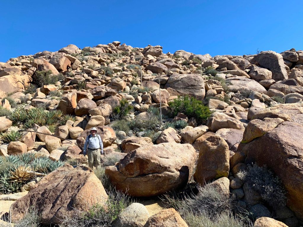
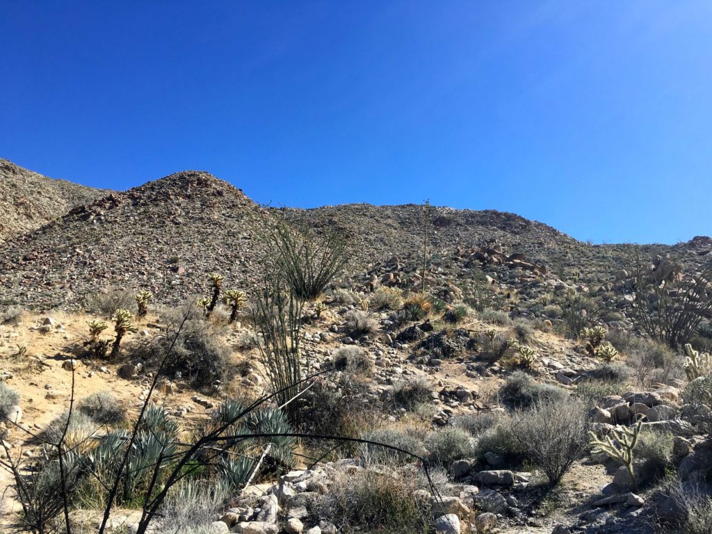
Parking on Artesian Road, I headed down the service road for the SD aqueduct. This peak would have some actual hiking involved, so I was looking forward to it after the two quickies earlier. Crossing the flowing stream, I left the service road behind and headed down the Del Sur Lusardi Connector Trail. Shortly I crossed back over the creak and started climbing up to the summit of peak 557. Some jumps had been added to the trail, so I kept my ears open for any mountain bikers. I did encounter a couple coming down the trail. Sadly they were not wearing any masks.
I found myself at the summit. There is nothing to denote it, so a photo would have to do. I decided to make it a loop of sorts. The fog had mostly lifted, and Black Mountain stood clearly to the southeast.
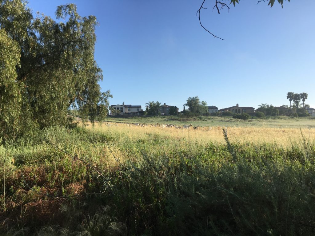
Soon I was passing the sheepherder’s trailer on my way back to the car. Yes, sheepherder. Their sheep used locally to control the grasses and wildfire danger.
The final summit of the day was Sol Benchmark. This little bump sits to the north of Bernardo Center Drive. I pulled off on Camino Crisalida. and parked. Crossing the oddly quiet road, I headed up the dirt service road. Eventually, this rutted road ends and transitions to overgrown singletrack. The trail drops down a ravine before climbing out of it and rejoining the service road. From here a trail leads to the summit. Once there I scoured the brush to see if I might find the Benchmark. But like the others, came up empty.
I decided to turn this hike into a loop. I worked my way down the hill toward the homes to the west. Unfortunately, there is not a trail connecting to the street. I followed a rain gutter for a while before pushing my way down to the street. With that, the ‘fun’ part was over and after about a quarter mile I was back at the car. Another near-by crossed off the list.
I am an avid peak bagger, sometimes backpacker, and former sea kayaker living in San Diego. I am the co-author of Urban Trails:San Diego, coming in Spring 2026!
In 2019, I became the third person to complete the San Diego 100 Peak Challenge. Not stopping with that accomplishment, I set my sights on the harder San Diego Sierra Club 100 Peak list, which I completed in 2021. In addition, I have conquered several Six-Pack of Peaks challenges (SoCal, San Diego, Central Coast, and both the Arizona-Winter and Arizona-Summer). I am looking forward to exploring new summits and new adventures across the southwest.
Hiked: March 15, 2020 Summit: 6,130 feet Distance: 13.2 miles Elevation Gain: 3,520 feet Round Trip Time: 5 hrs 45 mins
Our plan for the day was to drive out toward the Schoepe Boy Scout Reservation and hike out to Collins and Knob Benchmarks. This hike was going to be somewhere between 11 and 12 hours, so an early start was in order. We met up at the McDonald’s in Rancho Bernardo around 5 am and headed north toward Temecula. From there we would come back down the 79 to Chihuahua Valley Road then onto Lost Valley Road. As we drove on the dirt road, we encountered a closed gate. Crud. Although it was not locked, we opted not to proceed, as I had hit a few muddy spots already.
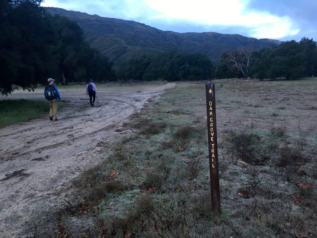
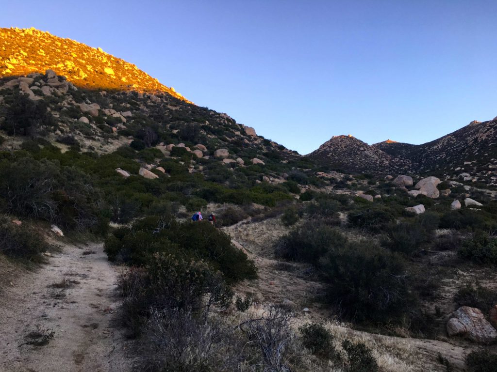
So, we thought about what alternate peaks we might go for instead. Both Matt and I needed to summit Palomar High Point for our respective lists, so up the 79, we went. Parking near the Oak Grove Fire Station, we geared up and headed off, following the nearby sign to the Oak Grove Trail.
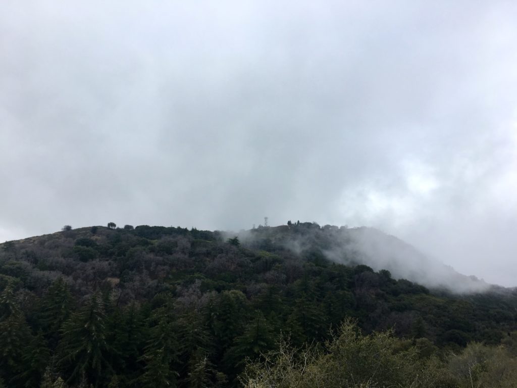
Quickly the trail began its sharp climb, gaining about 1,500 feet in just under 2 miles. The trail was a little muddy in some spots, but nothing troublesome. With the cloudy skies, there was no worry about getting too warm from the lack of shade.
The single-track trail then connected with the Oak Grove Fire Road. We took a short breather here before continuing. We stayed on this road for about 1.5 miles until we reached the High Point Truck Trail. Along the way we caught some great views of the snow-capped peaks of Mt. San Gorgonio and Mt. San Jacinto to our north. While not as steep as the first section of this hike, you still will be working those quads!
After about 5 miles into the hike, we reached the junction with the Palomar Divide Truck Trail. It was near here that I had parked on my previous times to the summit, so the rest of the hike was familiar. We started getting closer to the summit and the clouds were getting closer as well, so we donned another layer before continuing to the summit.
As we rounded the final section of the hike, we could feel the wind pick up and knew that we would not be lingering at the summit. We took a short break for some food and a few photos. The white domes of the Palomar Observatory were to our west. The tower was closed for the season (you can’t go up even if it is open).
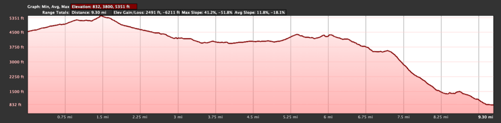
We retraced our route back down the mountain, encountering several other hikers making their way up to the summit. I don’t think we stopped for any measurable period of time during our entire descent. Back in the car, we wondered when we might be able to try for Collins and Knob, given the forecast for the week and the uncertainty about Covid-19. With that said, we did the 13.2 miles in 5:45 hrs. That was the first peak toward my Six-Pack of Peaks Challenge. I am aiming to complete all 18 this year. Wish me luck!
I am an avid peak bagger, sometimes backpacker, and former sea kayaker living in San Diego. I am the co-author of Urban Trails:San Diego, coming in Spring 2026!
In 2019, I became the third person to complete the San Diego 100 Peak Challenge. Not stopping with that accomplishment, I set my sights on the harder San Diego Sierra Club 100 Peak list, which I completed in 2021. In addition, I have conquered several Six-Pack of Peaks challenges (SoCal, San Diego, Central Coast, and both the Arizona-Winter and Arizona-Summer). I am looking forward to exploring new summits and new adventures across the southwest.
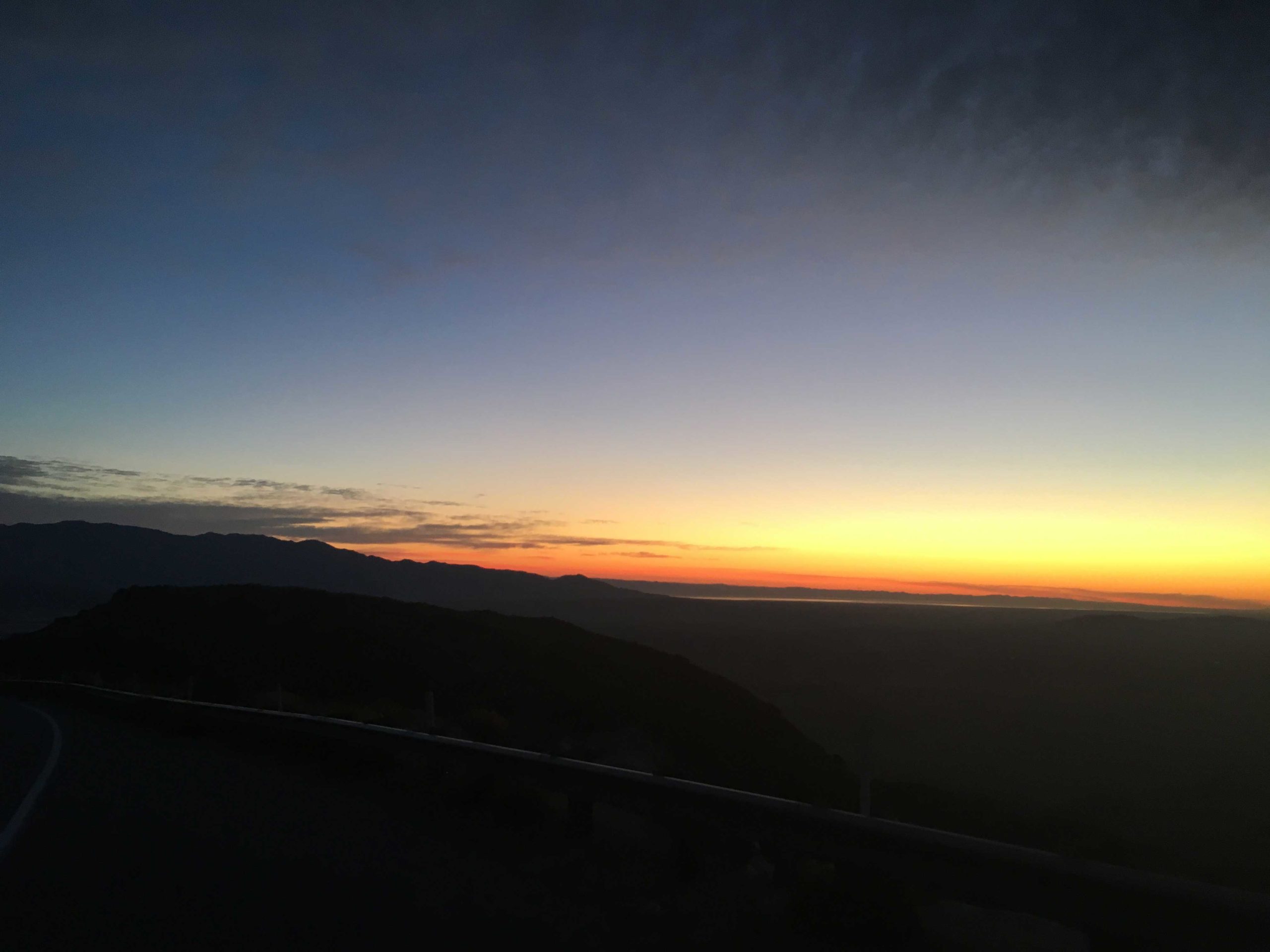
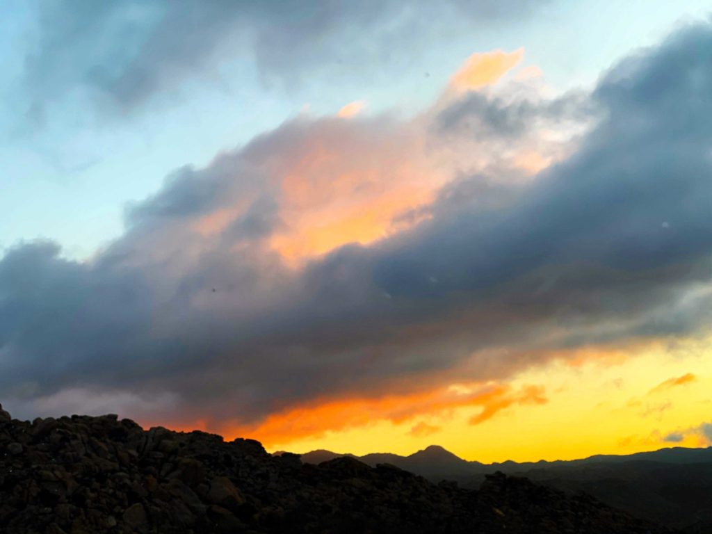
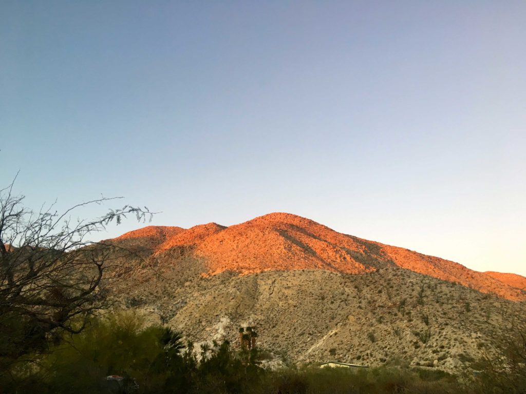
With Susie, Matt, and Greg off on a backpacking effort to summit Cody, Pike, and Palm Mesa, I opted to attempt Pyramid Peak. They had done it last December while I was madly racing to finish the 100 Peak Challenge. Since there were some winds forecast for later in the afternoon, I knew this was going to be a sunrise start. As I headed down from Ranchita, I caught another stunning sunrise. Usually, I let Ted grab those photos, but he had to work, so I had to pull over to snap a few shots.
After a quick pit stop at the parking lot for Maidenhair Falls for a bio-break, I kept heading east to the trailhead. Pulling into the turnout, another car was parked there. Since this is the same one for Villager and Mile High, I wondered what they might be off exploring? I grabbed my gear and headed northeast across the desert floor toward Palo Verde Wash.
As I neared the wash, the ground became rockier. I remembered from our ascent of Mile High that the wash was not one of those nice sandy ones. Once in the wash, my next landmark would be a cairn that would mark the mine trail I would take to the east. Checking my route, I knew it to be close. I had spent some time on Google Earth to get a feel of where I should look, as solo hiking takes some extra research. Susie had mentioned they made it larger when they took it. Sure enough, I spied it and scrambled up the side of the wash onto its well-defined path.
I would follow this trail until I reached the Smoketree Wash. A few flowers would line the trail along the way. I dropped down into the wash and continued north. I finally caught my first glimpse of the peak and the ridgeline I would take. I stayed in the wash for a very short time. While the exit did not have a cairn, the terrain made it pretty clear where the exit was.
Here I was able to pick up the use trail that I would follow all the way to the summit. The first section crossed a fairly steep and rocky scree section, I was not looking forward to descending this later. Once past this section, the terrain was far more manageable––somewhat rocky but without causing issues. I reached the top of a minor bump and took a short breather before the final push to the summit.
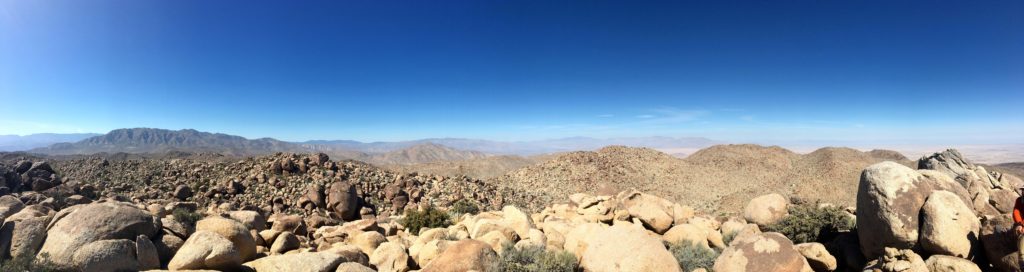
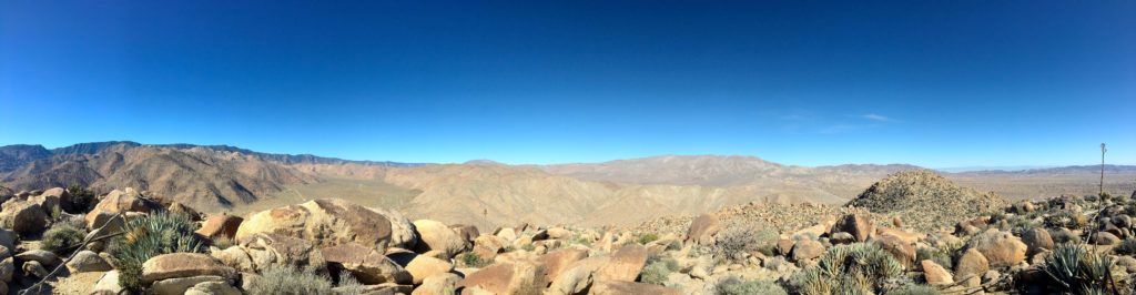
Once I crested the Ridge, I could feel the winds pick up. Here I turned north onto the new ridge and the last few thousand feet to the summit. Once there, I soaked in the views. Today, I think in part due to those winds, the skies were clear. The Salton Sea spread out to the east, and Travelers Peak somewhere to the south. To my north, I think stood Rosa Point. There is no Benchmark here, but a register filled with many familiar names. What was most impressive was the number of times Steve Fausett has been here!
The winds were building and I slipped on my windbreaker while I enjoyed my snack before heading back down. I retraced my route, and the use trail was even clearer on my descent. As I neared that section near leaving Smoketree Wash, I cautioned myself to watch my footing. Sadly, my foot slid on the rocky scree and I took a tumble. Thankfully, just a few minor scrapes.
Once safely back in the wash, I again found the mine trail. I had considered taking the other branch of the wash to explore the natural stone tanks, but my tumble aborted that plan. I cruised along the trail, the occasional lizard scampering by.
Clark Dry Lake Bed
Soon the Clark Dry Lake Bed was visible to the west as I made my final descent back into the Palo Verde Wash. From here, I again crossed the 1.4 miles back to the car. With that, my 88th Peak was completed!
I am an avid peak bagger, sometimes backpacker, and former sea kayaker living in San Diego. I am the co-author of Urban Trails:San Diego, coming in Spring 2026!
In 2019, I became the third person to complete the San Diego 100 Peak Challenge. Not stopping with that accomplishment, I set my sights on the harder San Diego Sierra Club 100 Peak list, which I completed in 2021. In addition, I have conquered several Six-Pack of Peaks challenges (SoCal, San Diego, Central Coast, and both the Arizona-Winter and Arizona-Summer). I am looking forward to exploring new summits and new adventures across the southwest.
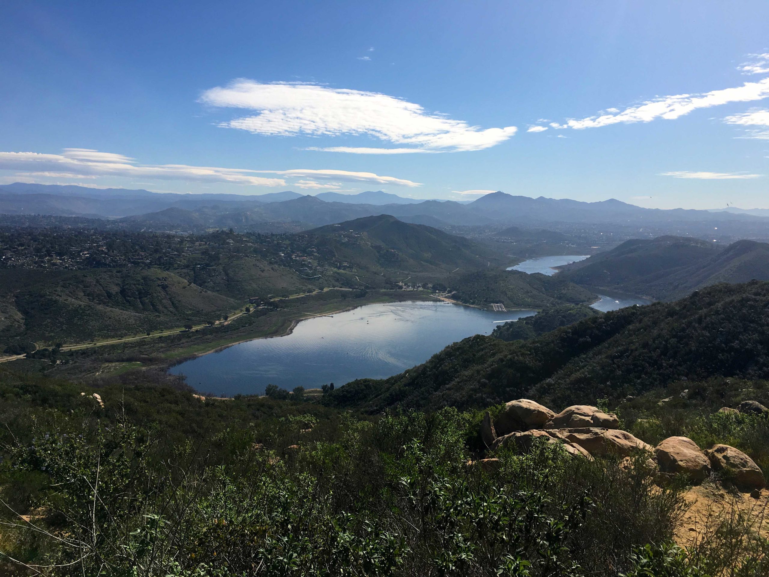
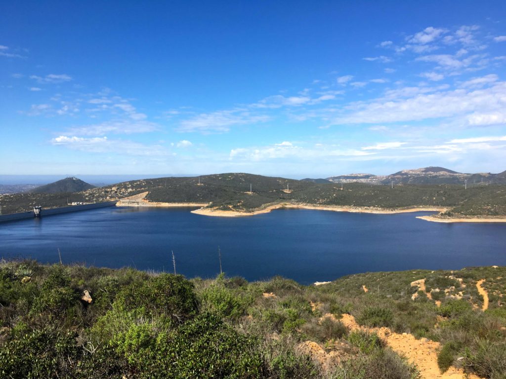
Since my hiking partner backed out of our planned hike up Volcan Benchmark, I decided to stay in town and complete the 2019-2020 Coast to Crest Challenge. My final hike was to be 6+ miles out to the Lake Hodges Overlook.
The trail begins with a good steep climb for the first mile and a quarter. One of the rewards of the climb was a nice vista of the peaks to the north and east. In fact, snow-capped San G was even visible in the distance.
As I continued my climb, I could see the “Way-Up Trail” across the ravine. Just past the summit, I turned north and worked my way up and down toward the overlook.
The shimmering waters of the Olivenhain reservoir stood to the west of me.
Eventually, I reached the overlook and took my required selfie. A small peak stood just a bit further to the south, so I had to go climb it. This peak is the official Lake Hodges overlook.
In fact, it had a small survey marker and a post on the summit! I snapped a few more photos and headed back. With that, my C2C Challenge was done! Can’t wait until the next one!
I am an avid peak bagger, sometimes backpacker, and former sea kayaker living in San Diego. I am the co-author of Urban Trails:San Diego, coming in Spring 2026!
In 2019, I became the third person to complete the San Diego 100 Peak Challenge. Not stopping with that accomplishment, I set my sights on the harder San Diego Sierra Club 100 Peak list, which I completed in 2021. In addition, I have conquered several Six-Pack of Peaks challenges (SoCal, San Diego, Central Coast, and both the Arizona-Winter and Arizona-Summer). I am looking forward to exploring new summits and new adventures across the southwest.
Initially, we thought we would have to summit Groan Benchmark as part of a long hard loop from McCain Valley, but thankfully Matt Hanan offered up a ride in his 4X4 Jeep to take us to the better trailhead for Groan Benchmark. I met Susie and Matt Bennet. in the parking lot at Grossmont Center and headed off to meet Matt H. at the turnoff to Carrizo Creek. As we drove through the clouds and lingering rain, we hoped that the skies over the desert would be clear (as predicted). Nearing Boulevard, the skies began to clear, and were greeted with a lovely sunrise.
Matt is an easy fellow to spot, as he is usually in a Celtic jersey and shorts. We piled into the Jeep and set off down the dirt road. Last weekend, Larry Edmonds finished his 100 by summiting Grunt Benchmark, which shares the same trailhead as Groan’s. Matt had joined Larry on that hike, so he was very familiar with the road and its challenges. As we bounced along, it was clearly well beyond what I would take my Subaru on.
We reached the end of the road, and thus our trailhead. We geared up, and there was a bit of a breeze, so I made sure to have a windbreaker in the pack. I figured it would be handy up on the summit. The trail follows a cobble-filled wash for some time. About a quarter-mile in, Matt H asked if we wanted to see the pictographs in the cave then or on the way back. No time like the present, so we scampered off up the rocky side to see them. What a well-preserved collection! A few morteros were nearby as well. We did not linger too long, as we still had about 6 miles of hiking to do.
Once back on the route, we eventually found a nice use trail for a bit, which was a relief from stepping on and around the rocks in the wash. After about two miles, it was time to leave the wash and begin the major portion of the climb to the summit. We plodded our way upward, trying to avoid the ‘anger bushes’ (as Scott Turner likes to call them). Sadly, I got hit a couple of times, despite my best efforts. Our route took us side-hilling for a while. The summit was now finally coming into view.
After crossing a small ravine, we began the final push to the summit. The true summit was just behind the top that was visible to us from our ascent, but an easy walk to it.
Once there we took a nice break, and since there was a bit of breeze, I did break out the windbreaker.
To the southeast, the Goat Canyon Trestle was clearly visible, as was Puff Benchmark. Back to the northwest, stood Gasp Benchmark.
We munched on our snacks, signed the register, and took our photos. In addition, we found the benchmark and reference mark.
One thing to note about this benchmark is it is mislabeled as Moan. In fact, Larry kidded that “We would Moan at Groan…” After about 30 minutes, we decided it was time to head back as it was warming up some. As we made our descent, we looked over the map and decided to explore an alternate route back.
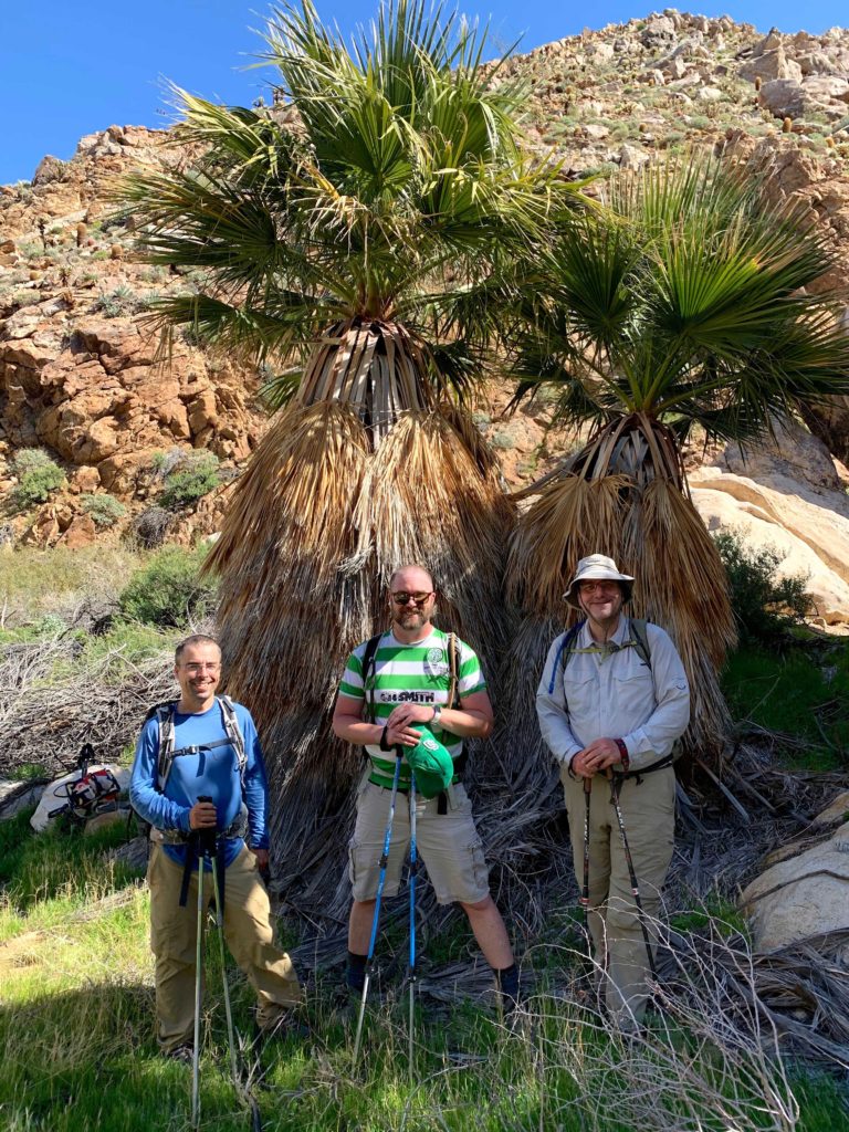
As we worked down, we passed a couple of California Palms, so Susie made us take a group shot of the guys.
The desert floor was green from the recent rains and almost seemed unnatural as we worked our way through the canyon. Along the way, we had two dry waterfalls to descend. Both posed no issues for any of us. The other surprise along the way was the various piles of sheep bones that we spotted.
There were also flowers along the way. Sadly, we all agreed that this year’s desert flower season will not be like the ones in years past.
Our alternate route eventually rejoined our initial track. We all agreed that it was so worth the little bit of extra distance. We picked up the use trail again, noting that some of the brush had been cut with a saw. We wondered about the why and the who behind that. The day was heating up, and the sun was reflecting off the sandy ground. Soon, Matt’s Jeep was spotted in the distance and our trek was done (except for the bouncy ride out). Just before we reached the S2, a truck was parked directly on the road! We were about to drive around them without incident, as we did they had a whole table of food set up behind them. We were not impressed by the Cal Tech Geology team and their choices.
Our original plan was to drive back up to McCain Valley and try from Gasp Benchmark, but we decided against it. Susie opted to save it as her final peak so that more folks might be able to celebrate with her. Instead, I convinced the group to take a short stroll to the top of Egg Mountain which was just across the road (Matt did it while waiting for us in the morning). More of a bump, it is listed on the Borrego Benchmark Club list, so why not?! We grabbed some trash along the way to the summit, but could not find a register or any other marks. We strolled back along the road (yes, we could have driven to the top). We said goodbye to Matt and thanked him for driving us to the trailhead.
Mt. Tule
Since we still had some time, and Matt B. had not done Mt. Tule yet, I offered to drive to the trailhead. This is also a modest portion of the road to the trailhead to Gasp Benchmark, so it would be worthwhile to see its condition. It was like I remembered, bumpy and at times a bit rutted. I pulled into the same spot I parked last time. Susie opted to tag along with Matt, but I was more than happy to grab a nap. They found the use trail to the summit without a problem and were back before I really started snoring (I think). I dropped them back off at their car and headed home. Unfortunately, Susie’s house keys had fallen out (thankfully in the car), so she and Matt had to drive all the way to my house in PQ to get them. Nevertheless, that was the 87th peak of my #SD100! With luck, I should hit 90 before this desert season ends.
I am an avid peak bagger, sometimes backpacker, and former sea kayaker living in San Diego. I am the co-author of Urban Trails:San Diego, coming in Spring 2026!
In 2019, I became the third person to complete the San Diego 100 Peak Challenge. Not stopping with that accomplishment, I set my sights on the harder San Diego Sierra Club 100 Peak list, which I completed in 2021. In addition, I have conquered several Six-Pack of Peaks challenges (SoCal, San Diego, Central Coast, and both the Arizona-Winter and Arizona-Summer). I am looking forward to exploring new summits and new adventures across the southwest.
With the day off for President’s Day (or as I call it, my distant cousin’s day), I rendezvoused with Susie and Matt to tackle Vallecito Mountains High Point. The real challenge of this hike is not the 5.6 miles nor the two boulder fields you need to navigate through, but rather the 18 or so miles of pure off-road driving. We had decided to meet at the bathrooms at the Ocotillo Wells Ranger Station and transfer into my Subaru. Susie and Matt had been camping since Friday out in various spots in Anza-Borrego, making a serious dent in the Sierra Club 100 list.
The beginning of the drive was very familiar as it is the same one we did just a few weeks back when we summited the Split Mountains. As we zoomed past them, we continued on Fish Creek Wash, heading deeper and deeper into the heart of Anza Borrego. The terrain and geology were fascinating, to say the least. There were certainly sections of the road that took a bit of skill and patience to navigate over. Finally, after about an hour of driving, we came to a sign pointing the way to Dave McCain Spring, our trailhead.
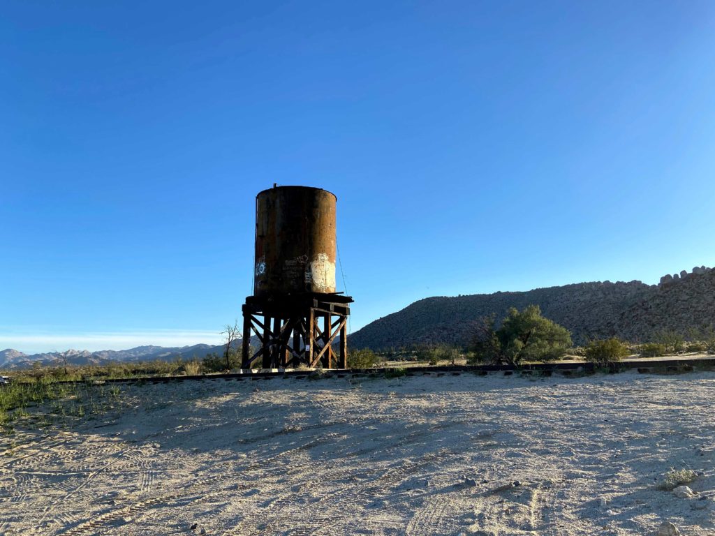
Once there, we quickly geared up and were ready to head out. We passed by the remains of the water tank for the spring, as we crested a small saddle. The pipe that carried the water from the actual spring still sat on the desert floor.
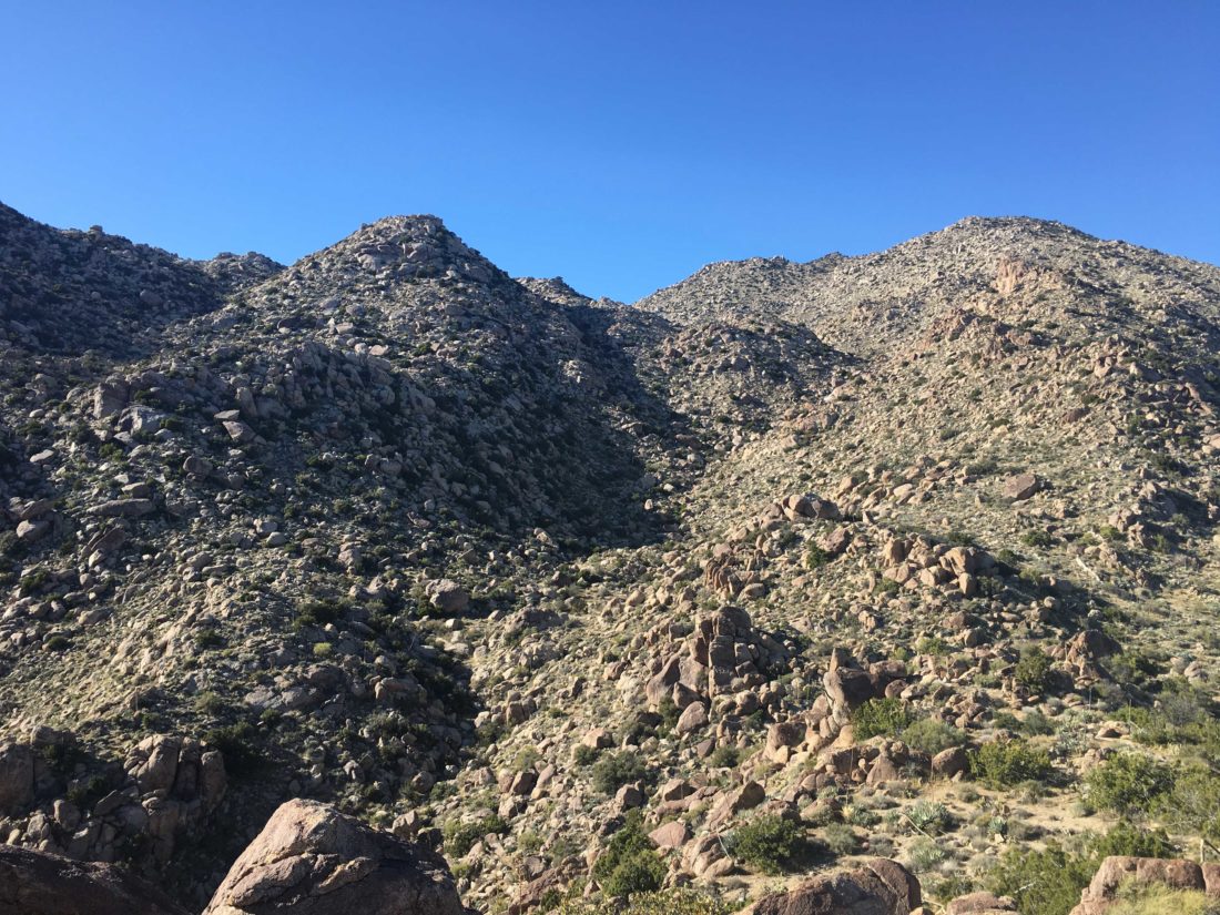
Upon reaching the crest, we dropped down and followed a small wash, which took us around a small hill. From there, our first challenge stood before us–the first boulder field. We worked our way to the south and followed the gully for a while. Eventually, we moved out of it and onto the slopes to the south. Matt found a nice path over the rest of this initial climb and we soon found ourselves descending about a mile into the wide plateau that we found.
We cruised along the fairly firm sandy wash toward the northeast of this section. We wondered exactly which of the boulder-filled slopes we would attempt. Finally, we reached the end of the wash and began our climb up toward the summit. Stowing our trekking poles, we opted to stay to the north of the gully for the ascent route. Matt would seem to almost effortlessly lead us along a great route up through the maze of rocks.
Just before the false summit (I hate those things!), was a small flat spot, perfect for a short break. We found a nice-sized boulder and sat in the shade for a few minutes. We knew we were close, so we pressed up and over. Upon reaching the saddle, Matt scoured the terrain and plotted our path to the true summit.
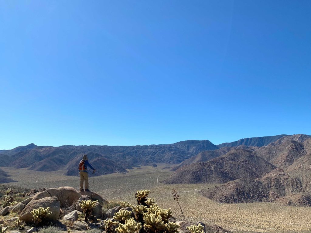
The views were tremendous! Whale Peak rising to our east, and Sunset Mountain to the northwest. The Santa Rosa Range to our north, and even though the haze, San Jacinto could be seen as well. There is no benchmark here, but we proudly signed the register and took our photos atop the highest rock.
After a nice break, we slung our packs back on to begin our descent. We were able to mostly follow the same-ish path down and up to the top of the false summit. From there, we kept slightly more to the north, as the route seemed to be a bit better. So far, the boulders were not too difficult.
Once back on the plateau, we opted to make our way to the western wash instead of the one we followed initially. We reached the junction of the initial wash and turned to the northwest. This time we decided to follow it further before making our way over the final boulders.
As we approached the top of the boulder field, we decided to stay to the north and work our way down from there, rather than work our way south across one section of boulders and back to the route we took on the way up. This proved not to be the best choice. Our route was tough, all the easy bouldering we had done until now was but a distant memory. We carefully worked our way through them. At one point we actually crawled through a small boulder cave. Finally, we reached the end of the boulders and were back in the initial wash. We worked our way back along the same route, knowing that soon we would be back at the car. While we still had an hour of off-road driving, we had summited Vallecito Mountains High Point. This was peak #86 for me, and #92 for Susie. I think we just might finish before this desert season ends!
I am an avid peak bagger, sometimes backpacker, and former sea kayaker living in San Diego. I am the co-author of Urban Trails:San Diego, coming in Spring 2026!
In 2019, I became the third person to complete the San Diego 100 Peak Challenge. Not stopping with that accomplishment, I set my sights on the harder San Diego Sierra Club 100 Peak list, which I completed in 2021. In addition, I have conquered several Six-Pack of Peaks challenges (SoCal, San Diego, Central Coast, and both the Arizona-Winter and Arizona-Summer). I am looking forward to exploring new summits and new adventures across the southwest.
Today’s primary summits were to be Puff Benchmark and Moan Benchmark out in southern Anza-Borrego. Susie and Matt were in that part of the desert after successfully summiting Red Top and Sawtooth the day before! Ted and I rendezvoused with them at the turn-off onto Dos Cabezas road and piled into the Outback. The hopeful plan was to be able to drive past the water tower to about where the jeep road intersects with train tracks and then set off from there. Hitting X-Mode on the Outback, we easily climbed the small incline to continue on to our starting point. As we neared the parking spot, there was a group of campers enjoying their morning. Since they were up and moving about, I did not feel bad about parking nearby. Once we geared up we headed off to the east along the jeep road. Indian Hill was our first landmark.
Neither Susie nor I needed to summit this peak again, so we opted not to. However, Matt did need this peak for his list. Rather than just scramble to the top and rejoin us on the jeep road, Matt decided to make his own way from there onto Moan Benchmark and then onto Puff, where we would meet up. Knowing his skills, we wished him well as he set off. It seems that we barely passed to the west of the peak when we hear him call out from its summit! We were amazed and jealous of his climbing speed.
Our route continued ever westward along the jeep road. A motorcycle passed us coming from the east, then a bit later it cycled back. As we neared the junction of the road with the train tracks, a group of campers had set up atop a nice cement pad. We chatted a bit, and they kindly offered some water and bananas, but we were fine. From here we continued our journey to Puff Benchmark to the south.
Puff Benchmark sits just above the famous Goat Canyon Trestle, the world’s longest wooden trestle. We climbed up the steep ridge, avoiding the various cacti toward its summit, and as we neared it, there stood Matt. We sat around at the summit, marveling at the wooden structure below us. Calling this the “Impossible Railroad” certainly seemed like the right choice. Looking back to the north, we could see the tracks as they hugged the side of the steep slopes. What it must have taken to construct this line.
After a nice break, it was time for the three of us to set off toward Moan Benchmark, Matt was continuing his solo journey to summit Piedras Grandes. He would meet us back at the car (of which we had no doubt). Upon our descent from Puff, we found two shovel blades on the desert floor and as we made our way up to Moan, we passed what must have been a work camp.
Water cans were neatly stacked, rusting quietly away. Unlike the clear summit of Puff, Moan proved to be slightly more challenging. After some incorrect route finding, we eventually dialed ourselves in and pushed upward. We crested over a peak, and a higher peak stood ahead of us. Assuming that was Moan, we continued on, knowing we were close. We paused for a quick route check, to discover that little peak we passed was it. Looking back at it, a wooden stake was clearly marking the peak. So we retraced our steps, and a few minutes later we were atop Moan Benchmark. I CAN say the two of us were certainly moaning over this ascent!
The view was outstanding from its summit. There is something deeply satisfying about looking out and knowing you have stood atop these peaks. Water was still filling several small pools around us. We signed the register and took our photos. We considered fully retracing our route or working our way down the northeast face of the peak. In the end, though, we decided to opt for the shorter route.
Unfortunately, this route was a steep mess of bouldering, Susie’s least favorite thing. We kept checking and rechecking our position as we carefully made our descent. About halfway down, Susie took a small fall. Thankfully she was ok, but it certainly made us aware as we scrambled down from rock to rock. Finally, we reached the desert floor and headed back toward the jeep road and eventually the car. Although we passed by Indian Hill once again, no one had the desire to summit it. Just past 4:00 pm, we reached the car and found Matt enjoying a nap in the shade. With that, Susie and I had ticked two more peaks from the San Diego 100, while Matt was able to remove 4! It was a fun 7 hours of hiking, covering just over 11 miles. Really glad to finally see the trestle in person, even from a distance.
I am an avid peak bagger, sometimes backpacker, and former sea kayaker living in San Diego. I am the co-author of Urban Trails:San Diego, coming in Spring 2026!
In 2019, I became the third person to complete the San Diego 100 Peak Challenge. Not stopping with that accomplishment, I set my sights on the harder San Diego Sierra Club 100 Peak list, which I completed in 2021. In addition, I have conquered several Six-Pack of Peaks challenges (SoCal, San Diego, Central Coast, and both the Arizona-Winter and Arizona-Summer). I am looking forward to exploring new summits and new adventures across the southwest.
Besides working on completing the Sierra Club San Diego 100 peaks list, I am also working on completing the San Dieguito’s River Foundations’ Coast to Crest Challenge. I knocked off three of the five hikes around New Years’. With my usual peak-bagging partners occupied, I decided to go do one of the remaining hikes, Santa Ysabel West Preserve.
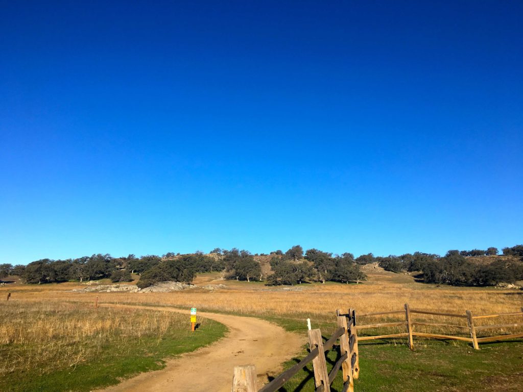
Dave Myron and I pulled into the empty parking lot just before 8 am. Thankfully, the gate was already open. We geared up and headed off. The entire trail is about 5.5 long and follows a lollipop pattern. This challenge requires a selfie at a particular spot along the trail, in this case near the top of the lollipop.
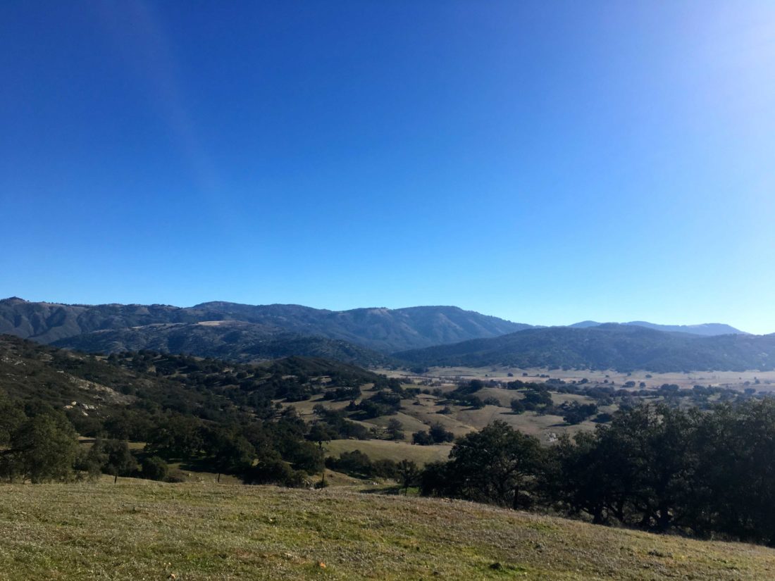
After a short flat section, the trail makes its first small climb. The trail then continues to work its way up and down the hills. We carefully crossed a nicely flowing stream before the final climb to the selfie spot. The grazing cows barely gave us notice as we passed by. The views were quite nice with Volcan Mountain rising to the east, and Cuyamaca to the southeast.
Upon our return, we meet a couple of groups of hikers, also enjoying the trail. Soon we were back at the car and headed back into town. I had hoped to get the final hike in on Sunday, but rain showers had other plans.
I am an avid peak bagger, sometimes backpacker, and former sea kayaker living in San Diego. I am the co-author of Urban Trails:San Diego, coming in Spring 2026!
In 2019, I became the third person to complete the San Diego 100 Peak Challenge. Not stopping with that accomplishment, I set my sights on the harder San Diego Sierra Club 100 Peak list, which I completed in 2021. In addition, I have conquered several Six-Pack of Peaks challenges (SoCal, San Diego, Central Coast, and both the Arizona-Winter and Arizona-Summer). I am looking forward to exploring new summits and new adventures across the southwest.
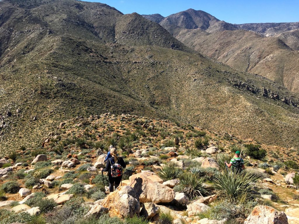
The final day of the weekend of desert peak-bagging was to be an epic attempt at 5 summits along the San Ysidro mountains; Goat Benchmark, San Ysidro East Peak, The Sirens, Kay Benchmark and Ode Benchmark. With the unfortunate blisters on my foot, I was uncertain as to what I might be able to do. A bit before 6 am, I picked Susie Kara up and headed over to the dirt lot next to Jilbertos in Borrego Springs. There we synced up with Matt Bennett, who got in Bonny and White Benchmarks after we did Stage Benchmark yesterday, and with Greg Gerlach, who summited The Thimble the day before. The plan was to drive Matt’s car to the Anza-Borrego Springs Visitor Center parking lot and leave it there (paying the $10 parking fee), then transfer to my Outback and drive up to Ranchita to start hiking.
We parked just a bit further down the road from the BLM sign and began gearing up. Following the all too familiar route toward The Thimble along the road through Cherry Canyon. I could feel some slight discomfort from my foot, but I was confident that I could make our first peak, Goat Benchmark. After about a mile, Matt headed off to summit both The Thimble and San Ysidro. From there he would attempt to rejoin us before we ascended San Ysidro East Peak. With his fast pace and strong route finding, none of us doubted this would not be the case. I gave him some guidance on the route I took up The Thimble, and he was off. Greg, Susie and I then continued on to the east. Rather than stay on the road and cause any private property issues, we kept traveling cross-country.
Once we crested the ridge to the south of The Thimble, the chimney route was clearly visible from our vantage point. Susie recounted her ascent that way and the challenge it posed her. As we began our descent, we heard a voice call out, and there on the summit of The Thimble stood Matt! We stared in disbelief and in awe. We waved, knowing we would be seeing him probably even earlier than planned.
The Thimble
The three of us stuck to a gully which gave us fairly easy passage as we made our gentle descent. We kept scanning to the southeast, wondering if we could actually spot Goat Benchmark amongst the rocky bumps. It has a history of being hard to locate. However, with Greg’s track loaded on our devices, plus having him along, this became almost trivial.
We sat at the summit and took a nice break. The register was located atop the same boulder as the benchmark. Thankfully nature had provided a nice rock step, so climbing it was a simple task. After signing the register and taking some photos, it was time to head out. From here we would continue descending down into Hellhole Flats, before making the ascent up to San Ysidro East Peak.
Just as we crossed into Hellhole Flats, Matt gave out a shout to let us know he was rejoining us. We passed by Lookout Knob, just to the south of our route. Greg had summited it in the past and offered a few suggestions as to the route to the top. We all declined this time and continued on.
Looking toward the summit of San Ysidro East
Once we reached the eastern edge of Hellhole Flats, we took another break before the ascent. I re-evaluated my foot’s condition. I added some additional padding, hoping it might reduce some of the pressure, and thus the discomfort. After some discussion, I felt I should not attempt San Ysidro East Peak. Instead, I would leave the group and head toward The Sirens. Once there, I would leave my arrival and departure time in the register, so the rest would have a sense of my location. Also, we knew once we reached that point, we would have cell coverage if needed.
I had always wondered how The Sirens got their name. Recently Larry Edmonds filled me in on its origin
A good friend who lives in Ranchita would look out at that short series of high points at the east end of Hell Hole Flat and call it “The Sirens” because they called to him. When the San Diego Peaks Club created there peak list they called the high point Sirens Peak because Paul Freiman, the creator of the peak list, and Ted, my friend, were also friends.
Larry Edmonds
So, I set off up a gully toward the saddle before turning southward. The Sirens were about a mile or so south at this point. I would follow the contours of the ridge as I drew closer to the summit. While I had Greg’s track loaded, I knew as I reached its base that it was now really my own navigation skills that I would take to the top. I plotted a route and began working my way up. As I drew closer and closer, I hoped that I had picked a route that would work. At one point, I was uncertain as to the path forward, however, there was a small cave that seemed to provide an option to explore. I worked my way through it and found myself much closer to Greg’s track. This gave me hope that I would find my way. After carefully traversing up a rocky slab, I found myself atop the summit. While I was not with the rest of the group working their way up to San Ysidro East Peak, I was feeling proud of making this one solo.
After signing the register and taking in the views. I turned my phone’s cell service back on and sent a text to the group (and my wife) of my current status. I was now going to continue on down toward Kay Benchmark. I took a more direct line with my descent from The Sirens. Now for probably the hardest part of the entire hike—the descent from The Sirens to Kay Benchmark. Every trip report I had read about this section spoke not only of the steepness but of the large boulders that also needed to be overcome. I tried to follow the track that Greg had done during his last trip, but at times I would drift off the track and would have to correct.
After almost 2 hours of careful route work, I found myself standing atop Kay Benchmark! I slid off my pack and leaned against a rock. As I sat there, I looked back to the west at what I had just navigated down solo. The plan was to wait here for Greg, Susie, and Matt to rejoin me. I checked back in with my wife, as the wind was starting to pick up some. Way off in the distance, I would hear the faint sounds of Matt and Susie, but even though Susie was wearing a bright pink top, I could not locate them. Finally, I spotted them! Turns out, they opted to follow the route Matt used on his previous trip. According to Greg, this was far superior to his previous route. He thought it only took them just over an hour to descend.
The winds continued to gust, even blowing my hat off at one point. Thankfully, a cholla caught it for me. We still had several more miles to go until we reached the visitors center, and about 2,500 feet of elevation to still lose, so we headed off. The terrain continued to be steep and rocky, but we were able to generally follow the ridgeline the entire way.
Off in the distance, we could see Ode Benchmark, our final peak of the day, poking up from the spine of the ridge, way below us. We continued working our way down. The terrain thankfully finally eased up some, as all the miles and climbing were taking their toll. With one final bit of climbing, we reached Ode Benchmark! Since I had previously summited this peak about a year ago, I snapped a quick photo of the benchmark and kept on trucking.
My foot was starting to hurt a bit more and I was looking forward to a nice cool drink of water at the Visitor Center. There was finally a decent use trail to follow, so my pace quickened slightly. The sun was setting, and the Santa Rosa mountains were beautifully lit. Soon, we reached the desert floor and I motored across it, to the promise of that cool water. We had done it! Our 10:35-hour day was done.
We headed back into town for some well-earned Mexican food, then Greg drove me back up to Ranchita to retrieve my car. While I had to skip the ascent of San Ysidro East Peak, I was still happy with my trek. I now have just 17 more peaks to climb to complete the Sierra Club-San Diego 100.
Final Stats
Start: 6:45 am Reached Goat: 8:55 am Reached The Sirens: 11:40 am Reached Kay: 1:50 pm Reached Ode: 4:50 pm Visitor Center: 5:20 pm
I am an avid peak bagger, sometimes backpacker, and former sea kayaker living in San Diego. I am the co-author of Urban Trails:San Diego, coming in Spring 2026!
In 2019, I became the third person to complete the San Diego 100 Peak Challenge. Not stopping with that accomplishment, I set my sights on the harder San Diego Sierra Club 100 Peak list, which I completed in 2021. In addition, I have conquered several Six-Pack of Peaks challenges (SoCal, San Diego, Central Coast, and both the Arizona-Winter and Arizona-Summer). I am looking forward to exploring new summits and new adventures across the southwest.
When I dropped Susie and Matt off at their campsite, we agreed to meet back up at 7 am at the trailhead for Stage Benchmark. I was uncertain if I was going to join. In part, I was still adjusting to my new shoes and wasn’t sure if I wanted to do this hike or sit it out since we had a big 5-peak day planned for Sunday. As the predawn glow spread across the desert hills, I figured I would try it. So, I ate my breakfast in the peaceful quiet, then broke down my camp and drove the few minutes to the trailhead.
Matt and Susie were waiting for me at the turnout. We grabbed our gear and set off again across the desert floor. After a short stretch, we entered a wash that would take us through the Tierra Blanca mountains and into the Inner Pasture. The wash was nice and wide as we snaked our way through it. A few motorcycle tracks cut through the desert sand. The miles quickly passed by, and soon we were greeted with the wide expanse known as the Inner Pasture. From here our route would turn south to approach the summit from the southwest.
The slopes were rocky, but not the crumbling kind we had during our ascent of Sunset Mountain. However, the firmer footing was offset by all the chollas dotting the slopes. We were all hit multiple times, despite our caution.
About halfway up, we froze in our tracks, as a bighorn sheep stood before us. It stared at us for some time before bounding off to the north. Apart from seeing the herd that one time en route to False Sombrero, I had never seen any in “the wild”.
We soon made our way to the summit and found the benchmark and the reference marks.
The day was a bit warmer than normal, so we spent a bit more time relaxing at the summit. Matt and Susie stared intently at Red Top and Sawtooth off to the southwest of us. These are two more peaks on the Sierra Club list and they are beasts.
After signing the register, we began our trek down. Again, more cholla attacks slowed us from time to time. Once off the slopes, we decided to continue west to intersect with the motorcycle trail that was clearly visible from the summit. We figured we would make better time on it, rather than on the cross-country open desert.
As we re-entered the canyon, the shade that had filled it when we first passed through it was now gone. I could feel some issues with my right foot and tried to adjust the tension on the lacing. Again, the miles passed quickly along through this wash. Matt and Susie were considering that this might become their route into the Inner Pasture for Red Top & Sawtooth.
Exiting the canyon, we opted to stay in the wash until it reached the highway. At first, we were happy to find some mylar balloons, but just before the road, Susie spotted a beer can. As she went to grab it, we soon found two shoes, and a bivy buried in the sand. We wrapped all this up and hauled it the short distance back to the car to properly dispose of it. All told we covered 9.56 miles in 5:13 hours and gained 1,713 feet to the summit. That was peak #80 of the Sierra Club 100! Susie and I headed into Borrego Springs and Matt was off to get a couple more peaks in.
I am an avid peak bagger, sometimes backpacker, and former sea kayaker living in San Diego. I am the co-author of Urban Trails:San Diego, coming in Spring 2026!
In 2019, I became the third person to complete the San Diego 100 Peak Challenge. Not stopping with that accomplishment, I set my sights on the harder San Diego Sierra Club 100 Peak list, which I completed in 2021. In addition, I have conquered several Six-Pack of Peaks challenges (SoCal, San Diego, Central Coast, and both the Arizona-Winter and Arizona-Summer). I am looking forward to exploring new summits and new adventures across the southwest.