While visiting my sister in Little Rock, my nephew-in-law, my son and I headed out to Pinnacle Mountain State Park to hike up the West Summit Trail. We started from the park picnic grounds and followed the rocky trail to the top of Pinnacle Mountain. From the top is a spectacular view of Lake Maumelle, the Arkansas River Valley, the Ouachita Mountains, and west Little Rock.
I am an avid peak bagger, sometimes backpacker, and former sea kayaker living in San Diego. I am the co-author of Urban Trails:San Diego, coming in Spring 2026!
In 2019, I became the third person to complete the San Diego 100 Peak Challenge. Not stopping with that accomplishment, I set my sights on the harder San Diego Sierra Club 100 Peak list, which I completed in 2021. In addition, I have conquered several Six-Pack of Peaks challenges (SoCal, San Diego, Central Coast, and both the Arizona-Winter and Arizona-Summer). I am looking forward to exploring new summits and new adventures across the southwest.
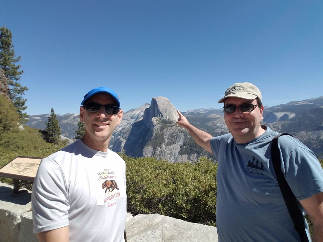
One of the items on my bucket list was to summit Yosemite’s Half Dome. This year I got a permit for the cables in late September! I convinced Ted Markus to join me on the adventure. However, as most know, I herniated two discs in my neck in early April. Slowly, I began my recovery from the injury. I kept focusing on getting strong enough to attempt the Dome. As the time got closer, I felt that I might be able to do it. My foot was doing well through the training hikes, and my neck was better. So, on Friday (Sept 21st), we loaded up the car and headed to Yosemite. Since it is a drive and sadly, we are not in our 20s, we decided to break the drive up into two parts. Since we were passing through Bakersfield, I had to introduce Ted to the only two good things in that town; Basque food (Benji’s) and Dewars!
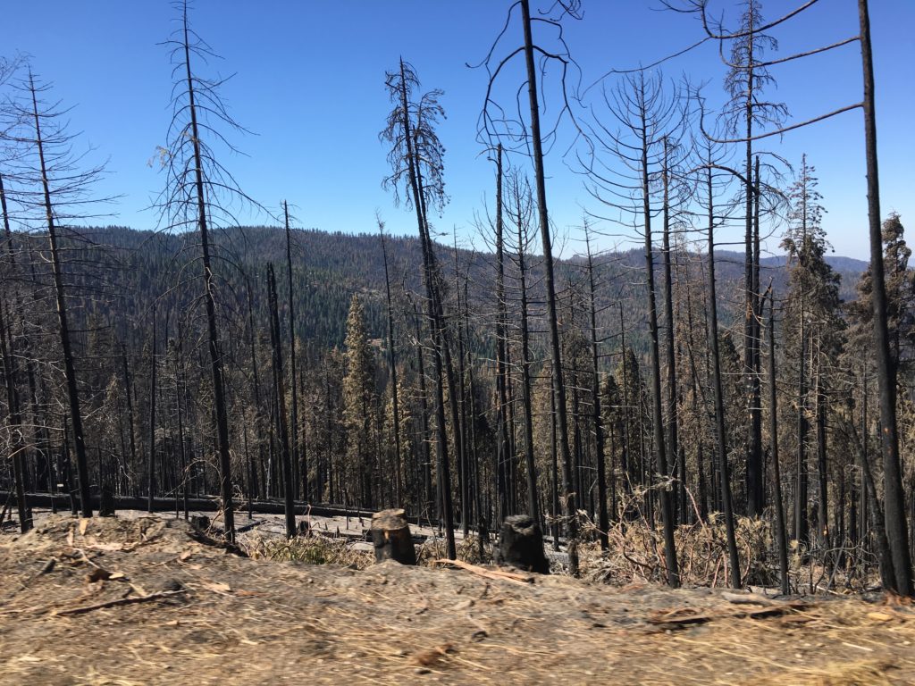
After a fine meal and some ice cream, and some chews to bring home, we headed on to Visalia for the night. As we drove into the Yosemite the next morning, the effects of the Ferguson fire were all around us; trees still smoldering, “Thank You” signs hung on fences, and repair crews still working to restore services…
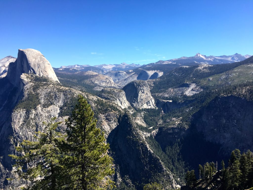
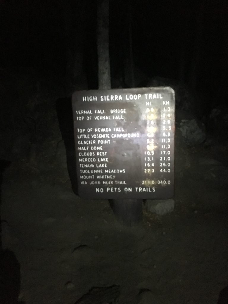
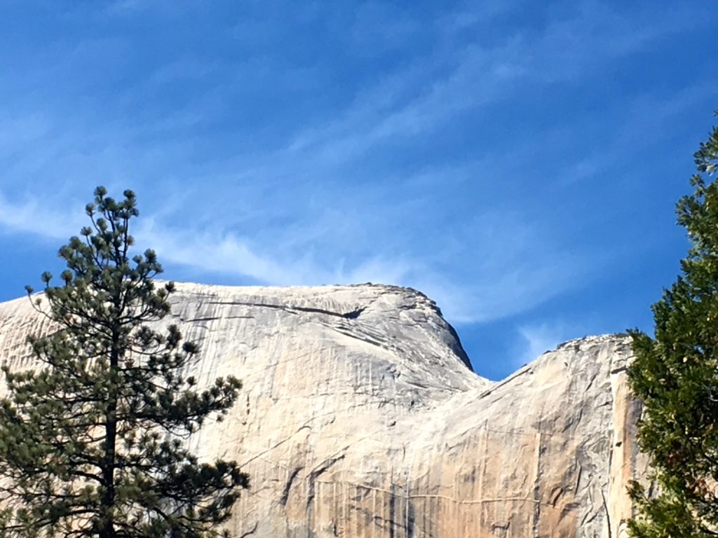
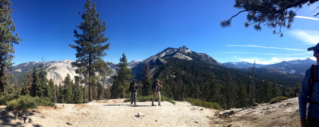
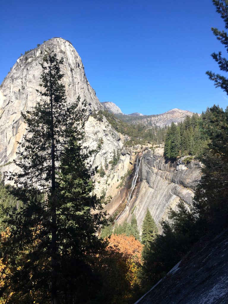
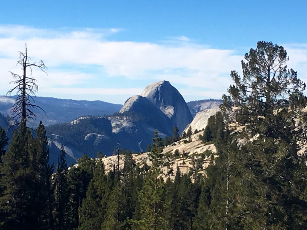
We drove our way up to Glacier Point to gaze at the Dome, as well as much of the route we would take the next morning from the valley floor: first past Vernal Falls, then Nevada Falls, along the Little Yosemite Valley, then back around to the sub-dome, then the cables to the top.
We had talked about a short hike to Sentinel Dome, but it took us 20 minutes to park at Glacier Point, and the parking at the Trailhead was full. In fact, some poor driver got his car seriously stuck as we were leaving.
We returned back to the valley floor to see some sights, find our trailhead, and double-check our permits with the Rangers. We took a short hike out to Mirror Lake (long since dry for the season) and gazed up at the sheer face of Half Dome.
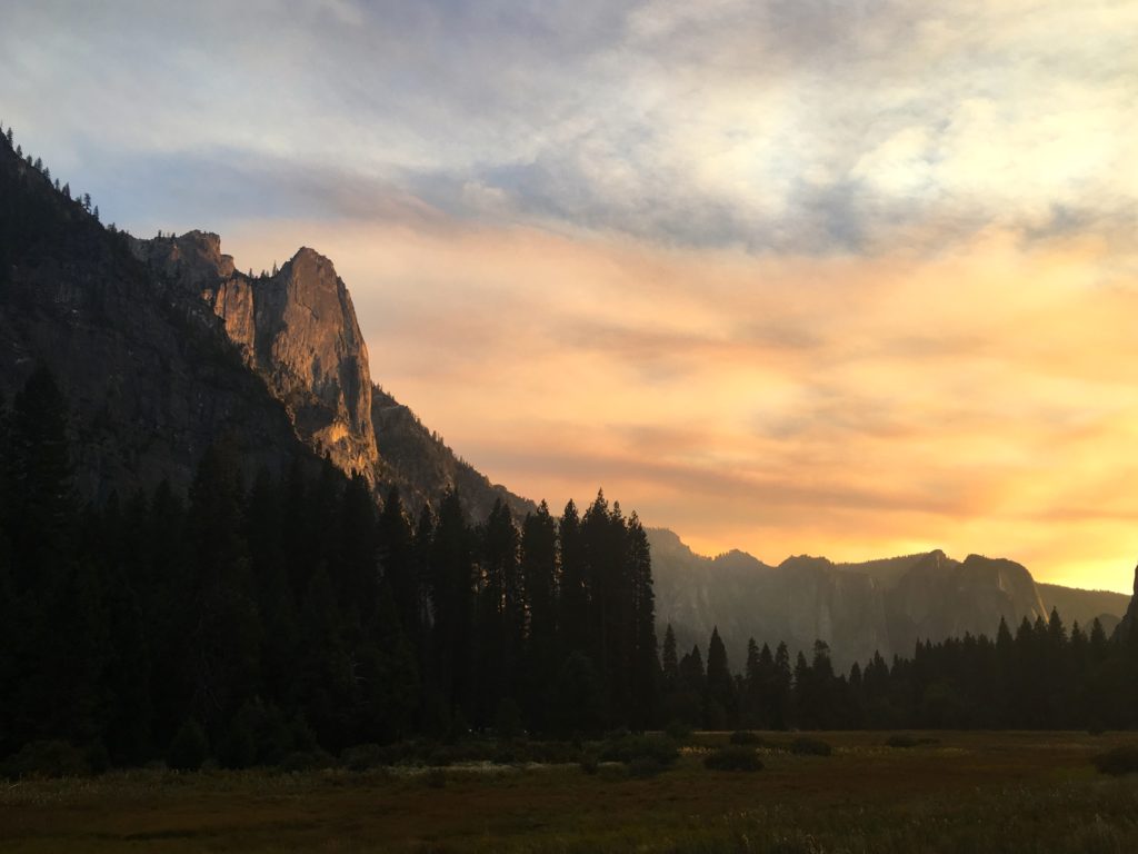
As the sun began to set, we headed out of the valley for an early dinner and last-minute prep for the following day. On the way out, we were greeted with some magical light against the valley walls.
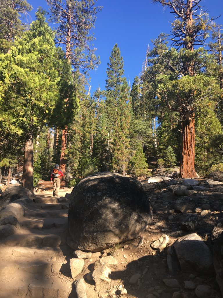
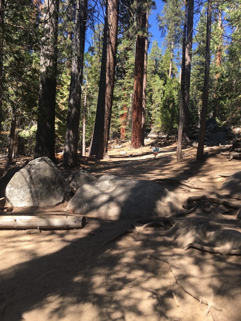
Unfortunately, the room we had reserved in El Portal had a pipe burst, so we had to stay another 10 minutes further from the entrance. We quickly settled in and had a forgettable dinner and hit the pillows. The alarm was set for 3:00 am, but we were both up before then. The air was crisp but not cool as we drove back into the park. The parking lot was slowly filling up with other hikers. We donned our gear and headed off. After a quarter-mile, we realized we made the wrong turn, so backtracking, we found the road to the Happy Isles bridge and began in earnest.
Through the darkness, lit only by our lamps, we trekked along the asphalt path toward the Vernal Falls bridge. A critter moved along the side of the trail, and the white stripe along its back made us pause and retreat. Thankfully, the only stink that we would be carrying would be our own.
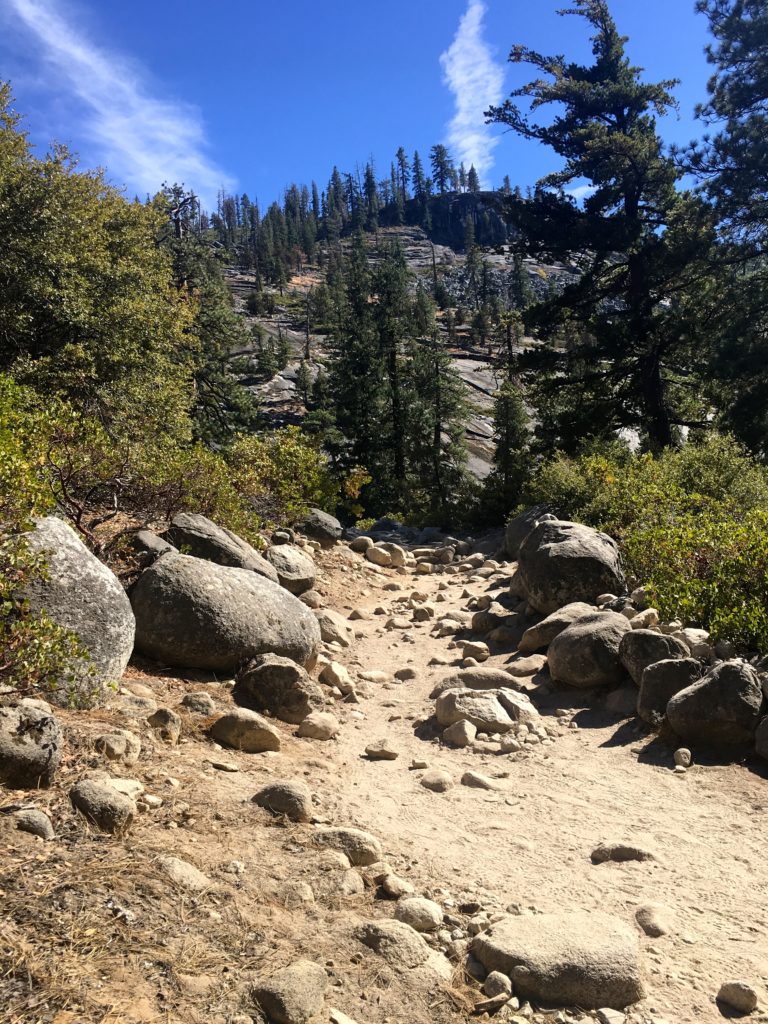
The splashing of the unseen Merced River could be heard as we climbed ever upward. Once we left the paved trail, the real hike began. About a mile later, I took a misstep and rolled my right ankle. I could not believe it! It hurt some, but I could put weight on it. Hoping it was just a light sprain, I soldiered on in the darkness, taking a tad more care as I climbed the stone steps upward.
Dawn’s light slowly began to fill the canyon, revealing the beauty that had been hidden. Atop the falls, we took a break before climbing to entering Little Yosemite Falls. We missed a turn and followed the wrong path for a bit. Our ‘Spidey-Sense’ told us to backtrack. Ted’s GPS was bouncing all over the place in the narrow canyon. So we entered the relative flat of Little Yosemite and enjoyed the respite as the Merced River flowed past…
The ankle was gently reminding me of the episode hours earlier as we walked through some river sand. I could also feel the elevation in my lungs as we climbed ever higher.
Soon, we began to catch glimpses of the backside of Half Dome and the sub-dome. They still were towering above us, although we had been hiking since 4:30 and it was close to 9:00 am. When we reached the turnoff for the last two miles up to Half Dome, we unloaded my two side water bottles, and Ted’s Gatorade, behind a tree. No sense in carrying the weight up to the summit.
I could feel my energy begin to drain, along with the unsteadiness of my ankle. I told myself that at the sub-dome I would be honest and decide if I should abandon the attempt. Over 7,000 feet up, the lungs were feeling it. We had started the day at about 4,000 feet.
Closer and closer, we neared the sub-dome, which many had said was equally as hard as the cable ascent.
As I reached the base of the sub-dome, I knew that I did not have it in me to safely attempt the summit. Between the ankle and my energy, I knew that I should not try. I was truly saddened as I wished Ted good luck on his summit attempt. I placed my safety belt on a rock, where I hoped someone would be able to use it. Ted said he passed his along as well once he was done with it.
We agreed to rendezvous back where we left the water. As I descended, my ankle gently reminded me that I was making the correct choice. I found solace under the pines as I worked my way back down. Once at the junction, I let my feet rest, ate some of my lunch, and sipped some water. I chatted with hikers as they passed, wishing them good luck on their attempts. Then I began to worry about my pace and the distance I needed to cover to return to the trailhead.
I packed up my water and left Ted’s empty Gatorade as a signal that I had started back down (along with an arrow made of sticks). As I made my way back down the switchbacks, each step reinforced my decision. I knew that Ted would catch me at some point, and if not, I planned to wait at the bridge at Nevada Falls, where we would take the John Muir Trail (JMT) down, bypassing the steep, stone steps from earlier.
Just before entering Little Yosemite Valley, the Ranger was checking permits on her iPad. I gave her my name and asked her to pass along a message to Ted that I was ok and headed down. I was also able to find some ankle tape, which greatly helped. I was so lucky that it was just lying there…
Ted caught me just before we left the valley again. Crossing over the Merced River, we were treated to some tremendous views of the falls as we worked our way down the JMT.
We still had about 4+ more miles to go back down to the valley floor, along with about 2,000 feet of elevation. Although this route is longer, by about 2 miles, our knees and my ankle were thankful.
We did have a brief unscheduled stop because a bear and her two cubs were reported ahead, so we let them pass. We did not see them.
But our adventure was not over! We decided to take the long way home down the 395 the next day. If you have never explored this road, you must. It is truly a hidden gem of California. After one last farewell to Half Dome, we continued along the 120, and over the pass at 10,000+ feet.
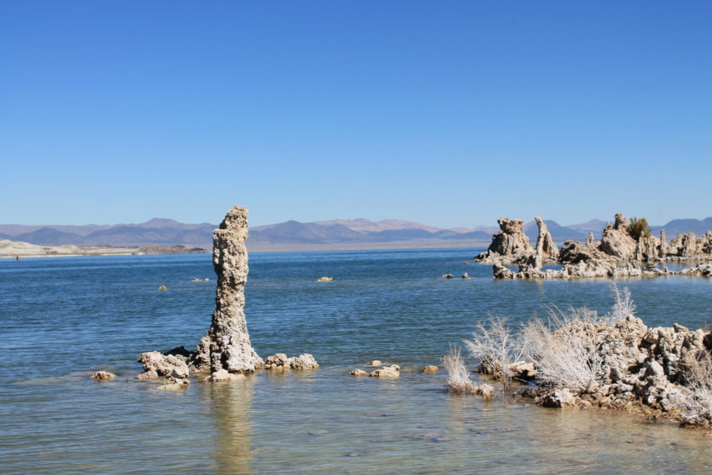
We quickly began our descent toward Lee Vinning, but not before more awesome vistas filled our car window. Our first quick stop along the 395 was at Mono Lake and the Tufas. (It was too early to hit the Whoa Nellie Deli).
As we drove down the 395, the eastern Sierras rose sharply along the highway. Patches of snow still clinging to a few spots. As lunchtime approached, we were nearing the town of Bishop, which could only mean one thing…
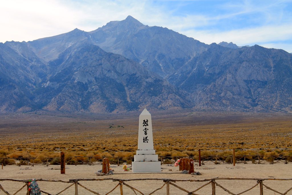
Grabbing some sandwiches to go, and a bag of bread for the family, we continued back toward San Diego. As we neared Lone Pine, we stopped at the Manzanar National Historic Site.
In 1942, the United States government ordered more than 110,000 men, women, and children to leave their homes and detained them in remote, military-style camps. Manzanar War Relocation Center was one of ten camps where Japanese American citizens and resident Japanese aliens were incarcerated during World War II. Sobering…
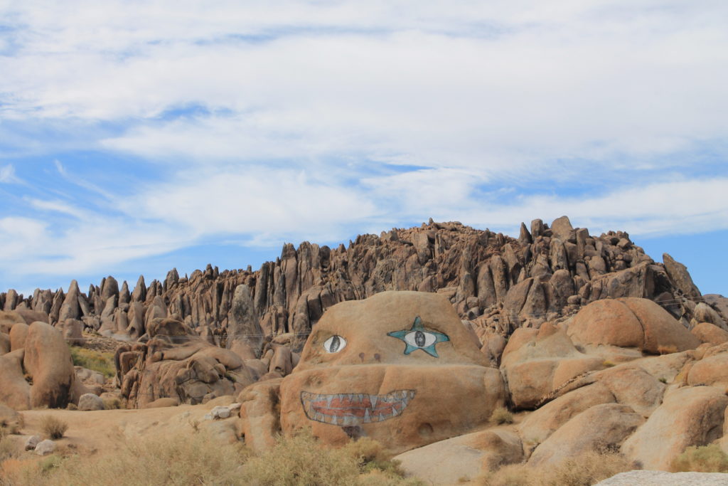
After a brief look at the Visitor Center and the driving tour of the site, we headed the short way to Lone Pine on Whitney Portal Road. There we headed out to the Alabama Hills and the Mobius Arch.
I was too sore to attempt the hike to the arch. I had seen it a few years before, so Ted scampered down the trail. I did stare up at Mt. Whitney in the distance…
We made our way through the high desert, occasionally slowed by traffic. It looks like the 395 is being widened from Kramer Junction to the 15 (eventually), and the 58 will be bypassing Kramer Junction sometime soon as well. We both reflected on the journey and we were thankful for it and the support of our family to undertake it.
Soon, the sun was setting over the desert, and Chris and Ted’s adventure came to a close. Thanks for reading. Happy Trails…
I am an avid peak bagger, sometimes backpacker, and former sea kayaker living in San Diego. I am the co-author of Urban Trails:San Diego, coming in Spring 2026!
In 2019, I became the third person to complete the San Diego 100 Peak Challenge. Not stopping with that accomplishment, I set my sights on the harder San Diego Sierra Club 100 Peak list, which I completed in 2021. In addition, I have conquered several Six-Pack of Peaks challenges (SoCal, San Diego, Central Coast, and both the Arizona-Winter and Arizona-Summer). I am looking forward to exploring new summits and new adventures across the southwest.
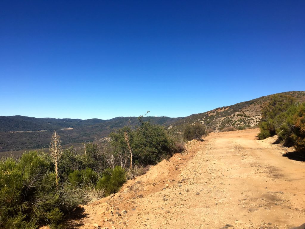
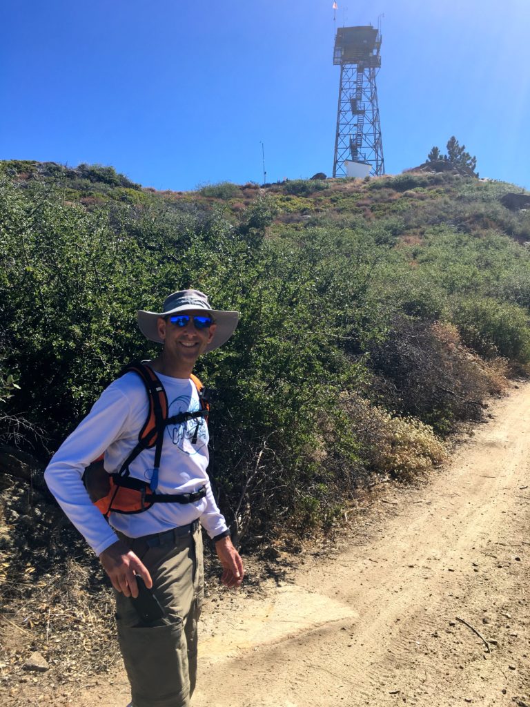
Since it was still too hot to consider any of my remaining peaks out in Anza-Borrego proper, we decided to tackle Palomar High Point. Although I still want to hike it from Oak Grove, we opted to drive up the Palomar Divide Trail partway, then hike to the lookout.
We drove the dirt road without incident, meeting one car coming down. Parking the car at a nice turnout, we started up the road under the shade of the trees. Soon, three trucks passed us heading back down from the summit.
After about a mile and a half, we reached the summit. The lookout tower is not open to the public. We wandered around the grounds some before heading back down.
In two weeks, Ted and I would be attempting to summit Half Dome, so we spent much of the time discussing our plans.
We quickly found ourselves back at the car and off to lunch after the drive back down.
I am an avid peak bagger, sometimes backpacker, and former sea kayaker living in San Diego. I am the co-author of Urban Trails:San Diego, coming in Spring 2026!
In 2019, I became the third person to complete the San Diego 100 Peak Challenge. Not stopping with that accomplishment, I set my sights on the harder San Diego Sierra Club 100 Peak list, which I completed in 2021. In addition, I have conquered several Six-Pack of Peaks challenges (SoCal, San Diego, Central Coast, and both the Arizona-Winter and Arizona-Summer). I am looking forward to exploring new summits and new adventures across the southwest.
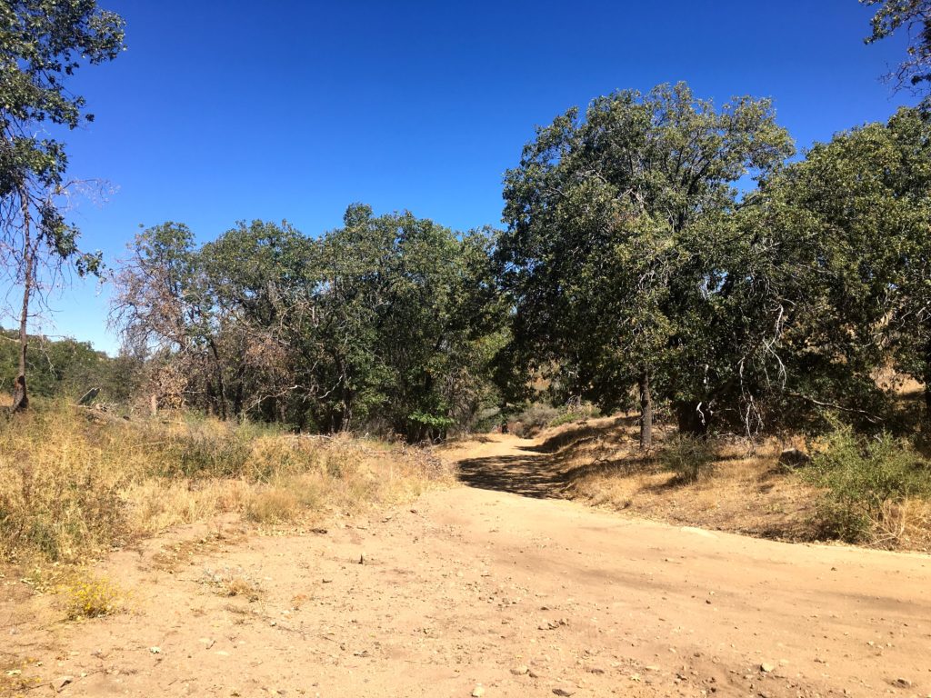
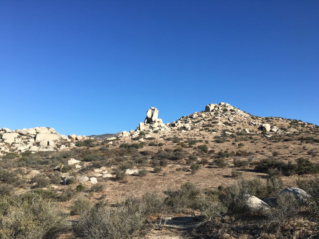
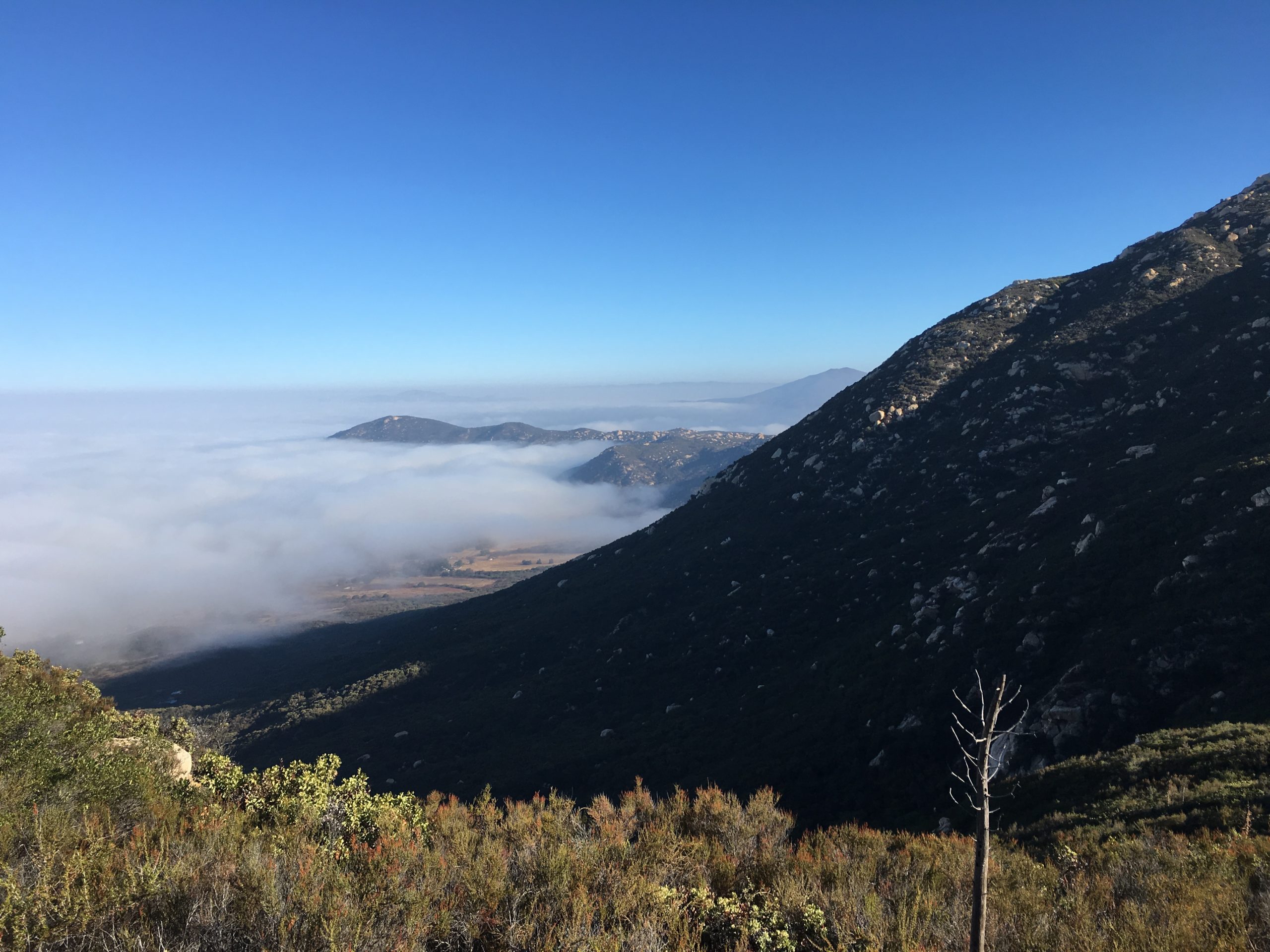
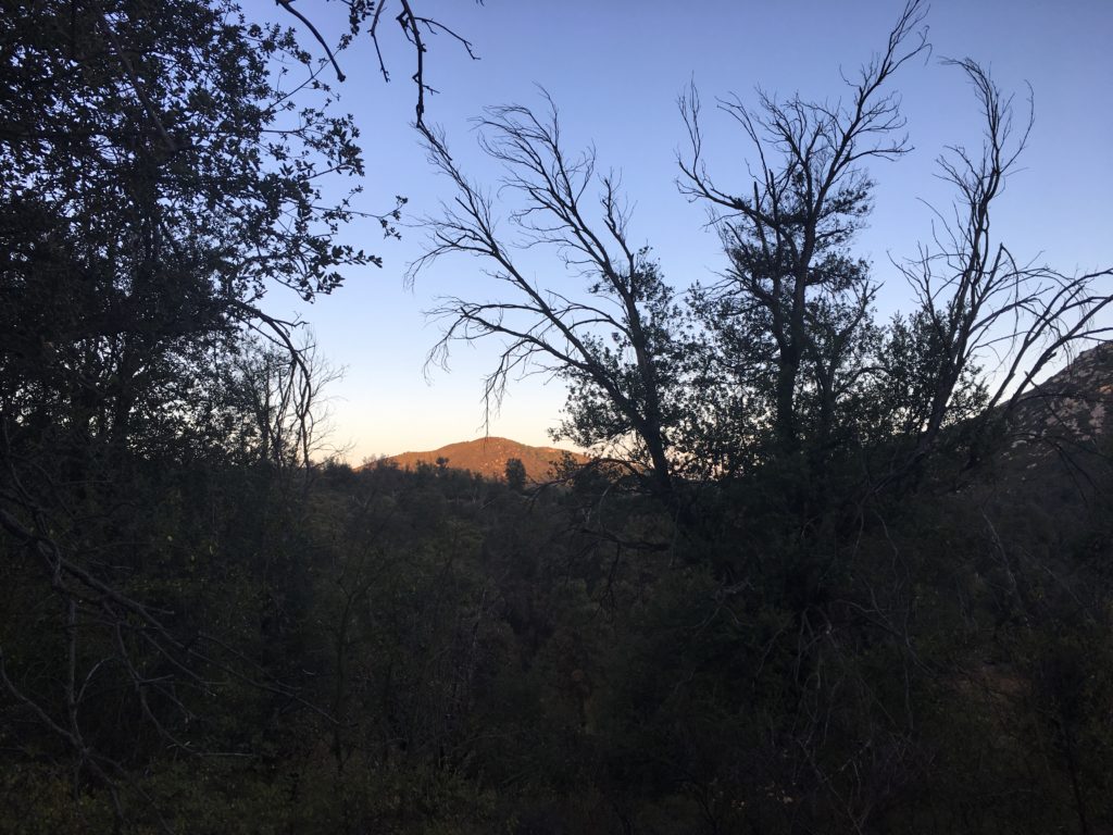
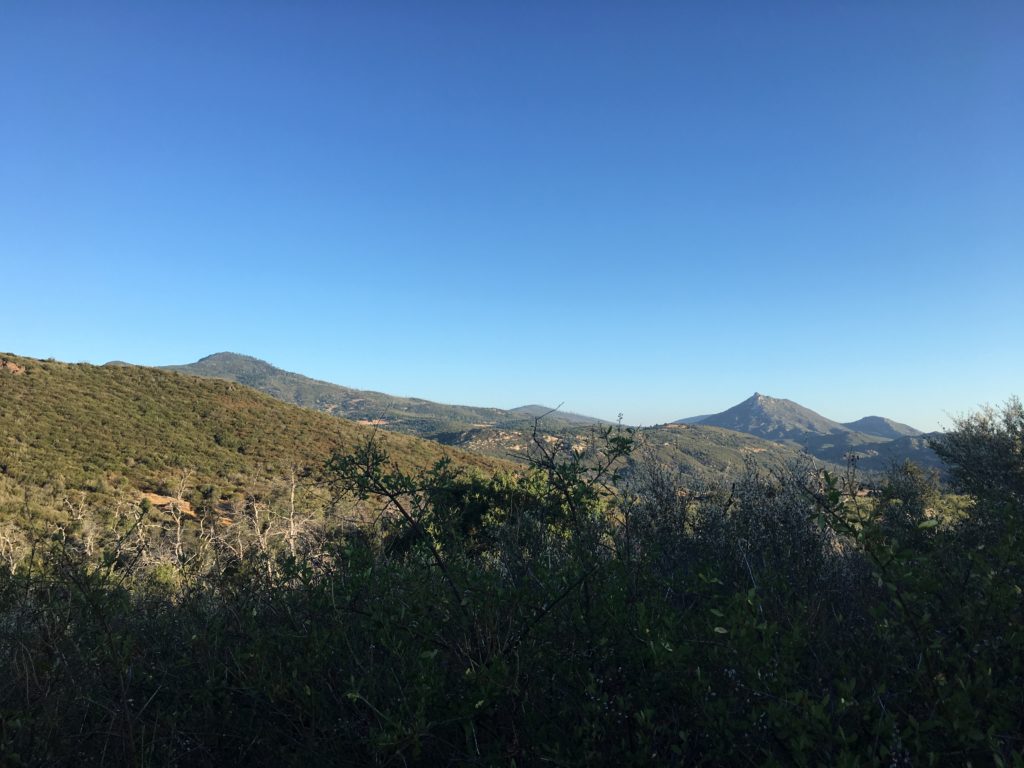
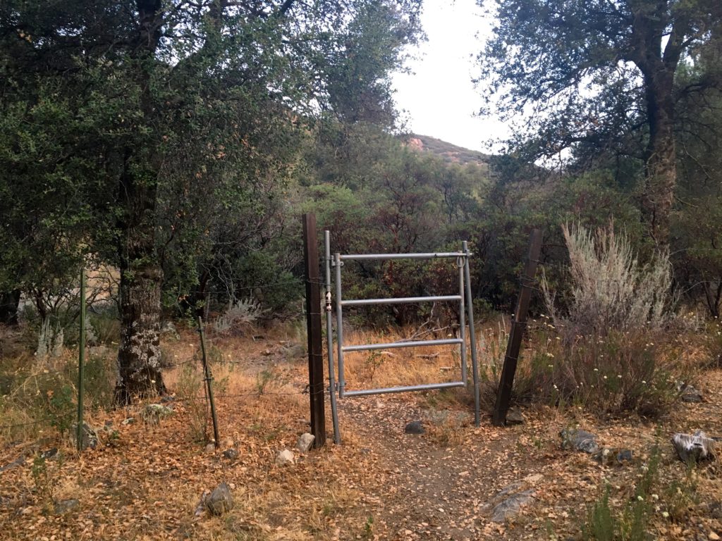
Today’s hike was going to summit two peaks out near Ranchita. Along with the two official peaks, two additional peaks were along our route. I had done some of this hike last week, but the main summit of White Benchmark did not happen. This time, with Ted tagging along, we headed north along the use trail near the fence defining the boundary of Anza-Borrego and the private property to the west. We passed through the shadow of Bonny as we drew closer to White. Up the ridgeline, we pushed upward.
Atop the peak, we found the benchmark with no trouble. We enjoy the views. The Thimble and San Ysidro loomed over us, but those summits were for another day. Looking back southward, Bonnie, Clyde, Chimney Rock, and Hut were spread out before us. Off to the northeast, was Goat Benchmark (somewhere…). Next along our route was Clyde. This peak was a simple scramble to the top. There is no register nor mark. But if you summit Bonny, you have to do Clyde ;).
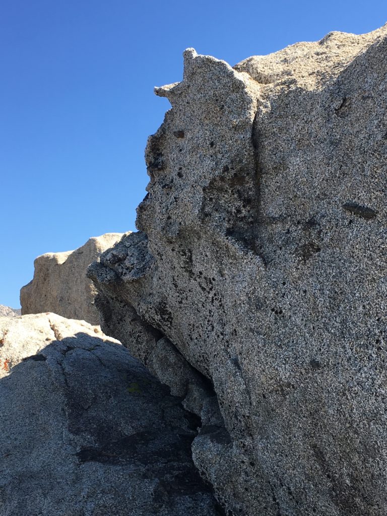
Chimney Rock
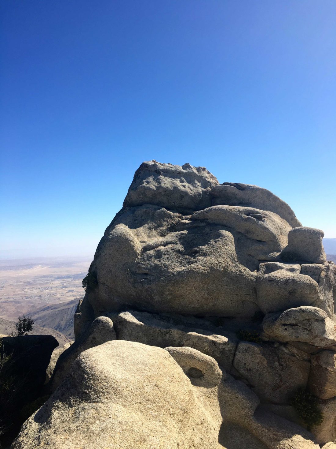
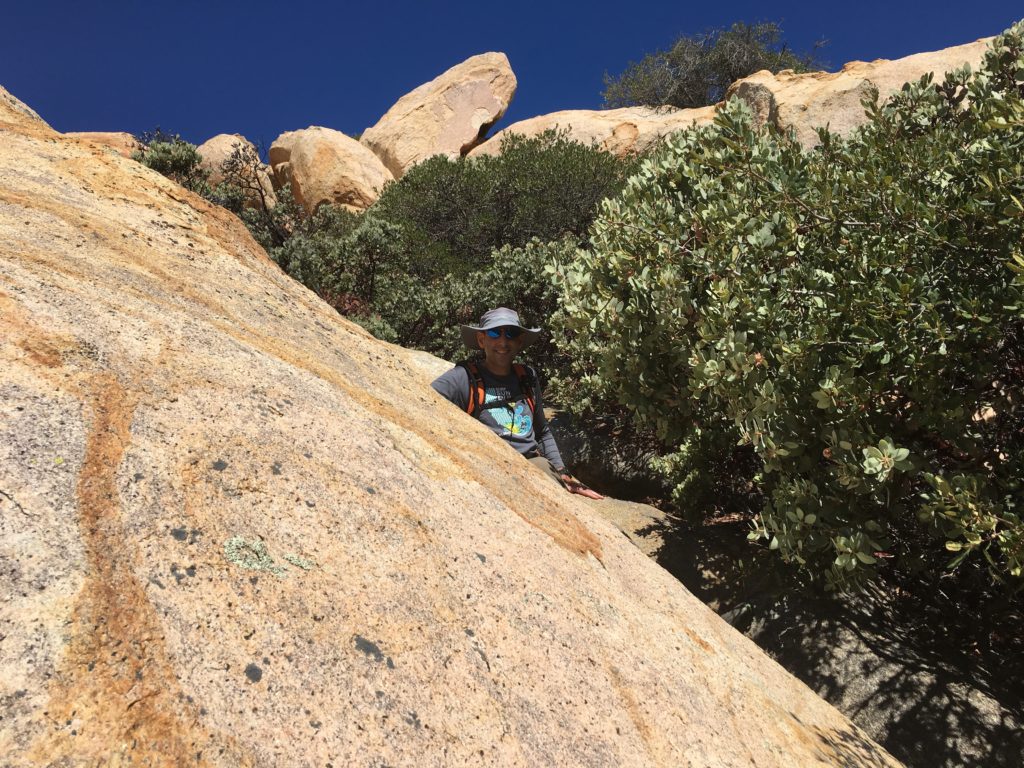
From there we angled back toward the west to explore Chimney Rock. Neither of us are climbers, so we just marveled at this spire from its base. Ted did scramble to the top of the mound to the north of it. I stayed below for the photo op.
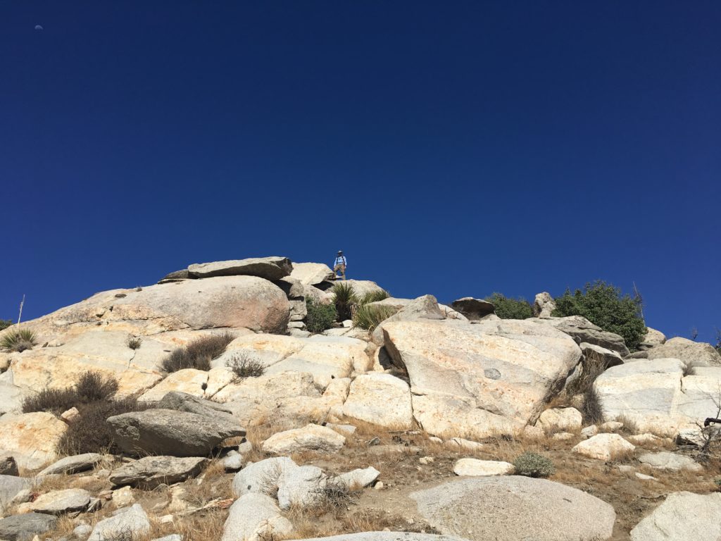
The use trail quickly led us to the foot of Bonny. Approaching it from the east, we rounded toward the south, there a small ledge provided the route to the summit proper.
A short hop was required to find the Benchmark proper.
Once we were ready we continued heading south. Our final target was Hut Benchmark. Unlike when I was out here the week before, the route to the Benchmark was a simple approach from the north side.
We then worked our way down through the slightly heavier brush back to the car. This was a fun day wandering from peak to peak. For anyone wanting to cut their teeth on a trail-less desert hike, this one is perfect.
I am an avid peak bagger, sometimes backpacker, and former sea kayaker living in San Diego. I am the co-author of Urban Trails:San Diego, coming in Spring 2026!
In 2019, I became the third person to complete the San Diego 100 Peak Challenge. Not stopping with that accomplishment, I set my sights on the harder San Diego Sierra Club 100 Peak list, which I completed in 2021. In addition, I have conquered several Six-Pack of Peaks challenges (SoCal, San Diego, Central Coast, and both the Arizona-Winter and Arizona-Summer). I am looking forward to exploring new summits and new adventures across the southwest.
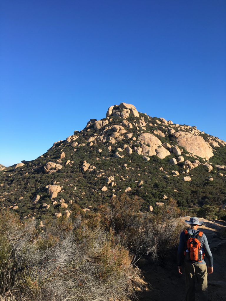
Now that I am finding my trail legs again, it was time to go back and summit Gaskill. When Ted and I tackled Lawson Peak, we did not continue onto Gaskill, as I had a sick daughter to attend to.
We followed the same route as before, we looked at the trail leading up to Lawson and joked if either of us wanted to scramble up the chimney again…
The route follows the road for about a mile until the trail to Gaskill appeared. Along the way, a motorcycle passed us. We were not entirely sure why he needs a machete on his back.
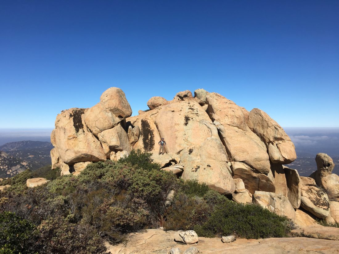
The trail worked its way to up the steep slope to the peak. There we explored the first set of rocks. Ted went over to see if we could scramble atop the other set. Not finding a safe route, we opted not to attempt it.
We retraced our route, as the heat began to rise. Once back in the car, some well earned Mexican food and a fresh Alpine Brewery beer were in order.
I am an avid peak bagger, sometimes backpacker, and former sea kayaker living in San Diego. I am the co-author of Urban Trails:San Diego, coming in Spring 2026!
In 2019, I became the third person to complete the San Diego 100 Peak Challenge. Not stopping with that accomplishment, I set my sights on the harder San Diego Sierra Club 100 Peak list, which I completed in 2021. In addition, I have conquered several Six-Pack of Peaks challenges (SoCal, San Diego, Central Coast, and both the Arizona-Winter and Arizona-Summer). I am looking forward to exploring new summits and new adventures across the southwest.
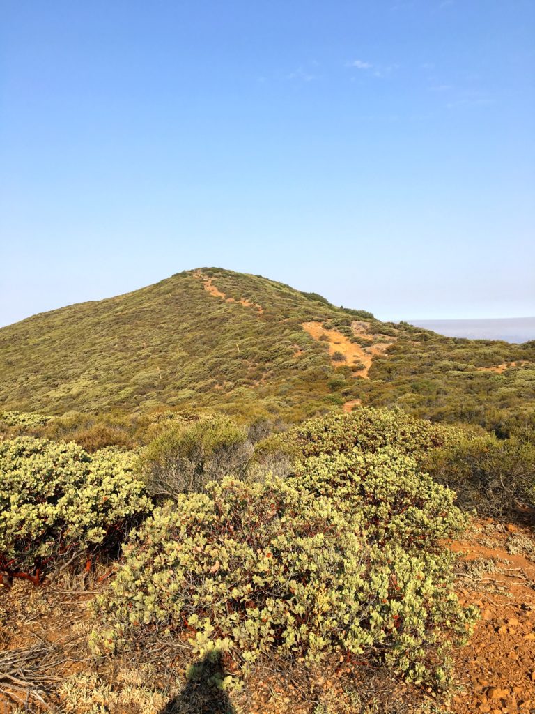
I decided to tackle something a bit longer in distance today, East Mesa High Point. I convinced another friend, Steve Boyle to tag along. It was another early start to beat the heat.
For the most part, this was going to be a straightforward hike to the base of the Mesa where some actual bushwhacking would be needed to summit.
We followed the Harvey Moore trail until it met the East Mesa Fire Road. Crossing a meadow and then cresting a small rise, we joined the East Mesa Fire Road.
Steve opted not to join me in my bushwhacking, so off I went toward the summit. I worked my way through the bush without too much trouble. I did not locate a register nor a benchmark.
I headed back down the Mesa and began working my way to the junction where I rejoined Steve. We retraced our route as the heat began to rise. Along the way, we encountered two ladies out on their horses.
We finally made it back to the car, feeling the effects of the heat and miles, but it was still a nice day on the trails.
I am an avid peak bagger, sometimes backpacker, and former sea kayaker living in San Diego. I am the co-author of Urban Trails:San Diego, coming in Spring 2026!
In 2019, I became the third person to complete the San Diego 100 Peak Challenge. Not stopping with that accomplishment, I set my sights on the harder San Diego Sierra Club 100 Peak list, which I completed in 2021. In addition, I have conquered several Six-Pack of Peaks challenges (SoCal, San Diego, Central Coast, and both the Arizona-Winter and Arizona-Summer). I am looking forward to exploring new summits and new adventures across the southwest.
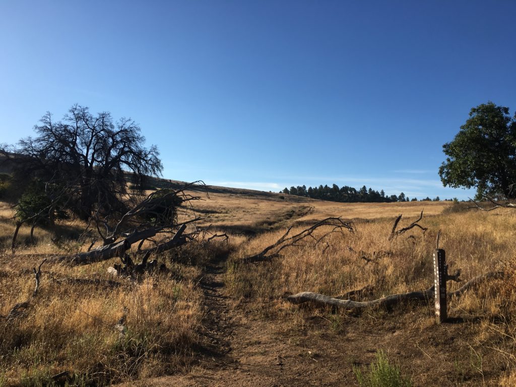
Well, after a much longer time off the trails, I was finally able to start summiting again. After the plantar fasciitis emerged in the early part of 2018, I took a couple of months off to let it recover, little did I know that time off would extend for almost half a year. While on vacation in Puerto Vallarta, two of my discs in my neck silently herniated. I went from planning my next hike, as my foot had recovered, to now being in tremendous pain. After three months of treatment, I was able to carefully resume hiking. I had done some of the minor peaks around my house that I have never bothered with to test out the neck. Finally, I was ready to try a real peak, and Guatay seemed to fit the bill.
I drove out the summit fairly early to beat the summer heat. When I arrived at the trailhead, a couple was just waking up from spending the night in their pickup bed watching the previous evening’s meteor shower. We chatted for a bit, and I headed off.
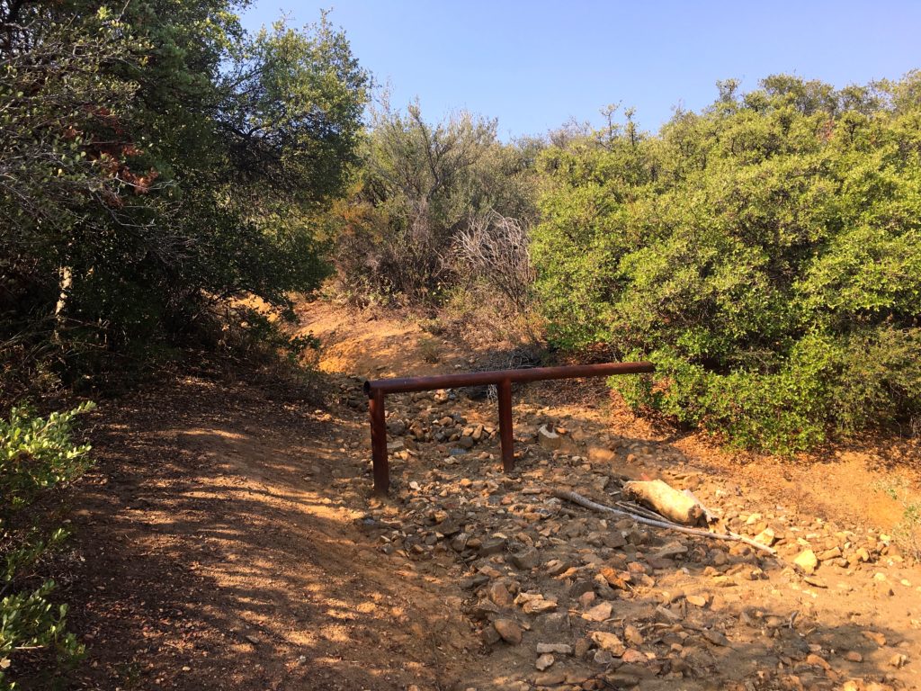
I backtracked along the road until I spotted the trailhead, almost hidden from view. The trail follows the creek along the eastern side of the mountain for a bit. Just long enough to warm up your leg muscles before the real climb begins. Coming to a metal post, the trail turn left and begins its steep climb toward the summit.
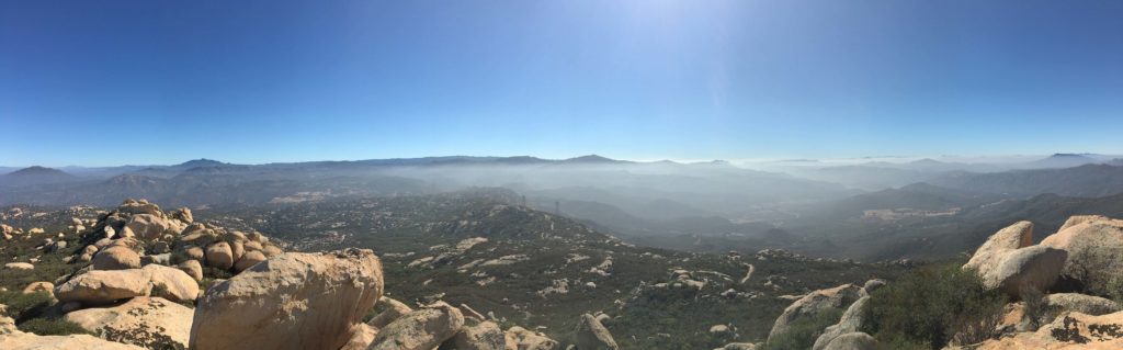
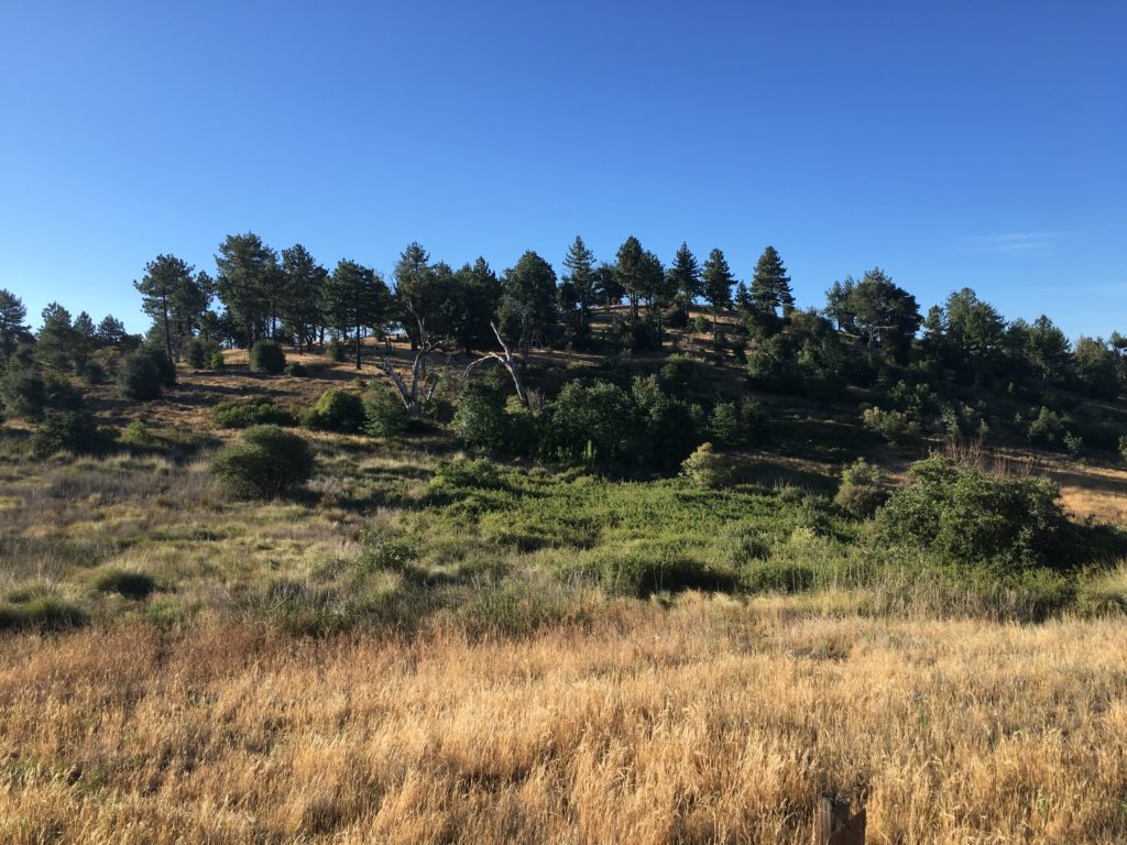
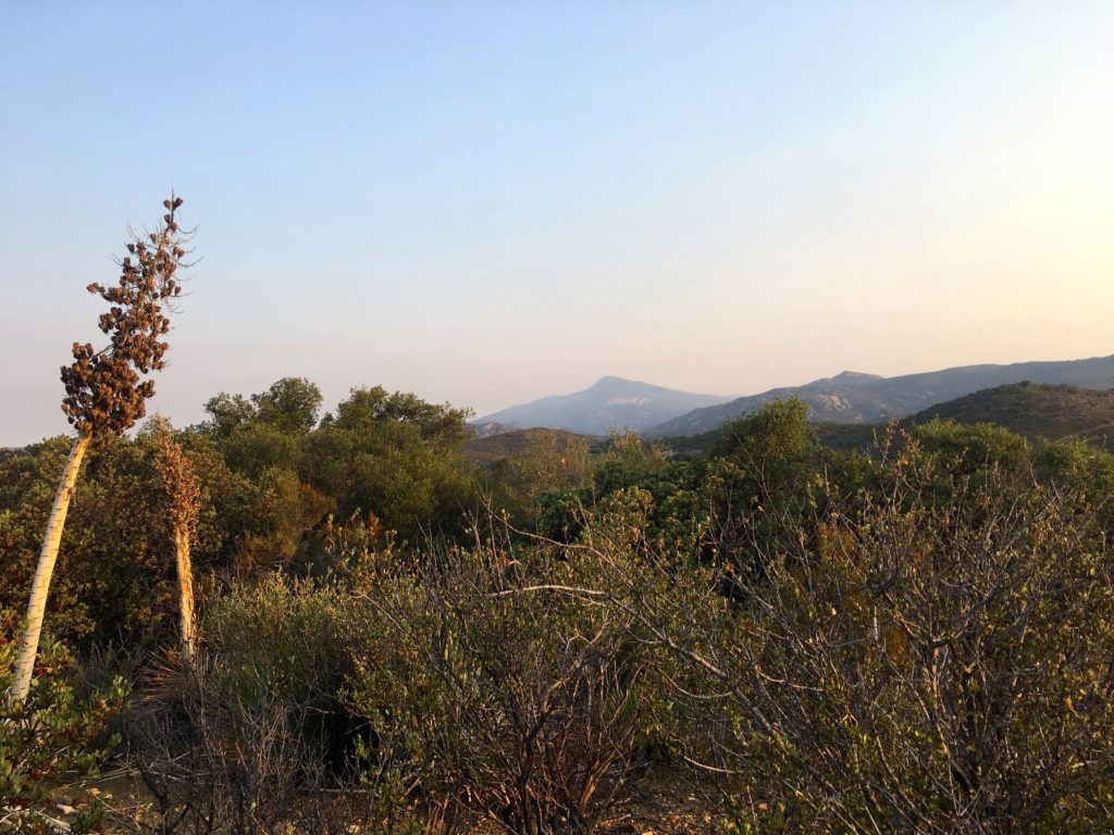
After a bit, the steepness eases as you reach the main ridge to the summit. The surround peaks also start to come to view, primarily Cuyamaca to the north.
But, Guatay has more work to be done in order to reach her summit. Two more steep sections lay ahead before the top is reached!
To the west, you can see El Cajon Mountain and the surrounding communities, to the south is the Los Pinos Peak/fire lookout in the Pine Creek Wilderness, Cuyamaca Peak stand proudly to the north, and looking back to the east, Mt. Laguna.
After a short rest, and signing the register, I headed back down the trail. So far the neck was feeling fine, and the leg wasn’t too bad. Along the way, I encounter some younger hikers heading up. One of them informed me she left her poles back along the trail. I told her that the section toward the top is a lot easier if you had them. She declined my advice. We parted ways, and I wondered why did you even bring them?
The descent was uneventful as the day got hotter. I was glad for the early start. I found myself back at the car, happy to finally be back on the trails.
I am an avid peak bagger, sometimes backpacker, and former sea kayaker living in San Diego. I am the co-author of Urban Trails:San Diego, coming in Spring 2026!
In 2019, I became the third person to complete the San Diego 100 Peak Challenge. Not stopping with that accomplishment, I set my sights on the harder San Diego Sierra Club 100 Peak list, which I completed in 2021. In addition, I have conquered several Six-Pack of Peaks challenges (SoCal, San Diego, Central Coast, and both the Arizona-Winter and Arizona-Summer). I am looking forward to exploring new summits and new adventures across the southwest.
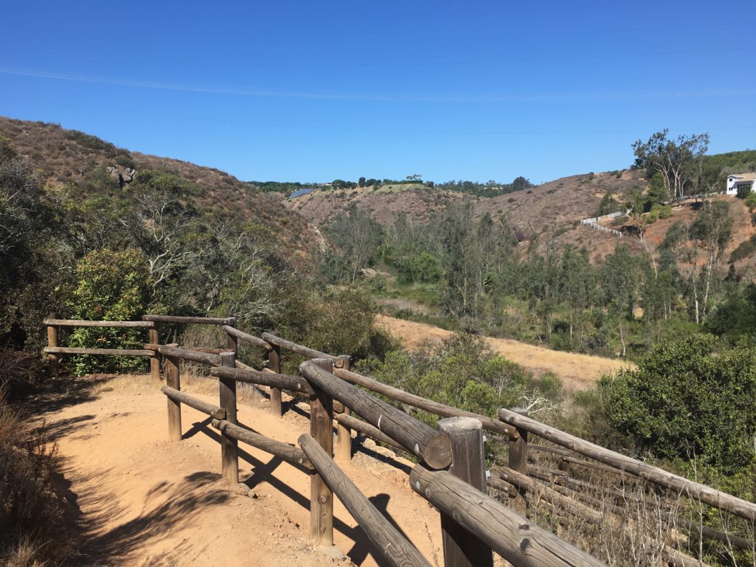
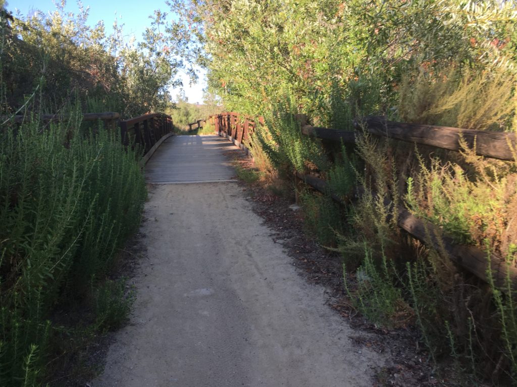
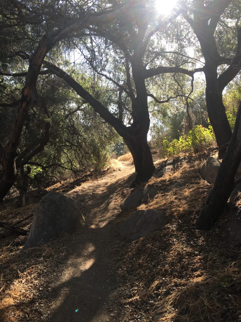
The starting point for this hike is the same parking area that I used when I did the Del Dios Gorge hike for the previous year’s Coast To Crest Challenge. This time I was headed west through a portion of the Santa Fe valley.
The trail begins by following the edge of a private golf course, then ducks beneath a bridge that crosses the San Dieguito River.
After a while, I came to the first of a series of switchbacks that I would encounter. The trail dipped down into a small canyon before climbing up the second series of switchbacks that would take me toward the eventual selfie-spot.
From here I had a nice view of the valley. After taking the picture, I retrace my route and called it a day.
I am an avid peak bagger, sometimes backpacker, and former sea kayaker living in San Diego. I am the co-author of Urban Trails:San Diego, coming in Spring 2026!
In 2019, I became the third person to complete the San Diego 100 Peak Challenge. Not stopping with that accomplishment, I set my sights on the harder San Diego Sierra Club 100 Peak list, which I completed in 2021. In addition, I have conquered several Six-Pack of Peaks challenges (SoCal, San Diego, Central Coast, and both the Arizona-Winter and Arizona-Summer). I am looking forward to exploring new summits and new adventures across the southwest.
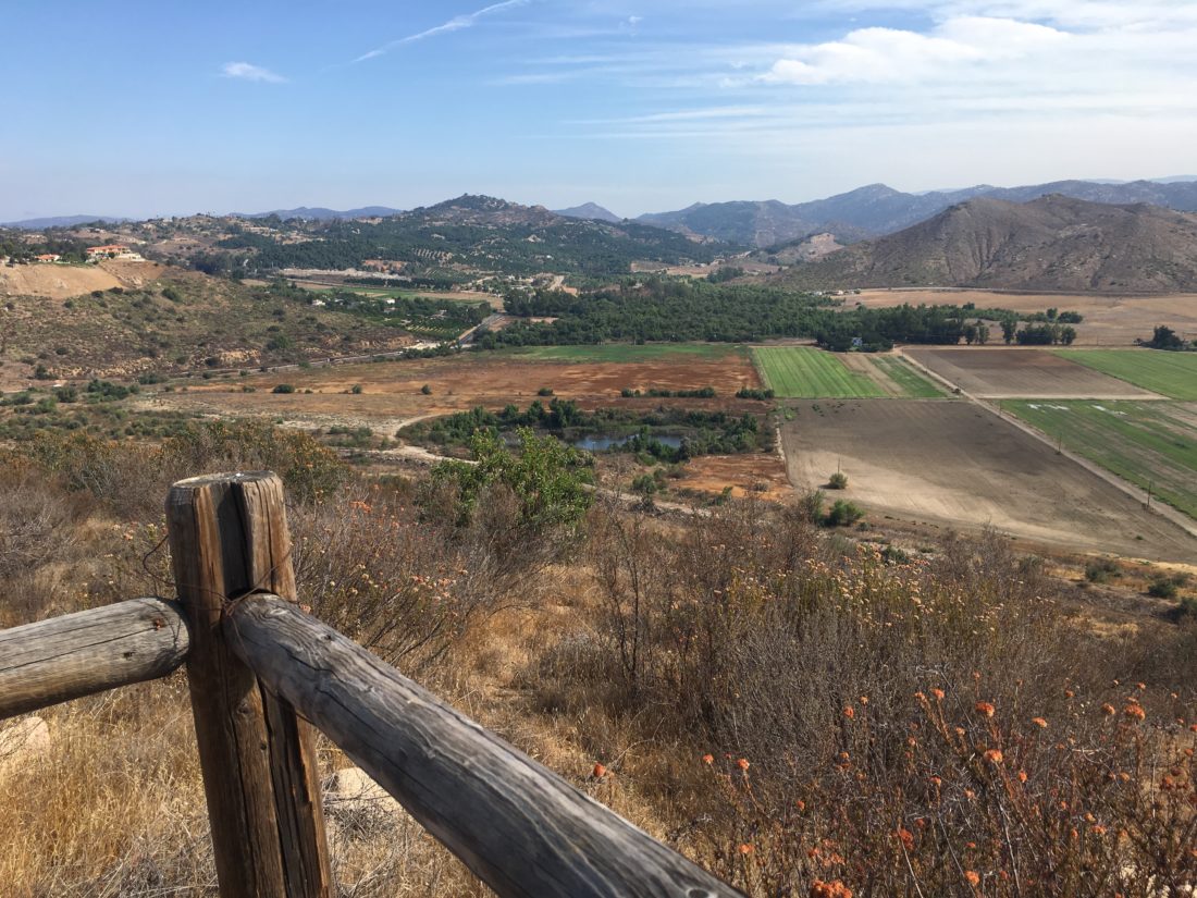
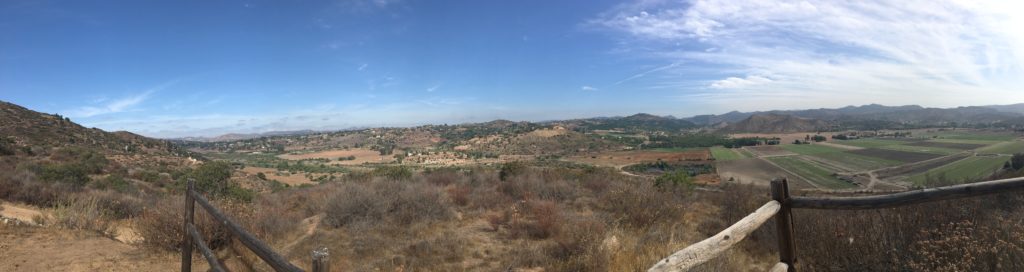
Not being a wine drinker, I never really had gone exploring Highland Valley Road. I would look out to the east as I crossed over Lake Hodges, and wonder what might be out there. Well, my hike up to Raptor Ridge was going to answer some of those questions. This hike is one of the five hikes that make up this year’s Coast to Crest Challenge.
Parking at the Old Coach Staging area, I headed north for about a quarter-mile before crossing Highland Valley Road. There I would follow the San Dieguito River on a nice wide trail.
Eventually, the trail would turn east. There is a nice stopping point before it begins its climb to the top of the hill. The trail will narrow into a single track as is works its way to the viewing spot. Here you are rewarded with a lovely view of the San Pasqual Valley. You can spy the San Diego Zoo Safari park to the northwest.
This was yet another gem along the entire trail. I will say there is not a lot of shade, so plan accordingly.
I am an avid peak bagger, sometimes backpacker, and former sea kayaker living in San Diego. I am the co-author of Urban Trails:San Diego, coming in Spring 2026!
In 2019, I became the third person to complete the San Diego 100 Peak Challenge. Not stopping with that accomplishment, I set my sights on the harder San Diego Sierra Club 100 Peak list, which I completed in 2021. In addition, I have conquered several Six-Pack of Peaks challenges (SoCal, San Diego, Central Coast, and both the Arizona-Winter and Arizona-Summer). I am looking forward to exploring new summits and new adventures across the southwest.
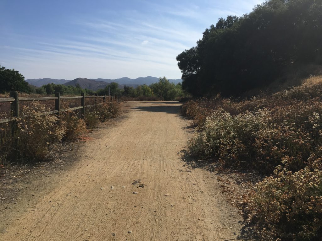
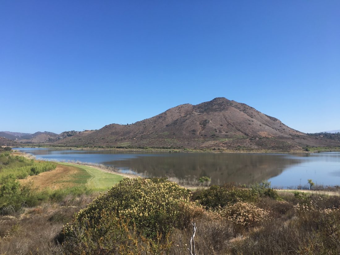
I pulled into the dirt parking lot just off West Bernardo Drive. Today’s hike would be along the Piedras Pintadas trail which is along the south shore of Lake Hodges. I grabbed my gear and headed past the informational kiosk and onto the trail. For a portion of the trail, numerous interpretive signs are posted along the trail, describing the life of the Kumeyaay people who once inhabited the area.
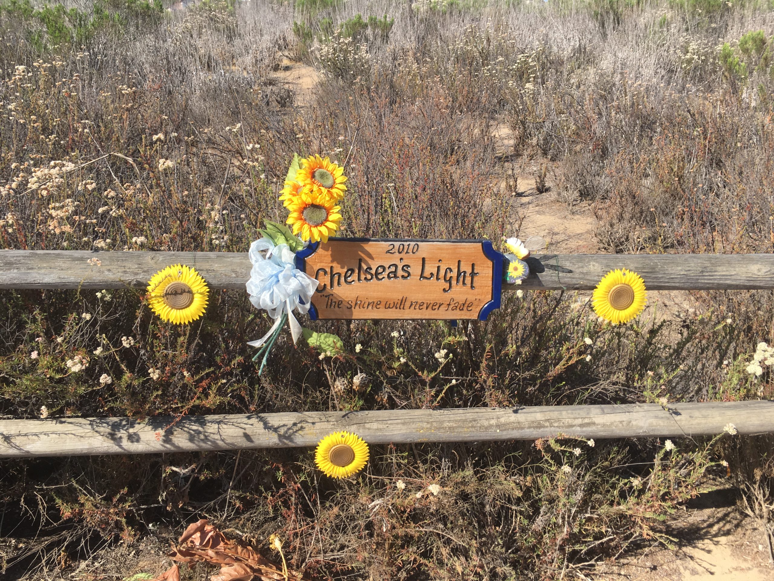
The trail will cross over a creek that feeds into Lake Hodges. The scenery will change from the dry grasses to more riparian as you follow the creek. I also passed the memorial sign for Chelsea King, who was murdered along this trail in 2010.
I then began to make a small climb toward the self spot. If you are able to hike after some rains, you will pass by a flowing waterfall.
The trail now turned northward. I opted to take the west branch at the Y. Soon I reach the top of the lollipop and was greeted with a nice vista with Lake Hodges and Bernardo Mountain. I took my required photo and continued up the small ridge. Near its summit is a nice bench to enjoy the view.
I made my way back down to the hill and found myself back at the car in no time at all. If you are looking for a longer hike, you can easily connect it to the Bernardo Bay Trail.
I am an avid peak bagger, sometimes backpacker, and former sea kayaker living in San Diego. I am the co-author of Urban Trails:San Diego, coming in Spring 2026!
In 2019, I became the third person to complete the San Diego 100 Peak Challenge. Not stopping with that accomplishment, I set my sights on the harder San Diego Sierra Club 100 Peak list, which I completed in 2021. In addition, I have conquered several Six-Pack of Peaks challenges (SoCal, San Diego, Central Coast, and both the Arizona-Winter and Arizona-Summer). I am looking forward to exploring new summits and new adventures across the southwest.