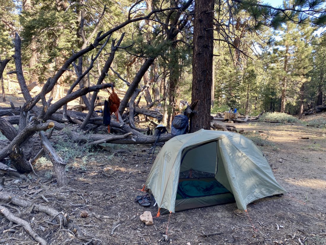
One of the tests for this trip was changing my sleep setup. Given I mostly sleep on my side, I decided to switch to a quilt instead of a traditional sleeping bag. It works so well! No longer was I fighting with my sleeping bag during the night. I was able to also solve my pillow height issue as well. For sleeping in a tent, I did fairly well.
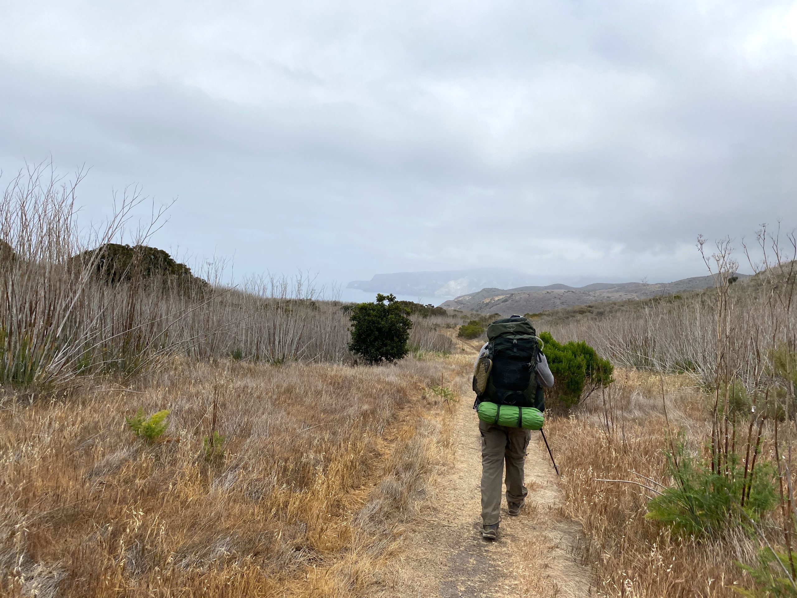
Today’s route was really one of two parts; the first is a short 2.1-mile jaunt to the airport and the second is 6+ miles of mostly downhill into Little Harbor. I wanted to arrive at the airport closer to lunchtime, so I took my time enjoying my coffee and oatmeal. Once done with breakfast, I loaded my pack and headed out.
When I saw the airport the previous night when I tried to climb Mt. Orizban, it did not look too far away. Like many things on Catalina, however, nothing is a straight line.
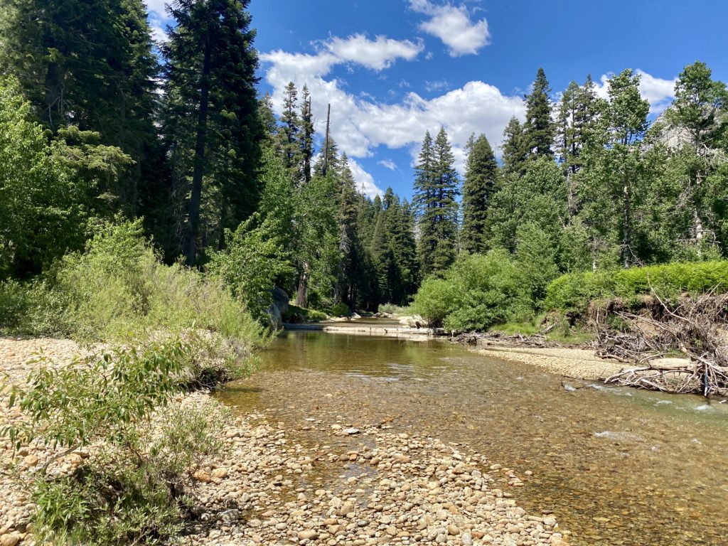
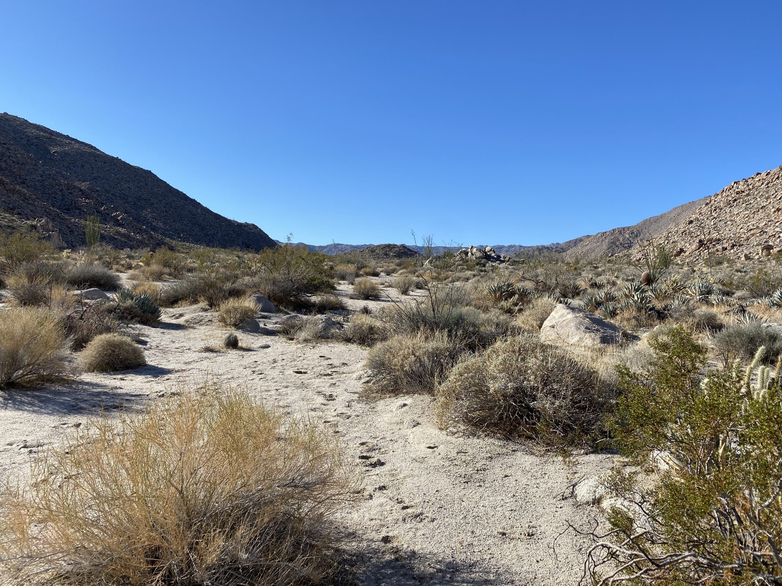
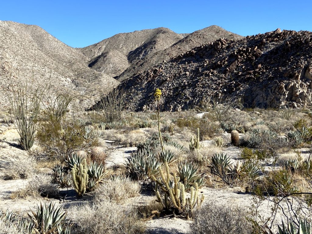
I had some water in my internal bladder, but my side bottles were empty to save a little weight for a while. The route took me down a ravine before climbing back up again. Since I was in no hurry, I took a leisurely pace. I actually had a small water crossing. It had rained the week before and some of the water was still around. As I made my way up, I spotted 3 hikers heading toward me. It was a bit early for anyone coming from Little Harbor. It turned out they work for the conservancy and they were out counting snakes. I happily informed them that I had neither seen nor heard any today.
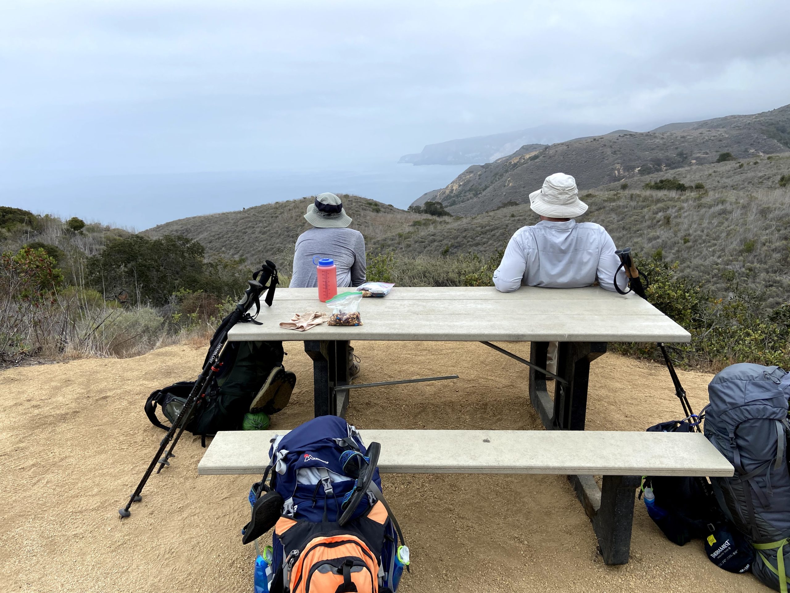
Once at the airport, I dropped my pack, found some shade, and enjoyed a cold soda. While the TCT is quite challenging, it intersects with civilization quite often. The airport was one of those intersections. After that cold drink, I ordered my bison burger with fries and another soda. I was here before when the twins and I had flown over with my friend Susan Bell for the same lunch. I let lunch settle a bit before starting to head out. Little Harbor is said to be a fantastic campsite so I wanted some time there. I filled my side bottles and bought two more sodas and an oatmeal raisin cookie for later. With mostly a descent ahead of me, the extra weight was fine.
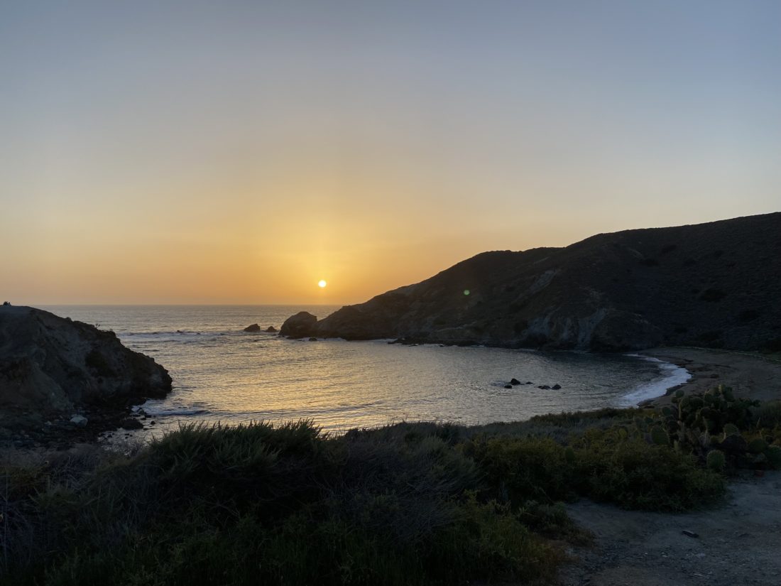
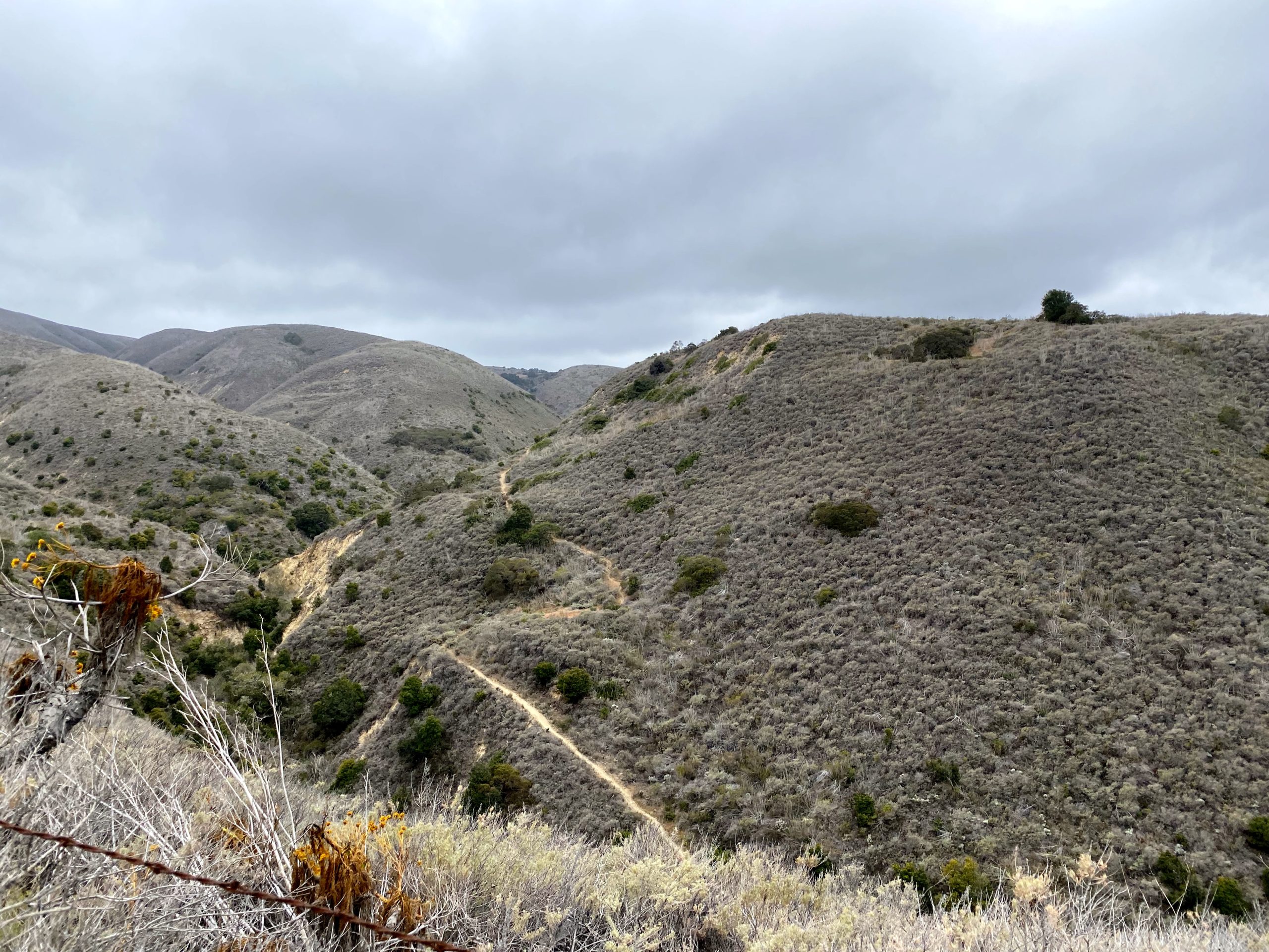
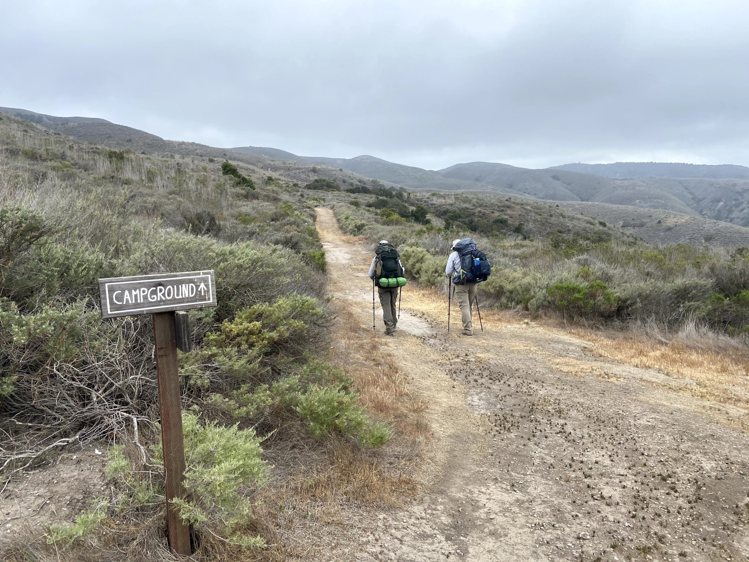
A modest portion of this section of the TCT is on the road, so I encountered some actual traffic. First, a SoCal Edison truck passed me, and then an LA County Sheriff. Both slowed so as not to kick up any road dust. About 10 minutes later a paramedic and another sheriff’s jeep were headed toward the airport. Since they did not slow down, one could only assume someone was being transported. The day was warm and there was almost no shade. As I left the road and back onto a traditional trail I looked at my map and saw there was a shade shelter somewhere around mile 17. I could see it down below me and was looking forward to dropping my pack and sitting a spell. When I got there, however, surrounding it was a herd of 20+ bison! Some were standing, while others lay down all across the trail. Since I did not think they would be moving anytime soon I began figuring out plan B. I could just wait and hope they move one but the surrounding terrain looked fine and I took off cross-country around them.
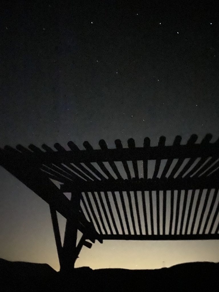
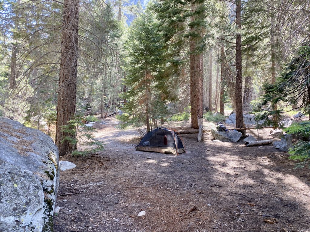
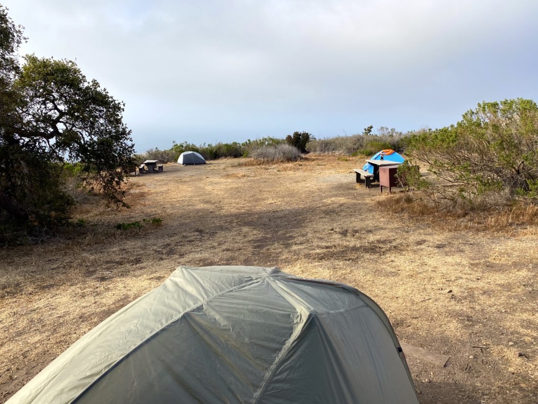
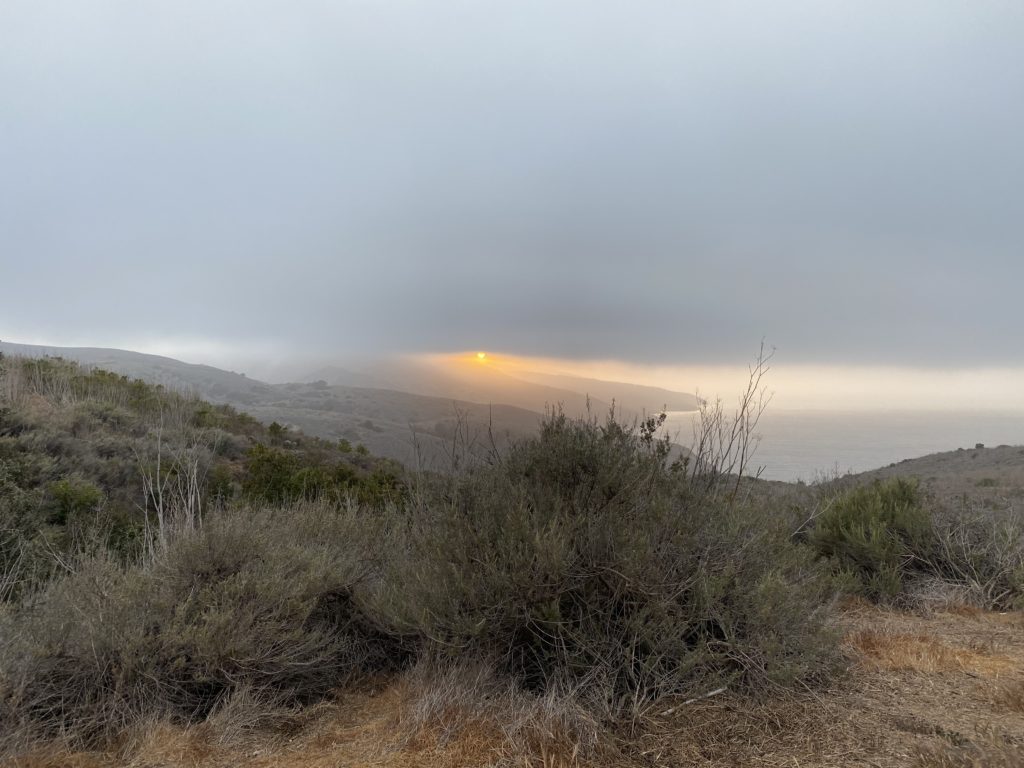
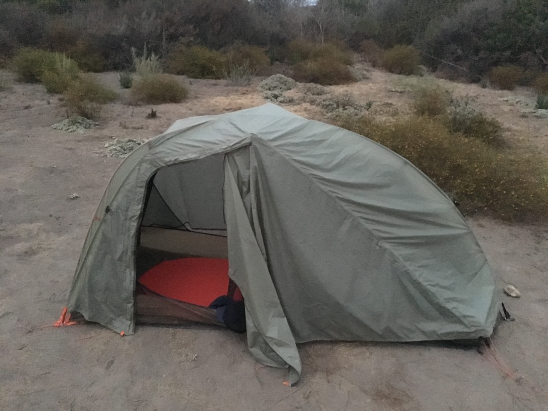
I strolled into camp and found my site. I booked one further back in part for the quiet. I set up camp and then went exploring the campground. What a beautiful spot! I can see why folks would camp here multiple nights. I took off my shoes and let the cool Pacific Ocean wash over my feet. Then I headed back to my campsite and chatted with the woman in the next site over. I made my dinner, then headed to a nice spot to watch the sunset. No green flash this evening, but it was still lovely. I decided not to put up my rainfly and just stare at the stars from in my tent. The moon would be setting soon, so I could enjoy them as I listened to an audiobook before drifting to sleep.
I am an avid peak bagger, sometimes backpacker, and former sea kayaker living in San Diego. I am the co-author of Urban Trails: San Diego, coming in Spring 2026!
The alarm went off at 6 am just like a regular workday. I took my time getting ready. Since I stayed in town I could also enjoy a nice hot breakfast before heading out. Pancakes, two eggs, and black coffee hit the spot. I went back to the room and gathered my gear. The hotel gave me a $20 voucher which I used at their Bistro to get another coffee and their “All-Day” lunch kit. I repacked it into my pack and set off. My TCT hike had begun!
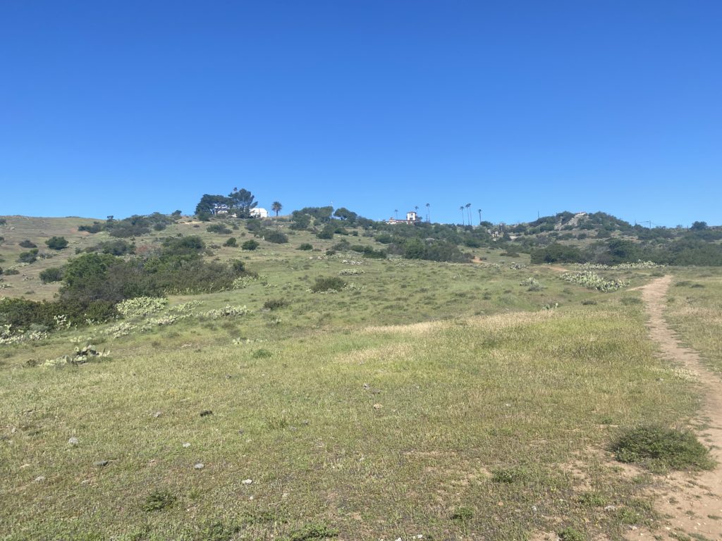
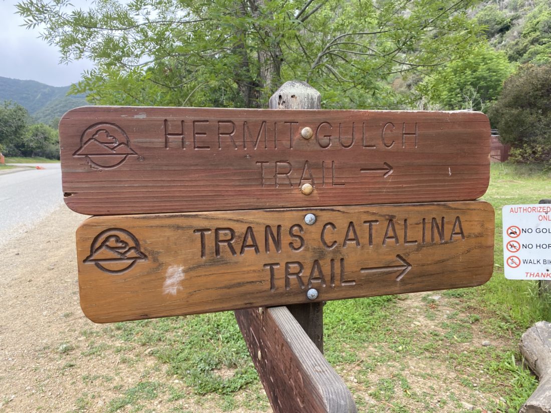
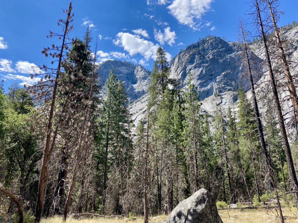
For now, the skies were overcast and it was very muggy as well. My shirt was quickly becoming damp but I would take that over a blazing sun any day. I passed through Hermit Gulch and began the first climb of the day. While the Trans-Catalina Trail is only 40 miles long, you have to climb over 9,000 feet along the way. The first climb would take me basically from sea level up to to just over 1,500 feet in 3 miles.
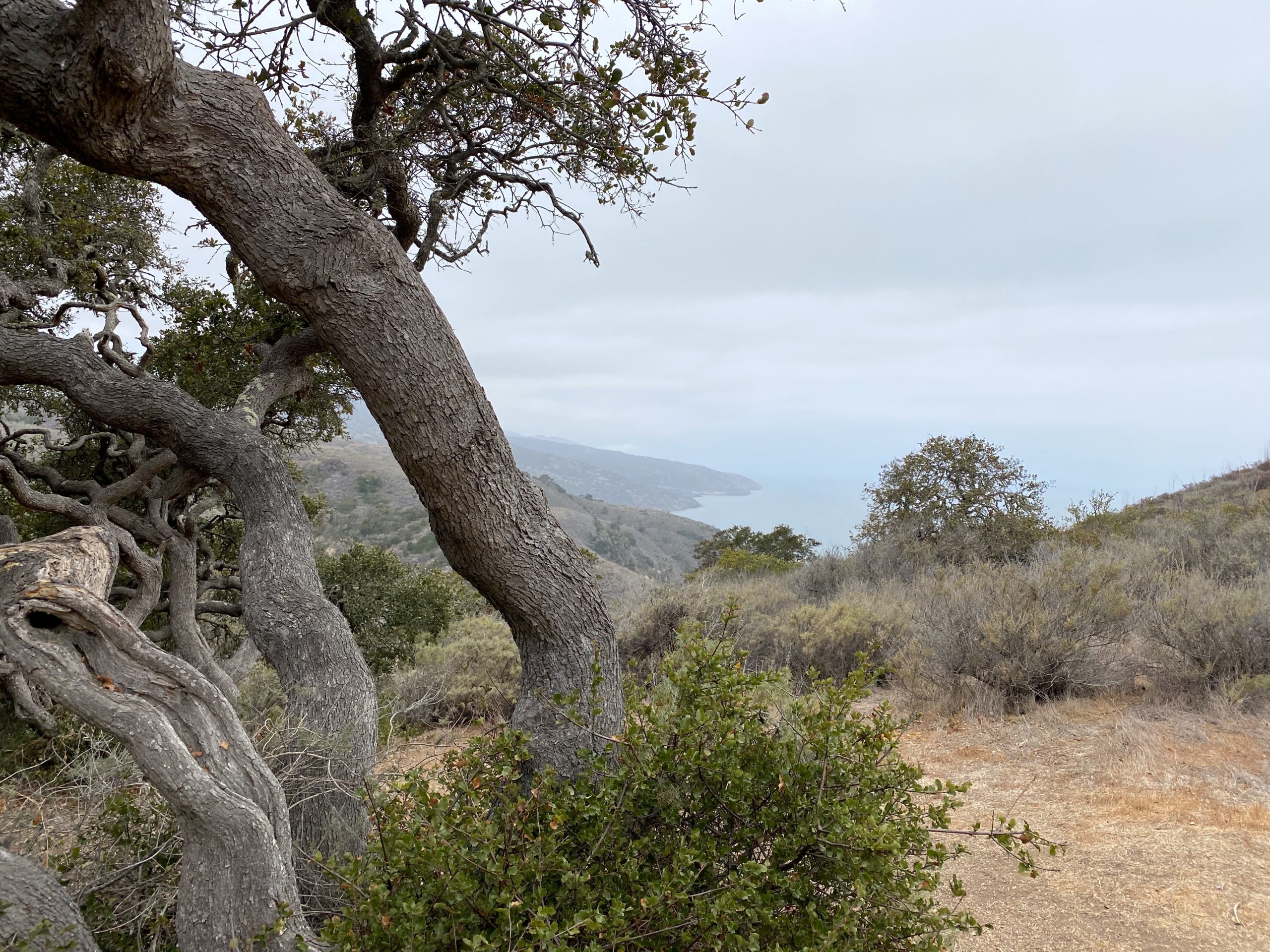
Along the way, I would stop and turn around and enjoy the view of Avalon and the cruise ship that arrived. As I neared the end of the climb, the sun was starting to burn through the marine layer. At one of the shade shelters along the TCT, I switched into my sunglasses and had a good drink, and continued on. The trail would rise and fall as I kept working my way toward Blackjack campground.
As I approached the small reservoir, a large male bison was working its way down the trail I needed to take. I stopped a safe distance away and grabbed some photos. I then waited, hoping he was heading down to the water for a drink. Thankfully he was, and then I hustled up a section in case he changed his mind.
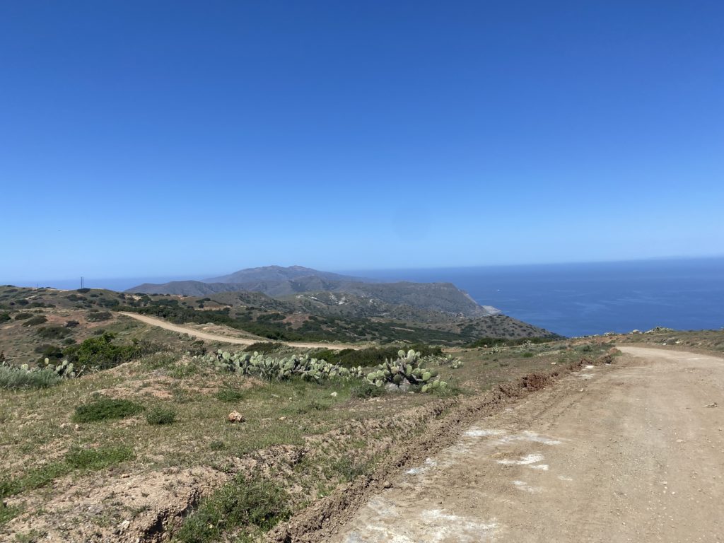
The TCT would flip flop from single-track to some road walking. I saw some traffic at times, none passed me while I was on the road. At each bench, I stopped and took a well-earned break, knowing I had over a 10-mile day with a full pack. I grabbed a snack and a good drink, saving my “All-day” lunch for when I arrived at the campground.
At mile 9, I took an extended break at the shade shelter. There was one more descent, then the final push into the campground. I plodded up the trail, praying for a switchback. Alas, it was just a straight-up assault on my legs. When I spied the campground in the distance a little spring came back into my step. I found my spot and sat down at the picnic table, and slowly ate my lunch. Once I had some energy, I set up camp. Afterward, I spent some time chatting with a couple from the next spot over. I grabbed a short nap in my tent, and then I decided to see if I might be able to hike out to Mount Orizaba, the high point on the island, but the road to the summit was gated and locked, and I did not feel proper hopping over the barbed wire fence. Off to the north, I could see the “Airport in the Sky”, the first stop for tomorrow, but more importantly, bison burgers! Once back at camp, I made my dinner and turned in. There are no campfires allowed here, so it was an early evening.
I am an avid peak bagger, sometimes backpacker, and former sea kayaker living in San Diego. I am the co-author of Urban Trails: San Diego, coming in Spring 2026!
My lovely bride dropped me off at the Catalina Express terminal in Dana Point after having lunch together. Thankfully the ferry was not too full so I did not have to store my backpack with the other passengers’ luggage. The boat ride over was fairly smooth, so I took a small nap. As we approached the dock at Avalon, it was still occupied, so the captain took us on a short cruise up the coast to kill some time. After disembarking, I grabbed my photo of the Catalina sign and headed over to one of the two spots to buy camping fuel. I later learned I picked the right store as Chet’s Hardware had run out. I checked into the Hotel Atwater. While many might camp at Hermit Gulch or plan for early arrival on the island, I treated myself to a real bed. When I booked the trip I had hoped one of my hiking friends might be able to join me. Unfortunately, no one could.
I wandered around the heart of Avalon and took a stroll to see the old casino. This is the iconic building you see in almost every photograph of Avalon. I skipped shopping in the various stores as I was not about to haul some knick-knack for 40-plus miles. I found a Mexican place for dinner and relaxed. Afterward, I grabbed some ice cream and watched the light fade over the ocean. Since I planned for an early start, I did not plan to go hit any of the bars, and turned in for the evening.
I am an avid peak bagger, sometimes backpacker, and former sea kayaker living in San Diego. I am the co-author of Urban Trails: San Diego, coming in Spring 2026!
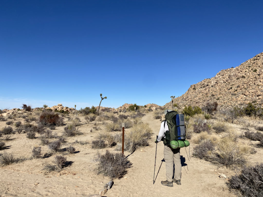
With my usual hiking partners busy, I decided to take a backpacking trip in Joshua Tree National Park. My friend Ted from Santa Barbara, who had joined me when I hiked Santa Cruz Island, was able to join me. We opted to hike the Boy Scout Trail, which would be a nice 8-mile hike, allowing us to explore both the upper Mojave desert with its Joshua Trees and then the lower Mojave desert, with cacti and yuccas. In addition, I hoped to summit two peaks on the Lower Peaks Committee list that are near the trail–Keys Peak and Mount Mel. We were doing this trip as a point-to-point hike, starting at the Keys West Trailhead and working our way down to the Indian Cove Trailhead. I arrived first at the Indian Cove Backcountry parking area and waited for Ted to arrive. Another hiker was getting ready to head off and planned on following the same route, but as a day hike. Since there is cell coverage at this trailhead, he had called for a cab to drive him to the other trailhead. This also could be an option for those who can’t or don’t want to set up a car shuttle. Ted eventually arrived, after getting a late start, and having to get a pass from the ranger station ($30). I took a short nap in the car while I waited. Once Ted arrived, I transferred my hiking gear into his car and he tossed his backpack into mine. With that, we headed back into town to grab lunch before setting off.
After enjoying a nice burger and soda at JT’s Country Kitchen, we drove back into the park via the West Entrance. This is the main entrance to the park from the north, so be prepared to wait a bit to pass by the ranger station. Since I have a National Parks Annual Pass, I was able to bypass some of the waiting. We drove south toward the Keys West parking lot. This is a large lot but can fill up. Sure enough, upon arriving, there was not a spot to be found. The Boy Scout Trail is also a popular day hiking site, so we decided to wait for some returning hikers and then take their spot. After about 10 or 15 minutes, a couple did return and I was able to take their spot. Two other cars were waiting behind me. I had grabbed two backcountry permits (free) while waiting at the other trailhead and had them filled out.
NOTE: Permits are no longer free for backpacking in Joshua Tree. You need to obtain them from Recreation.gov or from the Park Headquarters in Twentynine Palms.
We had left one at our destination and had the other ready to deposit at the backcountry board in this location. We took advantage of the primitive pit toilet before setting off. Another thing to note, there is no water at this trailhead.
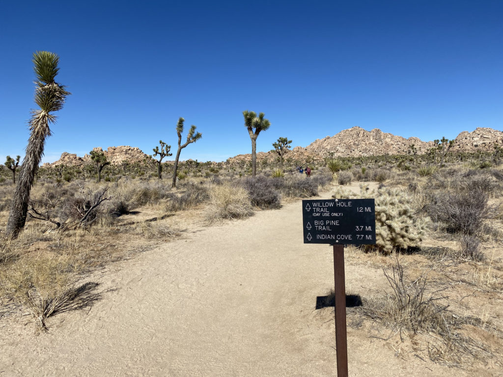
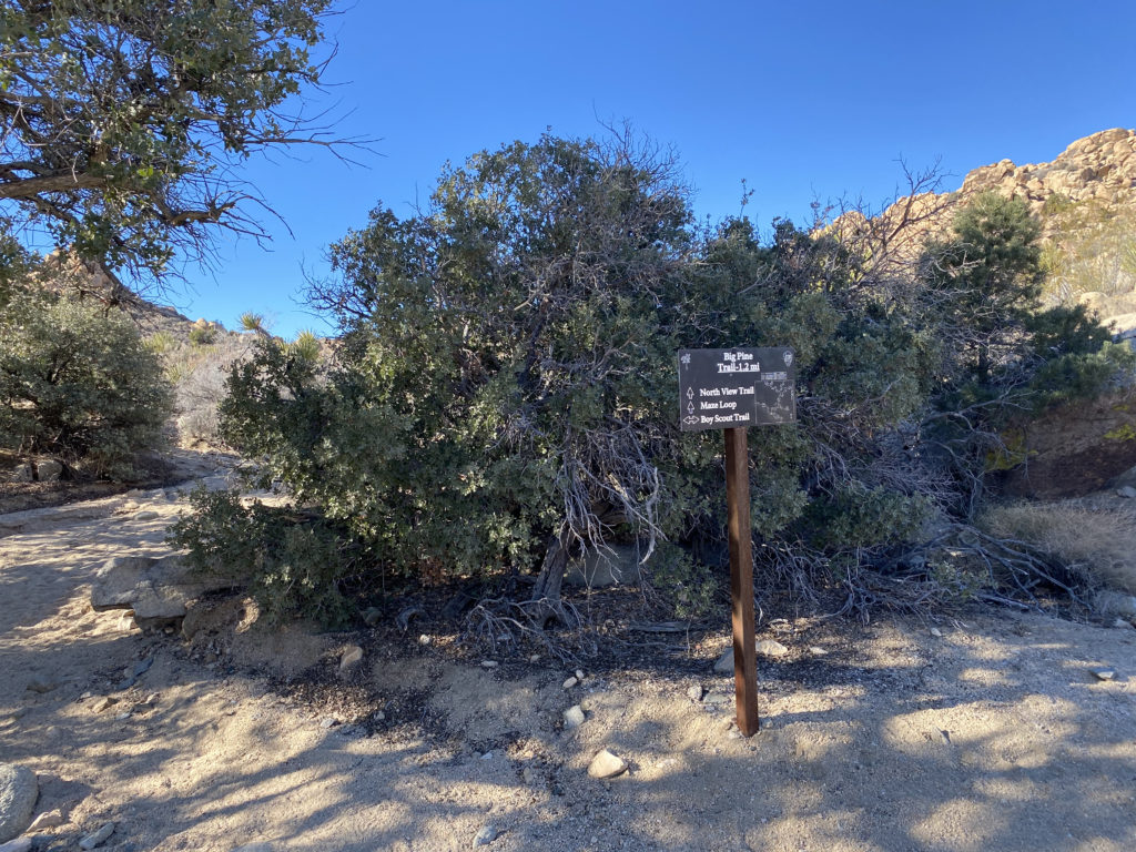
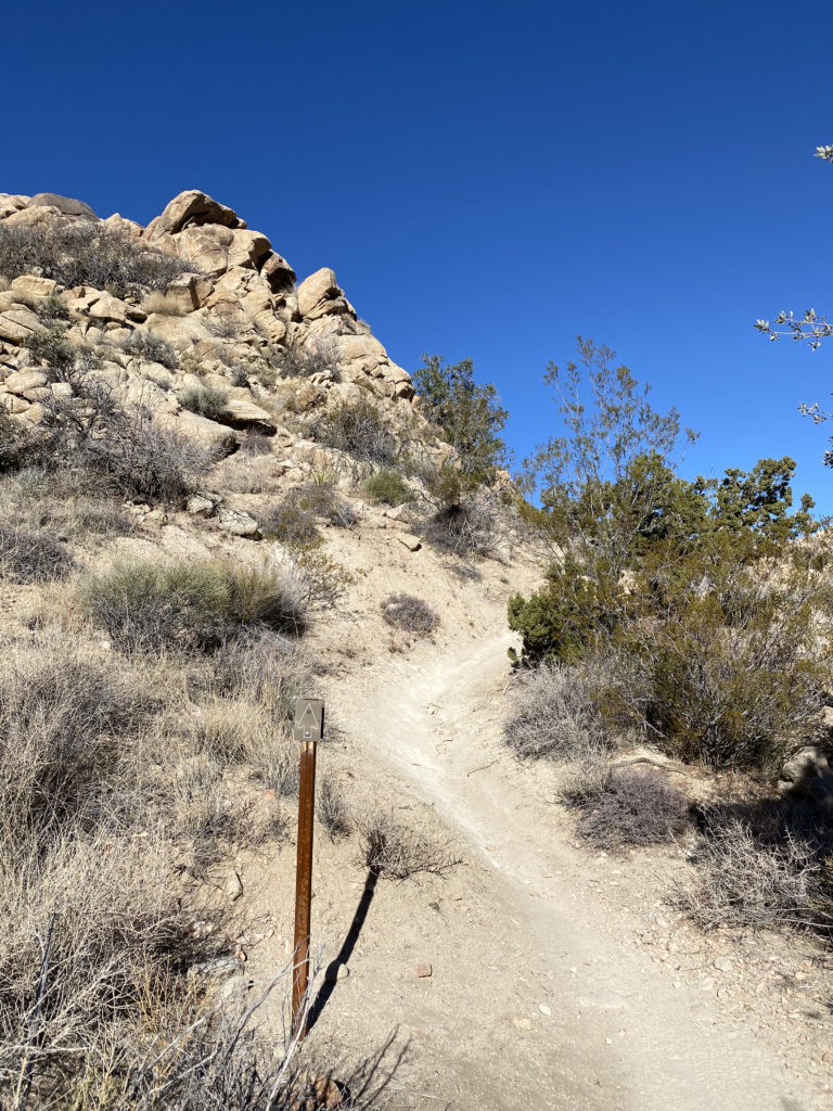
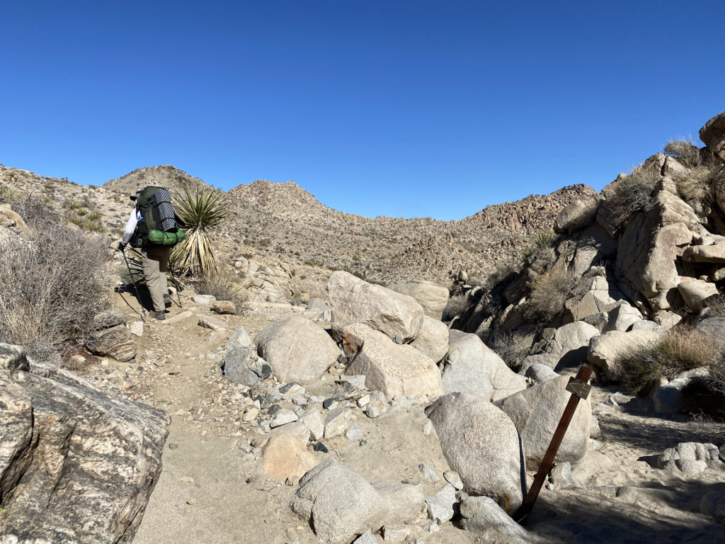
The trail sets off to the north. Soon you will see a mileage sign to the three main destinations from this trailhead; Willow Hole Trail (1.2 miles), the Big Pine Trail (3.7 miles), and Indian Cove (7.7 miles). What is interesting is the mileage sign next to the parking lot lists the Indian Cove at 7.5 miles. Since I had created markers for the turn-offs to each of the side peaks, I wanted to make sure my tracking app was working. For some reason, it was not recording the distance. After relaunching the app a few times, then finally rebooting my phone, it started working. I could have enabled tracking on my Garmin InReach Mini, but I like to only use that for communication with my wife or in a real emergency.
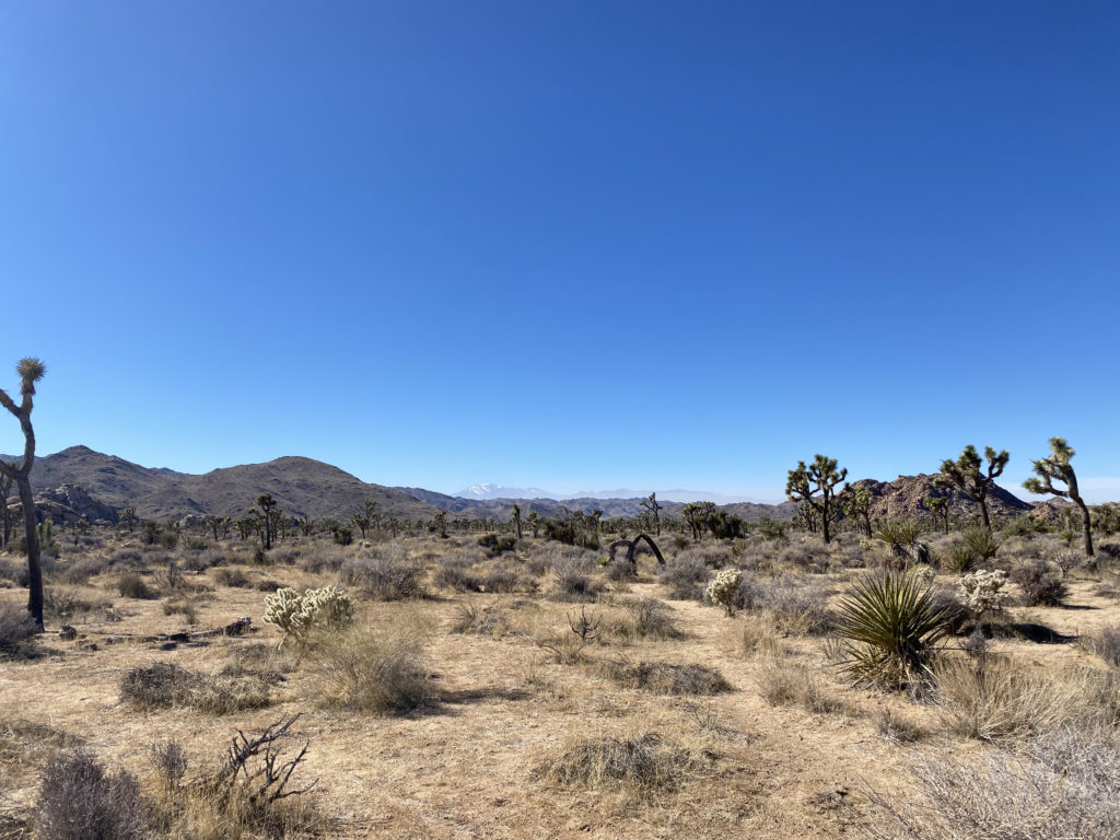
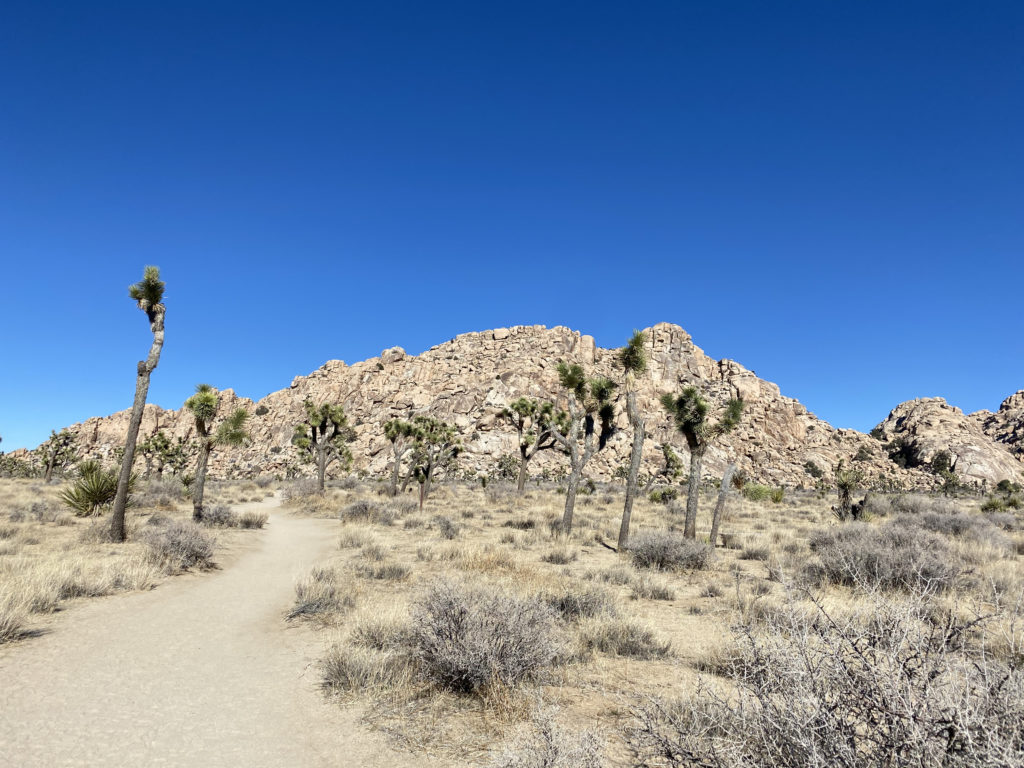
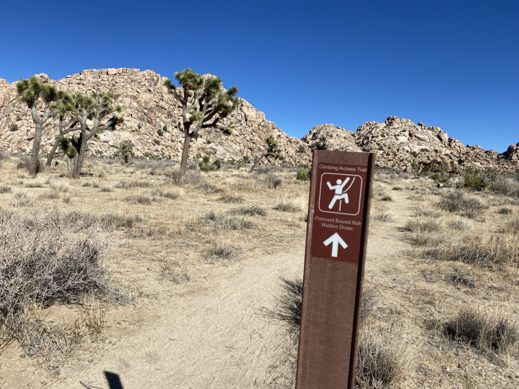
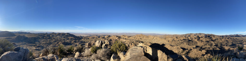
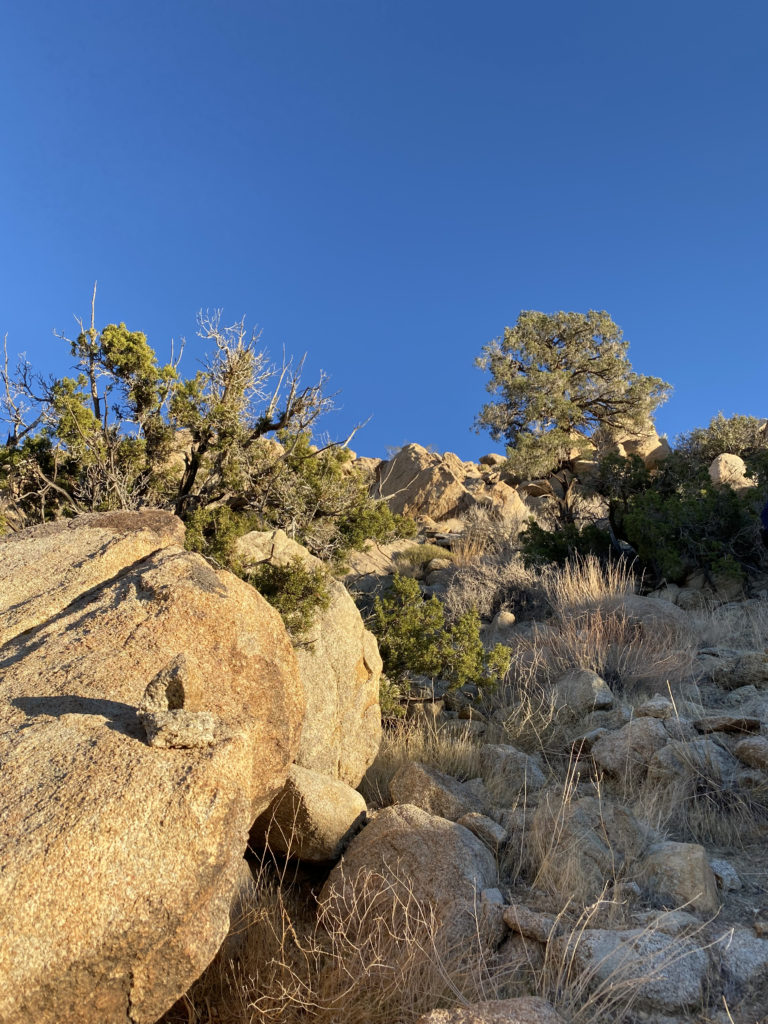
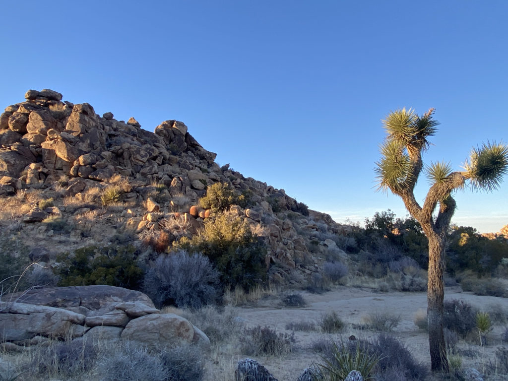
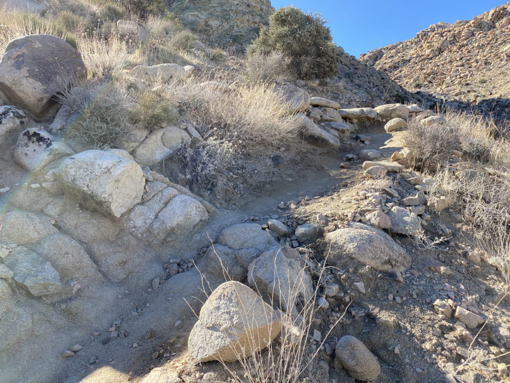
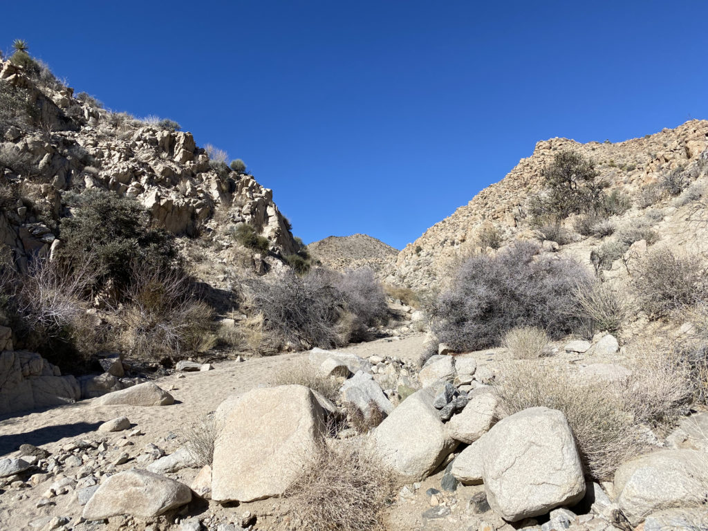
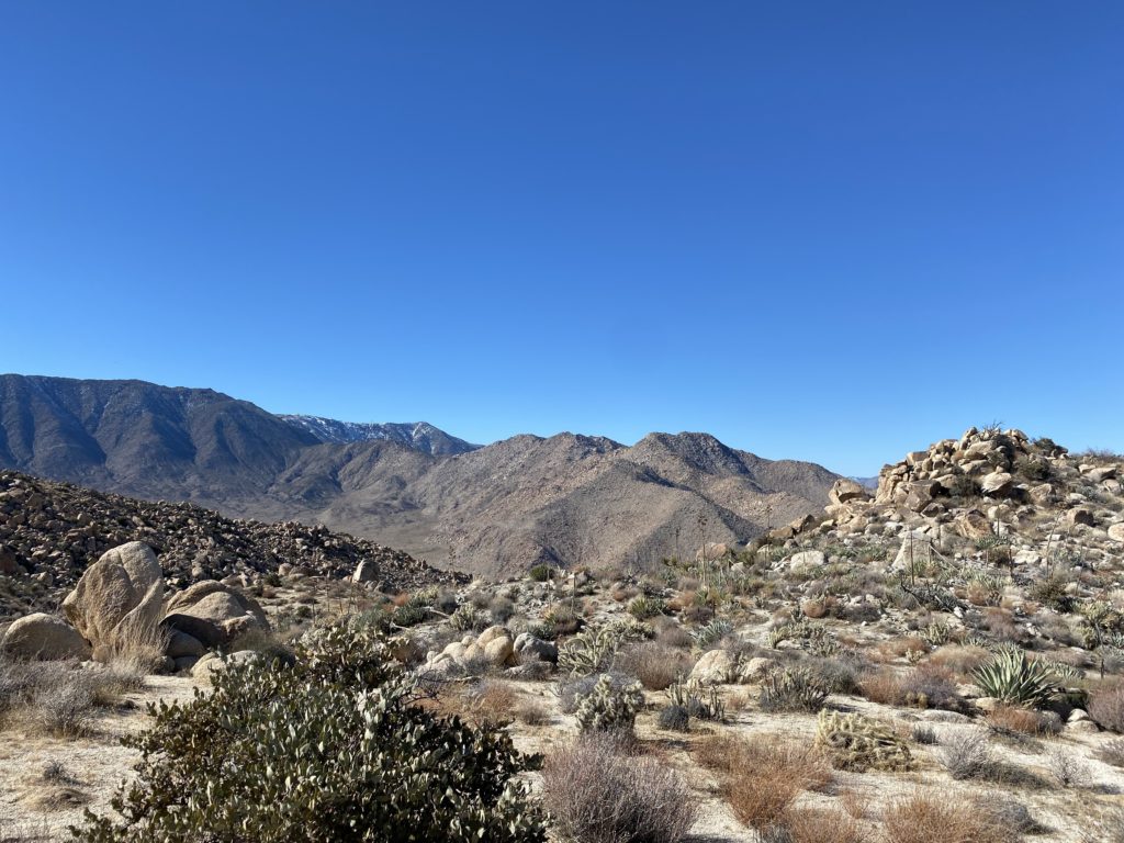
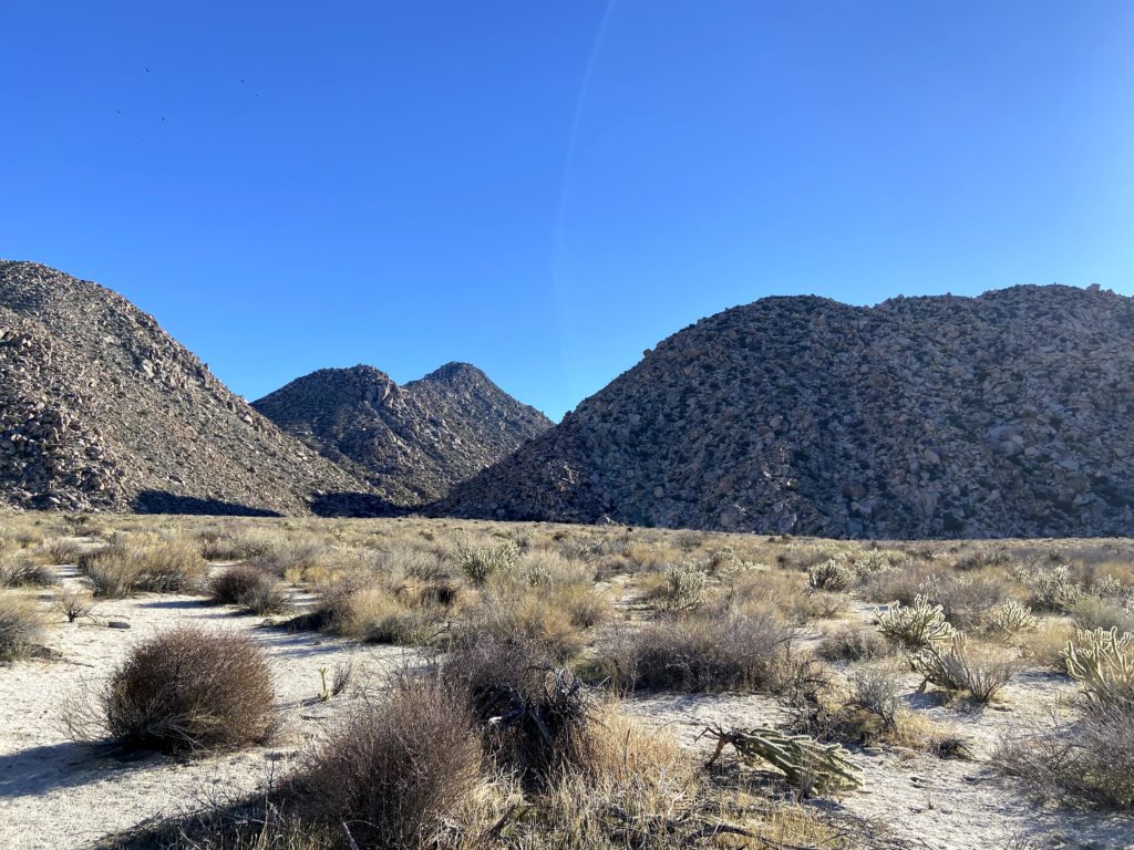
Off to the west, we could see the snow-capped summit of San Gorgonio, Southern California’s highest peak. The trail is nice and flat for almost the first 3.5 miles, so we were able to cruise along. This area is also a popular climbing area, and we would pass signs indicating various climbing access trails to spots like “Brownie Girl Dome” and “Hidden Dome”. The first real junction that you need to look for is the Willow Hole Trail. Stay to the left to keep on the Boy Scout Trail. As you cruise along the trail, enjoy the Joshua Trees that will dot the landscape.
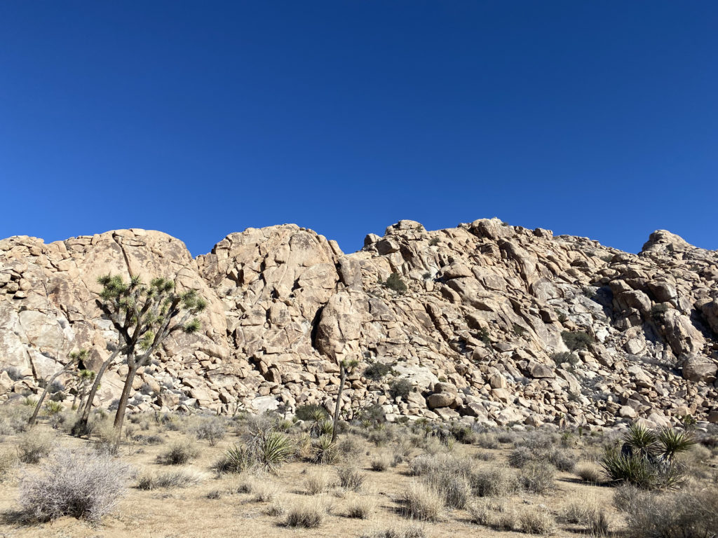
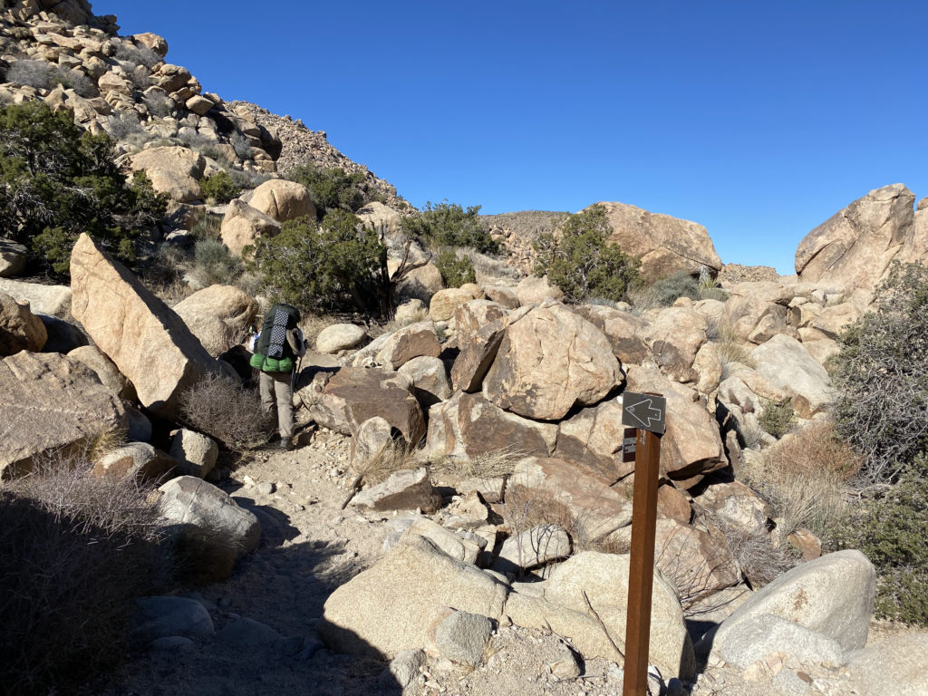
I knew at a certain point the trail would begin to pass into rockier terrain and we would no longer find a suitable campsite. In addition, there are some rules that we needed to observe. Besides the “stand 1 mile from a road and 500 feet from the trail”, we were also not allowed to camp on the east side of the trail. (NPS rules). We could see the terrain becoming less sandy, and the plant life began to change as well.
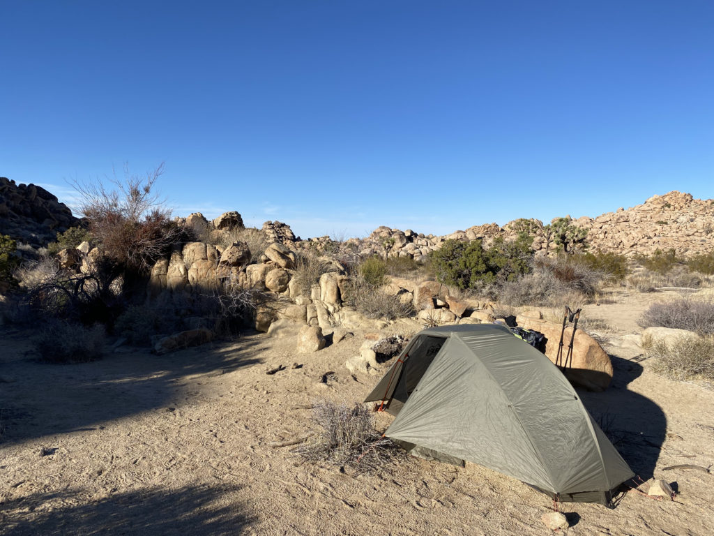
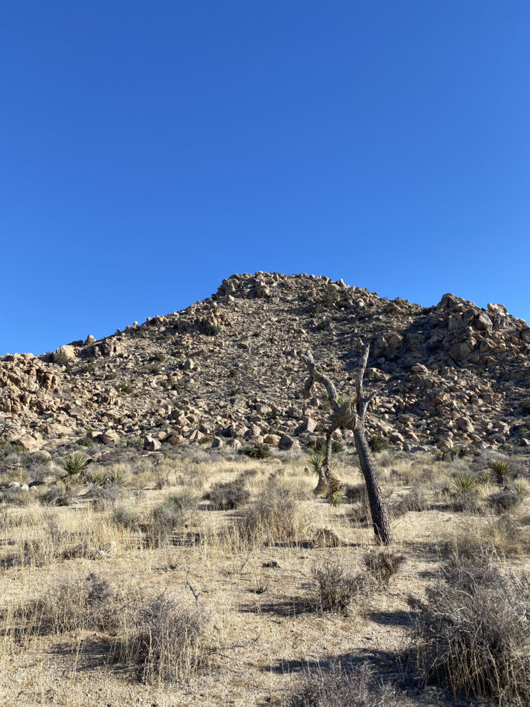
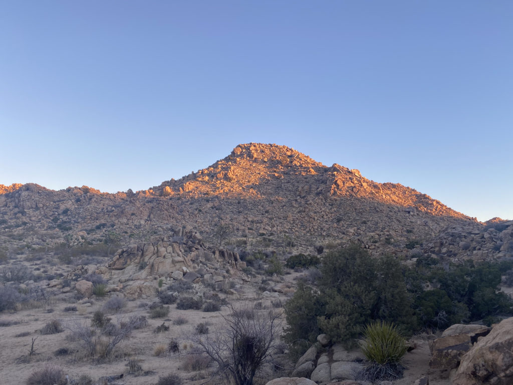
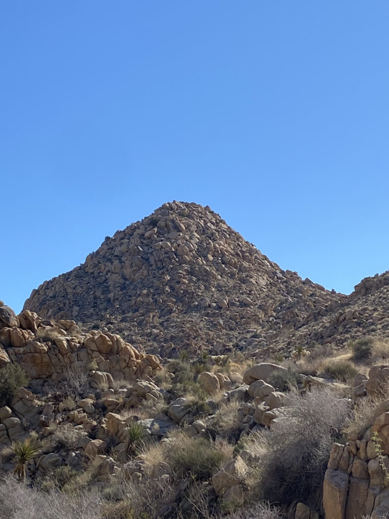
Off to my right, I could see Key Peak in the afternoon sun. We had been seeing several possible camping sites but decided to keep heading north just a bit. Not really finding anything else suitable, we retraced our route about .1 mile to a nice area near Keys Peak. We picked spots about 20 yards apart, so our snoring did not bother each other. Once camp was set up, we headed over to the base of the peak.
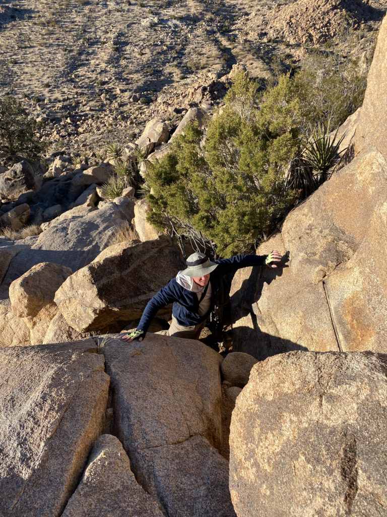
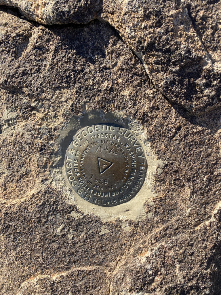
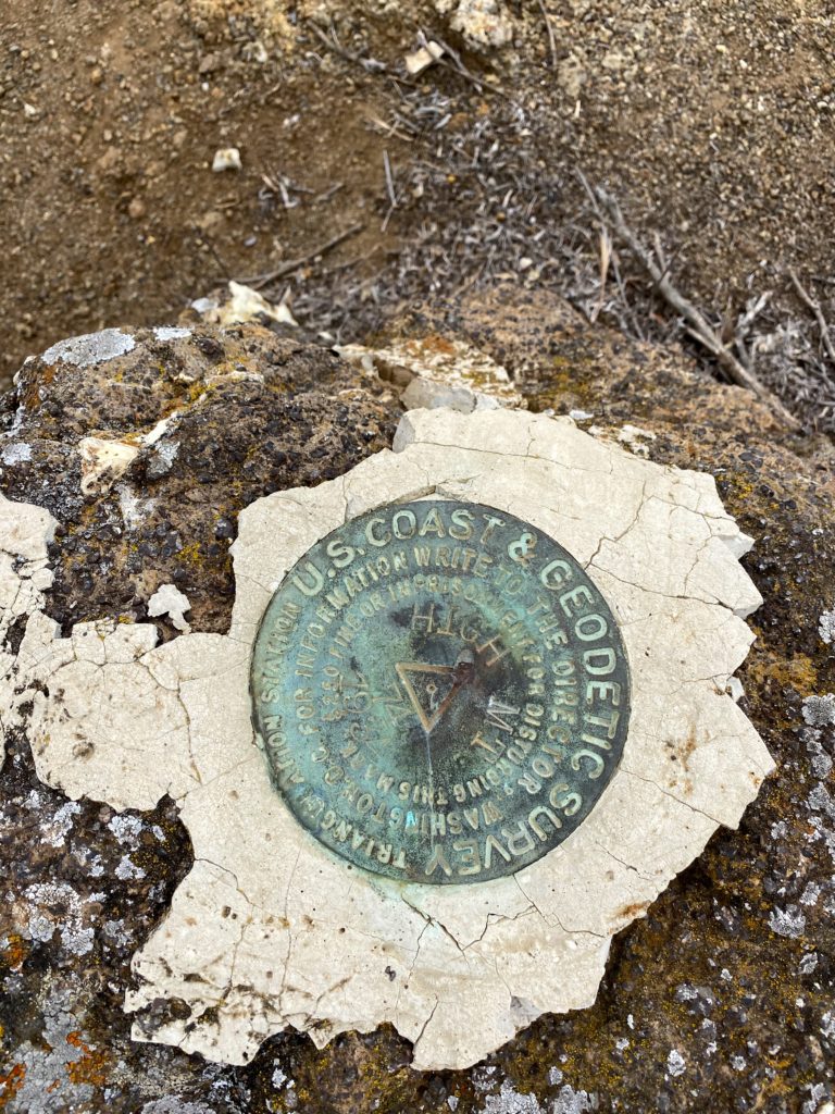
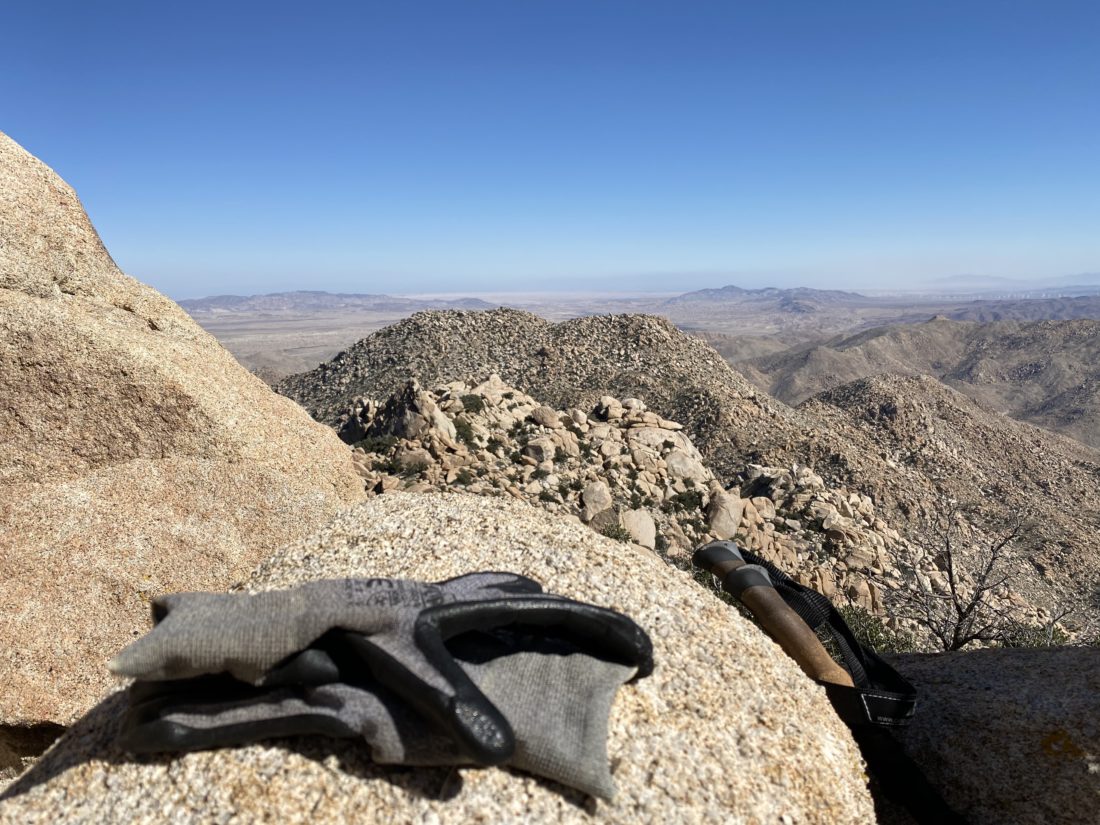
I looked at the western face and felt that we could tackle it straight on until near the summit where the rocks looked larger and we would stay to the right for the last bit. While I spotted one cairn near the start, I did not see the next one. No matter, the terrain did not provide any issues. About halfway up, something shiny caught my eye, and I found a mylar balloon caught in a bush, so I headed over to collect it. Once the trash was packed away, I headed back toward my original route. As I expected, toward the top, there were a few Class 2 sections to scramble through, but soon we were on the summit. I found the benchmark and register. We snapped our photos and took advantage of cell service to check in with our spouses. The sun was setting and there was a light breeze, so I was eager to climb back down and start thinking about dinner. Coming down, I quickly found the string of cairns that guided us back to the desert floor. This little excursion was .5 miles with just over 325 feet of gain.
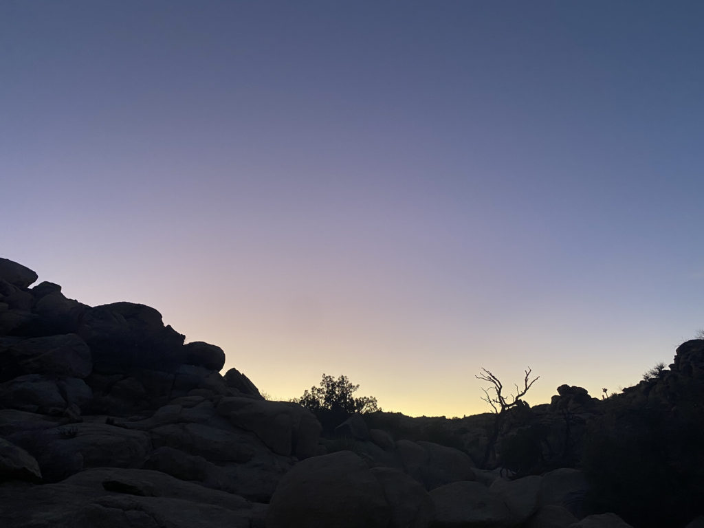
As the sun’s light began to fade, I sat back and enjoyed the changing light upon the rocks around us. We each had our dinners and some beers we had packed in as well. It was getting colder, so we each retreated to our tents for the night. Ted had brought a tripod and DSLR in hopes of getting some nice star shots later once the sliver of moon had set. I did not have the best night’s sleep, as I needed just a bit more warmth. I woke before the sun crested the hills to the east, and Ted was up soon thereafter. Ted took a bit longer to get ready, so I scrambled up the mound of boulders to our west for a look around. Once we were done with breakfast, we finished packing and headed back onto the trail.
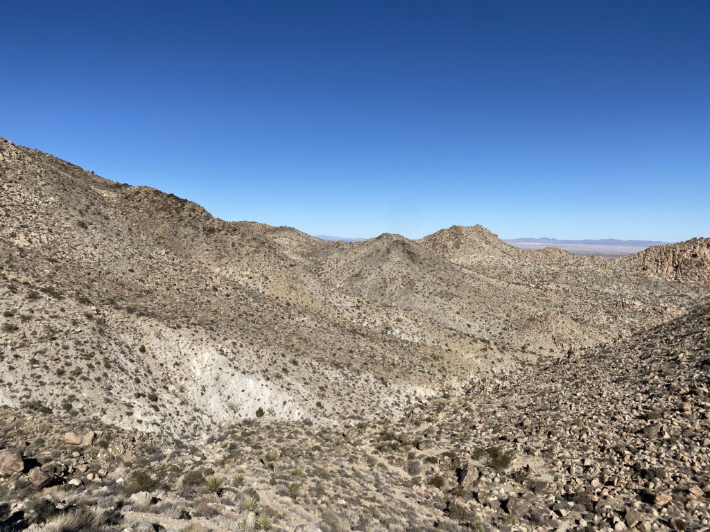
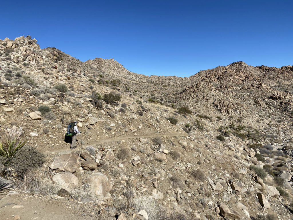
We came to the intersection with the Big Pine Trail that could take us to the west and eventually to the main road, but we continued working our way northward. The trail was getting rockier and rockier. There were a few boulders to work our way down, but nothing serious. It was more about having a backpack on versus a standard daypack. Along the way, we passed an old water basin from a nearby mine.
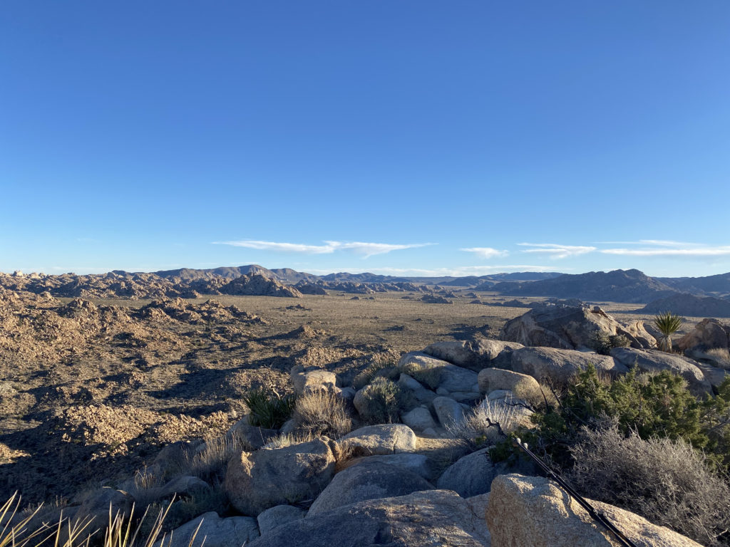
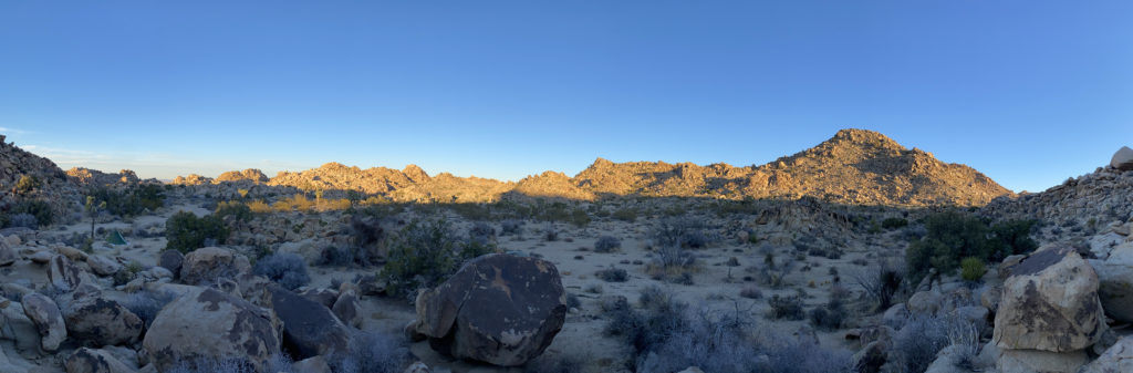
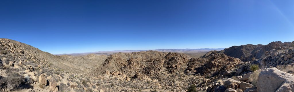
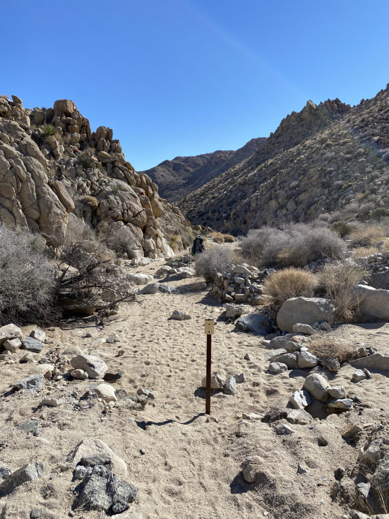
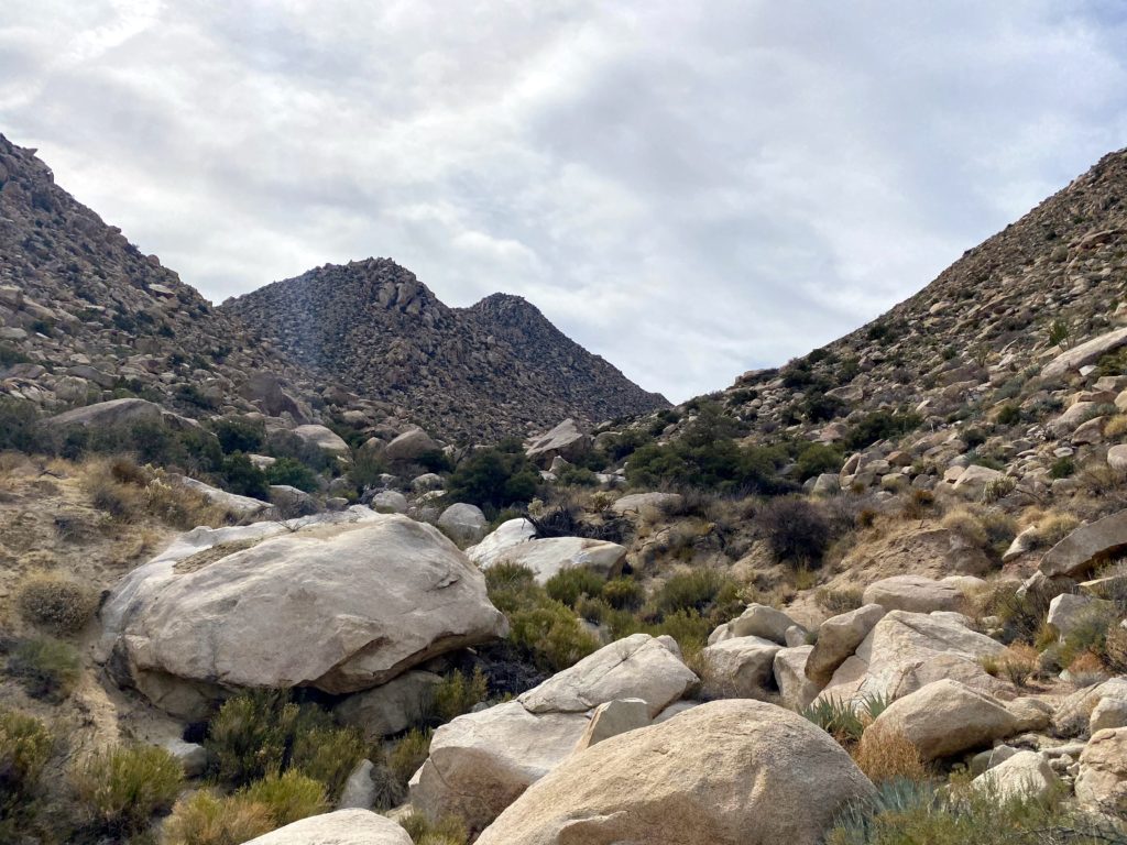
The trail markers kept us on the trail, although the route was very easy to follow. We had begun the descent toward the canyon that we would eventually follow out. Ted commented that we certainly picked the right direction, as climbing this with a full pack would take some effort. The next point of interest was the Boy Scout Viewpoint. This spot gave us an epic view toward the east. After capturing the panoramic view, we would descend through a series of switchbacks until we reached another wash. Here the trail made a hard right turn and began heading eastward.
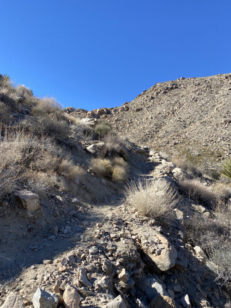
While trail markers would still guide us through the wash, there really is only one route to take. Various cacti would dot the sides of the wash and canyon walls, including some very beautiful and colorful barrel cacti. We still had some shade, so the temperatures were pleasant as we worked through the wash and the narrow slots. I kept an eye on our track for the turn-off to climb Mount Mel. I wasn’t certain if I was going to do it as the poor sleep had not left me overly eager to scramble up the rocky slopes to this summit. Once at the turn-off, I looked at it and decided to skip it. It is close enough to the other trailhead that returning another time was not going to be an issue.
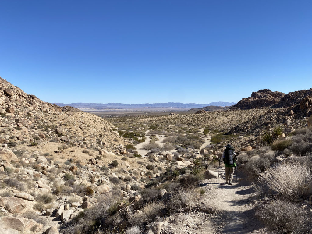
Finally, the trail left the wash, then hugged the side of the hill before exiting into the wide flat desert. From here we had a long gradual downhill hike back to the car. This trailhead only holds about 6-7 cars, and there were a few open spots. There are no facilities, but both the ranger station and Indian Cove campground do. We changed our shirts and shoes and headed back to go get my car. Along the way, we grabbed lunch at the Crossroad Cafe. They had a one-hour wait, but that gave us time to go into the park, get my car and be back in time. After lunch, Ted and I said our goodbyes until our next adventure.
Day 1: 3.93 miles, 1:35 with maybe 200 or so feet of gain.
Day 2: 4.45 miles, 2:09 with 1,280 of loss.
I am an avid peak bagger, sometimes backpacker, and former sea kayaker living in San Diego. I am the co-author of Urban Trails: San Diego, coming in Spring 2026!
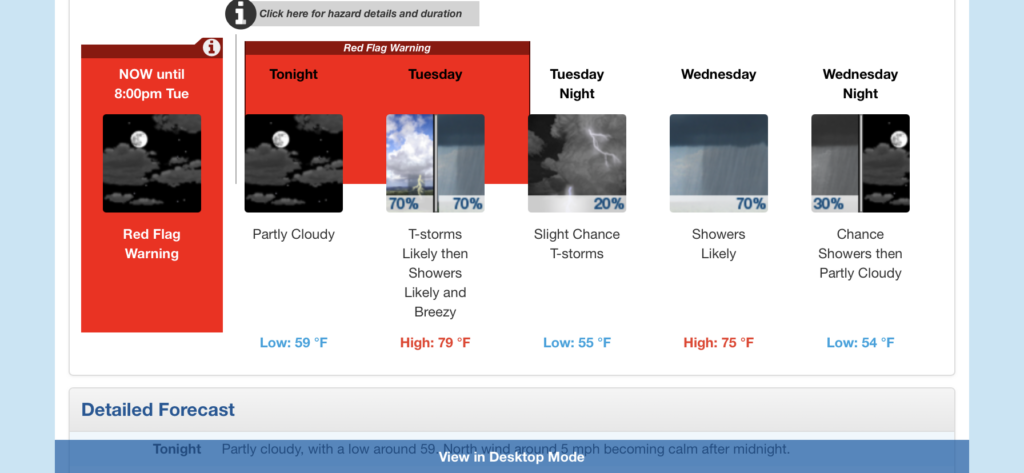
As my permit dates for Rae Lakes began approaching, I started watching the weather forecasts with more interest. Initially, this was to figure out what I might need to pack. But as the days became closer and closer, I became more concerned about the conditions I might find myself in. This was going to be my first multi-day solo trip, so I was trending toward being extra cautious about the journey. Initially, the forecast called for a warm start, followed by a 20% chance of thunderstorms for the rest of the trip. That is manageable, as thunderstorms are common in the latter part of the day. But each day, the forecast kept trending in the wrong direction. That 20-30% chance became 30-40%, then 40-50%. In addition, the weather service also issued a Fire Weather Warning (which was later changed to a Red Flag Warning) for late Monday afternoon through Tuesday evening. They warned of dry lightning triggering fires and the high winds creating the possibility of it becoming fast-moving. Not really the conditions that I looked forward to hiking into. As I sat in my hotel in Visalia, I reached out to some of my more experienced backpacking buddies (David & Leslie/Mike) to get their take. They all agreed that it did not look like it was going to be a fun trip. The general consensus was to go ahead, get up early as planned and drive the 2 hours to Road’s End and consult with the ranger. If I liked what I heard, continue on to the first campsite and spend the night. Then I could make the call and decide if I want to continue or simply turn back. With that, I set my alarm for 4 am, and hit the pillow.
When I woke up. I checked the latest weather report and saw that it was looking more like 50-60% of thunderstorms and showers as well were now in the forecast. Given I had not camped in the rain, doing it for multiple days seemed like a poor option. I got to the permit station just a touch after 7 am. I spoke with Ranger Mary about the forecast and what her thoughts were. She basically asked, “How much do you like being wet?” That settled it, no loop for me this time, but I was still game for one night in the wilderness! So, I parked in the long-term lot, finished getting ready, and hit the trailhead just before 8 am. The forecast for Upper Paradise was to be in the low 80s, with a light breeze. I had hoped that my early start would let me stay ahead of the heat. I had not paid attention to the forecasted high, so I had no idea exactly what I might be racing against.
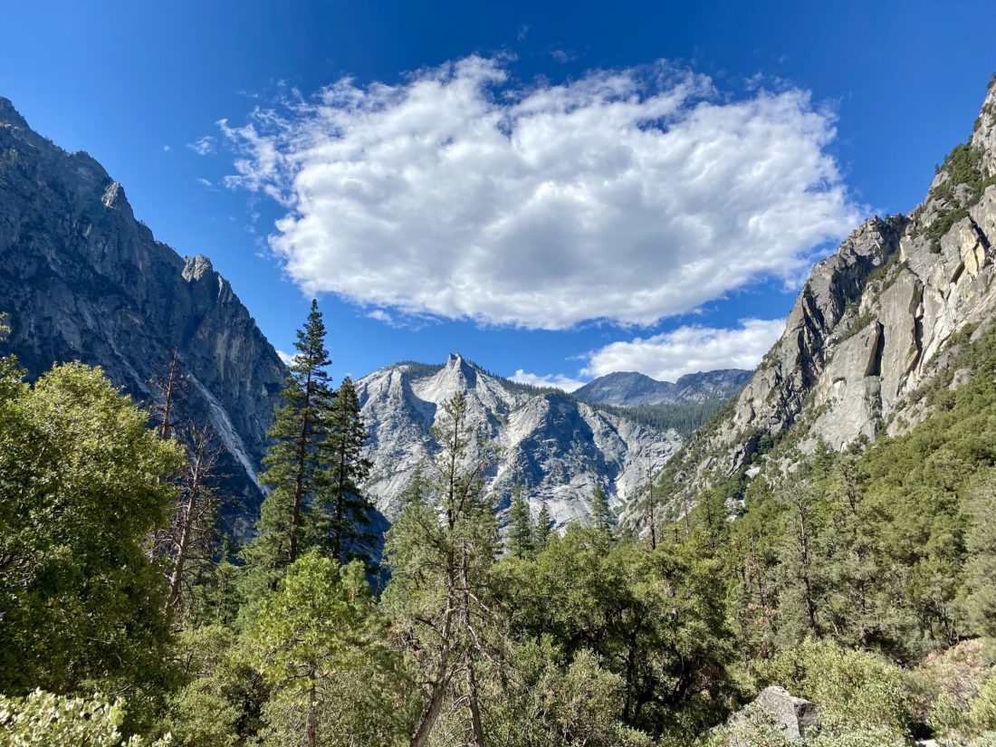
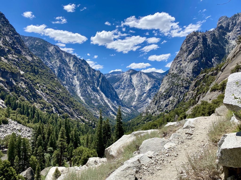
The trail is fairly flat for the first 1.9 miles until it reaches the junction of the Kings River and Bubbs Creek. Here I would take the left fork and begin ascending toward Paradise Valley. The sounds of the river were so refreshing. The views were as incredible as I had imagined. It was getting warmer as I pushed on. I had a liter of water in my interior water bladder, a liter in a side bottle, and 1 liter of Gatorade. I could feel my pace slow. At first, I thought I might be the added weight of 5 days of food, the extra clothing, and other items making it tougher. But, as I felt the sweat begin to soak my shirt, I knew that day was warmer than I had hoped for.
At Mist Falls I took an extended break. Ate some of the oranges I brought for the first day and drank some more fluids. I decided to spend a bit of time in the shade and recharge before pressing on. Most everyone here were day-hikers. Oh, how I coveted their small light packs… I pressed on, being mindful of the temperatures. I dug out my cooling towel and wrapped it around my neck.
I kept finding myself looking for a place to sit under some shade for a bit. I checked my position and the topography ahead of me. I gave serious consideration to throwing in the towel and bailing. I found another rest stop and refilled my side bottle with some cool water from the river (properly filtered of course). I finished my oranges but still could not think about having my proper lunch. I knew that this was not a good sign, so I tore open one of my goos and forced it down.
As I made my way across the exposed switchbacks, I estimated the temperatures were either in the upper 80s or low 90s. This was going to take some serious effort if I was actually going to make camp. My spirits were getting crushed. I would move from shady section to shady section, pausing for a bit almost every time. Once I reached the southern end of the valley, I took another break and was able to eat my lunch. I again went to the river to filter more water, as my bladder had been completely emptied by this point. Rechecking the map, I was not too far from Middle Paradise campsite, so I pressed on.
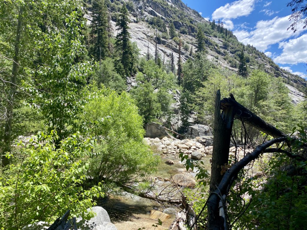
Passing through Lower Paradise, I could see the numerous dead trees and why this campsite is currently closed. I then spied the bear locker at Middle Paradise and said this was as far as I was going to go. I was the only one here, so picked a nice spot a bit back from the water, hoping the bugs would not be an issue. Thankfully, for most of the hike, they were not too bad.
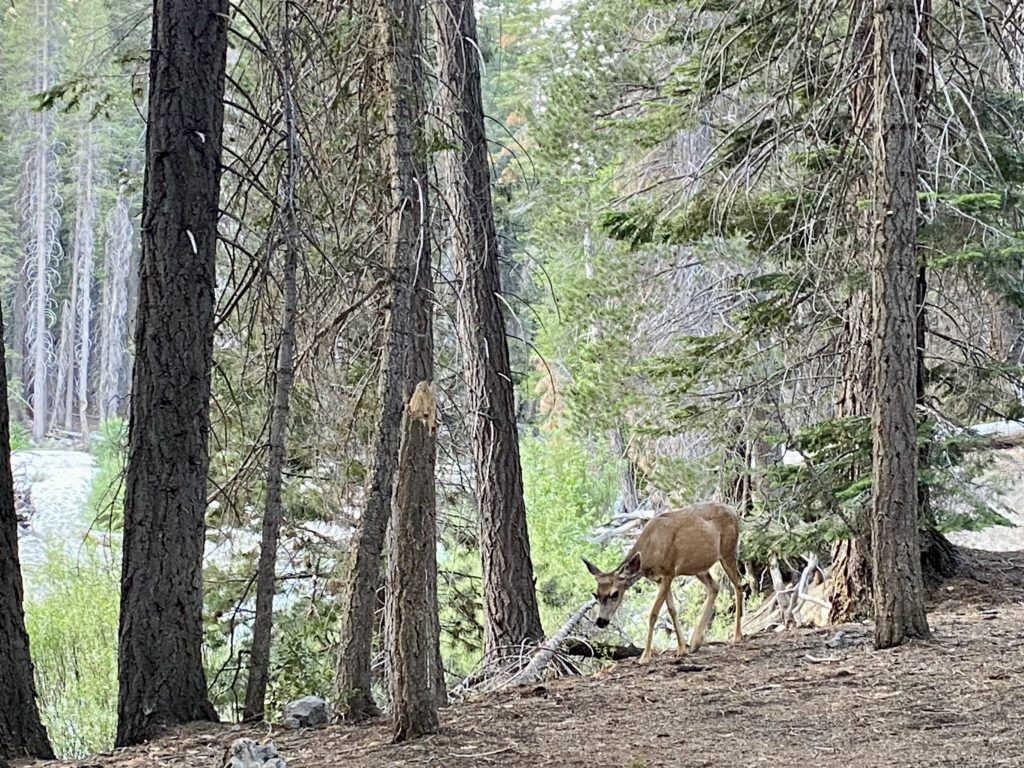
I got some more water and then began to set up camp for the night. It was only 3:30 or so, but I just did not have the energy to hike another 2 or so miles to Upper Paradise. Eventually, 3 other hikers joined me at the site. And not soon after that, a doe strolled past us with not a care in the world. While soaking my feet in the cool water, I used my InReach to report in with my wife and give her my status.
My site had a fire ring, so I had planned for a small fire to pass the time later. I gathered some starter material and placed the pine needles in the pit. I then set off to find some downed wood that I could use. I started to smell the familiar smell of a campfire. I figured it must be from further down the trail. According to GaiaGPS, the Middle Paradise campsite was further north. I then looked over to the fire pit, and the started material had begun to smolder on its own! It seems the last users of this firepit had not properly put it out. Thankfully, I took care of it, but I was pissed.
About 4 to 6 other hikers passed on through, pushing on toward Upper Paradise. I would say now that I had an extended break here, I probably could have pushed on. But, I was fine spending the night here. Later in the early evening, two more hikers also decided to find a spot to pitch their tents. It was one of them who spotted the bear as it passed around us. We watched it as it took a look at us. It looked to be about 2-3 years old and did not seem to have any tags or collar. Eventually, it wandered away. I certainly was going to be a bit more cautious for the evening. Since I was not needing 5 days of food I treated myself to a double dinner, being a bit more mindful of any unwanted company.
With plenty of water to manage my fire, I sat and enjoyed the flames. I reflected on what I had overcome. I let the fire die down until only the embers remained, I doused it with my water pouches and made sure it was out. I had really wanted to gaze up at the night sky from Rae Lakes, but this view would have to do. The night was pleasant, I slept without the cover on my tent and just my camp shirt on. Once the moon rose, it did wake me once, but even that was a welcomed sight. As the pre-dawn broke, I found myself rested and ready to head back out. The other folks were going to continue on to Woods Creek and then see what the weather held. I did briefly consider it, but in the end, felt it best to stick to the one night.
I repacked my bag, trying to be mindful of the other campers. I knew I was hiking down into the heat, so I wanted an earlier start. Not ten minutes on the trail, I spotted that same bear dashing in front of me and then stopping a safe distance away. I kept my face toward him as I continued carefully down the trail. Two hikers passed me before I reach Lower Paradise, and I gave them each a heads up about my earlier bear sighting. Upon reaching Lower Paradise there were two folks who had ignored the closure notice and camped there. I let them know as well.
The miles slipped by much easier, the pack a little lighter, the temperatures pleasant and mostly going downhill. I stopped at Mist Falls, and this time the entire area was empty. I sat a listened to the roar of the river tumbling down. When I went to put my pack back on, the sternum strap snapped. Crud! Maybe this was a sign that turning back was a good idea. Also, I did discover a hole in one of my pairs of Darn Tough Socks…. About ¾ of a mile past Mist Falls, I meet my first day-hikers. A family was taking a break and politely asked if I had bug spray. The bugs had been worse today. In fact, at Mist Falls, I broke out the bug net. I turned around and told the father which pocket to find it in. They were so happy. We chatted some before we each headed our separate ways.
As I made my way along the trail, a mule train was making its way up, I assume to resupply the ranger station at Rae Lakes. I stepped aside and let them pass. Now I would watch out for fresh droppings on the trail. A bit further down, I met two more day-hikers, they told me they just encountered a rattlesnake slithering off the trail. Sure, enough it was just off to the side, minding its own business. I safely snapped a photo or two and continued on.
I started to encounter a mix of day-hikers and those still heading out to attempt the loop. I let the backpackers know about my bear sighting at Middle Paradise and wished them well. Soon, I found myself back at the junction of Bubbs Creek and the Kings River. I hoped to cross that bridge upon my return from the loop. But this time just a quick stroll on it would have to do.
The day was getting much warmer, and I could feel the need to drink more and more as I covered the last couple of miles. I found myself drifting from shady section to shady section again. I was guessing it was in the mid to upper 80s. I would know soon enough once I got to the car. It was about 10:30, and I met someone just heading out. We chatted a bit, he had just landed a walk-up permit. He had hoped to have the ability to send a message to his wife, but couldn’t. So I offered to pass along his itinerary for him once I was able to.
Finally, the permit station came into view. I spoke with the ranger and gave him my bear sighting information, as well as the camping at Lower Paradise and the fire issue. The area is now at Stage 3 fire restrictions, so the small fire I had is no longer allowed. Once at the car, I cleaned up some, then threw on some shorts and a t-shirt. Unfortunately, I also developed a nice blister on my toe. I had felt something earlier, but when I checked my foot, I did not see it. I guess it was another sign that I made the right call. I picked out some snacks for the ride home, but the trail mix was not going to be one of the options, as it had melted into a mass of goo. Yeah, it had been warm on this hike. As I pulled away, heading toward Cedar Grove for some cold soda and a snack, I waited for the car’s thermometer to settle down. It read 95°F at 11 am. Yikes! That would explain why I had so much trouble, it was even hotter than I planned.
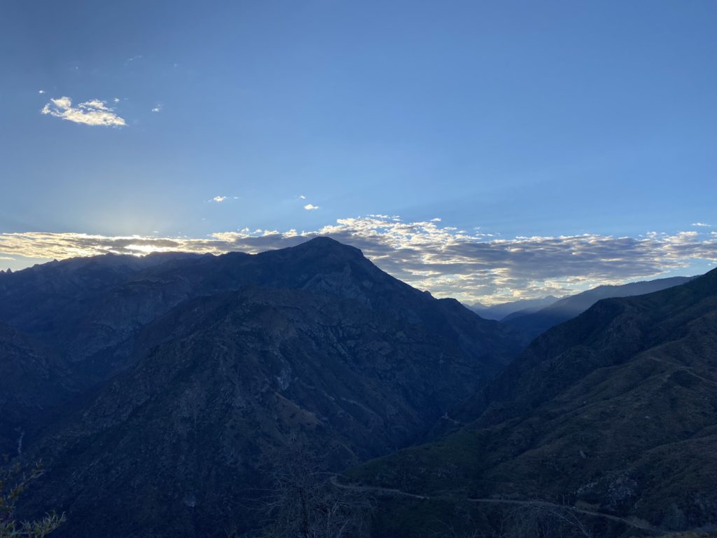
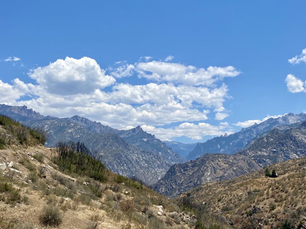
As I drove up out of Kings Canyon, I pulled over at a nice vista and could see the start of the clouds forming in the distance. I decided to take the long way home and drive through Sequoia National Park. I did not plan to stop, I just wanted to enjoy the trees and views. Once back off the mountain, I headed back through Bakersfield, this time stopping at Dewar’s to pick up some chews for the family. All in all, it was an adventure to build on. Except for the one-two punch of the heat and the predicted rain, the trip went mostly well. Maybe in the early fall, I might find an opportunity to try again…
The forecast on Monday.
I am an avid peak bagger, sometimes backpacker, and former sea kayaker living in San Diego. I am the co-author of Urban Trails: San Diego, coming in Spring 2026!
For those who have done the 3-2-1 Challenge in Los Padres National Forest, you know that one of the real challenges is just the long drive to the trailhead. Last year when Ted Markus and I did these peaks, we did it as a day hike. During the long drive back to San Diego, we both commented that while the hike itself was great, sitting in LA traffic, not so much. Since we had both acquired backpacks and related overnight gear, we decided to do this trip as an overnight adventure.
Last year I logged that the entire hike was just under 11 miles, including a side trip to Sawmill Mountain West, so we knew this trip would be quite manageable. In fact it is about 4.5 miles to the campsite, and we’d pass the first two peaks on the challenge; Mt. Pinos and Sawmill. I figured once we made camp, we could go to the summit of Grouse, about a mile away. Another goal of this trip was to test out a few new items before I embark on the Rae Lakes Loop in a few weeks. Primarily the bear canister and the water filter.
Ted and I left San Diego just after 8 am and began our drive up to the trailhead. Our first stop was the Subway in Castaic. While there is a spring at the campsite, we were cautious about the flow. One site labeled the flow as ‘a trickle’. Rather than risk needing to use our water for food, we planned our hike to avoid needing to do so. Also, instead of hauling out lunch to eat on the trail, we stopped at Mike’s Pizza Co in Frazier Park and split a nice medium-sized veggie pizza. Ted had also packed a couple of beers for later that evening, so I ran next door to the market and grabbed some as well.
About 30 minutes later, we were pulling the parking lot at the Chula Vista Trailhead (aka Nordic Base), and we quickly gathered our gear. I hung my Adventure Pass from the mirror and we were off. The temperatures were pleasant and the scent of the pines was a welcomed treat. I carried our dinner in the bear canister, along with 2 liters of water and one Gatorade. This fluid load is about what I am planning for Rae Lakes. While the actual pack will be heavier with more food and clothes for the trip, it should give me some insight to what I have in store.
The trail, actually a closed dirt road, led us to the top of Mt. Pinos. In just over 1.5 miles, we gained about 500 feet. Once at the summit, we snapped a few photos of the survey marks and the southern San Joaquin Valley. Neither one of us felt the need for a real break yet, so we continued on. The nice road ended at the Mt. Pinos Condor Observation Site. There are some nice benches here but we still felt fine, so instead of stopping we headed down the Tumamelt Trail. This hike is a bit of a roller coaster, up to one summit, down to a saddle, then up to the next, and once again for good measure. I remember needing to stop last time when I was ascending this section. I was interested to see how I would do on this section the next day. For now, we just worked our way down the switchbacks.
Once at the saddle, we began to regain those 500 feet we just lost. I took a couple of short breathers under some refreshing shade, but overall everything was still feeling good. The summit of Sawmill sits off to the side of the main trail, about .2 miles away. We soon found ourselves before the massively stacked cairn and the curiously misspelled sign. I have seen incorrect elevations before, but not a misspelling on a simple word like Sawmill.
We dropped our packs and took a short rest. I had some Gatorade and some trail mix. After about 10 minutes, we put our packs back on for the descent down to Sheep Camp. At about 4.6 miles, we came to the junction of Tumamelt and the North Fork Trail. The campsite is about ½ mile down the North Fork Trail. As we neared it, we could hear the voices of other campers. Since this was a first-come, first-served site, I was hoping that we would find a spot. Thankfully, site #2 was open and we would not be looking to find an alternate site for the evening. I dropped my pack and walked the 50 yards or so to inspect the state of the spring. It had a nice steady trickle. I could see if you needed water for a group of Boy Scouts, you could wait a while. But for what we needed, this would be fine.
Sheep Camp Spring
With our tents set up, we grabbed our slack packs and set off to finish the 3-2-1 Challenge by climbing up Grouse Mountain. Ted brought a simple waist pack, while I was testing yet another new item, the REI Flash 22 pack. We made our way back up to the junction and then continued on about .3 miles until the junction that would take us up to the summit. In keeping with the spirit of the day, we had another roller-coaster profile before we would reach ‘False’ Grouse. The well-defined trail ends at what appears to be the summit. There is even a small rock cairn. But in reality, the true summit is back along the crestline. There is where you will find the wooden structure that you probably have seen before. We snapped our photos and headed back to camp. Ted was hoping we might have a nice view to capture a sunset, but this wasn’t going to happen on this peak.
Back at camp, I went to the spring to filter some water for the evening and to have on hand since we were planning to enjoy a small campfire. As the sun slowly sank behind the hill, we broke out our sandwiches and beers. Soon evening fell and we began to enjoy the night sky. It was a new moon, so the stars were out in force. Ted was able to capture some pretty good shots.
I awoke just before sunrise, having an average night of sleep. Since we were just about 4.5 miles from the trailhead, we decided to wait on a real breakfast until we were back in town. I fired up the Jetboil for my coffee and Ted’s tea. As we sipped our beverages, we each munched on a bar, before packing up. We quietly left the campsite and began hiking out. I had a small blister on my pinky toe, but the KT tape seemed to be doing its job.
The final test for me was going to be that final climb up to the Condor Viewing area. Unlike last time, where I needed to take a few breaks, this time I was able to motor up with no real issues. It was here we finally started to encounter some hikers starting their day. I was wondering when we would. I had figured once we reached Mt. Pinos is where we would spot our first-day hikers.
Ted and I just continued on, thinking of some fresh eggs and toast… Soon we were back at the car, covering the 4.25 miles in just over 2 hours. We threw our packs in the car and changed into some clean shirts and drove back down the hill. Unfortunately, the restaurant I picked had some of the slowest service I had ever had. Not a lot of options in the area, so we just sucked it up and waited for our meals. But overall, the trip was great! Doing this trip as an overnight is the best way to do these peaks. Now to devote all my focus on getting ready for my big Rae Lakes trip!
I am an avid peak bagger, sometimes backpacker, and former sea kayaker living in San Diego. I am the co-author of Urban Trails: San Diego, coming in Spring 2026!
One of my goals for this year was to take more backpacking trips. In fact, I hope to do many of the Six-Pack of Peaks as overnights. But another adventure I wanted to take was a backpacking trip out on Santa Cruz Island. After doing some research, I settled on arriving at Prisoner’s Harbor and hiking up to Del Norte Primitive Campground. After spending the night there, I would hike across the island to Scorpion Cove and camp there and then depart back to the mainland the next day. The first challenge was to find permits for both of these sites. Del Norte can be tough to get as there are only 4 sites available. Once I had secured my Del Norte site, I selected a site at Scorpion. The next requirement was book passage with Island Packers to be ferried over to the island. But when I tried to book my trip I was unable to arrive at Prisoner’s Harbor and depart from Scorpion. I gave up and called them directly, and learned that you can not book a trip like that on the website, but it was no problem to book over the phone.
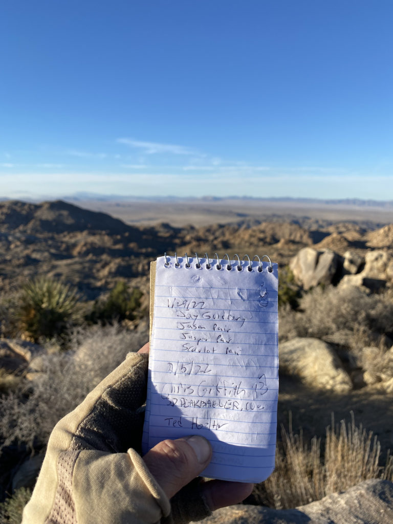
I then extended the invitation to the trip to Ted Markus and my college buddy, Ted Hoelter, both quickly said yes. What was going to be nice about this trip is all three of us will be vaccinated, making the trip far less stressful. Ted M. and I drove up to Ventura the night before and shared a hotel room, as neither of us wanted to wake up that early to drive up to Ventura Harbor. It was like pre-Covid.
Probably one of the biggest challenges of this hike was going to be the fact that Del Norte does not have any potable water, meaning we would have to carry enough water for the 3+ mile climb to the campsite, two meals, and the 10+ mile hike over to Scorpion Cove. By our calculations, we each needed to have about 6 liters of fluids. That is a lot of water weight.
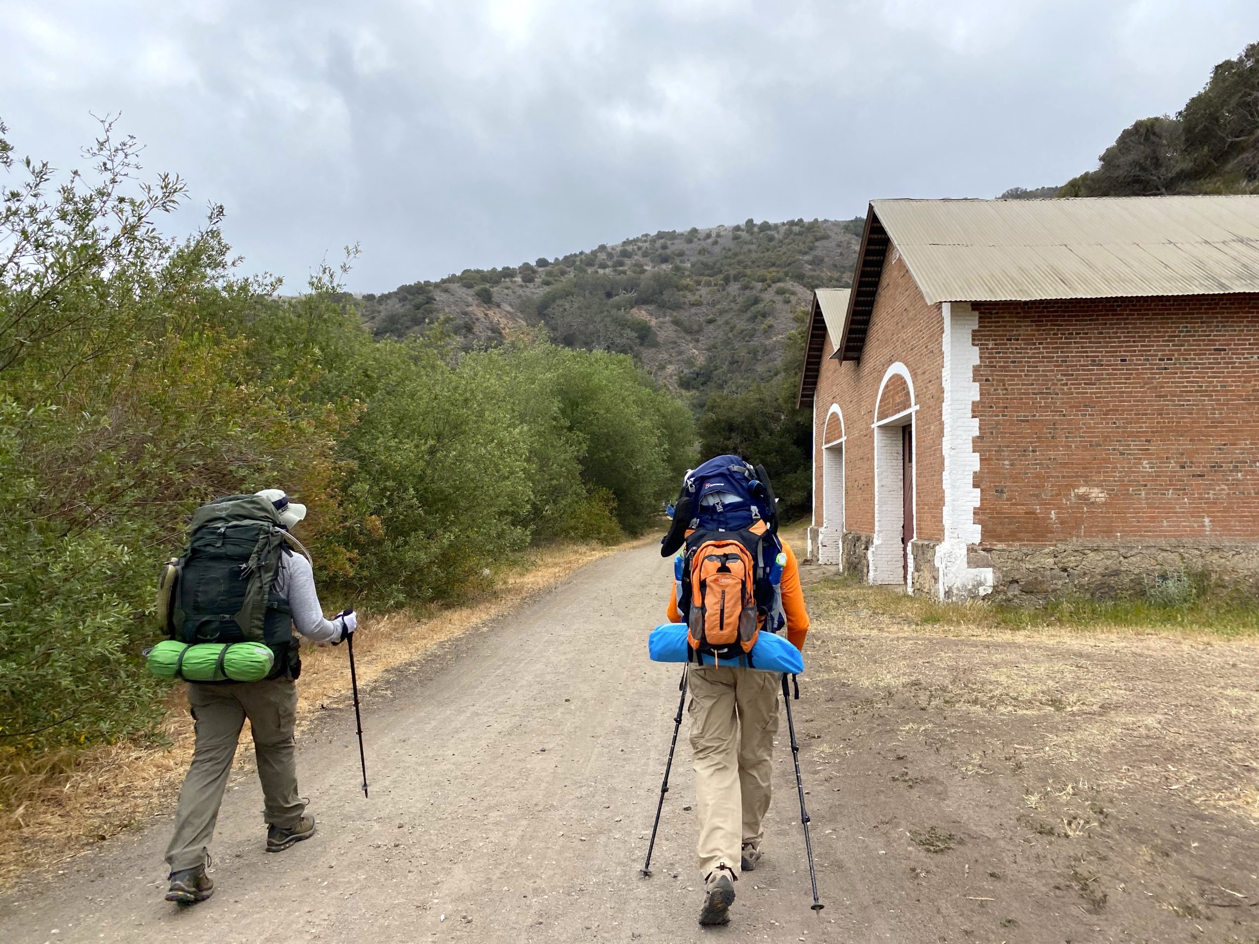
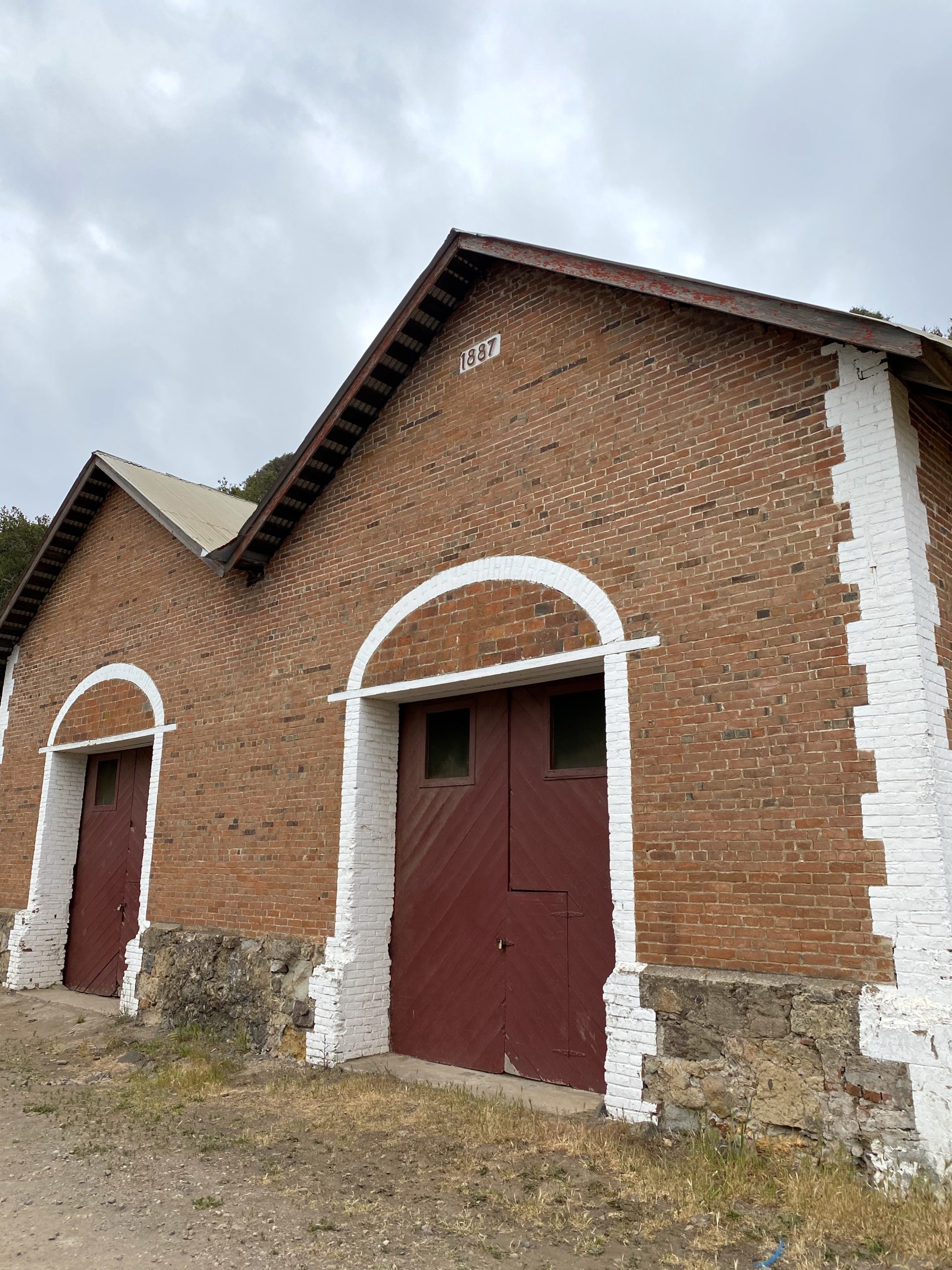
Ted M. and I grabbed breakfast at a café at the harbor before heading over to Island Packers’ dock. Our packs were weighed as there is a weight limit. In addition, our fuel had to be removed and stored separately, as did our water/fluids. I opted to put my fluids in my slack pack and keep it with me. Once on-board, we set off for the 1 ½ hour ride. The seas weren’t too bad, with just some light swell. We spotted some bottle-nose dolphins and a minke whale on the way over. Once we docked, we climbed the ladder up onto the pier and headed onto the island. The ranger was giving a briefing to the day visitors, most of whom were taking a guided hike onto the Nature Conservancy portion of the island. It seems the three of us were the only backpackers on this day. We found a picnic table and began to repack our packs. The ranger came over to us and gave us a short briefing and checked that we were properly prepared. With that we set off!
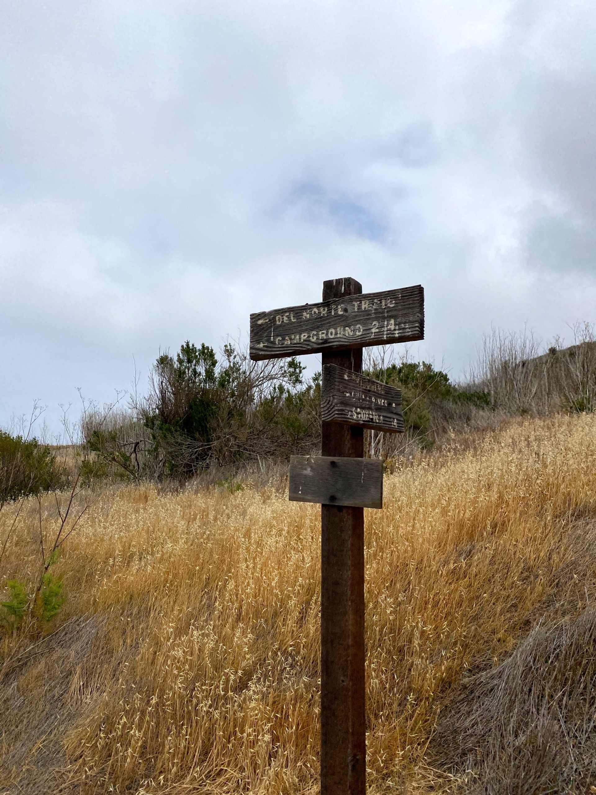
Ted M. and I had brought sandwiches for lunch. Neither of us was ready, so we kept them in our packs, figuring once we reached camp we would enjoy them. To get to the campsite, we followed the Navy Road for about 1.25 miles until it intersected with the Del Norte Trail. This first section was a fairly steady grade, but soon we would lose some of the 600 feet of gain, as the Del Norte trail would dip down into a ravine and back up. The skies were overcast and we would feel the humidity as we made our way up. From a recent YouTube video of this hike, I knew there was another picnic bench that would make a perfect rest stop. We slipped off our packs and took a nice break, enjoying the sweeping views. We debated having lunch here, but we only had one mile to camp, so we pushed on. Our climb continued until we reached the turn off to the campsite. We again slipped off our packs and surveyed the campsite. Not soon after, one of the island’s kit foxes trotted by. We decided to wait a bit to set up our tents as while currently we had the entire campsite to ourselves, in case someone was hiking over from Scorpion we did not want to have taken their site. We had our lunch and then enjoyed a nice nap for a bit. Around 5, we deemed that no one was coming, and we each took a site and set up our tents. I stayed in site 3, while Ted M. picked site 2, and Ted H. opted for site 1.
With our tents set up, we went for a short stroll up to the ranger’s house. While Gaia showed a loop, once we reached the residence, it was clear that the trail was no longer there. We returned to our camp and made dinner. I enjoyed one of the beers I had hauled in my pack as I ate my dinner. We watched the sun slip out from the cloud layer for a brief moment before sliding behind the island. We chatted around the table for a while, before storing our food in the bear boxes. I hung my pack from a nearby oak to keep some of the island’s animals from getting into it. I crawled into my tent and listened to some podcasts before drifting off to sleep. My only disappointment so far was, due to the cloudy skies, I was not going to get to enjoy the stars.
Thankfully, we had little wind throughout the night. We had read that it can get a bit windy here since it is an exposed campsite. As expected we all woke around 6. To conserve our water, we all had low-water breakfasts. I opted for oatmeal and one cup of coffee. We packed up fairly soon, as we figured we might as well start hiking while it was cooler.
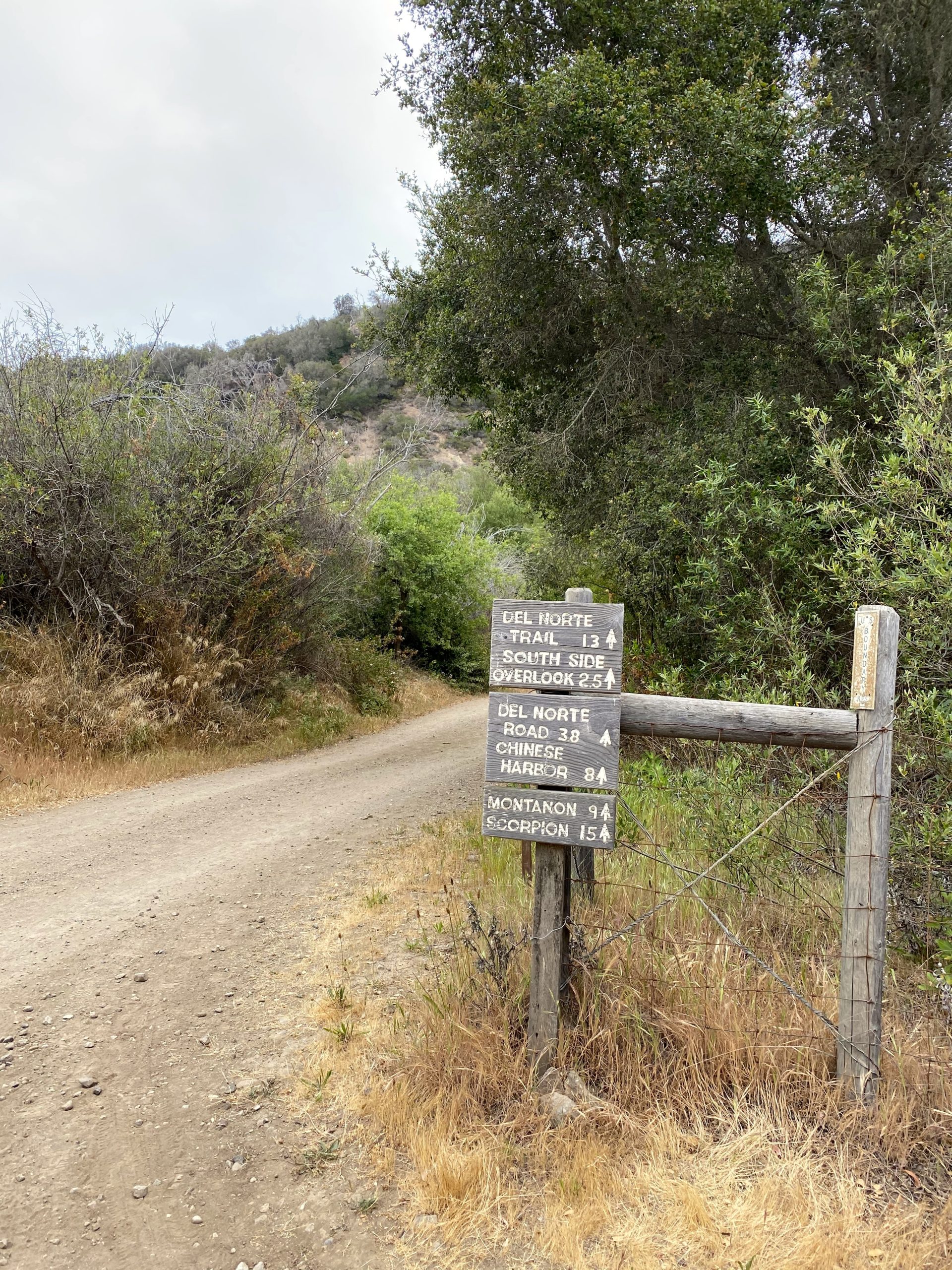
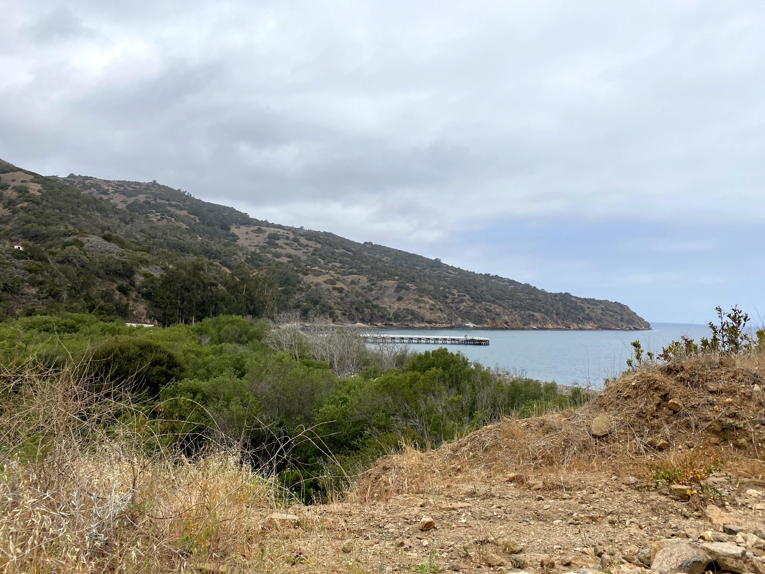
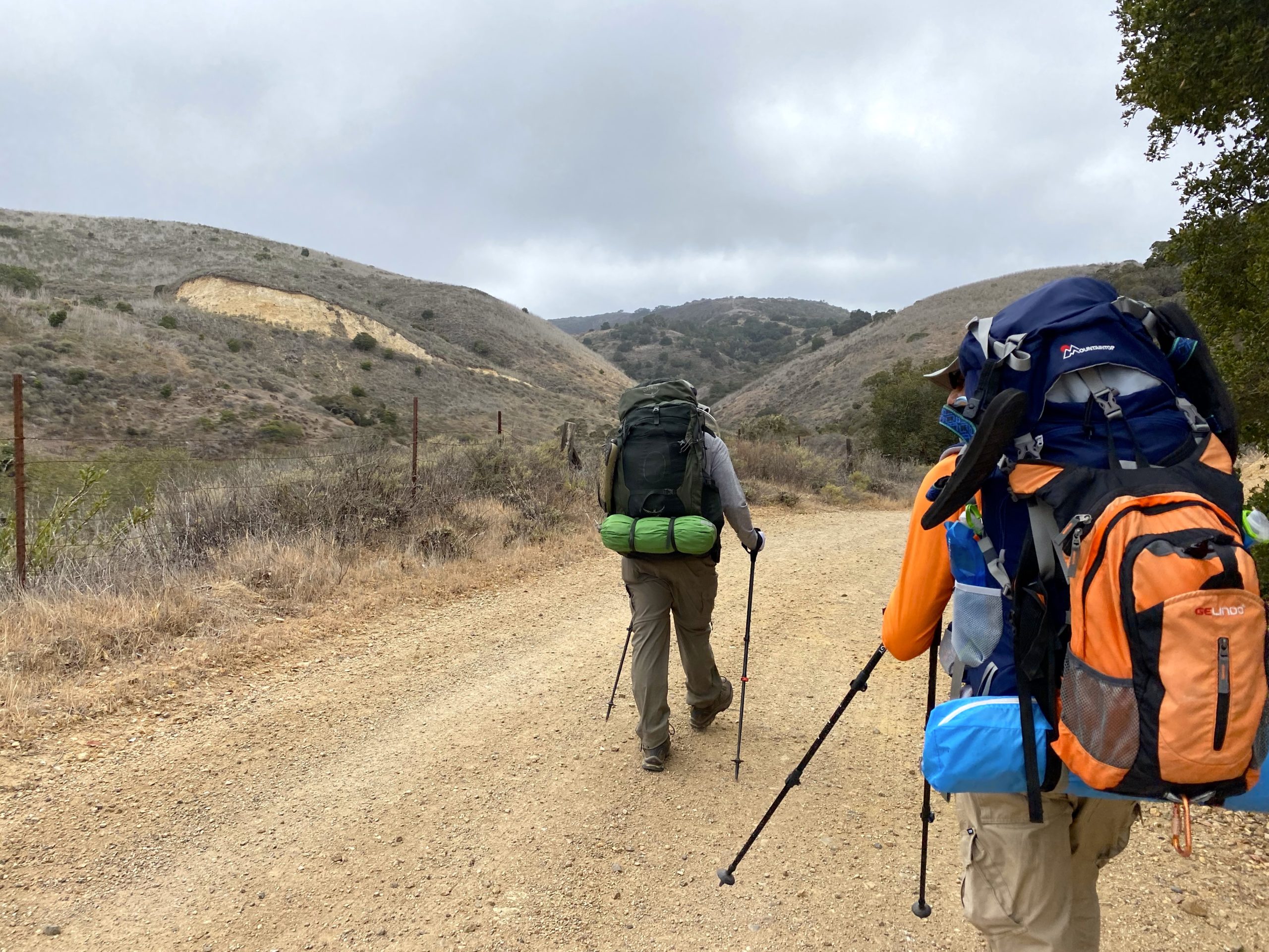
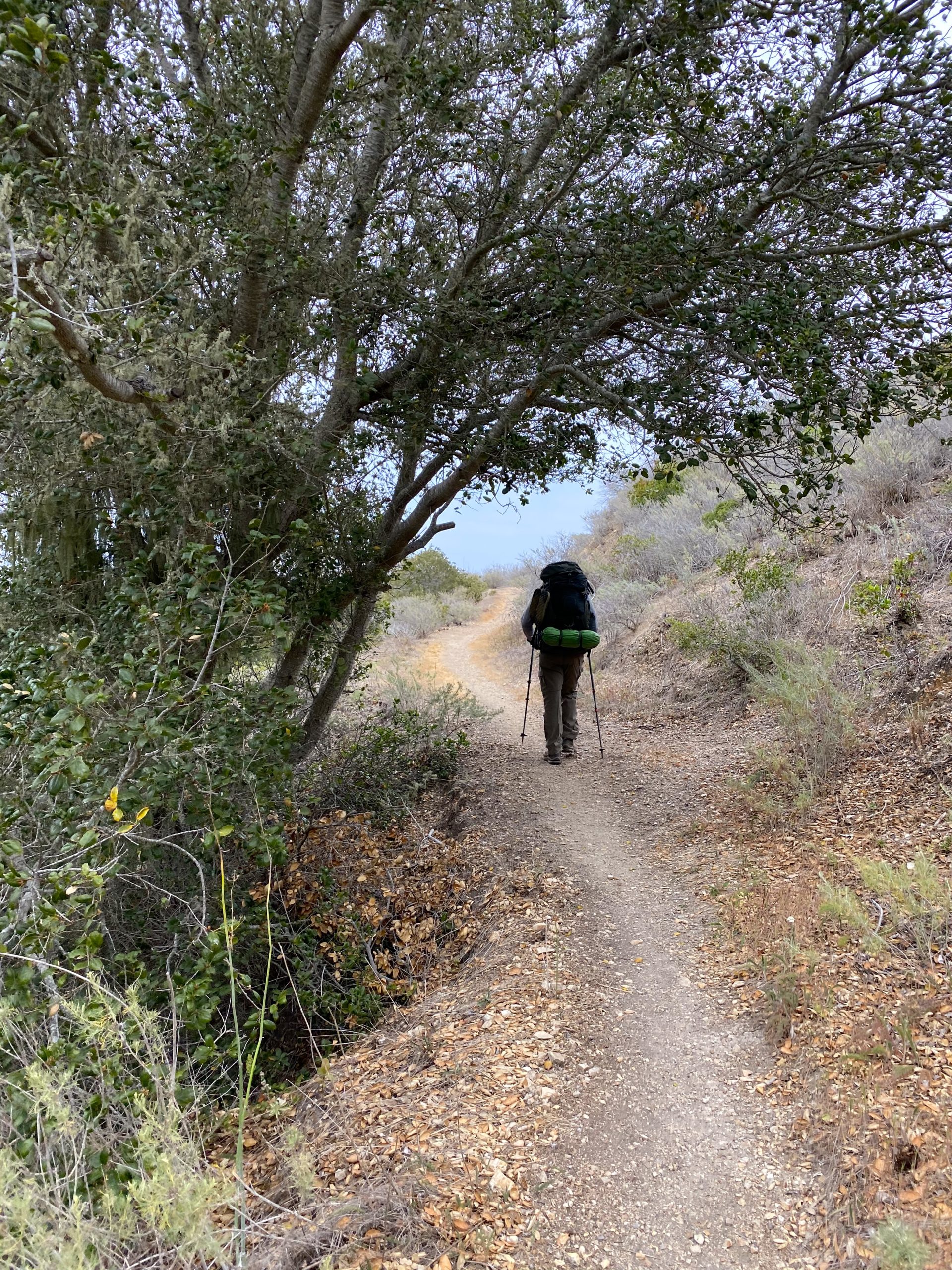
We made our way back onto the Del Norte Trail and began heading east until we reached the junction with the trail down to Chinese Harbor. From there we would connect with the East End Road and continue on. While we mostly were gaining elevation along the way, we did have a couple of ravines that dropped through. Although we each were lighter by 2 liters, our packs were still a bit heavy. The fog and clouds were all around us as we made good time.
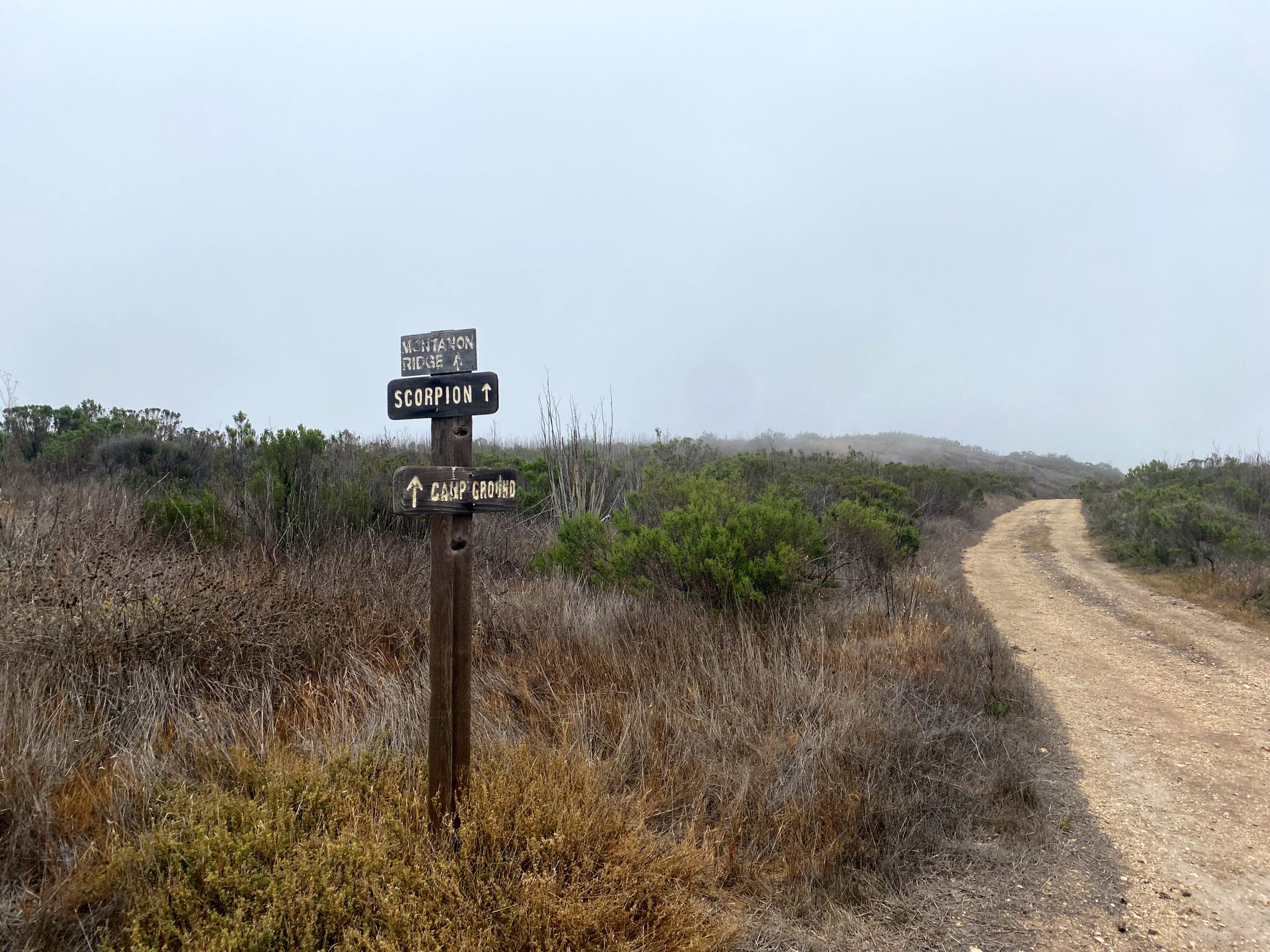
After about 4.5 miles or so, we came to another picnic bench. This one had seen better days, but it served as a welcome rest stop. We had a bit of uncertainty about the correct route, as Gaia showed a fork in the road, which we did not see. Ted H. and I scouted around and determined that the remaining road that we saw before us was the correct route. After a few minutes of traveling, we spied the overgrown road that we did not want to have taken. The Montanon Ridge stood before us. We debated which of the bumps was El Montanon, the peak I had hoped to summit. The road ended and our route returned to single track. We would now make the climb up the ridge. The Teds were a bit uncertain, but I knew that we would be fine.
We carefully made our way up the steep slope, given we did have backpacks on and our center of gravity was shifted. Once past the ‘hard’ part, we stopped and surveyed our ascent. Off to the side, a short use trail leads up to a viewpoint. Sadly, the fog and clouds hid the view, but it still made for a great photo op.
From there we continued on until we met up with the main trail. Looking off the east, we could see Anacapa Island in the distance. To our left, the main trail would take us down to the campsite for the evening. Off to the right was the use trail up to El Montanon. Looking at the map, this would be about .6 miles to the summit without too much gain. The reason I wanted to climb this summit as it is part of the Lower Peaks Committee list. This is one of the peak lists that I am now turning my attention to. In fact, it is known as the most expensive peak on the list. We followed the ridgeline, drawing close to a research station and its tower. However, the actual peak was one bump further. We were rewarded with some incredible views. Once at the real peak, we did not find a good spot for lunch, so we returned to the research station. After a nice break, we heard some day hikers making their way toward us. We greeted them and pointed out the location of the benchmark.
Once back at the junction, we opted to head toward another peak listed on Peakbagger — High Mount. This was an even shorter jaunt. While the main trail was just below us, the slope on the use trail was a bit too much, so we backtracked slightly. Now we had about 4 miles to descend to our campsite, where we’d find water. As we continued on, we would pass more hikers that had ventured up from Scorpion. It was quite the difference between the three of us with full backpacks and those just with some water.
The remaining miles went fairly quickly. We did have to decide if we wanted to enter via Upper Scorpion or via the route near the ocean. Upper Scorpion won. We passed various group sites, and there were a few solo campers as well. One camper inquired if we had come from Del Norte, and we said yes. She asked about the trail and its difficulty, as she was planning to hike over to it tomorrow. After giving her some details of the day’s hike, we wished her luck and continued on. We all thought about all the water she would be lugging.
We found our site and set up camp. We also enjoyed the fresh cool water from the nearby spout. I pulled out my water bladder from my pack and found it still had a liter left. After a rest, we went for a stroll down to the shore and actually had some cell signal. We checked in with our wives and did some other online things before heading back to our camp and having a well-earned dinner. We again sat around the table chatting for some time. Since two of the nearby sites were open, we borrowed one of the “bear” boxes to store our packs, as Ted H. and I have smaller tents.
Anyone who has camped knows that when the first light comes, you tend to wake up. Our last morning was no exception. Our ferry was not slated to arrive until 4, so we had almost a full day to explore. After a leisurely breakfast, we grabbed our slack packs and headed off toward Potato Harbor and Cavern Point.
We climbed up a draw near the edge of Lower Scorpion toward the bluffs. From there we followed it out to the Potato Harbor overlook. Although the skies were still overcast, we had some incredible views. We met a few fellow day hikers along the way. Upon our return, we went out to Cavern Point for some more of the incredible coastline. We then made our way off the bluffs and back to camp. We realized we had technically missed our check-out time, so we hustled back and broke camp. While someone had set up, we never saw them to apologize for not leaving on time. The nice thing about Scorpion is it has a lot of room for tents, so hopefully, they were not too impacted. We walked down to one of the other picnic tables near the pier and had lunch. We poked around the area, wandering through the visitor center and the other kiosks scattered around.
The ferry arrived on time and we walked down the new pier to board. In fact, this pier had only been open since January. On our return, we encountered more dolphins. The captain said we had a pod of about 200 around us, jumping and playing in our wakes. Shortly thereafter, we spotted two humpback whales — a mother and her calf. We watched them for some time before returning to our course and the harbor.
Once back at our cars, we changed into clean clothes and set off for dinner. It was a fantastic three days. Now to plan for my next backpacking trip!
Final Stats
Day 1: 3.1 miles, 1,100 feet of gain, 1:43 hrs
Day 2: 11.6 miles, 2,000 feet of gain, 6:43 hrs
Day 3: 5.1 miles, 652 feet of gain, 3:11 hrs
I am an avid peak bagger, sometimes backpacker, and former sea kayaker living in San Diego. I am the co-author of Urban Trails: San Diego, coming in Spring 2026!
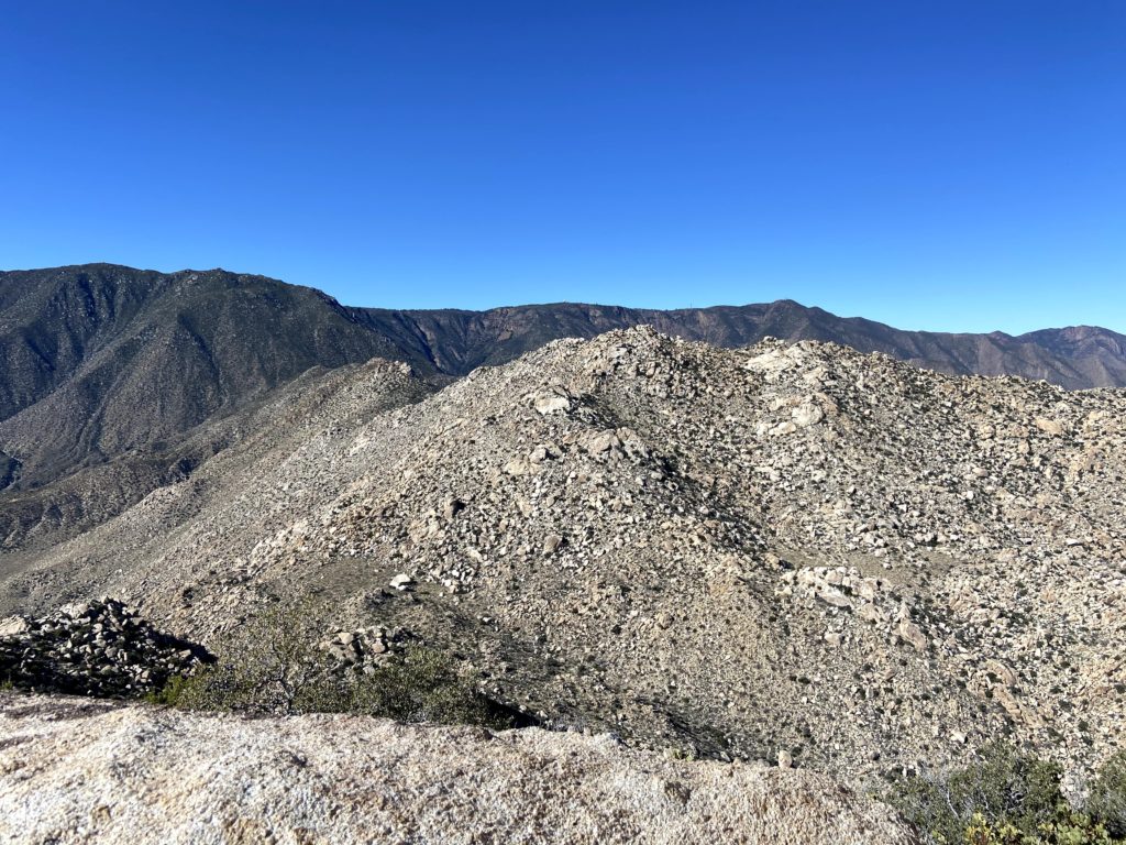
Whenever you talk to someone about the San Diego Sierra Club 100 Peak list, two peaks are always referenced as the hardest on the list – Red Top and Sawtooth Mountains High Point. In fact, my hiking buddy Matt Hannan referred to them as “Fun and Funner”. As I scoured over trip reports, reading of failed attempts to summit the pair, I knew that I truly had a mountain to climb. One of the challenges for these peaks is their remoteness compared to the rest of the peaks. While some might require some serious 4×4 driving to reach the trailhead, these peaks sit tucked within an area of Anza-Borrego known as the Inner Pasture. There are no accessible roads that can take you to the base of the mountain, so you are first going to have to hike in. There are three routes others have used in the past. One route begins in McCain Valley and descends down Pepperwood Canyon before reaching the Inner Pasture and the south face of the mountain. While the length of this route is not too bad, it does mean you have to climb back up the canyon after the summits. Another route climbers have used is to drive down Indian Gorge road, hike over a rocky pass, then onto the Inner Pasture. While this route does not have the big climb like the Pepperwood route, the crossing of the rocky pass twice (usually in the dark) is not fun either. The ascent up the peaks is usually the same south face as Pepperwood’s. The third option is to approach it from the north. This is an even longer route, but the hike to the base of the mountain is an easy one, through a nice canyon for about 3 miles, then across the flat Inner Pasture for another 3+ miles. Susie Kara and Matt Bennett had used this route last year with success. Now, a lot of climbers attempt these peaks as a long day hike, but some have started to treat them as an overnight trip. This was what Matt and Susie did, and I decided to follow their example for my attempt.
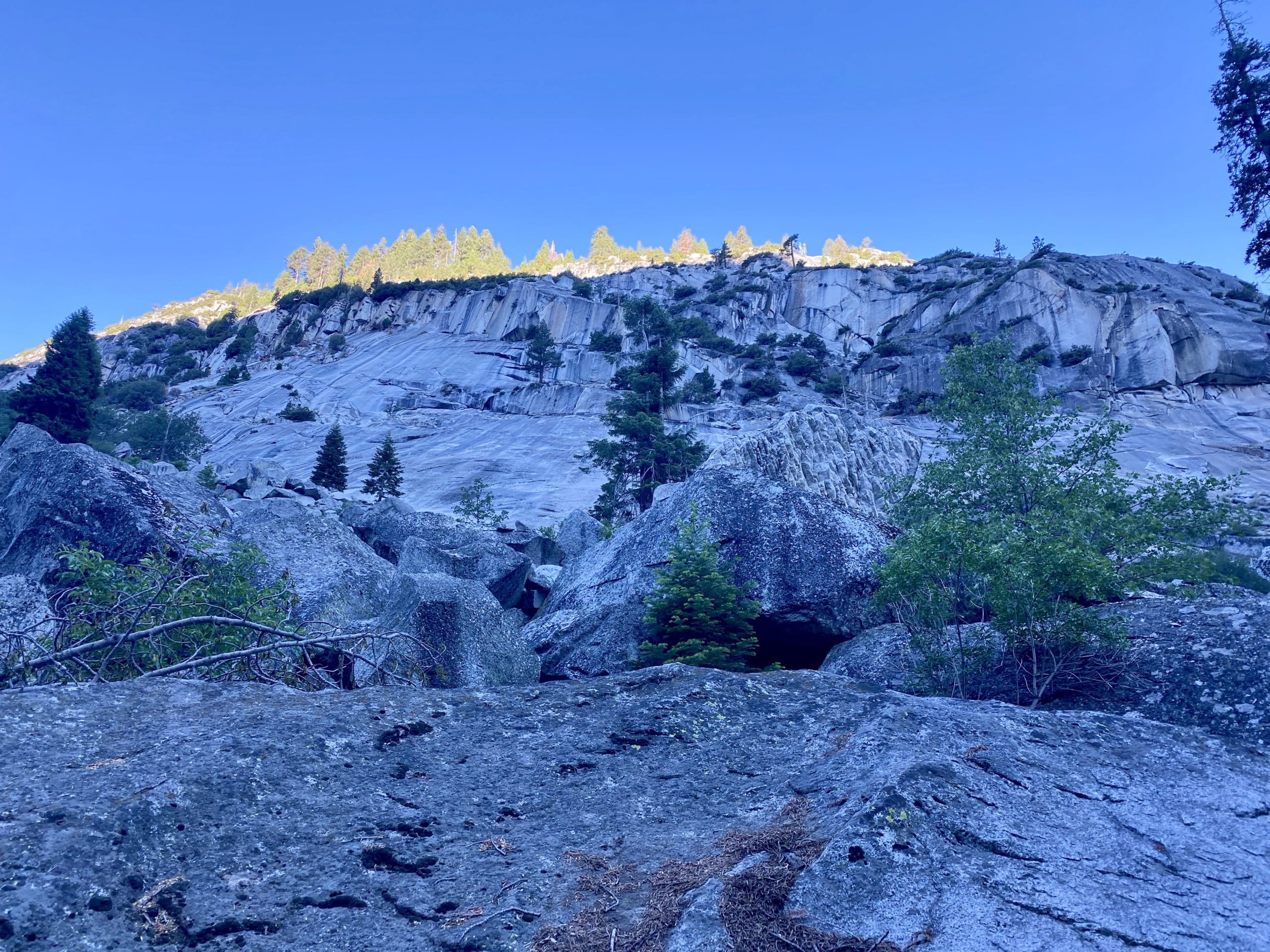
Sawtooth HP and Red Top from near False Sombrero
In addition to choosing a route, there is a very limited window in which you can try to summit these peaks. You need enough daylight to safely climb them, and also since they are relatively low, the desert heat becomes a factor as well. Mid to late February is usually the best choice. So, we began targeting the weekend of the 19th through the 21st for our attempt. My usual hiking companion Ted Markus was up for the challenge, as well as Susie and Matt. In addition, Greg Gerlach was up for trying this route as well. He had done these peaks three times before, once via Pepperwood and twice via Indian Gorge. He was curious to see if it was ‘easier’ with the third route. He also agreed to spend a second night and camp with us. We had a rock star team assembled, and I could not have asked for a better group of climbers to go with.
Since Ted and I were camping for two nights, we needed a bit more water than the 7 liters Susie and Matt used for the first trip. Rather than carry all that weight out at once, the previous weekend Ted and I made the 14-mile round trip hike to our planned campsite and cached about 10 liters between us. This also gave us an opportunity to see the start of the climb up close, as well as the crossing of the Inner Pasture. I was familiar with the canyon section, as it is the same route one uses to climb Stage Benchmark.
Red Top in the distance
We met Greg at the small turnout that we would use near the entrance to the unnamed canyon. We hoisted our packs onto our backs and set off. Ted certainly won the award for the biggest pack load. Although I had 4 liters cached, I still carried out almost 5 more liters. Matt and Susie were planning to join us later in the day. We wanted to take the hike out nice and slow – no need to race to the campsite. Since I am not an experienced backpacker, I did want to give myself enough time to set up camp in daylight.
The miles ticked off fairly quickly, with Ted & I stopping twice for a quick break. We wound up heading basically straight for the entrance to the drainage where we would camp. Not really a problem, but we had hoped to use the wash that we followed out the previous weekend. Oh well. Regardless, we still made the nearly 7 miles in 3:15 with fully loaded packs.
Once at the campsite, we dropped our packs and went off to recover our caches. There was a little bit of me hoping they were gone and I would not have to climb these monsters. But the bottles of water were safely recovered. No excuses now…
We set up our tents, keeping ourselves safely apart. Plus, no one needs to hear me snore. Matt and Susie came just as the sun was dipping below the ridgeline. We all chatted for a while, made our dinners, and agreed on waking up around 5:30 to set off by 6:30. As I lay in my tent, I went over the route in my head, recalling the satellite imagery to help as landmarks. While I knew Matt would be our guide for this hike, I still needed to take responsibility for my own safety if I needed to navigate for whatever reason.
A quarter moon lit up the night sky as I lay in my tent trying to fall asleep. My mind kept going over the challenge of tomorrow’s hike. Sleep did come, although fitfully. I woke to the predawn glow and quickly boiled some water for a hot cup of coffee. I had packed my slackpack the night before, so I was basically ready to go. We all were soon up and getting ready for a long day. We could see the sunlight begin to illuminate the summit of Red Top. To the north, the sun’s rays cast a golden glow across the Inner Pasture as I ate my breakfast.
The plan was to ascend up the drainage to the saddle between Red Top and Sawtooth, climb Red Top, which is usually considered the harder of the two, return back to the saddle and climb up Sawtooth, then return back down to the saddle and follow the drainage back to camp. I put all my remaining gear in the tent for safety and to give it some extra weight as the forecast had some winds predicted. The temperature was forecast to be in the low 60s, so I dressed fairly light. I had on one extra top layer, as we would be in the shade of the drainage for a while and it was in the mid-40s when we set off. That is another reason this route has some appeal – the fact you will be in the shade for some time while hiking.
With Matt in the lead, we set off up the drainage toward the saddle. Our route was a mixture of sand, rocks, brush, and cacti, and it took some effort and looking ahead at the route to find the easiest path. After about an hour, we took a short break and shed a layer.
Soon, the summit of Sawtooth also came into view to the south as we drew nearer to the saddle. It was clear to see why these peaks are so difficult – their slopes are nothing but a jumble of boulders and brush. There is no easy ridge line to follow, just a combination of your route-finding skill and a dash of luck.
Once at the saddle, we took an extended break. It had taken us just slightly over 2 hours to cover the 1.8 miles with about 1,200 feet of gain. We cached some water for later under the shade of a large boulder, as there was no sense in hauling it up and down Red Top.
We could see the summit from the saddle and I put my trust in Matt to find a way through what seemed an impossible climb. About halfway up, we reached a small plateau, which let us have a short breather, as the next section increased in difficulty. We stored our trekking poles, as the climb now required the use of our hands. As we worked our way up, the views to the southeast were spectacular. Finally, after an hour and a half to cover the ¾ of a mile with over 800 feet of gain, we were at the summit of Red Top.
We mostly hung out in the cave at the summit, enjoying some snacks, signing the register, etc. This was Greg’s fourth time on Red Top, he commented that was the easiest route he had ever had up from the saddle. We still had a long day ahead of us, however. At the summit, I discovered that I had lost one of my trekking poles during the ascent. They had gotten snagged on some brush at one point and it must have pulled the pole out of my pack. Crud! Hopefully, we would be able to retrace our route and find it, otherwise, I would have issues. I had also noticed the possible formation of a blister on the tip of one of my toes. Yup, a blister had formed. I took care of it, hoping it would not impede me. From the summit, we could see our next peak. There is just over a mile between the two summits, but it would take us almost three hours to cover it (including another break back at the saddle). That should give you an idea of the difficulty of these peaks.
Sawtooth HP from Red Top
We set back down toward the saddle, and sure enough, Matt spotted my missing pole. That tree must be related to Charlie Brown’s Kite Eating Tree! I was glad to have it back. My usual hiking pack has straps for my trekking poles so they would have been secured, but alas this pack does not. Something to address the next time I use that pack.
The breeze had started to pick up, which was fine, as we would no longer have any shade for a while. We gathered our cached fluids, had a nice snack, and reviewed the basic route that we were going to take up toward Sawtooth. Unlike Red Top, which is basically a direct approach, Sawtooth requires bypassing a peaklet. On the ascent, we stayed on the south side of it. This certainly took some care to navigate through the boulders. In addition, portions of this climb are sandy, but not like you would know by looking. If you have ever climbed up a steep sandy slope you will know that it is hard and draining. I started to feel my energy dropping as I made my way slowly up. Matt scampered back down to me and offered to carry some of my pack items to lighten the load. It wasn’t much, but enough to help me along.
I would look at the map on my phone, and see that we were closing in on the summit. I could almost taste it. When I arranged this attempt, I let the group know that if I ran into issues or was too slow, I would abandon trying for Sawtooth. Now, though, the summit was just a few hundred feet away. We came up the south side, and just as we did the winds began to roar. Those 40 mph gusts that were predicted came true. Carefully crossing an exposed section, Ted and I sat atop the south side of Sawtooth. I was in a bit of a daze. I had done it! The reality didn’t hit me until the next day, and in part, I knew that right now, I still needed to get down from the peak. We had a snack and I proudly signed the register. Since we had cell service, I texted my family the good news. Once we had recovered a bit, we clambered over some more exposed boulders to the northern side of the summit. Susie had kindly signed us in on the register located there, as neither of us wanted to scramble up.
Matt took us down a slightly different route from the summit, in part to see if we could avoid the troubles we had on the south side of the peaklet. So, we worked our way around the northside, and overall it was a better choice. Again, a HUGE thank you to Matt and his talents. Once back at the saddle, we took another break under the shade of a large boulder. Since Susie and Matt had hoped to hike out that evening, they bid adieu and they set off down the drainage. Greg, Ted, and I began our descent. Our route finding was pretty good, we would stop and readjust our track from what we recorded on our ascent, but nothing critical. Our only real issue was Ted hit his head on a boulder and had a small scrape that he had to attend to.
The sun dipped below the ridgeline as we drew nearer to camp, but we knew that we were almost done so we had no worries. When we arrived, we discovered that the wind had blown over my tent and moved Ted’s as well. There was no damage to either (except Ted did lose a tent stake). Once we had restored our tents, I quickly ate my dinner and called it a night, as did Greg and Ted. I was spent from the day. That was the hardest hike I have ever done to date. Palm and Elder were a close second, but these two peaks beat them. The stats for the day were 6.6 miles in 10:50 hours with 2738 feet of gain. If I ever revisit these peaks, I will do them as single peaks. In part, I would like to enjoy the summits more and not worry about the other summit.
We woke around 6 the next morning and started to break camp. While enjoying my morning coffee, I started to feel prouder about my summits. I knew it was still going to take a few days to fully process it. We enjoyed how much lighter our packs were without all the water and food we carried in. We set off just after 7 back toward the cars, and this time we did find the wash we used last week, making some great time crossing the Inner Pasture. We reflected on yesterday’s hike, and Greg commented that he felt the south approach is still slightly better. The primary reason is the easier exit off of Sawtooth.
On the way out, we encountered two hikers headed out to attempt Red Top. They were going to use the south approach, so they had quite a hike across the Inner Pasture. We asked about what their water load was, and they replied 4 gallons. Yikes! That is a lot of weight. They also planned to camp and attempt it the next day. We wished them luck and parted ways.
Once back at the car, we changed out of our hiking clothes into some clean clothes. Greg said goodbye and to keep him in the loop for my final hikes. Ted and I then drove a few minutes to the Agua Caliente Store and bought some well-earned ice cream sandwiches for a second breakfast. Over the three days, we hiked nearly 20 miles.
Now onto the final three!
I am an avid peak bagger, sometimes backpacker, and former sea kayaker living in San Diego. I am the co-author of Urban Trails: San Diego, coming in Spring 2026!
Well, it finally happened, I went backpacking! I had finally reached a point where some of the peaks I want to summit are more than a long day hike. Susie Kara suggested testing out my setup at Crystal Cove State Park. I booked a spot at the Upper Moro campsite. Throughout the week, I kept a close eye on the air quality. The plan was to start after work, hike back to the site, spend the night, then head back down. I got to the state park around 5, spoke to the ranger, and asked about the conditions. She said it wasn’t too bad, and agreed if we opted to leave the trail is easy to follow in the dark.
Ted Markus graciously decided to join me. We hit the trail right at 5:30, packs strapped to our backs. Our route wandered up through Moro Canyon. After about a mile, we reached the East Cut Across trail to begin climbing up toward the ridge.
Bring the Outdoors to Your Inbox
Sign up for our email and stay up to date on my adventures.
Here is where we would earn the beer we packed! Over the next mile, the trail would gain about 700 feet. Once on the ridge, we passed through Lower Moro Campground. We snapped a few photos of the view and continued on, as our campsite was about another .85 miles further.
We arrived at sunset and quickly set about setting up camp. We had the entire campsite to ourselves, so we did not need to camp next to each other. Once the tents were up, we enjoyed our sandwiches and beer. We chatted for a while, then turned in for the night. In many ways, this was going to be the real test for me.
My sleeping pad and tent worked well. While not the best sleep, I woke just after 6. I had a granola bar and some oranges while I broke down my gear. We loaded our packs and headed back down. A few early morning mountain bikers were testing their calves climbing the ridge, and some others were enjoying the trails.
We soon found ourselves back at our cars, knowing that we were ready to attempt a real backing trip once it was safe to do so. I quickly changed shirts and headed off as I had a 9:30 meeting.
I am an avid peak bagger, sometimes backpacker, and former sea kayaker living in San Diego. I am the co-author of Urban Trails: San Diego, coming in Spring 2026!