Blue Sky to Lake Poway

Decided to knock out another on this year’s Coast to Crest Challenge by hiking the Blue Sky – Lake Poway Loop. There were a few spots left in the parking lot around 7:30. I grabbed my gear and headed down the Torretto Trail to connect with the Green Valley Truck Trail. Once I reached the junction with the Creekside Trail, I opted to take it this time. The last time I hiked this loop, I stayed on the GVTT. The Creekside Trail was more trail-like, as it paralleled the GVTT. If there was some flow in the creek, this little section of trail would be fantastic, but the biggest concern is the large amount of poison oak along the sides of the trail.

Once the trail reconnected with the GVTT, I continued eastward until I reached the Lake Poway Trail. Now I would start climbing up toward the lake. This time I opted to circle the lake in a clockwise manner to make sure I had a little shade as I made my way around Lake Poway.

Along the way I snapped my needed selfie for the challenge and continued on. As I neared the Lake Poway parking lot, a group of hikers asked if this was the way to the “Potato Chip”. I gave them direction and silently shook my head at their lack of preparation. A new art installation of some “big” chairs were another stop along the loop. The trail then snaked its way back down toward the GVTT. Once back on the GVVT, I cruised back to the parking lot, covering the 5.3 miles in 1:41. Three more hikes to complete the challenge!


Buy Me a Coffee at ko-fi.com

I am an avid peak bagger, sometimes backpacker, and former sea kayaker living in San Diego. In 2019, I became the third person to complete the San Diego 100 Peak Challenge. Not stopping with that accomplishment, I set my sights on the harder San Diego Sierra Club 100 Peak list, which I completed in 2021. In addition, I have conquered several Six-Pack of Peaks challenges (SoCal, San Diego, Central Coast, and both the Arizona-Winter and Arizona-Summer). Beyond attempting the San Diego Sierra Club 100 Peak list a second time, I am looking forward to exploring new summits and new adventures across the southwest. 

Volcan Mountain (via 5 Oaks Trail)

This year’s Coast to Crest Challenge is a collection of their 5 favorite hikes from previous challenges; Volcan Benchmark, Santa Ysabel East, Blue Sky Preserve, Raptor Ridge and Bernardo Mountain. I figured I should start with the “Crest” of the trail, and that was Volcan Benchmark. This was going to be a solo hike as Ted was working and Susie had family obligations.

There were a few cars at the trailhead, less than I expected for the holiday weekend. I cruised up the main trail until it reached the Five Oaks Trail. This year’s challenge does not have fixed “selfie spots”, so I found a nice view and took one.

The rest of the hike to the summit was mostly uneventful until just near the summit. I was “chasing” down a pair of hikers ahead of me. When they stopped for a bit, and I caught up to them, they pointed to the small rattlesnake on the side of the trail. Since we were back on the main trail, there was plenty of room to walk past it.

At the summit, I snapped a few photos before heading back down. As I looped around the east side of the summit, I spotted a bench I did not recall being there the last time. I took a quick look but wanted to keep on moving.

The descent went quickly, and I let hikers heading up know I had seen a snake today. Soon I found myself on the gravel road heading to the trailhead. My final stats were 5.2 miles in 2 hours flat, just one minute off from last time. I had thought about getting another one of the Coast To Crest Hikes done, but it was warming up, and I did not want to push it.


Buy Me a Coffee at ko-fi.com

I am an avid peak bagger, sometimes backpacker, and former sea kayaker living in San Diego. In 2019, I became the third person to complete the San Diego 100 Peak Challenge. Not stopping with that accomplishment, I set my sights on the harder San Diego Sierra Club 100 Peak list, which I completed in 2021. In addition, I have conquered several Six-Pack of Peaks challenges (SoCal, San Diego, Central Coast, and both the Arizona-Winter and Arizona-Summer). Beyond attempting the San Diego Sierra Club 100 Peak list a second time, I am looking forward to exploring new summits and new adventures across the southwest. 

Half Dome

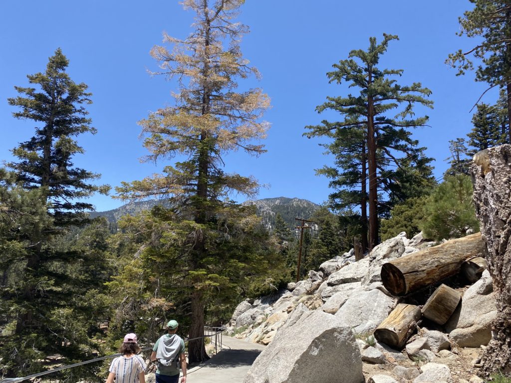
One of my bucket list hikes has been to stand atop Half Dome in Yosemite. I got close in 2018, but having turned my ankle in the dark on the way up, I knew it would not be safe for me to continue past the Sub Dome. Ever since then I have been applying for a permit to attempt the hike again. This year I finally won the lottery and got my permit! Unfortunately, Ted would not be able to join me again as he and his family were at West Point to drop off their son. Susie, however, was free and happily agreed to join me.

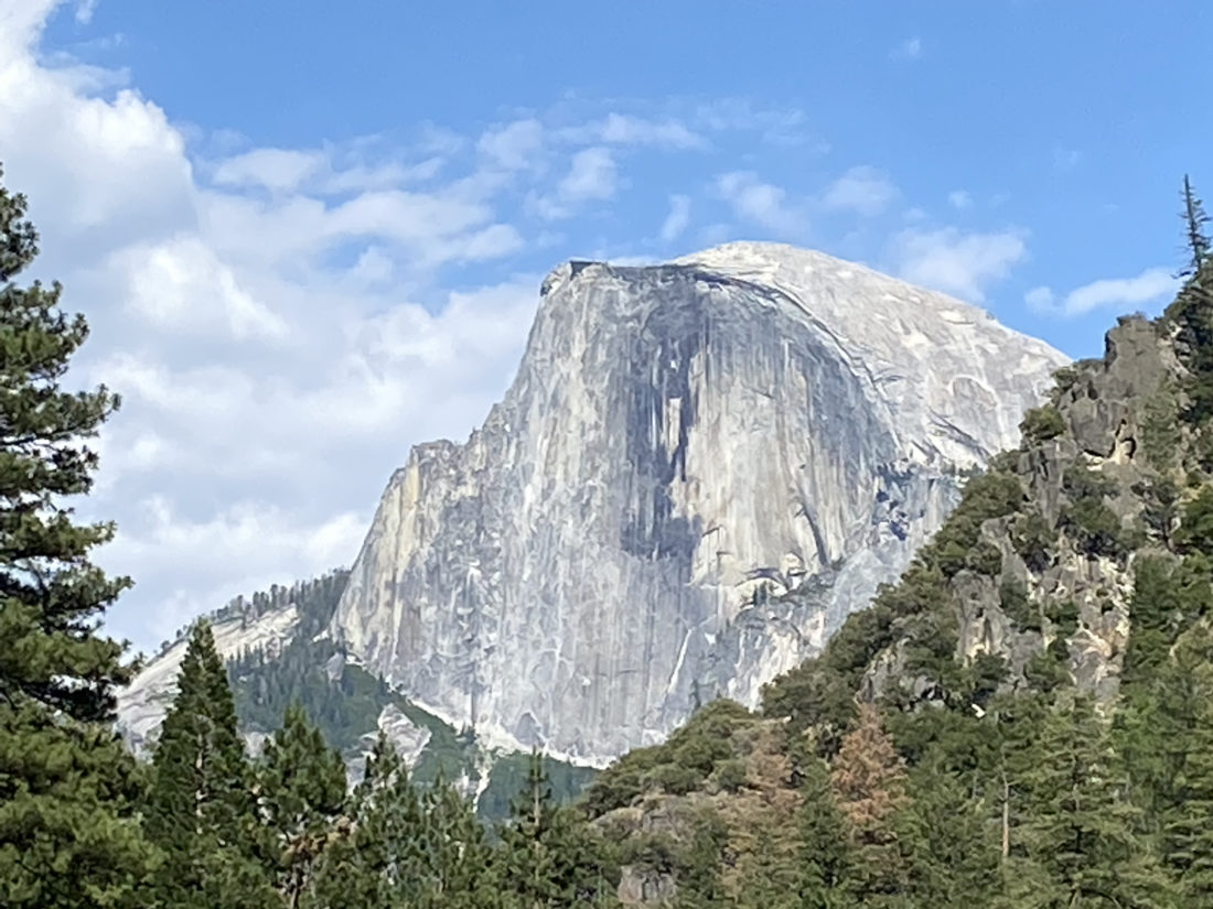
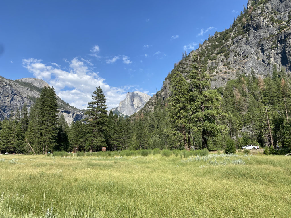
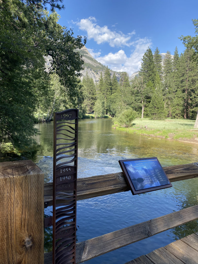
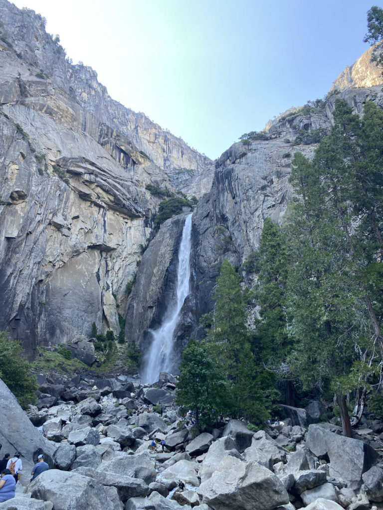
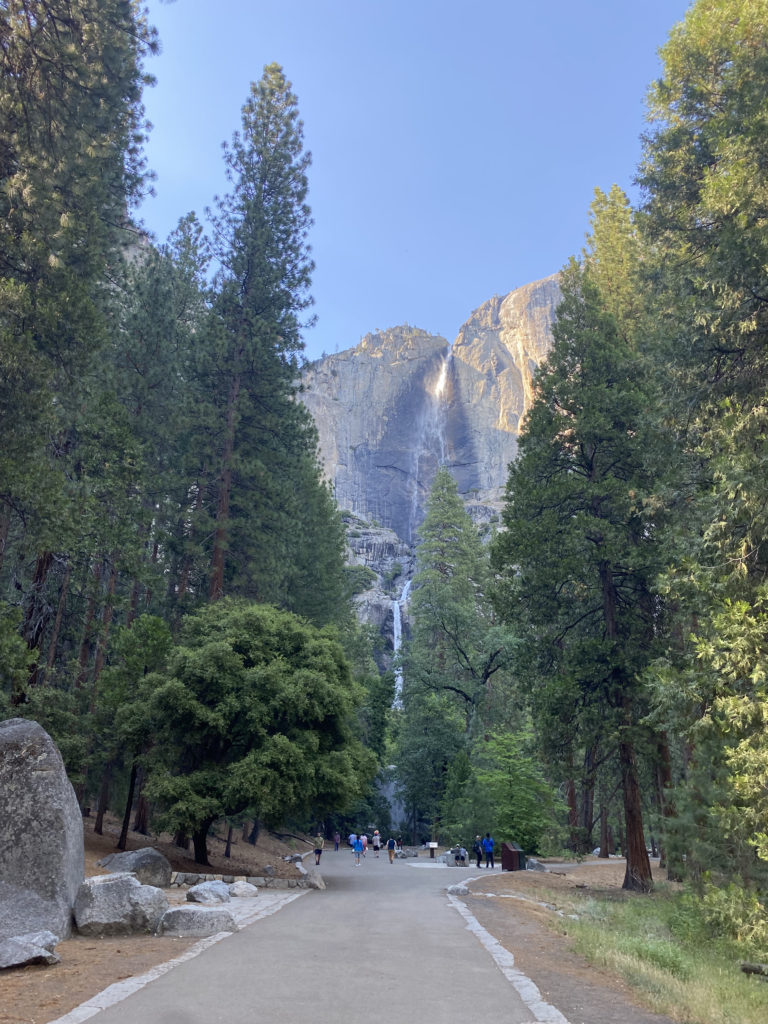
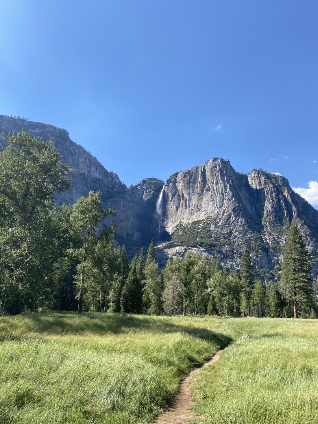
My permit was for Monday, so we drove up to El Portal on Sunday. We left a bit on the early side, mostly to avoid LA traffic. After checking into the motel, we drove on toward the valley. Susie had just purchased new shoes and wanted to get a couple of miles in before the big day. Yosemite is now on a timed entry system, meaning you have to have a reservation between 6:00 am and 4:00 pm to enter the park. As we neared the entrance, we were 7 minutes early. I was hoping the ranger would let us enter, given I did have a permit for tomorrow, but they still made us turn back around. So, we drove back a bit until it was safe to make another U-turn. This time we arrived after 4:00, so I just showed my Annual Pass and drove on in.  It was just over 90° F on the valley floor, so we were not looking for anything too adventurous. We found a parking spot with almost no trouble. As we crossed over the valley toward Yosemite Falls, Half Dome stood majestically to our east. Its timeless shape stood lit in the afternoon sun. After taking a nice loop to see lower Yosemite Falls, we returned to the car. Susie said the shoes felt good and gave them the green light for tomorrow’s adventure. 

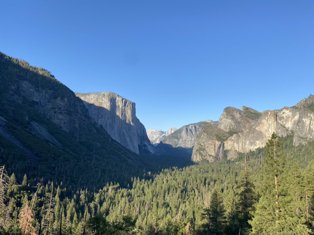
After making a stop at the store to see if there were any souvenirs we wanted, we drove up to Tunnel View to take in that classic vista of the valley. For dinner, we decided to try the new Basecamp restaurant. Unfortunately, both our sandwiches were barely edible. In fact, Susie just ate the fries and the biscuit that served as a bun for her chicken sandwich. 

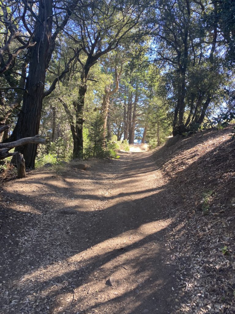
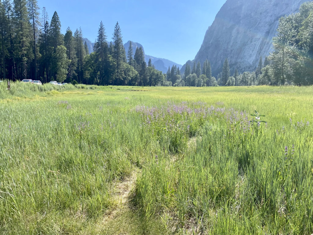
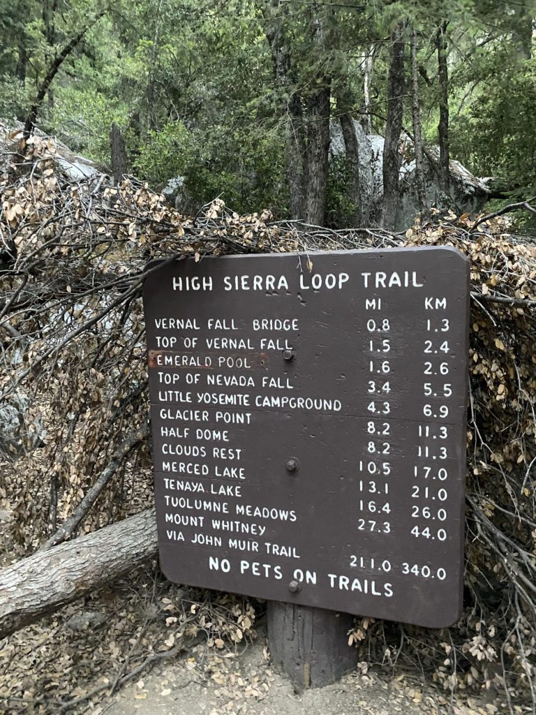
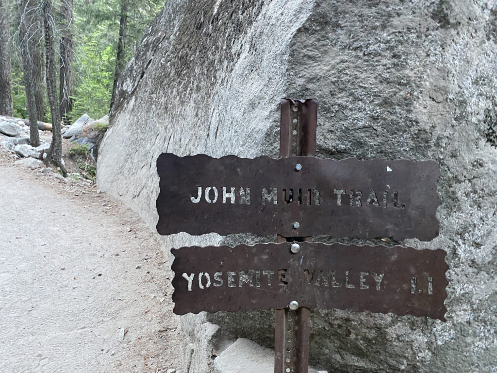
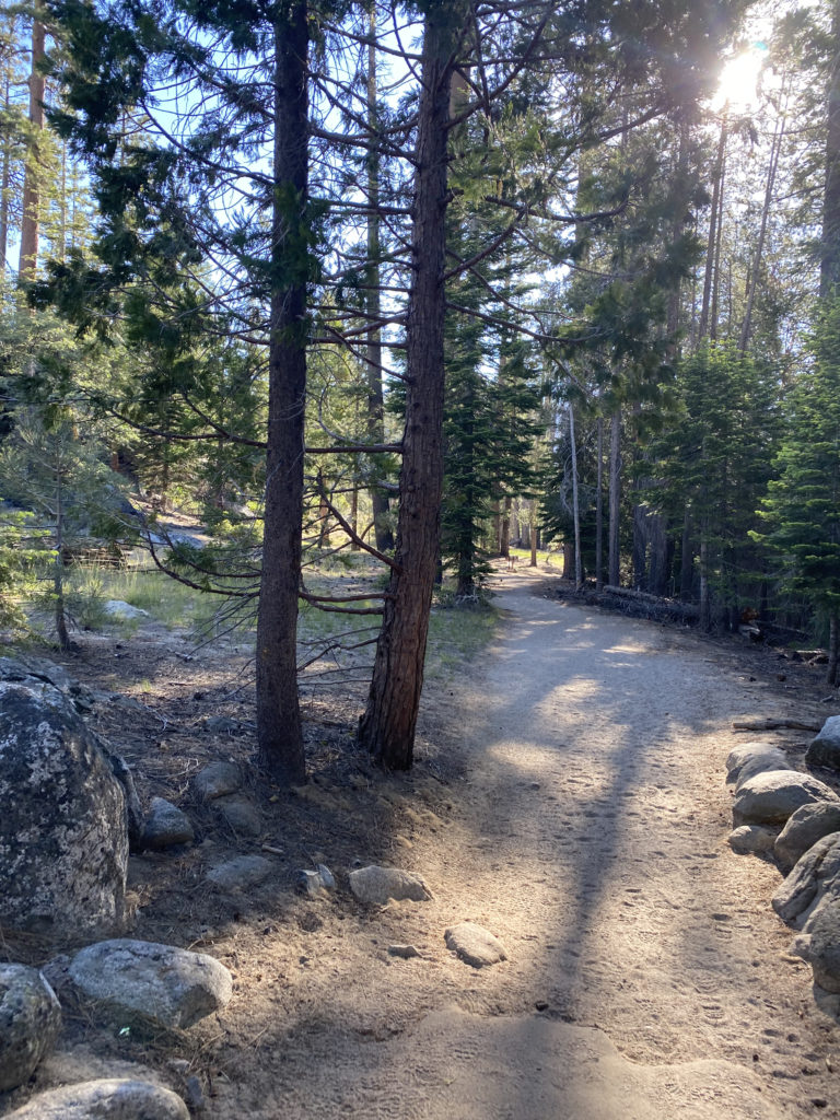
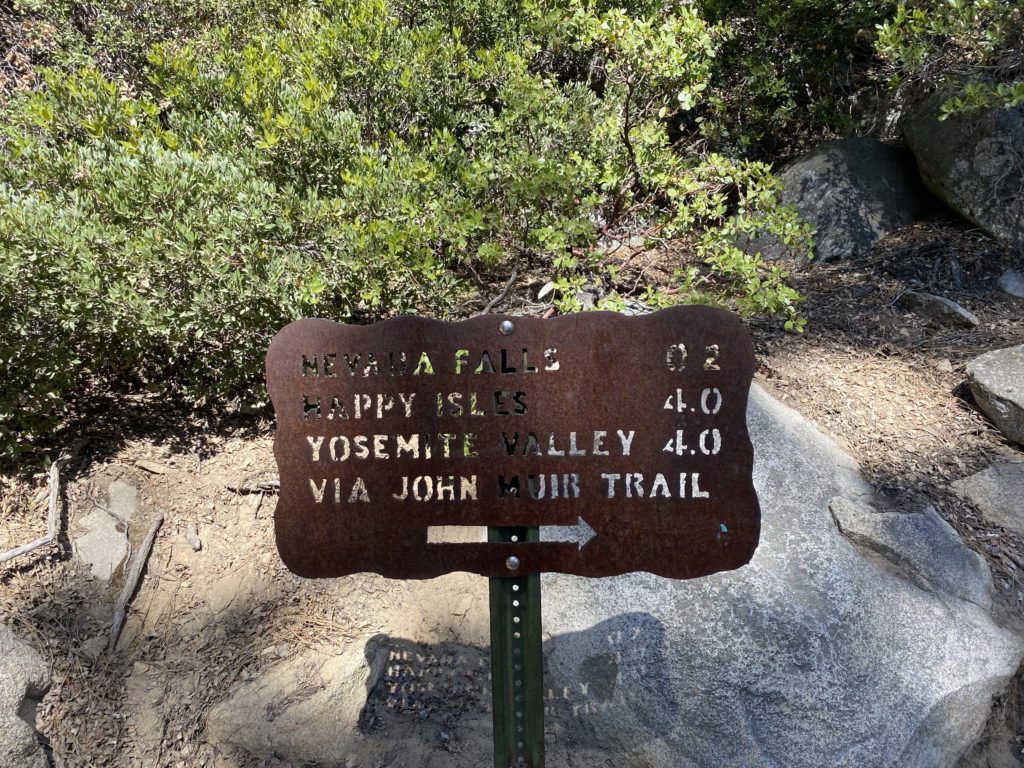
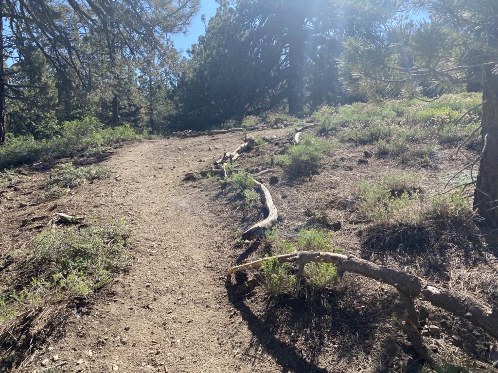
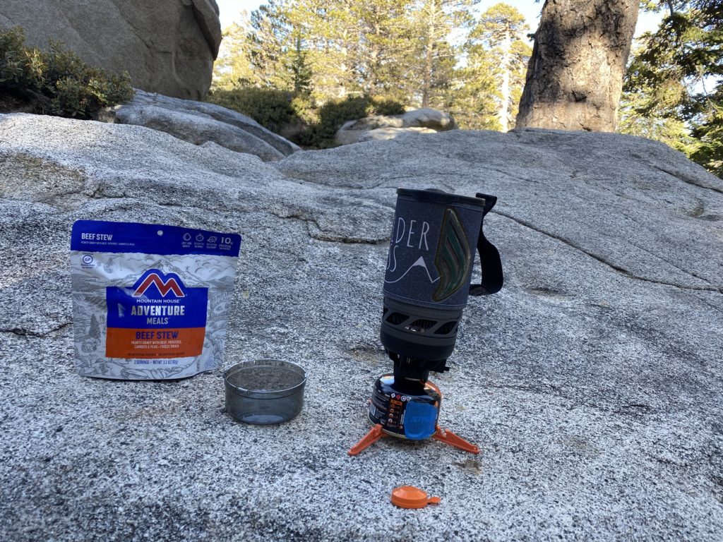
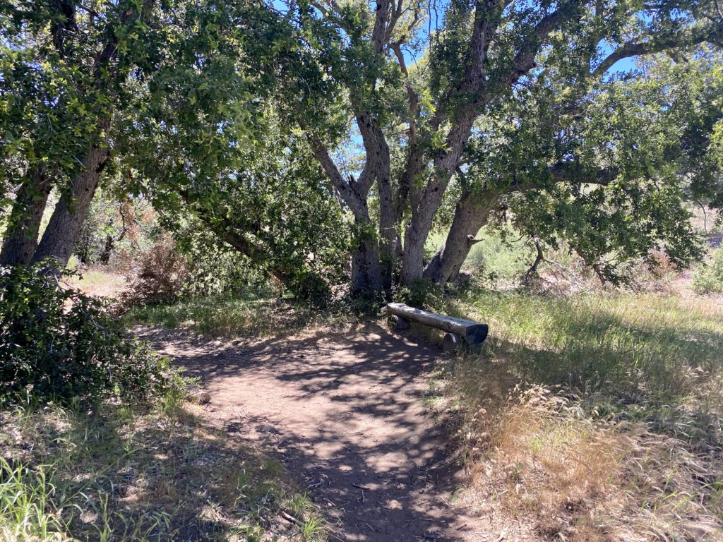
Once back at the motel, we reviewed our strategy for the hike and set an alarm for 4 am. This time I wanted to start in daylight to hopefully avoid any missteps like last time. Another difference from the last attempt was we planned to filter water several times during the hike, which would keep our pack weight down. Given the predicted warm temperature, this probably meant having to carry around 5 liters. The day before, we had stopped in Oakhurst and grabbed some muffins, bananas, and orange juice for our breakfast. I certainly am not going to find my usual pre-hike breakfast of a sausage biscuit and hash browns. The parking lot was about 60% full when we pulled in. As we gathered our gear, I drank down a liter of water to start off nice and hydrated. Once we were ready to go, we set off down the path toward Happy Isles and the start of the Mist Trail/John Muir Trail (JMT). After hiking about 3/10 of a mile, we came to the Happy Isles bus stop and made a quick bio-break here. As we crossed over the stone bridge that spans the Merced River, the hike would now “formally” begin.

​​Section 1: Mist Trail

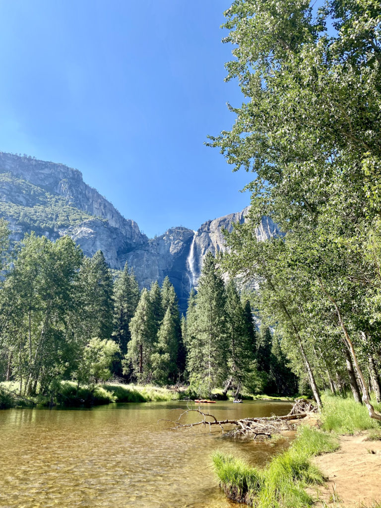
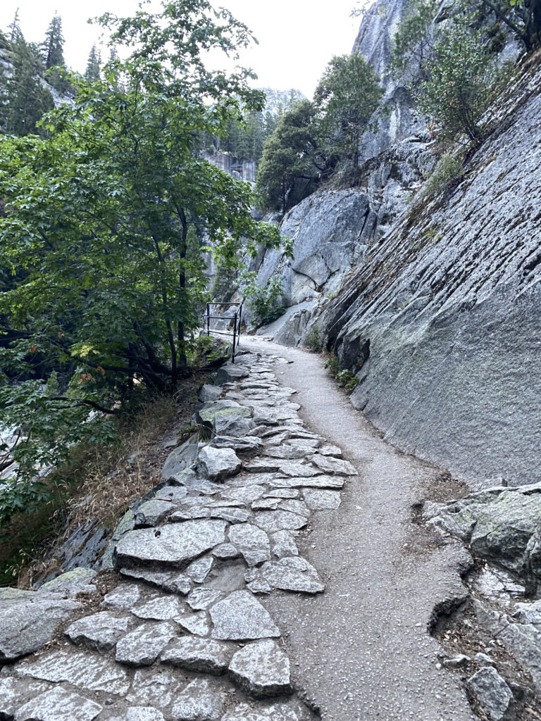
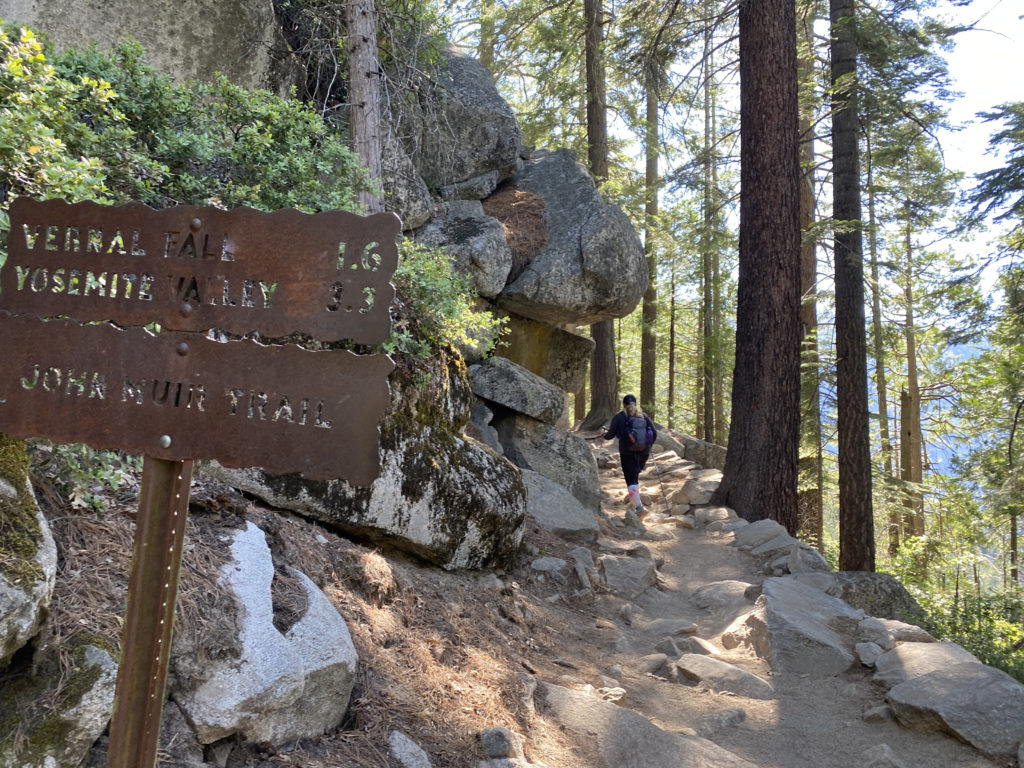
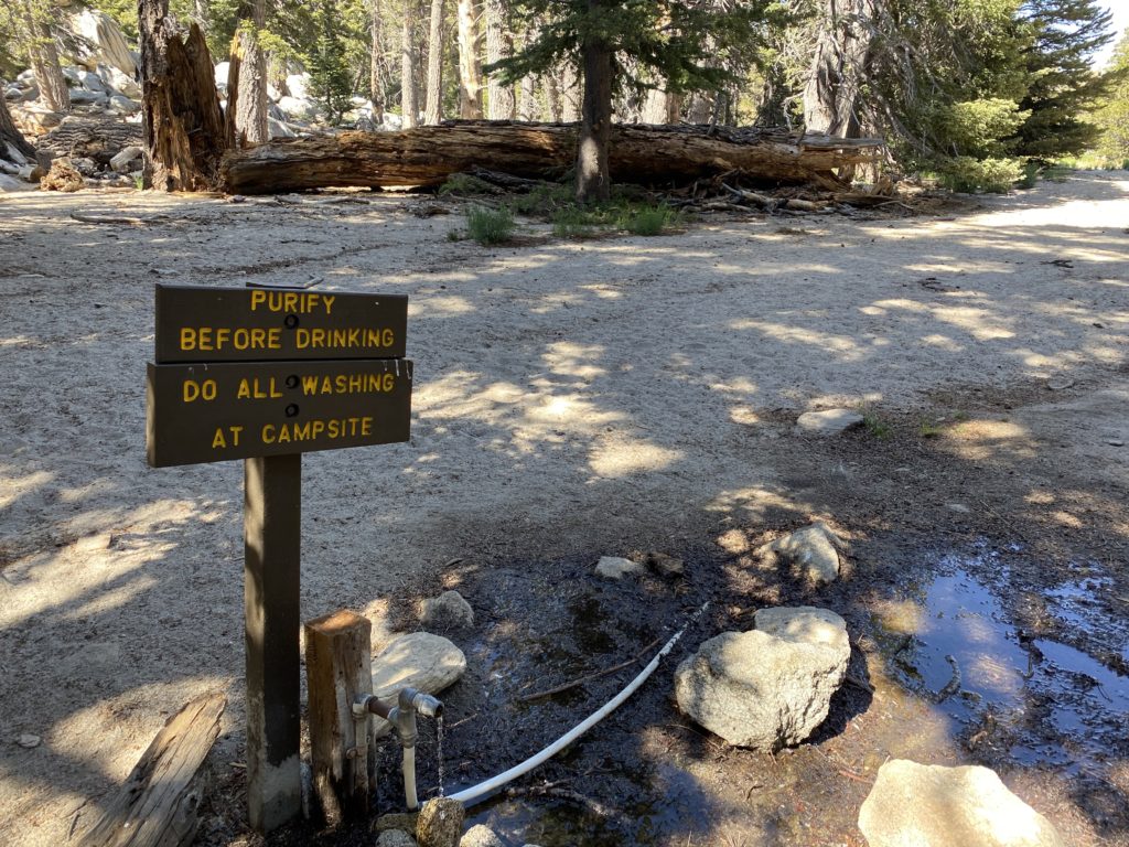
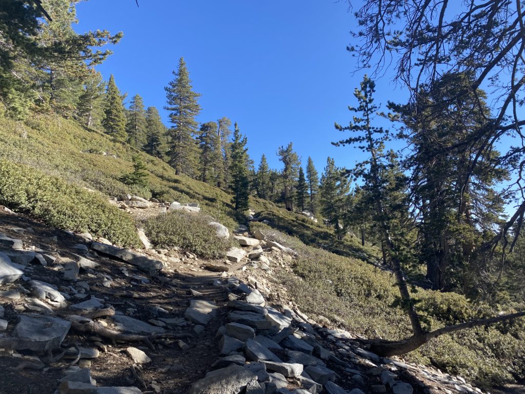
The first part of the Mist Trail is a paved, asphalt trail to the Vernal Fall footbridge. While this section is only about a mile long, you do gain about 500 feet, so we made sure to pace ourselves. While I was not thirsty, I had to take a sip at the water fountain, just because. For the rest of the hike, if you need water, you will have to filter it from the Merced or have it already. This is also the last chance for some flush toilets.

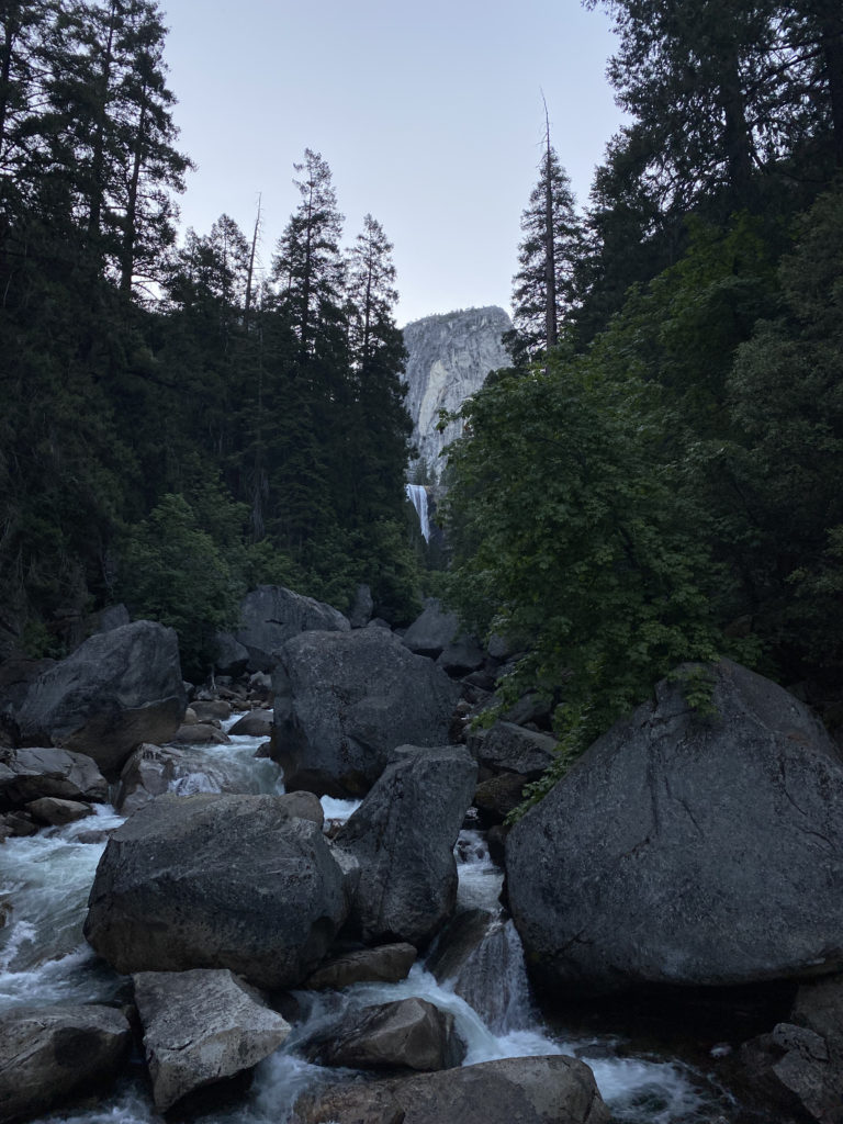
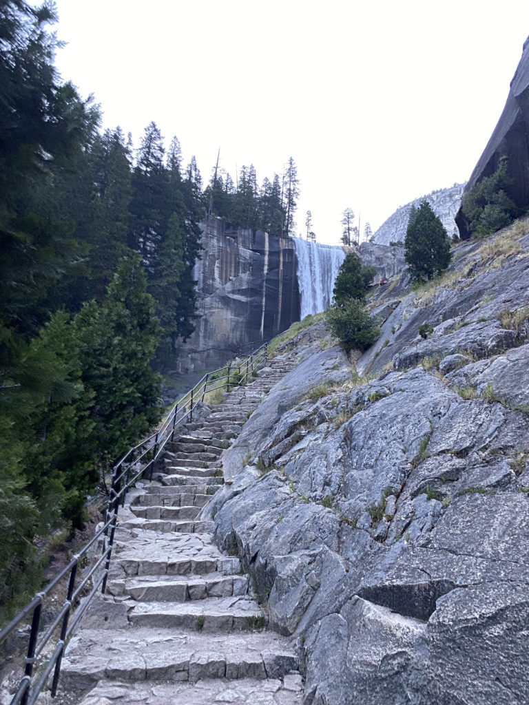
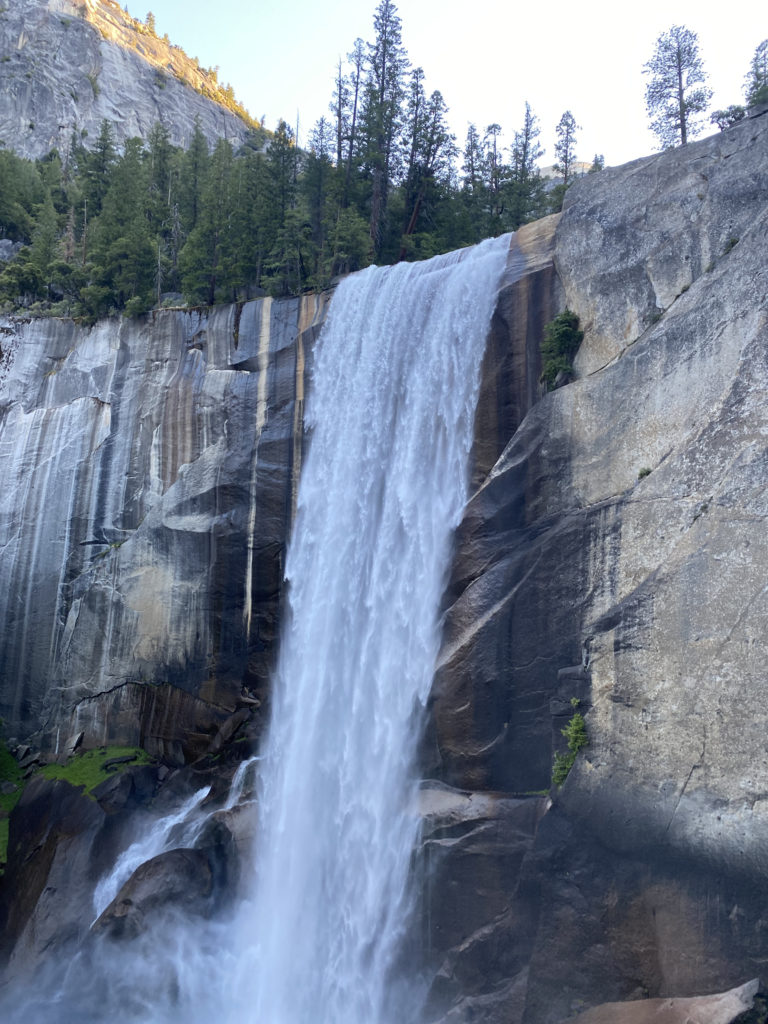
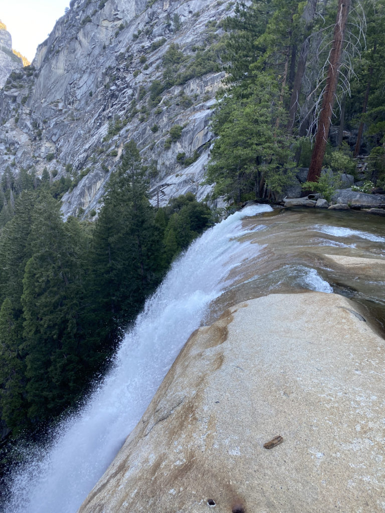
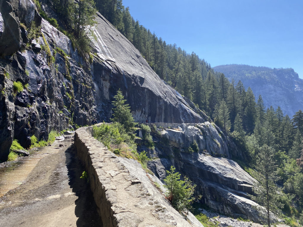
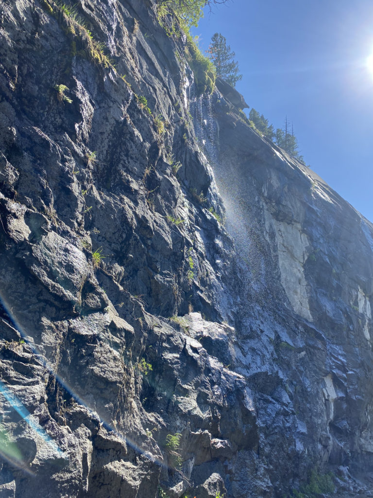
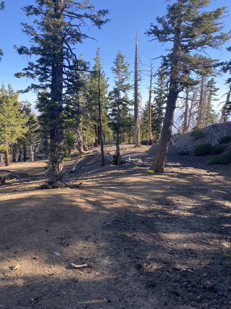
Now, the trail began climbing steeply toward Vernal Fall. After a short bit, the trail splits, with the JMT veering to the right and the Mist Trail to the left. The trail now turns into granite rocks and steps that would lead us up. While we had a glimpse of Vernal Fall from the footbridge, it was not until the trail made a slight turn did we get to see it fully. It is also here that you learn why this trail is called the Mist Trail. If there is a breeze, the mist from the waterfall is usually blown onto the trail. Thankfully, we only got a light mist during this section. During the winter, this section of the trail is closed due to it icing over and becoming unsafe. About 3/4 of the way to the top of Vernal Falls, the trail hugs a cliff wall, but thankfully, the metal railing provides some safety for this section.

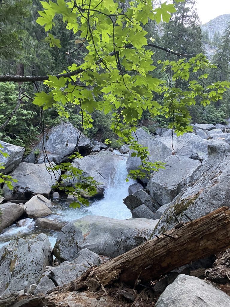
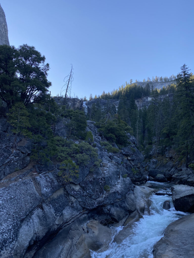
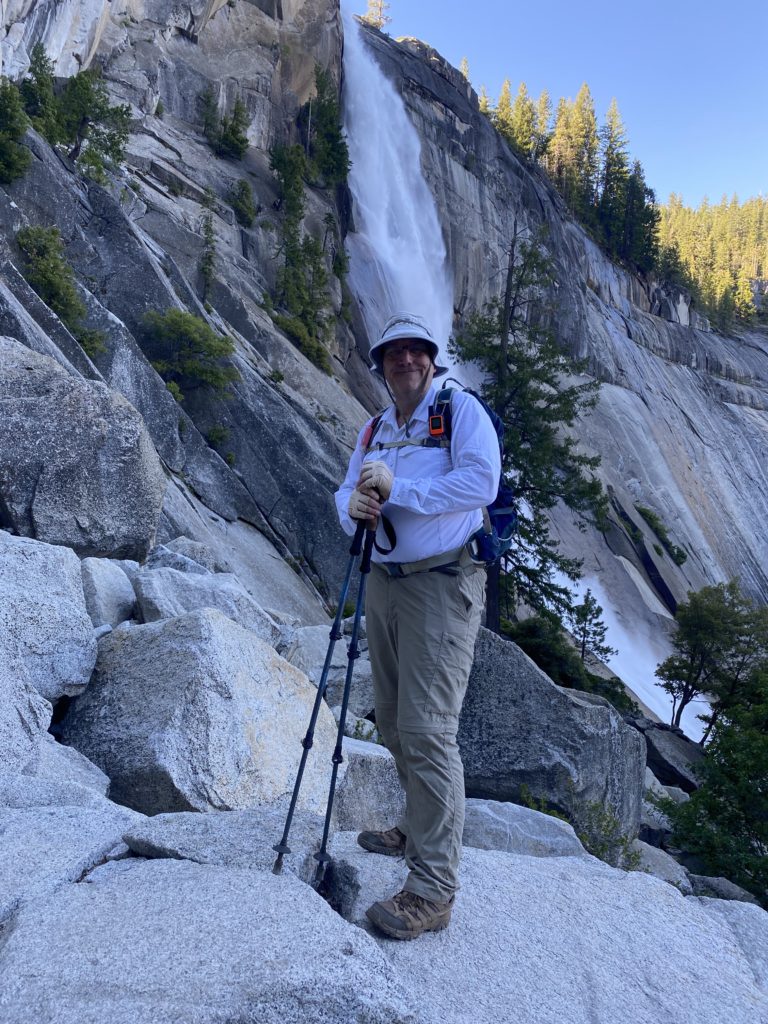
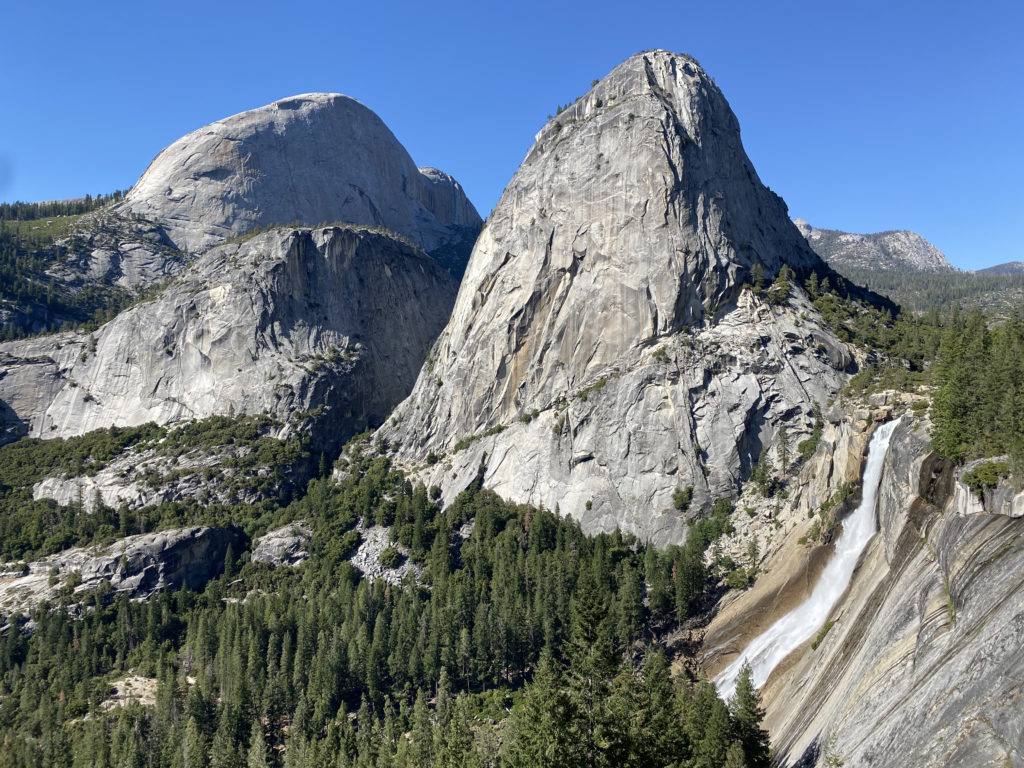
The trail then pops out at the top of Vernal Fall on a nice wide plateau. I wandered over to the overlook for a bit before continuing on. The trail takes a mini-break from the elevation gain as it passes the Emerald Pool. Once we crossed the Silver Apron bridge, our climb would begin in earnest again toward the top of Nevada Fall. Steep stone switchbacks carried us up, as the river cascaded to our right. At the top of the waterfall, we came to the end of the Mist Trail and our first planned break. While most hikers hang out right at the junction with the JMT, near the bathroom, we hiked toward the falls to a spot that would give us access to the river. We sat on the smooth rocky banks and enjoyed a well-earned snack as we filtered water for the next section of the hike. I opted to have a liter of electrolytes, as well as about 2.5 liters in my water bladder. Our plan was to filter again once we returned from the summit. After about 20 minutes, we were ready for the next portion of the hike.

Section 2: Little Yosemite Valley

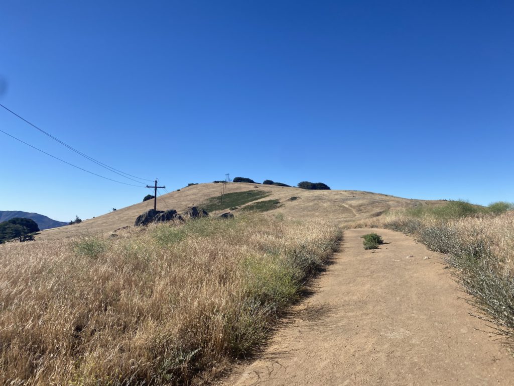
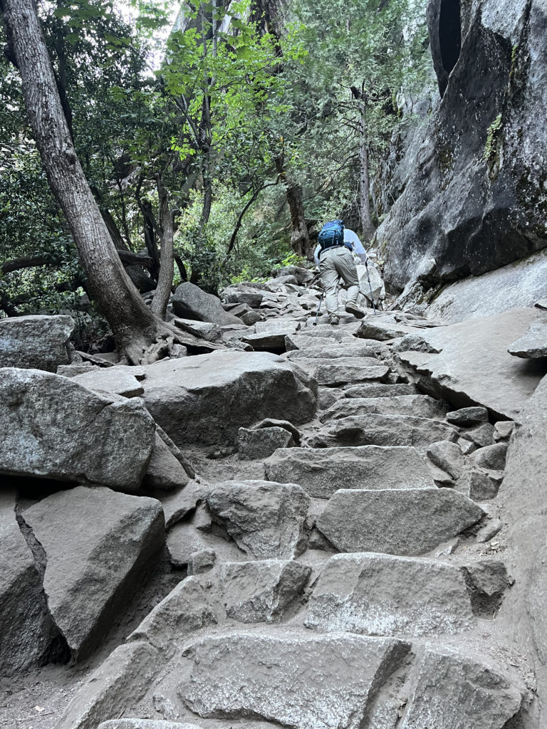
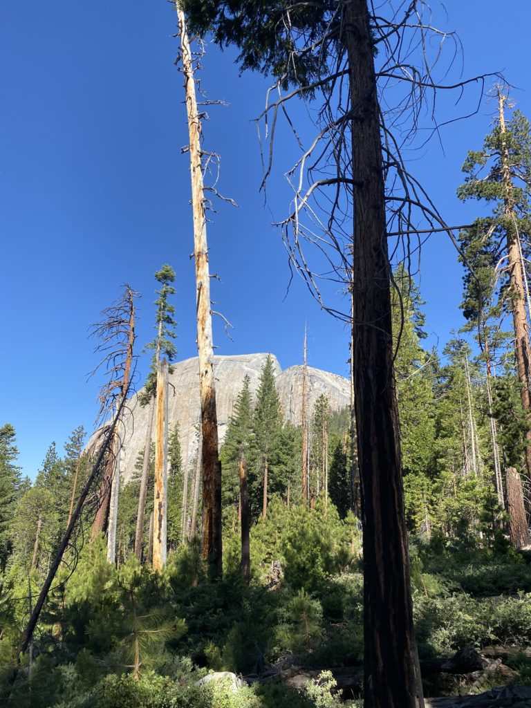
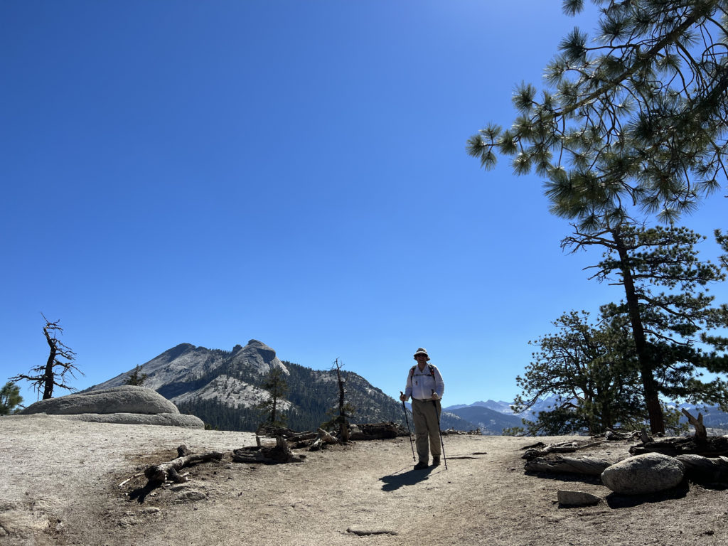
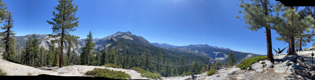
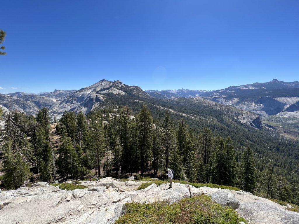
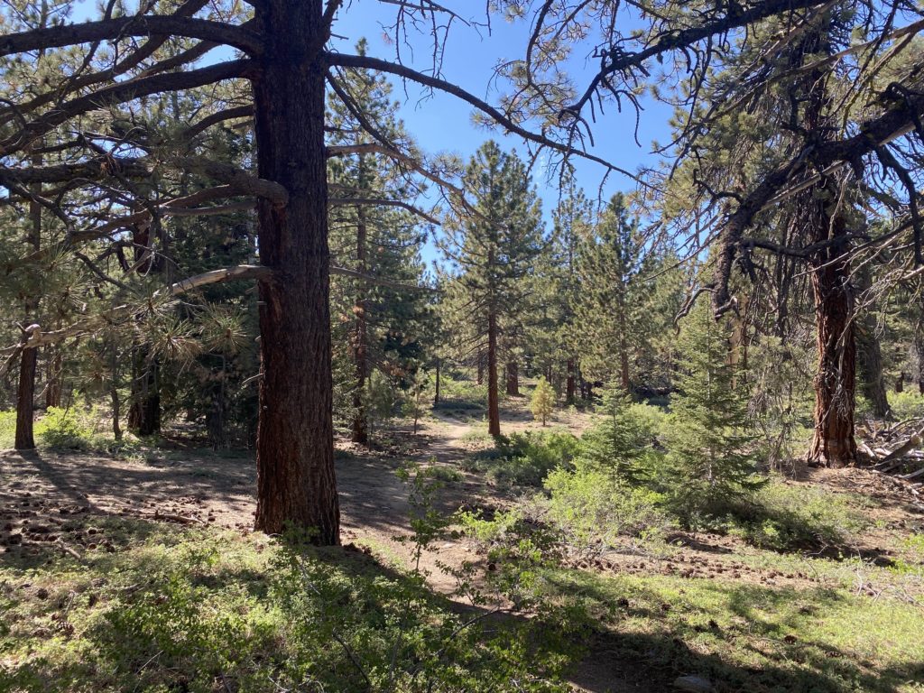
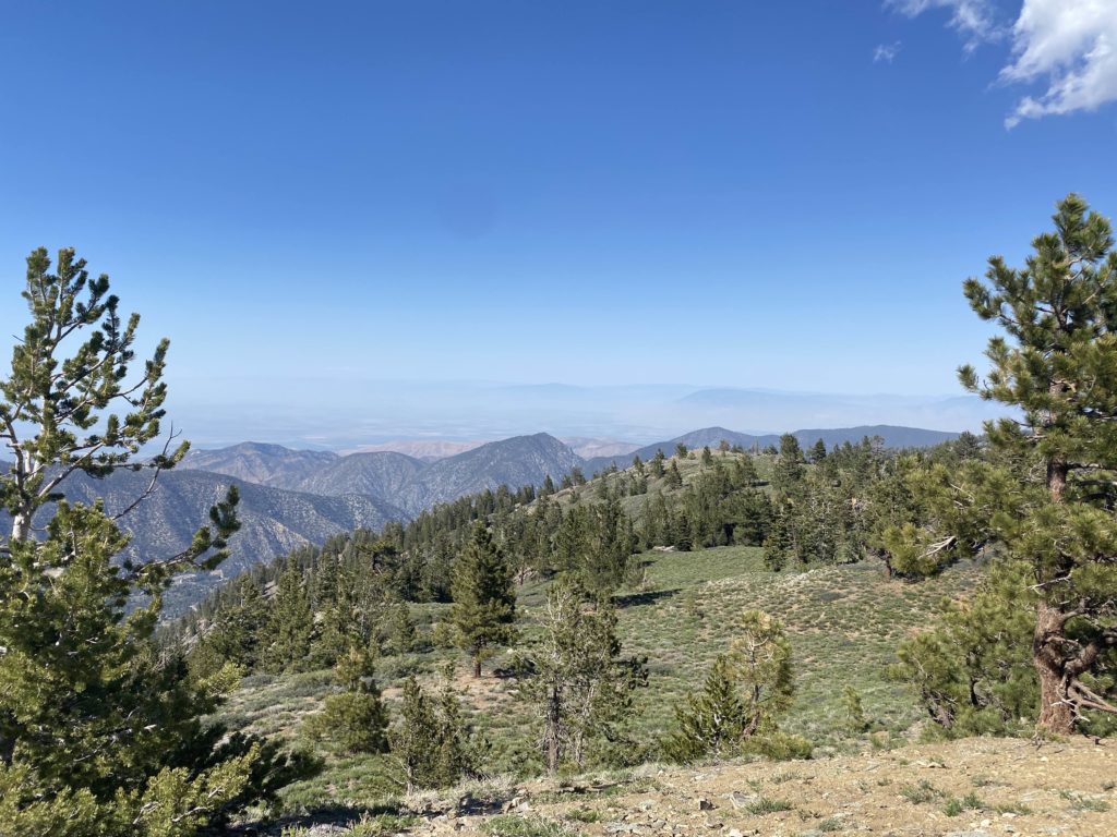
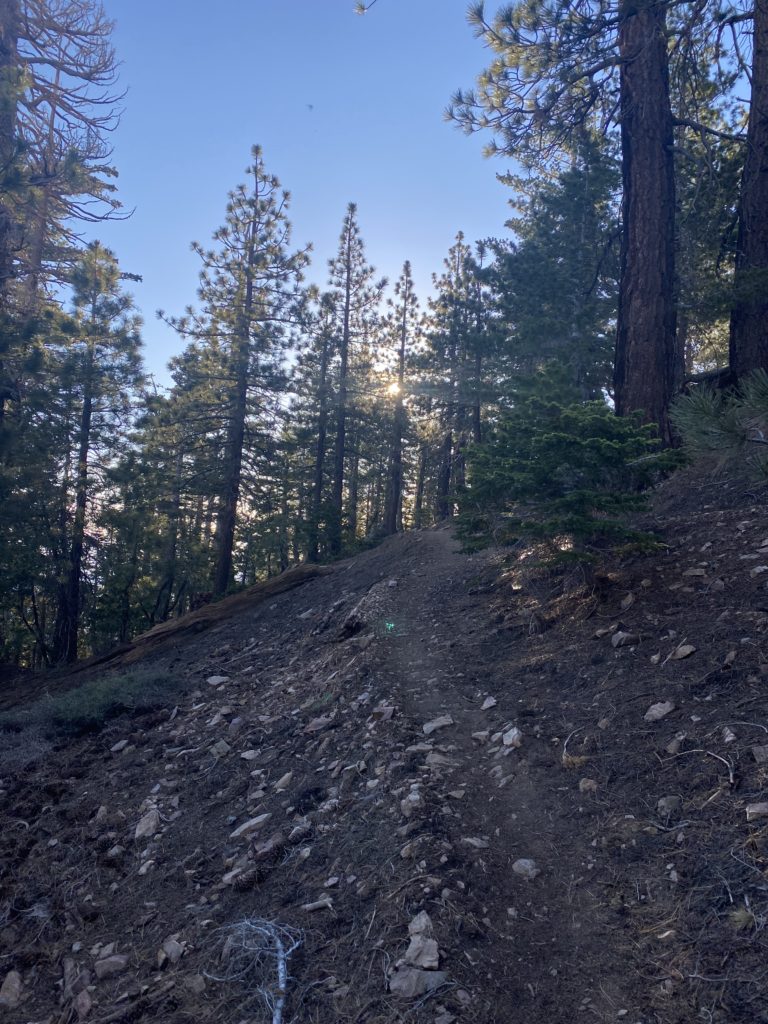
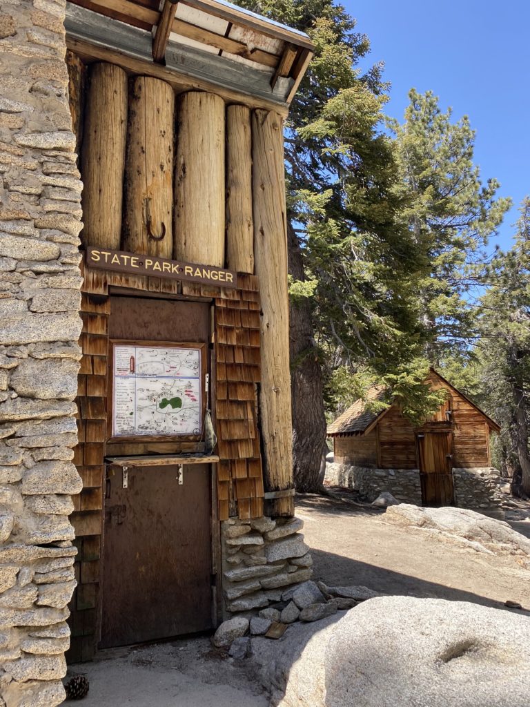
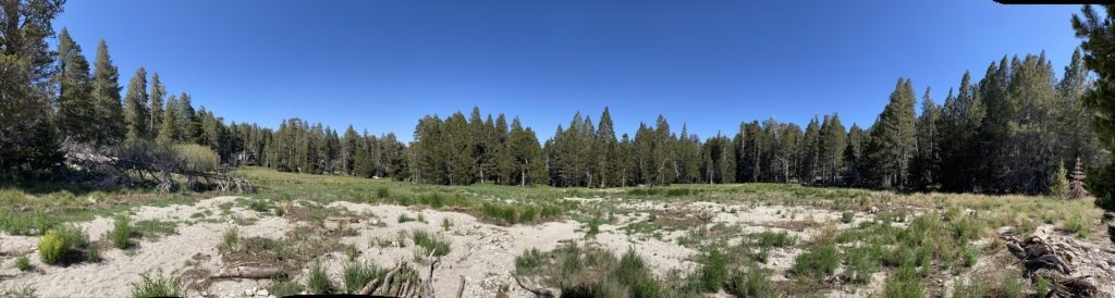
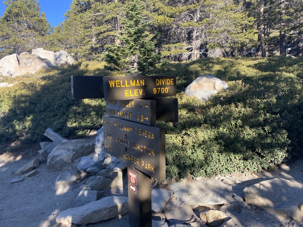
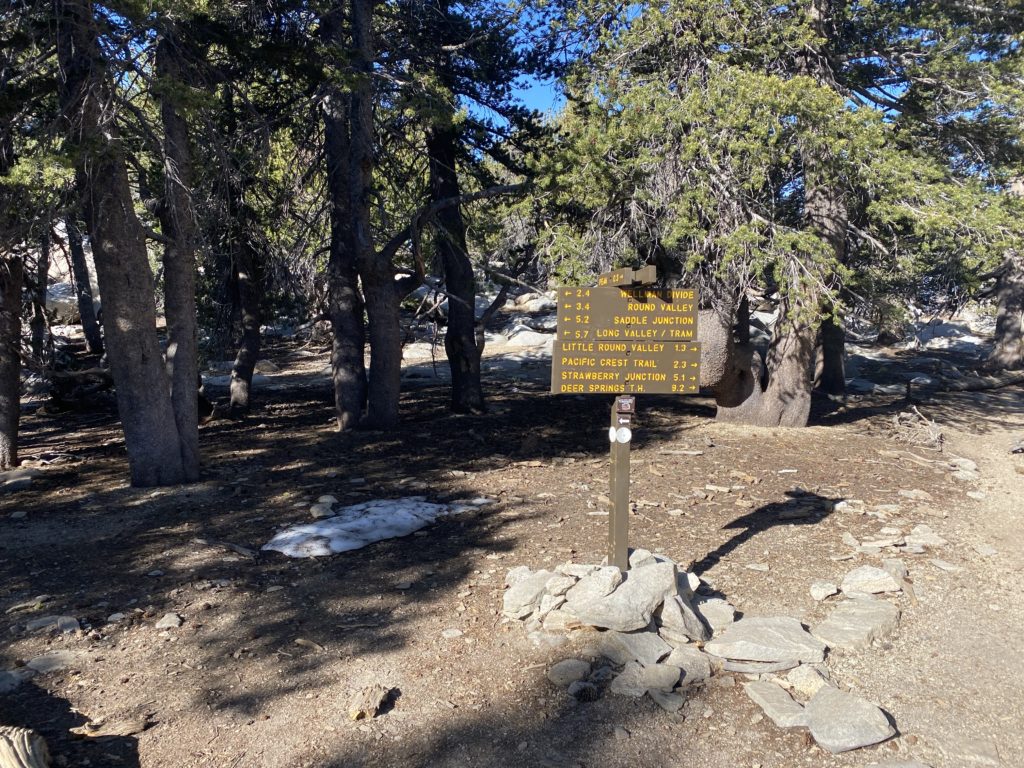
Now with our heavier packs, the flat but sandy section of the hike was welcomed. In just over 3 miles, we had already gained about 2,700 feet! Our first glimpses of the backside of Half Dome were coming into view as we cruised along. The trail splits after a bit, and if we continued straight we would enter the backpacking camp. There is a ranger station located at the camp, along with some pit toilets if you need one. Instead, we took the trail veering off to the left. Soon, this respite from the climbing would come to an end, as the trail makes a turn northward.

Section 3: The Climb

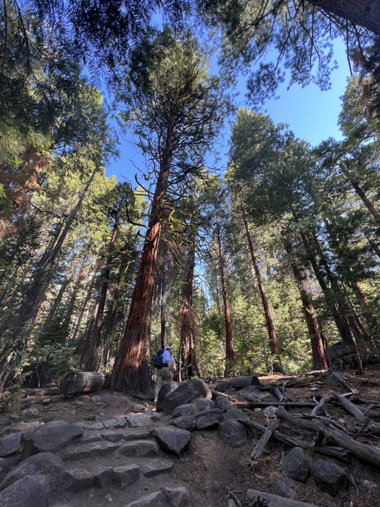
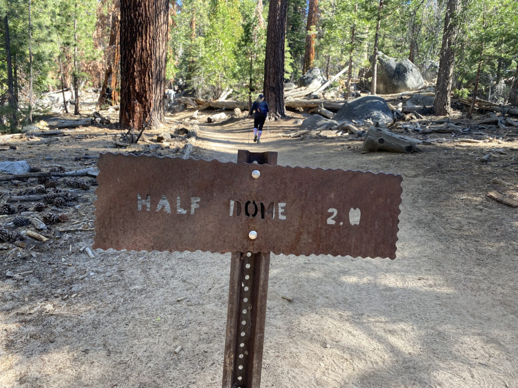
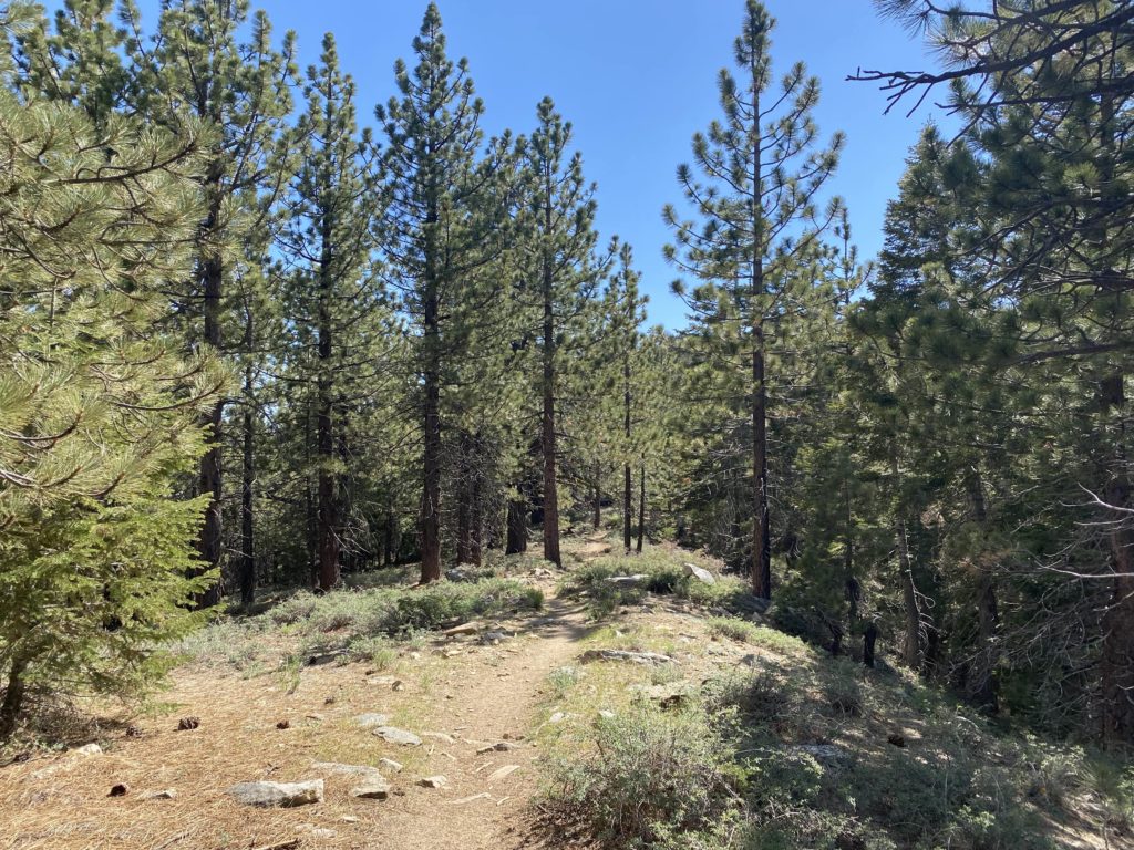
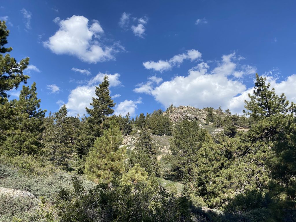
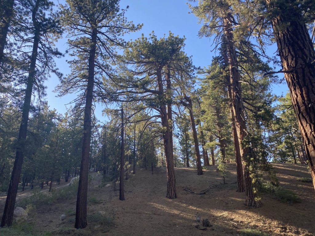
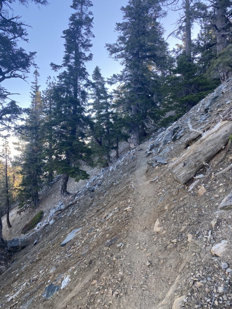
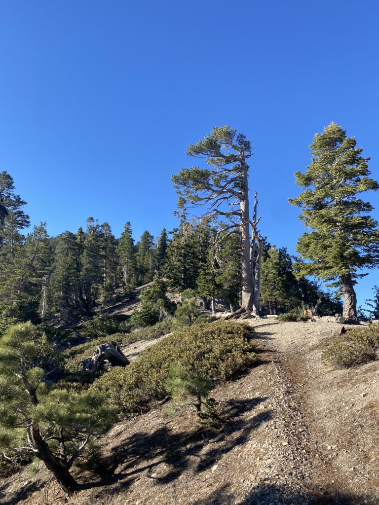
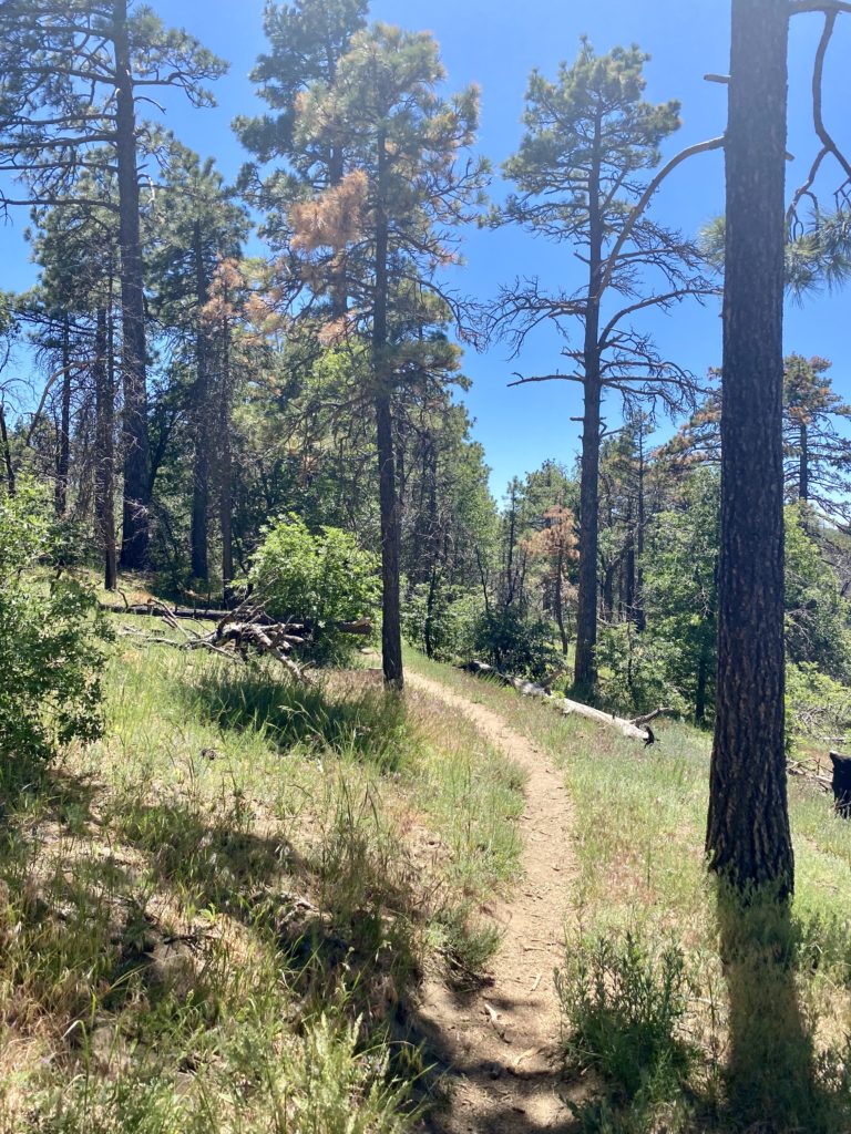
From Little Yosemite Valley, we were going to climb about 1,800 feet over the next 2.5 miles or so until we reached the Sub Dome. As we continued north along the JMT through some lovely forest, I felt myself beginning to feel a bit drained. I took a few short breathers that helped a bit. After 1.4 miles, we reached the junction with the Half Dome Trail. I found a nice spot for a break and then realized that I needed some real protein. I snacked on some jerky and soon began to feel better. Susie cruised on ahead and I once again found my groove. The trail finally turned west, and I knew that we would soon be at the Sub Dome.

Section 4: Sub Dome

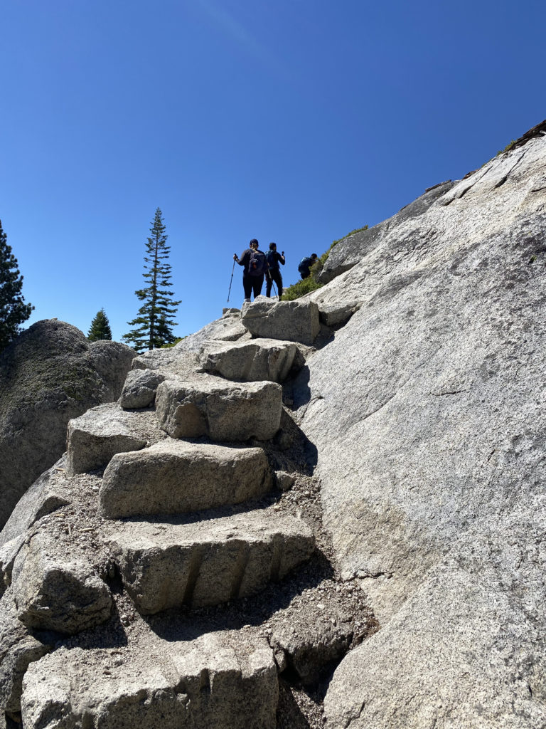
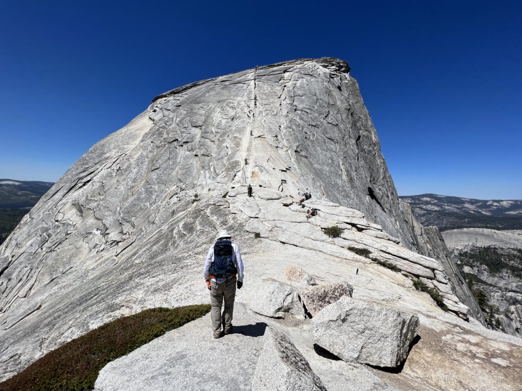
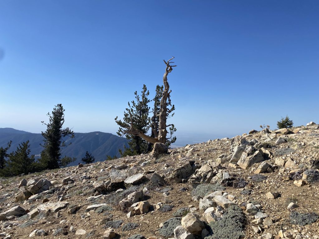
It was here that I made the decision to turn back in 2018, so from here on out the hike would be filled with unknowns for me. I showed my permit and ID to the ranger who was stationed at the base of the Sub Dome. She gave us a quick safety briefing and we were good to go, but first, I had another snack and a brief rest. The steep stone steps would rise almost 600 feet in just 3/10 mile. I paused a few times as I made my way up, in part to save some energy for the cables, but also to take in the view. Once I crested the Sub Dome, the infamous cable section stood before me. The most challenging part of the hike was about to begin.

Section 5: The Cables and Summit

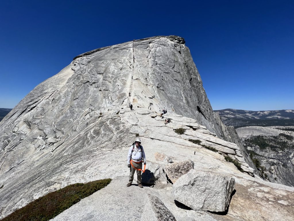
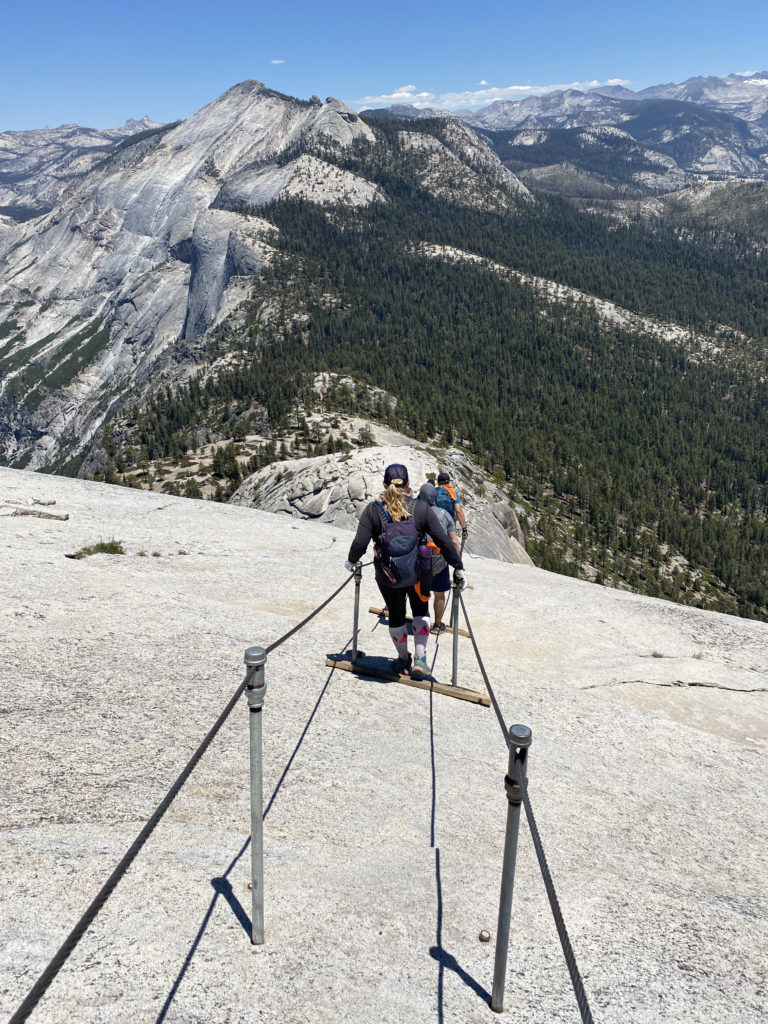
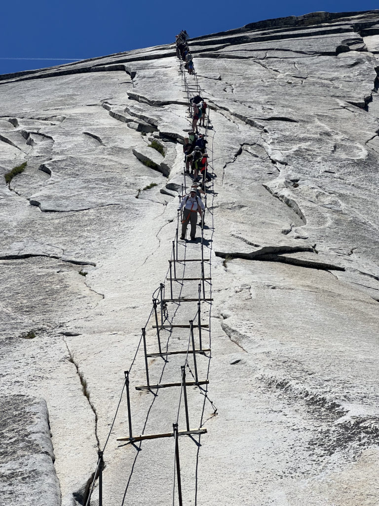
I have seen photos of the cables hundreds of times, but now they stood before me. We found a nice spot to take another quick break before continuing on. Both Susie and I brought a simple harness that would allow us to clip into the cables as we made our way up. Ted and I had these with us the last time. We stashed our trekking poles by some rocks and set off. Just a mere 400 feet of elevation gain in 1/10 mile up slick granite. Piece of cake, right? 

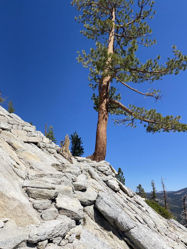
Across most of the poles that hold the cables up, is a wooden plank, but there are some sections where they are no longer there, and since Half Dome is protected, they will not be replaced. The cables start off mild, but quickly you find yourself pulling up using your arms from pole to pole. It is essentially a 45-degree angle in the beginning, which seems like a 60-degree angle in the middle, and then another 45-degree angle at the end. My gloves gave me a solid grip on the cable and I started to make my ascent. One of the other challenges with this section are the other climbers. We quickly found ourselves stuck behind one who was moving very slowly and we were in one of the more exposed sections of the cables. At that point, I decided that I needed to descend, so we turned back.

We sat once again at the base of the cables and stared up. Susie gave me a bit of pep talk, and we waited for the number of climbers on the cables to ease. The harness had been bothersome to use during our aborted attempt, so we both decided to forgo it this time. Once the crowd thinned, we again began making our way up. I focused on getting from one pole to another.  As I made my way up, if I needed to pause to allow a hiker to descend, I would clip in for a measure of safety. Overall, I knew that soon I would be standing atop the summit. 

As I stepped away from the cables, I felt a sense of accomplishment come over me. I walked over to a nice spot, slipped off my pack, and drank in the view. It was a touch warm, so I knew that we weren’t going to stay a long time on the summit. Plus, we did have the descent down the cables, which many say is harder, and the long hike back to the valley floor. I stood in the queue to have my photo taken on the “Visor”. Susie had already had her photos done while I was recovering from the effort. She hopped back into the queue and I took a new set for her. I also made sure to take a photo looking down from it, as I knew Ted had not ventured out and he might want to see what he missed.

While I wanted to have lunch up here, the heat was doing a number on our appetites, so we decided to head back down. Susie took the lead this time, as we carefully navigated the slick rock beneath our feet. I could feel my feet slip slightly from time to time, but I knew I had a good grip on the cable and focused on keeping myself in a safe place. We would pause and work out how to pass climbers heading up. I offered up words of encouragement to them, just as they had been given to me. Once past the section of the cables without planks, I knew that I had conquered Half Dome!

Section 6: The Descent

We stored our harnesses, retrieved our trekking poles, and started back down the granite stairs of the Sub Dome. My knee felt good, but I still took my time. We paused at the base of the Sub Dome for a bit and I had the last of the orange I had brought. I was also mindful of how much fluid I still had with me. There was still about 3.5 miles until we could filter water from the Merced. Thankfully, it was pretty much all downhill, so that would help.

After about 2.5 miles, I took a break and grabbed my small can of Coke, and drank it down. I knew the caffeine, sugar, and fluid would tide me over until we could refill our water. Finally, I reached Little Yosemite Valley and about ½ mile later, we sat next to the gently flowing Merced and began to filter our water. I had ¼ of a liter of water left when I arrived. We had some snacks while we refilled our bladders. I also filled my side bottle with more Gatorade as well. Once replenished, we set back down. Like most, we planned to descend using the JMT. This route is longer by an additional 1.5 miles, but without the knee-bashing steps along the Mist Trail. 

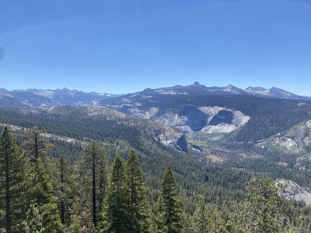
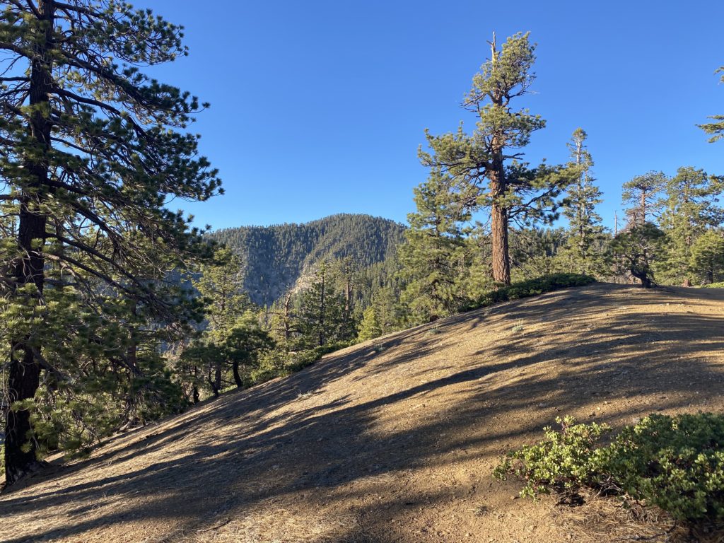
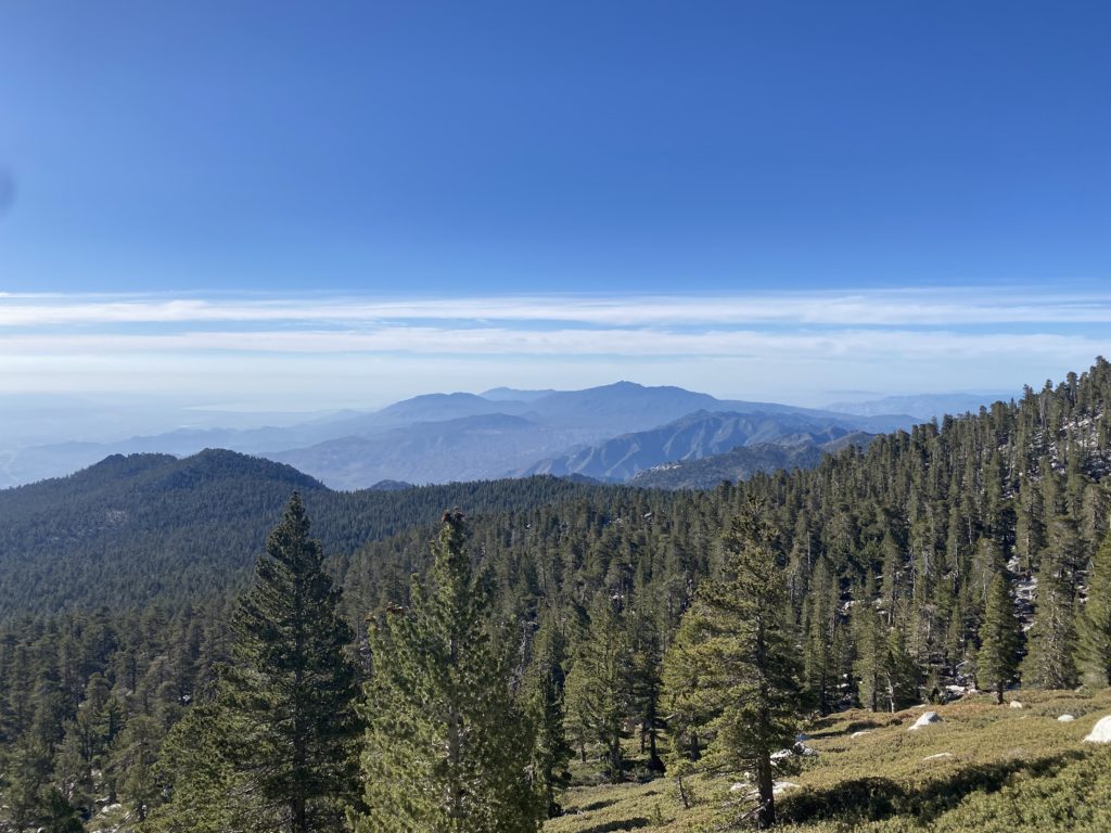
We could feel the heat as we traveled down. However, the views of Nevada Fall, Liberty Cap, and Half Dome did somewhat offset that. The next four miles were pretty much just more of the same. We both were ready to be done, and our feet were certainly in agreement. Finally, the trail rejoined the Mist Trail, and after a short break, we pushed on toward the end. Crossing back over the Vernal Fall footbridge, the end seemed so close, but that asphalt trail never seemed to end. Finally, the stone bridge came into view, and we just had the short, flat walk back to the car. Even at 6:30 pm, we could still feel the heat. I checked later and the high on the valley floor had been 100°F! We tossed our packs into the back of the Outback, changed shoes, and gave each other well-earned high-fives! 

The final stats for the hike were 17.02 miles in a total time of 13:12 hrs with an elevation gain of 5,485 feet. I did not stop my tracker during the entire hike. According to Susie’s tracker, our moving time was 9:53. We were a little slower than planned, but given the heat that we hiked under, we were quite pleased with our effort. 


Buy Me a Coffee at ko-fi.com

I am an avid peak bagger, sometimes backpacker, and former sea kayaker living in San Diego. In 2019, I became the third person to complete the San Diego 100 Peak Challenge. Not stopping with that accomplishment, I set my sights on the harder San Diego Sierra Club 100 Peak list, which I completed in 2021. In addition, I have conquered several Six-Pack of Peaks challenges (SoCal, San Diego, Central Coast, and both the Arizona-Winter and Arizona-Summer). Beyond attempting the San Diego Sierra Club 100 Peak list a second time, I am looking forward to exploring new summits and new adventures across the southwest. 

Yosemite Falls

It was just over 90° F on the valley floor, so we were not looking for anything too adventurous. We found a parking spot with almost no trouble. As we crossed over the valley toward Yosemite Falls, Half Dome stood majestically to our east. Its timeless shape stood lit in the afternoon sun. After taking a nice loop to see lower Yosemite Falls, we returned to the car. Susie said the new shoes felt good and gave them the green light for tomorrow’s adventure. 


Buy Me a Coffee at ko-fi.com

I am an avid peak bagger, sometimes backpacker, and former sea kayaker living in San Diego. In 2019, I became the third person to complete the San Diego 100 Peak Challenge. Not stopping with that accomplishment, I set my sights on the harder San Diego Sierra Club 100 Peak list, which I completed in 2021. In addition, I have conquered several Six-Pack of Peaks challenges (SoCal, San Diego, Central Coast, and both the Arizona-Winter and Arizona-Summer). Beyond attempting the San Diego Sierra Club 100 Peak list a second time, I am looking forward to exploring new summits and new adventures across the southwest. 

William Heise County Park

Joined Larry Edmonds’ Hike of the Month for a group hike through the various trails of William Heise County Park. I hadn’t been there in a long time, so this was a perfect opportunity to explore the park. The basic plan was to meet at the Day-Use parking area and then follow a mostly counter-clockwise route along the trail system.

Our first section to explore was the Fern Trail. We followed the Kelly Ditch trail for a bit, crossing over Cedar Creek. At a nicely signed junction, we turned onto the Fern Trail. Wildflowers still dotted the sides of the trail and we would stop from time to time to photograph them. The Fern Trail reconnects with the Kelly Ditch trail. For the very adventurous, you can hike this trail all the way to Lake Cuyamaca! 

Once we turned north, we headed toward the east and began hiking the Potter Loop. We had some lovely views of the surrounding mountains as we completed the one-mile loop. Once we were together again we began the short climb back toward the campground. Here we followed the Cedar Trail’s eastern section. After crossing back over the dry Cedar Creek, switchbacks made the climb a bit easier. The next trail we set off for was the Self-Guided Nature Trail on the east side of the campground. The smells of breakfast filled the air as we walked along the roads toward our trailhead.

We would take this trail for a short while until it connected with the Desert View Trail. Along the way, signs would identify the various trees and possible wildlife that could be found here. While we had a few short climbs so far, this section of our hike would have some measurable gain. Susie and I soon found ourselves at the front and cruised upward toward Glen’s View. We reached the end of the short spur trail and dropped our packs. The Salton Sea’s blue waters shone off in the distance. Familiar peaks rose around us—Granite, North Peak, Villager, and many more. The rest of the group arrived and took a nice break at the summit. 

After swapping tales of other hiking adventures for a bit, we set off to continue westward along the Desert View Trail. Some nice westerly views were spread out before us as we hiked down the rocky trail. Susie and I had once again pulled far ahead of the group. We came to a junction that could take us on a more direct path back to the campground or continue on to the Canyon Oak Trail. We both were a bit hungry, so we opted to skip the longer option and go on toward my car. Once back at the parking lot, I left a note for Larry on his car. After a quick stop at Calico Cidery to fill our growlers, we popped into Dudley’s for some sandwiches. While we waited for them, we chatted about our upcoming trip to climb Half Dome. This was a nice saunter through some nice trails with some lovely fellow hikers.


Buy Me a Coffee at ko-fi.com

I am an avid peak bagger, sometimes backpacker, and former sea kayaker living in San Diego. In 2019, I became the third person to complete the San Diego 100 Peak Challenge. Not stopping with that accomplishment, I set my sights on the harder San Diego Sierra Club 100 Peak list, which I completed in 2021. In addition, I have conquered several Six-Pack of Peaks challenges (SoCal, San Diego, Central Coast, and both the Arizona-Winter and Arizona-Summer). Beyond attempting the San Diego Sierra Club 100 Peak list a second time, I am looking forward to exploring new summits and new adventures across the southwest. 

Sawmill Mountain & Mt. Pinos

After climbing Mt. Baden-Powell, I set off for my final set of peaks, Mt. Pinos and Sawmill Mountain. The original plan was to car camp at McGill Campground about two miles from the trailhead, wake up early, get these peaks, then make back to San Diego for a graduation party. Unfortunately, I missed some fine print on the reservation and no longer had a spot. Since my legs still felt good and I wasn’t in any real hurry, I decided to see if I could make the 7.5 mile round trip out to Sawmill. The parking lot was almost empty when I pulled in. I changed into a fresh shirt, made sure that I had refilled my water bladder and set off to the first peak, Mt. Pinos. While the temperatures were in the mid-70s, a light breeze and shade of the trees made for some nice hiking weather.

A few clouds dotted the sky, giving my photos some nice texture. Soon the summit of Mt. Pinos came into view, and I walked over and found the summit sign. After snapping a few photos, I set off toward the Tumamait trailhead and the “hard” part of the hike. From here, the trail loses about 400 feet of elevation to almost immediately gain it again. I took my time and plodded along, much like the climbs earlier in the day. Soon the turnoff to Sawmill appeared, and a short 2/10 mile later the large rock cairn stood before me. I grabbed the summit sign and snapped a few photos. For many, they will continue onto Grouse Mountain to the west to complete the 3-2-1 challenge, but this time I had no desire to tack on another couple of miles. 

I started heading back down toward the saddle for that climb back up. Surprisingly, it went fairly well. I have to think the past few days at something besides sea level might have helped. Soon I was back at the Mt. Pinos Condor Observation Site and had just about 1.7 miles back to the car. Thankfully it was almost all downhill. 

Once back at the car, I took a moment to reflect on the past three days. I had put in some serious miles and elevation gain. I grabbed some cold sodas and a sandwich from the market then began the drive home. Thankfully the traffic wasn’t too bad and I was home before 10 pm. 

The final stats for these summits was 7.3 miles in 3:17 with 1,430 feet of gain.


Buy Me a Coffee at ko-fi.com

I am an avid peak bagger, sometimes backpacker, and former sea kayaker living in San Diego. In 2019, I became the third person to complete the San Diego 100 Peak Challenge. Not stopping with that accomplishment, I set my sights on the harder San Diego Sierra Club 100 Peak list, which I completed in 2021. In addition, I have conquered several Six-Pack of Peaks challenges (SoCal, San Diego, Central Coast, and both the Arizona-Winter and Arizona-Summer). Beyond attempting the San Diego Sierra Club 100 Peak list a second time, I am looking forward to exploring new summits and new adventures across the southwest. 

Baden-Powell (via Dawson’s Saddle)

The drive from Palm Springs to Wrightwood was uneventful. I decided to grab lunch along the way in Cazabon and refuel the Outback. After the mid-70s atop San Jacinto, the 100+ temps on the desert floor felt awful. The next peak on my adventure was Baden-Powell. Originally when I planned the adventure, I had hoped to hike out to the Big Horn Mine in the afternoon, but this heat wave we were having scuttled that idea. That hike is south-facing and without a lot of shade. I checked into my campsite at Table Mountain and then drove the 10 minutes back into Wrightwood to hit the market. I grabbed some soda, a couple of beers, and a bag of ice. Back at the campsite, I unpacked the backpack and the slack-pack and then reassembled my daypack. Soon I could feel my stomach being to grumble and headed again back into Wrightwood for dinner. After a nice Carne Asada burrito plate, I drove back to finish setting up for the night. Last year, I bought a custom air mattress for the Outback from Luno. In about 5 minutes, I had all the parts inflated and ready. The camp host stopped by and we chatted a bit. He said tonight the campground was mostly empty, but tomorrow it would be packed. I gathered some of the downed wood and enjoyed a small campfire as night fell. I crawled into the back of the Outback and listened to an audiobook for a while before drifting off to sleep. 

I woke again before dawn. I can see why they sell window covers, but I had a long day of hiking ahead of me and it was going to be warm, so I did not mind. I made my breakfast, this time some biscuits and gravy from Mountain House. If the temperatures had been milder, I might have considered breakfast in town. I deflated the mattress, relocated my other items, and set off toward Dawson’s Saddle. I had climbed Baden-Powell twice before, each time via the Vincent Gap trailhead and the infamous switchbacks. But this time, I decided to approach it from the other route. I passed the parking lot at Vincent Gap and there were about 5 cars parked there. 

Finding the parking area for Dawson’s Saddle was fairly easy, I just had to look for the CalTrans shed and park to the side. The full plan for the day was to hike from the saddle to Throop Peak, then continue along the ridge east to Mount Burnham and then Baden-Powell. I grabbed my gear and crossed over the Angeles Crest Highway to the trail. This first section of the trail was steep, and I honestly began to reconsider just doing the switchbacks. I knew though, that after a short portion of this, the trail would mellow out. As I gained the ridge that I would follow toward Throop, I was rewarded with some great views to the west, as well as some nice views to the south, including Throop Peak. The trail certainly became much more reasonable as I continued to climb. After about 1.5 miles, the trail splits. To the left is a connector trail that joins the Pacific Crest Trail or you can stay heading south to climb up to the summit of Throop Peak. I missed the junction, but since the trail made a turn to the east, I stopped and checked my route. I was just a bit off, so I did a quick U-turn, followed by some short cross-country hiking, and found the trail. I had about 4/10 mile to gain about 450 feet. I paced myself as I worked up toward the summit. I had a long day ahead of me and had a respectable day of hiking the day before. Soon the summit came into view and I spotted the metal plaque and ever-present summit signs. I snapped my photos and soaked in yet another summit vista. Off to the east stood my next two peaks, Mount Burnham and the primary goal, Baden-Powell. Once I was ready, I set off down from the summit to connect with the PCT. 

Once on the PCT, I had about a mile to go before the junction to summit Mount Burnham. From previous trip reports, I knew this approach was also a bit steep. I made the decision to bypass it and continue on to my primary goal of Baden-Powell and summit Burnham on my return. As I continued eastward on the PCT, I would be passed from time to time by actual PCT thru-hikers. We would stop for a bit and chat before each heading our separate ways. The views along the trail were delightful. At times, I could see the high desert to the north, and at other times off toward the Los Angeles basin.

Finally, I came to the junction that would take me up to the summit of Baden-Powell. Again, this is a short but steep climb. I kept my eyes focused on the trail in front of me and plodded upward. Soon, the familiar concrete monument was in front of me. I dropped my pack next to it and wandered over to the summit flag. I snapped a few photos, but I have found that I tend to take less at the summits when I revisit them. This time was no exception. I sat next to the monument to Lord Baden-Powell and enjoyed a well-earned snack. Off to my west, I could see my return route. From this side, the ascent of Mount Burnham looked much more hospitable. Once I was refreshed, I set off back the way I came. Looking back, I should have gone the other way, just to see the Wally Waldron tree before rejoining the PCT. Oh well…

I cruised along the PCT knowing for the most part, I would be descending, but with a few short climbs from time to time just to keep things interesting. I reached the junction to leave the PCT and make the climb up to Mount Burnham. I made my way up the trail, stopping briefly once to photograph Baden-Powell. I really only had to go about 500 feet with just about 100 feet of gain. A bit nicer than 3/10 mile and over 300 feet of gain. At the summit, a small rock cairn had been constructed, and the summit sign was placed next to it. I found a register and signed it. After a few photos, I set off down the other side. As I made my way down back toward the PCT, I was validated by my choice to do this peak upon my return. 

The trail would continue on, treating me to more views along the way. Soon I reached the junction with the side trail that avoided climbing back up Throop Peak. This was that same trail I was briefly on earlier in the day. I had about 2.3 miles mostly descending back toward Dawson’s Saddle. From time to time, I would see the burned slopes of Mount Lewis just to the north of where I was parked. That area burned during the Bobcat fire back in 2020. Along the way, I passed a group of four hikers heading out for Baden-Powell, I wished them well and continued on. Once safely down that short steep section, I again crossed the highway to my car. I really enjoyed the climb to Baden-Powell this way. While it had some moments, it felt less of a challenge and more of a hike. I would like to come back and explore some of the other peaks in the area. After changing out of the hiking clothes and a quick rinse, I headed down to the high desert and over toward Frazier Park and what was to be my next set of peaks; Mt. Pinos and Sawmill Mountain. The final stats for this hike were 8.5 miles, in 4:46 with 2,640 feet of gain.


Buy Me a Coffee at ko-fi.com

I am an avid peak bagger, sometimes backpacker, and former sea kayaker living in San Diego. In 2019, I became the third person to complete the San Diego 100 Peak Challenge. Not stopping with that accomplishment, I set my sights on the harder San Diego Sierra Club 100 Peak list, which I completed in 2021. In addition, I have conquered several Six-Pack of Peaks challenges (SoCal, San Diego, Central Coast, and both the Arizona-Winter and Arizona-Summer). Beyond attempting the San Diego Sierra Club 100 Peak list a second time, I am looking forward to exploring new summits and new adventures across the southwest. 

Backpacking San Jacinto

Earlier this year, Jeff Hester, the founder of the Six-Pack of Peaks Challenges, asked if I would be interested in joining a group to scout out a new set of peaks for a New Mexico-based Challenge. I immediately said yes! However, New Mexico had to close all its National Forests, as several wildfires were raging across the state. That meant we would have to postpone the trip, possibly to Fall. Since I had the time off, I decided to turn my focus to either working on the SoCal Six-Pack or the Arizona Summer Six-Pack. In the end, the SoCal trip won. One of the biggest pains of the SoCal is all the driving to and from San Diego, but turning it into more of a camping road trip would take some of the sting out of the effort. Plus, this would let me have an adventure! The first peak on the list was San Jacinto, but instead of hiking up via Devil’s Slide or the Marion Mountain route, I would do this peak as an overnight trip. I sent away for my overnight permit (yes, you still have to apply for the permit via the mail). Once I received my permit, I secured campgrounds near the other two peaks I wanted to climb, Baden-Powell and Sawmill. This trip was going to be a blend of backpacking and car camping, so I had an interesting collection of gear in the back of my trusty Outback. With everything loaded, I set off for Palm Springs and the Aerial Tram.

Day 1: Mountain Station to Round Valley

The first day was actually going to be pretty mild. I parked my car in the overnight lot at the tram station and grabbed my gear. While I had a reserved ticket for 2 pm, I was there a bit early. There was room on the tram, so I headed up away from the heat of the desert. After my 12-minute ride, I headed to the ranger station to check in. The ranger went over the basic rules and showed me how the campsite actually worked. I must admit, in planning this portion of the trip I did not really understand the layout of the Round Valley campground. Along the trail, there are posts, each marked with an R and a number. These serve as junction markers to trails that lead back to the various campgrounds, which are all named. He told me to avoid R1-R4 as they are just off the main trail to the peak. Since there were some winds forecasted for the evening, he also suggested not staying at Upper Chinquapin. Now that I understood the campground, and carrying a much better map that came with my permit, I set off. 

The temperatures were in the mid-70s, but the light breeze and the shade made for a pleasant time. Since I was early, I debated heading to the campsite, dropping my gear, and heading up to the summit, but I knew I had several more days of hiking ahead of me and did not need to rush. Once at Round Valley, I began to explore some of the options to set up camp. In the end, I picked Buckthorn, as there was a spot sheltered by some boulders that could offer some additional protection from the wind. I walked back down to the Seasonal Ranger station and marked on the map that I had taken Buckthorn for the evening, then went over to the faucet to filter water. 

As evening came, I made my dinner and enjoyed a nice beer I carried up. Since I only had to cover just over 2 miles with an elevation gain of about 800 feet, I was willing to have the extra weight for a nice Victory at Sea from Ballast Point. A quarter moon hung in the sky as I crawled into my tent and drifted to sleep.

Day 2: Round Valley to Summit

I woke just before dawn, and the forecasted winds never seemed to come. I had my oatmeal and a couple of cups of coffee while I broke down camp. My plan was to stash my backpack, while I slack-packed up to the summit. I found a nice nook near the ranger station and set off up the trail toward Wellman Divide. Since the first tram up wasn’t until 10 am, I doubted I would see anyone for quite a while. I felt great as I made the climb up from Round Valley. I suspect that spending the night at 9,100 feet helped my body get a bit more used to the altitude. I reached Wellman Divide still feeling great. I stopped for a bit to grab some photos before continuing upward.

The trail was familiar, as this was the third time I had covered this portion of the route. Unlike last time, where I had been feeling the climb, this time I just kept cruising along. I reached the turn near Miller Peak and kept trucking along, knowing I was almost there. I came to the junction with the trail that connects up from Little Round Valley. If I was going to see anyone this early, it would be anyone who might have camped there. Although I suspect, if they had camped there, they might have tried for a sunrise summit. There was a tiny patch of snow nearby, and I wondered how much longer it would last?  

I set off for the final 3/10 mile to the summit. I briefly stopped at the Rescue Hut but was starting to run low on energy. Since I had a short scramble to the top, I pushed on. Someone had spray-painted blue arrows to help guide you up the rocks. I could not recall seeing this the last time. 

Once at the summit, I stood alone. I snapped my photos, enjoying not having to wait for others. I then found a nice spot to take my well-earned break. With a little bit of food in me, I was feeling great again. I took in the views some more, then headed back down the trail. As I neared the turn near Miller Peak, I decided to hike over and check it out. I got close to the true summit, but it would have been a bit of a scramble to the top and I just did not feel like doing it. After rejoining the main trail, I cruised back down. I would look at my watch and wonder when I might encounter my first day hikers. My best guess was just around Round Valley. The return to Round Valley went smoothly, stopping only for photos. 

Once back at Round Valley, I switched back to my backpack, securing my slack-pack to the outside. I thought about transferring my water bladder back into my backpack but figured I had just about 2 miles of downhill ahead of me and I would be fine. Just past the first campsites, I met my first day-hikers. My guess had been correct as to the timing. We chatted a bit, then each went our separate ways. About every 15 minutes or so, I would pass another set of hikers making their way toward the summit. Some seemed a bit more prepared than others. Finally, I reached the ranger station. I checked in with the ranger to let him know I safely returned. As I enjoyed a nice cool drink of water, I listened to him caution a group of hikers about the warm day. Feeling a bit refreshed, I set off on the hardest part of the entire hike, the climb to the actual tram station. I plodded my way up the 120 feet of steep concrete switchbacks. Once there, I bought a cold soda and waited for the next tram down. With one peak down, it was off to drive over to Table Mountain Campground and tackle Baden-Powell via Dawson’s Saddle tomorrow.

Final Stats

Day 1: Ranger Station to Round Valley: 2.25 miles, 1:17, and 795 feet of gain.

Day 2: Round Valley – Summit: 5.9 miles, 3:39 (excluding time at the summit), and 1,735 feet of gain 

Round Valley to Ranger Station: 1.9 miles, 1:03, and 795 feet of loss. 


Buy Me a Coffee at ko-fi.com

I am an avid peak bagger, sometimes backpacker, and former sea kayaker living in San Diego. In 2019, I became the third person to complete the San Diego 100 Peak Challenge. Not stopping with that accomplishment, I set my sights on the harder San Diego Sierra Club 100 Peak list, which I completed in 2021. In addition, I have conquered several Six-Pack of Peaks challenges (SoCal, San Diego, Central Coast, and both the Arizona-Winter and Arizona-Summer). Beyond attempting the San Diego Sierra Club 100 Peak list a second time, I am looking forward to exploring new summits and new adventures across the southwest. 

Kwaaymii Trail

Tucked just behind the Mount Laguna Visitor’s Center is the Kwaaymii Trail, a very short interpretive loop that one can explore. After our jaunt on the Desert View Trail, we weren’t ready to leave the Laguna’s yet, but our dog had enough adventure for the day, so my wife and he hung out at the Visitor’s Center while I took off.

The trailhead is located at the northwest edge of the Visitor’s Center parking lot. A wooden box holding trail guides is attached to the signpost but was unfortunately empty. I passed a large stone marker labeling this trail as the “Indian Trail”. Thankfully, this trail has been renamed. If you are not familiar with the Kwaaymii, those people were a subset of the Kumeyaay that once inhabited the area.

The trail passes by some cabins, and you are reminded to stay on the trail. Soon, the trail began a short climb to Pinyon Point. I quickly took in the views before continuing on. Off to the north, I had a great view of the FAA station atop Stephenson Peak. The trail descended along the east side of the hill and I was quickly back at the Visitor Center. 


Buy Me a Coffee at ko-fi.com

I am an avid peak bagger, sometimes backpacker, and former sea kayaker living in San Diego. In 2019, I became the third person to complete the San Diego 100 Peak Challenge. Not stopping with that accomplishment, I set my sights on the harder San Diego Sierra Club 100 Peak list, which I completed in 2021. In addition, I have conquered several Six-Pack of Peaks challenges (SoCal, San Diego, Central Coast, and both the Arizona-Winter and Arizona-Summer). Beyond attempting the San Diego Sierra Club 100 Peak list a second time, I am looking forward to exploring new summits and new adventures across the southwest. 

Desert View Nature Trail

After having a nice picnic lunch at the Desert View Picnic area, it was time to burn off a few of those calories by exploring the Desert View Nature Trail. This trail is just over a mile in length and has minimal elevation gain, but it offers some incredible views despite those small stats. Starting from the southeast edge of the picnic area, we began hiking south. 

Soon, the views to the east opened up and the Anza-Borrego desert was spread out before us. I could see Red Top and Sawtooth directly in front of me. We continued on until we reached a junction in the trail. From our starting point, this trail is basically a “lollipop”. We soon passed a nice wooden bench nestled under some shady Black Oaks, taking the right fork. The trail continued on until it reached Burnt Rancheria Campground, the other starting point. We walked briefly along the road eastward, until we picked up the trail again. Upon leaving the campground, we found a “water drinker” that had been installed, along with a water trough for horses. To the east was a barbed wire fence and a sign denoting the land beyond was an Indian Reservation.

We followed the trail north back to our trailhead. This portion of the Desert View Trail is also shared with the PCT. Soon we found ourselves back in our car after an enjoyable little jaunt. Either a day pass or Adventure Pass will be needed to park at either the Desert View Picnic Area or Burnt Rancheria’s Day Use area. Dogs are allowed on leash. 


Buy Me a Coffee at ko-fi.com

I am an avid peak bagger, sometimes backpacker, and former sea kayaker living in San Diego. In 2019, I became the third person to complete the San Diego 100 Peak Challenge. Not stopping with that accomplishment, I set my sights on the harder San Diego Sierra Club 100 Peak list, which I completed in 2021. In addition, I have conquered several Six-Pack of Peaks challenges (SoCal, San Diego, Central Coast, and both the Arizona-Winter and Arizona-Summer). Beyond attempting the San Diego Sierra Club 100 Peak list a second time, I am looking forward to exploring new summits and new adventures across the southwest.