Trans-Catalina Trail: Day 3

I awoke just before sunrise, after a fairly good sleep under the stars. I had gotten a little damp overnight, but nothing too troublesome. Today was going to be a warm one, as the forecasts for the rest of the week was going to be unseasonably hot. So I wanted to get an early start to get the climb out of Little Harbor done before it was too warm. I made a cup of coffee and ate a breakfast bar while I broke camp. I still had a coke that I had bought the day before, so I drank it down for some extra “go” juice. I waved goodbye to the woman at the next site, as she was just starting her day. My plasma lighter had trouble last night igniting the tinder, so I borrowed her traditional lighter, and that coupled with the bag my oatmeal-raisin cookie came in let me enjoy my campfire.

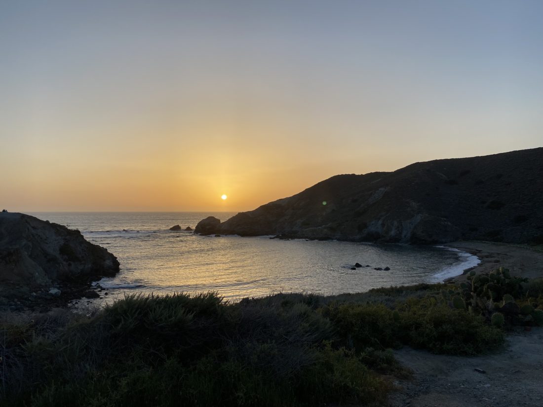
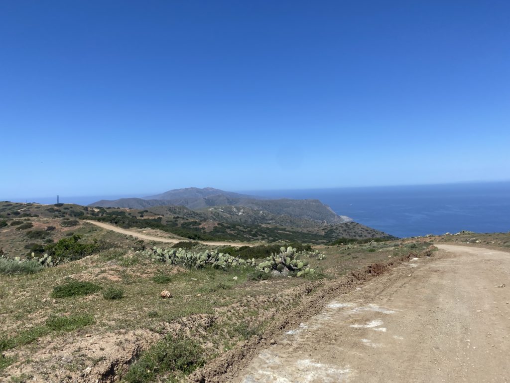
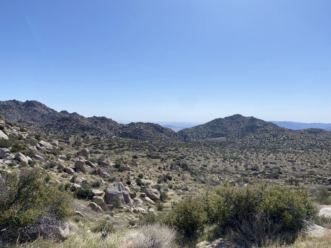
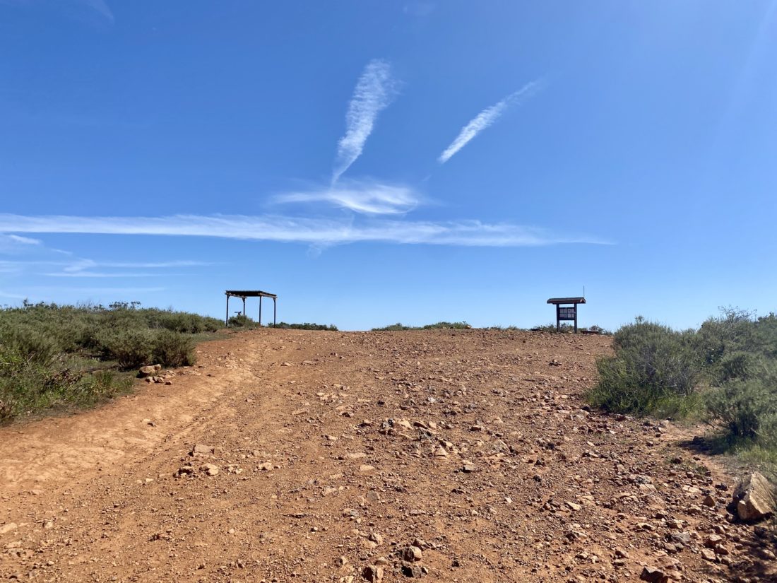
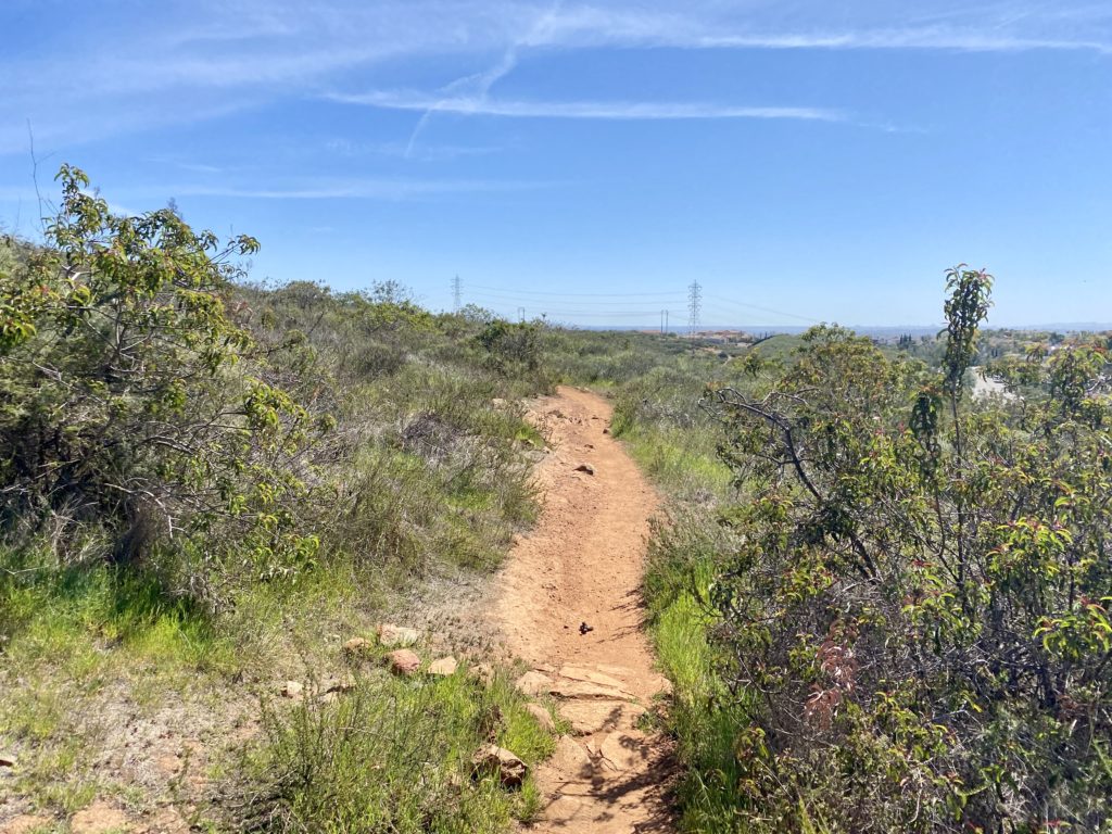
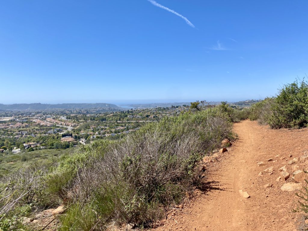
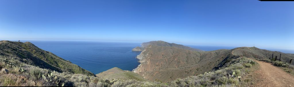
The trail doesn’t waste any time and starts climbing directly from the campground. Why the trail builders did not use switchbacks, I will never know. While it was steep, it was not too awful.  I did remember to stop and turn back toward Little Harbor for a few more photos. As I continued climbing, the views of the coast to my left were stunning. After about 2 miles, a shade shelter came into view, which indicated that the summit was almost there. I paused and shared with another hiker that I’d been “chasing” for much of the climb, but the draw of the General Store in Two Harbors was strong, so I said my goodbyes and continued down the trail. I had another almost 2.5 miles to go, but I did make a very short side trip to the top of Banning House Mountain. The extreme heat forecasted for the next day meant that it was highly unlikely I was actually going to try and summit Silver Peak if I took the high route out to Parsons Landing.

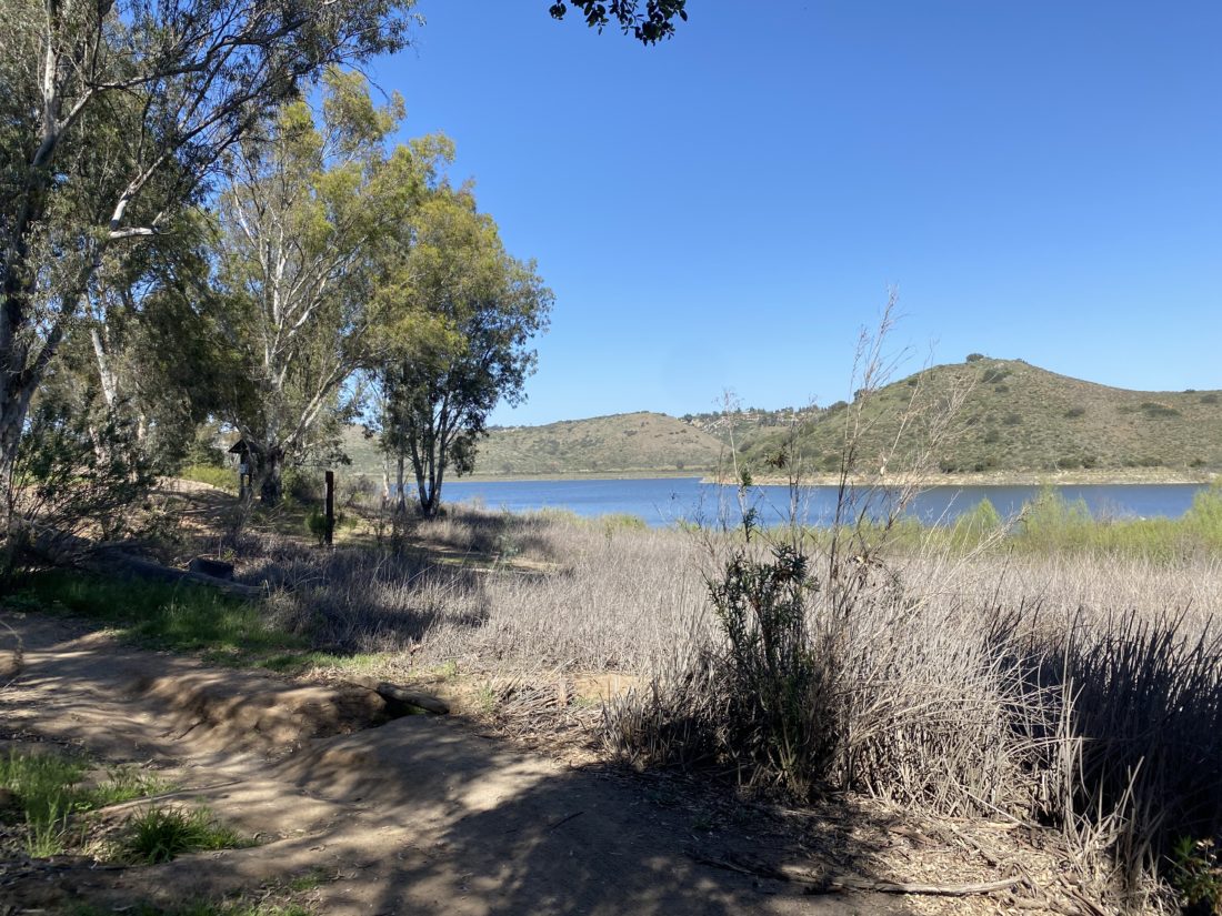
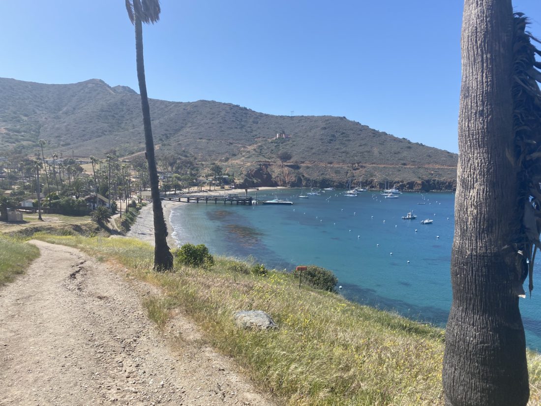
The descent was pleasant and seeing Cat Harbor was a welcome sight. I dropped my pack near the General Store and grabbed some cool drinks. After that, I made the ¼ mile walk over to the campsite. This time I’d be right next to the water. Once I was set up, I headed back into town for lunch and exploration. Between the campground and town, there’s a small hill that you go up and over. I had my lunch and then inquired about the locker key for Parsons Landing. Instead of putting my water and firewood in the locker, it would be marked for me placed next to one. I strolled back to the campsite and then went down to the beach below me to find a spot to relax. I also took some time to rinse my clothes and grab a simple shower. While you can pay for a warm one in town, the warm day made this cold one feel very refreshing. Since the store closes at 5, I made my way back over to grab a beer and hopefully some Fritos to go with dinner Sadly there were no Fritos to accompany my chili mac. I also opted to grab a Detour IPA from the excellent beer selection. It seemed appropriate since I was making a detour on the TCT.

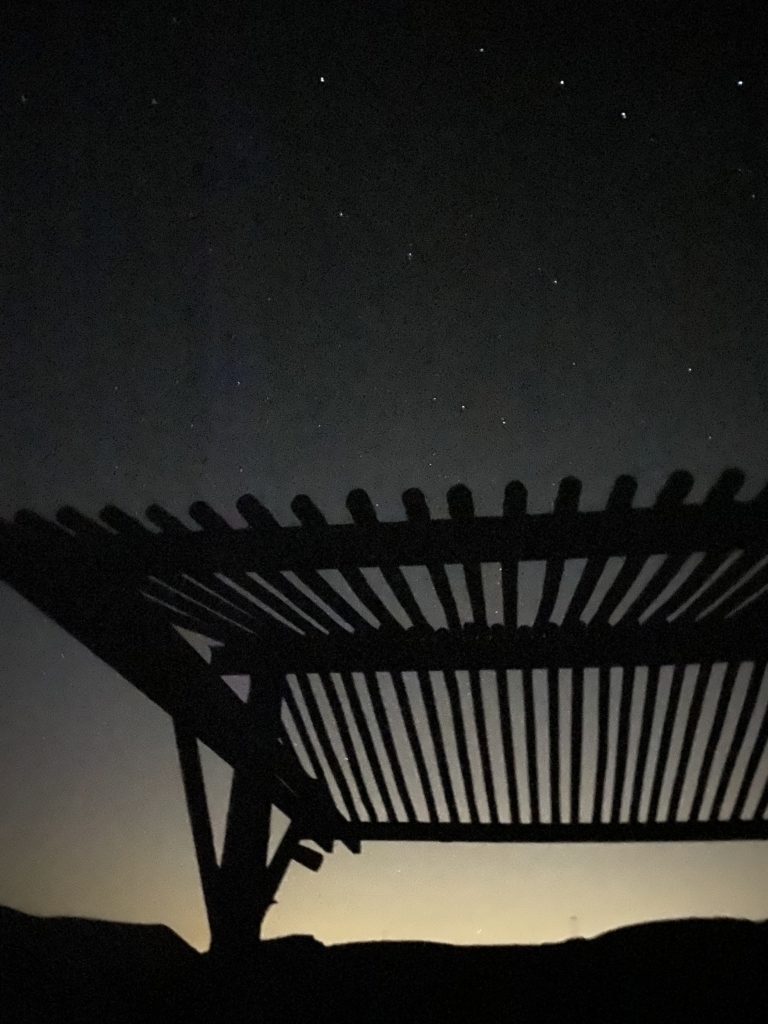
Some of the other hikers I had met along the way were also in town waiting until the restaurant opened. They invited me for dinner, but I really wanted to eat and enjoy the view from my campsite. So I compromised and had a cup of chowder with them instead. I was hoping to sleep again without the rain fly and enjoy the night sky. However, the fog started to roll in, so on it went. I also brought the rain cover for my backpack and slipped it on as well. Once again I enjoyed another fire as evening fell. 

While I did debate an early start to try to take the high route, I knew that the additional 2 miles to also climb Silver Peak might be too much in this heat. Even so, I still wanted an early start to go to Parsons Landing. While the road route was mostly flat, it was still nearly 8 miles. One downside of the Two Harbors campground is it can be quite noisy in the evenings. And true to those warnings, we had some campers making a bit of a racket into the evening. Thankfully they did quiet down before I got too grumpy.

Day 4: Two Harbors to Parsons Landing


Buy Me a Coffee at ko-fi.com

I am an avid peak bagger, sometimes backpacker, and former sea kayaker living in San Diego. In 2019, I became the third person to complete the San Diego 100 Peak Challenge. Not stopping with that accomplishment, I set my sights on the harder San Diego Sierra Club 100 Peak list, which I completed in 2021. In addition, I have conquered several Six-Pack of Peaks challenges (SoCal, San Diego, Central Coast, and both the Arizona-Winter and Arizona-Summer). Beyond attempting the San Diego Sierra Club 100 Peak list a second time, I am looking forward to exploring new summits and new adventures across the southwest. 

Trans-Catalina Trail: Day 2

One of the tests for this trip was changing my sleep setup. Given I mostly sleep on my side, I decided to switch to a quilt instead of a traditional sleeping bag. It works so well! No longer was I fighting with my sleeping bag during the night. I was able to also solve my pillow height issue as well. For sleeping in a tent, I did fairly well. 

Today’s route was really one of two parts; the first is a short 2.1-mile jaunt to the airport and the second is 6+ miles of mostly downhill into Little Harbor. I wanted to arrive at the airport closer to lunchtime, so I took my time enjoying my coffee and oatmeal. Once done with breakfast, I loaded my pack and headed out.

When I saw the airport the previous night when I tried to climb Mt. Orizban, it did not look too far away. Like many things on Catalina, however, nothing is a straight line.

I had some water in my internal bladder, but my side bottles were empty to save a little weight for a while. The route took me down a ravine before climbing back up again. Since I was in no hurry, I took a leisurely pace. I actually had a small water crossing. It had rained the week before and some of the water was still around. As I made my way up, I spotted 3 hikers heading toward me. It was a bit early for anyone coming from Little Harbor. It turned out they work for the conservancy and they were out counting snakes. I happily informed them that I had neither seen nor heard any today.

Once at the airport, I dropped my pack, found some shade, and enjoyed a cold soda. While the TCT is quite challenging, it intersects with civilization quite often. The airport was one of those intersections. After that cold drink, I ordered my bison burger with fries and another soda. I was here before when the twins and I had flown over with my friend Susan Bell for the same lunch. I let lunch settle a bit before starting to head out. Little Harbor is said to be a fantastic campsite so I wanted some time there. I filled my side bottles and bought two more sodas and an oatmeal raisin cookie for later. With mostly a descent ahead of me, the extra weight was fine.

A modest portion of this section of the TCT is on the road, so I encountered some actual traffic. First, a SoCal Edison truck passed me, and then an LA County Sheriff. Both slowed so as not to kick up any road dust. About 10 minutes later a paramedic and another sheriff’s jeep were headed toward the airport. Since they did not slow down, one could only assume someone was being transported. The day was warm and there was almost no shade. As I left the road and back onto a traditional trail I looked at my map and saw there was a shade shelter somewhere around mile 17. I could see it down below me and was looking forward to dropping my pack and sitting a spell. When I got there, however, surrounding it was a herd of 20+ bison! Some were standing, while others lay down all across the trail. Since I did not think they would be moving anytime soon I began figuring out plan B. I could just wait and hope they move one but the surrounding terrain looked fine and I took off cross-country around them.

I strolled into camp and found my site. I booked one further back in part for the quiet. I set up camp and then went exploring the campground. What a beautiful spot! I can see why folks would camp here multiple nights. I took off my shoes and let the cool Pacific Ocean wash over my feet. Then I headed back to my campsite and chatted with the woman in the next site over. I made my dinner, then headed to a nice spot to watch the sunset. No green flash this evening, but it was still lovely. I decided not to put up my rainfly and just stare at the stars from in my tent. The moon would be setting soon, so I could enjoy them as I listened to an audiobook before drifting to sleep.

Day 3: Little Harbor to Two Harbors


Buy Me a Coffee at ko-fi.com

I am an avid peak bagger, sometimes backpacker, and former sea kayaker living in San Diego. In 2019, I became the third person to complete the San Diego 100 Peak Challenge. Not stopping with that accomplishment, I set my sights on the harder San Diego Sierra Club 100 Peak list, which I completed in 2021. In addition, I have conquered several Six-Pack of Peaks challenges (SoCal, San Diego, Central Coast, and both the Arizona-Winter and Arizona-Summer). Beyond attempting the San Diego Sierra Club 100 Peak list a second time, I am looking forward to exploring new summits and new adventures across the southwest. 

Trans-Catalina Trail: Day 1

The alarm went off at 6 am just like a regular workday. I took my time getting ready. Since I stayed in town I could also enjoy a nice hot breakfast before heading out. Pancakes, two eggs, and black coffee hit the spot. I went back to the room and gathered my gear. The hotel gave me a $20 voucher which I used at their Bistro to get another coffee and their “All-Day” lunch kit. I repacked it into my pack and set off. My TCT hike had begun!

For now, the skies were overcast and it was very muggy as well. My shirt was quickly becoming damp but I would take that over a blazing sun any day. I passed through Hermit Gulch and began the first climb of the day. While the Trans-Catalina Trail is only 40 miles long, you have to climb over 9,000 feet along the way. The first climb would take me basically from sea level up to to just over 1,500 feet in 3 miles. 

Along the way, I would stop and turn around and enjoy the view of Avalon and the cruise ship that arrived. As I neared the end of the climb, the sun was starting to burn through the marine layer. At one of the shade shelters along the TCT, I switched into my sunglasses and had a good drink, and continued on. The trail would rise and fall as I kept working my way toward Blackjack campground.

As I approached the small reservoir, a large male bison was working its way down the trail I needed to take. I stopped a safe distance away and grabbed some photos. I then waited, hoping he was heading down to the water for a drink. Thankfully he was, and then I hustled up a section in case he changed his mind.

The TCT would flip flop from single-track to some road walking. I saw some traffic at times, none passed me while I was on the road. At each bench, I stopped and took a well-earned break, knowing I had over a 10-mile day with a full pack. I grabbed a snack and a good drink, saving my “All-day” lunch for when I arrived at the campground.

At mile 9, I took an extended break at the shade shelter. There was one more descent, then the final push into the campground. I plodded up the trail, praying for a switchback. Alas, it was just a straight-up assault on my legs. When I spied the campground in the distance a little spring came back into my step. I found my spot and sat down at the picnic table, and slowly ate my lunch. Once I had some energy, I set up camp. Afterward, I spent some time chatting with a couple from the next spot over. I grabbed a short nap in my tent, and then I decided to see if I might be able to hike out to Mount Orizaba, the high point on the island, but the road to the summit was gated and locked, and I did not feel proper hopping over the barbed wire fence. Off to the north, I could see the “Airport in the Sky”, the first stop for tomorrow, but more importantly, bison burgers! Once back at camp, I made my dinner and turned in. There are no campfires allowed here, so it was an early evening.

Day 2: Blackjack Campground to Little Harbor


Buy Me a Coffee at ko-fi.com

I am an avid peak bagger, sometimes backpacker, and former sea kayaker living in San Diego. In 2019, I became the third person to complete the San Diego 100 Peak Challenge. Not stopping with that accomplishment, I set my sights on the harder San Diego Sierra Club 100 Peak list, which I completed in 2021. In addition, I have conquered several Six-Pack of Peaks challenges (SoCal, San Diego, Central Coast, and both the Arizona-Winter and Arizona-Summer). Beyond attempting the San Diego Sierra Club 100 Peak list a second time, I am looking forward to exploring new summits and new adventures across the southwest. 

Trans-Catalina Trail: Day 0

My lovely bride dropped me off at the Catalina Express terminal in Dana Point after having lunch together. Thankfully the ferry was not too full so I did not have to store my backpack with the other passengers’ luggage. The boat ride over was fairly smooth, so I took a small nap. As we approached the dock at Avalon, it was still occupied, so the captain took us on a short cruise up the coast to kill some time. After disembarking, I grabbed my photo of the Catalina sign and headed over to one of the two spots to buy camping fuel. I later learned I picked the right store as Chet’s Hardware had run out. I checked into the Hotel Atwater. While many might camp at Hermit Gulch or plan for early arrival on the island, I treated myself to a real bed. When I booked the trip I had hoped one of my hiking friends might be able to join me. Unfortunately, no one could.

I wandered around the heart of Avalon and took a stroll to see the old casino. This is the iconic building you see in almost every photograph of Avalon. I skipped shopping in the various stores as I was not about to haul some knick-knack for 40-plus miles. I found a Mexican place for dinner and relaxed. Afterward, I grabbed some ice cream and watched the light fade over the ocean. Since I planned for an early start, I did not plan to go hit any of the bars, and turned in for the evening.

Day 1: Avalon to Blackjack Campground


Buy Me a Coffee at ko-fi.com

I am an avid peak bagger, sometimes backpacker, and former sea kayaker living in San Diego. In 2019, I became the third person to complete the San Diego 100 Peak Challenge. Not stopping with that accomplishment, I set my sights on the harder San Diego Sierra Club 100 Peak list, which I completed in 2021. In addition, I have conquered several Six-Pack of Peaks challenges (SoCal, San Diego, Central Coast, and both the Arizona-Winter and Arizona-Summer). Beyond attempting the San Diego Sierra Club 100 Peak list a second time, I am looking forward to exploring new summits and new adventures across the southwest. 

Cuyamaca Peak (via Conejos Trail)

With the desert too warm to continue working on the San Diego Sierra Club 100 Peak List, I decided to start working on the San Diego Six-Pack of Peaks Challenge. Opted to climb Cuyamaca Peak with a friend. The Los Vaqueros Trailhead was almost packed, as there was a training run for the SD100 Trail Race. We made our way along the Milk Ranch Road, along the way we spotted a herd of deer wandering by. Once at the turn, we began looking for the mountain lion prints that the training director had told us about. Sure enough, we could see a nice collection of the lion’s travels.

We linked up with the Conejos Trail and began working our way up. The trail becomes a bit rocky so we needed to be mindful of our steps. Partway up we heard the sounds of running water, the Conejos Spring was flowing, and in fact, some of the trail itself had running water on it.

As we neared the paved fire road, we noted quite a few trees had been snapped due to the high winds a few weeks back.

Once at the summit, more evidence of this as a mast on some equipment had been taken down and smashed its solar panels. We soaked in the views and enjoyed a well-earned snack before heading down.

Instead of taking the Conejos Trail again, we continued to the Azalea Springs Fire Road. That way we could skip the rocky section. Once back on the Milk Ranch Road, we spotted some wild turkeys. The entire hike took us 4:03 (including the break at the summit) and covered 8.7 miles.


Buy Me a Coffee at ko-fi.com

I am an avid peak bagger, sometimes backpacker, and former sea kayaker living in San Diego. In 2019, I became the third person to complete the San Diego 100 Peak Challenge. Not stopping with that accomplishment, I set my sights on the harder San Diego Sierra Club 100 Peak list, which I completed in 2021. In addition, I have conquered several Six-Pack of Peaks challenges (SoCal, San Diego, Central Coast, and both the Arizona-Winter and Arizona-Summer). Beyond attempting the San Diego Sierra Club 100 Peak list a second time, I am looking forward to exploring new summits and new adventures across the southwest. 

Inaja Nature Trail

I can’t count the times I have driven past the Inaja Memorial Picnic Ground on my way to and from my hikes. But, this short 1/2 mile hike was included on the North County San Diego Sierra Club’s 50 hikes for 50 years Challenge, so when driving back from hiking Cuyamaca Peak, Ted and I made a quick stop. Next to the parking lot are several covered picnic tables, and a small monument dedicated to the firefighters who lost their lives battling the Inaja Fire. In 1956, 11 firefighters lost their lives while battling the Inaja Fire along the San Diego River outside of Julian. 

Just past the pit toilets, the nature trail begins a short climb up around the hill. Off to our left was the San Diego River Gorge. As the trail looped north, we were greeted with some beautiful views of the Santa Ysabel valley. We spotted a small use trail that led us toward the “summit”, where we found a viewfinder, allowing us to locate various landmarks across the horizon.

The trail continued working its way around and soon we found ourselves back at the trailhead. If we had been smarter, we should have run down to Dudley’s, got our sandwiches and made the short drive backup and enjoyed them here.


Buy Me a Coffee at ko-fi.com

I am an avid peak bagger, sometimes backpacker, and former sea kayaker living in San Diego. In 2019, I became the third person to complete the San Diego 100 Peak Challenge. Not stopping with that accomplishment, I set my sights on the harder San Diego Sierra Club 100 Peak list, which I completed in 2021. In addition, I have conquered several Six-Pack of Peaks challenges (SoCal, San Diego, Central Coast, and both the Arizona-Winter and Arizona-Summer). Beyond attempting the San Diego Sierra Club 100 Peak list a second time, I am looking forward to exploring new summits and new adventures across the southwest. 

Goat, Webo and Ted Benchmarks

With the desert season slowly coming to a close, we wanted to try to get the most bang for our hiking buck. So, we decided to do the ‘infamous’ San Ysidro Traverse, starting near Ranchita, working our way down through Hellhole Flats, then down one of the ridges onto the desert floor. Along this route, we could summit Goat Benchmark, San Ysidro East Peak, The Sirens, and for our planned exit, Webo and Ted Benchmarks. I needed to summit San Ysidro East Peak and The Sirens, while Susie and Matt needed all 5. We knew the weather might be problematic, but we felt it was within our comfort level.

I spent the week watching the forecast, and on Friday I felt that we should be fine for our hike on Sunday. Saturday afternoon, I checked the forecast from NOAA and it seemed to be about the same. Well, as I loaded my car in the predawn it was clear that the predicted shower had at least happened in San Diego. In checking the latest forecast, the wind advisory had been extended and the forecasted wind speeds bumped upwards. Not ideal, but at this point, we figured we might as well see what conditions really were.  We had some backup plans just in case we had real issues. Susie and I met Matt at the Maidenhair Falls parking lot. Matt tossed his gear into the Outback, paid his $10 use fee, and we backtracked up to the very familiar spot along Lease Road. When we got out of the car, it was chilly and there was a stiff breeze. If these conditions held, we were fine attempting the hike.

We followed the old jeep trail up, then we headed cross-country to a nice spot to cross the barbed wire fence. From there we made a short steep climb to the ridgeline that The Thimble sits on. We were greeted with a sweeping view of Anza-Borrego. The Thimble loomed over us to our north, White Benchmark was off to our south. Crossing another barbed wire fence, we began our descent toward Goat Benchmark. This would be my third time to this peak, but I still needed to be mindful of my GPX track, as it is just a small jumble of rocks. In fact, it is not even the highest jumble nearby. As we reached it, the winds really began to pick up. Susie opted not to make the short climb to the summit block. We had a quick snack and began to discuss our options: Continue on and re-evaluate conditions as we draw closer, or climb back out. We agreed that we should push on and see how the weather continued to play out.

As we descended from Goat, we had a small climb to make. Due to some conflicting recollections, we wound up making a larger than planned loop around it (With a bit of gain and eventual descent). Next time, we will remember there is this short little ascent to deal with. But as we stood looking across Hellhole Flats, the wind was really blowing. I could feel it push me as I stood there. The clouds raced around Middle San Ysidro Peak behind us. It was now decision time. Do we continue eastward toward San Ysidro East and attempt to summit, or head south across Hellohole Flats toward Webo? The Sirens were clearly out due to their very exposed nature and the more difficult ascent.

None of us felt comfortable making the ascent. While we were feeling good and the temperatures were pleasant, the level of risk was beyond what we wanted to take. Plus, without The Sirens, this identical trip was going to be done again. So we cruised across the flats toward the west ridge to Webo. I pointed out some features I encountered the last time I did the traverse. The climb up to Webo went smoothly. We would look back at SYEP and The Siren and wish we could have climbed them, but then a strong gust of wind would dispel any illusions we had.

The summit block for Webo is very exposed. Matt climbed up enough to grab the register, while Susie was just fine hiding from the wind. We took a long break and enjoyed a larger snack. I did climb the block just far enough to return the register. Then we began the steep descent. 

Unlike last time, when my right knee was very painful, today’s descent was only moderately bothersome, just the discomfort one would expect from about 4,100 feet to 900 feet in 3 miles. We deftly avoid the various cacti that dotted the ridgeline. Some were even blooming! The desert had almost no rain this year, so there have not been a lot of flowers. We worked our way around a couple of more bouldery sections by staying on the south side of them. We kept an eye on our track, just so we did not pass Ted Benchmark. We spotted the cairn and the reference mark. The register took a moment or two to locate, but we found it tucked just a bit below the cairn. We took a short break. I shed my fleece and switched my gloves. We continued on down the ridge, Matt’s car looming in the distance. The conditions below Ted changed in other ways, while it had become warm and less windy, the rocks had now become smaller and loose. So, we had to keep an eye on our footing as the sandy desert floor drew ever closer. Once off the ridge, we had a nice 1.3-mile stroll back to the car. A couple of folks passed us heading to what we were sure were the dry Maidenhair falls. Matt this shuttled us back up to Ranchita and dropped us at my car. Susie and I made a quick stop at the Montezuma Valley Market for a cold soda and a Snickers. A couple of PCT Thru-Hikers were hanging on the porch, charging their phones. Gave them a quick nod and wished them well. The drive home was actually uneventful. Often we are caught in traffic returning from Julian, but the weather had kept a lot of folks at home. I doubt we will be able to try again this season, but you never know… The final stats were 8.94 miles in 7:36. We climbed a total of 1,675 feet and descended a total of 5,318 feet!


Buy Me a Coffee at ko-fi.com

I am an avid peak bagger, sometimes backpacker, and former sea kayaker living in San Diego. In 2019, I became the third person to complete the San Diego 100 Peak Challenge. Not stopping with that accomplishment, I set my sights on the harder San Diego Sierra Club 100 Peak list, which I completed in 2021. In addition, I have conquered several Six-Pack of Peaks challenges (SoCal, San Diego, Central Coast, and both the Arizona-Winter and Arizona-Summer). Beyond attempting the San Diego Sierra Club 100 Peak list a second time, I am looking forward to exploring new summits and new adventures across the southwest. 

North Shore Lake Hodges

After the quick stroll along the Questhaven Nature Trail, I headed to my second hike of the afternoon, along the North Shore of Lake Hodges. According to the WBC 50 for 50 Challenge, this hike was to start near Hernandez Hideaway and head north along the shoreline. I had used this trailhead before for one of the Coast to Crest Challenge Hikes down to the Rattlesnake View Point

Since it was a workday afternoon, the parking lot was almost completely empty, but I knew from past experiences this area is a popular mountain biking area, so I was thankful not to be as worried about sharing the trail. There wasn’t a specific spot where I needed to take my photo, so I just wandered a bit until I found a nice view of the lake and took one. I then retraced my route back to the car and called it a day.


Buy Me a Coffee at ko-fi.com

I am an avid peak bagger, sometimes backpacker, and former sea kayaker living in San Diego. In 2019, I became the third person to complete the San Diego 100 Peak Challenge. Not stopping with that accomplishment, I set my sights on the harder San Diego Sierra Club 100 Peak list, which I completed in 2021. In addition, I have conquered several Six-Pack of Peaks challenges (SoCal, San Diego, Central Coast, and both the Arizona-Winter and Arizona-Summer). Beyond attempting the San Diego Sierra Club 100 Peak list a second time, I am looking forward to exploring new summits and new adventures across the southwest. 

Denk Tank Mountain

The North County group of the Sierra Club is celebrating its 50 anniversary.  As part of that celebration, they are hosting a 50 Hike Challenge. I decided to work on this list as my backup hikes or my mid-week hikes. Yesterday was such a day. Denk Mountain is just a few minutes from work, and even on my way home. I parked near the trailhead and laced up my boots, grabbed my poles, and set off.

While it was sunny, the temperatures were not too warm as I quickly made my way up the trail. There is quite a network of trails across this mountain, so you do need to take some care at junctions to stay on the route you want to take to the summit.

At the summit, I snapped a few photos, including the one for the challenge, and headed back down. There were a few flowers dotting the sides of the trail. Judging by the tracks on the trail and the repair stand at the summit, it is safe to assume this area is favored by mountain bikers, so make sure you keep an ear and an eye out for them when you hike it. The hike was 2.8 miles in 1:07 with 663 feet of gain.


Buy Me a Coffee at ko-fi.com

I am an avid peak bagger, sometimes backpacker, and former sea kayaker living in San Diego. In 2019, I became the third person to complete the San Diego 100 Peak Challenge. Not stopping with that accomplishment, I set my sights on the harder San Diego Sierra Club 100 Peak list, which I completed in 2021. In addition, I have conquered several Six-Pack of Peaks challenges (SoCal, San Diego, Central Coast, and both the Arizona-Winter and Arizona-Summer). Beyond attempting the San Diego Sierra Club 100 Peak list a second time, I am looking forward to exploring new summits and new adventures across the southwest. 

Coyote Mountain

As we pulled onto the side road along Rockhouse Canyon Road, another car was parked with a solo hiker getting ready to make their ascent of Coyote Mountain. Unlike last weekend, when the winds were a bit too high for our comfort, today’s forecast looked pleasant, although just a touch on the warmer side. Susie, Alberto, and I gathered our gear and began hiking across the desert floor to the ridge that we would follow up to the summit. The other hiker had already left and appeared to be making good time.

Soon we found ourselves at the base of the steep ridge and started our ascent. I was hoping that I might find the folded rock again and see it in a better light. As luck would have it, we passed right by it. Score! 

Susie guided us up the ridge. The route is very well marked with cairns, and after a bit, the use trail began to reveal itself. While not really needed, as this is a standard ridgeline hike without any real obstacles, it is nice to walk on a more cleared route. 

Unfortunately, I am not as fit as Susie, so we took a short break to let me recover a bit. I then took over the pace-setting. We would take a few more quick breathers just before a steeper section along the ascent, We were still holding a solid pace. 

As we neared the final steep section, that earlier hiker was making his way back down. We chatted a bit before continuing on. Soon, we crested the summit, and the wooden pole that marks it stood before us. We took a nice break, snapping some photos, signing the register, and refueling. I found the two reference marks, as well as the benchmark itself. Since both Susie and I had early evening plans, we were mindful of the time and headed back down.

The descent went pretty quickly. I found a nice rhythm that did not bother my knees. When I did this hike back in 2019, I had some serious knee pain on the descent. This time, no real discomfort. Susie and Alberto would stop occasionally for a brief moment to regroup. One thing I have learned with my knees is to hike at the pace my body can handle. Once I would catch up with them, I usually kept right on going.

As we neared the base of the ridge, we almost headed down the wrong spur, but a quick check of our ascent track got us back on track. Off in the distance, we spotted a truck that had pulled up. We were curious who might be looking at starting this hike around noon. The temperatures were in the mid-70s and there is no shade on the entire hike. It turns out it was another hiker and his wife we knew, who had just started tackling some harder hikes across San Diego. We chatted some before parting ways. The stats for the hike were 5.2 miles in 4:29. Our time up to the summit was 2:15, and we spent about 20 minutes relaxing before heading down. The elevation gain was a mere 2,623 feet. 


Buy Me a Coffee at ko-fi.com

I am an avid peak bagger, sometimes backpacker, and former sea kayaker living in San Diego. In 2019, I became the third person to complete the San Diego 100 Peak Challenge. Not stopping with that accomplishment, I set my sights on the harder San Diego Sierra Club 100 Peak list, which I completed in 2021. In addition, I have conquered several Six-Pack of Peaks challenges (SoCal, San Diego, Central Coast, and both the Arizona-Winter and Arizona-Summer). Beyond attempting the San Diego Sierra Club 100 Peak list a second time, I am looking forward to exploring new summits and new adventures across the southwest.