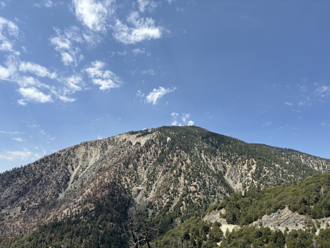
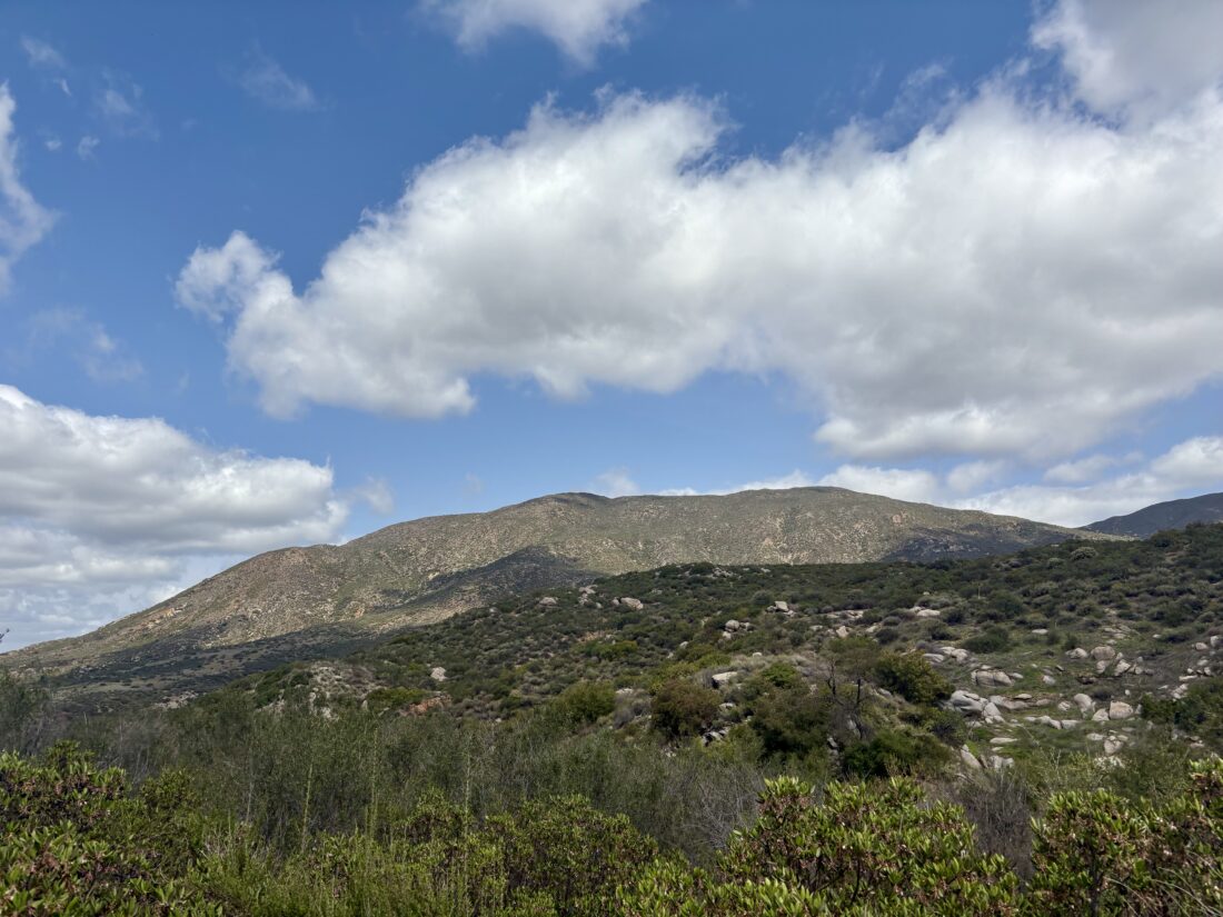
When the closure order for the Bridge Fire was lifted, this meant Mount Baden-Powell could once again be summited. However, the road to Vincent Gap was still closed, meaning either starting the hike with a 5-mile road walk or approaching it from Windy Gap. A few days ago, the road was opened past Wrightwood to Vincent Gap, so I decided to make the drive up and hike the 40+ switchbacks to the top. As I passed Wrightwood, I could see the damage caused by the Bridge Fire. Drawing nearer to the parking area, Mount Baden-Powell came into view. The south-east side clearly had been hit by the fire, while the north-east side still looked nice and green. Just before the fire occurred, a new parking fee was introduced for the main lot and a $5 pass is needed to park there. Previously, I would just hang my America the Beautiful pass and be fine. Now, even that pass will not work. If I park across the road, my pass is all I need. For more on this, watch this video. There were two cars in the “paid” lot and one car across the road. I grabbed my new backpack and set off. I was trying out the Osprey Hikelite 26 as an option for my upcoming attempt to climb Mt. Whitney.
It had been a few years since I took this route, but I certainly remembered that first steep “Welcome to Mount Baden-Powell” section. The trail eases up after 1/10th of a mile and starts working its way up the face of the mountain. It was slightly humid, but the shade of the trees helped. Switchback after switchback passed by, and I kept a good solid pace.
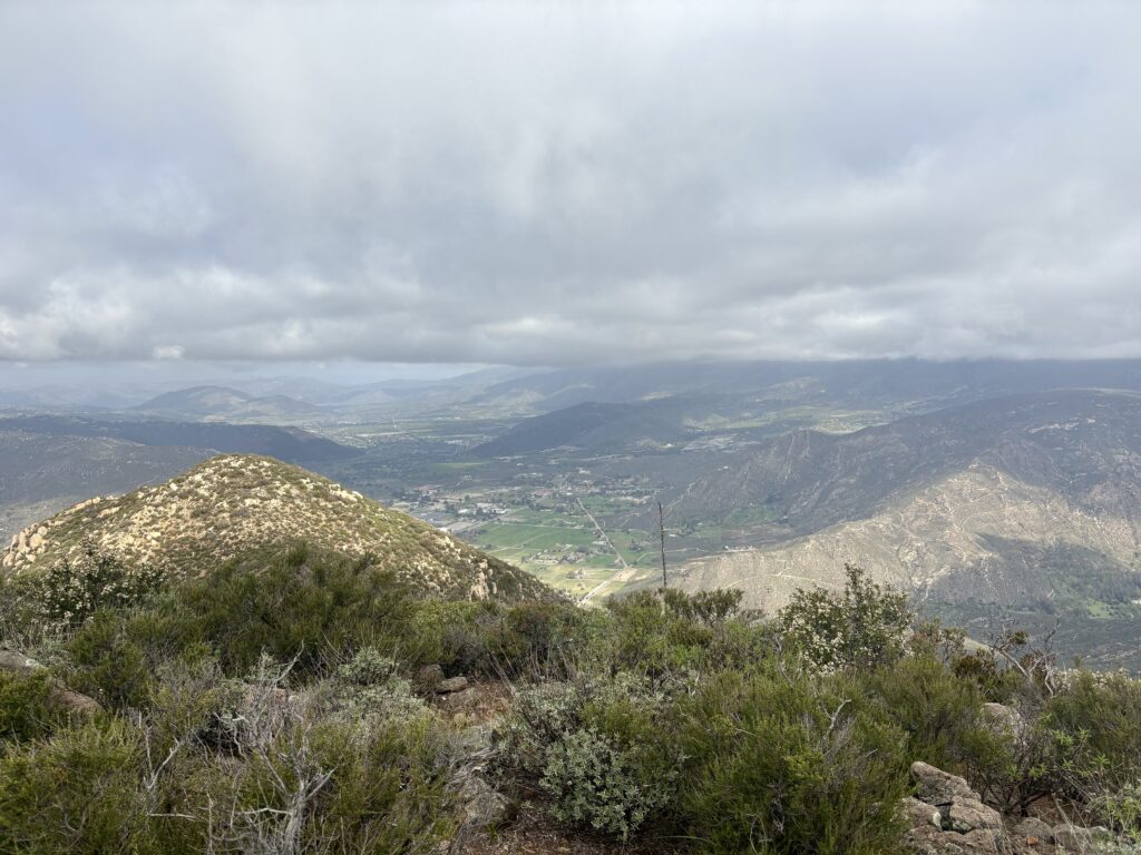
After two sets of hikers, I drew nearer to the summit as the distance between switchbacks reduced. Then the Wally Walden tree came into view. This tree is estimated to be over 1,500 years old. I made the rest of the push to the summit, where two hikers were hanging out. I found a spot to take a break and soak in the views for a bit. The other hikers said their goodbyes and began their descent. I did some filming of the monument to Lord Baden-Powell and the vistas from the summit before I also headed down. The descent went quickly, and I decided to go over and see Lamel Spring. The trail got a bit dicey just before the spring, but it was still flowing so it was worth it. I suppose if you were camping partway up, you could save a bit of water weight. I passed several other hikers making their way up. Soon, the parking lot came back into view. The new pack worked out nicely and might become my primary daypack. Originally, I had planned to grab lunch in Wrightwood, but it was too early, so I waited until I was closer to home and hit The Rib Shack in Fallbrook. I covered the 8.3-mile (including the side trip to the spring) in 3:393 with an elevation gain of 2,745 feet.
I am an avid peak bagger, sometimes backpacker, and former sea kayaker living in San Diego. I am the co-author of Urban Trails: San Diego, coming in Spring 2026!
The adventure began with kissing my wife goodbye, patting our dog, and setting off toward Lee Vining. I had said goodbye to my son, who recently moved home to become the Youth Director at our synagogue, the night before. The first stop was at a Starbucks, as a large coffee was needed for the long drive. I was meeting Rick to borrow a small tripod, as both of the ones I ordered to replace the one I lost when hiking Sawmill were delayed in arriving. With Rick’s tripod now in hand, I began the drive north. Traffic was not too bad, and the podcasts passed the time.
My first stop was the Eastern Sierra Visitor Center in Lone Pine. I had a question about our upcoming permit to climb Mt. Whitney, and wanted to swap out a plastic Junior Ranger badge for a wooden one. Unfortunately, I arrived during their lunch break, and they were closed. I did, however, see some runners racing in the Badwater 135, and support cars were parked throughout the town.
My next stop was Manzanar National Historic Site, again to obtain a Junior Ranger badge. Sadly, due to staffing issues, the Visitor Center is now closed from Tuesday through Thursday. Ted and I will have to return when we come back for our Whitney attempt. I already knew that the Copper Top BBQ was closed, and found Mountain Rambler Brewery as a replacement for my lunch stop. After a fine burger and a tasty flight, I made a quick stop for gas and continued northward. As I neared Mono Lake, I saw a sign saying there would be a Ranger-led walk at 6 pm. I certainly had time for this, but after checking into the motel and unloading my gear, I drove over to the Mono Basin Scenic Area Visitor Center to confirm that the walk was still scheduled. The kind volunteer said it was. I also inquired about any Junior Ranger badges, and they indeed had one for the Inyo National Forest! I made the 15-minute drive back to the south shore of Mono Lake and waited on a bench.
Our walk was led by a staffer from the Mono Lake Committee, Ana. She had recently started working there and was full of enthusiasm about the lake. About 15 of us walked the Loop Trail, stopping at various points to learn about a wide range of topics. I left toward the end, as I was getting hungry and wanted a good night’s sleep.
Dinner was the “world-famous” fish tacos at the Whoa Nellie Deli. The mango salsa one was outstanding, and the ginger coleslaw was good as well. I watched the sun set on the lake and headed back to the motel. Earlier in the day, I made the 30-minute drive into Yosemite National Park to pick up my Wilderness Permit, as well as a Junior Ranger booklet. I figured I could work on it that evening in the motel, which I did. With that task complete, it was time to turn in for the night. Tomorrow would begin 6 days of backpacking through Yosemite’s backcountry.
Day 1: Tuolumne Meadows to Glen Aulin
After a fairly good night’s rest in the motel, I took my last shower for almost a week. I walked down the highway to Nicely’s for a good breakfast to start off this adventure. Given that the Tuolumne Meadows Visitor Center did not open until 9 am, I was not in a rush. I swung by the Whoa Nellie Deli again to grab a ready-made sandwich for my lunch. The drive back to the park was uneventful, except for the dead deer on the side of the highway. I pulled into the parking lot for the Tuolumne Meadows Visitor Center and stored my backpack in a nearby bear locker. I went in and presented my completed Junior Ranger booklet. After a little chat with the Ranger, I was sworn in as a Junior Ranger for Yosemite. On her suggestion, I opted to park back at the Wilderness Permit Station. I checked back in with the rangers there in case something had changed. They reported all was good, just a few mosquitoes at spots. With that, it was time to hit the trail. I stepped onto the PCT and followed it westward. The trail paralleled Tioga Road for a bit before crossing it and following the road to the Glen Aulin Trailhead. Along the way, I was stopped by a woman assembling her backpacking gear, and she had a question about the parking for Glen Aulin. I told her where I had parked, but I was planning on doing the whole loop. She thanked me, and we parted ways.
The first point of interest was Soda Springs. This is a naturally carbonated spring that sits on the edge of the meadow. You can take a taste, which I did. It was slightly fizzy, with a bit of a metallic tinge.
The trail was mostly downhill for the first day, and with 6 days of food on my back, I was thankful. I took a short break and watched the waters of the Tuolumne River flow past. There I met a lady day-hiking to Glen Aulin, and we hiked down the trail together. We crossed the first bridge over the Tuolumne and saw some PCT hikers grabbing a few photos. We continued on down the trail, chatting about the state of our parks and public lands.
About 5 miles in, we met a Ranger on patrol. We chatted a bit, and I presented my permit. She commented on how small my pack seemed. I replied that I was leveraging the bear lockers at each site, so I left my heavy bear can in the car and was storing my food in my new Adotec bag. She said it was perfectly fine, given that each site does have lockers. If I were adventuring elsewhere, then an approved bear can would be needed.
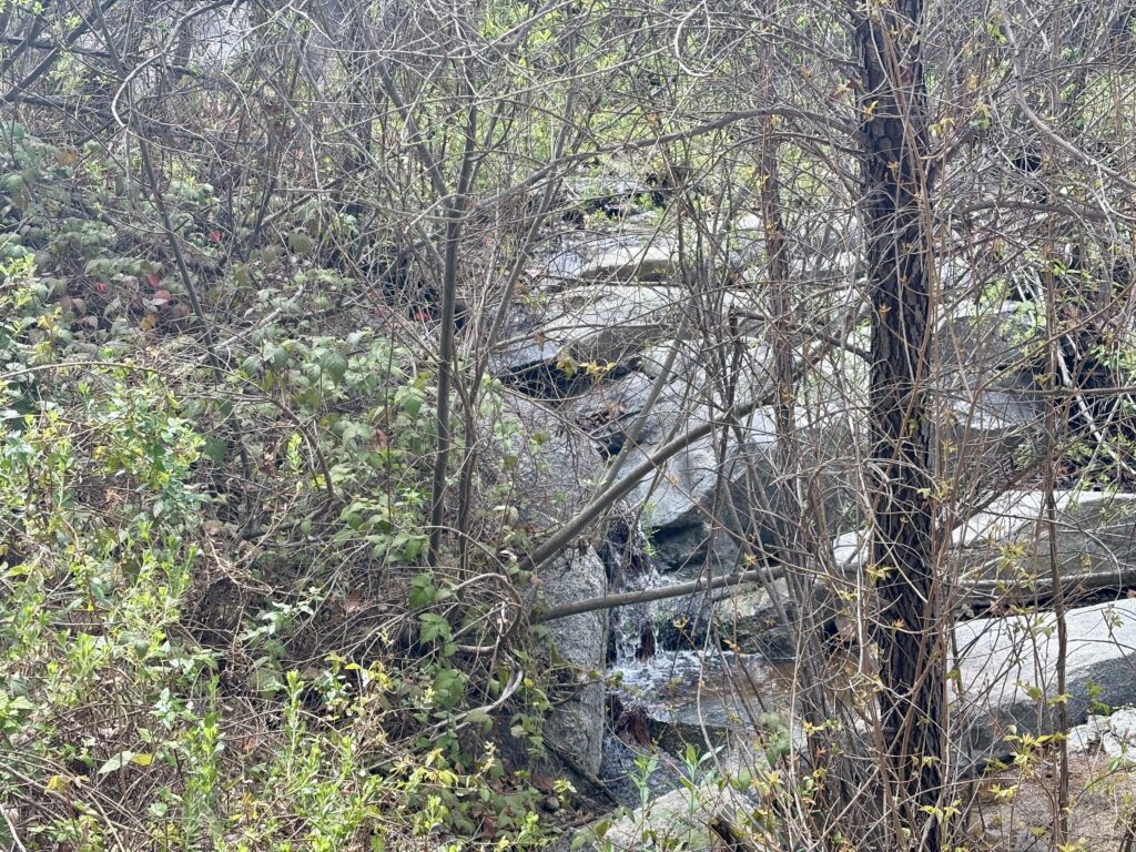
Soon, the sounds of a waterfall began to fill the air, and this meant we were drawing close to Glen Aulin. The bridge that crossed the Tuolumne River into Glen Aulin had been destroyed due to high snow a few years back, but thankfully had been rebuilt. Once across, we took a second bridge over Conness Creek into camp. She found a nice spot to have her lunch, and I did a quick tour of the backpacking site. The High Sierra Camps are built in two parts: the actual camp and its associated infrastructure, and a section for traditional backpackers. The camps were not open this year, so the various tents and other structures were not assembled. Continuing on to the backpacking area, I skipped the first collection of sites, as several spots were already taken, and continued on. I found a set of sites up on a granite ridge, all of which were unclaimed. I left my poles on a site that looked perfect, and returned down to also have my lunch with my hiking companion. When done, she headed back up the trail. I then tossed my food into the bear locker before making the short climb to my campsite. I decided to change which spot I picked upon closer inspection of the slope. Soon, I had my tent set up and was good for the evening. I wandered down to the river’s edge to fill my CNOC water bag, so I could filter some water later.
I found a nice shady spot and took a short nap. Once refreshed, I wandered around camp, including taking advantage of the composting toilet. I chatted with some of the other campers: a few PCTers, an Outward Bound group, and eventually the woman I met at the beginning of the hike. I sauntered down the trail that parallels the Tuolumne to explore some of the falls downstream for a bit. There I saw my first Marmot, but didn’t have time to snap a photo. I returned to camp to have dinner. I found a spot far enough away from my tent to make and eat my pasta. After cleaning up and storing the rest of the scented items, I turned in. I was tired from the day’s hike, and lying in my tent listening to my audiobook for a bit was just what I needed. A full moon would be rising soon, so that would put a damper on any stargazing or astrophotography. I turned my phone off to save some battery and drifted off to sleep. I forgot to mention, I did check in with Anita and let her know that I was safely at camp.
DAY 2: Glen Aulin to May Lake
Sleep was about what I expected. I was actually a tad too warm, but this is one of the lower elevation sites, so I might still want my better quilt at the other camps. I awoke at first light, but fell back asleep for another 30 minutes. I packed up my gear, made a pit stop, then gathered my food and scented items from the locker. I went down to the river’s edge and had my breakfast of oatmeal and a cup of coffee. I properly re-packed my backpack and set off. Today’s journey would be hiking about 8 miles up to May Lake. According to one guide I read, I would be gaining about 1,400 feet of elevation. While this would almost be trivial back home, I had a fairly full backpack and was starting at 7,880 feet.
I crossed back over the Tuolumne River, the morning light shining through the mists from the waterfall, and made the steep climb to the junction with the trail to May Lake. This trail heads mostly southward, first toward McGee Lake. The mosquitoes were out in force, so the bug net quickly came out. The trail initially worked its way upward through the forest. The views were stunning, and occasionally I would dart off the trail to explore a possible viewpoint. About 3 miles in, I took a break and, since I had a clear view of the sky, sent a check-in message back home. I shouldered my pack again and set off. There was very little breeze, so it was a tad warm.
Just after one steeper section, I took another break under the shade and to soak in the views. I then began a series of switchbacks, and after about 10 minutes, I went to grab the tripod, and it was missing! It must have fallen off my pack where I took my break, so I turned and hiked back. At the rest stop, it was nowhere to be found. Ugh! I gave up looking there and started back up the trail, and just after the first switchback, I spotted it on the trail. I had walked right over it on the way down. Crisis averted. I tightened the strap I had been using to hold it on my pack and kept climbing. This section was very sun-exposed, so I was feeling the sun’s rays upon me. I took another break and adjusted my socks and shoes. Before leaving, I again checked that the tripod was still secure. Soon, I crested a small saddle and began the short and gentle descent to May Lake. Its waters were a welcoming sight. I had forgotten to “camel up” before leaving Glen Aulin, so I drank more than I planned for during my ascent. I passed through the closed camp’s foundations and buildings before finding a spot for the night. It was only about noon, so I had a lot of time to kill.
I again stashed my food in a locker, filtered some water, and, under the shade of the trees, ate my lunch. I drank some electrolytes to replace those that I sweated away. I then found another shady spot and took a well-earned nap. My tracker recorded the climb as over 1,930 feet of gain. Quite a difference from what I had read earlier. That would explain the tightness in my calf. I certainly was hiking faster than I would have had I done a better job in understanding this section of the trip. I explored the area some more, stretching the calf, trying to get some relief. I went back down the water’s edge and soaked my feet in the cool waters. I opted for a second nap, because why not? I started considering my options. The next day’s hike was listed as “very strenuous” with about 1,600 feet of descent over 3 miles, followed by an ascent of almost the same amount but in just over a mile. The following day was a long descent, and then the day after that was the climb over Vogelsang Pass. If my calf worsened, I would be in for some long days. Knowing I had plans to attempt Mt. Whitney later in the month also weighed on my mind. I sat under the shade and considered my options. I took my phone out of Alpine mode and discovered that I had two bars of signal. I guess we had a line of sight into Yosemite Valley. I spoke with Anita, and I decided to let the descent tomorrow be the judge. If the calf felt ok, then I would continue my trek. If not, I would cross Tiagoa Road and should be able to get a hitch back to my car. With a plan in place, I cooked up my dinner and watched the sun dip behind the mountains.
Day 3: May Lake to Sunrise Trailhead
I awoke just after 5:30 and quickly packed up. The calf did not cramp overnight, but I could still feel it as I broke camp. Instead of making breakfast, I tossed a few bars into my hip belt pocket and set off. I figured the sooner I got to the road, the better I might find a hiker driving in for a day hike.
The descent went smoothly, and from time to time, I could see Half Dome in the distance. When the grade was steep enough, I could feel the tightness in my calf, validating my decision to end early. I reached the first May Lake Trailhead and tossed the trash I had been carrying. From there, I continued on the High Country Highway, according to the information sign. Bits of the asphalt were visible as I hiked along.
I did spy a bear print in the sand, just a reminder that there is a reason for all those warnings. Upon reaching the road, I crossed over and cruised on toward the Sunrise Trailhead. I figured I would have a better chance getting a hitch there than just on the side of the road with no place to pull over. This section was nice and flat, and my calf was thankful. I was bummed not to be continuing, as, except for that issue, everything else was going pretty well. The parking lot was filled with cars and hikers getting ready to head out. This is the primary trailhead for Cloud’s Rest, an epic hike that takes you to a view of Yosemite Valley from the east end. It is one that is on my list as well. I stood with my thumb out, and after a few cars drove past, two ladies in a Jeep pulled over and offered me a lift. Turns out they were backpacking down to Glen Aulin, so I filled them in on everything I just did. They dropped me off at the Lambert Dome parking area, and they headed down the side road to find parking. I cruised back to the car. Once back at the car, I tossed my backpack in and was going to stop off at the permit office, but the line was out the door.
I had tickets to see Alison Krauss and Union Station back in San Diego that night, so I was on a timetable. I purchased those tickets before I won the lottery for this trip. We had been trying to sell them, but had no luck. I stopped off at the small market and bought a cup of coffee to go with another bar I was eating. At the Tuolumne Meadows Visitor Center, I took advantage of the real restroom to change out of my hiking gear and into something comfortable to make the long drive home. Since I did not get my Yosemite patch when I was at the Visitor Center on Wednesday, I had to wait for them to open at 9. Once they did open, I grabbed my patch and a couple of other items, paid for them, and hit the road. I fueled the car back up in Bishop. Unfortunately, I would be passing through Big Pine too early to stop at Copper Top BBQ, so I would have to settle for something quick in Lone Pine. I did make another stop at Manzanar and got both my Junior Ranger badge and an Eastern Sierra Pear that was grown nearby. The rest of the drive was as exciting as you might imagine. I made it home in time to shower and make it to the concert, which I enjoyed, and my wife tolerated. Now to let that calf recover for a few days, then keep focusing on Mt. Whitney!
I am an avid peak bagger, sometimes backpacker, and former sea kayaker living in San Diego. I am the co-author of Urban Trails: San Diego, coming in Spring 2026!
I awoke about 3:30 in the morning to dead silence, as the power had gone out. I fell back to sleep until my alarm went off an hour later. Today I was planning to climb Kendrick Peak, about an hour’s drive from Flagstaff. I grabbed breakfast at McDonald’s and set off. After about 30 minutes, I turned off the highway and onto the forest road. The dirt road was in great shape. I could spot various campers tucked away in the forest. If I weren’t staying with good friends, I might have done the same. Pulling into the park area, there was one car parked, but being a Monday, that did not surprise me. The trailhead has pit toilets, but no water. I gathered my gear and set off. Since there were a few afternoon showers yesterday, and the possibility of some today, I wanted to have this early start.
The trail was in pretty good shape, with just an occasional tree to step over. This area had a forest fire back in 2000, and the forest is making a comeback. I had some nice views off to the west, I could even spy Bill Williams Mountain off in the distance. Just before the cabin, I met the owner of the car as he was returning from the summit. We chatted briefly before continuing on. I skipped visiting the cabin on the ascent, saving it for after my primary goal.
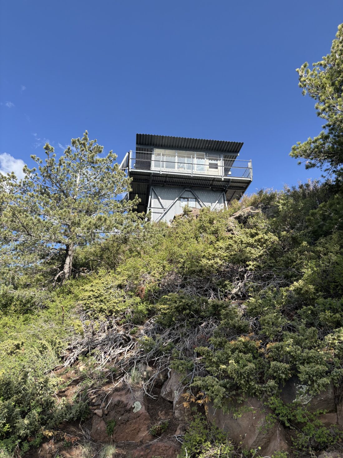
The trail made a series of switchbacks just before the summit, and soon the abandoned fire tower came into view. Unlike the tall tower atop Bill Williams, this lookout tower is low, and you can walk up the flight of stairs and walk around the outside. The interior of the tower is closed, but you can look inside to see what it was like for someone to staff it. I took in the sweeping views, lingering on Humphreys off to the southwest of me. In two days’ time, I planned to climb it. I picked a spot on the tower’s walkway to sit and enjoy a snack. Being mindful of the chance of showers, I did not linger too long. However, my rain shell did make a nice cushion while I took that break.
With the primary goal achieved, I made a short side trip to look at the cabin. The Kendrick Mountain cabin was built in 1912 as a place for fire lookouts to stay while watching for wildfires. The cabin was constructed atop Kendrick Mountain in a location that took advantage of the high elevation and provided commanding views to aid in wildfire detection. Firefighters wrapped the historic 1912 lookout cabin and the ruins of a smaller cabin with fire-resistant material. Helicopters doused the lookout tower with fire retardant. Both the historic cabin and lookout tower survived, but fire burned the smaller cabin ruins along the Pumpkin Trail.
When I was done looking at it and noting a nearby tent site, it was time to make my way back to the car. I slipped my AirPods and began flying down the trail. At one point, I met a hiker working his way up, so I removed my AirPods to be able to chat with him. After a short conversation, he continued up, and I headed down. As I slipped the AirPods back into my ears, the left one fell out. I immediately stopped and began looking for it. But it was nowhere to be seen! I tried having it play its location tune, which I could hear, but not well enough to actually locate. After 10 minutes of looking, I gave up. It must have bounced off the trail and gotten lost in the brush. Ugh! The rest of the hike went smoothly, and I was back at the car before I knew it. After tossing my gear in the car, I saw a sign for the Lava River Cave about 2 miles past the junction I took getting to the trailhead, so I decided to check it out.
I pulled into the parking lot, and it had a few more cars here. Along the way, I saw even more campers scattered through the forest. I unfortunately did not have a proper flashlight or headlamp to explore it beyond just what the natural light allowed. Something for the next visit to the area. For the actual hike, I did the 9.2 miles in 4:05 (including looking for that darn AirPod), with 2677 feet of gain. I think I will be ready to tackle the highest peak in Arizona in two days…
I am an avid peak bagger, sometimes backpacker, and former sea kayaker living in San Diego. I am the co-author of Urban Trails: San Diego, coming in Spring 2026!
As I left San Diego under drizzle, I hoped the forecast I read for Tahquitz Peak was correct. Luckily, as I crossed into Temecula, the clouds and rain faded away, and I had clear skies. After grabbing a biscuit and coffee from McDonald’s, I continued the drive up to Idyllwild. Since I was planning on hiking the Devil’s Slide trail, I knew I needed to get a permit from the Ranger Station in town. Since this was a weekday, I could obtain one of the self-issued permits for this hike. Otherwise, I would have had to either get one in advance or wait for the station to open. After filling out the permit and slipping the white copy into the slot, I made the short drive up to Humber Park. A few cars were here when I arrived. Again, the upside of doing this on a weekday. I hung my America the Beautiful pass from my mirror, as either that or an Adventure Pass is required. The air was cool, but once again, I knew once I started hiking, I would be shedding my layers in 5 minutes, so that fleece once again stayed in my pack. The plan was to hike up to the fire lookout tower atop Tahquitz Peak and then loop back through Tahquitz Valley.
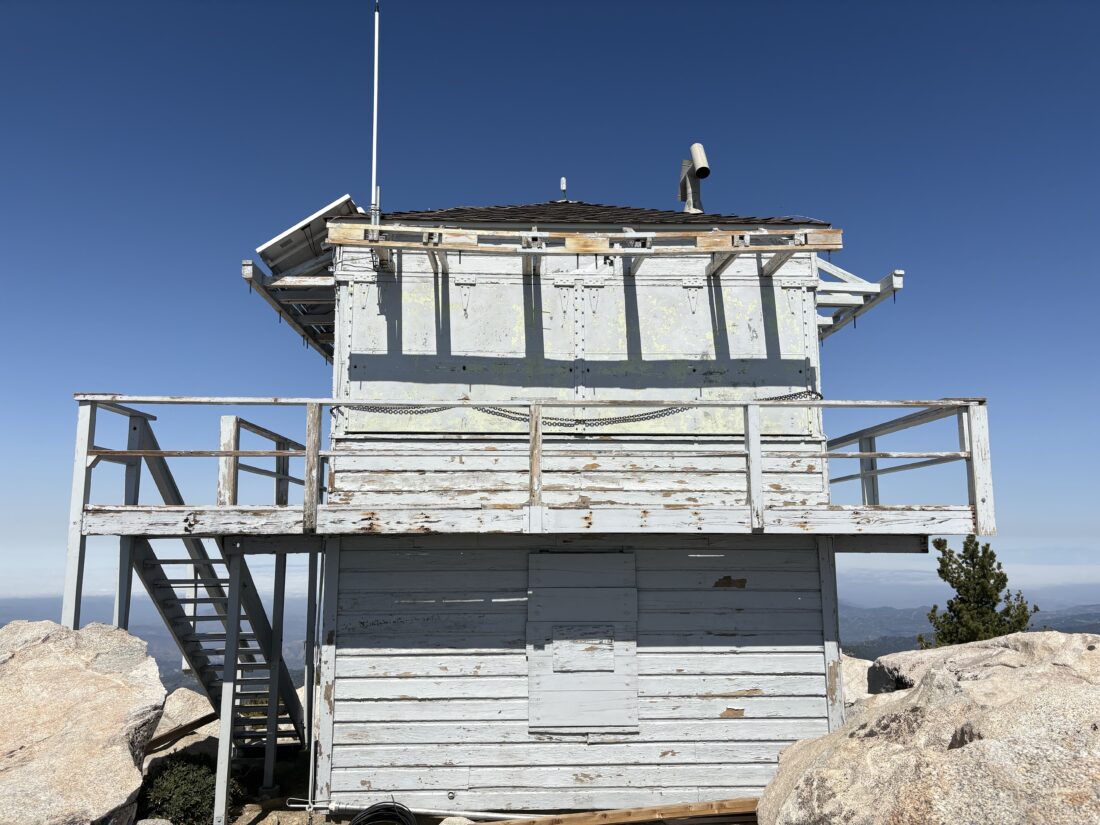
The trail begins as a climb straight from the parking lot. Thankfully, the grade is not overwhelming. I suspect it is the altitude that gets hikers as they work their way up. Off to the left, you have a stunning view of Suicide Rock (another trail I need to do). I passed by two springs that were barely flowing. As I neared Saddle Junction, I met a PCT hiker from the Netherlands who was having to hike back down to Idyllwild to get a package. We chatted a bit, she did her first 20-mile day the day before, so she felt she was finally getting her “hiker legs”. I wished her well on her journey. At the junction, I took a right and joined the PCT myself, as I hiked southward toward Tahquitz Peak. The section was a lot more gentle than the 1,700 feet of gain I made coming up from Humber Park. After about 1.4 miles, I came to the spur trail that would take me to the lookout tower. The tower was another 0.4 miles further. Unfortunately, the tower will not be open in 2025 due to structural issues and budget concerns. I climbed the stairs up the tower and began taking in the sweeping views, while enjoying a well-earned snack. A fellow hiker and his dog joined me on the summit, and we chatted for some time before they set off back down. I lingered a bit more, doing some filming before I too set off.
Back at the junction with the PCT, I continued east along it for about 0.7 miles until I left it and started heading north toward Tahquitz Meadow. The creek had already dried up for the season, but the meadow was still beautiful. When I reached the Caramba Trail, I joined it to return me back to Saddle Junction. Once there, I mixed up some electrolytes and broke open a bag of trail mix to enjoy on my descent. I passed a few hikers making their way up the trail. Then I spotted the familiar colors of a ranger hiking up the trail. We stopped and chatted for some time, and she did indeed ask for my permit, which I had. She continued up, and I continued down. The call of some Mexican food in Idyllwild was getting strong. The entire loop was 9.8 miles with 2604 feet of gain in 4:13 (including the stops with the PCT hiker and the Ranger).
I am an avid peak bagger, sometimes backpacker, and former sea kayaker living in San Diego. I am the co-author of Urban Trails: San Diego, coming in Spring 2026!
I pulled into the Ice House Canyon parking lot just around 6:30 am. Given this was a Monday, I did not have any trouble finding a spot, as there were only about 8 other cars here. It was nippy, but I knew that once I started up Ice House Canyon, I would be shedding that fleece layer in no time, so it stayed tucked in the pack. Next to the trailhead, work has begun on the new Heroes Project retreat. This is the organization that holds the Climb for Heroes event up Mt. Baldy, which I have done in the past. I had already gotten the free permit online needed to hike Cucamonga, so I skipped filling out the paper one and set off. The creek was flowing nicely as I passed by the cabins in the canyon. Just a few wildflowers remained along the side of the trail. About two miles in, the sun finally rose over the ridgeline. I stopped and got a photo for Ted, as he does enjoy a good sunrise. The trail continued its climb toward Icehouse Saddle. At the junction with the trail from Cedar Glen Campground, a trail runner was standing in front of the sign with a puzzled look on his face. I inquired about where he was trying to get to, and he replied, “Cucamonga”. I told him to stay on this trail and then look for the sign toward the east once you were at Icehouse Saddle. He thanked me and began jogging off. I shook my head at how unprepared he was. Before too long, I reached the saddle and took a well-earned break.
After enjoying the silence, I set off along the Cucamonga Trail toward the summit. From time to time, I had some great views of the high desert to the northeast. I stopped at the Bighorn Mine for a quick photo, but did not venture inside either tunnel. I reached the Bighorn Saddle and got ready for the 1,200 or so feet of gain that lay ahead of me. A few trail runners had passed me earlier in the climb, and they were now making their return as I climbed the switchbacks. I asked about that trail runner I helped earlier to find out if he got on the right trail. They said they did see him, so I didn’t have to worry about him heading the wrong way.
Partway up, I met two backpackers making their return from camping on the summit. I asked what their water load was for their trip, and they replied 6 liters. They had filled up at Columbine Spring, so they did have all that water weight from the beginning. We wished each other a safe hike and continued on. Soon, I spotted the wooden post indicating the side trail that you use to reach the summit, and I remembered the struggle up this section the last time I climbed Cucamonga. Thankfully, it was a bit easier this time around. As I reached the broad summit, I looked around for anyone else, but it was deserted! Slipping off my pack, I pulled out my tripod to be able to take the classic photo standing on the rock outcropping. I was glad I had the foresight to bring it, just in case. After snapping some more photos, I found a nice spot to enjoy an early lunch. A chipmunk chirped nearby as it tried to work its way over to grab some crumbs. As I was finishing my PB&J, two pairs of hikers joined me on the summit. We swapped cameras for some photos, and then I set off for my next destination, Etiwanda Peak.
Sitting just under a mile to the east of Cucamonga Peak is Etiwanda Peak, which is on the Sierra Club Hundred Peaks Section list. The trail mostly follows the ridgeline until a nice-sized cairn marks the junction with its side trail to the summit. After a short but steep climb, I stood atop the white quartz that sits at the top of the summit and soaked in the views. Unlike Cucamonga, I had a full 360° view of the area. After a quick snack, it was time to make my way back down.
One of the pair of hikers who joined me at the summit was also making their way to Etiwanda, and I let them know the cairn for the side trail was very visible. At Bighorn Saddle, I briefly thought about climbing the ridgeline and summiting it as well, but I plan on climbing Ontario again, so I opted to save it for that trip.
Back at Icehouse Saddle, I paused for just a bit to rearrange some snacks for the hike down the canyon into one of my hip pockets. I cruised along, making good time on the descent. I passed a couple of backpackers making their way up to Kelly Camp for the night, and a few folks exploring Ice House Canyon. Before too long, I started passing the cabins again and knew the end of the trail was not far off. Once back at the car, I tossed in my gear and changed into a dry shirt. After a well-earned meal from In-N-Out, I hit the freeway home. The hike was 14.48 miles in 7:04 with 4770 feet of gain.
I am an avid peak bagger, sometimes backpacker, and former sea kayaker living in San Diego. I am the co-author of Urban Trails: San Diego, coming in Spring 2026!
Finally had the chance to hike Mt. Wilson from Chantry Flats, as this route had been closed since the 2020 Bobcat Fire. So, with a very early morning start, I made the drive up. Pulling into the nearly empty parking lot just after 6, I gathered my gear and got ready to head off. From what I have read, this parking lot becomes packed on the weekends, much like Ice House Canyon’s parking area can be. For now, my Outback was one of only about 8 cars. I was planning on doing the hike as a loop, up the Gabrielino Trail, with a side hike to Sturtevant Falls, and returning to Chantry Flats via the Winter Creek Trail.
I followed the dirt road down into San Olene Canyon and made the first of many water crossings. To the left was the Lower Winter Creek Trail, and to the right, the Gabrielino Trail continued. Due to budgeting issues, the toilets at this junction were closed. I now entered the East Fork Santa Anita Canyon and began following the Big Santa Anita Creek. Here I passed by the Big Santa Anita Canyon Cabin Tract. These historic cabins were built by private citizens on Forest Service land under a Special Use Permit over 100 years ago. They are still owned by local families, many of whom are descendants of the original owners. As I continued past these cabins, sill dams lined the creek. The goal of these dams was to keep silt and other debris from impacting the main dam further downstream. After about 0.7 miles, I came to the junction with the side trail to Sturtevant Falls, and I hustled along it for about 0.3 miles. After a simple water crossing followed by a short scramble, the 50-foot falls stood before me. I enjoyed a bit of solitude, and I can only imagine what it is like on a hot weekend. I returned to the last junction and began my climb in earnest. I was thankful to have the “May grey” in effect. While I had my AirPods with me, the sounds of the flowing water were just too enchanting not to be my hike’s soundtrack for a while. The trail was in pretty good shape, with just one or two spots to watch my footing.
Soon, I came to Spruce Grove Trail Camp and saw that someone had made the trek here to spend the night. A small hot spot was forming on my right foot, so I stopped briefly to address it with some KT tape. I also took this as a good time for a snack before continuing. Shortly thereafter, I came to Sturtevant Camp. Apparently, you can rent cabins here on the weekend. Not sure if I can convince my wife to make the hike up to them. Just past here is the connector trail over Mt. Zion. Signs cautioned hikers that while the trail is open, it is still being rebuilt and to use extreme caution if they choose to hike it. I stayed on the Gabrielino Trail and continued my ascent toward Mt. Wilson. The overcast skies I had previously were gone, so I could feel the warmth of the sun.
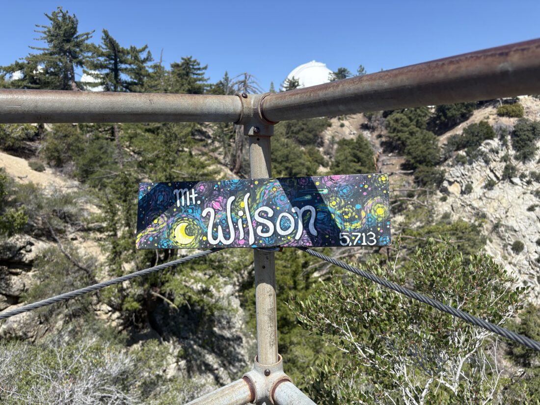
The trail had a good amount of shade, so it wasn’t too much of an issue. In fact, for the most part, I kept my sun hoodie down. Checking my map, I saw I was getting close to the summit, which was good, as I was in need of a break. Being so close, I pushed on for the last 1/4 mile. As I reached the top, I turned right to the viewpoint on Echo Rock to snap my summit selfies. I did not linger as I really wanted to sit in the shade at the Cosmic Café and eat my lunch. As I strolled along the road, past the various domes and other astronomical items, I ran into another hiker about to make his way down the Gabrielino. We swapped a few bits of trail beta and then went our separate ways. Once at the Café, I slipped off my pack, took off my shoes and socks to give my feet a rest, and broke out my lunch. Being a weekday, the café is not open. On the upside, there wasn’t another person there, so I ate my PB&J in blissful silence. I drank a liter of water and mixed up some electrolytes for the descent. I carried up 2.75 liters, but next time I will probably carry less and maybe pack my water filter if I am really concerned.
After walking over to the benchmark and the plaque honoring Wilson (who I am distantly related to), I stepped onto the Mt. Wilson Trail. This section of the trail was completely burned over by the Bobcat fire. After about 0.6 miles, this trail joins the Mt. Wilson Toll Road. I thought about taking the side road up to Mt. Harvard, but opted to skip it. While this used to be an actual road, large rocks have now fallen onto the roadway. With the sounds of flowing water long since gone, I slipped my AirPods on and enjoyed an episode of Backpacker radio. In 0.5 miles, the Mt. Wilson trail again leaves the Toll Road. Since the Toll Road is still closed from the fire (a large sign informs you of such), I made my left-hand turn back onto the trail. I hiked down the trail toward Manazanita Ridge. Here, a nice bench offers some respite for hikers needing a break from their climb. The Mt. Wilson Trail veers to the right, but it is also still closed due to the fire damage. Instead, I followed the Winter Creek Trail down. After about 1.2 miles, the sounds of Winter Creek began to fill the air, and I put my AirPods away. How often do you get to hike next to flowing water in Southern California?
At Hoegee Trail Camp, where a few more private Cabins were, along with 13 primitive campsites, the trail splits. The Lower Winter Creek Trail follows the creek back and connects with the Gabrielino before Chantry Flats. While the Upper Winter Creek Trails return you to Chantry Flats proper. My routes that I had loaded onto my phone did not properly sync overnight, so I was hiking a bit in the blind. Since how often do I get to hike next to a flowing stream, I opted for the lAt Hoegee Trail Camp, where a few more private cabins are, along with 13 primitive campsites, the trail splits. The Lower Winter Creek Trail follows the creek back and connects with the Gabrielino before Chantry Flats. While the Upper Winter Creek Trails return you to Chantry Flats proper, my routes I had tried to load onto my phone did not properly sync overnight, so I was hiking a bit in the blind. Since I don’t often get to hike next to a flowing stream, I opted for the lower trail. The trail crisscrossed the stream 5 or 6 times. I passed the other end of the Zion Trail, along with the same warnings posted. After 1.5 miles, I came back to the junction with the Gabrielino Trail. There were now other folks on the trail, and a crew from the Forest Service doing some work. I made the 0.6-mile, 390-foot climb back up to the parking area, all the while questioning whether the stream was worth this climb. Once back at the trailhead, I walked over to the Pack Station and bought a cold Coke and a Snickers and enjoyed them on the patio. After tossing my gear into the car and putting on a dry shirt, I began the drive home, hoping the LA traffic wouldn’t be too bad. I logged my loop at 15.23 miles, in 6:39 (turning off the tracker at the Café) and 4,808 feet of gain. That was my first peak for the 2025 SoCal Six Pack of Peaks Challenge.
I am an avid peak bagger, sometimes backpacker, and former sea kayaker living in San Diego. I am the co-author of Urban Trails: San Diego, coming in Spring 2026!
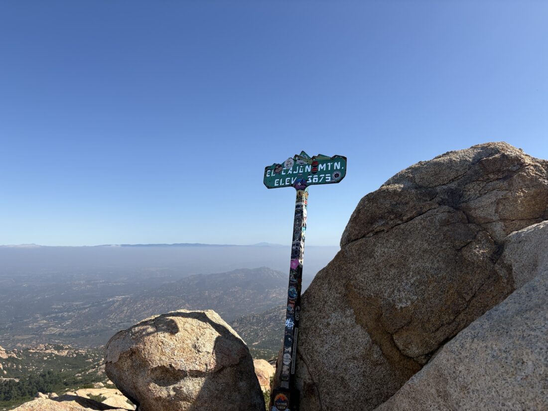
As we approached the parking lot for the trailhead, cars lined both sides of Wildcat Canyon. I decided to gamble and see if there might be a spot still in the lot, and there was! Ted and I gathered our gear and walked over to the sign-in tent. Today was the Warrior Hike Challenge up El Cajon Mountain in honor of Memorial Day. We attached our commemorative carabiners to our packs and small American flags as well and set off. The overcast skies were welcomed as we made the first climb of the day. The 1-mile Celebration Station was still setting up as we passed by. Wildflowers dotted the edges of the trail from time to time. We were making good time as we continued pushing onward. The trail splits around the 2.5-mile mark, and we opted to take the trail to the left. This section is one of the steeper portions of the climb, but I felt good pushing upward. When the trail came back together, we saw the 3-mile Celebration Station about 100 yards down the other trail. We decided to stop at it upon our return. I was curious about what our time to the summit might be, as I was feeling good.
From time to time, hikers who had gotten an even earlier start were making their way back from the summit. A small stream was still flowing across the trail, just before the final climb. We passed the abandoned truck, and soon the junction with the trail to El Cajon Mountain and El Capitan. Now we followed the single-track trail up the last bit to the summit. As expected, the summit was crowded, but we found a spot to take a break and refuel. I pulled up my tracker and saw that we had reached the summit in 2:27!
After snapping some photos, including with the summit sign, we set off back down the mountain. We would pause from time to time to allow the uphill hikers the right of way. Once at the junction with El Capitan, we decided to make the 0.2-mile trek to visit that summit. In all my times up El Cajon, I never hiked over. As we approached the summit, the ruins of the building came into view. I joked this was practice for seeing the hut atop Mt. Whitney. After snapping some more photos, we returned to the junction and went back down. One of the challenges of this hike is that you have two modest climbs to make upon your return, so we were mindful of that.
At the junction with the spur trail to the old mines, we opted to make the 0.1-mile trek to see them. We took a few photos in the entrance to one of the mines, but opted not to go exploring further. Once back on the main trail, we soon came to the 3-mile Celebration Station. We grabbed some free snacks and one of the cords we needed to earn our commemorative patch and challenge coin.
As we continued down the trail, my knees were feeling the steep descent, and Ted’s foot was also feeling it. The miles ticked by, and off in the distance was the blue tent of the 1-mile Celebration Station. One final climb brought us to it, and we got our second cord and another round of snacks. As we headed to the trailhead, the thought of burritos filled our heads. Back at the trailhead, we got our last cords, earning the patch and coin. If we repeat this hike for Veterans Day, we can earn two more coins. After tossing our gear back into the car, Ted and I compared our recorded stats, which did vary quite a bit. Ted’s Garmin recorded 12.02 and Strava on his phone recorded 11.89! My tracker logged the hike at 11.5 miles in 5:51 and 3,152 feet of gain. With that summit, my San Diego Six Pack of Peaks was completed. Now to start on the SoCal Six Pack.
I am an avid peak bagger, sometimes backpacker, and former sea kayaker living in San Diego. I am the co-author of Urban Trails: San Diego, coming in Spring 2026!
With desert season drawing to a close, I decided to try to get another San Diego Sierra Club peak crossed off my list. I decided on attempting Kay Benchmark, which is just to the west of the Anza-Borrego State Park Visitor Center. I arrived a bit after 8 am, paid my $10 day use fee, and took advantage of the freshly cleaned restrooms. After a short walk across the desert floor, it was time to ascend the ridgeline that I would follow. A faint use trail guided me through the early section of the climb, and about a 1/2 hour later, I was standing atop Ode Benchmark. Ted and I had climbed this peak back in 2019 but did not venture past it. I actually have never climbed up to Kay Benchmark, as my only “ascent” was when I hiked over from Ranchita.
After a quick check-in at Ode, I descended toward a small saddle before continuing my climb. It was here that, during Greg Gerlach’s last summit, he exited the ridge and returned via the drainage to the north. I might consider that option upon my return, but for now, my focus was on the steep climb ahead of me.
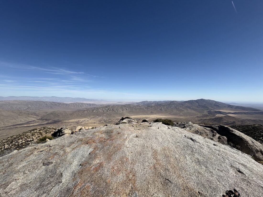
I would dodge and weave around cacti and look for more friendly routes up the slope. A slight breeze helped keep things pleasant from a temperature point of view. As I neared 3,400 feet in elevation, the ascent became more difficult, and I was now faced with some serious rocks to pick my way through. That section was not going to be fun upon my return. I worked my way through them, and the summit was almost in view.
As I reached it, a sense of accomplishment came over me. When I last stood atop this pile of rocks, I had just down-climbed some serious terrain. While the ascent had a few challenges, nothing compared to that. I took in the views and had a nice, relaxing snack. Unfortunately, I forgot to pack any electrolytes, so I hoped that wouldn’t be an issue on the descent. I still had plenty of water, so I was not worried about that at least.
Now for the long descent. I carefully worked my way down past that steep rock face, only having to retreat once from a route that was not safe. Once that section was behind me, I could feel my anxiety level drop. Now, it was mostly standard desert ridgeline hiking. I just needed to take care and dodge and weave around the cacti and find solid footing.
Once at the saddle, I looked up at the climb to pass over Ode Benchmark and said to myself, “Greg had the right idea”. So down a side ridge I went, and soon I was in the wide drainage leading back to the east. While a bit rocky, it was still easier than continuing on the ridge. Before too long, I spotted the flagpole at the Visitor Center, and not much later, I was back at my car. I tossed my gear in and headed into the center for information about my next adventure: Vallecito Mountains High Point. They did not have a lot of information, but it was worth checking. After grabbing lunch in town, a well-earned burrito, I also grabbed a sandwich for dinner later. For Kay Benchmark, my stats were 4.51 miles in 5:31 with 2,860 feet of elevation gain.
I am an avid peak bagger, sometimes backpacker, and former sea kayaker living in San Diego. I am the co-author of Urban Trails: San Diego, coming in Spring 2026!
The original plan was for us to tackle Goat Benchmark, San Ysidro East Peak, and The Sirens as an overnight adventure. However, checking the forecast Friday morning quickly put an end to that plan. Winds between 25-30 mph, with predicted gusts up to 50 mph. None of us wanted to camp in that, especially in an exposed open flat, so we began looking for alternate hikes. The high winds scuttled anything out in the desert. Rick and Andrea suggested an interesting loop in Mission Trails, and I offered up doing either Mt. Gower or Paradise Mountain (both of which Ted needs). We settled on Paradise Mountain and agreed to meet at the trailhead at 8. Ted and I arrived first, and just before 8, Rick and Andrea pulled into the parking lot. The skies were overcast, and the summit of the peak was obscured by the clouds as we set off down the trail.
The trail almost immediately began to descend 300 feet down to Hell Creek. After the simple water crossing, the trail became mostly flat before beginning the climb to the summit. We chatted about all sorts of topics as we motored along the fairly well-maintained trail. The clouds had lifted, and the summit stood above us.
When we reached the junction, we all agreed that we should do the loop in a clockwise fashion. We pushed upward, pausing a few times to link back up. A side trail took us over to Viewpoint A, as labeled on Peakbagger. It did offer some nice views from there, but we did not linger. Once back on the main loop, we quickly reached Ditch Benchmark and stopped for a few photos. Someone had incorrectly left a summit sign for Paradise Mountain there. We tucked it into my pack and carried it over to the proper summit, about 1/2 mile to the east. We stopped for a snack break and to soak in the views.
Once refueled, we set off down the trail. Unlike our steep ascent, the descent was a gentler grade, which made everyone’s knees happier. Before we knew it, we were crossing back over the creek, starting the climb back to the trailhead. Along the way, a horse and rider passed us, heading down the trail. Once back at the trailhead, five more horses were getting ready to take their riders along the trail. We quickly cleaned up and headed out for a well-earned lunch at Burger Bench. I logged the hike at 8.25 miles in 4:31, with an elevation gain of 2,080 feet. The only negative was that I did find a tick on me later. It was still crawling, so I removed it and crushed it. Rick found one on him while hiking, so we’re keeping an out for any more.
I am an avid peak bagger, sometimes backpacker, and former sea kayaker living in San Diego. I am the co-author of Urban Trails: San Diego, coming in Spring 2026!
After the scouting trip to the trailhead on Saturday, I decided to take advantage of the break between the storms to go climb Granite Mountain again. The other time I summited this peak was via the Cool Canyon route, and this time I really wanted to use the Rodriguez Canyon trailhead. After filling up the gas tank and grabbing my breakfast and coffee, I headed out to the desert. As I drove through Julian, I spied a PCT hiker thumbing a ride back down to the trail. I pulled over and offered a lift. We had a lovely chat as we drove down the Banner Grade. I dropped him off at the Scissors Crossing parking lot and wished him well on his journey. I then cruised down to the trailhead, making a quick stop at the pit toilets in Blair Valley. I was glad I had my “poop kit” with me, as both toilets had no toilet paper. I turned off the highway, and began driving the road that Ted and I drove on Saturday. The heavy construction equipment that was parked beside the road had been busy, as one section of the road had been smoothed over. I still had to carefully pick my way up out of Vallecito Wash, but the Outback handled it like a champ. I drove up Rodriguez Canyon a short distance and found a nice spot to pull off. Grabbing my gear I headed north across the open desert floor until I linked up with an old jeep road that led to a couple of abandoned mines. The road was overgrown and would fade from time to time.
At some point I lost the road and began working my way up a ridge. When I checked my position again, using Keith Winston’s route, I found myself on the wrong side of a ravine. I decided to keep on my route, follow the contour to get closer to Keith’s route and go from there. I knew after the mines that I missed, the route follows the ridgeline up. I began weaving and dodging cacti as I kept climbing. The temperature was perfect, cool with a slight breeze. I had a fleece and a wind shell in my pack, but never needed them. I would stop to snap a photo from time to time, but just kept motoring on.
From time to time, cairns would appear. Around 5000 feet in elevation, small patches of snow started to appear in the shade. I could see snow over on the Laguna Mountains to my southwest and on Volcan Mountain to my northwest. As I neared the end of this ridgeline, there was one small bouldery section to climb, but nothing like the mess I recall from the Cool Canyon Route. At the end of this ridgeline, I followed another ridgeline to the northeast. Once over a small false summit, the peak and its massive granite boulders stood before me. This was certainly an easy route, although the section in Cool Canyon itself is a highlight.
I scouted around the boulders looking for a route up, and eventually found one. As I made my final move onto the summit, my two full water bottles on the side of my pack fell out. One went bouncing one way and the other a different way. Crud! I hoped I would be able to find them in the rocks below, otherwise I would be collecting some of that snow to turn into drinking water.
On the summit, I enjoyed some snacks and the last of the water from the bottle that I keep in my shoulder pouch. The views were as stunning as I remembered. If there was a register, it is tucked somewhere below, and I did not bother to go scouting for it, I figured I would have enough scouting to find my water. After a nice break atop the summit, it was time to head back. I surveyed where one bottle bounced, and declared it lost. I worked my way down from the summit block and hoped that the second bottle could be located, and thankfully it was. Since I was heading down and had water in the car, I felt I should be ok. I slipped the recovered bottle into the side pouch and tightened the strap to be sure.
My goal for the descent was to stick to Keith’s track more closely, as I really wanted to see one or two of the abandoned mines. The descent went fine, and there was a faint use trail that I picked up from time to time, just like on the ascent. For the most part, though, it was again weaving past the cacti as I hiked down the ridge. I reached Keith’s turn off spot and generally stayed on course.
I spotted the first mine and peered in, but really did not have any interest in clamoring inside. I walked over to where the second mine was, but it appears that it is no longer open. I could see the outline of the jeep road across the ravine and worked my way carefully down to it. Once on it, I continued to follow it down the mountain. I could see my car off in the distance, always a good sign. Once back at the car, I drank 1/2 liter of water, as I had finished my remaining water about a mile back.
As I drove out, a lone backpacker was hiking along the road. I stopped and chatted with him. He had hiked down Oriflame Canyon and was headed over to the campground at Stagecoach Trails. I offered him a ride, as I was stopping there for a cold soda and snack, but he wanted to hike the whole route. I wished him well and drove away to get that aforementioned soda and begin my drive home. All told, I hiked 7.4 miles with just over 3,000 feet of elevation gain in 6:01.
I am an avid peak bagger, sometimes backpacker, and former sea kayaker living in San Diego. I am the co-author of Urban Trails: San Diego, coming in Spring 2026!