Trip Reports

Cody & Pike Benchmarks + 4 more!

When I was hiking with Gina Norte on Hot Springs Mountain last weekend, she mentioned that she was taking some fellow peakbaggers out for their attempt at Palm Mesa High Point, and possibly Cody & Pike. Since Gina was one of my hiking buddies when I summited Palm Mesa High Point, I knew she was not planning on doing that peak again. She said she might try for Phil and Norte Benchmarks instead. So, I asked if she would enjoy some company, to which she joyfully said yes. We chatted about what other peaks we might explore and how. In the end, we left it a bit flexible as to our plans and were just going to see how the day unfolded.

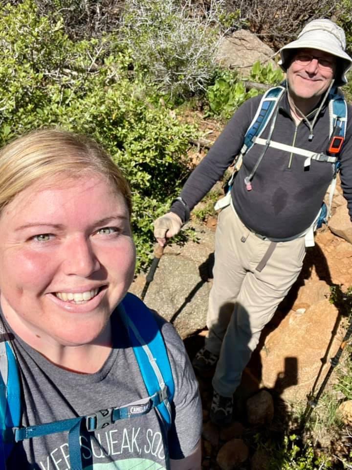
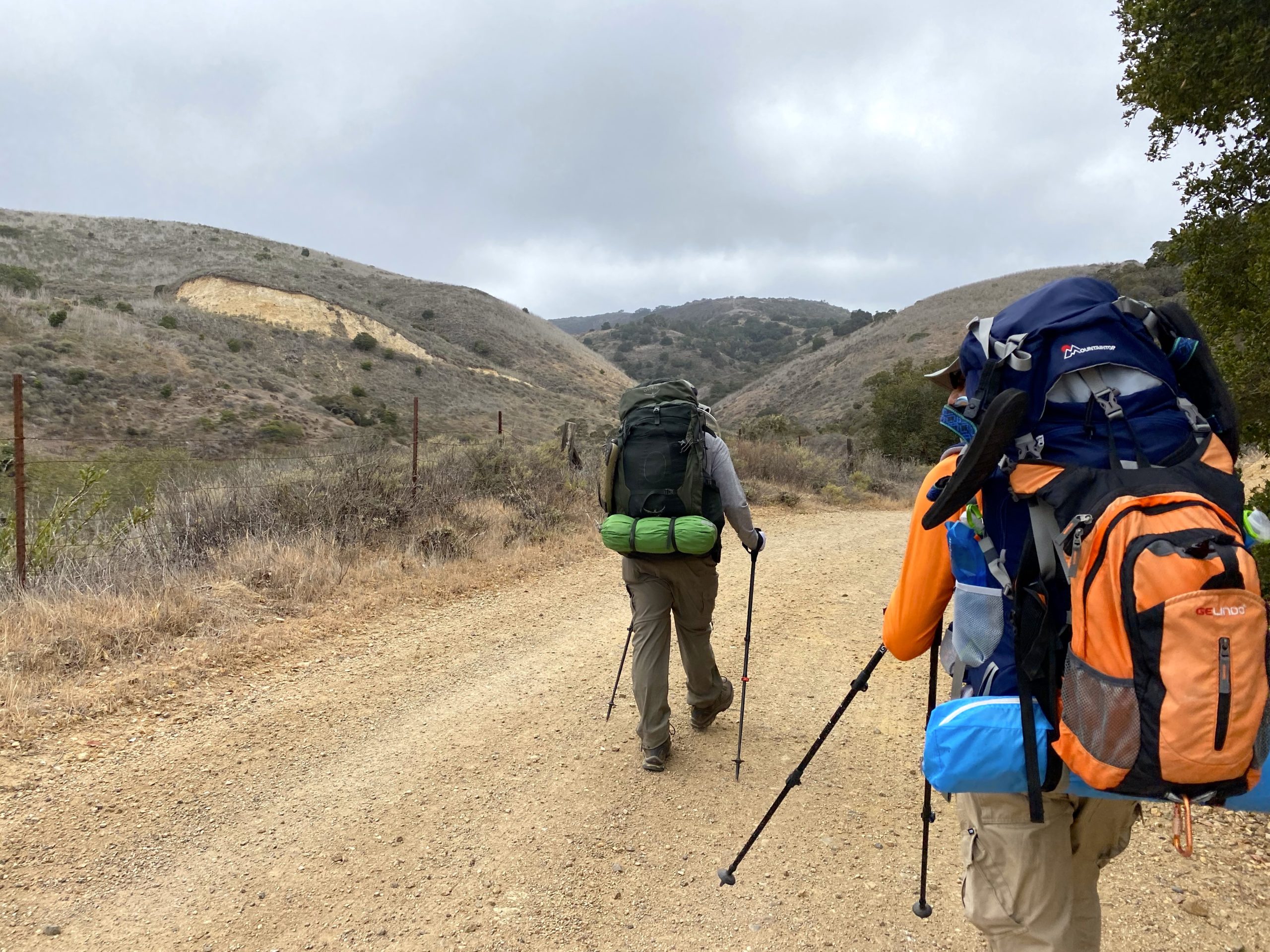
I arrived at the guard station for Los Coyotes Indian Reservation around 6:15. It was in the high 30s, but the forecast for the region that Gina and I would be hiking was in the low 70s. Alberto and Dale pulled up around 6:30. Initially, another peakbagger, Phil Y. had planned to come but he just did a long hike up in the San Gabriels and was not up for this adventure. Gina arrived soon after and we headed back to the campground. Dale and Alberto transferred into Gina’s car and I stayed in mine. Since I did not know how long Gina and I were going to spend hiking, having my car allowed me to leave if we finished before Dale and Alberto did (which is what we expected).

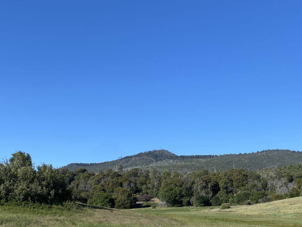
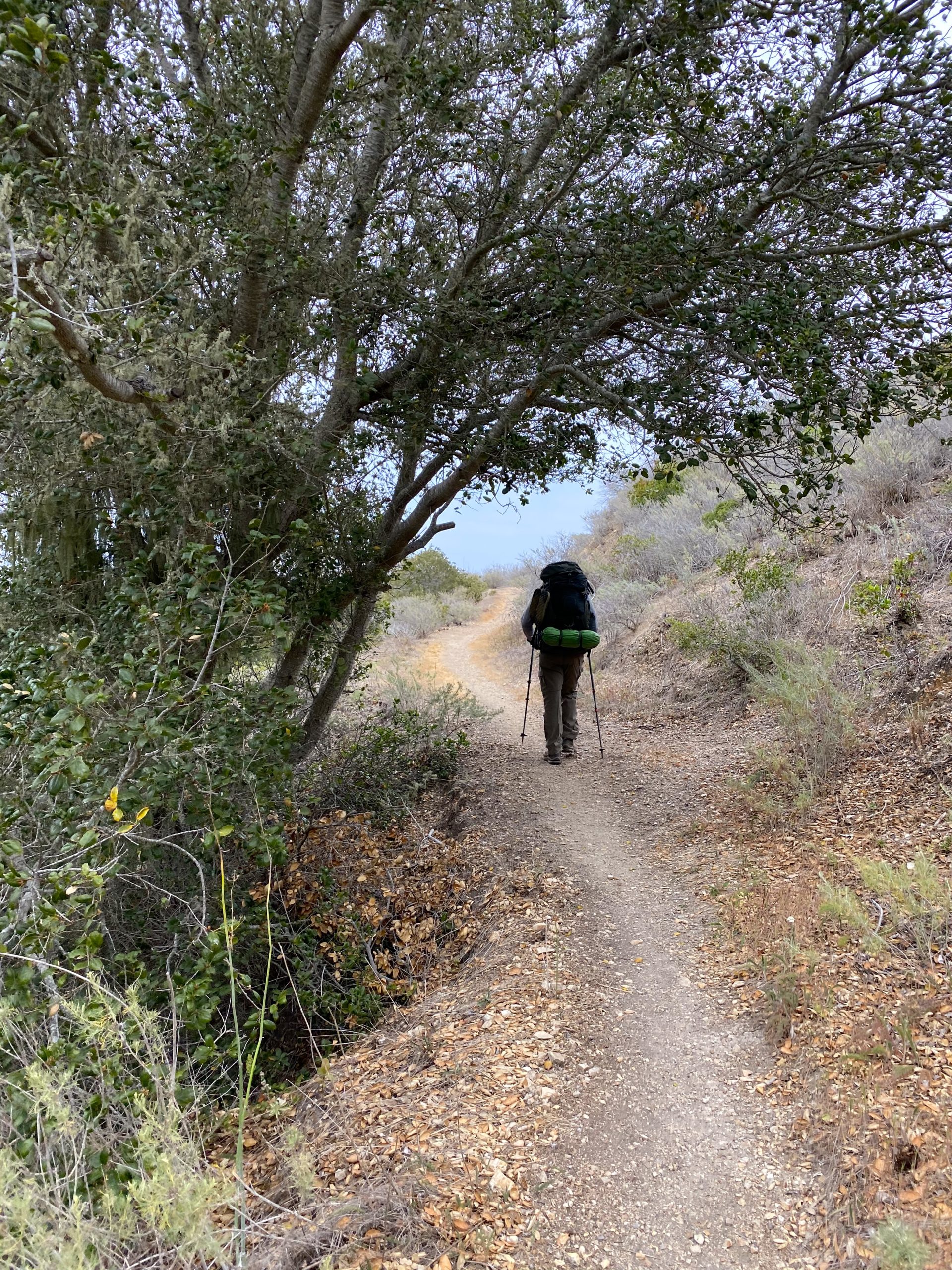
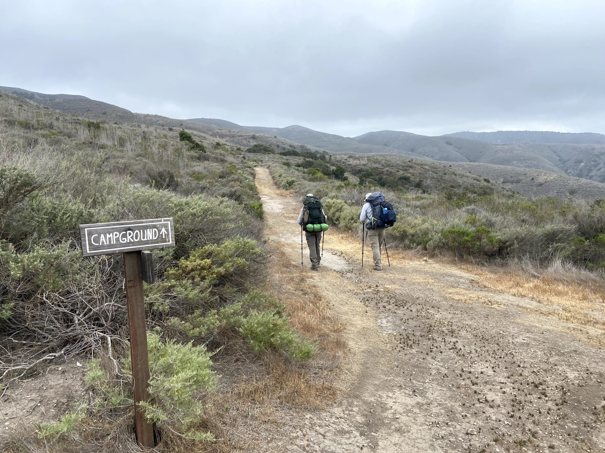
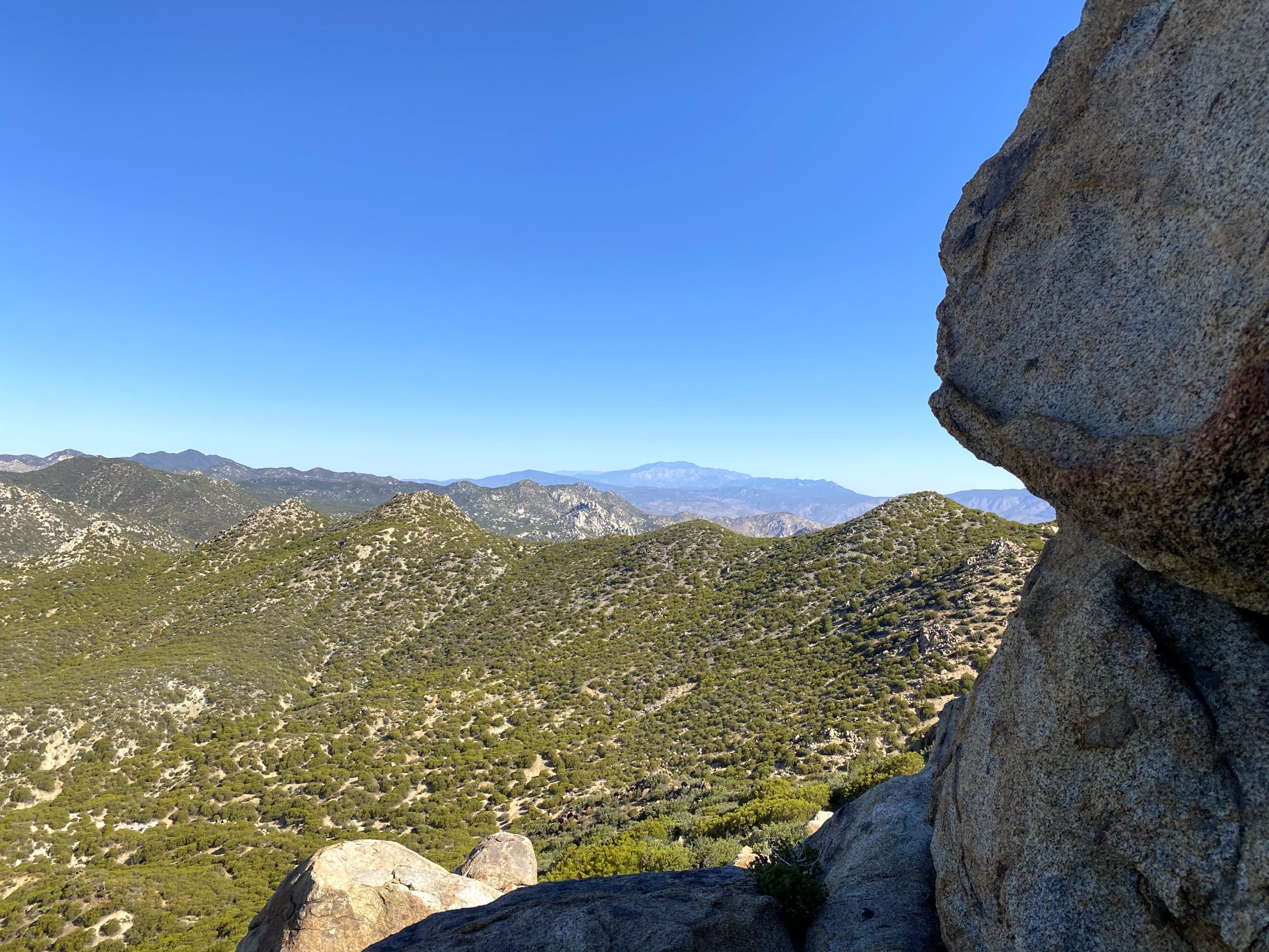
We drove to the familiar parking spot near the cemetery and quickly gathered our gear. Gina and I weren’t in a rush, but Dale and Alberto had a long, hard day ahead of them, so we got underway fairly quickly. This was the first time I had a chance to meet Dale in real life. We chatted about various topics as we made our way down to the wash and then up the saddle. The biggest question I had was “what order/route they were going to take?” Alberto had been with the group that was with me when I did Palm Mesa High Point. Per our recommendation, he had climbed Cody and Pike Benchmarks, but he was unable to make it down to Palm Mesa High Point. So for him, this was his first priority.

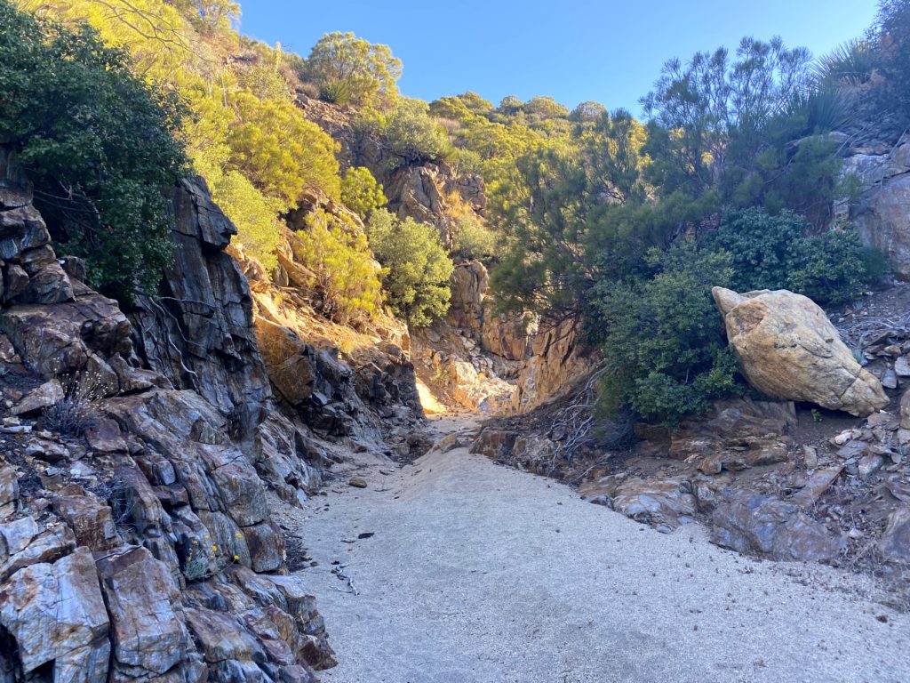
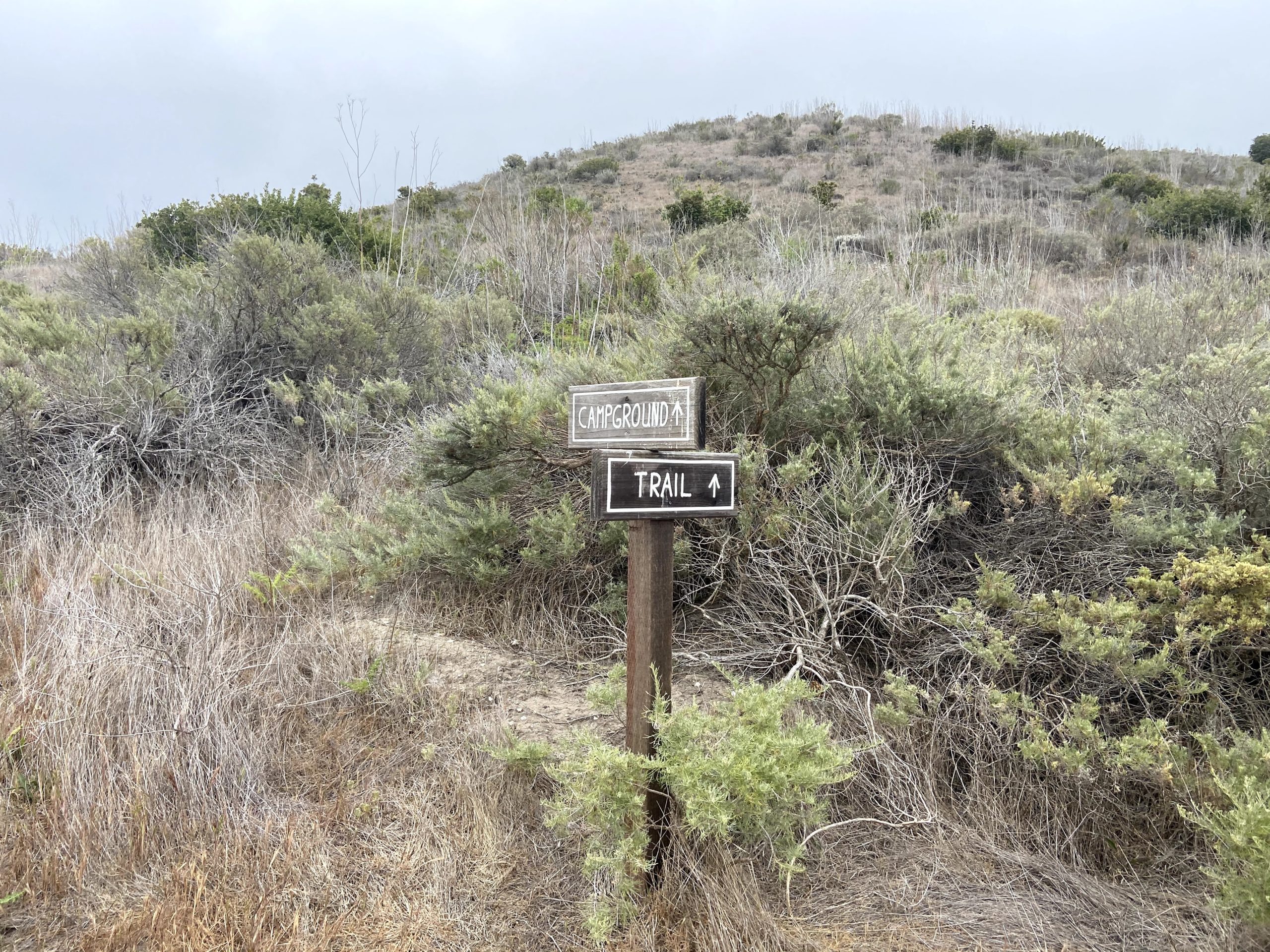
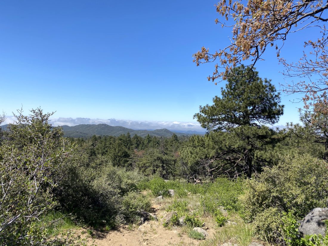
The hike up the wash went quickly. This time I did not miss the junction to the right, but did leave the wash a bit too early to reach the saddle. Nothing too problematic, but that is what happens when you are too busy talking and not double-checking your route that closely. Gina took a quick break just below the saddle and I escorted Dale and Alberto on up to it. Once there I pointed out Pike off to the left and Cody off to the right. I pointed at the wash below us and said “just follow that to Palm Mesa High Point”. 

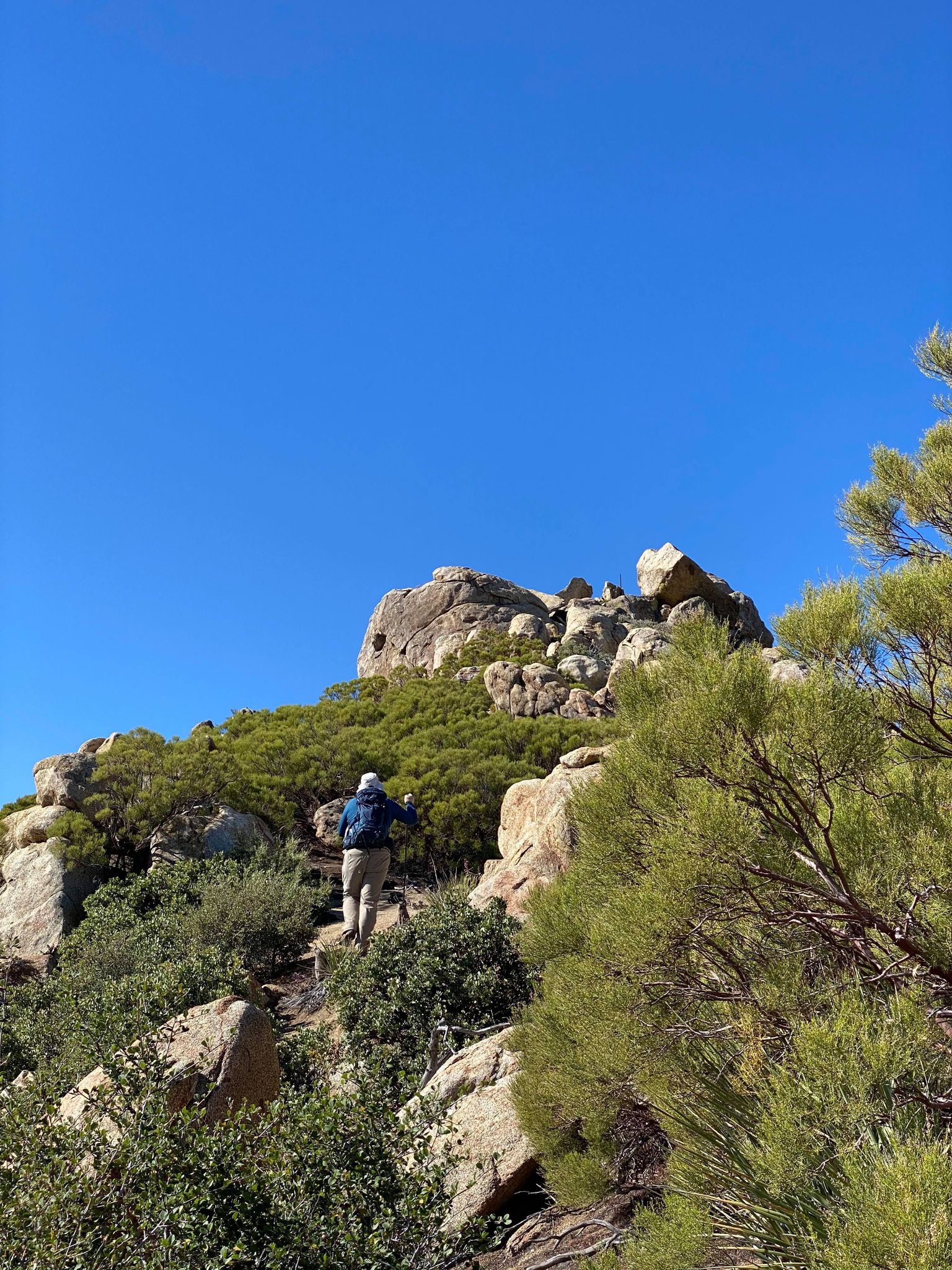
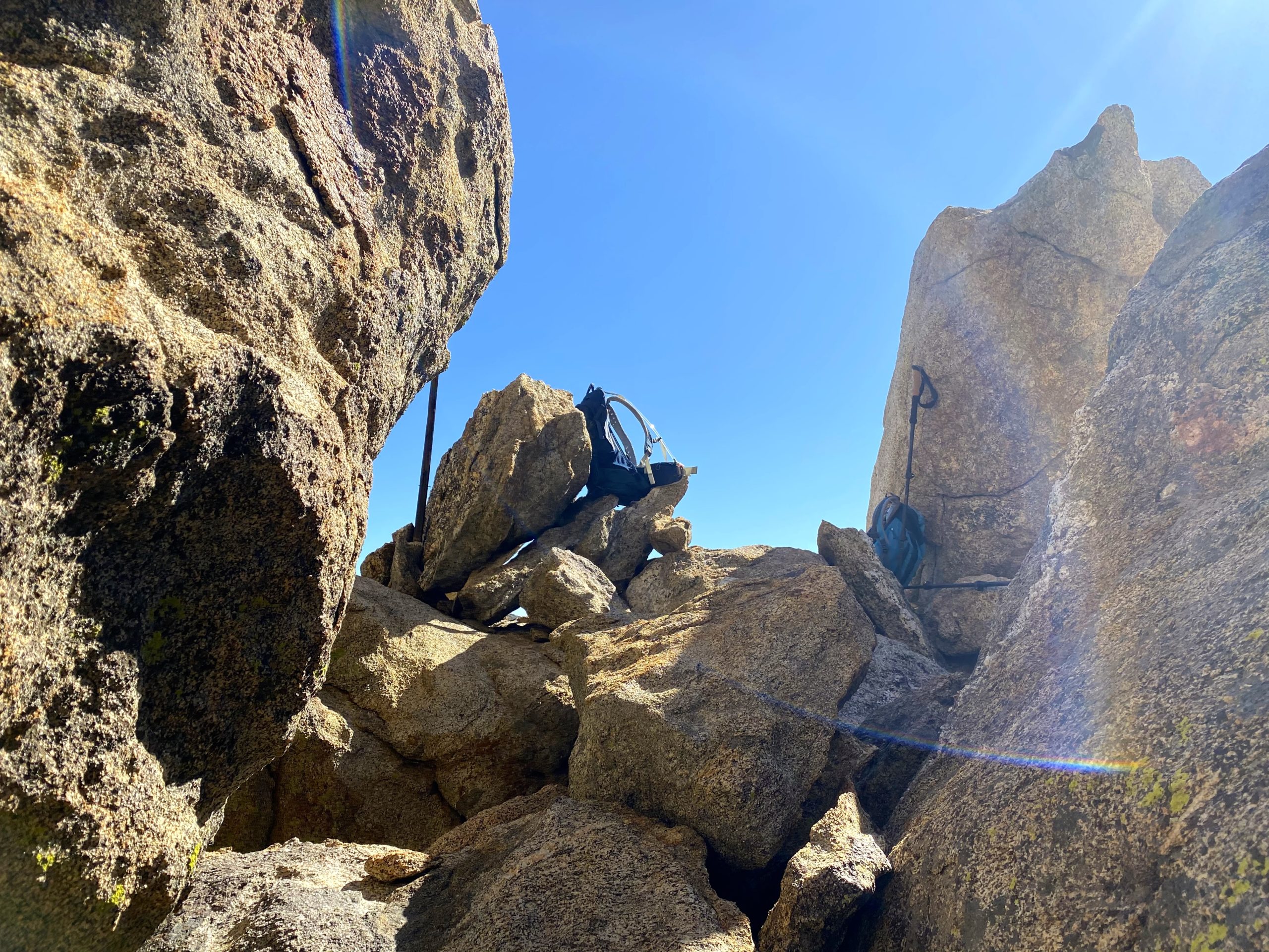
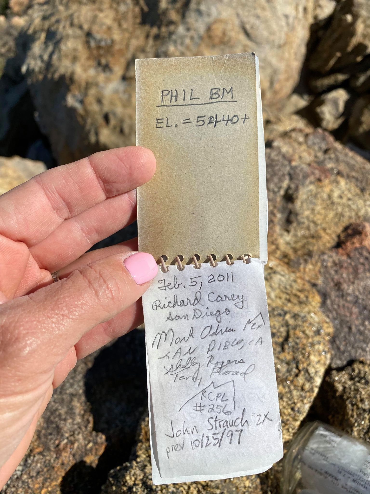
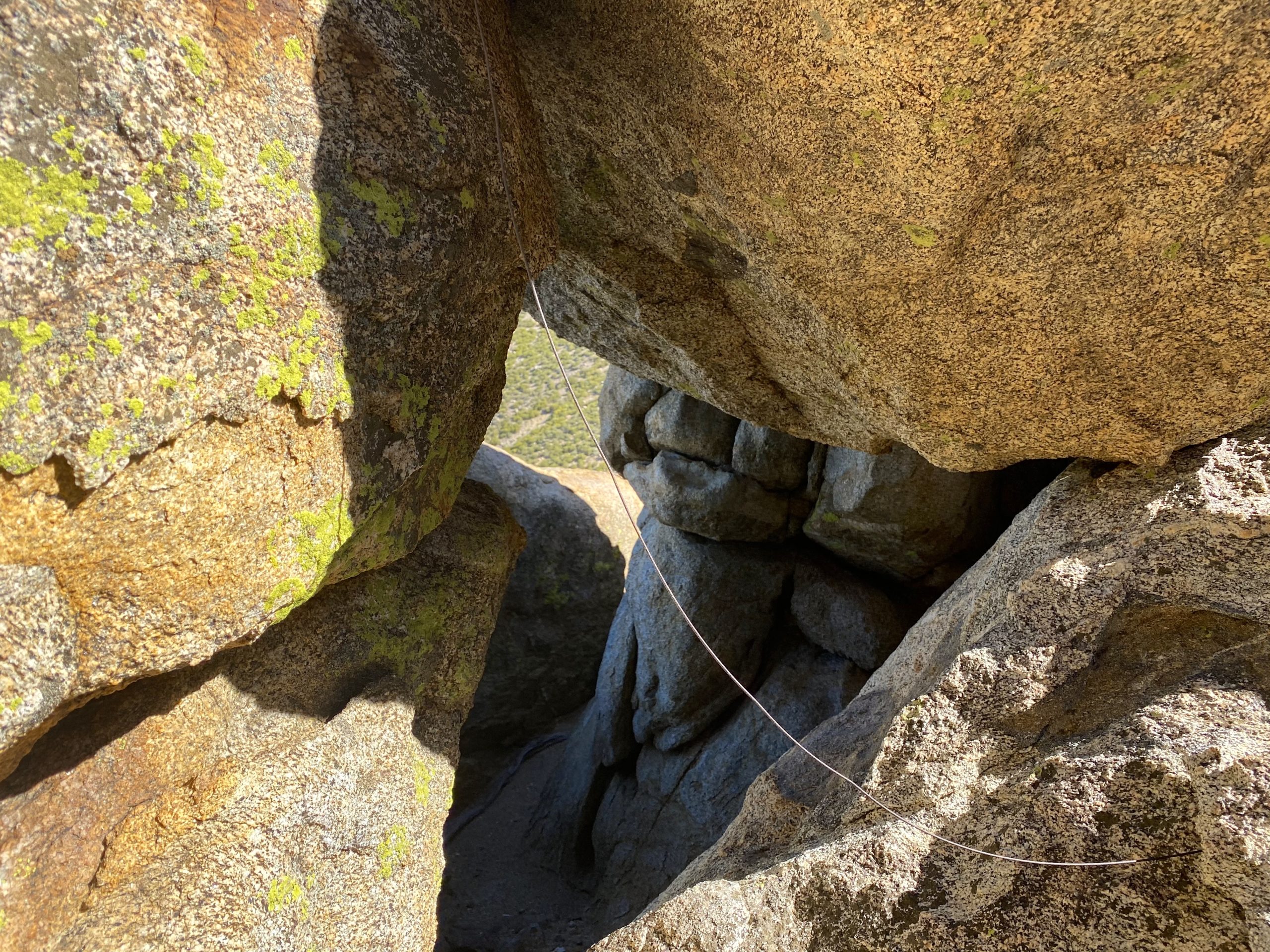
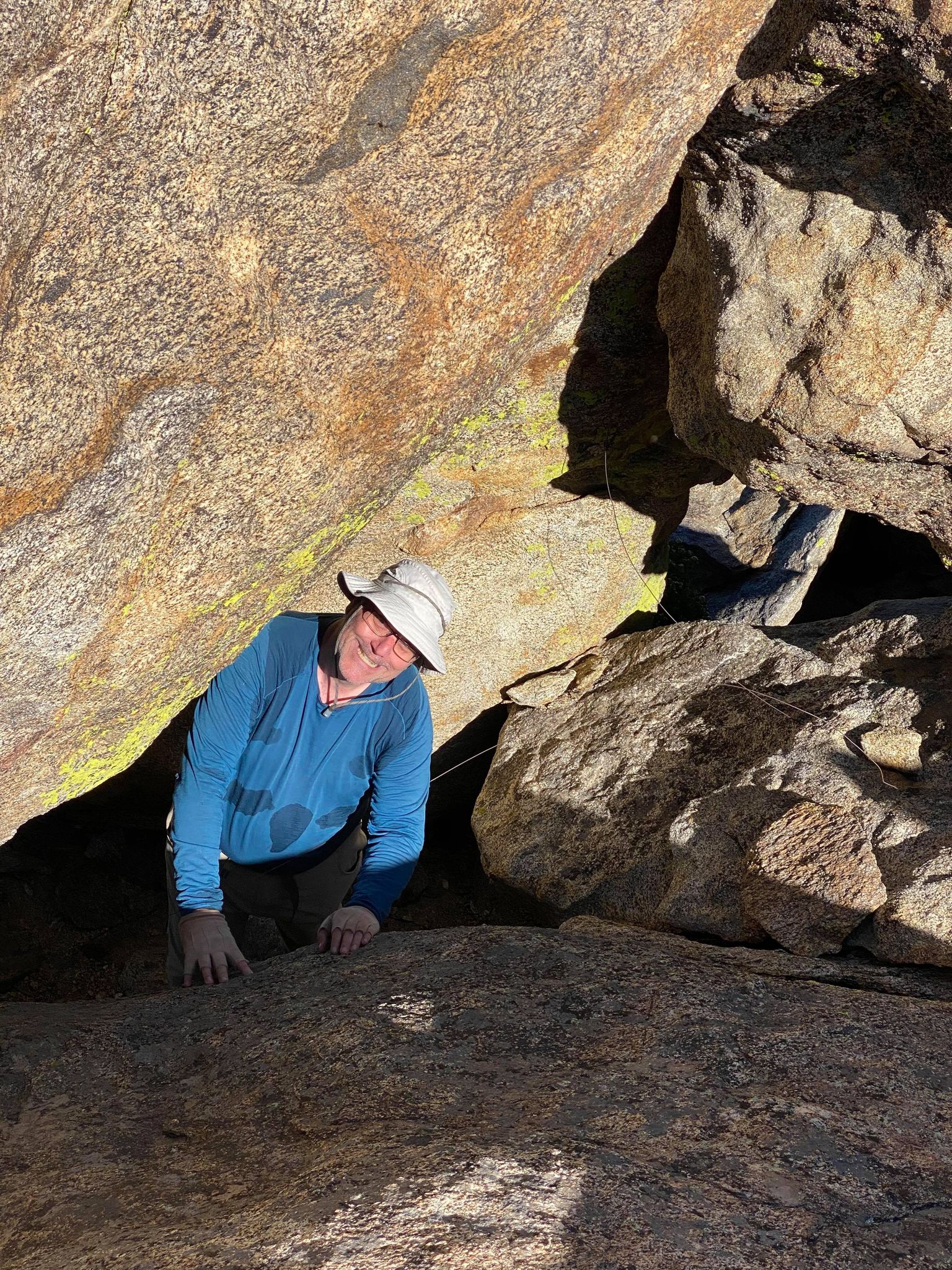
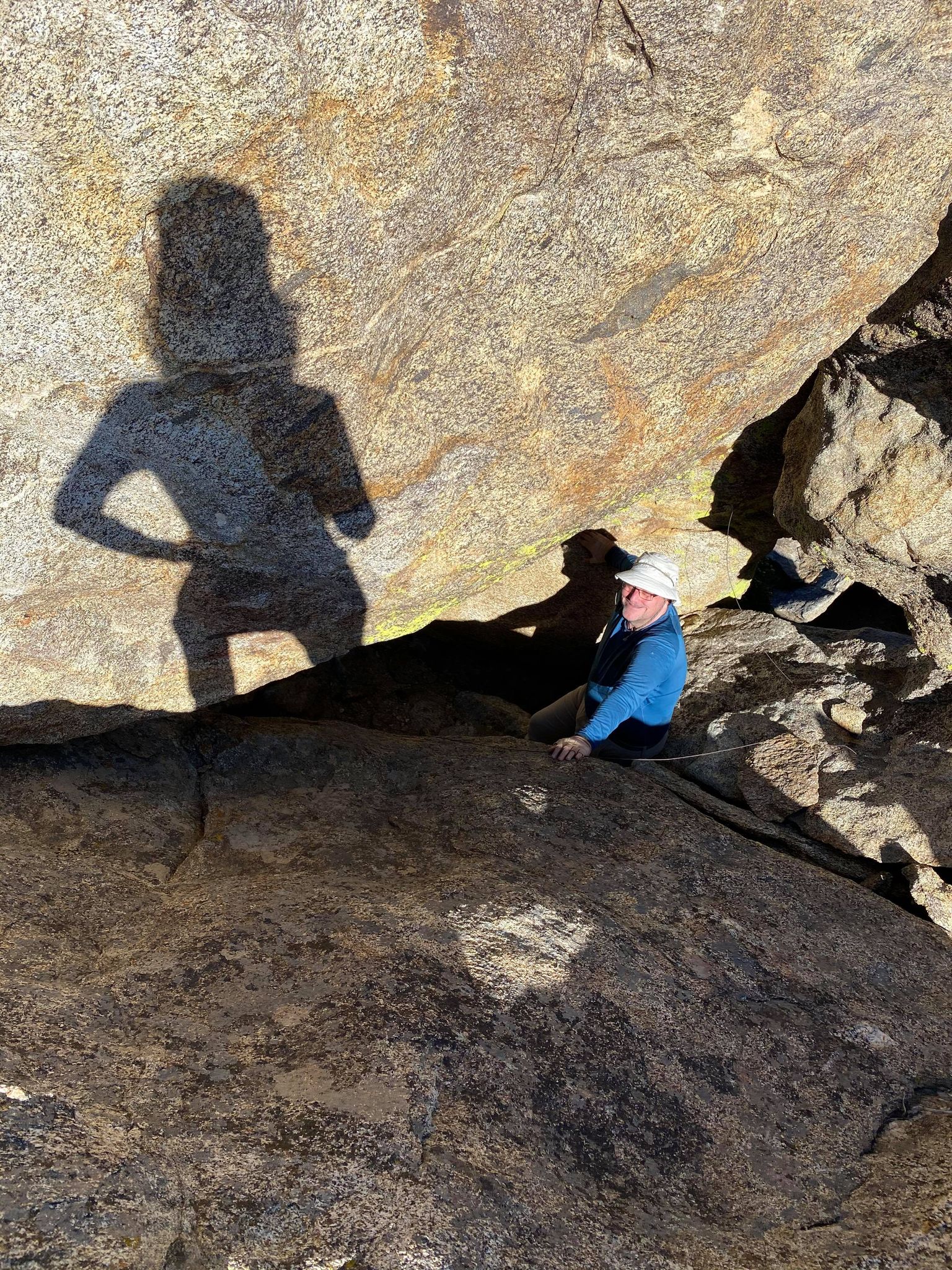
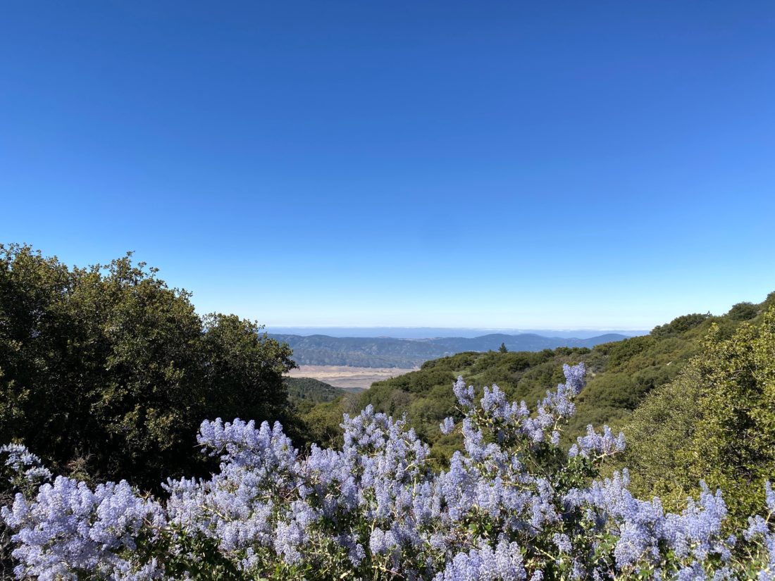
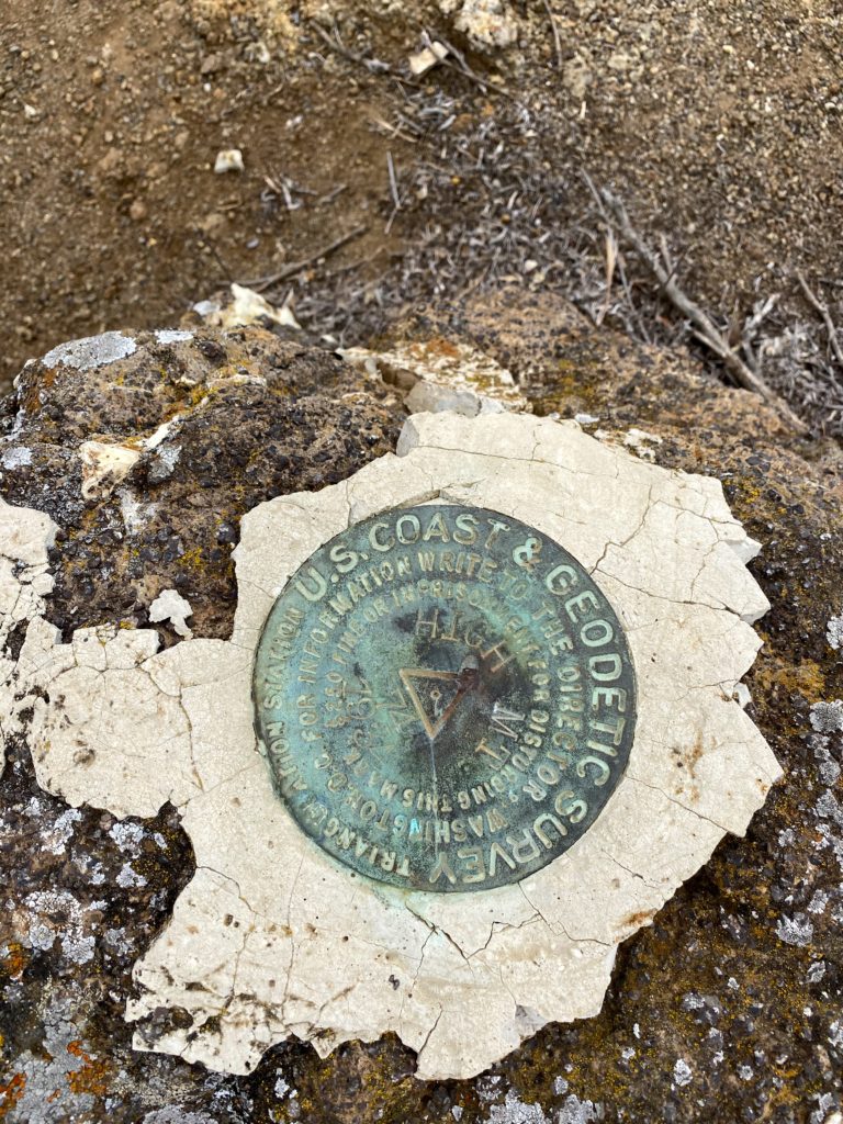
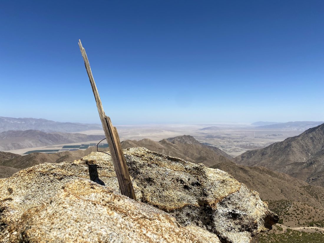
I returned back to Gina, and we set off for our primary peaks, Phil and Norte Benchmarks. I had spotted what appeared to be a descent route up earlier, so took it up the slope. In hardly any time at all, we found ourselves next to the summit of Phil. I spotted the register in a glass jar sitting high up on the summit block. Below it was some of the guidewires for the survey post. Gina carefully scrambled up the rocks and signed us in. Meanwhile, I poked around and found a passage under the summit block that gave us a nice route toward our next peak, Norte. We relaxed and chatted for a while, and also surveyed the surrounding terrain for how we might visit the other nearby peaks. We were in no hurry, so we just sauntered toward Norte.

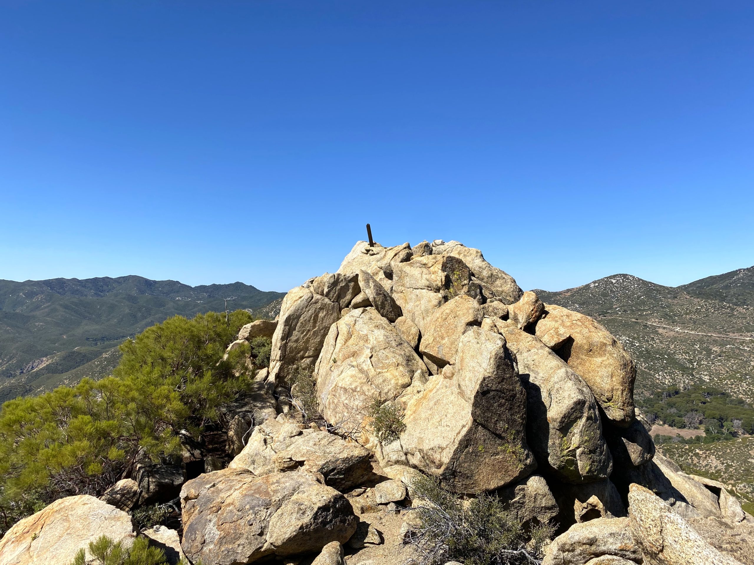
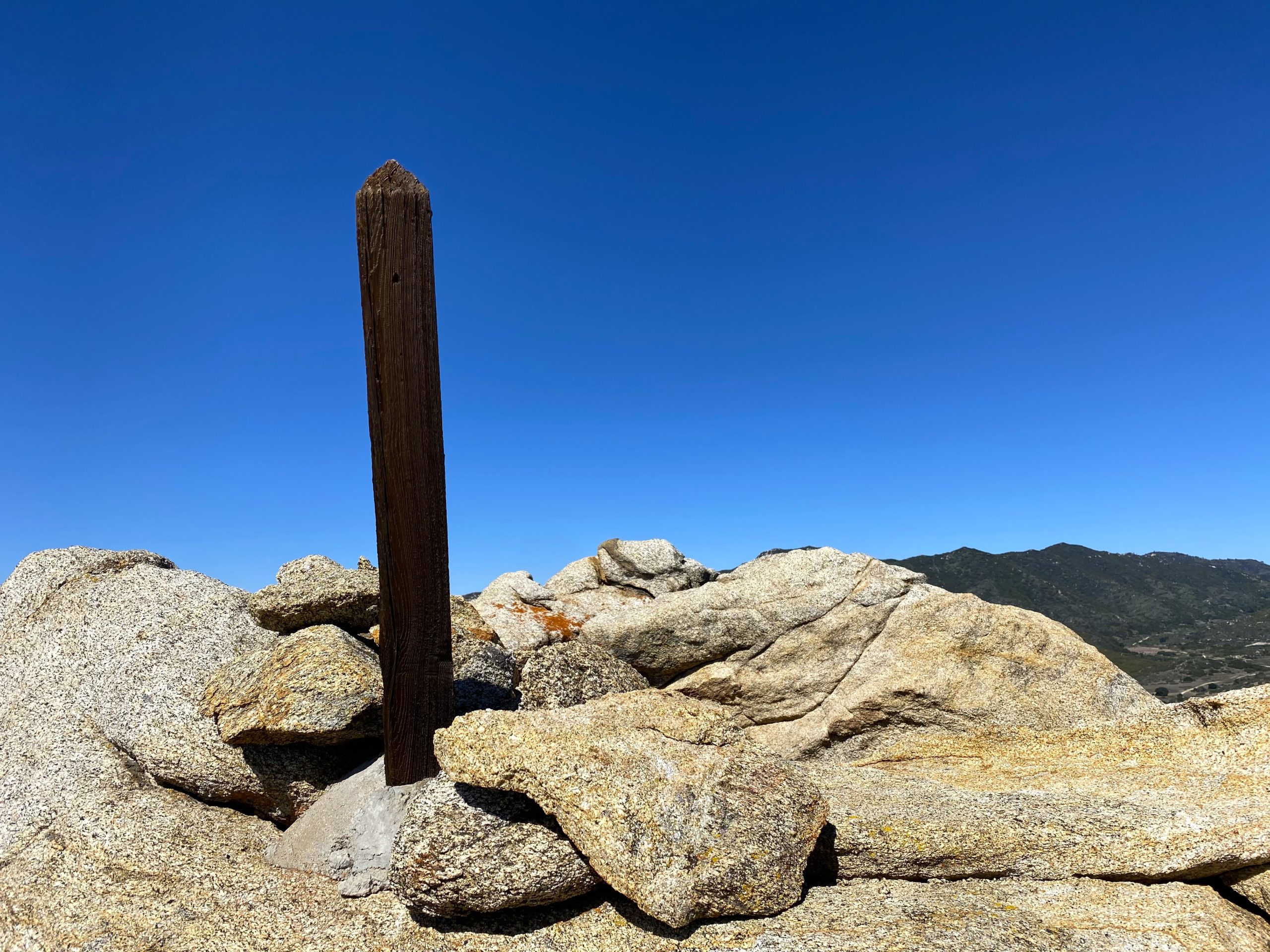
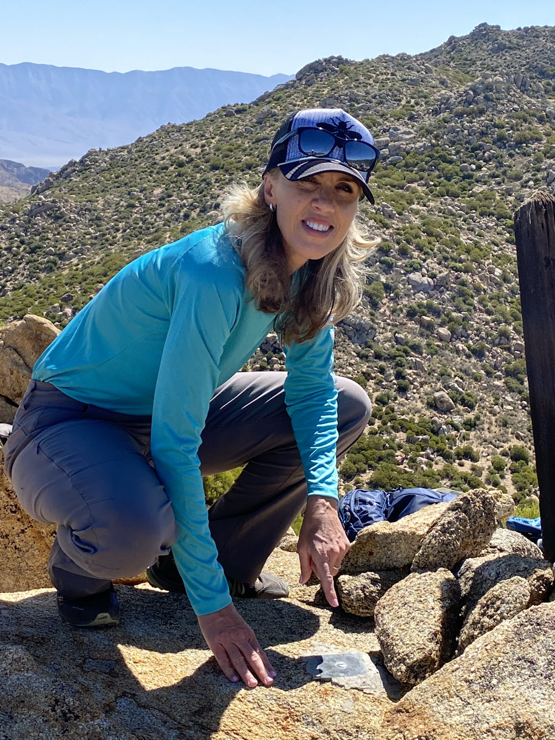
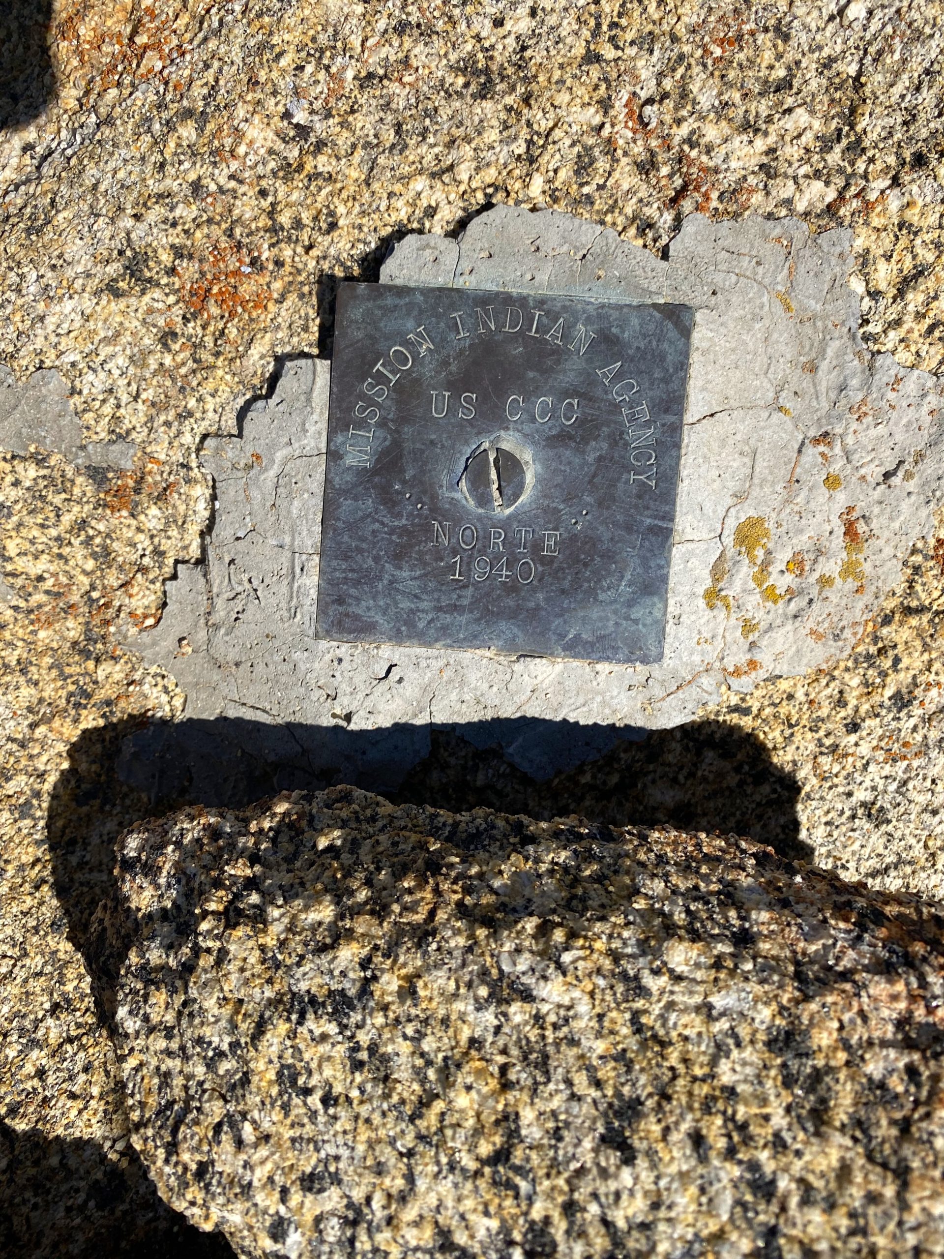
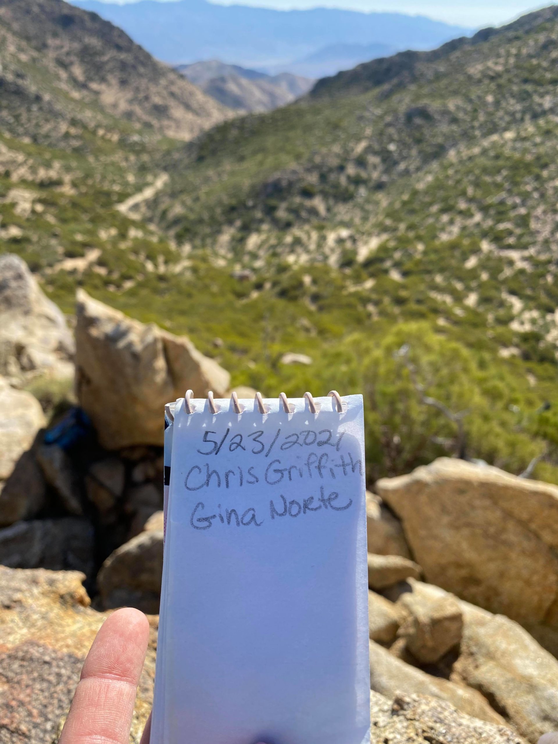
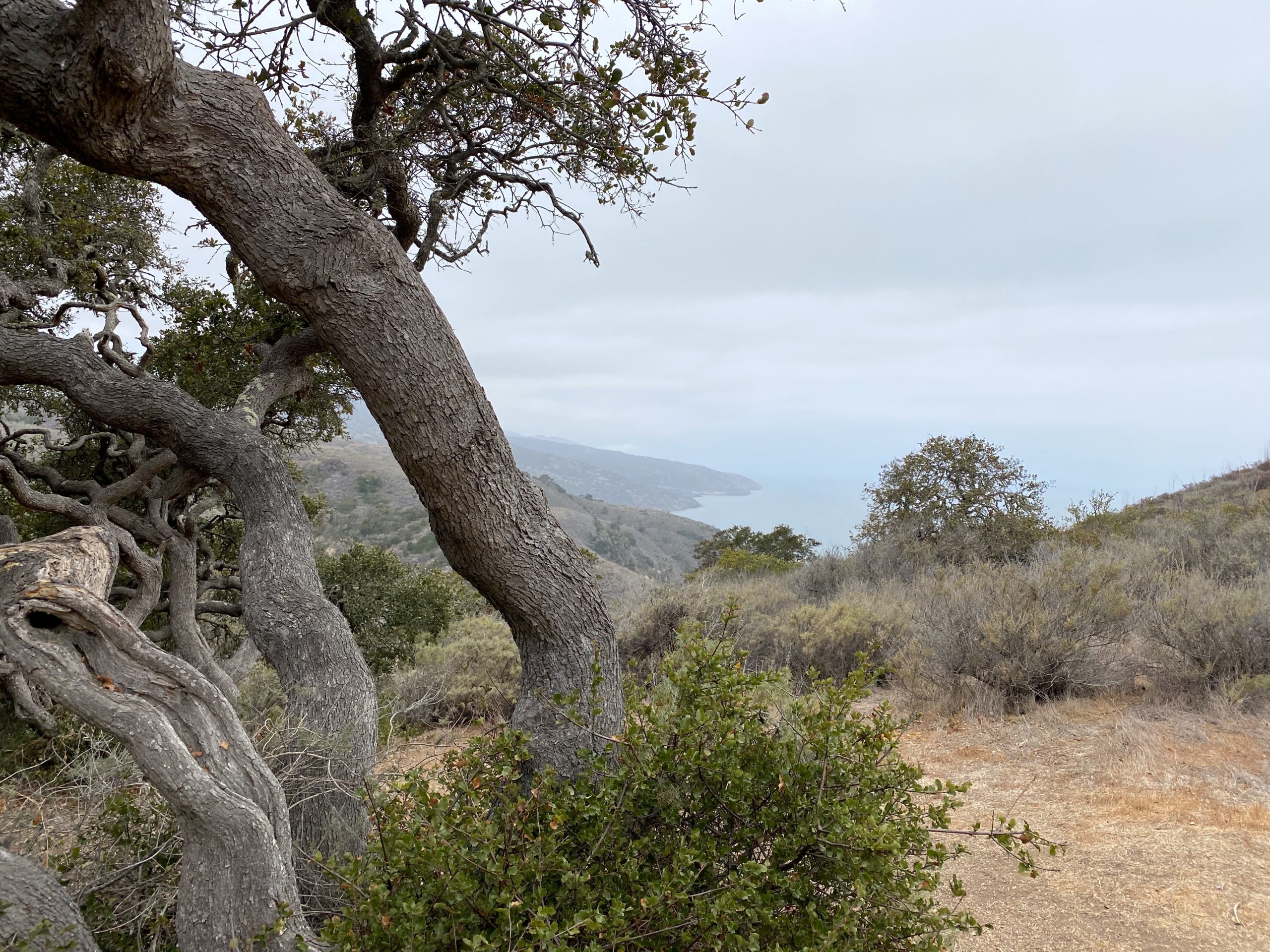
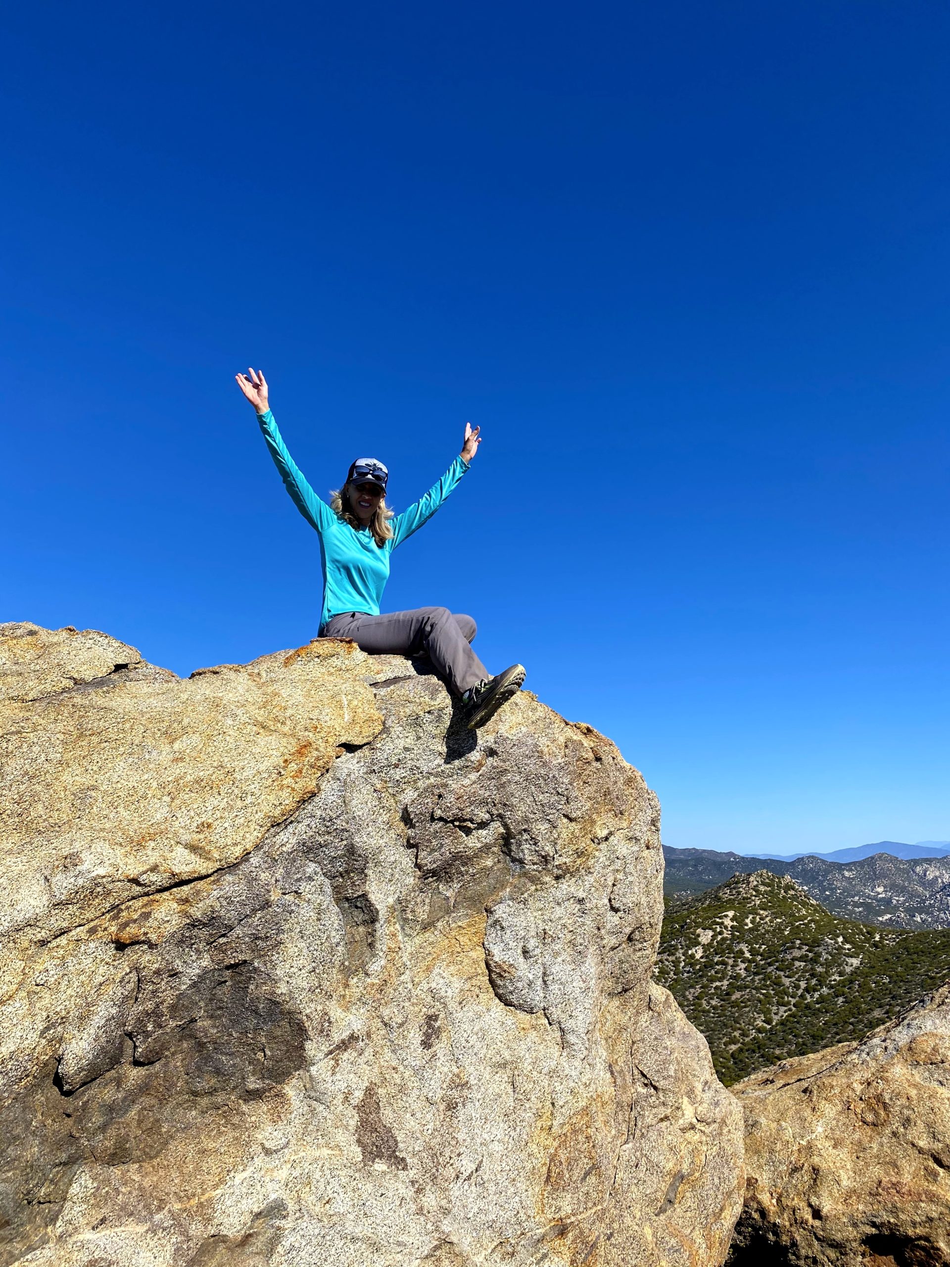
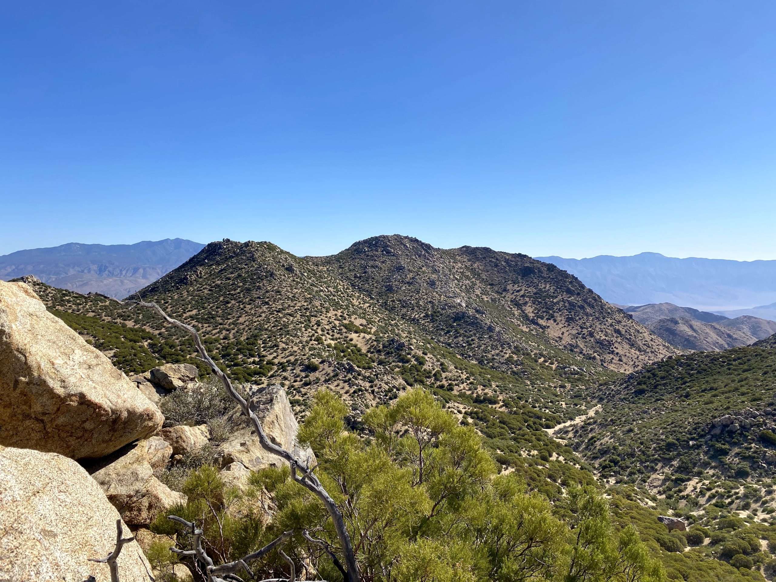
Jim Wick had done Phil and Norte a number of years back, and in his trip report, he mentioned that the approach to Norte was almost a walk up from the south side. So we looped around and his report was spot on. This was a special summit for Gina, as this peak was named in honor of her husband’s family. In fact, the benchmark is different from the regular USGS ones. We proudly signed the register and again took in the views. Since we both were feeling great, we decided to keep on exploring. Almost directly to our south stood Cody Benchmark. Gina had also wanted to climb it, so off we went. I had summited it with Susie Kara back in June of 2020, but we tackled it from the north up a steep and rocky route. This time, Gina and I worked our way along the ridgeline, staying on its northern side. Soon, we found ourselves at the saddle just below the summit and the short climb up.

We relaxed on the summit for a good while, soaking in the view, having a snack, and enjoying a little bit of cell coverage. I showed Gina the route Susie had taken down from Pike and up to Cody. Then looking back west toward Phil and Norte, we could see the difference between the south and north sides of the ridge. While Phil Benchmark was just a mere .7 miles to our north, I had no desire to take the direct route, especially having done the reverse. So, we roughly retraced our route to the saddle.

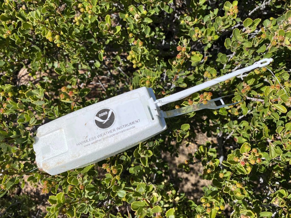
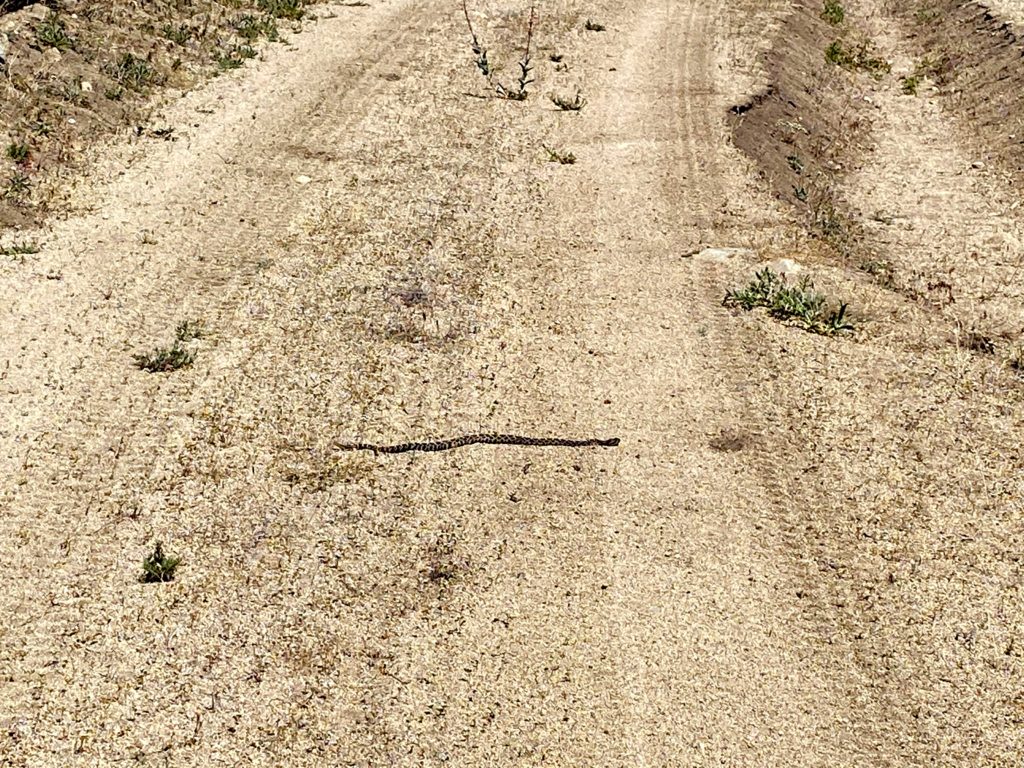
Along the way, I spied a string running from plant to plant. I suspected it was probably a weather balloon of some kind. We located the beacon, then followed the string to see if any remains of the balloon could be found. We only found the plastic hook, so we gathered up the items and stowed them in our pack. 

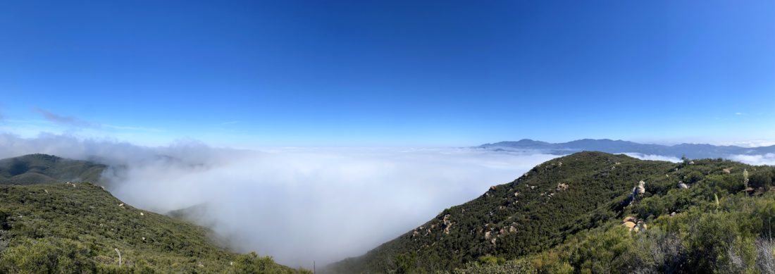
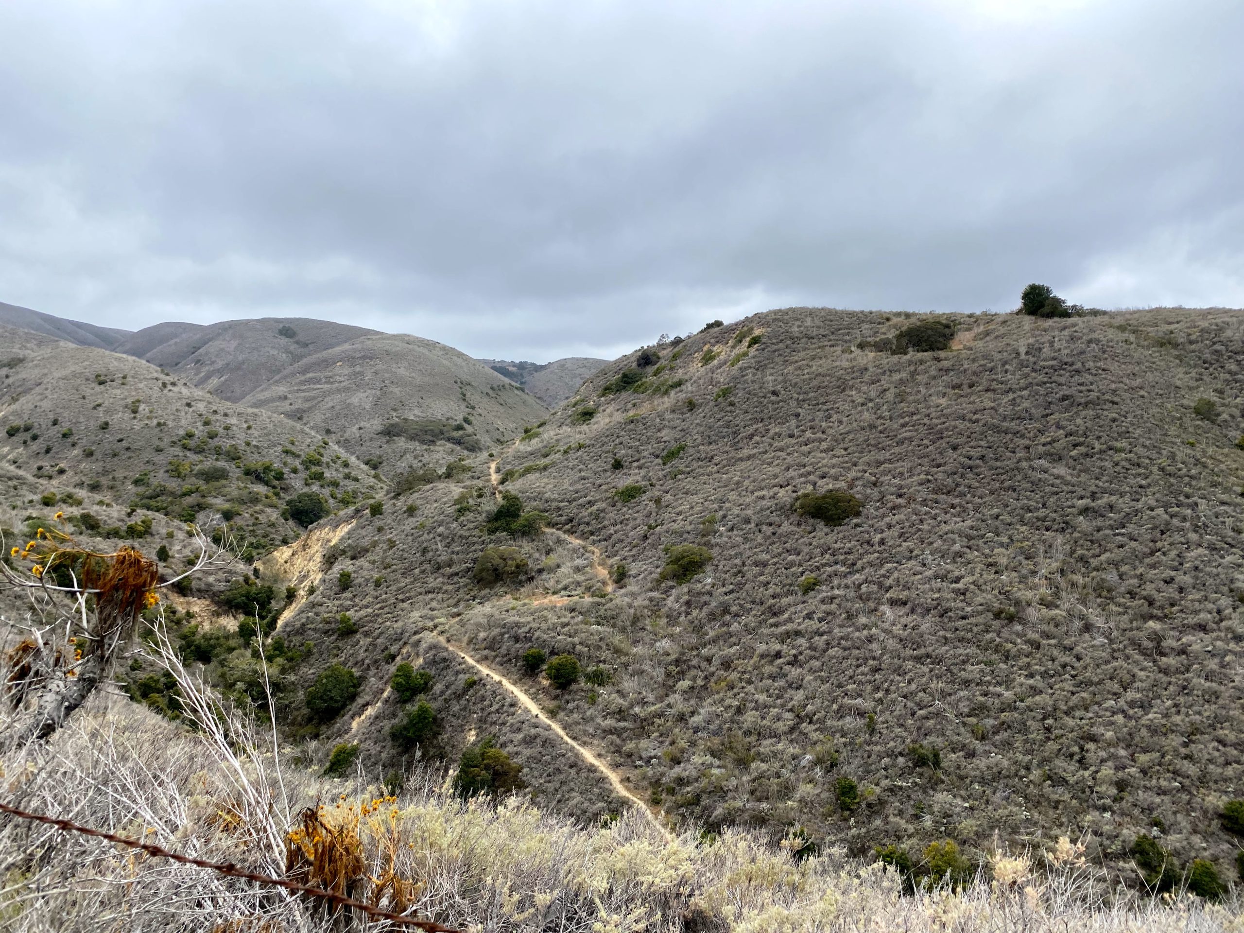
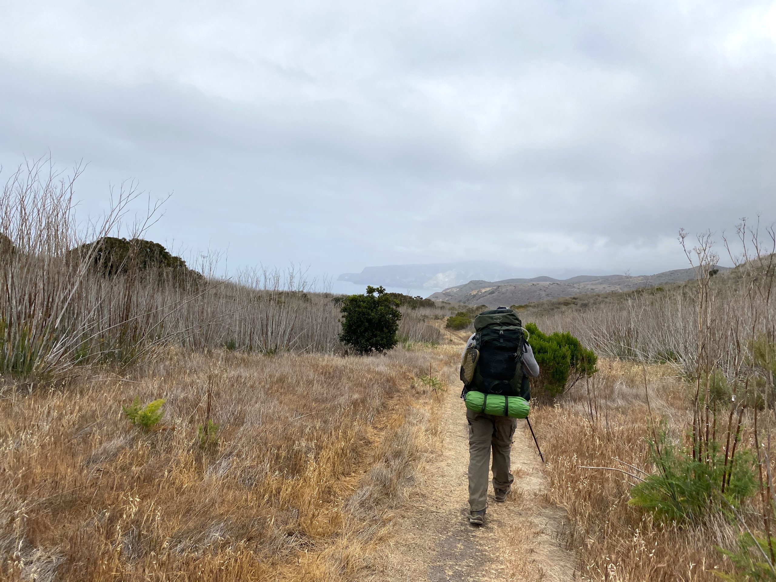
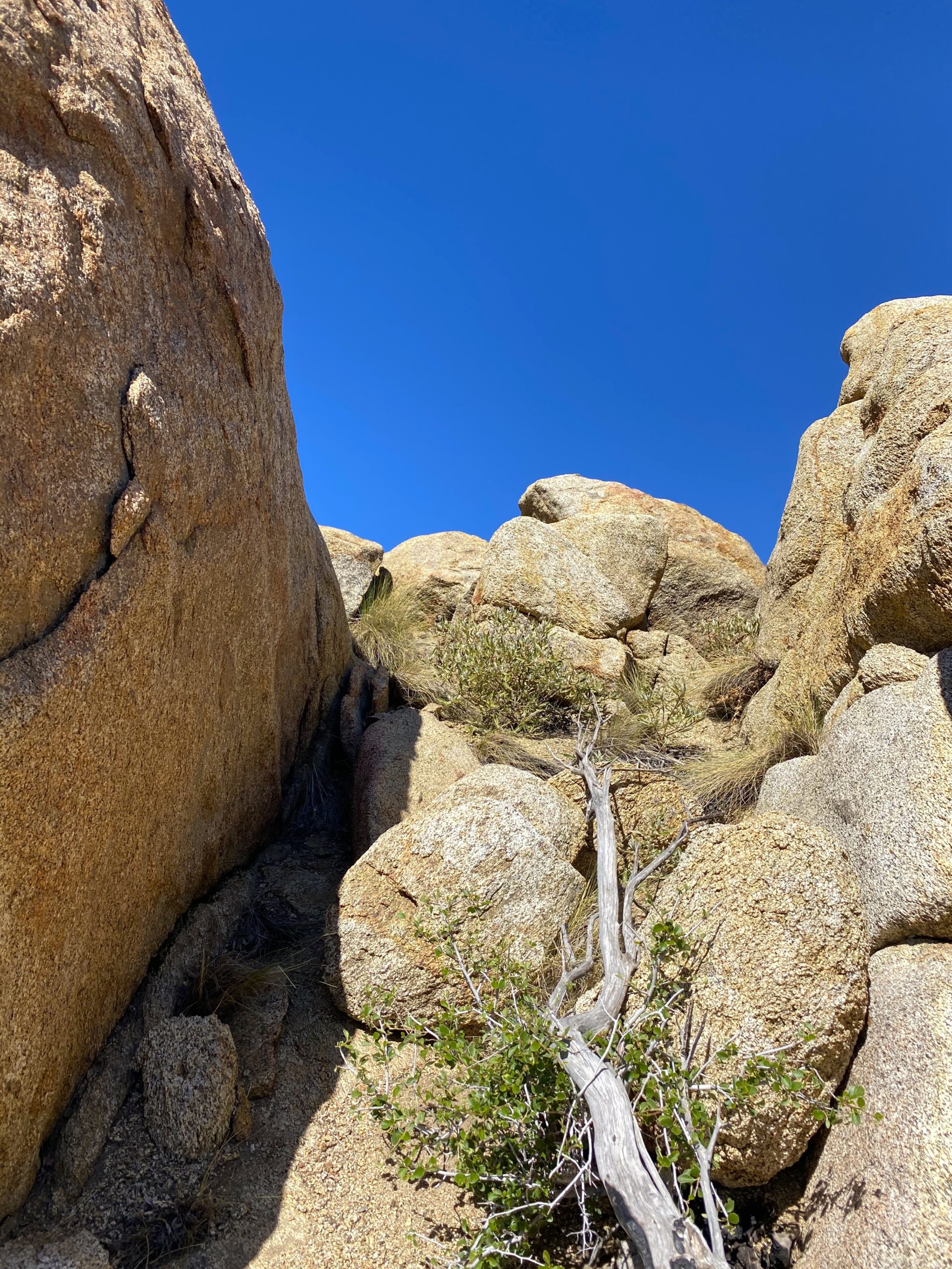
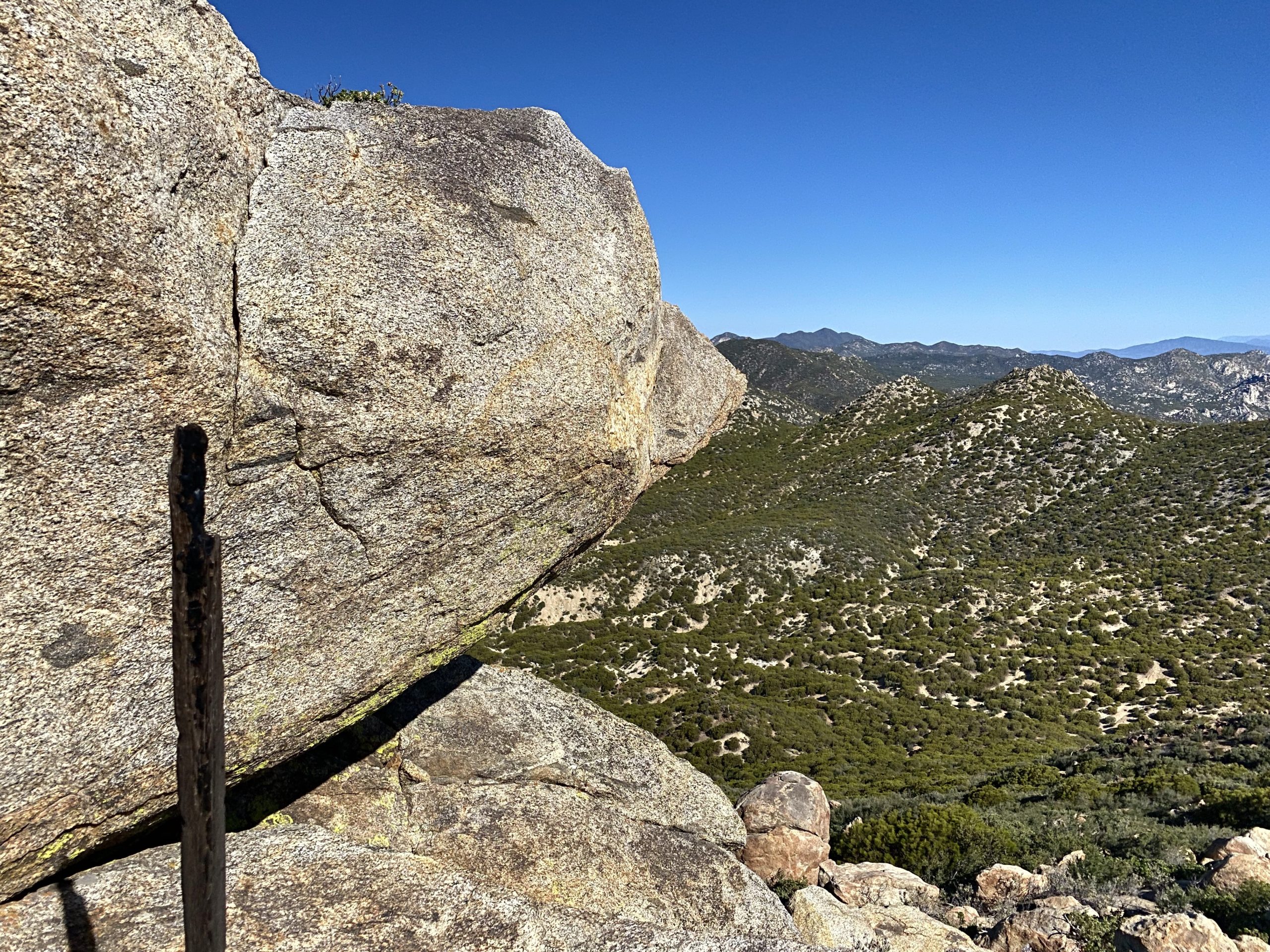
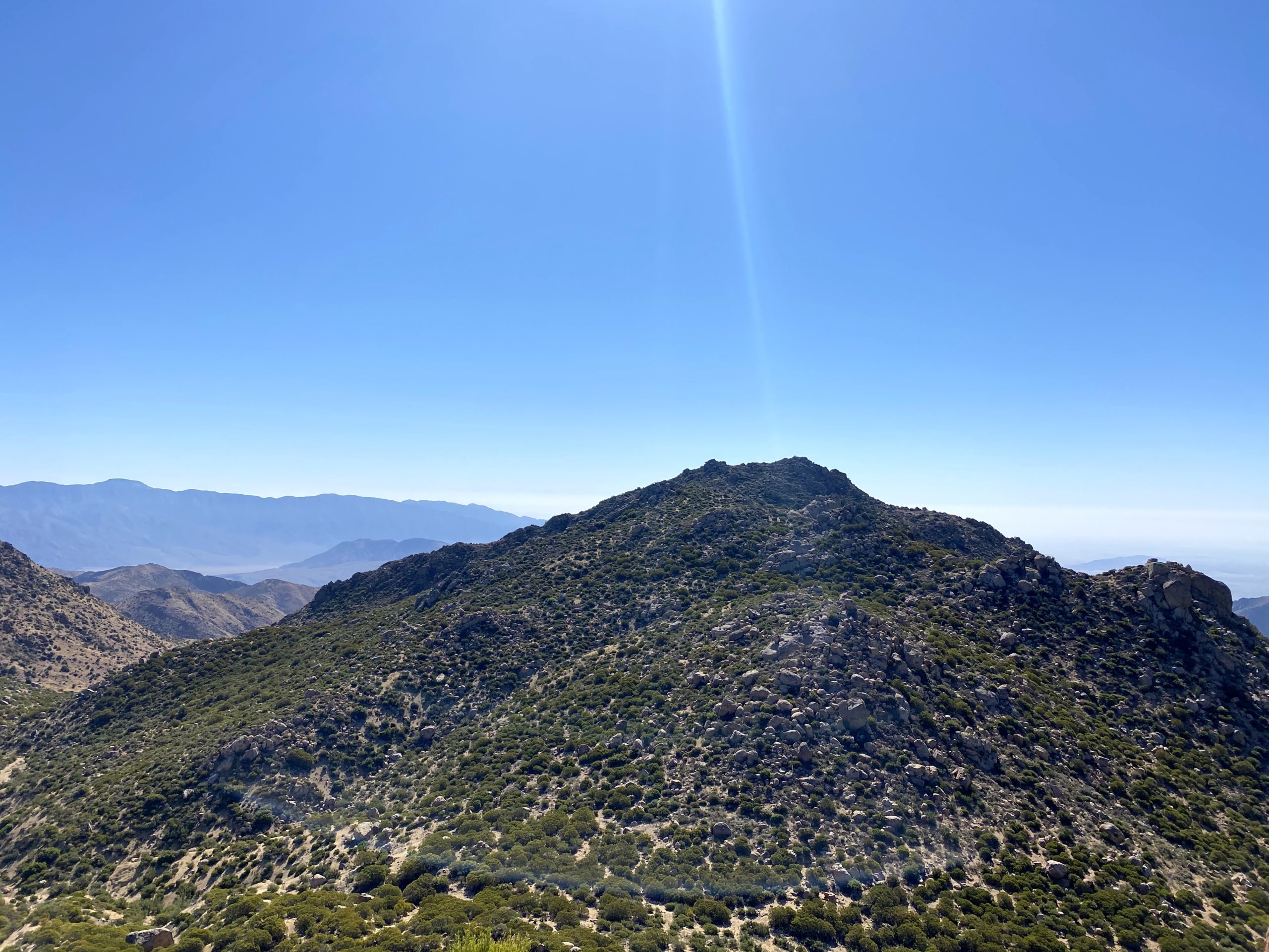
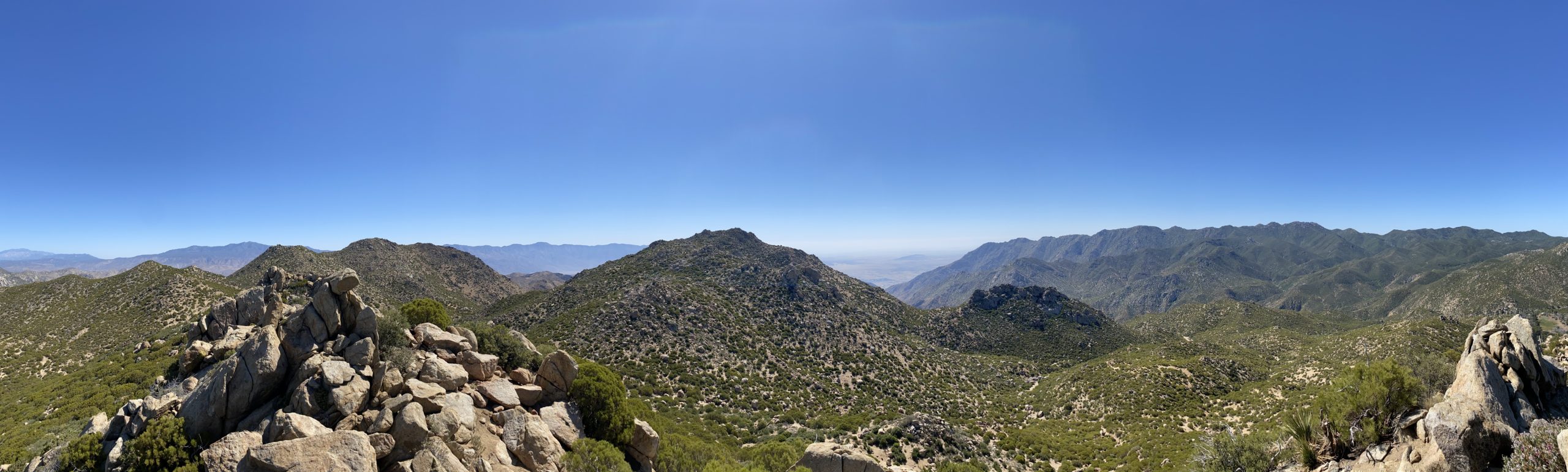
Still feeling good, we set off for our fourth peak of the day, Army Benchmark. This provisional peak sits just north of the saddle. We followed the main ridgeline up toward it. There were two possible bumps that it could be. Once we reached the first one, we did not see any signs that this was it, so we moved on to the next bump, a mere 300 feet away. Here, we did find some remnants of the surveying post. We found a nice spot for our lunch. From my spot, I could see Collins and Knob off to our north. We once again had some cell coverage and got a message that Dale and Alberto had reached Palm Mesa High Point. This let us begin to estimate when they might return. We debated if we should head west and summit Dry Benchmark, or push on and try for the Pikes. Still feeling adventurous, we set off for Pike Benchmark Summit and Pike Benchmark. Since we were on the ridge, we opted to stay on it as we worked our way over. Just to the west of Pike Benchmark Summit is a nice saddle. We walked over to its northern edge and had a sweeping view. Cougar Canyon was below us, SquareTop, Collins, Knob, Palm, and Elder were spread out before us. The final push up to Pike Benchmark Summit was a bit bouldery, so I continued my route finding and weaved our way up it without issue. 

Once on the summit, we could see Pike Benchmark just a stone’s throw away to the east. We again took in the views and signed the register. Rather than taking the direct approach to Pike Benchmark, we went north a bit, then across the minor saddle and up to the summit. If memory serves, Susie and I just charged straight across. 

As I stood atop my sixth summit of the day, I had to chuckle to myself. Initially, I thought I might just do two peaks, but here I was on #6 of the day. As an added bonus, I was a little closer to finishing the San Diego Sierra Club 100 Peaks list again. We scanned the wash below us to see if we might spot Dale or Alberto, but no luck. Gina and I discussed our route back, one option was to drop down from Pike all the way to the wash and climb back to the saddle, which was probably about 500 feet of gain once we dropped down. Or, we could follow the contour lines and sidehill it back to the saddle. That was the option we decided on, as it was getting a bit warmer in the mid-afternoon sun. I picked various landmarks to work our way toward, adjusting as the terrain revealed itself to us. After about 45 minutes or so, we found ourselves back at the saddle. When I was at the saddle in the morning, there was a cactus that was in full bloom, so I had to find it again since that is something that Gina loves to find.

Although we had not seen nor heard Dale and Alberto, we felt that we should probably head back, just in case they had slipped past us. We cruised back down the wash and back to our cars. We arrived about 4:30 and neither of them was there. We did some calculations of when they might arrive, and we loosely estimated they had at least another hour or more of hiking, depending on if they tried for eighth Cody or Pike on their return. I followed Gina back to the locked gate, and she let me through. I said my goodbyes and headed home. Gina returned to wait for them. She told me they arrived around 6:15 or so. I will let them tell their own adventures. But for us, it was an absolutely fantastic day; six peaks, 6.9 miles, and 1,715 feet of gain! 


Buy Me a Coffee at ko-fi.com

I am an avid peak bagger, sometimes backpacker, and former sea kayaker living in San Diego. I am the co-author of Urban Trails:San Diego, coming in Spring 2026!

In 2019, I became the third person to complete the San Diego 100 Peak Challenge. Not stopping with that accomplishment, I set my sights on the harder San Diego Sierra Club 100 Peak list, which I completed in 2021. In addition, I have conquered several Six-Pack of Peaks challenges (SoCal, San Diego, Central Coast, and both the Arizona-Winter and Arizona-Summer). I am looking forward to exploring new summits and new adventures across the southwest. 

Cuyamaca Peak (via Conejos Trail)

With my recent summit of Hot Springs Mountain, I was down to only one more peak to complete the San Diego Six-Pack of Peaks Challenge — Cuyamaca Peak. Initially I had planned to save doing it until a nice fall day, but we still had some nice spring weather so I decided just to go knock it off the list. The past few times I have summited this mountain I had been working on the 100 Peak Challenge, so getting Airplane Ridge and Japacha Peak had been on the agenda. This time I did not need to revisit those summits, so I looked at some of the other possible routes. For many, they simply take the newly re-paved fire road to the summit from the campground. This was the route I did the first time years ago. While it is the shortest route, it is steep and all on a paved road. I had no desire to take this route again. Instead, I opted to use some of the trails on the north side of the mountain.

Cuyamaca in the distance

I pulled into the parking lot near the Trout Pond trail, just a bit north of the Paso Picacho Campground. This the same starting point you would use if you were going to hike up Middle Peak. There were a few cars here as I gathered my gear. It was still a bit nippy, so I pulled on a fleece. The forecasted high on the summit was in the low 50s, so I was probably going to want it later even if I warmed up while I was hiking.

After carefully crossing the highway, I headed down Milk Ranch Road. The grade was nice and gentle and had some lovely views. I passed the turn off that would take you up toward Middle Peak. After about 1.4 miles I came to the junction of the Black Oak Trail to my north and the Azala Springs Fire Road to my south. Walking around the gate, I continued on for about a quarter of a mile until I reached the Conejo Trail. My route now turned from nice wide roads to a more traditional trail. I continued to have a nice view of Cush-Pi (Stonewall) to my east. Over the next 1.5 miles, I would gain almost 900 feet of elevation. I could occasionally hear some voices ahead of me, and since I was making good time, I figured I would probably catch up to them. As I turned the corner of one of the switchbacks, I recognized Amber Haslerud from the San Diego Hiking Society. She and her boyfriend were also climbing Cuyamaca today. I stopped and chatted a bit. I loved following Amber’s hiking journeys, so it was a treat to finally meet her face to face. I wished them a good hike and continued on. The trail still had some nice wildflowers along it, so I seemed to be grabbing my phone to snap a photo quite often.

The Conejo Trail meets up with the Lookout Fire Road about .4 miles from the summit. However, I still had over 300 feet of gain until I summited. As I made my way to the top from the road, I spied two teeny tiny patches of snow tucked in the shade. The summit sign was still there, so I took my summit selfie then wandered over to take a few more photos of some of the interesting landmarks, the NASA benchmark, the Forest Service carving, and of course the view. I had a quick snack and was just about ready to leave when Amber and John arrived. Since this was their first time at the summit, I showed them how to get to the top. Once there, I gave them a quick tour of the summit. We chatted some more, and then I let them enjoy their accomplishment by themselves.

Since I found much of the Conejo Trail a tad rocky, I opted to take a slightly different route back to the car.

So, I stayed on the fire road until it met up with Azala Springs Fire Road. I followed it for about .6 miles until I reached the spring. Now if I had parked at the campground, there is another trail that would take me there, but I continued north back toward Milk Ranch Road, and eventually my car. My entire hike clocked in at 8.73 miles with 1,862 feet of gain in 4:02 (including all the chatting).


Buy Me a Coffee at ko-fi.com

I am an avid peak bagger, sometimes backpacker, and former sea kayaker living in San Diego. I am the co-author of Urban Trails:San Diego, coming in Spring 2026!

In 2019, I became the third person to complete the San Diego 100 Peak Challenge. Not stopping with that accomplishment, I set my sights on the harder San Diego Sierra Club 100 Peak list, which I completed in 2021. In addition, I have conquered several Six-Pack of Peaks challenges (SoCal, San Diego, Central Coast, and both the Arizona-Winter and Arizona-Summer). I am looking forward to exploring new summits and new adventures across the southwest. 

Sitton Peak

My fellow admin of the San Diego Hiking Society wanted to climb Sitton Peak, and as I also needed to climb it again for this year’s Six-Pack of Peaks, we arranged to hike it together. We met in the parking lot under overcast skies. After grabbing our gear we carefully crossed Ortega Highway and onto the trail. I signed the back-country register and we continued making our way on the trail. 

Wildflowers still dotted the sides of the trail. The grey skies provided some nice relief, as there was not a lot of shade to be found while we worked our way to the peak. The entire route was still marked with white signs at each of the junctions. 

We passed one person who appeared to have spent the night camping. Soon we found ourselves at the turn-off to the summit. Here is where you earn the summit by gaining about 400 feet in 3/10 of a mile. I lead the way up and it was easier for me this time.

Soon the summit came into view and we had a well-earned break. The clouds had burned off near us, and while the marine layer still socked-in the coast, Santiago Peak stood out clearly to the north of us. After a nice break and snapping our photos, two more hikers joined us at the summit. 

We let them enjoy the summit to themselves and began our descent. As we made our way back I spied a nice 3-foot rattlesnake coiled on the trail. We paused at a safe distance and waited to see if it would decide to move out of our way. The hikers we had met at the summit, along with two more, came up behind us. At this point, the snake was mostly off-trail and we could pass safely. 

A bit later we found ourselves back at our cars and headed back to San Diego. It was a fun 9.4 miles in 4:31. That was my second peak on my 2021 Six-Pack of Peak Challenge


Buy Me a Coffee at ko-fi.com

I am an avid peak bagger, sometimes backpacker, and former sea kayaker living in San Diego. I am the co-author of Urban Trails:San Diego, coming in Spring 2026!

In 2019, I became the third person to complete the San Diego 100 Peak Challenge. Not stopping with that accomplishment, I set my sights on the harder San Diego Sierra Club 100 Peak list, which I completed in 2021. In addition, I have conquered several Six-Pack of Peaks challenges (SoCal, San Diego, Central Coast, and both the Arizona-Winter and Arizona-Summer). I am looking forward to exploring new summits and new adventures across the southwest. 

Hot Springs Mountain (via Nelson Camp)

With the Sierra Club 100 behind me, as well as my backpacking trip on Santa Cruz Island, it was time to turn my attention back to completing the various Six-Pack of Peak Challenges. Since I am hoping to do several of them as overnighters, I had a handful to pick from. Since I knew my friend Gina Norte usually hikes Hot Springs Mountain on Saturdays, I reached out to see what her plans were. She replied that she was taking another San Diego Hiking Society admin, Conni Barth Nardo, and a friend up Hot Springs Mountain, but via the Nelson Camp route. I remember reading about this route in my earlier editions of Afoot and Afield in San Diego. Instead of starting at the campground, this route follows an older jeep road from much further back on the reservation. Access to this part of the reservation has been closed for a number of years, so given the opportunity to explore a new trail, I was so excited to be able to tag along. 

We met as usual at the guard shack and followed Gina to the campground. The tribe had recently changed their hiking hours to allow starting at 6 am, and there were about 8 or so cars already parked. We tossed our gear into Gina’s car and set off, driving along the dirt road for a bit. Instead of heading to the right, like we did when we hiked to Palm Mesa High Point, we veered left. We passed through our second locked gate, then past the shooting range. Finally, we pulled over near what Gina referred to as “Four Corners”. From here we would follow an old jeep road until it intersected with Hot Springs Mountain Road.

The four of us began working our way up the mountain, Gina leading the way and telling us about the history of the land and its people. After a bit, we stopped and she led us off-trail to an impressive collection of morteros. These were some of the deepest I have ever seen. Then she led us over to the cooking area. She pointed out some of the shards of pottery that remain. Also, she told us how to distinguish it from the surrounding ground. 

Once back on the trail, the “road” became rockier in nature. One of Gina’s roles for the tribe is also to monitor some of the wildlife on the mountain. Along this route, she has a trail camera set up to capture the other ‘visitors’ to Hot Springs Mountain. Near its position, Gina spotted a mound of mountain lion scat. She estimated that it was 1-2 days old. Since we were traveling in a close group, there was very little risk. Plus, we all knew what to do if we did have an encounter.

After about 1.2 miles we met up with the main road and continued on up to the summit. Neither Gina nor I missed bypassing those first couple miles on the normal route. Once at the top, we opted to head over to the summit block first, then return to explore the area around the abandoned lookout tower. As we made our way to the true summit, four ladies were getting ready to take a Happy Birthday photo. Gina asked if they had made it to the top, and they said they did not. Gina being Gina said “come along” and she would guide them up. Arriving at the summit block, there were some other hikers making their way up. Gina offered some tips to them as well. Connie, her friend Meredith, and I just hung around while everyone else made their way up.

The four of us finally scrambled up the rock and soaked in the views. I pointed out the various key mountains that surrounded us. We carefully scrambled down, and even more folks were waiting their turn. HSM was quite popular today. Gina helped another set of hikers make it up before we headed over to the tower.

We poked around there a bit and had a snack. I even ran into a former Qualcomm colleague. After catching up a bit, we headed off. Plus it was getting crowded up there. I was glad I was vaccinated. Upon our return, we decided to take another off-trail excursion, with Gina’s permission to summit Peak 6440. This peak is just about 0.2 miles off the main route. We scrambled up its rocky dome to some incredible views. We could look back and see the summit and tower to our west, and some even better desert views to our east. We wandered the summit a bit before heading back down.

We continued sharing stories and adventures as we made our way back down to the car. The day had warmed up a tad, but it was still pleasant. There was one section of the route that had changed. On the way up there was a portion of the road that was muddy from a spring. Upon our descent, bees had arrived to drink, so we had to carefully pass through it. Once back at the car we returned to the campground, but not before spotting a rattlesnake sunning itself in the road. I snapped a few photos from the safety of the car, then guided Gina around it, as it had no interest in moving. We bid farewell at the campground and headed back home. Since I only had a snack at the tower, I was a bit hungry. I debated just getting some snacks from Don’s Market or a sandwich from Dudleys. Dudley’s won.

I am so grateful that I was able to come along on this hike and see more of this incredible area. We are already planning a laundry list of other hikes to come… The final stats for this route were 6.9 miles in 5:14 with 1,459 of gain. 


Buy Me a Coffee at ko-fi.com

I am an avid peak bagger, sometimes backpacker, and former sea kayaker living in San Diego. I am the co-author of Urban Trails:San Diego, coming in Spring 2026!

In 2019, I became the third person to complete the San Diego 100 Peak Challenge. Not stopping with that accomplishment, I set my sights on the harder San Diego Sierra Club 100 Peak list, which I completed in 2021. In addition, I have conquered several Six-Pack of Peaks challenges (SoCal, San Diego, Central Coast, and both the Arizona-Winter and Arizona-Summer). I am looking forward to exploring new summits and new adventures across the southwest. 

Backpacking across Santa Cruz Island

One of my goals for this year was to take more backpacking trips. In fact, I hope to do many of the Six-Pack of Peaks as overnights. But another adventure I wanted to take was a backpacking trip out on Santa Cruz Island. After doing some research, I settled on arriving at Prisoner’s Harbor and hiking up to Del Norte Primitive Campground. After spending the night there, I would hike across the island to Scorpion Cove and camp there and then depart back to the mainland the next day. The first challenge was to find permits for both of these sites. Del Norte can be tough to get as there are only 4 sites available. Once I had secured my Del Norte site, I selected a site at Scorpion. The next requirement was book passage with Island Packers to be ferried over to the island. But when I tried to book my trip I was unable to arrive at Prisoner’s Harbor and depart from Scorpion. I gave up and called them directly, and learned that you can not book a trip like that on the website, but it was no problem to book over the phone.

I then extended the invitation to the trip to Ted Markus and my college buddy, Ted Hoelter, both quickly said yes. What was going to be nice about this trip is all three of us will be vaccinated, making the trip far less stressful. Ted M. and I drove up to Ventura the night before and shared a hotel room, as neither of us wanted to wake up that early to drive up to Ventura Harbor. It was like pre-Covid.

Probably one of the biggest challenges of this hike was going to be the fact that Del Norte does not have any potable water, meaning we would have to carry enough water for the 3+ mile climb to the campsite, two meals, and the 10+ mile hike over to Scorpion Cove. By our calculations, we each needed to have about 6 liters of fluids. That is a lot of water weight.

Ted M. and I grabbed breakfast at a café at the harbor before heading over to Island Packers’ dock. Our packs were weighed as there is a weight limit. In addition, our fuel had to be removed and stored separately, as did our water/fluids. I opted to put my fluids in my slack pack and keep it with me. Once on-board, we set off for the 1 ½ hour ride. The seas weren’t too bad, with just some light swell. We spotted some bottle-nose dolphins and a minke whale on the way over. Once we docked, we climbed the ladder up onto the pier and headed onto the island. The ranger was giving a briefing to the day visitors, most of whom were taking a guided hike onto the Nature Conservancy portion of the island. It seems the three of us were the only backpackers on this day. We found a picnic table and began to repack our packs. The ranger came over to us and gave us a short briefing and checked that we were properly prepared. With that we set off!

Ted M. and I had brought sandwiches for lunch. Neither of us was ready, so we kept them in our packs, figuring once we reached camp we would enjoy them. To get to the campsite, we followed the Navy Road for about 1.25 miles until it intersected with the Del Norte Trail. This first section was a fairly steady grade, but soon we would lose some of the 600 feet of gain, as the Del Norte trail would dip down into a ravine and back up. The skies were overcast and we would feel the humidity as we made our way up. From a recent YouTube video of this hike, I knew there was another picnic bench that would make a perfect rest stop. We slipped off our packs and took a nice break, enjoying the sweeping views. We debated having lunch here, but we only had one mile to camp, so we pushed on. Our climb continued until we reached the turn off to the campsite. We again slipped off our packs and surveyed the campsite. Not soon after, one of the island’s kit foxes trotted by. We decided to wait a bit to set up our tents as while currently we had the entire campsite to ourselves, in case someone was hiking over from Scorpion we did not want to have taken their site. We had our lunch and then enjoyed a nice nap for a bit. Around 5, we deemed that no one was coming, and we each took a site and set up our tents. I stayed in site 3, while Ted M. picked site 2, and Ted H. opted for site 1. 

With our tents set up, we went for a short stroll up to the ranger’s house. While Gaia showed a loop, once we reached the residence, it was clear that the trail was no longer there. We returned to our camp and made dinner. I enjoyed one of the beers I had hauled in my pack as I ate my dinner. We watched the sun slip out from the cloud layer for a brief moment before sliding behind the island. We chatted around the table for a while, before storing our food in the bear boxes. I hung my pack from a nearby oak to keep some of the island’s animals from getting into it. I crawled into my tent and listened to some podcasts before drifting off to sleep. My only disappointment so far was, due to the cloudy skies, I was not going to get to enjoy the stars. 

Thankfully, we had little wind throughout the night. We had read that it can get a bit windy here since it is an exposed campsite. As expected we all woke around 6. To conserve our water, we all had low-water breakfasts. I opted for oatmeal and one cup of coffee. We packed up fairly soon, as we figured we might as well start hiking while it was cooler. 

We made our way back onto the Del Norte Trail and began heading east until we reached the junction with the trail down to Chinese Harbor. From there we would connect with the East End Road and continue on. While we mostly were gaining elevation along the way, we did have a couple of ravines that dropped through. Although we each were lighter by 2 liters, our packs were still a bit heavy. The fog and clouds were all around us as we made good time.

After about 4.5 miles or so, we came to another picnic bench. This one had seen better days, but it served as a welcome rest stop. We had a bit of uncertainty about the correct route, as Gaia showed a fork in the road, which we did not see. Ted H. and I scouted around and determined that the remaining road that we saw before us was the correct route. After a few minutes of traveling, we spied the overgrown road that we did not want to have taken. The Montanon Ridge stood before us. We debated which of the bumps was El Montanon, the peak I had hoped to summit. The road ended and our route returned to single track. We would now make the climb up the ridge. The Teds were a bit uncertain, but I knew that we would be fine.

We carefully made our way up the steep slope, given we did have backpacks on and our center of gravity was shifted. Once past the ‘hard’ part, we stopped and surveyed our ascent. Off to the side, a short use trail leads up to a viewpoint. Sadly, the fog and clouds hid the view, but it still made for a great photo op.

From there we continued on until we met up with the main trail. Looking off the east, we could see Anacapa Island in the distance. To our left, the main trail would take us down to the campsite for the evening. Off to the right was the use trail up to El Montanon. Looking at the map, this would be about .6 miles to the summit without too much gain. The reason I wanted to climb this summit as it is part of the Lower Peaks Committee list. This is one of the peak lists that I am now turning my attention to. In fact, it is known as the most expensive peak on the list. We followed the ridgeline, drawing close to a research station and its tower. However, the actual peak was one bump further. We were rewarded with some incredible views. Once at the real peak, we did not find a good spot for lunch, so we returned to the research station. After a nice break, we heard some day hikers making their way toward us. We greeted them and pointed out the location of the benchmark. 

Once back at the junction, we opted to head toward another peak listed on Peakbagger — High Mount. This was an even shorter jaunt. While the main trail was just below us, the slope on the use trail was a bit too much, so we backtracked slightly. Now we had about 4 miles to descend to our campsite, where we’d find water. As we continued on, we would pass more hikers that had ventured up from Scorpion. It was quite the difference between the three of us with full backpacks and those just with some water. 

The remaining miles went fairly quickly. We did have to decide if we wanted to enter via Upper Scorpion or via the route near the ocean. Upper Scorpion won. We passed various group sites, and there were a few solo campers as well. One camper inquired if we had come from Del Norte, and we said yes. She asked about the trail and its difficulty, as she was planning to hike over to it tomorrow. After giving her some details of the day’s hike, we wished her luck and continued on. We all thought about all the water she would be lugging.

We found our site and set up camp. We also enjoyed the fresh cool water from the nearby spout. I pulled out my water bladder from my pack and found it still had a liter left. After a rest, we went for a stroll down to the shore and actually had some cell signal. We checked in with our wives and did some other online things before heading back to our camp and having a well-earned dinner. We again sat around the table chatting for some time. Since two of the nearby sites were open, we borrowed one of the “bear” boxes to store our packs, as Ted H. and I have smaller tents.

Anyone who has camped knows that when the first light comes, you tend to wake up. Our last morning was no exception. Our ferry was not slated to arrive until 4, so we had almost a full day to explore. After a leisurely breakfast, we grabbed our slack packs and headed off toward Potato Harbor and Cavern Point.

We climbed up a draw near the edge of Lower Scorpion toward the bluffs. From there we followed it out to the Potato Harbor overlook. Although the skies were still overcast, we had some incredible views. We met a few fellow day hikers along the way. Upon our return, we went out to Cavern Point for some more of the incredible coastline. We then made our way off the bluffs and back to camp. We realized we had technically missed our check-out time, so we hustled back and broke camp. While someone had set up, we never saw them to apologize for not leaving on time. The nice thing about Scorpion is it has a lot of room for tents, so hopefully, they were not too impacted. We walked down to one of the other picnic tables near the pier and had lunch. We poked around the area, wandering through the visitor center and the other kiosks scattered around. 

The ferry arrived on time and we walked down the new pier to board. In fact, this pier had only been open since January. On our return, we encountered more dolphins. The captain said we had a pod of about 200 around us, jumping and playing in our wakes. Shortly thereafter, we spotted two humpback whales — a mother and her calf. We watched them for some time before returning to our course and the harbor. 

Once back at our cars, we changed into clean clothes and set off for dinner. It was a fantastic three days. Now to plan for my next backpacking trip!

Final Stats

Day 1: 3.1 miles, 1,100 feet of gain, 1:43 hrs

Day 2: 11.6 miles, 2,000 feet of gain, 6:43 hrs

Day 3: 5.1 miles, 652 feet of gain, 3:11 hrs


Buy Me a Coffee at ko-fi.com

I am an avid peak bagger, sometimes backpacker, and former sea kayaker living in San Diego. I am the co-author of Urban Trails:San Diego, coming in Spring 2026!

In 2019, I became the third person to complete the San Diego 100 Peak Challenge. Not stopping with that accomplishment, I set my sights on the harder San Diego Sierra Club 100 Peak list, which I completed in 2021. In addition, I have conquered several Six-Pack of Peaks challenges (SoCal, San Diego, Central Coast, and both the Arizona-Winter and Arizona-Summer). I am looking forward to exploring new summits and new adventures across the southwest. 

Bayside Trail

My final hike of the day was going to be the Bayside Trail at Cabrillo National Monument. This hike had the added bonus of stopping off at Fathom Bistro for lunch and a beer. They are located on the Shelter Island pier and serve up some tasty hot dogs and have a wonderful tap list. I drove out to Point Loma, passing my old office along the way, showed my National Parks Annual Pass, and parked. I grabbed my gear and a jacket and set off toward the lighthouse. The trailhead to the Bayside trail is just before the lighthouse along the access road. The trail follows the cliffs down to a nice view of San Diego and Coronado with several information panels along the way. I reached the end of the trail, snapped a few photos, and began my ascent. Back at the access road, I stopped and chatted with one of the park volunteers for a while. Afterward, I thought to myself this is exactly what my dad would do all the time. With three hikes done for the day, some BBQ was in order for dinner.


Buy Me a Coffee at ko-fi.com

I am an avid peak bagger, sometimes backpacker, and former sea kayaker living in San Diego. I am the co-author of Urban Trails:San Diego, coming in Spring 2026!

In 2019, I became the third person to complete the San Diego 100 Peak Challenge. Not stopping with that accomplishment, I set my sights on the harder San Diego Sierra Club 100 Peak list, which I completed in 2021. In addition, I have conquered several Six-Pack of Peaks challenges (SoCal, San Diego, Central Coast, and both the Arizona-Winter and Arizona-Summer). I am looking forward to exploring new summits and new adventures across the southwest. 

Grasslands Loop

The second hike of the day was to do the Grassland Loop & Oak Canyon out in Mission Trails. The Oak Canyon portion was one of the hikes I recommended for my synagogue’s Stepping Into Israel hiking challenge. I decided to add the Grasslands Loop for a change of scenery while doing it. The skies were still grey and a light mist was falling as I set off. Since almost all of this hike has no shade, this was welcomed hiking weather. The trail was mostly empty, in part due to the weather. The stream was once again dry. Making my way back to the car, I passed a nice collection of morteros. Once back at the car, I headed off to grab lunch and then my third hike of the day.


Buy Me a Coffee at ko-fi.com

I am an avid peak bagger, sometimes backpacker, and former sea kayaker living in San Diego. I am the co-author of Urban Trails:San Diego, coming in Spring 2026!

In 2019, I became the third person to complete the San Diego 100 Peak Challenge. Not stopping with that accomplishment, I set my sights on the harder San Diego Sierra Club 100 Peak list, which I completed in 2021. In addition, I have conquered several Six-Pack of Peaks challenges (SoCal, San Diego, Central Coast, and both the Arizona-Winter and Arizona-Summer). I am looking forward to exploring new summits and new adventures across the southwest. 

Wooded Hill

Since I was the hiking consultant for my synagogue’s Stepping Into Israel hiking challenge, I figured I should hike some of my recommendations. One of the hikes I recommended was the Wooded Hill Nature Trail. I have hiked this 1.5-mile loop twice before, but decided to do it once again. As I drove out to the trailhead, the marine layer was so thick that it was actually raining during my drive out. Just past Alpine, I broke through the clouds into a wonderfully sunny day. I pulled into the trailhead, grabbed my gear, and set off. Some remaining wildflowers still lined the edges of the trail.

It was nice to hike this trail on fresh legs. The previous times I had done this hike were after a full day of hiking. As I made my way up the hill, I heard the sounds of a woodpecker. After cresting the summit, I once again encountered mountain bikers on this trail. Wish they would enforce the rules sometimes. Once back at my car, I headed back into town for my second hike of the day.


Buy Me a Coffee at ko-fi.com

I am an avid peak bagger, sometimes backpacker, and former sea kayaker living in San Diego. I am the co-author of Urban Trails:San Diego, coming in Spring 2026!

In 2019, I became the third person to complete the San Diego 100 Peak Challenge. Not stopping with that accomplishment, I set my sights on the harder San Diego Sierra Club 100 Peak list, which I completed in 2021. In addition, I have conquered several Six-Pack of Peaks challenges (SoCal, San Diego, Central Coast, and both the Arizona-Winter and Arizona-Summer). I am looking forward to exploring new summits and new adventures across the southwest. 

Lake Calavera

The second hike of the morning was to climb Calavera mountain up in Carlsbad. What is interesting about this peak is that it is actually an extinct volcano. I parked on the street and headed down toward the small reservoir/lake. Once across the dam, I began working my way up to the summit. The trail passes in front of the remains of the volcanic plug. I paused for a bit to marvel at what stood in front of me, but I did need to make this hike quick and get back to work.

The trail was a touch steep at points, so I was glad I had my trekking poles. Once at the summit I had a nice view of the area. I could see some of the rock labyrinths back down near the base of the hill. I snapped my photos and headed back down as I had a work call soon.I certainly want to come back and explore this area a bit more.


Buy Me a Coffee at ko-fi.com

I am an avid peak bagger, sometimes backpacker, and former sea kayaker living in San Diego. I am the co-author of Urban Trails:San Diego, coming in Spring 2026!

In 2019, I became the third person to complete the San Diego 100 Peak Challenge. Not stopping with that accomplishment, I set my sights on the harder San Diego Sierra Club 100 Peak list, which I completed in 2021. In addition, I have conquered several Six-Pack of Peaks challenges (SoCal, San Diego, Central Coast, and both the Arizona-Winter and Arizona-Summer). I am looking forward to exploring new summits and new adventures across the southwest. 

Batiquitos Lagoon

One of North County San Diego’s quiet gems is the Batiquitos Lagoon trail. This trail runs along the north shore of Batiquitos Lagoon in south Carlsbad. I found one of the few parking spots near the west trailhead, grabbed my water bottle and hat, and set off. Since this was still during Covid, the Nature Center was closed. 

The trail was dotted with the occasional wildflowers, and the calm waters of the lagoon were off to the south. I passed several other hikers and runners enjoying the nice wide trail. Although the way, interpretive signs will give you insight into the wildlife that inhabit the lagoon.  After about 1.5 miles, the trail comes to an end, so I made my U-turn and returned to the car. At several spots, there are some benches if you want to stop and soak in the views. This is a great trail for those who want an easy trail to enjoy some nature.


Buy Me a Coffee at ko-fi.com

I am an avid peak bagger, sometimes backpacker, and former sea kayaker living in San Diego. I am the co-author of Urban Trails:San Diego, coming in Spring 2026!

In 2019, I became the third person to complete the San Diego 100 Peak Challenge. Not stopping with that accomplishment, I set my sights on the harder San Diego Sierra Club 100 Peak list, which I completed in 2021. In addition, I have conquered several Six-Pack of Peaks challenges (SoCal, San Diego, Central Coast, and both the Arizona-Winter and Arizona-Summer). I am looking forward to exploring new summits and new adventures across the southwest.