Trip Reports

Lawson Peak

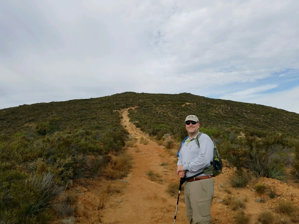
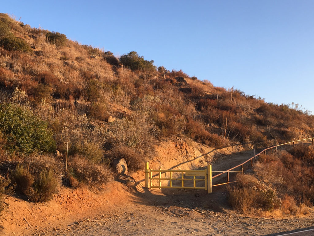
The final summits for 2017 were the duo of Lawson and Gaskill peaks. Ted and I drove out past Jamul to the trailhead just off Lyons Valley Road.

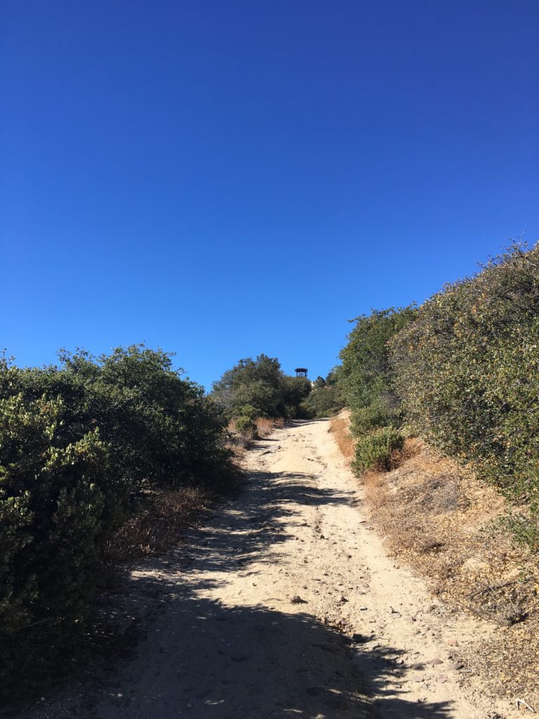
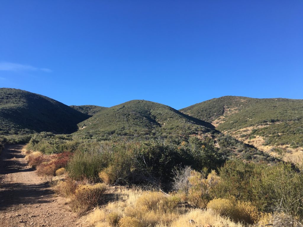
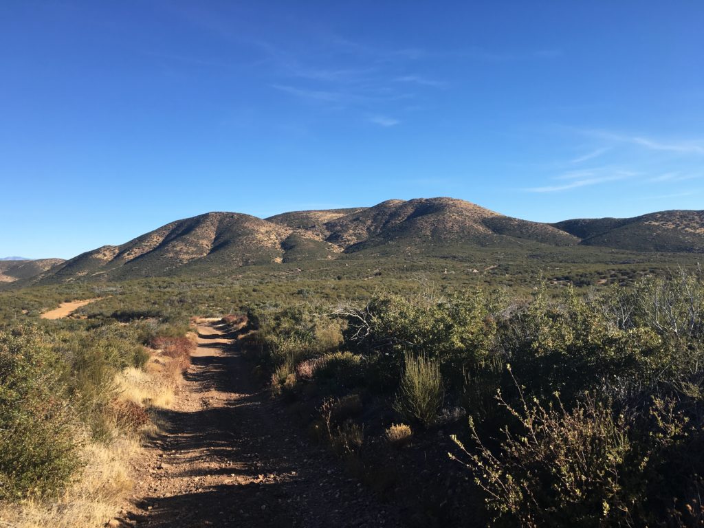
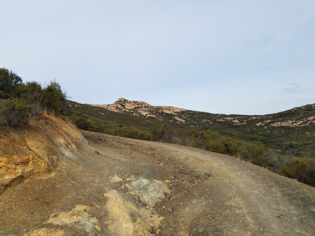
The trail follows Carvacre Road for about 1.9 miles, gaining about 1,000 feet of elevation. The road is somewhat rutted, so you do have to watch your footing some. The peak is not initially visible, but will soon loom before you as the road works it way up.

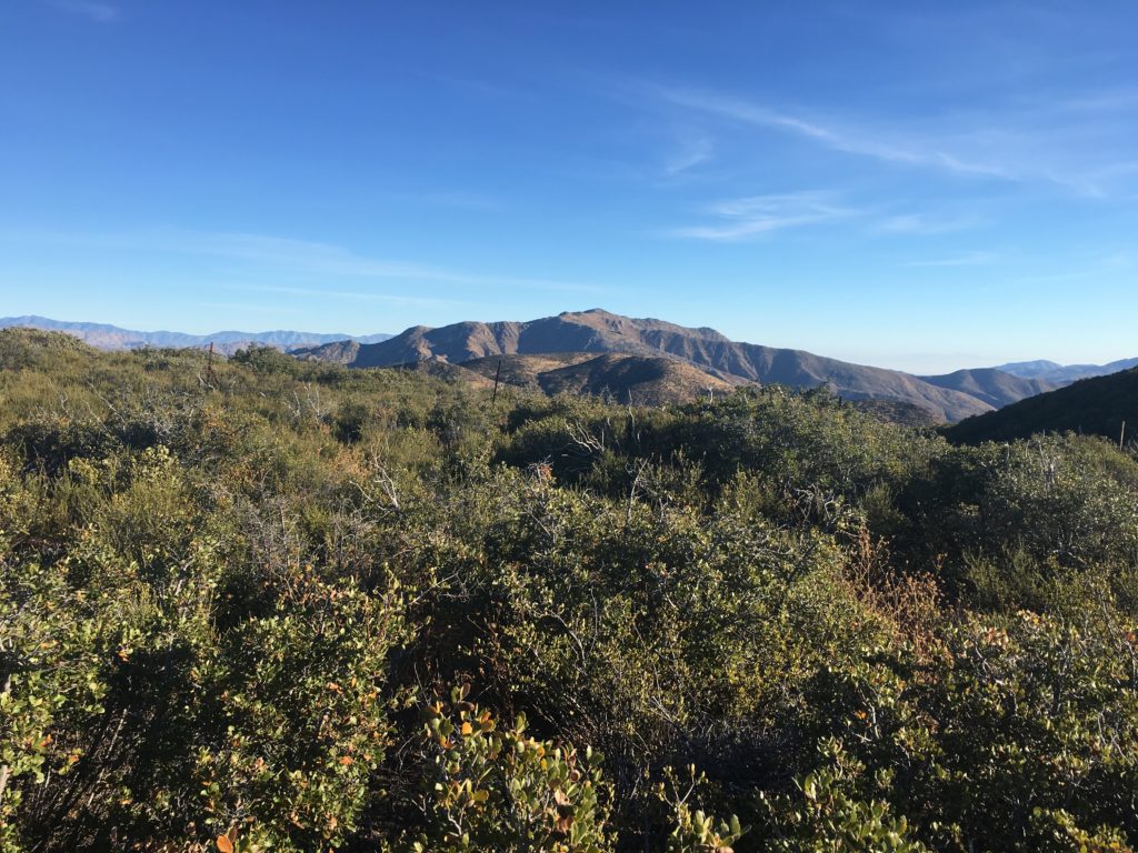
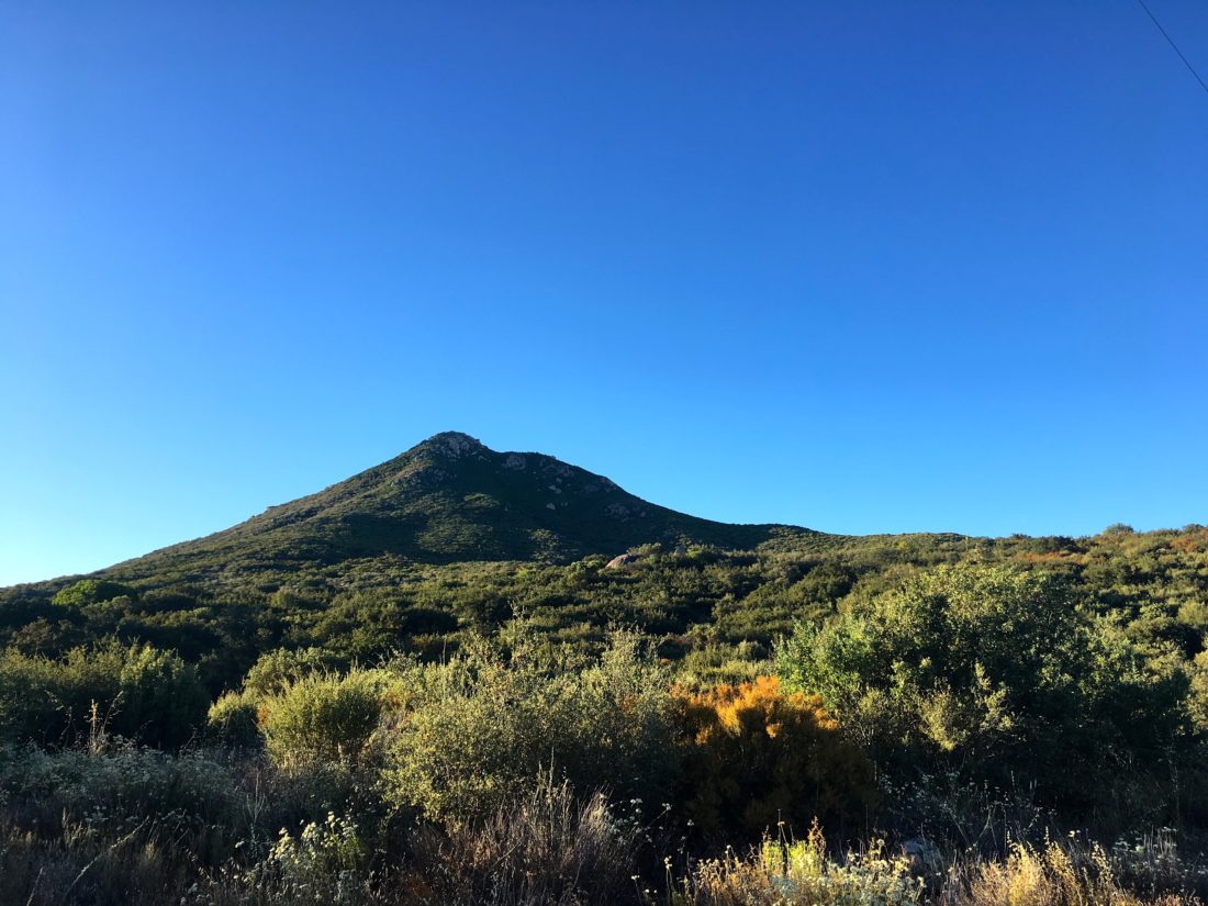
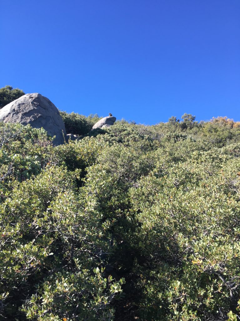
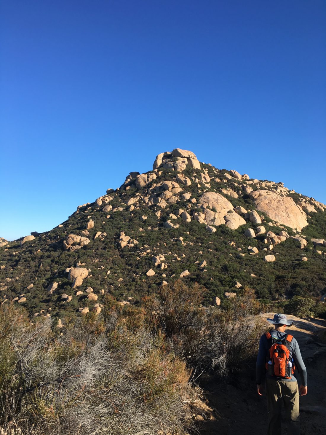
As we drew closer to the peak, we passed a massive granite outcropping near the junction with Wisecraver road. Here is where the real effort begins to reach the summit. A nice trail begins the steep ascent through the brush and boulders until we reached the base of the real challenge of Lawson peak.

Circling around to the north-west side, we found the 20-foot high chute that we needed to climb. We carefully tested the rope and work our way up into the cave at the top.

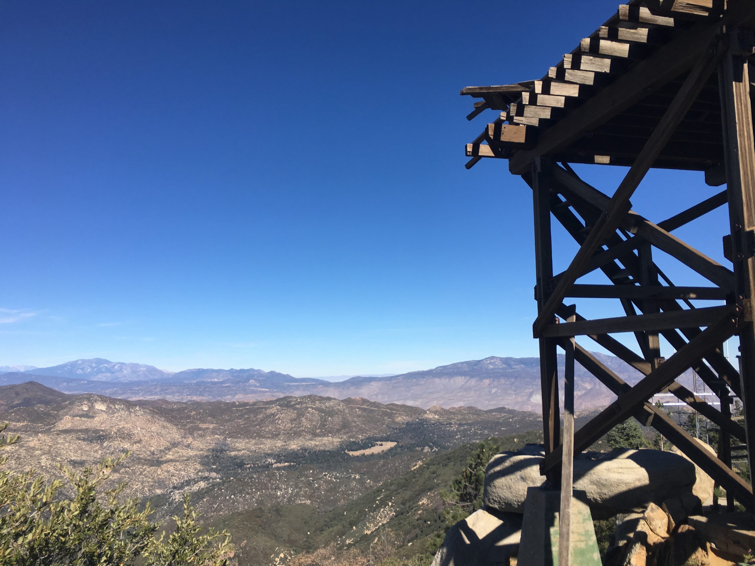
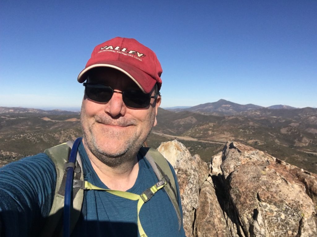
We worked our way through the small cave to arrive near the summit.

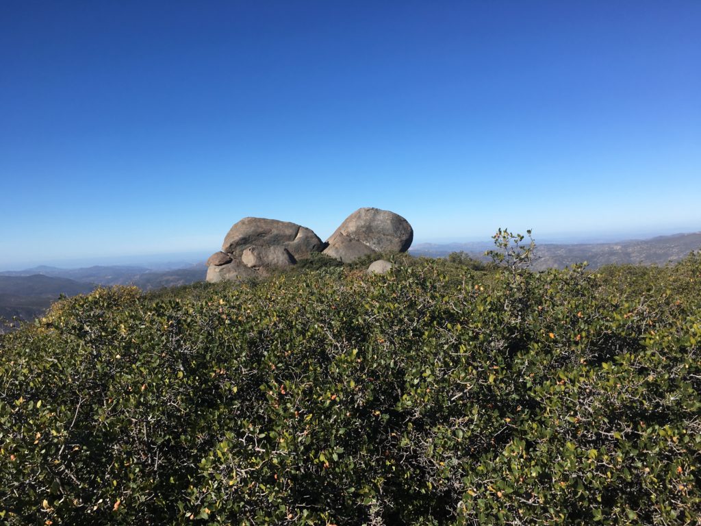
From there, we scrambled to the top.

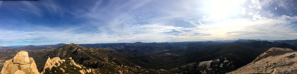
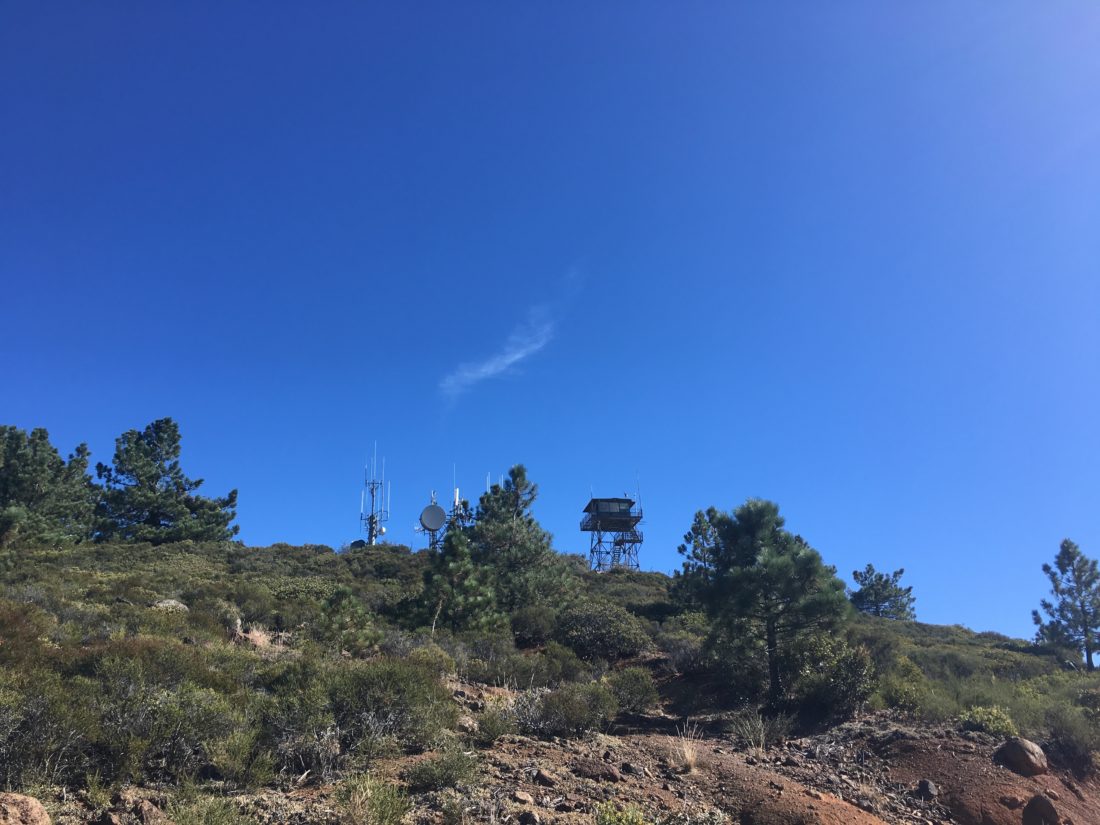
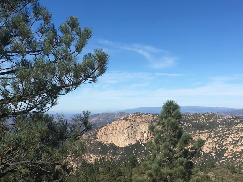
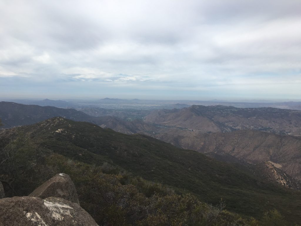
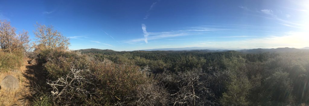
There we were rewarded with sweeping views, Gaskill to the north, Lyons peak to the south.

I checked in with the family and my daughter was feeling under the weather, so I needed to head home. So, Gaskill was going to have to wait for another day. We carefully worked ourselves back down the chute and back to the main road. Soon we were back at the car, with time to shower and rest up before our New Years’ Eve celebrations.


Buy Me a Coffee at ko-fi.com

I am an avid peak bagger, sometimes backpacker, and former sea kayaker living in San Diego. I am the co-author of Urban Trails:San Diego, coming in Spring 2026!

In 2019, I became the third person to complete the San Diego 100 Peak Challenge. Not stopping with that accomplishment, I set my sights on the harder San Diego Sierra Club 100 Peak list, which I completed in 2021. In addition, I have conquered several Six-Pack of Peaks challenges (SoCal, San Diego, Central Coast, and both the Arizona-Winter and Arizona-Summer). I am looking forward to exploring new summits and new adventures across the southwest. 

Hot Springs Mountain

I decided to tackle the tallest peak in San Diego, Hot Springs Mountain. Ted was able to tag along as we drove out past Warner Springs to the Los Coyotes Indian Reservation. We drove toward the road that would lead us to the summit. As we pull up, the chain was down, some other hikers were gearing up to begin their trek up to the peak. We decided to continue up the road, bypassing some of the steeper sections. We found a nice turnout and parked. From here we simply followed the road to the abandoned fire lookout tower.

We had a fantastic view from the base of the tower. You can no longer access the tower, and it is only a matter of time until it needs to be fully torn down.

We opted not to work our way to the formal summit block, as I was feeling the effects of my increased hiking cadence. We returned back down the road, enjoying the shade from the trees.

As we drove out, we once again looked for someplace to pay our entrance fee, but no luck. I had to chuckle to myself, the highest point in San Diego was still lower than my starting point for my recent summit of San Jacinto.


Buy Me a Coffee at ko-fi.com

I am an avid peak bagger, sometimes backpacker, and former sea kayaker living in San Diego. I am the co-author of Urban Trails:San Diego, coming in Spring 2026!

In 2019, I became the third person to complete the San Diego 100 Peak Challenge. Not stopping with that accomplishment, I set my sights on the harder San Diego Sierra Club 100 Peak list, which I completed in 2021. In addition, I have conquered several Six-Pack of Peaks challenges (SoCal, San Diego, Central Coast, and both the Arizona-Winter and Arizona-Summer). I am looking forward to exploring new summits and new adventures across the southwest. 

Chariot Mountain

Chariot Mountain is an interesting summit as it is an inverted peak, meaning that you start at a higher elevation than the summit. I got to the trailhead right off Sunrise Highway.

The trail headed through a nice wide meadow until it intersected the Pacific Crest Trail. However, you are only the PCT for a very short section. I initially missed the trail down to the summit, but I found the slightly over-grown trail.

Granite Mountain in the distance, and Chariot Mountain before it

The trail to the summit quickly dropped down a steep ridge to the Anza-Borrego desert. I picked my way down the path, thinking I much this ascent is going to hurt.

My return climb

The peak was visible across a small valley. The quiet gave me time to reflect on some things weighing on me.

Chariot Mountain

Soon I was at the foot of the mountain. There was a faint use trail that I followed to the summit. There is no benchmark, but there is a register. The views were quite spectacular from the summit.

As I made it back toward the base of the ridge for the ascent up the ridge, I did consider following the Mason Truck Trail instead of the PCT. This would have been a longer route, certainly less steep, but I opted to take the ridge.

I debated my discussion as my legs felt the climb and the road gently climbed to the south. Finally, I reached the PCT and strolled back across the meadow toward the car.


Buy Me a Coffee at ko-fi.com

I am an avid peak bagger, sometimes backpacker, and former sea kayaker living in San Diego. I am the co-author of Urban Trails:San Diego, coming in Spring 2026!

In 2019, I became the third person to complete the San Diego 100 Peak Challenge. Not stopping with that accomplishment, I set my sights on the harder San Diego Sierra Club 100 Peak list, which I completed in 2021. In addition, I have conquered several Six-Pack of Peaks challenges (SoCal, San Diego, Central Coast, and both the Arizona-Winter and Arizona-Summer). I am looking forward to exploring new summits and new adventures across the southwest. 

Long Valley Peak

Just south of the 8, near Pine Valley, stands Long Valley Peak. The trailhead is shared with the Bear Valley Off-Road Trail, so expect to see folks prepping their motorcycles. Fortunately, the trail to the summit does not follow the same route, but you will hear them in the distance. The trail initially follows a road that serves the nearby power lines. After a few rolling hills, you approach the turnoff to the actual summit.

The route takes you through some single-track trails that seem to criss-cross the lower portion of the summit. As you work your way up the slope of the peak, the route begins to fade away and you are left to your own route finding. Quickly you will find yourself scrambling over the rocks to reach the summit.

As I rested upon the summit, I could hear the distance, and the din of the traffic of the highway. I signed the register that was tucked away in a rocky nook. I could also spy many of my previously summited peaks around me.

Since I had plans, I headed back down. I considered taking an alternate route back but opted to simply retrace my route back to the car.


Buy Me a Coffee at ko-fi.com

I am an avid peak bagger, sometimes backpacker, and former sea kayaker living in San Diego. I am the co-author of Urban Trails:San Diego, coming in Spring 2026!

In 2019, I became the third person to complete the San Diego 100 Peak Challenge. Not stopping with that accomplishment, I set my sights on the harder San Diego Sierra Club 100 Peak list, which I completed in 2021. In addition, I have conquered several Six-Pack of Peaks challenges (SoCal, San Diego, Central Coast, and both the Arizona-Winter and Arizona-Summer). I am looking forward to exploring new summits and new adventures across the southwest. 

Los Pinos Lookout

When we were hiking out to Corte Madera, we considered also summiting the nearby Los Pinos Lookout Tower. But the route from the Espinosa trail followed a dirt road that had off-roaders using. Although there was a more direct route, it was a steep ascent, and we opted not to tackle it.

I debated how I wanted to return to summit this peak, as I am not a big fan of hiking on active roads. Instead, after summiting Long Valley Peak, I drove down to the Corral Canyon OHV area, passing the parking spot for the Espinosa trail. Continuing along the road, I kept driving until I approached the Four Corners trailhead. From there I made a right and continued up Los Pinos.

Near the summit, I found a nice place to park and hiked the .25 miles to the lookout tower and the summit. The tower is closed, so I wandered around the summit enjoying the views.

Corte Madera’s sheer face is clearly visible in the distance.

I returned to my car and drove back down, passing several other off-roaders along the way.


Buy Me a Coffee at ko-fi.com

I am an avid peak bagger, sometimes backpacker, and former sea kayaker living in San Diego. I am the co-author of Urban Trails:San Diego, coming in Spring 2026!

In 2019, I became the third person to complete the San Diego 100 Peak Challenge. Not stopping with that accomplishment, I set my sights on the harder San Diego Sierra Club 100 Peak list, which I completed in 2021. In addition, I have conquered several Six-Pack of Peaks challenges (SoCal, San Diego, Central Coast, and both the Arizona-Winter and Arizona-Summer). I am looking forward to exploring new summits and new adventures across the southwest. 

Manza Benchmark

Looking to summit another peak in the Lagunas before any weather hit, so I opted to hike out to Manza Benchmark.  This time I was joined by my good friend James. We parked just off Sunrise Highway, right near the Sunset trailhead. We followed the main trail for a bit before locating a use trail heading across the meadow.

The trees were still showing some bit of fall on them. We knew that the trail was going to descend into a drainage area, before climbing another ridge to the actual summit. Carefully checking our maps and route, we navigated down through the brush. Bits of poison oak were spotted along the sides of the trail, so some extra care was taken as we began ascending.

Once we reached the ridge, we began passing through thickets of manzanita and over several false summits, until at the end of the ridge our goal was sighted.

With some minor rock scrambling, we found the benchmark and signed the register. As we rested, the views were surprisingly nice. After soaking up some sun and the quiet, we began our trek back to the trailhead. We again were careful as we worked our way down the drainage ravine, as it was a steep descent. Soon we found ourselves back at the car and off for a cold beer at Alpine Brewery and a tasty burrito.

A few months later, I was hiking with Derek up to Whale Peak, and our conversation turned to what my favorite peak had been so far. Although I had some really enjoyable summits out in Anza-Borrego, the summit was my answer. It was a nice blend of scenery, a bit of challenge, and adventure.


Buy Me a Coffee at ko-fi.com

I am an avid peak bagger, sometimes backpacker, and former sea kayaker living in San Diego. I am the co-author of Urban Trails:San Diego, coming in Spring 2026!

In 2019, I became the third person to complete the San Diego 100 Peak Challenge. Not stopping with that accomplishment, I set my sights on the harder San Diego Sierra Club 100 Peak list, which I completed in 2021. In addition, I have conquered several Six-Pack of Peaks challenges (SoCal, San Diego, Central Coast, and both the Arizona-Winter and Arizona-Summer). I am looking forward to exploring new summits and new adventures across the southwest. 

Sheephead Mountain

On the advice from another 100 Peak Challenger, she suggested that I might want to attempt this peak in case the access road to the trailhead is closed by the Forest Service. So, with that Sheephead Mountain became my next peak to summit. The trailhead is about a mile down Kitchen Creek road just off Sunrise Highway. The first part of the trail gently headed west among the pines.

But before long, the trail turned south and down through a ravine. Once at the bottom, you will intersect a dirt road. I continued following this road southward through a small valley. The trail to the peak skirts very near some private property, so I was on high alert for the proper route. It was still hunting season, I did not want to cause an issue.

So I followed a small use trail to the north of the road that ran parallel to it. Checking my map and GPS, I found about where the trail should be to begin the ascent. It took some hunting, but I found the faint trail that quickly led up the mountain.

I pushed my way through the growth and eventually reached the summit. Although not as windy as Derek’s summit, there was a bit of a breeze. 

I found the benchmark, but no register. I work my way back down the mountain with little trouble. Funny, how it is so much easier to see the route on the descent…

I missed the turnoff from the road back to the trail up the ravine, so my GPS track has an extra leg on it. Soon, I found myself back at the car and heading home.


Buy Me a Coffee at ko-fi.com

I am an avid peak bagger, sometimes backpacker, and former sea kayaker living in San Diego. I am the co-author of Urban Trails:San Diego, coming in Spring 2026!

In 2019, I became the third person to complete the San Diego 100 Peak Challenge. Not stopping with that accomplishment, I set my sights on the harder San Diego Sierra Club 100 Peak list, which I completed in 2021. In addition, I have conquered several Six-Pack of Peaks challenges (SoCal, San Diego, Central Coast, and both the Arizona-Winter and Arizona-Summer). I am looking forward to exploring new summits and new adventures across the southwest. 

Sycuan Peak

After three peaks the day before, I opted to just grab a shorter peak on Sunday. Sycuan Peak fits that bill perfectly. Ted and I made the drive out to the trailhead. I was thankful to have some extra eyes, as there wasn’t much parking on the road and the trailhead was easy to miss. Once we began up the trail, we did see the sign for the ecological preserve.

The trail immediately started climbing steeply. Portions of the trail were quite rutted as well continued our ascent, but soon we found ourselves scrambling over the rocks to reach the summit.

I don’t think there was a register, but we did find the benchmark. After a short rest, we headed back down to the car.


Buy Me a Coffee at ko-fi.com

I am an avid peak bagger, sometimes backpacker, and former sea kayaker living in San Diego. I am the co-author of Urban Trails:San Diego, coming in Spring 2026!

In 2019, I became the third person to complete the San Diego 100 Peak Challenge. Not stopping with that accomplishment, I set my sights on the harder San Diego Sierra Club 100 Peak list, which I completed in 2021. In addition, I have conquered several Six-Pack of Peaks challenges (SoCal, San Diego, Central Coast, and both the Arizona-Winter and Arizona-Summer). I am looking forward to exploring new summits and new adventures across the southwest. 

Wooded Hill

My third summit of the day was the nature trail of Wooded Hill. I have been trying to tack this peak on to the end of my other hikes in the Lagunas, but time constraints always seemed to nix it. The trail is not too far off the 8 along Sunrise Highway.

As I pulled into the parking area, there was one family getting ready to hit the trail as well. If you are looking for a fun mountain hike with the kids, this one should be on your shortlist.

The trail is easy to follow, quite the change from the day’s first two hikes. Along the route, there are numbered markers that you can use the brochure to learn more about the plants and wildlife. Once at the high point, again you are rewarded with some lovely views.

I continued the loop and quickly found myself back at the car.


Buy Me a Coffee at ko-fi.com

I am an avid peak bagger, sometimes backpacker, and former sea kayaker living in San Diego. I am the co-author of Urban Trails:San Diego, coming in Spring 2026!

In 2019, I became the third person to complete the San Diego 100 Peak Challenge. Not stopping with that accomplishment, I set my sights on the harder San Diego Sierra Club 100 Peak list, which I completed in 2021. In addition, I have conquered several Six-Pack of Peaks challenges (SoCal, San Diego, Central Coast, and both the Arizona-Winter and Arizona-Summer). I am looking forward to exploring new summits and new adventures across the southwest. 

Mine Peak

The first peak of the day was Mine Peak. After the forgotten shoe incident of the day before, I was triple checking all my gear before heading out to Anza-Borrego. With the family out of town, I knew I could take my time with my summits. After following I-8 to S2, I made the right turn onto Dolomite Mine Road. This dirt road worked its way toward the remains of the Dolomite Mine perched on the side of the hill. My Subaru had no trouble getting close to the ruin, but other cars might need to find a turnout a bit further away.

This peak was going to be my first test of a trail-less desert hike. I knew from the trip reports that it was fairly straightforward, and the difficulty level was not terribly high. I followed the road up around the mine for a bit, then began my open desert adventure.

Following faint use trails and the ridgeline, I quickly found myself at the summit. Checking my GPS, I honed in on the register and benchmark.

The skies were clear and the desert spread out in all directions.

I took a short rest and began to retrace my route back to the car, still hoping to summit two more peaks that Saturday. This peak was a perfect intro to desert hiking for me.


Buy Me a Coffee at ko-fi.com

I am an avid peak bagger, sometimes backpacker, and former sea kayaker living in San Diego. I am the co-author of Urban Trails:San Diego, coming in Spring 2026!

In 2019, I became the third person to complete the San Diego 100 Peak Challenge. Not stopping with that accomplishment, I set my sights on the harder San Diego Sierra Club 100 Peak list, which I completed in 2021. In addition, I have conquered several Six-Pack of Peaks challenges (SoCal, San Diego, Central Coast, and both the Arizona-Winter and Arizona-Summer). I am looking forward to exploring new summits and new adventures across the southwest.