Trip Reports

Peak 3339 & Al Holden

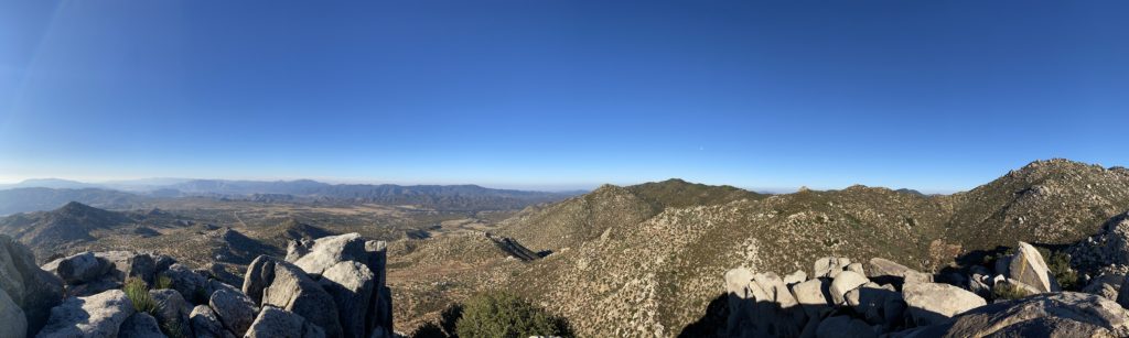
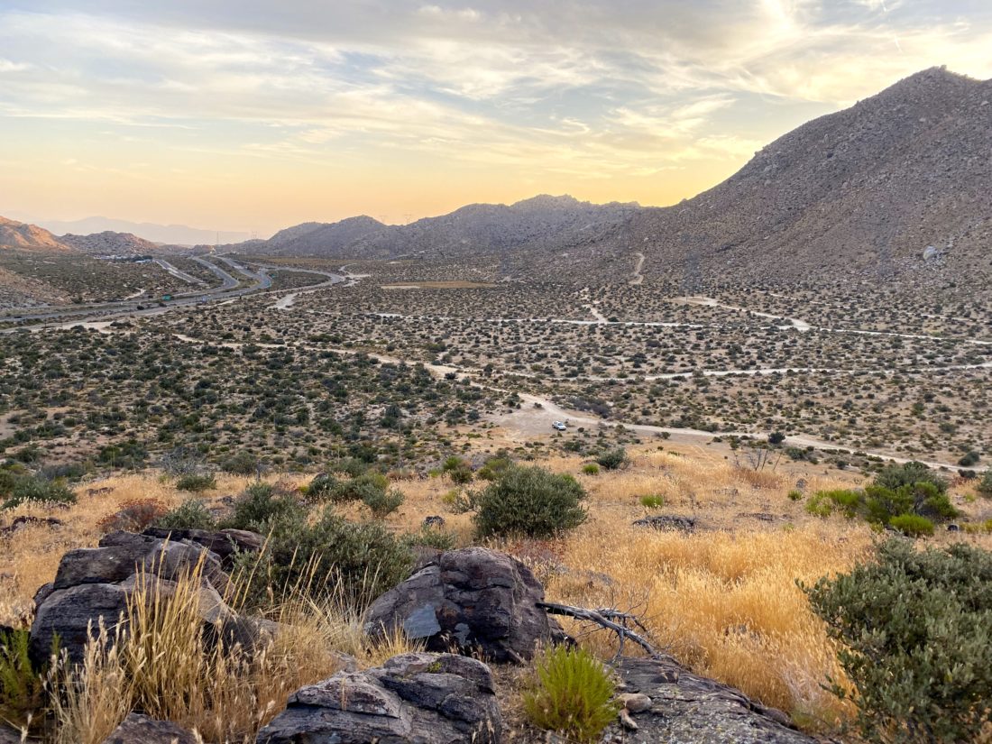
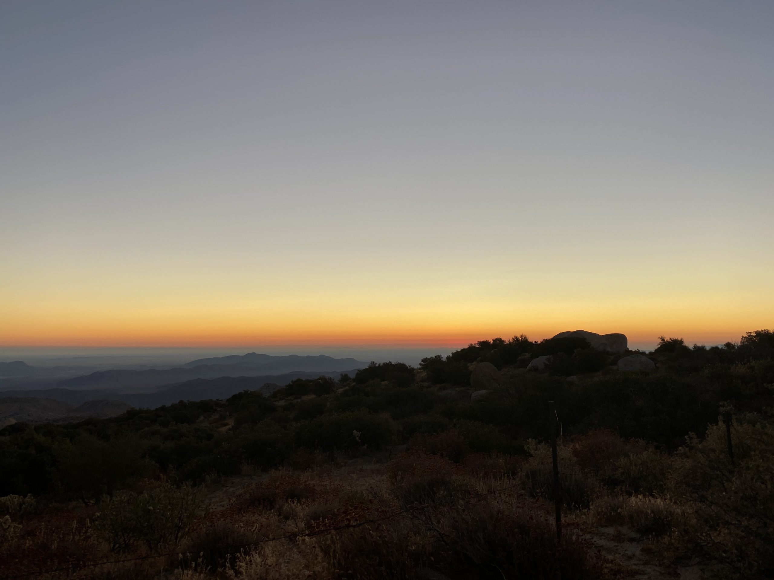
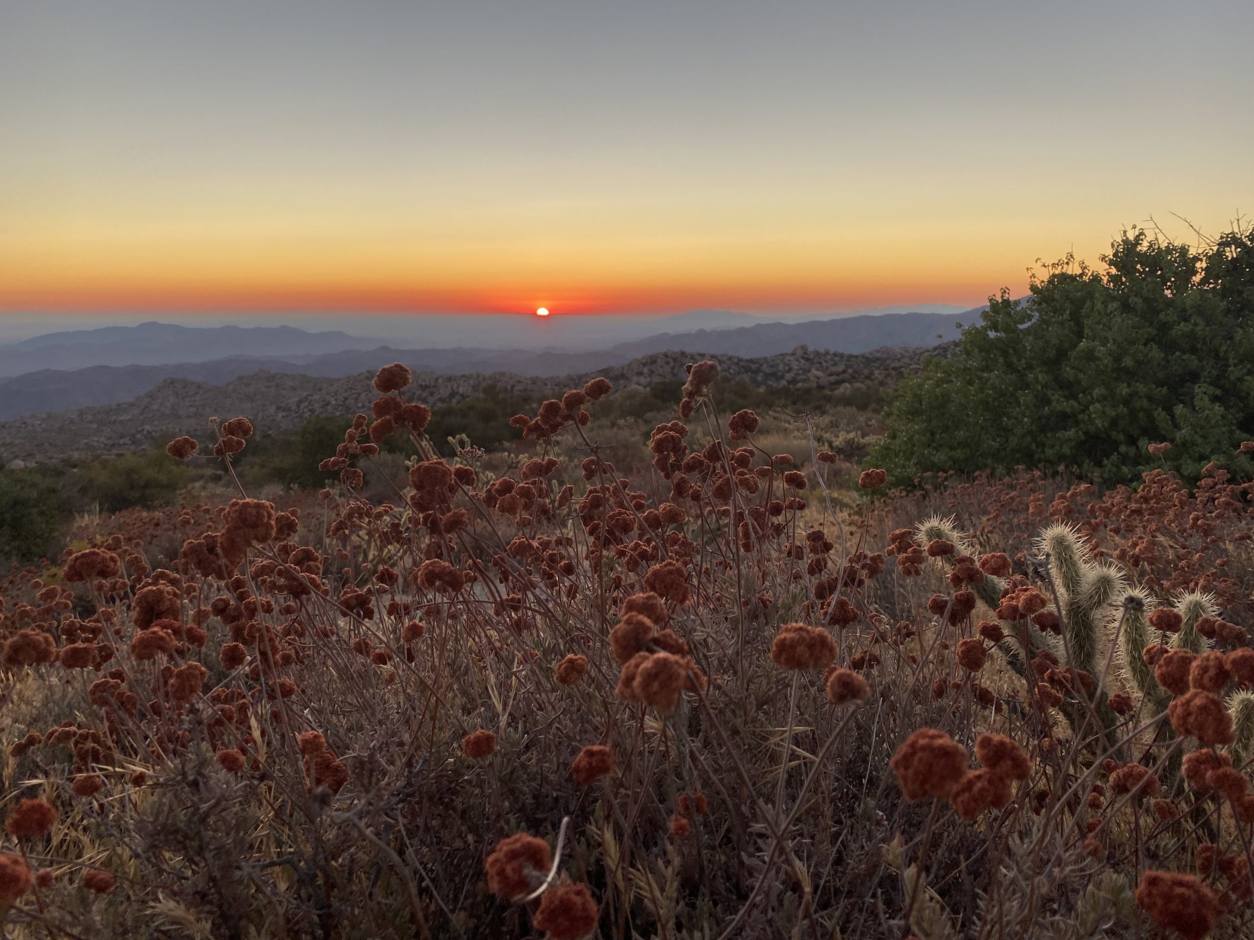
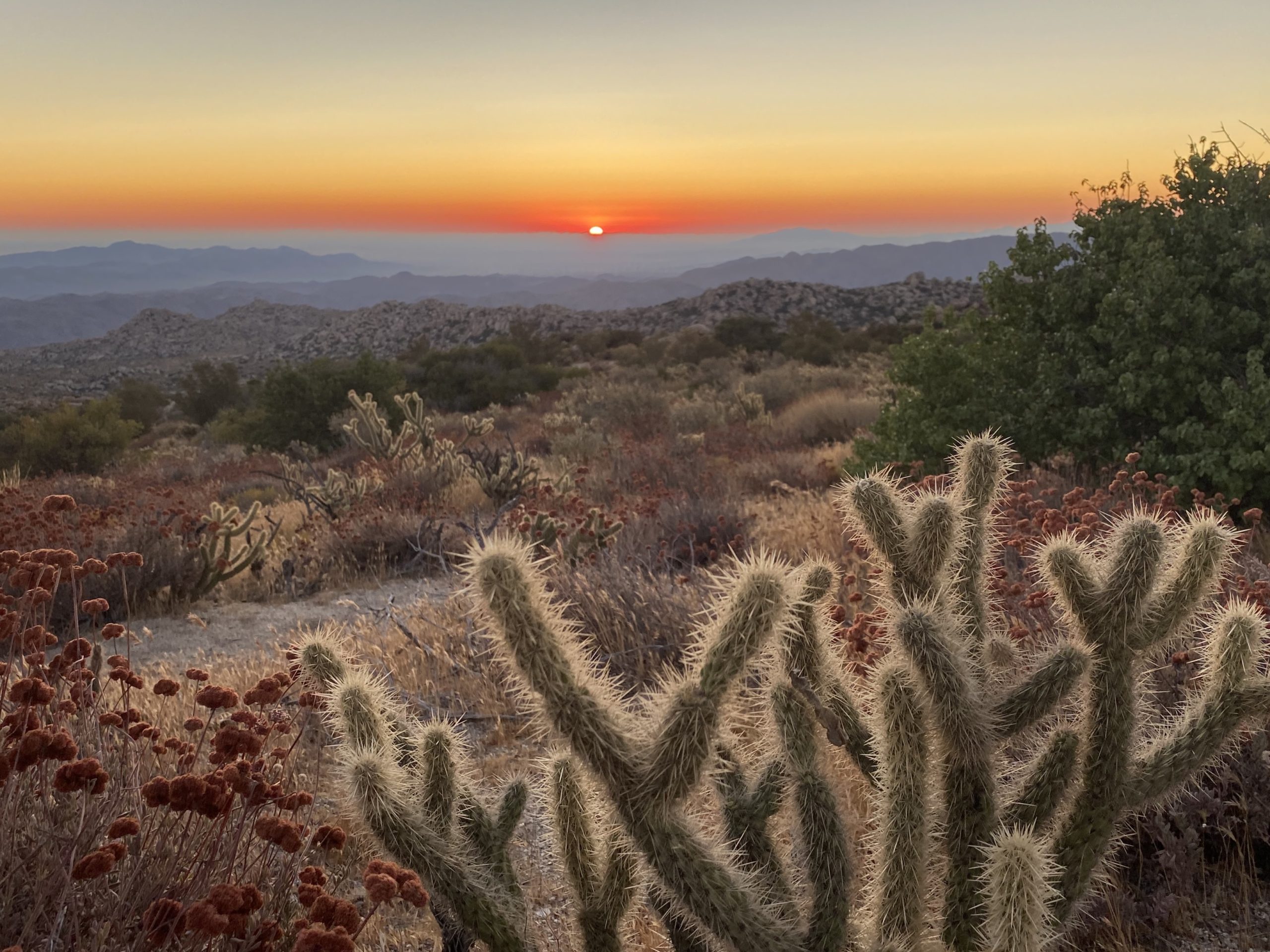
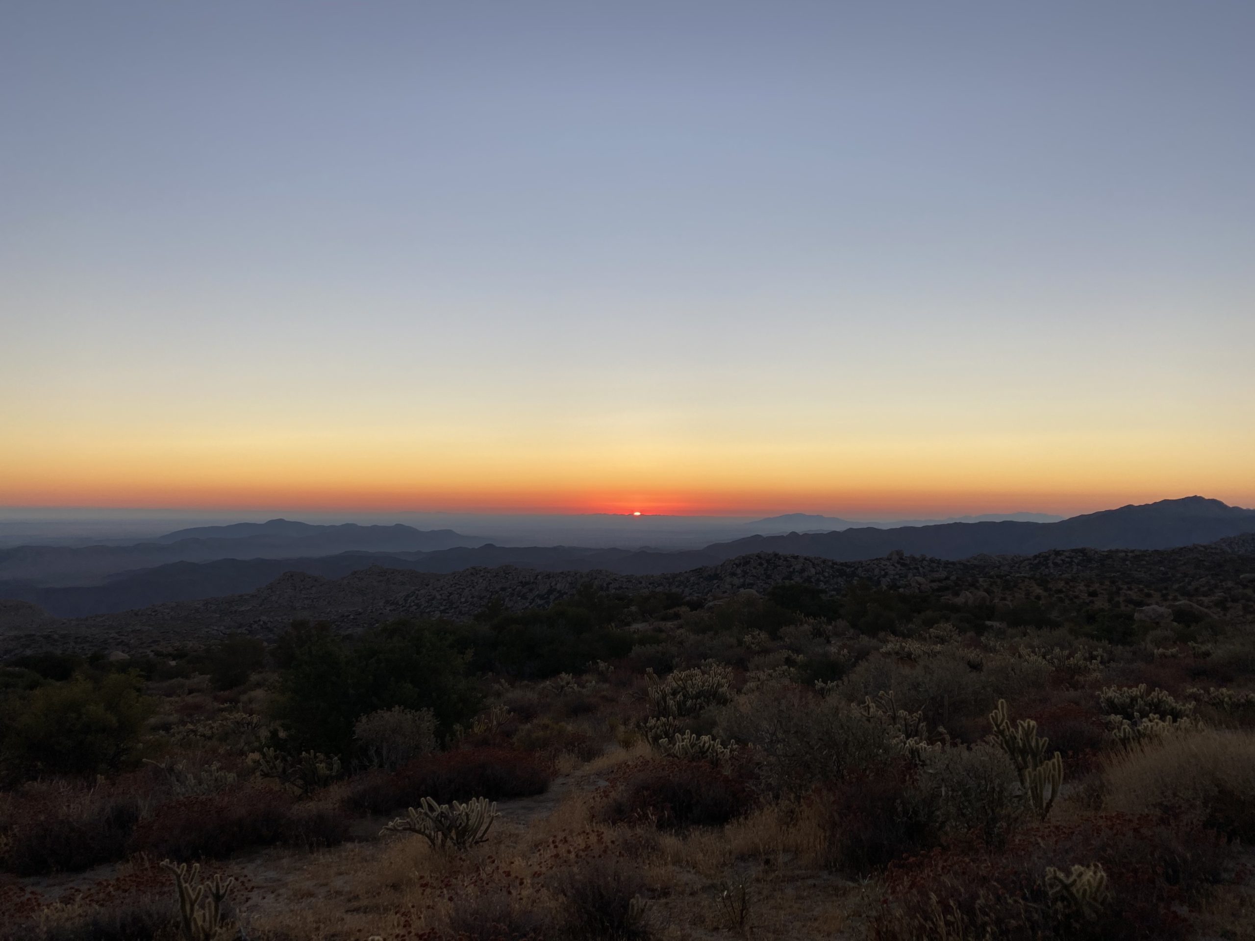
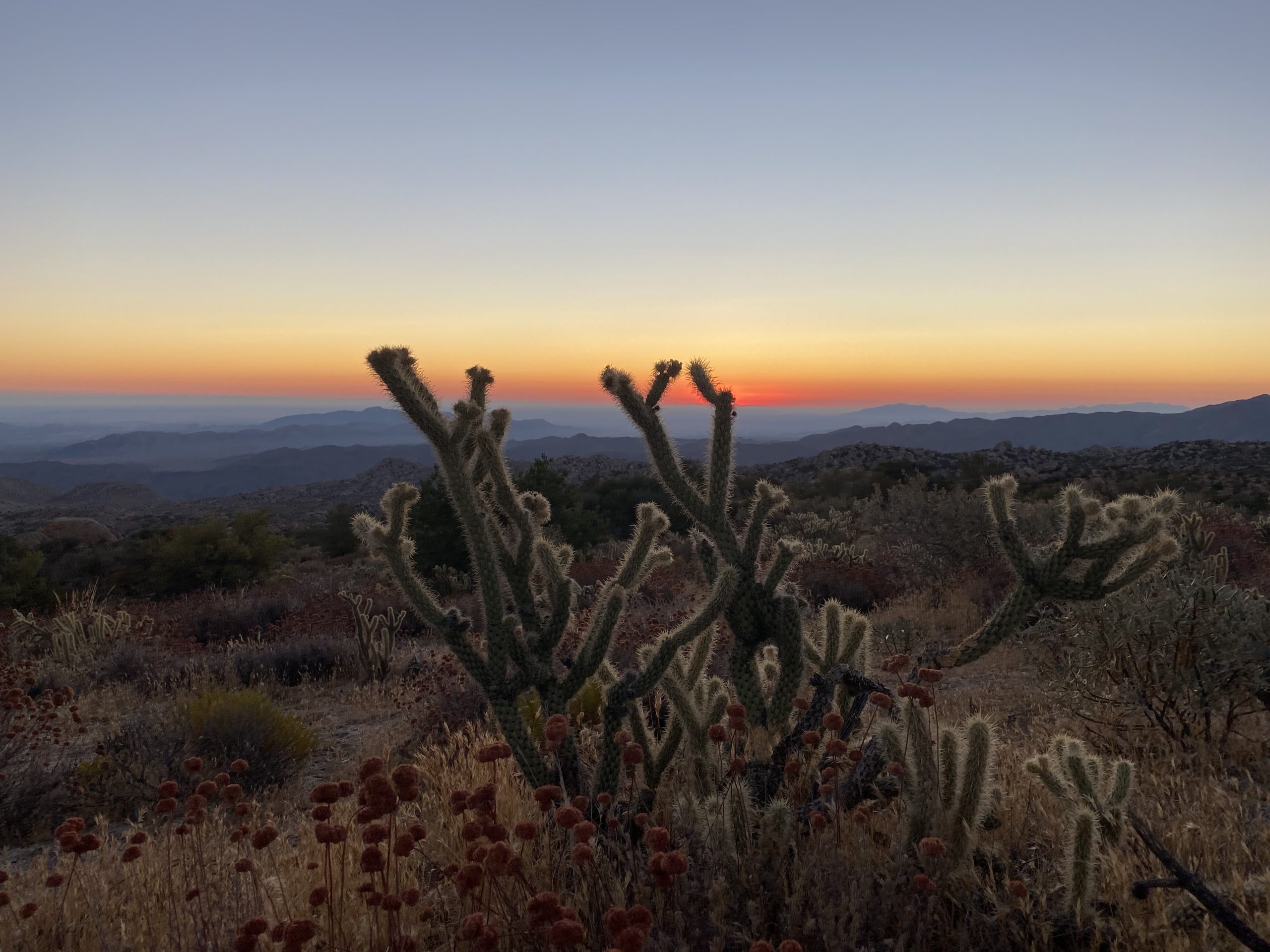
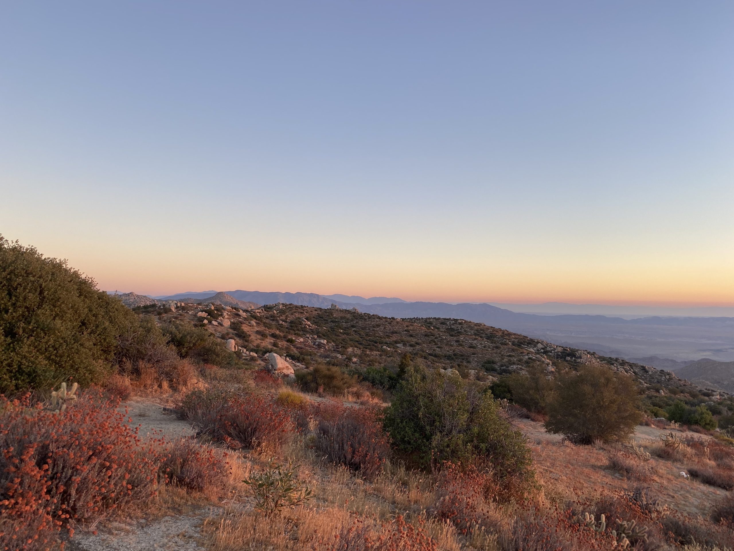
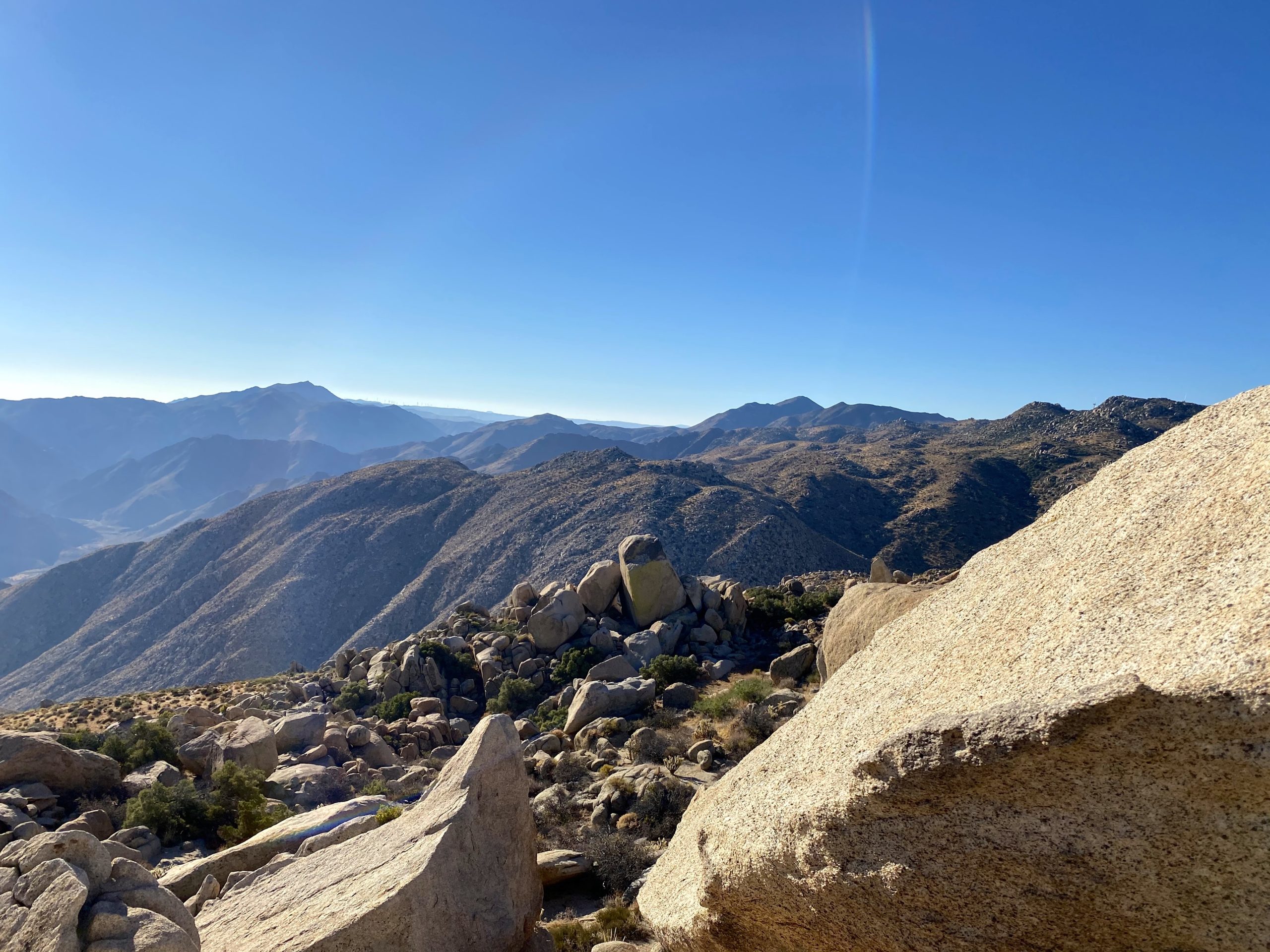
With the desert starting to cool off a bit, Ted, Susie, & I decided to return to peak 3339 just east of McCain Valley. In addition to this peak, we wanted to summit Al Holden as well. That peak was named in honor of the OG San Diego Peakbagger, so it seemed like something we had to do as well. We timed the drive to arrive just before sunrise, figuring we would have some amazing views to capture. As the sun slowly rose, the three of us snapped away. To our south, another gentleman was atop a boulder doing the same thing. 

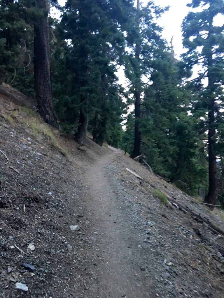
After grabbing our gear we began our descent. Yes, this is a canyon, or inverted hike, meaning we get to climb back up at the end. Some folks had cowboy camped right at the trailhead, but the sunrise had already awakened them before we passed.

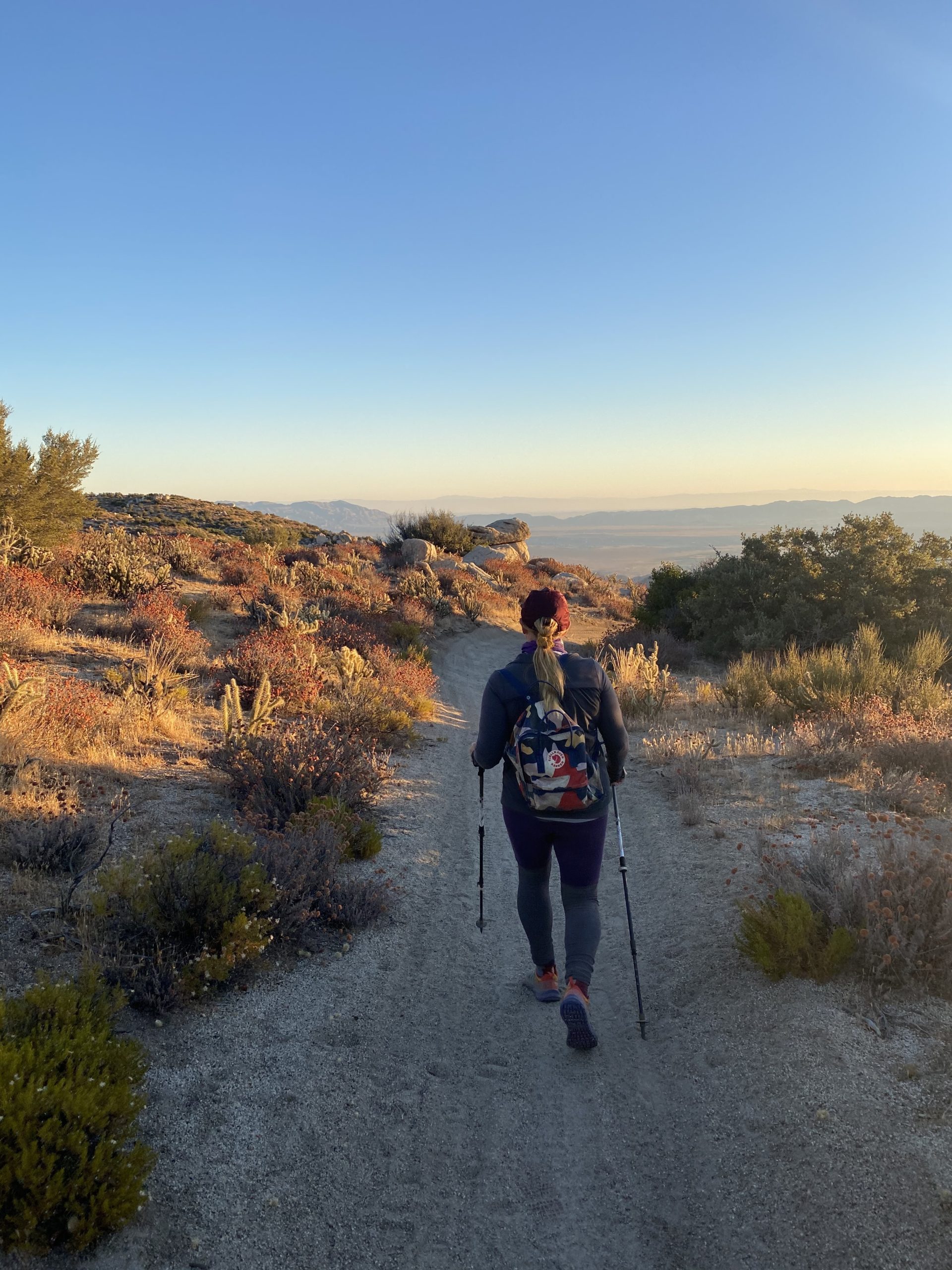
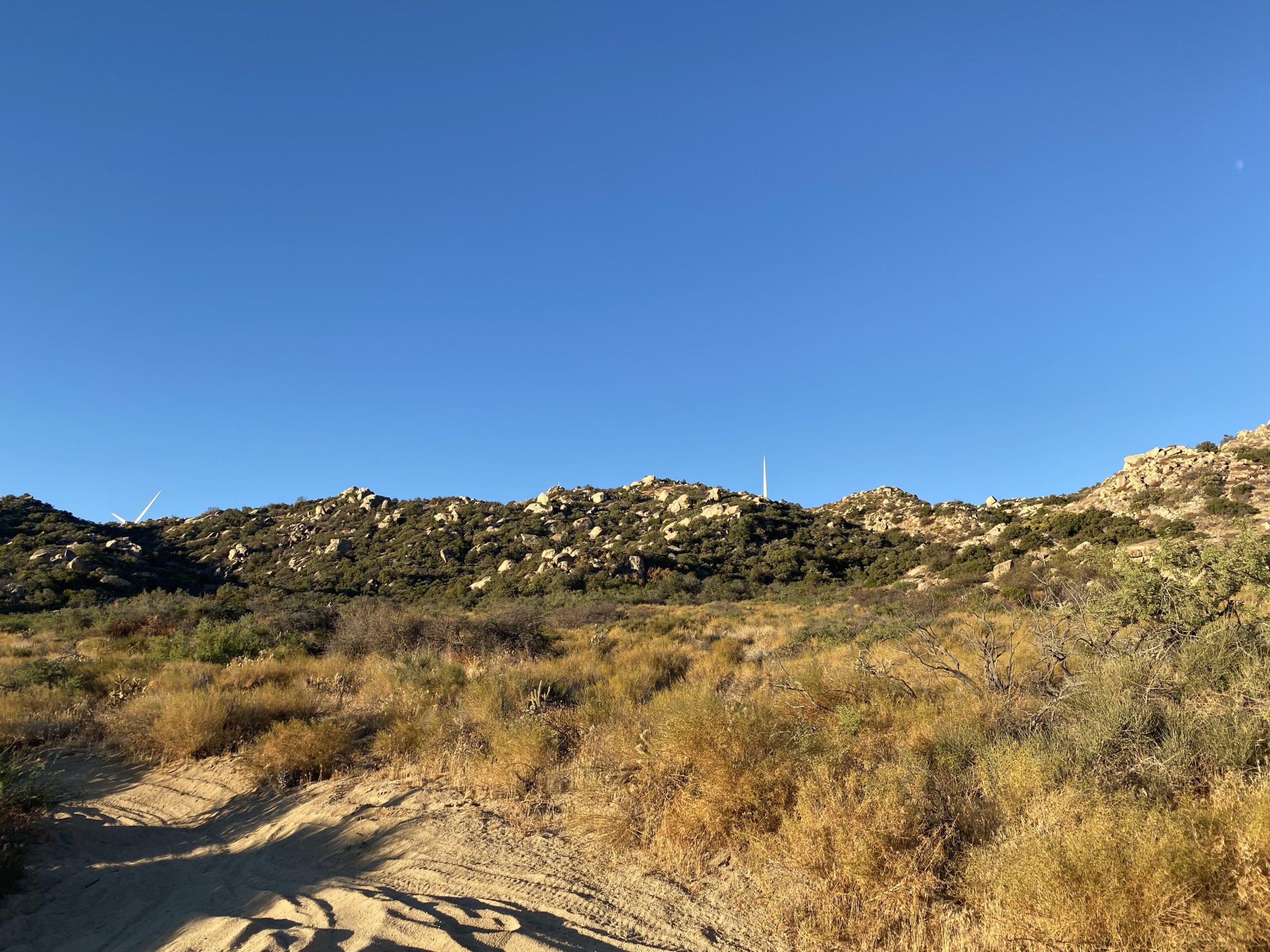
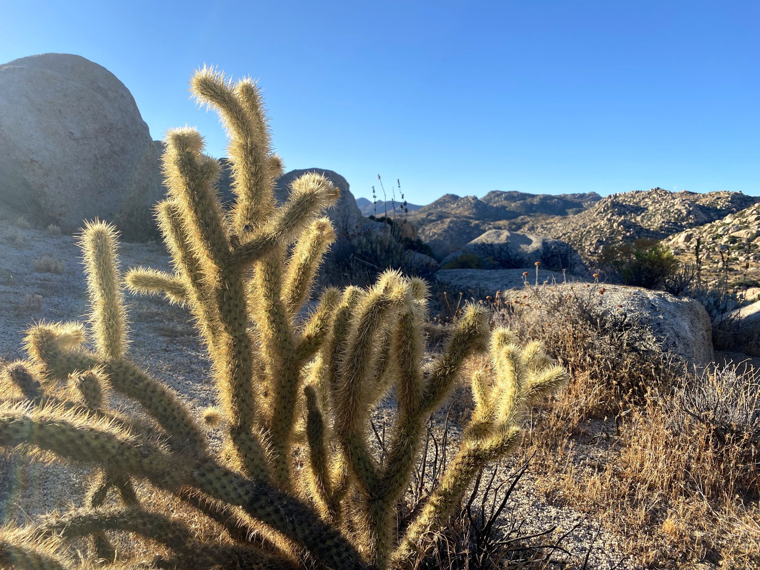
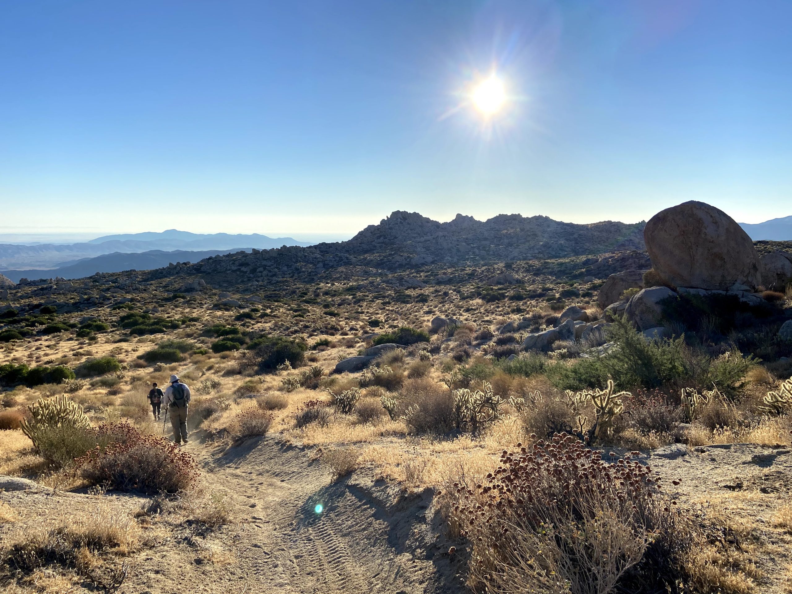
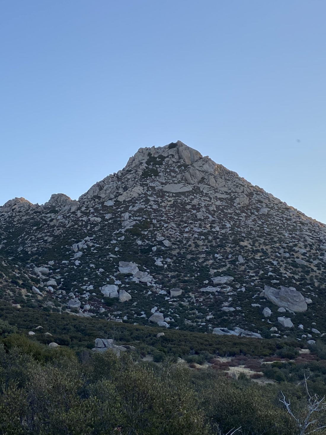
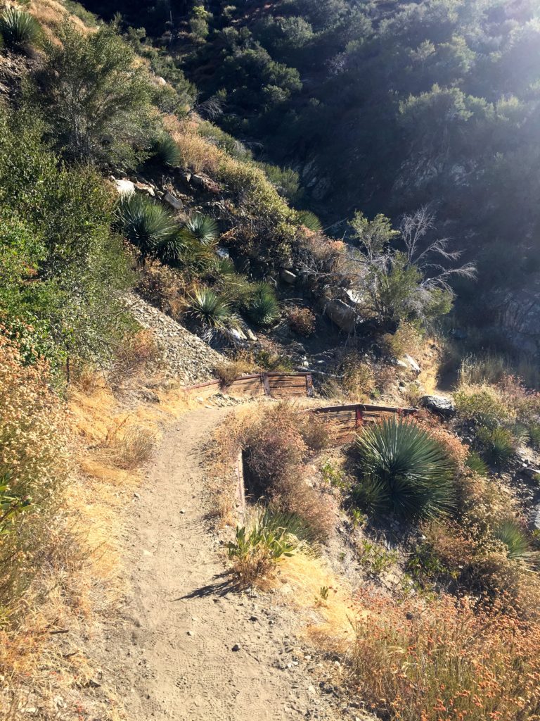
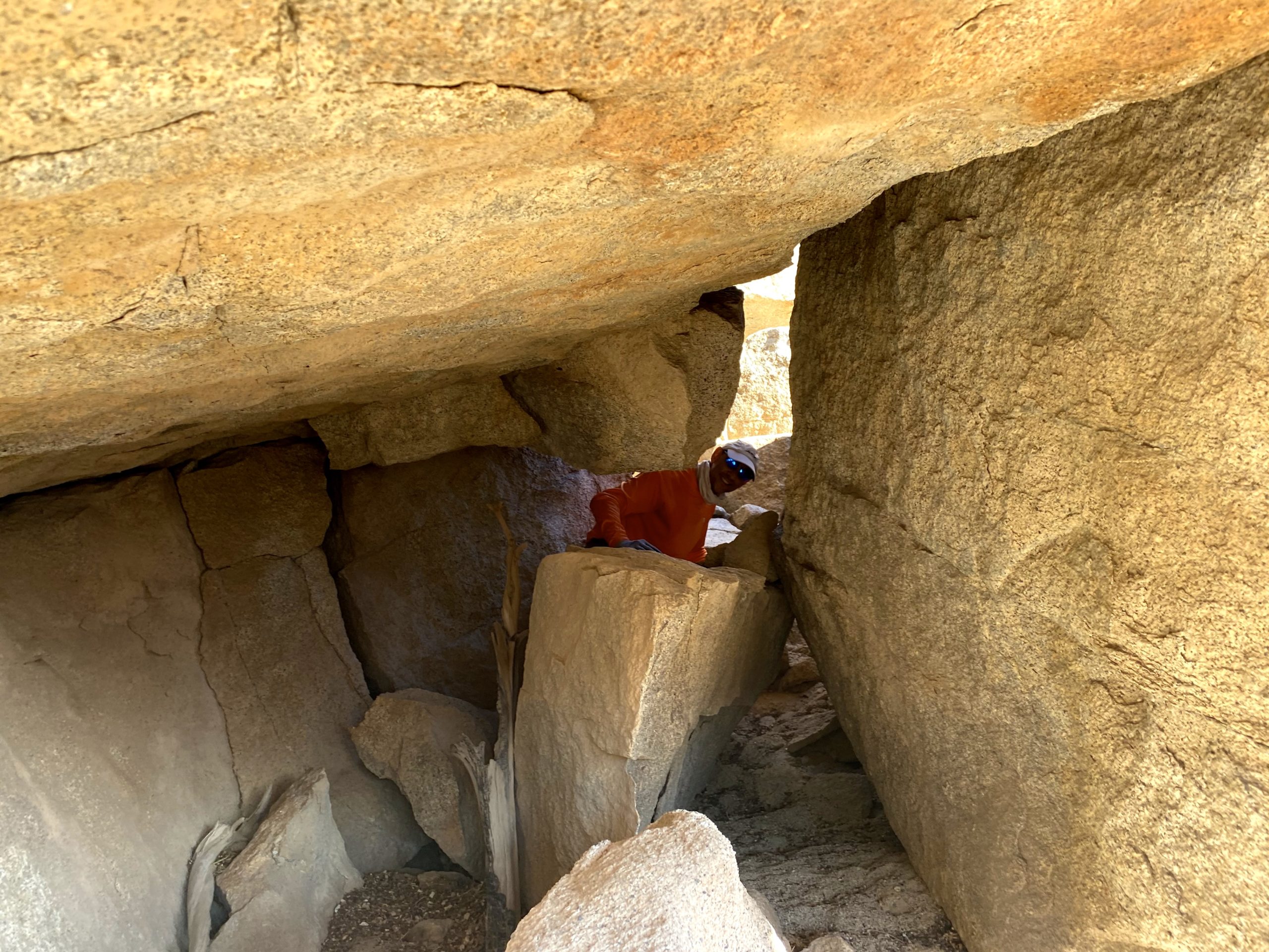
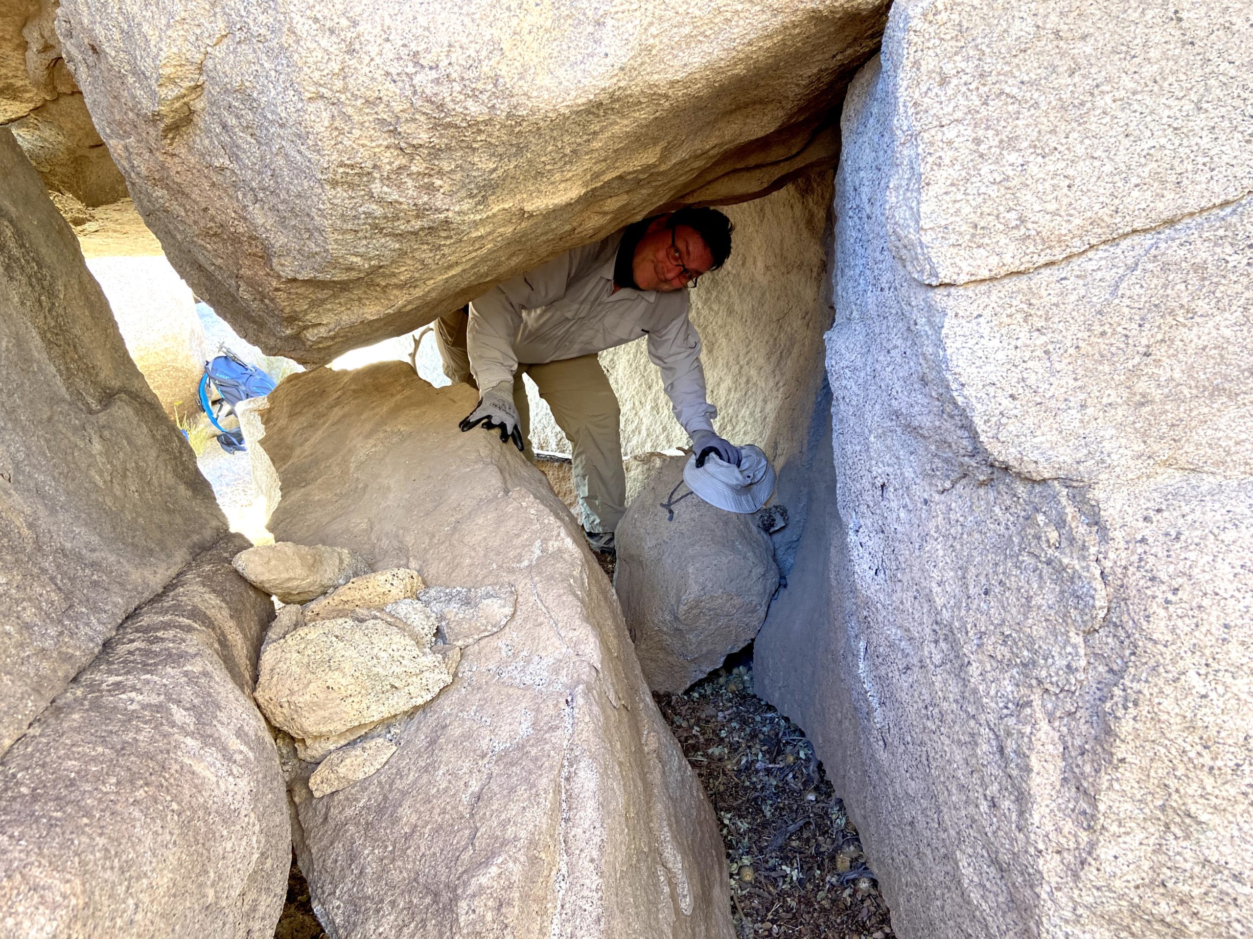
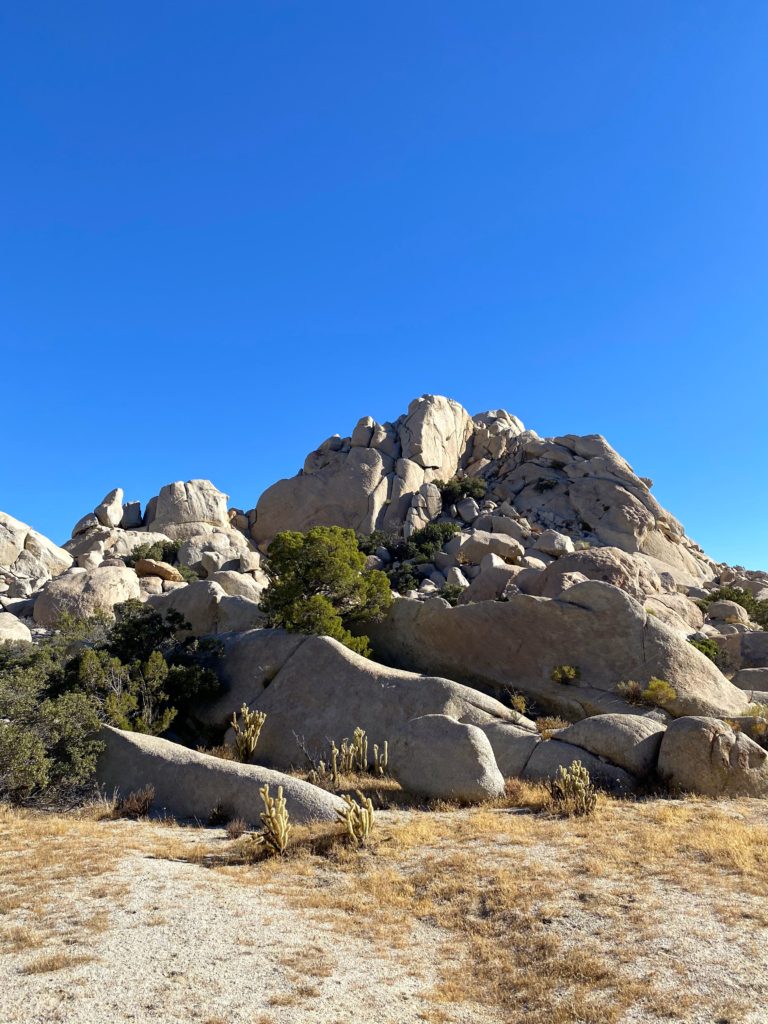
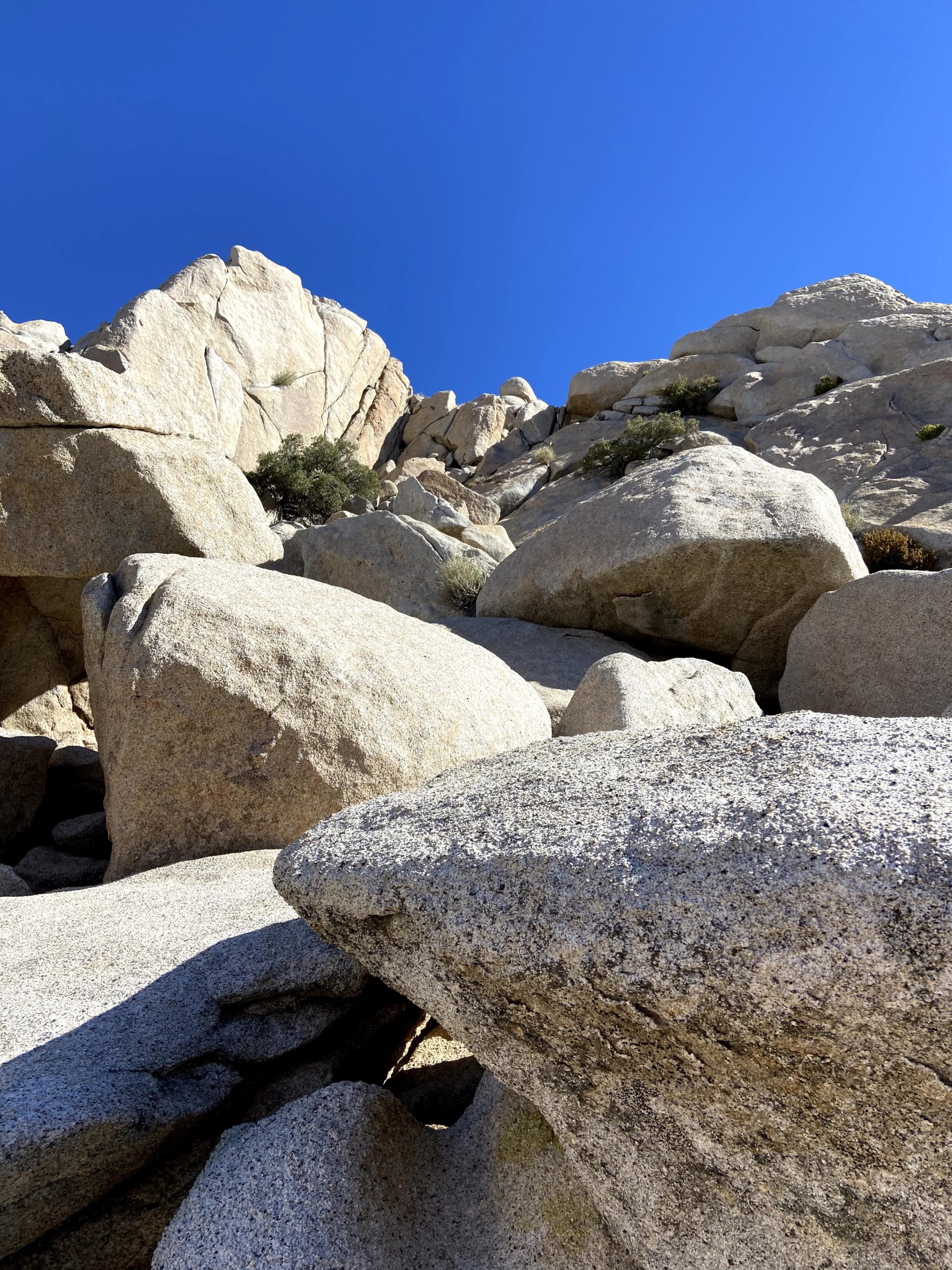
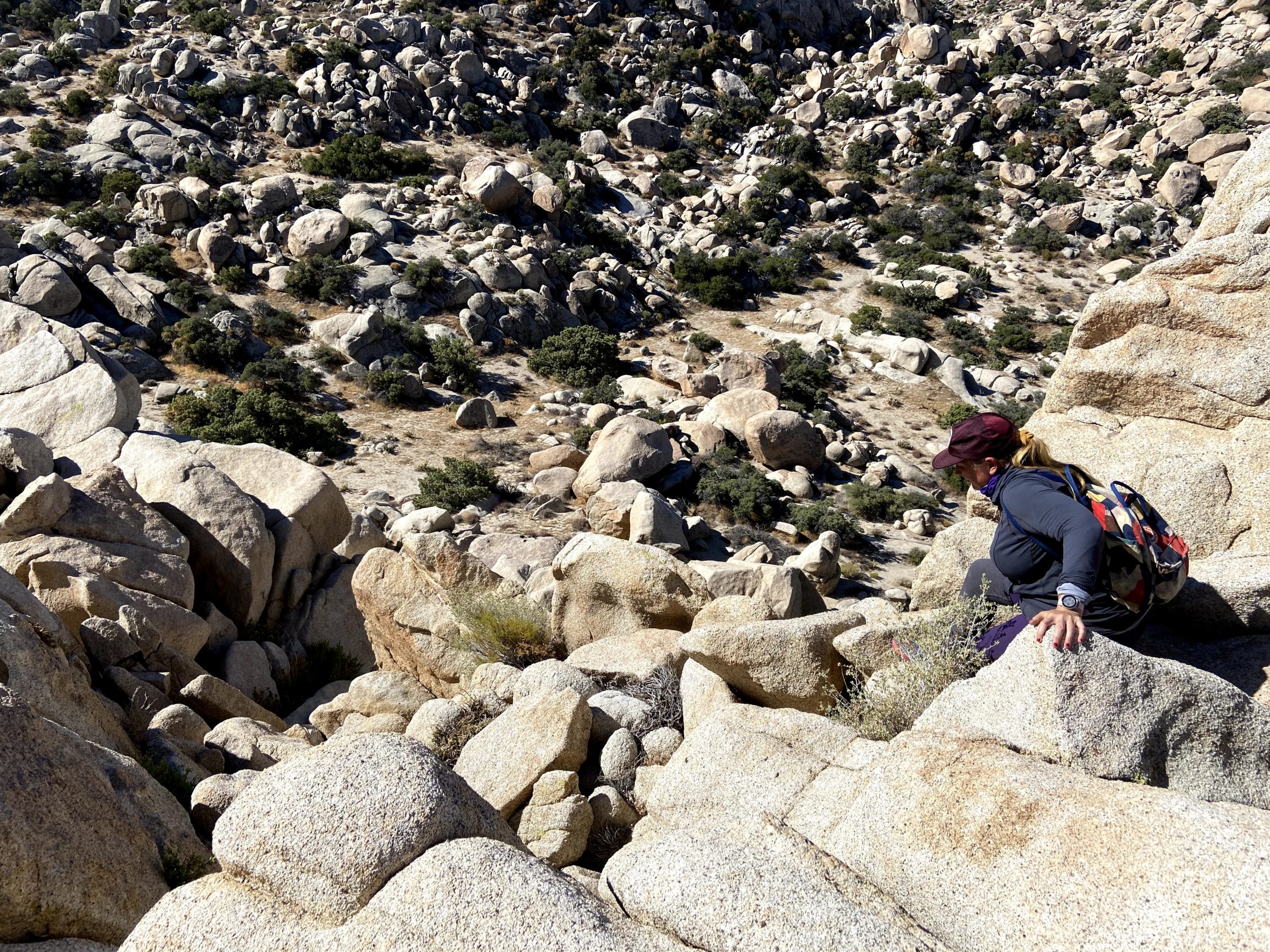
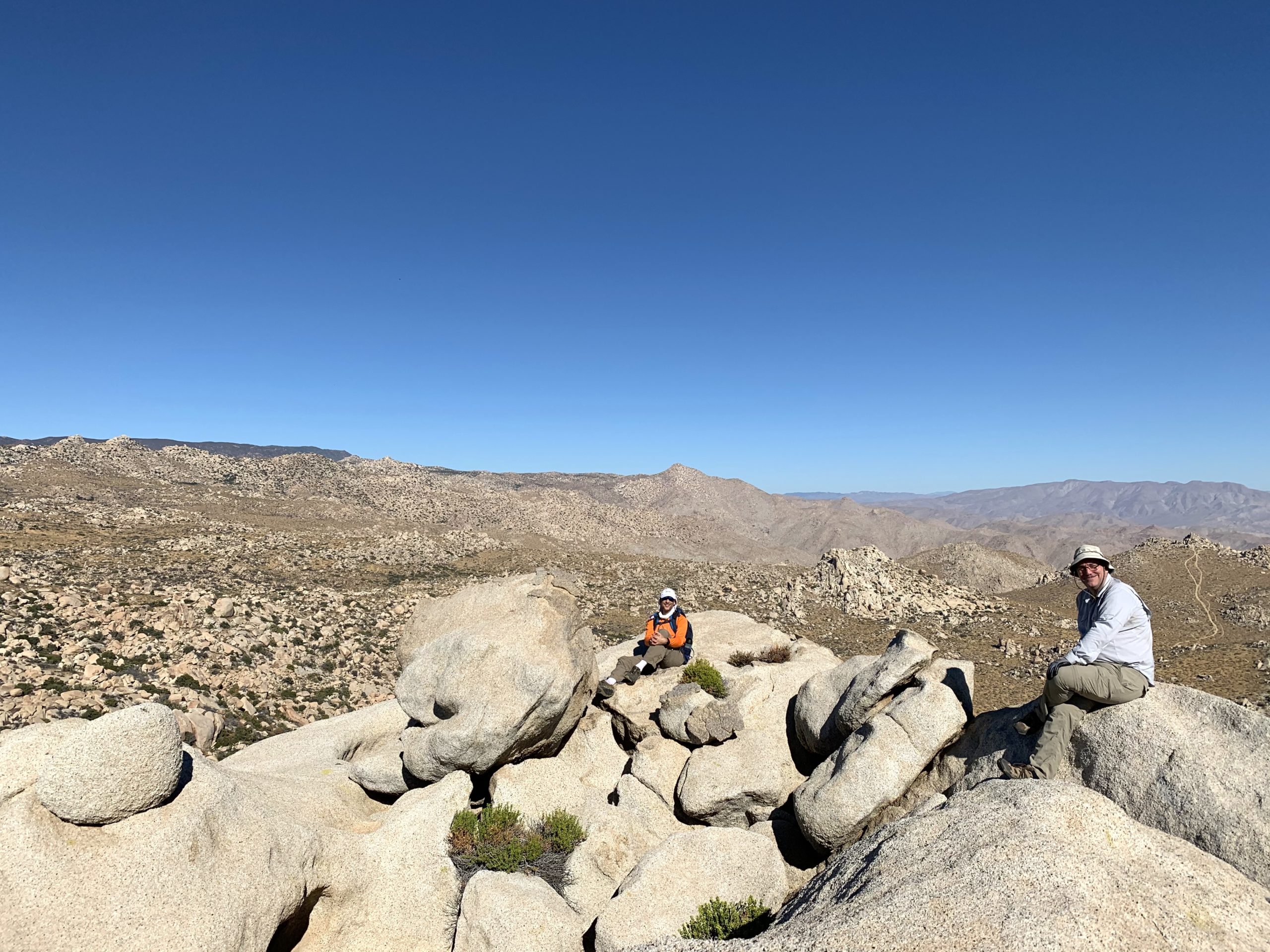
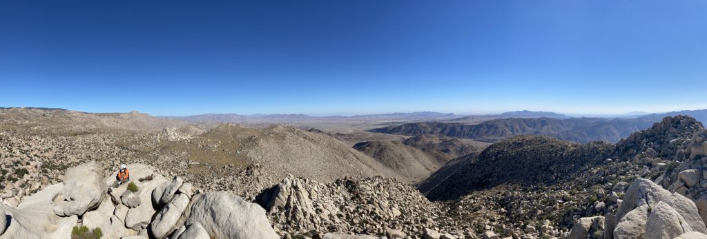
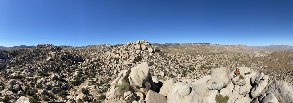
The trail was steep for a bit, then became more gentle. Peak 3339 was a mound of boulders off to the east. Eventually, we left the trail and began our cross-country portion. We worked our way up close to the summit. Opting to approach from the south, we drew close and found a small tunnel, which guarded the register and through which we were atop 3339. 

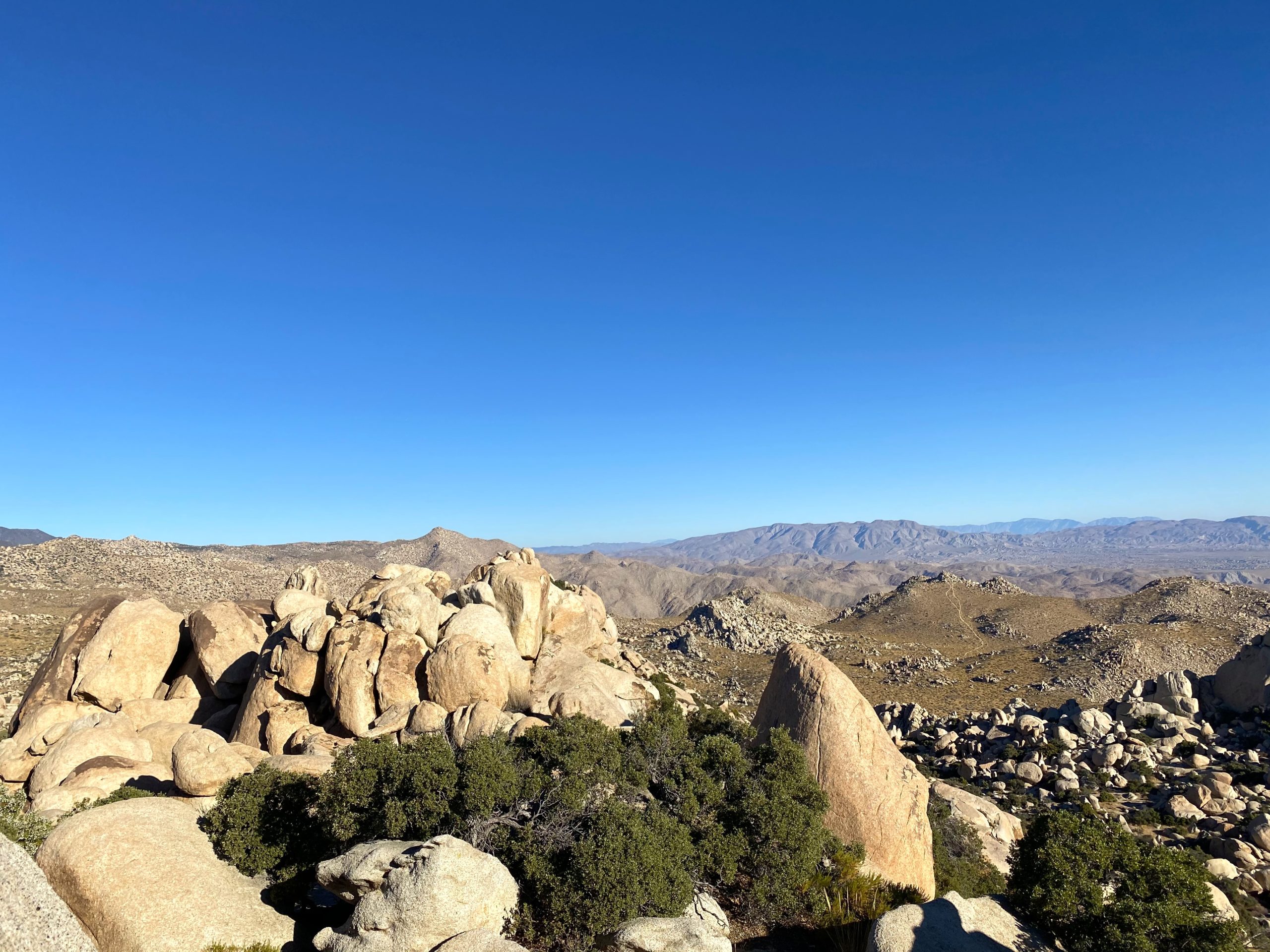
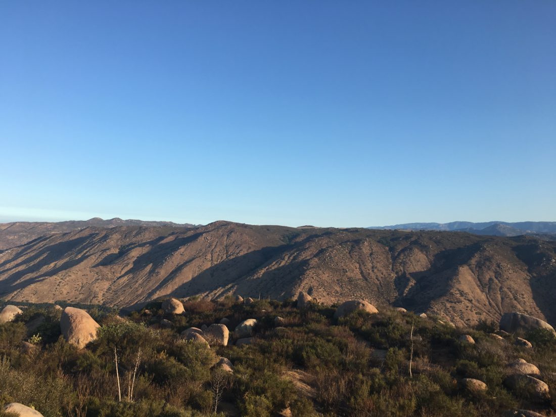
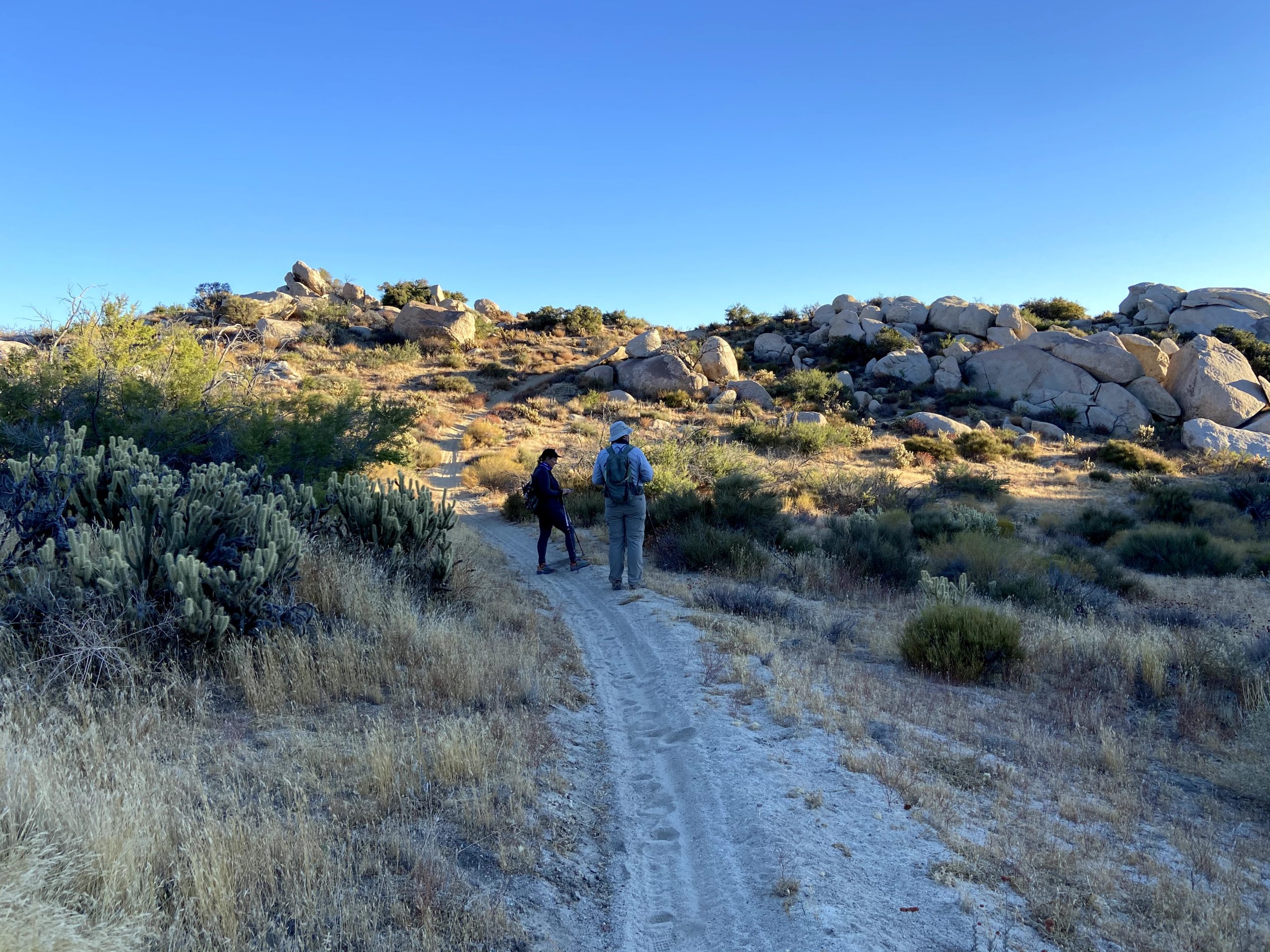
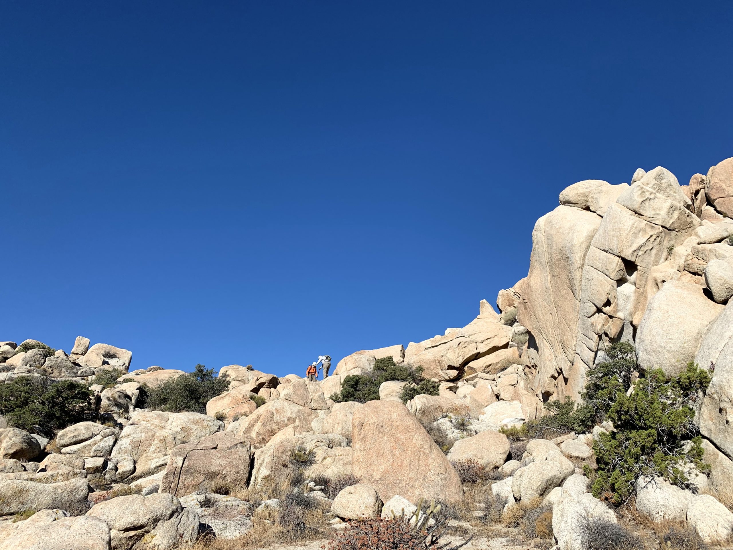
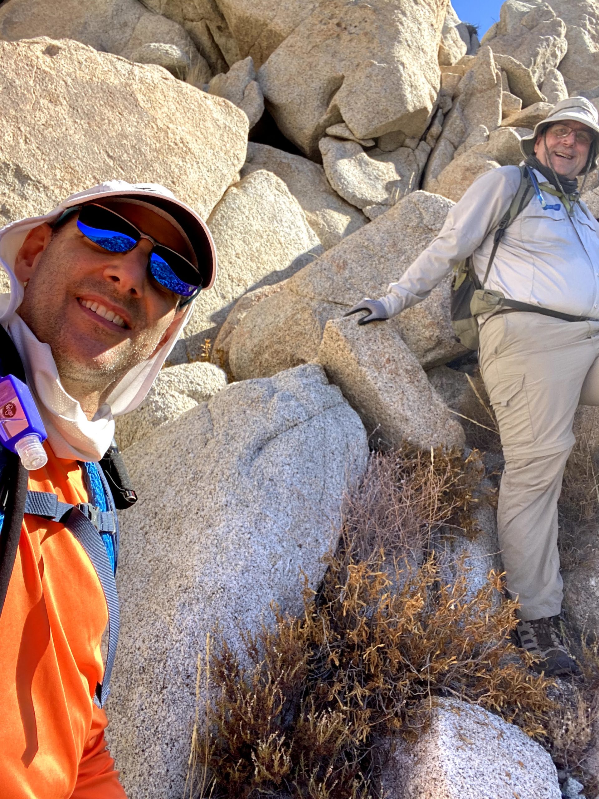
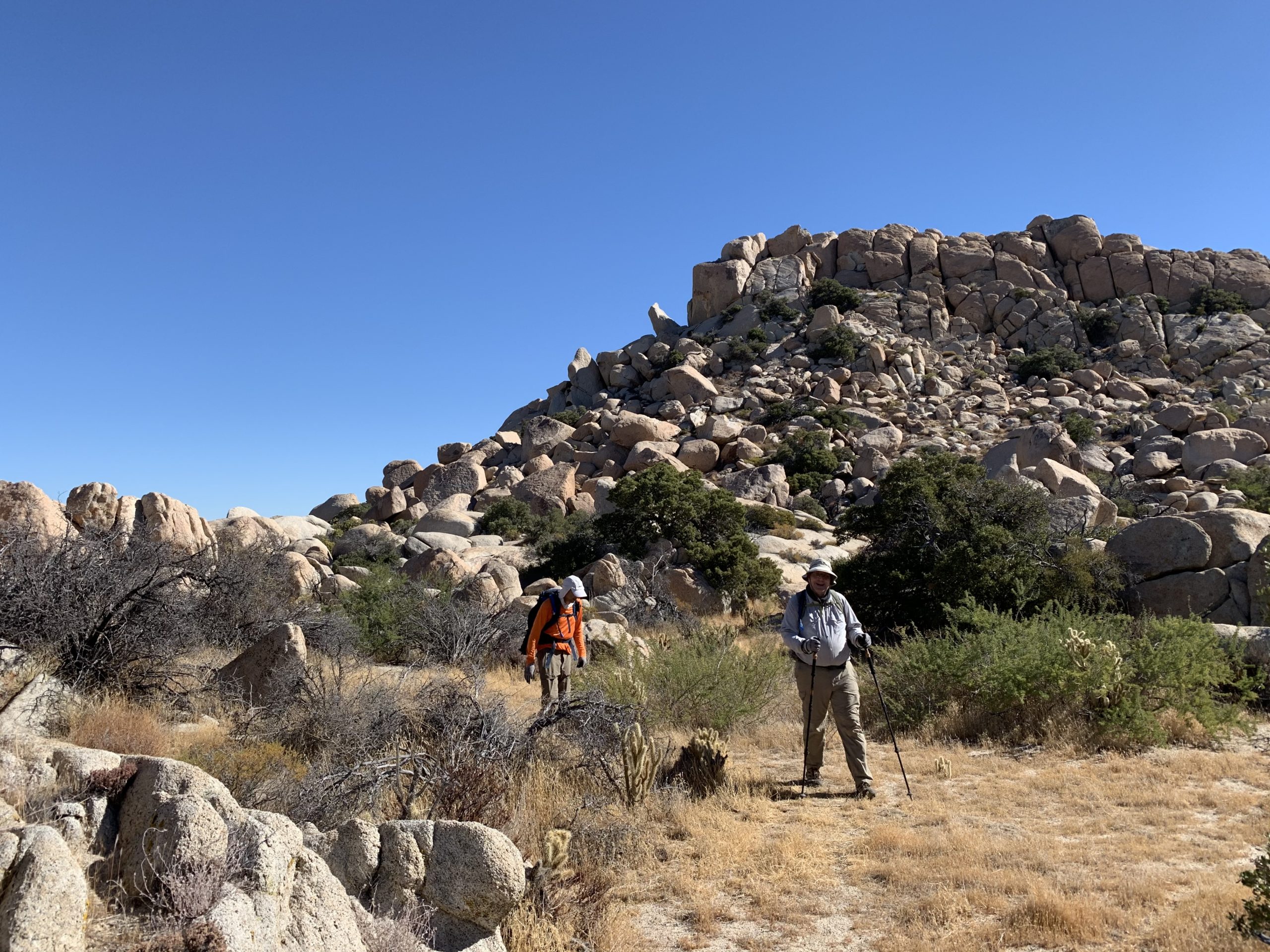
Both Susie and I agreed this was much easier than our previous summits. The day was warming up, but we felt that we could get Al Holden in. We passed back through the tunnel and retraced our route for a bit. Finally we headed north, referring to one of the few tracks to this peak. Scrambling over boulders and past the occasional juniper, we realized the mound of rocks we thought was Al Holden wasn’t. It stood one pile to the east. 

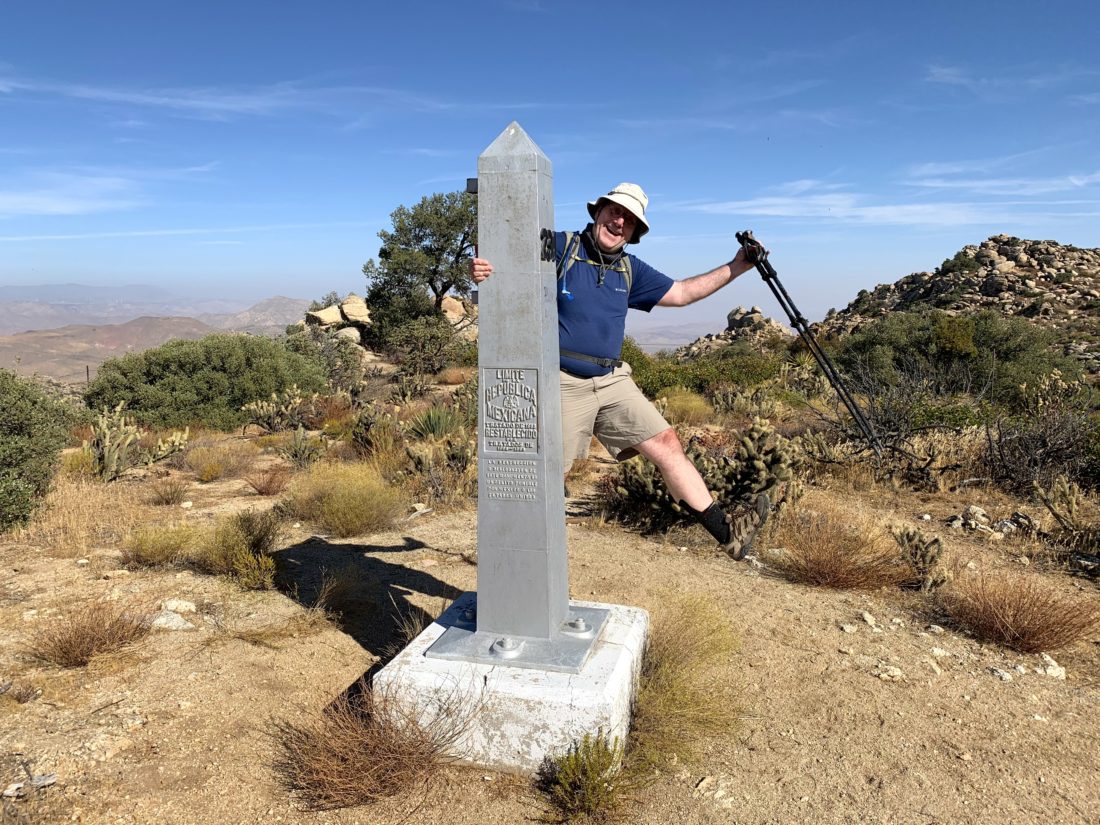
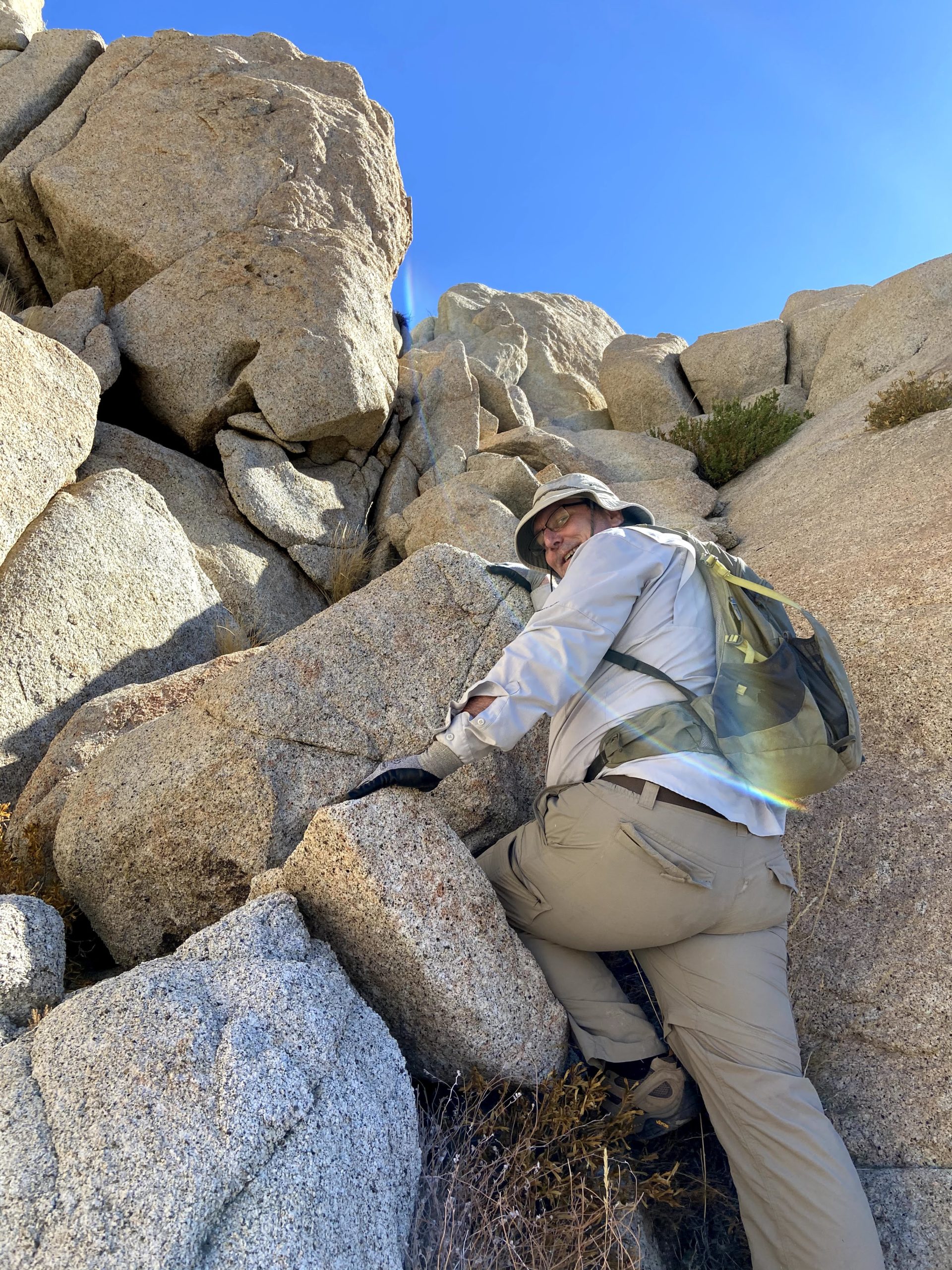
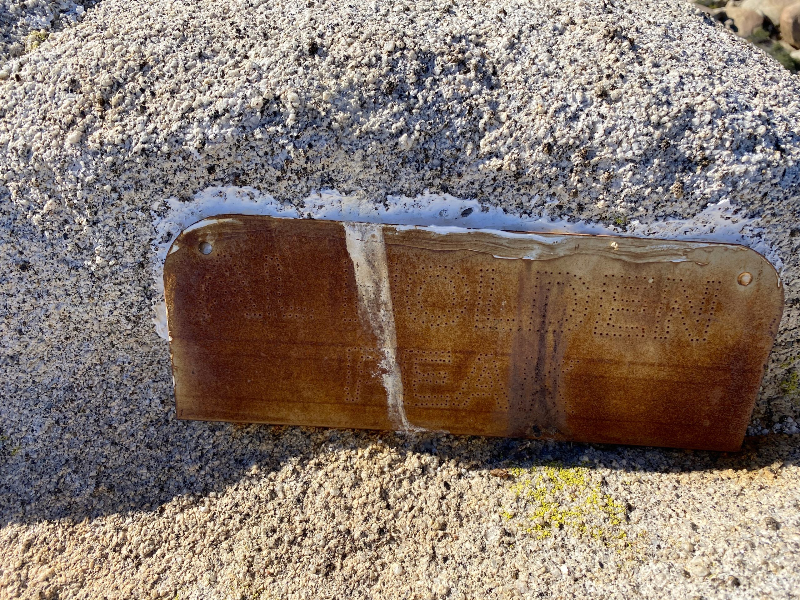
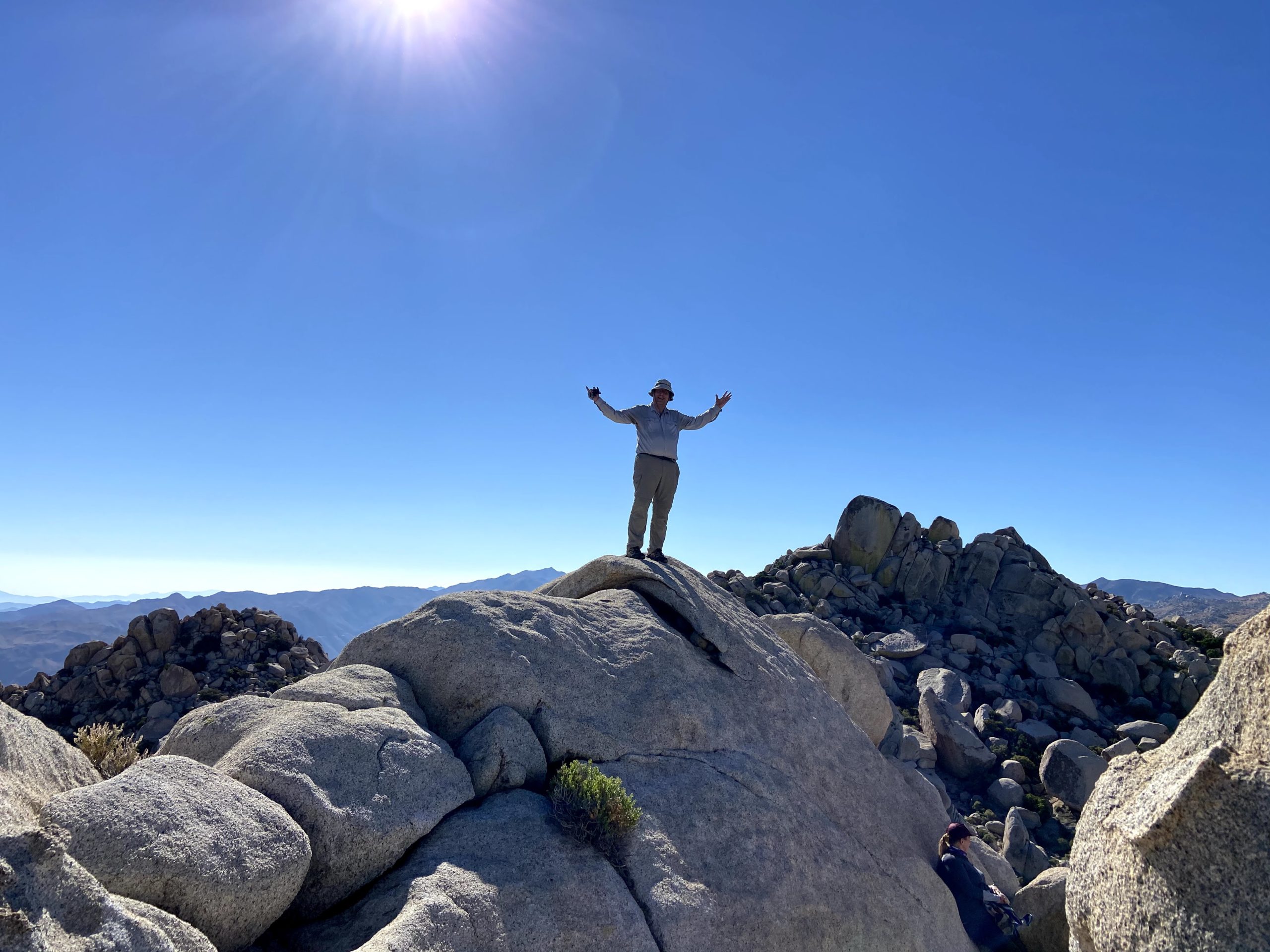
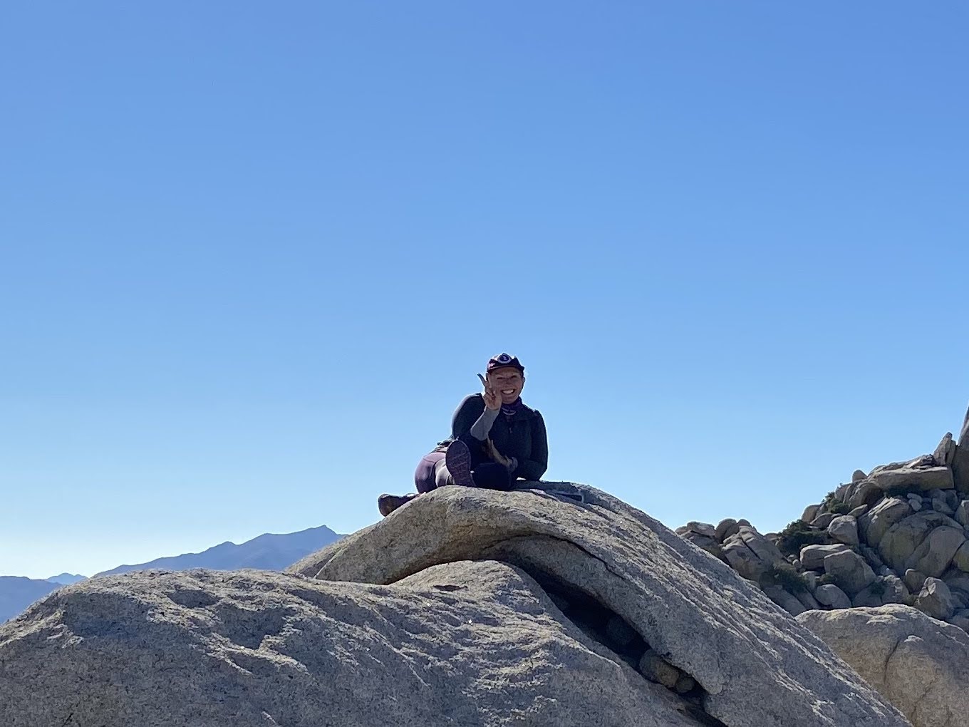
With the proper peak located, we began our careful climb up. This is a “leave the poles behind and put on gloves” kind of peak. We picked our way up, with a few careful Class 3 moves, & found ourselves atop Al Holden. We had a nice break, and I found some shade as I was starting to feel the heat. There is no register, but a metal sign is cemented atop a boulder.

Looking to the north
Looking to the west

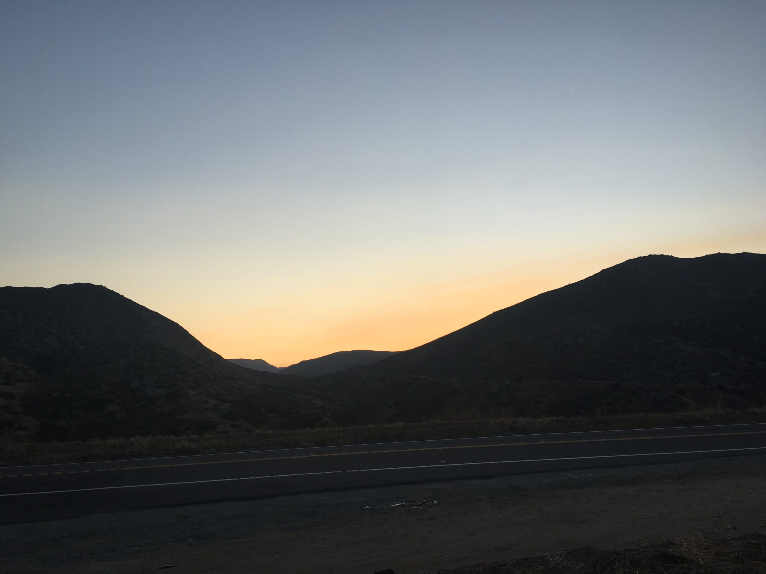
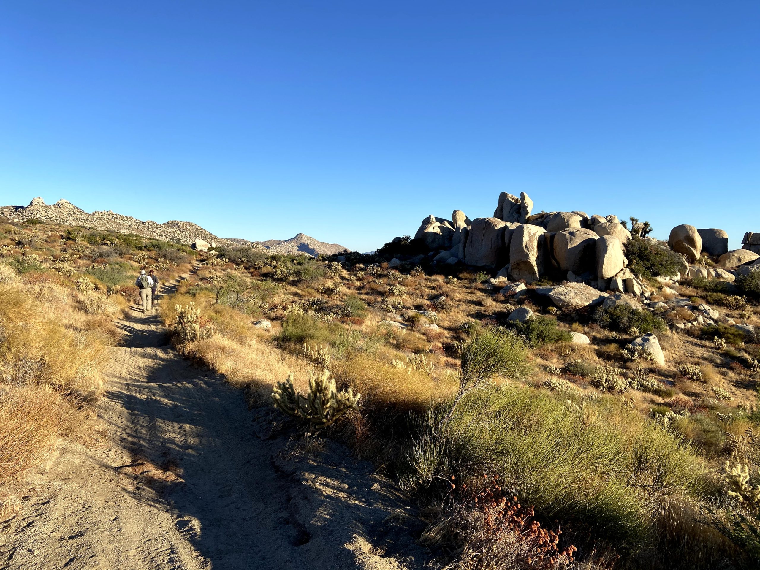
We worked our way back down from the summit, then over the saddle. From there we continued cross country until we rejoined the trail. The heat was taking a toll on me. I may have grown up in Bakersfield, but I don’t have the same tolerance anymore. The temps were in the mid-80s, but without the breeze, it felt worse. Now we had the ascent back to the car. My pace dropped considerably and I had to rest in the shade a few times. Ted shared some ice water, which helped. I cracked out my emergency Coke for some sugar and caffeine. That bottle of Gatorade I left in the fridge would have been helpful. 

Slowly but steadily I plodded my fat ass up the trail, with Ted and Susie watching over me. I tried to keep moving while not going too fast and overheating further. Finally, the end came into view and this effort was done. The cold water back at the car felt wonderful, as did the AC. Once I cooled off again I felt fine. I’m going to have to be more cautious next week when I am out at Joshua Tree NP. Again, thanks to Ted and Susie for their support in this one!


Buy Me a Coffee at ko-fi.com

I am an avid peak bagger, sometimes backpacker, and former sea kayaker living in San Diego. I am the co-author of Urban Trails:San Diego, coming in Spring 2026!

In 2019, I became the third person to complete the San Diego 100 Peak Challenge. Not stopping with that accomplishment, I set my sights on the harder San Diego Sierra Club 100 Peak list, which I completed in 2021. In addition, I have conquered several Six-Pack of Peaks challenges (SoCal, San Diego, Central Coast, and both the Arizona-Winter and Arizona-Summer). I am looking forward to exploring new summits and new adventures across the southwest. 

Boynton Canyon

I had hoped to get to the trailhead for Devil’s Bridge before the crowds were too bad, but even with my early arrival, I could not find a parking spot. Plus, given this was still during the pandemic (and before the vaccine) I did not want to deal with it. Instead I headed further down the road to another great hike, Boynton Canyon. I found a parking spot at the the trailhead and grabbed my gear. If the lot was full, there are some overflow spots down the road.

The trail first passes by the Enchantment Resort before leaving civilization behind. You will also see a trail off to your right. This is the Boynton Vista Trail and after a short climb will offer some nice views. It is also said that this is the location of one of the energy vortexes in the region. 

Once you are past the resort, the trail will continue northward and into the canyon proper. As you enter the canyon, the canyon wall will become closer and the trees more numerous. While I was here in October, I am sure this shade would be very welcomed during the hotter months. The trail will then turn westward. About 2 miles in is the turn-off to the Subway Cave. I did not do this side trip, in part I was not planning to do it so I did not have any information on the side route.

Staying on the Boynton Canyon Trail, I passed through the beautiful forest filled with ponderosa pine trees, and then oaks and maple trees. The trail does start to get a bit rockier and steeper as it nears the end of the trail. There is a nice wide plateau to relax and enjoy a snack, and of course soak in the view. Then simply retrace your route back to the trailhead.


Buy Me a Coffee at ko-fi.com

I am an avid peak bagger, sometimes backpacker, and former sea kayaker living in San Diego. I am the co-author of Urban Trails:San Diego, coming in Spring 2026!

In 2019, I became the third person to complete the San Diego 100 Peak Challenge. Not stopping with that accomplishment, I set my sights on the harder San Diego Sierra Club 100 Peak list, which I completed in 2021. In addition, I have conquered several Six-Pack of Peaks challenges (SoCal, San Diego, Central Coast, and both the Arizona-Winter and Arizona-Summer). I am looking forward to exploring new summits and new adventures across the southwest. 

The Thimble

With the forests closed, we opted to try for a pair of peaks—The Thimble and San Ysidro out near Ranchita. We knew it was going to be a warm one, so hit the trail just before sunrise.

We worked our way up the old road to the saddle. From there, Ted got his first look at The Thimble. Having summited this peak before, I outlined the basics of our ascent for Ted. There is no trail to the summit, so this climb would be a true adventure for us. We left the old road and began crossing toward the base. Carefully crossing the boundary fence into Anza Borrego State Park, we began weaving past the brush and boulders as we made our way up the 30-50% grade. 

Soon we found ourselves at that wall of brush. The right edge still provided a narrow passage past the thicket. From there it was a quick scramble to the summit.

Greg Gerlach had left a new register earlier this year, which we happily signed. The views were tremendous. I took the opportunity to scan my upcoming route into Hellhole Flats and San Ysidro East Peak. 

After a pleasant break, we began our careful descent. Since Ted had spotted a baby rattlesnake on our ascent, we were mindful of that as we retraced our route.

We kept looking for a route that would allow us to vector toward the route up to San Ysidro. Nothing revealed itself to me, so we went to the base. We then evaluated if we should go for our second peak. The day was certainly warming up. I looked over the distance and gain, along with needing to be back in town for my annual flu shot scheduled for early afternoon. With that, we would leave San Ysidro for another day.

Once back in the car, the thermometer read a toasty 88. Turning back was the right call.


Buy Me a Coffee at ko-fi.com

I am an avid peak bagger, sometimes backpacker, and former sea kayaker living in San Diego. I am the co-author of Urban Trails:San Diego, coming in Spring 2026!

In 2019, I became the third person to complete the San Diego 100 Peak Challenge. Not stopping with that accomplishment, I set my sights on the harder San Diego Sierra Club 100 Peak list, which I completed in 2021. In addition, I have conquered several Six-Pack of Peaks challenges (SoCal, San Diego, Central Coast, and both the Arizona-Winter and Arizona-Summer). I am looking forward to exploring new summits and new adventures across the southwest. 

Blue Angels Peak

Today’s adventure was to summit Blue Angels Peak. With the forests closed due to fire danger, we were looking for something that we could do. I had suggested doing San Ysidro and The Thimble, but Susie wanted to explore something new, so Blue Angels Peak was selected. I headed out early to try and catch the sunrise and squeeze in a quick summit of Jade Benchmark. About 7:3, Susie and Gail pulled up and transferred into my Subaru. Rather than make the steep climb up from the trailhead we opted to drive to a turnout to avoid this section.

The views were spectacular as we worked our way along the roads. Finally we came to the point where we left the road and began to follow a use trail toward the summit.

With a bit of scrambling at the very end, the summit was reached. Susie found the register and we signed ourselves in. The Valley of the Moon spread out before us to the east, and Mexico was just to our south. A nice breeze kept us cool. A Border Patrol jeep cruised the road below us.

I scrambled around the summit locating the various reference marks. Plastic bottles could be found scattered about. Our next goal was the boundary marker to our south. This obelisk denotes the border between the United States and Mexico.

We took our photos and then headed back. I had located several other peaks also on the Borrego Benchmark Club list, but the day was warming up a bit and I needed to get home since Yom Kippur starts at sundown. This is a place I need to return to and explore this region further!


Buy Me a Coffee at ko-fi.com

I am an avid peak bagger, sometimes backpacker, and former sea kayaker living in San Diego. I am the co-author of Urban Trails:San Diego, coming in Spring 2026!

In 2019, I became the third person to complete the San Diego 100 Peak Challenge. Not stopping with that accomplishment, I set my sights on the harder San Diego Sierra Club 100 Peak list, which I completed in 2021. In addition, I have conquered several Six-Pack of Peaks challenges (SoCal, San Diego, Central Coast, and both the Arizona-Winter and Arizona-Summer). I am looking forward to exploring new summits and new adventures across the southwest. 

Almost There Adventure Podcast

I had an awesome time talking with Jeff Hester, Jason Fitzpatrick, and Saveria Tilden on the “Almost There Adventure Podcast” about the 100 Peak Challenge! I, along with Derek Loranger, (creator of the 100 Peak Challenge as well as a good friend) and Susie Kara, my often hiking companion (in addition to being the first finisher), talked about completing it and what that adventure has meant to us (plus other ramblings).

Hope you enjoy listening as much as we enjoyed recording it. 

Listen here

Jade Benchmark

Today’s adventure was to summit Blue Angels Peak. With the forests closed due to fire danger, we were looking for something that we could do. I had suggested doing San Ysidro and The Thimble, but Susie wanted to explore something new, so Blue Angels Peak was selected. 

I headed out early to try and catch the sunrise and squeeze in a quick summit of Jade Benchmark, which is on the Borrego Benchmark Club list. It was a short climb to the summit. I found the register, but the ink in the pen was dry. I was also able to locate the benchmark before I hustled back down and waited for Susie and Gail to arrive.


Buy Me a Coffee at ko-fi.com

I am an avid peak bagger, sometimes backpacker, and former sea kayaker living in San Diego. I am the co-author of Urban Trails:San Diego, coming in Spring 2026!

In 2019, I became the third person to complete the San Diego 100 Peak Challenge. Not stopping with that accomplishment, I set my sights on the harder San Diego Sierra Club 100 Peak list, which I completed in 2021. In addition, I have conquered several Six-Pack of Peaks challenges (SoCal, San Diego, Central Coast, and both the Arizona-Winter and Arizona-Summer). I am looking forward to exploring new summits and new adventures across the southwest. 

San Pasqual South-Peak 1755

Because of how I completed the 100 Peak Challenge, I actually summited most of the peaks twice, once during my first incomplete attempt and again during my successful second attempt. Recently, I got to thinking about summiting those peaks I did not summit twice. Taking a look at them and I got to thinking, why not? While both the Six Pack of Peaks and the Sierra Club 100 will still come first, when I can’t hike one of those peaks, you just might find revisiting one of my 100 Peak Challenge summits.

Several cars were already in the parking lot at a touch before 7. The plan was to hike up to Peak 1755, which is a bump just off the trail en route to “The Chairs”. As I made my way up the trail, I note how the area had begun its recovery from the fire two years ago.

I reached the top of the canyon and found the use trail to the summit. There is no benchmark nor a register. I snapped a few photos and headed back down. From this summit, I could see a small crowd milling around the chairs. I had no need to take my photo on them, so I opted to just end to the end of the trail instead.

I scrambled up the rocks to enjoy the view of the San Pasqual valley below me. Since I wanted to make it home in time for most of the Rosh Hashanah service, so I did not linger. I cruised back down the trail and headed home.


Buy Me a Coffee at ko-fi.com

I am an avid peak bagger, sometimes backpacker, and former sea kayaker living in San Diego. I am the co-author of Urban Trails:San Diego, coming in Spring 2026!

In 2019, I became the third person to complete the San Diego 100 Peak Challenge. Not stopping with that accomplishment, I set my sights on the harder San Diego Sierra Club 100 Peak list, which I completed in 2021. In addition, I have conquered several Six-Pack of Peaks challenges (SoCal, San Diego, Central Coast, and both the Arizona-Winter and Arizona-Summer). I am looking forward to exploring new summits and new adventures across the southwest. 

Camping at Crystal Cove

Well, it finally happened, I went backpacking! I had finally reached a point where some of the peaks I want to summit are more than a long day hike. Susie Kara suggested testing out my set up at Crystal Cove State Park. I booked a spot at the Upper Moro campsite. Throughout the week, I kept a close eye on the air quality. The plan was to start after work, hike back to the site, spend the night then head back down. I got to the state park around 5, spoke to the ranger, and asked about the conditions. She said it wasn’t too bad, and agreed if we opted to leave the trail is easy to follow in the dark.

Ted Markus graciously decided to join me. We hit the trail right at 5:30, packs strapped to our backs. Our route wandered up through Moro Canyon. After about a mile we reached the East Cut Across trail to begin climbing up toward the ridge. 

Here is where we would earn the beer we packed! Over the next mile the trail would gain about 700 feet. Once on the ridge, we passed through Lower Moro Campground. We snapped a few photos of the view and continued on, as our campsite was about another .85 miles further.

We arrived at sunset, and quickly set about setting up camp. We had the entire campsite to ourselves, so we did not need to camp next to each other. Once the tents were up, we enjoyed our sandwiches and beer. We chatted for a while then turned in for the night. In many ways this was going to be the real test for me.

My sleeping pad and tent worked well. While not the best sleep, I woke just after 6. I had a granola bar and some oranges while I broke down my gear. We loaded our packs and headed back down. A few early morning mountain bikers were testing their calves climbing the ridge and some others were enjoying the trails.

We soon found ourselves back at our cars, knowing that we were ready to attempt a real backing trip once it was safe to do so. I quickly changed shirts and headed off as I had a 9:30 meeting.


Buy Me a Coffee at ko-fi.com

I am an avid peak bagger, sometimes backpacker, and former sea kayaker living in San Diego. I am the co-author of Urban Trails:San Diego, coming in Spring 2026!

In 2019, I became the third person to complete the San Diego 100 Peak Challenge. Not stopping with that accomplishment, I set my sights on the harder San Diego Sierra Club 100 Peak list, which I completed in 2021. In addition, I have conquered several Six-Pack of Peaks challenges (SoCal, San Diego, Central Coast, and both the Arizona-Winter and Arizona-Summer). I am looking forward to exploring new summits and new adventures across the southwest. 

Strawberry Peak

The alarm went off way too early, but we wanted to be at the trailhead around sunrise to once again beat the heat and the crowds. My partner in crime this time was Susie Kara. We met at a Park And Ride in Escondido and headed up the 15. We caught up on things–my kids starting their college classes remotely and Susie filling me in on her recent camping trip.

Today’s summit was going to be Strawberry Peak, in the front range of the San Gabriels. This was going to be my 10th peak in my Six-Pack of Peaks Challenge. We followed the Angeles Crest Highway as it wound its way up. The sun was just beginning to rise as we pulled into the Red Box Picnic Area, and a couple of cars were already parked. We grabbed our gear and carefully crossed the highway to the trailhead.

The trail would follow the road for a bit before heading off to the north. The grade was gentle and we cruised right along. We knew this hike would be in two parts–this gentle section and the steep push up to the summit.

The morning sun was shining its glow across the peaks around us. After about 2,5 miles, the trail dropped steeply down toward the Lawlor Saddle. Thankfully, this section was relatively short. We reached the junction with the trail to Strawberry Meadow and took a short break. Staying on the trail up to Strawberry Peak, we began the real climb. 

While some might find this section technical, our countless hours exploring the peaks of Anza-Borrego made this section almost second nature. Reaching Strawberry Peak requires crossing several false summits, so remember that as not to be disappointed when cresting one, to only see another climb ahead of you. But, finally, the true summit was a short climb before us. Susie, of course, reached it first and was resting as I made my way up. 

Next to the summit post, four different wooden signs were available for our summit photo. I had unfortunately forgotten the strawberries in my fridge that we were going to enjoy. We were soon joined by three trail runners. We shared the summit respectfully and chatted a bit. After snapping our photos we began our descent.

The trail runners soon passed us as we carefully descended. Susie had forgotten her trekking poles, so she was a bit more cautious, and I paid attention to my knee as we traversed down the steep section. We would now start to encounter more hikers making their way to the summit. Everyone would don their mask as we passed.

The effects of the 2009 Station Fire

After climbing back up from Lawlor Saddle, we cruised the two or so miles back to the car. It was starting to warm up, and I was glad we were heading back down. We could hear folks enjoying the twists and turns of the highway as we got closer. 

After quickly crossing the road again, the parking lot was now almost completely full. We tossed our gear in the car and headed back home. I logged 7 miles with 1,717 feet of elevation gain in 3:30 of active hiking time.


Buy Me a Coffee at ko-fi.com

I am an avid peak bagger, sometimes backpacker, and former sea kayaker living in San Diego. I am the co-author of Urban Trails:San Diego, coming in Spring 2026!

In 2019, I became the third person to complete the San Diego 100 Peak Challenge. Not stopping with that accomplishment, I set my sights on the harder San Diego Sierra Club 100 Peak list, which I completed in 2021. In addition, I have conquered several Six-Pack of Peaks challenges (SoCal, San Diego, Central Coast, and both the Arizona-Winter and Arizona-Summer). I am looking forward to exploring new summits and new adventures across the southwest. 

Baden-Powell (via Vincent Gap)

The planned summit for today was Mount Baden-Powell, just west of Wrightwood. Given the heatwave that much of the state had been under and the threat of an afternoon thunderstorm, we knew that we needed to have an early start for this peak, and being a San Diego resident, this meant an even earlier start with the two-hour drive to the trailhead. Ted arrived just before 4 am and loaded his gear into the back of the car. We slipped on our masks and drove northward. As we climbed up toward the Cajon Pass, a small rain shower came down. This hike might have turned out to be a long drive for nothing if we felt the weather conditions weren’t favorable.

Trailhead

We pulled into the parking lot off the Angeles Crest Highway. About ten or so other cars were already there. We gathered our gear, used the (thankfully open) restroom, and headed onto the trail. 

The route was going to be a fairly constant climb along the Pacific Crest Trail. While we were going to be under the shade of the various evergreens for much of it, we still had some 40 switchbacks to count off as we worked our way ever upward toward the summit.

As we made our way up, a few light sprinkles began to fall. Since the temperature was pleasant, it did not bother us as we plodded upward. After about a mile in, we passed the bench, and since we were feeling good we did not stop. The sun was making itself visible from over the mountains, so we grabbed a few photos and continued on up the trail. We kept a fairly steady pace, as the gradient of the trail stayed mostly constant, although we slowly would feel the elevation in our lungs. We passed a few hikers along the way. The trail did make it hard to step out of the way, but everyone was wearing a mask as they passed. 

The trees began thinning out as we drew near the summit. Around 3 miles in, we started to get some nice views of Antelope Valley to the north. Finally, we reached the Mount Baden-Powell Saddle. It was there that we would leave the PCT for the final push to the summit.

We paused under the Wally Waldron Tree for a bit. This limber pine is believed to be the oldest living thing in the entire San Gabriel Mountains and was named after Michael H. “Wally” Waldron, an L.A. area Boy Scout leader who helped organize a nine-week project to repair the trails and erect the concrete monument and plaque to Lord Baden-Powell.

We then climbed the final tenth of a mile to the summit. A couple of other hikers were milling about. The flag was there, along with two wooden signs. Since no was over by them, we opted to get our photos out of the way before taking a well-earned break.

We found some shade to the south of the summit and enjoyed a nice snack and took a brief rest. Mount Wilson’s domes could be seen off to the west. Since we knew it was only going to get hotter and there was a chance of some afternoon thunderstorms, we decided it was time to head back down. We stopped at the monument to Lord Baden,took some photos, and signed the nearby register. I found two survey markers for the summit just off to either side of the peak.

Now for the 4 miles back down to the car. The traffic on the trail was picking up, and we would stop repeatedly to let hikers pass. Almost all were wearing masks but we did pass a couple of hikers who were not. As we approached the parking lot, we could see that it had completely filled up. This was not a surprise given the number of hikers we passed during our descent. We got back to the car just after 11 am. We did the 8 miles with over 2,790 feet of elevation gain in just under 4 hours and 30 minutes (sans the break at the summit). That was my 9th peak on the Six-Pack of Peaks Challenge. Now on to planning the next one!


Buy Me a Coffee at ko-fi.com

I am an avid peak bagger, sometimes backpacker, and former sea kayaker living in San Diego. I am the co-author of Urban Trails:San Diego, coming in Spring 2026!

In 2019, I became the third person to complete the San Diego 100 Peak Challenge. Not stopping with that accomplishment, I set my sights on the harder San Diego Sierra Club 100 Peak list, which I completed in 2021. In addition, I have conquered several Six-Pack of Peaks challenges (SoCal, San Diego, Central Coast, and both the Arizona-Winter and Arizona-Summer). I am looking forward to exploring new summits and new adventures across the southwest.