Trip Reports

Combs Peak

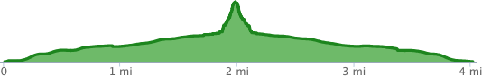
The goal for today’s hike was Comb’s Peak, the fifth highest peak in San Diego County and also one of the most remote. As I punched in the route to the trailhead, it actually routed me up through Temecula, then back into San Diego County. I was looking for a shorter hike, as my left foot was a tad sore from last weekend’s hike to Wilson Benchmark.

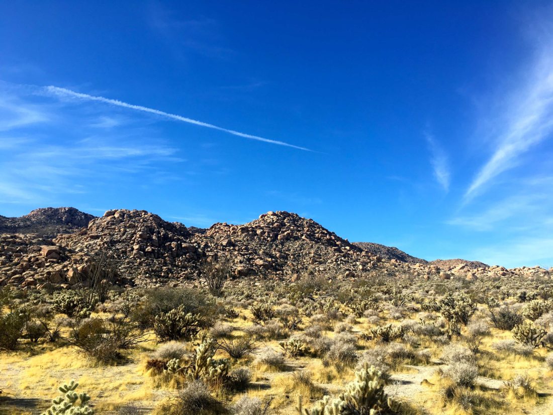
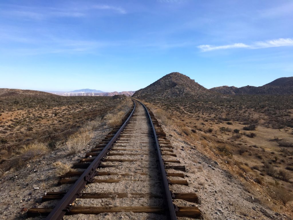
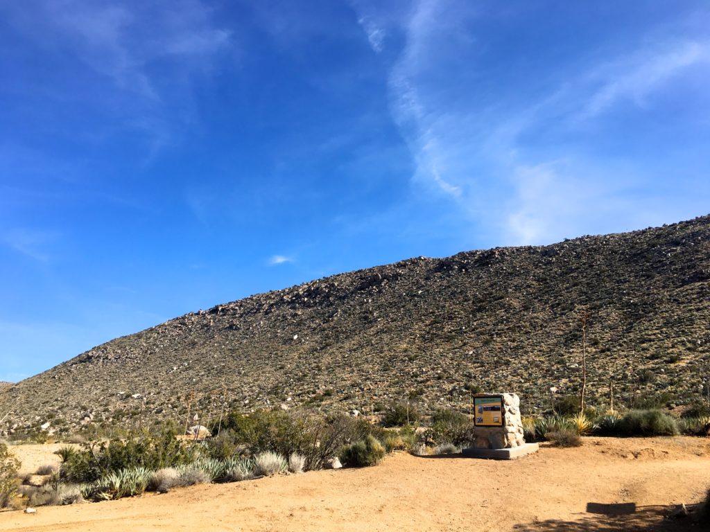
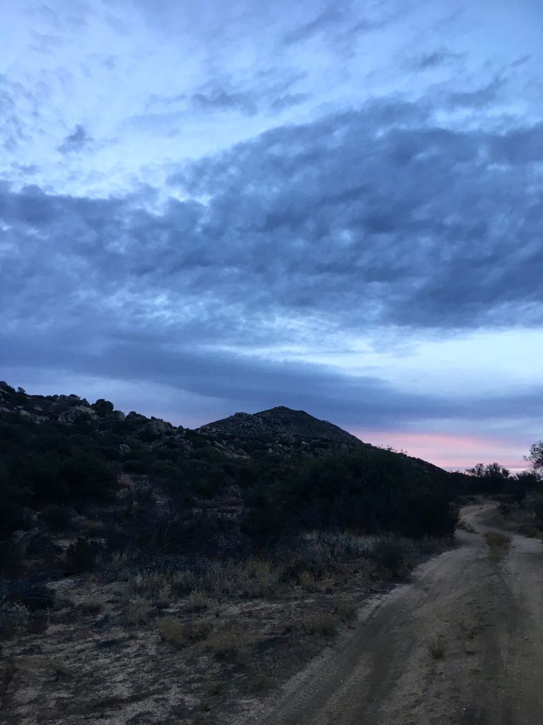
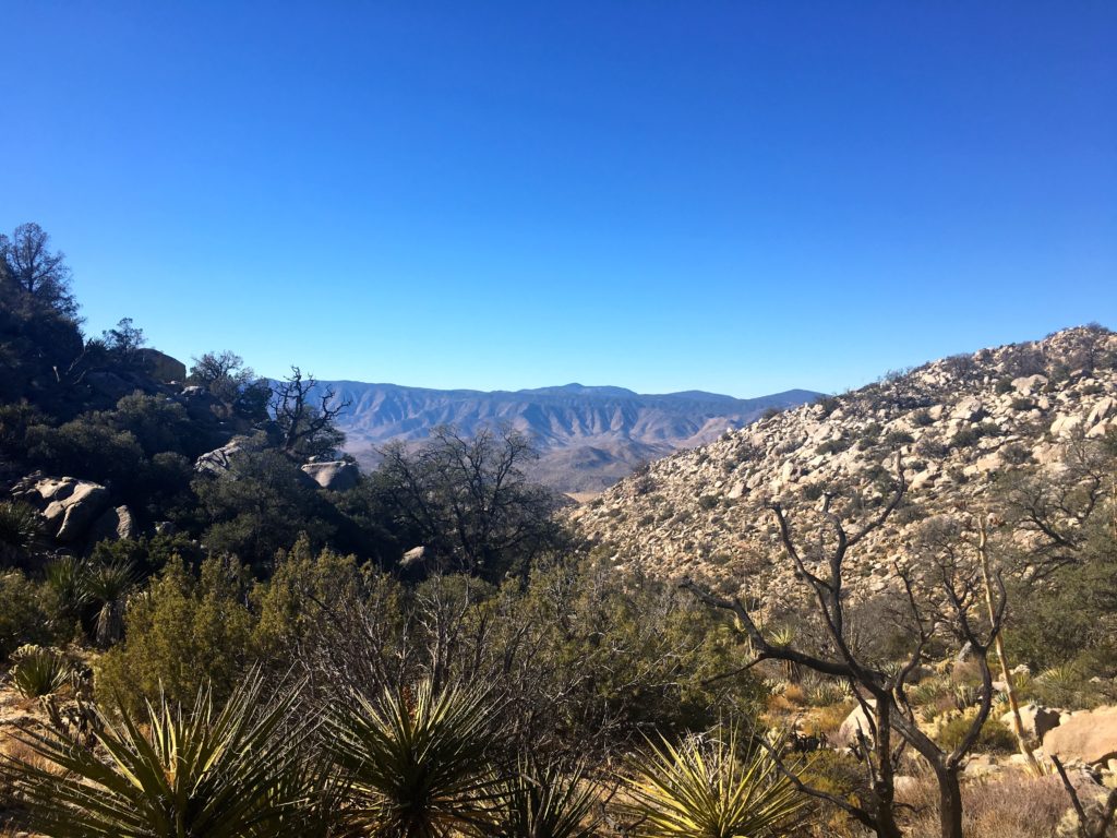
As I drove on the dirt road toward the trailhead, I actually entered Anza-Borrego Desert State Park. I began hiking north along the PCT, gently leaving Long Valley Road behind.

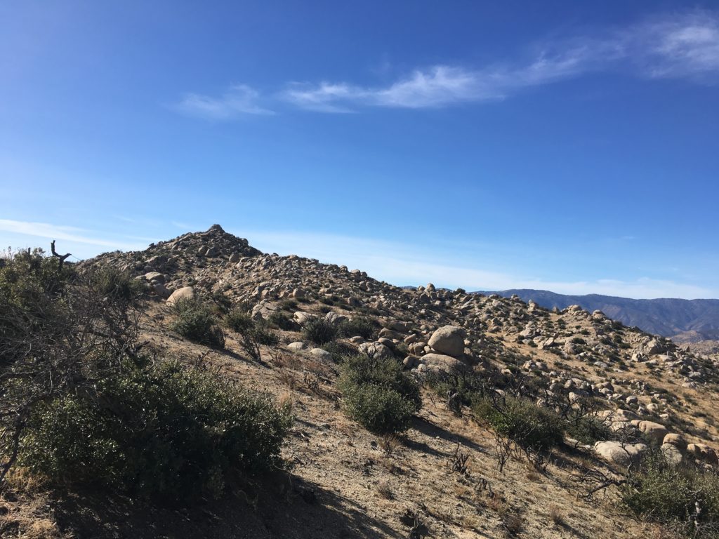
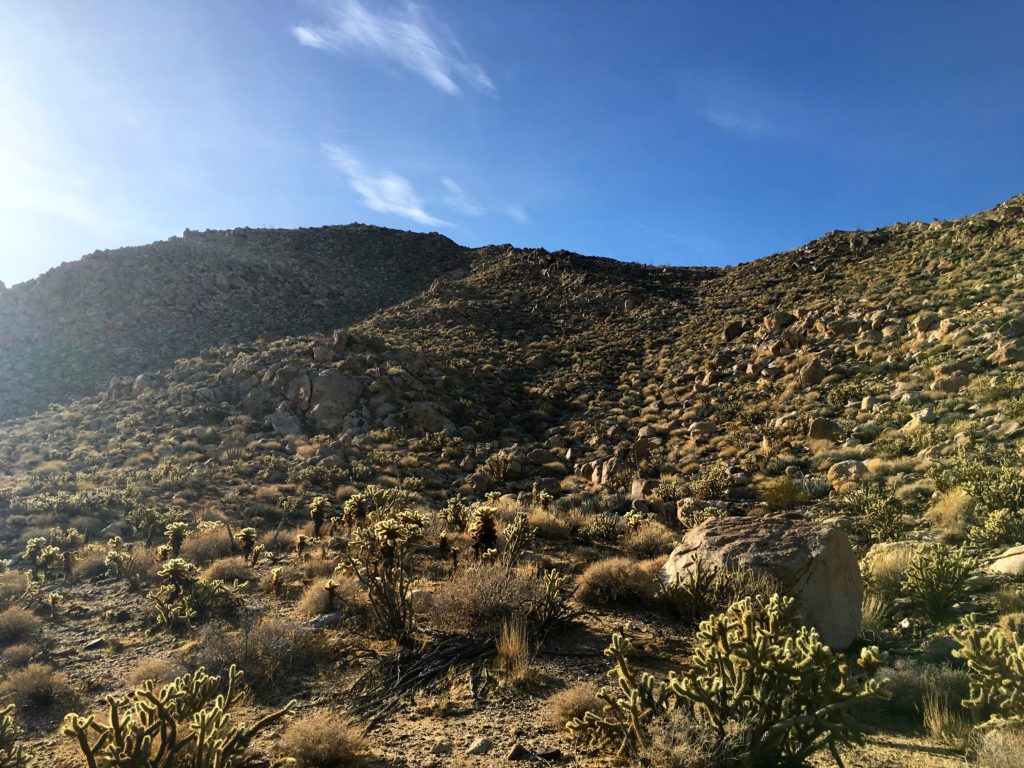
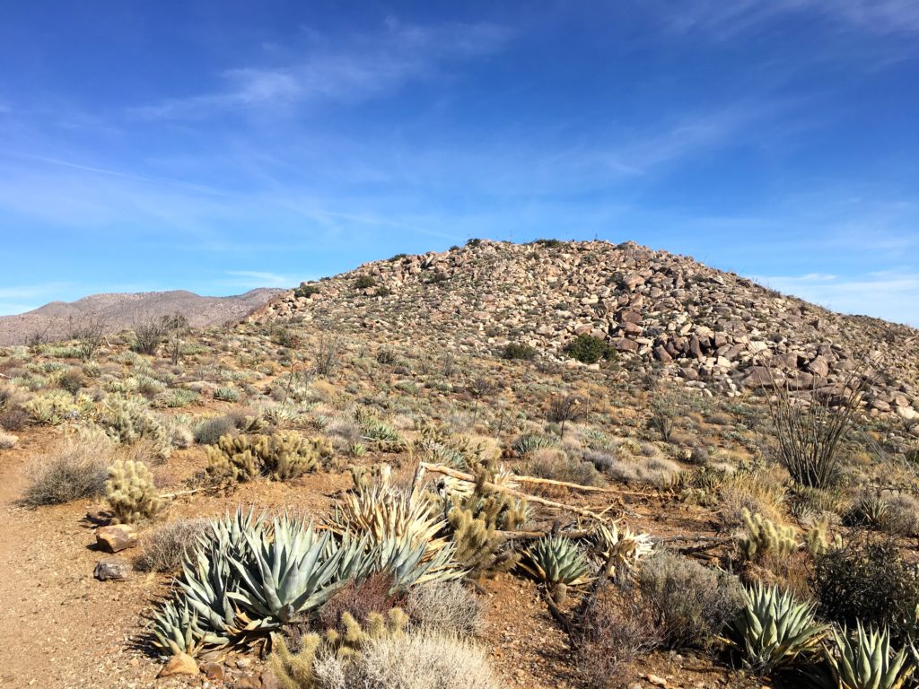
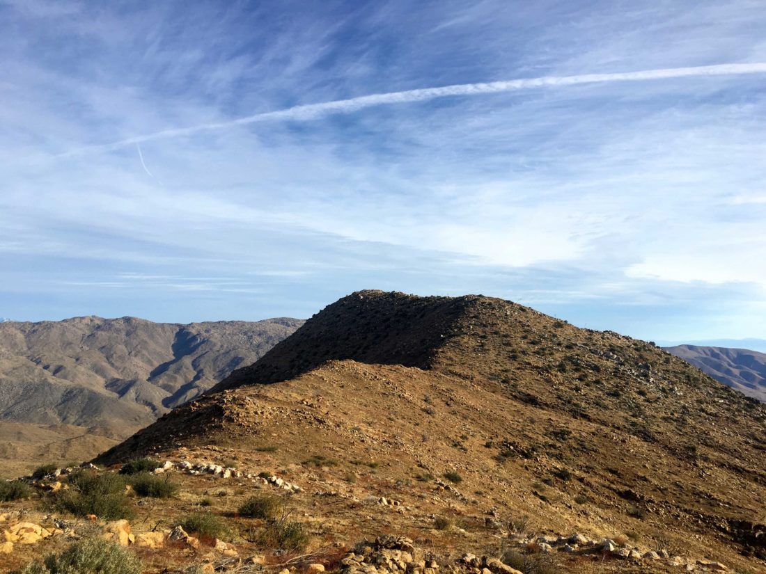
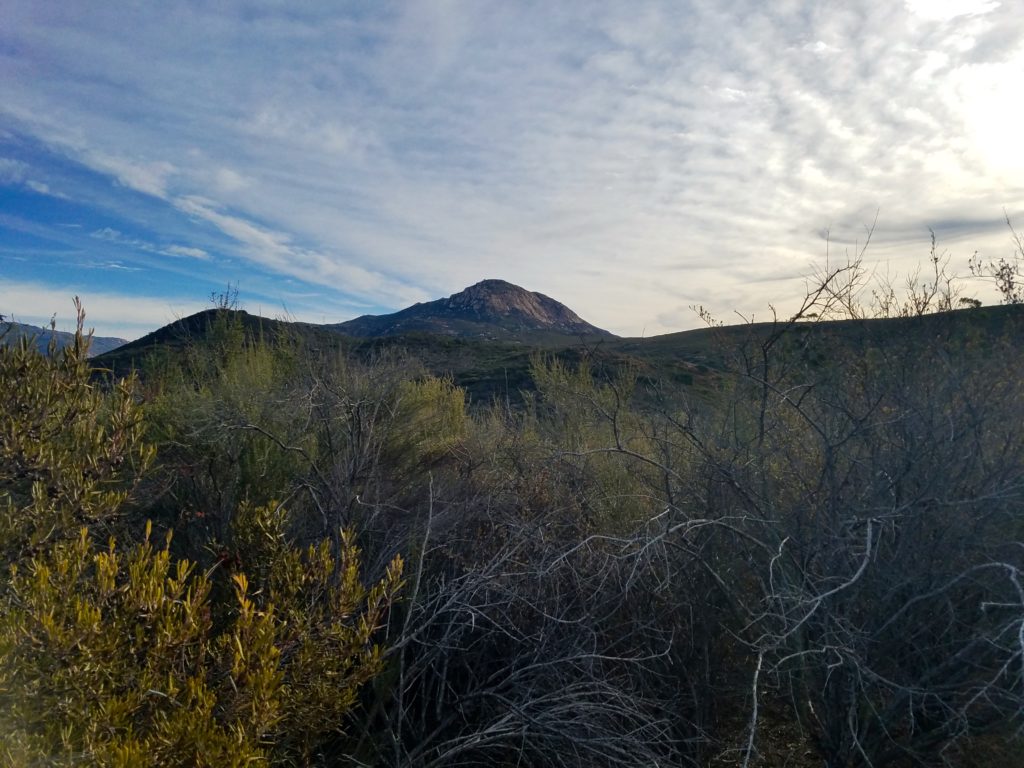
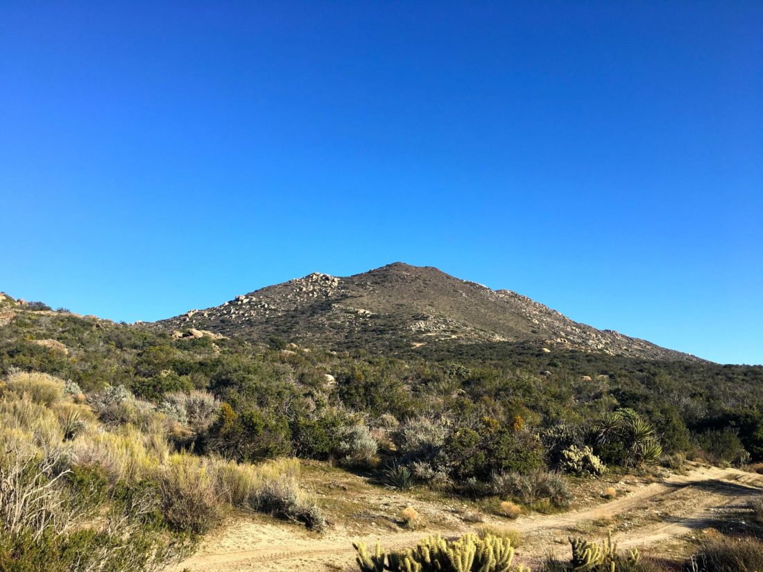
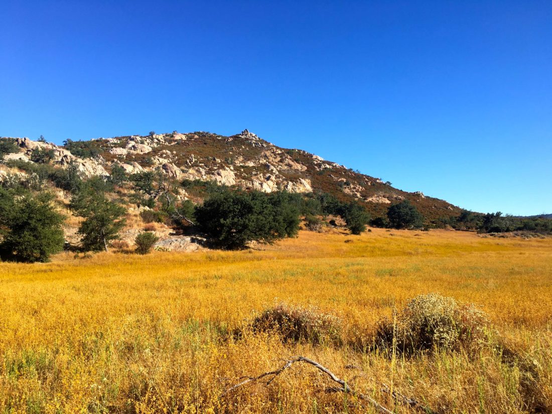
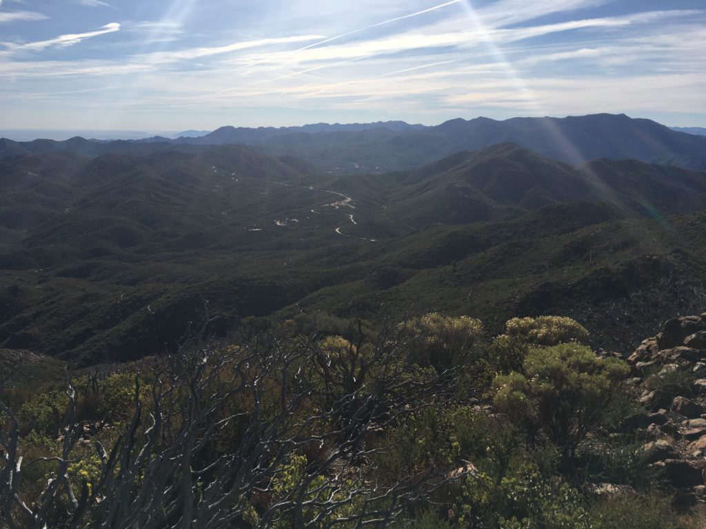
Comb’s Peak soon came into view to the northwest as I continued to make my way toward a saddle near the eastern shoulder of the peak.

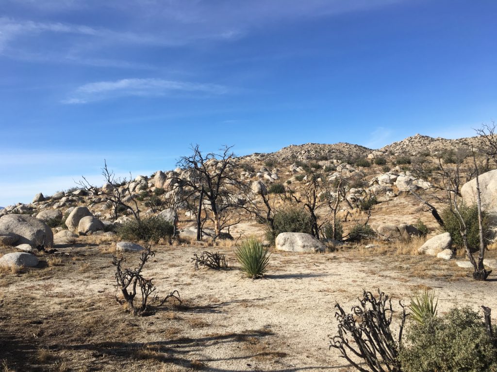
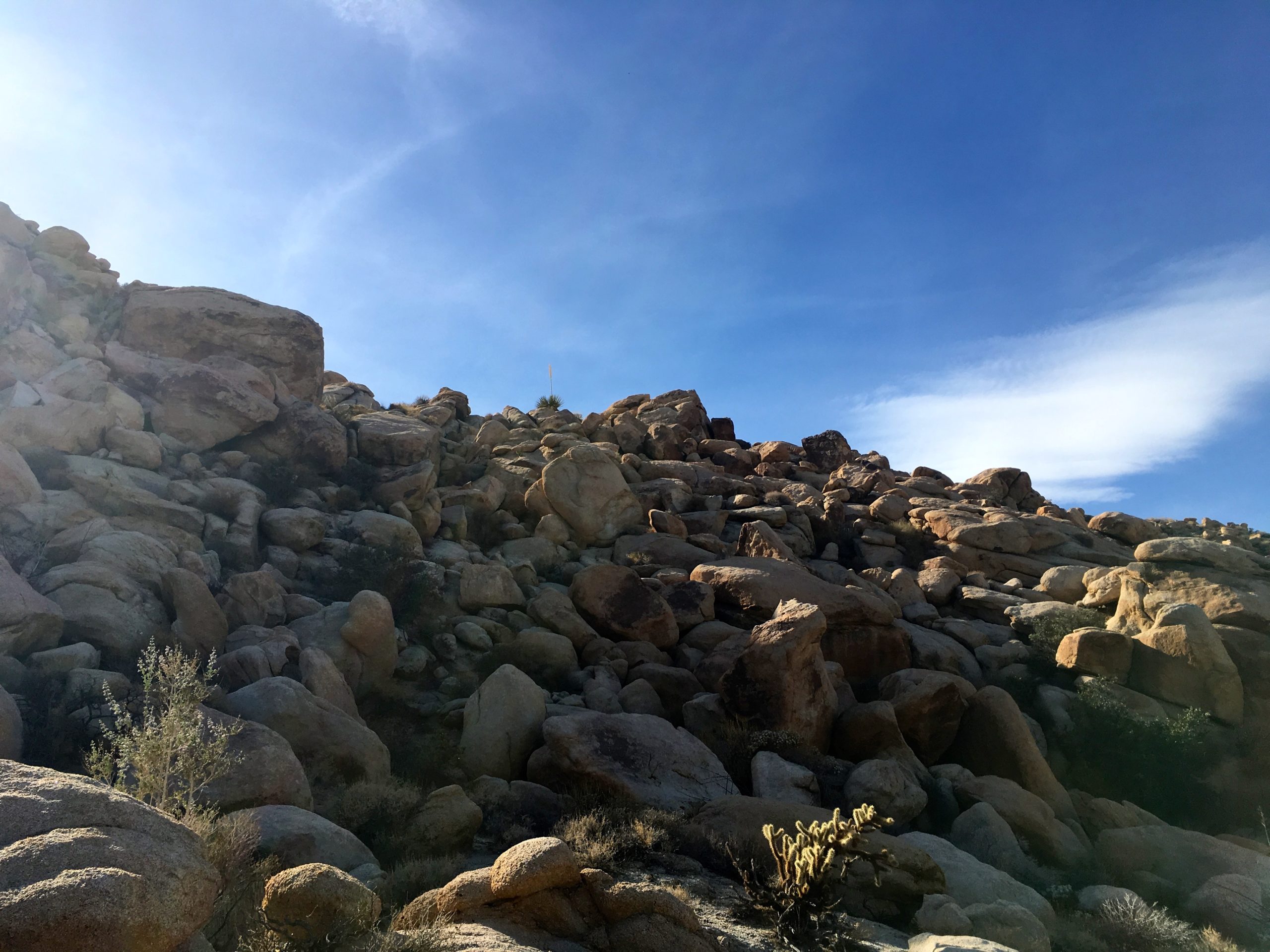
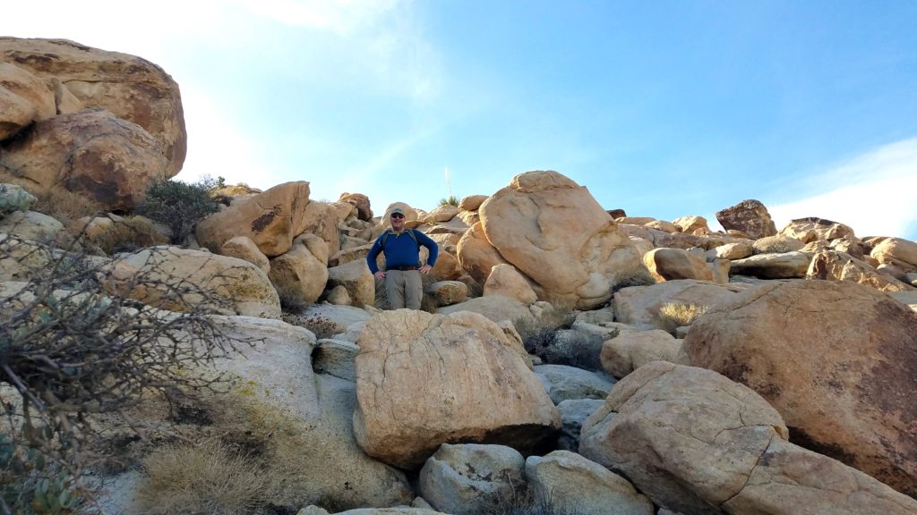
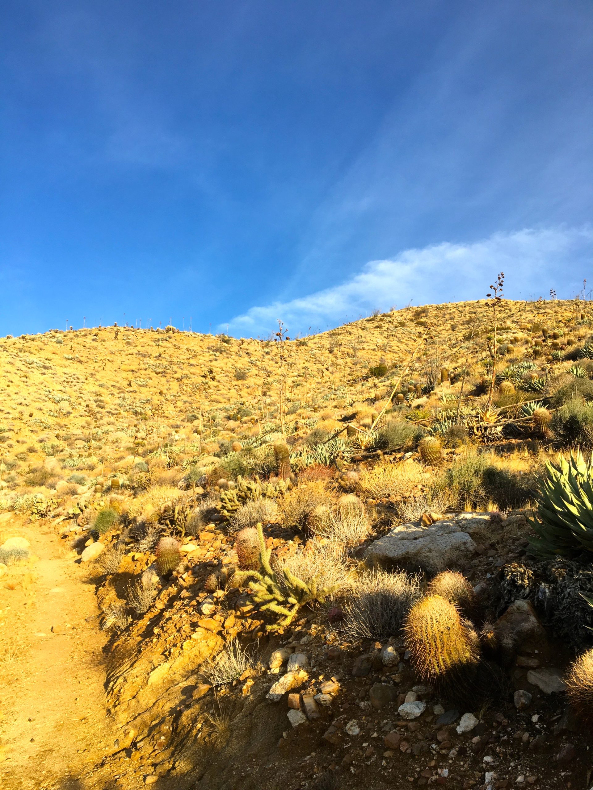
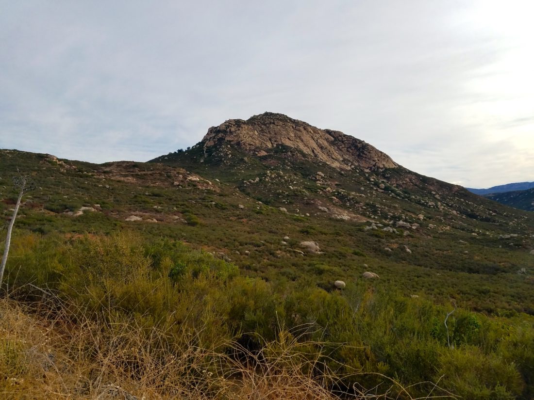
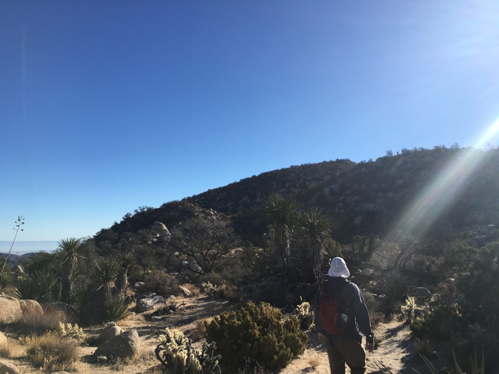
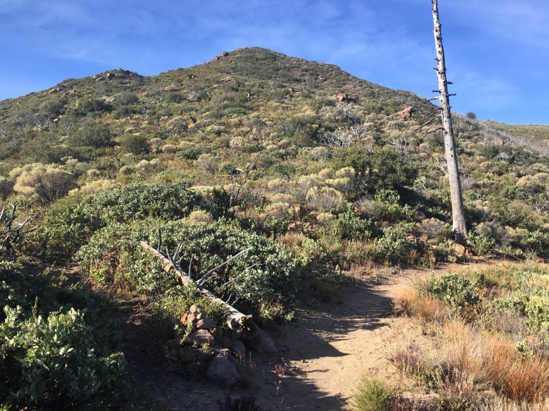
The trail then works its way up through the thick chaparral to the summit. In just about .5 miles, I gained some 600′ of elevation.

There were a few rocky sections that took a touch of care (mostly on the descent).

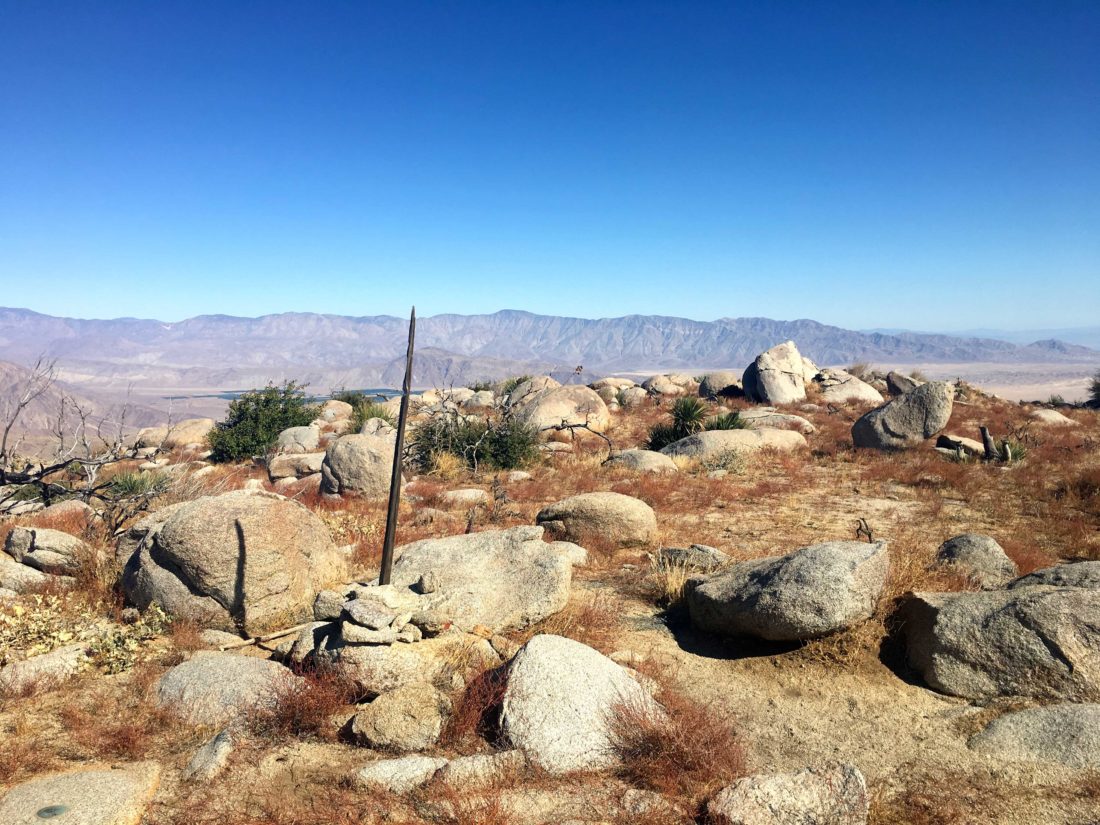
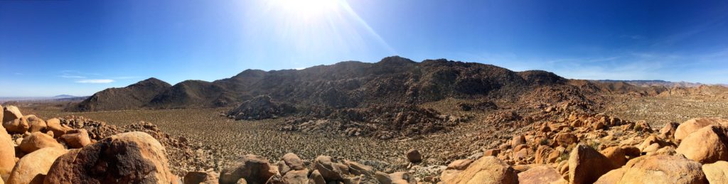
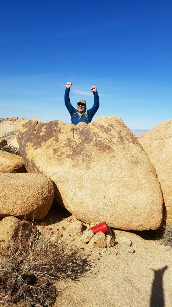
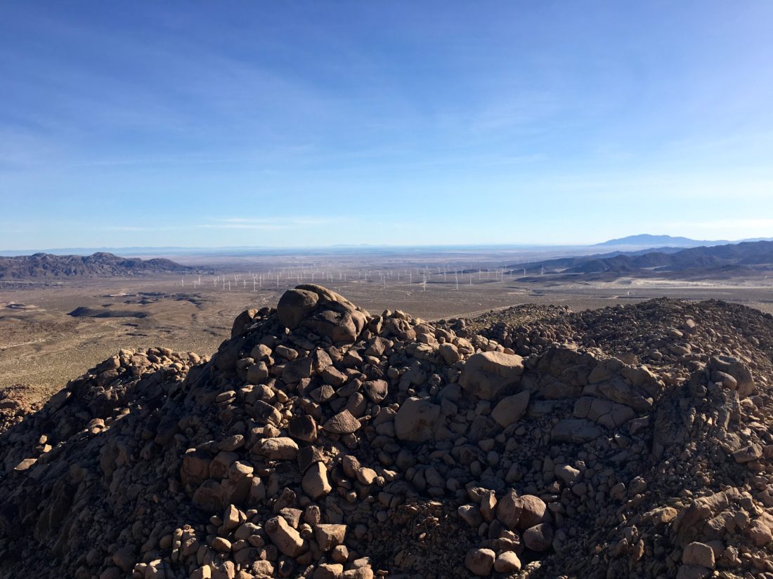
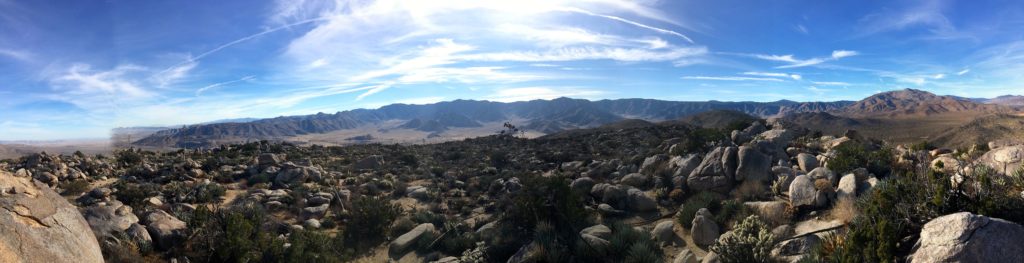
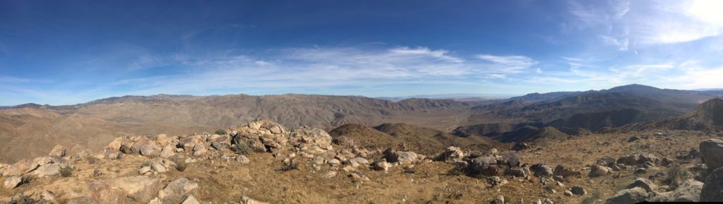
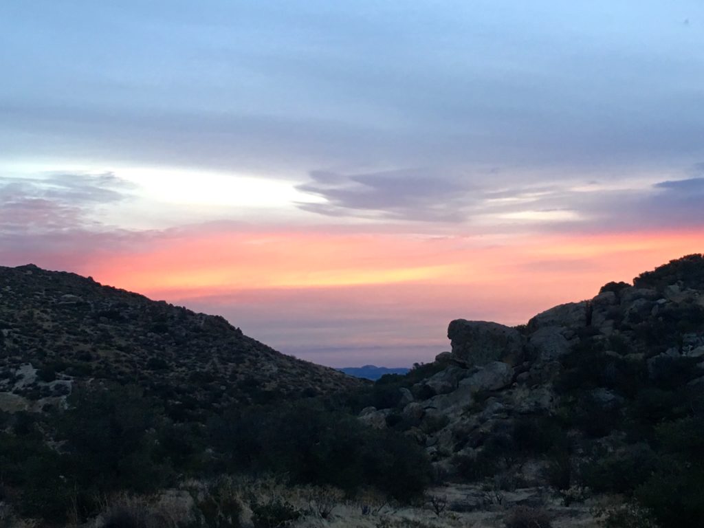
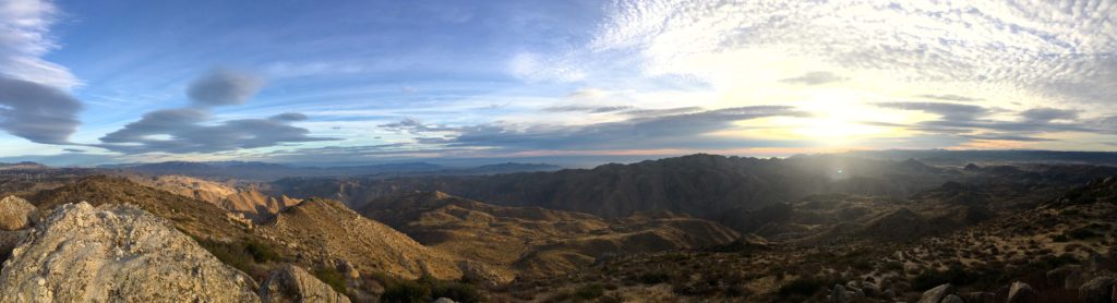
Atop the summit, I could see snow-capped San Gorgonio and San Jacinto to the north. To the east, I spied the Salton Sea. The wind was blowing, so I did not linger. The benchmark and register were both found.

While descending, I thought I heard voices. Something I was not expecting for such a remote hike. Upon reaching the saddle, I encounter three other hikers. One of the gentlemen was actually beginning his PCT thru-hike. Since the winter had been so mild, he figured he would get a head-start. We chatted some, while they rested. So, they continued on their trek north, and I returned south back to the car.

My left foot began to ache more as I descended. I later learned that I had developed a case of plantar fasciitis, and it would sideline me for the next several months.


Buy Me a Coffee at ko-fi.com

I am an avid peak bagger, sometimes backpacker, and former sea kayaker living in San Diego. I am the co-author of Urban Trails:San Diego, coming in Spring 2026!

In 2019, I became the third person to complete the San Diego 100 Peak Challenge. Not stopping with that accomplishment, I set my sights on the harder San Diego Sierra Club 100 Peak list, which I completed in 2021. In addition, I have conquered several Six-Pack of Peaks challenges (SoCal, San Diego, Central Coast, and both the Arizona-Winter and Arizona-Summer). I am looking forward to exploring new summits and new adventures across the southwest. 

Wilson Benchmark & Pinyon Ridge

Today was going to be another two-fer, the primary peak is Wilson Benchmark and the secondary peak is Pinyon Ridge. I was able to convince both Ted and Dave to head out into the chilly high desert. We grabbed our wool caps and gloves and headed out. We drove out toward Ranchita, until we reached Wilson Road, from there we turned on to Old Culp Valley Road. Glad we were in the Subaru. We found the trailhead without any issues.

The trail is an old, partially overgrown jeep road, and it goes up and down through the sparse landscape of burnt trees, resprouting shrub skeletons, blackened yucca trunks, and granitic boulders. Most of the area had burned in the 2012 “Vallecito Lighting Complex” fire. Pinyon is just a short side jaunt from the main route out to Wilson. As we worked our way across the desert, we slowly started to warm up.

Pinyon was a fun little scramble to the top. We found the northeast corner easier to navigate to the top of the summit block. Found the register and signed in. The wind was a tad chilly, so we did not stay too long. As I was scrambling back down to fetch my poles, I found a patch of snow tucked between the rocks.

Rather than return directly to the trail, we continued across the open desert to the east until we intersected the trail again.

After about 4 miles, we reach the base of the summit. From there we worked our way up, past the boulders and burned trees.

Once there we easily found the benchmark and register.

Anza-Borrego was again spread out before us. We could see the Salton Sea in the distance. Although it had warmed up some, there was still a bit of wind blowing, so we did not linger.

The return to the trailhead and the car was brisk, as Dave needed to get home.


Buy Me a Coffee at ko-fi.com

I am an avid peak bagger, sometimes backpacker, and former sea kayaker living in San Diego. I am the co-author of Urban Trails:San Diego, coming in Spring 2026!

In 2019, I became the third person to complete the San Diego 100 Peak Challenge. Not stopping with that accomplishment, I set my sights on the harder San Diego Sierra Club 100 Peak list, which I completed in 2021. In addition, I have conquered several Six-Pack of Peaks challenges (SoCal, San Diego, Central Coast, and both the Arizona-Winter and Arizona-Summer). I am looking forward to exploring new summits and new adventures across the southwest. 

Indian Hill

After resting from summiting Piedras Grandes, Hahn and I headed north along the tracks toward Indian Hill.

We eventually headed west, unlike my first attempt, we went north around a small hill that resembled a pyramid. As we weaved our way past the chollas across the flat desert floor. We continued west for a bit as the peak rose up to the south of us until we found a nice route up.

Much like the ascent of Piedras Grandes, this was a steep rocky scramble up, but nothing too challenging.

Soon we reached the summit, I turn to Hahn and remarked that this was about 100x easier than what I had tried to navigate.

From the summit, I spotted the ravine that I had incorrectly taken.

Hahn said that if I had reached the top of that peak I would have summited Moan Benchmark. To which I said, if that was true you would have heard a middle-aged man moan…

We sat for a bit, enjoyed the views, signed the register, and then headed back down. I continued to pick her brain about various summits. We found ourselves back at the car and headed back into town.


Buy Me a Coffee at ko-fi.com

I am an avid peak bagger, sometimes backpacker, and former sea kayaker living in San Diego. I am the co-author of Urban Trails:San Diego, coming in Spring 2026!

In 2019, I became the third person to complete the San Diego 100 Peak Challenge. Not stopping with that accomplishment, I set my sights on the harder San Diego Sierra Club 100 Peak list, which I completed in 2021. In addition, I have conquered several Six-Pack of Peaks challenges (SoCal, San Diego, Central Coast, and both the Arizona-Winter and Arizona-Summer). I am looking forward to exploring new summits and new adventures across the southwest. 

Piedras Grandes

Earlier in the month, I had driven out to Anza Borrego to summit a pair of peaks, Indian Hill and Piedras Grandes.  Unfortunately, I misread my route to Indian Hill and about halfway up a rocky ravine, I decided it too much and headed back to the car. I was not in the mood to attempt Piedras Grandes and drove home.

This time, I reached out to Hahn Asoy, one of the two 2017 finishers of the 100 Peak Challenge, if she would assist with my route finding. She gladly said yes, so back out to Dos Cabezas!

We opted to summit Piedras Grandes first since it is shorter of the two. We headed southwest across the desert floor until we reached the base of the peak. From there we picked our way up, past the rocks and cacti.

Quickly we found ourselves at the summit, looking across the desert, and the windmills near Ocotillo.

After a short rest, we headed back down and returned to the car before heading off for the second peak of the day.


Buy Me a Coffee at ko-fi.com

I am an avid peak bagger, sometimes backpacker, and former sea kayaker living in San Diego. I am the co-author of Urban Trails:San Diego, coming in Spring 2026!

In 2019, I became the third person to complete the San Diego 100 Peak Challenge. Not stopping with that accomplishment, I set my sights on the harder San Diego Sierra Club 100 Peak list, which I completed in 2021. In addition, I have conquered several Six-Pack of Peaks challenges (SoCal, San Diego, Central Coast, and both the Arizona-Winter and Arizona-Summer). I am looking forward to exploring new summits and new adventures across the southwest. 

Ghost Mountain

After Grapevine Mountain, I drove south to Little Blair Valley, toward the south end of the valley stands Ghost Mountain. For most people, this trail leads to the Marshall South homestead.

The trail quickly begins to climb up the side of the mountain to the ridgeline. From there it follows it toward the homestead, providing a sweeping view to the north and south as the trail continues its gentle climb.

After about 2 miles, I reached the remains of the adobe cabin. Marshall lived here for nearly 17 years. I spent some time examining the ruins before continuing eastward toward the summit.

It is clear the 95% of visitors turn back at this point, as the trail faded away. I picked my way through the rocks and plants until I reached the actual summit.

Here I found the Lower Peaks Committee register which I gladly signed.

I was feeling the miles from earlier, so I headed back down the trail to the car and back home.


Buy Me a Coffee at ko-fi.com

I am an avid peak bagger, sometimes backpacker, and former sea kayaker living in San Diego. I am the co-author of Urban Trails:San Diego, coming in Spring 2026!

In 2019, I became the third person to complete the San Diego 100 Peak Challenge. Not stopping with that accomplishment, I set my sights on the harder San Diego Sierra Club 100 Peak list, which I completed in 2021. In addition, I have conquered several Six-Pack of Peaks challenges (SoCal, San Diego, Central Coast, and both the Arizona-Winter and Arizona-Summer). I am looking forward to exploring new summits and new adventures across the southwest. 

Grapevine Mountain

The first peak of the day was slated to be Grapevine Mountain. The trailhead is just north of the scissors crossing in Anza Borrego. The morning was cool, but not too cold. The route to the summit follows the Pacific Crest Trail for some time, slowly snaking its way back up from the valley floor.

At some time point, it was time to bid fair well to the PCT and begin the off-trail ascent toward the summit.

Carefully weaving my way past the cactus and up the steep slopes, I found myself atop the first summit, but the actual summit was further east. I continued to work my way to the summit. I found the benchmark and the register with no trouble.

I spotted Sentenac Mountain to the south.

I did not stay too long as I knew I had to navigate the steep descent to the PCT and wanted to reach the summit of Ghost Mountain. I picked my way carefully down the slope as the San Felipe Valley spread out before me. Soon I reached the PCT and began retracing my steps back to the trailhead.


Buy Me a Coffee at ko-fi.com

I am an avid peak bagger, sometimes backpacker, and former sea kayaker living in San Diego. I am the co-author of Urban Trails:San Diego, coming in Spring 2026!

In 2019, I became the third person to complete the San Diego 100 Peak Challenge. Not stopping with that accomplishment, I set my sights on the harder San Diego Sierra Club 100 Peak list, which I completed in 2021. In addition, I have conquered several Six-Pack of Peaks challenges (SoCal, San Diego, Central Coast, and both the Arizona-Winter and Arizona-Summer). I am looking forward to exploring new summits and new adventures across the southwest. 

Bell Bluff

Ted and I were back at it. Today’s summit was Bell Bluff, located just a bit south of Alpine. We parked the car a bit away from the trailhead, as parking can be tight along the road. The trail passes better two homes before crossing the Sweetwater River. When we did the hike the riverbed was almost bone dry. However, the river bank was a bit steep, thankfully a rope was available for an assist.

As we crossed the sandy riverbed, we could not find the exit. We spent a good 20 minutes wandering looking for the trail. Finally we found it a bit further to the west. We followed what appeared to be an old Jeep trail for some time. Bell Bluff loomed before us in the distance.

Then the double cairns marked the turnoff toward the summit. The gentleness of the previous miles was replaced by some 700 feet of gain over about a half-mile. Partway up we have to work our way up one Class 3 section.

The summit had its benchmark still intact, and a register safely stored in an all too familiar red can.

We could see the north side of Lawson, which we recently summited, and Gaskill which still beckoned. Working our way back to the car, laughing at our earlier misadventures with the crossing…

Climbing back out of the river on the way back to the car.

Buy Me a Coffee at ko-fi.com

I am an avid peak bagger, sometimes backpacker, and former sea kayaker living in San Diego. I am the co-author of Urban Trails:San Diego, coming in Spring 2026!

In 2019, I became the third person to complete the San Diego 100 Peak Challenge. Not stopping with that accomplishment, I set my sights on the harder San Diego Sierra Club 100 Peak list, which I completed in 2021. In addition, I have conquered several Six-Pack of Peaks challenges (SoCal, San Diego, Central Coast, and both the Arizona-Winter and Arizona-Summer). I am looking forward to exploring new summits and new adventures across the southwest. 

Mount Tule

I decided to drive out and summit Mt. Tule. This peak sits just north of the small hamlet of Boulevard as part of the In Ko Pah mountain range. Since I needed to be back in San Diego by 9:30, I arrived at the trailhead just before sunrise, which I was rewarded with a gorgeous one.

I followed a Jeep trail southward for a bit, debating if I should have kept driving to save some time. Soon, the road ended and a use trail began to work its way up to the summit.

Once at the summit, the early morning light spread over the desert.

I found the register, and make sure you take the time to read some of the entries.

I worked my way back down quickly and back into town.


Buy Me a Coffee at ko-fi.com

I am an avid peak bagger, sometimes backpacker, and former sea kayaker living in San Diego. I am the co-author of Urban Trails:San Diego, coming in Spring 2026!

In 2019, I became the third person to complete the San Diego 100 Peak Challenge. Not stopping with that accomplishment, I set my sights on the harder San Diego Sierra Club 100 Peak list, which I completed in 2021. In addition, I have conquered several Six-Pack of Peaks challenges (SoCal, San Diego, Central Coast, and both the Arizona-Winter and Arizona-Summer). I am looking forward to exploring new summits and new adventures across the southwest. 

Ant Benchmark

Well finally had the chance to summit Ant Benchmark after running out of time during my last time out near Julian. Ted was able to join me on this adventure. We drove down Boulder Creek Road to the trailhead. There is no parking at the proper trailhead, but there is a spot about a quarter-mile before, just past the cattle guard. At the bend in the road, the trail begins. We continued down the trail until we reached the meadow and our first real view of our peak.  Upon crossing the meadow, the real fun began as we started our scramble up.

The brush was not too bad, and the boulders were manageable. The summit surprised us with her views.

We scrambled back down and called it a day as we had an event in the early afternoon.


Buy Me a Coffee at ko-fi.com

I am an avid peak bagger, sometimes backpacker, and former sea kayaker living in San Diego. I am the co-author of Urban Trails:San Diego, coming in Spring 2026!

In 2019, I became the third person to complete the San Diego 100 Peak Challenge. Not stopping with that accomplishment, I set my sights on the harder San Diego Sierra Club 100 Peak list, which I completed in 2021. In addition, I have conquered several Six-Pack of Peaks challenges (SoCal, San Diego, Central Coast, and both the Arizona-Winter and Arizona-Summer). I am looking forward to exploring new summits and new adventures across the southwest. 

Whale Peak

I was finally able to arrange to go hiking with Derek, the creator of the 100 Peak Challenge. He had recently opened Burger Bench, which had been keeping him quite busy. He wanted to scout for possible campsites on Whale Peak for a camping trip with his daughter and I needed to summit it. Win-win.

We met in the early morning near our houses and headed out. The ritual stop at the Jack-in-the-Box in Ramona got some food in our bellies as we headed out into Anza Borrego. Just off S2, we turned east and worked our way down the dirt road. Derek had a high clearance car so we were fine as bounced along. The trailhead for Whale Peak is also shared by Pinyon Mountain. We hoped to summit it afterward.

After working our way up the wash, we continued south across a grassy flat along a faint trail. Then we began working our way upward again, past the junipers and pinyon pines. Soon, we emerged into a nice valley.

Derek poked around for some possible campsites for a bit before we headed toward the east. Derek pointed to the wash to the west and cautioned the watch yourself combing back down and not to accidentally head down that way…

The trail continues to push upward, with steep sections followed by flatter sections. The summit is still not in sight, even with all this hiking, but after some more quad-burning climbing, the actual summit is achieved.

We drank in the views, while we enjoyed some well-earned snacks. I found the register and signed us in, then photographed the Benchmark.

We headed back down to the car, stopping to chat with another hiker working his way up. Derek filled me more on the navigation story, but I won’t recount it here…

We chatted about the challenge some, as we continued back down. Back at the car, we refueled before we tackled Pinyon Mountain.


Buy Me a Coffee at ko-fi.com

I am an avid peak bagger, sometimes backpacker, and former sea kayaker living in San Diego. I am the co-author of Urban Trails:San Diego, coming in Spring 2026!

In 2019, I became the third person to complete the San Diego 100 Peak Challenge. Not stopping with that accomplishment, I set my sights on the harder San Diego Sierra Club 100 Peak list, which I completed in 2021. In addition, I have conquered several Six-Pack of Peaks challenges (SoCal, San Diego, Central Coast, and both the Arizona-Winter and Arizona-Summer). I am looking forward to exploring new summits and new adventures across the southwest.